lake michigan pilot study update national water quality monitoring council meeting philadelphia, pa...
TRANSCRIPT

Lake Michigan Pilot Study Lake Michigan Pilot Study UpdateUpdate
National Water Quality Monitoring National Water Quality Monitoring Council MeetingCouncil MeetingPhiladelphia, PAPhiladelphia, PA
July 23, 2007July 23, 2007

General Process and FlowGeneral Process and Flow
• Submitted Statement of InterestSubmitted Statement of Interest• Pilot selectedPilot selected• Recruited initial membersRecruited initial members• Held “kick-off” meeting May 10, 2007 in New Held “kick-off” meeting May 10, 2007 in New
Buffalo, MIBuffalo, MI• Component Workgroups formed – more Component Workgroups formed – more
participates recruited (~ 50 total to date)participates recruited (~ 50 total to date)• Lake MI Pilot Study wiki created:Lake MI Pilot Study wiki created:
http://glos.us/wiki/display/PilotNMN/Lake+Michigan+Pilot+http://glos.us/wiki/display/PilotNMN/Lake+Michigan+Pilot+Study+of+the+National+Monitoring+Network+HomeStudy+of+the+National+Monitoring+Network+Home
• Lake MI Pilot Study listserv createdLake MI Pilot Study listserv created
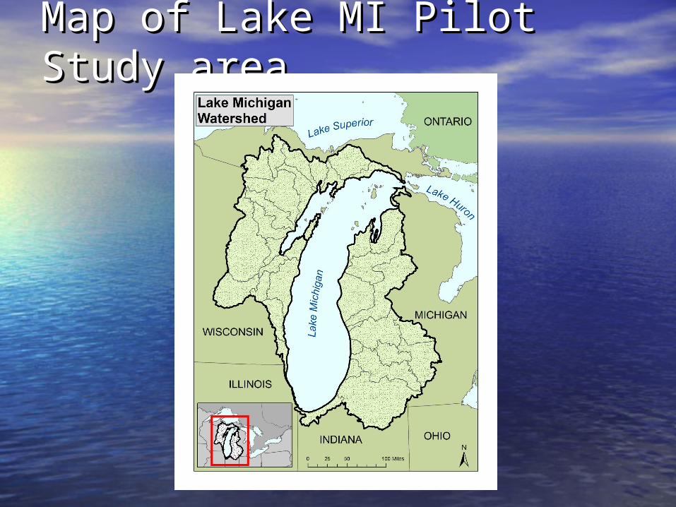
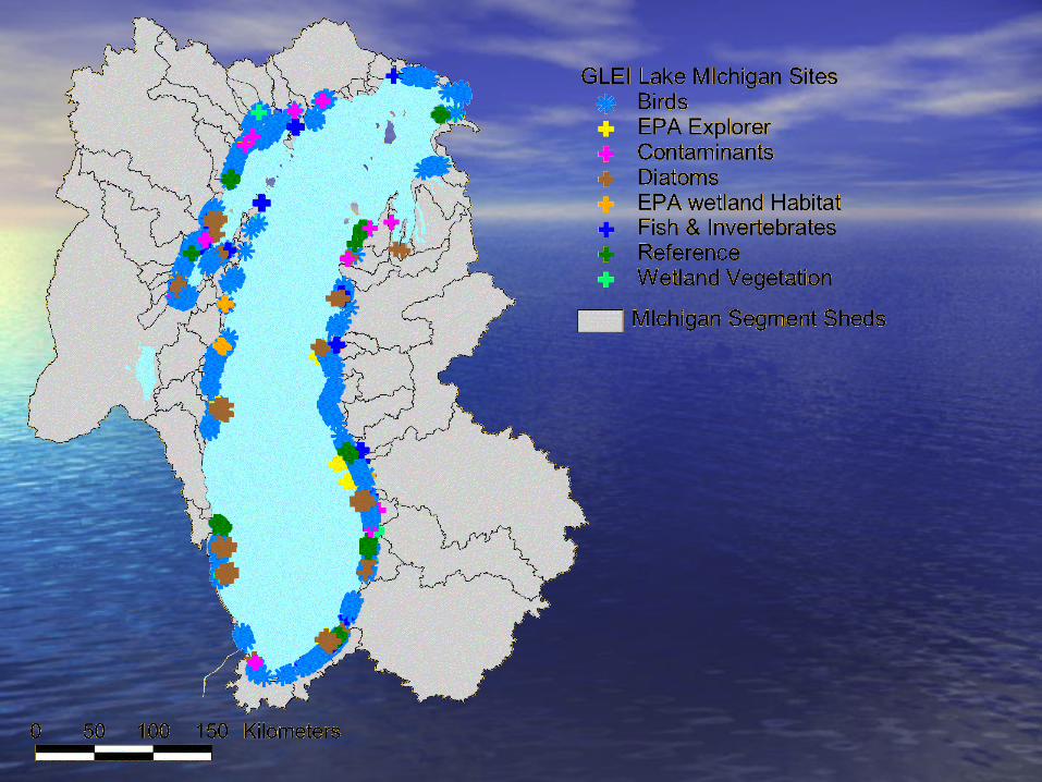
Map of Lake MI Pilot Study Map of Lake MI Pilot Study areaarea

Two key Lake MI Ref DocsTwo key Lake MI Ref Docs• Lake MI Lakewide Management Plan (LaMP)Lake MI Lakewide Management Plan (LaMP)
– Biennial updatesBiennial updates– Snapshot of the basinSnapshot of the basin– Can you eat fish, swim, drink the water?Can you eat fish, swim, drink the water?
• Series of indicatorsSeries of indicators• Excellent reference for Lake MI Management issuesExcellent reference for Lake MI Management issues
• Lake MI Mass Balance StudyLake MI Mass Balance Study– 1995-20051995-2005– PCBs, Mercury, Nutrients concentrations/loadingsPCBs, Mercury, Nutrients concentrations/loadings
• Studied at mouths of 11 major tributaries – LMMB modelStudied at mouths of 11 major tributaries – LMMB model• Follow-up (10-year anniversary) in final analysis/reporting Follow-up (10-year anniversary) in final analysis/reporting
phasephase• See web site for detailsSee web site for details

GL Monitoring InventoryGL Monitoring Inventory
• Approximately 300 programs include Approximately 300 programs include monitoring in some portion of Lake monitoring in some portion of Lake MichiganMichigan
• Majority of the monitoring programs Majority of the monitoring programs taking place at the state leveltaking place at the state level

Metadata Fields CollectedMetadata Fields Collected
• Program InformationProgram Information– Organization, department, websiteOrganization, department, website
• Contact InformationContact Information– Name, title, address, phone, fax, emailName, title, address, phone, fax, email
• Program Description Program Description – Program name, description, data uses, start Program name, description, data uses, start
and end dates, status (ongoing, etc.), and end dates, status (ongoing, etc.), medium monitored, sampling frequency, medium monitored, sampling frequency, collection months, # of stations, methods, collection months, # of stations, methods, parameters monitoredparameters monitored
Metadata Fields CollectedMetadata Fields Collected
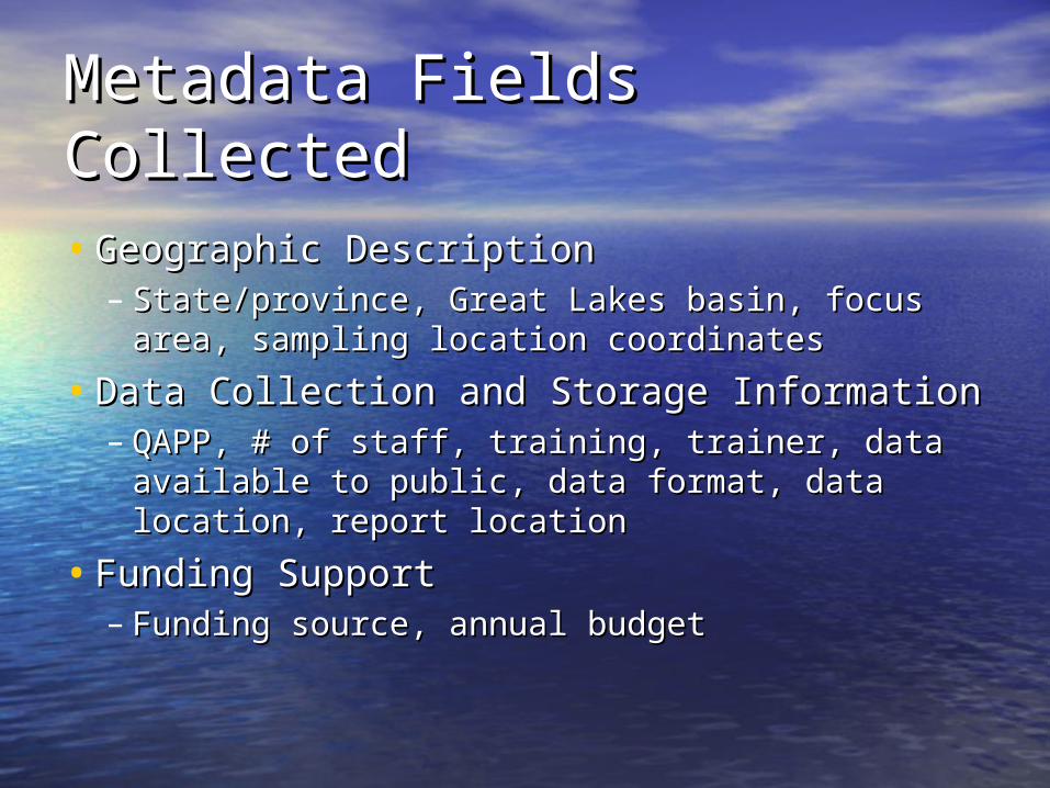
• Geographic DescriptionGeographic Description– State/province, Great Lakes basin, focus area, State/province, Great Lakes basin, focus area,
sampling location coordinatessampling location coordinates
• Data Collection and Storage InformationData Collection and Storage Information– QAPP, # of staff, training, trainer, data QAPP, # of staff, training, trainer, data
available to public, data format, data available to public, data format, data location, report locationlocation, report location
• Funding SupportFunding Support– Funding source, annual budgetFunding source, annual budget

Monitoring CategoriesMonitoring Categories• Fish ConsumptionFish Consumption• Drinking WaterDrinking Water• Beach SafetyBeach Safety• Air MonitoringAir Monitoring• Water QualityWater Quality• Sediment QualitySediment Quality• SoilSoil• GroundwaterGroundwater• Climate/WeatherClimate/Weather• Fish Population Fish Population
HealthHealth• Urban IssuesUrban Issues
• Aquatic Invasive SpeciesAquatic Invasive Species
• Coastal WetlandsCoastal Wetlands
• Wildlife EcologyWildlife Ecology
• Benthic and Invertebrate Benthic and Invertebrate EcologyEcology
• Plant EcologyPlant Ecology
• Habitat and CommunityHabitat and Community
• Atmospheric DepositionAtmospheric Deposition
• Nutrient ManagementNutrient Management
• Land UseLand Use
• ErosionErosion

Distribution of Sampling Distribution of Sampling Programs by AgencyPrograms by Agency
157
294
8957
40
50
50
100
150
200
250
300
350
Federal State/Prov. Local University NGO Private

Distribution of Sampling Distribution of Sampling Programs by LakePrograms by Lake
0
50
100
150
200
250
300
350
400
Michigan Superior Huron Erie Ontario
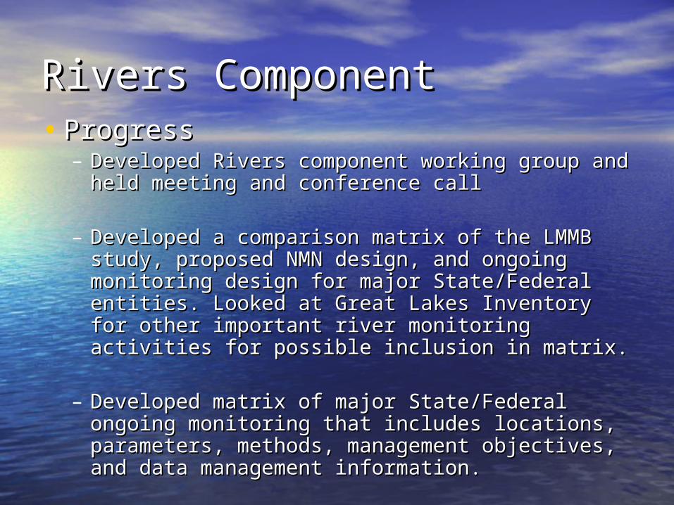
Rivers ComponentRivers Component• ProgressProgress
– Developed Rivers component working group and Developed Rivers component working group and held meeting and conference callheld meeting and conference call
– Developed a comparison matrix of the LMMB Developed a comparison matrix of the LMMB study, proposed NMN design, and ongoing study, proposed NMN design, and ongoing monitoring design for major State/Federal monitoring design for major State/Federal entities. Looked at Great Lakes Inventory for entities. Looked at Great Lakes Inventory for other important river monitoring activities for other important river monitoring activities for possible inclusion in matrix.possible inclusion in matrix.
– Developed matrix of major State/Federal Developed matrix of major State/Federal ongoing monitoring that includes locations, ongoing monitoring that includes locations, parameters, methods, management objectives, parameters, methods, management objectives, and data management information.and data management information.

Rivers ComponentRivers Component
• Progress (cont’d)Progress (cont’d)– Compared proposed nutrient method range Compared proposed nutrient method range
and detection levels to major State/Federal and detection levels to major State/Federal protocol range and detection levels for protocol range and detection levels for nutrients.nutrients.
– Pulled historic water quality information for Pulled historic water quality information for Lake Michigan river sites and from 1970 – Lake Michigan river sites and from 1970 – 2001 and summarized graphically.2001 and summarized graphically.
– All information included on Lake Michigan All information included on Lake Michigan pilot wiki pilot wiki

The Numbers Tell a StoryThe Numbers Tell a Story
Count of stream water-quality stations by year for HUC4 (Great Lakes)
0
200
400
600
800
1000
1200
1400
1940 1950 1960 1970 1980 1990 2000 2010
Year
Nu
mb
er
of
wa
ter-
qu
alit
y s
tati
on
s w
ith
a
t le
as
t o
ne
sa
mp
le p
er
ye
ar

Rivers ComponentRivers Component
• NeedsNeeds– Final information from all IWGs Final information from all IWGs
(nutrients, contaminants, biology)(nutrients, contaminants, biology)– Information for data inventory formatInformation for data inventory format– Format for rivers component of Lake Format for rivers component of Lake
Michigan Pilot report Michigan Pilot report

Ground Water ComponentGround Water Component• Conducted query of GL Mon Inventory for Conducted query of GL Mon Inventory for
GW monitoring in Lake MI basinGW monitoring in Lake MI basin• Held conference call – coming activities:Held conference call – coming activities:
– Conduct an inventory of wells in the drainage Conduct an inventory of wells in the drainage areas that directly discharge to the Lake for areas that directly discharge to the Lake for shallow flow paths (we don't think there will be shallow flow paths (we don't think there will be very many)very many)
– Put together GIS layers on geology and land Put together GIS layers on geology and land use from either the GAP project or from the use from either the GAP project or from the Water Availability and Use Project (or both)Water Availability and Use Project (or both)
– Use existing models and reports to determine Use existing models and reports to determine ground-water flux directly to the lake (RASA ground-water flux directly to the lake (RASA model, Milwaukee Model, Door Peninsula model, Milwaukee Model, Door Peninsula models, etc and Annotated Bibliography report) models, etc and Annotated Bibliography report)

Ground Water ComponentGround Water Component
• Thoughts on How to Proceed (cont’d)Thoughts on How to Proceed (cont’d)– Conduct NWIS and STORET queries for quality of Conduct NWIS and STORET queries for quality of
water data in the drainage area (we haven't yet water data in the drainage area (we haven't yet figured out how to do this)figured out how to do this)
– Use flux estimates and GW data to make a rough Use flux estimates and GW data to make a rough estimate of loads of some chemical constituents estimate of loads of some chemical constituents to the Laketo the Lake
– Based on these load estimates, we will work on a Based on these load estimates, we will work on a monitoring plan that will improve the load monitoring plan that will improve the load estimates estimates
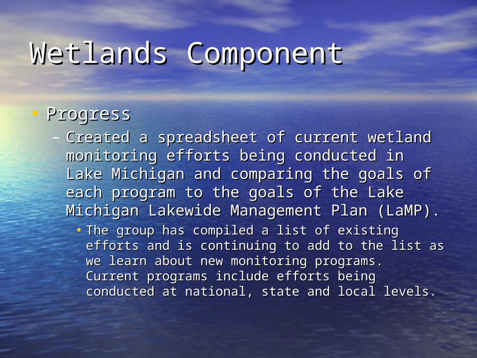
Wetlands ComponentWetlands Component
• ProgressProgress– Created a spreadsheet of current wetland Created a spreadsheet of current wetland
monitoring efforts being conducted in Lake monitoring efforts being conducted in Lake Michigan and comparing the goals of each Michigan and comparing the goals of each program to the goals of the Lake Michigan program to the goals of the Lake Michigan Lakewide Management Plan (LaMP).Lakewide Management Plan (LaMP).• The group has compiled a list of existing efforts and The group has compiled a list of existing efforts and
is continuing to add to the list as we learn about new is continuing to add to the list as we learn about new monitoring programs. Current programs include monitoring programs. Current programs include efforts being conducted at national, state and local efforts being conducted at national, state and local levels. levels.

Wetlands ComponentWetlands Component
• Exploring the possibility of using methods from Exploring the possibility of using methods from the Great Lakes Coastal Wetland Consortium the Great Lakes Coastal Wetland Consortium (GLCWC) as part of the monitoring design(GLCWC) as part of the monitoring design– Status: The GLCWC is in the process of preparing a Status: The GLCWC is in the process of preparing a
GL coastal wetlands monitoring plan (indicators, GL coastal wetlands monitoring plan (indicators, protocols, metrics, site selection, etc.) to be protocols, metrics, site selection, etc.) to be complete by September 2007. When these complete by September 2007. When these protocols are available, we will compare them to protocols are available, we will compare them to current monitoring efforts and determine what the current monitoring efforts and determine what the cost differences may be for implementing the cost differences may be for implementing the GLCWC design for CWs.GLCWC design for CWs.
Wetlands ComponentWetlands Component
• Will prepare a report comparing Will prepare a report comparing existing efforts for Lake Michigan existing efforts for Lake Michigan with a new network design (if with a new network design (if available). If a network design is available). If a network design is unavailable, will summarize existing unavailable, will summarize existing efforts in Lake Michigan/Great Lakes efforts in Lake Michigan/Great Lakes and comment on their applicability to and comment on their applicability to a nationwide design. a nationwide design.

Embayments (Estuaries) Embayments (Estuaries) Comp.Comp.• Need to compare the 19 existing Need to compare the 19 existing
monitoring projects to the 50 monitoring projects to the 50 randomly selected embayments randomly selected embayments chosen by the Network design in the chosen by the Network design in the Great Lakes regionGreat Lakes region
• Need to get our hand on the entire Need to get our hand on the entire list of embayments that the 50 were list of embayments that the 50 were chosen from – why 50?chosen from – why 50?

Embayments (Estuaries) Embayments (Estuaries) Comp.Comp.• 7 of the 50 randomly chosen sites are in 7 of the 50 randomly chosen sites are in
Lake MILake MI
• Need to determine whether 7 sites are Need to determine whether 7 sites are adequate for samplingadequate for sampling
• Determine whether embayments with Determine whether embayments with different surrounding landscapes (urban vs different surrounding landscapes (urban vs ag vs pristine) should have different ag vs pristine) should have different monitoring goals and different monitoring monitoring goals and different monitoring requirementsrequirements

Atmospheric Deposition Atmospheric Deposition ComponentComponent
• Great Lakes covered in full report appendixGreat Lakes covered in full report appendix
• Looks to GLs and how PBT/toxic chemical Looks to GLs and how PBT/toxic chemical deposition might apply elsewheredeposition might apply elsewhere
• Still vague recommendations – awaiting Still vague recommendations – awaiting national feedbacknational feedback
• IADN is lacking in Mercury monitoringIADN is lacking in Mercury monitoring
• IADN will look at national recommendationsIADN will look at national recommendations
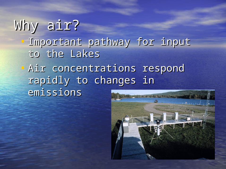
Why air?Why air?• Important pathway for input to the Important pathway for input to the
LakesLakes
• Air concentrations respond rapidly Air concentrations respond rapidly to changes in emissionsto changes in emissions

Shift to Atmospheric Inputs Shift to Atmospheric Inputs Over Past DecadesOver Past Decades
Values in Kg/Year
1610
4500*
12000
1970
Tributaries Atmosphere Sediment
Lake Michigan PCB Sources
350
2500
1150
1995


IADN OverviewIADN Overview
• Joint EPA-Environment Canada project Joint EPA-Environment Canada project – Ron Hites at Indiana University is U.S. granteeRon Hites at Indiana University is U.S. grantee
• In operation since 1990 (GLWQA and CAAA of 1990)In operation since 1990 (GLWQA and CAAA of 1990)
• Measure PBTs in air and precipitation at 15 sites around the Measure PBTs in air and precipitation at 15 sites around the Great Lakes (U.S. runs five)Great Lakes (U.S. runs five)
• Goals:Goals: – Determine atmospheric loadings to the LakesDetermine atmospheric loadings to the Lakes– Look at trends in concentrationsLook at trends in concentrations– Use data to measure progress made by toxics reduction effortsUse data to measure progress made by toxics reduction efforts

IADN SummaryIADN Summary• Levels of “legacy” chemicals are decreasing, but they Levels of “legacy” chemicals are decreasing, but they
may be starting to level off.may be starting to level off.
• Cities are important source areas of many chemicals Cities are important source areas of many chemicals (PCBs, PAHs, PBDEs, some pesticides, etc.)(PCBs, PAHs, PBDEs, some pesticides, etc.)
• Ongoing monitoring is useful for examining progress Ongoing monitoring is useful for examining progress in reducing “old” chemicals and finding new potential in reducing “old” chemicals and finding new potential problems (Dechlorane Plus, for example)problems (Dechlorane Plus, for example)
• IADN drawbacks:IADN drawbacks:
– No Hg measurements on U.S. side (states doing some No Hg measurements on U.S. side (states doing some monitoring)monitoring)
– Urban coverage only in Chicago and ClevelandUrban coverage only in Chicago and Cleveland
• We are currently considering dropping or reducing We are currently considering dropping or reducing frequency on some legacy chemicals with low frequency on some legacy chemicals with low detection rates to free up resources for adding detection rates to free up resources for adding chemicals of emerging concernchemicals of emerging concern

Off Shore ComponentOff Shore Component
• Problem with probabilistic approach – what Problem with probabilistic approach – what is it based on?is it based on?
• 3 programs – 30 years of data3 programs – 30 years of data• Build on existing monitoringBuild on existing monitoring• Few Off Shore stations – what is minimum Few Off Shore stations – what is minimum
number required to capture status/trends?number required to capture status/trends?• Need to determine spatial & temporal Need to determine spatial & temporal
variation for extrapolating to other lakesvariation for extrapolating to other lakes– 10-45 meter Near Shore needs attention10-45 meter Near Shore needs attention– Temporal variation increases Near ShoreTemporal variation increases Near Shore

Off Shore ComponentOff Shore Component
• USGS-GLSC long-term survey of prey fish USGS-GLSC long-term survey of prey fish community (since 1973)community (since 1973)– 7 different bottom trawl fixed sites around Lake 7 different bottom trawl fixed sites around Lake
MIMI– Acoustic survey uses a stratified random design Acoustic survey uses a stratified random design
to select transects each yearto select transects each year• No consistent water quality monitoring No consistent water quality monitoring
done on USGS vesselsdone on USGS vessels• Little communication with EPA with regard Little communication with EPA with regard
to their WQ and zooplankton sampling to their WQ and zooplankton sampling efforts on Lake MIefforts on Lake MI– Perhaps this will change as a result of the NMNPerhaps this will change as a result of the NMN
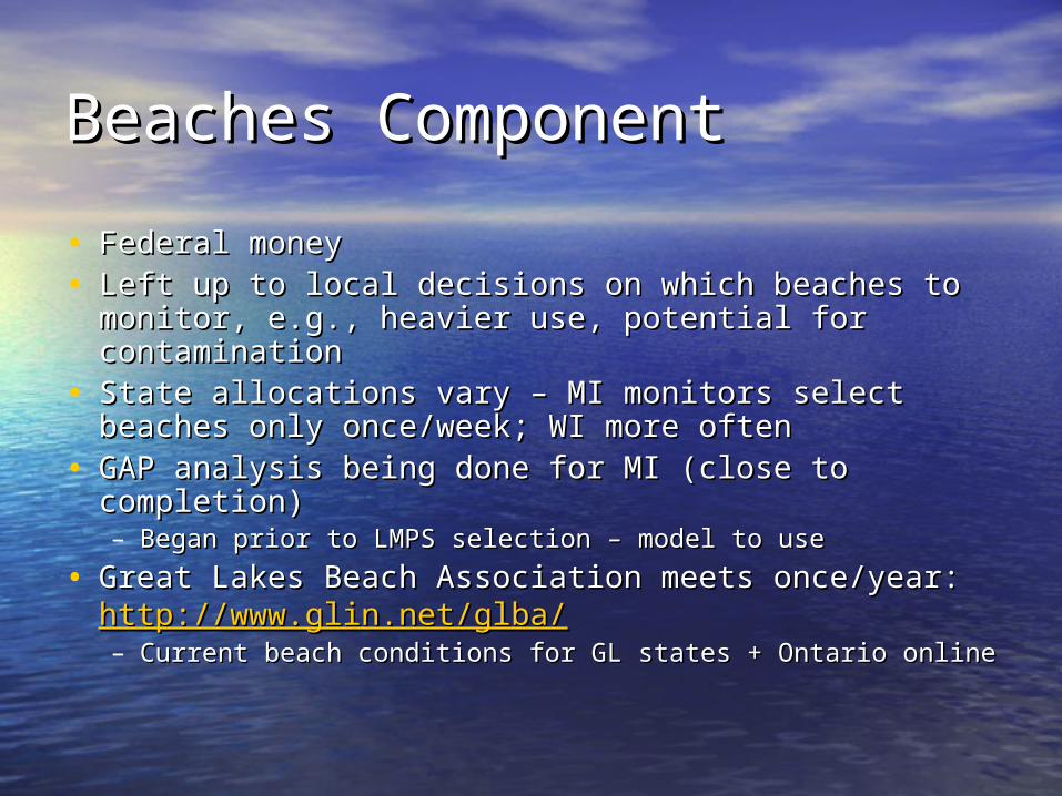
Beaches ComponentBeaches Component
• Federal moneyFederal money• Left up to local decisions on which beaches to Left up to local decisions on which beaches to
monitor, e.g., heavier use, potential for monitor, e.g., heavier use, potential for contaminationcontamination
• State allocations vary – MI monitors select beaches State allocations vary – MI monitors select beaches only once/week; WI more oftenonly once/week; WI more often
• GAP analysis being done for MI (close to GAP analysis being done for MI (close to completion)completion)– Began prior to LMPS selection – model to useBegan prior to LMPS selection – model to use
• Great Lakes Beach Association meets once/year: Great Lakes Beach Association meets once/year: http://www.glin.net/glba/http://www.glin.net/glba/– Current beach conditions for GL states + Ontario onlineCurrent beach conditions for GL states + Ontario online

Near Shore ComponentNear Shore Component
• Need to define Near Shore areaNeed to define Near Shore area• Utilities do monitoring of raw water intakes Utilities do monitoring of raw water intakes
– shallow near shore to 30 meters– shallow near shore to 30 meters• Characterizing sites – what should coasts Characterizing sites – what should coasts
look like?look like?

Near Shore ComponentNear Shore Component
• On WI side, sites monitored for (WDNR/UW-On WI side, sites monitored for (WDNR/UW-M):M):– Cladophora growth/densitiesCladophora growth/densities– Zebra and quagga mussels presenceZebra and quagga mussels presence– Water quality (TP,TDP,SRP,TKN,NO3,TSS, Chlora-Water quality (TP,TDP,SRP,TKN,NO3,TSS, Chlora-
a)a)– Physical parameters profile (dissolved O2, Physical parameters profile (dissolved O2,
conductivity, temperature, light)conductivity, temperature, light)– Algal tissue samples collected for nutrient Algal tissue samples collected for nutrient
analysis (C,N,P,SI)analysis (C,N,P,SI)– USGS-GLSC NS studies looking at food web – USGS-GLSC NS studies looking at food web –
invasives/native fish – changes w/ depth – to 18 invasives/native fish – changes w/ depth – to 18 metersmeters
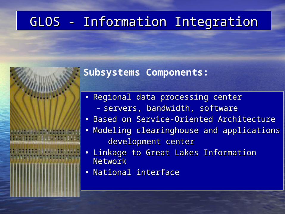
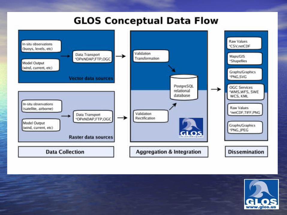
GLOS - Information IntegrationGLOS - Information IntegrationGLOS - Information IntegrationGLOS - Information Integration
• Regional data processing centerRegional data processing center– servers, bandwidth, softwareservers, bandwidth, software
• Based on Service-Oriented ArchitectureBased on Service-Oriented Architecture• Modeling clearinghouse and applicationsModeling clearinghouse and applications development centerdevelopment center• Linkage to Great Lakes Information Linkage to Great Lakes Information
NetworkNetwork• National interfaceNational interface
Subsystems Components:
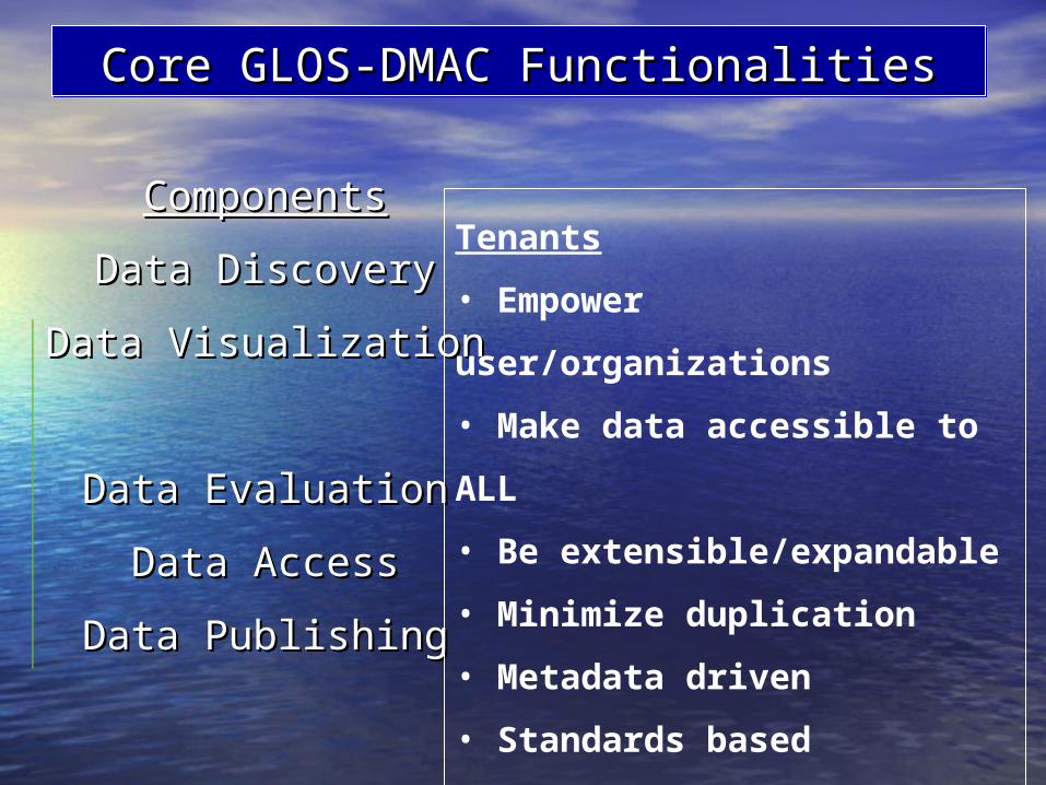
ComponentsComponents
Data DiscoveryData Discovery
Data Visualization Data Visualization
Data EvaluationData Evaluation
Data AccessData Access
Data PublishingData Publishing
Core GLOS-DMAC FunctionalitiesCore GLOS-DMAC FunctionalitiesCore GLOS-DMAC FunctionalitiesCore GLOS-DMAC Functionalities
Tenants
• Empower user/organizations
• Make data accessible to ALL
• Be extensible/expandable
• Minimize duplication
• Metadata driven
• Standards based
• Leverage open source software
• Service Oriented Architecture
Contact:Contact:Great Lakes Great Lakes Commission Commission John Hummer (John Hummer ([email protected]@glc.org))734-971-9135734-971-9135
QUESTIONS?