lancaster county gis projects 2012 aerial photos cooperative project with nga and usgs leveraged...
TRANSCRIPT

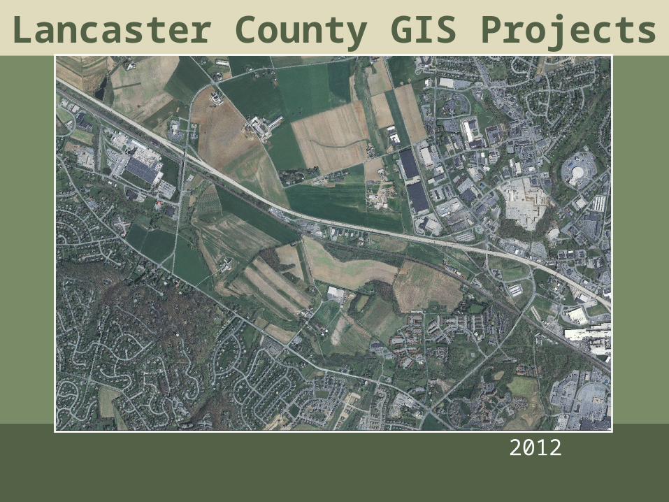
Lancaster County GIS Projects
2012 Aerial Photos• Cooperative project with NGA and USGS
leveraged about $70,000 of Federal Funds• Lancaster County provided CWC funded
$48,700• Captured 3/28 to 4/3/2012• Staff performed a QC review and new
aerials were accepted on 3/11/13• 1’ resolution, + 2’ horizontal accuracy• Available for Download from PASDA


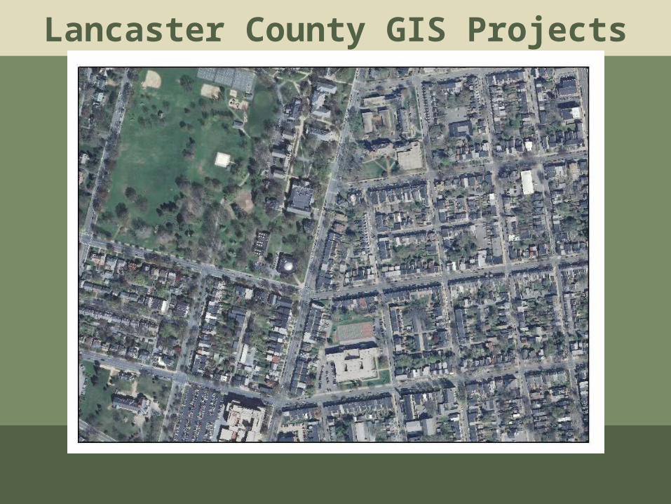
Lancaster County GIS Projects
1993

Lancaster County GIS Projects
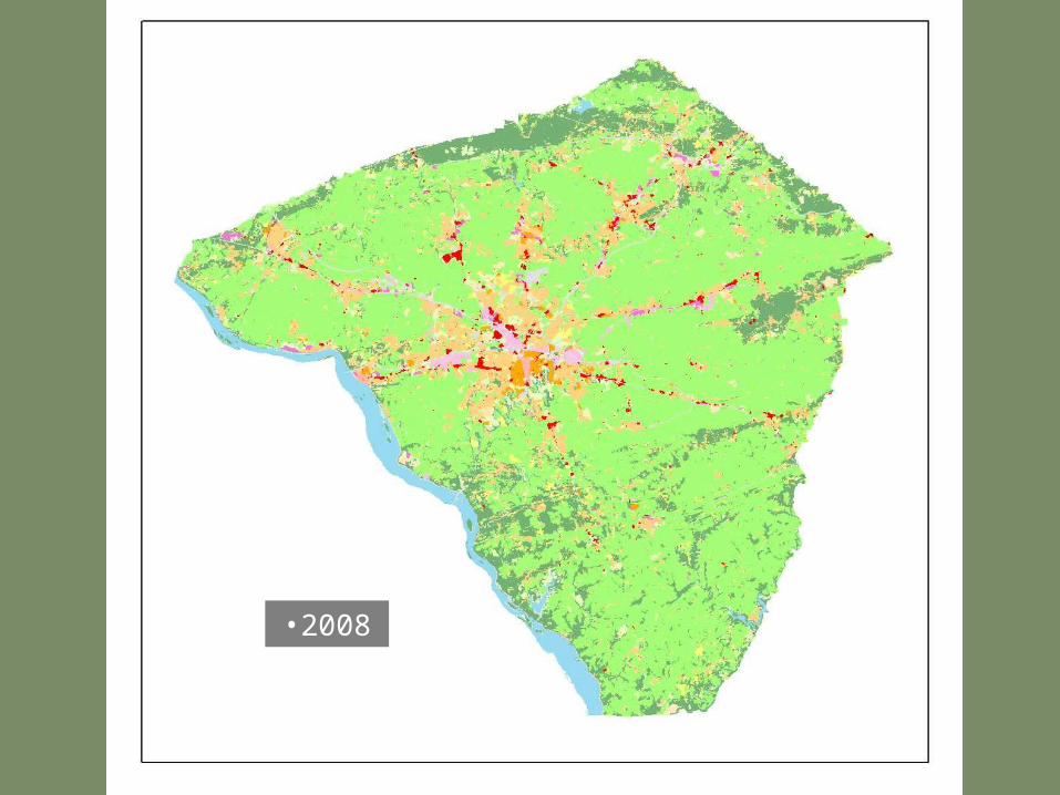
2008
Lancaster County GIS Projects
2012
Lancaster County GIS Projects

Lancaster County GIS Projects

Lancaster County GIS Projects
LULC Layer Uses• Growth Tracking Analysis• Growth management analysis• Clean and Green analysis – Ag land
preferential assessment program.• Stormwater modeling• Growth management analysis• General Plan Review• Available for Download from PASDA

•1993

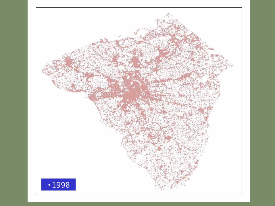
•1998

•2002

•2005
•2008

•2012

•1993
•1998

•2002

•2005

•2008

•2012

•Forest Block < 100 Acres

•Forest Block > 100 Acres
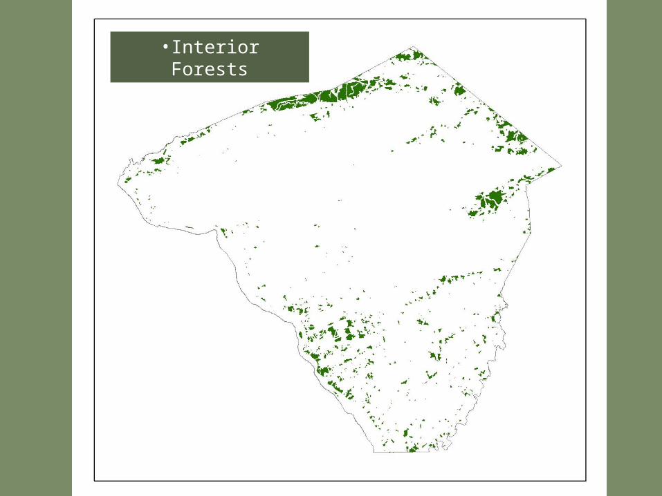
•Interior Forests

DEVELOPED Impervious surfaces Buildings, Roads, Drives, Parking Lots
Regulated v. Non-regulated Buildings, Roads, Drives, Parking Lots
Connected v. Disconnected Buildings, Roads, Drives, Parking Lots
Residential v. Non-residential
Buildings, Roads, Drives, Parking Lots, Land Use Land Cover, Parcels
Pervious surfaces Land Use Land Cover
Regulated v. Non-regulated
Connected v. Disconnected
Residential v. Non-residential
Fertilized v. Unfertilized Golf courses Land Use Land Cover, Parks, Parcels Roads Number of lanes Road Centerlines
Congested vs. Uncongested Road Centerlines, Traffic Counts, CMS, LOS
Connected vs. Disconnected Road Centerlines
Construction Land Use Land Cover, Parcels Urban Trees Tree Canopy data Lancaster City Tree points, polygons

AGRICULTURAL
Farmsteads Impervious v. Pervious Land Use Land Cover (114) Regulated v. Unregulated Crops Land Use Land Cover (211) Grain & forage Land Use Land Cover, w/ Image analysis Hay (grass) Land Use Land Cover, w/ Image analysis Hay (legume) Land Use Land Cover w/ Image analysis Vegetables Land Use Land Cover, w/ Image analysis Pasture Land Use Land Cover (212) Nurseries Land Use Land Cover(220) Covered v. Uncovered Land Use Land Cover, w/ Image analysis Orchards Land Use Land Cover(220) Sod farms Land Use Land Cover, w/ Image analysis Idle/fallow Land Use Land Cover, w/ Image analysis
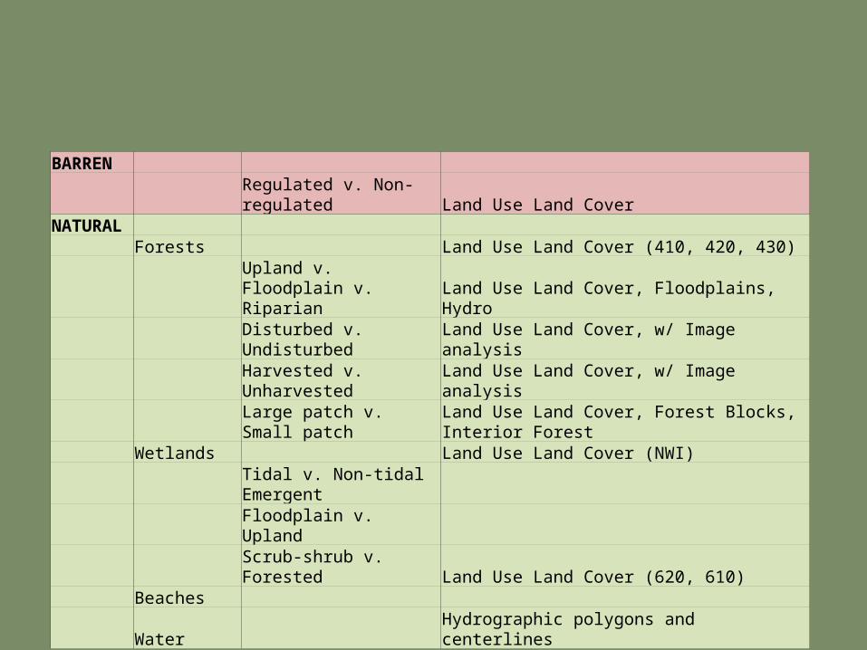
BARREN Regulated v. Non-regulated Land Use Land CoverNATURAL Forests Land Use Land Cover (410, 420, 430)
Upland v. Floodplain v. Riparian Land Use Land Cover, Floodplains, Hydro
Disturbed v. Undisturbed Land Use Land Cover, w/ Image analysis Harvested v. Unharvested Land Use Land Cover, w/ Image analysis Large patch v. Small patch Land Use Land Cover, Forest Blocks, Interior Forest Wetlands Land Use Land Cover (NWI) Tidal v. Non-tidal Emergent Floodplain v. Upland Scrub-shrub v. Forested Land Use Land Cover (620, 610) Beaches Water Hydrographic polygons and centerlines
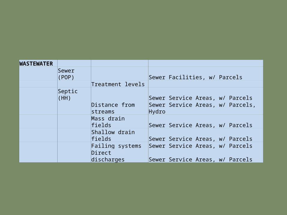
WASTEWATER Sewer (POP) Sewer Facilities, w/ Parcels Treatment levels Septic (HH) Sewer Service Areas, w/ Parcels Distance from streams Sewer Service Areas, w/ Parcels, Hydro Mass drain fields Sewer Service Areas, w/ Parcels Shallow drain fields Sewer Service Areas, w/ Parcels Failing systems Sewer Service Areas, w/ Parcels Direct discharges Sewer Service Areas, w/ Parcels

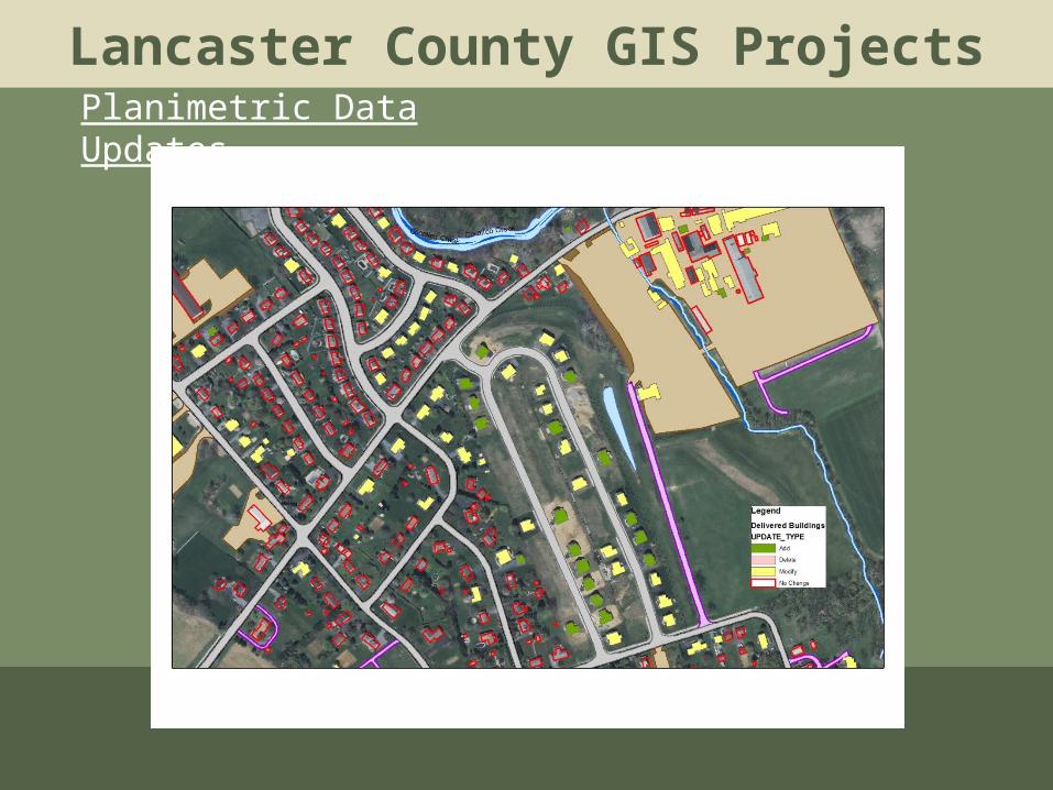
Lancaster County GIS ProjectsPlanimetric Data Updates
• Buildings
• Pavement
Type of Edit
Number of Buildings
Add 8,478
Delete 20,408
Modify 58,227
No Change 202,399
LayerFeatures w/ Edits Total Features
Road Edge 114 591
Driveways 7,703 20,331
Parking Lots 3,860 11,258
Lancaster County GIS ProjectsPlanimetric Data Updates
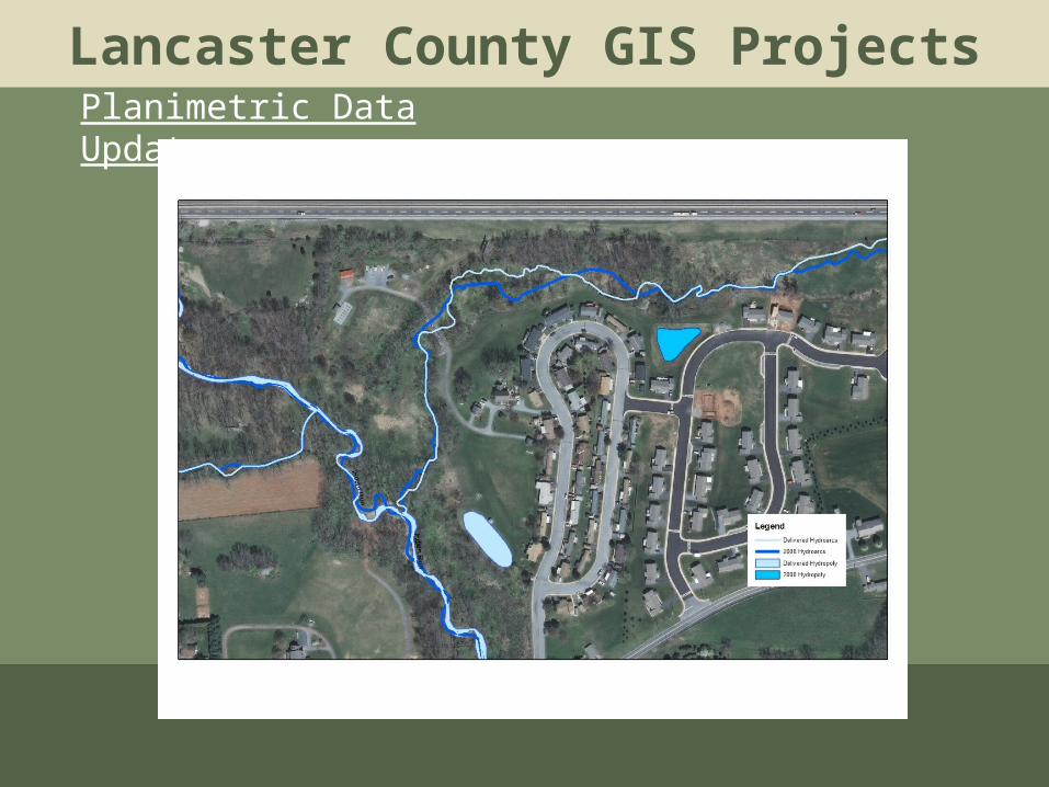
Lancaster County GIS ProjectsPlanimetric Data Updates

Lancaster County GIS ProjectsPlanimetric Data Updates

Lancaster County GIS Projects
Land Use Land Cover Update•Completed in-house since 2001•1,846 LULC edits were made

Lancaster County GIS Projects
LULC Generalized Class Spring 2012 Area (Acres)
Agriculture 338423.43
Commercial 8592.06
High Density Residential 5458.45
Industrial 4339.70
Industrial/Commercial 4125.96
Institutional 5781.43
Low Density Residential 34579.97
Medium Density Residential 54814.81
Mineral Extraction 2788.18
Miscellaneous 2046.66
Mixed Urban Land 1116.76
Open Land 35109.74
Open Land, Barren 851.34
Open Water 26211.26
Transportation/Utilities 4631.19
Woodland 112511.39