land use for the record
DESCRIPTION
Land Use for the Record. Presented by Dennis L. Marker, Santaquin City Planner. Utah Municipal Clerks Association Spring Conference 2010. Land Use Regulation in Utah Utah Code Anno 1953, Title 10-9a-102(1). - PowerPoint PPT PresentationTRANSCRIPT
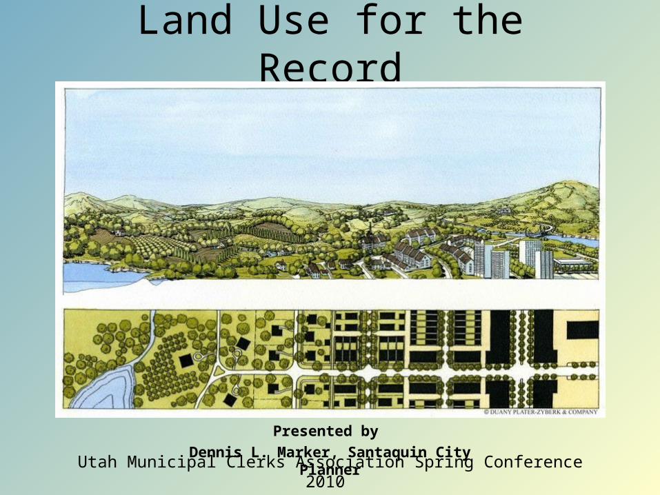
Land Use for the Record
Presented by
Dennis L. Marker, Santaquin City PlannerUtah Municipal Clerks Association Spring Conference 2010
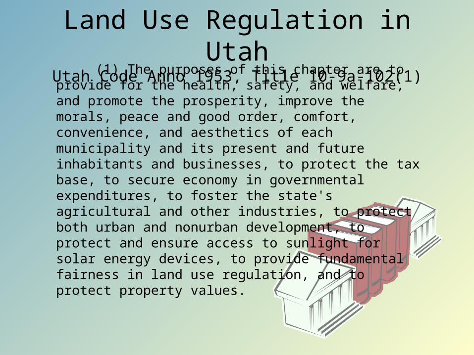
Land Use Regulation in UtahUtah Code Anno 1953, Title 10-9a-102(1)
(1) The purposes of this chapter are to provide for the health, safety, and welfare, and promote the prosperity, improve the morals, peace and good order, comfort, convenience, and aesthetics of each municipality and its present and future inhabitants and businesses, to protect the tax base, to secure economy in governmental expenditures, to foster the state's agricultural and other industries, to protect both urban and nonurban development, to protect and ensure access to sunlight for solar energy devices, to provide fundamental fairness in land use regulation, and to protect property values.
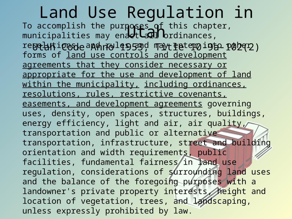
Land Use Regulation in UtahUtah Code Anno 1953, Title 10-9a-102(2)
To accomplish the purposes of this chapter, municipalities may enact all ordinances, resolutions, and rules and may enter into other forms of land use controls and development agreements that they consider necessary or appropriate for the use and development of land within the municipality, including ordinances, resolutions, rules, restrictive covenants, easements, and development agreements governing uses, density, open spaces, structures, buildings, energy efficiency, light and air, air quality, transportation and public or alternative transportation, infrastructure, street and building orientation and width requirements, public facilities, fundamental fairness in land use regulation, considerations of surrounding land uses and the balance of the foregoing purposes with a landowner's private property interests, height and location of vegetation, trees, and landscaping, unless expressly prohibited by law.
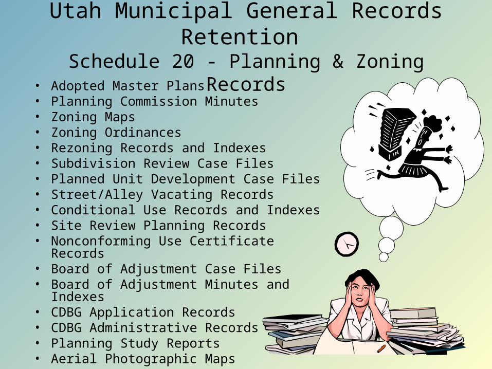
Utah Municipal General Records Retention Schedule 20 - Planning & Zoning Records
• Adopted Master Plans• Planning Commission Minutes • Zoning Maps• Zoning Ordinances• Rezoning Records and Indexes • Subdivision Review Case Files• Planned Unit Development Case Files• Street/Alley Vacating Records • Conditional Use Records and Indexes• Site Review Planning Records• Nonconforming Use Certificate Records• Board of Adjustment Case Files• Board of Adjustment Minutes and Indexes• CDBG Application Records• CDBG Administrative Records• Planning Study Reports• Aerial Photographic Maps
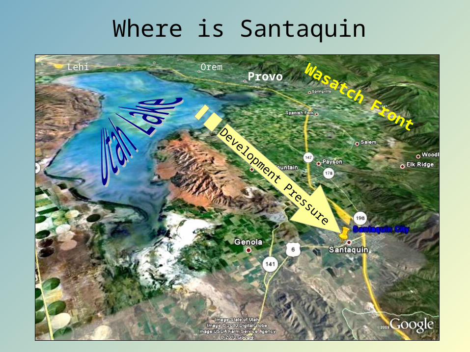
Where is Santaquin
Wasatch FrontDevelopment Pressure
Provo
OremLehi
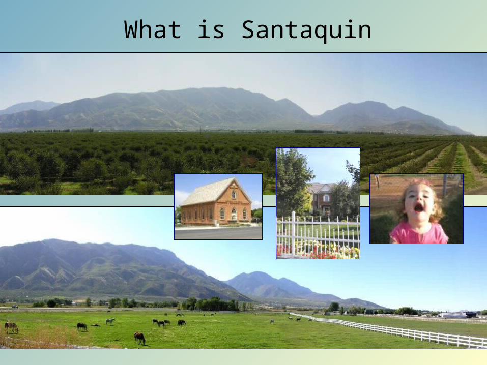
What is Santaquin
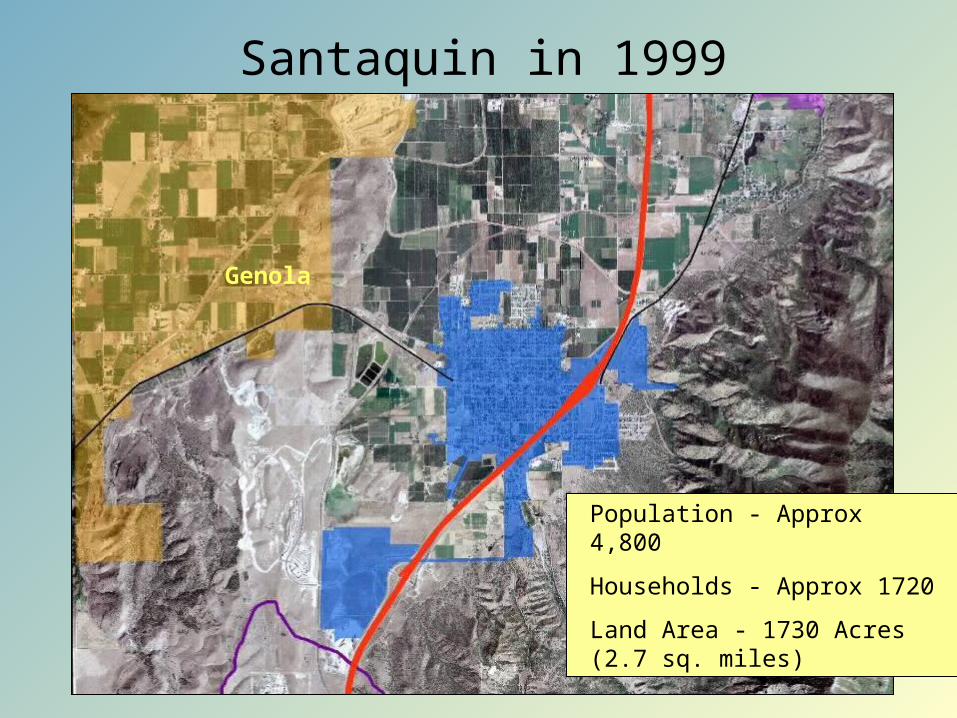
Santaquin in 1999
Population - Approx 4,800
Households - Approx 1720
Land Area - 1730 Acres (2.7 sq. miles)
Genola
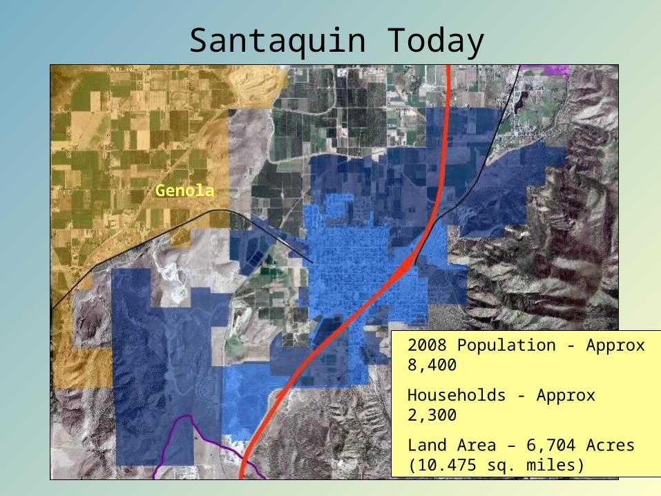
Santaquin Today
2008 Population - Approx 8,400
Households - Approx 2,300
Land Area – 6,704 Acres (10.475 sq. miles)
Genola
The General Plan Requirement Utah Code Anno 1953, Title 10-9a-401(1) each municipality shall prepare and adopt a comprehensive, long-range general
plan for: (a) present and future needs of the municipality; and (b) growth and development of all or any part of the land within the municipality.
(2) The plan may provide for: (a) health, general welfare, safety, energy conservation, transportation, prosperity,
civic activities, aesthetics, and recreational, educational, and cultural opportunities; (b) the reduction of the waste of physical, financial, or human resources that result
from either excessive congestion or excessive scattering of population; (c) the efficient and economical use, conservation, and production of the supply of: (i) food and water; and (ii) drainage, sanitary, and other facilities and resources; (d) the use of energy conservation and solar and renewable energy resources; (e) the protection of urban development; (f) the protection or promotion of moderate income housing; (g) the protection and promotion of air quality; (h) historic preservation; (i) identifying future uses of land that are likely to require an expansion or significant
modification of services or facilities provided by each affected entity; and (j) an official map.

General Plan Elements Utah Code Anno 1953, Title 10-9a-402
(2) (a) At a minimum, the proposed general plan, with the accompanying maps, charts, and descriptive and explanatory matter, shall include: (i) a land use element. (ii) a transportation and traffic circulation element
(iii) a moderate income housing element.
(3) The proposed general plan may include:(a) an environmental element:(b) a public services and facilities element
(c) a rehabilitation, redevelopment, and conservation element consisting of plans and programs for: (i) historic preservation; (ii) the diminution or elimination of blight; and (iii) redevelopment of land, including housing sites, business and
industrial sites, and public building sites;(d) an economic element
(e) recommendations for implementing all or any portion of the general plan (f) provisions addressing any of the matters listed in Subsection 10-9a-401(2); (g) any other element the municipality considers appropriate.

How it Ties Together
General Plan
Zoning Regulations Subdivisions
Site Plan Review
Non-conforming
Uses
LandscapingArchitectural
Standards
Redevelopment
ConditionalUses
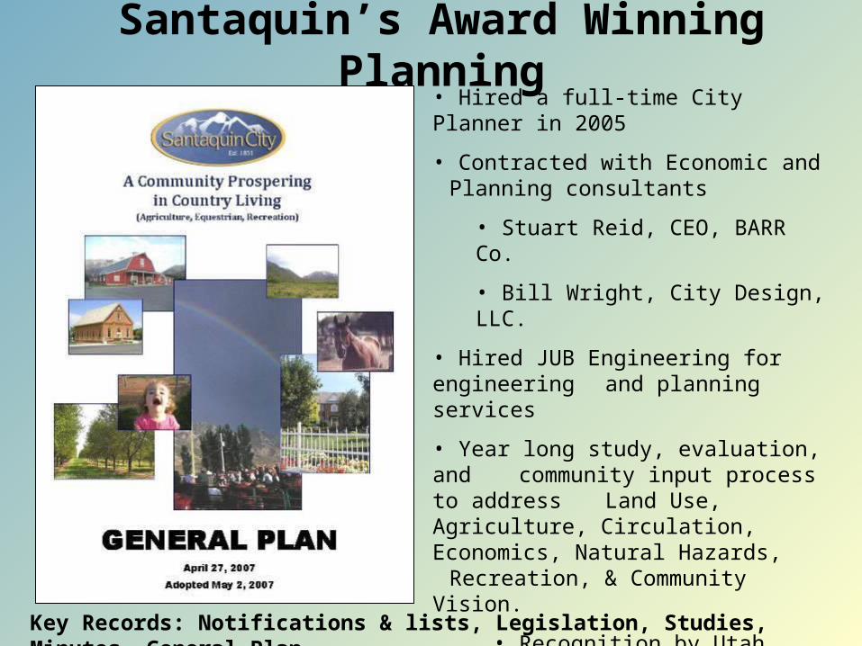
Santaquin’s Award Winning Planning• Hired a full-time City Planner in 2005
• Contracted with Economic and Planning consultants
• Stuart Reid, CEO, BARR Co.
• Bill Wright, City Design, LLC.
• Hired JUB Engineering for engineering and planning services
• Year long study, evaluation, and community input process to address
Land Use, Agriculture, Circulation, Economics, Natural Hazards,
Recreation, & Community Vision.
• Recognition by Utah Legislature as “Utah Farming Heritage District”
• Utah Chapter of American Planning Association (APA) 2007 Award of Merit
Key Records: Notifications & lists, Legislation, Studies, Minutes, General Plan
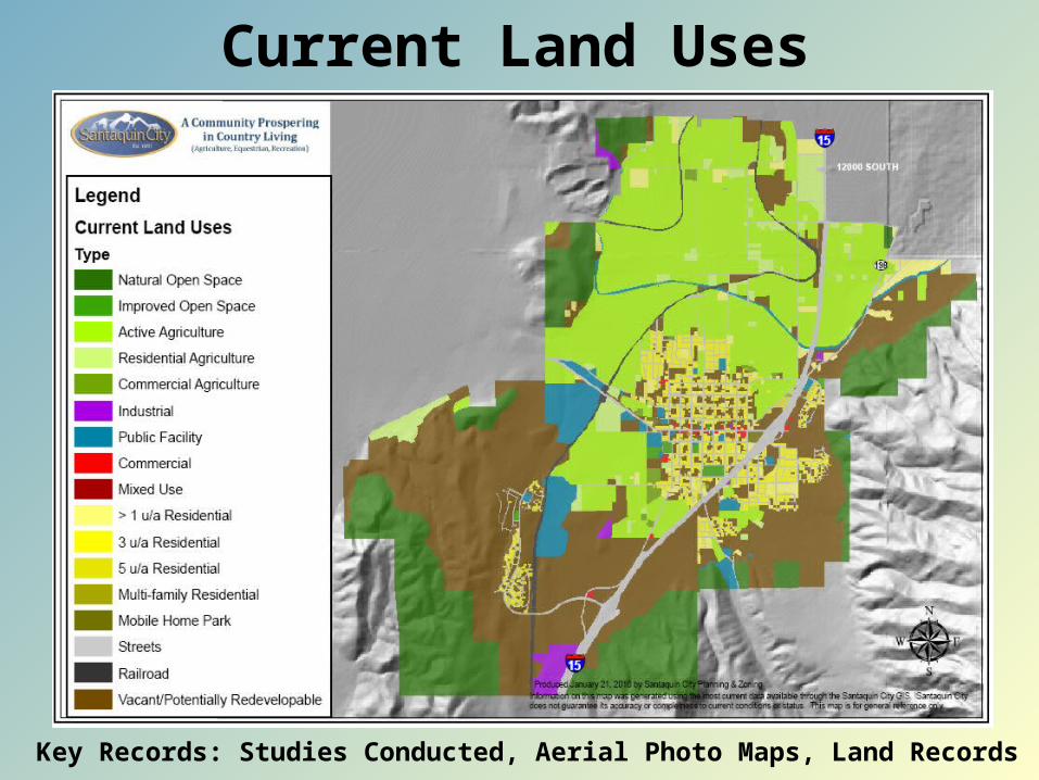
Key Records: Studies Conducted, Aerial Photo Maps, Land Records
Current Land Uses
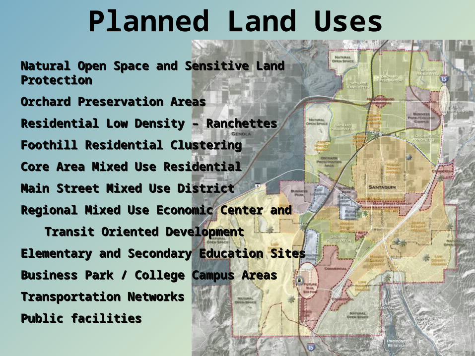
Natural Open Space and Sensitive Land ProtectionNatural Open Space and Sensitive Land Protection
Orchard Preservation AreasOrchard Preservation Areas
Residential Low Density – RanchettesResidential Low Density – Ranchettes
Foothill Residential ClusteringFoothill Residential Clustering
Core Area Mixed Use ResidentialCore Area Mixed Use Residential
Main Street Mixed Use DistrictMain Street Mixed Use District
Regional Mixed Use Economic Center and Regional Mixed Use Economic Center and
Transit Oriented DevelopmentTransit Oriented Development
Elementary and Secondary Education SitesElementary and Secondary Education Sites
Business Park / College Campus AreasBusiness Park / College Campus Areas
Transportation NetworksTransportation Networks
Public facilitiesPublic facilities
Planned Land Uses
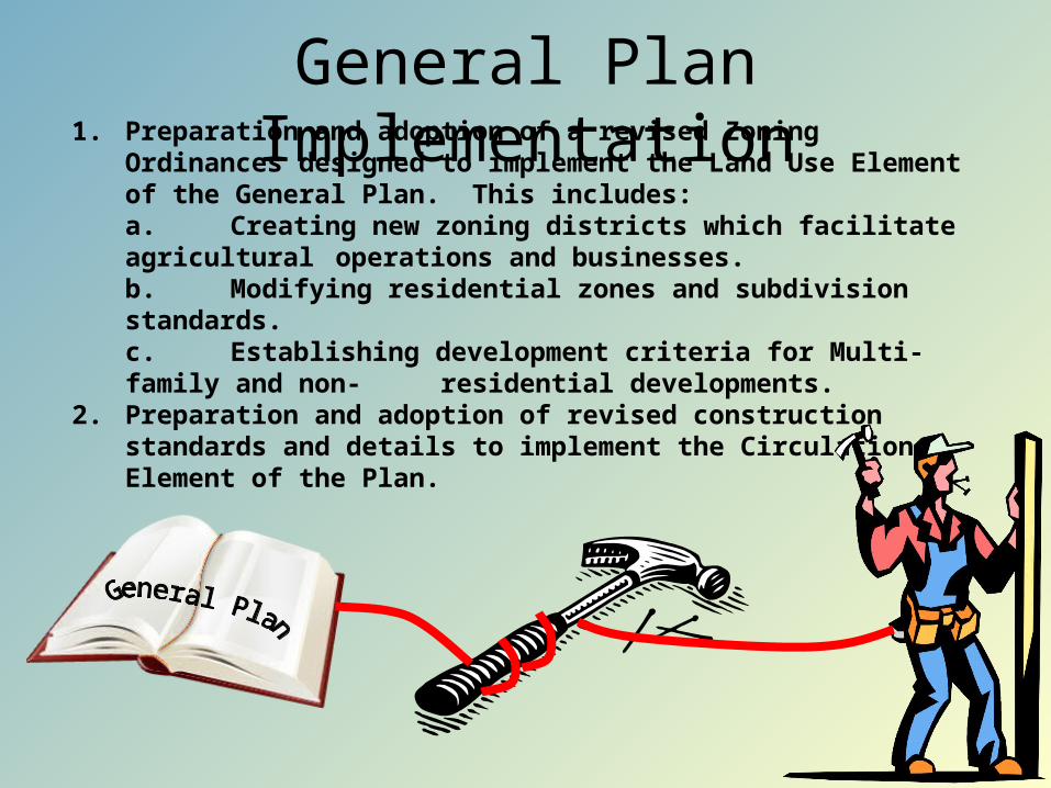
General Plan Implementation1. Preparation and adoption of a revised Zoning Ordinances designed
to implement the Land Use Element of the General Plan. This includes:a. Creating new zoning districts which facilitate agricultural operations and businesses. b. Modifying residential zones and subdivision standards.c. Establishing development criteria for Multi-family and non-residential developments.
2. Preparation and adoption of revised construction standards and details to implement the Circulation Element of the Plan.

Zoning Utah Code Anno 1953, Title 10-9a
10-9a-505. Zoning districts. (1) (a) The legislative body may divide its territory over into zoning districts of a
number, shape, and area that it considers appropriate.(b) Within those zoning districts, the legislative body may regulate and
restrict the erection, construction, reconstruction, alteration, repair, or use of buildings and structures, and the use of land.
(c) A municipality may enact an ordinance regulating land use and development in a flood plain or potential geologic hazard area to protect
life and prevent the substantial loss of real property or substantial damage to real property.
(2) The legislative body shall ensure that the regulations are uniform for each class or kind of buildings throughout each zoning district, but the regulations in one zone may differ from those in other zones. (3) (a) There is no minimum area or diversity of ownership requirement for a
zone designation. (b) Neither the size of a zoning district nor the number of landowners within
the district may be used as evidence of the illegality of a zoning district or of the invalidity of a municipal decision.
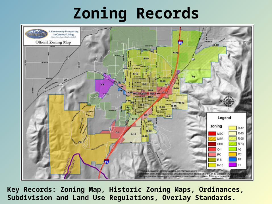
Zoning Records
Key Records: Zoning Map, Historic Zoning Maps, Ordinances, Subdivision and Land Use Regulations, Overlay Standards.
Key Records: General Plan, Studies Conducted, Zoning Map, Rezoning File, Notifications, Meeting Minutes, Ordinances, Land Records, ROW.
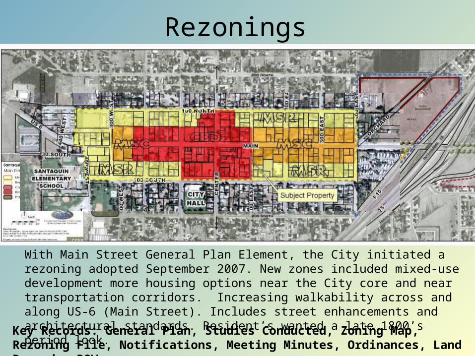
With Main Street General Plan Element, the City initiated a rezoning adopted September 2007. New zones included mixed-use development more housing options near the City core and near transportation corridors. Increasing walkability across and along US-6 (Main Street). Includes street enhancements and architectural standards. Resident’s wanted a late 1800’s period look.
Rezonings
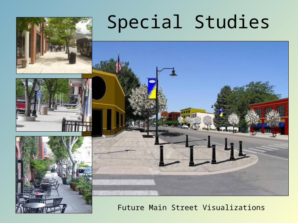
Future Main Street Visualizations
Special Studies
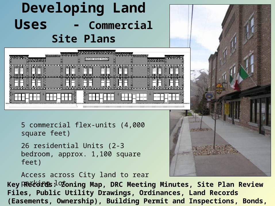
5 commercial flex-units (4,000 square feet)
26 residential Units (2-3 bedroom, approx. 1,100 square feet)
Access across City land to rear parking lot.
Developing Land Uses - Commercial Site Plans
Key Records: Zoning Map, DRC Meeting Minutes, Site Plan Review Files, Public Utility Drawings, Ordinances, Land Records (Easements, Ownership), Building Permit and Inspections, Bonds, Business Licenses, Utility Contracts.
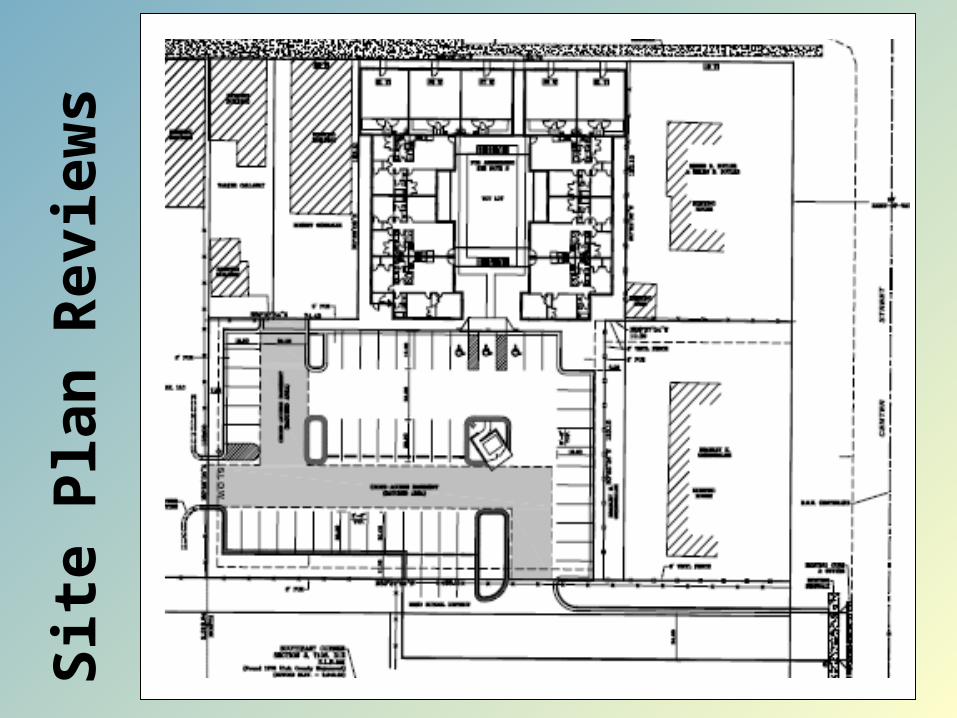
Sit
e P
lan
Revie
ws
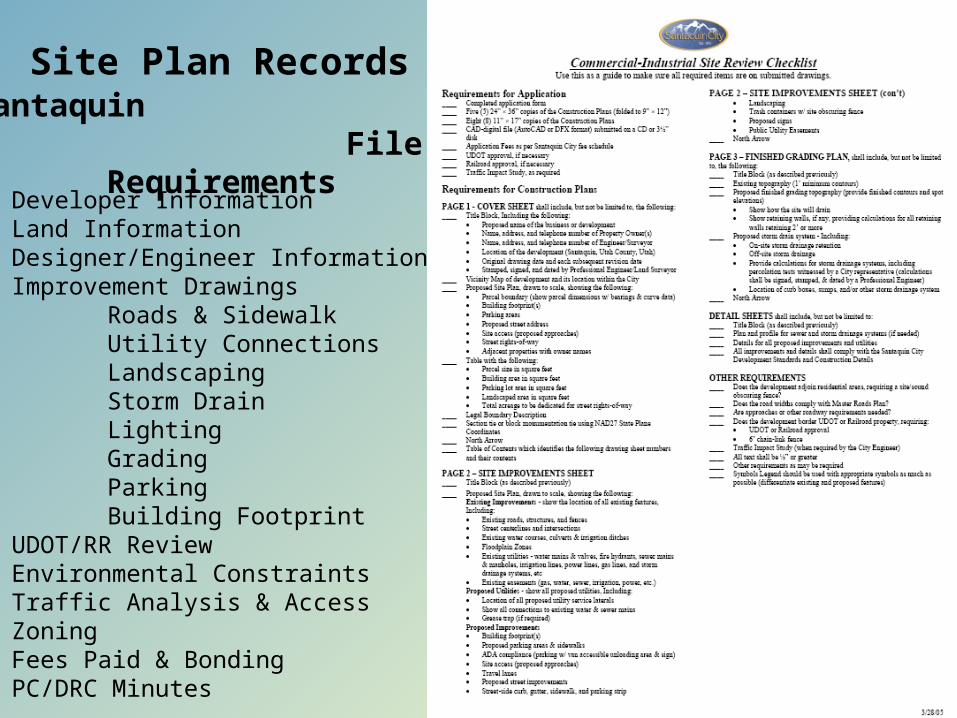
Santaquin File Requirements
Site Plan Records
Developer InformationLand InformationDesigner/Engineer InformationImprovement Drawings
Roads & SidewalkUtility ConnectionsLandscapingStorm DrainLightingGradingParkingBuilding Footprint
UDOT/RR ReviewEnvironmental ConstraintsTraffic Analysis & AccessZoningFees Paid & BondingPC/DRC Minutes
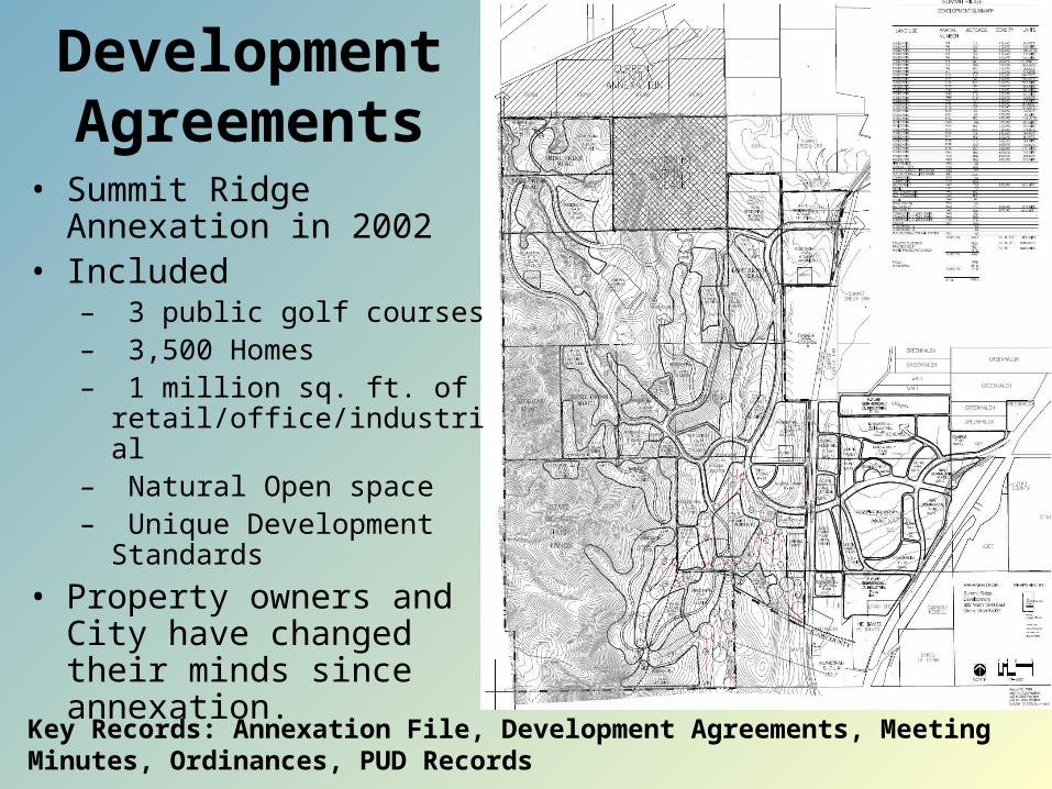
• Summit Ridge Annexation in 2002
• Included– 3 public golf courses– 3,500 Homes– 1 million sq. ft. of
retail/office/industrial– Natural Open space– Unique Development
Standards
• Property owners and City have changed their minds since annexation.
Key Records: Annexation File, Development Agreements, Meeting Minutes, Ordinances, PUD Records
Development Agreements
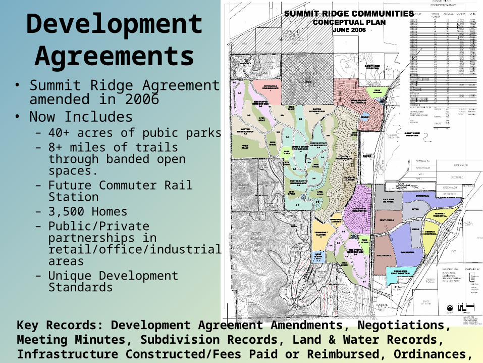
• Summit Ridge Agreement amended in 2006
• Now Includes– 40+ acres of pubic parks– 8+ miles of trails through
banded open spaces.– Future Commuter Rail
Station– 3,500 Homes– Public/Private partnerships
in retail/office/industrial areas
– Unique Development Standards
Key Records: Development Agreement Amendments, Negotiations, Meeting Minutes, Subdivision Records, Land & Water Records, Infrastructure Constructed/Fees Paid or Reimbursed, Ordinances, PUD Records
Development Agreements
Subdivision Records
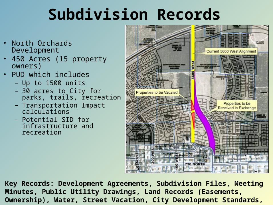
• North Orchards Development• 450 Acres (15 property
owners)• PUD which includes
– Up to 1500 units– 30 acres to City for parks,
trails, recreation– Transportation Impact
calculations– Potential SID for
infrastructure and recreation
Key Records: Development Agreements, Subdivision Files, Meeting Minutes, Public Utility Drawings, Land Records (Easements, Ownership), Water, Street Vacation, City Development Standards, Building Permits and Inspections, Bonds.
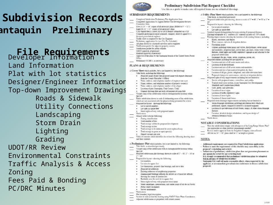
Santaquin Preliminary File Requirements
Subdivision Records
Developer InformationLand Information Plat with lot statisticsDesigner/Engineer InformationTop-down Improvement Drawings
Roads & SidewalkUtility ConnectionsLandscapingStorm DrainLightingGrading
UDOT/RR ReviewEnvironmental ConstraintsTraffic Analysis & AccessZoningFees Paid & BondingPC/DRC Minutes
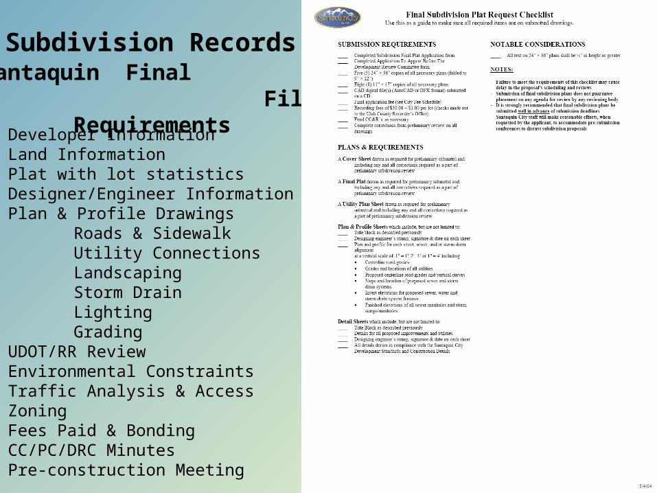
Santaquin Final File Requirements
Subdivision Records
Developer InformationLand Information Plat with lot statisticsDesigner/Engineer InformationPlan & Profile Drawings
Roads & SidewalkUtility ConnectionsLandscapingStorm DrainLightingGrading
UDOT/RR ReviewEnvironmental ConstraintsTraffic Analysis & AccessZoningFees Paid & BondingCC/PC/DRC MinutesPre-construction Meeting
Conditional Uses
Key Records: Zoning Maps, Zoning regulations, Building Permits and Inspections, Conditional Use Files, Notifications, Special Studies, Public Safety Records, Enforcement History, Land Records
Utah State Code annotated 1953, §10-9a-507
(1) A land use ordinance may include conditional uses and provisions for conditional uses that require compliance with standards set forth in an applicable ordinance.
(2) (a) A conditional use shall be approved if reasonable conditions are proposed, or can be imposed, to mitigate the reasonably
anticipated detrimental effects of the proposed use in accordance with applicable standards.
(b) If the reasonably anticipated detrimental effects of a proposed conditional use cannot be substantially mitigated by the proposal or
the imposition of reasonable conditions to achieve compliance with applicable standards, the conditional use may be denied.
Non-conforming Uses
Key Records: Subdivision Files, Historic Zoning Maps, Historic Zoning regulations, Building Permits and Inspections, Confirmation Letters, Land Use Studies, Board of Adjustment Files, Aerial Photography Maps
Utah State Code annotated 1953, §10-9a-103 Definitions
"Nonconforming use" means a use of land that:(a) legally existed before its current land use designation;(b) has been maintained continuously since the time the land use
ordinance governing the land changed; and(c) because of one or more subsequent land use ordinance
changes, does not conform to the regulations that now govern the use of the land.
Although supportive of agriculture Santaquin had inadvertently made such land uses non-conforming through re-zonings and code amendments. Ramifications included one farmers inability to construct additional greenhouses. Farmers are now encouraged to zone their properties to new Agriculture Zones and obtain Agriculture Protection Area status.
May also include an historic home built 15 feet from a road that doesn’t meet a 30 feet front yard setback.
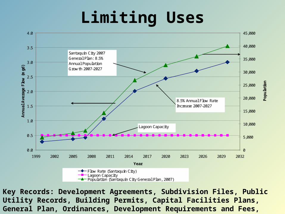
Limiting Uses
0.0
0.5
1.0
1.5
2.0
2.5
3.0
3.5
4.0
1999 2002 2005 2008 2011 2014 2017 2020 2023 2026 2029 2032
Year
Annual
Ave
rage
Flo
w (m
gd)
0
5,000
10,000
15,000
20,000
25,000
30,000
35,000
40,000
45,000
Popula
tion
Flow Rate (Santaquin City)Lagoon CapacityPopulation (Santaquin City General Plan, 2007)
Santaquin City 2007 General Plan: 8.5% Annual Population Growth 2007-2027
8.5% Annual Flow Rate Increase 2007-2027
Lagoon Capacity
Key Records: Development Agreements, Subdivision Files, Public Utility Records, Building Permits, Capital Facilities Plans, General Plan, Ordinances, Development Requirements and Fees, Impact Fees, Budgets.
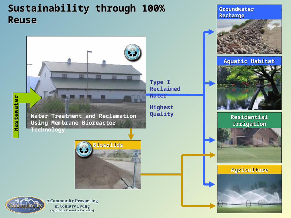
Sustainability through 100% ReuseSustainability through 100% Reuse
Water Treatment and Reclamation Using Membrane Bioreactor Technology
Aquatic HabitatAquatic Habitat
Residential IrrigationResidential Irrigation
AgricultureAgriculture
Type I Reclaimed Water
Highest Quality
Groundwater RechargeGroundwater RechargeW
as
tew
ate
r
BiosolidsBiosolids
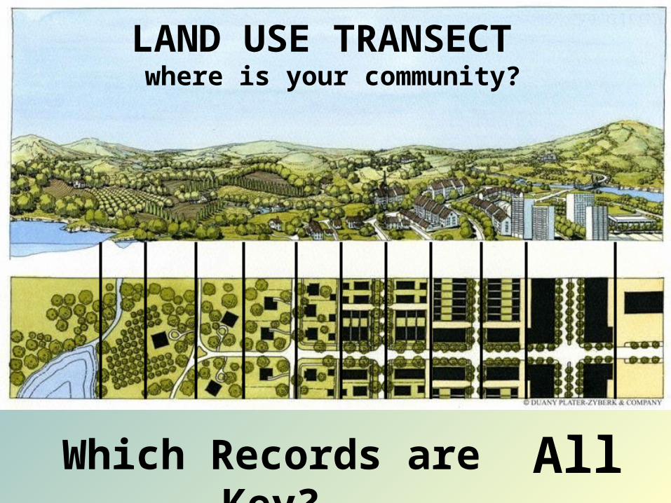
Which Records are Key? All
LAND USE TRANSECT where is your community?
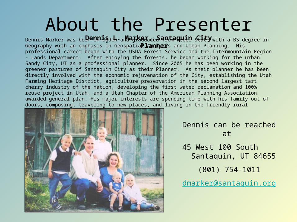
About the PresenterDennis L. Marker, Santaquin City Planner
Dennis Marker was born in Ogden and graduated from Weber State with a BS degree in Geography with an emphasis in Geospatial Analysis and Urban Planning. His professional career began with the USDA Forest Service and the Intermountain Region - Lands Department. After enjoying the forests, he began working for the urban Sandy City, UT as a professional planner. Since 2005 he has been working in the greener pastures of Santaquin City as their Planner. As their planner he has been directly involved with the economic rejuvenation of the City, establishing the Utah Farming Heritage District, agriculture preservation in the second largest tart cherry industry of the nation, developing the first water reclamation and 100% reuse project in Utah, and a Utah Chapter of the American Planning Association awarded general plan. His major interests are spending time with his family out of doors, composing, traveling to new places, and living in the friendly rural community of Santaquin.
Dennis can be reached at
45 West 100 South Santaquin, UT 84655
(801) 754-1011