landgate copy of original not to scale thu aug … · landgate copy of original not to scale thu...
TRANSCRIPT

LANDGATE COPY OF ORIGINAL NOT TO SCALE Thu Aug 1 10:54:05 2013 JOB 42421163

LANDGATE COPY OF ORIGINAL NOT TO SCALE Thu Aug 1 10:54:05 2013 JOB 42421163

LANDGATE COPY OF ORIGINAL NOT TO SCALE Thu Aug 1 10:54:05 2013 JOB 42421163

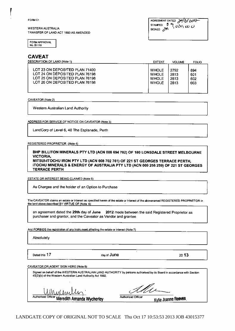
LANDGATE COPY OF ORIGINAL NOT TO SCALE Thu Oct 17 10:53:53 2013 JOB 43015377
LANDGATE COPY OF ORIGINAL NOT TO SCALE Thu Oct 17 10:53:53 2013 JOB 43015377


GHD
GHD House, 239 Adelaide Tce. Perth, WA 6004 P.O. Box 3106, Perth WA 6832 T: 61 8 6222 8222 F: 61 8 6222 8555 E: [email protected]
© GHD 2013
This document is and shall remain the property of GHD. The document may only be used for the purpose for which it was commissioned and in accordance with the Terms of Engagement for the commission. Unauthorised use of this document in any form whatsoever is prohibited. G:\61\29682\WP\135309.docx
Document Status
Rev No.
Author Reviewer Approved for Issue Name Signature Name Signature Date
A S. Shankar C. Murphy A. Vagg 30/08/2013
B S. Shankar C. Murphy A. Vagg 10/09/2013
C S. Shankar C. Murphy D. Joannides 07/10/2013

www.ghd.com

Page 1
Form 1 - Responsible Authority Report (Regulation 12)
Property Location: Lot 48 North West Coastal Hwy, Roebourne
Application Details: Transient Workforce Accommodation
DAP Name: Pilbara JDAP
Applicant: Portside Accommodation Enterprises
Owner: Cheeditha Group Aboriginal Corporation
LG Reference: P3393
Responsible Authority: Shire of Roebourne
Authorising Officer: Director Development Services
Department of Planning File No: DP13/00726
Report Date: 15 January 2014
Application Receipt Date: 30 August 2013
Application Process Days: 138
Attachment(s): 1. Site plan & Locality Plan- Drawing
No.11162-C-101: Rev A 2. Central Facilities Layout Plan – Plan
No.CH/TWA/A1: Rev C 3. Central Facilities Elevation and Floor
Plans: Drawing - Kitchen & Dining:
Plan No.CH/TWA/A5: Rev D Drawing – ERT & Medical
Centre: Drawing No.CH/TWA/A6: Rev D
Drawing – Rec Room & Induction: Plan No.CH/TWA/A7: Rev D
Drawing - Admin & Shop: Plan No.CH/TWA/A8: Rev D
Drawing – Locker Room: Plan No.CH/TWA/A9: Rev D
Drawing – Ablutions Block: Plan No.CH/TWA/A10: Rev D
Drawing – Gym: Plan No.CH/TWA/A11: Rev D
Drawing – Café/Bar: Plan No. CH/TWA/A12: Rev D
Drawing - Pool & Multi Use Sports Court: Plan No.CH/TWA/A13: Rev D
4. Accommodation Room Plans:
Floor Plan: Drawing No.LB0118-VV001-01-A001
5. Access Road Concept Plan: Title – Point Samson Access Road: Drawing No.11162- SK-003: Rev A
6. Summary Table of External Agency Comments

Page 2
7. Complete Responses of External Agencies
Recommendation: That the Pilbara JDAP approve DAP Application reference DP13/00726 and accompanying plans:
Site plan & Locality Plan- Drawing No.11162-C-101: Rev A Central Facilities Layout Plan – Plan No.CH/TWA/A1: Rev C Central Facilities Elevation and Floor Plans:
Drawing - Kitchen & Dining: Plan No.CH/TWA/A5: Rev D Drawing – ERT & Medical Centre: Drawing No.CH/TWA/A6: Rev D Drawing – Rec Room & Induction: Plan No.CH/TWA/A7: Rev D Drawing - Admin & Shop: Plan No.CH/TWA/A8: Rev D Drawing – Locker Room: Plan No.CH/TWA/A9: Rev D Drawing – Ablutions Block: Plan No.CH/TWA/A10: Rev D Drawing – Gym: Plan No.CH/TWA/A11: Rev D Drawing – Café/Bar: Plan No. CH/TWA/A12: Rev D Drawing - Pool & Multi Use Sports Court: Plan No.CH/TWA/A13: Rev
D Accommodation Room Plans: Floor Plan: Drawing No.LB0118-VV001-01-A001 Access Road Concept Plan: Title – Point Samson Access Road: Drawing No.11162- SK-003: Rev A
in accordance with Clause 4.5 of the Shire of Roebourne Town Planning Scheme No. 8, subject to the following conditions: Conditions What this Approval Allows
1. This approval allows the development and use of a Three Hundred (300) bed Transient Workforce Accommodation facility and ancillary uses.
General Conditions
2. The development hereby permitted must substantially commence within three (3) years from the date of this decision letter.
3. The development hereby permitted taking place in accordance with the
approved plans and approved Social Impact Assessment Plan dated January 2014, prepared by Pracsys.
4. The use and development permitted by this approval as shown on the
approved plans must not be altered or modified for any reason except with the prior written consent of the Joint Development Assessment Panel and the local government.
5. Vehicular access to the facility hereby permitted, as shown on the approved
plans, shall be via Reserve 611 to Point Samson – Roebourne Road only. There is to be no direct vehicular access via any informal road from North West Coastal Highway to the facility hereby permitted.

Page 3
6. The stormwater shall be discharged in a manner so that there is no discharge onto the adjoining properties to the satisfaction of the local government.
7. All works must be undertaken in a manner that minimises soil erosion, and any exposed areas of soil within the development footprint must be stabilised to prevent soil erosion to the satisfaction of the local government.
8. The kitchen/dining building is to be designed to a Building Code of Australia
importance level four [4] for emergency cyclone sheltering purposes.
9. The applicant must undertake the excision of the land from Reserve 611 in accordance with Council resolution 152681 made at the Ordinary Council Meeting of 18 November 2013, to enable the access road from the development to the Point Samson – Roebourne Road to be developed.
Expiry Date
10. This approval will expire and the use permitted by this approval must cease on or before five (5) years from the first date of the occupation of the development.
Conditions to be met prior to commencement of earthworks
11. Prior to commencement of earthworks, written confirmation must be submitted to the satisfaction of the local government demonstrating the need for a major project and showing an imminent contractual arrangement for the occupation of the Transient Workforce Accommodation by a construction workforce(s) located within the vicinity of the approved location of the Transient Workforce Accommodation facility.
12. Prior to commencement of earthworks, the proponent shall prepare and submit, to the satisfaction of the local authority, a Construction Environmental Management Plan (CEMP). The CEMP, once approved, shall thereafter be implemented on an ongoing basis to the satisfaction of the local authority throughout the construction phase of development. The CEMP must have the following components:
i. Dust management; ii. Waste Management (Solid and Liquid); iii. Noise Management; iv. Traffic Management (approved by Main Roads WA); v. A plan for actions should any items of aboriginal cultural materials or
new sites be uncovered during earthworks; vi. Hazard Management (including oil and fuel spills/leaks); vii. Emergency management, including cyclone, bushfire and flood
preparedness and response; viii. Acid Sulphate Soil management and dewatering if required; ix. Insect Vector Management; x. Pest and Weed Management;
Conditions to be met prior to commencement of building works
13 Prior to commencement of building works a Stormwater Management Plan (SWMP) is to be submitted to and endorsed by the Shire for the operational phase of the development.

Page 4
14 Prior to commencement of building works, a detailed landscaping plan is to be submitted to and approved by the local government.
15 Prior to commencement of building works, a detailed Lighting Plan to be
lodged with and endorsed by the Shire of Roebourne.
16 Prior to commencement of building works, a Colour, Materials and Finishes Plan showing the materials, finishes and colours of the development is to be submitted to and endorsed by the Shire of Roebourne.
Conditions to be met prior to occupation of development
17 Prior to the occupation of the development, the vehicle access road traversing Reserve 611, linking the facility with Point Samson – Roebourne Road, shall be constructed at the proponents’ cost to the specification and satisfaction of the local government and Main Roads WA.
18 Prior to occupation of the development, the car parking areas, loading dock,
service yard, and vehicle access and circulation areas shown on the approved site plan, including the provision of universally accessible (disabled) car parking, is to be constructed, drained, and line marked to the satisfaction of the local government.
19 Prior to the development becoming operational, the proponent shall prepare
and submit, to the satisfaction of the local authority, an Operational Environmental Management Plan (OEMP). The OEMP, once approved, shall thereafter be implemented on an ongoing basis to the satisfaction of the local authority throughout the construction phase of development. The OEMP must have the following components:
i. Waste water management; ii. Solid waste management; iii. Pest and weed management; iv. Dust management; v. Noise management; vi. Odour management; vii. Insect vector management; viii. Emergency evacuation procedures, including cyclone and bushfire
preparedness and details of emergency evacuation including assembly points and safe places for occupants, staff and visitors to all components of the development in case of an emergency.
20 Prior to occupation of the development, he kitchen/dining building, laundry
facilities and the majority of the recreational facilities, as indicated in the attached stamped plans, are to be constructed and operational.
21 Prior to occupation, landscaping is to be completed in accordance with the
approved plans or any approved modifications thereto to the satisfaction of the local government.
22 Prior to occupation, stormwater drainage works must be completed in
accordance with the approved plans to the satisfaction of the local government.

Page 5
23 Prior to occupation, the development hereby approved shall be connected to a potable water supply.
24 Prior to occupation, the development hereby permitted shall be connected to
an approved effluent treatment and disposal system.
25 Prior to occupation, uniform perimeter fencing is to be constructed to the satisfaction and specifications of the local government.
Conditions requiring ongoing compliance
26 All car parking areas, loading dock, service yard and vehicle access and circulation areas are to be maintained and available for car parking, and vehicle access and circulation on an ongoing basis to the satisfaction of the local government.
27 The access road traversing Reserve 611 to Point Samson – Roebourne Road
must be maintained on an ongoing basis to the satisfaction of the local government.
28 All landscaped areas are to be maintained on an ongoing basis to the
satisfaction of the local government.
29 The on-site drainage system shall be maintained on an ongoing basis to the satisfaction of the local government.
Rehabilitation Plan 30 A Rehabilitation Plan, prepared to the satisfaction to the local government,
indicating how and when the development will be removed and the site rehabilitated, must be submitted to the Shire for approval at least 18 months prior to the cessation of the Planning Approval.
Advice Notes
a. The Pilbara Joint Development Assessment Panel (Pilbara JDAP) has determined this application. Rights of appeal are also available to you under the Planning and Development Act 2005 against the decision of the Pilbara JDAP, including any conditions associated with this decision. Any such appeal must be lodged within 28 days of the date of this decision to the State Administrative Tribunal (telephone 9219 3111 or 1300 306).
b. An application for a Building Permit to construct the development hereby
permitted is required to be submitted and approved by the local government prior to any works commencing on-site in relation to this determination.
c. Prior to undertaking any departure from the endorsed plans the joint
Development Assessment Panel secretariat should be contacted to determine whether an amendment to this development approval is required, or whether the departure is permissible to be documented on ‘as constructed’ plans to be submitted to Planning Services of the Shire of Roebourne for endorsement upon the completion of the development.
d. In regard to Condition 3, the applicant is reminded that he the development is
to not only be constructed in accordance with the approved plans but that

Page 6
commitments within the approved SIMP are to be undertaken by the proponent.
e. In regard to Condition 9, Council’s resolution 152681 stated the following:
1. Pursuant to Section 51 of the Land Administration Act 1997 Section 3.18 of
the Local Government Act 1995 RESOLVES to EXCISE land from Reserve 611 as shown in the Concept Plan (Attachment 2 of this report) for the creation of a private access road across existing Reserve 611 (Lot 346) and the conversion of this land to a lot to be leased to Portside Accommodation Enterprises (PAE) for the purpose of ‘vehicle access’ subject to the following:
a) a Planning Approval being issued to Portside Accommodation
Enterprises (PAE) by the Pilbara Joint Development Assessment Panel (PJDAP) for Application for Planning Approval No.DP13/00726.
b) any lease over a newly created lot is for a time period commensurate with any time period provided under conditions of approval that may be issued by the PJDAP for Application for Planning Approval No.DP13/00726 that relates to the lifespan of the proposed Transient Workers Accommodation, should approval be granted by the PJDAP.
c) at the expiry of any lease granted by DoL to PAE, the land originally excised from Reserve 611 is returned to the land area of Reserve 611.
d) any costs involved in the above actions under Part 1 of this resolution are to be at the cost of PAE.
2. Pursuant to Section 3.18 of the Local Government Act 1995 RESOLVES to
ADVISE the applicant that support for the excision of this land from Reserve 611 and the creation of a lot to be leased to PAE for the purpose of vehicle access is not an indication of support for the lodged PJDAP Application for Planning Approval No.DP13/00726 and as outlined above, such formalisation of vehicle access can only be undertaken upon the PJDAP issuing a Planning Approval to the PJDAP Application for Planning Approval No.DP13/00726.
f. In regard to Condition 12 and more specifically the plan for action should
cultural materials or new sites be uncovered the proponent is to be aware there is an obligation under Section 15 of the Aboriginal Heritage Act, to record and report site information to the Department of Aboriginal Affairs.
g. In regard to Conditions 12 & 19 when preparing the Emergency Management
Plane and prior to clearing any firebreaks it is recommended the applicant seek the advice of the Department of Fire and Emergency Services.
h. In regard to Condition13, development is to be in accordance with the
endorsed Flood Study prepared by JDA and stated as being adequate, by the Department of Water, in regard to mitigating any impacts by a major 1 in 100 year flooding event.
i. In regard to Condition 14, when preparing the Landscaping Plan, the
applicant is advised to consult with the Water Corporation in regard to waterwise plantings.
j. In regard to Condition 23, any licenses/approvals required for the bore and/or
water supply treatment plant infrastructure are to be gained by the proponent from the relevant agencies. It is recommended the proponent contact both the

Page 7
Department of Water and the Department of Health to determine the required approvals. Potable water must be of the quality as specified under the Australian Drinking Water Guidelines 2004.
k. In regard to Conditions 5, 9 and 17, it is recommended the proponent contact
Main Roads WA (MRWA) to confirm requirements of MRWA for the approvals process for surveyed and civil engineering plans and for associated works programs and Traffic Management Plans for works associated with the connection of the vehicle access to the Point Samson – Roebourne Road.
l. In regard to Condition 24, the proponent is to gain approval for the waste
water treatment plant and proposed treated waste water dispersal area, from the Department of Health, prior to construction of this infrastructure. Recycling of the wastewater is subject to approval by DoH and the preparation of a Recycled Water Quality Management Plan.
m. In regard to Condition 24, the following should be considered:
The approval of the DoH is required for the WWTP and treated wastewater dispersal area.
The Shire requests that a copy of any approval for the WWTP from the Department of Health be submitted to the Shire’s Environmental Health Department.
The recycling of the wastewater is subject to approval by DoH and the preparation of a Recycled Water Quality Management Plan.
n. A Native Vegetation Clearance Permit is required to be issued by the DER
prior to any land clearing on site.
o. Should any temporary water supply be required from the Water Corporation (WaterCorp) for the construction of the camp that this must be the subject of an agreement with the WaterCorp.
p. The proponent is to apply to Horizon Power for connection to the localised
power supply network.
q. A Building Permit is required to be issued by the Shire prior to the commencement of any on-site building works.
r. The preparation of a Site Management Plan or similar, prior to occupation, is
the responsibility of the proponent/management of the facility and should be carried out at all times of operation for the safety and well being of occupants and also surrounding land owners and occupants. The Site Management Plan should address the following matters:
i) Behaviour; ii) Safety; iii) Consumption of liquor; iv) Noise emissions; v) Supervision; vi) Hours of operation; vii) Avoidance Sites; and viii) Provision of recreational facilities.

Page 8
s. Should the proponent seek to develop the bar facility (a part of this approval) for the service of alcoholic beverages, the relevant liquor licence must be issued by the Department of Racing Gaming and Liquor (DGRL) prior to the service or consumption of any alcohol within the approved Transient Workforce Accommodation facility.
t. The Shire shall recommend to the Department of Racing Gaming and Liquor
(DGRL), in writing, that the Shire requests that should the DRGL issue a liquor licence to the proponent that conditions to the following effect should be included: a) No alcohol is to be taken any further than an area strictly limited to the
bar/beer garden area (no alcohol to be taken beyond this area to accommodation rooms or outside of the TWA facility)
b) No alcohol to be sold to or consumed by any persons, including staff, with the exception of the TWA occupants.
u. During the construction stage adjoining lots are not to be entered without the
prior written consent of the affected owner(s).
v. It is the responsibility of the applicant to search the title of the property to ascertain the presence of any easements that in any case must not be built upon.
w. Advertising signs shall not be erected or displayed on the site except in
accordance with the Shire of Roebourne Town Planning Scheme No.8 and Local Law: Signs, Hoardings and Bill Postings. These documents may require the submission of an application for Planning Approval and/or an application for a Building Permit to the Shire.
Background:
Insert Property Address: Lot 48 North West Coastal Highway, Roebourne
Insert Zoning MRS:
TPS: Rural
Insert Use Class: ‘AA’
Insert Strategy Policy: N/A
Insert Development Scheme: Shire of Roebourne Town Planning Scheme No.8
Insert Lot Size: Approximately 405 hectares
Insert Existing Land Use: Aboriginal Community
Value of Development: $30,000,000
Site and Surrounds The site is located in the north eastern corner of Lot 48 as shown in Attachment 1. The area of the footprint of the proposed development within Lot 48 including the treated waste water dispersal land area is approximately 7.5 hectares, with the total area of Lot 48 being approximately 405 hectares. Lot 48 is zoned ‘Rural’ under the Shire of Roebourne Town Planning Scheme No.8 (TPS8). The area the footprint of the development is currently vacant land with a native vegetation cover and a locally significant, natural drainage channel running along the southern edge of the footprint. Lot 48 contains in the southern extremity of the site the Cheeditha Aboriginal Community which encompasses 17 dwellings and basic community infrastructure.

Page 9
The centre of the community is located approximately 3km from the town of Roebourne and approximately 35km east of Karratha. The community is located approximately 800m from the southern edge of the proposed development footprint and is physically separated from the proposed development by the natural drainage channel. This channel is dry most of the year and contains vegetation, common to the Pilbara region along its length. The vegetation being low scrub sparsely populated with trees. There are currently some informal vehicle tracks leading from the community, across the channel and into the vicinity of the proposed development site. Some informal tracks exist that connect the Point Samson – Roebourne Road to the proposed development site. The Point Samson- Roebourne Road is located approximately 1km to the east of the eastern edge of the proposed development footprint (see Attachment 1 & 5). The ‘Rural’ zoning surrounds the footprint of the development and also surrounds lot 48 to the south, east and west with an ‘Infrastructure’ zoning along the northern boundary of Lot 48 and containing a gas pipeline. Beyond this to the north the ‘Rural’ zoning continues. To the west of Lot 48 is another ‘Infrastructure’ zoning corridor, which contains a railway line taking iron ore trains from the inland to the Cape Lambert Port facilities. This railway line is located approximately 2.7km from the proposed TWA. Surrounding the site in all directions is vacant land containing native vegetation cover. The ‘rural’ zoned land is a Pastoral lease to the north, south and west of Lot 48 and Unallocated Crown land to the south east. Reserve 611 for the purpose of ‘Common Usage’ is located to the north eastern corner of Lot 48 and is adjacent to the footprint of the proposed development and separates the development site from the Point Samson – Roebourne Road. Reserve 611 is under Management Order to the Shire of Roebourne and is currently vacant with only informal vehicle tracks traversing the Reserve. Water Corporations sewage treatment facility for Roebourne is located to the south east of Lot 48 and approximately 800m from the proposed development. Outline of Development Application The proposed development is for a Transient Workforce Accommodation facility to accommodate 300 persons and is intended to service a major project within the vicinity of the site in the near future. The components of the proposal are listed below: Accommodation areas:
300 single person accommodation rooms; Laundry buildings.
The accommodation rooms are single storey buildings. A number of accessible accommodation rooms are also provided. Each accommodation room building contains covered out door living areas that are semi screened with an area of 6.5m2 each (see Attachment 4). Shade shelters and landscape communal areas are provided for within the accommodation room area along with pedestrian pathways linking the components of the development. Central Facilities:
Kitchen/dining building (also acts as the TWA’s cyclone shelter)

Page 10
Office building with: small shop containing general convenience goods, reception, offices and rec & induction room, comms and plant rooms
Gym building Outdoor pool and shade shelter Outdoor tennis court Plaza shelter Locker building Communal toilet building Wet mess/bar/café building with associated outdoor beer garden Service yard with bin compounds Paramedic facilities
All buildings in the central facilities area are single storey and as shown in the submitted elevations (see Attachment 3) have considerable pitched roofing and verandahs, improving the overall visual aesthetics of the development. A waste water treatment plant and associated land area for treated waste water dispersal is proposed, along with an onsite bore for water extraction and an onsite water treatment facility to provide potable drinking water to the development and its occupants. Access: The proposal also includes access from the Point Samson – Roebourne Road via a proposed newly formed private access road that is intended to traverse Reserve 611 to the east of the site. The eventual tenure of this land following excision of this land area from the Reserve as supported by Council will be that of a lease from the Department of Lands to the proponent. This is outlined in further detail later in the report. Partnership: A cornerstone of the application is for the partnership between two local Aboriginal Corporations being the Cheeditha Aboriginal Group Corporation (CGAC) and the Juluwaru Aboriginal Group Corporation (JAGC) and a private company being National Lifestyle Villages. These three entities form Portside Accommodation Enterprises whom is the applicant. Legislation & policy: Legislation Planning and Development Act, 2005 Shire of Roebourne Town Planning Scheme No.8 (TPS8)
Clause 1.6 – Aims of the Scheme Clause 3.2 – Zoning Table Clause 4.1 – Requirement for Planning Approval Clause 4.3 – Advertising of Applications Clause 4.4 – Matters to be considered by Council Clause 5.13 - Roebourne Objectives Clause 6.5 – Transient Workforce Accommodation Clause 6.8 – Rural Zones Clause 6.12 - Vehicle Parking and Access Clause 6.13 – Landscaping, Screening and Fencing Clause 7.5 – Storm Surge Risk Area
State Government Policies State Planning Policy (SPP) 2.5 – Land Use Planning in Rural Areas

Page 11
SPP 3.2 – Aboriginal Settlements SPP 3.4 – Natural Hazards and Disasters SPP 4.1 – State Industrial Buffer Policy and Draft SPP 5.4 – Road and Rail Transport Noise and Freight Considerations in Land Use Planning Local Policies DP 10 – Transient Workforce Accommodation and Draft DP10 Consultation: Public Consultation Under the Zoning Table of TPS8, in the ’Rural’ zone, TWA is an ‘AA’ use. Although advertising is not required for an ‘AA’ use, given the scale of the development advertising was undertaken for a minimum period of 21 days as allowed for and in accordance with Clauses 4.3.2 and 4.3.3, in the following forms:
Public Notice in the Pilbara News Shire Website
The application was advertised in the Pilbara News from 5 September 2013 with submissions closing 30 September 2013. In addition the application was placed on the Shire’s website during this period. No submissions were received from the public.
Consultation with other Agencies The application was forwarded to the following agencies for consideration and comment;
Department of Water Water Corporation Horizon Power Department of Racing Gaming and Liquor Department of Parks and Wildlife Department of Environmental Regulation Department of Health Department of Aboriginal Affairs Department of Lands Department of State Development Main Roads WA Pilbara Development Commission Roebourne Police Department of Fire and Emergency Services
Comments were received from all of the above with the exception of the Department of Fire and Emergency Services The comments from the various agencies and the Shire’s responses to these are outlined in the Table presented in Attachment 6. The full submissions are presented in Attachment 7. Planning assessment: Relevant State Planning Policies SPP 2.5 – Land Use Planning in Rural Areas

Page 12
The footprint of the development is wholly contained within the ‘Rural’ zoning as per TPS8 and the land surrounding the development site is largely zoned ‘Rural’. It is considered that the area of land proposed for the footprint of the development, being approximately 7.5 hectares, is negligible as compared to the vast areas of ‘Rural’ zoned land in the immediate vicinity of the site and the greater Roebourne region. It is not considered that the use of this relatively small land area under ‘Rural’ zoning for a period of time that can later revert back to a more recognised rural use, would impede or prevent rural activities within this area of the Shire into the future. The land is not currently used and vast areas of rural land with no intense uses in the area are available should future rural innovations require the uptake of ‘Rural’ zoned land in the short to medium term. As will be addressed in greater detail later in the report a recommended condition of approval is for a time limited approval of 5 years and other conditions to rehabilitate the land. This will ensure that the land returns to be available for more traditional rural pursuits within the medium term timeframe. It is considered that the proposal would not hinder the objectives of this policy being attained. 3.4 – Natural Hazards and Disasters The WAPC’s State Planning Policy 3.4 Natural Hazards and Disasters (2006) sets the planning framework, under Section 26 of the Planning and Development Act 2005, for the planning and development of land that may be affected by natural disasters and hazards. The objectives of the policy are to:
Include planning for natural disasters as a fundamental element in the preparation of all statutory and non-statutory planning documents, specifically town planning schemes and amendments, and local planning strategies; and
Through the use of these planning instruments, to minimise the adverse impacts of natural disasters on communities, the economy and the environment.
This policy is pertinent to the application as the proposed development is located in the Storm Surge Risk Special Control Area under TPS8, is located in a cyclonic region and has the potential to be exposed to bushfire and flooding. The site is located some distance from the coast and is not known to be prone to storm surge events. The site is approximately 7km from the coast to the north of the site and approximately 1.5km from the Harding River. The application has been referred to the Department of Water (DoW) for comment and issues pertaining to flooding were raised. The development has, after considerable consultation, been designed so that finished floor levels of accommodation rooms and the central facilities buildings are 500mm above the 1 in 100 year flood levels as provided by the DoW. This is shown as a notation on the site plan (see Attachment 1). The proposal is considered to meet the objectives for coastal planning in regard to design for potential storm surge and flooding events. The applicant, prior to being able to construct on site, will be required to gain a building permit which will require the buildings to meet structural standards for wind loads associated with this cyclonic region. An advice note to any approval that may be issued is recommended in this regard. Further to this, the implementation of an Emergency Management Plan (EMP) through conditions requiring the provision of a Construction Environmental Management Plan (CEMP) and an Operational Environmental Management Plan

This is an unlicensed copy of Split Pdf
This page will be appended to every output
in unlicensed mode only.
For purchase information see our website
http://www.traction-software.co.uk/servertools/splitpdf/
Thank you,