landscape risk assessment - frames
TRANSCRIPT

Landscape Hazard Assessment
Past Approaches and
Current Modeling Tools

• Vegetation/Fuels Information was ground truthed.
• Rating Included Ignition Likelihood, Values at Risk, and Suppression Difficulty
• Fuels Hazard based on static evaluation of each location. Not able to evaluate change based on Fuel Treatments


• Fire behavior calculated independently for each pixel
• Used fireline intensity (analog for flame length)
• No assessment of ignition or spread

Adding Fire Growth PotentialFLAMMAP Burn Probability/IFT-DSS RanDig

FLAMMAP 5 is stand alone software, with latest version of the Minimum Travel Time (MTT) fire growth model for Burn Probability and Treatment Optimization calculations.• It includes spotting as spread vector• Calculation intensive analyses like
burn probability can take hours to complete
IFT-DSS is online tool, in development. • It includes FLAMMAP
3, which does not incorporate spotting spread
• Calculations made on server, saving local computer resources


Factor Issues forBurn Probability Analysis
• What are vectors of spread
• What environmental scenarios are of interest
• Ignition frequency and distribution
• What are barriers
• How are fuel treatments and fire scars represented
• Are you evaluating individual landscape changes or evaluating hazard in a general sense
• Size of Analysis Area

Effect of Landscape Classification

LANDFIRE 2008
CWPP 2006
LANDFIRE Landscapes are consistently developed across the entire US. Limited use of local mapping of vegetation. Significant edits are normally required for analysis.
Locally produced versions, like this CWPP project map may be more accurate. They are often limited by ownership boundary, image availability, and the time for production.
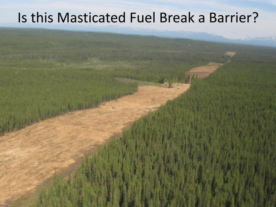
Is this Masticated Fuel Break a Barrier?
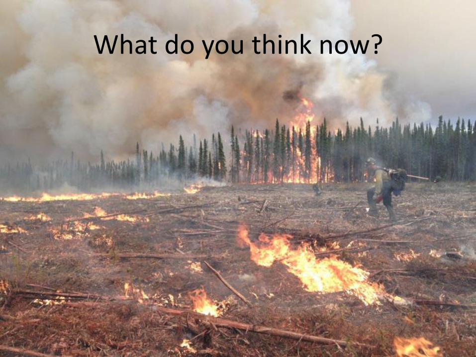
What do you think now?

Fire Behavior in Treatments & Burn Scars
Effect of Ignition Source
Random Ignitions
And
Spatially Explicit Ignitions

Lightning and Human Ignitions• 2013 Ignition Cause
402 -- Human
211 -- Lightning
• 2014 Ignition Cause339 -- Human
54 -- Lightning

Lowery, James, "The effect of random and spatially explicit lightning and human-caused ignitions on simulated burn probabilities at small scales" (2012). Theses, Dissertations, Professional Papers. Paper 992
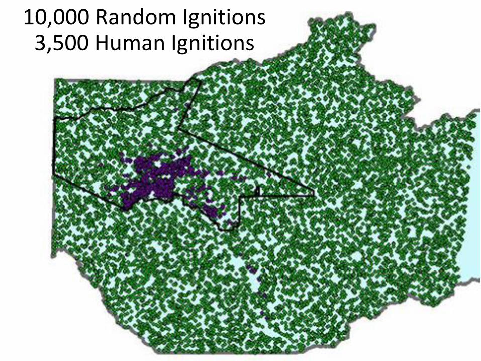
10,000 Random Ignitions 3,500 Human Ignitions

Effect of Environment Factors
Fuel Moisture
Windspeed
Wind Direction

WindspeedWind Direction
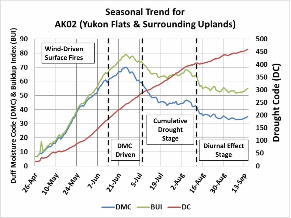
Wind-Driven Surface Fires
DMC Driven
Cumulative Drought
StageDiurnal Effect
Stage
How the FLAMMAP Burn Probability Model Works

10,000 overlappingFire Perimeters
Before Recent Fires

10,000 overlappingFire Perimeters
After Recent Fires
The Inputs Matter!

The Results
Burn Probability
Conditional Flame Length
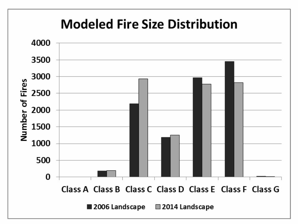
Fire Size Distribution

Burn Probability Output Use enough ignitions to burn entire landscape

Conditional Flame Length Averages all flame length
from fires that burned each pixel

Evaluating Treatments• Landscape accuracy critical• Worst case environment?• Multiple wind directions?

Reprocessing Model Outputs
• Combining burn probabilities from multiple analyses, accounting for
– wind direction
– Landscape changes
• Other Examples
Ager, Alan A.; Vaillant, Nicole M.; Finney, Mark A.; Preisler, Haiganoush K. 2012. Analyzing wildfire exposure and source–sink relationships on a fire prone forest landscape. Forest Ecology and Management. 267: 271–283.
Concluding thoughts and questions