landscape science for forest planning
TRANSCRIPT

Landscape Science for Forest Planning
Thomas D. Sisk, Northern Arizona University29 March 2010

Landscape Science for Forest Planning
• The Landscape Context• Landscape Assessments and PlanningLandscape Assessments and Planning
– Spatial Data to Support Planning– Modeling Fire, Wildlife, Watershed
• Participatory Analysis and Collaboration• Participatory Analysis and Collaboration– Scenario-building– Forest Treatment Models
/• Thoughts on the Science/Policy Interface
The State of the Science:The State of the Science:Practical

Landscape Context: Increased threat of uncharacteristic fire
Example:
Why “Landscape”?
Example:
Rodeo-Chediski Fire of 2002
O d l h• Operated at scales that dwarf project-level managementg
• Analysis should be conducted at the scale at
1976-2006
which key ecosystem processes operate –“minimum dynamic unit”y
(Pickett and White, 1978)

Landscape Context: Increased risk to wide-ranging species
Conservation of wide-ranging animals can be compromised if planning is carried out at scales that fail to capture
l i d i d h bipopulation dynamics and habitat requirements
Demographic analysis may beDemographic analysis may be impractical or impossible in some situations, however, presence-absence data, available from many monitoringdata, available from many monitoring programs, can inform models that predict site occupancy and geographic distribution
This approach can complement PVA by providing insight on viability for less-studied species and over portions of the range where vital rates are not known
ID Fish & Game

Landscape Context: Biological invasions
Si il h i bSimilar techniques can be used for plants:
Predicted occurrence of cheatgrass (Bromus tectorum) across the 850,000 ac Kane and Two Mil R n h N rth RiMile Ranches, North Rim of Grand Canyon
Based on presence data from 606 vegetationfrom 606 vegetation points monitored by the Grand Canyon Trust
(Albano et al., in prep.)
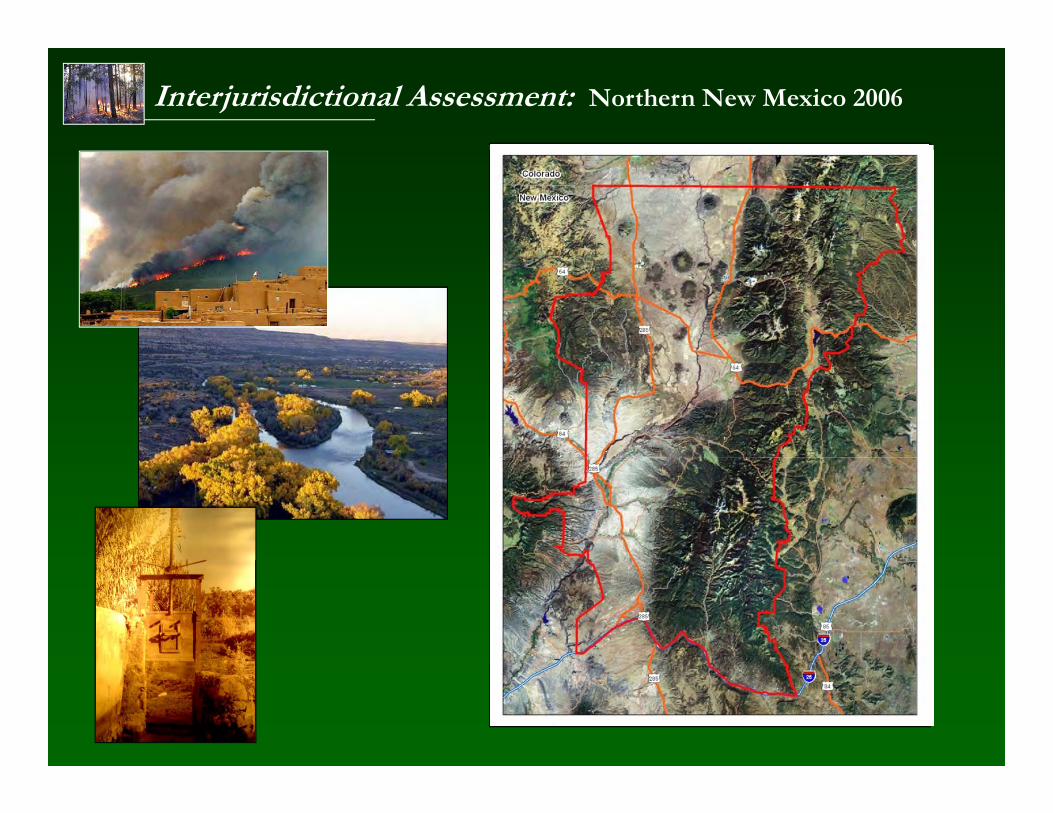
Interjurisdictional Assessment: Northern New Mexico 2006

Foundational Data Layers: E.g., Canopy Cover
• Developed using widely available imagery and ground data collected by collaborating agencies andcollaborating agencies and scientists
• Independent training data collected for accuracycollected for accuracy assessment
• FGDC Metadata standards
• Derived from USGS B/W orthophotos using object-oriented, machine learning analysis; 10-30-m resolution;analysis; 10 30 m resolution; >80% of the predicted values were within 16% of the actual value (n = 343
d l ) X l 2006 Ad d l d l i f iground plots) Xu et al. 2006. Advanced exploratory data analysis for mapping regional canopy cover. Photogrammetric Engineering & Remote Sensing. 72:31-38

Foundational Data Layers: E.g., Basal Area
• Multitemporal Landsat 5 TM imagery
• 30-m resolution
• CART methodology i i 23incorporating 23 predictor variables, including:
- NDVI- Topography- Principal components
• C stom training data• Custom training data (n = 343 ground plots)
• 81% of all pixel values were within 5m2/ha

Derived Data: Fire Hazard
• Outputs from FlamMap (ver 3.0, Finney et al. 2006) using LANDFIRE2006) using LANDFIRE and ForestERA input maps from
• 90th percentile drought weather parameters
- Low understory fuel ymoistures
- Low foliar fuel moistures
- 30mph wind @225deg
• 30m resolution30m resolution

Derived Data: Mexican Spotted Owl Habitat
• Autologistic regression and multimodel inference
• Strong ForestERA-derived predictors:
- Basal areaT d i- Tree density
• n = 125 locations• AUC = 0.92• NR 2 = 0.72
Prather et al. 2007. Real versus perceived conflicts between restoration of ponderosa pine forests and conservation of theforests and conservation of the Mexican Spotted Owl. Forest Policy & Economics 10:140-150.

Derived Data: Tassel-eared Squirrel Density
• Density and juvenile recruitment in ponderosa pine vegetation onlypine vegetation only
• Multiple linear regression and multimodel inference
• Strong ForestERA-derived predictors:
- Basal area- Canopy cover
• Training = 25 sites in N. AZ• V lid ti = 24 sites in NM• Validation = 24 sites in NM• R2 = 58%
Prather et al. 2006. Landscape models to predict the influence of forest structure onpredict the influence of forest structure on Tassel-eared Squirrel populations. Journal of Wildlife Management 70:722-730.

Building Social Capital: Collaborative process
• Collaboration enlists the strengths of science in a focused effort to solve realscience in a focused effort to solve real problems and resolve important issues
• Collaboration results in sharing traditional gknowledge and local experience, which can be important in planning
h b d• The gap between science and application is bridged—science becomes more relevant, decisions become more rational
(Paraphrased from Forsythe 2003)

Outcomes of Science-based Collaboration
Priorities
Level of Agreement
Management Actions

Predicted Effects: Modeling Forest Treatments

Predicted Effects: Modeling Forest Treatments

Predicted Effects: Landscape-level Fire Hazard

Predicted Effects: Mexican spotted owl habitat

Public Science for Landscape-level Planning
₪ Science must be transparent, but not ‘dumbed down’
₪ It must be rigorous, repeatable, and defensible so that it will inspire confident actionp
₪ The public must ‘own’ the science if they are to trust and accept decisions based on it
₪ The planning process should provide a predictive capacity and allow exploration of alternative scenarios
₪ Science should inform and guide planning, not attempt to dictate decisions

Acknowledgments
Colleagues on the JFSP Northcentral New Mexico Interjurisdictional Landscape Assessment Project:Brett Dickson, Sam DesGeorges, Haydee Hampton, Eytan Krasilovsky, Tischa Munoz-Erickson Simon Niemeyer Pat Pacheco John PratherTischa Munoz Erickson, Simon Niemeyer, Pat Pacheco, John Prather, Lou Romero, Jill Rundall, David Schlosberg, and Yaguang Xu
ForestERA Project Science Advisors: Craig Allen, Greg Aplet, and Barry Noon
And many other colleagues, including: Christine Albano, Jessie Anderson, Ethan Aumack, Henry Carey, Wally Covington, Pete Fule, , , y y, W y v g , ,Wynne Geikenjoyner, Jean Palumbo, Steve Sesnie, Diane Vosick, New Mexico BLM, Forest Service Region 3, and hundreds of citizens, stakeholders, and collaborative group participants across the Southwest