langi ghiran text1210 - parks...
TRANSCRIPT
pa
rkn
ote
s
For more information call the Parks Victoria Information Centre
on 13 1963 or visit our website at www.parkweb.vic.gov.au
Healthy Parks Healthy People
Visiting a park can improve your health, mind, body and
soul. So, with over four million hectares of parkland available to Victorians, why not escape
to a park today!
Langi Ghiran State Park
Lar-ne-jeering Visitor Guide Rugged granite peaks and gentle sloping woodlands are the dominant features of this local
landmark. A pleasant walk to the mountain summit presents a view of ancient Red Gums on
the surrounding plains skirted by Mount Buangor in the east and the Grampians in the distant
west. Lar-ne-jeering (Langi Ghiran) is Djab Wurrung language for 'home of the black
cockatoo’.
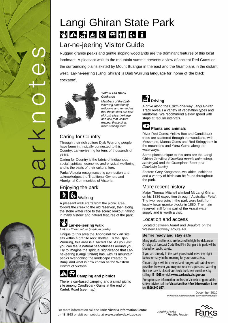
Yellow Tail Black Cockatoo Members of the Djab Wurrung community welcome and remind us that these sites are part of Australia’s heritage, and ask that visitors respect these sites when visiting them.
Caring for Country Through their rich culture Djab Wurrung people have been intrinsically connected to this Country, Lar-ne-jeering for tens of thousands of years. Caring for Country is the fabric of Indigenous social, spiritual, economic and physical wellbeing and is the basis of their cultural lore. Parks Victoria recognises this connection and acknowledges the Traditional Owners and Aboriginal Communities of Victoria.
Enjoying the park
Walking A pleasant walk starts from the picnic area, follows the creek to the old reservoir, then along the stone water race to the scenic lookout, taking in many historic and natural features of the park.
Lar-ne-jeering walk 1.8km - 30min return (medium grade) Unique to this area the Aboriginal rock art site sits within a granite rock shelter. To the Djab Wurrung, this area is a sacred site. As you visit, you can feel a natural peacefulness around you. Try to imagine the spiritual significance that Lar-ne-jeering (Langi Ghiran) has, with its mountain peaks overlooking the landscape created by Bunjil and what is now known as the Western District of Victoria.
Camping and picnics There is car-based camping and a small picnic site among Candlebark Gums at the end of Kartuk Road (see map).
Driving A drive along the 6.3km one-way Langi Ghiran Track reveals a variety of vegetation types and landforms. We recommend a slow speed with stops at regular intervals.
Plants and animals River Red Gums, Yellow Box and Candlebark trees are scattered through the woodland, with Messmate, Manna Gums and Red Stringybark in the mountains and Yarra Gums along the waterways. Some plants unique to this area are the Langi Ghiran Grevillea (Grevillea montis-cole subsp. brevistyla) and the Grampians Bitter-pea (Daviesia laevis). Eastern Grey Kangaroos, wallabies, echidnas and a variety of birds can be found throughout the park.
More recent history Major Thomas Mitchell climbed Mt Langi Ghiran on his 1836 expedition through ‘Australian Felix’. The two reservoirs in the park were built from locally hewn granite blocks in 1880. The main reservoir still forms part of the Ararat water supply and is worth a visit.
Location and access Located between Ararat and Beaufort on the Western Highway, Route A8.
Be fire ready and stay safe Many parks and forests are located in high fire risk areas. On days of forecast Code Red Fire Danger this park will be closed for public safety. If you are already in the park you should leave the night before or early in the morning for your own safety. Closure signs will be erected and rangers will patrol when possible, however you may not receive a personal warning that the park is closed so check the latest conditions by calling 13 1963 or visit www.parkweb.vic.gov.au For up to date information on fires in Victoria or general fire safety advice call the Victorian Bushfire Information Line on 1800 240 667.
December 2010 Printed on Australian-made 100% recycled paper

pa
rkn
ote
s
For more information call the Parks Victoria Information Centre on 13 1963 or visit our website at www.parks.vic.gov.au
Healthy Parks Healthy People
Visiting a park can improve your health, mind, body and
soul. So, with over four million hectares of parkland available to Victorians, why not escape
to a park today!
For further informationParks Victoria
Information CentreCall 13 1963
Or visit the website at www.parks.vic.gov.au
Parks Victoria officeTel: 5321 4800
Sawpit RoadCreswick 3363
The Djab Wurrung people are represented by
Martang Pty Ltd - the Registered Aboriginal
Party for this area
Visitor Information CentresArarat
91 High StreetARARAT 3377Tel: 5352 2096
Beaufort72 Neill Street
BEAUFORT 3373Tel: 5349 2604
Caring for theenvironment
Help us look after your park by following these guidelines:All native plants and animals
are protected by lawPlease do not disturb them in
any wayDogs, cats, horses and
firearms are not permitted in this park
Please take rubbish home with you for recycling and
disposalVehicle including motor
cycles must not be driven off open formed roads
All vehicles must be registered and drivers
licensedRemain on walking tracks where applicable to avoid
damaging vegetationPractice minimal impact
camping the remote sections of the park
Mobile phones: you may not be in network range in some
park areas.To be connected to
emergency services when you are not in range dial 112
then press the ‘Yes’ key
FireLangi Ghiran State Park is in the South West Total Fire Ban District.
It is your responsibility to know if it is a day of Total Fire Ban.If in doubt call the Victorian Bushfire Information Line: 1800 240 667Fires may only be lit in fireplaces provided.No fires/flames, (including gas or fuel stoves/lanterns in tents) may be lit on days of Total Fire Ban.
Park closuresBe prepared to leave early as extreme weather may cause the closure of some park areas for public safety
ToArarat
Horsham
Parks Victoria does not guarantee that this data is without flaw and therefore disclaims all liability which may arise from you relying on this information.
Drive
Family walk
Recreational &Visitor Facilities
Langi GhiranState Park
Sealed roadUnsealed roadManagement vehicles and walkers only
Walking trackRailway
Gate
State ParkOther public land
Creek / Gully
Water body
Aboriginal Art siteCampingFireplaceInformationLookoutParkingPicnic areaToiletsDriveFamily walk