latin america’s physical geography eq: what are characteristics of latin america’s physical...
TRANSCRIPT

Latin America’s Physical Geography
EQ: What are characteristics of Latin America’s physical
features?
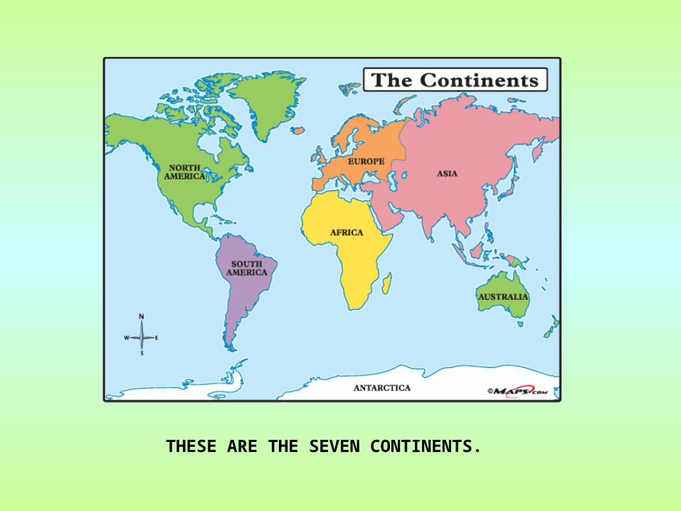
THESE ARE THE SEVEN CONTINENTS.

Latin America is divided into 3 Regions:
• Mexico and Central America
• The Caribbean
• South America

This is Latin America.
Latin America is NOT a continent.
Latin America is NOT a country.
Latin America IS a cultural Region.

Latin America lies between the Pacific and Atlantic oceans. Both oceans are important trade routes for Latin America. The Caribbean Sea is another important body of water in Latin America.
ATLANTIC OCEAN
PACIFIC OCEAN
CARIBBEAN SEA

Gulf of Mexico
• Body of water
• Bordered by the US to the north, 5 Mexican states to the south, and Cuba to the east
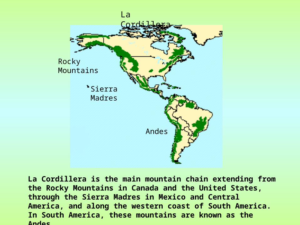
La Cordillera
La Cordillera is the main mountain chain extending from the Rocky Mountains in Canada and the United States, through the Sierra Madres in Mexico and Central America, and along the western coast of South America. In South America, these mountains are known as the Andes.
Rocky Mountains
Sierra Madres
Andes

Sierra Madre Mountains• Mountain system in Mexico• Three major chains: the Sierra Madre
Occidental in the west, the Sierra Madre Oriental in the east, and the Sierra Madre del Sur, which extends along the southern coast– The Sierra Madre range
contains some of the highest
mountains and volcanoes
in Mexico.

SIERRA MADRES
SIERRA MADRES EAST
SIERRA MADRES WEST
In Mexico the Sierra Madres mountains split into the Sierra Madre West and Sierra Madre East.


Sierra Madre Mountains

The Sierra MadresThe Sierra Madres, Mexico, Mexico

Panama Canal• canal across the isthmus of Panama in Central
America– Major “shortcut” that allows ships to travel between the
Pacific and Atlantic oceans
• handles a large volume of world shipping and enables vessels to avoid traveling around South America, reducing their voyages by thousands of miles and many days. – Consists of artificially created lakes, channels, and a series
of locks, or water-filled chambers, that raise and lower ships through the mountainous terrain of central Panama
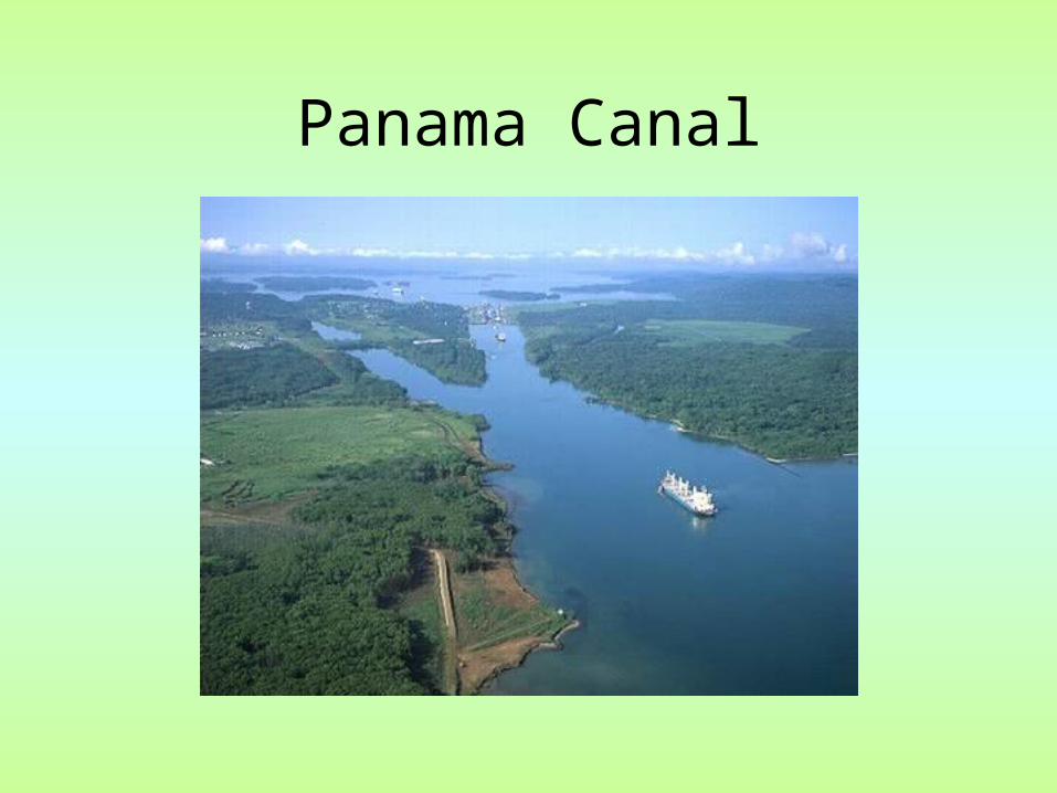
Panama Canal

The Panama CanalThe Panama Canal

Caribbean Sea• Surrounds the islands of the West Indies
• East of Central America
• A major trade route for Latin American countries
• A popular tourist area—
noted for its mild tropical
climate and beautiful waters

Caribbean Sea

ANDES M
OUN
TAINS
ANDESThe Andes are the longest mountain range in the world and, the 2nd highest mountains in the world.

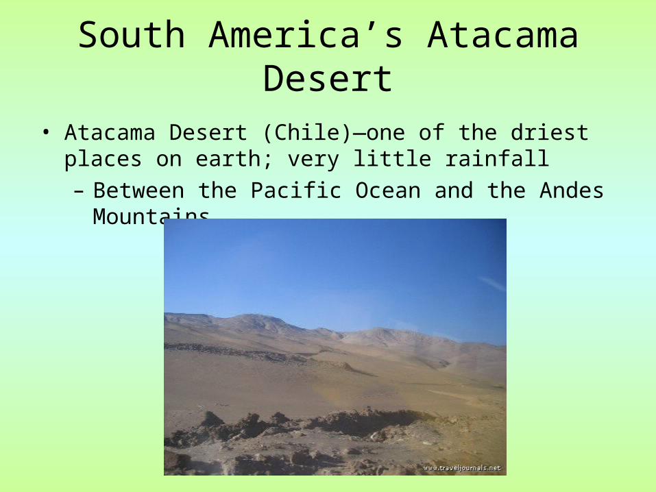
South America’s Atacama Desert• Atacama Desert (Chile)—one of the driest places on
earth; very little rainfall– Between the Pacific Ocean and the Andes Mountains

Atacama Desert

Atacama DesertAtacama Desert

South America—Water • Rivers serve as natural highways where
it’s hard to build roads– provide food and hydroelectric power
• Amazon River—2nd largest river in the world (1st--Nile River)– 4,000 miles from Peru across to Atlantic
Ocean– Contains 20% of all fresh water in the world!

AMAZON RIVERThe Amazon is the largest river in the world. It begins in the Andes Mountains in Peru and flows east across Brazil. It is 4,000 miles long.

Amazon River—view from space

Pacific Ocean• World’s largest ocean
• Covers the western coast of South America