latitude and longitude we now enter a realm where we worry more about precision. angular measuring...
TRANSCRIPT
Latitude and Longitude
• We now enter a realm where we worry more about precision.
• Angular measuring devices
• Time measuring devices
• Corrections of one degree
Latitude and Longitude• Modern technique:
– Observe height of two or more celestial bodies, where you know their declination and SHA
– Know time of observation– Gives two lines of position– Intersection of two lines gives position.– Process is called “sight reduction”
• In primitive navigation, don’t have access to:– High precision measurement of height (angle above horizon)– Precise declination and SHA tables– Calculators or trig tables– Maybe not a watch (e.g. Vikings, Polynesians)– Must improvise height measurement– Take advantage of tricks– Longitude impossible without a watch (exception is “lunar method”,
which requires tables and extensive calculations).
Altitude (height) measuring devicesover the years
• Kamal• Cross staff• Back staff• Astrolabe• Quadrant• Sextant
– Bubble– Gyro-sextant
• Octant
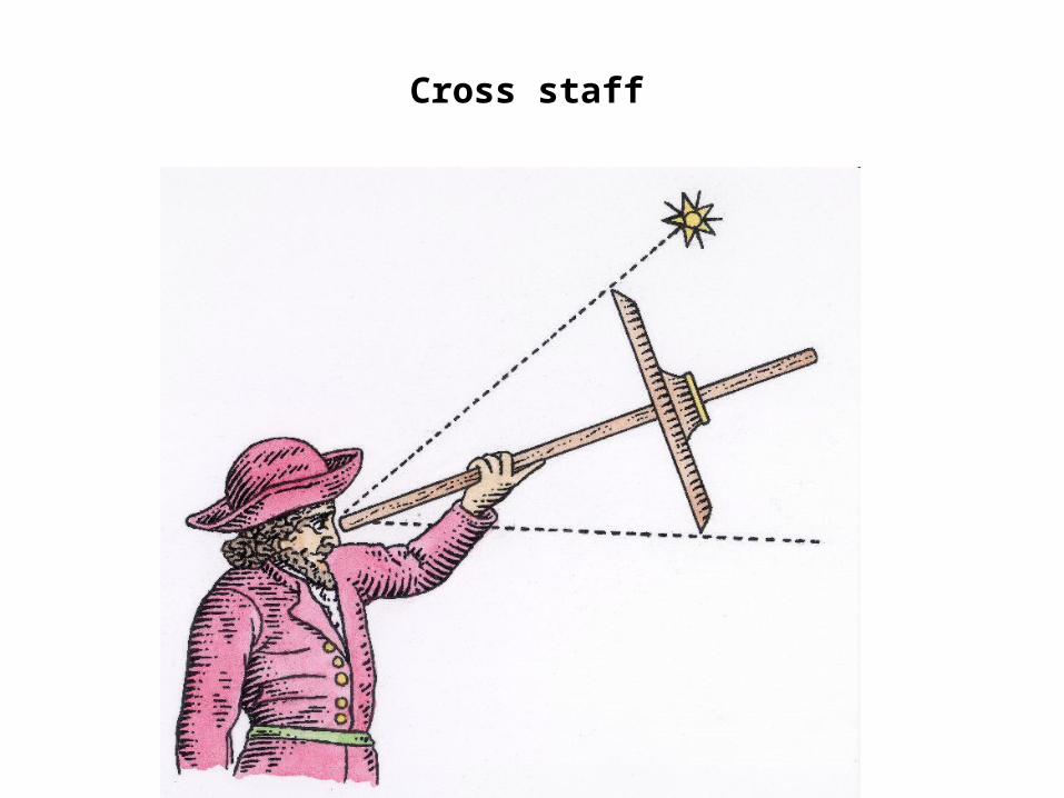
Cross staff
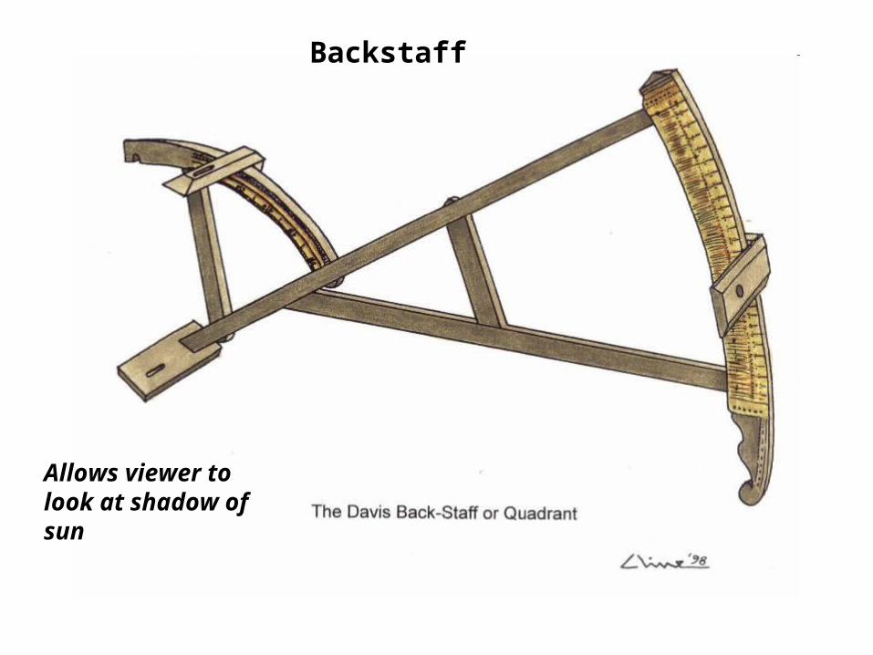
Backstaff
Allows viewer tolook at shadow ofsun
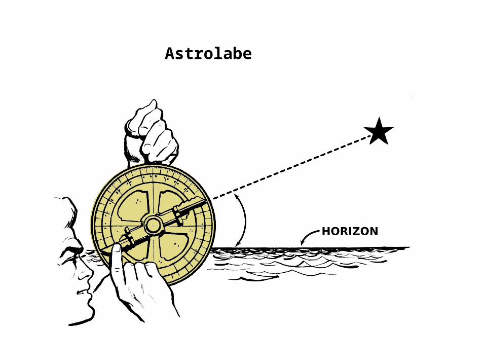
Astrolabe
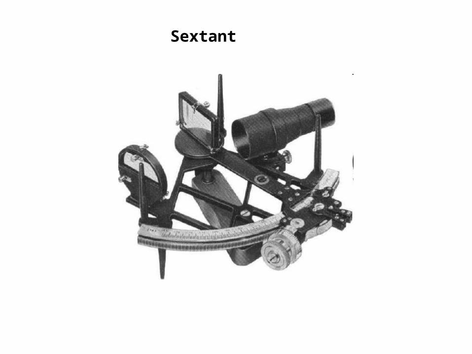
Sextant
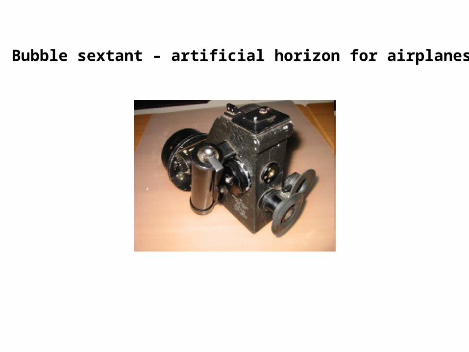
Bubble sextant – artificial horizon for airplanes
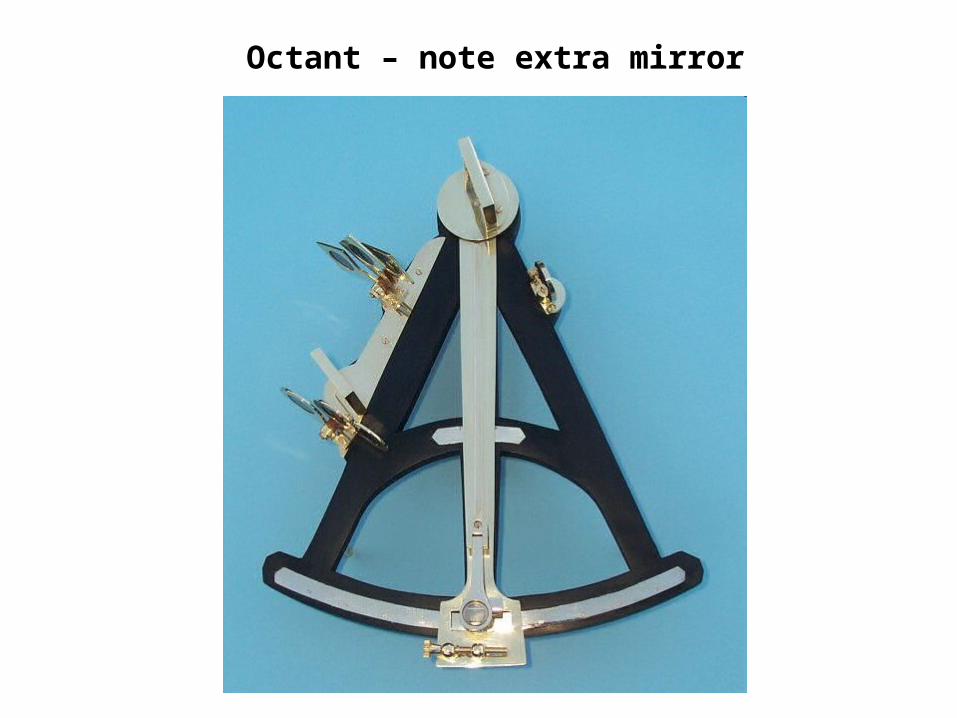
Octant – note extra mirror

Finished quadrant Taking a sighting near sunset
Quadrant made from materials lying around the houseScrap wood, paper, pencil, metal tube, old banjo string,glue
Estimated accuracy is about ½ a degree (30’)

Quadrant markings made by successive halving of angles
Ab initio way of dividing up the angles, if degree markings are notavailable.
This one is divided into 64 angles = 1.40625o per angle.
Estimated accuracy of this is 21’ by interpolation (using triangles)
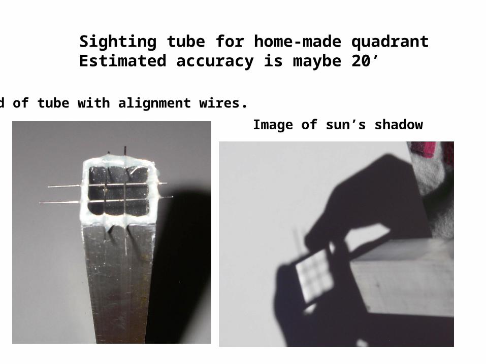
End of tube with alignment wires.Image of sun’s shadow
Sighting tube for home-made quadrantEstimated accuracy is maybe 20’

Modern versus “primitive tools”
• Tube was manufactured with a high precision drawing process
• Banjo wires, likewise• Angle calibration aided by compass, ruler
– Using circle arcs works down to about 22.5o
– Divide chords visually at smaller angles
• Cut of board was precise• Can take advantage of local materials (e.g.
metal broom-handle) which have more precision than primitive items.
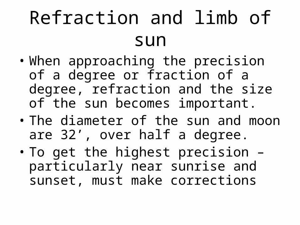
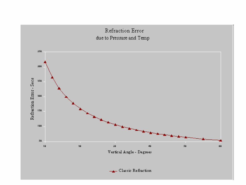
Refraction and limb of sun
• When approaching the precision of a degree or fraction of a degree, refraction and the size of the sun becomes important.
• The diameter of the sun and moon are 32’, over half a degree.
• To get the highest precision – particularly near sunrise and sunset, must make corrections
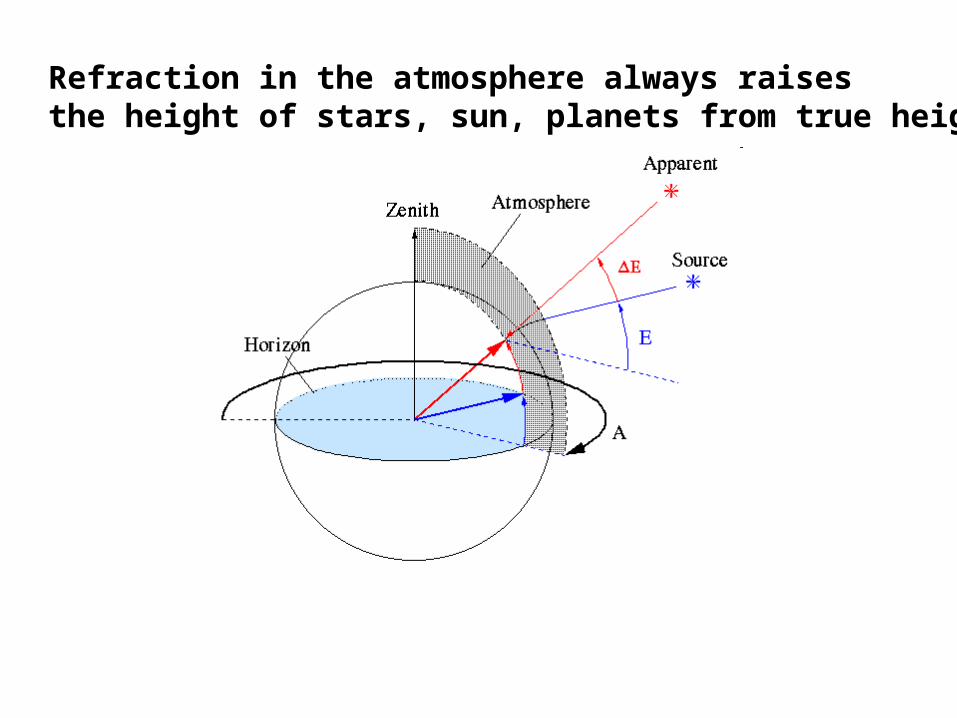
Refraction in the atmosphere always raisesthe height of stars, sun, planets from true height
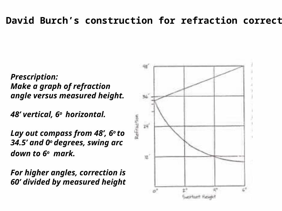
David Burch’s construction for refraction correction
Prescription: Make a graph of refractionangle versus measured height.
48’ vertical, 6o horizontal.
Lay out compass from 48’, 6o to34.5’ and 0o degrees, swing arc
down to 6o mark.
For higher angles, correction is60’ divided by measured height
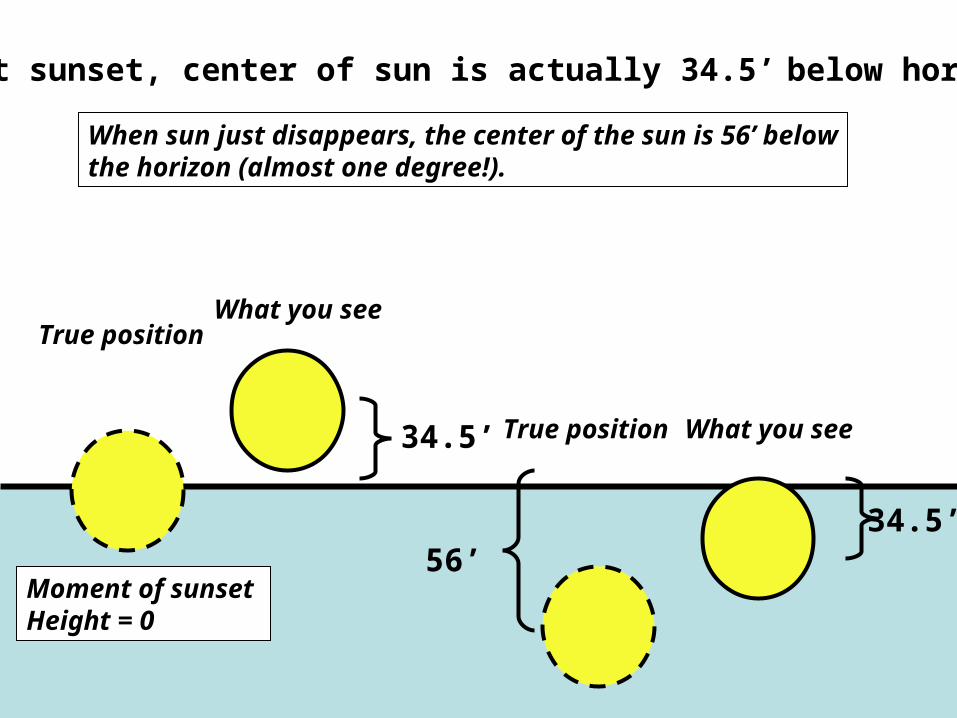
At sunset, center of sun is actually 34.5’ below horizon
What you see
True position
34.5’
34.5’
True position
When sun just disappears, the center of the sun is 56’ belowthe horizon (almost one degree!).
What you see
Moment of sunset Height = 0
56’
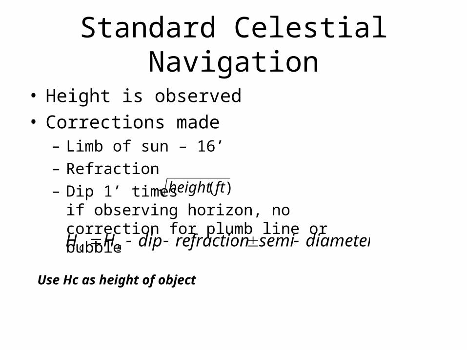
Standard Celestial Navigation
• Height is observed • Corrections made
– Limb of sun – 16’– Refraction– Dip 1’ times if observing horizon,
no correction for plumb line or bubble
)( ftheight
diametersemirefractiondipHH sc
Use Hc as height of object
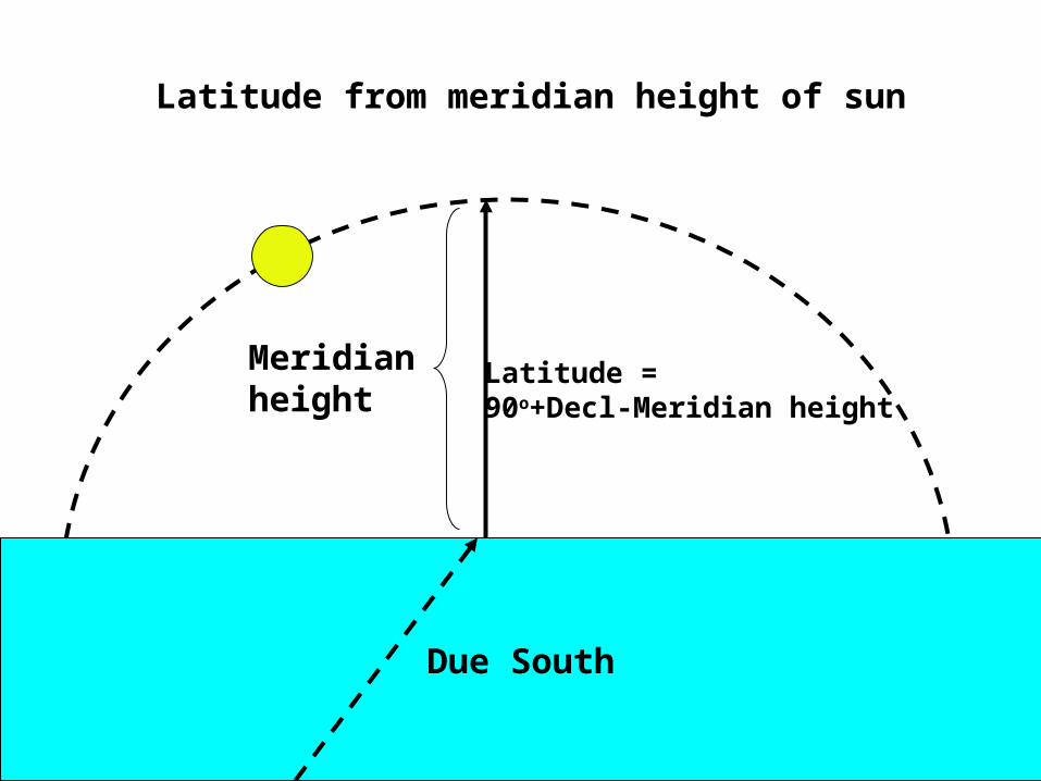
Due South
Latitude = 90o+Decl-Meridian height
Meridianheight
Latitude from meridian height of sun
Fraction of day since midnight
Ver
tical
an
gle
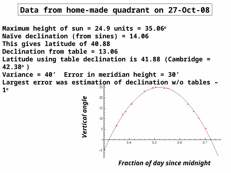
Data from home-made quadrant on 27-Oct-08
Maximum height of sun = 24.9 units = 35.06o Naïve declination (from sines) = 14.06This gives latitude of 40.88Declination from table = 13.06Latitude using table declination is 41.88 (Cambridge = 42.38o )Variance = 40’ Error in meridian height = 30’Largest error was estimation of declination w/o tables – 1o

Latitude from meridian passage of stars
True for any star or planet where you know the declination.
Basically the same as for the sun, but issues arise with finding a horizon at night.
Due South
Meridianheight
Latitude = 90o+Decl-Meridian height
Declination is more reliable for stars – it never changes
Have to use an artificial horizonof some kind (plumb bob) at night.
Requires multiple sightings to findmaximum height – changes slowly during passage.
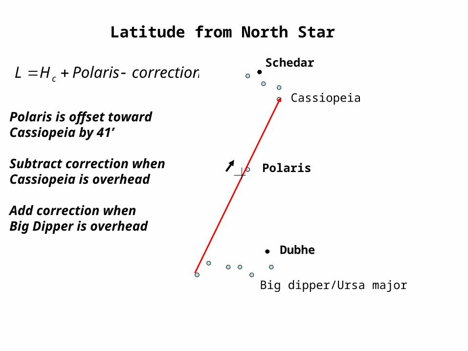
Dubhe
Schedar
Cassiopeia
Big dipper/Ursa major
Polaris
Latitude from North Star
correctionPolarisHL c
Polaris is offset towardCassiopeia by 41’
Subtract correction whenCassiopeia is overhead
Add correction when Big Dipper is overhead
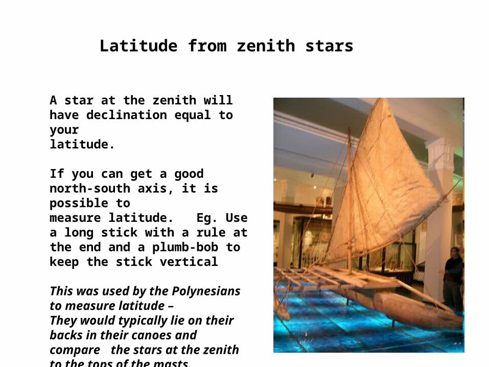
Latitude from zenith stars
A star at the zenith will have declination equal to yourlatitude.
If you can get a good north-south axis, it is possible to measure latitude. Eg. Use a long stick with a rule atthe end and a plumb-bob to keep the stick vertical
This was used by the Polynesians to measure latitude – They would typically lie on their backs in their canoes and compare the stars at the zenith to the tops of the masts.
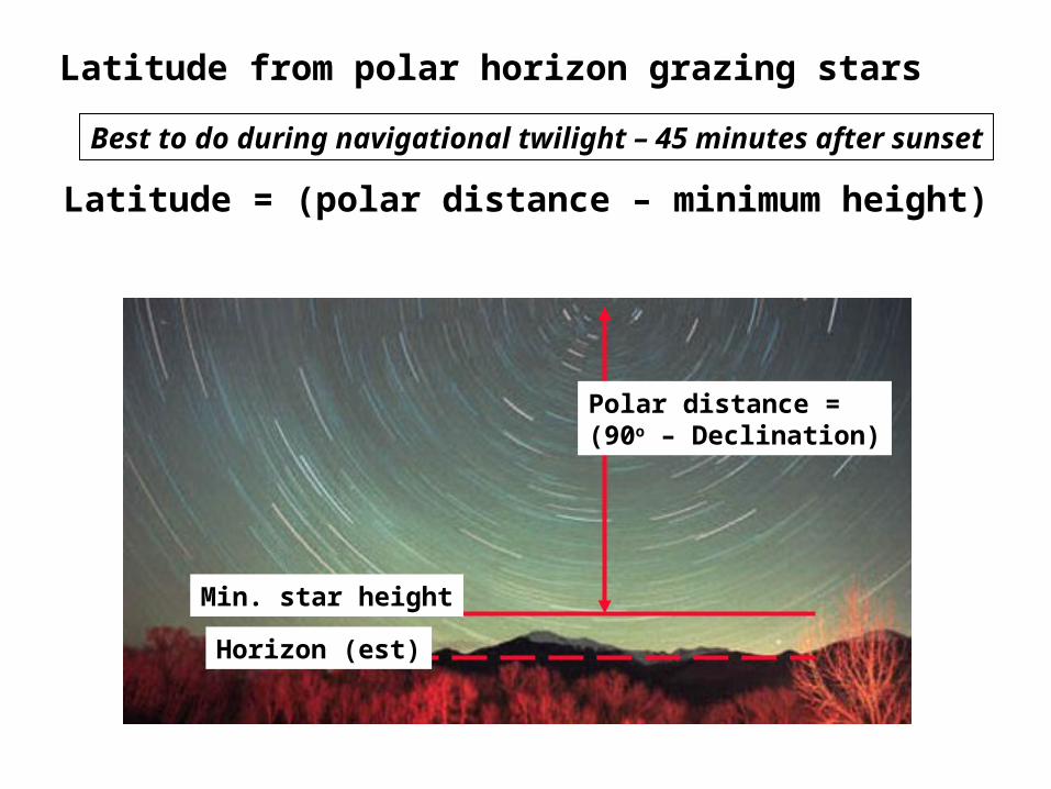
Latitude from polar horizon grazing stars
Horizon (est)
Min. star height
Polar distance =(90o – Declination)
Latitude = (polar distance – minimum height)
Best to do during navigational twilight – 45 minutes after sunset

Latitude sailing
• Accurate longitude determination only came when chronometers were available
• Before this, many voyages involved latitude sailing: sail along the coast until one reaches the latitude of the destination, then sail east or west along this latitude across the sea (checking position with astrolabe, etc).– Columbus– Arab traders– Vikings– etc
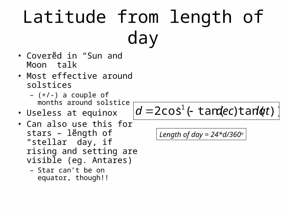
Latitude from length of day
• Covered in “Sun and Moon” talk
• Most effective around solstices– (+/-) a couple of months
around solstice
• Useless at equinox• Can also use this for
stars – length of “stellar” day, if rising and setting are visible (eg. Antares)– Star can’t be on equator,
though!!
))tan()tan((cos2 1 latdecd
Length of day = 24*d/360o
Time!!!
• Many navigational techniques require time– Longitude for sure– Latitude from length of day– Latitude from time of sunset
• Until the invention of the nautical chronometer, navigation was a combination of latitude observations and dead reckoning for longitude
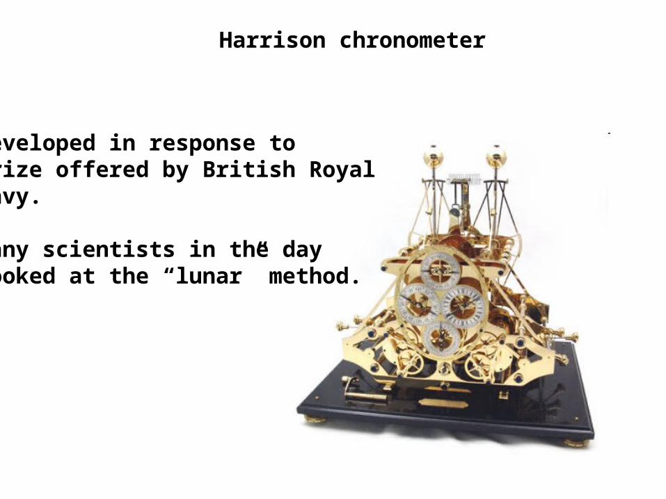
Harrison chronometer
Developed in response to prize offered by British RoyalNavy.
Many scientists in the daylooked at the “lunar” method.
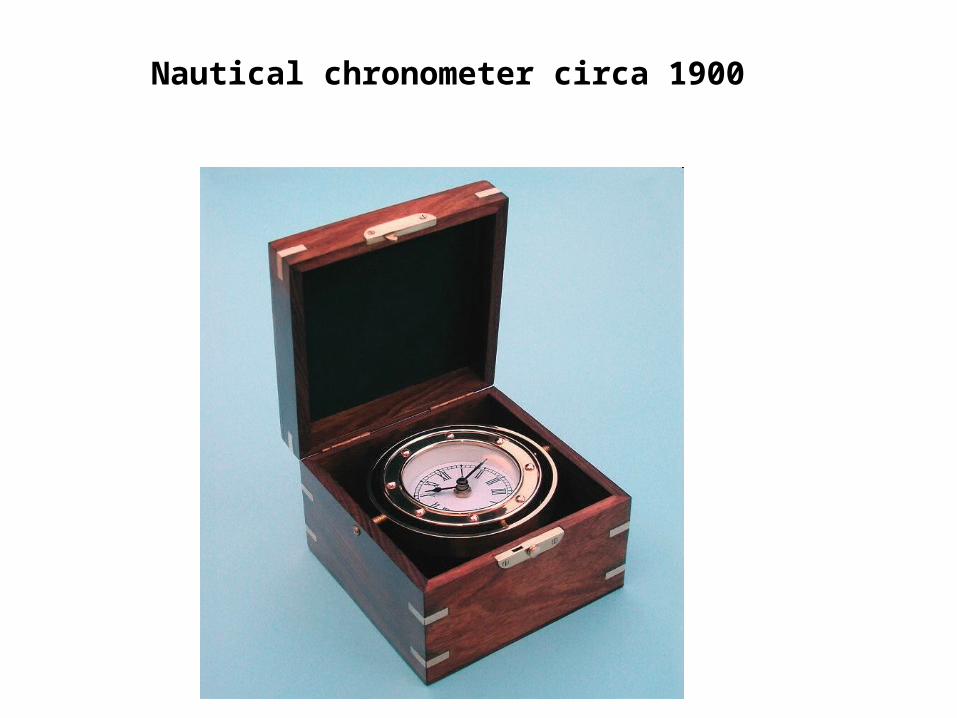
Nautical chronometer circa 1900
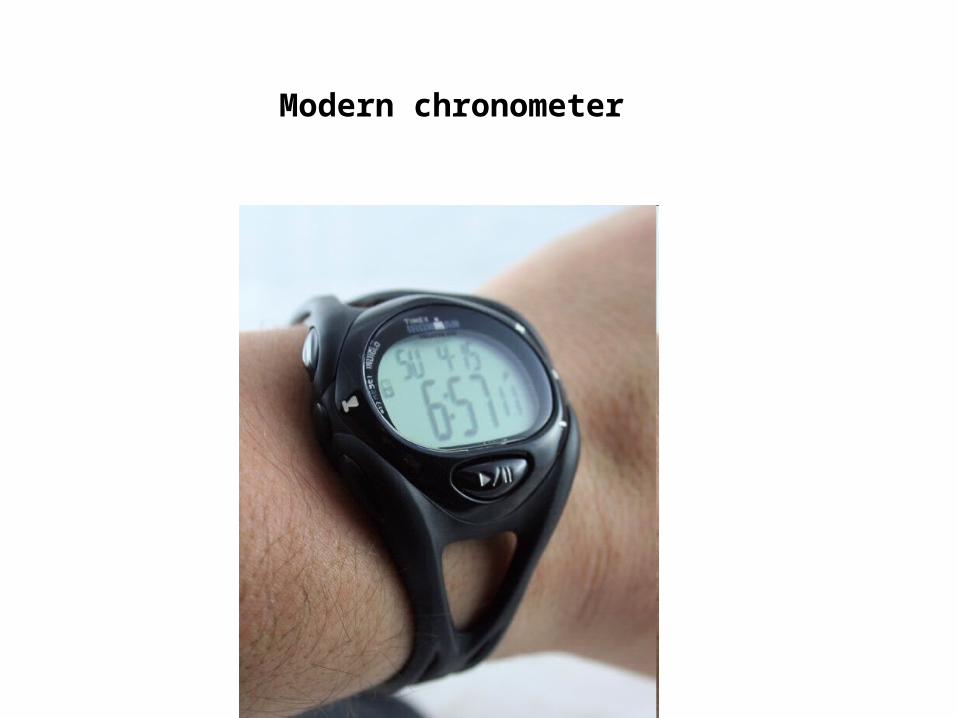
Modern chronometer
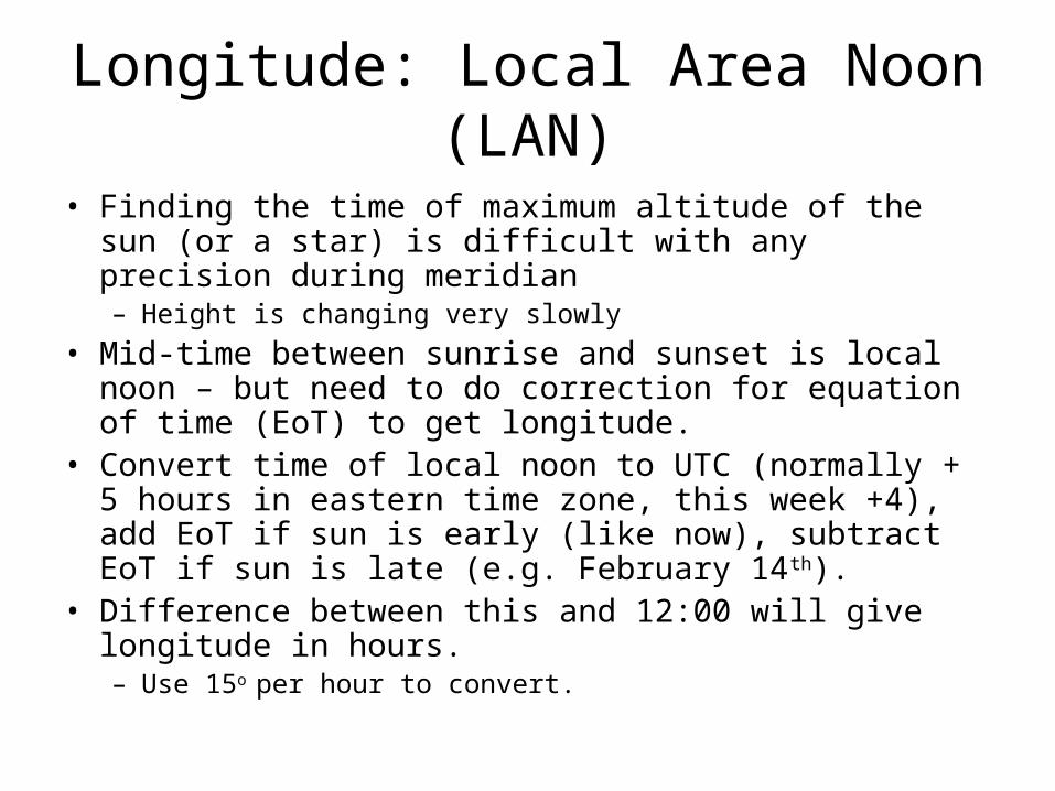
Longitude: Local Area Noon (LAN)
• Finding the time of maximum altitude of the sun (or a star) is difficult with any precision during meridian– Height is changing very slowly
• Mid-time between sunrise and sunset is local noon – but need to do correction for equation of time (EoT) to get longitude.
• Convert time of local noon to UTC (normally + 5 hours in eastern time zone, this week +4), add EoT if sun is early (like now), subtract EoT if sun is late (e.g. February 14th).
• Difference between this and 12:00 will give longitude in hours. – Use 15o per hour to convert.
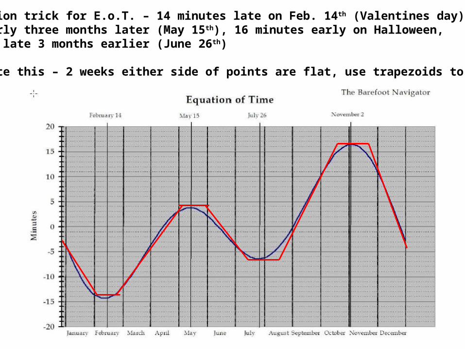
Memorization trick for E.o.T. – 14 minutes late on Feb. 14th (Valentines day), 4 days early three months later (May 15th), 16 minutes early on Halloween, 6 minutes late 3 months earlier (June 26th)
Approximate this – 2 weeks either side of points are flat, use trapezoids to connect
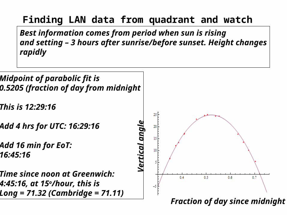
Finding LAN data from quadrant and watch
Fraction of day since midnight
Ver
tical
an
gle
Best information comes from period when sun is risingand setting – 3 hours after sunrise/before sunset. Height changesrapidly
Midpoint of parabolic fit is 0.5205 (fraction of day from midnight
This is 12:29:16
Add 4 hrs for UTC: 16:29:16
Add 16 min for EoT:16:45:16
Time since noon at Greenwich:4:45:16, at 15o/hour, this isLong = 71.32 (Cambridge = 71.11)

LAN for Stars
• If you can find stars that rise *and* set, you can find the meridian crossing time.
• Example – take the mid-point of rising and setting Antares.
• Again, need a good horizon, or artificial horizon.
• Stars low in the sky (southern stars) are best choices.
• Have to use the number of days after March 21st and SHA to use meridian crossing.
Full Treatment of Celestial Navigation
• Assume locations of all planets, sun, stars to arbitrary accuracy
• Standard is UTC (coordinated universal time)
• Assume a clock that is synchronized to UTC
• Return to azimuth and celestial coordinates
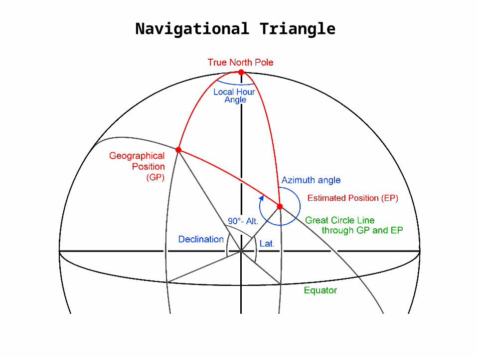
Navigational Triangle
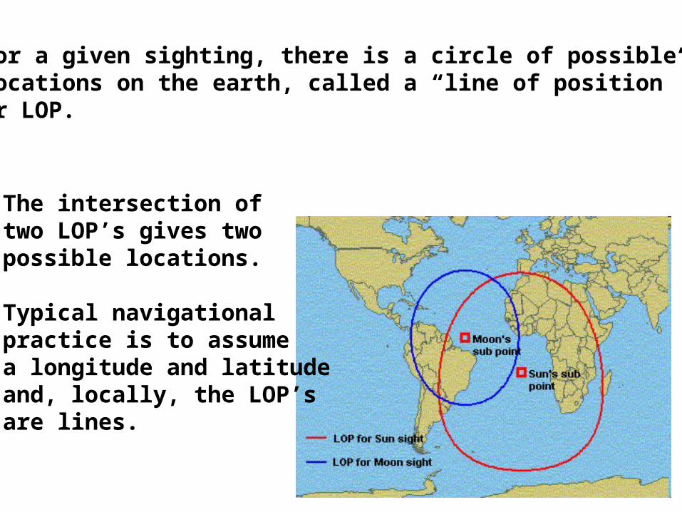
For a given sighting, there is a circle of possible locations on the earth, called a “line of position”or LOP.
The intersection oftwo LOP’s gives two possible locations.
Typical navigationalpractice is to assumea longitude and latitudeand, locally, the LOP’sare lines.
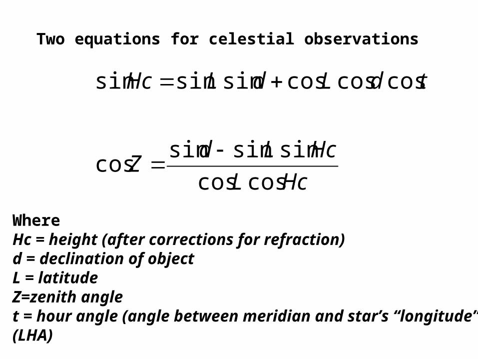
HcL
HcLdZ
tdLdLHc
coscos
sinsinsincos
coscoscossinsinsin
WhereHc = height (after corrections for refraction)d = declination of objectL = latitudeZ=zenith anglet = hour angle (angle between meridian and star’s “longitude”)(LHA)
Two equations for celestial observations