lessons learned from mining-influenced ...lessons learned from mining-influenced waters studies at...
TRANSCRIPT

LESSONS LEARNED FROM MINING-INFLUENCED WATERS STUDIES AT THE NEW MEXICO
BUREAU OF GEOLOGY AND MINERAL RESOURCES
Virginia T. McLemore
New Mexico Bureau of Geology and Mineral Resources
New Mexico Institute of Mining and Technology, Socorro, NM

ACKNOWLEDGMENTS
• Numerous colleagues and students have assisted with studies presented in this paper and their help is appreciated
• Funding agencies over the years USGS, BOR, EPA, ACofE, Chevron
OUTLINE • NURE data • Uranium in the Española Basin, Santa Fe
County • Orogrande district, Otero County • Terrero (Pecos) mine, Willow Creek district, San
Miguel County • Questa waste rock piles, Taos County • Lessons learned

NURE DATA

NURE DATA • National Uranium Resource Evaluation program
during the 1970s • >27,000 stream sediments samples • >12,000 surface and well water samples • Provides a first order of geochemical
background conditions in New Mexico • Part of the USGS National Geochemical
Database http://mrdata.usgs.gov/geochem/doc/home.htm

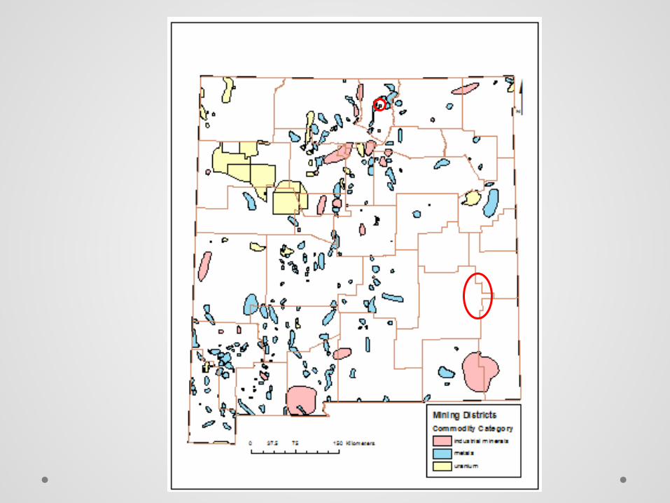
Distribution of NURE stream-
sediment samples in New
Mexico

Distribution of NURE water
samples in New Mexico
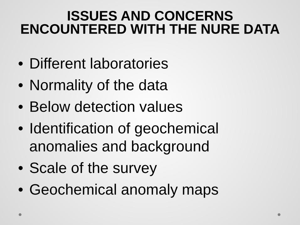
ISSUES AND CONCERNS ENCOUNTERED WITH THE NURE DATA
• Different laboratories • Normality of the data • Below detection values • Identification of geochemical
anomalies and background • Scale of the survey • Geochemical anomaly maps
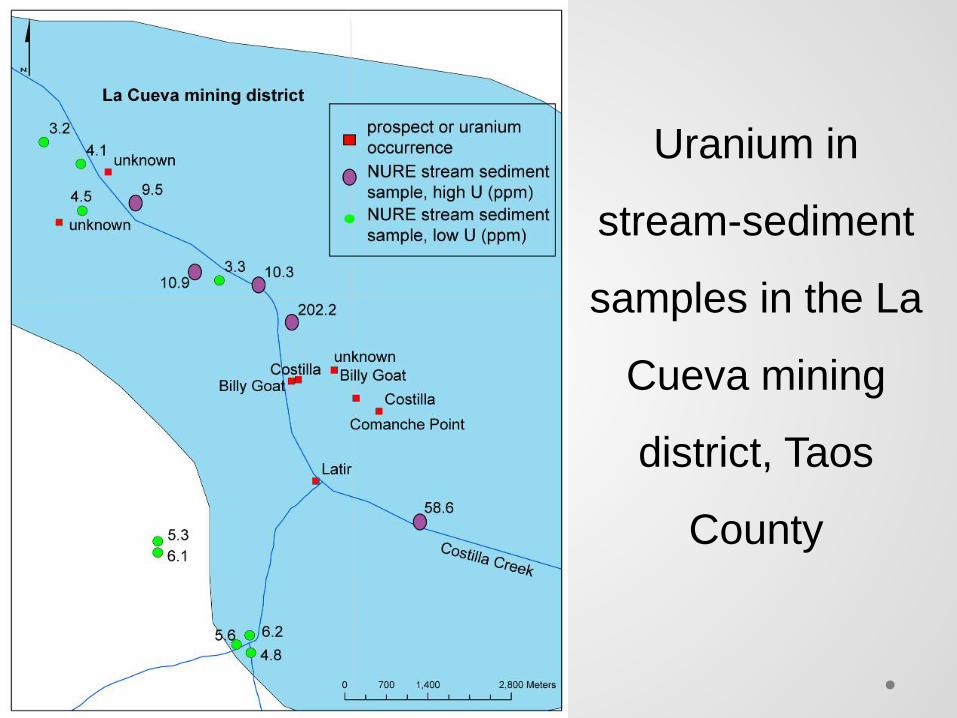
Uranium in
stream-sediment
samples in the La
Cueva mining
district, Taos
County
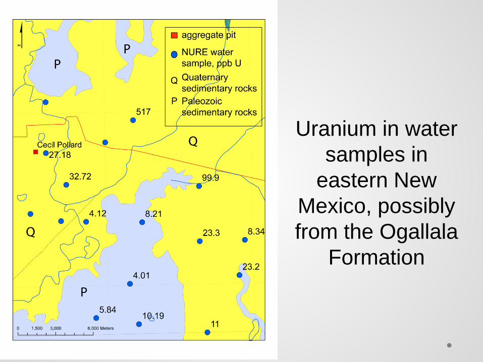
Uranium in water samples in
eastern New Mexico, possibly from the Ogallala
Formation

Conclusions—NURE Data • Incorporation of various data sets into ArcMap
has resulted in identification of several areas with anonymously high U concentrations
• Only a few areas examined thus far in NM at the scale of the NURE data are a result of solely contamination from mining and other anthropogenic inputs
• Most areas are a result of natural processes related to local rock chemistry, weathering, or formation of mineral deposits
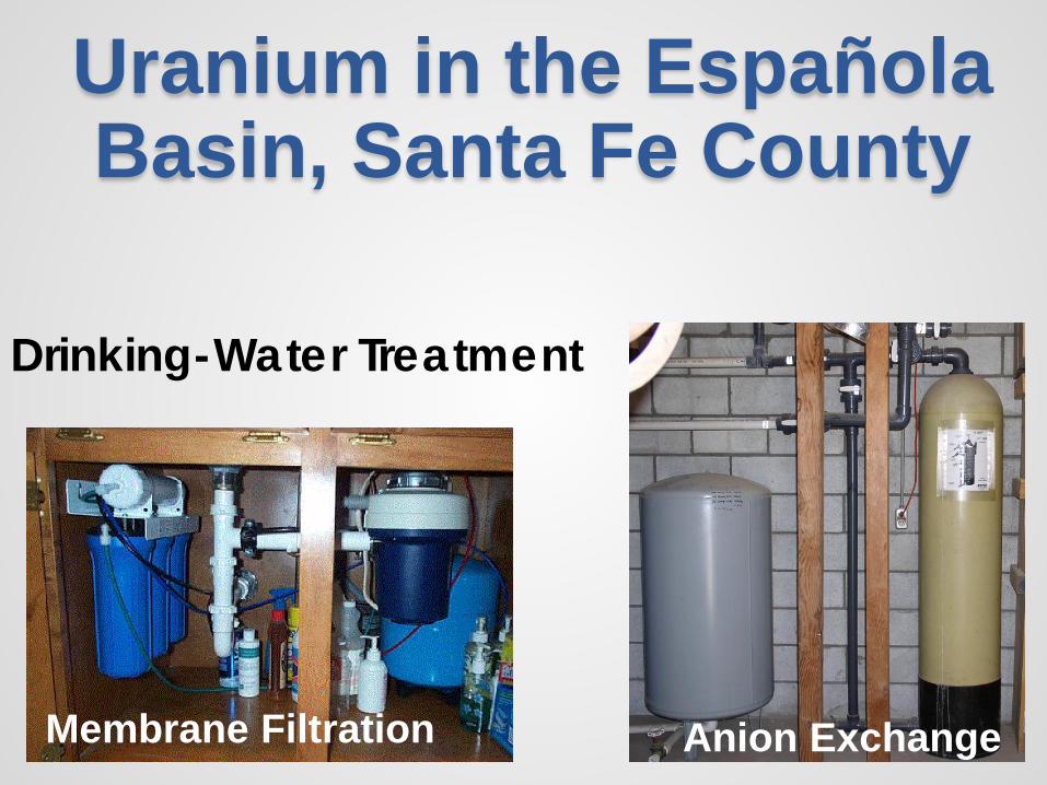
Uranium in the Española Basin, Santa Fe County
Drinking-Water Treatment
Membrane Filtration Anion Exchange


• Sampling by the New Mexico Environment Department and Los Alamos National Laboratory have shown elevated concentrations of uranium in drinking water in the Española Basin
• Many samples have concentrations of dissolved uranium that exceed 100 µg/L and some as much as 1,820 µg/L within the Española Basin
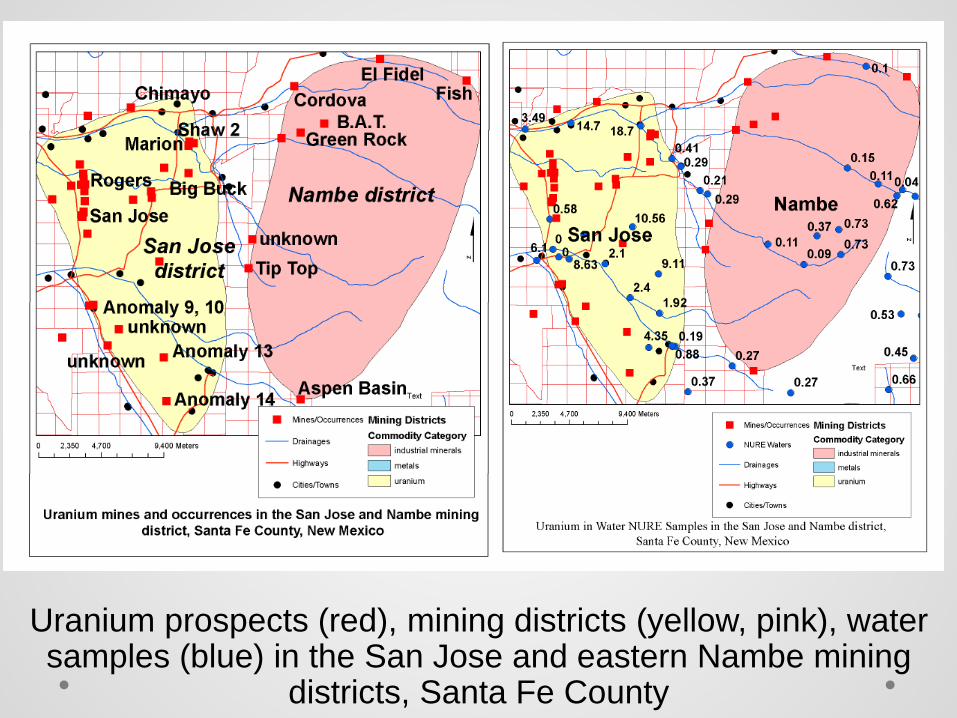
Uranium prospects (red), mining districts (yellow, pink), water samples (blue) in the San Jose and eastern Nambe mining
districts, Santa Fe County
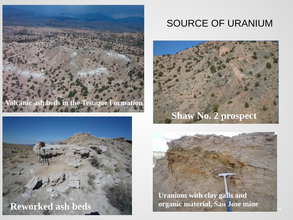
SOURCE OF URANIUM
Volcanic ash beds in the Tesuque Formation.
Reworked ash beds
Shaw No. 2 prospect
Shaw No. 2 prospect. Uranium with clay galls and organic material, San Jose mine

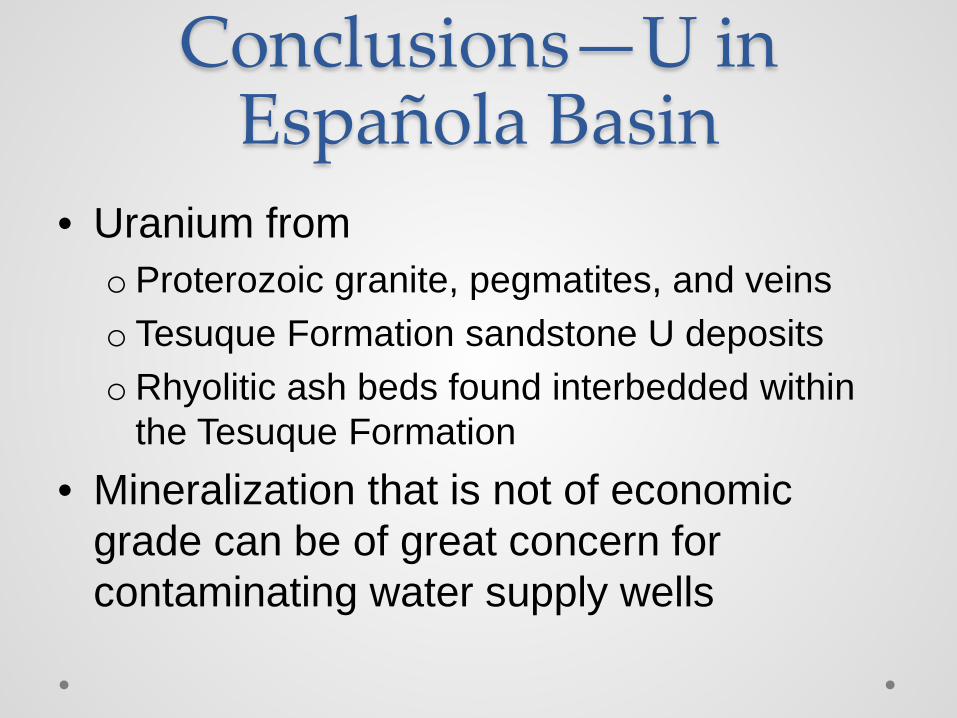
Conclusions—U in Española Basin
• Uranium from o Proterozoic granite, pegmatites, and veins o Tesuque Formation sandstone U deposits oRhyolitic ash beds found interbedded within
the Tesuque Formation • Mineralization that is not of economic
grade can be of great concern for contaminating water supply wells
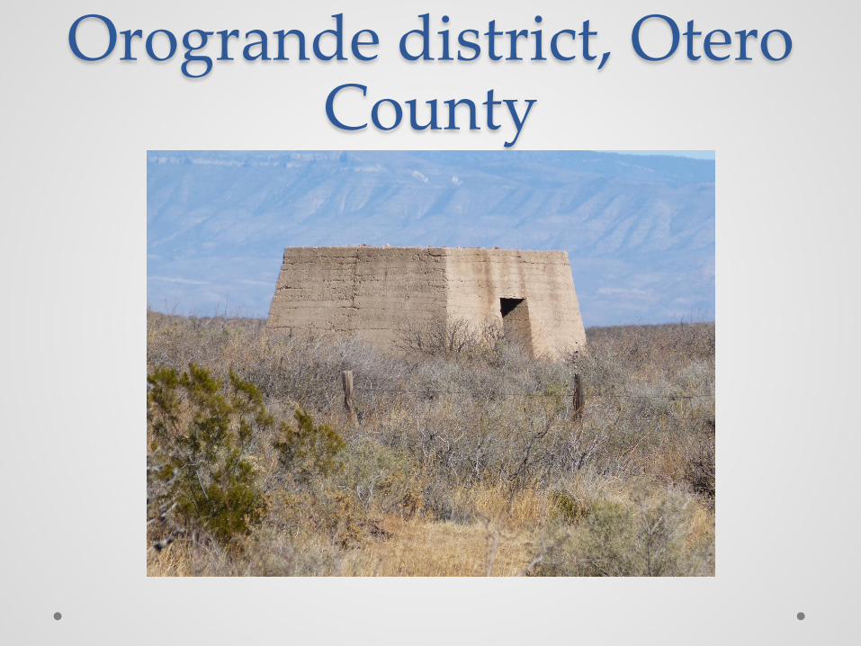
Orogrande district, Otero County

Copper in stream-sediment samples in the Orogrande
area, Otero County. Note the samples (in purple) high in copper south and
east of the Orogrande smelter (section 14, T22S, R8E) that is likely
due to contamination from
the smelter
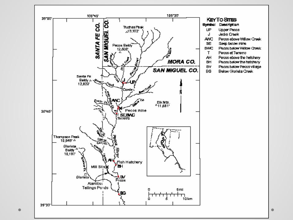
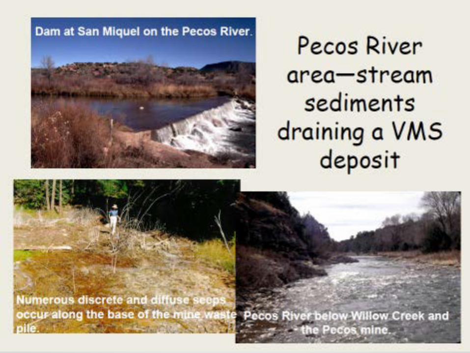
Terrero (Pecos) mine, Willow Creek district, San Miguel
County

Terrero (Pecos) mine • Volcanogenic massive-sulfide deposit containing Pb, Zn, Cu,
Ag, and Au as sulfide minerals with pyrite
• Mined on and off for 42 years beginning in 1902
• Generated ~70,000 m3 of waste rock, which was a source of acidic drainage
• The ore was shipped 18 km SW by aerial tram to the Alamitos Canyon mill where the mill tailings were deposited along Alamitos Canyon
• Point sources of contamination for Pb, Zn, Cu, Se, Cd, and Cr
• Reclamation began in the early 1990s until about 2003
• 9 yr study (1992-2000) of geochemistry of stream sediments and water along the Pecos River


Conclusions—Terrero mine • Cu, Pb, Zn, and other metals were eroded and
leached from the Terrero mine waste pile and the tailings
• Overall metal concentrations dramatically decrease in stream sediments below Pecos Village, mostly due to dilution of sediment derived from the red bed sedimentary units
• Decrease in concentrations with time since reclamation began, especially in the immediate vicinity of the Pecos mine o Cu levels from 310 to 92 ppm o Cd from 17 to 4.7 ppm o Pb from 300 to 160 ppm o Zn from 3100 to 2080 ppm

Questa weathering study, Taos County
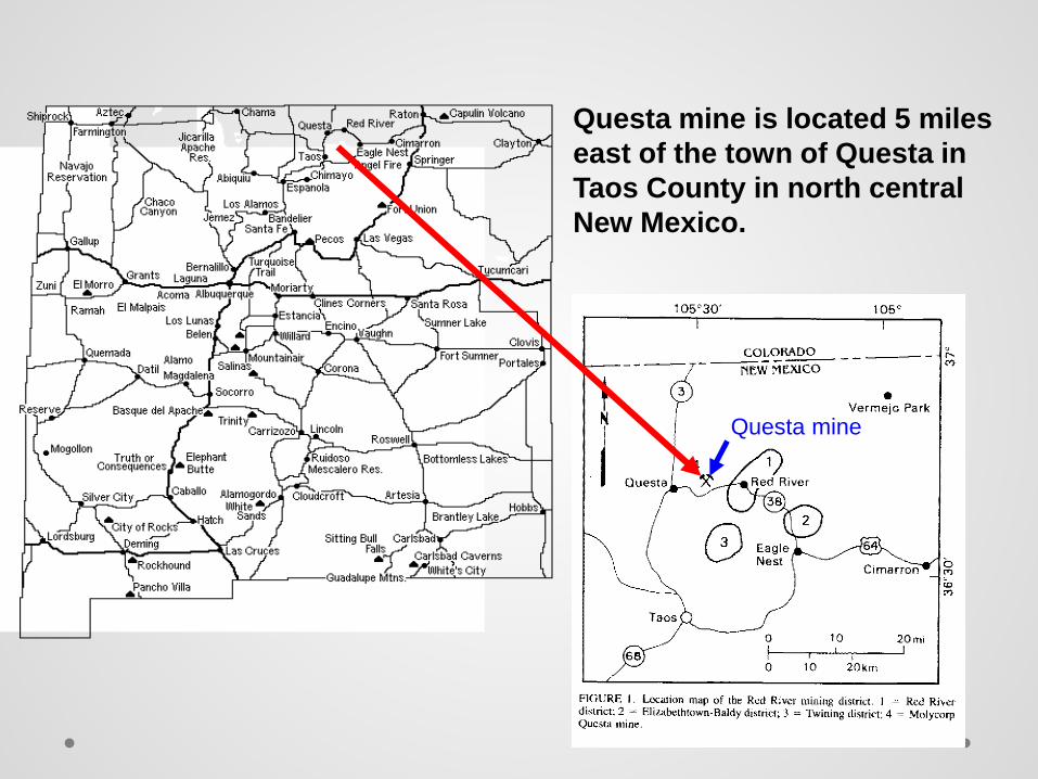
Questa mine is located 5 miles east of the town of Questa in Taos County in north central New Mexico.
Questa mine
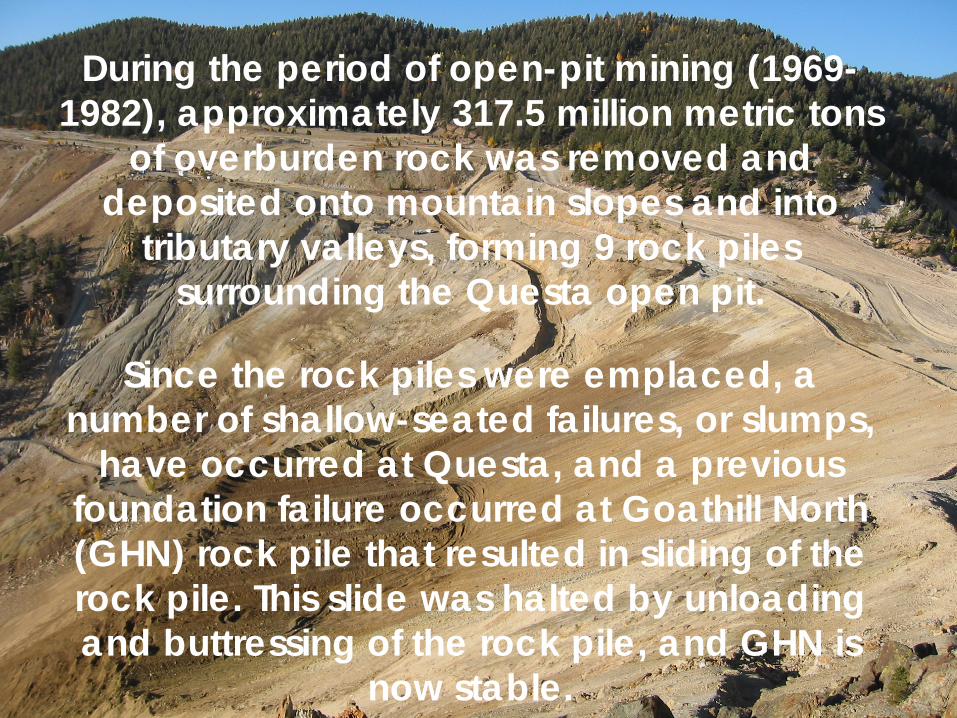
During the period of open-pit mining (1969-1982), approximately 317.5 million metric tons
of overburden rock was removed and deposited onto mountain slopes and into
tributary valleys, forming 9 rock piles surrounding the Questa open pit.
Since the rock piles were emplaced, a
number of shallow-seated failures, or slumps, have occurred at Questa, and a previous
foundation failure occurred at Goathill North (GHN) rock pile that resulted in sliding of the rock pile. This slide was halted by unloading and buttressing of the rock pile, and GHN is
now stable.
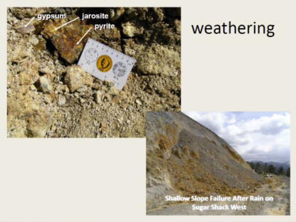
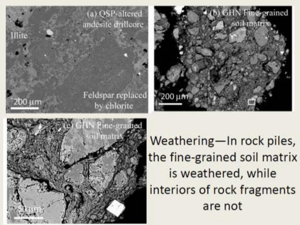

Conclusions—Questa • Predominant weathering reactions in the GHN
rock pile are oxidation of pyrite, dissolution of carbonate, and formation of sulfate minerals (gypsum, jarosite, and soluble, efflorescent salts)
• Clays are predominantly from the pre-mining hydrothermal alteration, not the result of chemical precipitation in the rock piles under low pH during weathering over the last 25-40 years

Other data

Other data • Geochemical analyses of mineral deposits
throughout New Mexico • Geochemical analyses of mine dumps in
Sierra and Otero Counties

LESSONS LEARNED • NURE data provides a first order of geochemical
background conditions in NM, especially for U • Some areas in NM have elevated U in water, which
is a result of natural processes not mining • Some areas in NM have elevated metals in stream
sediments or soils, but not in water that are possibly a result of mining
• Weathering in most mine waste rock piles involve the oxidation of pyrite, dissolution of carbonate, and formation of sulfate minerals, but little if any clay minerals are forming as a result of weathering; instead the clays are from pre-mining altered rocks

LESSONS LEARNED • Differences in chemistry of MIW within the
various mining districts in NM are due to differences in geology, type of mineral deposits, and alteration of adjacent rocks, including weathering
• Each area is site-specific and must be examined in detail and over a period of time to determine the cause of the adverse MIW

LESSONS LEARNED • However, as more people are building houses in
and near mining districts, even natural geochemical anomalies could become a health problem and may have to be addressed in some manner
• More detailed sampling is required in these areas
• Additional analysis and evaluation of these data sets is on-going

More Information • http://geoinfo.nmt.edu/staff/mclemore/projects/h
ome.html • http://geoinfo.nmt.edu/ • https://nmgs.nmt.edu/publications/guidebooks/h
ome.cfm?ListBy=Number