leveraging gis to alleviate poverty in ghana · leveraging gis to alleviate poverty in ghana july...
TRANSCRIPT
GIS Best Practices
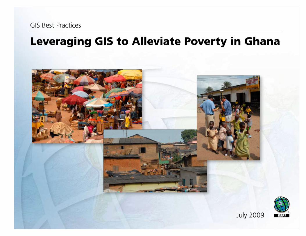
Leveraging GIS to Alleviate Poverty in Ghana
July 2009
i
Table of Contents
What Is GIS? 1
Leveraging GIS Technologies to Alleviate Poverty 3
Ghana Project Leverages GIS-Based Title Registration and Microfi nance to Alleviate Poverty 5
Geospatial Technology Drives Adjudication 17
GIS Brings Commercial Viability to Recognizing the Land Interests of the World's Poor 27
GIS BEST PRACTICES 1 WWW.ESRI.COM
What Is GIS?Making decisions based on geography is basic to human thinking. Where shall we go, what will it be like, and what shall we do when we get there are applied to the simple event of going to the store or to the major event of launching a bathysphere into the ocean's depths. By understanding geography and people's relationship to location, we can make informed decisions about the way we live on our planet. A geographic information system (GIS) is a technological tool for comprehending geography and making intelligent decisions.
GIS organizes geographic data so that a person reading a map can select data necessary for a specifi c project or task. A thematic map has a table of contents that allows the reader to add layers of information to a basemap of real-world locations. For example, a social analyst might use the basemap of Eugene, Oregon, and select datasets from the U.S. Census Bureau to add data layers to a map that shows residents' education levels, ages, and employment status. With an ability to combine a variety of datasets in an infi nite number of ways, GIS is a useful tool for nearly every fi eld of knowledge from archaeology to zoology.
A good GIS program is able to process geographic data from a variety of sources and integrate it into a map project. Many countries have an abundance of geographic data for analysis, and governments often make GIS datasets publicly available. Map fi le databases often come included with GIS packages; others can be obtained from both commercial vendors and government agencies. Some data is gathered in the fi eld by global positioning units that attach a location coordinate (latitude and longitude) to a feature such as a pump station.
GIS maps are interactive. On the computer screen, map users can scan a GIS map in any direction, zoom in or out, and change the nature of the information contained in the map. They can choose whether to see the roads, how many roads to see, and how roads should be depicted. Then they can select what other items they wish to view alongside these roads such as storm drains, gas lines, rare plants, or hospitals. Some GIS programs are designed to perform sophisticated calculations for tracking storms or predicting erosion patterns. GIS applications can be embedded into common activities such as verifying an address.
From routinely performing work-related tasks to scientifi cally exploring the complexities of our world, GIS gives people the geographic advantage to become more productive, more aware, and more responsive citizens of planet Earth.
GIS BEST PRACTICES 3 WWW.ESRI.COM
Leveraging GIS Technologies to Alleviate PovertyAccording to renowned economist Hernando de Soto, the inability of the world's poor to gain formal recognition of their property rights is a major stumbling block to alleviating poverty. De Soto points out that almost everywhere in the world the poor have one thing in common: the only signifi cant asset they have is the land they occupy. Unfortunately, very few of these people have ever received any type of legal recognition that the land they occupy is theirs, especially in situations where the ownership is informal or based on customary forms of tenure. Nowhere is this truer than in the African nation of Ghana.
By leveraging GIS-based technologies with de Soto's theories, a consortium of private sector companies joined together in 2008 to implement a sustainable and scalable approach to the land registration process in Ghana. Known as Medeem, which means "In my name" in Twi, the native language of most Ghanaians, the pilot project utilizes the distribution network of microfi nance lenders with an innovative GIS-based paralegal titling process to signifi cantly reduce the time and cost involved in collecting and documenting property ownership information.
Medeem does not seek to replace the role of government but, rather, to enable the practical use of private sector expertise and signifi cant cost savings to bring transformational change to the lives of the poor by providing legal empowerment that is both affordable and accessible.
GIS BEST PRACTICES 5 WWW.ESRI.COM
Ghana Project Leverages GIS-Based Title Information and Microfi nance to Alleviate PovertyBy Peter Rabley, International Land Systems, Inc.
Photos by Bryant DeRoy
Highlights
The project was presented to the United Nations Commission on the Legal Empowerment of the Poor.
The Land Registry System incorporates ArcGIS functionality to link title information with the digital parcel map.
Title and parcel data for loan processing is obtained and maintained using GIS-based technology, provided to the landowner in a form designed to meet registration requirements, then batched and provided to the Ministry of Lands.
A pilot project under way in the African nation of Ghana seeks to demonstrate the vital role that formalization of landownership can play in helping the poor take a crucial fi rst step away from poverty. Focused on one of the poorest areas in the capital city of Accra, the pilot is leveraging the latest geospatial technologies to create a land titling process and GIS-based land records system where neither existed in the past.
Impetus for the Ghana pilot comes from the Clinton Global Initiative (CGI), started by former U.S. president Bill Clinton to challenge some of the world's leading organizations and individuals to make commitments that positively impact global health, poverty, climate change, and education. Accepting the CGI challenge to work toward alleviating poverty was First American Corp., a major title insurance and real estate information provider based in Santa Ana, California.

JULY 2009 6 LEVERAGING GIS TO ALLEVIATE POVERTY
Using ILS MultiCadastre, all surveyed schools can be viewed. The ILS Open Title Module allows documents and images associated with each property to be examined as well.
With an extensive background in land titling, Craig DeRoy, then president of First American, embraced the economic theories described by Dr. Hernando de Soto in his acclaimed book The Mystery of Capital. The Peruvian economist is among the fi rst to identify and describe the relationship between the formal recognition of property rights and the fi ght against poverty. DeRoy saw the CGI challenge as an opportunity to put de Soto's ideas into action.
With several partners, DeRoy presented the concept of a pilot project to the leaders of the United Nations Commission on the Legal Empowerment of the Poor, which seeks to "make legal protection and economic opportunity not the privilege of the few but the right of all." The project received immediate feedback and encouragement from the commission's cochairpersons, Madeleine Albright and de Soto.
GIS BEST PRACTICES 7 WWW.ESRI.COM
"Government recognition of landownership rights gives the poor an identity, which yields numerous benefi ts," says DeRoy. "When formally recognized, their land can ultimately be used as an asset to leverage permanent change in their economic and fi nancial futures."
According to de Soto, poor people almost everywhere in the world have one thing in common—the only real asset they have is the land they occupy. Unfortunately, very few have ever received any type of legal recognition that the land is theirs, especially in situations where the ownership is informal or based on customary forms of land tenure. Without a registered deed, title, or lease, the owner cannot leverage the land as collateral to take out a loan that might be used to start a business or improve the property.
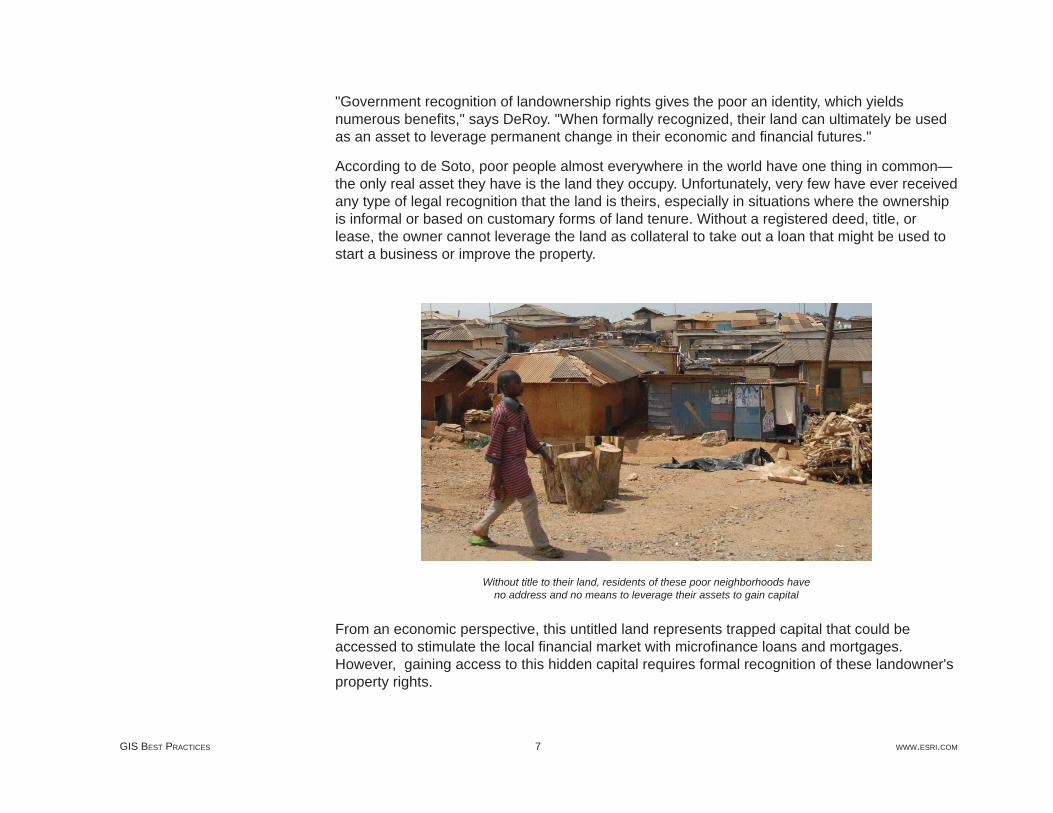
Without title to their land, residents of these poor neighborhoods have no address and no means to leverage their assets to gain capital
From an economic perspective, this untitled land represents trapped capital that could be accessed to stimulate the local fi nancial market with microfi nance loans and mortgages. However, gaining access to this hidden capital requires formal recognition of these landowner's property rights.
JULY 2009 8 LEVERAGING GIS TO ALLEVIATE POVERTY
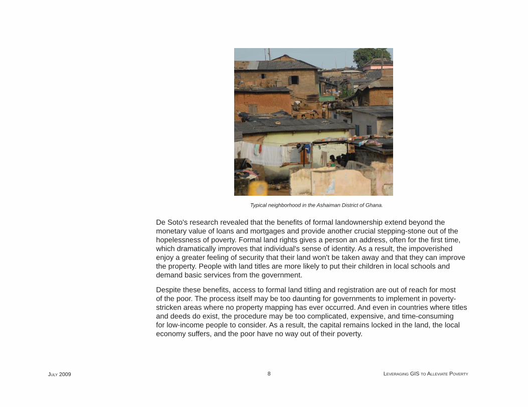
Typical neighborhood in the Ashaiman District of Ghana.
De Soto's research revealed that the benefi ts of formal landownership extend beyond the monetary value of loans and mortgages and provide another crucial stepping-stone out of the hopelessness of poverty. Formal land rights gives a person an address, often for the fi rst time, which dramatically improves that individual's sense of identity. As a result, the impoverished enjoy a greater feeling of security that their land won't be taken away and that they can improve the property. People with land titles are more likely to put their children in local schools and demand basic services from the government.
Despite these benefi ts, access to formal land titling and registration are out of reach for most of the poor. The process itself may be too daunting for governments to implement in poverty-stricken areas where no property mapping has ever occurred. And even in countries where titles and deeds do exist, the procedure may be too complicated, expensive, and time-consuming for low-income people to consider. As a result, the capital remains locked in the land, the local economy suffers, and the poor have no way out of their poverty.
GIS BEST PRACTICES 9 WWW.ESRI.COM
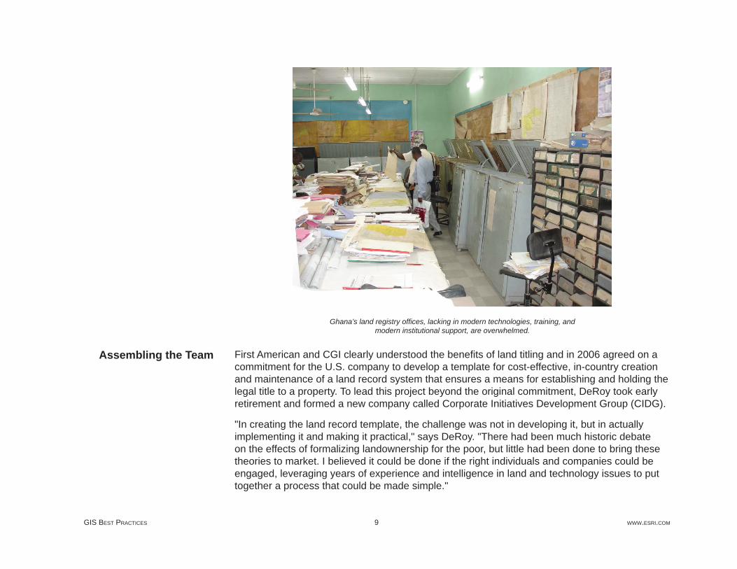
Ghana’s land registry offi ces, lacking in modern technologies, training, and modern institutional support, are overwhelmed.
First American and CGI clearly understood the benefi ts of land titling and in 2006 agreed on a commitment for the U.S. company to develop a template for cost-effective, in-country creation and maintenance of a land record system that ensures a means for establishing and holding the legal title to a property. To lead this project beyond the original commitment, DeRoy took early retirement and formed a new company called Corporate Initiatives Development Group (CIDG).
"In creating the land record template, the challenge was not in developing it, but in actually implementing it and making it practical," says DeRoy. "There had been much historic debate on the effects of formalizing landownership for the poor, but little had been done to bring these theories to market. I believed it could be done if the right individuals and companies could be engaged, leveraging years of experience and intelligence in land and technology issues to put together a process that could be made simple."
Assembling the Team
JULY 2009 10 LEVERAGING GIS TO ALLEVIATE POVERTY
He sought to extend the original CGI commitment to include an in-country pilot implementation. To make the pilot a reality, CIDG assembled a team consisting of International Land Systems, (ILS) Inc.; Opportunity International; Trimble Navigation; and ESRI. Each provides a capability vital to the development of a practical land record system:
ESRI is supplying core technology that underpins the land surveying and mapping activities, to create a parcel map for the paralegal title process and the land registry database.
International Land Systems, Inc., an ESRI Business Partner in Silver Spring, Maryland, is providing project management and technical consulting services and is implementing its commercial off-the-shelf GIS-based land recording and registration system, the key technology application in the pilot.
SAMBUS Company Ltd. is the international distributor in Ghana for both ESRI and Trimble Navigation. SAMBUS is Medeem’sSM Ghanaian partner for supply of software and hardware support.
Losamills Consult Inc. is a Ghanaian geoinformatics company specializing in land surveying and is responsible for deploying trained local survey teams for the Medeem pilot program.
Sinapi Aba Trust is the largest microfi nance lender in Ghana. It has joined Medeem’s team to accelerate the deployment of paralegal titles throughout Ghana. Opportunity International of San Diego, California, is a nonprofi t microfi nance lender already active in Africa. Its loan offi cers were trained to use the mobile GPS equipment in the fi eld to determine point location of the property and to record basic ownership and property information compiled by the Medeem pilot program.
Trimble Navigation of Sunnyvale, California, is providing handheld mobile GPS devices and supporting equipment and technology that are being used to map the parcels in the fi eld cost- and time-effi ciently.
Corporate Initiatives Development Group (CIDG) founded, and is providing project direction to, the Medeem program, building upon more than 25 years of executive management experience including designing and implementing products, services, and solutions to meet challenges and opportunities of emerging markets worldwide.
GIS BEST PRACTICES 11 WWW.ESRI.COM
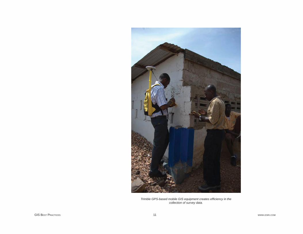
Trimble GPS-based mobile GIS equipment creates effi ciency in the collection of survey data.

JULY 2009 12 LEVERAGING GIS TO ALLEVIATE POVERTY
Selection of Opportunity International as a partner in the pilot highlights the important role that microfi nance can play in the alleviation of poverty through formalized land titling. Historically, microfi nance has focused on lending relatively small amounts of money—$50–$500—to individuals for use in starting in-home businesses. A sewing machine, for instance, can allow a woman to make and sell clothing in her neighborhood. Usually based on short-term paybacks, these loans are often made in trust groups so that peer pressure, not collateral, is the incentive for repayment. The result is a repayment rate of more than 95 percent on microfi nance loans worldwide.
Small business enterprise in the Ashaiman District.
"Microfi nance brings capital to these emerging markets in a very responsible way," explains DeRoy. "The creation of micro-entrepreneurs is a proven approach to the transformation of entire communities. In our project, we move microfi nance one step further by placing the microfi nance lender into the position of acting as a trusted broker for its clients seeking paralegal title to their property. This use of the private sector serves to initiate, simplify, and accelerate a process that is often stymied by overwhelming governmental procedures and bureaucracy."
GIS BEST PRACTICES 13 WWW.ESRI.COM
In recent years, microfi nance lenders have been looking to expand their reach by loaning larger amounts of money for a variety of uses beyond entrepreneurial business. More often than not, these lenders experience the other side of the situation described by de Soto. They want to loan money to the poor, but the only asset is untitled land, which can't be used to secure the transaction.
This oft-repeated scenario provides microfi nance lenders with an incentive to facilitate paralegal land titling as a means of better understanding clients and growing the potential market for microfi nance product offerings. Knowing that a client owns the land where a school will be located, or the ground where crops will be grown, creates confi dence in providing the fi nancing to support those projects. New doors open for the poor as this confi dence builds.
In 2007, the participants chose a very poor area known as Ashaiman on the outskirts of Accra, Ghana, as the pilot location. Ashaiman is home to about 400,000 people in a 40-square-kilometer region where most of the structures can best be described as shacks and shanties. It was considered ideal for the pilot because Opportunity International is actively involved in microfi nance there and had already been considering developing loan programs for the hundreds of private schools located in the area.
Operation of private schools is a growing business in Ghana, and the owners are seeking funds to build additional facilities and accommodate more students. From a mapping perspective, the schools were appealing for the pilot because the boundaries of their land are usually well defi ned. The decision was made to target only private schools in the initial pilot, because they presented the best opportunity to demonstrate the mutually benefi cial link that can be made between formalized land registration, microfi nance, and poverty alleviation.
Although the Ashaiman pilot is being conducted in close cooperation with the Ghana Ministry of Lands, Forestry and Mines, the project is relying solely on private funds and is at no cost to the school owners. In the future, as Medeem becomes operational, meeting market demand with economies of scale and GIS technology-driven solutions, the cost of processing paralegal titles will be signifi cantly reduced. At an expected fee not to exceed $35, the cost of obtaining a paralegal title will be commensurate with the level of the lowest microloans, making the formalization of property rights affordable and accessible to the poorest of the poor.
Implementation of the pilot began in March 2008, and land titling had been completed for more than half of the 51 private schools in the pilot zone by August. Each school owner had sought to become part of the land registration pilot and actively participated in the required procedures as
Targeting Ghana's Schools
JULY 2009 14 LEVERAGING GIS TO ALLEVIATE POVERTY
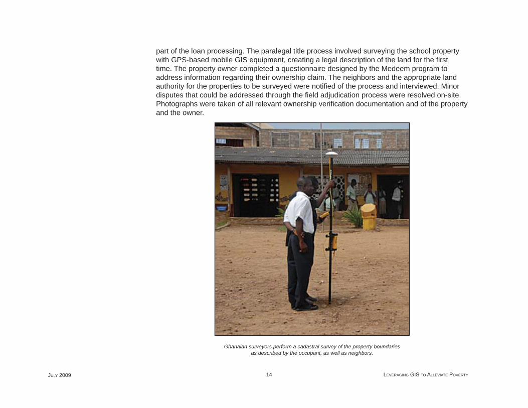
part of the loan processing. The paralegal title process involved surveying the school property with GPS-based mobile GIS equipment, creating a legal description of the land for the fi rst time. The property owner completed a questionnaire designed by the Medeem program to address information regarding their ownership claim. The neighbors and the appropriate land authority for the properties to be surveyed were notifi ed of the process and interviewed. Minor disputes that could be addressed through the fi eld adjudication process were resolved on-site. Photographs were taken of all relevant ownership verifi cation documentation and of the property and the owner.
Ghanaian surveyors perform a cadastral survey of the property boundaries as described by the occupant, as well as neighbors.
GIS BEST PRACTICES 15 WWW.ESRI.COM
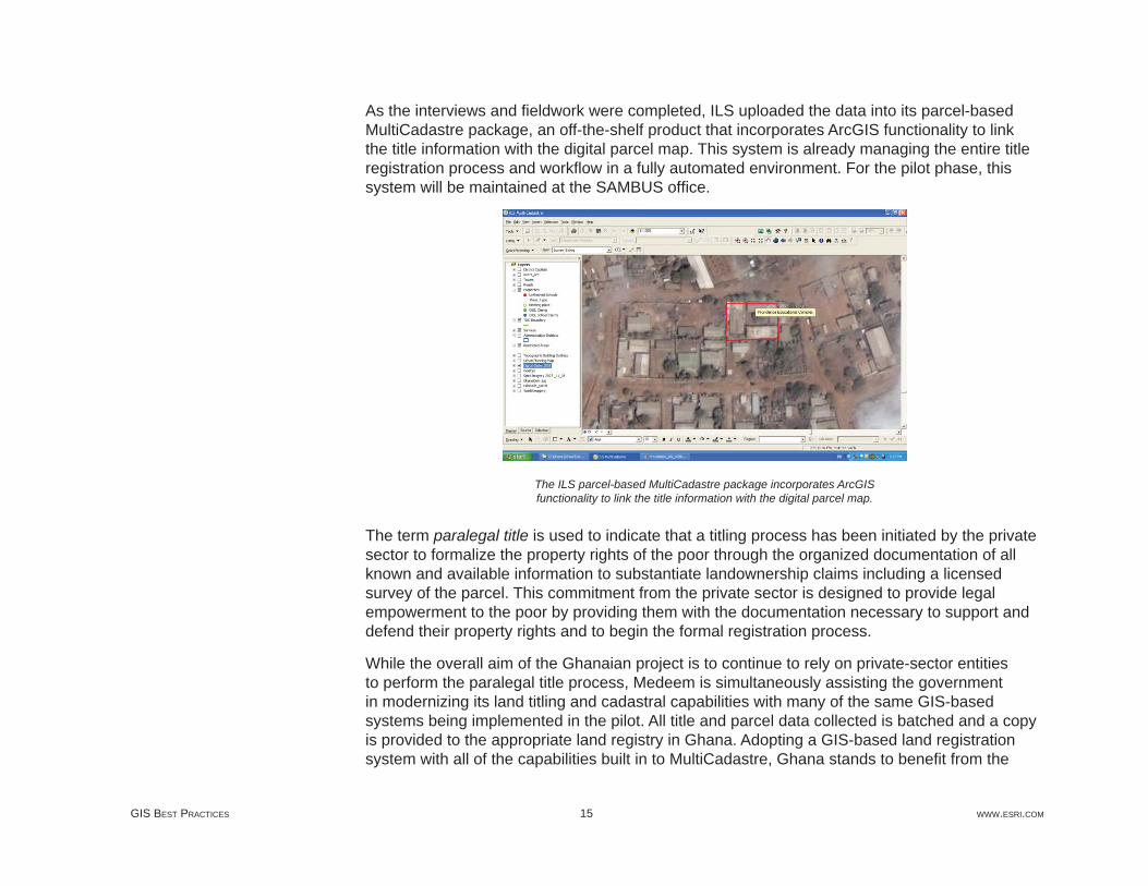
As the interviews and fi eldwork were completed, ILS uploaded the data into its parcel-based MultiCadastre package, an off-the-shelf product that incorporates ArcGIS functionality to link the title information with the digital parcel map. This system is already managing the entire title registration process and workfl ow in a fully automated environment. For the pilot phase, this system will be maintained at the SAMBUS offi ce.
The ILS parcel-based MultiCadastre package incorporates ArcGIS functionality to link the title information with the digital parcel map.
The term paralegal title is used to indicate that a titling process has been initiated by the private sector to formalize the property rights of the poor through the organized documentation of all known and available information to substantiate landownership claims including a licensed survey of the parcel. This commitment from the private sector is designed to provide legal empowerment to the poor by providing them with the documentation necessary to support and defend their property rights and to begin the formal registration process.
While the overall aim of the Ghanaian project is to continue to rely on private-sector entities to perform the paralegal title process, Medeem is simultaneously assisting the government in modernizing its land titling and cadastral capabilities with many of the same GIS-based systems being implemented in the pilot. All title and parcel data collected is batched and a copy is provided to the appropriate land registry in Ghana. Adopting a GIS-based land registration system with all of the capabilities built in to MultiCadastre, Ghana stands to benefi t from the
JULY 2009 16 LEVERAGING GIS TO ALLEVIATE POVERTY
most streamlined and cost-effective technology available today. Thus, this project demonstrates the capabilities of a true public/private partnership using Medeem’s unique approach.
According to DeRoy, this project also demonstrates the true effect of what is called the "leapfrog factor." Given the rapid pace of technology development, those who come to implement a system of land registration today and are not burdened with existing infrastructure or bureaucracy can gain the maximum benefi t from streamlined and cost-effective new processes while leveraging proven solutions.
Peter Rabley is president of International Land Systems, Inc., with more than 20 years of experience designing and implementing land information systems around the world.
For more information, contact Frank Pichel, International Land Systems, Inc. (tel.: 301-587-7531, fax: 301-587-2796, e-mail: [email protected]). Further reading: "The Power of One," Time magazine, July 16, 2007, by Madeleine Albright and Hernando de Soto.
(Based on an article that fi rst appeared in the Fall 2008 issue of ArcNews magazine)
About the Author
More Information
GIS BEST PRACTICES 17 WWW.ESRI.COM
Geospatial Technology Drives AdjudicationGhana Project Leverages GIS-Based Title Registration and Microfi nance to Alleviate Poverty—Part 2
By Peter Rabley, International Land Systems, Inc., and Craig DeRoy, Corporate Initiatives Development Group
Photos by Bryant DeRoy
Highlights
The parcel cadastre was built with an enterprise cadastral management system created by ILS.
The team tapped into ArcWeb Services to access 3D models of the entire country and satellite images.
The low-cost land titling and cadastral solution was developed with off-the-shelf components.
In the Fall 2008 issue of ArcNews, the fi rst article in this series introduced a land titling project now The Fall 2008 issue of ArcNews, the fi rst article in a series, introduced a land titling project now under way in the African nation of Ghana. With support from the Clinton Global Initiative (CGI), the project sought to demonstrate how formalization of landownership helps poor people take the fi rst crucial steps out of poverty. One of the key advantages of holding a land title is that it enables the poor to begin thinking of their property as an asset upon which to build wealth and gain access to capital.
Sponsored within CGI by Corporate Initiatives Development Group of California, the project moved into its pilot phase in March 2008. The objective was to develop a land titling process involving the collection of property ownership information, creation of land legal descriptions, and surveys of the properties. The pilot targeted private schools in Ashaiman, one of the poorest sections of Accra, the capital city. Ashaiman is a maze of shacks and shanties, home to approximately 400,000 people, where land titling was little more than a dream.
JULY 2009 18 LEVERAGING GIS TO ALLEVIATE POVERTY
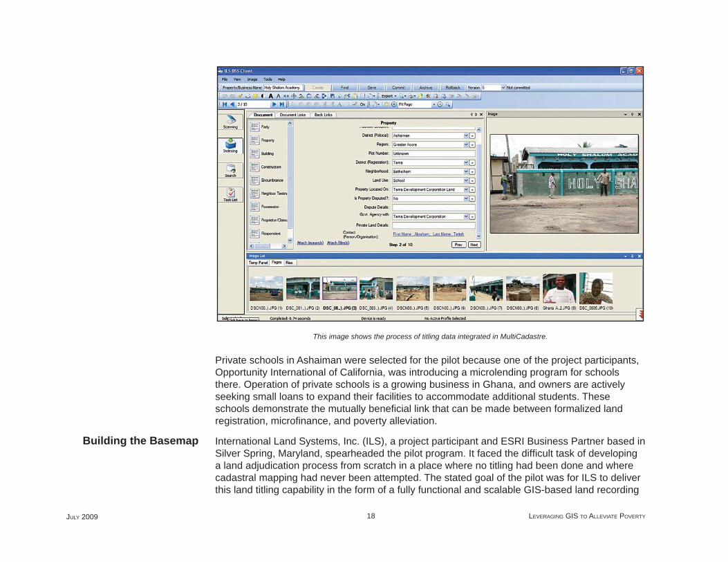
This image shows the process of titling data integrated in MultiCadastre.
Private schools in Ashaiman were selected for the pilot because one of the project participants, Opportunity International of California, was introducing a microlending program for schools there. Operation of private schools is a growing business in Ghana, and owners are actively seeking small loans to expand their facilities to accommodate additional students. These schools demonstrate the mutually benefi cial link that can be made between formalized land registration, microfi nance, and poverty alleviation.
International Land Systems, Inc. (ILS), a project participant and ESRI Business Partner based in Silver Spring, Maryland, spearheaded the pilot program. It faced the diffi cult task of developing a land adjudication process from scratch in a place where no titling had been done and where cadastral mapping had never been attempted. The stated goal of the pilot was for ILS to deliver this land titling capability in the form of a fully functional and scalable GIS-based land recording
Building the Basemap
GIS BEST PRACTICES 19 WWW.ESRI.COM
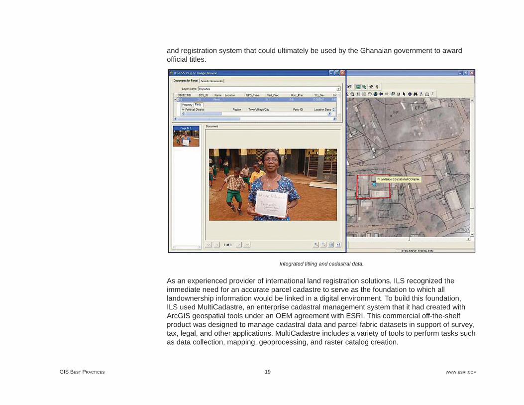
and registration system that could ultimately be used by the Ghanaian government to award offi cial titles.
Integrated titling and cadastral data.
As an experienced provider of international land registration solutions, ILS recognized the immediate need for an accurate parcel cadastre to serve as the foundation to which all landownership information would be linked in a digital environment. To build this foundation, ILS used MultiCadastre, an enterprise cadastral management system that it had created with ArcGIS geospatial tools under an OEM agreement with ESRI. This commercial off-the-shelf product was designed to manage cadastral data and parcel fabric datasets in support of survey, tax, legal, and other applications. MultiCadastre includes a variety of tools to perform tasks such as data collection, mapping, geoprocessing, and raster catalog creation.

JULY 2009 20 LEVERAGING GIS TO ALLEVIATE POVERTY
Cadastral data layers in MultiCadastre.
In preparation for the pilot, ILS personnel collected as much spatial data as possible for Ashaiman. Through the GeoEye Foundation, GeoEye donated a one-meter-resolution color satellite image of the area. And after extensive searching of offi cial archives, the Ghana Ministry of Lands, Forestry and Mines provided a high-quality topographic map created from aerial photography fl own in 2003. The team tapped into ArcWeb Services through the ILS MultiCadastre system to access 3D models of the entire country and additional satellite images and data of Accra.
"These data layers serve as the basemap for our land registry and parcel cadastre," says Frank Pichel, project coordinator of ILS. "In addition to providing contextual information relating to the locations of streets and buildings, the maps reveal the boundaries of fl oodplains, which could factor into the land titling process."

GIS BEST PRACTICES 21 WWW.ESRI.COM
For the Ghana pilot, the MultiCadastre system is using Microsoft SQL Server Express as the database that holds digital documents, photos, videos, and spatial datasets.
ILS set up the MultiCadastre system in the Accra offi ces of SAMBUS Company Ltd., ESRI's distributor in Ghana, and began training local microfi nance loan offi cers to collect basic landownership and property information.
A microloan offi cer, trained by ILS personnel, conducts interviews with property owners using a menu-driven questionnaire.
With 51 private schools in the pilot area, the adjudication process evolved quickly as the loan offi cers became comfortable with the methodology. Early on, they used a printed list of questions when interviewing the school owners. These questions were designed to gather the details needed to establish legal ownership of the property. Neighbors were also interviewed, and unless boundary disputes arose, ownership was relatively easy to prove. Loan offi cers also collected copies of any paper documents that helped support the ownership claim.
As the loan offi cers became more effi cient with the interviews, ILS personnel entered the questions into a menu-driven digital format that could be accessed on the screen of a Trimble GeoXH, a GPS-based mobile GIS data collection device. Upon completion of the interview with the point-and-click interface on the handheld unit, the loan offi cer used the device to capture a GPS coordinate at either the front door of the school building or the center of the property.
The Pilot Begins
JULY 2009 22 LEVERAGING GIS TO ALLEVIATE POVERTY
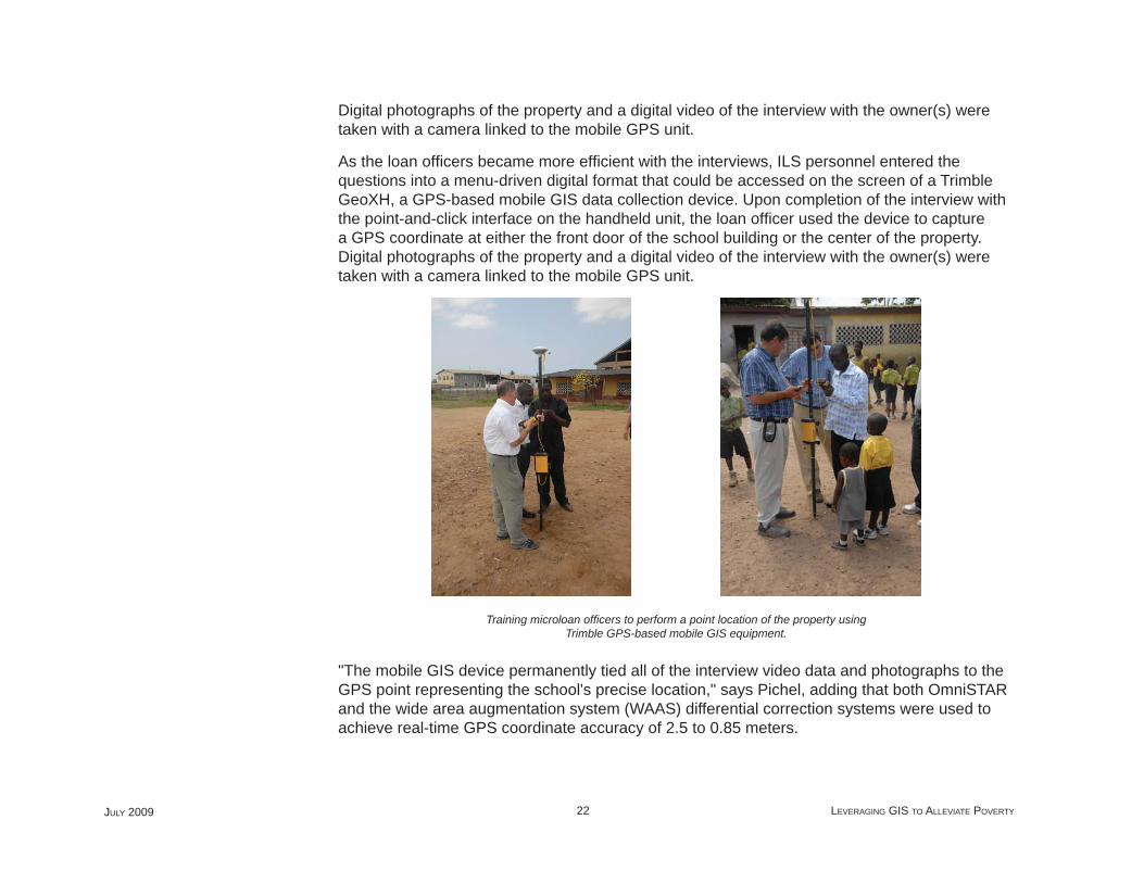
Digital photographs of the property and a digital video of the interview with the owner(s) were taken with a camera linked to the mobile GPS unit.
As the loan offi cers became more effi cient with the interviews, ILS personnel entered the questions into a menu-driven digital format that could be accessed on the screen of a Trimble GeoXH, a GPS-based mobile GIS data collection device. Upon completion of the interview with the point-and-click interface on the handheld unit, the loan offi cer used the device to capture a GPS coordinate at either the front door of the school building or the center of the property. Digital photographs of the property and a digital video of the interview with the owner(s) were taken with a camera linked to the mobile GPS unit.
Training microloan offi cers to perform a point location of the property using Trimble GPS-based mobile GIS equipment.
"The mobile GIS device permanently tied all of the interview video data and photographs to the GPS point representing the school's precise location," says Pichel, adding that both OmniSTAR and the wide area augmentation system (WAAS) differential correction systems were used to achieve real-time GPS coordinate accuracy of 2.5 to 0.85 meters.
GIS BEST PRACTICES 23 WWW.ESRI.COM
Once the fi eld interview was completed—a process that now takes about 30 minutes—the loan offi cer delivered the hard-copy and digital documents to SAMBUS headquarters. Team members then scanned the paper fi les and uploaded the digital information from the Trimble handheld device into the ILS MultiCadastre solution, which handled the scanning, organizing, archiving, and retrieval of all the landownership information. MultiCadastre is an off-the-shelf product capable of managing digital text, photographic, video, and geospatial data fi le formats.
ILS has developed the MultiCadastre system so that all landownership documents are linked via the GPS information to appropriate property locations on the basemap layers. A user can click on a parcel displayed on a map layer and instantly view the ownership records, photographs, and other title information related to it. In addition, MultiCadastre has been customized to serve as an automated land registry system. It generates paralegal titles once all the necessary information has been input into the fi le of a specifi c property.
"The integration of the GPS and MultiCadastre systems has created a start-to-fi nish land titling solution," says Pichel. "This solution is fully scalable and can be handed over to Ministry of Lands at the conclusion of the pilot and potentially used as the government's offi cial land titling and registration system."
The Ashaiman pilot has been conducted with the approval and interest of the Ghana Ministry of Lands. This agency understands the benefi ts of having an automated land titling system that can be used for the processing, recording, and registration of offi cial titles in Accra and around the entire nation. For this reason, the ministry has been monitoring the progress of the pilot with great optimism. As the pilot was nearing completion in October 2008, government offi cials indicated they were impressed that the process could be carried out so quickly with the automated system.
Survey crews from SAMBUS were dispatched to those school properties for which the paralegal documentation had been completed. The SAMBUS crews are skilled at performing land surveys using traditional equipment, as well as GPS. Having conducted property registration projects in numerous countries, ILS realized the quality of the parcel survey will be a make-or-break aspect of overall project success in the eyes of the government. "The property surveys have to fi t accurately into the established land cadastre, or they risk being rejected by the government," says David Horwood, ILS senior consultant. "One of the easiest ways for a cadastral survey to go awry in a project like this is for participants to fail to maintain uniformity among the map datums used in the various cadastral layers." Accra presents a challenging situation because at least three datum grids have been established there. The most prominent, the Accra Datum,
Conducting Parcel Surveys
JULY 2009 24 LEVERAGING GIS TO ALLEVIATE POVERTY
was used by the survey teams for much of the pilot. But due to the pre-GPS techniques used to create it, ILS suspects this grid may lose accuracy over distance away from the primary control points.
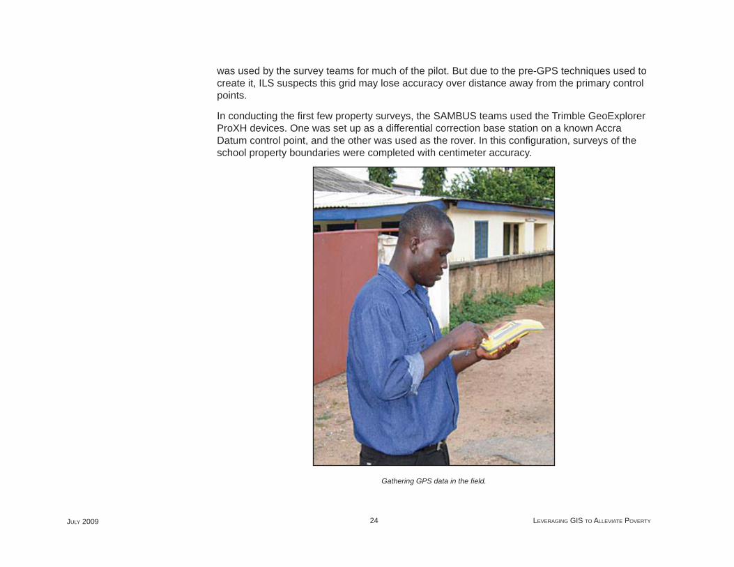
In conducting the fi rst few property surveys, the SAMBUS teams used the Trimble GeoExplorer ProXH devices. One was set up as a differential correction base station on a known Accra Datum control point, and the other was used as the rover. In this confi guration, surveys of the school property boundaries were completed with centimeter accuracy.
Gathering GPS data in the fi eld.
GIS BEST PRACTICES 25 WWW.ESRI.COM
To achieve a higher level of accuracy and eliminate datum uncertainty, ILS installed a Trimble NetR5 GPS base station, donated by Trimble Navigation, at SAMBUS headquarters for use in completing the remainder of the property surveys. The handheld Trimble mobile GIS devices will be capable of achieving real-time survey-grade accuracy in the two- to fi ve-centimeter range once the high-quality RTK (NetR5) base station is available. The accuracy provided by this base station satisfi es the survey requirements of the Ghana Ministry of Lands.
ILS believes it can establish World Geodetic System (WGS) 84 coordinates for the local control monuments with the base station. The WGS 84 datum is preferable because it is highly accurate and a commonly used GPS standard. Most of the satellite image basemap layers are already projected in this datum. Assuming WGS 84 can be established in Accra, all future property surveys will be performed in that datum. ILS will calculate a datum transformation that can run inside MultiCadastre to convert the initial surveys of some of the existing basemap data to WGS 84.
But if WGS 84 can't be established in Accra, Horwood explains that the team would stick with the Accra Grid and make a coordinate conversion to transform all the satellite image data from WGS 84 to the local datum, removing distortions as needed. This conversion model will be programmed into MultiCadastre to ensure that all cadastral basemap and fi eld survey data is presented in the same datum for future applications of the land registry solution..
As the pilot drew to a close, the participants were confi dent they had successfully developed a low-cost and extremely powerful land titling and cadastral solution—built with off-the-shelf components—that can be handed over to the Ghana Ministry of Lands for use in quickly and inexpensively providing legal titles to the people of Ghana, regardless of their location or income level.
The results of the pilot will soon be offi cially presented to the ministry. The following article in this series will describe the results of the pilot and plans for how the system will be deployed in a scalable and sustainable approach for the future.
Peter Rabley is president of International Land Systems, Inc., with more than 20 years of experience designing and implementing land information systems around the world. Craig DeRoy is president of Corporate Initiatives Development Group. With more than 20 years of executive management experience, he is expert in designing and implementing services and solutions to meet the challenges and opportunities of emerging markets worldwide.
The Future
About the Author
JULY 2009 26 LEVERAGING GIS TO ALLEVIATE POVERTY
For more information, contact Peter Rabley (e-mail: [email protected]) or Craig DeRoy (e-mail: [email protected]).
(Based on an article that fi rst appeared in the Winter 2008/2009 issue of ArcNews magazine)
More Information
GIS BEST PRACTICES 27 WWW.ESRI.COM
GIS Brings Commercial Viability to Recognizing the Land Interests of the World's PoorEvaluating Ghana Pilot Project Results—Part 3
By Peter Rabley, International Land Systems, Inc., and Craig DeRoy, Corporate Initiatives Development Group
Photos by Bryant DeRoy
In his widely acclaimed book, The Mystery of Capital, Hernando de Soto states that "nearly every developing and former communist nation has a formal property system. The problem is that most citizens [the poor] cannot gain access to it." The barriers to access vary from country to country, but primarily are due to overwhelmed or corrupt bureaucratic government processes that are far too complex, cumbersome, and costly for the impoverished to navigate successfully. As a result, the poor, who represent as much as fi ve-sixths of humanity, are unable to register the only real asset they may have—their land. This basic inequity literally cuts the poor out of a capital market largely recognized in the form of land rights that can be built upon, be fi nanced, and serve as the foundation for asset accumulation and transfers of wealth or inheritance.
The pilot project which was completed in 2009 in the West African nation of Ghana has proved that sustainable GIS-based technology can be used to develop a practical, commercially viable means of formalizing the land registration process for the poor. This new model combines geospatial technology and an innovative paralegal registration process to develop a land titling process and GIS-based land records system that automates much of the work involved in collecting property ownership information, creating low-cost and timely property descriptions and surveying of parcels. To most effi ciently and responsibly identify and reach the poor in need, the pilot program utilizes the distribution network of a microfi nance lender as the trusted broker partner. The program bases its unique approach on a foundation of commercial sustainability and scalability, which has been sorely lacking in other land reform projects that are typically highly subsidized.
The Ghana pilot program initially targeted the owners of 30 private schools in Ashaiman District, one of the poorest areas of Accra, Ghana. By late 2008, the Ghana pilot program was yielding results. The partnered team was beginning to see that it could produce its paralegal title at a cost that could—in a relatively short time—become easily accessible and affordable by the poor.
JULY 2009 28 LEVERAGING GIS TO ALLEVIATE POVERTY
That is, the team began to align the real cost for such practical registrations with the level of microfi nance loans typically available to the poor. To achieve this cost- and time-effective result, the team leveraged key components of the very process used by the microlenders to make those loans.
The premise of the pilot program is that human dignity goes hand in hand with certain basic rights. One means of restoring the dignity of the poor is to recognize their identity and the location of where they live through a formal land registration process assisted by a trusted broker in the community. Formal recognition of land tenure empowers leaseholders or landowners in many ways, the most important of which is the ability to leverage their property and be able to begin looking at property as an asset, including the potential for using it to obtain and build on microfi nance loans. These loans, often less than $500, can assist individuals in making dramatic changes in their lives, such as starting or growing small businesses.
Overall, the project has been judged a success for achieving the primary objective of showcasing that private industry can implement a practical, informal land registration and paralegal titling system that is much simpler and faster than the traditional formal process. With microfi nance loan offi cers serving as the trusted brokers and assisting the school owners with documentation, the titling process that once took years to arrive at an identity for the property and its landowner can now be completed in a few weeks. All 30 of the pilot schools have had their properties identifi ed through mapping from high-resolution satellite imagery supplemented by GPS "walk-arounds," and the owners/tenants have received the paralegal title package representing their property rights to the land under their buildings.
As the newly elected democratic government in Ghana takes hold and the newly appointed land minister continues the process of moving land registration ahead across the country, the paralegal titling process provides a ready-made starting point for formal land registration by the government. The land team is confi dent that the adoption of the ILS MultiCadastre Open Title system (based on ESRI technology) will drive the government's appreciation of the economies of scale now possible to make formal land registration truly accessible to the poor. A major factor helping cut the costs involved in conducting surveys and producing the paralegal title packages is the time savings delivered by state-of-the-art GIS technologies.
Several conclusions can be drawn from the early results of the pilot. Most notable is the fact that low-cost, sustainable, and scalable GIS-based land registration technology can indeed enable the poor to quickly and successfully identify their land tenure rights. Moreover, the pilot demonstrates that recognition of customary tenure as a validation of an individual’s rights as a
GIS BEST PRACTICES 29 WWW.ESRI.COM
person—regardless of economic stature—can be accomplished within the framework of existing laws.
In a project such as this, progress and success are often gauged by impersonal statistics or reports fi led with stakeholders. But in Ghana, the people didn't read about progress in the newspaper; they witnessed it fi rsthand when survey teams equipped with high-accuracy GPS receivers began surveying their schoolyards in Ashaiman. Once a community begins to see that the process is actually working and paralegal titles are being issued to their neighbors, they begin to believe that it can work for them too, and they begin to feel empowered as a community.
Ms. Adamah is the owner of the Providence Educational Complex, which was one of the fi rst schools in the pilot to be reviewed under the paralegal titling process. Looking back on the sequence of events, she believes the most signifi cant benefi t given to her under this program was the validation that her school property was indeed "in her name." Her legal rights had been privately formalized, and as a result, she had confi dence that the school could someday be used as an asset and could be passed on by inheritance to her family. She was visibly moved the day her property was surveyed and she was shown the outline of the school overlaid on a satellite image of Accra. For the fi rst time, she literally saw her place in the world—and it had an address that reaffi rmed her sense of identity.
As word of Adamah's experience, and others like hers, spread by word of mouth through the community, neighbors began approaching the land team's fi eld personnel during the GPS boundary survey and fi eld adjudication process, asking if they could be next. Many of them had attempted to navigate the government’s titling process on their own but had been frustrated by the process. In a survey of the landowners conducted prior to the pilot program, 80 percent said they had tried to get formal title to their property for years, but all had given up. However, seeing is believing. When these individuals see their own property geocoded with a location on a map for the fi rst time, they realize that their stature has just risen to a new level as they have joined the ranks of those who already enjoy what is rightly due them—access to capital based on the assets they own.
The pilot revealed some unexpected insights as well. Most notable among these is the importance of property rights recognition along a continuum of personal rights—beginning with the very basic property report showing a GPS coordinate location of that piece of land on the earth and moving to the offi cial description of landownership rights supported by formal
Belief in the Process
A Continuum
JULY 2009 30 LEVERAGING GIS TO ALLEVIATE POVERTY
documentation in offi cial government records. The pilot program has demonstrated that GIS-based technology is an effective tool that can be readily calibrated to match the need for defi nition of a range of property interests and information that is affordable. This pilot program utilized a level of specifi city in the form of a paralegal title package. The next gradation is the primary level of formal title where the parcel surveys produced are accepted and recorded in the offi cial records of the government.
From a technological perspective, the pilot is also proving that even in the poorest of areas, land adjudication with modern geospatial techniques yields benefi ts extending well beyond the low-income leaseholder and into the entire surrounding community. During the parcel survey, the introduction of real-time differential correction with the Trimble base station was a watershed event for both SAMBUS and the Ghana Ministry of Lands. Until the GPS technology began providing 10-centimeter accuracy in real time, the government did not consider GPS a viable technology for parcel mapping. But it does now. And local companies can realize a business model change overnight as the time required for a property survey was reduced from half a day to just 15 minutes. Companies can now offer GPS survey services at a fraction of the previous costs, making them affordable to individuals at the low end of the poverty spectrum and a variety of new industries as well.
GIS BEST PRACTICES 31 WWW.ESRI.COM
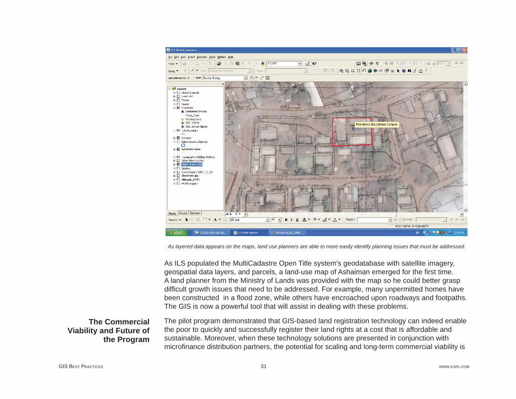
As layered data appears on the maps, land use planners are able to more easily identify planning issues that must be addressed.
As ILS populated the MultiCadastre Open Title system's geodatabase with satellite imagery, geospatial data layers, and parcels, a land-use map of Ashaiman emerged for the fi rst time. A land planner from the Ministry of Lands was provided with the map so he could better grasp diffi cult growth issues that need to be addressed. For example, many unpermitted homes have been constructed in a fl ood zone, while others have encroached upon roadways and footpaths. The GIS is now a powerful tool that will assist in dealing with these problems.
The pilot program demonstrated that GIS-based land registration technology can indeed enable the poor to quickly and successfully register their land rights at a cost that is affordable and sustainable. Moreover, when these technology solutions are presented in conjunction with microfi nance distribution partners, the potential for scaling and long-term commercial viability is
The Commercial Viability and Future of
the Program
JULY 2009 32 LEVERAGING GIS TO ALLEVIATE POVERTY
dramatically increased. The global movement in microfi nance has seen tremendous growth in recent years, and it is estimated to now be serving between 125 and 150 million customers, according to a recent article in Financial Times. By utilizing microfi nance lenders that are already established as trusted brokers in the communities they serve, this program is able to leverage existing distribution networks, thereby reducing the cost of identifying and delivering land registration services to the poor. By offering the land registration services to the full spectrum of microlenders, from those that are more commercially based to those that are highly subsidized or donor based, there is an increased ability to ensure that the program will aid the poor at all levels of the poverty spectrum, including the poorest of the poor who are often considered too hard to reach or too expensive to serve.
As promising as the results of the Ghana pilot program have been, the project participants understand there is still much work to be accomplished. The most important goal now is to keep the momentum going in Ghana and elsewhere. The project partners will expand the Ghana pilot in 2009 to include support for new microfi nance products under development. The group is also looking at expansion of its program in the rural areas outside Accra where farmers are granted oral permission to work the fi elds owned by local tribes. Looking globally, success will be declared as additional microfi nance organizations validate the concept by embracing these innovative paralegal titling services as part of their offerings to the poor. The project partners—Corporate Initiatives Development Group (CIDG), ILS, Trimble Navigation, and ESRI—are working with the Clinton Global Initiative (CGI) to expand the program globally. They are interested in initiating new partnerships and are actively seeking suggestions from organizations operating in other parts of the world where the impoverished would benefi t from easy and inexpensive access to paralegal title to substantiate and document their land rights for land registration.
Peter Rabley is president of International Land Systems, Inc., with more than 20 years of experience designing and implementing land information systems around the world. Craig DeRoy is president of Corporate Initiatives Development Group. With more than 20 years of executive management experience, he is expert in designing and implementing services and solutions to meet the challenges and opportunities of emerging markets worldwide.
For more information, contact Peter Rabley (e-mail: [email protected]) or Craig DeRoy (e-mail: [email protected]).
(Based on an article that fi rst appeared in the Summer 2009 issue of ArcNews magazine)
About the Authors
More Information
Copyright © 2009 ESRIAll rights reserved.Printed in the United States of America.
The information contained in this document is the exclusive property of ESRI. This work is protected under United States copyright law and other international copyright treaties and conventions. No part of this work may be reproduced or transmitted in any form or by any means, electronic or mechanical, including photocopying and recording, or by any information storage or retrieval system, except as expressly permitted in writing by ESRI. All requests should be sent to Attention: Contracts and Legal Services Manager, ESRI, 380 New York Street, Redlands, CA 92373-8100, USA.
The information contained in this document is subject to change without notice.
U.S. GOVERNMENT RESTRICTED/LIMITED RIGHTSAny software, documentation, and/or data delivered hereunder is subject to the terms of the License Agreement. In no event shall the U.S. Government acquire greater than RESTRICTED/LIMITED RIGHTS. At a minimum, use, duplication, or disclosure by the U.S. Government is subject to restric-tions as set forth in FAR §52.227-14 Alternates I, II, and III (JUN 1987); FAR §52.227-19 (JUN 1987) and/or FAR §12.211/12.212 (Commercial Technical Data/Computer Software); and DFARS §252.227-7015 (NOV 1995) (Technical Data) and/or DFARS §227.7202 (Computer Software), as applicable. Contractor/Manufacturer is ESRI, 380 New York Street, Redlands, CA 92373-8100, USA.
@esri.com, 3D Analyst, ACORN, ADF, AML, ArcAtlas, ArcCAD, ArcCatalog, ArcCOGO, ArcData, ArcDoc, ArcEdit, ArcEditor, ArcEurope, ArcExplorer, ArcExpress, ArcGIS, ArcGlobe, ArcGrid, ArcIMS, ARC/INFO, ArcInfo, ArcInfo Librarian, ArcInfo—Professional GIS, ArcInfo—The World’s GIS, ArcLocation, ArcLogistics, ArcMap, ArcNetwork, ArcNews, ArcObjects, ArcOpen, ArcPad, ArcPlot, ArcPress, ArcQuest, ArcReader, ArcScan, ArcScene, ArcSchool, ArcSDE, ArcSdl, ArcSketch, ArcStorm, ArcSurvey, ArcTIN, ArcToolbox, ArcTools, ArcUSA, ArcUser, ArcView, ArcVoyager, ArcWatch, ArcWeb, ArcWorld, ArcXML, Atlas GIS, AtlasWare, Avenue, Business Analyst Online, BusinessMAP, Community, CommunityInfo, Data Automation Kit, Database Integrator, DBI Kit, EDN, ESRI, ESRI—Team GIS, ESRI—The GIS Company, ESRI—The GIS People, ESRI—The GIS Software Leader, FormEdit, Geographic Design System, ESRI BIS, Geography Matters, Geography Network, GIS by ESRI, GIS Day, GIS for Everyone, GISData Server, JTX, MapBeans, MapCafé, MapData, MapObjects, Maplex, MapStudio, ModelBuilder, MOLE, NetEngine, PC ARC/INFO, PC ARCPLOT, PC ARCSHELL, PC DATA CONVERSION, PC STARTER KIT, PC TABLES, PC ARCEDIT, PC NETWORK, PC OVERLAY, PLTS, Rent-a-Tech, RouteMAP, SDE, Site·Reporter, SML, Sourcebook·America, Spatial Database Engine, StreetEditor, StreetMap, Tapestry, the ARC/INFO logo, the ArcAtlas logo, the ArcCAD logo, the ArcCAD WorkBench logo, the ArcCOGO logo, the ArcData logo, the ArcData Online logo, the ArcEdit logo, the ArcEurope logo, the ArcExplorer logo, the ArcExpress logo, the ArcGIS logo, the ArcGIS Explorer logo, the ArcGrid logo, the ArcIMS logo, the ArcInfo logo, the ArcLogistics Route logo, the ArcNetwork logo, the ArcPad logo, the ArcPlot logo, the ArcPress for ArcView logo, the ArcPress logo, the ArcScan logo, the ArcScene logo, the ArcSDE CAD Client logo, the ArcSDE logo, the ArcStorm logo, the ArcTIN logo, the ArcTools logo, the ArcUSA logo, the ArcView 3D Analyst logo, the ArcView Business Analyst logo, the ArcView Data Publisher logo, the ArcView GIS logo, the ArcView Image Analysis logo, the ArcView Internet Map Server logo, the ArcView logo, the ArcView Network Analyst logo, the ArcView Spatial Analyst logo, the ArcView StreetMap 2000 logo, the ArcView StreetMap logo, the ArcView Tracking Analyst logo, the ArcWorld logo, the Atlas GIS logo, the Avenue logo, the BusinessMAP logo, the Community logo, the Data Automation Kit logo, the Digital Chart of the World logo, the ESRI Data logo, the ESRI globe logo, the ESRI Press logo, the Geography Network logo, the MapCafé logo, the MapObjects Internet Map Server logo, the MapObjects logo, the MOLE logo, the NetEngine logo, the PC ARC/INFO logo, the Production Line Tool Set logo, the RouteMAP IMS logo, the RouteMAP logo, the SDE logo, The World’s Leading Desktop GIS, Water Writes, www.esri.com, www.esribis.com, www.geographynetwork.com, www.gis.com, www.gisday.com, and Your Personal Geographic Information System are trademarks, registered trademarks, or service marks of ESRI in the United States, the European Community, or certain other jurisdictions.
Other companies and products mentioned in the ESRI Web site may be trademarks or registered trademarks of their respective trademark owners.
G36879_mg

ESRI • 380 New York Street • Redlands, CA 92373-8100 • 909-793-2853 • FAX 909-793-5953 • www.esri.com
Since 1969, ESRI has been giving customers around
the world the power to think and plan geographically.
The market leader in geographic information system
(GIS) solutions, ESRI software is used in more than
300,000 organizations worldwide including each
of the 200 largest cities in the United States, most
national governments, more than two-thirds of Fortune
500 companies, and more than 5,000 colleges and
universities. ESRI applications, running on more than one
million desktops and thousands of Web and enterprise
servers, provide the backbone for the world’s mapping
and spatial analysis. ESRI is the only vendor that provides
complete technical solutions for desktop, mobile, server,
and Internet platforms. Visit us at www.esri.com.