lidar remote sensing for land management and monitoring in mexico
TRANSCRIPT
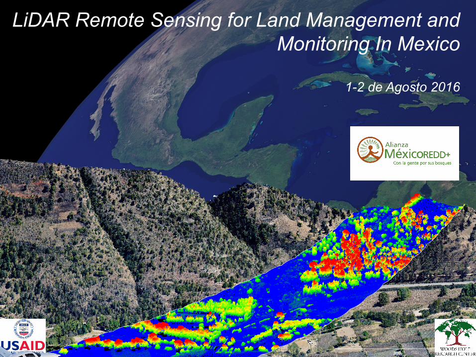
LiDAR Remote Sensing for Land Management and Monitoring In Mexico
1-2 de Agosto 2016
1

Introduc)ontoLiDARTechnologyandSystems
1-2deAgosto2016�GuadalajaraMexico
Drs.WayneWalker,ManoloCanto,&AlessandroBaccini

Introduc)ontoLiDARTechnologyandSystems:
• WhatisLiDAR?
• HowdoesLiDARwork?
• AirborneLiDARapplica)ons
Outline
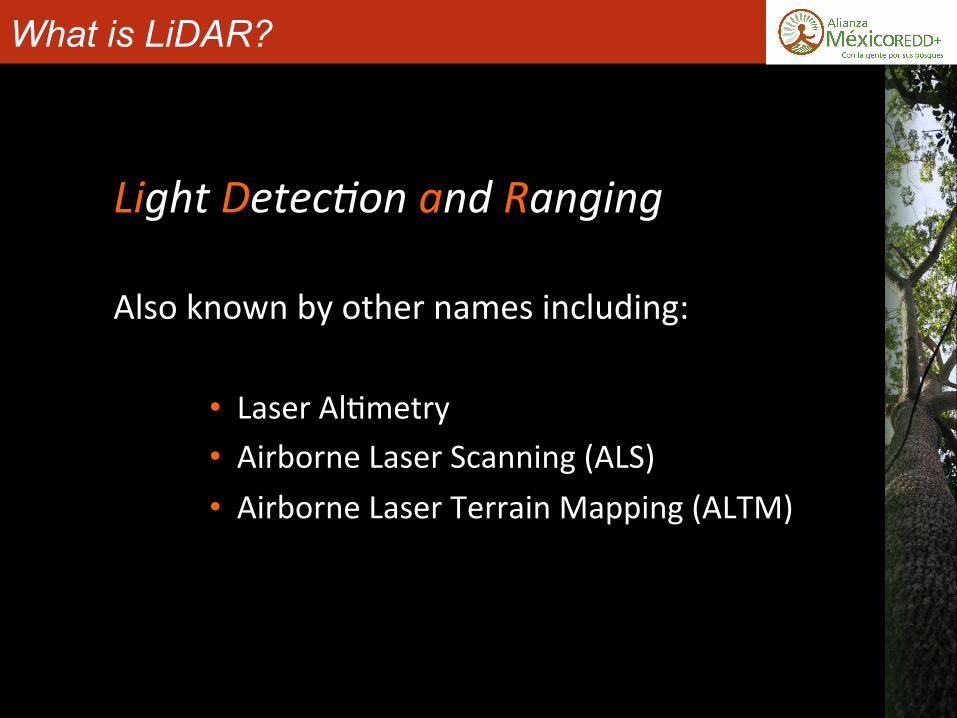
What is LiDAR?
LightDetec*onandRangingAlsoknownbyothernamesincluding:
• LaserAl)metry• AirborneLaserScanning(ALS)• AirborneLaserTerrainMapping(ALTM)
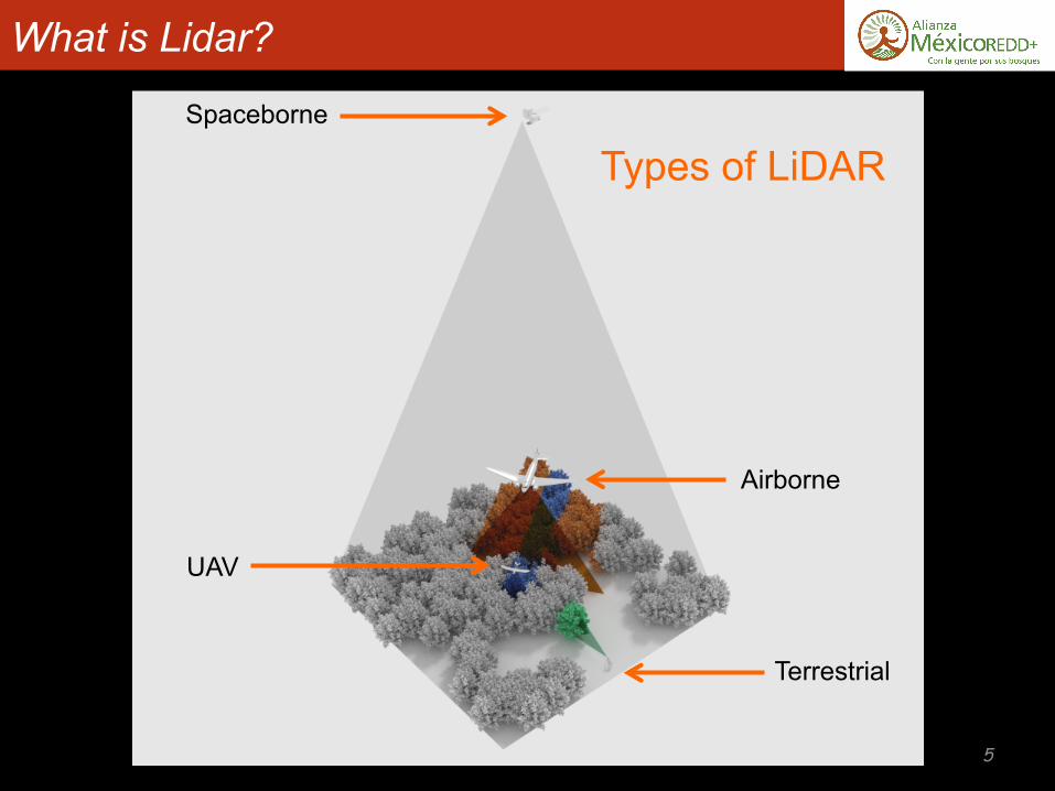
What is Lidar?
Airborne
Terrestrial
Spaceborne
UAV
Types of LiDAR
5
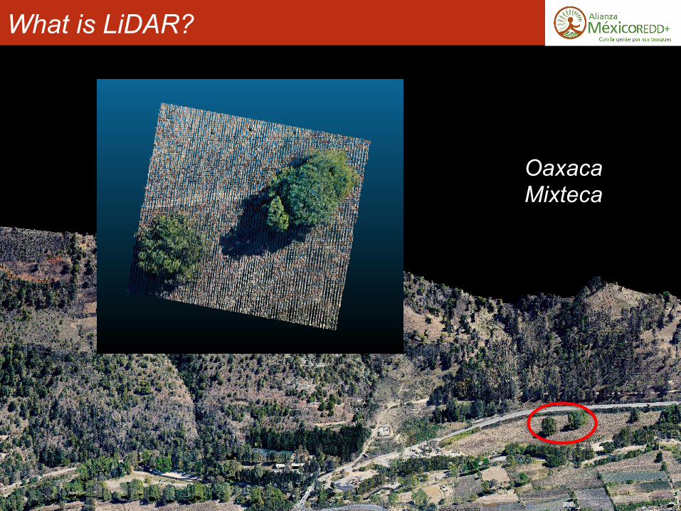
What is LiDAR?
Oaxaca Mixteca
6
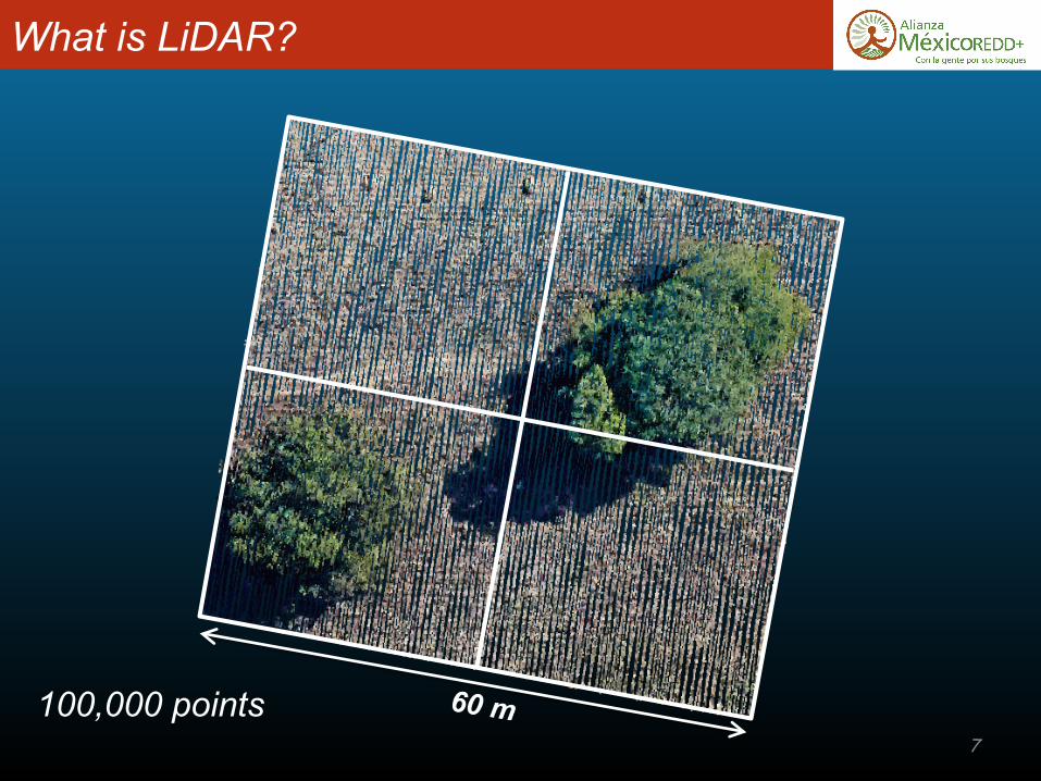
What is LiDAR?
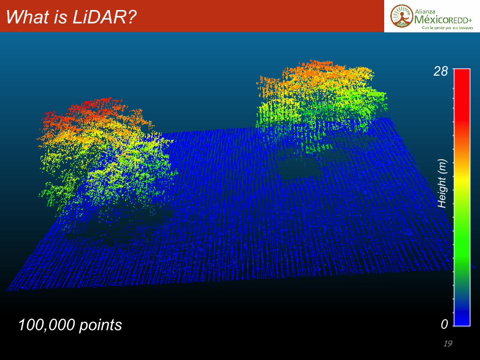
100,000 points 7
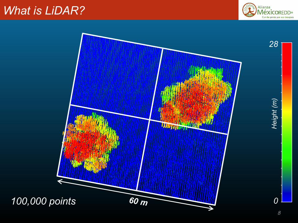
What is LiDAR?
28
0
Hei
ght (
m)
100,000 points 8

What is LiDAR?
28
0
Hei
ght (
m)
100,000 points 9
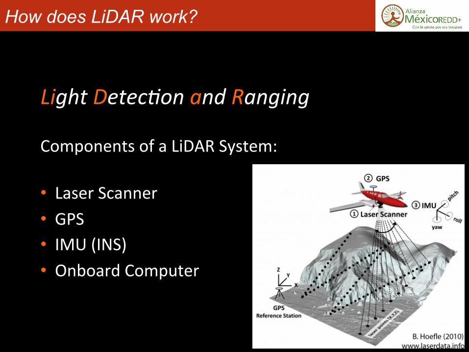
How does LiDAR work?
LightDetec*onandRanging
ComponentsofaLiDARSystem:
• LaserScanner• GPS• IMU(INS)• OnboardComputer

How does LiDAR work?
LaserScanner:
• LiDARusesLASERlight
LightAmplifica*onbySimulatedEmissionofRadia*on
• Monochroma)c(onecolor)• Coherent(inphase)• Collimated(parallel)
hXp://spaceplace.nasa.gov/laser/
LaserScanner:
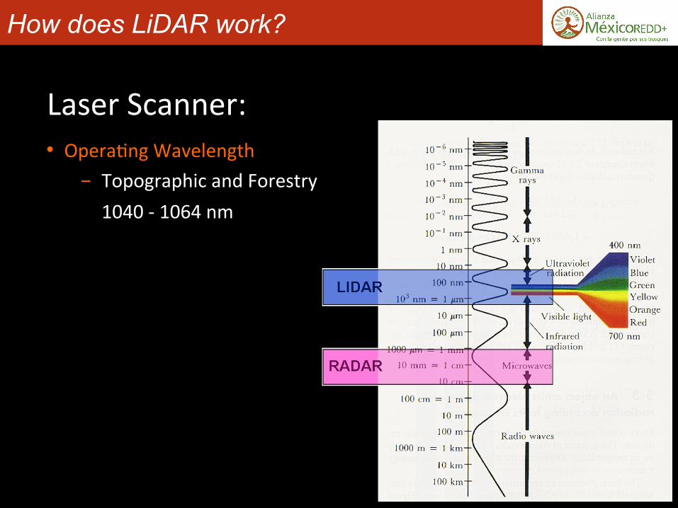
How does LiDAR work?
• Opera)ngWavelength- TopographicandForestry1040-1064nm

How does LiDAR work?
LaserScanner:
• Anoscilla)ngmirrorenablesthescanner
Source:USFS-PNW-GTR-768

How does LiDAR work?
GPS:
• Differen)allycorrectedtoprovideposi)onalaccuracyoftheaircra^(andlaserpulse)towithincen)meters

How does LiDAR work?
IMU(Iner)alMeasurementUnit):
• Con)nuouslyrecordstheaircra^’sa`tudevectors(orienta)on)bywayofgyroscopesandaccelerometers

How does LiDAR work?
OnboardComputer:
• Recordsdata…-Photondetector-Laser)ming- Mirrorscanangle- GPSinfo-IMUinfo
• ConvertsdatatoXYZ
• Providesreal-)medisplay
How does LiDAR work?
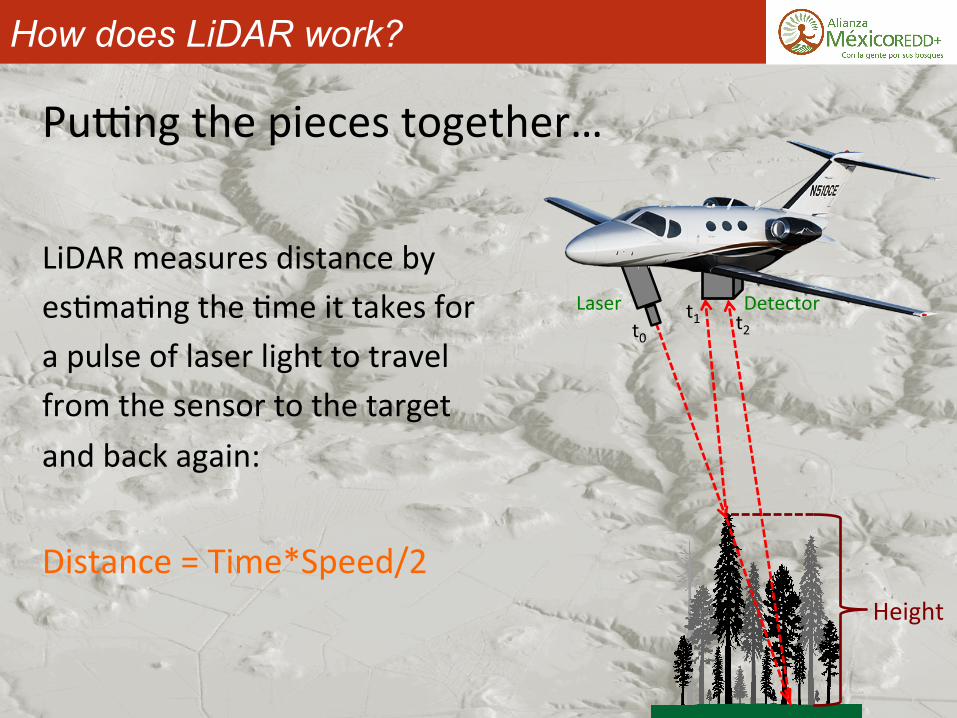
Pu`ngthepiecestogether…
LiDARmeasuresdistancebyes)ma)ngthe)meittakesforapulseoflaserlighttotravelfromthesensortothetargetandbackagain:
Distance=Time*Speed/2
Laser Detectort0
t1 t2
Height

How does LiDAR work?
What is LiDAR?
28
0
Hei
ght (
m)
100,000 points 19

LiDAR Applications Atmosphere• Cloudheights/phase/temporalsta)s)cs• Aerosolex)nc)on/sizedistribu)onprofiles• Gas(H2O,CO2,O3,etc.)profiles
Cryosphere• Glaciermonitoring• Icesheetthickness/movement
Geosphere• Digitaleleva)onmodelgenera)on/upda)ng• Faultdetec)onandupli^measurement• Landslideriskanalysis• SubsidenceissuesBiosphere• Forestinventory/structurecharacteriza)on• Vegeta)on/Habitatmapping
Hydrosphere• Bathymetricsurveying• Watersurfaceroughness• Turbidityandproduc)vity• Shoreline/CoastalchangeUrban• U)lityplanning/surveying• Urban/SuburbanplanningArcheology• Sitediscovery• Sitemapping
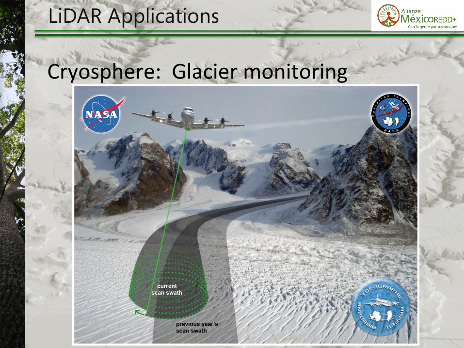
Cryosphere:Glaciermonitoring
LiDAR Applications
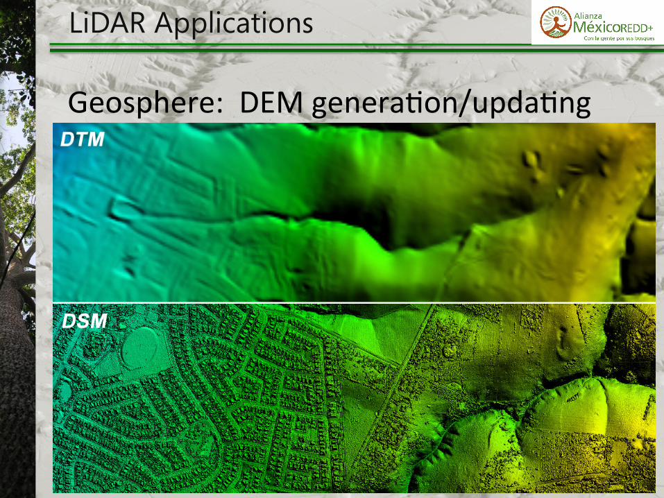
Geosphere:DEMgenera)on/upda)ng
LiDAR Applications
LiDAR Applications
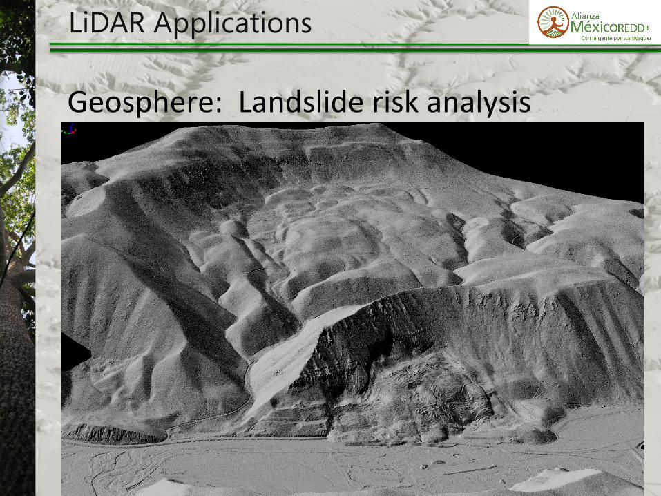
Geosphere:Landslideriskanalysis

LiDAR Applications
Urban:U)lityplanning/surveying

LiDAR Applications
Urban:Urban/Suburbanplanning

LiDAR Applications
Archeology:Sitediscovery/mapping
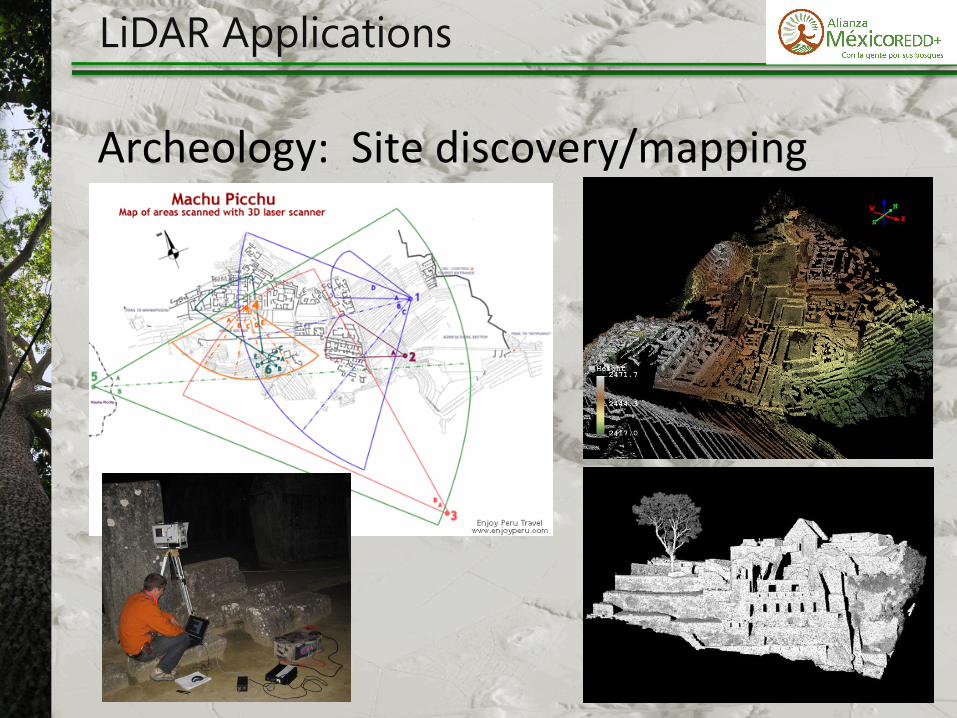
LiDAR Applications
Archeology:Sitediscovery/mapping
LiDAR Applications
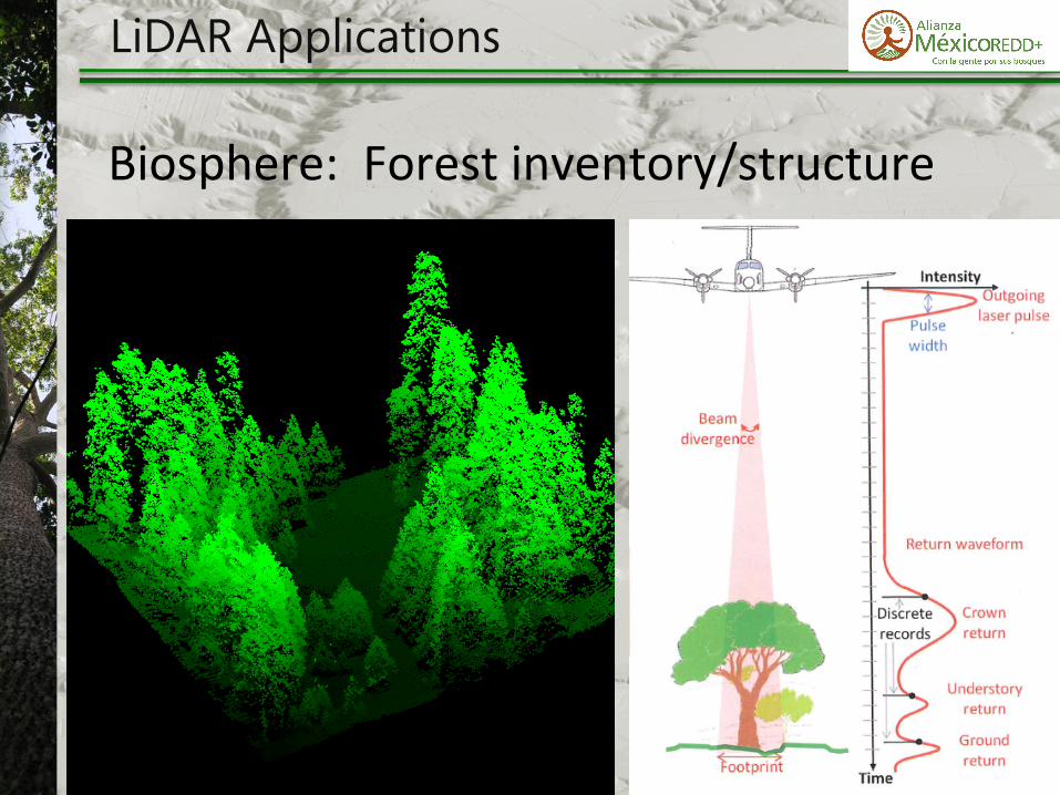
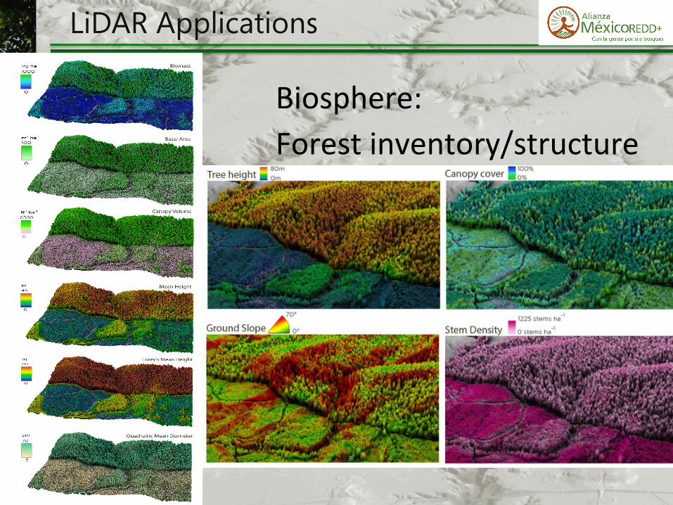
Biosphere:Forestinventory/structure
29
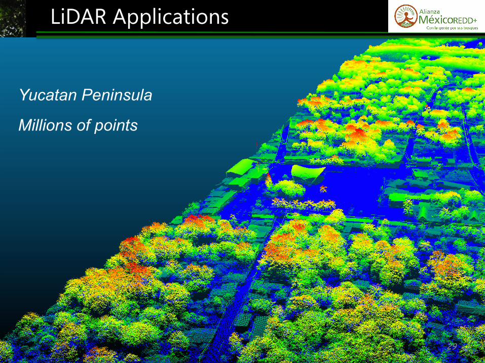
LiDAR Applications
Yucatan Peninsula
Millions of points
LiDAR Applications
Biosphere:Forestinventory/structure
LiDAR Applications
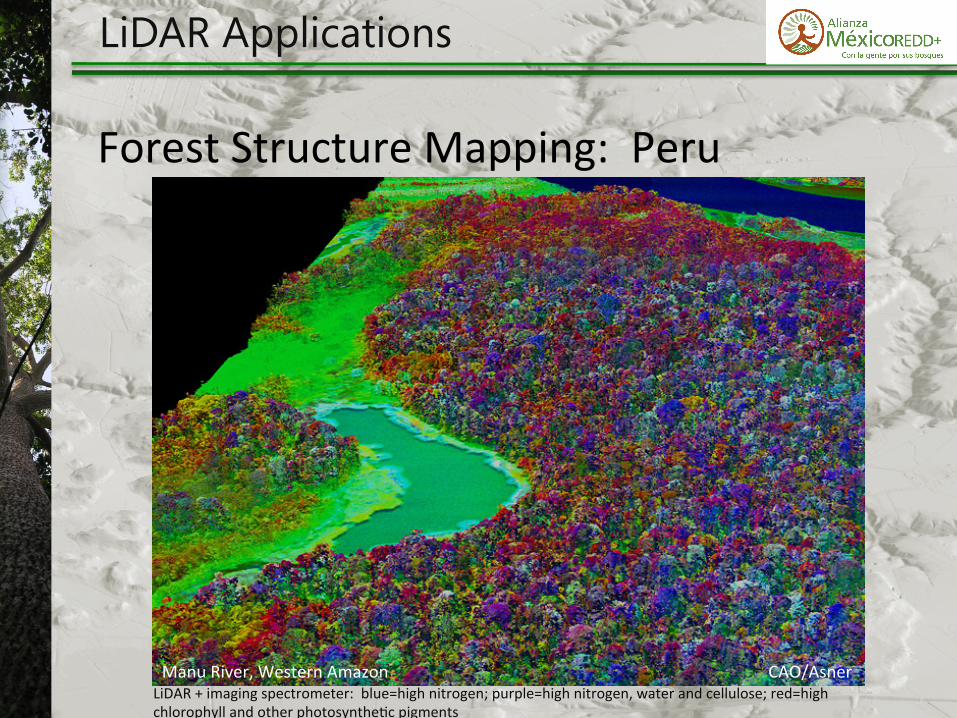
ForestStructureMapping:Peru
CAO/AsnerLiDAR+imagingspectrometer:blue=highnitrogen;purple=highnitrogen,waterandcellulose;red=highchlorophyllandotherphotosynthe)cpigments
ManuRiver,WesternAmazon

And tomorrow…
32
LiDAR Applications Field data collection today…

33
LiDAR Applications
70,000,000 points