life, fire and water in the atacama. the driest desert in the world
TRANSCRIPT

© 2015 Gerard Prins
San Pedro & the Atacama Desert
Life in the driest desert in the world Chile, II Region

© 2015 Gerard Prins Desert colors (better get used to them)

© 2015 Gerard Prins Flow patterns in the desert

© 2015 Gerard Prins The desert. Pollock style

San Pedro de Atacama and nearby places

© 2015 Gerard Prins Colonial church – San Pedro de Atacama

San Pedro de Atacama colonial church, side entrance

San Pedro de Atacama colonial church, frontis

© 2015 Gerard Prins Pukará de Quitor, an Inca stone fortress

© 2015 Gerard Prins The buried village of Tulor

© 2015 Gerard Prins The buried village of Tulor, storage room

© 2015 Gerard Prins On All Saints Day, people renovate the paper flowers at the local cemetery – Toconao

© 2015 Gerard Prins Toconao colonial church
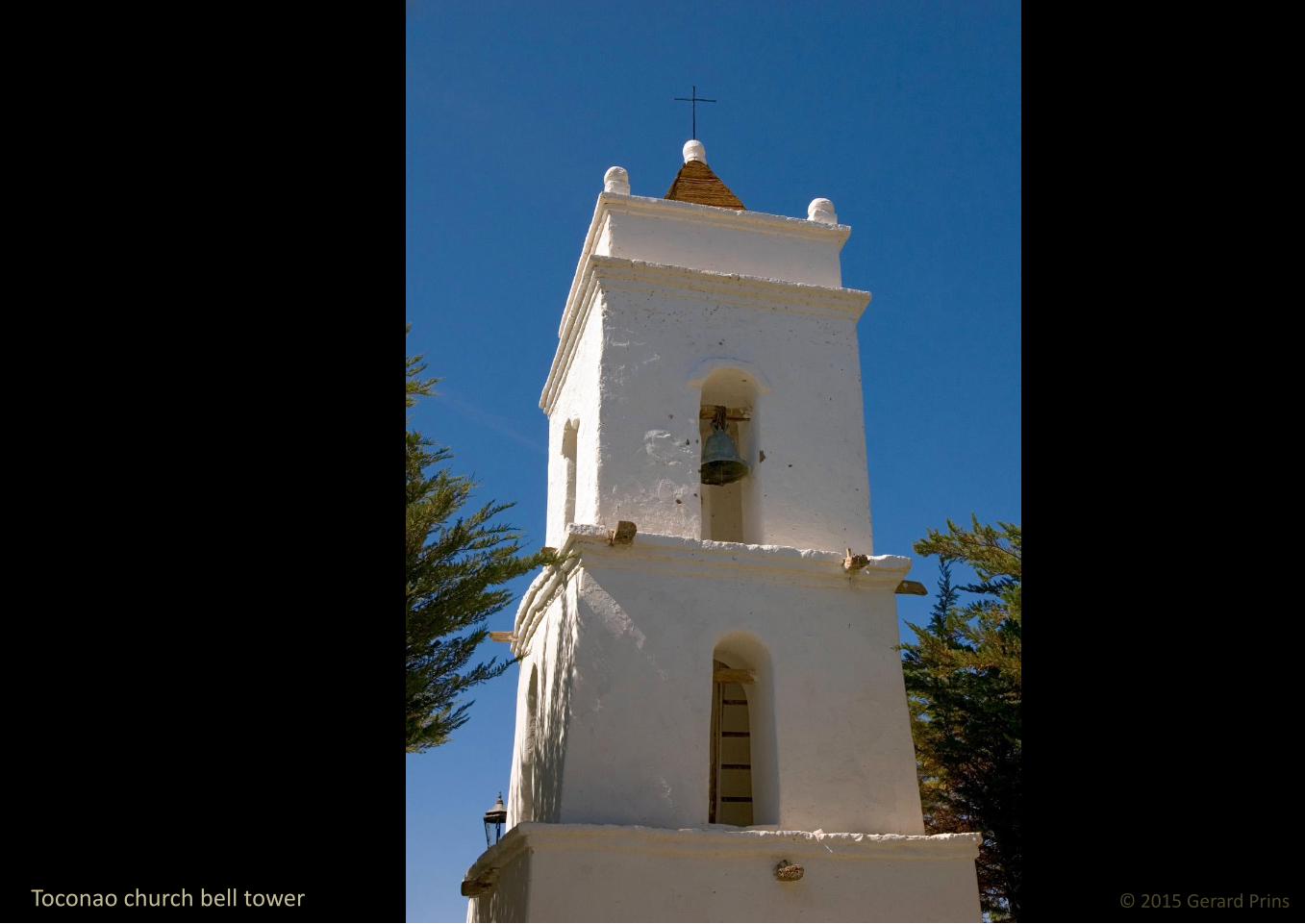
© 2015 Gerard Prins Toconao church bell tower

Machuca village colonial church. Note the color of the door. Calypso or blue doors are ordained to keep the devil out

© 2015 Gerard Prins Machuca colonial church

Lama wool wrapped crosses offer protection from evil spirits. Most houses in the Machuca village carry one

© 2015 Gerard Prins

Cordillera de la Sal, Valle de la Luna & Quebrada de Cari

© 2015 Gerard Prins Cordillera de la Sal

© 2015 Gerard Prins Cordillera de la Sal

© 2015 Gerard Prins Dunescape across the Tree Marias – Moon Valley

© 2015 Gerard Prins The Amphitheater – Moon Valley

© 2015 Gerard Prins Rainbow over red rock – Moon Valley

© 2015 Gerard Prins Ripples and waves on a sea of rock – Moon Valley

© 2015 Gerard Prins Sculpted by the Gods

© 2015 Gerard Prins Salt, sand, sun and tectonic shift. Amphitheater – Moon Valley

© 2015 Gerard Prins Sunset over the Gran Duna – Moon Valley
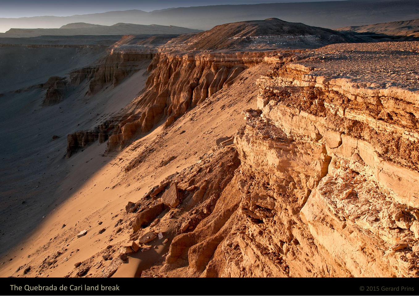
© 2015 Gerard Prins The Quebrada de Cari land break

© 2015 Gerard Prins View on the desert from the Quebrada de Cari

© 2015 Gerard Prins What if it breaks? Tourists at the edge of the precipice. Quebrada de Cari

The Gran Salar salt flat & Laguna Chaxa

© 2015 Gerard Prins Sunrise over the Miñiques volcano

© 2015 Gerard Prins At the heart of the desert
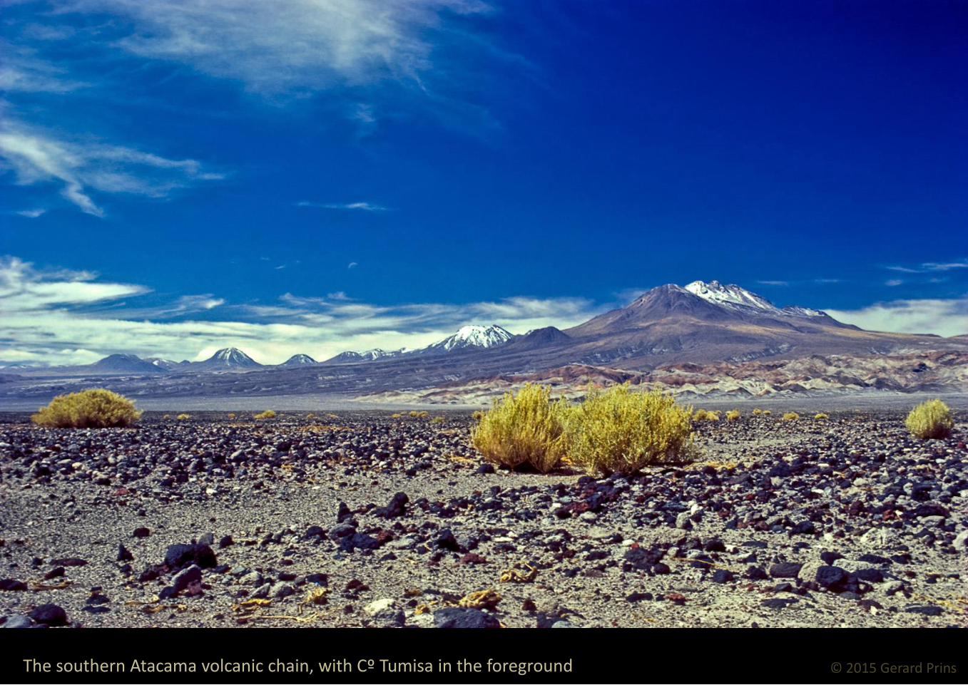
© 2015 Gerard Prins The southern Atacama volcanic chain, with Cº Tumisa in the foreground

© 2015 Gerard Prins Laguna Chaxa

© 2015 Gerard Prins

© 2015 Gerard Prins

© 2015 Gerard Prins

© 2015 Gerard Prins

© 2015 Gerard Prins

© 2015 Gerard Prins Laguna Chaxa and Cº Quimal

© 2015 Gerard Prins

To the El Tatio geothermal field and back

© 2015 Gerard Prins Sunrise at 4.000 MSL

© 2015 Gerard Prins The Machuca bofedal at 6:30 AM

© 2015 Gerard Prins Dawn at El Tatio

© 2015 Gerard Prins

© 2015 Gerard Prins

© 2015 Gerard Prins

© 2015 Gerard Prins


© 2015 Gerard Prins Geyser vents

© 2015 Gerard Prins Mineral deposits around the vents
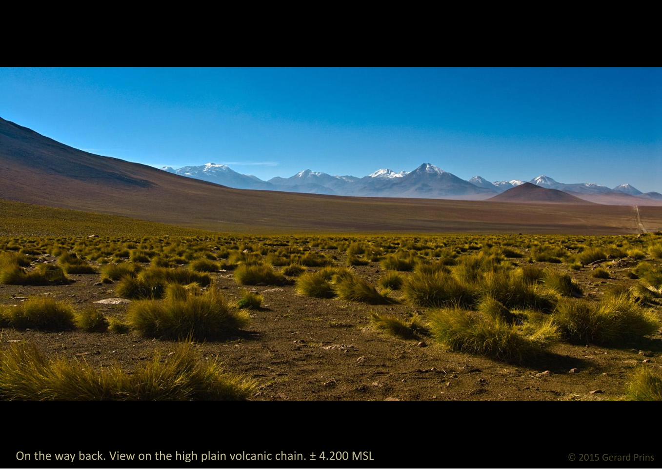
© 2015 Gerard Prins On the way back. View on the high plain volcanic chain. ± 4.200 MSL

© 2015 Gerard Prins Bofedal Machuca wetland and the cerros de Tatio

© 2015 Gerard Prins The cerros de Tocorpuri volcanic group, seen from bofedal Machuca

© 2015 Gerard Prins Fumaroles on the Putana volcano summit

A volcano skyline. FLTR: Vn. Putana, Cº Curiquinca, Cº Colorado, Cº Escalante, Ojos del Toro, Cº Saciel and Vn. Saire Cabur

Baños de Puritama hot water baths

Valle Arcoiris & Hierbas Buenas

© 2015 Gerard Prins Valle Arcoiris (Rainbow Valley) is supposedly a collapsed caldera

© 2015 Gerard Prins Igneous rock formations – Valle Arcoiris

© 2015 Gerard Prins Crested hill – Valle Arcoiris

© 2015 Gerard Prins Igneous rock formations – Valle Arcoiris

© 2015 Gerard Prins Igneous rock formations – Valle Arcoiris

© 2015 Gerard Prins

© 2015 Gerard Prins Igneous rock formations – Valle Arcoiris

© 2015 Gerard Prins Donkey grey on olivine green – Valle Arcoiris

© 2015 Gerard Prins Ancestral Art. Geoglyphs at Hierbas Buenas

© 2015 Gerard Prins Desert foxes, lamas and flamingoes. Geoglyphs at Hierbas Buenas
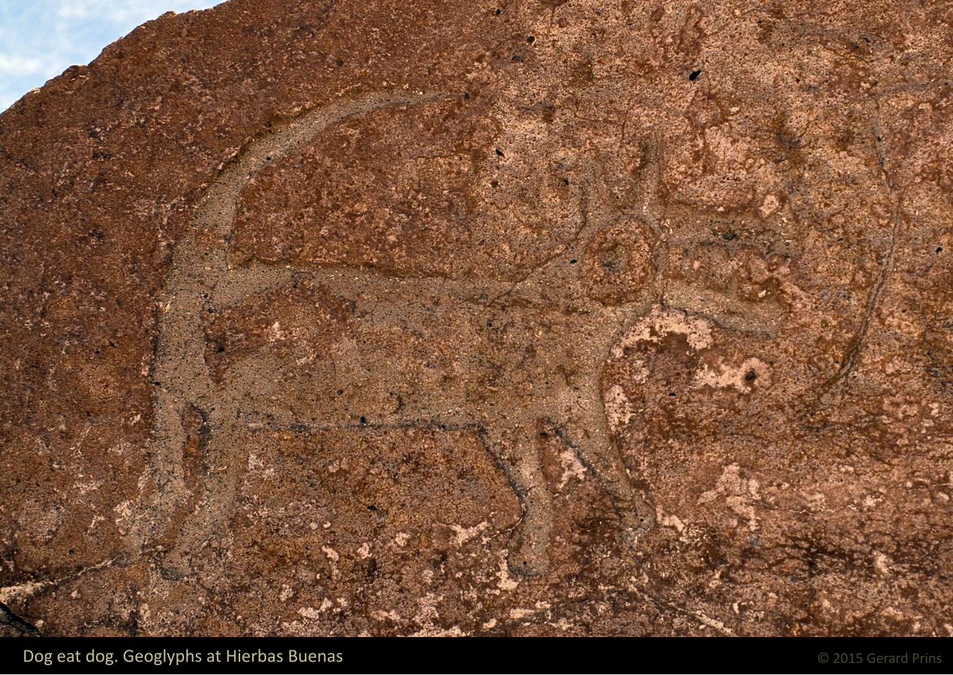
© 2015 Gerard Prins Dog eat dog. Geoglyphs at Hierbas Buenas

© 2015 Gerard Prins Cry wolf. Geoglyphs at Hierbas Buenas

The Atacama chain of fire Volcanoes, volcanoes and
more volcanoes

© 2015 Gerard Prins Cerro Paniri (5.946 m)

© 2015 Gerard Prins Cerro del León (5.760 m) and cerro Toconce (5.419 m)

© 2015 Gerard Prins The Linzor volcano and cerro el Volcán or Deslinde (5.606 m) seen from El Tatio geothermal field

© 2015 Gerard Prins Volcán Linzor (5.610 m)
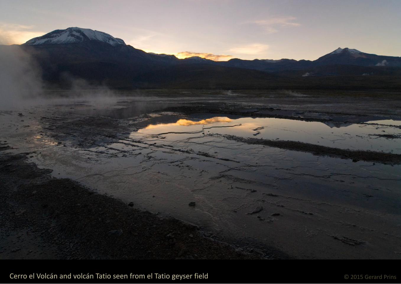
© 2015 Gerard Prins Cerro el Volcán and volcán Tatio seen from el Tatio geyser field

FLTR: volcán Tatio, cerros del Tatio, cerro la Torta (cake hill) and the cerros de Tocorpuri volcanic complex

© 2015 Gerard Prins Volcán Tatio (5.208 m, L) and cerros del Tatio

© 2015 Gerard Prins Cerro la Torta rhyolite lava dome (5.018 m)

© 2015 Gerard Prins Vicuñas grazing near Cerro la Torta

© 2015 Gerard Prins Cerros de Tocorpuri volcanic group (5.808 m)

© 2015 Gerard Prins Volcán Putana (5.890 m)

© 2015 Gerard Prins Fumaroles and solfataras at the Putana volcano summit crater

These so-called cerros (hills) are really volcanoes. FLTR: Cº Curiquinca, Cº Colorado (4.518 m.) and Cº El Apagado
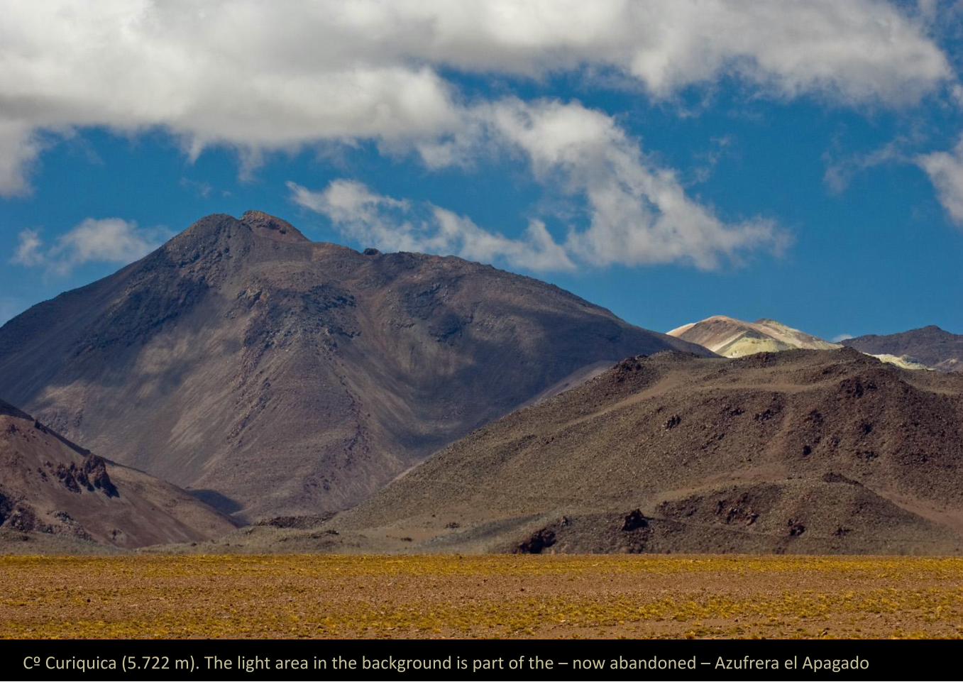
Cº Curiquica (5.722 m). The light area in the background is part of the – now abandoned – Azufrera el Apagado

© 2015 Gerard Prins Cerro Colorado seen from the north
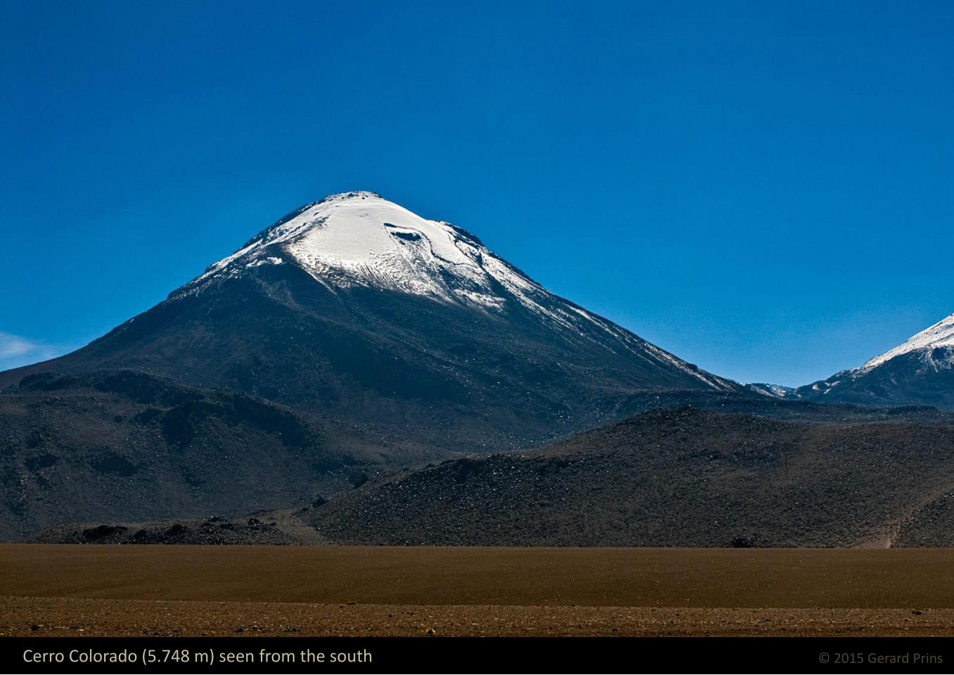
© 2015 Gerard Prins Cerro Colorado (5.748 m) seen from the south

Vn. Escalante and Cº el Apagado lie at the northern end of the Saire Cabur volcanic chain.

The southern end of the Saire Cabur volcanic chain. FLTR: Ojos del Toro (5.627 m), Cº Saciel and Vn. Saire Cabur (5.971 m)

© 2015 Gerard Prins Cerro Saciel and Saire Cabur

© 2015 Gerard Prins Volcán Saire Cabur (rain mountain) up close

© 2015 Gerard Prins Volcán Lican Cabur (people’s mountain, 5.961 m)

Ruins of ancient holy places and a small, mostly frozen crater lake can be found at the summit of Lican Cabur

© 2015 Gerard Prins The Lican Cabur and Juriques (5.704 m) volcanoes seen from Tulor village

© 2015 Gerard Prins The Guayaques volcanic complex lies east of Cerro Toco

Cerro Toco (5.604 m) is part of a larger complex including the Cajón ignimbrite, the top of which is visible on the left

© 2015 Gerard Prins Cerro Toco

Cº Negro cinder dome (front) and cerros de Macón.

© 2015 Gerard Prins Cerro Negro (5.025 m) and cerros de Macón (4.865 m) seen from Laguna Chaxa
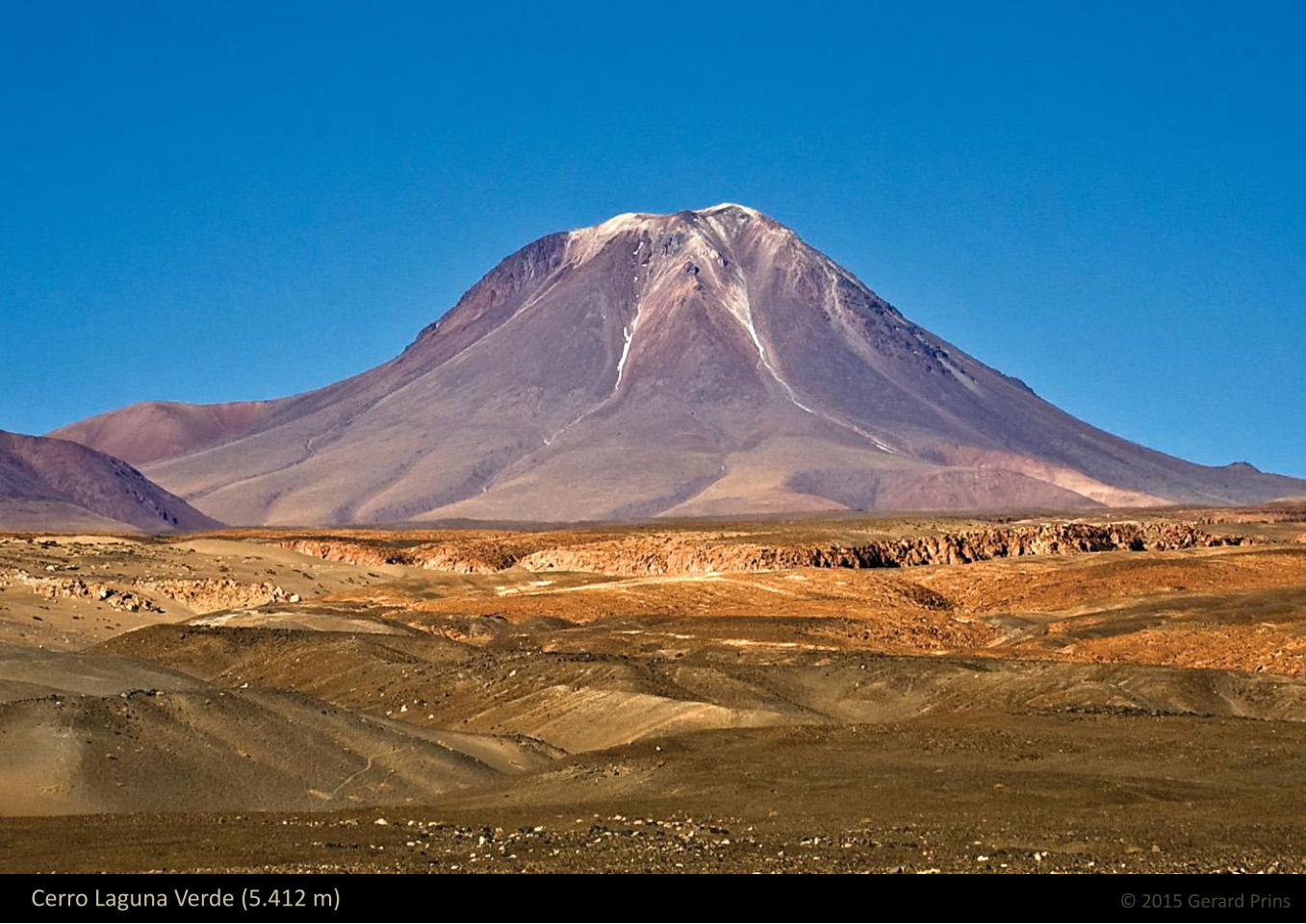
© 2015 Gerard Prins Cerro Laguna Verde (5.412 m)

FLTR: Vn. Aguas Calientes (or Simbad, 5.924 m), Vn. Lascar and Cº Corona (5.291 m), seen from Pukará de Quitor

Volcán Lascar (5.154 m) is one of Chile's most active volcanoes. Hidden behind it lies volcán Agua Calientes

© 2015 Gerard Prins FLTR: Vns. Acamarachi, Aguas Calientes and Lascar, Cº Corona, Cº Tumisa and Cº Lejía

© 2015 Gerard Prins Cerro Tumisa (5.658 m), seen from Laguna Chaxa

© 2015 Gerard Prins Cerro Leña (5.793 m)

© 2015 Gerard Prins Cerro Chiliques (5.778 m) and Laguna Miscanti

© 2015 Gerard Prins FLTR: Cº Chiliques, Laguna and Cº Miscanti, plus part of the Puntas Negras volcanic complex

© 2015 Gerard Prins Cerro Miscanti (5.622 m)

© 2015 Gerard Prins The Puntas Negras volcanic complex seen from Laguna Miscanti

© 2015 Gerard Prins The Cº Miñiques volcano (5.910 m), seen from the north-east

© 2015 Gerard Prins The Cº Miñiques volcano and its homonym lagoon

© 2015 Gerard Prins
Alive and well in the Desert

© 2015 Gerard Prins Andean gull – El Tatio

© 2015 Gerard Prins Andean gull – El Tatio

© 2015 Gerard Prins Female Vicuña with offspring. In the background, part of cerros de Tocorpuri

© 2015 Gerard Prins Chilean flamingoes – Bofedal Machuca

© 2015 Gerard Prins Andean crested duck – Bofedal Machuca

© 2015 Gerard Prins Puna teal couple – Bofedal Machuca

© 2015 Gerard Prins The Tamarind forest. These trees can find water virtually anywhere

© 2015 Gerard Prins Wild donkeys near the Tamarind forest

© 2015 Gerard Prins Alpacas – Tamarind forest

© 2015 Gerard Prins Andean Flamingoes – Laguna Chaxa
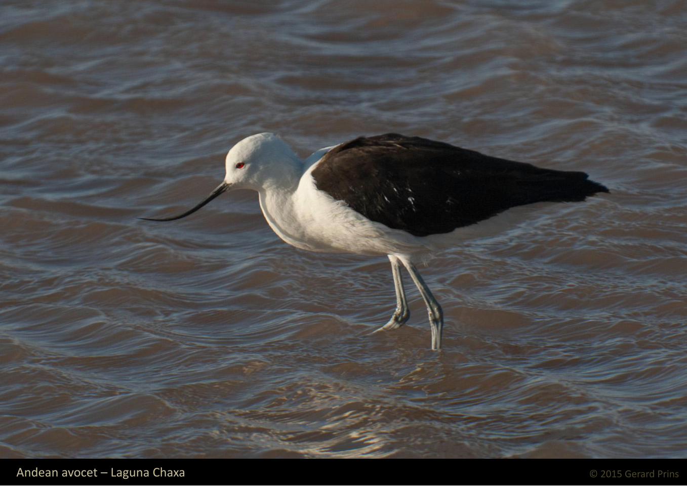
© 2015 Gerard Prins Andean avocet – Laguna Chaxa

© 2015 Gerard Prins Puna plover – Laguna Chaxa

© 2015 Gerard Prins Baird's sandpiper – Laguna Chaxa

© 2015 Gerard Prins Salt flat lizard – Laguna Chaxa

© 2015 Gerard Prins Vicuñas at Laguna Miscanti

© 2015 Gerard Prins

© 2015 Gerard Prins Toconao. Water makes all the difference, and now they sold it…

© 2015 Gerard Prins
On the way out

© 2015 Gerard Prins Cordillera Domeyco and the Patience plain

© 2015 Gerard Prins The Lican Cabur and Juriqes volcanoes seen across the llanura de la Paciencia plain

© 2015 Gerard Prins La Escondida open-pit copper mine

© 2015 Gerard Prins The Llullaillaco volcano and the Puntas Negras salt flat

Hasta Lluego