localization services for online common operational picture and situation awareness
TRANSCRIPT
LOCALIZATION SERVICES FOR ONLINE COMMON
OPERATIONAL PICTURE AND SITUATION AWARENESS .
GERMIYA K JOSE
III MCA
CHRIST UNIVERSITY
BANGALORE
1325918
1
IEEE
Communication , Networking &
Broadcasting
AGENDA
• Introduction
• Use case Scenario
• Common operational picture
• Situation awareness
• System architecture and overview
• Presentation
• Mobile robot
• Conclusion
2
INTRODUCTION
• Many operations, be they military, police, rescue, or other field
operations, require localization services and online situation
awareness to make them effective.
• The operation environment is typically partly unknown, which
require mapping and localization of objects (own field team
members, persons ).
• Online localization and situation awareness system is presented,
called Mobile Urban Situation Awareness System (MUSAS).
3
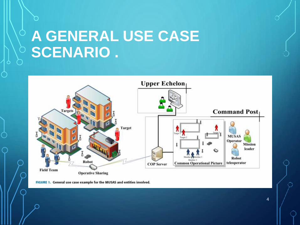
A GENERAL USE CASE SCENARIO .
4
• A field team performs some task based on the
instructions from the mission leader and upper echelon.
• Field team members have a hand-held device for
interfacing with the COP.
• The COP contains information of locations of objects and
targets of the task, typically humans, overlaid on a map of
the environment, to assist in situation awareness.
5
COMMON OPERATIONAL PICTURE
• Situation awareness consists of several levels. The first
level is perception or sensing.
• In the second level, comprehension is built from the
observed data, as meaning is assigned to each piece of
information and the relations between the components
are inferred.
6
• In the third level, the situation implications are projected
or predicted into the future .
• A common operational picture displays all gathered and
combined data from several sources in a single presentation to
the user .
• The main task of COP systems is thus to bring together
data from different subsystems and present that into an
overview for enabling situation awareness of a variety of
users and different teams .
7
SITUATION AWARENESS
• Most of the situation awareness literature concerns
military cases.
• Situation awareness of individual soldiers is an important
issue, and different armies around the world are
developing their future soldier concepts.
• The target is to create a soldier, who is not only a warrior,
but also an active information creator and consumer.8
SYSTEM ARCHITECTURE
• The target of the MUSAS is to provide a common
operational picture for the command post, to the
field team and share it with the upper echelon.
• This is accomplished by combining information
from several different subsystems into a single
view.
9
GENERAL SYSTEM OVERVIEW
• A common operational picture is the visual
representation of the up-to-date state of the operation.
• To achieve a COP, information from several online
localization systems, backdrop information, such as
geographical data and operative information, must be
integrated and distributed to all users .
• The COP server forms the COP model based on inputs
provided by all subsystems, and it shares the resultant
model with the upper echelon and with the field team
using the operative sharing subsystem.10
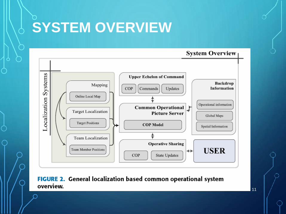
SYSTEM OVERVIEW
11
• The backdrop information subsystem provides basic information
related to the operation and the environment.
• Based on the localization systems, online situation and localization
information are formed, and updated the COP model to the current
state of the situation.
• The operative sharing subsystem allows transferring and displaying
the generated COP model to the field team, and conveying status
updates from the field team to the COP server.
• Similarly, the upper echelon subsystem provides means for
conveying the COP model to the command post, and delivers
executive commands to the COP server.
12
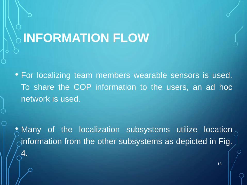
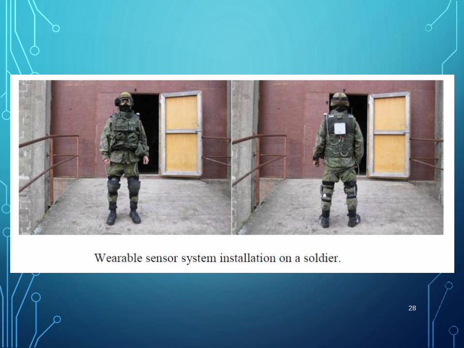
• For localizing team members wearable sensors is used.
To share the COP information to the users, an ad hoc
network is used.
• Many of the localization subsystems utilize location
information from the other subsystems as depicted in Fig.
4.13
INFORMATION FLOW
14

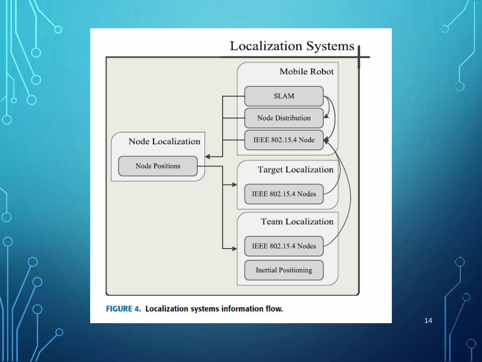
COMMON OPERATIONAL PICTURE SERVER
• The main task of the COP server is to produce the COP model,
which includes all information that is significant for supporting
situation awareness.
• The COP server encapsulates multiple functions, such as
hosting relevant backdrop information, geographical information
system, as well as publishing the formed COP. These entities
are presented in Fig. 5, which is a detail view of the COP server
block in Fig. 2.
• The COP server hosts services like command and control
application is running as a front end application for the COP
server, which provides a user interface for the command post
operator.
15
16
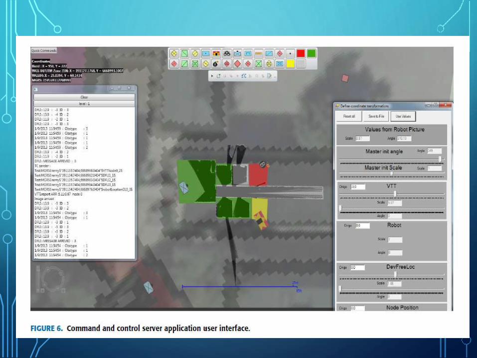
PRESENTATION
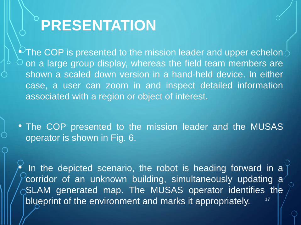
• The COP is presented to the mission leader and upper echelon
on a large group display, whereas the field team members are
shown a scaled down version in a hand-held device. In either
case, a user can zoom in and inspect detailed information
associated with a region or object of interest.
• The COP presented to the mission leader and the MUSAS
operator is shown in Fig. 6.
• In the depicted scenario, the robot is heading forward in a
corridor of an unknown building, simultaneously updating a
SLAM generated map. The MUSAS operator identifies the
blueprint of the environment and marks it appropriately. 17
18
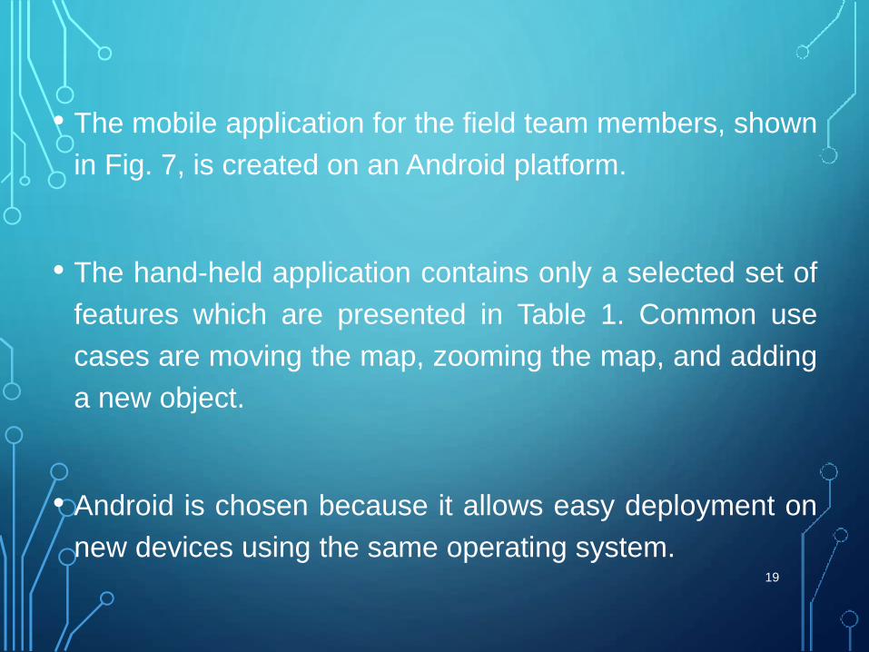
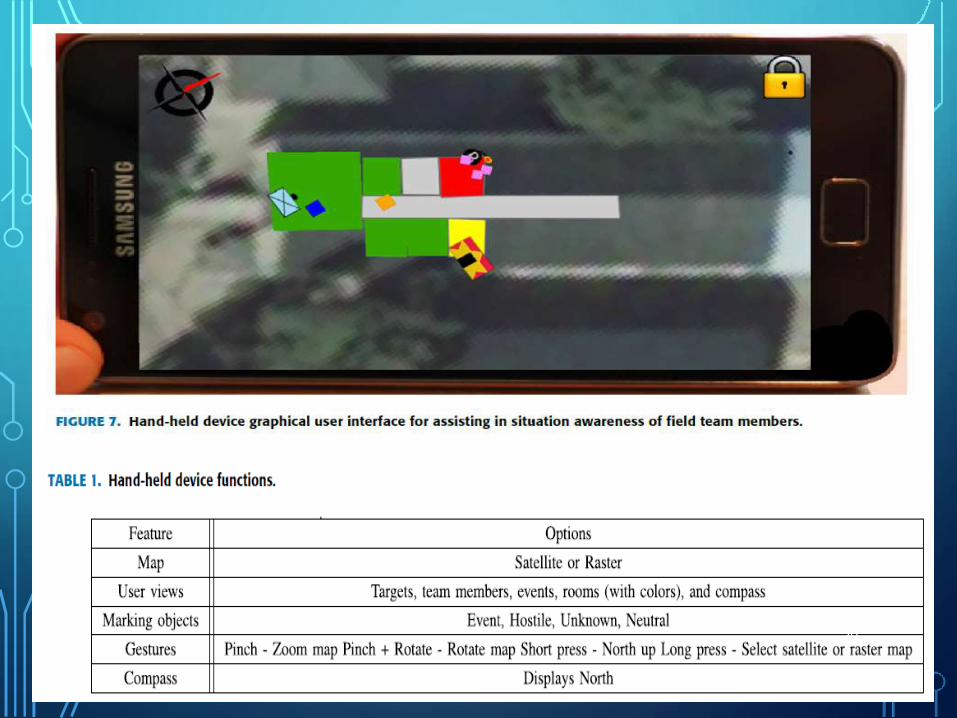
• The mobile application for the field team members, shown
in Fig. 7, is created on an Android platform.
• The hand-held application contains only a selected set of
features which are presented in Table 1. Common use
cases are moving the map, zooming the map, and adding
a new object.
• Android is chosen because it allows easy deployment on
new devices using the same operating system.19
20
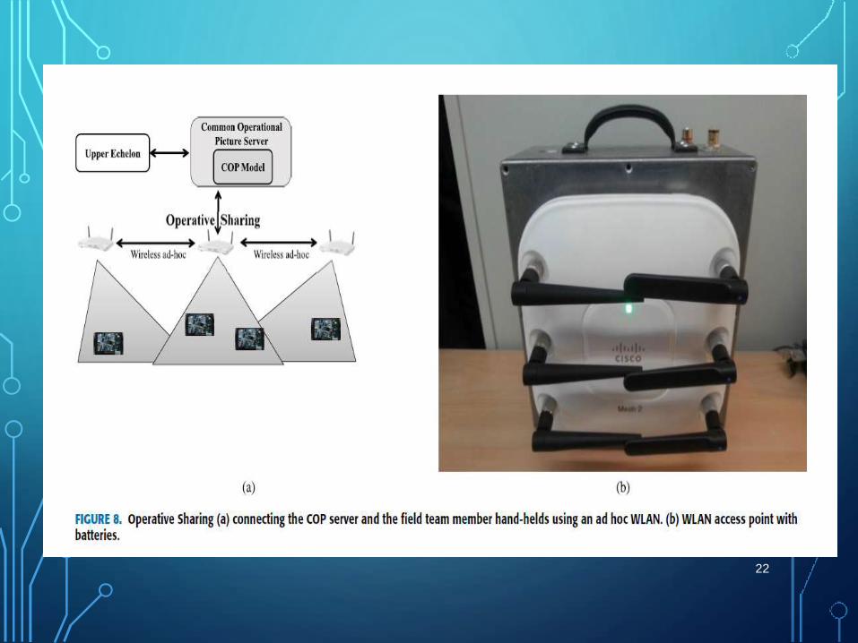
OPERATIVE SHARING• Sharing the COP information to hand-held of the field team members
is accomplished by using a mobile IEEE 802.11a (WLAN) based ad
hoc capable, battery powered, access point network.
• The network, depicted in Fig. 8(a) and Fig. 3, enables flexible
deployment and independence from external infrastructure. No
special configuration is needed for the network and it acts as a
normal WLAN network for the handheld devices.
• The access point, pictured in Fig. 8(b), can automatically connect and
join to the existing network access points in the field. When deploying
the system, it can be placed anywhere, because it is battery driven.21
22
ONLINE INFORMATION ACQUISITION USING A MOBILE ROBOT
• To operate in an unknown environment, reconnaissance to
collect data and map the area is necessary. For mapping
and reconnaissance purposes, the MUSAS uses a mobile
robot with SLAM capabilities.
• In this section, a short description of the mobile robot system
is presented.
• A mobile robot features many benefits in the use cases of
the MUSAS. Most importantly, it can be deployed to gather
information about an unknown situation without risking
human lives and the robot is in a central role in creating a
common frame of reference for the system. 23
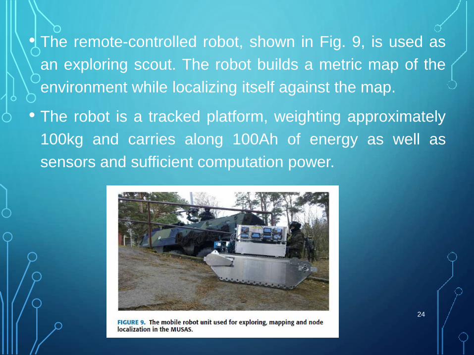
• The remote-controlled robot, shown in Fig. 9, is used as
an exploring scout. The robot builds a metric map of the
environment while localizing itself against the map.
• The robot is a tracked platform, weighting approximately
100kg and carries along 100Ah of energy as well as
sensors and sufficient computation power.
24
25
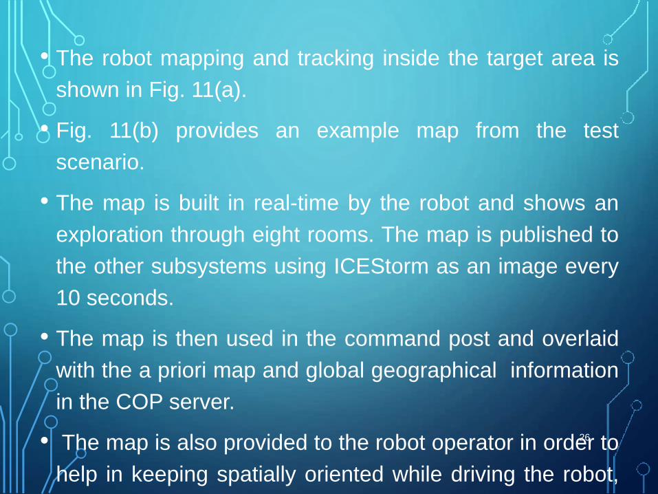
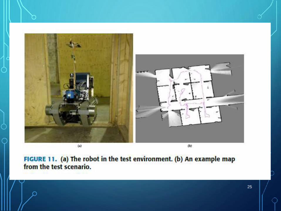
• The robot mapping and tracking inside the target area is
shown in Fig. 11(a).
• Fig. 11(b) provides an example map from the test
scenario.
• The map is built in real-time by the robot and shows an
exploration through eight rooms. The map is published to
the other subsystems using ICEStorm as an image every
10 seconds.
• The map is then used in the command post and overlaid
with the a priori map and global geographical information
in the COP server.
• The map is also provided to the robot operator in order to
help in keeping spatially oriented while driving the robot,
as shown in Fig. 10.
26
The robot is equipped with a communication subsystem,
which enables communication with the robot practically in
all environments, without the need for an existing
infrastructure.
• The robot is controlled by teleoperating from the
command post.
• The the image from the camera, the calculated position
and the constructed map of the area is sent to the
teleoperation station display shown in Fig. 10.
27
28
29
CONCLUSIONS
• Compared to other similar systems, the MUSAS focuses on
multiple localization services and localized information
presentation.
• The system can be deployed in search-and-rescue and
earthquake disaster situations to map the environment and
localize people. It has also applications in police hostage
situation, indoor fire-fighting scenarios and military operations.
• Future plans for development include also the implementation
of a 3D environment model for localization, as well as
improved views for the Android devices.30
REFERENCE
• IEEE journal “Localization Services for Online
Common Operational Picture and Situation
Awareness .“
• Date of publication October 25, 2013, date of
current version November 1, 2013.
31

THANK YOU
32