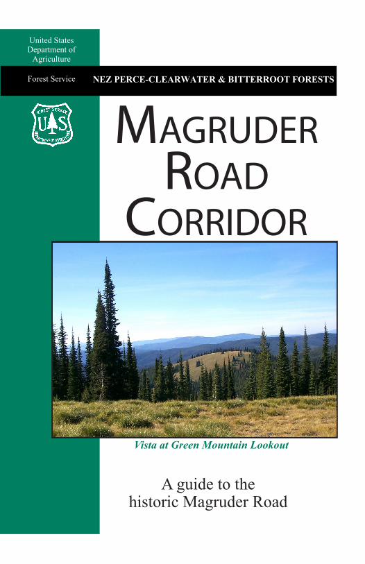
magruder road corridor
TRANSCRIPT
United StatesDepartment of
Agriculture
Forest Service NEZ PERCE-CLEARWATER & BITTERROOT FORESTS
Vista at Green Mountain Lookout
A guide to the historic Magruder Road
Magruder road
Corridor
IDAHO
MO
NTA
NA
Darby
Dixie
Elk City
468
Red RiverRanger Station
Sout
h For
kRed
Rive
r
FRANK CHURCH-RIVER OF NO RETURNWILDERNESS
c
468
222
West ForkRanger Station
SELWAY-BITTERROOTWILDERNESS
To Hamilton
To LostTrail Pass
14
93
95
473
To Shoup, ID
95
95
12
The MagruderRoad Corridor
Idaho
Montana
285To Grangeville
µµ
r
r
c c
c
µ
c
c
c
c
c
c
1
3
45
67
8 9
10
1112
6223
2468C
1314
15
16
1718
224
19
2021
22
Page 1
IDAHO
MO
NTA
NA
Darby
Dixie
Elk City
468
Red RiverRanger Station
Sout
h For
kRed
Rive
r
FRANK CHURCH-RIVER OF NO RETURNWILDERNESS
c
468
222
West ForkRanger Station
SELWAY-BITTERROOTWILDERNESS
To Hamilton
To LostTrail Pass
14
93
95
473
To Shoup, ID
95
95
12
The Magruder Road Corridor
Idaho
Montana
285To Grangeville
µµ
r
r
c c
c
µ
c
c
c
c
c
c
1
3
45
67
8 9
10
1112
6223
2468C
1314
15
16
1718
224
19
2021
22
Page 2
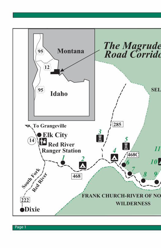
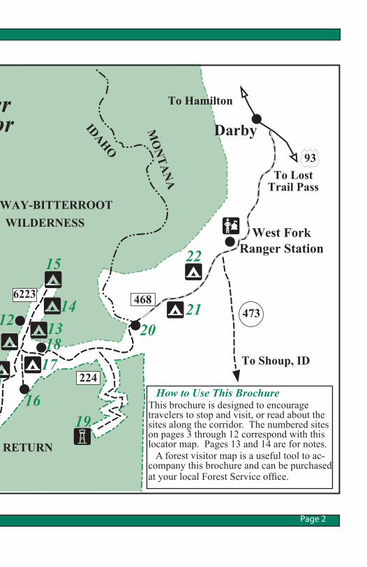
How to Use This Brochure This brochure is designed to encourage travelers to stop and visit, or read about the sites along the corridor. The numbered sites on pages 3 through 12 correspond with this locator map. Pages 13 and 14 are for notes. A forest visitor map is a useful tool to ac-company this brochure and can be purchased at your local Forest Service office.
Introduction The 101-mile primitive Magruder Corridor Road winds through a vast undeveloped area, offering solitude and pristine beauty as well as expansive mountain views. The landscape is much the same as when the Nez Perce Indians and other early travelers crossed the area. The road has changed little since its construction by the Civilian Conservation Corps (CCC) in the 1930s. It has also been known as the Southern Nez Perce Trail, Elk City to Darby Road, Montana Road and the Parker Trail.
Page 1
Together, they represent the largest unroaded block of land in the lower 48 states and are nearly twice as large as the combined states of Delaware and Rhode Island. To help safeguard the natural-ness of wilderness, practice “leave no trace” techniques to ensure the country you came to
Another safeguard is the use of weed-seed-free-feed products. Since 1996, all feed used on national forest lands in Idaho and Montana must be certified weed-seed-free. Remember the use of motor-ized or mechanized equipment or vehicles is not permitted in a designated wilderness.
Fire on the Landscape Throughout the Magruder Corridor you will see effects of natural fire, some from very large fires and some from small creeping fires. The larger fires occurred in 1996 in the upper Selway drainage, in 2000 most visibly through the Observation Point/Salmon Mountain area, in 2005 in the Horse Heaven area, in 2007 in the Magruder Mountain area and many more smaller fires. In 1973, the Bitterroot Na-tional Forest began testing the Wilderness Fire Policy when a lightning-caused fire was allowed to burn naturally in the White Cap drainage. Over 30 years of successful wilderness fire man-agement in the Selway-Bitterroot Wilderness followed, leading the way for wildland fire manage-ment. By carefully choosing which fires to suppress and which to actively manage for resource benefit, managers can return forests to a more natural,resilient and healthy condition.
Page 3
The corridor was created in 1980 when the Central Idaho Wilderness Act was passed, leav-ing a unique road that enables a traveler to drive between two wildernesses: the 1.2- million-acre Selway-Bitterroot Wil-derness to the north, and the 2.3-million-acre Frank Church-River of No Return Wilderness to the south.
Wilderness
enjoy will remain intact for fu-ture generations.
Fire experts and research find-ings agree that fire has played a cruicial role in shaping our wild-lands for thousands of years and is vital for the survival of many plants and animals.
Road Conditions This primitive one-lane road is rough, steep and winding, with few turnouts for passing oncom-ing vehicles. It is suitable for high clearance vehicles, pickup trucks, motorcycles and moun-tain bikes. The Forest Service does not recommend towing trailers because there are several hairpin turns along the route. Motor homes with low clearance should not travel the road. Snow begins to fall in early Oc-tober and persists into July; how-ever, snowstorms are possible at any time. Four-wheel-drive is recommended when the road is snow covered or muddy. Remember you are traveling through an extensive undevel-oped area with no services for 117 miles. Be sure you start with a vehicle in good operat-ing condition, a full tank of gas and a spare tire. At all times be alert for other traffic, washouts, fallen trees and other debris on the road. The road is becoming more popular for ATV travel during the summer months and can be very busy during the Idaho hunting season (mid-September through mid-November).
Travel Time Travel time varies, but it takes eight to ten hours to travel from Red River to Darby without rest stops. The average speed will be 12-15 miles per hour. A two-day trip is ideal with an overnight stay at one of the dispersed or primitive campsite locations. Take your time, absorb the sol-itude and enjoy the remoteness far from the hassles of crowded highways.
Camping When camping at primitive locations, please follow these guidelines:
• Choose a site 200 feet from trails and water.
• Use existing fire grates and fire rings when building camp-fires.
• When going to the bathroom, do as a cat: dig a hole and bury human waste. Maintain a distance of 200 feet from water and trails.
• Make sure your campfire is dead out when you leave.
• Pack out all trash, both yours and that of others.
• Leave no trace of your stay.
Drinking Water Water from springs, lakes, ponds and streams should not be consumed without proper treat-ment (boiling for more than five minutes or using a water filter) as giardia could be present. It is a good idea to carry extra water. Page 4
Elk City Ranger Station Visitors are encouraged to stop at the Elk City Ranger Sta-tion on the Red River Ranger District in Elk City and ask questions about maps, road con-ditions, weather and any other concerns. After office hours, visitors can obtain limited information at an interpretive sign at the old Red River Rang-er Station (now closed) that briefly describes the southern Nez Perce Trail. It is located just south of the ranger station along with an RV dump station. Magruder Road #468 begins on the left side of Road #222. The first eight miles are a steady climb. Oregon Butte Lookout and Buffalo Hump are visible to the west.
#1 - Mountain Meadows The headwaters of Meadow Creek lie directly north of the road. Visitors will find the Mountain Meadows campsite in this vicinity.
Red River Ranger Station to Granite Springs
At 14-Mile Tree, the trail-head begins for Trails 501 and 580, which lead into the Frank Church-River of No Return Wilderness. There is an infor-mation board, registration box and toilet. Stock facilities in-clude a feeding rack and hitch-ing rails.
The Southern Nez Perce Trail parallels a portion of the Magruder Corridor Road. The Nez Perce Indians found a practi-cal hunting/gathering route that followed the South Fork of the Clearwater River to the rolling country and lush meadows near Elk City and the upper Red River drainage. The trail went south of the extremely difficult terrain of the Selway-Bitterroot Wilder-ness, and also avoided the more rugged portion of the deep, nar-row Salmon River canyon.
#2 - Granite Springs Campground Granite Springs Campground lies on both sides of the road. It has drinking water, pit toilets, picnic tables, stock facilities and water for stock.
Page 5
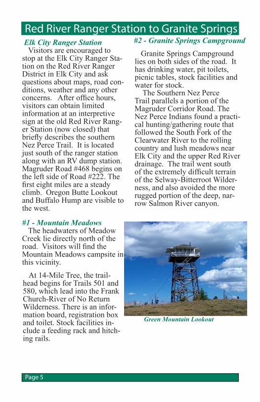
Green Mountain Lookout
#3 - Elk Mountain Road #285 The road continues to climb from the Granite Springs Campground. Elk Mountain Road #285 branches to the northeast, a driveable 4-miles to the Green Mountain Lookout, with views of the Red River drainage. From the #285 junc-tion, the Magruder Road winds steeply down into Bargamin Creek. Drive slowly and watch for brakes heating up.
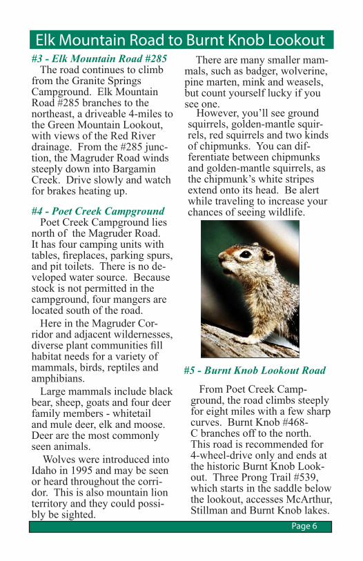
#4 - Poet Creek Campground Poet Creek Campground lies north of the Magruder Road. It has four camping units with tables, fireplaces, parking spurs, and pit toilets. There is no de-veloped water source. Because stock is not permitted in the campground, four mangers are located south of the road. Here in the Magruder Cor-ridor and adjacent wildernesses, diverse plant communities fill habitat needs for a variety of mammals, birds, reptiles and amphibians. Large mammals include black bear, sheep, goats and four deer family members - whitetail and mule deer, elk and moose. Deer are the most commonly seen animals. Wolves were introduced into Idaho in 1995 and may be seen or heard throughout the corri-dor. This is also mountain lion territory and they could possi-bly be sighted.
However, you’ll see ground squirrels, golden-mantle squir-rels, red squirrels and two kinds of chipmunks. You can dif-ferentiate between chipmunks and golden-mantle squirrels, as the chipmunk’s white stripes extend onto its head. Be alert while traveling to increase your chances of seeing wildlife.
Elk Mountain Road to Burnt Knob Lookout
From Poet Creek Camp-ground, the road climbs steeply for eight miles with a few sharp curves. Burnt Knob #468-C branches off to the north. This road is recommended for 4-wheel-drive only and ends at the historic Burnt Knob Look-out. Three Prong Trail #539, which starts in the saddle below the lookout, accesses McArthur, Stillman and Burnt Knob lakes.
Page 6
There are many smaller mam-mals, such as badger, wolverine, pine marten, mink and weasels, but count yourself lucky if you see one.
#5 - Burnt Knob Lookout Road
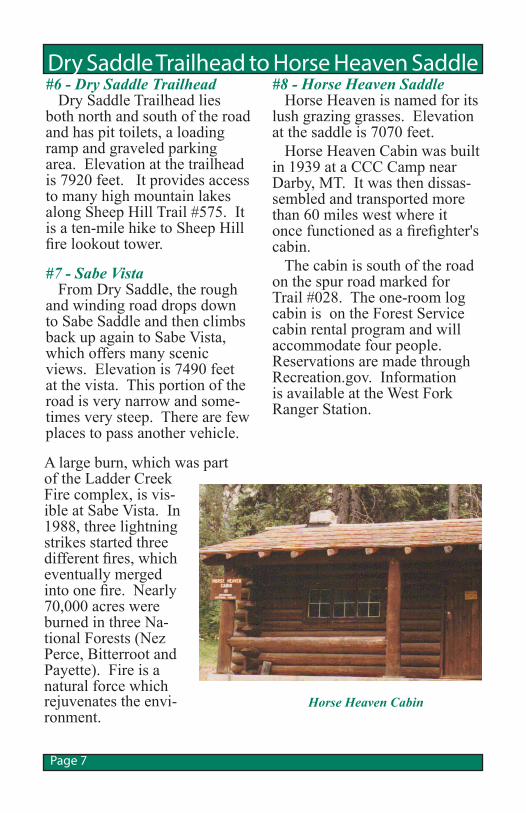
Dry Saddle Trailhead to Horse Heaven Saddle #8 - Horse Heaven Saddle Horse Heaven is named for its lush grazing grasses. Elevation at the saddle is 7070 feet. Horse Heaven Cabin was built in 1939 at a CCC Camp near Darby, MT. It was then dissas-sembled and transported more than 60 miles west where it once functioned as a firefighter's cabin. The cabin is south of the road on the spur road marked for Trail #028. The one-room log cabin is on the Forest Service cabin rental program and will accommodate four people. Reservations are made through Recreation.gov. Information is available at the West Fork Ranger Station.
Page 7
#6 - Dry Saddle Trailhead Dry Saddle Trailhead lies both north and south of the road and has pit toilets, a loading ramp and graveled parking area. Elevation at the trailhead is 7920 feet. It provides access to many high mountain lakes along Sheep Hill Trail #575. It is a ten-mile hike to Sheep Hill fire lookout tower.
#7 - Sabe Vista From Dry Saddle, the rough and winding road drops down to Sabe Saddle and then climbs back up again to Sabe Vista, which offers many scenic views. Elevation is 7490 feet at the vista. This portion of the road is very narrow and some-times very steep. There are few places to pass another vehicle.
A large burn, which was part of the Ladder Creek Fire complex, is vis-ible at Sabe Vista. In 1988, three lightning strikes started three different fires, which eventually merged into one fire. Nearly 70,000 acres were burned in three Na-tional Forests (Nez Perce, Bitterroot and Payette). Fire is a natural force which rejuvenates the envi-ronment.
Horse Heaven Cabin
"Ribbon forests" are visible on the slopes in this area. These are elongated narrow forest strips growing perpendicular to prevailing wind directions and alternating with narrow bands of moist-wet subalpine mead-ows called “snow glades.” Also, you can find good examples of “ghost” trees on the mountain. These whitebark pines were killed by a combi-nation of mountain pine beetle and blister rust attacks. They became bleached from the sum-mer sun, giving them a ghost-white appearance.
Salmon Mountain Area to Observation Point
Page 8
#9 - Salmon Mountain Area The Old Salmon Mountain Ranger Station site was estab-lished in 1911. Nearby is the Salmon Mountain base camp, a very popular trailhead during hunting season. It has stock facilities. A one-mile trail leads to the Salmon Mountain lookout tower which is staffed by vol-unteers during fire season. The elevation is 8944 feet. Moun-tain goats are often seen on the rocky crags and talus slopes of Salmon Mountain. This area is one of the few places in America where you can see the subalpine larch. The larch is the only deciduous coniferous tree, meaning that its needles turn yellow and drop off in the fall. Near the peak of the mountain
are “banner” or “flag” trees and stunted trees called “krumm-holz,” which are often hundreds of years old and only two feet high.
#10 - Observation Point Observation Point Camp-ground has nice camping spots and toilets. The elevation is 7620 feet and visitors can view the southern portion of the Bitterroot Mountain Range, especially El Capitan. The point also offers breathtaking vistas of subalpine/alpine wilderness.
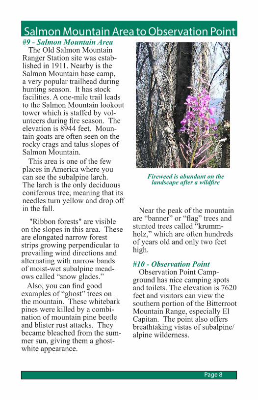
Fireweed is abundant on the landscape after a wildfire
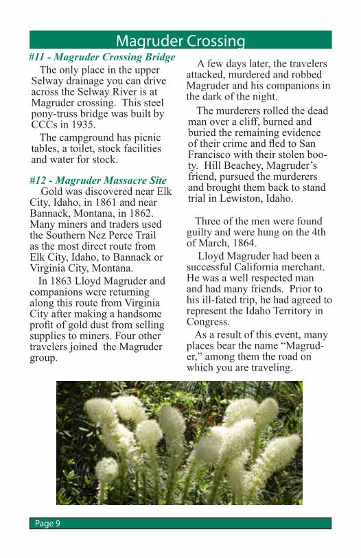
#12 - Magruder Massacre Site Gold was discovered near Elk City, Idaho, in 1861 and near Bannack, Montana, in 1862. Many miners and traders used the Southern Nez Perce Trail as the most direct route from Elk City, Idaho, to Bannack or Virginia City, Montana. In 1863 Lloyd Magruder and companions were returning along this route from Virginia City after making a handsome profit of gold dust from selling supplies to miners. Four other travelers joined the Magruder group.
The only place in the upper Selway drainage you can drive across the Selway River is at Magruder crossing. This steel pony-truss bridge was built by CCCs in 1935. The campground has picnic tables, a toilet, stock facilities and water for stock.
Magruder Crossing #11 - Magruder Crossing Bridge
Three of the men were found guilty and were hung on the 4th of March, 1864. Lloyd Magruder had been a successful California merchant. He was a well respected man and had many friends. Prior to his ill-fated trip, he had agreed to represent the Idaho Territory in Congress. As a result of this event, many places bear the name “Magrud-er,” among them the road on which you are traveling.
The murderers rolled the dead man over a cliff, burned and buried the remaining evidence of their crime and fled to San Francisco with their stolen boo-ty. Hill Beachey, Magruder’s friend, pursued the murderers and brought them back to stand trial in Lewiston, Idaho.
A few days later, the travelers attacked, murdered and robbed Magruder and his companions in the dark of the night.
Page 9
Paradise Road #6223 Travelers on this narrow one-lane road will enjoy a pleasant 12-mile drive along the Wild and Scenic Selway River. The river flows through a deep, beautiful canyon with some stands of western red cedar along its banks. There is a pack bridge for the trail to Spot Mountain Lookout. Three campgrounds are available along the road: Raven Creek, Indian Creek and Paradise. The road ends at Paradise Camp-ground.
Raven Creek is a primitive campgground with two sites and a pit toilet right along the road.
#14 - Indian Creek Hatchery The Indian Creek hatching channel was constructed in 1964 so that spring chinook salmon eggs could be planted in the Selway River drainage. Fish had been unable to reach the Selway since the construc-tion of the Lewiston Dam in 1929. A total of approximately two million eggs were planted each year form 1965 to 1981 and again in 1985. In the spring the emerging fry were trapped and distributed in the upper Selway by vehicle, stock and aircraft. This supplemented the natu-rally spawning chinook salmon
in the Selway River. Chinook salmon are found throughout the Selway River, however, they are usually seen during peak spawning activity in late August and early September.
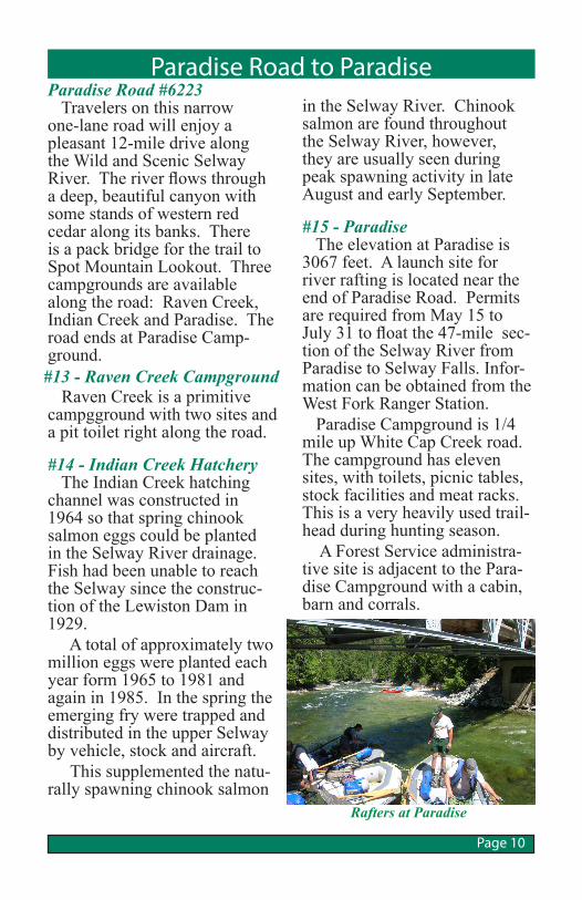
#15 - Paradise The elevation at Paradise is 3067 feet. A launch site for river rafting is located near the end of Paradise Road. Permits are required from May 15 to July 31 to float the 47-mile sec-tion of the Selway River from Paradise to Selway Falls. Infor-mation can be obtained from the West Fork Ranger Station. Paradise Campground is 1/4 mile up White Cap Creek road. The campground has eleven sites, with toilets, picnic tables, stock facilities and meat racks. This is a very heavily used trail-head during hunting season. A Forest Service administra-tive site is adjacent to the Para-dise Campground with a cabin, barn and corrals.
Page 10
Paradise Road to Paradise
#13 - Raven Creek Campground
Rafters at Paradise
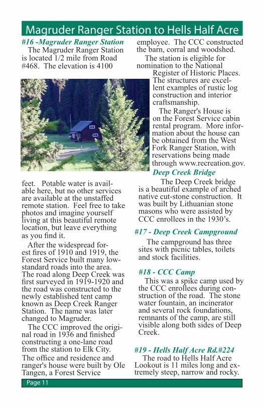
Magruder Ranger Station to Hells Half Acre#16 -Magruder Ranger Station The Magruder Ranger Station is located 1/2 mile from Road #468. The elevation is 4100
feet. Potable water is avail-able here, but no other services are available at the unstaffed remote station. Feel free to take photos and imagine yourself living at this beautiful remote location, but leave everything as you find it. After the widespread for-est fires of 1910 and 1919, the Forest Service built many low-standard roads into the area. The road along Deep Creek was first surveyed in 1919-1920 and the road was constructed to the newly established tent camp known as Deep Creek Ranger Station. The name was later changed to Magruder. The CCC improved the origi-nal road in 1936 and finished constructing a one-lane road from the station to Elk City.The office and residence and ranger's house were built by Ole Tangen, a Forest Service
Page 11
employee. The CCC constructed the barn, corral and woodshed. The station is eligible for nomination to the National
Register of Historic Places. The structures are excel-lent examples of rustic log construction and interior craftsmanship. The Ranger's House is on the Forest Service cabin rental program. More infor-mation about the house can be obtained from the West Fork Ranger Station, with reservations being made through www.recreation.gov.Deep Creek Bridge The Deep Creek bridge
is a beautiful example of arched native cut-stone construction. It was built by Lithuanian stone masons who were assisted by CCC enrollees in the 1930’s.
The campground has three sites with picnic tables, toilets and stock facilities.
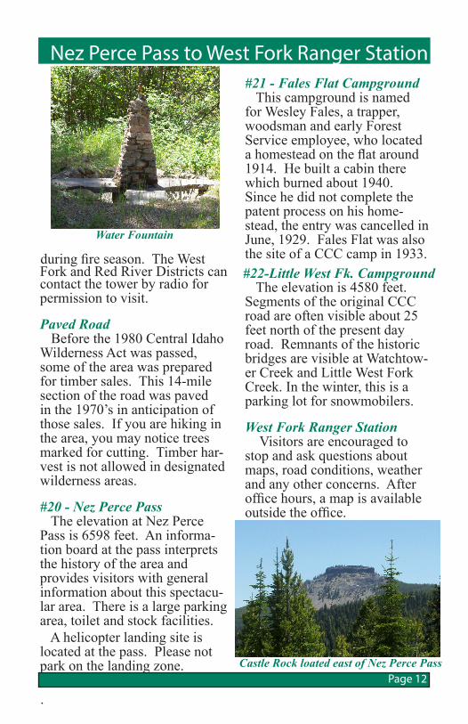
#18 - CCC Camp This was a spike camp used by the CCC enrollees during con-struction of the road. The stone water fountain, an incinerator and several rock foundations, remnants of the camp, are still visible along both sides of Deep Creek.
#17 - Deep Creek Campground
#19 - Hells Half Acre Rd.#224 The road to Hells Half Acre Lookout is 11 miles long and ex-tremely steep, narrow and rocky.
Magruder Ranger Station to Hells Half Acre
#21 - Fales Flat Campground This campground is named for Wesley Fales, a trapper, woodsman and early Forest Service employee, who located a homestead on the flat around 1914. He built a cabin there which burned about 1940. Since he did not complete the patent process on his home-stead, the entry was cancelled in June, 1929. Fales Flat was also the site of a CCC camp in 1933. The elevation is 4580 feet. Segments of the original CCC road are often visible about 25 feet north of the present day road. Remnants of the historic bridges are visible at Watchtow-er Creek and Little West Fork Creek. In the winter, this is a parking lot for snowmobilers.
West Fork Ranger Station Visitors are encouraged to stop and ask questions about maps, road conditions, weather and any other concerns. After office hours, a map is available outside the office.
Nez Perce Pass to West Fork Ranger Station
during fire season. The West Fork and Red River Districts can contact the tower by radio for permission to visit.
Paved Road Before the 1980 Central Idaho Wilderness Act was passed, some of the area was prepared for timber sales. This 14-mile section of the road was paved in the 1970’s in anticipation of those sales. If you are hiking in the area, you may notice trees marked for cutting. Timber har-vest is not allowed in designated wilderness areas.
#20 - Nez Perce Pass The elevation at Nez Perce Pass is 6598 feet. An informa-tion board at the pass interprets the history of the area and provides visitors with general information about this spectacu-lar area. There is a large parking area, toilet and stock facilities. A helicopter landing site is located at the pass. Please not park on the landing zone.
.
#22-Little West Fk. Campground
Water Fountain
Castle Rock loated east of Nez Perce PassPage 12

Travel Notes
Page 13
Travel Notes
Page 14
For More Information
R1-10-03
Nez Perce-Clearwater National Forests903 3rd StreetKamiah, ID 83536(208) 935-2513Website: www.fs.usda.gov/nezperceclearwater
Red River Ranger District Elk City Ranger Station 300 American River Road Elk City, ID 83525(208) 842-2245
Bitterroot National Forest1801 North 1st StreetHamilton, MT 59840(406) 363-7100 Website: www.fs.usda.gov/bitterroot
West Fork Ranger District 6735 West Fork Road Darby, MT 59829
USDA is an equal opportu-nity provider and em-ployer. To file a complaint of discrimination, write: USDA, Office of the As-sistant Secretary for Civil Rights, Office of Adjudica-tion, 1400 Independence Ave., SW, Washington, DC 20250-9410 or call (866) 632-9992 (Toll-free Customer Service), (800) 877-8339 (Local or Federal relay), (866) 377-8642 (Re-lay voice users).