management of ground water in africa including
TRANSCRIPT
HAL Id: hal-02329787https://hal.archives-ouvertes.fr/hal-02329787
Submitted on 23 Oct 2019
HAL is a multi-disciplinary open accessarchive for the deposit and dissemination of sci-entific research documents, whether they are pub-lished or not. The documents may come fromteaching and research institutions in France orabroad, or from public or private research centers.
L’archive ouverte pluridisciplinaire HAL, estdestinée au dépôt et à la diffusion de documentsscientifiques de niveau recherche, publiés ou non,émanant des établissements d’enseignement et derecherche français ou étrangers, des laboratoirespublics ou privés.
Management of Ground Water in Africa IncludingTransboundary Aquifers: Implications for Food Security,
Livelihood and Climate Change AdaptationYvan Altchenko, Seleshi B. Awulachew, Benjamin Brida, Hama Arba Diallo,
Dam Mogbante, Paul Pavelic, Callist Tindimugaya, Karen G. Villholth
To cite this version:Yvan Altchenko, Seleshi B. Awulachew, Benjamin Brida, Hama Arba Diallo, Dam Mogbante, et al..Management of Ground Water in Africa Including Transboundary Aquifers: Implications for FoodSecurity, Livelihood and Climate Change Adaptation. [Technical Report] Working Paper 6, UnitedNations Economic Commission for Africa - African Climate Policy Centre. 2011. �hal-02329787�
Economic Commission for Africa
Economic Commission for Africa
Postal AddressP O Box 3001Addis Ababa
Ethiopia
LocationKirkos Sub-cityECA Compound
Addis AbabaEthiopia
Telephone+251-11 5 172000
Fax+251-11 5443164
Websitehttp://www.uneca.org/acpc/
United Nations Economic Commission for AfricaAfrican Climate Policy Centre
Printed by the UNECA Documents and Publishing Unit
Management of Ground Water in Africa Including Transboundary Aquifers:
Implications for Food Security, Livelihood and Climate
Change Adaptation
Working Paper 6

United Nations Economic Commission for Africa African Climate Policy Centre
Working Paper 6
MANAGEMENT OF GROUNDWATER IN AFRICA INCLUDING TRANSBOUNDARY AQUIFERS:
IMPLICATIONS FOR MEETING MDGS, LIVELIHOOD GOALS AND CLIMATE CHANGE ADAPTATION
November 2011
ii
Acknowledgment
This paper is the result of African Climate Policy Center (ACPC) of United Nations Economic Commission for Africa (UNECA) under the Climate for Development in Africa (ClimDev Africa) Programme. The paper is produced with guidance, coordination and contribution of ACPC and contributing authors from various institutions. Contributions to this paper are made by (alphabetical) Yvan Altchenko, International Water Management Institute; Seleshi B. Awulachew, UNECA-ACPC; A. Benjamin Brida , UNECA-ACPC, Hama Arba Diallo, Former Executive Secretary of United Nations Convention to Combat Desertification, Dam Mogbante, Global Water Partnership (West Africa); Paul Pavelic, International Water Management Institute; Callist Tindimugaya, Uganda Water Resources Planning and Regulation, Karen Villholth , Geological Survey of Denmark and Greenland.
This working paper is prepared as an input to foster dialogue and discussion in African climate change debate. The findings, interpretations and conclusions presented in this working paper are the sole responsibility of the contributing authors and do not in any way reflect the official position of ECA or the management team. As this is also a working paper, the ECA does not guarantee the accuracy of the information contained in this publication and will not be held responsible for any consequences arising from their use. Copyright © 2011, by UNECA. UNECA encourages the use of its material provided that the organization is acknowledged and kept informed in all such instances. Please direct inquiries and comments to: [email protected]
A free copy of this publication can be downloaded at http://www.uneca.org/acpc/publications

iii
TABLE OF CONTENTS
TABLE OF CONTENTS ....................................................................................................................... iii
LIST OF FIGURES ............................................................................................................................... iv
LIST OF TABLES ................................................................................................................................. iv
ACRONYMS .......................................................................................................................................... v
1. SETTING THE SCENE ON GROUNDWATER RESOURCES IN AFRICA .................................. 1
2. MAJOR AQUIFER SYSTEMS AND THEIR DEVELOPMENT POTENTIAL .............................. 3
2.1 Aquifer Systems ............................................................................................................................ 3
2.2 Resource availability ..................................................................................................................... 4
2.3 Resource assessments: mapping groundwater potential and sustainability .................................. 4
3. TRANSBOUNDARY AQUIFERS – DISTRIBUTION AND CURRENT KNOWLEDGE ............. 6
4. CLIMATE CHANGE IMPACTS ON GROUNDWATER ................................................................ 8
5. POLICY IMPLICATIONS RELATED TO GROUNDWATER ....................................................... 9
5.1 West Africa ................................................................................................................................... 9
5.2 East Africa .................................................................................................................................. 11
5.3 Southern Africa ........................................................................................................................... 12
6. FUTURE RESEARCH NEEDS AND OPPORTUNITIES .............................................................. 14
REFERENCES ..................................................................................................................................... 14

iv
LIST OF FIGURES Figure 1: Identified transboundary aquifers of Africa ............................................................................ 6 Figure 2: Projected changes in mean annual groundwater flow in the River Mitano Basin, relative to
the 1961-1990 baseline period, under a 2°C rise in global mean air temperature for the priority subset of CMIP-3 GCMs (adapted from Taylor and Tindimugaya, in Press). ........... 9
Figure 3: River basins within SADC .................................................................................................... 13
LIST OF TABLES Table 1: Examples of studies assessing groundwater potential .............................................................. 5

v
ACRONYMS
AGWC African Ground Water Commission AMCOW African Ministers’ Council on Water BRG Bundesanstalt für Geowissenschaften und Rohstoffe CILSS Comité Inter-Etate pour la Lutte contre la Sécheresse au Sahel (French:
Permanent Inter-State Committee for Drought Control in the Sahel) CMIP 3 Coupled Model Intercomparison Project 3 ECOWAP ECOWAS Common Agricultural Policy ECOWAS Economic Community of West African States FAO Food and Agriculture Organisation GCM Global Climate Model GEF Global Environmental Facilities GW Ground Water GWP/WA Global Water Partnership/West Africa IAH International Association of Hydrogeologists IHP International Hydrological Program ISARM International Shared Aquifer Resources Management Project IGRAC International Groundwater Resources Assessment Centre (The Netherlands) INWEB International Network of Water-Environment Centre for the Balkans IWRM Integrated Water Resources Management MDG Millennium Development Goal OMVS Organisation pour la Mise en Valeur du Fleuve Senegal (Senegal River
Development Organization) RBO River Basin Organizations RWP Regional Water Policy SADC Southern African Development Community SSA Sub Saharan Africa SSO Sahara and Sahel Observatory NWSA North-Western Sahara Aquifer UNECA United Nations Economic Commission for Africa UNECE United Nations Economic Commission for Europe UNEP United Nations Environmental Program UNESCO United Nations Educational, Scientific and Cultural Organization WSSD World Summit on Sustainable Development WHO World Health Oganisation WHYMAP World-wide Hydrogeological Mapping and Assessment Programme

1
ABSTRACT:
Groundwater is one of the most important sources for drinking water, livestock water, and irrigation in Africa. It is of vital importance in meeting the Millennium Development Goals (MDGs) target of accessing clean water, as most of rural Africa and a considerable part of urban Africa are supplied by groundwater. Groundwater also has a major role to play in improving food security through expansion of irrigation supplied by shallow and deep wells. As such, groundwater has high relevance to the development and wellbeing of Africa, if adequately assessed and sustainably exploited. However, impacts of rapid development and climate change on water resources, including groundwater, are expected to be very severe unless major actions are taken to address the limited human and institutional capacity and hydrogeological knowledge base needed to devise sustainable adaptive water management strategies. Whilst the potential for groundwater resources development and the extent of their vulnerability due to climate change in the African context continue to be reported in the literature, a quantitative understanding of these issues remains poor. Although groundwater systems respond to human and climatic changes slowly (relative to surface water systems), climate change still could affect groundwater significantly through changes in groundwater recharge as well as groundwater storage and utilization. These changes result from changes in temperature and precipitation or from change in land use/land cover, and increased demand. There is therefore a need for ensuring sustainability and proper management of groundwater resources through instituting proper aquifer management practices such as the establishment of groundwater monitoring systems, better understanding of the role of groundwater storage and groundwater discharges in sustaining aquatic ecosystems, understanding the interactions between various aquifers (including transboundary aquifers) and assessing the impact of increased pumping from various aquifer systems on the sustainability of groundwater abstraction. This paper provides an overview of the regional hydrogeological framework, the current state of knowledge of aquifer systems, their development potential and climate change impacts on groundwater, research gaps, and policy implications for meeting the MDGs of accessing clean water and livelihood goals in Africa.
KEYWORDS: Groundwater, Africa, Climate change and variability, Monitoring, Vulnerability, Adaptation, Water storage

2
1. SETTING THE SCENE ON GROUNDWATER RESOURCES IN AFRICA Groundwater is an important source of water on the African continent for meeting various demands. It is particularly important for arid and semi arid countries in the Northern and Southern parts of Africa since it is often the only source of water (UNEP, 2010). Groundwater resources represent 15% of the continent’s renewable water resources (UNECA et al., 2000), yet its hidden presence under the ground has left it largely under-valued and under-utilized, with the exception of the provision of potable supplies. Whilst the availability of rainwater and freshwater from rivers and lakes will become more erratic and thus less reliable as a result of climate change impacts, groundwater on the other hand, will respond to climate change effects, such as pronounced variability, higher temperature and evaporation, in a much more tempered fashion.
Since ancient times, groundwater has been central to human development, with the location of settlements remote from major perennial water bodies being determined almost entirely by the availability of adequate groundwater supplies accessed through hand-dug wells and springs. Groundwater has become the preferred source of supply for the thousands of communities dispersed across small urban towns and rural areas. The characteristics that often make groundwater attractive include its ubiquitous and perennial presence, high storage capacity, good water quality, resilience to inter-annual climate variability and low cost relative to alternative sources (Adelana and MacDonald, 2008; Calow et al., 2010). It is estimated that more than 100 million people, including rural people throughout sub-Saharan Africa utilize groundwater for domestic supplies and livestock rearing (Adelana and MacDonald, 2008). Groundwater is the source of drinking water for 75% of the continent’s population (UNECA et al., 2000). This proportion is higher in some arid and semi-arid countries and in the case of Libya is as high as 95% (Margat, 2010). At the continent-scale, in terms of quantity, groundwater is mainly used for irrigation (75%) while domestic water use represents around 20%, although a high heterogeneity exists, with groundwater use in rural areas being very important for domestic uses. Most of the villages and small towns having access to groundwater supplies, and even many of the largest cities (e.g. Addis Ababa, Abidjan, Dakar, Nairobi, Dar es Salaam, Windhoek), meet a large proportion of the urban demand from well-fields (Masiyandima and Giordano, 2007). Naturally, it has been the drier northern, western, eastern and southeastern parts of Africa with annual precipitation of less than 1000 mm/yr and diminished surface water storage opportunities, where groundwater development has most flourished (Foster et al., 2006).
The available information suggests that groundwater availability in Africa on a per-capita basis is not low, and probably higher than many other regions of the world, including some European countries (Giordano, 2006). Whilst such broad generalizations mask the substantial variation that indeed occurs across the region, nevertheless, such statistics clearly show that a vast untapped potential remains. It is the myriad of technical, socio-economic and institutional factors that have historically constrained the extent of groundwater use (MacDonald and Davies 2000; Masiyandima and Giordano, 2007; Shah et al., 2007).
There are three major drivers for heightened modern-day interest toward groundwater development in Africa. The first, and arguably the most pressing over the short term, relates to the UN Millennium Development Goals (MDGs) for provision of improved access to safe and clean water supplies to all affected SSA communities. In that sense, the delivery of groundwater through well-placed and appropriately constructed and maintained borewells has a vital role to play for the reasons mentioned above. Secondly, adequate access to

3
groundwater for livestock watering and small-scale and commercial irrigation represents an important measure of poverty and livelihoods potential (Carter and Bevan, 2008). To that end, groundwater is still a largely untapped resource for agricultural development in SSA (Giordano, 2006; Masiyandima and Giordano, 2007). Thirdly, climate change affects the precipitation and temperature dynamics on a global scale, and hence will impact upon the supply and demand for water of local communities. Enhancing water storage capacity, both above and below ground, is widely accepted as a coping strategy against hydrological shocks such as floods and droughts (Hetzel et al., 2008; Taylor, 2009; McCartney and Smakhtin, 2010).
A significant impact on water resources from climate change is anticipated, with an increasing number of African countries likely to face greater water stress by 2025. While groundwater offers essential livelihood mechanisms as noted above, groundwater resources in Africa represent an essential part of climate change adaptation strategies. Groundwater resources in Africa are broadly distributed, of generally good quality, and resilient to climate variability including extreme climate events. They constitute the most important buffer and reserve of water during surplus periods as well as a source of water for streams and/or direct withdrawals in times of shortage and thus are expected to play an essential role for climate change adaptation.
However, there are major gaps in the knowledge of groundwater resources in Africa with significant uncertainty regarding the impact of climate change on groundwater resources and groundwater-dependent ecosystems in Africa. The aim of this paper is to provide an overview of the current state of knowledge on groundwater in Africa so as to identify and highlight the most critical gaps that currently exist towards the evolution of sustainable groundwater development and attainment of MDGs for provision of drinking water, increased food security and adaptation to climate change impacts. By so doing, it is hoped that this will help to solicit appropriate responses from governments and the donor community to support the implementation of on-the-ground activities and action research needed to improve access and sustainable use of groundwater resources.
2. MAJOR AQUIFER SYSTEMS AND THEIR DEVELOPMENT POTENTIAL
2.1 Aquifer Systems
At the broadest scale, the regional hydrogeological framework for Africa is now reasonably well known thanks to systematic efforts by various workers over past decades. Comprehensive reviews of the regional hydrogeology provinces can be found in various studies (e.g. UNESCO, 1991; MacDonald and Davies, 2000).
Across the African continent (including island countries) there are four major aquifer types: the crystalline basement extending over about 40% of the landmass; consolidated sedimentary rocks covering about 35%; unconsolidated alluvial sediments covering 20%; and volcanic rocks over just 5% (MacDonald et al., 2005).
The crystalline basement rock features the most complex array of weathered and fractured crystalline igneous and metamorphic rocks situated over much of West Africa, Eastern Africa in Uganda and Tanzania, and Southern Africa in Malawi, much of Zimbabwe, northern Mozambique and northern South Africa. Basement complex aquifers have little or no primary

4
permeability and useful aquifers arise where extensive weathering or fractured/fissured zones are present.
Consolidated sedimentary rocks can store considerable volumes but productivity is highly dependent on the geology. They range from highly productive sandstones and limestones through to low permeability mudstones and shale. This aquifer type is distributed across most of South Africa, Botswana, southern Angola, eastern Namibia, eastern Democratic Republic of Congo, north-west Zimbabwe, eastern Ethiopia, Somalia and across much of the North Africa sub-region. Unconsolidated sediments are probably the more productive aquifers in Africa and occur in southern Mozambique, central Democratic Republic of Congo, and across much of the Sahel. Unconsolidated sediments are also found along major and minor rivers and in coastal areas, but are often fine textured and therefore of low permeability. Groundwater is associated with sediments, which vary from coarse gravel and sand to silt and clay. They are easy to drill and hand drilling is possible where aquifers are shallow. Volcanic rocks can be important aquifer resources but complexity of the geology leads to high variability in groundwater potential which is related to the presence of fractures. These aquifers are mainly located in the Ethiopian and Kenyan highlands and Southern Africa.
2.2 Resource availability
The distribution of renewable groundwater is highly skewed. Indeed, more than half of Africa’s renewable groundwater is contained in just four countries: The Democratic Republic of Congo, The Republic of Congo, Cameroon and Nigeria (Giordano, 2005). Vast amounts of groundwater are stored in non-renewable reserves in sedimentary formations such as the Nubian Sandstone mainly in the Northern sub-region. While groundwater resources represent 15% of the continent’s renewable water resources (UNECA et al., 2000), when the total amount of water held in storage is taken into account, including fossil water, groundwater is in fact the most abundant water source on the continent (UNEP, 2010).
Whilst the resource availability is relatively well known at the regional and sub-regional scales, at smaller scales where development is invariably focused, knowledge of the resource-base is far from being adequately understood, particularly in SSA. Characterizing the availability and distribution of groundwater resources is a vital and important first step for identifying the most prospective locations for groundwater development and for gauging the likely development potential. Lack of adequate information makes borehole drilling a risky business. Across many regions, the complex nature of the hardrock or fissured aquifers that may be very heterogeneous and discontinuous in extent leads to high rates of failure in drilling new wells (MacDonald et al., 2008).
2.3 Resource assessments: mapping groundwater potential and sustainability
There is wide acceptance that the hydrogeological conditions combined with climate (particularly rainfall, past and present) are the major controllers of groundwater availability and sustainability. Lack of data on the physical extent, accessibility and development potential of aquifer systems combined with the vastness of the region is a severe constraint to development. Hydrogeological maps provide an invaluable tool to better understand the resource and to provide guidance on its management as well as on where to focus efforts in a first step that would include more detailed local-scale assessments.

5
Table 1 offers a summary of some studies that have been carried out at the continent, country, sub-country and basin scales. Most of the maps and tools developed use either or both satellite-based remote sensing methods, geological maps, drilled hole logs and climate data. In some cases attempts to validate the maps have taken place with reasonable results. The extent of coverage of such maps is limited to just a handful of countries. Works of a similar kind are urgently needed in other regions to help lessen the risks and generally support decision making about tapping groundwater.
Table 1: Examples of studies assessing groundwater potential
Notes * GW: Ground Water, BY: Bassin Yield
Study Region Scale Output
Howard et al. (1992) Uganda country GW* potential
Wright (1992) Africa continent GW potential
Chilton and Foster (1995) Africa continent GW potential
Biemi (1996) Ivory Coast country and sub-continent
Water crises and constraints, GW availability,
Taylor and Howard (2000) Uganda country GW potential, flow types; GW balance
Tindimugaya (2000) Uganda country GW potential, GWbalance
Macdonald et al. (2001) Ethiopia country GW availability Taylor et al. (2004) Uganda country GW potential, flow types
Mantin and van de Giesen (2005)
Volta Basin basin GW potential
Woodford et al. (2006) South Africa country GW balance Tindimugaya (2008) Uganda country GW potential,
sustainability, storage capacity, flow types
WHYMAP (2008) Africa continent GW resources BGS (2011) Africa continent BY* , storage capacity,
flow types, saturated thickness
Forkuour et al. (2011) Northern Ghana
Sub-country
GW potential, accessibility
SADC, 2011 SADC Sub-continent
GW drought vulnerability
Gumma and Pavelic (in prep) Ghana country GW potential

3. TRAKNOW
An inteboundaradminisor moreresourcHydroloManagearising aquifer
Many osome caaquifersMany,
ANSBOUNWLEDGE
ernational trries that exstrative arrae countries es in Afogical Proement Proje
from ISAsystems in
Fig(so
of Africa’s lases contains in Africabut not all
NDARY AE
ransboundaxtend overangements.
and so, trfrica. The ogram (IHPect (ISARM
ARM (UNEAfrica (Pur
gure 1: Idenource: IGRA
largest resern water from, the most of these ar
AQUIFER
ary aquifer one or m
Most of theransboundar
IntergoveP) launche
M) after its ESCO-FAO-ri and Aurel
ntified transAC with ack
rves of groum previous significant re indicated
6
RS – DIST
can be defmore admin
e major aqury aquifers ernmental ed the Int14th session-IAH-UNECli, 2009).
sboundary aknowledgm
undwater ocwetter climof which a
d in Figure
TRIBUTIO
fined as an istrative bouifer systemrepresent hCouncil oternational n in June 2CE) identif
aquifers of Ament to UNE
ccur in vast mates. Thereare found i
e 1. In fact,
ON AND
aquifer sysoundaries wms in Africahighly impoof UNESC
Shared A000. Inter-afied 40 ma
Africa ESCO)
transboundae are at leasin arid and , the total n
CURREN
stem with pwith heteroa are sharedortant grou
CO’s InterAquifer Reagency cooajor transb
dary aquifersst 60 transb
d semi-arid number of
NT
physical geneous
d by two undwater rnational esources peration oundary
s, that in oundary regions. aquifers
7
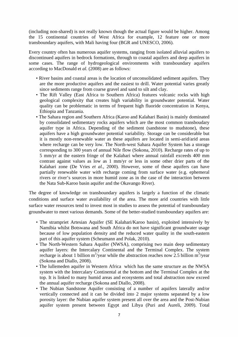
(including non-shared) is not really known though the actual figure would be higher. Among the 15 continental countries of West Africa for example, 12 feature one or more transboundary aquifers, with Mali having four (BGR and UNESCO, 2006).
Every country often has numerous aquifer systems, ranging from isolated alluvial aquifers to discontinued aquifers in bedrock formations, through to coastal aquifers and deep aquifers in some cases. The range of hydrogeological environments with transboundary aquifers according to MacDonald et al. (2008) are as follows:
• River basins and coastal areas is the location of unconsolidated sediment aquifers. They are the more productive aquifers and the easiest to drill. Water potential varies greatly since sediments range from coarse gravel and sand to silt and clay.
• The Rift Valley (East Africa to Southern Africa) features volcanic rocks with high geological complexity that creates high variability in groundwater potential. Water quality can be problematic in terms of frequent high fluoride concentration in Kenya, Ethiopia and Tanzania.
• The Sahara region and Southern Africa (Karoo and Kalahari Basin) is mainly dominated by consolidated sedimentary rocks aquifers which are the most common transboudary aquifer type in Africa. Depending of the sediment (sandstone to mudstone), these aquifers have a high groundwater potential variability. Storage can be considerable but it is mostly non-renewable water as these aquifers are located in semi-arid/arid areas where recharge can be very low. The North-west Sahara Aquifer System has a storage corresponding to 300 years of annual Nile flow (Sokona, 2010). Recharge rates of up to 5 mm/yr at the eastern fringe of the Kalahari where annual rainfall exceeds 400 mm contrast against values as low as 1 mm/yr or less in some other drier parts of the Kalahari zone (De Vries et al., 2000). However, some of these aquifers can have partially renewable water with recharge coming from surface water (e.g. ephemeral rivers or river’s sources in more humid zone as in the case of the interaction between the Nata Sub-Karoo basin aquifer and the Okavango River).
The degree of knowledge on transboundary aquifers is largely a function of the climatic conditions and surface water availability of the area. The more arid countries with little surface water resources tend to invest most in studies to assess the potential of transboundary groundwater to meet various demands. Some of the better-studied transboundary aquifers are:
• The strampriet Artesian Aquifer (SE Kalahari/Karoo basin), exploited intensively by Namibia whilst Botswana and South Africa do not have significant groundwater usage because of low population density and the reduced water quality in the south-eastern part of this aquifer system (Scheumann and Polak, 2010).
• The North-Western Sahara Aquifer (NWSA), comprising two main deep sedimentary aquifer layers: the Intercalary Continental and the Terminal Complex. The system recharge is about 1 billion m3/year while the abstraction reaches now 2.5 billion m3/year (Sokona and Diallo, 2008).
• The lullemeden aquifer in Western Africa which has the same structure as the NWSA system with the Intercalary Continental at the bottom and the Terminal Complex at the top. It is linked to many humid areas and ecosystems and total abstraction now exceed the annual aquifer recharge (Sokona and Diallo, 2008).
• The Nubian Sandstone Aquifer consisting of a number of aquifers laterally and/or vertically connected and it can be divided into 2 major systems separated by a low porosity layer: the Nubian aquifer system present all over the area and the Post-Nubian aquifer system present between Egypt and Libya (Puri and Aureli, 2009). Total
8
abstraction is close to 2 billion m3/year and the water level has generally been declining at a rate of 1m to 2m per year (INWEB database, 2007).
While some aquifer systems have been studied extensively, a great lack of knowledge on transboundary aquifers still exists. For example, the number of identified aquifers varies according to the source. The International Network of Water-Environment Centre for the Balkans (INWEB) database presents 15 transboundary aquifer systems in the South Mediterranean region while the ISARM-IGRAC database shows only 8. The “missing” aquifers are mainly small and located between Morocco and Algeria. Disparity in the database and lack of knowledge on the aquifer boundaries shows that the identification and the understanding of the transboudary aquifers still need improvement.
4. CLIMATE CHANGE IMPACTS ON GROUNDWATER
Globally, the impact of climate change on the hydrological system is predicted to increase current variability in the spatial and temporal distribution of precipitation over the next century. Current forecasts, although uncertain, suggest that subtropical regions in Africa as well as the ‘Horn of Africa’ will experience a reduction in precipitation whereas precipitation in the humid tropics is predicted to rise. The tropics is also where the impacts of rapid development and climate change on water resources are expected to be the most severe and where the need for sustainable adaptive management strategies in the water sector is greatest (Taylor et al., 2009). In addition, it is the tropics where the human and institutional capacity and hydrological knowledge base to devise adaptive water strategies are the most limited.
Climate change is not only a problem of the future; it is an issue of the present. In the most productive northern regions of Algeria for example, major declines in rainfall have been experienced in recent decades, placing greater stress on both surface water and groundwater systems. Studies indicate that the shift toward more intensive rainfall as a result of global warming will result in more variable river discharge and reduced soil moisture storage (Taylor and Tindimugaya, 2009). These will threaten food security as well as access to safe drinking water. The increased spatial and temporal variability in precipitation will therefore increase reliance on groundwater to meet domestic, agricultural and industrial water demands.
Groundwater resources, which account for over 90% of the world’s accessible freshwater according to Shiklomanov and Rodda (2003), are expected to be key in the strategies to adapt to changing freshwater availability and demand throughout Africa. Groundwater has always enabled communities across Africa to adapt to seasonal or perennial shortages in surface water by providing water for drinking, watering livestock, and more recently for irrigation. As groundwater abstraction intensifies it is not clear whether intensive groundwater abstraction to meet the increasing demand for domestic and agricultural water is viable or sustainable. While the impacts of climate change on groundwater resources in Africa continue to be reported in literature (e.g. Adelana et al., 2008; Carter & Parker, 2009; MacDonald et al., 2009) a quantitative understanding of the impact of climate change on groundwater resources remains poorly defined.
Research in various areas suggest that a shift towards more intensive rainfall – a robust, generic climate change impact – serves to increase groundwater recharge (and surface runoff) but reduce soil moisture in weathered-fractured aquifer systems on surfaces of low relief (Taylor and Tindimugaya, in press). Supplemental irrigation with groundwater is consequently a logical strategy to adapt to reduced soil moisture (and crop yields) associated

9
with variable rainfall. The studies further show that the estimated uncertainty in current projections of climate change impacts on groundwater resources is so large (e.g. 17% decline to 83% rise in Uganda) and is a concern to water management (Figure 2).
Figure 2: Projected changes in mean annual groundwater flow in the River Mitano Basin, relative to the 1961-1990 baseline period, under a 2°C rise in global mean air temperature for the priority subset of CMIP-3 GCMs (adapted from Taylor and Tindimugaya, in Press).
5. POLICY IMPLICATIONS RELATED TO GROUNDWATER
5.1 West Africa
Groundwater is the most important water resource and the most heavily used by West African populations. With its buffering capacity (storage of runoff during periods of surplus, feed streams and / or levies in times of deficit), the reservoirs constituted by aquifer systems are likely to play an essential role in the adaptation to the effects of climate change.
In addition, good groundwater quality is very important in achieving the MDGs. Adverse quality is related to the geology of the aquifer (e.g. fluoride and arsenic levels), the incidence of salt water intrusion (for coastal aquifers in particular), but also to human activity and industrial and other pollution sources (wellfield in urban areas in particular). In Senegal, where more than 80% of drinking water comes from groundwater, this resource is found in the central part of the country where natural fluoride pollution occurs with concentrations higher than the maximum standard of safety set by WHO (1.5 mg/l). The fluoride content can reach 8.5 mg /l and constitutes a major public health problem in Senegal. In Burkina Faso it was officially noted that some wells had a concentration of arsenic exceeding the standards set by WHO (10 µg/l), sometimes reaching 1,600 µg/l. These examples show the importance and need for improving the knowledge of the resource in terms of quality as well as quantity. Concerning the quality of groundwater, UNESCO rightly notes that human impact will be far more important than the impact of climate change, particularly in terms of saline intrusion in coastal aquifers. Indeed, it is well known that in coastal aquifers in West Africa, saltwater intrusion is so severe that, at the Wellfield Plateau (Abidjan) and Southern Abidjan, Ivory
‐40
‐20
0
20
40
60
80
100
hadcm3 cccma csiro ipsl mpi ncar hadgem1
Mean annual gro
undwater flow anomaly
(% change fro
m baseline)

10
Coast, Godomey in Cotonou, Benin and Agouévè in Lome, Togo production from some water supply boreholes was stopped to halt the progression of this phenomenon.
From the standpoint of the quantity, to meet the growing needs of multiple uses, but also in terms of quality, knowledge of the resource is paramount and is also an essential element in the development of decision support tools. The aquifers of West Africa are still very poorly defined in terms of their physical boundaries, exploitable volumes, quality, etc. However, the situation appears quite uneven, depending on the aquifer. Some aquifers have huge water resources that are yet to be tapped for the socio-economic development of large populations. Other aquifers are on the contrary overused (e.g. the Quaternary sands in Abidjan) to cover the ever growing water needs due to urbanization and rapid population growth and the inherent impacts (increase in water demands for irrigation and livestock).
Conflicts often arise from ignorance of the real potential of the resource. Strengthening the research and implementation of appropriate policies and relevant institutional arrangements for the joint management of aquifers are essential.
Among the experiences from which one can learn, are: i) the work of the Sahel and Saharan Observatory (SSO) on groundwater, including the study of the North Western Sahara Aquifer Basin (NWSA), the first synthesis of hydrogeological knowledge of the Southern Sahara basins (Senegal-Mauritanian Basin, the Taoudeni Basin, the Iullemeden Basin and the Chad Basin); ii) the collaboration between Mali, Nigeria and Niger for joint management of the Iullemeden aquifer system with the support of the SSO. iii) the Senegal River Basin development Organisation (OMVS) has installed a large piezometric network in the valley to assess the recharge of aquifers adjacent to the river; after the completion of the Diama Dam at the mouth of the river, and Manantali Dam upstream. This network consisted of 1174 piezometers including 403 (237 piezometers and 166 village wells) on the right bank, 748 (332 piezometers and 416 village wells) in left bank and 23 (20 monitoring wells and three boreholes) in the upper basin around Manantali. A weak point in this regard is that the monitoring of piezometers was, as usual, too much related to the project activities, and proper monitoring was not carried out for more than fifteen years in some countries. OMVS felt obligated to reclaim the monitoring of that piezometric network even though this should have been considered as a sovereign mission of the States concerned.
Groundwater initiatives are lacking at present; the fact is that, both at national and regional levels, the policies and development strategies confer very poor consideration to groundwater. Some issues raised for improved water resources management in West Africa during the national IWRM processes in Benin, Burkina Faso, Cape Verde, Mali, and Togo include:
- Very poor knowledge on groundwater (in terms of quantity, quality and uses) - Lack of tools to monitor, evaluate and manage groundwater effectively - Poor policy and legal tools regarding this resource - No management mechanisms/arrangements for groundwater - The lack of human resources (in terms of qualified hydrogeologists) The African Groundwater Commission, AGWC, is set up under the auspices of the African Ministers’ Council on Water (AMCOW). A lot of work is still needed to translate this political commitment into a practical and fully functioning body. At the sub-regional level in West Africa, there is a lack of organizations addressing the collaborative management of the existing shared aquifers. The ECOWAS Water Resources Policy for West Africa, the

11
ECOWAS Common Agricultural Policy (ECOWAP), the ECOWAS Environmental Policy and the sub-regional Action Programme to reduce vulnerability and for adaptation to climate change in West Africa are key policy and orientation tools for sustainable development. The ECOWAS Regional Water Policy mentioned that “the community recommends the establishment of transboundary basin organizations that will deal with underground water by developing dialogue between countries when aquifers concern several basins”, and that a “better knowledge of surface and underground water resources” is needed.
Some initiatives are underway but need to be strengthened, including:
- The Sahara and Sahel Observatory (SSO) which is an advanced research and expertise centre on transboundary aquifer systems. SSO has conducted for several years a programme called "Collaborative Water Resources Management", as part of which the Iullemeden aquifer system was studied (Mali, Niger and Nigeria, through a SSO, CILSS and UNESCO cooperation). Other similar projects are also being drafted by SSO in West Africa (e.g. the Senegalo-Mauritanian aquifer system).
- The initiative from GWP/WA on a “Dialogue for a Collaborative Management of Transboundary Aquifers in West Africa”
Indeed, various institutions are working in many countries but they are scattered, isolated and uncoordinated. Groundwater management organizations should be created and linked up with existing river basin organizations. Cooperation between neighbouring countries is therefore a requirement if we are to reduce the risks of degradation and allow sustainable use of these shared resources.
During the last decade and mainly after the World Summit on Sustainable Development (WSSD) in Johannesburg in 2002, countries in West Africa made an important effort to develop their national IWRM Plans. The process including the diagnosis study on the threats and stakes in water management and the prioritization of the national plans, groundwater management appeared as one of the major issues. The national water policies adopted Integrated Water Resources Management (IWRM) principles but the actual implementation strategies and programmes are still not giving enough importance to groundwater. In terms of investments, funds are invested in infrastructure projects on the basis of immediate priorities and not within institutional frameworks for concerted longer term resource management. When investments are made in water resources management, these go to surface water primarily. It is now time to make some investments in groundwater management, building upon improved knowledge and consultation among parties.
5.2 East Africa Considering that there will be heavy reliance on groundwater for meeting rapidly rising demand for domestic and agricultural water as surface water resources reduce, or become more unreliable due to climate change, there is a need to improve understanding of the sustainability of intensive groundwater abstraction throughout Africa (Taylor et al., 2009). Close monitoring of intensive abstraction of groundwater by users and regulators as well as a process of ‘learning by doing' are key in informing proactively sustainable groundwater development policies.
Recognising that development of effective water management policies and planning of sustainable water development require knowledge gained through sustained and accurate monitoring of climate conditions (Taylor et al., 2009) and water resources, that groundwater
12
and surface water resources are hydraulically connected in many areas (Taylor and Howard, 2000; Tindimugaya, 2008), and that groundwater is often ignored in water resources management activities, initiation or expansion of climate and water monitoring activities as well as integration of groundwater into River Basin Management plans are needed (Taylor et al., 2009).
5.3 Southern Africa The Southern African Development Community (SADC) is a regional cooperation organization comprising 15 member states in Southern Africa1. The overarching goal of the SADC is ‘Regional Integration and Poverty Eradication’ and the SADC recognizes groundwater as a high potential water supply in rural areas of many countries in SADC as they make effort to meet the MDGs (SADC, 2011). However, groundwater knowledge which is a key for developing and managing groundwater resources is often poor in half of the countries of the SADC. The more advance countries on groundwater database (South Africa, Botswana, Namibia) are located in the semi-arid/arid part of SADC region (BGR et al., 2007).
The management of transboundary waters in SADC is subject to a regional protocol based on the principles of international water law. Following the 1997 United Nations Convention on the Non-Navigational Uses of the National Watercourses, the 1995 protocol on shared Watercourses Systems (PSWS) was revised in 2000 and entered in force in 2003. SADC states have an obligation to manage groundwater within the legal framework provided by the Protocol (Christelis et al., 2010).
The Protocol on shared Watercourses Systems defines a watercourse system as “the inter-related hydrologic components of the drainage basin such as streams, rivers, lakes, canals and underground water which constitute a unitary whole by virtue of their physical relationship. The definition of shared watercourse system is also explained as a “watercourse system passing through or forming the border between two or more basin states”. Hence underground water is specifically named in the protocol and transboundary aquifer is part of the shared watercourse system. The protocol also indicates that the member states undertake to establish river basin commissions. SADC region comprise 16 rivers basins2 including the upper reaches of the Nile basin. However, only 10 River Basin Organizations (RBO’s) already exist including the Lake Tanganyika Authority (Figure 3) and four river basins (Umbeluzi, Save, Buzi, Pungwe) still do not have their own RBO’s. The RBO’s operate under sound legislation and system for planning and stakeholder involvement and embracing the Dublin principles of IWRM (Braune et al., 2008). They are, among other things, in charge of the harmonization of national water resource legislation, the monitoring and the control of the water uses and the environment protection of the resources of shared watercourse systems.
To reinforce its objectives, the SADC presented the Regional Water Policy (RWP) in 2005 then the Regional Water Strategy in 2006. The RWP has been formulated to follow the adoption of the MDG’s and the World Summit on Sustainable Development (WSSD) targets. These water-related targets such as increasing water access and food security have a
1 Angola, Botswana, Democratic Republic of Congo (DRC), Lesotho, Madagascar, Malawi, Mauritius, Mozambique, Namibia, Seychelles, South Africa, Swaziland, United Republic of Tanzania, Zambia and Zimbabwe 2 Congo, Zambezi, Kunene, Cuvelai, Okavango, Umbeluzi, Ruvuma, Limpopo, Save/Sabi, Buzi, Pungwe, Incomati, Maputo, Orange and Nile

significespeciawater su
As an eand Drcapacitypart of Studiesstrengthgroundw
Figure 3(source
cant impact lly on grouupplies in th
example of rought Many, knowledgthe project,, Universityhen and supwater mana
3: River bas: SADC Wa
on water rundwater rehe SADC re
a key initianagement Pge products, a groundwy of the Fr
pport ongoinagement.
sins within ater Sector I
resources msources, whegion (Brau
ative that isroject 2007 and tools r
water managree State, Bng initiative
SADC ICP Collabo
13
managementhich is the une and Xu,
s underway,7 to 2011related to grgement instiBloemfonteies for region
oration Port
t at the natlargest wat2008).
, SADC hassupported broundwater itute, hostedin, South Anal collabor
tal, 2011)
tional and rer supply s
s embarkedby GEF/Wmanagemen
d by InstitutAfrica, is beration and c
regional levsource for d
d on a GrouWB. This wient in the regute for Groueing establcapacity bui
vels and domestic
undwater ill build gion. As
undwater ished to ilding in
14
6. FUTURE RESEARCH NEEDS AND OPPORTUNITIES There is a growing recognition that groundwater management in Africa is an essential component of climate change adaptation strategies. Renewable groundwater resources in Africa are underutilised, yet groundwater can play a major role in assisting farmers increase food production and also overcome the threat to food security posed by more variable rainfall as a result of climate change. Research is needed on how to overcome major obstacles to groundwater development such as the high costs of well construction and limited understanding of groundwater resources that currently restrict development of groundwater for irrigation in many parts of Africa. Presently, less than one percent of the area under cultivation is irrigated by groundwater in SSA (Siebert et al., 2010).
Sustainable use of renewable groundwater resources depends upon the quantity and quality of groundwater recharge. However, there is substantial inter-annual variability in groundwater recharge in Africa and long lag times between recharge events and aquifer replenishment (Tindimugaya, 2008; Taylor et al., 2009). Sustainability is also dependent upon allocating water for all sectors, including for the environment to support ecological services. This therefore calls for an improved understanding of the role of groundwater storage and groundwater discharge in sustaining groundwater-dependent ecosystems.
Understanding the flow and storage properties of groundwater in various aquifer systems is key to their sustainable development and management (Taylor and Howard, 2000; Tindimugaya, 2008). For example, current understanding of the weathered and fractured-bedrock aquifers is simplistic and largely conceptual implying that there is an urgent need for quantitative information regarding groundwater flow and storage (Tindimugaya, 2008). Specific knowledge gaps include circulation rates in aquifer systems and the response of aquifer systems to intensive abstraction. Further research is required to improve understanding of the interactions between various aquifers and to assess the impact of increased pumping rates from various aquifer systems simultaneously with climate change on the sustainability of groundwater utilization.
Considering that there is great uncertainty in current projections of climate change impacts on groundwater resources in part, groundwater management needs to become both adaptive (‘learn by doing’) and informed (Taylor et al., 2009). This requires the expansion and establishment of groundwater and meteorological monitoring systems at various levels to assess how groundwater systems respond to abstraction and climate variability.
This will require establishment and expansion of groundwater and meteorological monitoring networks at the national or basin scale to assess how groundwater systems respond to human impacts as well as climate variability. Not only do future needs include increasing scientific knowledge on aquifer systems, but also in terms of institutional arrangements, that will require increasing cooperation amongst countries sharing common groundwater resources.
REFERENCES Adelana, S.M.A. and MacDonald, A.M. 2008. Groundwater research issues in Africa. In:
Applied Groundwater Studies in Africa. IAH Selected Papers on Hydrogeology, Volume 13 (S.M.A. Adelana & A.M. MacDonald Eds.). CRC Press/Balkema, Leiden, the Netherlands.
15
BGS, 2011. Development of an aquifer map for Africa. Groundwater Resilience in Africa Project, British GeologicalSurvey. http://www.bgs.ac.uk/GWResilience/dfid_aquiferMap.html (last accessed 28 July 2011).
Biémi, J. 1996. Water Crises and Constraints in West and Central Africa: The Case of Côte d'Ivoire . IRDC Book. http://www.research-matters.net/mimap/ev-31125-201-1-DO_TOPIC.html (last accessed 10 November 2011).
BGR and UNESCO, 2006. Transboundary aquifer in Africa. BGR Hannover / UNESCO, Paris.
Braune, E., Hollingworth, B., Xu, Y., Nel, M., Mahed, G., and Solomon, H. 2008. Protocol for the Assessment of the Status of Sustainable Utilization and Management of Groundwater Resources -With Special Reference to Southern Africa. Pretoria. Water Research Commission.
Braune, E. and Xu, Y. 2008. Lessons from Implementation in Developing Countries. International Conference on Integrated Water Resource Management (IWRM) from 10 to 12 March 2008 in Cape Town, South Africa. Available on website: http://www.wrc.org.za ISSN 0378-4738 = Water SA Vol. 34 No. 6 (IWRM Special Edition) 2008 ISSN 1816-7950 = Water SA (on-line).
Calow, R.C., MacDonald, A.M., Nicol, A.L.and Robins, N.S. 2010. Ground Water Security and Drought in Africa: Linking Availability, Access, and Demand. Ground Water 48(2):246–256.
Carter, R.C. and Bevan, J.E. 2008. Groundwater development for poverty alleviation in sub-Saharan Africa. In: Applied Groundwater Studies in Africa. IAH Selected Papers on Hydrogeology, Volume 13 (S.M.A. Adelana & A.M. MacDonald Eds.). CRC Press/Balkema, Leiden, the Netherlands.
Carter, C.R and Parker, A. 2009. Climate change, population trends and groundwater in Africa. . In Hydrological Sciences Journal, Vol. 54, Special Issue 4: Groundwater and Climate in Africa. IAHS Press.
Chilton, P.J. and Foster, S.S.D. 1995. Hydrogeological characterisation and water supply potential of basement aquifers in tropical Africa. Hydrogeology Journal 3:36-49.
Christelis, G. Hunger, G. Mulele, O. Mangisi, N. Mannathoko, I. van Wyk, E. Braune, E. and Heyns, P. 2010. (Unpublished paper). http://www.siagua.org/archivos_adjuntos/documentos/sur_africa.pdf (last accessed 14 November 2011).
De Vries, J. J., Selaolo, E.T., Beekman, H.E. 2000. Groundwater recharge in the Kalahari, with reference to paleo-hydrologic conditions, Journal of Hydrology 238, pp 110–123
Forkuor, G., McCartney, M. and Amisigo, B. 2011. Evaluating the implications of future water resource development under current and projected climate in the Volta basin. Proceedings of the 3rd Ghana Water Forum, Accra, Ghana.
Foster, S.S.D., Tuinhof A. and Garduño, H. 2006. Groundwater Development in Sub-Saharan Africa: A Strategic Overview of Key Issues and Major Needs. World Bank GWP
16
Associate Program. Sustainable Groundwater Management: Concepts and Tools. Case Profile Collection No. 15.
Giordano, M. 2005. Agricultural groundwater use in sub-Saharan Africa: What do we know and where should we go? Water Policy, 7: 613–626.
Giordano, M. 2006. Agricultural groundwater use and rural livelihoods in sub-Saharan Africa: A first-cut assessment, Hydrogeology Journal 14(3):310-318.
Gumma, M.K. and Pavelic, P. in prep. Mapping of groundwater potential zones across Ghana using GIS and remote sensing techniques. Environmental Monitoring and Assessment (submitted).
Hetzel, F., V. Vaessen, T. Himmelsbach, W. Struckmeier, and K.G. Villholth: Groundwater
and Climate Change: Challenges and Possibilities. BGR and GEUS. 15 pp. Howard, K.W. F., Hughes, M., Charlesworth, D.L., Ngobi, G. 1992 Hydrogeologic
evaluation of fracture permeability in crystalline basement aquifers of Uganda Hydrogeology Journal 1:55-65.
INWEB database: http://www.inweb.gr/index.php?Itemid=201
ISARM –IGRAC database: http://igrac.nitg.tno.nl/ggis_map/start.html
MacDonald, A.M., Calow, R.C., Nicol, A.L., Hope, B. and Robins, N.S. 2001. Ethiopia: water security and drought. British Geological Survey Technical Report WC/01/02.
MacDonald A.M. and Davies J., 2000. A brief review of groundwater for rural water supply in sub-Saharan Africa. BGS Technical Report WC/00/33.
MacDonald A., Davies J. & Calow R. 2008. African hydrogeology and rural water supply In: Adelana, Segun; MacDonald, Allan (eds.). Applied Groundwater Studies in Africa. IAH selected paper on hydrogeology, 13, pp 127-148.
MacDonald, A.M., Calow, R.C., MacDonald, D.M.J, Darling, G.and Dochartaigh, E.O.B. 2009. What impact will climate change have on rural groundwater supplies in Africa. In Hydrological Sciences Journal, Vol. 54, Special Issue 4: Groundwater and Climate in Africa. IAHS Press.
Margat, J. 2010. Ressources et utilisation des eaux souterraines en Afrique. Managing Shared Aquifer Resources in Africa, Third International Conférence Tripoli 25-27 may 2008. International Hydrological Programme, Division of Water Sciences, IHP-VII Series on groundwater No.1, UNESCO, pp 26-34.
Martin, N. and van de Giesen, N. 2005. Spatial distribution of groundwater production and development potential in the Volta river basin of Ghana and Burkina Faso. Water International 30(2):239-249.
Masiyandima, M. and Giordano M. 2007. Sub-Saharan Africa: opportunistic exploitation. In: Giordano, M. and Villholth, K. (Eds.) 2007. The agricultural groundwater revolution: opportunities and threats to development. Comprehensive Assessment of Water Management in Agriculture Series 3. Wallingford: IWMI and CAB International.

17
McCartney, M. and Smakhtin, V. 2010. Water storage in an era of climate change: addressing the challenge of increasing rainfall variability. Blue paper. Colombo, Sri Lanka: International Water Management Institute (IWMI). 14p. [http://dx.doi.org/10.5337/2010.012]
Puri S., Aureli A., 2009. Atlas of Transboundary Aquifers: global maps, region cooperation and local inventories, ISARM Program, UNESCO-IHP.
SADC, 2011. SADC Regional Groundwater Vulnerability Mapping. Final Report. 126 pp.
Scheumann W., Polak M. 2010. Facing the challenge of launching joint initiatives to manage Africa’s transboundary aquifer systems. Managing Shared Aquifer Resources in Africa, Third International Conference Tripoli 25-27 may 2008. International Hydrological Programme, Division of Water Sciences, IHP-VII Series on groundwater No.1, UNESCO, pp 197-202).
Shah, T., Burke, J., Villholth, K., Angelica, M., Custodio, E., et al. 2007. Groundwater: a global assessment of scale and significance. In Water for food, Water for life: A Comprehensive Assessment of Water Management in Agriculture, D. Molden (Ed.). London, UK/Colombo, Sri Lanka: Earthscan.
Shiklomanov, I. A and Rodda, J. C. 2003. World Water Resources at the Beginning of the Twenty-First Century (Cambridge: Cambridge University Press).
Siebert, S., J. Burke, J.M. Faures, K. Frenken, J. Hoogeveen, P. Döll, and F.T. Portmann, 2010. Groundwater use for irrigation - a global inventory. Hydrol. Earth Syst. Sci. Discuss., 7, 3977–4021.
Sokona Y., Diallo O. and al. 2008. The North-western Sahara Aquifer System (Algeria, Tunisia, Libya): joint management transborder water basin. Synthesis Collection No 1, OSS, 48pp.
Sokona Y., Diallo O. and al. 2008. Lullemeden Aquifer System (Mali, Niger, Nigeria): concerted management of shared water resources of a sahelian transboundary aquifer. Synthesys Collection No 2, OSS, 33pp.
Sokoma Y. 2010. Importance des aquiferes transfrontaliers en Afrique., Managing Shared
Aquifer Resources in Africa, Third international conference Tripoly 25-27 may 2008. International Hydrological Programme, Division of Water Sciences, IHP-VII Series on groundwater No.1, UNESCO, pp 45-48.
Taylor R.G., Howard K.W.F. 2000. A tectono-geomorphic model of the hydrogeology of deeply weathered crystalline rock: evidence from Uganda. Hydrogeology Journal 8: 279-294
Taylor, R.G., Tindimugaya, C., Barker, J.A., Macdonald, D., Kulabako, R. 2004. Convergent radial tracing of viral and solute transport in gneiss saprolite. Ground Water 48: 284-294
Taylor, R. G. 2009. Rethinking water scarcity: The role of storage. Eos Trans. AGU, 90(28), p.237, doi:10.1029/2009EO280001.

18
Taylor, R.G and Tindimugaya, C. 2009. Can groundwater enable communities in sub-Saharan Africa to adapt to predicted impacts of climate change on freshwater resources? IOP Conf. Series: Earth and Environmental Science 6.
Taylor, R.G, Koussis, A.D. and Tindimugaya, C. 2009. Groundwater and climate in Africa- a review. In Hydrological Sciences Journal, Vol. 54, Special Issue 4: Groundwater and Climate in Africa. IAHS Press.
Taylor, R.G and Tindimugaya,C. (in Press). The impacts of climate change and rapid development on weathered crystalline rock aquifer systems in the humid tropics of sub-Saharan Africa: evidence from southwestern Uganda. UNESCO GRAPHIC Case study publications, Taylor and Francis.
Tindimugaya, C. 2000. Assessment of groundwater development potential for Wobulenzi town, Uganda. Unpublished Master’s Thesis, International Institute for Infrastructural, Hydraulic and Environmental Engineering, IHE Deft, Netherlands.
Tindimugaya C. 2008. Groundwater flow and storage in weathered crystalline rock aquifer systems of Uganda: evidence from environmental tracers and aquifer responses to hydraulic stress. PhD Thesis, University College London (unpublished).
UNECA, AU and AfDB (2000). “The Africa Water Vision 2025”: Equitable and Sustainable Use of Water for Socioeconomic Development. http://www.uneca.org/awich/african%20water%20vision%202025.pdf
UNEP, 2010. “Africa Water Atlas”. Division of Early Warning and Assessment (DEWA).
United Nations Environment Programme (UNEP). Nariobi. Kenya.
UNESCO, 1991. Africa Geological Map Scale (1:5,000,000). 6 Sheets. UNESCO, Paris
WHYMAP, 2008. Groundwater resources of the world. BGR/ UNESCO. Accessed at: http://www.whymap.org.
Woodford, A., Rosewarne, P. and Girman, J. 2006.. How much groundwater does South Africa have? Accessed at: www.srk.co.uk/groundwater/PDFs/1_A_Woodford.pdf.
Wright, E.P. 1992. The hydrogeology of crystalline basement aquifers in Africa. In: Wright, E.P. and Burgess, W.G. (Eds.), Hydrogeology of crystalline basement aquifers in Africa. Geological Society Special Publication No. 66, pp 1 - 27.