march/april 2015 - 中国海洋大学 lecture "advanced conceptual issues in climate and...
TRANSCRIPT
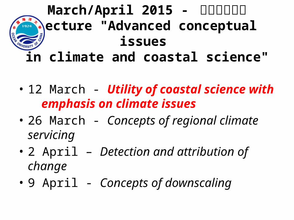
March/April 2015 - 中国海洋大学Lecture "Advanced conceptual issues
in climate and coastal science"
• 12 March - Utility of coastal science with emphasis on climate issues
• 26 March - Concepts of regional climate servicing
• 2 April – Detection and attribution of change• 9 April - Concepts of downscaling
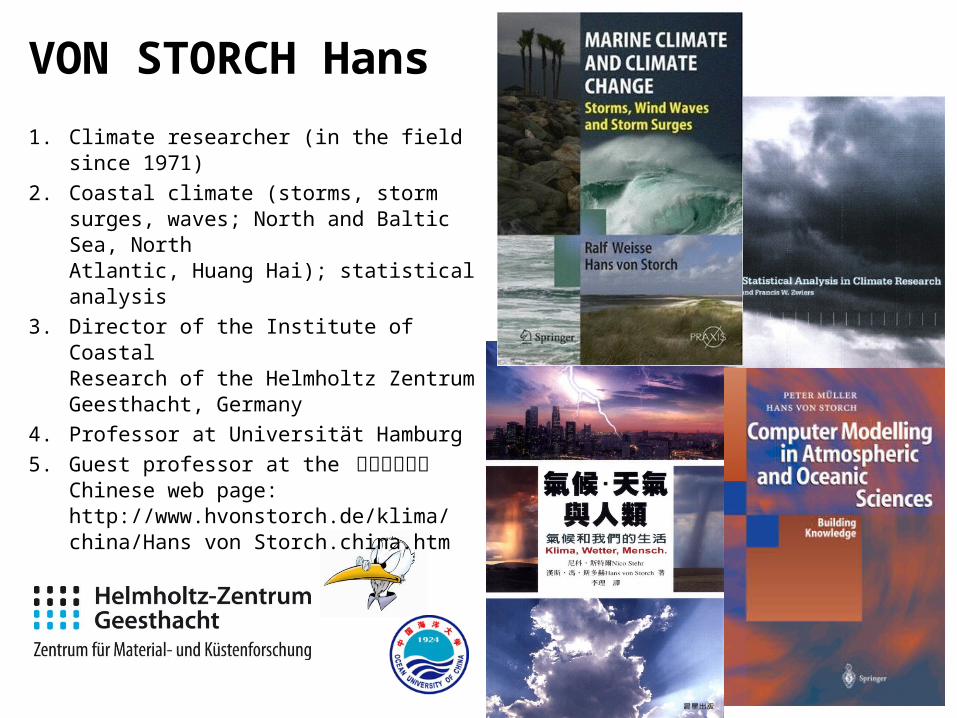
VON STORCH Hans1. Climate researcher (in the field since 1971)2. Coastal climate (storms, storm surges,
waves; North and Baltic Sea, North Atlantic, Huang Hai); statistical analysis
3. Director of the Institute of Coastal Research of the Helmholtz Zentrum Geesthacht, Germany
4. Professor at Universität Hamburg5. Guest professor at the 中国海洋大学
Chinese web page:http://www.hvonstorch.de/klima/china/Hans von Storch.china.htm
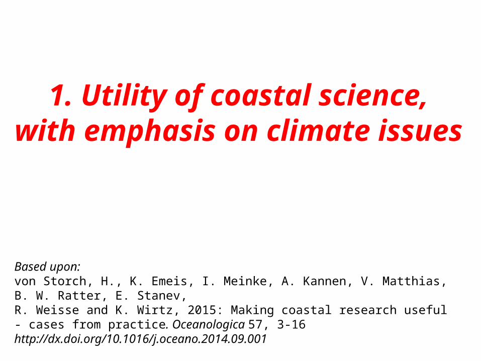
1. Utility of coastal science,with emphasis on climate issues
Based upon:von Storch, H., K. Emeis, I. Meinke, A. Kannen, V. Matthias, B. W. Ratter, E. Stanev, R. Weisse and K. Wirtz, 2015: Making coastal research useful - cases from practice. Oceanologica 57, 3-16 http://dx.doi.org/10.1016/j.oceano.2014.09.001
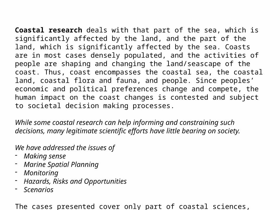
Coastal research deals with that part of the sea, which is significantly affected by the land, and the part of the land, which is significantly affected by the sea. Coasts are in most cases densely populated, and the activities of people are shaping and changing the land/seascape of the coast. Thus, coast encompasses the coastal sea, the coastal land, coastal flora and fauna, and people. Since peoples’ economic and political preferences change and compete, the human impact on the coast changes is contested and subject to societal decision making processes.
While some coastal research can help informing and constraining such decisions, many legitimate scientific efforts have little bearing on society.
All decision making processes are political, so that scientific knowledge is not the dominant driver in such processes.
Using cases from the Institute of Coastal Research of Helmholtz Zentrum Geesthacht, we describe some of these potentially useful parts of science, and discuss under which circumstances the potential usefulness transform into real utility. These cases do not span the full range of coastal science.
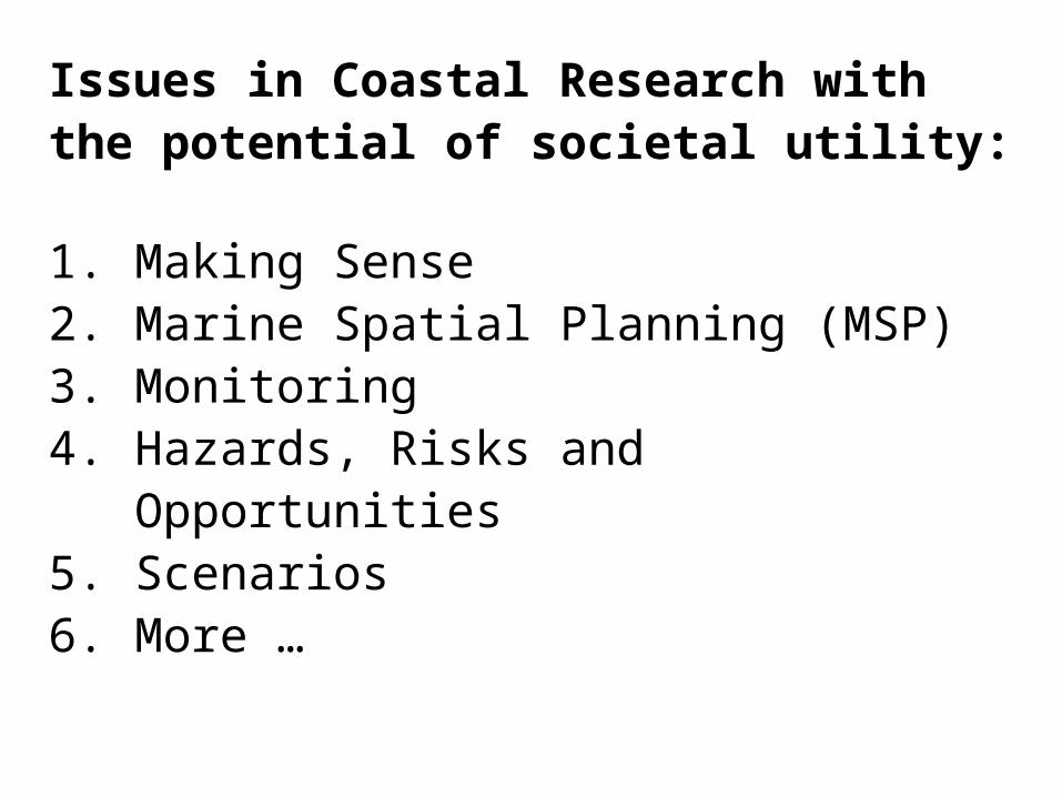
Issues in Coastal Research with the potential of societal utility:
1. Making Sense 2. Marine Spatial Planning (MSP)3. Monitoring4. Hazards, Risks and Opportunities 5. Scenarios6. More …
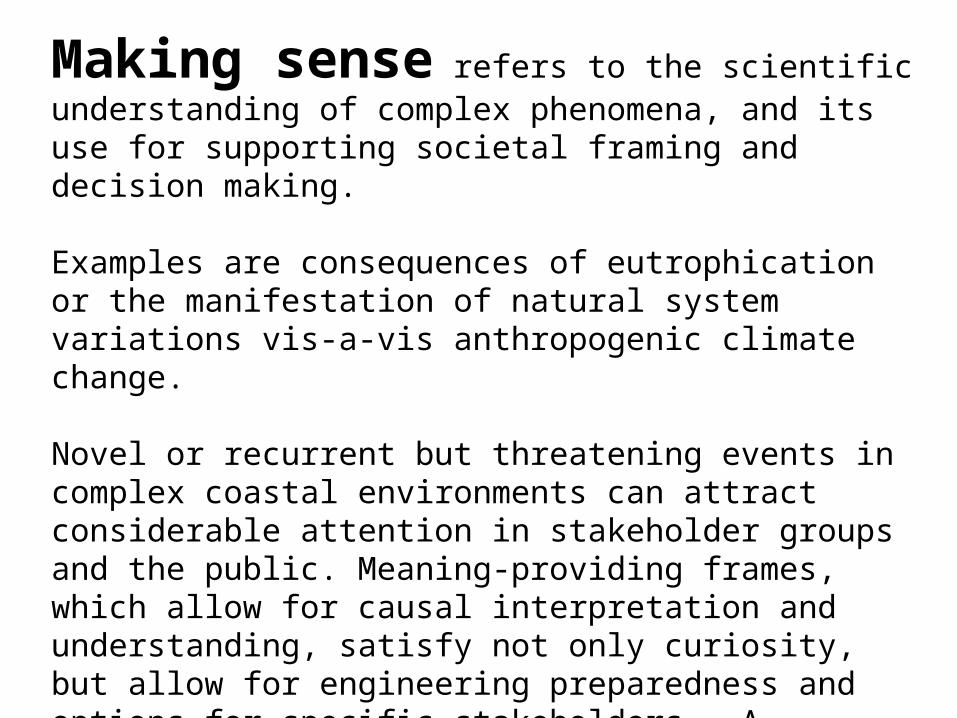
Making sense refers to the scientific understanding of complex phenomena, and its use for supporting societal framing and decision making.
Examples are consequences of eutrophication or the manifestation of natural system variations vis-a-vis anthropogenic climate change.
Novel or recurrent but threatening events in complex coastal environments can attract considerable attention in stakeholder groups and the public. Meaning-providing frames, which allow for causal interpretation and understanding, satisfy not only curiosity, but allow for engineering preparedness and options for specific stakeholders. A significant constraint is that science is not the sole supplier of such understanding, but other knowledge brokers are active as well.
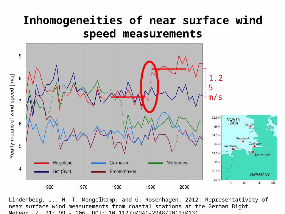
1.25 m/s
Lindenberg, J., H.-T. Mengelkamp, and G. Rosenhagen, 2012: Representativity of near surface wind measurements from coastal stations at the German Bight. Meteor. Z. 21: 99 - 106. DOI: 10.1127/0941-2948/2012/0131
Inhomogeneities of near surface wind speed measurements
Lindenberg et al., 2012
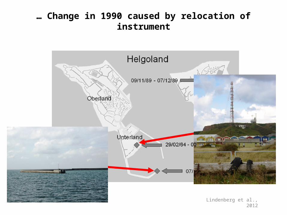
… Change in 1990 caused by relocation of instrument

Storm surges as recorded at the tide gauge St Pauli in Hamburg. The green horizontal bars indicate stipulated dike heights. Dike failures are marked by red stars. The color codes mark surge heights. Data provided by Gabriele Gönnert.
Making sense
What is the process behind the marked increase of storm surge heights in Hamburg since the 1970s?
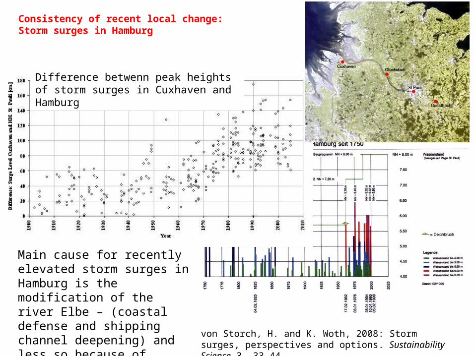
Difference betwenn peak heights of storm surges in Cuxhaven and Hamburg
Main cause for recently elevated storm surges in Hamburg is the modification of the river Elbe – (coastal defense and shipping channel deepening) and less so because of changing storms or sea level.
Consistency of recent local change:Storm surges in Hamburg
von Storch, H. and K. Woth, 2008: Storm surges, perspectives and options. Sustainability Science 3, 33-44
Page 11
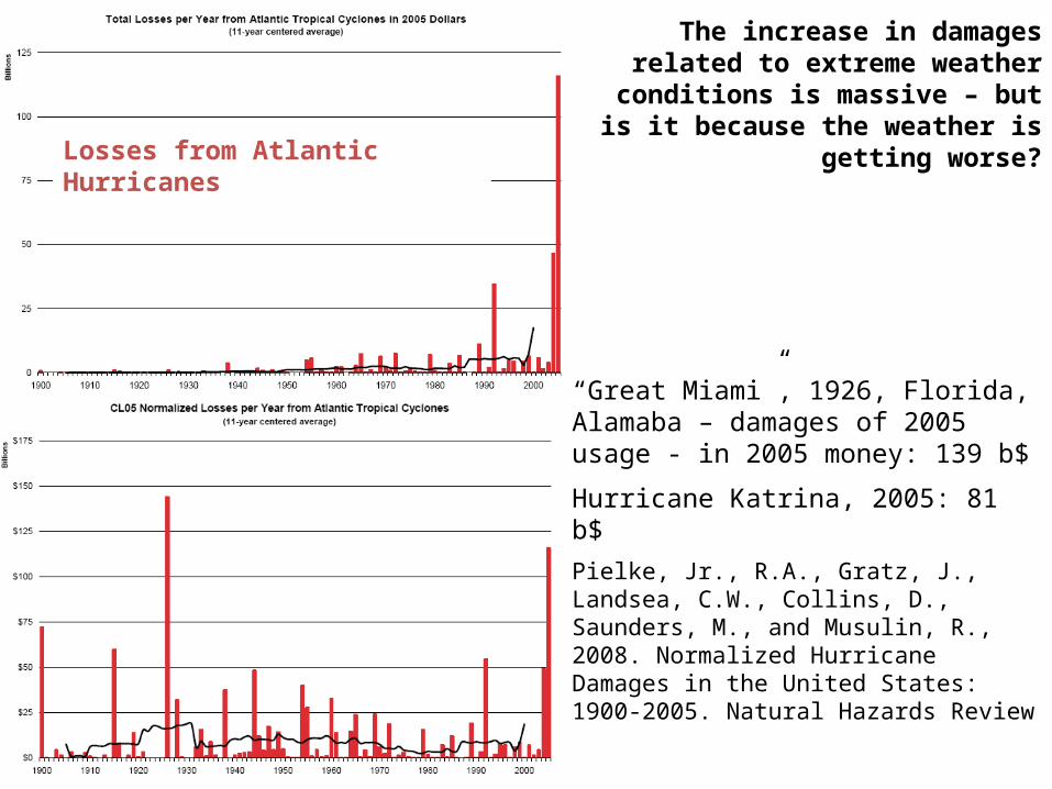
“Great Miami”, 1926, Florida, Alamaba – damages of 2005 usage - in 2005 money: 139 b$
Hurricane Katrina, 2005: 81 b$
Pielke, Jr., R.A., Gratz, J., Landsea, C.W., Collins, D., Saunders, M., and Musulin, R., 2008. Normalized Hurricane Damages in the United States: 1900-2005. Natural Hazards Review
The increase in damages related to extreme weather conditions is massive –
but is it because the weather is getting worse?
Losses from Atlantic Hurricanes
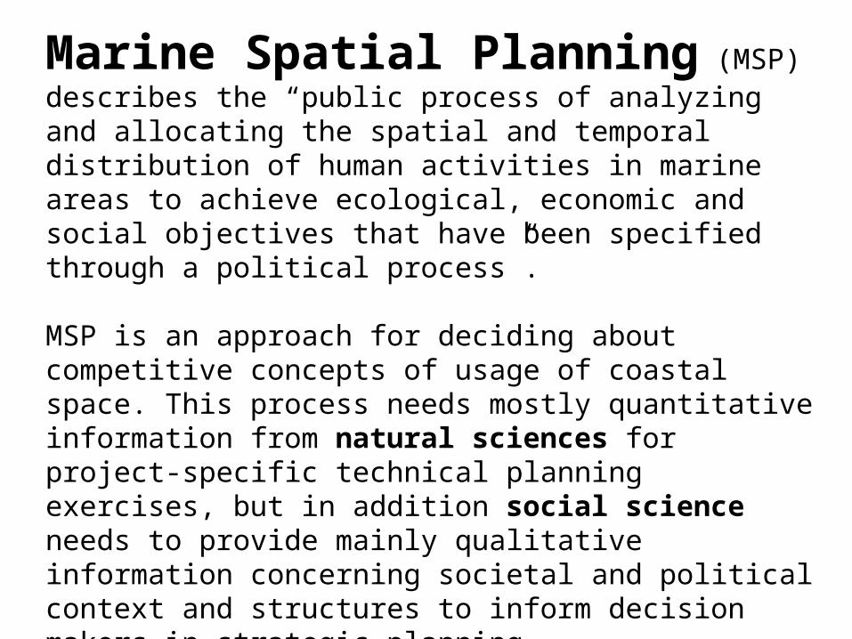
Marine Spatial Planning (MSP) describes the “public process of analyzing and allocating the spatial and temporal distribution of human activities in marine areas to achieve ecological, economic and social objectives that have been specified through a political process”.
MSP is an approach for deciding about competitive concepts of usage of coastal space. This process needs mostly quantitative information from natural sciences for project-specific technical planning exercises, but in addition social science needs to provide mainly qualitative information concerning societal and political context and structures to inform decision makers in strategic planning.
Coastal science is not doing MSP as such, but in research in conditions of how to implement MSP.
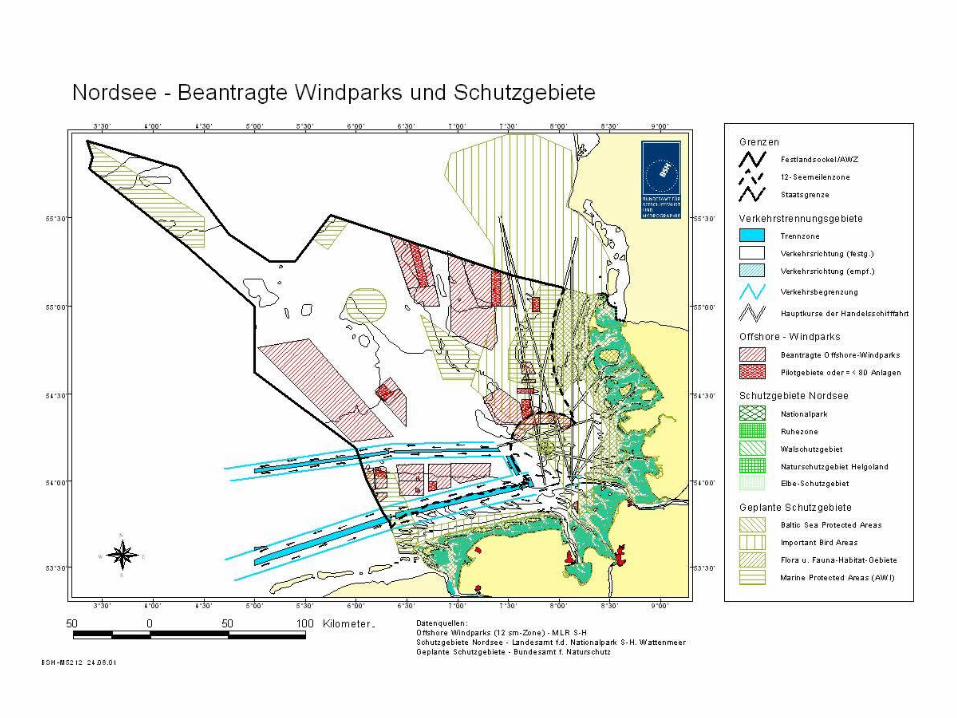
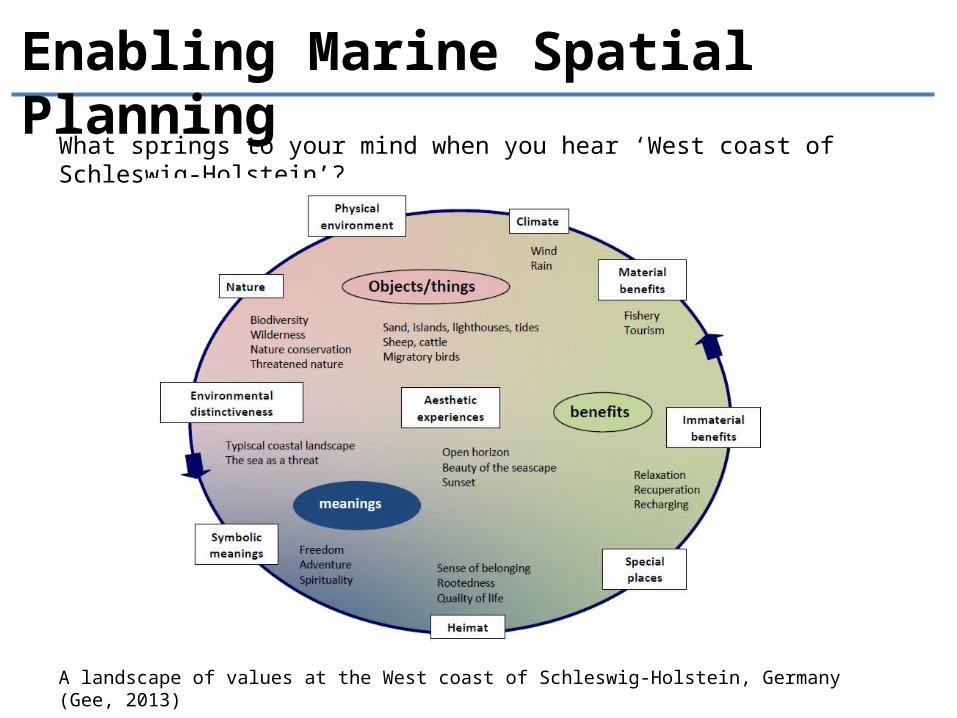
Enabling Marine Spatial Planning
What springs to your mind when you hear ‘West coast of Schleswig-Holstein’?
A landscape of values at the West coast of Schleswig-Holstein, Germany (Gee, 2013)
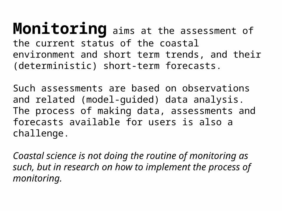
Monitoring aims at the assessment of the current status of the coastal environment and short term trends, and their (deterministic) short-term forecasts.
Such assessments are based on observations and related (model-guided) data analysis. The process of making data, assessments and forecasts available for users is also a challenge.
Coastal science is not doing the routine of monitoring as such, but in research on how to implement the process of monitoring.
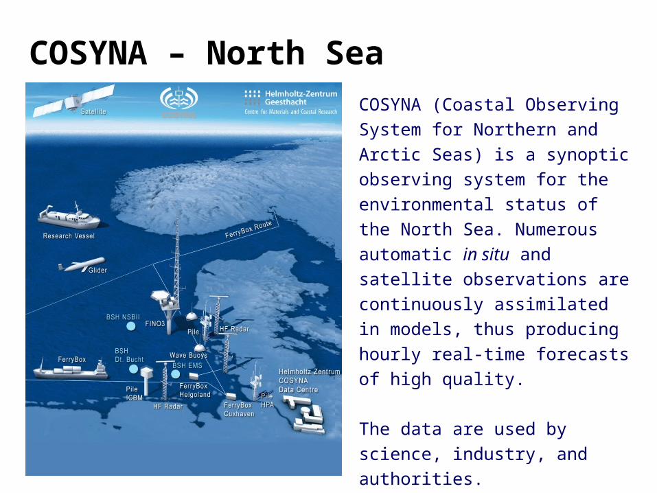
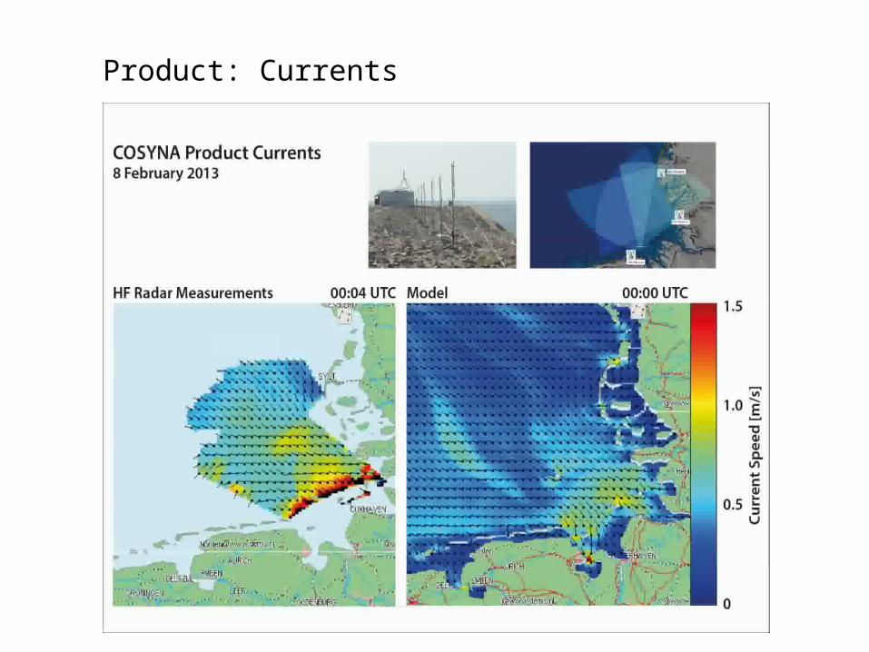
COSYNA (Coastal Observing System for Northern and Arctic Seas) is a synoptic observing system for the environmental status of the North Sea. Numerous automatic in situ and satellite observations are continuously assimilated in models, thus producing hourly real-time forecasts of high quality.
The data are used by science, industry, and authorities.
COSYNA – North Sea
Land-Meer-InteraktionenRäumliche und zeitliche VariabilitätTrendsEvents, Risiken
Photo: NASA
Nordsee Actual state & forecast:
•current
•waves
•salinity
•temperature
•turbidity / chlorophyll
Application:
•oil spills/chemical accidents
•toxic algal blooms
•wind farms
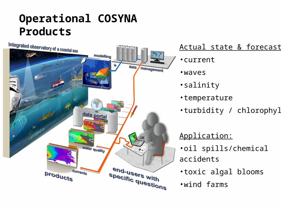
Operational COSYNA Products
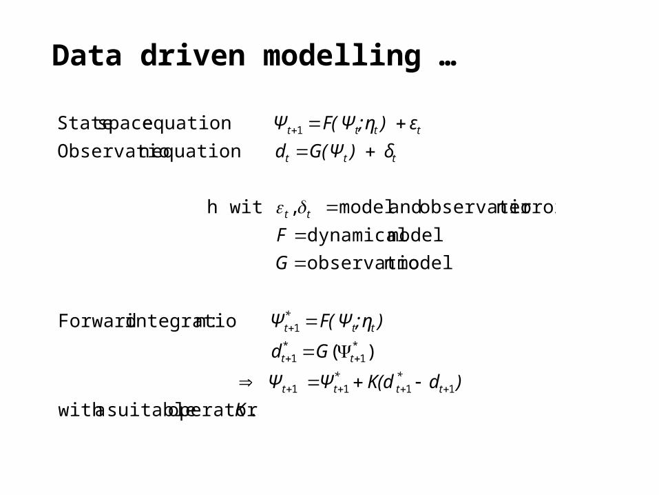
.operator suitablea with
)(
:nintegratio Forward
model nobservatio
model dynamical
errors nobservatio and model , h wit
equation nObservatio
equation space State
1111
*1
*1
1
1
K
)dK(dΨΨ
Gd
);ηF(ΨΨ
G
F
δ) G(Ψd
ε) ;ηF(ΨΨ
t*t
*t t
tt
tt*t
tt
ttt
tttt
Data driven modelling …
Land-Meer-InteraktionenRäumliche und zeitliche VariabilitätTrendsEvents, Risiken
Photo: NASA
Nordsee
Product: Currents
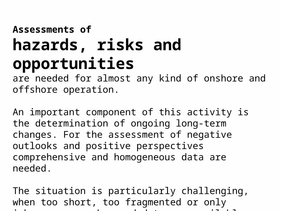
Assessments of
hazards, risks and opportunities are needed for almost any kind of onshore and offshore operation.
An important component of this activity is the determination of ongoing long-term changes. For the assessment of negative outlooks and positive perspectives comprehensive and homogeneous data are needed.
The situation is particularly challenging, when too short, too fragmented or only inhomogeneous observed data are available. Then, sometimes, model-derived estimates can be used.
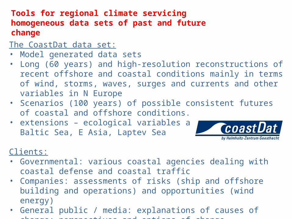
GKSS in GeesthachtThe CoastDat data set:• Model generated data sets• Long (60 years) and high-resolution reconstructions of recent offshore and
coastal conditions mainly in terms of wind, storms, waves, surges and currents and other variables in N Europe
• Scenarios (100 years) of possible consistent futures of coastal and offshore conditions.
• extensions – ecological variables and other regions: Baltic Sea, E Asia, Laptev Sea
Clients:• Governmental: various coastal agencies dealing with coastal defense and
coastal traffic• Companies: assessments of risks (ship and offshore building and operations)
and opportunities (wind energy)• General public / media: explanations of causes of change; perspectives and
options of change
Tools for regional climate servicing homogeneous data sets of past and future change
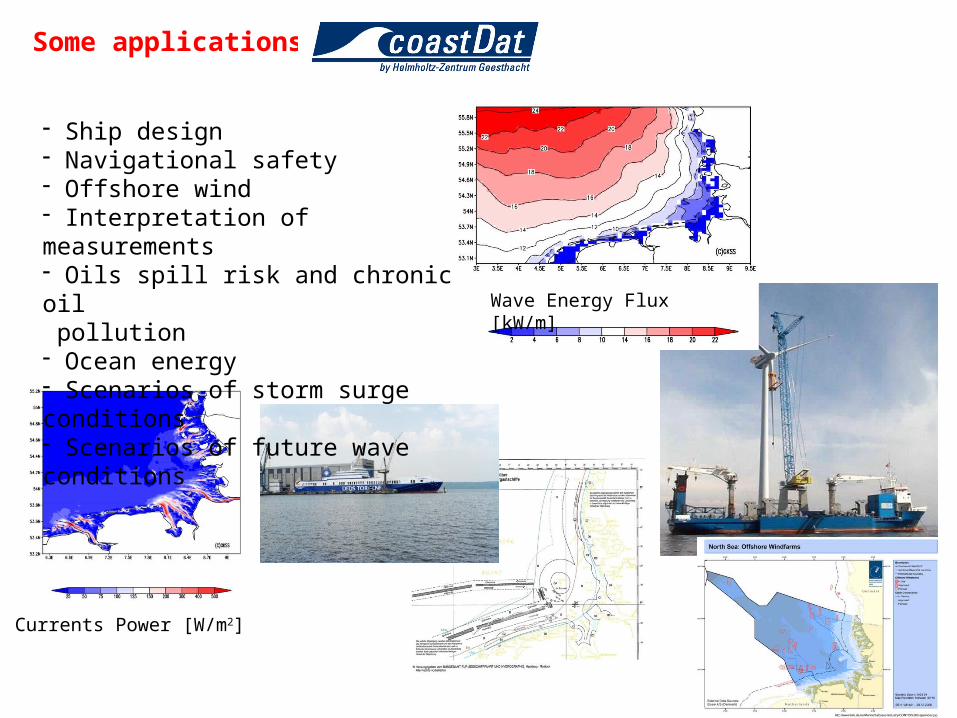
Wave Energy Flux [kW/m]
Currents Power [W/m2]
Some applications of
- Ship design- Navigational safety- Offshore wind- Interpretation of measurements- Oils spill risk and chronic oil pollution- Ocean energy- Scenarios of storm surge conditions- Scenarios of future wave conditions
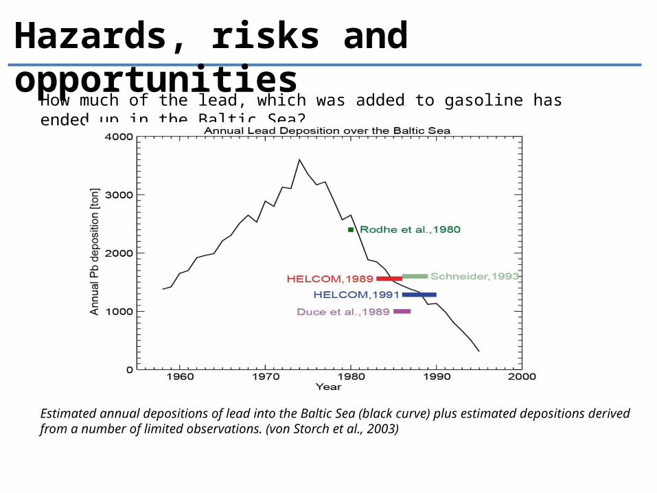
Hazards, risks and opportunities
How much of the lead, which was added to gasoline has ended up in the Baltic Sea?
Estimated annual depositions of lead into the Baltic Sea (black curve) plus estimated depositions derived from a number of limited observations. (von Storch et al., 2003)
Added value over global re-analysis products
• in medium scales (in particular coastal regions).• in describing medium scale phenomena – in particular storms• in generating regional impact variables, in particular wind for
storm surges and ocean waves.
More in lecture #4 „Concepts of downscaling” (9 April 2015)
Scenarios, differently to forecasts, address questions of the type “What may happen, if … and nothing else”.
Such projections provide a useful outlook for assessing consequences of possible future developments and uncertainties. Therefore scenarios have become increasingly popular in various scientific and decision making contexts.
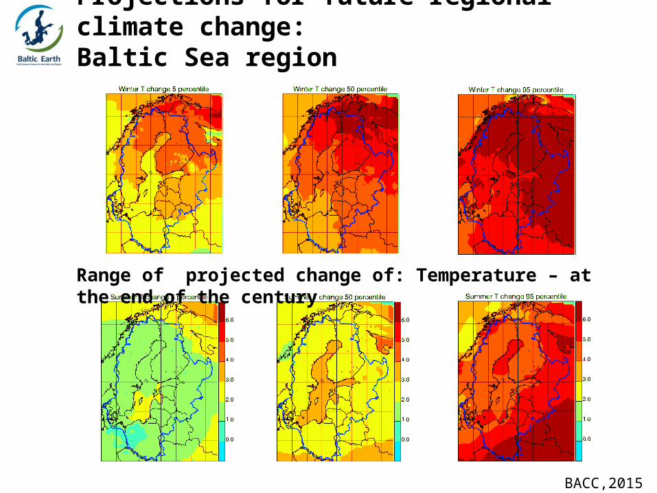
Range of projected change of: Temperature – at the end of the century
Projections for future regional climate change:Baltic Sea region
BACC,2015
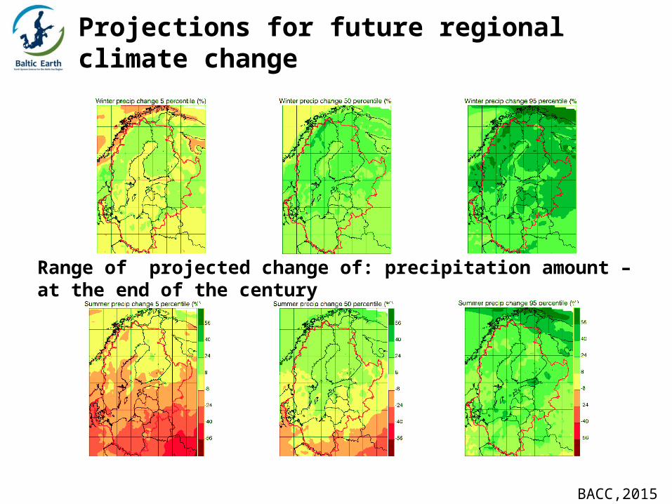
Range of projected change of: precipitation amount – at the end of the century
Projections for future regional climate change
BACC,2015
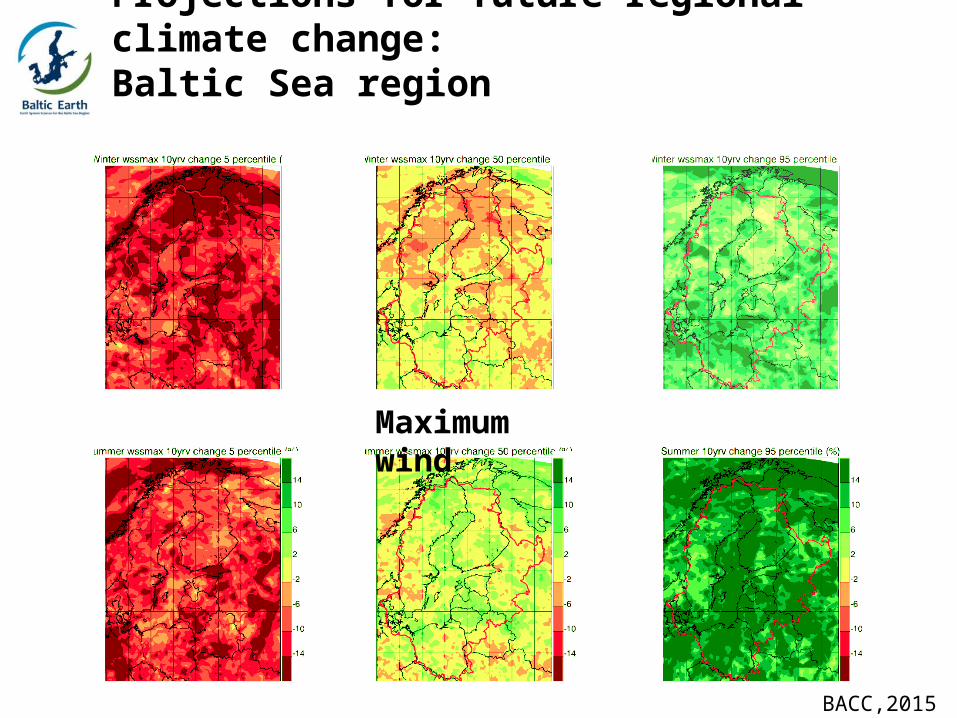
Maximum wind
BACC,2015
Projections for future regional climate change:Baltic Sea region
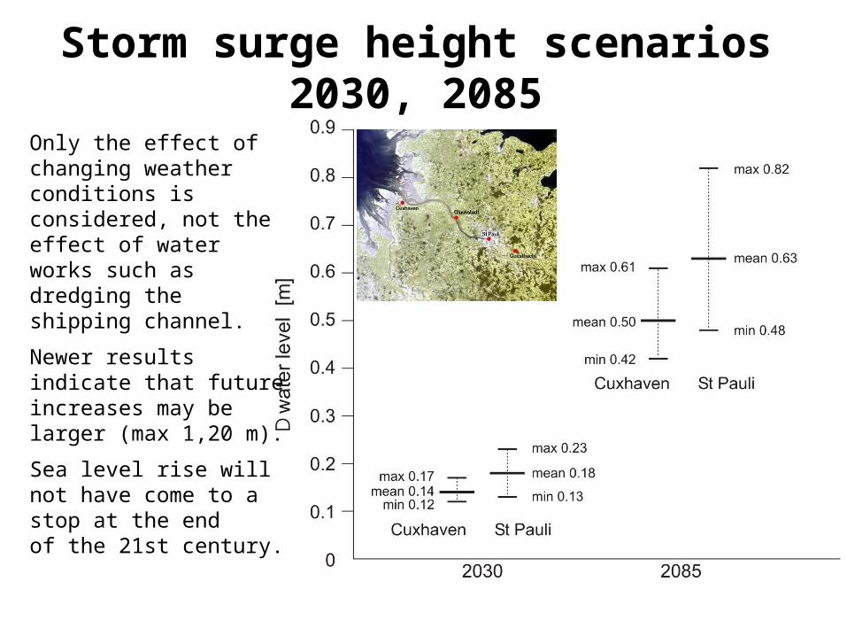
Storm surge height scenarios 2030, 2085
Only the effect of changing weather conditions is considered, not the effect of water works such as dredging the shipping channel.
Newer results indicate that future increases may be larger (max 1,20 m).
Sea level rise will not have come to a stop at the end of the 21st century.
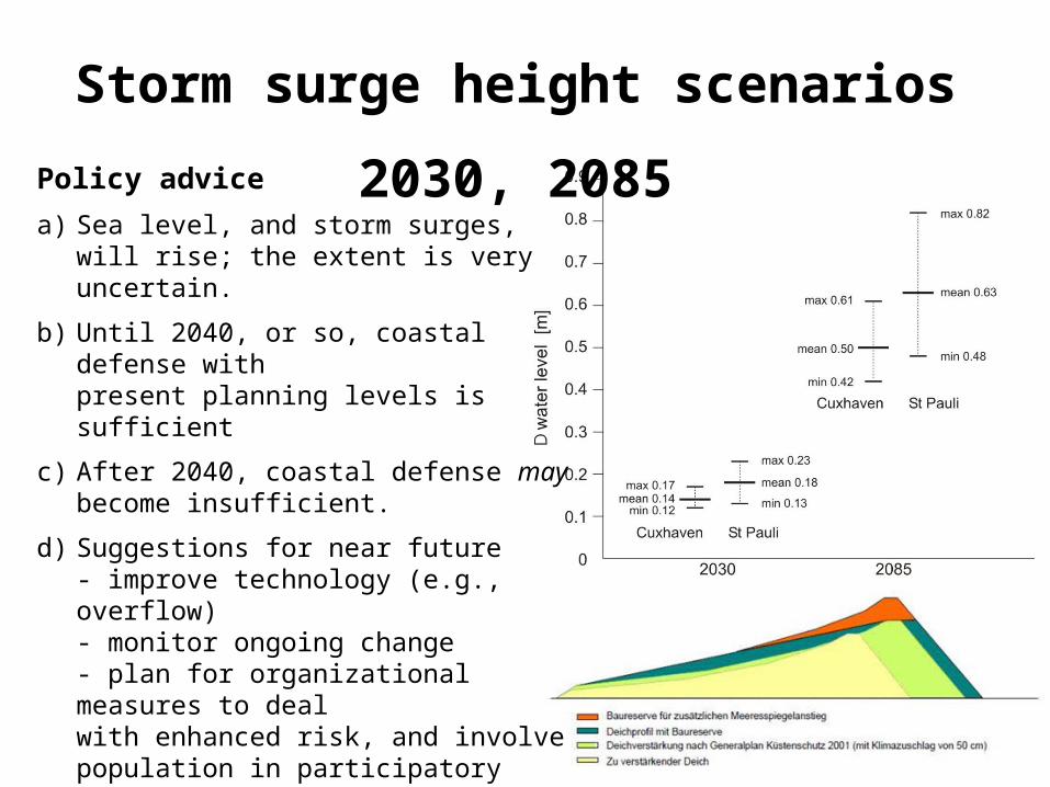
Storm surge height scenarios 2030, 2085
Policy advice
a) Sea level, and storm surges, will rise; the extent is very uncertain.
b) Until 2040, or so, coastal defense with present planning levels is sufficient
c) After 2040, coastal defense may become insufficient.
d) Suggestions for near future- improve technology (e.g., overflow)- monitor ongoing change- plan for organizational measures to deal with enhanced risk, and involve population in participatory efforts- do all coastal defense modernization so that future additional fortifications are possible- be prepared to implement decisions in 20 years
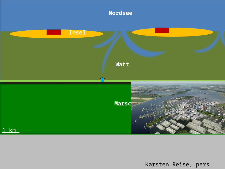
Nordsee
Watt
Marsch
Insel
Hauptdeich Brack- und SüßwasserÜberflutbarer Deich KompaktsiedlungEingedeichte Marsch Wohnhügel (Warft/Wurt)Überflutbare Marsch Hausboot
Marsch
1 km
Karsten Reise, pers. comm.
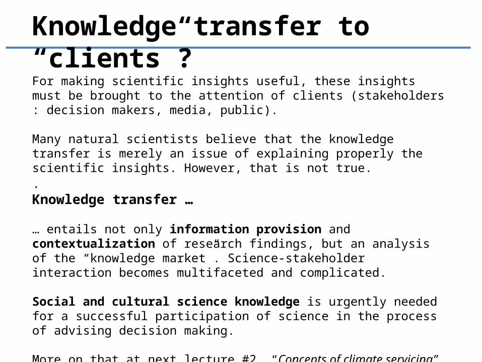
Knowledge transfer to “clients”?
For making scientific insights useful, these insights must be brought to the attention of clients (stakeholders : decision makers, media, public).
Many natural scientists believe that the knowledge transfer is merely an issue of explaining properly the scientific insights. However, that is not true..Knowledge transfer …
… entails not only information provision and contextualization of research findings, but an analysis of the “knowledge market”. Science-stakeholder interaction becomes multifaceted and complicated.
Social and cultural science knowledge is urgently needed for a successful participation of science in the process of advising decision making.
More on that at next lecture #2, “Concepts of climate servicing”, on 26 March 2015.
Coastal research deals with that part of the sea, which is significantly affected by the land, and the part of the land, which is significantly affected by the sea. Coasts are in most cases densely populated, and the activities of people are shaping and changing the land/seascape of the coast. Thus, coast encompasses the coastal sea, the coastal land, coastal flora and fauna, and people. Since peoples’ economic and political preferences change and compete, the human impact on the coast changes is contested and subject to societal decision making processes.
While some coastal research can help informing and constraining such decisions, many legitimate scientific efforts have little bearing on society.
We have addressed the issues of - Making sense- Marine Spatial Planning- Monitoring- Hazards, Risks and Opportunities- Scenarios
The cases presented cover only part of coastal sciences, and have emphasized the issue of regional marine climate change.