marion - mass gis
TRANSCRIPT

BioMap2 CONSERVING THE BIODIVERSITY OF
MASSACHUSETTS IN A CHANGING WORLD
Marion Produced in 2012
This report and associated map provide information about
important sites for biodiversity conservation in your area.
This information is intended for conservation planning, and is
not intended for use in state regulations.

BioMap2
Conserving the Biodiversity of Massachusetts in a Changing World
Natural Heritage Massachusetts Division of Fisheries and Wildlife
1 Rabbit Hill Road, Westborough, MA 01581 & Endangered
phone: 508-389-6360 fax: 508-389-7890
Species Program
For more information on rare species and natural communities, please see our fact sheets online at www.mass.gov/nhesp.
Table of Contents
Introduction
What is BioMap2 Ȯ Purpose and applications
One plan, two components
Understanding Core Habitat and its components
Understanding Critical Natural Landscape and its components
Understanding Core Habitat and Critical Natural Landscape Summaries
Sources of Additional Information
Marion Overview
Core Habitat and Critical Natural Landscape Summaries
Elements of BioMap2 Cores
Core Habitat Summaries
Elements of BioMap2 Critical Natural Landscapes
Critical Natural Landscape Summaries

BioMap2
Conserving the Biodiversity of Massachusetts in a Changing World
Natural Heritage Massachusetts Division of Fisheries and Wildlife
100 Hartwell Street, Suite 230, West Boylston, MA 01583 & Endangered
phone: 508-389-6360 fax: 508-389-7890
Species Program
For more information on rare species and natural communities, please see our fact sheets online at www.mass.gov/nhesp.
Introduction
The Massachusetts Department of Fish & Game,
ɳɧɱɮɴɦɧ ɳɧɤ Dɨɵɨɲɨɮɭ ɮɥ Fɨɲɧɤɱɨɤɲ ɠɭɣ Wɨɫɣɫɨɥɤ˘ɲ
Natural Heritage & Endangered Species
Program (NHESP), and The Nature
Cɮɭɲɤɱɵɠɭɢɸ˘ɲ Mɠɲɲɠɢɧɴɲɤɳɳɲ Pɱɮɦɱɠɬ developed BioMap2 ɳɮ ɯɱɮɳɤɢɳ ɳɧɤ ɲɳɠɳɤ˘ɲ
biodiversity in the context of climate change.
BioMap2 ɢɮɬɡɨɭɤɲ NHESP˘ɲ ȯȬ ɸɤɠɱɲ ɮɥ rigorously documented rare species and natural
community data with spatial data identifying
wildlife species and habitats that were the focus
ɮɥ ɳɧɤ Dɨɵɨɲɨɮɭ ɮɥ Fɨɲɧɤɱɨɤɲ ɠɭɣ Wɨɫɣɫɨɥɤ˘ɲ ȮȬȬȱ State Wildlife Action Plan (SWAP). BioMap2 also
ɨɭɳɤɦɱɠɳɤɲ Tɧɤ Nɠɳɴɱɤ Cɮɭɲɤɱɵɠɭɢɸ˘ɲ ɠɲɲɤɲɲɬɤɭɳ
of large, well-connected, and intact ecosystems
and landscapes across the Commonwealth,
incorporating concepts of ecosystem resilience
to address anticipated climate change impacts.
Protection and stewardship of BioMap2 Core
Habitat and Critical Natural Landscape is
essential to safeguard the diversity of species
and their habitats, intact ecosystems, and
resilient natural landscapes across
Massachusetts.
Get your copy of the BioMap2 report! Download
from www.mass.gov/nhesp or contact Natural
Heritage at 508-389-6360 or
What Does Status Mean?
The Division of Fisheries and Wildlife
determines a status category for each rare
species listed under the Massachusetts
Endangered Species Act, M.G.L. c.131A, and its
implementing regulations 321 CMR 10.00. Rare
species are categorized as Endangered,
Threatened or of Special Concern according to
the following:
Endangered species are in danger of
extinction throughout all or a significant
portion of their range or are in danger of
extirpation from Massachusetts.
Threatened species are likely to become
Endangered in Massachusetts in the
foreseeable future throughout all or a
significant portion of their range.
Special Concern species have suffered a
decline that could threaten the species if
allowed to continue unchecked or occur in
such small numbers or with such restricted
distribution or specialized habitat
requirements that they could easily become
Threatened in Massachusetts.
In addition NHESP maintains an unofficial
watch list of plants that are tracked due to
potential conservation interest or concern, but
are not regulated under the Massachusetts
Endangered Species Act or other laws or
regulations. Likewise, described natural
communities are not regulated by any law or
regulations, but they can help to identify
ecologically important areas that are worthy of

BioMap2
Conserving the Biodiversity of Massachusetts in a Changing World
Natural Heritage Massachusetts Division of Fisheries and Wildlife
100 Hartwell Street, Suite 230, West Boylston, MA 01583 & Endangered
phone: 508-389-6360 fax: 508-389-7890
Species Program
For more information on rare species and natural communities, please see our fact sheets online at www.mass.gov/nhesp.
protection. The status of natural communities
reflects the documented number and acreages of
each community type in the state:
Critically Imperiled communities typically
have 5 or fewer documented sites or have
very few remaining acres in the state.
Imperiled communities typically have 6-20
sites or few remaining acres in the state.
Vulnerable communities typically have 21-
100 sites or limited acreage across the state.
Secure communities typically have over 100
sites or abundant acreage across the state;
however, excellent examples are identified
as Core Habit to ensure continued
protection.
In 2005 the Massachusetts Division of Fisheries
and Wildlife completed a comprehensive State
Wildlife Action Plan (SWAP) documenting the
status of Massachusetts wildlife and providing
recommendations to help guide wildlife
conservation decision-making. SWAP includes
all the wildlife species listed under the
Massachusetts Endangered Species Act (MESA),
as well as more than 80 species that need
conservation attention but do not meet the
requirements for inclusion under MESA. The
SWAP document is organized around habitat
types in need of conservation within the
Commonwealth. While the original BioMap
focused primarily on rare species protected
under MESA, BioMap2 also addresses other
Species of Conservation Concern, their habitats,
and the ecosystems that support them to create a
spatial representation of most of the elements of
SWAP.
BioMap2: One Plan, Two Components
BioMap2 identifies two complementary spatial
layers, Core Habitat and Critical Natural
Landscape.
Core Habitat identifies key areas that are critical
for the long-term persistence of rare species and
other Species of Conservation Concern, as well
as a wide diversity of natural communities and
intact ecosystems across the Commonwealth.
Protection of Core Habitats will contribute to the
conservation of specific elements of biodiversity.
Critical Natural Landscape identifies large
natural Landscape Blocks that are minimally
impacted by development. If protected, these
areas will provide habitat for wide-ranging
native species, support intact ecological
processes, maintain connectivity among
habitats, and enhance ecological resilience to
natural and anthropogenic disturbances in a
rapidly changing world. Areas delineated as
Critical Natural Landscape also include
buffering upland around wetland, coastal, and
aquatic Core Habitats to help ensure their long-
term integrity.
The long-term persistence of Massachusetts
biological resources requires a determined
commitment to land and water conservation.
Protection and stewardship of both Critical
Natural Landscapes and Core Habitats are
needed to realize the biodiversity conservation
vision of BioMap2.
Components of Core Habitat
Core Habitat identifies specific areas necessary
to promote the long-term persistence of rare
species, other Species of Conservation Concern,
exemplary natural communities, and intact
ecosystems.
Rare Species
There are 432 native plant and animal species
listed as Endangered, Threatened or Special
Concern under the Massachusetts Endangered
Species Act (MESA) based on their rarity,
population trends, and threats to survival. For
BioMap2
Conserving the Biodiversity of Massachusetts in a Changing World
Natural Heritage Massachusetts Division of Fisheries and Wildlife
100 Hartwell Street, Suite 230, West Boylston, MA 01583 & Endangered
phone: 508-389-6360 fax: 508-389-7890
Species Program
For more information on rare species and natural communities, please see our fact sheets online at www.mass.gov/nhesp.
BioMap2, NHESP staff identified the highest
quality habitat sites for each non-marine species
based on size, condition, and landscape context.
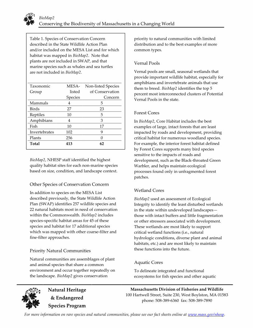
Table 1. Species of Conservation Concern
described in the State Wildlife Action Plan
and/or included on the MESA List and for which
habitat was mapped in BioMap2. Note that
plants are not included in SWAP, and that
marine species such as whales and sea turtles
are not included in BioMap2.
Taxonomic MESA- Non-listed Species
Group listed of Conservation
Species Concern
Mammals 4 5
Birds 27 23
Reptiles 10 5
Amphibians 4 3
Fish 10 17
Invertebrates 102 9
Plants 256 0
Total 413 62
Other Species of Conservation Concern
In addition to species on the MESA List
described previously, the State Wildlife Action
Plan (SWAP) identifies 257 wildlife species and
22 natural habitats most in need of conservation
within the Commonwealth. BioMap2 includes
species-specific habitat areas for 45 of these
species and habitat for 17 additional species
which was mapped with other coarse-filter and
fine-filter approaches.
Priority Natural Communities
Natural communities are assemblages of plant
and animal species that share a common
environment and occur together repeatedly on
the landscape. BioMap2 gives conservation
priority to natural communities with limited
distribution and to the best examples of more
common types.
Vernal Pools
Vernal pools are small, seasonal wetlands that
provide important wildlife habitat, especially for
amphibians and invertebrate animals that use
them to breed. BioMap2 identifies the top 5
percent most interconnected clusters of Potential
Vernal Pools in the state.
Forest Cores
In BioMap2, Core Habitat includes the best
examples of large, intact forests that are least
impacted by roads and development, providing
critical habitat for numerous woodland species.
For example, the interior forest habitat defined
by Forest Cores supports many bird species
sensitive to the impacts of roads and
development, such as the Black-throated Green
Warbler, and helps maintain ecological
processes found only in unfragmented forest
patches.
Wetland Cores
BioMap2 used an assessment of Ecological
Integrity to identify the least disturbed wetlands
in the state within undeveloped landscapesȯ those with intact buffers and little fragmentation
or other stressors associated with development.
These wetlands are most likely to support
critical wetland functions (i.e., natural
hydrologic conditions, diverse plant and animal
habitats, etc.) and are most likely to maintain
these functions into the future.
Aquatic Cores
To delineate integrated and functional
ecosystems for fish species and other aquatic
BioMap2
Conserving the Biodiversity of Massachusetts in a Changing World
Massachusetts Division of Fisheries and Wildlife Natural Heritage 100 Hartwell Street, Suite 230, West Boylston, MA 01583
& Endangered phone: 508-389-6360 fax: 508-389-7890
Species Program
For more information on rare species and natural communities, please see our fact sheets online at www.mass.gov/nhesp.
Species of Conservation Concern, beyond the
species and exemplary habitats described above,
BioMap2 identifies intact river corridors within
which important physical and ecological
processes of the river or stream occur.
Components of Critical Natural Landscape
Critical Natural Landscape identifies intact
landscapes in Massachusetts that are better able
to support ecological processes and disturbance
regimes, and a wide array of species and
habitats over long time frames.
Landscape Blocks
BioMap2 identifies the most intact large areas of
predominately natural vegetation, consisting of
contiguous forests, wetlands, rivers, lakes, and
ponds, as well as coastal habitats such as barrier
beaches and salt marshes.
Upland Buffers of Wetland and Aquatic
Cores
A variety of analyses were used to identify
protective upland buffers around wetlands and
rivers.
Upland Habitat to Support Coastal
Adaptation
BioMap2 identifies undeveloped lands adjacent
to and up to one and a half meters above
existing salt marshes as Critical Natural
Landscapes with high potential to support
inland migration of salt marsh and other coastal
habitats over the coming century.
The conservation areas identified by BioMap2
are based on breadth and depth of data,
scientific expertise, and understanding of
Mɠɲɲɠɢɧɴɲɤɳɳɲ˘ ɡɨɮɣɨɵɤɱɲɨɳɸ˅ Tɧɤ ɭɴɬɤɱɮɴɲ
sources of information and analyses used to
Legal Protection of Biodiversity
BioMap2 presents a powerful vision of what
Massachusetts would look like with full
protection of the land most important for
ɲɴɯɯɮɱɳɨɭɦ ɳɧɤ Cɮɬɬɮɭɶɤɠɫɳɧ˘ɲ ɡɨɮɣɨɵɤɱɲɨɳɸ˅
While BioMap2 is a planning tool with no
regulatory function, all state-listed species enjoy
legal protection under the Massachusetts
Endangered Species Act (M.G.L. c.131A) and its
implementing regulations (321 CMR 10.00).
Wetland habitat of state-listed wildlife is also
protected under the Wetlands Protection Act
Regulations (310 CMR 10.00). The Natural
Heritage Atlas contains maps of Priority Habitats
and Estimated Habitats, which are used,
respectively, for regulation under the
Massachusetts Endangered Species Act and the
Wetlands Protection Act. For more information
on rare species regulations, and to view Priority
and Estimated Habitat maps, please see the
Regulatory Review page at
http://www.mass.gov/eea/agencies/dfg/dfw/natur
al-heritage/regulatory-review/.
BioMap2 is a conservation planning tool that
does not, in any way, supplant the Estimated
and Priority Habitat Maps which have
regulatory significance. Unless and until the
BioMap2 vision is fully realized, we must
continue to protect our most imperiled species
and their habitats.
create Core Habitat and Critical Natural
Landscape are complementary, and outline a
comprehensive conservation vision for
Massachusetts, from rare species to intact
landscapes. In total, these robust analyses
define a suite of priority lands and waters that, if
permanently protected, will support
Mɠɲɲɠɢɧɴɲɤɳɳɲ˘ ɭɠɳɴɱɠɫ ɲɸɲɳɤɬɲ ɥɮɱ ɦɤɭɤɱɠɳɨɮɭɲ
to come.

BioMap2
Conserving the Biodiversity of Massachusetts in a Changing World
Natural Heritage Massachusetts Division of Fisheries and Wildlife
100 Hartwell Street, Suite 230, West Boylston, MA 01583 & Endangered
phone: 508-389-6360 fax: 508-389-7890
Species Program
For more information on rare species and natural communities, please see our fact sheets online at www.mass.gov/nhesp.
Understanding Core Habitat Summaries
Following the Town Overview, there is a
descriptive summary of each Core Habitat and
Critical Natural Landscape that occurs in your
city or town. These summaries highlight some
of the outstanding characteristics of each Core
Habitat and Critical Natural Landscape, and
will help you learn more about your city or
ɳɮɶɭ˘ɲ ɡɨɮɣɨɵɤɱɲɨɳɸ˅ Yɮɴ ɢɠɭ ɥɨɭɣ ɮɴɳ ɬɮɱɤ information about many of these species and
natural communities by looking at specific fact
sheets at www.mass.gov/nhesp.
Additional Information
For copies of the full BioMap2 report, the
Technical Report, and an interactive mapping
tool, visit the BioMap2 website via the Land
Protection and Planning tab at
www.mass.gov/nhesp. If you have any
questions about this report, or if you need help
protecting land for biodiversity in your
community, the Natural Heritage & Endangered
Species Program staff looks forward to working
with you.
Contact the Natural Heritage & Endangered
Species Program
By phone 508-389-6360
By fax 508-389-7890
By email [email protected]
By Mail 100 Hartwell S treet, Suite 230
West Boylston, MA 01583
The GIS datalayers of BioMap2 are available for
download from MassGIS at
www.mass.gov/mgis.
BioMap2
Conserving the Biodiversity of Massachusetts in a Changing World
Natural Heritage Massachusetts Division of Fisheries and Wildlife
100 Hartwell Street, Suite 230, West Boylston, MA 01583 & Endangered
phone: 508-389-6360 fax: 508-389-7890
Species Program
For more information on rare species and natural communities, please see our fact sheets online at www.mass.gov/nhesp.
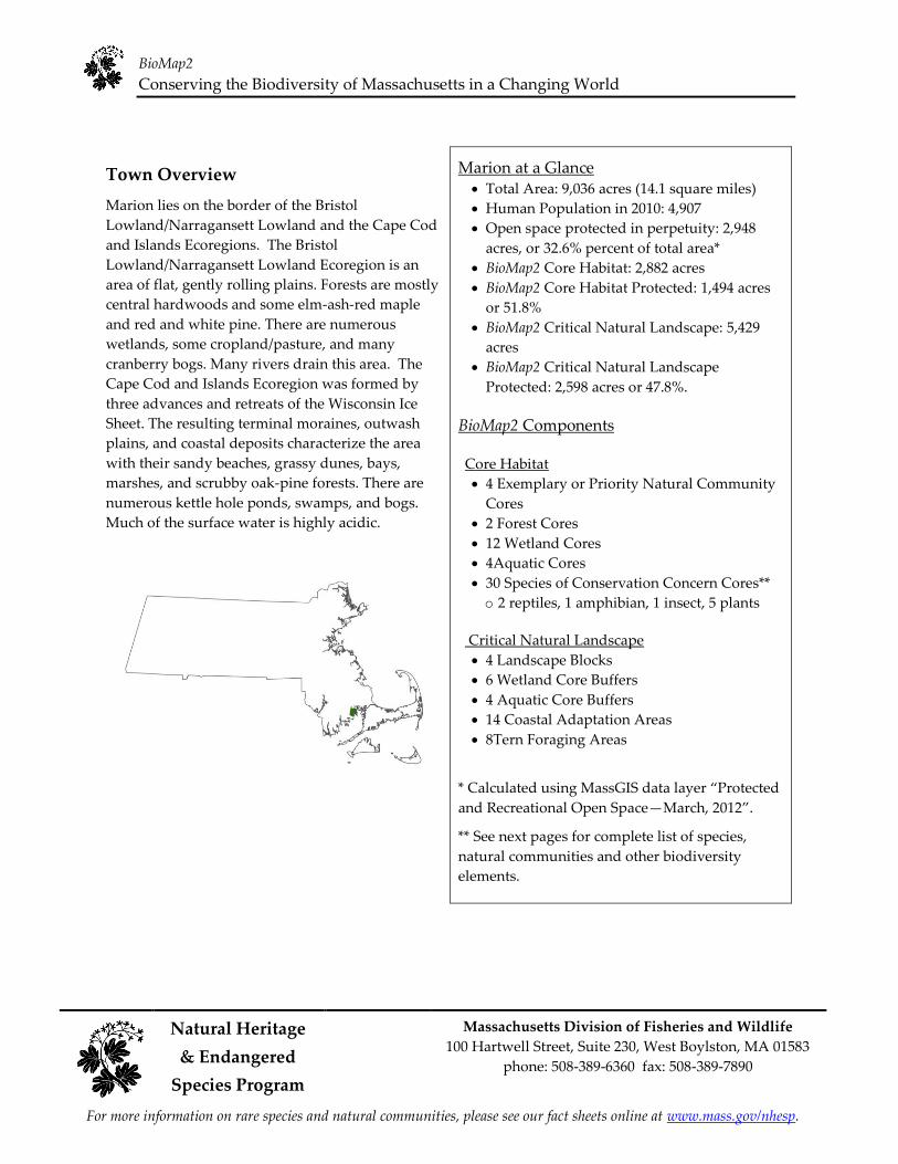
Town Overview
Marion lies on the border of the Bristol
Lowland/Narragansett Lowland and the Cape Cod
and Islands Ecoregions. The Bristol
Lowland/Narragansett Lowland Ecoregion is an
area of flat, gently rolling plains. Forests are mostly
central hardwoods and some elm-ash-red maple
and red and white pine. There are numerous
wetlands, some cropland/pasture, and many
cranberry bogs. Many rivers drain this area. The
Cape Cod and Islands Ecoregion was formed by
three advances and retreats of the Wisconsin Ice
Sheet. The resulting terminal moraines, outwash
plains, and coastal deposits characterize the area
with their sandy beaches, grassy dunes, bays,
marshes, and scrubby oak-pine forests. There are
numerous kettle hole ponds, swamps, and bogs.
Much of the surface water is highly acidic.
Marion at a Glance Total Area: 9,036 acres (14.1 square miles)
Human Population in 2010: 4,907
Open space protected in perpetuity: 2,948
acres, or 32.6% percent of total area*
BioMap2 Core Habitat: 2,882 acres
BioMap2 Core Habitat Protected: 1,494 acres
or 51.8%
BioMap2 Critical Natural Landscape: 5,429
acres
BioMap2 Critical Natural Landscape
Protected: 2,598 acres or 47.8%.
BioMap2 Components
Core Habitat
4 Exemplary or Priority Natural Community
Cores
2 Forest Cores
12 Wetland Cores
4Aquatic Cores
30 Species of Conservation Concern Cores**
o 2 reptiles, 1 amphibian, 1 insect, 5 plants
Critical Natural Landscape 4 Landscape Blocks 6 Wetland Core Buffers 4 Aquatic Core Buffers 14 Coastal Adaptation Areas 8Tern Foraging Areas
* Calculated uɲɨɭɦ MɠɲɲGIS ɣɠɳɠ ɫɠɸɤɱ ȃPɱɮɳɤɢɳɤɣ and Recreational Open SpaceȯMarch, ȮȬȭȮȄ.
** See next pages for complete list of species,
natural communities and other biodiversity
elements.

BioMap2
Conserving the Biodiversity of Massachusetts in a Changing World
Natural Heritage Massachusetts Division of Fisheries and Wildlife
100 Hartwell Street, Suite 230, West Boylston, MA 01583 & Endangered
phone: 508-389-6360 fax: 508-389-7890
Species Program
For more information on rare species and natural communities, please see our fact sheets online at www.mass.gov/nhesp.
BioMap2 Core Habitat and Critical Natural Landscape in Marion
BioMap2
Conserving the Biodiversity of Massachusetts in a Changing World
Natural Heritage Massachusetts Division of Fisheries and Wildlife
100 Hartwell Street, Suite 230, West Boylston, MA 01583 & Endangered
phone: 508-389-6360 fax: 508-389-7890
Species Program
For more information on rare species and natural communities, please see our fact sheets online at www.mass.gov/nhesp.
Species of Conservation Concern, Priority and Exemplary Natural Communities,
and Other Elements of Biodiversity in Marion
Insects
Moths
Water-willow Stem Borer, (Papaipema sulphurata), T
Amphibians
Four-toed Salamander, (Hemidactylium scutatum), Non-listed SWAP
Reptiles
Diamond-backed Terrapin, (Malaclemys terrapin), T Eastern Box Turtle, (Terrapene carolina), SC
Plants
Pygmyweed, (Crassula aquatica), T Mattamuskeet Panic-grass, (Dichanthelium dichotomum ssp. mattamuskeetense), E
Philadelphia Panic-grass, (Panicum philadelphicum ssp. philadelphicum), SC Long-leaved Panic-grass, (Panicum rigidulum ssp. pubescens), T
Northern Gama-grass, (Tripsacum dactyloides), E
Priority Natural Communities
Sea-Level Fen, S1 Estuarine Intertidal: Brackish Tidal Marsh, S1
Coastal Plain Pondshore, S2 Coastal Forest/Woodland, S3
Other BioMap2 Components
Forest Core Aquatic Core
Wetland Core
Landscape Block Aquatic Core Buffer
Wetland Core Buffer
Coastal Adaptation Area Tern Foraging Area E = Endangered
T = Threatened
SC = Special Concern
S1 = Critically Imperiled communities, typically 5 or fewer documented sites or very few remaining
acres in the state. S2 = Imperiled communities, typically 6-20 sites or few remaining acres in the state. S3 = Vulnerable communities, typically have 21-100 sites or limited acreage across the state.
BioMap2
Conserving the Biodiversity of Massachusetts in a Changing World
Natural Heritage Massachusetts Division of Fisheries and Wildlife
100 Hartwell Street, Suite 230, West Boylston, MA 01583 & Endangered
phone: 508-389-6360 fax: 508-389-7890
Species Program
For more information on rare species and natural communities, please see our fact sheets online at www.mass.gov/nhesp.
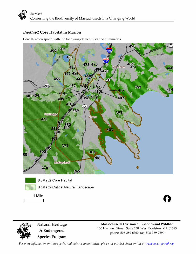
BioMap2 Core Habitat in Marion
Core IDs correspond with the following element lists and summaries.
BioMap2
Conserving the Biodiversity of Massachusetts in a Changing World
Natural Heritage Massachusetts Division of Fisheries and Wildlife
100 Hartwell Street, Suite 230, West Boylston, MA 01583 & Endangered
phone: 508-389-6360 fax: 508-389-7890
Species Program
For more information on rare species and natural communities, please see our fact sheets online at www.mass.gov/nhesp.
Elements of BioMap2 Cores
This section lists all elements of BioMap2 Cores that fall entirely or partially within Marion. The elements
listed here may not occur within the bounds of Marion.
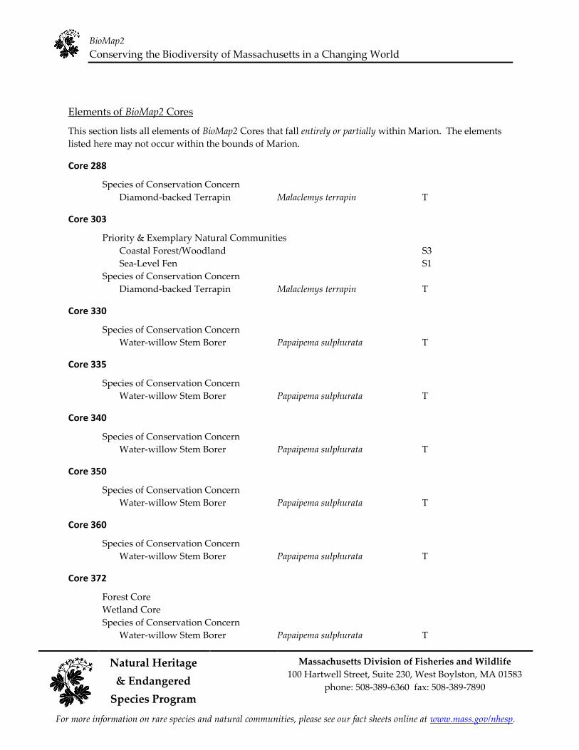
Core 288
Species of Conservation Concern
Diamond-backed Terrapin Malaclemys terrapin T
Core 303
Priority & Exemplary Natural Communities
Coastal Forest/Woodland
Sea-Level Fen
Species of Conservation Concern
Diamond-backed Terrapin Malaclemys terrapin
S3
S1
T
Core 330
Species of Conservation Concern
Water-willow Stem Borer Papaipema sulphurata T
Core 335
Species of Conservation Concern
Water-willow Stem Borer Papaipema sulphurata T
Core 340
Species of Conservation Concern
Water-willow Stem Borer Papaipema sulphurata T
Core 350
Species of Conservation Concern
Water-willow Stem Borer Papaipema sulphurata T
Core 360
Species of Conservation Concern
Water-willow Stem Borer Papaipema sulphurata T
Core 372
Forest Core
Wetland Core
Species of Conservation Concern
Water-willow Stem Borer Papaipema sulphurata T
BioMap2
Conserving the Biodiversity of Massachusetts in a Changing World
Natural Heritage Massachusetts Division of Fisheries and Wildlife
100 Hartwell Street, Suite 230, West Boylston, MA 01583 & Endangered
phone: 508-389-6360 fax: 508-389-7890
Species Program
For more information on rare species and natural communities, please see our fact sheets online at www.mass.gov/nhesp.
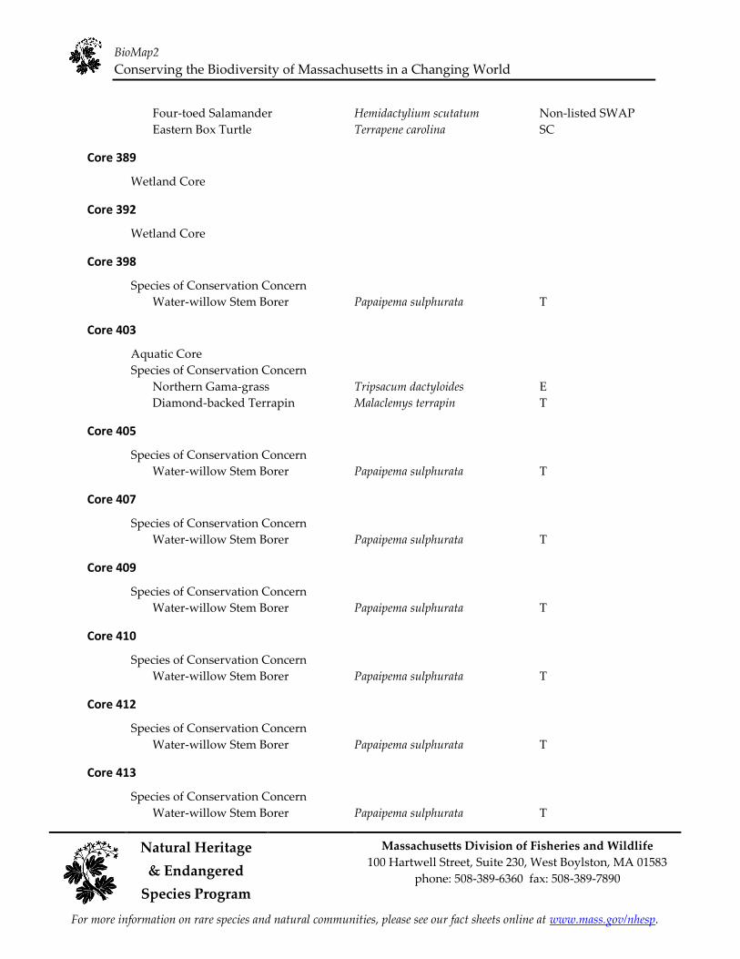
Four-toed Salamander Hemidactylium scutatum Non-listed SWAP
Eastern Box Turtle Terrapene carolina SC
Core 389
Wetland Core
Core 392
Wetland Core
Core 398
Species of Conservation Concern
Water-willow Stem Borer Papaipema sulphurata T
Core 403
Aquatic Core
Species of Conservation Concern
Northern Gama-grass Tripsacum dactyloides E
Diamond-backed Terrapin Malaclemys terrapin T
Core 405
Species of Conservation Concern
Water-willow Stem Borer Papaipema sulphurata T
Core 407
Species of Conservation Concern
Water-willow Stem Borer Papaipema sulphurata T
Core 409
Species of Conservation Concern
Water-willow Stem Borer Papaipema sulphurata T
Core 410
Species of Conservation Concern
Water-willow Stem Borer Papaipema sulphurata T
Core 412
Species of Conservation Concern
Water-willow Stem Borer Papaipema sulphurata T
Core 413
Species of Conservation Concern
Water-willow Stem Borer Papaipema sulphurata T

BioMap2
Conserving the Biodiversity of Massachusetts in a Changing World
Natural Heritage Massachusetts Division of Fisheries and Wildlife
100 Hartwell Street, Suite 230, West Boylston, MA 01583 & Endangered
phone: 508-389-6360 fax: 508-389-7890
Species Program
For more information on rare species and natural communities, please see our fact sheets online at www.mass.gov/nhesp.
Core 414
Species of Conservation Concern
Water-willow Stem Borer Papaipema sulphurata T
Core 417
Species of Conservation Concern
Water-willow Stem Borer Papaipema sulphurata T
Core 418
Species of Conservation Concern
Water-willow Stem Borer Papaipema sulphurata T
Core 419
Species of Conservation Concern
Water-willow Stem Borer Papaipema sulphurata T
Core 421
Forest Core
Wetland Core
Priority & Exemplary Natural Communities
Red Maple Swamp
Species of Conservation Concern
Mattamuskeet Panic-grass Dichanthelium dichotomum ssp. mattamuskeetense E
Water-willow Stem Borer Papaipema sulphurata T
Eastern Box Turtle Terrapene carolina SC
Core 424
Species of Conservation Concern
Water-willow Stem Borer Papaipema sulphurata T
Core 427
Species of Conservation Concern
Water-willow Stem Borer Papaipema sulphurata T
Core 428
Species of Conservation Concern
Water-willow Stem Borer Papaipema sulphurata T
Core 432
Aquatic Core
Priority & Exemplary Natural Communities
Estuarine Intertidal: Brackish Tidal Marsh S1

BioMap2
Conserving the Biodiversity of Massachusetts in a Changing World
Natural Heritage Massachusetts Division of Fisheries and Wildlife
100 Hartwell Street, Suite 230, West Boylston, MA 01583 & Endangered
phone: 508-389-6360 fax: 508-389-7890
Species Program
For more information on rare species and natural communities, please see our fact sheets online at www.mass.gov/nhesp.
Species of Conservation Concern
Mattamuskeet Panic-grass
Pygmyweed
Water-willow Stem Borer
Dichanthelium dichotomum ssp. mattamuskeetense
Crassula aquatica T
Papaipema sulphurata T
E
Core 437
Wetland Core
Core 441
Wetland Core
Core 451
Wetland Core
Core 452
Wetland Core
Core 458
Wetland Core
Core 488
Aquatic Core
Priority & Exemplary Natural Communities
Coastal Plain Pondshore S2
Species of Conservation Concern
Long-leaved Panic-grass Panicum rigidulum ssp. pubescens T
Philadelphia Panic-grass Panicum philadelphicum ssp. philadelphicum SC
Core 769A
Aquatic Core
Priority & Exemplary Natural Communities
Estuarine Intertidal: Freshwater Tidal Marsh S1
Species of Conservation Concern
Bristly Foxtail Setaria parviflora SC Long's Bitter-cress Cardamine longii E Parker's Pipewort Eriocaulon parkeri E Pygmyweed Crassula aquatica T Salt Reedgrass Spartina cynosuroides T Drunk Apamea Moth Apamea inebriata SC New England Bluet Enallagma laterale
Diamond-backed Terrapin Malaclemys terrapin T Piping Plover Charadrius melodus T

BioMap2
Conserving the Biodiversity of Massachusetts in a Changing World
Natural Heritage Massachusetts Division of Fisheries and Wildlife
100 Hartwell Street, Suite 230, West Boylston, MA 01583 & Endangered
phone: 508-389-6360 fax: 508-389-7890
Species Program
For more information on rare species and natural communities, please see our fact sheets online at www.mass.gov/nhesp.
Core Habitat Summaries
Core 288
An 11-acre Core Habitat featuring a Species of Conservation Concern.
The Diamond-backed Terrapin, a medium-sized turtle, inhabits salt marshes which border quiet salt or
brackish tidal waters. They can also be found in mud flats, shallow bays, coves, tidal estuaries and rivers
mouths adjacent to salt water. Adjacent sandy dry upland areas are required for nesting.
Core 303
A 223-acre Core Habitat featuring Priority Natural Communities and a Species of Conservation Concern.
Coastal Forests are mixed deciduous communities, and are often shorter than forests further inland, but
taller than maritime forests. They may have dense shrubs and vines. This community is found in
sheltered areas along the coast. This example of Coastal Forest/Woodland, though small and somewhat
fragmented, occurs within a larger mosaic of natural coastal ecosystems and is in good condition.
Sea-Level Fens are herbaceous/graminoid peatlands that occur at the upland edges of ocean tidal
marshes. The combination of upland freshwater seepage and periodic brackish overwash produces a
mixed plant community of freshwater and estuarine species. This example of Sea Level Fen is of good
size and in good condition, despite the presence of an exotic invasive species which may pose a future
threat to its persistence.
The Diamond-backed Terrapin, a medium-sized turtle, inhabits salt marshes which border quiet salt or
brackish tidal waters. They can also be found in mud flats, shallow bays, coves, tidal estuaries and rivers
mouths adjacent to salt water. Adjacent sandy dry upland areas are required for nesting.
Core 330
A 1-acre Core Habitat featuring a Species of Conservation Concern.
The Water-willow Stem Borer is a yellowish moth with purple-brown shading that inhabits shallow
portions of coastal plain wetlands where water-willow grows. It is endemic to southeastern
Massachusetts.
Core 335
A <1-acre Core Habitat featuring a Species of Conservation Concern.
The Water-willow Stem Borer is a yellowish moth with purple-brown shading that inhabits shallow
portions of coastal plain wetlands where water-willow grows. It is endemic to southeastern
Massachusetts.
BioMap2
Conserving the Biodiversity of Massachusetts in a Changing World
Natural Heritage Massachusetts Division of Fisheries and Wildlife
100 Hartwell Street, Suite 230, West Boylston, MA 01583 & Endangered
phone: 508-389-6360 fax: 508-389-7890
Species Program
For more information on rare species and natural communities, please see our fact sheets online at www.mass.gov/nhesp.
Core 340
A 4-acre Core Habitat featuring a Species of Conservation Concern.
The Water-willow Stem Borer is a yellowish moth with purple-brown shading that inhabits shallow
portions of coastal plain wetlands where water-willow grows. It is endemic to southeastern
Massachusetts.
Core 350
A 2-acre Core Habitat featuring a Species of Conservation Concern.
The Water-willow Stem Borer is a yellowish moth with purple-brown shading that inhabits shallow
portions of coastal plain wetlands where water-willow grows. It is endemic to southeastern
Massachusetts.
Core 360
A 7-acre Core Habitat featuring a Species of Conservation Concern.
The Water-willow Stem Borer is a yellowish moth with purple-brown shading that inhabits shallow
portions of coastal plain wetlands where water-willow grows. It is endemic to southeastern
Massachusetts.
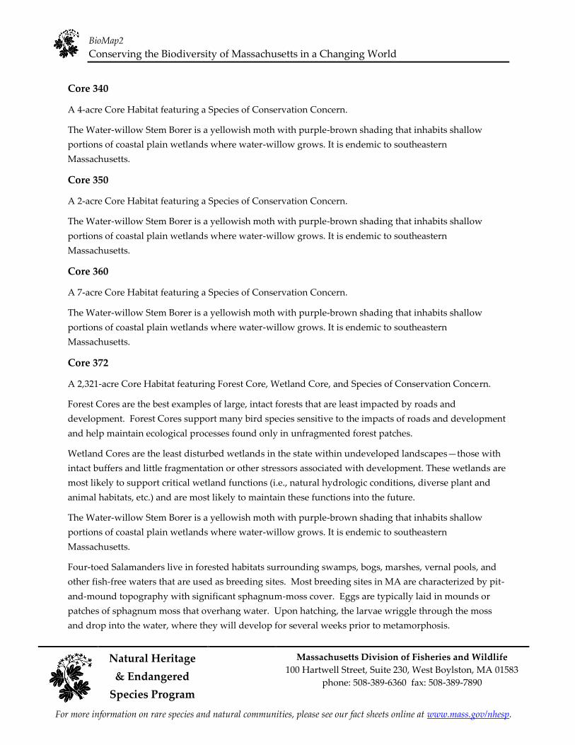
Core 372
A 2,321-acre Core Habitat featuring Forest Core, Wetland Core, and Species of Conservation Concern.
Forest Cores are the best examples of large, intact forests that are least impacted by roads and
development. Forest Cores support many bird species sensitive to the impacts of roads and development
and help maintain ecological processes found only in unfragmented forest patches.
Wetland Cores are the least disturbed wetlands in the state within undeveloped landscapesȯthose with
intact buffers and little fragmentation or other stressors associated with development. These wetlands are
most likely to support critical wetland functions (i.e., natural hydrologic conditions, diverse plant and
animal habitats, etc.) and are most likely to maintain these functions into the future.
The Water-willow Stem Borer is a yellowish moth with purple-brown shading that inhabits shallow
portions of coastal plain wetlands where water-willow grows. It is endemic to southeastern
Massachusetts.
Four-toed Salamanders live in forested habitats surrounding swamps, bogs, marshes, vernal pools, and
other fish-free waters that are used as breeding sites. Most breeding sites in MA are characterized by pit-
and-mound topography with significant sphagnum-moss cover. Eggs are typically laid in mounds or
patches of sphagnum moss that overhang water. Upon hatching, the larvae wriggle through the moss
and drop into the water, where they will develop for several weeks prior to metamorphosis.

BioMap2
Conserving the Biodiversity of Massachusetts in a Changing World
Natural Heritage Massachusetts Division of Fisheries and Wildlife
100 Hartwell Street, Suite 230, West Boylston, MA 01583 & Endangered
phone: 508-389-6360 fax: 508-389-7890
Species Program
For more information on rare species and natural communities, please see our fact sheets online at www.mass.gov/nhesp.
The Eastern Box Turtle is a terrestrial turtle, inhabiting many dry and moist woodland and early
successional habitat. Development, roads, collection, and disease are the primary conservation concerns.
Core 389
A 28-acre Core Habitat featuring Wetland Core.
Wetland Cores are the least disturbed wetlands in the state within undeveloped landscapesȯthose with
intact buffers and little fragmentation or other stressors associated with development. These wetlands are
most likely to support critical wetland functions (i.e., natural hydrologic conditions, diverse plant and
animal habitats, etc.) and are most likely to maintain these functions into the future.
The Wetland Core occurs on very low elevation Granite, one of the least common ecological settings for
Wetland Cores in the state.
Core 392
A 171-acre Core Habitat featuring Wetland Core.
Wetland Cores are the least disturbed wetlands in the state within undeveloped landscapesȯthose with
intact buffers and little fragmentation or other stressors associated with development. These wetlands are
most likely to support critical wetland functions (i.e., natural hydrologic conditions, diverse plant and
animal habitats, etc.) and are most likely to maintain these functions into the future.
The 171-acre Wetland Core is among the largest 20% of Wetland Cores statewide. It occurs on very low
elevation Granite, one of the least common ecological settings for Wetland Cores in the state.
Core 398
A 2-acre Core Habitat featuring a Species of Conservation Concern.
The Water-willow Stem Borer is a yellowish moth with purple-brown shading that inhabits shallow
portions of coastal plain wetlands where water-willow grows. It is endemic to southeastern
Massachusetts.
Core 403
A 1,173-acre Core Habitat featuring Aquatic Core and Species of Conservation Concern.
Aquatic Cores are intact river corridors within which important physical and ecological processes of the
river or stream occur. They delineate integrated and functional ecosystems for fish species and other
aquatic Species of Conservation Concern.
Northern Gama-grass is a large, tuft-forming species that may reach 5 feet tall. It bears large hard
cylindrical seeds. In Massachusetts, it is found at the edge of salt marshes.

BioMap2
Conserving the Biodiversity of Massachusetts in a Changing World
Natural Heritage Massachusetts Division of Fisheries and Wildlife
100 Hartwell Street, Suite 230, West Boylston, MA 01583 & Endangered
phone: 508-389-6360 fax: 508-389-7890
Species Program
For more information on rare species and natural communities, please see our fact sheets online at www.mass.gov/nhesp.
The Diamond-backed Terrapin, a medium-sized turtle, inhabits salt marshes which border quiet salt or
brackish tidal waters. They can also be found in mud flats, shallow bays, coves, tidal estuaries and rivers
mouths adjacent to salt water. Adjacent sandy dry upland areas are required for nesting.
Core 405
A 2-acre Core Habitat featuring a Species of Conservation Concern.
The Water-willow Stem Borer is a yellowish moth with purple-brown shading that inhabits shallow
portions of coastal plain wetlands where water-willow grows. It is endemic to southeastern
Massachusetts.
Core 407
A <1-acre Core Habitat featuring a Species of Conservation Concern.
The Water-willow Stem Borer is a yellowish moth with purple-brown shading that inhabits shallow
portions of coastal plain wetlands where water-willow grows. It is endemic to southeastern
Massachusetts.
Core 409
A 6-acre Core Habitat featuring a Species of Conservation Concern.
The Water-willow Stem Borer is a yellowish moth with purple-brown shading that inhabits shallow
portions of coastal plain wetlands where water-willow grows. It is endemic to southeastern
Massachusetts.
Core 410
A 1-acre Core Habitat featuring a Species of Conservation Concern.
The Water-willow Stem Borer is a yellowish moth with purple-brown shading that inhabits shallow
portions of coastal plain wetlands where water-willow grows. It is endemic to southeastern
Massachusetts.
Core 412
A 1-acre Core Habitat featuring a Species of Conservation Concern.
The Water-willow Stem Borer is a yellowish moth with purple-brown shading that inhabits shallow
portions of coastal plain wetlands where water-willow grows. It is endemic to southeastern
Massachusetts.
Core 413
A 117-acre Core Habitat featuring a Species of Conservation Concern.

BioMap2
Conserving the Biodiversity of Massachusetts in a Changing World
Natural Heritage Massachusetts Division of Fisheries and Wildlife
100 Hartwell Street, Suite 230, West Boylston, MA 01583 & Endangered
phone: 508-389-6360 fax: 508-389-7890
Species Program
For more information on rare species and natural communities, please see our fact sheets online at www.mass.gov/nhesp.
The Water-willow Stem Borer is a yellowish moth with purple-brown shading that inhabits shallow
portions of coastal plain wetlands where water-willow grows. It is endemic to southeastern
Massachusetts.
Core 414
A 1-acre Core Habitat featuring a Species of Conservation Concern.
The Water-willow Stem Borer is a yellowish moth with purple-brown shading that inhabits shallow
portions of coastal plain wetlands where water-willow grows. It is endemic to southeastern
Massachusetts.
Core 417
A 5-acre Core Habitat featuring a Species of Conservation Concern.
The Water-willow Stem Borer is a yellowish moth with purple-brown shading that inhabits shallow
portions of coastal plain wetlands where water-willow grows. It is endemic to southeastern
Massachusetts.
Core 418
A 2-acre Core Habitat featuring a Species of Conservation Concern.
The Water-willow Stem Borer is a yellowish moth with purple-brown shading that inhabits shallow
portions of coastal plain wetlands where water-willow grows. It is endemic to southeastern
Massachusetts.
Core 419
A <1-acre Core Habitat featuring a Species of Conservation Concern.
The Water-willow Stem Borer is a yellowish moth with purple-brown shading that inhabits shallow
portions of coastal plain wetlands where water-willow grows. It is endemic to southeastern
Massachusetts.
Core 421
A 3,717-acre Core Habitat featuring Forest Core, Wetland Core, Priority Natural Communities, and
Species of Conservation Concern.
Forest Cores are the best examples of large, intact forests that are least impacted by roads and
development. Forest Cores support many bird species sensitive to the impacts of roads and development
and help maintain ecological processes found only in unfragmented forest patches.
This important 2,275-acre Forest Core is the third largest in the ecoregion and is almost entirely protected,
with the majority of the area in Rochester and Mattapoisett.

BioMap2
Conserving the Biodiversity of Massachusetts in a Changing World
Natural Heritage Massachusetts Division of Fisheries and Wildlife
100 Hartwell Street, Suite 230, West Boylston, MA 01583 & Endangered
phone: 508-389-6360 fax: 508-389-7890
Species Program
For more information on rare species and natural communities, please see our fact sheets online at www.mass.gov/nhesp.
Wetland Cores are the least disturbed wetlands in the state within undeveloped landscapesȯthose with
intact buffers and little fragmentation or other stressors associated with development. These wetlands are
most likely to support critical wetland functions (i.e., natural hydrologic conditions, diverse plant and
animal habitats, etc.) and are most likely to maintain these functions into the future.
Red Maple Swamps are acidic forested wetlands that are dominated by red maple. They are the most
common forested wetlands in Massachusetts. This community type is highly variable in its species
composition. This example of Red Maple Swamp is large, well-buffered, and free of exotic invasive
species.
Mattamuskeet Panic-grass is found in seasonally wet, sunny habitats that are often created through some
form of human disturbance or intervention. These include trails, powerlines, roadsides and ditches
which have been opened up in or near a swamp, marsh, or streambed. The exposed, damp to wet soils
are predominantly sandy, but often covered with a thin peaty or organic layer that indicates an originally
bog-like habitat.
The Water-willow Stem Borer is a yellowish moth with purple-brown shading that inhabits shallow
portions of coastal plain wetlands where water-willow grows. It is endemic to southeastern
Massachusetts.
The Eastern Box Turtle is a terrestrial turtle, inhabiting many dry and moist woodland and early
successional habitat. Development, roads, collection, and disease are the primary conservation concerns.
Core 424
A 7-acre Core Habitat featuring a Species of Conservation Concern.
The Water-willow Stem Borer is a yellowish moth with purple-brown shading that inhabits shallow
portions of coastal plain wetlands where water-willow grows. It is endemic to southeastern
Massachusetts.
Core 427
A 6-acre Core Habitat featuring a Species of Conservation Concern.
The Water-willow Stem Borer is a yellowish moth with purple-brown shading that inhabits shallow
portions of coastal plain wetlands where water-willow grows. It is endemic to southeastern
Massachusetts.
Core 428
A 5-acre Core Habitat featuring a Species of Conservation Concern.
The Water-willow Stem Borer is a yellowish moth with purple-brown shading that inhabits shallow
portions of coastal plain wetlands where water-willow grows. It is endemic to southeastern
Massachusetts.
BioMap2
Conserving the Biodiversity of Massachusetts in a Changing World
Natural Heritage Massachusetts Division of Fisheries and Wildlife
100 Hartwell Street, Suite 230, West Boylston, MA 01583 & Endangered
phone: 508-389-6360 fax: 508-389-7890
Species Program
For more information on rare species and natural communities, please see our fact sheets online at www.mass.gov/nhesp.
Core 432
A 27-acre Core Habitat featuring Aquatic Core, Priority Natural Communities, and Species of
Conservation Concern.
Aquatic Cores are intact river corridors within which important physical and ecological processes of the
river or stream occur. They delineate integrated and functional ecosystems for fish species and other
aquatic Species of Conservation Concern.
The Brackish Tidal Marsh community is often found in stretches of coastal rivers where salt and fresh
water mix, and consists of mixed herbaceous vegetation that is flooded by daily tides. The community is
structurally diverse, including high marsh and low marsh. This example is small, not well buffered, and
has some unusual native plant species as well as some exotic invasive species.
Mattamuskeet Panic-grass is found in seasonally wet, sunny habitats that are often created through some
form of human disturbance or intervention. These include trails, powerlines, roadsides and ditches
which have been opened up in or near a swamp, marsh, or streambed. The exposed, damp to wet soils
are predominantly sandy, but often covered with a thin peaty or organic layer that indicates an originally
bog-like habitat.
Pygmyweed is a tiny, annual, fleshy, herbaceous aquatic plant that grows on coastal or freshwater shores.
The Water-willow Stem Borer is a yellowish moth with purple-brown shading that inhabits shallow
portions of coastal plain wetlands where water-willow grows. It is endemic to southeastern
Massachusetts.
Core 437
An 80-acre Core Habitat featuring Wetland Core.
Wetland Cores are the least disturbed wetlands in the state within undeveloped landscapesȯthose with
intact buffers and little fragmentation or other stressors associated with development. These wetlands are
most likely to support critical wetland functions (i.e., natural hydrologic conditions, diverse plant and
animal habitats, etc.) and are most likely to maintain these functions into the future.
Core 441
A 13-acre Core Habitat featuring Wetland Core.
Wetland Cores are the least disturbed wetlands in the state within undeveloped landscapesȯthose with
intact buffers and little fragmentation or other stressors associated with development. These wetlands are
most likely to support critical wetland functions (i.e., natural hydrologic conditions, diverse plant and
animal habitats, etc.) and are most likely to maintain these functions into the future.

BioMap2
Conserving the Biodiversity of Massachusetts in a Changing World
Natural Heritage Massachusetts Division of Fisheries and Wildlife
100 Hartwell Street, Suite 230, West Boylston, MA 01583 & Endangered
phone: 508-389-6360 fax: 508-389-7890
Species Program
For more information on rare species and natural communities, please see our fact sheets online at www.mass.gov/nhesp.
Core 451
A 10-acre Core Habitat featuring Wetland Core.
Wetland Cores are the least disturbed wetlands in the state within undeveloped landscapesȯthose with
intact buffers and little fragmentation or other stressors associated with development. These wetlands are
most likely to support critical wetland functions (i.e., natural hydrologic conditions, diverse plant and
animal habitats, etc.) and are most likely to maintain these functions into the future.
Core 452
A 35-acre Core Habitat featuring Wetland Core.
Wetland Cores are the least disturbed wetlands in the state within undeveloped landscapesȯthose with
intact buffers and little fragmentation or other stressors associated with development. These wetlands are
most likely to support critical wetland functions (i.e., natural hydrologic conditions, diverse plant and
animal habitats, etc.) and are most likely to maintain these functions into the future.
Core 458
An 18-acre Core Habitat featuring Wetland Core.
Wetland Cores are the least disturbed wetlands in the state within undeveloped landscapesȯthose with
intact buffers and little fragmentation or other stressors associated with development. These wetlands are
most likely to support critical wetland functions (i.e., natural hydrologic conditions, diverse plant and
animal habitats, etc.) and are most likely to maintain these functions into the future.
Core 488
A 57-acre Core Habitat featuring Aquatic Core, Priority Natural Communities, and Species of
Conservation Concern.
Aquatic Cores are intact river corridors within which important physical and ecological processes of the
river or stream occur. They delineate integrated and functional ecosystems for fish species and other
aquatic Species of Conservation Concern.
Coastal Plain Pondshores are globally rare herbaceous communities of exposed pondshores with a
distinct coastal plain flora. Water levels change with the water table, typically leaving an exposed
shoreline in late summer where many rare species grow. This example of Coastal Plain Pondshore is in
fair condition, and is degraded by intensive use for cranberry production. An abandoned beach area is
slowly recovering, but lacks the diversity of this community type.
Long-leaved Panic-grass, a slender-stemmed perennial of the Grass family, grows in dense tufts. Habitats
include an open, peaty border of a small basin marsh, a very shallow fresh water pond, a seasonally wet,
peaty depression under powerlines, and a disturbed, former sand-extraction area that is seasonally
inundated by groundwater.

BioMap2
Conserving the Biodiversity of Massachusetts in a Changing World
Natural Heritage Massachusetts Division of Fisheries and Wildlife
100 Hartwell Street, Suite 230, West Boylston, MA 01583 & Endangered
phone: 508-389-6360 fax: 508-389-7890
Species Program
For more information on rare species and natural communities, please see our fact sheets online at www.mass.gov/nhesp.
Philadelphia Panic-grass, a member of the Grass family, is a slender, hairy, herbaceous, annual grass with
yellow-green leaves. Philadelphia Panic-grass subspecies philadelphicum grows primarily on sandy
shores of lakes and streams.
Core 769A
A 2,560-acre section of a larger 37,136-acre Core Habitat featuring Aquatic Core, Priority Natural
Communities, and Species of Conservation Concern.
On the coast of Wareham, the Weweantic and Wareham Rivers empty out together into Buzzards Bay.
This riverine section of a very large Core Habitat supports 11 rare and uncommon plants and animals,
including the Diamond-backed Terrapin, which nests at the upland edges of salt marshes. The heads of
tide on the Weweantic and the Agawam River, a tributary to the Wareham River, host three rare plants -
the globally rare and Endangered Parker's Pipewort and the Threatened Pygmyweed and Salt Reedgrass.
On the Agawam River, these rare plants are found in a very rare type of natural community, a Freshwater
Tidal Marsh.
The Freshwater Tidal Marsh community occurs along coastal rivers, upstream of brackish tidal marsh.
Here the marshes are flooded by tidal action twice a day, but with fresh water. These structurally diverse
marshes are globally rare. This example of Freshwater Tidal Marsh is of moderate size, and is in fairly
good condition despite having little buffering by naturally vegetated land.
Aquatic Cores are intact river corridors within which important physical and ecological processes of the
river or stream occur. They delineate integrated and functional ecosystems for fish species and other
aquatic Species of Conservation Concern.

BioMap2
Conserving the Biodiversity of Massachusetts in a Changing World
Natural Heritage Massachusetts Division of Fisheries and Wildlife
100 Hartwell Street, Suite 230, West Boylston, MA 01583 & Endangered
phone: 508-389-6360 fax: 508-389-7890
Species Program
For more information on rare species and natural communities, please see our fact sheets online at www.mass.gov/nhesp.
BioMap2 Critical Natural Landscape in Marion
Critical Natural Landscape IDs correspond with the following element lists and summaries.

BioMap2
Conserving the Biodiversity of Massachusetts in a Changing World
Natural Heritage Massachusetts Division of Fisheries and Wildlife
100 Hartwell Street, Suite 230, West Boylston, MA 01583 & Endangered
phone: 508-389-6360 fax: 508-389-7890
Species Program
For more information on rare species and natural communities, please see our fact sheets online at www.mass.gov/nhesp.
Elements of BioMap2 Critical Natural Landscapes
This section lists all elements of BioMap2 Critical Natural Landscapes that fall entirely or partially within
Marion. The elements listed here may not occur within the bounds of Marion.
CNL 198
Coastal Adaptation Area
Tern Foraging Area
CNL 199
Coastal Adaptation Area
Tern Foraging Area
CNL 208
Coastal Adaptation Area
Tern Foraging Area
CNL 217
Coastal Adaptation Area
Tern Foraging Area
CNL 249
Coastal Adaptation Area
Tern Foraging Area
CNL 250
Landscape Block
Wetland Core Buffer
CNL 252
Coastal Adaptation Area
Tern Foraging Area
CNL 262
Coastal Adaptation Area
CNL 264
Coastal Adaptation Area
CNL 287
Aquatic Core Buffer
Coastal Adaptation Area
CNL 429
Aquatic Core Buffer
Coastal Adaptation Area
Landscape Block
Tern Foraging Area

BioMap2
Conserving the Biodiversity of Massachusetts in a Changing World
Natural Heritage Massachusetts Division of Fisheries and Wildlife
100 Hartwell Street, Suite 230, West Boylston, MA 01583 & Endangered
phone: 508-389-6360 fax: 508-389-7890
Species Program
For more information on rare species and natural communities, please see our fact sheets online at www.mass.gov/nhesp.
CNL 468
Aquatic Core Buffer
Coastal Adaptation Area
Landscape Block
Tern Foraging Area

BioMap2
Conserving the Biodiversity of Massachusetts in a Changing World
Natural Heritage Massachusetts Division of Fisheries and Wildlife
100 Hartwell Street, Suite 230, West Boylston, MA 01583 & Endangered
phone: 508-389-6360 fax: 508-389-7890
Species Program
For more information on rare species and natural communities, please see our fact sheets online at www.mass.gov/nhesp.
Critical Natural Landscape Summaries
CNL 198
A <1-acre Critical Natural Landscape featuring Coastal Adaptation Area and Tern Foraging Area.
The coastal habitats of Massachusetts are particularly vulnerable to potential sea-level rise in the next
century, which many estimates suggest is likely to exceed one meter. Therefore, in addition to prioritizing
current coastal habitats, the creators of BioMap2 examined the landward side of salt marshes to determine
where these habitats might move to as sea levels rise. Undeveloped lands adjacent to and up to one and a
half meters above existing salt marshes were identified, and included as Critical Natural Landscapes with
high potential to support inland migration of salt marsh and other coastal habitats over the coming
century.
Terns range widely from their breeding colonies to forage. While the breeding and staging areas for
Roseate, Arctic, Common, and Least Terns were included in the Species of Conservation Concern Core
Habitat for BioMap2, tern foraging areas were included in BioMap2 as part of Critical Natural Landscape.
The extent of foraging habitat for Arctic, Common, and Roseate Terns depends on the size of the breeding
colony. For Least Tern, all shallow marine and estuarine waters within 2 miles of recent colony sites and
up to 1 mile offshore were mapped as foraging habitat.
CNL 199
A <1-acre Critical Natural Landscape featuring Coastal Adaptation Area and Tern Foraging Area.
The coastal habitats of Massachusetts are particularly vulnerable to potential sea-level rise in the next
century, which many estimates suggest is likely to exceed one meter. Therefore, in addition to prioritizing
current coastal habitats, the creators of BioMap2 examined the landward side of salt marshes to determine
where these habitats might move to as sea levels rise. Undeveloped lands adjacent to and up to one and a
half meters above existing salt marshes were identified, and included as Critical Natural Landscapes with
high potential to support inland migration of salt marsh and other coastal habitats over the coming
century.
Terns range widely from their breeding colonies to forage. While the breeding and staging areas for
Roseate, Arctic, Common, and Least Terns were included in the Species of Conservation Concern Core
Habitat for BioMap2, tern foraging areas were included in BioMap2 as part of Critical Natural Landscape.
The extent of foraging habitat for Arctic, Common, and Roseate Terns depends on the size of the breeding
colony. For Least Tern, all shallow marine and estuarine waters within 2 miles of recent colony sites and
up to 1 mile offshore were mapped as foraging habitat.
CNL 208
A 46-acre Critical Natural Landscape featuring Coastal Adaptation Area and Tern Foraging Area.
The coastal habitats of Massachusetts are particularly vulnerable to potential sea-level rise in the next
century, which many estimates suggest is likely to exceed one meter. Therefore, in addition to prioritizing
current coastal habitats, the creators of BioMap2 examined the landward side of salt marshes to determine
where these habitats might move to as sea levels rise. Undeveloped lands adjacent to and up to one and a
BioMap2
Conserving the Biodiversity of Massachusetts in a Changing World
Natural Heritage Massachusetts Division of Fisheries and Wildlife
100 Hartwell Street, Suite 230, West Boylston, MA 01583 & Endangered
phone: 508-389-6360 fax: 508-389-7890
Species Program
For more information on rare species and natural communities, please see our fact sheets online at www.mass.gov/nhesp.
half meters above existing salt marshes were identified, and included as Critical Natural Landscapes with
high potential to support inland migration of salt marsh and other coastal habitats over the coming
century.
Terns range widely from their breeding colonies to forage. While the breeding and staging areas for
Roseate, Arctic, Common, and Least Terns were included in the Species of Conservation Concern Core
Habitat for BioMap2, tern foraging areas were included in BioMap2 as part of Critical Natural Landscape.
The extent of foraging habitat for Arctic, Common, and Roseate Terns depends on the size of the breeding
colony. For Least Tern, all shallow marine and estuarine waters within 2 miles of recent colony sites and
up to 1 mile offshore were mapped as foraging habitat.
CNL 217
A 62-acre Critical Natural Landscape featuring Coastal Adaptation Area and Tern Foraging Area.
The coastal habitats of Massachusetts are particularly vulnerable to potential sea-level rise in the next
century, which many estimates suggest is likely to exceed one meter. Therefore, in addition to prioritizing
current coastal habitats, the creators of BioMap2 examined the landward side of salt marshes to determine
where these habitats might move to as sea levels rise. Undeveloped lands adjacent to and up to one and a
half meters above existing salt marshes were identified, and included as Critical Natural Landscapes with
high potential to support inland migration of salt marsh and other coastal habitats over the coming
century.
Terns range widely from their breeding colonies to forage. While the breeding and staging areas for
Roseate, Arctic, Common, and Least Terns were included in the Species of Conservation Concern Core
Habitat for BioMap2, tern foraging areas were included in BioMap2 as part of Critical Natural Landscape.
The extent of foraging habitat for Arctic, Common, and Roseate Terns depends on the size of the breeding
colony. For Least Tern, all shallow marine and estuarine waters within 2 miles of recent colony sites and
up to 1 mile offshore were mapped as foraging habitat.
CNL 249
A 65-acre Critical Natural Landscape featuring Coastal Adaptation Area and Tern Foraging Area.
The coastal habitats of Massachusetts are particularly vulnerable to potential sea-level rise in the next
century, which many estimates suggest is likely to exceed one meter. Therefore, in addition to prioritizing
current coastal habitats, the creators of BioMap2 examined the landward side of salt marshes to determine
where these habitats might move to as sea levels rise. Undeveloped lands adjacent to and up to one and a
half meters above existing salt marshes were identified, and included as Critical Natural Landscapes with
high potential to support inland migration of salt marsh and other coastal habitats over the coming
century.
Terns range widely from their breeding colonies to forage. While the breeding and staging areas for
Roseate, Arctic, Common, and Least Terns were included in the Species of Conservation Concern Core
Habitat for BioMap2, tern foraging areas were included in BioMap2 as part of Critical Natural Landscape.
The extent of foraging habitat for Arctic, Common, and Roseate Terns depends on the size of the breeding
colony. For Least Tern, all shallow marine and estuarine waters within 2 miles of recent colony sites and
up to 1 mile offshore were mapped as foraging habitat.
BioMap2
Conserving the Biodiversity of Massachusetts in a Changing World
Natural Heritage Massachusetts Division of Fisheries and Wildlife
100 Hartwell Street, Suite 230, West Boylston, MA 01583 & Endangered
phone: 508-389-6360 fax: 508-389-7890
Species Program
For more information on rare species and natural communities, please see our fact sheets online at www.mass.gov/nhesp.
CNL 250
A 3,411-acre Critical Natural Landscape featuring Wetland Core Buffer and Landscape Block.
A variety of analyses were used to identify protective upland buffers around wetlands and rivers. One,
the variable width buffers methodology, included the most intact areas around each wetland and river,
by extending deeper into surrounding unfragmented habitats than into developed areas adjacent to each
wetland. Other upland buffers were identified through the rare species habitat analysis. In this way, the
conservation of wetland buffers will support the habitats and functionality of each wetland, and also
include adjacent uplands that are important for many species that move between habitat types.
Landscape Blocks, the primary component of Critical Natural Landscapes, are large areas of intact
predominately natural vegetation, consisting of contiguous forests, wetlands, rivers, lakes, and ponds, as
well as coastal habitats such as barrier beaches and salt marshes. Pastures and power-line rights-of-way,
which are less intensively altered than most developed areas, were also included since they provide
habitat and connectivity for many species. Collectively, these natural cover types total 3.6 million acres
across the state. An Ecological Integrity assessment was used to identify the most intact and least
fragmented areas. These large Landscape Blocks are most likely to maintain dynamic ecological processes
such as buffering, connectivity, natural disturbance, and hydrological regimes, all of which help to
support wide-ranging wildlife species and many other elements of biodiversity.
In order to identify critical Landscape Blocks in each ecoregion, different Ecological Integrity thresholds
were used to select the largest intact landscape patches in each ecoregion while avoiding altered habitat
as much as possible. This ecoregional representation accomplishes a key goal of BioMap2 to protect the
ecological stages that support a broad suite of biodiversity in the context of climate change. Blocks were
defined by major roads, and minimum size thresholds differed among ecoregions to ensure that BioMap2
includes the best of the best in each ecoregion.
CNL 252
A 68-acre Critical Natural Landscape featuring Coastal Adaptation Area and Tern Foraging Area.
The coastal habitats of Massachusetts are particularly vulnerable to potential sea-level rise in the next
century, which many estimates suggest is likely to exceed one meter. Therefore, in addition to prioritizing
current coastal habitats, the creators of BioMap2 examined the landward side of salt marshes to determine
where these habitats might move to as sea levels rise. Undeveloped lands adjacent to and up to one and a
half meters above existing salt marshes were identified, and included as Critical Natural Landscapes with
high potential to support inland migration of salt marsh and other coastal habitats over the coming
century.
Terns range widely from their breeding colonies to forage. While the breeding and staging areas for
Roseate, Arctic, Common, and Least Terns were included in the Species of Conservation Concern Core
Habitat for BioMap2, tern foraging areas were included in BioMap2 as part of Critical Natural Landscape.
The extent of foraging habitat for Arctic, Common, and Roseate Terns depends on the size of the breeding
colony. For Least Tern, all shallow marine and estuarine waters within 2 miles of recent colony sites and
up to 1 mile offshore were mapped as foraging habitat.

BioMap2
Conserving the Biodiversity of Massachusetts in a Changing World
Natural Heritage Massachusetts Division of Fisheries and Wildlife
100 Hartwell Street, Suite 230, West Boylston, MA 01583 & Endangered
phone: 508-389-6360 fax: 508-389-7890
Species Program
For more information on rare species and natural communities, please see our fact sheets online at www.mass.gov/nhesp.
CNL 262
A 26-acre Critical Natural Landscape featuring Coastal Adaptation Area.
The coastal habitats of Massachusetts are particularly vulnerable to potential sea-level rise in the next
century, which many estimates suggest is likely to exceed one meter. Therefore, in addition to prioritizing
current coastal habitats, the creators of BioMap2 examined the landward side of salt marshes to determine
where these habitats might move to as sea levels rise. Undeveloped lands adjacent to and up to one and a
half meters above existing salt marshes were identified, and included as Critical Natural Landscapes with
high potential to support inland migration of salt marsh and other coastal habitats over the coming
century.
CNL 264
A 131-acre Critical Natural Landscape featuring Coastal Adaptation Area.
The coastal habitats of Massachusetts are particularly vulnerable to potential sea-level rise in the next
century, which many estimates suggest is likely to exceed one meter. Therefore, in addition to prioritizing
current coastal habitats, the creators of BioMap2 examined the landward side of salt marshes to determine
where these habitats might move to as sea levels rise. Undeveloped lands adjacent to and up to one and a
half meters above existing salt marshes were identified, and included as Critical Natural Landscapes with
high potential to support inland migration of salt marsh and other coastal habitats over the coming
century.
CNL 287
A 212-acre Critical Natural Landscape featuring Aquatic Core Buffer and Coastal Adaptation Area.
A variety of analyses were used to identify protective upland buffers around wetlands and rivers. One,
the variable width buffers methodology, included the most intact areas around each wetland and river,
by extending deeper into surrounding unfragmented habitats than into developed areas adjacent to each
wetland. Other upland buffers were identified through the rare species habitat analysis. In this way, the
conservation of wetland buffers will support the habitats and functionality of each wetland, and also
include adjacent uplands that are important for many species that move between habitat types.
The coastal habitats of Massachusetts are particularly vulnerable to potential sea-level rise in the next
century, which many estimates suggest is likely to exceed one meter. Therefore, in addition to prioritizing
current coastal habitats, the creators of BioMap2 examined the landward side of salt marshes to
determine where these habitats might move to as sea levels rise. Undeveloped lands adjacent to and up to
one and a half meters above existing salt marshes were identified, and included as Critical Natural
Landscapes with high potential to support inland migration of salt marsh and other coastal habitats over
the coming century.
CNL 429
A 38,511-acre Critical Natural Landscape featuring Aquatic Core Buffer, Landscape Block, Coastal
Adaptation Area, and Tern Foraging Area.
A variety of analyses were used to identify protective upland buffers around wetlands and rivers. One,
the variable width buffers methodology, included the most intact areas around each wetland and river,

BioMap2
Conserving the Biodiversity of Massachusetts in a Changing World
Natural Heritage Massachusetts Division of Fisheries and Wildlife
100 Hartwell Street, Suite 230, West Boylston, MA 01583 & Endangered
phone: 508-389-6360 fax: 508-389-7890
Species Program
For more information on rare species and natural communities, please see our fact sheets online at www.mass.gov/nhesp.
by extending deeper into surrounding unfragmented habitats than into developed areas adjacent to each
wetland. Other upland buffers were identified through the rare species habitat analysis. In this way, the
conservation of wetland buffers will support the habitats and functionality of each wetland, and also
include adjacent uplands that are important for many species that move between habitat types.
Landscape Blocks, the primary component of Critical Natural Landscapes, are large areas of intact
predominately natural vegetation, consisting of contiguous forests, wetlands, rivers, lakes, and ponds, as
well as coastal habitats such as barrier beaches and salt marshes. Pastures and power-line rights-of-way,
which are less intensively altered than most developed areas, were also included since they provide
habitat and connectivity for many species. Collectively, these natural cover types total 3.6 million acres
across the state. An Ecological Integrity assessment was used to identify the most intact and least
fragmented areas. These large Landscape Blocks are most likely to maintain dynamic ecological processes
such as buffering, connectivity, natural disturbance, and hydrological regimes, all of which help to
support wide-ranging wildlife species and many other elements of biodiversity.
In order to identify critical Landscape Blocks in each ecoregion, different Ecological Integrity thresholds
were used to select the largest intact landscape patches in each ecoregion while avoiding altered habitat
as much as possible. This ecoregional representation accomplishes a key goal of BioMap2 to protect the
ecological stages that support a broad suite of biodiversity in the context of climate change. Blocks were
defined by major roads, and minimum size thresholds differed among ecoregions to ensure that BioMap2
includes the best of the best in each ecoregion.
At 26,428 acres, this Landscape Block is the second largest in the ecoregion and among the largest 20% of
all Blocks statewide, which is especially important in the fragmented landscapes of Southeastern
Massachusetts. This Block, which supports globally important sandplain habitats, is centered around the
Myles Standish State Forest, however significant portions of the Block remain unprotected.
The coastal habitats of Massachusetts are particularly vulnerable to potential sea-level rise in the next
century, which many estimates suggest is likely to exceed one meter. Therefore, in addition to prioritizing
current coastal habitats, the creators of BioMap2 examined the landward side of salt marshes to
determine where these habitats might move to as sea levels rise. Undeveloped lands adjacent to and up to
one and a half meters above existing salt marshes were identified, and included as Critical Natural
Landscapes with high potential to support inland migration of salt marsh and other coastal habitats over
the coming century.
Terns range widely from their breeding colonies to forage. While the breeding and staging areas for
Roseate, Arctic, Common, and Least Terns were included in the Species of Conservation Concern Core
Habitat for BioMap2, tern foraging areas were included in BioMap2 as part of Critical Natural Landscape.
The extent of foraging habitat for Arctic, Common, and Roseate Terns depends on the size of the breeding
colony. For Least Tern, all shallow marine and estuarine waters within 2 miles of recent colony sites and
up to 1 mile offshore were mapped as foraging habitat.
CNL 468
A 64,735-acre Critical Natural Landscape featuring Aquatic Core Buffer, Landscape Block, Coastal
Adaptation Area, and Tern Foraging Area.

BioMap2
Conserving the Biodiversity of Massachusetts in a Changing World
Natural Heritage Massachusetts Division of Fisheries and Wildlife
100 Hartwell Street, Suite 230, West Boylston, MA 01583 & Endangered
phone: 508-389-6360 fax: 508-389-7890
Species Program
For more information on rare species and natural communities, please see our fact sheets online at www.mass.gov/nhesp.
A variety of analyses were used to identify protective upland buffers around wetlands and rivers. One,
the variable width buffers methodology, included the most intact areas around each wetland and river,
by extending deeper into surrounding unfragmented habitats than into developed areas adjacent to each
wetland. Other upland buffers were identified through the rare species habitat analysis. In this way, the
conservation of wetland buffers will support the habitats and functionality of each wetland, and also
include adjacent uplands that are important for many species that move between habitat types.
Landscape Blocks, the primary component of Critical Natural Landscapes, are large areas of intact
predominately natural vegetation, consisting of contiguous forests, wetlands, rivers, lakes, and ponds, as
well as coastal habitats such as barrier beaches and salt marshes. Pastures and power-line rights-of-way,
which are less intensively altered than most developed areas, were also included since they provide
habitat and connectivity for many species. Collectively, these natural cover types total 3.6 million acres
across the state. An Ecological Integrity assessment was used to identify the most intact and least
fragmented areas. These large Landscape Blocks are most likely to maintain dynamic ecological processes
such as buffering, connectivity, natural disturbance, and hydrological regimes, all of which help to
support wide-ranging wildlife species and many other elements of biodiversity.
In order to identify critical Landscape Blocks in each ecoregion, different Ecological Integrity thresholds
were used to select the largest intact landscape patches in each ecoregion while avoiding altered habitat
as much as possible. This ecoregional representation accomplishes a key goal of BioMap2 to protect the
ecological stages that support a broad suite of biodiversity in the context of climate change. Blocks were
defined by major roads, and minimum size thresholds differed among ecoregions to ensure that BioMap2
includes the best of the best in each ecoregion.
At 36,331 acres, this Landscape Block is the second largest in the ecoregion and the seventh largest in
Massachusetts. This Landscape Block includes a rich mosaic of important habitats including extensive
upland forest and a relatively high percentage of forested and open wetlands, lakes, and ponds, including
a portion of the Assawompest Pond Complex. These large landscapes provide invaluable wildlife
habitat and other ecosystem values such as clean drinking water and absorbing carbon from the
atmosphere. This Block is only partially protected.
The coastal habitats of Massachusetts are particularly vulnerable to potential sea-level rise in the next
century, which many estimates suggest is likely to exceed one meter. Therefore, in addition to prioritizing
current coastal habitats, the creators of BioMap2 examined the landward side of salt marshes to
determine where these habitats might move to as sea levels rise. Undeveloped lands adjacent to and up to
one and a half meters above existing salt marshes were identified, and included as Critical Natural
Landscapes with high potential to support inland migration of salt marsh and other coastal habitats over
the coming century.
Terns range widely from their breeding colonies to forage. While the breeding and staging areas for
Roseate, Arctic, Common, and Least Terns were included in the Species of Conservation Concern Core
Habitat for BioMap2, tern foraging areas were included in BioMap2 as part of Critical Natural Landscape.
The extent of foraging habitat for Arctic, Common, and Roseate Terns depends on the size of the breeding
colony. For Least Tern, all shallow marine and estuarine waters within 2 miles of recent colony sites and
up to 1 mile offshore were mapped as foraging habitat.

Help Save Endangered Wildlife!
Please contribute on your Massachusetts income tax form or directly to the
Natural Heritage &
Endangered Species Fund
To learn more about the Natural Heritage & Endangered Species Program ɠɭɣ ɳɧɤ Cɮɬɬɮɭɶɤɠɫɳɧ˘ɲ ɱɠɱɤ ɲɯɤɢɨɤɲˆ ɵɨɲɨɳ ɮɴɱ web site at www.mass.gov/nhesp.