mary carr climate change at the arctic's edge
TRANSCRIPT

Climate Change at the Arctic's Edge
Educator Fellowship with Earthwatch InstituteJune 19 – 29, 2011, Churchill, Manitoba
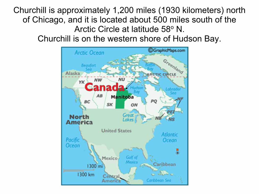
Churchill is approximately 1,200 miles (1930 kilometers) north of Chicago, and it is located about 500 miles south of the
Arctic Circle at latitude 58o N. Churchill is on the western shore of Hudson Bay.

There are no roads to Churchill. It is accessible only by air or train (45 hours trip from Winnipeg).

Typical housing – most of it is government subsidized
Above: Train station and Parcs Canada Museum
Below: Arctic Trading Company souvenir shop

Top left: track vehicles, all with interesting paint jobs, were seen around the area
Top right: the local branch of University College of the North
Left: The Northern, the only grocery store in Churchill.
The cost of everything is quite high due to the fact that all goods must be brought in by train or plane.Example: gallon of milk, $9.85
apples, approximately $3 / pound
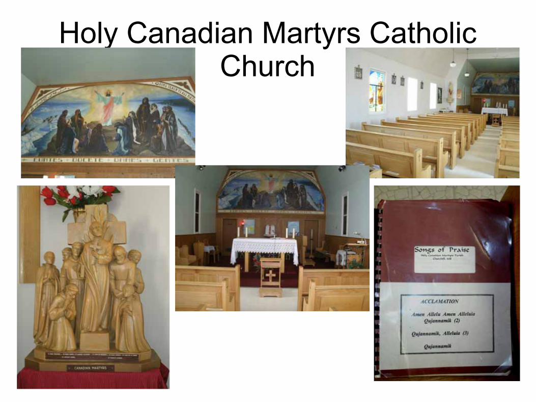
Holy Canadian Martyrs Catholic Church

Eskimo Museum run by the Catholic Church

Churchill Town Centre Complex Health Authority, Senior Services, Day Care, indoor playground, Teen Centre, movie theater, fitness centre, hockey/curling rink, swimming pool, bowling, gathering space, town administrative offices, public/school library, K-12 school – all under one roof!

Grain shipping facility on Hudson Bay
Grain from throughout the plains of Canada comes by rail July – October, for shipment across the oceans
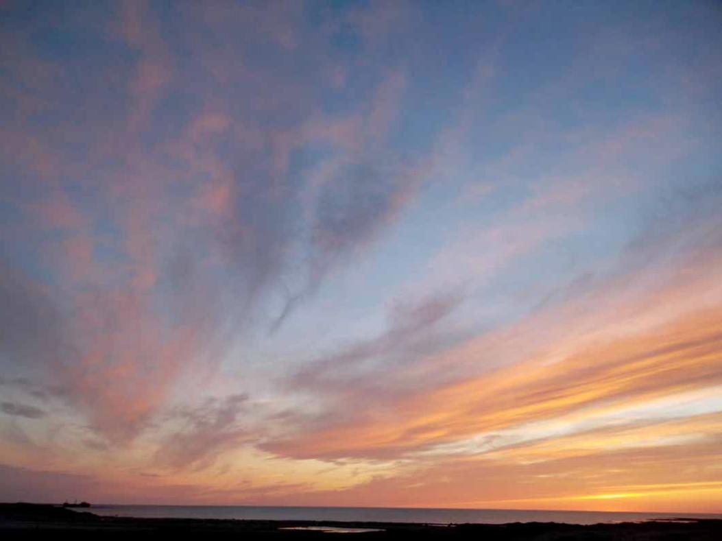
Hudson Bay at sunset
It was late June and this picture was taken around 10:30 pm
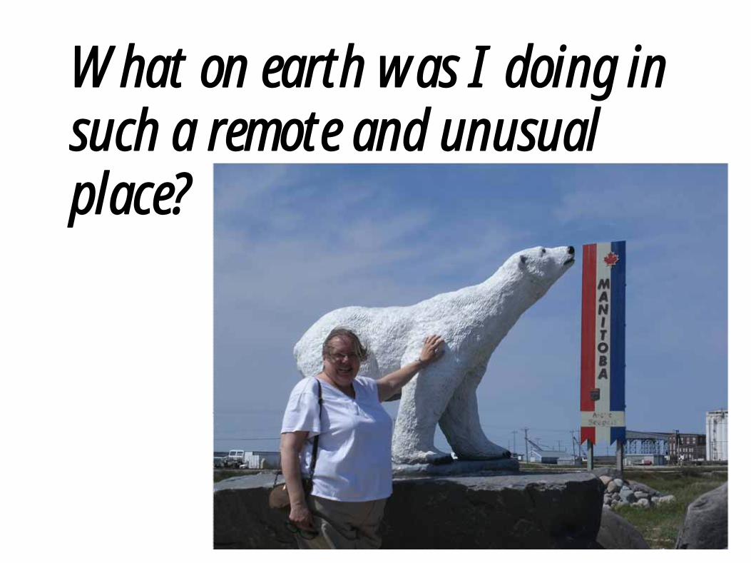
What on earth was I doing in such a remote and unusual place?

Earthwatch Expedition team
One researcher and two research associates (all Canadian) Twelve middle school and high school teachers (from California, Georgia,
Idaho, Illinois, Maryland, Nebraska, New Mexico, and Virginia)

Churchill Northern Studies Centre our home and base for the expedition
On the site of the former Canadian Research (Rocket) Range
Atmospheric sounding rockets were launched, including some for NASA, 1957 – 1998
The Churchill area was also used by Canadian and U.S. militaries for cold weather testing of weapons, equipment, and fighting tactics during the Cold War. This ended in 1979.

•Dorm-style rooms, bathrooms with composting toilets, showers with 1-minute timers•Cafeteria (where guests help with the dishes)•Classrooms, labs, and meeting rooms•Library•Fitness room, TV room, laundry facility•Computers•2nd
floor outdoor deck•Outward opening external doors
The building opened just one week prior to our arrival

Principal Investigator
Peter Kershaw, Ph.D.Associate Professor
Department of Earth and Atmospheric SciencesUniversity of Alberta

Pete's research objectives in the Churchill area since 1999
Quantify environmental changes in the permafrost and in the
treeline resulting from climate change at the Arctic's edge (where
the tundra meets the treeline)
▪Microclimate – air and soil temperature, precipitation, wind, snowpack
▪Permafrost – active layer depth, GPR, temperature
▪Soil – moisture, OM, macronutrients
▪Primary producers -- vegetation description, biomass, annual growth rings
▪Primary consumers – small mammals
My team’s areas of involvement

Climate ChangeSubarctic temperature is rising and is rising atan increasing rate:
0.9° C (~ 16o F) over the last century0.6° C (~ 11o F) over the last 3 decades
Confirmation found in tree rings, marinecoral, marine sediments, glacial ice, andsediment in front of glaciers
How do we know this?
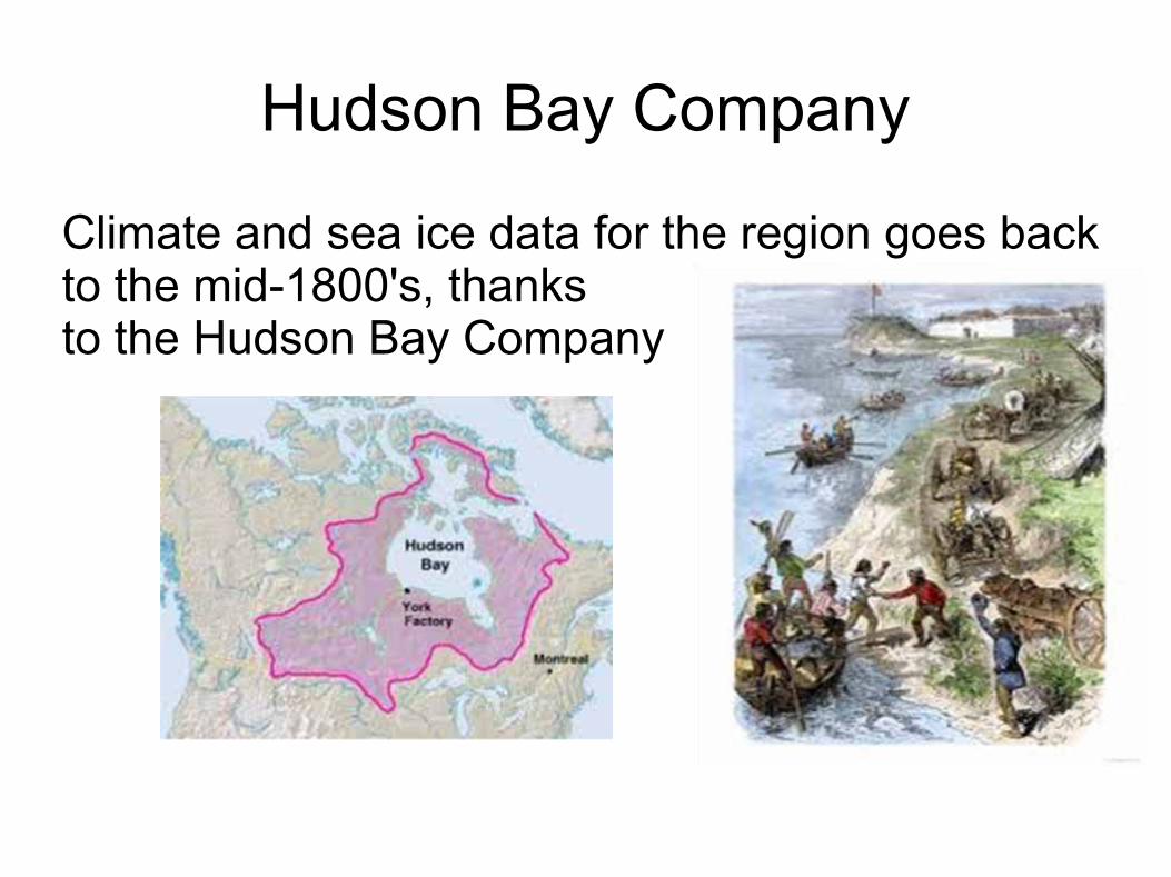
Hudson Bay Company
Climate and sea ice data for the region goes back to the mid-1800's, thanksto the Hudson Bay Company

Mean global temperature today is 14° C (approx 57° F)
Predictions:Increase by 2° C (3.6° F) by year 2100
Increase by 6° C (10.8° F) in the Arctic

Albedo effectAlbedo: diffuse reflectivity, or reflecting power of a surface
White surfaces (snowpack and ice) reflect light
Dark surfaces(land and open water) absorb light
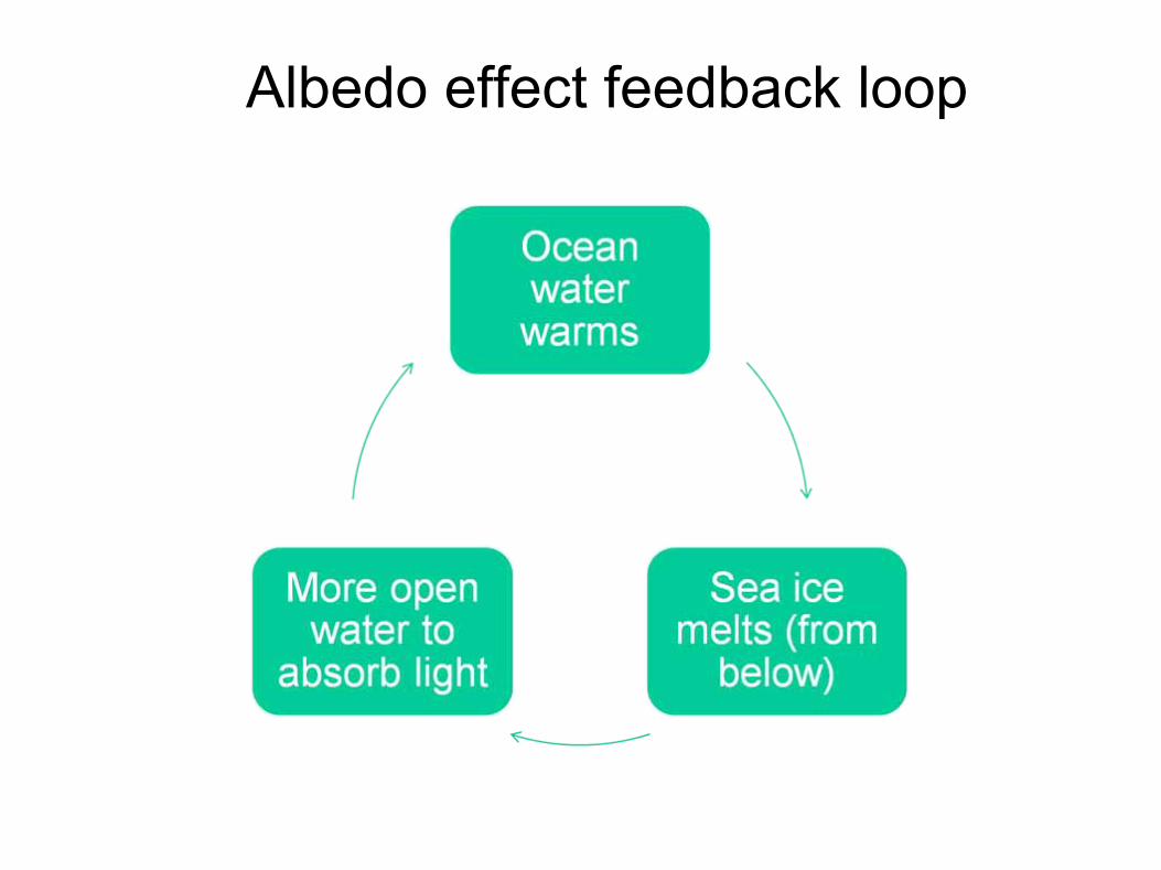
Albedo effect feedback loop

Changes that are occurring due to the warming of the earth's atmosphere:
1) sea ice is shrinking in the Northern hemisphere – the depth, duration, and extent of the ice
2) reduced late winter Arctic snowpack (i.e. it's melting earlier). Less snow, more sunlight absorbed by the earth.
3) global average sea level has increased about 21 cm (~ 8 inches)since 1840.

Rising sea levels
1. Increased melting of land-based and ocean ice
1. Thermal expansion – as ocean water warms, it expands

Correlation between increasing temperatures and atmospheric
greenhouse gases Pre- industrial (mid- 1800's)
Today % increase
CO2 280 ppm 387ppm 38.2%
CH4
(methane)
660 ppm 1800 ppm 172.7%

Sources of CO2 and CH4
emissions from combustion of fossil fuels
decomposition of organic matter in peatlands
land use change which has reduced the amountof forested area

Largest sources of methane
We all know it's cattle farts!
But an even greater source is rice paddies
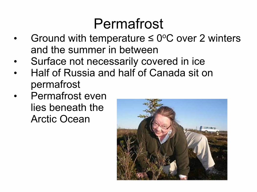
Permafrost• Ground with temperature ≤ 0oC over 2 winters
and the summer in between• Surface not necessarily covered in ice • Half of Russia and half of Canada sit on
permafrost• Permafrost even
lies beneath the Arctic Ocean

Peat – decayed vegetation
Vast stores of organic carbon, in the form of peat, are frozen in the permafrost across the north.
The Hudson Bay lowlands is the second largest peatland in the world.
The upper three meters of permafrost across the Arctic store more than 2x the carbon that exists in the atmosphere today!

What do permafrost and peat have to do with climate change?

Some forestry vocab
Treeline – latitudinal limit of trees
Timberline – altitudinal limit of trees

Back to Pete’s research

Northward movement of the treeline
The hypothesis
As the average temperature rises,1) the line of permafrost moves northward2) the snowpack melts earlier3) the treeline advances onto the tundra

Winter Earthwatch teams – permafrost and snowpack
Earthwatch teams measure:
- depth of snowpack- density (snow/water equivalent) of snowpack- effect of wind on snowpack- depth of permafrost- extent of permafrost

Summer Earthwatch teams - trees
Core samples from lots and lots of trees in severaldifferent tree islands.
From the cores, Pete will determine the age of the treesperiods of fast and slow growth
Data on the location and direction of growth of each tree core will assist in determining the effects of wind and snowpack on the health and growth of the trees.


Tools of the trade


Back in the lab
Tree cores were: 1) placed in wooden racks; 2) dried in oven; 3) glued into racks with proper orientation of the pith and rings; 4) sanded down to a flat surface; 5) sent to University of Alberta for analysis


Saplings and seedlingsTo determine the “recruitment” (northward establishment) of new tree growth:
1) marked off 1 m x 2 m plots and recorded GPS location of opposite corners1)searched for
a) seedlings (up to 15 cm tall, some as small as 1 cm) b) saplings (15 cm to 2 meters)
3) tagged each seedling and sapling, recorded GPS location and various measurements

We worked mosquito-free for several days, but when they came out, there were millions, and they were nasty!

At the end of a long day in the field and lab, the Beer Fridge was a popular spot

The Canadian Sub-Arctic
There’s much, much more than Canada Geese…

FloraAndromeda polifolia
Arctic avens
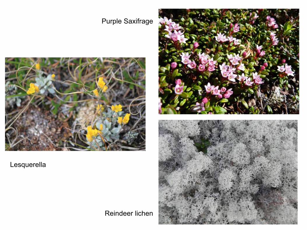
Lesquerella
Purple Saxifrage
Reindeer lichen

Fauna

Beluga whale tour

seen shore
Beluga whales live in Arctic and sub- Arctic waters, some populations migrating to the warmer waters in the south when the ice melts.
Beluga are typically present in the Churchill River in July and August. We first saw them offshore in Hudson Bay on June 22 and by the hundreds in the Churchill River on June24th.
Belugas are at the top of an ailing food chain.
Belugas eat Arctic cod, which eat small crustaceans called copepods. Copepods feed off algae that grows on sea ice. Warming temperatures mean less sea ice. A ripple effect moves up the food chain from the algae to the beluga.

Polar bears 101•Live on sea ice, eating mainly ringed seals
•Both polar bears and seals depend on the ice• Bears: platform for hunting seals• Seals: place to rest and to raise their young
•Diminished sea ice• Smaller hunting grounds• Ice platforms spread too far apart for bears to swim
between
•Summer, Hudson Bay is ice-free• Bears come onto land until ice re-forms in fall• Pregnant females go to maternity dens, give birth
October-December, emerging from the den in March/early April
• Others exist in “walking hibernation”

Bears normally show up on land early July
Bears are now coming ashore earlier and thinner. Females are now typically having twin births instead of triplets as they did in the past.

June 27, 2011
First spotted by Craig
20 minutes later, right behind our building

Seen from the van on our way back to our work area after lunch.

On the dinner menu that day:
“Roast pork good enough to make a polar bear’s nose twitch”

Check out my expedition blog
http://tundratracks.blogspot.com
Included are more pictures, and links to additionalsources of information

Possible discussion starters
1.The Arctic acts as an air conditioner for the northern hemisphere. As it warms …
1.Just like the advancement of the treeline, southern species finding the north more hospitable may crowd out or destroy native species.
1.Less ice on the Arctic Ocean opens the Northwest Passage. Will territorial disputes result?
4. Potential disaster for coastal areas as sea level rises.