maryland historical trust state historic sites inventory...
TRANSCRIPT

Maryland Historical Trust State Historic Sites Inventory Form
Survey No. WA-II-1160
Magi No.
DOE yes no
1. Name of Property (indicate preferred name)
historic Delemere
and/or common
2. Location street & numberl^f "HPrintz Road not for publication
city, town Boonsboro X vicinity of 6 congressional district
state Maryland county Washington
3. Classification Category
district X building(s)
structure site object
Ownership public
X private
both Public Acquisition
in process being considered
X not applicable
Status
X occupied
unoccupied
work in progress
Accessible yes: restricted yes; unrestricted
X no
Present Use agriculture
commercial educational
entertainment government industrial military
street & number telephone no.
museum park private residence religious
scientific transportation
other
4. Owner of Property (give names and mailing addresses of all owners)
name
city, town state and zip code
5. Location of Legal Description courthouse, registry of deeds, etc. Liber
street & number Folio
city, town state
6. Representation in Existing Historical Sur/eys
titto
date federal state county local
deposrtory for survey records
city, town state

7. Description Survey No. WA-II-1160
Condition Check one Check one
X excellent deteriorated unaltered X original site
good ruins X altered moved date of move fair unexposed
Prepare both a summary paragraph and a general description of the resource and its various elements as it exists today.
Description:
Delemere is an imposing two story brick structure measuring five bays long by two bays deep. A two story portico with large columns shelters the central entrance. The building has a large chimney at either end. There is a round-arched fanlight in the west gable. Delemere appears to have been buih in the early 19^ century, although local histories give the construction date as 1770s.
On Delemere property- is a family cemetery, grist mill site and other buildings. These are surveyed separately.
8. Significance Survey No. WA-II-1160 Period Areas of Significance Checl< and justify below
prehistoric Archeology-prehistoric community planning landscape architecture religion 1400-1499 archeology-historic conservation law science 1500-1599 X agriculture economics literature sculpture 1600-1699 X architecture X education military social/
X 1700-1799 art engineering music humanitarian 1800-1899 commerce exploration/settlement philosophy theater 1900- communications industry politics/government transportation
invention other (specify)
Specific dates Builder/Architect
check: Applicable Criteria: X A B X C D and/or
Applicable Exceptions: A B C D E F G
Level of Significance: national state X local
Prepare both a summary paragraph of significance and a general statement of history and support.
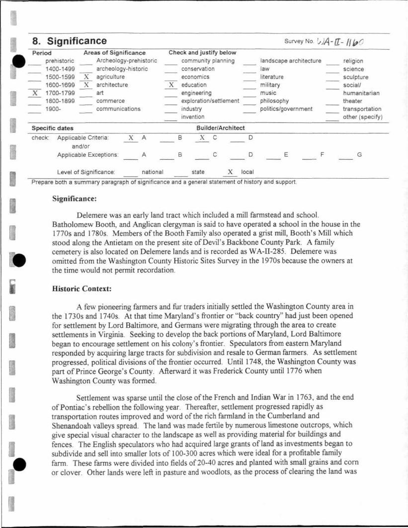
Significance:
Delemere was an early land tract which included a mill farmstead and school. Batholomew Booth, and Anglican clergyman is said to have operated a school in the house in the 1770s and 1780s. Members of the Booth Family also operated a grist mill. Booth's Mill which stood along the Antietam on the present site of Devil's Backbone County Park. A family cemetery is also located on Delemere lands and is recorded as WA-n-285. Delemere was omitted from the Washington County Historic Sites Survey in the 1970s because the owners at the time would not permit recordation.
Historic Context:
A few pioneering farmers and fur traders initially settled the Washington County area in the 1730s and 1740s. At that time Maryland's frontier or "back country" had just been opened for settlement by Lord Baltimore, and Germans were migrating through the area to create settlements in Virginia. Seeking to develop the back portions of Maryland, Lord Baltimore began to encourage settlement on his colony's frontier. Speculators from eastern Maryland responded by acquiring large tracts for subdivision and resale to German farmers. As settlement progressed, political divisions of the frontier occurred. Until 1748, the Washington County was part of Prince George's County. Afterward it was Frederick County until 1776 when Washington County was formed.
Settlement was sparse until the close of the French and Indian War in 1763, and the end of Pontiac's rebellion the following year. Thereafter, settlement progressed rapidly as transportation routes improved and word of the rich farmland in the Cumberiand and Shenandoah valleys spread. The land was made fertile by numerous limestone outcrops, which give special visual character to the landscape as well as providing material for buildings and fences. The English speculators who had acquired large grants of land as investments began to subdivide and sell into smaller lots of 100-300 acres which were ideal for a profitable family farm. These farms were divided into fields of 20-40 acres and planted with small grains and com or clover. Other lands were left in pasture and woodlots, as the process of clearing the land was

Maryland Historical Trust State Historic Sites Inventory Form Section Number 8 Page 2
slow. Woodlot and pasture functions were often combined in areas where rock outcrops made cultivation difficult. Allowing cattle and hogs to forage through woodlands helped to keep them open and clear. As farms developed and inhabitants prospered, towns and villages grew to support the local population. Sharpsburg shares with Hagerstown the title of being the oldest established town in Washington County. Both were incorporated in 1763, although settlements were present on their sites earlier.
The area prospered, achieving a high level cultivation and development during the period from 1760-1860. Most of the substantial farmhouses and "Swisser" bams common to the region were constructed between 1790 and 1850. Favored building materials for houses were log (nearly always covered with siding or stucco), native limestone, or brick (most brick farmhouses in the area date from after 1820). The earliest bams were log or limestone with brick or timber framing favored after the 1830s.
By the time of the outbreak of the Civil War in 1861, the area was well established and intensively farmed. Farms were characterized by fields and boundaries marked with wood or stone fences, orchards and small herds of cattle, hogs and sheep, and flocks of chickens and geese. Farms had careftally maintained woodlots kept to supply firewood, building materials and fencing. Demand for wood was great in the 19* century with the need for construction material and fuel (most households consumed about 10 cords of wood per year for heating). Historic photographs affirm the massive consumption of wood, revealing that the landscape at the time of the Civil War had far fewer trees than are seen today.
The prosperity of the greater region led to its being served by important transportation routes, a good system of turnpikes, the National Road, C&O Canal and the B«&0 Railroad. These amenities and the overall prosperity of the region were certainly factors influencing Confederate General Robert E. Lee's attempts to enter and occupy the central portion of Maryland in the summers of 1862, 1863 and 1864.
After the Civil War, Maryland's urbanization accelerated. Population began to shift with internal migration from the countryside to the cities. Baltimore grew, but so did cities like Cumberiand, Hagerstown and, to a lesser extent, Frederick. By 1910, Cumbedand was the second largest city in Maryland, with a population of 21,838. Hagerstown was third with 16,507 and Frederick was the fourth largest city with 10,411 people. Baltimore City, however, had 43.1% of the state's population, ranking seventh in the nation.' The rapid growth of BaUimore, Haaerstown and Cumberiand had to do with the multiple railroads serving these cities in the late 19"̂ and eariy 20* centuries. Hagerstown was a hub for four intersecting railroads. The good transportation opportunity led to growth of industries there and consequently population growth.
William Lloyd Fo.\. "Social-Culmral Developments from the Civil War to 1920." Walsh and Fox, p. 503.
Survey No. WA-II-1160
Magi No.
DOE yes no
Maryland Historical Trust State Historic Sites Inventory Form
Section Number 8 Page 3
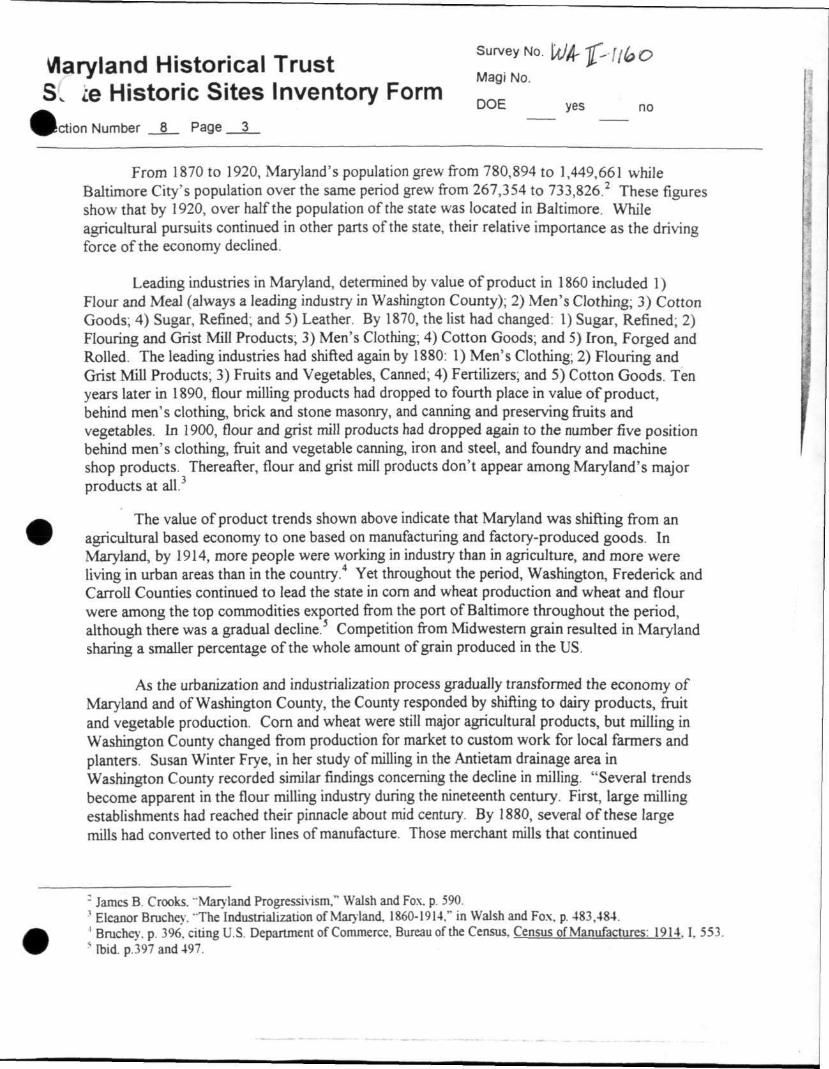
From 1870 to 1920, Maryland's population grew from 780,894 to 1,449,661 while Baltimore City's population over the same period grew from 267,354 to 733,826.^ These figures show that by 1920, over half the population of the state was located in Baltimore. While agricultural pursuits continued in other parts of the state, their relative importance as the driving force of the economy declined.
Leading industries in Maryland, determined by value of product in 1860 included 1) Flour and Meal (always a leading industry in Washington County); 2) Men's Clothing; 3) Cotton Goods; 4) Sugar, Refined; and 5) Leather. By 1870, the list had changed: 1) Sugar, Refined; 2) Flouring and Grist Mill Products; 3) Men's Clothing; 4) Cotton Goods; and 5) Iron, Forged and Rolled. The leading industries had shifted again by 1880: 1) Men's Clothing; 2) Flouring and Grist Mill Products; 3) Fruits and Vegetables, Canned; 4) Fertilizers; and 5) Cotton Goods. Ten years later in 1890, flour milling products had dropped to fourth place in value of product, behind men's clothing, brick and stone masonry, and canning and preserving ftuits and vegetables. In 1900, flour and grist mill products had dropped again to the number five position behind men's clothing, fruit and vegetable canning, iron and steel, and foundry and machine shop products. Thereafter, flour and grist mill products don't appear among Maryland's major products at all. .
The value of product trends shown above indicate that Maryland was shifting from an agricultural based economy to one based on manufacturing and factory-produced goods. In Maryland, by 1914, more people were working in industry than in agriculture, and more were living in urban areas than in the country.'* Yet throughout the period, Washington, Frederick and Carroll Counties continued to lead the state in com and wheat production and wheat and flour were among the top commodities exported from the port of Baltimore throughout the period, although there was a gradual decline.' Competition from Midwestern grain resulted in Maryland sharing a smaller percentage of the whole amount of grain produced in the US.
As the urbanization and industrialization process gradually transformed the economy of Maryland and of Washington County, the County responded by shifting to dairy products, fruit and vegetable production. Com and wheat were still major agricultural products, but milling in Washington County changed from production for market to custom work for local farmers and planters, Susan Winter Frye, in her study of milling in the Antietam drainage area in Washington County recorded similar findings concerning the decline in milling, "Several trends become apparent in the flour milling industry during the nineteenth century. First, large milling establishments had reached their pinnacle about mid century. By 1880, several of these large mills had converted to other lines of manufacture. Those merchant mills that continued
- James B, Crooks. "Marvland Progressivism," Walsh and Fox. p, 590. ' Eleanor Bruchev. The'industrialization of Maryland. 1860-1914." in Walsh and Fo.\. p, 483,484, ' Bruchcy. p, 396. ciUng U.S. Department of Commerce, Bureau of the Census, Census of Manufactures: 1914,1, 553. ' Ibid, p.397 and 497.
Survey No. WA-II-1160
Magi No.
DOE yes no

Maryland Historical Trust State Historic Sites Inventory Form Section Number 8 Page 4
producing flour decreased their output."^ The fact that Frederick and Washington Counties were still producing large amounts of wheat and com while decreasing mill output, indicates that grain was being shipped unprocessed to markets or mills in Baltimore, or was converted locally to animal feed.
The trend toward urbanization and the shift of population to Baltimore continued into the 20* century. In 1920, Maryland had become 60% urban with slightly over half the state's population in Baltimore.^ By the end of the 1920s, the number of farms in Maryland had decreased by 4,704.^ Meanwhile suburban residential districts and recreational areas spread outward from Washington D.C. and Baltimore into Montgomery and Bahimore Counties, a trend that has continued to the present. The conversion of farmland use to dairy and orchards in the county led to the decrease of local agricultural industries particularly milling and attendant businesses and industries. While Washington County's population continued to grow, it grew much more slowly than the urban growth of Baltimore, as the rural population siphoned off to the more flamboyant life in the city.
In 1929, on the eve of the Great Depression, wheat was still a large income producer in Maryland, with an estimated gross income in the state of $9,053,000. Most of the state's wheat was still being grown in Frederick, Washington and Carroll Counties in the old wheat belt. The wheat production in gross income, however, fell far below the $25,156,000 produced from sales of milk in the same year. Due to the Depression and also to a bad drought year in 1930, the gross income fi-om sales of wheat by 1932 had fallen to $1,715,000 and dairy to $16,875,000.^ Even with the drop in income, the figures show that dairy farming had far outdistanced wheat production in the 20'*' century. Interestingly, during the depression years the gross income from tobacco and truck farms actually increased during the period from 1929-1932. These agricultural products tend to be produced in eastern and southern Maryland, as opposed to the dominance of wheat and dairy farming in central and western Maryland. Thus the income figtires suggest that the Depression of the 1930s may have hit agriculture in Frederick and adjoining counties harder than elsewhere in the state.
The 1930 drought brought more woes to Maryland farmers, with agricultural losses estimated at $38,000,000. While federal loans were available for relief to farmers, as many as 25% of Maryland's farmers were so destitute that they were unable to pull together the required collateral to qualify for the loan money." In 1931, one of the major bank failures in Maryland was the Central Trust Company of Frederick and its 11 branches. When it collapsed, it affected
'' Susan Winter Frve. "Evolution of Mill Settlement Patterns in the Antietam Drainage, Washington Count>\ Maryland." p. 71.
James B. Crooks. "Maryland Progressi\ism,'" Walsh and Fox, p. 590 * Dorothy M. Brown. "Maryland Between the Wars." Walsh and Fox. p. 704. ' Ibid. p. 704. citing W.S. Hamill. The Agricultural Industry of Maryland. Baltimore: Maryland Development Bureau of the
Baltimore Association of Commerce, 1934. P. 37,51-52,81.107,110-116,310. "' Ibid. " Ibid. p. 735.
Survey No. WA-II-1160
Magi No.
DOE yes no
Maryland Historical Trust State Historic Sites Inventory Form Section Number 8 Page 5
14 smaller banks in Western Maryland. This troubled the already depressed farming area in central and western Maryland even more. The bleak economic outlook for farmers in the region encouraged even more people to leave the land and try to turn their fortunes in the city.'^
'" Paula S. Reed and Associates. Inc. developed this historic context for use with properties in central and western Maryland.
Survey No. WA-II-1160
Magi No.
DOE yes no
9. Major Bibliographical References Survey No. WA-II-1160
See attached Continuation Sheet.
10. Geographical Data Acreage of nomination property
Quadrangle name FunkstowTi
UTM References DO NOT COMPLETE UTM REFERENCES Quadrangle scale 1:24.000
Zone Easting Northing Zone Easting Northing
Zone Easting Northing Zone Easting Northing
Zone Easting
Zone Easting
Northing
Northing Zone
Zone Easting
Easting
Northing
Northing
Verbal boundary description and justification See attached Continuation Sheet
List all states and counties for properties overlapping state or county boundaries
state code county code
state code county code
11. Form Prepared By name/title Paula S. Reed. PhD, Architectural Historian organization Paula S. Reed and Associates, Inc. date July, 2001 street & number 105 N. Potomac Street telephone 301-739-2070 city or town Hagerstown state MP
The Maryland Historic Sites Inventory was officially created by an Act of the Maryland Legislature to be found in the Annotated Code of Maryland, Article 41, Section 181 KA, 1974 supplement.
The survey and inventory are being prepared for information and record purposes only and do not constitute any infringement of individual property rights.
return to: Maryland Historical Trust People's Resource Center 100 Community Place Crownsville, MD 21032-2023 410-514-7000
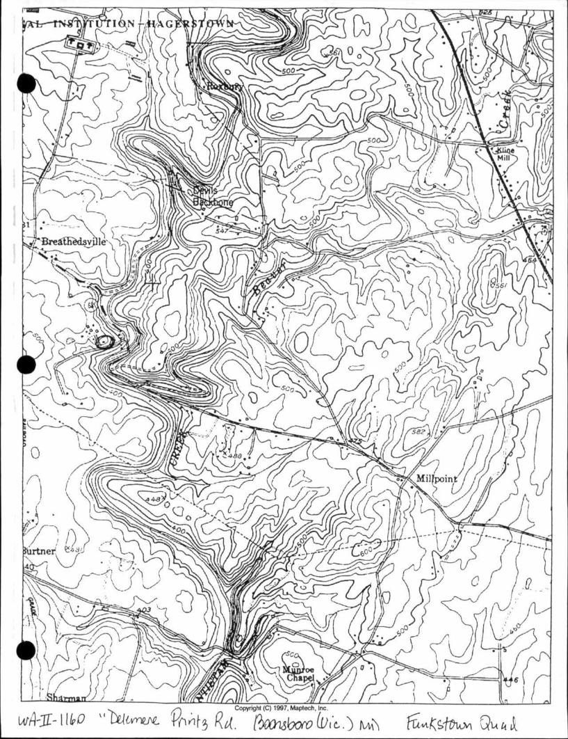
WA-II-1160 "Delemere" Printz Rd. Boonsboro (vic) MD Funkstown Quad

WA-II-1160
View of Delmere.