mastercard its smart city hackathon webex presentation
TRANSCRIPT

Mastercard ITSSmart City Hack
<Melbourne><2016>

©2015 MasterCard.Proprietary and Confidential
Day 1 Schedule
2December 2, 2015
09:00
09:30
10:00
12:00
Doors open to Attendees
Breakfast
Opening Ceremony
CODING BEGINS
18:00
00:00
Dinner is Served
Midnight Snack on the Ten
CODE THROUGH THE NIGHT!11:00
13:00 Tech Breakout Sessions
19:00 Pitch Workshop
11 11:00
12:00 Lunch

©2015 MasterCard.Proprietary and Confidential
Day 2 Schedule
3December 2, 2015
07:00
12:00
13:00
14:00
16:00
Breakfast of Those Who Made It
Lunch
Hackathon Ends (Submission due on hackathon.io)
Winners Announced
Demos Begin (Demos only. No slide decks)(If your demo doesn't work, take us through the code—what you did and where you got stuck. It's about showing what you've learned and not about pitching an idea.) ?

©2015 MasterCard.Proprietary and Confidential
The Grand Prize!
4December 2, 2015
$10,0001x
Fitbit Flex Per team
6months
mentorship by members of the Smart City Hack
Best uses of Mastercard & Partner API’s and solves a real consumer pain point with integration across different modes of transport will receive the following:

©2015 MasterCard.Proprietary and Confidential
The Challenges and Prizes
5December 2, 2015
Green Challenge Challenge: Build an intelligent transportation solution to
facilitate or encourage the use of sustainable, eco-friendly methods of transport & payments for residents, commuters,tourists, or transportation of goods.
Prizes: $3,000 (AUD) for the winning team.
1x Fitbit for each member of the winning team
Demand Management Challenge
Challenge: Build an intelligent transportation solution that can help cities like Melbourne manage demand for transport services for
passenger and freight. Consider a better use of available resources, from empty bus seats to car
parks to car seats, to drive local commercial activity.
Prizes: $3,000 (AUD) for the winning team.
1x Fitbit for each member of the winning team

©2015 MasterCard.Proprietary and Confidential
The Challenges and Prizes
6December 2, 2015
Future City Challenge Challenge:
Build an intelligent transportation solution that can help cities like Melbourne make better use of the wealth of data
available. Some idea could include: higher utilization of bike sharing schemes or better management of traffic
flows to support improved urban planning, take a look at the Future Melbourne plan for some inspiration.
Prizes: $3,000 (AUD) for the winning team.
1x Fitbit for each member of the winning team

©2015 MasterCard.Proprietary and Confidential
Judging Criteria
7December 2, 2015
Fresh Code Enforced Code Review No PowerPoints Team Size
Usage of Tech and Data
IMPACTDESIGN
CREATIVITYEXECUTION
5 points for each criteria ! max score = 25
Must use 1 Mastercard API and 1 Partner Tech

©2015 MasterCard.Proprietary and Confidential
Unbelievable judges!
8

Doug Howe, Vice President Enterprise PartnershipsMike Rowe, Vice President Expert SalesJie Zhang, Leader, Global Product
Empowering Smart Cities
Mastercard Payments and Data

10
Transit Buses & Trains
Road Tolls &
Charges
Parking Fees & Fines
City Taxis
Bike & Car-
Share
Mastercard Smart Cities ChallengeFour Challenges – Seven API’s – One Smart City Use Case

Challenge (http://mastercarditshack.com/#challenges)

MPGS – Mastercard Payment Gateway System
– You can use this API for any online payment between a merchant and a consumer. So if your idea involves paying for something online, this API is quick and easy to use.
Send
– You can use this API to send money to friends and family easily. If your idea involves sending money to friends, maybe dividing the cost of city experience, then this may be the API for you.
rePower – You can use this API to Top up a Pre-Paid
card. So if your idea involves using a Pre-paid card in your Smart City idea then this provides people with a way to convert cash into a Prepaid mastercard at a Retailer Point of Sale.
Want to move money?
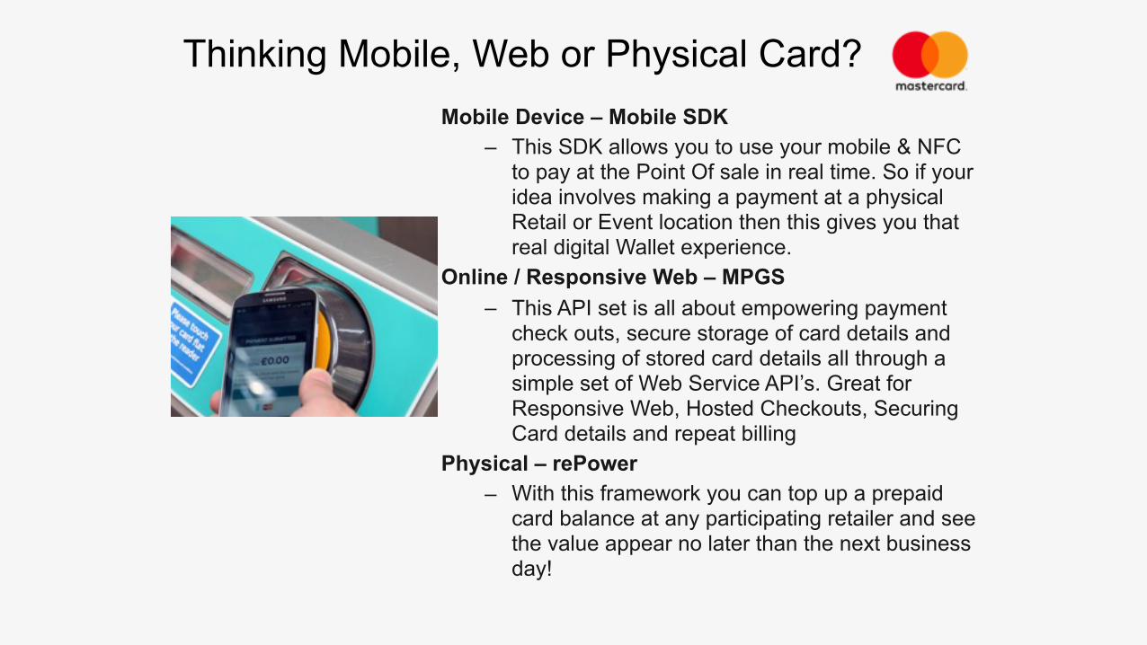
Thinking Mobile, Web or Physical Card?Mobile Device – Mobile SDK
– This SDK allows you to use your mobile & NFC to pay at the Point Of sale in real time. So if your idea involves making a payment at a physical Retail or Event location then this gives you that real digital Wallet experience.
Online / Responsive Web – MPGS – This API set is all about empowering payment
check outs, secure storage of card details and processing of stored card details all through a simple set of Web Service API’s. Great for Responsive Web, Hosted Checkouts, Securing Card details and repeat billing
Physical – rePower – With this framework you can top up a prepaid
card balance at any participating retailer and see the value appear no later than the next business day!
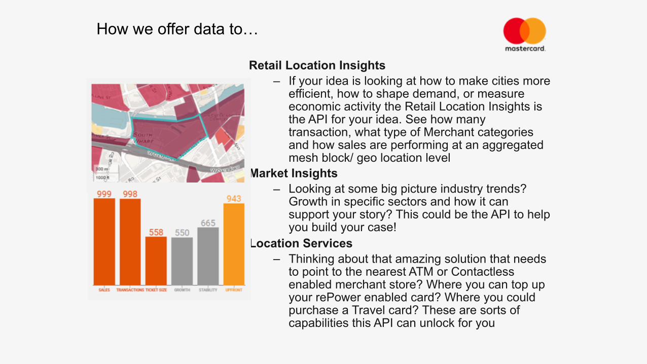
Retail Location Insights – If your idea is looking at how to make cities more
efficient, how to shape demand, or measure economic activity the Retail Location Insights is the API for your idea. See how many transaction, what type of Merchant categories and how sales are performing at an aggregated mesh block/ geo location level
Market Insights – Looking at some big picture industry trends?
Growth in specific sectors and how it can support your story? This could be the API to help you build your case!
Location Services – Thinking about that amazing solution that needs
to point to the nearest ATM or Contactless enabled merchant store? Where you can top up your rePower enabled card? Where you could purchase a Travel card? These are sorts of capabilities this API can unlock for you
How we offer data to…

• Check out http://mastercarditshack.com/
• Think about a challenge • Take a look at the API’s
Summary
Any questions? • [email protected] (Business) • [email protected] (Technical)

ITS 2016 Mastercard Smart Cities Hackathon
Neil Smith – Manager Digital Delivery

Victorian Government - Data
www.data.vic.gov.au

General Transit Feed Specification
www.data.vic.gov.au

General Transit Feed Specification
www.data.vic.gov.au

Timetable API
www.data.vic.gov.au
API Dev key is required so please download PTV Timetable API and register before the event.

PTV Timetable API
www.data.vic.gov.au

ITS 2016 Mastercard Smart Cities Hack
Roger Clark – Manager Data Services

Available Data
• VicRoads, Information Access has 56 datasets available through the Victorian government DATA.VIC portal. •These datasets provide data about Road Crash Statistics, Speed signs and Speed zone data, traffic signal volume data, to heavy vehicle permit routes and live travel time data. •The datasets using ARCGIS online can be can be presented in the following formats: API/Tool, CSV, KML, SHP, GEOJSON,ESRIREST

Range of Data
• Traffic •Volume •Speed
• Crash Data •Location of the crash •People involved •Vehicle involved
•Road Asset – Condition of the road •Spatial data sets eg Bike paths

Popular Data Sets
Dataset Title Views Visits Downloads
VicRoads Office Locations 907 670 9
Crashes Last Five Years 804 395 235
Crash Stats - Data Extract 581 314 317
VicRoads Country Street Directory Grids 414 255 31
VicRoads Declared Roads 217 64 136
Live travel time data 174 59 0
Traffic Volumes for Freeways and Arterial Roads 148 29 48
Principal Bicycle Network 124 20 46
Traffic Signals 117 21 18
Homogeneous Traffic Volume Network 95 9 1
VicRoads Speed Data by road segment 90 3 64
VicRoads Regions 88 34 19
Higher Mass Limit Routes 85 3 37
Crash Stats 84 52 0
Speed Zone Data 77 32 45
Strategic Cycling Corridor 76 8 22
BlueTooth sites 73 14 0
Victoria's Higher Productivity Freight Vehicle (HPFV) Mass Network 72 5 19
Travel time links 71 24 0
BDouble routes 71 10 31

Number of Views
Data.vic au No. of Views
-500
0
500
1,000
1,500
2,000
2014 2015 2016

Live Data Sets
•Live travel time data. This dataset is generated by receiving data from BlueTooth receivers at strategically located within SCATS traffic signal controllers. The data is received from BlueTooth transmitters (hands free in cars) and sent to a computer system that uses software to generate travel time for defined links. Thisi information will be able to be view via a Smartphone application.
•Emergency Road Closure. The data for Emergency Road Closures is drawn for the Situation Report (SITREP) database that is used to advise internal and external stakeholders of incidents (via email) and to automatically provide a data feed to map and text based information on VicRoads website and other public information applications "
•Multiple Variable Electronic Speed Signs Live . This dataset contains near real-time multiple variable electronic speed signs along the VicRoads Freeway Management System

Bluetooth• Currently 300+ Sites • Provide point to point travel time/Speed • 20 to 30% of devices Active •Travel Time available live via API
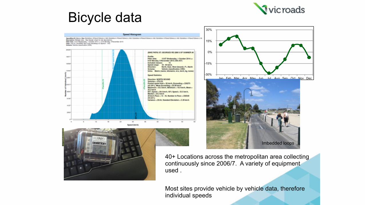
Bicycle data
-30%
-15%
0%
15%
30%
Jan Feb Mar Apr May Jun Jul Aug Sep Oct Nov Dec
Imbedded loops
40+ Locations across the metropolitan area collecting continuously since 2006/7. A variety of equipment used . Most sites provide vehicle by vehicle data, therefore individual speeds

Other available Traffic Data
• 7,000+ Rural sections of road • Collected every 2 to 3 years • Individual vehicle speed • Mean & 85th percentile • 10+ years of history • Vehicles classified based on
axle configuration

City of MelbourneOpen Data Platform
Will McIntosh

City of Melbourne Data Almost 100 datasets in total 20 datasets in Transport & Movement
Hosted on Socrata Platform Cloud based visualisation and analysis tools
SODA API REST API. Libraries for PHP, Javascript, Python, R, Ruby, Java, Apple iOS, Google Android
The Data platform

Getting Started
Find a dataset
data.melbourne.vic.gov.au
Access the JSON endpoint data.melbourne.vic.gov.au/resource/qnjw-wgaj.json
Developer tools & Examples
dev.socrata.com/consumers/getting-started.html
Need custom views?
Get account at data.melbourne.vic.gov.au/signup
{}

Thank you
Will McIntosh Open Data Lead City of Melbourne [email protected]
Steve Bennett Senior Open Data Specialist
City of Melbourne [email protected]
@stevage1

© 2016 Intelematics Australia - Connected Mobility
Intelematics Australia ITS 2016 Mastercard Smart Cities Hackathon
Phillip Lyng

Intelematics AustraliaIncorporated in 1999 • 16 years delivering OEM telematics programs Around 160 people across 3 countries • Intelematics Australia (IAU) – HQ Melbourne • Intelematics North America (INA) – HQ Los Angeles • Intelematics Europe (IEU) – HQ London
Out-posted staff in key customer locations • Quality management • 24 x 7 telematics call centre in Adelaide – 30 agents
Independent service provider – supporting many competing electronics, mobility, and automotive brands
Intelematics is the region’s largest provider, by market share, of Connected Vehicle services to the passenger vehicle segment in Australia, New Zealand and North America.
36

Created by Intelematics
Sourced, Value Added & Managed by Intelematics Offered by Intelematics - sourced via 3rd party suppliers
SUNA Traffic & ContentSUNA provides a portfolio of industry leading motoring-centric information
37
Local SearchSUNA Traffic
Customised Content
SUNA Parking
SUNA Fuel
Safety Cameras
Weather
Traveller Information
Flights
Events
News
Stocks
Music / Radio

Parking The SUNA Parking service includes location-referenced dynamic parking data, defined by a set of fields including: brand, address, contact details, operating times, retail pricing, discount offers and location data. Build dynamic driver assistance services. Fuel The SUNA Fuel service delivers service station and fuel price data, defined by a set of fields including: brand, address, contact details, fuel types and optional reported fuel prices that update throughout the day. All data is location-referenced allowing for use in navigation or display on a map. Weather The SUNA Weather service delivers comprehensive weather data related to current conditions, multi-day forecasts and rain radar images where available. Extensive coverage of cities and towns allow the most relevant location-based information to be retrieved. Traffic The SUNA Traffic Channel delivers comprehensive congestion and incident data to in-car navigation systems and mobile devices, covering the major road networks of each capital city and a number of regional centres within Australia and New Zealand.
38
SUNA Motoring Content

Parkopedia
Intelematics Parking Service
Wilson Parking
Secure Parking
Parking Editor
Intelematics Parking Data Service

{ “carparks": [ { “parkingOperator": "RACV", “parkingId": "racv_chancerylane", “parkingName": "RACV City Club", “address": "New Chancery Lane ", “suburb": "Melbourne", “stateOfAus": "VIC", “latitude": "-37.815998", “longitude": "144.95995", “attractionsNearby": "RACV Club, City, Shops, Bars", “instructions": “misc info .. maybe a link to their website” "openingHours": [ … ] “images": [ … ], “rates": [ … ], “simpleRates": [ … ] } ] }
Web Service Feed in JSON

Steven Moloney Product Manager
Intelematics Australia Pty Ltd 250 Swan Street Richmond Vic 3121
+61 3 8415 9061 [email protected]
www.intelematics.com www.sunatraffic.com
41
Phillip Lyng Developer
Intelematics Australia Pty Ltd 250 Swan Street Richmond Vic 3121
+61 3 8415 9045 [email protected]
For further information

©2015 MasterCard.Proprietary and Confidential 42
December 2, 2015
KEEP CALM
HACK ONAND