mca 2013 - mario kortman - waternet
TRANSCRIPT

Smart City,
Smart Canals
Mario Kortman | Mobile Convention Amsterdam | 23 mei 2013

What does
Waternet do?

Everything
water
So how’s
Waternet doing?

They’re clean

But busy

With business
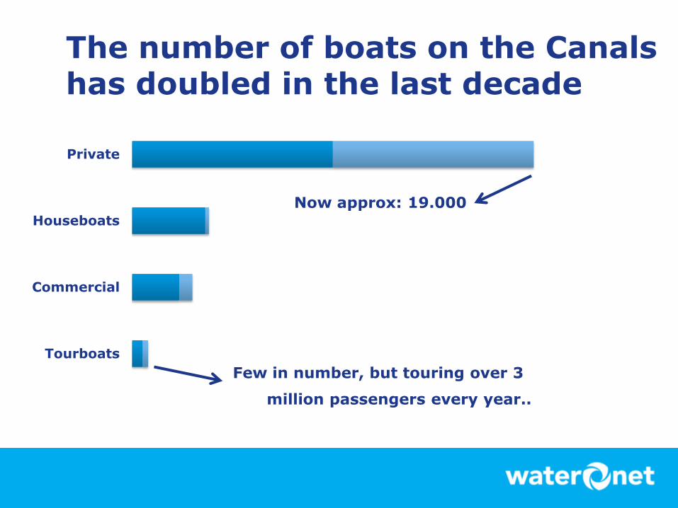
The number of boats on the Canals has doubled in the last decade
Tourboats
Commercial
Houseboats
Private
Now approx: 19.000
Few in number, but touring over 3
million passengers every year..

And

Public Management

Has transformed

Into the management of complex and interconnected systems
City Policy Goals 2020:
• More and a more diverse use of the canals
• But greener, more balanced and with minimal traffic congestion
• While building on its unique value to Amsterdam

Goal:
To change how we use and manage
the Canals

• We want our App to be a non-intrusive everyday dashboard
• And we use the site to communicate with you about your experiences or our
policies
We developed a platform

• As a world-first our sensors detect a boat’s speed, direction and length
• And they are busy: some are counting over 1500 boats a day
And installed 17 sensors
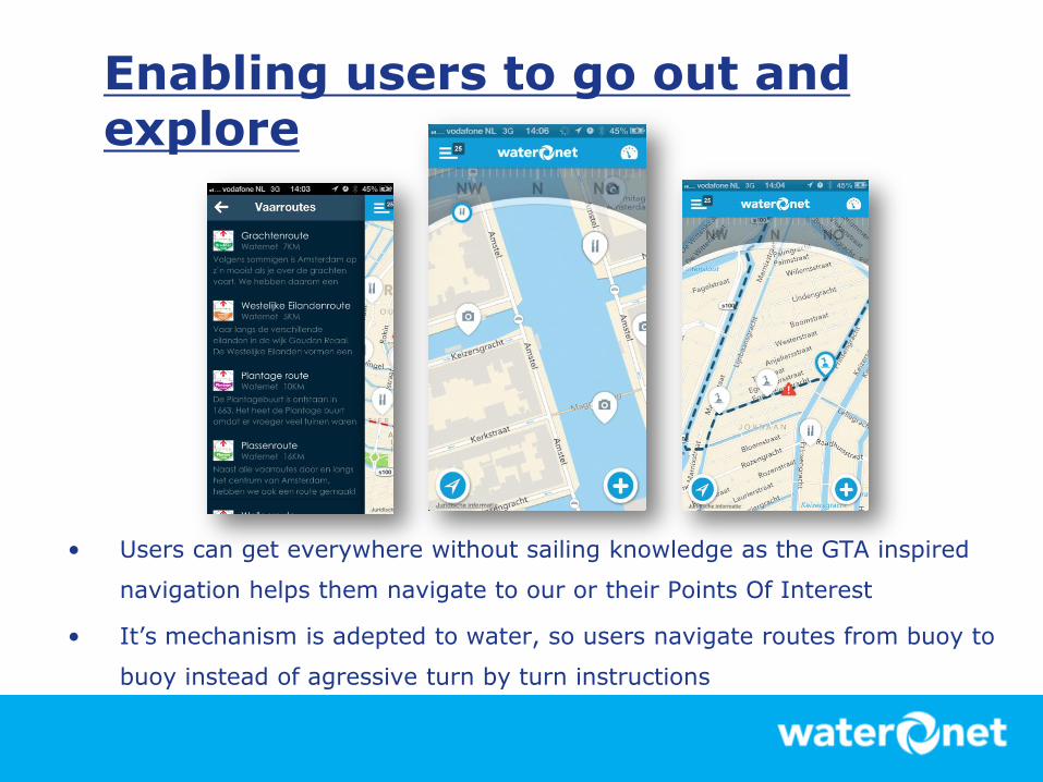
Enabling users to go out and explore
• Users can get everywhere without sailing knowledge as the GTA inspired
navigation helps them navigate to our or their Points Of Interest
• It’s mechanism is adepted to water, so users navigate routes from buoy to
buoy instead of agressive turn by turn instructions

Becoming part of their everyday use
• Logging trips helps users keep track of their routes and gas usage, so the
Dashboard becomes a regular part of their sailing trip
• The App enabls them to meet up with their Facebook friends and share their
routes for them to use, integrating with their social life on water

Helping them to make informed decisions
• The App provides information specific to a boat profile and location and
enables users to adept their routes to our realtime TNO traffic data
• Which helps them to enjoy their trip, and us to be effective at our crowd
management

Working together changes the dynamics
• We are able to evaluate and improve our measures using forecasts generated
by the TNO traffic model and their feedback
• And sharing this knowledge helps establish objective facts in the public debate
concerning our policy proposals
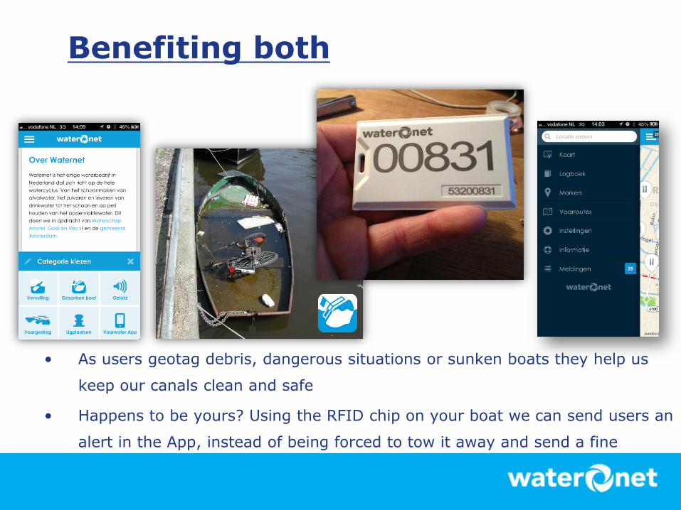
Benefiting both
• As users geotag debris, dangerous situations or sunken boats they help us
keep our canals clean and safe
• Happens to be yours? Using the RFID chip on your boat we can send users an
alert in the App, instead of being forced to tow it away and send a fine
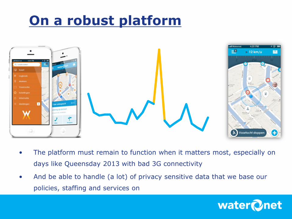
On a robust platform
• The platform must remain to function when it matters most, especially on
days like Queensday 2013 with bad 3G connectivity
• And be able to handle (a lot) of privacy sensitive data that we base our
policies, staffing and services on

Results: well, it’s one day old :)
Kickoff project
• 1 december 2012
Version 1 live:
• 18 April 2013
Version 1.2 (traffic)
• 22 May 2013 (yes.. yesterday)
But:
• The App achieved free publicity in all major Dutch newspapers on launch,
spurring 10.000 users to download it in the first 10 days (55% of our target
audience)
• And approximately 35% of the boats on the canals registered an active
session in the App on Queensday

Some tips

Use specialists

Know what you want
• Toss away ‘mobile first’ and think user-centric by creating something
that is relevant to their goals and specific to their situation

Expect feedback
• Users tend to have a (strong) opinion about what you do and why
you do it. And in public management, they’re youre boss.

Save yourself some stress
• Don’t plan to realise this for your own Canals in under 5 months.

Thanks!
Let’s connect:
@mkortman
linkedin.com/in/mariokortman