measuring distance ©2010 dr. b. c. paul note – the techniques shown in these slides are...
TRANSCRIPT
Measuring Distance
©2010 Dr. B. C. PaulNote – The techniques shown in these slides are considered common
knowledge to surveyors. Figures in the slides may be the authors own work or extracted from Instrument Users Manuals, Surveying by
Bouchard, Mine Surveying, or various internet image sources.

How do We Know Distance? Physically Measure It
Counting off paces (only good for very loose surveys)
Tape Measures For a line a mile long this gets fun fast
Optical Techniques Things appear larger or smaller depending on
distance Rate that things get smaller is function of focal
length of lens If know focal length of lens can determine distance
optically by how big an object of know size is
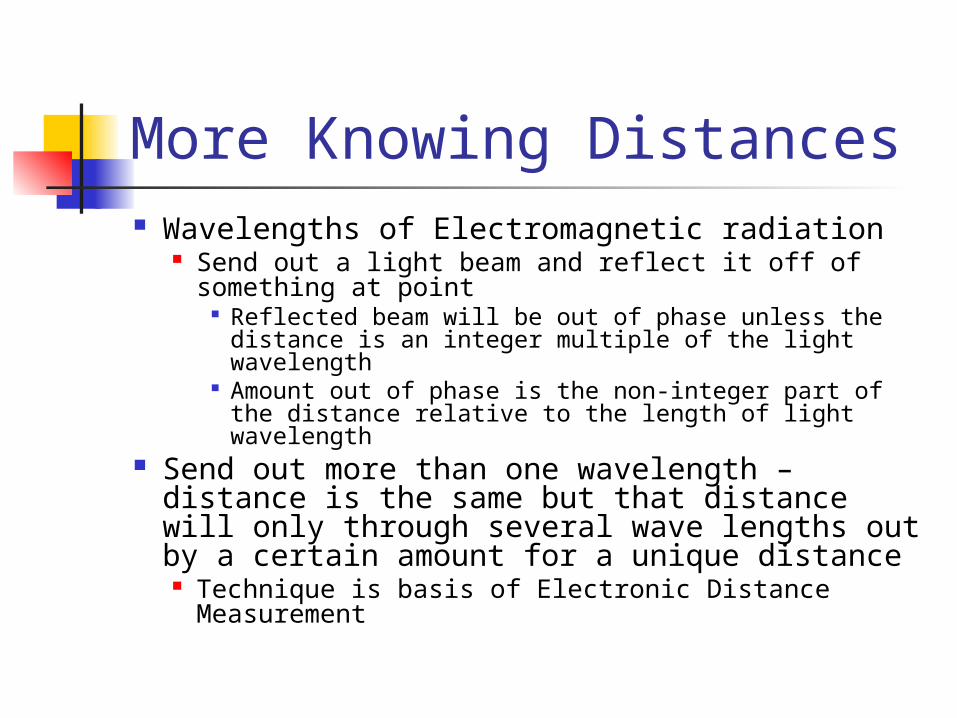
More Knowing Distances Wavelengths of Electromagnetic radiation
Send out a light beam and reflect it off of something at point
Reflected beam will be out of phase unless the distance is an integer multiple of the light wavelength
Amount out of phase is the non-integer part of the distance relative to the length of light wavelength
Send out more than one wavelength – distance is the same but that distance will only through several wave lengths out by a certain amount for a unique distance Technique is basis of Electronic Distance
Measurement

And More Knowing of Distance
If know the coordinates of two points Pythagorean theorem will give you the distance
Getting coordinates of points Grid of Global Positioning Satellites above the
earth Read the angel and distance to a satellite from an
electronic signal it sends down Solve coordinates of any point from satellite position
If set up two points, a base point and a point being measured can use ground based stations to compare signals and get mm accuracy
Can hit within feet with single back-pack mounted units
May know this technology is being put in cars now

Surveyor’s Chains Were Robust Wilderness Ready Tape Measures
A link is one of those wire lengths with a loop at each end

Chain Characteristics Chains had 100 links with brass holding
handles at the ends. Chains had brass tags every 10 links to
speed counting of links on partial chains Two Basic Kinds of Chains
Surveyors Chain (also called Gunter’s Chain) Was 66 feet long
Engineers Chain Was 100 feet long

Why a Profound Number Like 66 ft
Turns out a mile (5280 feet) is 80 chains long Divides nicely for quarter sections or
common land divisions Surveyors were laying out blocks
of land Also helps explain why no little
fractions for inches etc.

The Class Chain
Is a reproduction 10 meters long We’ll use it to measure out a baseline
on first lab just for nostalgia
Measurement by Tacheometry
Surveying Instruments have very precise optics – focal length is very well known You can tell how far away something is
by how big it appears in the lens (provided you know the size of the something)
That something is the rod used to mark your foresight point
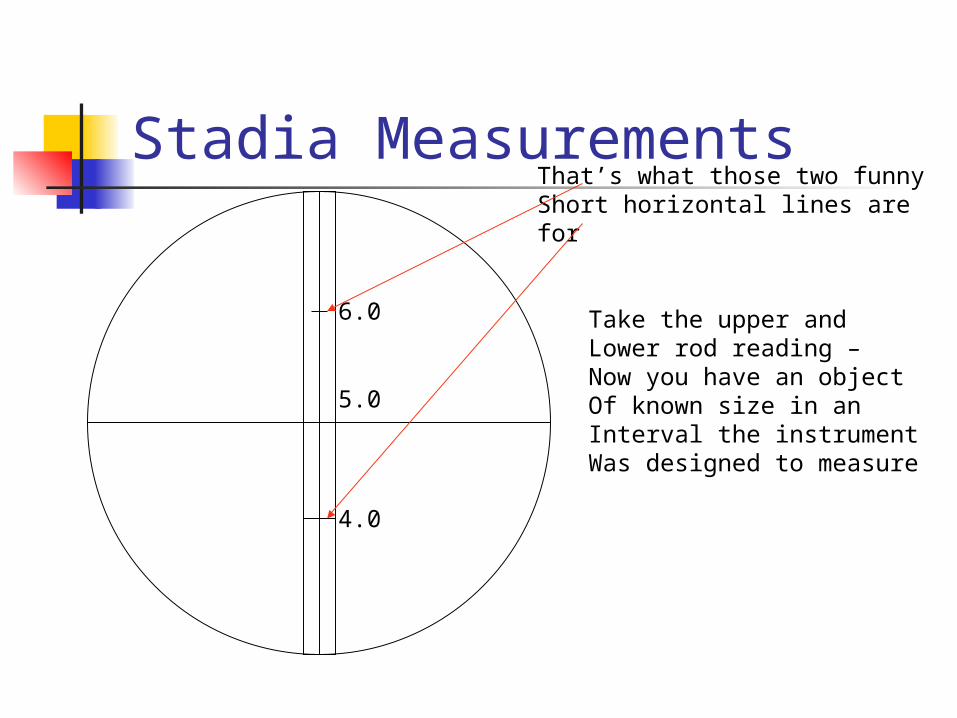
Stadia Measurements
5.0
6.0
4.0
That’s what those two funnyShort horizontal lines arefor
Take the upper andLower rod reading –Now you have an objectOf known size in anInterval the instrumentWas designed to measure
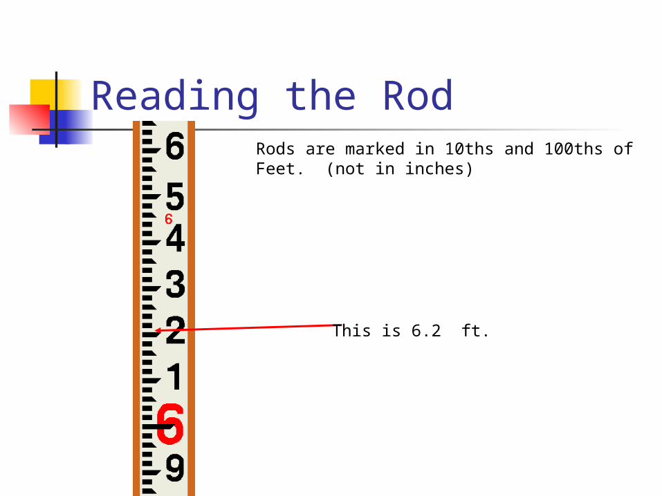
Reading the RodRods are marked in 10ths and 100ths ofFeet. (not in inches)
This is 6.2 ft.
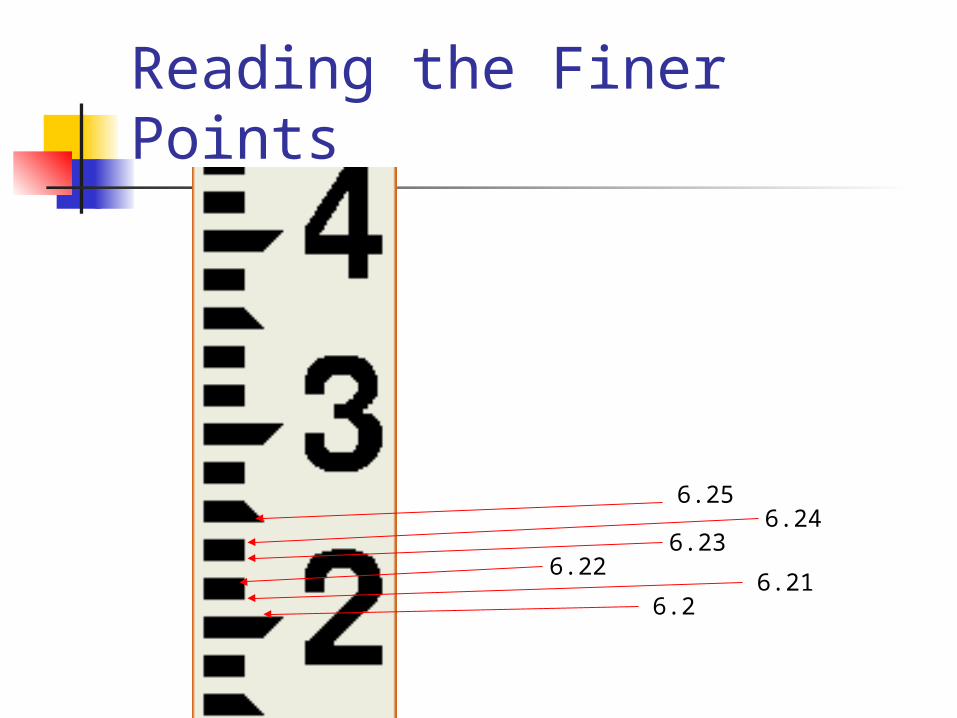
Reading the Finer Points
6.26.21
6.226.23
6.246.25
Getting the Hang of it!
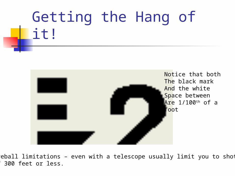
Notice that bothThe black markAnd the whiteSpace betweenAre 1/100th of afoot
Eyeball limitations – even with a telescope usually limit you to shotsOf 300 feet or less.

For Instruments Other Than Very Old Ones
Ratio between the stadia intercept distance (which you read from the rod) is 100
Can get distance by
)*2sin(*)(*50
)(*)(*100 cos2
gleverticalanLUV
gleverticalanLUH
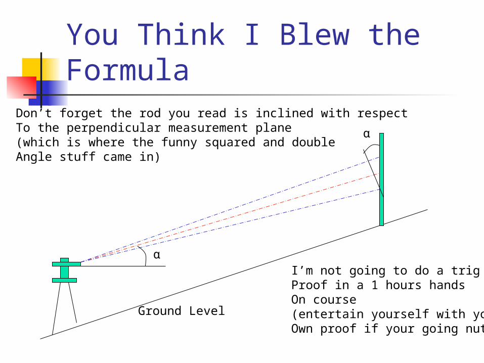
You Think I Blew the Formula
Ground Level
α
α
Don’t forget the rod you read is inclined with respectTo the perpendicular measurement plane(which is where the funny squared and doubleAngle stuff came in)
I’m not going to do a trigProof in a 1 hours handsOn course(entertain yourself with yourOwn proof if your going nuts)

Vertical Control with Stadia
V in the formula is the vertical change in distance from the height of instrument to the center reading on the rod
To get change in ground elevationΔV = V + Height of Instrument – Center
Rod Reading

An ExampleThe upper rod reads 6.5
The lower rod reads 6.1
The intercept is 6.5 – 6.1 = 0.4ft
Using a stadia constant of 100
0.4 * 100 = 40 feet
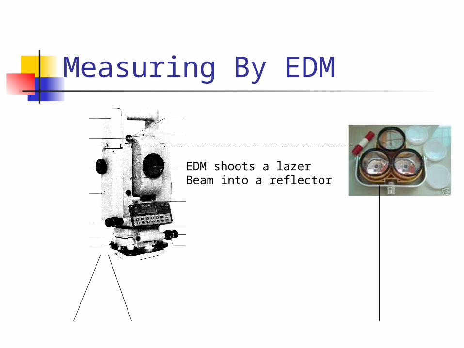
Measuring By EDM
EDM shoots a lazerBeam into a reflector
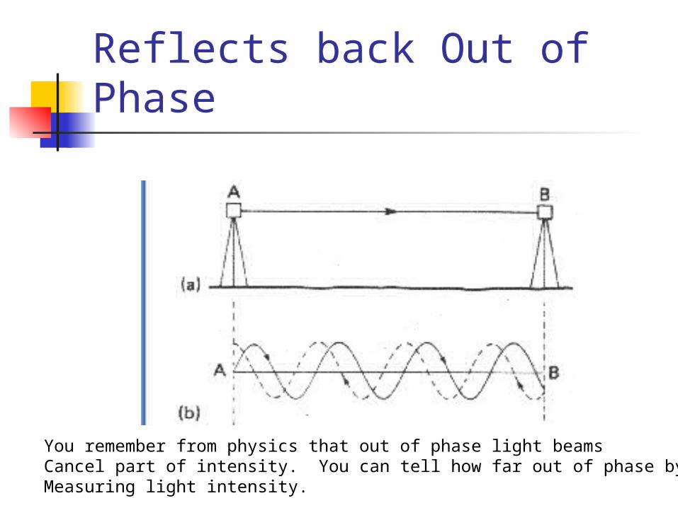
Reflects back Out of Phase
You remember from physics that out of phase light beamsCancel part of intensity. You can tell how far out of phase byMeasuring light intensity.

To Do it.
Turn the instrument on using theSwitch on the side
Our totally digital stations haveTo be turned on to work atAll.
Take aim at your target using the telescope

Set Your Units for Distance Measure
The ft andM indictor tellsYou what unitsIts it.
Push the enter button to change it

The Real Tuff Part.Push the Measure Button
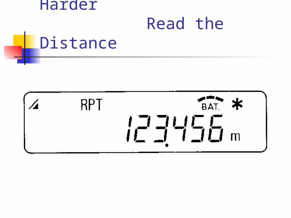
I Lied – This is Even Harder Read the Distance

Proficiency #5
Task #1 chain the distance between 2 stakes – use instrument to keep people on line
Task #2 measure a distance by stadia
Task #3 measure a distance by EDM