measuring tool - gisdata.eddmaps.orggisdata.eddmaps.org/written/measuretool.pdf1 measuring tool all...
TRANSCRIPT

1
Measuring Tool
All tutorial data is being used from http://gisdata.eddmaps.org/apps/demo
To follow along with the tutorials, feel free to use that web address to gain access to the online
demo.
The information in the demo map is being provided for demonstration purposes
only and does not constitute real data pertaining to
noxious weeds. The data cannot be considered reliable
and cannot be used for on the ground weed management decisions.
ALL RIGHTS RESERVED | EDDMAPS.ORG

2
Measuring
Measure
Tool
There are 3 ways you can measure features on the map:
Area, Line Length, and X/Y coordinates.
To get started click on the "Measure Tool" in the bottom toolbar.
3
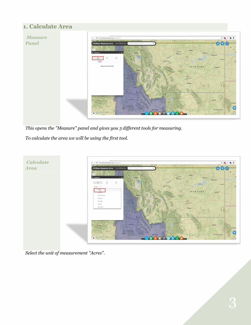
1. Calculate Area
Measure
Panel
This opens the "Measure" panel and gives you 3 different tools for measuring.
To calculate the area we will be using the first tool.
Calculate
Area
Select the unit of measurement "Acres".

4
Calculate
Area
Start by drawing a polygon around the area you want to measure.
As you draw notice the Measurement Results are being updated.
Calculate
Area
Double click your polygon to close the shape.
Notice the total area is calculated in acres. We will change the unit of measurement in the next step.
5
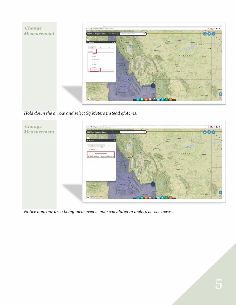
Change
Measurement
Hold down the arrow and select Sq Meters instead of Acres.
Change
Measurement
Notice how our area being measured is now calculated in meters versus acres.

6
2. Calculate Length
Measuring
Length
Click on the Length tool to measure the length of a line feature.
Measure
Line
Click on the map and then draw a line to the next spot. Double click the line to quit drawing.
Notice the Measurement Results are in miles and are calculated instantly.

7
Measure
Length
To measure multiple line segments (polyline) click on the map every place you need a vertices but
continue to draw on the map.
Double click to finish the drawing.
Change
Units
Change the unit of measurement by clicking on the arrow and selecting a different unit.
8
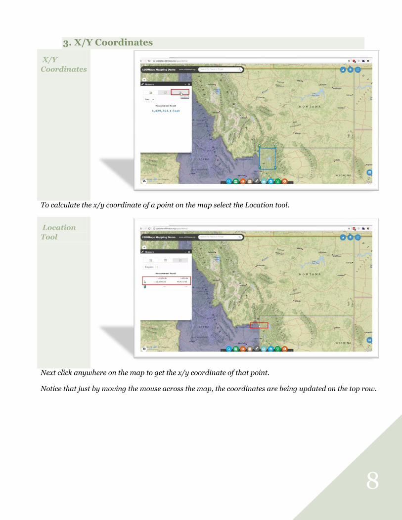
3. X/Y Coordinates
X/Y
Coordinates
To calculate the x/y coordinate of a point on the map select the Location tool.
Location
Tool
Next click anywhere on the map to get the x/y coordinate of that point.
Notice that just by moving the mouse across the map, the coordinates are being updated on the top row.

9
Change
Coordinates
You can change the Coordinate Units from Decimal Degrees to Degree Minute Seconds by selecting it
from the list. The units are changed instantly.
X/Y
Coordinates
Continue clicking on any point on the map to get the X/Y Coordinates.
Close the Measure Panel by clicking on the top "X" when you are done.