medusa - optimare.de maritime surveillance aircrat of casa cn-235 type equipped with ... ing system...
TRANSCRIPT

MEDUSAYour mission system
for airborne maritime surveillance

MEDUSAAdvanced Data Acquisition and Processing for Airborne Maritime Surveillance
APPLICATION
• Airbornemaritimesurveillance
• Airborneoilspillmonitoring
• EEZprotection
• Borderpatrol
• Fisherypatrol
• Hydrographicmonitoring
FEATURES
• Missionplanning
• Real-timedisplayofsensordata
• Immediatepost-overpassanalysis
• Supportofanyremotesensor
• Classiicationofmarinepollution
• Automatedsceneanalysis
• Computer-aidedreportcreation
• Geo-referencingandGIScapability
• In-lightandgroundprocessing
• Displayofelectroniccharts
• Redundantstorage
• AISsupport
The MEDUSA System allows robust acquisition, real-time display
as well as immediate post-overlight processing of remote sen-
sing data. Post-overlight processing includes automated image
analysis, pollution classiication and GIS export.
Spanish maritime surveillance aircrat of Casa CN-235 type equipped with
OPTIMARE’s MEDUSA system as a subsystem of the EADS FITS system (Pho-
tograph courtesy of AIRBUS MILITARY).
Overview
The optimum operation of an airborne maritime surveil-lance system is more demanding than ever – requiring en-hanced real-time data acquisition and sotware solutions.
The MEDUSA System integrates multiple remote sensors and mission system components into one user-friendly, network-based data acquisition and processing frame-work.
The entire MEDUSA System roughly comprises the follow-ing structural components:
• MEDUSAnetwork
• MEDUSAsensors
• MEDUSASotwareSuite
MEDUSA can be either operated stand-alone or as a sur-veillance subsystem of an integrated mission system via a customizable interface.
MEDUSA screen showing the professional marine navigational chart system
with AIS objects in conjunction with an enhanced AIS ilter tool.
�
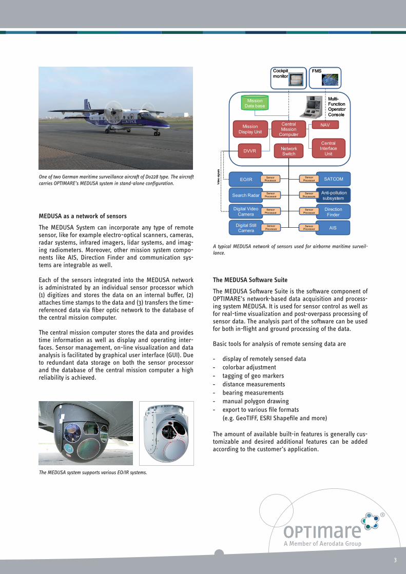
One of two German maritime surveillance aircrat of Do228 type. The aircrat
carries OPTIMARE’s MEDUSA system in stand-alone coniguration.
MEDUSAasanetworkofsensors
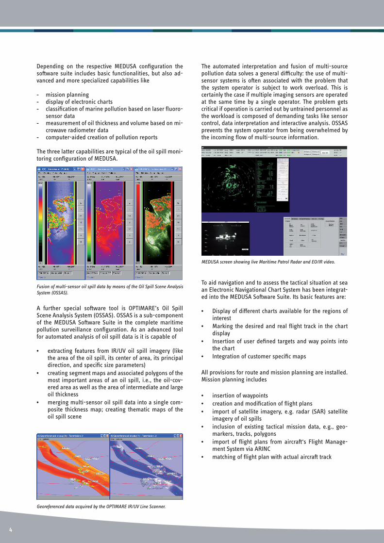
The MEDUSA System can incorporate any type of remote sensor, like for example electro-optical scanners, cameras, radar systems, infrared imagers, lidar systems, and imag-ing radiometers. Moreover, other mission system compo-nents like AIS, Direction Finder and communication sys-tems are integrable as well.
Each of the sensors integrated into the MEDUSA network is administrated by an individual sensor processor which (1) digitizes and stores the data on an internal bufer, (�) attaches time stamps to the data and (�) transfers the time-referenced data via iber optic network to the database of the central mission computer.
The central mission computer stores the data and provides time information as well as display and operating inter-faces. Sensor management, on-line visualization and data analysis is facilitated by graphical user interface (GUI). Due to redundant data storage on both the sensor processor and the database of the central mission computer a high reliability is achieved.
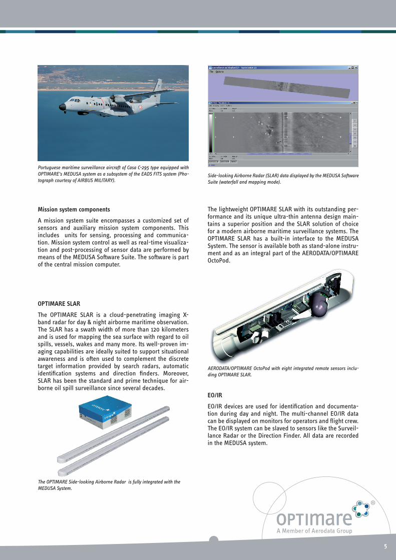
The MEDUSA system supports various EO/IR systems.
A typical MEDUSA network of sensors used for airborne maritime surveil-
lance.
TheMEDUSASotwareSuite
The MEDUSA Sotware Suite is the sotware component of OPTIMARE’s network-based data acquisition and process-ing system MEDUSA. It is used for sensor control as well as for real-time visualization and post-overpass processing of sensor data. The analysis part of the sotware can be used for both in-light and ground processing of the data.
Basic tools for analysis of remote sensing data are
- display of remotely sensed data
- colorbar adjustment
- tagging of geo markers
- distance measurements
- bearing measurements
- manual polygon drawing
- export to various ile formats
(e.g. GeoTIFF, ESRI Shapeile and more)
The amount of available built-in features is generally cus-tomizable and desired additional features can be added according to the customer’s application.
SATCOM
AIS
DigitalVideo
Camera
DigitalStillCamera
Anti-pollution
subsystem
EO/IR
CentralMission
Computer
MissionData base
NAV
CentralInterface
UnitDVVR
Direction
Finder
SensorProcessor
Sensor
Processor
Sensor
Processor
Sensor
Processors
NetworkSwitch
Search RadarSensor
Processor
FMS
Mission
DisplayUnit
Cockpit
monitor
Vid
eo
sig
na
ls
Multi-FunctionOperator
Console
SensorProcessor
Sensor
Processor
Sensor
Processor SATCOM
AIS
DigitalVideo
Camera
DigitalStillCamera
Anti-pollution
subsystem
EO/IR
CentralMission
Computer
MissionData base
NAV
CentralInterface
UnitDVVR
Direction
Finder
SensorProcessor
Sensor
Processor
Sensor
Processor
Sensor
Processors
NetworkSwitch
Search RadarSensor
Processor
FMS
Mission
DisplayUnit
Cockpit
monitor
Vid
eo
sig
na
ls
Multi-FunctionOperator
Console
SensorProcessor
Sensor
Processor
Sensor
Processor
�
Depending on the respective MEDUSA coniguration the sotware suite includes basic functionalities, but also ad-vanced and more specialized capabilities like
- mission planning - display of electronic charts- classiication of marine pollution based on laser luoro-
sensor data- measurement of oil thickness and volume based on mi-
crowave radiometer data- computer-aided creation of pollution reports
The three latter capabilities are typical of the oil spill moni-toring coniguration of MEDUSA.
Fusion of multi-sensor oil spill data by means of the Oil Spill Scene Analysis
System (OSSAS).
Georeferenced data acquired by the OPTIMARE IR/UV Line Scanner.
MEDUSA screen showing live Maritime Patrol Radar and EO/IR video.
A further special sotware tool is OPTIMARE’s Oil Spill Scene Analysis System (OSSAS). OSSAS is a sub-component of the MEDUSA Sotware Suite in the complete maritime pollution surveillance coniguration. As an advanced tool for automated analysis of oil spill data is it is capable of
• extracting features from IR/UV oil spill imagery (like the area of the oil spill, its center of area, its principal direction, and speciic size parameters)
• creating segment maps and associated polygons of the most important areas of an oil spill, i.e., the oil-cov-ered area as well as the area of intermediate and large oil thickness
• merging multi-sensor oil spill data into a single com-posite thickness map; creating thematic maps of the oil spill scene
The automated interpretation and fusion of multi-source pollution data solves a general diiculty: the use of multi-sensor systems is oten associated with the problem that the system operator is subject to work overload. This is certainly the case if multiple imaging sensors are operated at the same time by a single operator. The problem gets critical if operation is carried out by untrained personnel as the workload is composed of demanding tasks like sensor control, data interpretation and interactive analysis. OSSAS prevents the system operator from being overwhelmed by the incoming low of multi-source information.
To aid navigation and to assess the tactical situation at sea an Electronic Navigational Chart System has been integrat-ed into the MEDUSA Sotware Suite. Its basic features are:
• Display of diferent charts available for the regions of interest
• Marking the desired and real light track in the chart display
• Insertion of user deined targets and way points into the chart
• Integration of customer speciic maps
All provisions for route and mission planning are installed. Mission planning includes
• insertion of waypoints
• creation and modiication of light plans
• import of satellite imagery, e.g. radar (SAR) satellite imagery of oil spills
• inclusion of existing tactical mission data, e.g., geo-markers, tracks, polygons
• import of light plans from aircrat‘s Flight Manage-ment System via ARINC
• matching of light plan with actual aircrat track
��
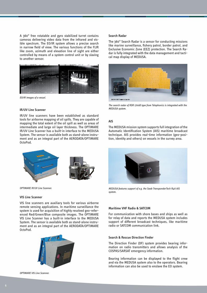
Portuguese maritime surveillance aircrat of Casa C-295 type equipped with
OPTIMARE’s MEDUSA system as a subsystem of the EADS FITS system (Pho-
tograph courtesy of AIRBUS MILITARY).
The OPTIMARE Side-looking Airborne Radar is fully integrated with the
MEDUSA System.
Side-looking Airborne Radar (SLAR) data displayed by the MEDUSA Sotware
Suite (waterfall and mapping mode).
Missionsystemcomponents
A mission system suite encompasses a customized set of sensors and auxiliary mission system components. This includes units for sensing, processing and communica-tion. Mission system control as well as real-time visualiza-tion and post-processing of sensor data are performed by means of the MEDUSA Sotware Suite. The sotware is part of the central mission computer.
OPTIMARESLAR
The OPTIMARE SLAR is a cloud-penetrating imaging X-band radar for day & night airborne maritime observation. The SLAR has a swath width of more than 1�0 kilometers and is used for mapping the sea surface with regard to oil spills, vessels, wakes and many more. Its well-proven im-aging capabilities are ideally suited to support situational awareness and is oten used to complement the discrete target information provided by search radars, automatic identiication systems and direction inders. Moreover, SLAR has been the standard and prime technique for air-borne oil spill surveillance since several decades.
AERODATA/OPTIMARE OctoPod with eight integrated remote sensors inclu-
ding OPTIMARE SLAR.
The lightweight OPTIMARE SLAR with its outstanding per-formance and its unique ultra-thin antenna design main-tains a superior position and the SLAR solution of choice for a modern airborne maritime surveillance systems. The OPTIMARE SLAR has a built-in interface to the MEDUSA System. The sensor is available both as stand-alone instru-ment and as an integral part of the AERODATA/OPTIMARE OctoPod.
EO/IR
EO/IR devices are used for identiication and documenta-tion during day and night. The multi-channel EO/IR data can be displayed on monitors for operators and light crew. The EO/IR system can be slaved to sensors like the Surveil-lance Radar or the Direction Finder. All data are recorded in the MEDUSA system.
��
EO/IR images of a vessel.
IR/UVLineScanner
IR/UV line scanners have been established as standard tools for airborne mapping of oil spills. They are capable of mapping the total extent of the oil spill as well as areas of intermediate and large oil layer thickness. The OPTIMARE IR/UV Line Scanner has a built-in interface to the MEDUSA System. The sensor is available both as stand-alone instru-ment and as an integral part of the AERODATA/OPTIMARE OctoPod.
OPTIMARE IR/UV Line Scanner.
VISLineScanner
VIS line scanners are auxiliary tools for various airborne remote sensing applications. In maritime surveillance the system is used for acquisition of highly resolved geo-refer-enced Red/Green/Blue composite images. The OPTIMARE VIS Line Scanner has a built-in interface to the MEDUSA System. The sensor is available both as stand-alone instru-ment and as an integral part of the AERODATA/OPTIMARE OctoPod.
OPTIMARE VIS Line Scanner.
SearchRadar
The �60° Search Radar is a sensor for conducting missions like marine surveillance, ishery patrol, border patrol, and Exclusive Economic Zone (EEZ) protection. The Search Ra-dar is fully integrated with the data management and tacti-cal map display of MEDUSA.
AIS
The MEDUSA mission system supports full integration of the Automatic Identiication System (AIS) maritime broadcast technique. AIS provides real-time information (geo-posi-tion, identity and others) on vessels in the survey area.
MaritimeVHFRadio&SATCOM
For communication with shore bases and ships as well as for relay of data and reports the MEDUSA system includes support of diferent broadcast techniques, like maritime radio or SATCOM communication link.
The search radar of RDR 1700B type from Telephonics is integrated with the
MEDUSA system.
MEDUSA features support of e.g. the Saab TransponderTech R4A AIS
system.
A �60° free rotatable and gyro stabilized turret contains cameras delivering video data from the infrared and vis-ible spectrum. The EO/IR system allows a precise search in narrow ield of view. The various functions of the FLIR like zoom, azimuth and elevation line of sight are either controlled by means of a system control unit or by slaving to another sensor.
Search&RescueDirectionFinder
The Direction Finder (DF) system provides bearing infor-mation on radio transmitters and allows analysis of the COSPAS/SARSAT emergency information.
Bearing information can be displayed to the light crew and via the MEDUSA system also to the operators. Bearing information can also be used to enslave the EO system.
6
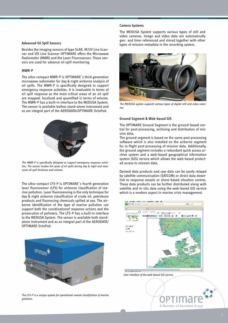
CameraSystems
The MEDUSA System supports various types of still and video cameras. Image and video data are automatically geo- and time-referenced and stored together with other types of mission metadata in the recording system.
GroundSegment&Web-basedGIS
The OPTIMARE Ground Segment is the ground-based cen-tral for post-processing, archiving and distribution of mis-sion data.The ground segment is based on the same post processing sotware which is also installed on the airborne segment for in-light post-processing of mission data. Additionally, the ground segment includes a redundant quick access ar-chive system and a web-based geographical information system (GIS) service which allows the web-based protect-ed access to mission data.
Derived data products and raw data can be easily relayed by satellite communication (SATCOM) or direct data down-link to response vessels or shore-based situation centres. These data products can be further distributed along with satellite and in-situ data using the web-based GIS service which is a modern aspect in marine crisis management.
The MWR-P is speciically designed to support emergency response activi-
ties. The sensor locates hot spots of oil spills during day & night and mea-
sures oil spill thickness and volume.
The MEDUSA system supports various types of digital still and video came-
ras.
The ultra-compact LFS-P is OPTIMARE´s fourth generation laser luorosensor (LFS) for airborne classiication of ma-rine pollution. Laser luorosensing is the only technique for day & night airborne classiication of crude oil, petroleum products and luorescing chemicals spilled at sea. The air-borne identiication of the type of marine pollution can support both the coordinationof response actions and the prosecution of polluters. The LFS-P has a built-in interface to the MEDUSA System. The sensor is available both stand-alone instrument and as an integral part of the AERODATA/OPTIMARE OctoPod.
The LFS-P is a unique system for operational remote classiication of marine
pollution.
User interface of the web-based GIS service.
AdvancedOilSpillSensors
Besides the imaging sensors of type SLAR, IR/UV Line Scan-ner and VIS Line Scanner OPTIMARE ofers the Microwave Radiometer (MWR) and the Laser Fluorosensor. These sen-sors are used for advance oil spill monitoring.
MWR-P
The ultra-compact MWR-P is OPTIMARE´s third generation microwave radiometer for day & night airborne analysis of oil spills. The MWR-P is speciically designed to support emergency response activities. It is invaluable in terms of oil spill response as the most critical areas of an oil spill are mapped, localized and quantiied in terms of volume. The MWR-P has a built-in interface to the MEDUSA System. The sensor is available bothas stand-alone instrument and as am integral part of the AERODATA/OPTIMARE OctoPod.
�

OPTIMARE Systems GmbH
Fischkai 1
27572 Bremerhaven
Germany
Tel +49 471 48361-0
Fax +49 471 48361-11
www.optimare.de
For further information on the MEDUSA System you are welcome to contact us.
January 2017
Subject to technical changes and misprints