meetings - city of charlottecharlottenc.gov/charlottefuture/cip/cnip/documents/pvjune... · •...
TRANSCRIPT

PROSPERITY VILLAGE CNIP
2nd FOCUS GROUP MEETINGS
6/3/2015
Comprehensive Neighborhood Improvement Program (CNIP)

CNIP Team
City of Charlotte Core Team:
• Kristie Kennedy – E&PM Project Manager • Kent Main - Planning Department Rep.• Tom Sorrentino - CDOT Rep.• John Short - Neighborhood and Business Services Rep.
Woolpert Team:
• Paul Smith – Woolpert Project Manager• Wayne Robinson – Woolpert Project Planner• Marc Meddaugh – Woolpert Designer• Gary Stewart – Leading the Way, LLC• Jim Schumacher – Schumacher Urban Projects• Kelly Hayes – SEPI Inc.
CNIP Team
Comprehensive Neighborhood Improvement Program (CNIP)
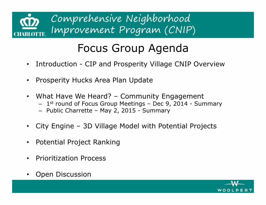
Focus Group Agenda
• Introduction - CIP and Prosperity Village CNIP Overview
• Prosperity Hucks Area Plan Update
• What Have We Heard? – Community Engagement– 1st round of Focus Group Meetings – Dec 9, 2014 - Summary – Public Charrette – May 2, 2015 - Summary
• City Engine – 3D Village Model with Potential Projects
• Potential Project Ranking
• Prioritization Process
• Open Discussion
Comprehensive Neighborhood Improvement Program (CNIP)
Focus Group Agenda

CIP vs CNIP
� The Community Investment Plan (CIP) is a long-range investment program designed to meet the needs of our growing community.
� Over the next several years, $816.4 M in proposed community improvements will be planned, designed and implemented.
� The CIP includes $120 M for 5 CNIP’s.
� Prosperity Village CNIP is slated to receive $30 M of that total over an eight year period.
Comprehensive Neighborhood Improvement Program (CNIP)
CIP vs CNIP

Community Investment Plan Goals
Creating jobs and
growing the tax base
Enhancing public safety
Ensuring housing diversity
Leveraging public
and private investments
Enhancing transportation
choices and mobility
Providing integrated
neighborhood improvements
Community Investment Plan Goals
The overall goal of the CIP program is to invest in projects that generate the most benefit and impact to our entire community in the following ways:
6
Comprehensive Neighborhood Improvement Program (CNIP)
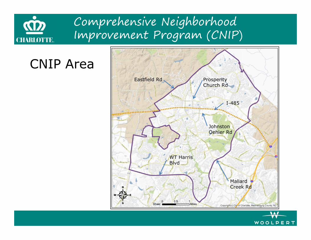
CNIP Area
Eastfield Rd
I-485
Prosperity Church Rd
Mallard Creek Rd
WT Harris Blvd
Johnston Oehler Rd
CNIP Area
Comprehensive Neighborhood Improvement Program (CNIP)

Prosperity Village CNIP
• Prosperity Village is categorized as an emerging, high growth area in need of increased connectivity to regional nodes and employment centers.
• The Prosperity Village project area includes most of the same area described in the draft Prosperity Hucks Area Plan. – The area is generally low-density
– with strong, stable neighborhoods and
– contains a Mixed-Use Activity Center in the vicinity surrounding Prosperity Church Road and I-485.
Comprehensive Neighborhood Improvement Program (CNIP)
Prosperity Village CNIP

Prosperity Hucks Area Plan Update
• Current Version of the Area Plan is consistent with the Public Presentation held on April 15, 2015
• Next Steps for the Plan Adoption: City Council Meeting - June 22, 2015 Public Comment Opportunity
• Scheduled Area Plan Adoption - July, 2015
Comprehensive Neighborhood Improvement Program (CNIP)

PROJECT CRITERIA FROM THE AREA PLAN
• Streets need to be pedestrian friendly
• Projects need to create a great place to live, work, and play
• Connect the neighborhoods with the Activity Center
• Transportation needs to be safe for pedestrians, bicyclists, transit users, and motorists
• Integrate greenways, parks, and open space
• Need to provide protection of environmentally sensitive areas
Comprehensive Neighborhood Improvement Program (CNIP)

PROJECT CRITERIA FROM THE AREA PLAN
• Activity Center needs to become a gathering place and sense of place
• Local streets need to be connected
• Important to provide interconnectivity of vehicles, bicycles, and pedestrians within the Activity Center
• Activity Center includes 4 large tracts to accommodate walkable sub-town centers
• There are 2 core areas within the Activity Center-o North: retail, the heart of the Village, sense of place, civic uses
around existing pond, and gathering spaceso South: employment center, sense of place, promote walking,
connect to Clark’s Creek Greenway
Comprehensive Neighborhood Improvement Program (CNIP)

IMPLEMENTATION GUIDE FROM THE AREA PLAN
Short-term Projects (0-5 years)
• NCDOT transfer of ownership of Ridge Road Natural Heritage Site• Construct and upgrade the thoroughfares to the Activity Center:o Benfield Roado Prosperity Church Roado Ridge Roado Johnston-Oehler Roado I-485 Frontage Roads
Comprehensive Neighborhood Improvement Program (CNIP)
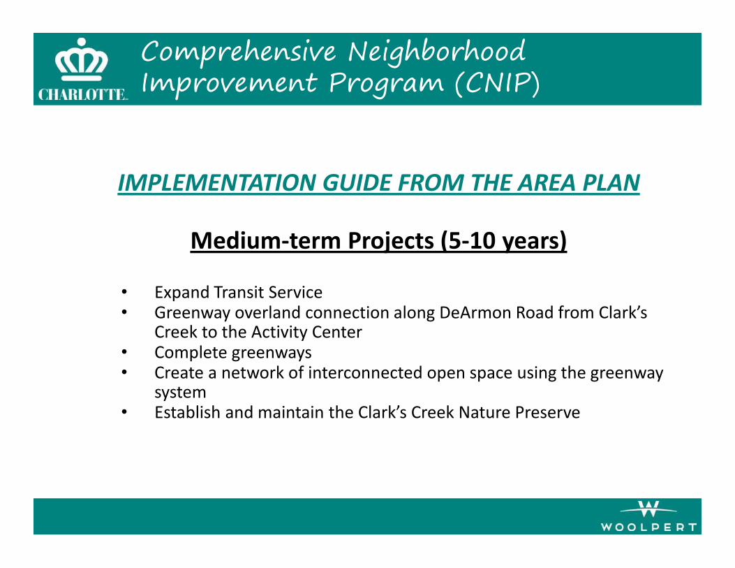
IMPLEMENTATION GUIDE FROM THE AREA PLAN
Medium-term Projects (5-10 years)
• Expand Transit Service• Greenway overland connection along DeArmon Road from Clark’s
Creek to the Activity Center• Complete greenways• Create a network of interconnected open space using the greenway
system• Establish and maintain the Clark’s Creek Nature Preserve
Comprehensive Neighborhood Improvement Program (CNIP)

What We Have Heard?
• 1st Focus Groups
• Public Charrette
Comprehensive Neighborhood Improvement Program (CNIP)

Results from December 2014 Focus Groups
• Private Sector Meeting
• Public Sector Meeting
• Residential Leaders Meeting
Comprehensive Neighborhood Improvement Program (CNIP)

FOCUS GROUPS INPUT FROM DECEMBER, 2014
PRIVATE SECTOR MEETING
• For transformative change, create an employment center that is supported with public amenities/services and well connected pedestrian environment
• Combination of large and smaller projects
• Projects should be ranked based on their environmental impact and consistency with the Area Plan
• For it to become a special place, the Activity Center will need to happen with mixed land uses, gathering spaces, and connected with the surrounding neighborhoods
• There are opportunities for greenways, and open space integration
• Provide incentives to developers to build the Activity Center
• Public sector needs to focus on improving the gaps between developments- sidewalks, etc.
• Retail and office will be the hottest land uses after the I-485 interchange is open.
Comprehensive Neighborhood Improvement Program (CNIP)

FOCUS GROUPS INPUT FROM DECEMBER, 2014
PUBLIC SECTOR MEETING
• Desirable open space will make the area a livable community
• Roadway improvements will be the best investment for getting around
• To promote an employment center, need to provide transit service and roadway improvements
• Best way to get a transformative change is with providing quality open space along with improvements to transit service
• No preference to large or small projects
• Highest usage should be the key consideration in ranking the projects
• Great opportunity for this area to become an employment center and sense of place, with great public amenities and access
Comprehensive Neighborhood Improvement Program (CNIP)

FOCUS GROUPS INPUT FROM DECEMBER, 2014
PUBLIC SECTOR MEETING
• Use the lake north of I-485 to create a sense of place
• Public should focus on infrastructure improvements to bring in private capital
• Best Projects for the public sector include:o Transportationo Open spaceo Transit serviceo Sidewalks and greenways
• Create public-private partnerships with developers • Consider a library
Comprehensive Neighborhood Improvement Program (CNIP)

FOCUS GROUPS INPUT FROM DECEMBER, 2014
PUBLIC SECTOR MEETING
• Most important transportation needs:
o Widen surface streets
o Provide a connection with the light rail system
o Greenways
• Provide pedestrian connections with the neighborhoods
• Create bike lanes
• Use traffic controls with designated bike lanes, and pedestrian crosswalks
to make it a safer community
Comprehensive Neighborhood Improvement Program (CNIP)

FOCUS GROUPS INPUT FROM DECEMBER, 2014
COMMUNITY LEADERS MEETING
• Best investments to make it a livable community-
Vehicular transportation
Pedestrian transportation
Aesthetics- gateways, streetscapes, and signage
Open space
• Best investments in getting around-
Pedestrian transportation
• Best investments for job growth-
Water/waste water/ and storm water improvements
Aesthetics- gateways, streetscapes, and signage
Comprehensive Neighborhood Improvement Program (CNIP)

FOCUS GROUPS INPUT FROM DECEMBER, 2014
COMMUNITY LEADERS MEETING
• To create transformative change focus on the following:o Aesthetics- gateways, streetscapes, and signageo Open spaceo Pedestrian transportation
• Prefer multiple smaller projects• Rank the projects based on:
o Consistency with the Area Plano Increased valueo Usage
• Best way to strengthen the existing residential neighborhoods:o Open spaceo Aestheticso Pedestrian transportationo Government facilities- library
Comprehensive Neighborhood Improvement Program (CNIP)

Results from May 2015 Public Charrette
Four Potential Project Categories:
• Community Identity and Beautification
• Greenways, Trails and Open Space
• Pedestrian Circulation
• Transportation
Comprehensive Neighborhood Improvement Program (CNIP)

COMMUNITY IDENTITY AND BEAUTIFICATION
• Establish a brand for the community• Create better connectivity• Most popular projects-
o I-485 and Frontage Roads Streetscapeso Community signageo Village gateways
GREENWAYS, TRAILS, AND OPEN SPACE
• Support all greenway expansion projects• Connect neighborhoods with the Activity Center• Most popular projects:
o G1 Trailhead and Clark’s Creek Greenway extension o G3 Southwest Connector Multi-Use Trail
Comprehensive Neighborhood Improvement Program (CNIP)

PEDESTRIAN CIRCULATION
• Connect neighborhoods with the Activity Center• Most popular projects-
o Sidewalks on Ridge Road from Prosperity Church Road to Highland Creek Parkway
TRANSPORTATION
• Any project that will reduce traffic congestion• Provide better access from the neighborhoods to the
Activity Center• Most popular projects:
o T2 Ridge Road Extensiono T3 Ridge Road Wideningo T14 Traffic Signal/Intersection Improvement at
Brown and DeArmon
Comprehensive Neighborhood Improvement Program (CNIP)

PARTNERSHIPS
• Connect neighborhoods with the Activity Center
• Most popular projects-
o Sidewalks on Ridge Road from Prosperity Church
Road to Highland Creek Parkway
Comprehensive Neighborhood Improvement Program (CNIP)

CHARRETTE DISCUSSION ITEMS
• Hucks complete street and sidewalks
• Sidewalks and turn lanes on Ridge Road
• Expansion of greenways, pedestrian connections between Highland Creek and Mallard Creek Park
• Traffic signal at DeArmon and Browne Road
• Utilize CATS parking area on Mallard Creek Road for Mallard Creek Greenway Access
• Provide public open space
• Library is a high priority
Comprehensive Neighborhood Improvement Program (CNIP)

CityEngine Planning and
Design Tools
Comprehensive Neighborhood Improvement Program (CNIP)

Comprehensive Neighborhood Improvement Program (CNIP)
Prosperity Village Area Plan Boundary

Comprehensive Neighborhood Improvement Program (CNIP)
Prosperity Village Area Plan Concept

Comprehensive Neighborhood Improvement Program (CNIP)
Activity Center Boundary

Comprehensive Neighborhood Improvement Program (CNIP)
Activity Center Concept

Comprehensive Neighborhood Improvement Program (CNIP)
Area C4

Comprehensive Neighborhood Improvement Program (CNIP)
Area C4 Concept Sketch
New Street
ConnectionEast-West connecting
Highland Shoppes Drive
to Benfield Road supports
Activity Center mobility.
Relocation of
McKay RoadProvides North-South
movement and improve
intersection and site
access functionality.
Retail and OfficeUses that orient to the
pond and to the new street
connections knits the
Activity Center together.
Open SpaceUse of existing pond as an
amenity serves the
community as a central
gathering location.

Comprehensive Neighborhood Improvement Program (CNIP)
Area C4 Existing Conditions Aerial

Comprehensive Neighborhood Improvement Program (CNIP)
Area C4 Existing Conditions City Engine Model

Comprehensive Neighborhood Improvement Program (CNIP)
Area C4 Existing Conditions City Engine Model Perspective

Comprehensive Neighborhood Improvement Program (CNIP)
City Engine Model of Proposed Roadway Alignment
of Highland Shoppes Drive Extension

Comprehensive Neighborhood Improvement Program (CNIP)
City Engine Model of Proposed Roadway Alignment
of Highland Shoppes Drive Extension

Comprehensive Neighborhood Improvement Program (CNIP)
Community Identity / Beautification

As we discuss each project please think about which projects would garner the highest priority. We will ask you to select three (3) of your highest priority projects from this list at the end of the presentation.
I-1: Prosperity Village Gateway on I-485 Exit Ramp
I-2: I-485 Ramp Loop Streetscape Beautification
I-3: Landmarks at Roundabouts
I-4: Community Signage Program
I-5: Village Gateway Landmarks
I-6: Village Identity Monument
Comprehensive Neighborhood Improvement Program (CNIP)
Community Identity / Beautification

• Development and construction of gateway identification monuments/signs installed
on both I-485 off ramps
• Special designed monument/sign structure with reverse channel lighted lettering
• Accent lighting
• Special accent landscape design
• Irrigation system.
Comprehensive Neighborhood Improvement Program (CNIP)
Community Identity / Beautification
I-1: Prosperity Village Gateway on I-485 Exit Ramp
• Design and installation of streetscape beautification
• +/- 4,960 L.F. of interstate frontage roads
• Widening of the existing sidewalks to 12’, street trees on both sides
• Accent landscape at special nodes with understory trees, flowering and evergreen shrubs and ground
cover, landscape irrigation, area/pedestrian lighting and potential seating/resting locations
Comprehensive Neighborhood Improvement Program (CNIP)
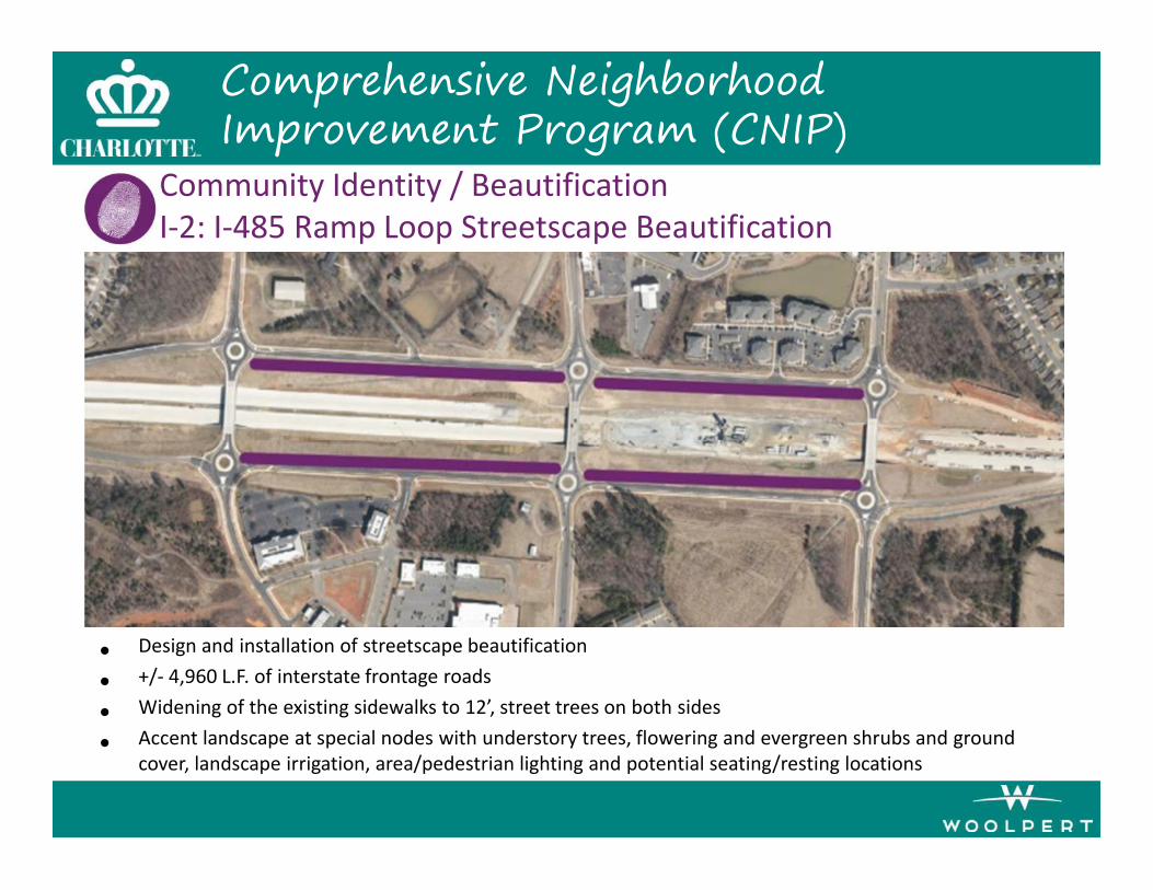
Community Identity / Beautification
I-2: I-485 Ramp Loop Streetscape Beautification

• design and install landmarks at the roundabouts
• sculptural/art pieces or specific branding/identification structures
• accent landscaping, landscape irrigation and special accent lighting.
Comprehensive Neighborhood Improvement Program (CNIP)
Community Identity / Beautification
I-3: Landmarks at Roundabouts

• Develop and install community identification signs
• Small signs or monuments at the seven (7) major intersections
• No landscape, lighting, irrigation should be included.
Comprehensive Neighborhood Improvement Program (CNIP)
Community Identity / Beautification
I-4: Community Signage Program

• North and South village core entries (Prosperity Church Road and Eastfield Road
and Prosperity Church Road and Stone Park Drive)
• Landmark structure, reverse channel lighted letters, accent landscape, landscape
irrigation system and accent lighting.
Comprehensive Neighborhood Improvement Program (CNIP)
Community Identity / Beautification
I-5: Village Gateway Landmarks

• Main village identity monument
• Pedestrian open space
• Located at Northeast corner of the
Prosperity Church Road and
Dearmon Road intersection
• Monument or covered gazebo type
structure and a special paved plaza
area with seating
• Accent landscaping, landscape
irrigation system and accent and
pedestrian level lighting
Comprehensive Neighborhood Improvement Program (CNIP)
Community Identity / Beautification
I-6: Village Identity Monument

As we discuss each project please think about which projects would garner the highest priority. We will ask you to select three (3) of your highest priority projects from this list at the end of the presentation.
I-1: Prosperity Village Gateway on I-485 Exit Ramp
I-2: I-485 Ramp Loop Streetscape Beautification
I-3: Landmarks at Roundabouts
I-4: Community Signage Program
I-5: Village Gateway Landmarks
I-6: Village Identity Monument
Comprehensive Neighborhood Improvement Program (CNIP)
Community Identity / Beautification

Comprehensive Neighborhood Improvement Program (CNIP)
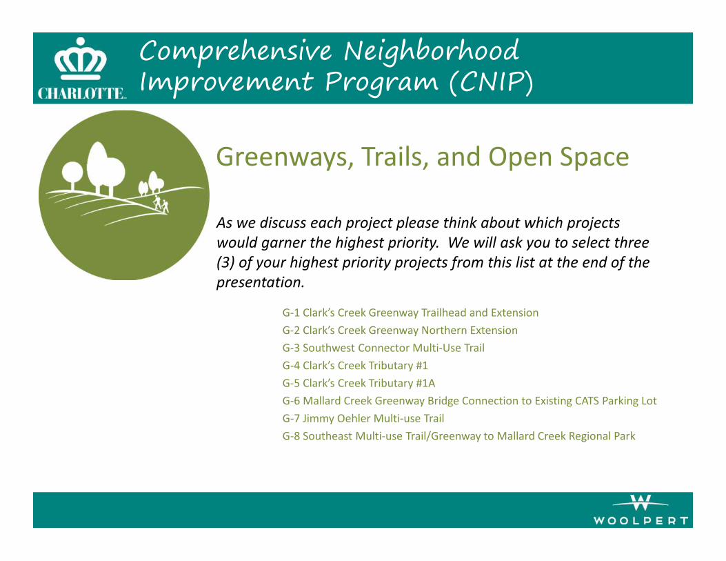
Greenways, Trails, and Open Space

As we discuss each project please think about which projects
would garner the highest priority. We will ask you to select three
(3) of your highest priority projects from this list at the end of the
presentation.
G-1 Clark’s Creek Greenway Trailhead and Extension
G-2 Clark’s Creek Greenway Northern Extension
G-3 Southwest Connector Multi-Use Trail
G-4 Clark’s Creek Tributary #1
G-5 Clark’s Creek Tributary #1A
G-6 Mallard Creek Greenway Bridge Connection to Existing CATS Parking Lot
G-7 Jimmy Oehler Multi-use Trail
G-8 Southeast Multi-use Trail/Greenway to Mallard Creek Regional Park
Comprehensive Neighborhood Improvement Program (CNIP)
Greenways, Trails, and Open Space

• 0.65 mile extension of the existing Clark's Creek
Greenway
• Trailhead at DeArmon Road
• Property acquisition on two parcels – Greenway
• Acquisition of 3 acres – Trailhead
• 40 parking spaces
• Pedestrian bridge crossing Clark's Creek
• Well supported by the public and Parks and Rec
• CNIP funding with Park and Rec partnership
Comprehensive Neighborhood Improvement Program (CNIP)
Greenways, Trails, and Open Space
G-1: Prosperity Village Gateway on I-485 Exit Ramp

• 1.44 mile long greenway extension from North from DeArmon road under I-485 to Eastfield Road
• 12' wide asphalt paved trail with 2' gravel shoulders on each side
• Spur connection to the Northern Village area running parallel to the I-485 Westbound on ramp
• Utilize Duke Energy transmission easement
• CNIP funding with Park and Rec partnership
Comprehensive Neighborhood Improvement Program (CNIP)
Greenways, Trails, and Open Space
G-2: Clark’s Creek Greenway Northern Extension

• Pedestrian and bicycle connectivity from the Clark's Creek Greenway to the Prosperity Village center
• 0.58 miles long running along DeArmon Road and Prosperity Church Road to the Village Center
• This multi-use connection project was very well received by the public
• Routing within the Village will need to be further studied to select the best route
Comprehensive Neighborhood Improvement Program (CNIP)
Greenways, Trails, and Open Space
G-3: Southern Connector Multi-Use Trail
• 2.56 mile tributary extension of Clark's Creek Greenway
• Already planned by Mecklenburg County
• Property acquisition has not occurred
• Park and Recreation standards with a 12' asphalt paved surface and 2' gravel shoulders
• CNIP funding with Park and Rec partnership
Comprehensive Neighborhood Improvement Program (CNIP)
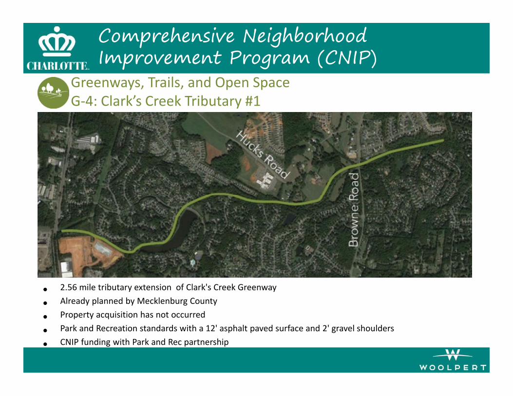
Greenways, Trails, and Open Space
G-4: Clark’s Creek Tributary #1

• 1.86 mile tributary extension of the existing
Clark's Creek Greenway
• Branching Northwesterly between Browne
and Old Statesville Road
• Already planned by Mecklenburg County
• Property acquisition has not occurred
• Park and Recreation standards with a 12'
asphalt paved surface and 2' gravel
shoulders
• CNIP funding with Park and Rec partnership
Comprehensive Neighborhood Improvement Program (CNIP)
Greenways, Trails, Open Space
G-5: Clark’s Creek Tributary #1A

• Connection of a CATS Park and Ride lot to
the Mallard Creek Greenway on East Side of
Mallard Creek Road
• Across from the intersection with
Prestigious Lane
• Requires the construction of a pedestrian
bridge and approximately 400 linear feet of
greenway
• This project was brought to the team by a
resident who has developed the project's
concept to create additional greenway
parking and potential increase the
greenway usage.
Comprehensive Neighborhood Improvement Program (CNIP)
Greenways, Trails, and Open Space
G-6: Mallard Creek Greenway Bridge Connection to Existing CATS Parking Lot

• Suggested by a resident
• Connect Thomas Ridge Drive and Jimmy
Oehler Road via a 700 linear foot +/- multi-
use trail
• Constructed like a greenway as a 12' wide
paved path with 2' gravel shoulders
• Require an easement across the Oehler
property
Comprehensive Neighborhood Improvement Program (CNIP)
Greenways, Trails, and Open Space
G-7: Jimmy Oehler Multi-use Trail

• 1.02 miles of proposed multi-use trail / greenway
• Connect the Southern Village Area to Mallard Creek Park
• 12' paved path with 2' gravel shoulders
• Require easements across private property
• portions of the alignment would be on Mecklenburg County property and within an existing Duke Energy transmission line easement
Comprehensive Neighborhood Improvement Program (CNIP)
Greenways, Trails, and Open Space
G-8: Southeast Multi-use Trail/Greenway to Mallard Creek Regional Park
As we discuss each project please think about which projects
would garner the highest priority. We will ask you to select three
(3) of your highest priority projects from this list at the end of the
presentation.
G-1 Clark’s Creek Greenway Trailhead and Extension
G-2 Clark’s Creek Greenway Northern Extension
G-3 Southwest Connector Multi-Use Trail
G-4 Clark’s Creek Tributary #1
G-5 Clark’s Creek Tributary #1A
G-6 Mallard Creek Greenway Bridge Connection to Existing CATS Parking Lot
G-7 Jimmy Oehler Multi-use Trail
G-8 Southeast Multi-use Trail/Greenway to Mallard Creek Regional Park
Comprehensive Neighborhood Improvement Program (CNIP)
Greenways, Trails, and Open Space

Comprehensive Neighborhood Improvement Program (CNIP)
Pedestrian Circulation

As we discuss each project please think about which projects
would garner the highest priority. We will ask you to select five
(5) of your highest priority projects from this list at the end of
the presentation.
Comprehensive Neighborhood Improvement Program (CNIP)
Pedestrian Circulation
C-1 Traffic Signal at Prosperity Church Road and Katelyn Drive
C-2 Crosswalk at Senior Center on Prosperity Church Road
C-3 Pedestrian Beacon at Prosperity Church Road and Prosperity Point Lane
C-4 Traffic Signal at Prosperity Church Road and Driwood Court
C-5 Sidewalk Gaps on Mallard Creek Road from WT Harris Blvd to Prosperity Church Road
C-6 Sidewalk Gaps from Prosperity Church Road to Johnston Oehler Road
C-7 Sidewalk on Ridge Road from Prosperity Church Road to Highland Creek Parkway
C-8 Sidewalk on Prosperity Church Road
C-9 Sidewalk Gaps on Eastfield Drive
C-10 Additional Midblock Refuge Islands on Ridge Road
C-11 Sidewalk on Browne Road
C-12 Sidewalk on DeArmon Road
C-13 Sidewalk Gaps on David Cox Road
C-14 Sidewalk Gaps on Jimmy Oehler Road
C-15 Sidewalk along Hucks Road
C-16 Crosswalk at Clark’s Creek Nature Preserve
C-17 Sidewalk on Ridge Road from Highland Creek Parkway to Shelley Avenue
C-18 Signalized Crosswalk at Johnston Oehler for Mallard Creek High School

• Addition of a 4 way signalized intersection
• Pedestrian crossing improvements
• No apparent roadway improvements
necessary
Comprehensive Neighborhood Improvement Program (CNIP)
Pedestrian Circulation
C-1: Traffic Signal at Prosperity Church Road and Katelyn Drive

• Addition of a signalized crosswalk
• Pedestrian crosswalk improvements
Comprehensive Neighborhood Improvement Program (CNIP)
Pedestrian Circulation
C-2: Crosswalk at Senior Center on Prosperity Church Road
• No apparent roadway improvements
necessary

Comprehensive Neighborhood Improvement Program (CNIP)
Pedestrian Circulation
C-3: Pedestrian Beacon at Prosperity Church Road and Prosperity
Point Lane
• Addition of a signalized pedestrian crosswalk
• Pedestrian crosswalk improvements• No apparent roadway improvements
necessary

Comprehensive Neighborhood Improvement Program (CNIP)
Pedestrian Circulation
C-4: Traffic Signal at Driwood Court
• Addition of a traffic signal
• Pedestrian crosswalk improvements• No apparent roadway improvements
necessary

• Sidewalk gaps on West side of Mallard Creek Road
• +/- 6,170 L.F. of gaps
• Special attention - West side of the bridge over Mallard
Creek Greenway NE
Comprehensive Neighborhood Improvement Program (CNIP)
Pedestrian Circulation
C-5: Sidewalk Gaps Mallard Creek Road from
WT Harris Blvd to Prosperity Church Rd

• Sidewalk gaps on East and West side of Mallard
Creek Road from Prosperity
• +/- 6,680 L.F. of gaps
Comprehensive Neighborhood Improvement Program (CNIP)
Pedestrian Circulation
C-6: Sidewalk Gaps from Prosperity Church Rd to Johnston Oehler Rd

• Sidewalk on Ridge Road from Prosperity Church Road to Highland Creek Parkway
• +/- 2,839 L.F. located on North and South sides of the road
Comprehensive Neighborhood Improvement Program (CNIP)
Pedestrian Circulation
C-7: Sidewalk on Ridge Road

• New sidewalk on both sides of Prosperity
Church Road
• From Ridge Road to Prosperity Ridge Road
• +/- 2,275 L.F.
Comprehensive Neighborhood Improvement Program (CNIP)
Pedestrian Circulation
C-8: Sidewalk on Prosperity Church Road

• Sidewalk gaps along Eastfield
Road Browne Road to
City/County Line
• +/- 10,660 L.F. South side of
the road
Comprehensive Neighborhood Improvement Program (CNIP)
Pedestrian Circulation
C-9: Sidewalk Gaps on Eastfield Drive

• Pedestrian midblock refuge islands on Ridge Road
Comprehensive Neighborhood Improvement Program (CNIP)
Pedestrian Circulation
C-10: Additional Midblock Refuge Islands on Ridge Road

• New sidewalk along Browne Road
• Between I-485 and WT Harris Boulevard
• Approximately +/- 12,010 L.F. on the West side of the
road
• Approximately +/- 16,940 L.F. on the East side of the
road
• Sidewalks would cross 5 full intersections, 15 one side
intersections and 28 driveways
Comprehensive Neighborhood Improvement Program (CNIP)
Pedestrian Circulation
C-11: Sidewalk on Browne Road

• New sidewalks along DeArmon Road
• Between Browne Road and Prosperity Church Road which is approximately +/- 2,300 L.F. on the South
side and +/- 2,896 L.F. on the North side.
• Special consideration needs to be made where DeArmon Road crosses the Clark's Creek greenway
Comprehensive Neighborhood Improvement Program (CNIP)
Pedestrian Circulation
C-12: Sidewalk on DeArmon Road
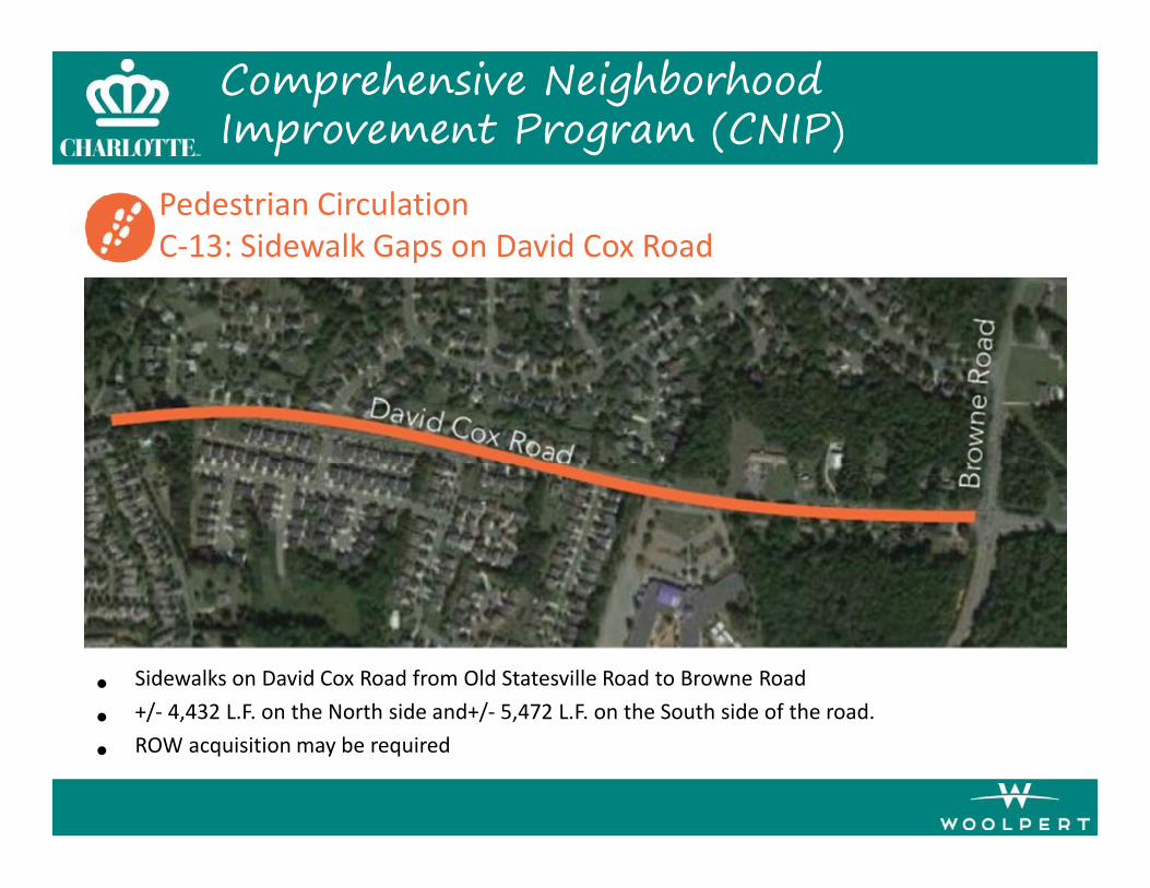
• Sidewalks on David Cox Road from Old Statesville Road to Browne Road
• +/- 4,432 L.F. on the North side and+/- 5,472 L.F. on the South side of the road.
• ROW acquisition may be required
Comprehensive Neighborhood Improvement Program (CNIP)
Pedestrian Circulation
C-13: Sidewalk Gaps on David Cox Road

• Sidewalk on Jimmy Oehler Road from Creek Breeze Road to the newly constructed bridge over I-485
• The sidewalk measures +/- 525 L.F. on the North side of the road
Comprehensive Neighborhood Improvement Program (CNIP)
Pedestrian Circulation
C-14: Sidewalk Gaps on Jimmy Oehler Road

New sidewalk along Hucks Road between Browne Road and Old Statesville Road.
Comprehensive Neighborhood Improvement Program (CNIP)
Pedestrian Circulation
C-15: Sidewalk along Hucks Road
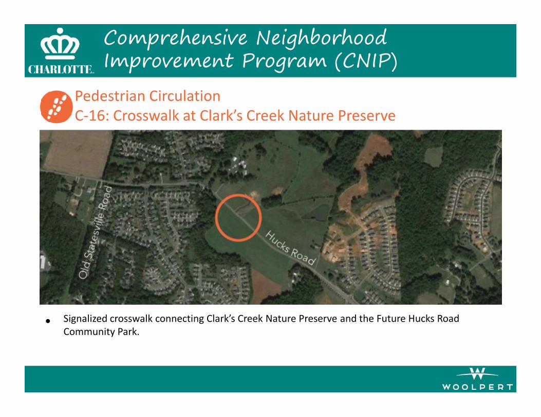
• Signalized crosswalk connecting Clark’s Creek Nature Preserve and the Future Hucks Road
Community Park.
Comprehensive Neighborhood Improvement Program (CNIP)
Pedestrian Circulation
C-16: Crosswalk at Clark’s Creek Nature Preserve

• New sidewalk along Ridge Road between Highland Creek Parkway and Shelley Avenue
• Sidewalks measure +/- 2,925 L.F. on the South side and +/- 3,050 L.F. on the North side
Comprehensive Neighborhood Improvement Program (CNIP)
Pedestrian Circulation
C-17: Sidewalk on Ridge Rd from Highland Creek Pkwy to Shelley Ave

• This project includes a signalized pedestrian crosswalk at Mallard Creek High School on Johnston
Oehler Road
• No other roadway improvements are anticipated
Comprehensive Neighborhood Improvement Program (CNIP)
Pedestrian Circulation
C-18: Signalized Crosswalk at Johnston Oehler for Mallard Creek High School

As we discuss each project please think about which projects
would garner the highest priority. We will ask you to select five
(5) of your highest priority projects from this list at the end of
the presentation.
Comprehensive Neighborhood Improvement Program (CNIP)
Pedestrian Circulation
C-1 Traffic Signal at Prosperity Church Road and Katelyn Drive
C-2 Crosswalk at Senior Center on Prosperity Church Road
C-3 Pedestrian Beacon at Prosperity Church Road and Prosperity Point Lane
C-4 Traffic Signal at Prosperity Church Road and Driwood Court
C-5 Sidewalk Gaps on Mallard Creek Road from WT Harris Blvd to Prosperity Church Road
C-6 Sidewalk Gaps from Prosperity Church Road to Johnston Oehler Road
C-7 Sidewalk on Ridge Road from Prosperity Church Road to Highland Creek Parkway
C-8 Sidewalk on Prosperity Church Road
C-9 Sidewalk Gaps on Eastfield Drive
C-10 Additional Midblock Refuge Islands on Ridge Road
C-11 Sidewalk on Browne Road
C-12 Sidewalk on DeArmon Road
C-13 Sidewalk Gaps on David Cox Road
C-14 Sidewalk Gaps on Jimmy Oehler Road
C-15 Sidewalk along Hucks Road
C-16 Crosswalk at Clark’s Creek Nature Preserve
C-17 Sidewalk on Ridge Road from Highland Creek Parkway to Shelley Avenue
C-18 Signalized Crosswalk at Johnston Oehler for Mallard Creek High School

Comprehensive Neighborhood Improvement Program (CNIP)
Transportation

Comprehensive Neighborhood Improvement Program (CNIP)
Transportation
As we discuss each project please think about which projects
would garner the highest priority. We will ask you to select five
(5) of your highest priority projects from this list at the end of
the presentation.
T-1 Prosperity Church Road Widening
T-2 Ridge Road Extension
T-3 Ridge Road Widening
T-4 Roundabout at Prosperity Church Road and Prosperity Ridge
Road
T-5 DeArmon Road Farm-to-Market
T-6 Prosperity Ridge Road Southeast Arc
T-7 Robin Lane Farm-to-Market
T-8 Christenbury Road & Millstream Ridge Drive Roundabout
T-9 Hucks Road Extension Eastern Segment
T-10 Arbor Creek Drive & Rocky Ford Club Road Roundabout
T-11 Highland Creek Parkway and Eastfield Road Signalization and Intersection Improvements
T-12 Rebuild Road Pavement Sections on Christenbury Road
T-13 Hucks Road Complete Street Old Statesville Road to Browne Road
T-14 DeArmon Road and Browne Road Signalization and Intersection Improvements
T-15 Old Statesville Road and Hucks Road Intersection Improvements
T-16 Browne Road Complete Streets from I-485 to WT Harris

• Prosperity Church Road from Ridge Road to
Prosperity Ridge Road - "Complete Street“
• Prosperity Church Road approximately 1,467
L.F.
• Cross Section A-2 in the Area Plan
Comprehensive Neighborhood Improvement Program (CNIP)
Transportation
T-1: Prosperity Church Road Widening

• Ridge Road Extension from Eastfield Road to Benfield Road - "Complete Street“
• Extend Ridge Road approximately 3,500 L.F.
• Follow Cross Section A-7 in the Area Plan
Comprehensive Neighborhood Improvement Program (CNIP)
Transportation
T-2: Ridge Road Extension

• Widening of Ridge Road from Prosperity Church Road to Highland Creek Parkway - "Complete Street“
• Widen Ridge Road approximately +/- 3,700 L.F.
• Follow cross section A-13
• The widening will also include a complete street design with sidewalks and bike lanes.
Comprehensive Neighborhood Improvement Program (CNIP)
Transportation
T-3: Ridge Road Widening

• Single Lane Roundabout
• Widened approaches from Prosperity Church Road and Prosperity Ridge Road approximately
1,000 L.F. each
Comprehensive Neighborhood Improvement Program (CNIP)
Transportation
T-4: Roundabout at Prosperity Church Rd and Prosperity Ridge Rd

• DeArmon Road from Browne Road to Benfield Road - "Complete Street“
• Approximately 4,500 LF
• Following cross section A-4 East of Clark’s Creek and A-9 West of Clark’s Creek
• Add northbound right turn-lane with 4-way signalization.
Comprehensive Neighborhood Improvement Program (CNIP)
Transportation
T-5: DeArmon Road Farm-to-Market

• Johnston Oehler Road to Prosperity Church Road - "Complete Street“
• Approximately 2,140 L.F.
• Follow cross section A-1 in the Area Plan
• Add northbound right turn-lane with 4-way signalization.
Comprehensive Neighborhood Improvement Program (CNIP)
Transportation
T-6: Prosperity Ridge Road Southeast Arc

• Removal of barricade on Robin Lane
• Connect Mallard Ridge Drive to Mallard Drive
Comprehensive Neighborhood Improvement Program (CNIP)
Transportation
T-7: Robin Lane and Mallard Ridge Drive Connections

• Repair cracking pavement at roundabout
• Located at Christenbury Road and Millstream Ridge Drive
Comprehensive Neighborhood Improvement Program (CNIP)
Transportation
T-8: Roundabout at Christenbury Road & Millstream Ridge Drive

• Hucks Road Extension from Browne Road to Prosperity Church Road - "Complete Street“
• Approximately 4,500 LF
• Follow cross section A-11 in the Area Plan
Comprehensive Neighborhood Improvement Program (CNIP)
Transportation
T-9: Hucks Road Extension Eastern Segment

• Rebuild/Widen Single Lane Roundabout
• Widen approaches from Arbor Creek Drive and Rocky Ford Club Road approximately 1,000 LF
each.
Comprehensive Neighborhood Improvement Program (CNIP)
Transportation
T-10: Roundabout at Arbor Creek Drive & Rocky Ford Club Road
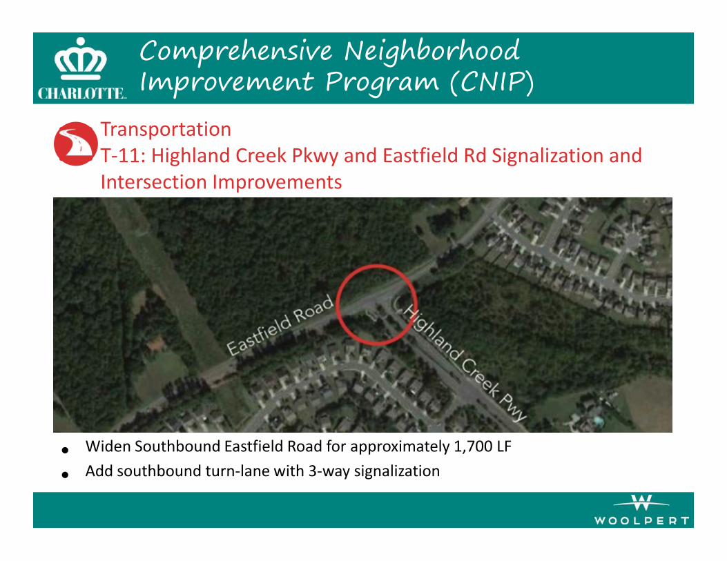
• Widen Southbound Eastfield Road for approximately 1,700 LF
• Add southbound turn-lane with 3-way signalization
Comprehensive Neighborhood Improvement Program (CNIP)
Transportation
T-11: Highland Creek Pkwy and Eastfield Rd Signalization and
Intersection Improvements

• Christenbury Road from Highland Creek Parkway to Millstream Ridge Drive
• Full Depth Pavement Rehabilitation for approximately 1,650 L.F.
• Match Existing cross section
Comprehensive Neighborhood Improvement Program (CNIP)
Transportation
T-12: Rebuild Road Pavement Sections on Christenbury Road

• Widen Hucks Road approximately 7,200 L.F.
• Follow cross section A-11 in the Area Plan
• Add westbound right turn-lane with 4-way signalization.
Comprehensive Neighborhood Improvement Program (CNIP)
Transportation
T-13: Hucks Rd Complete Street from Old Statesville Rd to Browne Rd

• Widen Westbound DeArmon Road approximately 900 L.F.
• Add northbound right-turn lane, add westbound 12' right turn-lane with 4-way
signalization
Comprehensive Neighborhood Improvement Program (CNIP)
Transportation
T-14: DeArmon Rd and Browne Rd Signalization and Intersection Improvements

• Widen Southbound Old Statesville Road approximately 1,600 L.F.
• Add southbound left turn-lane, add northbound right turn-lane, add westbound right-turn lane
• 3-way signalization
Comprehensive Neighborhood Improvement Program (CNIP)
Transportation
T-15: Old Statesville Road and Hucks Road Intersection Improvements

• Widen Browne Road and West Sugar Creek Road
approximately 16,000 L.F.
• Follow cross section A-9 in the Area Plan
Comprehensive Neighborhood Improvement Program (CNIP)
Transportation
T-16: Browne Road Complete Streets from I-485 to WT Harris Blvd

Comprehensive Neighborhood Improvement Program (CNIP)
Transportation
As we discuss each project please think about which projects
would garner the highest priority. We will ask you to select five
(5) of your highest priority projects from this list at the end of
the presentation.
T-1 Prosperity Church Road Widening
T-2 Ridge Road Extension
T-3 Ridge Road Widening
T-4 Roundabout at Prosperity Church Road and Prosperity Ridge
Road
T-5 DeArmon Road Farm-to-Market
T-6 Prosperity Ridge Road Southeast Arc
T-7 Robin Lane Farm-to-Market
T-8 Christenbury Road & Millstream Ridge Drive Roundabout
T-9 Hucks Road Extension Eastern Segment
T-10 Arbor Creek Drive & Rocky Ford Club Road Roundabout
T-11 Highland Creek Parkway and Eastfield Road Signalization and Intersection Improvements
T-12 Rebuild Road Pavement Sections on Christenbury Road
T-13 Hucks Road Complete Street Old Statesville Road to Browne Road
T-14 DeArmon Road and Browne Road Signalization and Intersection Improvements
T-15 Old Statesville Road and Hucks Road Intersection Improvements
T-16 Browne Road Complete Streets from I-485 to WT Harris

As we discuss each project please think about which projects
would garner the highest priority. We will ask you to select one (1)
of your highest priority projects from this list at the end of the
presentation.
P-1: Prosperity Village Public Library Land
Acquisition
P-2: Urban Open Space w/ Water View
P-3: Prosperity Ridge Road Southeast Arc
Comprehensive Neighborhood Improvement Program (CNIP)
Partnerships

• Establish a site fro a new public library
• Partnering with a developer
• CNIP funds a portion of the development 's public infrastructure as payment for the
library site
• trade or lease the tract to the Charlotte Mecklenburg Library System.
Comprehensive Neighborhood Improvement Program (CNIP)
Partnerships
P-1: Prosperity Village Public Library Land Acquisition

• Public-private partnership, reconstruct an existing pond on private land abutting Prosperity
Church
• surrounding green-space, community gathering place
• A portion of the waterfront would have adjacent privately developed retail and/or housing
• Developer/landowner would be responsible for daily and routine maintenance of the pond and
public green-space
• Acquire remnant NCDOT parcels and coordinate new local streets with the church and
developers
Comprehensive Neighborhood Improvement Program (CNIP)
Partnerships
P-2: Urban Open Space w/ Water View

• Incent a housing developer to construct housing on property along the proposed SE Arc
• Fund a portion of the cost of the public infrastructure.
Comprehensive Neighborhood Improvement Program (CNIP)
Partnerships
P-3: Prosperity Ridge Road Southeast Arc

As we discuss each project please think about which projects
would garner the highest priority. We will ask you to select one (1)
of your highest priority projects from this list at the end of the
presentation.
P-1: Prosperity Village Public Library Land
Acquisition
P-2: Urban Open Space w/ Water View
P-3: Prosperity Ridge Road Southeast Arc
Comprehensive Neighborhood Improvement Program (CNIP)
Partnerships
Focus Group Agenda
• CIP Program Goals
– Creating Jobs and Growing the Tax Base
– Leveraging Public and Private Investments
– Enhancing Public Safety
– Enhancing Transportation Choices and Mobility
– Ensuring Housing Diversity
– Providing Integrated Neighborhood Improvements
Comprehensive Neighborhood Improvement Program (CNIP)
Project Prioritization Criteria

Focus Group Agenda
• Additional Criteria
– Public Support
– Usage
– Private Property Rights
– Transformative Change
– Previously Identified by Public Agency/Program
– Consistency with local plans/codes
Comprehensive Neighborhood Improvement Program (CNIP)
Project Prioritization Criteria

Focus Group AgendaComprehensive Neighborhood Improvement Program (CNIP)
Open Discussion

Thank You for Participating
Additional information on the CNIP program can be found on the City of
Charlotte Website:
http://charmeck.org/city/charlotte/charlottefuture/CIP/CNIP/Pages/Prosperity.aspx
Kristie Kennedy
(704) 336-6194
Comprehensive Neighborhood Improvement Program (CNIP)