michigan; the role of community planning in riparian corridor protection - oakland county
TRANSCRIPT
8/3/2019 Michigan; The Role of Community Planning in Riparian Corridor Protection - Oakland County
http://slidepdf.com/reader/full/michigan-the-role-of-community-planning-in-riparian-corridor-protection- 1/22
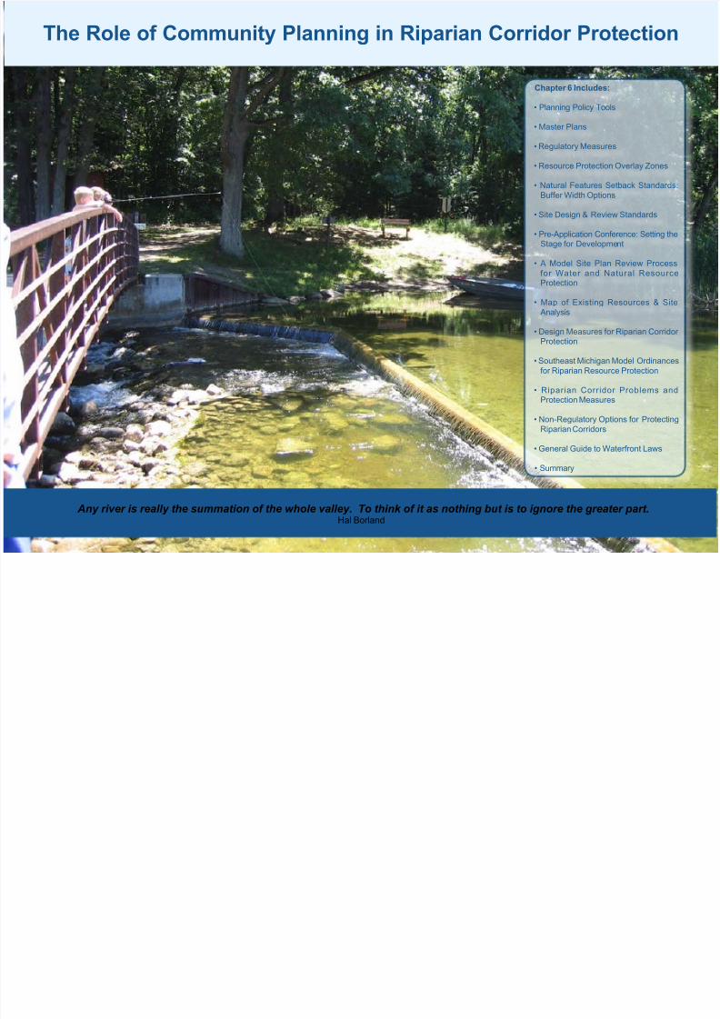
Any river is really the summation of the whole valley. To think of it as nothing but is to ignore the greater part.Hal Borland
The Role of Community Planning in Riparian Corridor Protection
Chapter 6 Includes:
• Planning Policy Tools
• Master Plans
• Regulatory Measures
• Resource Protection Overlay Zones
• Natural Features Setback Standards:
Buffer Width Options
• Site Design & Review Standards
• Pre-Application Conference: Setting theStage for Development
• A Model Site Plan Review Process
for Water and Natural ResourceProtection
• Map of Existing Resources & Site
Analysis
• Design Measures for Riparian Corridor Protection
• Southeast Michigan Model Ordinances
for Riparian Resource Protection
• Riparian Corridor Problems andProtection Measures
• Non-Regulatory Options for Protecting
Riparian Corridors
• General Guide to Waterfront Laws
• Summary
8/3/2019 Michigan; The Role of Community Planning in Riparian Corridor Protection - Oakland County
http://slidepdf.com/reader/full/michigan-the-role-of-community-planning-in-riparian-corridor-protection- 2/22
70
Riparian corridors represent a natural
resource that offers communities an
opportunity to balance the need for growthwith environmental preservation. Local
governments that plan for the establishment
of riparian corridors as community assets can
create many benets for their community.
Using innovative site design standards,
developers can preserve natural areas and
riparian corridors as integral components of
a development. These natural features can
then be used to market quality of life benets
such as access to open space, and scenicviews, to prospective residents. The result is
often a win-win situation for the environment,
the developer, and the community as a
whole. In addition, preserving riparian
corridors contributes to the health, safety,
and welfare of residents of the community.
The Role of Community Planning in Riparian Corridor Protection
Prior to addressing riparian corridor
protection in local plans and ordinances,
the community’s riparian corridors shouldbe inventoried and mapped (See Chapter
3 for more information on mapping riparian
corridors). Inventory and map data should
then form the basis for subsequent plans,
policies, and ordinances designed to protect
riparian corridors at the local level. Making
riparian inventory and map data available to
community members early in the process will
clarify the location of riparian corridors, and
allow property owners who may be affected
by riparian regulations to understand how
they may be impacted. Such efforts may
assist community leaders in building public
support for riparian corridor protection. In
addition, mapped inventories of riparian
resources may help communities understand
how river corridors transcend community
boundaries and make the case for a multi-
community approach to protecting ripariancorridors on a watershed basis.
The conservation and management of
riparian corridors can benet from proactive
community planning, sensible regulatorymeasures, and appropriate development
design standards. In Michigan, local
governments play a major role in riparian
corridor management. Community home
rule means that the major responsibilities
and choices for implementation of riparian
protection and restoration initiatives rest at
the local level.
Tools such as local master plans, zoningordinances, and subdivision regulations
can be used to address conservation and
management needs of riparian corridors,
as well as guide sustainable and protable
development within communities. Non-
regulatory tools such as public education
and innovative land preservation approaches
may also be used by communities to protect
and restore local riparian areas.
Planning Policy Tools
Maximizing
community
assets related
to river corridors
requires good
community
planning.
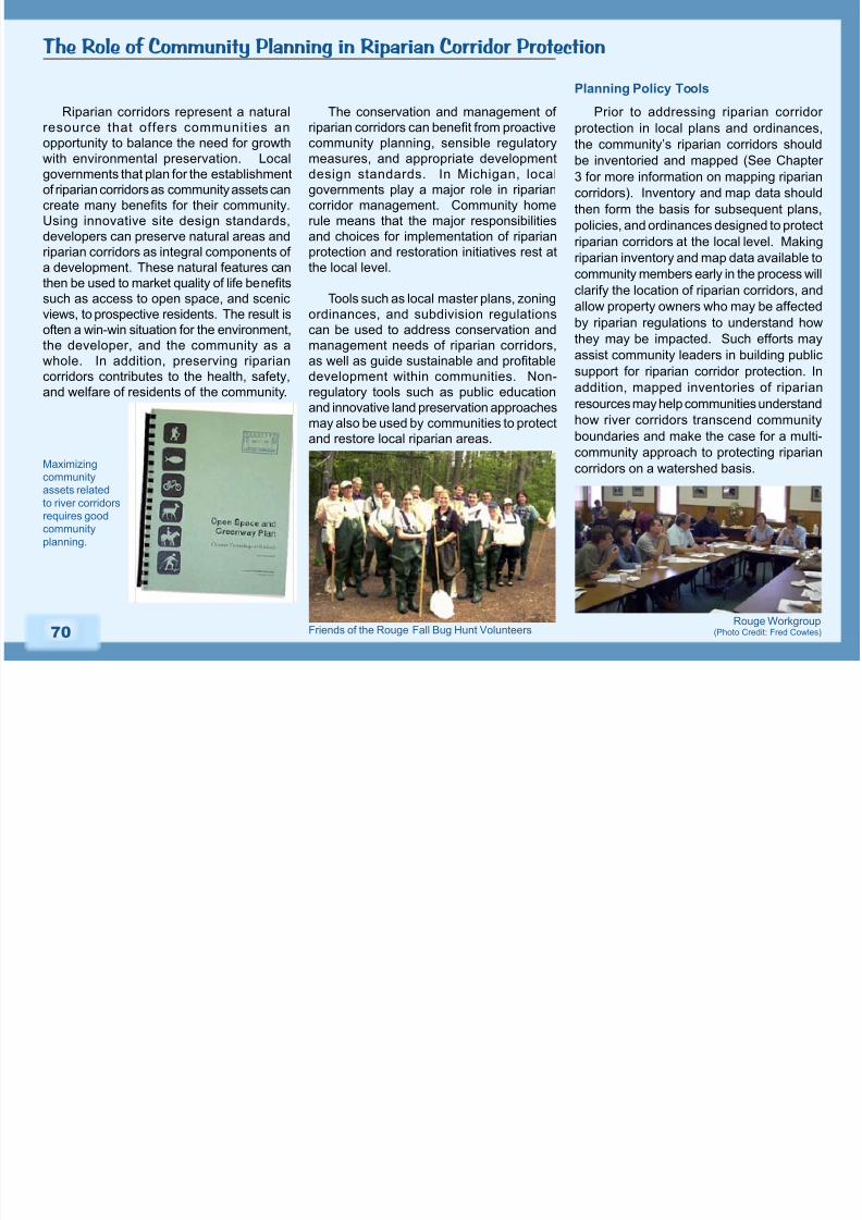
Rouge Workgroup(Photo Credit: Fred Cowles)Friends of the Rouge Fall Bug Hunt Volunteers

8/3/2019 Michigan; The Role of Community Planning in Riparian Corridor Protection - Oakland County
http://slidepdf.com/reader/full/michigan-the-role-of-community-planning-in-riparian-corridor-protection- 3/22
71
Master Plans
The Master Plan is the ofcial document
that sets forth policies to guide future land
use and development in the community. It
provides the legal basis for zoning and land
use decisions. A community’s master plan
can be used to establish both the basis
for preservation of riparian corridors and
justication for related ordinances.
Communities interested in protecting
riparian resources should include goals,
policies, and objectives for protecting
riparian buffers and corridors in their Master Plan. Riparian corridor protection provisions
may also be listed in the Master Plan’s
implementation chapter. Master Plans
should also include an inventory and map of
riparian corridors and associated resources
identied throughout the community. The
riparian corridor map may be presented as a
stand-alone piece with descriptive text or as
a component of the Future Land Use map.
Oakland Township
Green Infrastructure
Design Charrette
Example Goals for Community Master Plans
Adapted from: Wetland Stewardship for Local Governments: Master Plan as a Basis.
Clinton River Watershed Council
Goal: To the maximum extent possible, preserve existing riparian corridors and the
hydrological systems that they support so that these ecosystems can continue
to perform their vital functions of providing terrestrial and aquatic habitat for plants and wildlife, ood and stormwater storage, runoff attenuation,
water quality protection, shoreline and stream bank stabilization, aesthetics, and
recreation.
Goal: Enhance and restore existing riparian corridors that have suffered degradation.
Goal: Recognize the natural capacity and limitation of riparian lands to support
development.
Policies pertinent to riparian preservation should address:
Land Use Intensity: The intensity of development on the land is dependent on the
natural capability of the land to support various degrees of development.
Natural Resource Capability: All development respects the natural characteristics
of riparian corridors and their constraints.
Site Design Policies: These policies provide model development principles that canbe applied to site designs to reduce the impact of development on riparian
areas.
Presentation on the Cold Water Springs Nature Area
Master Plan during Johnson Creek Day in 2005.(Photo Credit: Johnson Creek Protection Group)
8/3/2019 Michigan; The Role of Community Planning in Riparian Corridor Protection - Oakland County
http://slidepdf.com/reader/full/michigan-the-role-of-community-planning-in-riparian-corridor-protection- 4/22
72
Park and Recreation Plans
Adapted From: The Town Planner’s Toolbox.
From: Guidance for Communities in the Connecticut River Watershed.
Suggested Allowable Uses for Riparian Corridors
Encourage park and recreation areas with minimal structural development; non-motorized trails; forestry practices that use riparian best management practices (BMPs).
Encourage passive use of land for recreation and nature appreciation. Maintain
wetlands, ood plains, seeps, and bogs in their natural condition.
Suggested Prohibited Uses for Riparian Corridors
All uses that present a higher potential for pollution. Campgrounds other than
dispersed forested tenting sites should be excluded because of their tendency toward
deforestation and soil compaction. Towns may wish to guide use of ATVs and mountainbiking to less sensitive locations since these higher impact uses can contribute to
vegetation loss and erosion within the riparian zone. Buildings that do not depend on
proximity to water should be sited outside a riparian buffer.
Park and Recreation Plans can adopt the
goals, policies, and objectives for riparianprotection that are listed in the community
master plan, or include its own park and
recreation-specific recommendations for
riparian corridor management. Content
may focus on defining appropriate and
inappropriate recreational uses for riparian
areas located within parks. Park and
Recreation Plans may also provide guidelines
for proper construction and maintenance of
river access points, and rules and regulationsfor public access as these topics relate to
potential impacts on riparian buffers.
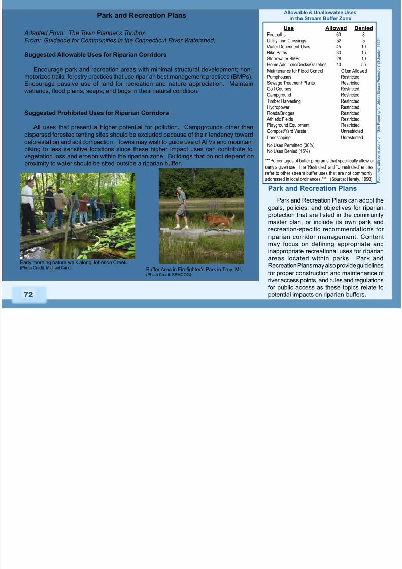
Park and Recreation Plans
Use Allowed DeniedFootpaths 60 8
UtilityLineCrossings 52 5
WaterDependentUses 45 10
BikePaths 30 15
StormwaterBMPs 28 10
HomeAdditi ons/Decks/Gazebos 10 55
MaintenanceforFloodControl OftenAllowedPumphouses Restricted
SewageTreatmentPlants Restricted
GolfCourses Restricted
Campground Restricted
TimberHarvesting Restricted
Hydropower Restricted
Roads/Bridges Restricted
AthleticFields Restricted
PlaygroundEquipment Restricted
Compost/YardWaste Unrestricted
Landscaping Unrestricted
NoUsesPermitted(30%)
NoUsesDenied(15%)
***Percentages of buffer programs that specically allow or
denyagivenuse.The“Restricted”and“Unrestricted”entries
refertootherstreambufferusesthatarenotcommonly
addressedinlocalordinances.***(Source:Heraty,1993)
Allowable & Unallowable Uses
in the Stream Buffer Zone
Early morning nature walk along Johnson Creek.(Photo Credit: Michael Carr) Buffer Area in Fireghter’s Park in Troy, MI.
(Photo Credit: SEMCOG)
R e p r i n t e d w i t h p e r m i s s i o n f r
o m “ S
i t e P l a n n i n g f o r U r b a n S t r e a m P
r o t e c t i o
n ” ( S c h u e l e r , 1 9 9 5 )
8/3/2019 Michigan; The Role of Community Planning in Riparian Corridor Protection - Oakland County
http://slidepdf.com/reader/full/michigan-the-role-of-community-planning-in-riparian-corridor-protection- 5/22
73
Regulatory Measures
A zoning ordinance provides the authority
to regulate private use of land by creating
land use zones and applying development
standards in the various zones or districts.
Adopting a comprehensive local
ordinance, or series of local ordinances
designed to reduce the adverse effects
of common human activities on riparian
resources will better enable implementation
and enforcement of the goals, policies, and
objectives for riparian protection set forth in
the Master Plan.
Ordinances and regulatory measures
for riparian corridor protection should
focus on encouraging the use of various
riparian conservation techniques. Zoning
ordinances might include two important
riparian conservation tools: overlay zones
and natural feature setback standards for
rivers, lakes, oodplains, and associated
riparian corridors and buffers.
Overlay zones can be used to apply
special restrictions to areas with unique
conditions such as rivers, lakes, oodplains,
and associated riparian corridors and
buffers. Parcels included within these zones
retain their underlying zoning classication
but are subject to additional requirements
specied in the overlay zoning ordinance. It
is important to note that if enacted correctly,
riparian conservation zoning is not a
“taking” because it doesn’t inherently reduce
development density or alter allowable uses
otherwise specied. In preparing an overlayzone, it is rst necessary to identify the
geographic limits of the areas to be included.
A riparian corridor map inventory is a critical
component of the overlay process. The
purpose for the zone and any use restrictions
or development requirements must also be
clearly stated.
Resource Protection Overlay Zones
The adoption of an overlay district can
accomplish any of the following, depending
upon how it is structured:
1. Require all parcels within the zone to
be inventoried.
2. Alert developers that the parcel
contains potentially significant
resources, and development of the
site would be subject to special
restrictions.
3. Allow the community to identify priority
protection areas that a developer must
refrain from developing or develop
with minimal site disturbance.
Parcels falling within a riparian overlay
zone may be inventoried on a lot-by-lot
basis or via a comprehensive survey.
During the inventory process it is important
that the full ecological significance of aparcel in relationship to its surroundings is
considered. Communities are encouraged
to adopt riparian-based conservation
overlay zones that can be used to direct
development away from sensitive riparian
areas, require signicant riparian buffers,
and be coupled with conservation easements
or land donations to preserve riparian lands
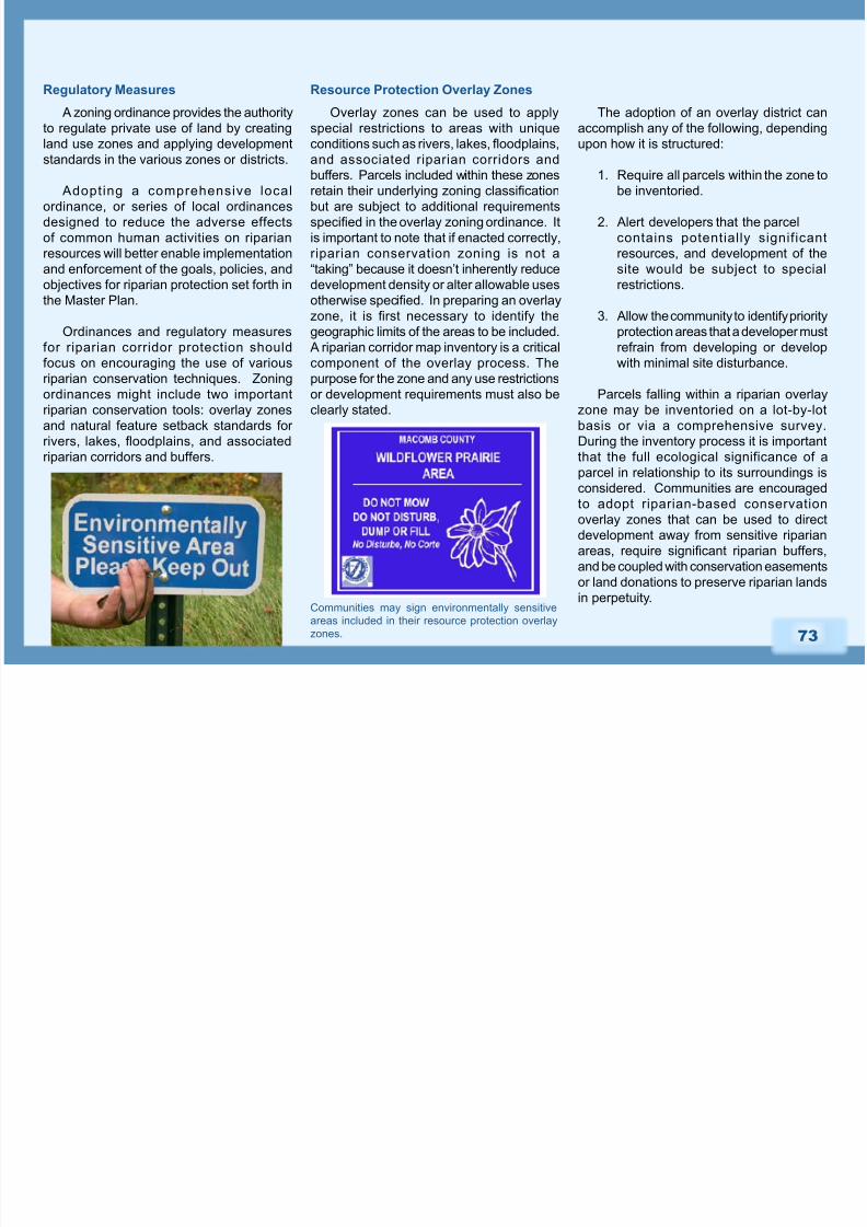
in perpetuity.Communities may sign environmentally sensitiveareas included in their resource protection overlay
zones.

8/3/2019 Michigan; The Role of Community Planning in Riparian Corridor Protection - Oakland County
http://slidepdf.com/reader/full/michigan-the-role-of-community-planning-in-riparian-corridor-protection- 6/22
74
A natural features setback establishes
a minimum setback (buffer width) from
natural features to prevent physical harm or
destruction of the feature. This ordinance
recognizes the relationship that terrestrial and
aquatic ecosystems have to one another and
should be applied to both small streams and
larger rivers. Each community establishes
buffer width standards at their discretion. In
general, the wider the buffer the greater the
number of ecological functions the riparian
zone will provide. Communities may choose
to establish xed or variable width buffers or a combination of the two.
The community can establish a xed-
width riparian buffer similar to a utility right-
of-way, whose width is determined before
construction begins. The xed width should
be determined by selecting a distance that
protects the community’s most desired
riparian functions. Fixed-width buffers
are simplest to administer but may be
ecologically inadequate in many situations.
Natural Features Setback Standards:
Buffer Width Options Fixed-width Buffer
While more difficult to administer,
adopting a variable width buffer ordinance
provides communities the opportunity to
tailor riparian protection to the land, and
eliminates a cookie-cutter approach to
buffer management. Variable-width buffers
are more ecologically-based, and address
site-specic conditions such as slope and
intensity of land use. Because the goal
of variable-width buffers is to account for
ecological variation in every stream and
parcel, they require more site evaluation
than xed-width buffers.
Communities may opt to enact a
combination of fixed and variable-width
buffer standards by determining a standard
width, and specifying criteria for expanding
or contracting the buffer. Often this is
achieved through buffer averaging that
allows exceptions to the xed-width standard
to account for the 100-year floodplain,
steepness of slope, adjacent wetlands,critical habitat, stormwater ponds, limited lot
size, and pre-existing structures.
Variable-width Buffer
“Averaged” Buffer Width “Fixed” Buffer Width
Stream Buffer: Averaging in the Middle Zone
(Reprinted with permission from “Site planning for Urban Stream Protection” (Schueler, 1995))
Fall colors along a well-vegetated
portion of the Lake Angelus shoreline.(Photo Credit: Oakland Land Conservancy)
8/3/2019 Michigan; The Role of Community Planning in Riparian Corridor Protection - Oakland County
http://slidepdf.com/reader/full/michigan-the-role-of-community-planning-in-riparian-corridor-protection- 7/22
75
Site Design & Review Standards
Riparian zoning ordinances, regulatory
measures, and design standards should
guide the placement of development,
not prohibit it. When possible, specific
sustainable site design, construction
methods, and review standards should be
outlined in the community’s ordinances
and other regulatory documents. This will
help make the community’s expectations
for riparian preservation clear, and provide
development professionals with a greater
degree of certainty in the development
and permitting process. Communitiesmay enforce the riparian conservation
techniques presented in their planning and
regulatory documents by right or by special
exception.
The site plan development and review
process provides a forum for communities and
developers to discuss possible development
approaches, and for communities to
determine developer compliance withriparian (and additional natural and water
resource) protection provisions specied
in community planning and regulatory
documents.
Potential Ordinances and Regulatory
Measures for Riparian Corridor
Protection
1. Resource Protection Overlay Zones
2. Natural Feature Setbacks
3. Storm Water Ordinance
4. Impervious Surface Limitations
5. Soil Erosion and Sedimentation
Control
6. Steep Slope Regulations
7. Trees & Woodland Protection
Ordinance
8. Native Vegetation Ordinance
9. Establishing Wildlife Corridors &
Greenways
10. Controls on Docks and Other Water
Dependent Structures
Pre-Application Conference: Setting the
Stage for Development
Communities can facilitate quality
decision-making and collaboration by
holding a pre-application conference with
the developer. At the meeting, staff or
consultant planners, engineers, and local
ofcials familiarize the applicant with the
policies and procedures of the community,
and discuss the vision of the community as
it relates to the piece of land in question. A
site visit may also be scheduled early in the
review process to assess and discuss the
environmental sensitivity of the property,
and to help the developer save time andexpense designing around it. This is a good
opportunity to discuss the value of riparian
buffers and the reasons to implement
site design measures for riparian corridor
protection.
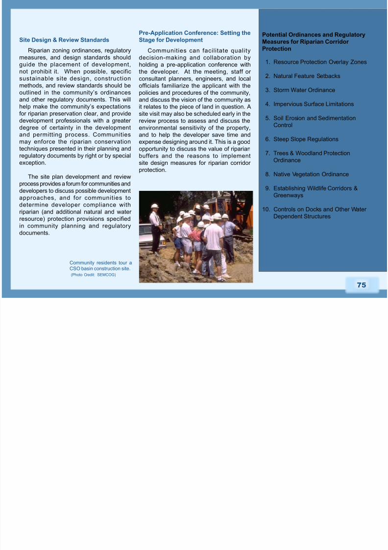
Community residents tour a
CSO basin construction site.
(Photo Credit: SEMCOG)
8/3/2019 Michigan; The Role of Community Planning in Riparian Corridor Protection - Oakland County
http://slidepdf.com/reader/full/michigan-the-role-of-community-planning-in-riparian-corridor-protection- 8/22
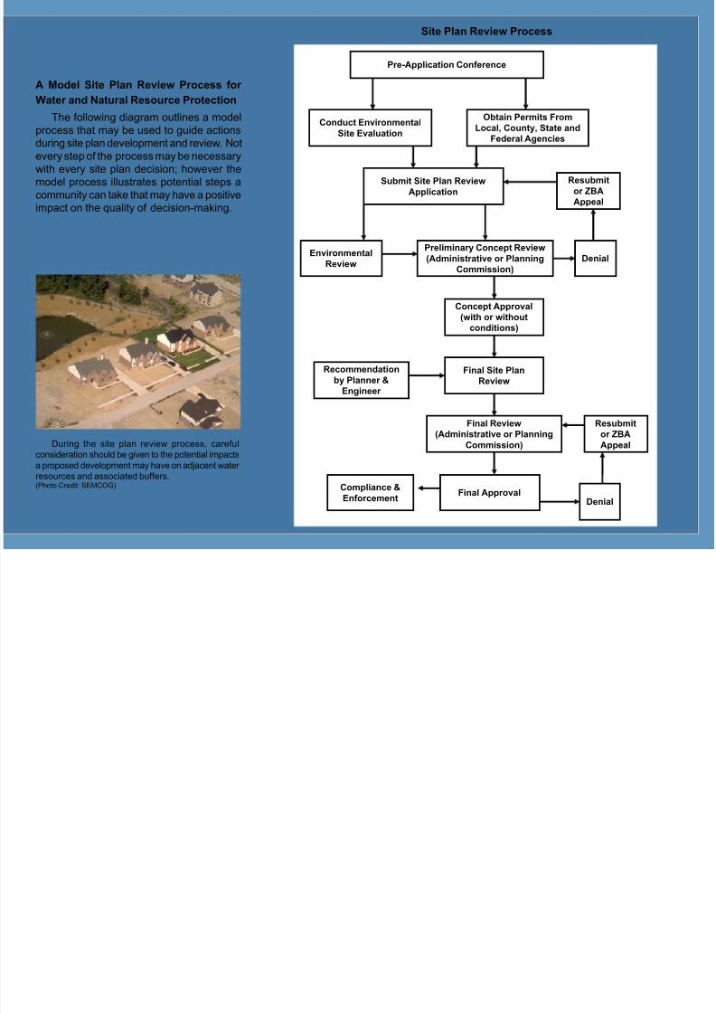
A Model Site Plan Review Process for
Water and Natural Resource Protection
The following diagram outlines a model
process that may be used to guide actions
during site plan development and review. Not
every step of the process may be necessary
with every site plan decision; however the
model process illustrates potential steps a
community can take that may have a positive
impact on the quality of decision-making.
During the site plan review process, careful
consideration should be given to the potential impacts
a proposed development may have on adjacent water
resources and associated buffers.(Photo Credit: SEMCOG)
Pre-Application Conference
Obtain Permits From
Local, County, State andFederal Agencies
Conduct EnvironmentalSite Evaluation
Submit Site Plan Review
Application
Preliminary Concept Review(Administrative or Planning
Commission)
EnvironmentalReview
Denial
Resubmit
or ZBA
Appeal
Concept Approval
(with or without
conditions)
Final Site Plan
Review
Recommendation
by Planner &
Engineer
Final Review
(Administrative or Planning
Commission)
Final Approval
Denial
Resubmit
or ZBA
Appeal
Compliance &
Enforcement
Site Plan Review Process
8/3/2019 Michigan; The Role of Community Planning in Riparian Corridor Protection - Oakland County
http://slidepdf.com/reader/full/michigan-the-role-of-community-planning-in-riparian-corridor-protection- 9/22
77
The most important documents to have
in place for the pre-application conference
are professional land surveys and GIS
maps that delineate the property’s riparian
resources and related natural features.
These documents should be used to guide
ecologically-sound decisions regarding site-
appropriate development design measures
for riparian protection.
The following elements should be
included in the land survey and/or GIS
maps of the property. It may be useful todistribute this list to the applicant prior to the
conference.
Proposed Development Information
Available infrastructure (existing
utilities)
Special districts (resource overlay)
Site topography (2-foot contours or
less)
General construction zone, buildinglocation, and orientation
Professional tree and natural features
survey
Si te improvements , bu i ld ing
locations, and conceptual stormwater
management plan
Pre-development drainage area
delineation (total area tributary to
site)
Map of Existing Resources & Site
Analysis
Natural Features
Sensitive headwaters area
Lake, river, or stream
Wetlands (note acreage, type,
functional values of wetland)
Floodplain
Groundwater recharge and discharge
areas
Landmark trees
Woodlands and tree rows
Wildlife corridors
Fragile land (high erosion areas)
Unique geological features
River valley features (bluffs, terraces,
ravines)
Sloped land
Endangered or protected species
present
Wellhead protection area
Natural drainage pathways
Soil types
Heritage Features
Designated agricultural/orchard
area
Human pathway/trail connection
Cultural features
Historic features
Viewsheds or vistas
Site Description
Property boundaries
Existing zoning
Master plan designation
Current land use
Adjacent property zoning
Adjacent property land use
Legal history (easements/deed
restrictions)
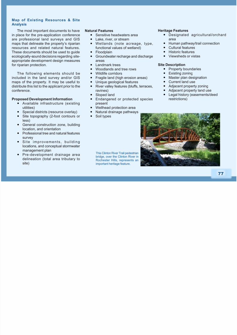
This Clinton River Trail pedestrian
bridge, over the Clinton River in
Rochester Hills, represents an
important heritage feature.
8/3/2019 Michigan; The Role of Community Planning in Riparian Corridor Protection - Oakland County
http://slidepdf.com/reader/full/michigan-the-role-of-community-planning-in-riparian-corridor-protection- 10/22
78
Based on the information gathered and
discussed at the pre-application conference,
the community may require the applicant
to submit a professional environmental
survey as part of the preliminary site plan
preparation. At this time, the applicant should
investigate necessary permits. Permits
should be secured after preliminary site plan
review and prior to nal site plan approval.
During site plan review, the community’s
staff planner or planning consultant, and
planning commission should thoroughly
review the proposed plan to evaluatepotential impacts on riparian and related
natural resources. The community should
be mindful of opportunities to minimize
environmental damage and leverage
opportunities presented by the development
project.
The following elements represent a menu
of design measures for riparian and natural
resource protection that communities may
choose to encourage or require developers
to incorporate during the site plan review
process.
Conservation Subdivision or Open Space
Regulations:
Can require a developer to prepare
a natural features inventory on
proposed project sites.
Can require a certain percentage of total parcel acreage to be retained as
open space.
Can reference minimum buffer widths
for riparian corridors and identify
upland areas adjacent to riparian
corridors as preferred green space
designated for low-impact residential
recreation activities.
Can advocate cluster development
that concentrates construction onland with less conservation value,
and allows owners of house lots in
the development to share undivided
ownership of the portion of the
property remaining in a scenic and
natural condition.
Can advocate lot averaging standards
for retention of riparian resources and
natural features on smaller sites.
Design Measures for Riparian Corridor
Protection
Lot Size & Density Regulations:
Provide exible lot size and density
standards to guide development
away from a stream buffer or other
sensitive land.
Provide developers with density
bonuses for land-conserving design
and density and disincentives to
actively discourage land-consuming
layouts.
Minimum Frontage & Road Setback
Regulations:Provide flexibility in frontage and
road setback standards to minimize
development intrusion on riparian
buffers.
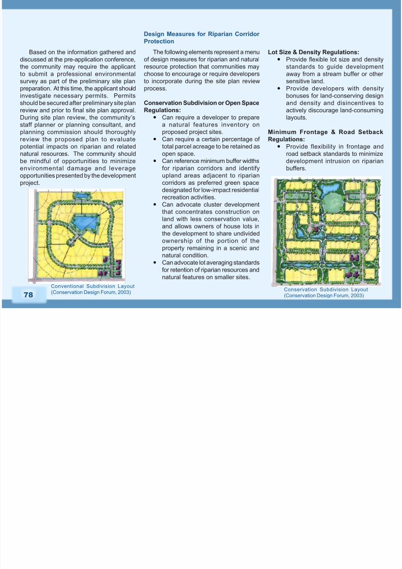
Conventional Subdivision Layout
(Conservation Design Forum, 2003)Conservation Subdivision Layout
(Conservation Design Forum, 2003)
8/3/2019 Michigan; The Role of Community Planning in Riparian Corridor Protection - Oakland County
http://slidepdf.com/reader/full/michigan-the-role-of-community-planning-in-riparian-corridor-protection- 11/22
79
Impervious Surface Reduction
Regulations:
Limit land disturbance and
grading.
Set standards that limit the overall
area of impervious surfaces and
suburban lawns.
Encourage developers to use
alternative materials that allow rain
and snowmelt to soak in rather thanrun off, such as porous pavement,
bioretention areas, lter strips, and/
or vegetated swales.
Set guidelines for designing roads,
sidewalks, driveways, and other
parking areas to minimum width
standards.
Stormwater Management Guidelines:
Regulate erosion control before,
during, and after construction.
Encourage developers to retain
natural vegetation already at work
protecting waterways.
Create a variable-width, naturally
vegetated buffer system along
all perennial streams that also
encompasses critical environmental
features such as the 100-year
f loodplain, s teep s lopes, and
wetlands.
Limit clearing and grading of forests
and native vegetation at a site to the
minimum amount needed to build
lots, allow access, and provide re
protection.
Promote forested buffers as part of
stormwater management planning.
Allow the pollution removal
effectiveness of buffers and inltration
devices to be credited in stormwater
plans and calculations.
Wastewater Management
Specifcations:
Include erosion and sedimentationcontrol, stormwater management,
landscaping, and provisions for
special investigative studies.
Conventional Stormwater
Conveyance System(Photo Credit: Carlisle/Wortman
Associates, Inc.)
Alternative Stormwater
Conveyance System(Photo Credit: Carlisle/Wortman
Associates, Inc.)
8/3/2019 Michigan; The Role of Community Planning in Riparian Corridor Protection - Oakland County
http://slidepdf.com/reader/full/michigan-the-role-of-community-planning-in-riparian-corridor-protection- 12/22

8/3/2019 Michigan; The Role of Community Planning in Riparian Corridor Protection - Oakland County
http://slidepdf.com/reader/full/michigan-the-role-of-community-planning-in-riparian-corridor-protection- 13/22
81
Riparian Corridor Problems and Protection Measures
Comprehensive conservation and management of riparian corridors requires that communities address the following factors in their
planning and ordinance documents:
Riparian
Corridor
Protection
Measure
Problem Action StepsApplicable Planning
& Regulatory Tools
Erosion &
Sedimentation
Removing or reducing riparian
buffer vegetation leads to
bank erosion and associated
sedimentation of surface waters.
Erosion and sedimentation seriously
impact water quality and aquatic
ecosystems. Much of the erosion
and sedimentation problem is
associated with construction sites.
With an anticipated 390,000 newand replacement households in the
SE MI region by 2025, removal of
riparian vegetation and associated
erosion and sedimentation are
serious threats to our resources.
Ensure that the agency
responsible for enforcing soil
erosion control permits has
proper funding to administer
regular inspections, and
enforce permit compliance, if
not conducted by the County.
Educate riparian property
owners on how they canprevent soil erosion on their
property and report non-
compliance.
Incorporate a riparian buffer system into master
plans and zoning ordinances to prevent erosion
and sedimentation into aquatic systems.
Link development approvals to compliance with
soil erosion protections.
Reduce or limit the amount of impervious
surfaces around the water resource through
mechanisms such as overlay zoning.
Assure that all erosion control permit
requirements have been satised before issuing
the local occupancy permit.
Habitat
Protection
Riparian corridors provide high-
quality habitat for a wide variety
of wildlife, and often serve as
protective corridors that facilitate
wildlife movement and allow accessto critical terrestrial and aquatic
resources in urbanized landscapes.
Land use that compromises
the width and quality of riparian
corridors can have far-reaching
repercussions on local wildlife
populations.
Inventory riparian corridors
for native and non-native
vegetation species.
Advocate the use of nativeriparian vegetation and
backyard conservation
programs to riparian property
owners.
Contact a local land
conservancy to discuss
options for maintaining high-
quality riparian corridor areas
in perpetuity.
Advocate for a multi-community, watershed-
based, riparian corridor greenway initiative in the
community master plan.
In the community master plan, include goals,policies, and objectives to remove invasive
species from riparian corridors.
Encourage use of native vegetation in the riparian
planting guidelines of local zoning ordinances and
prohibit use of invasives.
Establish and require minimum riparian buffer
widths in site design standards and development
regulations.
8/3/2019 Michigan; The Role of Community Planning in Riparian Corridor Protection - Oakland County
http://slidepdf.com/reader/full/michigan-the-role-of-community-planning-in-riparian-corridor-protection- 14/22
82
Riparian
Corridor
Protection
Measure
Problem Action StepsApplicable Planning
& Regulatory Tools
Stream
Corridor and
Floodplain
Protection
Riparian vegetation plays an
especially critical role in protecting
water quality and preventing ood
damage to properties located
adjacent to streams and oodplains.
Conduct a stream corridor inventory
to identify opportunities to mitigate
impacts of existing or future
development on stream corridors
and oodplains.
Educate residents on the benets
of protecting stream corridors
and oodplains and provide a
mechanism to report those not
complying with oodplain or stream
buffer ordinances.
Actively strive to achieve and
maintain the natural land use in
riparian zones.
Advocate the use of native plants
in stream corridor and oodplain
restoration projects.
Incorporate measures into community
master plans and ordinances to protect
100-year oodplain areas such that no
building encroachments should be allowed
that will signicantly impact ood storage
capacity, water quality, or wildlife habitat.
Adopt a buffer ordinance for stream
corridors. The wider the buffer, the more
protective it will be. Many communities
have adopted 25 foot buffers; however
wider buffers may be more protective of
very sensitive features. This buffer should
be extended to include adjacent sensitive
areas where present.
Advocate the use of a variety of conservation development techniques to
protect the ecological integrity of stream
corridors and oodplains including: cluster
development, transfer of development
rights, land acquisition, land purchase, or
conservation easement.
Include an assessment of the impact of
riparian areas as part of the site plan review
process.
8/3/2019 Michigan; The Role of Community Planning in Riparian Corridor Protection - Oakland County
http://slidepdf.com/reader/full/michigan-the-role-of-community-planning-in-riparian-corridor-protection- 15/22
83
Riparian
Corridor
Protection
Measure
Problem Action StepsApplicable Planning
& Regulatory Tools
Watershed
Management
Riparian corridors do not stop at
municipal boundaries. Riparian
corridors are often most effectively
managed at the watershed
level through multi-municipal
partnerships coordinated to address
concerns specic to upstream and
downstream portions of the riparian
corridor.
Contact neighboring communities concerning
interest in watershed-wide and subwatershed
planning for protecting and managing riparian
corridors.
Engage in watershed and subwatershed
planning and implementation.
Local government ordinances
that regulate private
development should be
protective of riparian corridor
quality and quantity.
Public
Education and
Participation
Local riparian protection programs
will not be successful without
the support of the public. Public
education and participationprograms provide communities with
an opportunity to build support and
stewardship within their jurisdiction
for riparian corridor protection
initiatives.
List environmental education mechanisms that
could be used within the community. Identify
and prioritize opportunities for each mechanism.
List environmental education partners with
expertise in riparian corridor stewardship.
Provide public education workshops that
promote the identity and value of riparian
corridors within the community and provide
information on how citizens can become
involved in riparian protection and stewardship
activities at the local level.
Provide goals, policies, and
objectives within the community
master plan that advocate
raising public awarenessabout the importance of a local
riparian corridor protection
program.
Provide language in the master
plan that advocates supporting
the efforts of the local
watershed councils.
Vo l u n t e e rs r e mo v e d
invasive garlic mustard
from areas border ing
Johnson Creek. This event
was sponsored by Visteon
as part of Johnson Creek
Day in 2005.
(Photo Credit: Johnson CreekProtection Group) Pebble Creek Stabilization
Project(Photo Credit: Wayne County
Department of Environment)
8/3/2019 Michigan; The Role of Community Planning in Riparian Corridor Protection - Oakland County
http://slidepdf.com/reader/full/michigan-the-role-of-community-planning-in-riparian-corridor-protection- 16/22
84
Riparian
Corridor
Protection
Measure
Problem Action StepsApplicable Planning
& Regulatory Tools
Wetland
Protection
Wetland health and function are
intricately linked to the presenceof riparian buffers. Wetland buffers
function to maintain water quality
by ltering stormwater run-off,
preventing shoreline erosion
control, and providing food and
nesting habitat for wetland-
dependent species. Impacting the
integrity of riparian buffers can have
far-reaching negative impacts on
wetland systems.
Inventory and map the wetlands in
your community.
Identify wetland buffer restoration
needs within the community.
Educate residents about the
benets of wetlands and associated
buffer zones and provide a
mechanism to report non-
compliance with the wetland and
wetland set-back ordinance.
Include goals, policies, and objectives for
preserving and restoring wetland buffer zones within the community master plan.
Establish a wetland protection ordinance
or set-back ordinance to protect wetland
buffers.
Provide a list of recreational activities that
are acceptable within riparian buffer zones
in the community’s recreation plan.
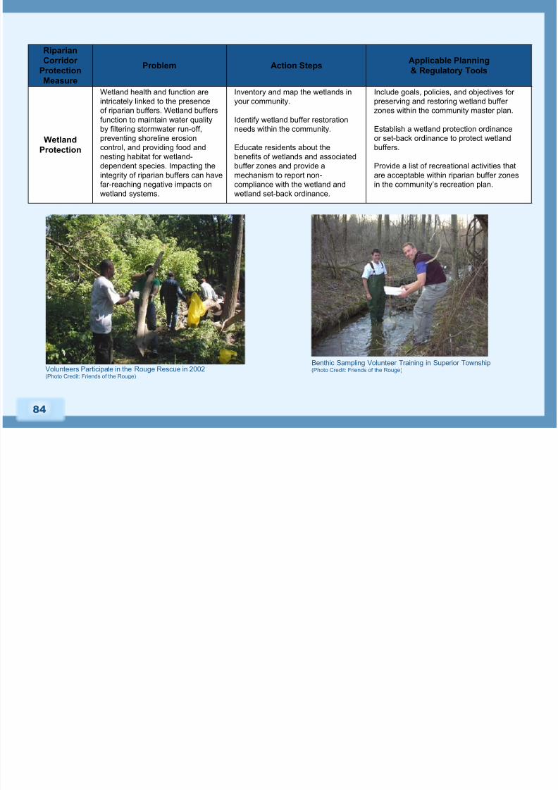
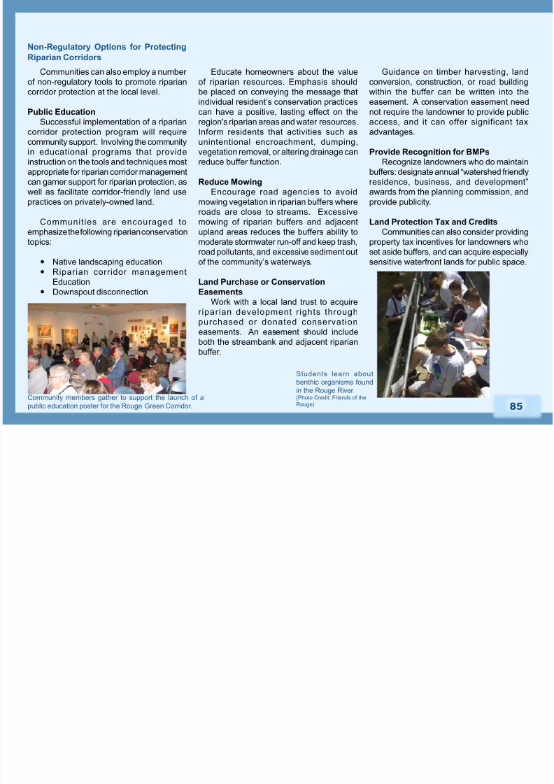
Benthic Sampling Volunteer Training in Superior Township(Photo Credit: Friends of the Rouge)Volunteers Participate in the Rouge Rescue in 2002
(Photo Credit: Friends of the Rouge)
8/3/2019 Michigan; The Role of Community Planning in Riparian Corridor Protection - Oakland County
http://slidepdf.com/reader/full/michigan-the-role-of-community-planning-in-riparian-corridor-protection- 17/22
85
Non-Regulatory Options for Protecting
Riparian Corridors
Communities can also employ a number
of non-regulatory tools to promote riparian
corridor protection at the local level.
Public Education
Successful implementation of a riparian
corridor protection program will require
community support. Involving the community
in educational programs that provide
instruction on the tools and techniques most
appropriate for riparian corridor management
can garner support for riparian protection, as
well as facilitate corridor-friendly land usepractices on privately-owned land.
Communities are encouraged to
emphasize the following riparian conservation
topics:
Native landscaping education
Riparian corridor management
Education
Downspout disconnection
Educate homeowners about the value
of riparian resources. Emphasis should
be placed on conveying the message that
individual resident’s conservation practices
can have a positive, lasting effect on the
region's riparian areas and water resources.
Inform residents that activities such as
unintentional encroachment, dumping,
vegetation removal, or altering drainage can
reduce buffer function.
Reduce Mowing
Encourage road agencies to avoidmowing vegetation in riparian buffers where
roads are close to streams. Excessive
mowing of riparian buffers and adjacent
upland areas reduces the buffers ability to
moderate stormwater run-off and keep trash,
road pollutants, and excessive sediment out
of the community’s waterways.
Land Purchase or Conservation
EasementsWork with a local land trust to acquire
riparian development r ights through
purchased or donated conservation
easements. An easement should include
both the streambank and adjacent riparian
buffer.
Guidance on timber harvesting, land
conversion, construction, or road building
within the buffer can be written into the
easement. A conservation easement need
not require the landowner to provide public
access, and it can offer significant tax
advantages.
Provide Recognition for BMPs
Recognize landowners who do maintain
buffers: designate annual “watershed friendly
residence, business, and development”
awards from the planning commission, andprovide publicity.
Land Protection Tax and Credits
Communities can also consider providing
property tax incentives for landowners who
set aside buffers, and can acquire especially
sensitive waterfront lands for public space.
Students learn about
benthic organisms found
in the Rouge River.(Photo Credit: Friends of the
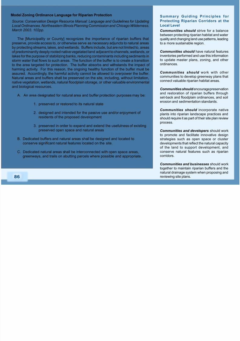
Rouge)Community members gather to support the launch of a
public education poster for the Rouge Green Corridor.
8/3/2019 Michigan; The Role of Community Planning in Riparian Corridor Protection - Oakland County
http://slidepdf.com/reader/full/michigan-the-role-of-community-planning-in-riparian-corridor-protection- 18/22
86
Model Zoning Ordinance Language for Riparian Protection
Source: Conservation Design Resource Manual: Language and Guidelines for Updating
Local Ordinances. Northeastern Illinois Planning Commission and Chicago Wilderness.
March 2003. 102pp.
The [Municipality or County] recognizes the importance of riparian buffers that
preserve, provide access to, or otherwise serve as necessary adjuncts to natural areasby protecting streams, lakes, and wetlands. Buffers include, but are not limited to, areas
of predominantly deeply rooted native vegetated land adjacent to channels, wetlands, or
lakes for the purpose of stabilizing banks, reducing contaminants including sediments in
storm water that ows to such areas. The function of the buffer is to create a transition
to the area targeted for protection. The buffer absorbs and withstands the impact of
harming activity. For this reason, the ongoing healthy function of the buffer must be
assured. Accordingly, the harmful activity cannot be allowed to overpower the buffer.
Natural areas and buffers shall be preserved on the site, including, without limitation,
native vegetation, wetlands, natural oodplain storage, or other valuable environmental
and biological resources.
A. An area designated for natural area and buffer protection purposes may be:
1. preserved or restored to its natural state
2. designed and intended for the passive use and/or enjoyment of
residents of the proposed development
3. preserved in order to expand and extend the usefulness of existingpreserved open space and natural areas
B. Dedicated buffers and natural areas shall be designed and located to
conserve signicant natural features located on the site.
C. Dedicated natural areas shall be interconnected with open space areas,
greenways, and trails on abutting parcels where possible and appropriate.
Summary Guiding Principles for
Protecting Riparian Corridors at the
Local Level
Communities should strive for a balance
between protecting riparian habitat and water
quality and changing land use patterns, leading
to a more sustainable region.
Communities should have natural features
inventories performed and use this information
to update master plans, zoning, and other
ordinances.
Communities should work with other
communities to develop greenway plans that
connect valuable riparian habitat areas.
Communities should encourage preservation
and restoration of riparian buffers through
set-back and oodplain ordinances, and soil
erosion and sedimentation standards.
Communities should incorporate native
plants into riparian landscape practices and
should require it as part of their site plan review
process.
Communities and developers should work
to promote and facilitate innovative design
strategies such as open space or cluster
developments that reect the natural capacity
of the land to support development, and
conserve natural features such as riparian
corridors.
Communities and businesses should work
together to maintain riparian buffers and thenatural drainage system when proposing and
reviewing site plans.
8/3/2019 Michigan; The Role of Community Planning in Riparian Corridor Protection - Oakland County
http://slidepdf.com/reader/full/michigan-the-role-of-community-planning-in-riparian-corridor-protection- 19/22
87
General Guide to Waterfront Laws*
The rights of riparian land owners and
the waters of Michigan are protected and
regulated by a number of laws. Much of
the general concepts for Michigan’s water
use laws developed through court cases
and rulings given over the past 200 years.
The State Legislature also has passed
comprehensive laws, such as the Natural
Resources and Environmental Protection
Act, 1994, PA 451 which includes Part 301,
Inland Lakes and Streams, and Part 303,
Wetlands Protection. Both regulate certain
uses of riparian areas. The Oakland CountyDrain Commissioner also has jurisdiction
over certain drainage ways within Oakland
County to minimize ooding and ensure
conveyance of stormwater.
*Regulations about the use of water
in the State are complex and continue to
evolve. The information included here was
gathered from a number of sources: Public
Rights of Michigan Waters, published by the Law Enforcement Division of the State
of Michigan, 1997; the Michigan Waterfront
Alliance website, and the Michigan Lakes,
Streams and Watersheds Association
website. It should not be construed as legal
advice, nor a comprehensive evaluation of
the topics discussed.
Rights and Responsibilities of Riverfront Property Owners
Jurisdictional Boundaries
There are several general concepts that
form the basis for Michigan’s riparian laws.
Several are explained here:
In general, the State of Michigan has
jurisdiction over “navigable” waters,
sh, and water-oriented construction
operations, such as marinas, docks,
canals, bridges, dredging, filling,
and impoundments. The State uses
the denition of navigable waters to
determine if a lake or stream is public
(navigable) or private (non-navigable).The denition of navigable has been
developed through a series of judicial
decisions, but there is significant
uncertainty regarding the public
or private character of most of the
State’s streams. Many streams are
designated public or private after
some type of litigation has been
settled over the use of the stream by
someone other than the riparian landowner.
A riparian land owner (or Riparian)
is one who owns land or property
abutting water. The Riparian also
owns the submerged lands adjacentto his or her property to the center
of the lake or stream. However, a
Riparian does not own the water, or
in most cases, the sh. These are
held in public trust for the benet of
all the people. The surface of a lake,
whether open or frozen, is shared
equally by all riparian property owners
that abut the lake. They may sh or
boat on any part of it.
T he O ak l and C oun t y D r a i n
Commissioner is given jurisdiction by
municipalities to establish drainage
districts and implement drain projects.
Application is made by a community
for both tasks. Once an application
is made, it is evaluated by the Drain
Commissioner’s office and either accepted or denied. Natural drainage
ways may be designated as a County
Drain, and this designation may only
cover portions of a natural stream,
as opposed to the entire length of
the stream. A drain also can be
an underground pipe, retention
pond, ditch or swale that conveys
stormwater.
8/3/2019 Michigan; The Role of Community Planning in Riparian Corridor Protection - Oakland County
http://slidepdf.com/reader/full/michigan-the-role-of-community-planning-in-riparian-corridor-protection- 20/22
88
Rights of Passage within a Watercourse
If a stream is navigable, the public has
the right to wade up a stream and sh, but
cannot trespass on the uplands. However,
if the stream is obstructed or in case of
an emergency, the fisherman can make
reasonable use of the upland to go around
the obstruction or get help. An abutting
property owner may not create obstructions
to keep the public from wading, swimming
or shing a navigable stream. If the stream
is not navigable, the public cannot wade up
the stream, or access the stream by boat.
Hunting, on the other hand, is a right thatgoes with land ownership and permission
from the landowner is required.
Drawing Water for Irrigation
As indicated earlier, riparian land owners
do not own waters adjacent to their lands,
but do have the right to reasonable use of
the water for their own purposes, including
irrigation. However, the landowner cannot
impair the water as it passes along or
decrease the benefits of the water for
other riparian landowners. Non-riparian
owners are not entitled to similar water use
rights, and extraction of water for their own
purposes is considered trespassing against
the rights of the riparian owner. Further, a
riparian landowner cannot permit a non-riparian landowner to withdraw water.
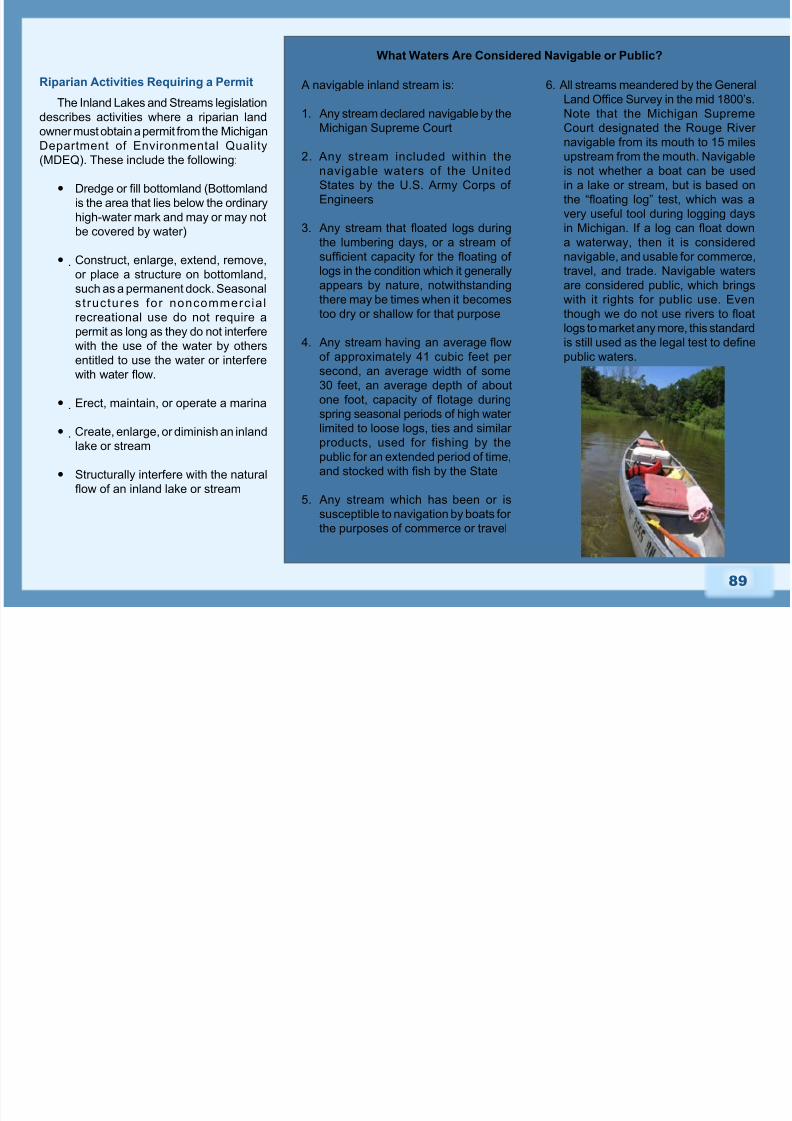
Footbridges
The Inland Lakes and Streams laws do
not allow property owners to structurally
interfere with the natural ow of a stream, nor
construct anything within the bottomland of
a stream without a permit from the MDEQ.
In addition, the Oakland County Drain
Commissioner, who is charged with ensuring
drainage of stormwater throughout Oakland
County, prefers that homeowners refrain
from constructing footbridges because of the
possibility of debris collecting under these
small bridges and obstructing the ow of
the stream.
A footbridge over the Clinton River allows nearby
residents entry into the Drayton Plains Nature
Center.
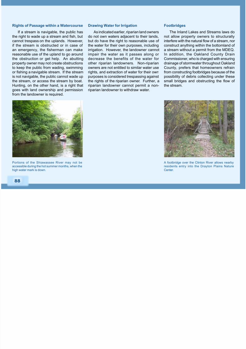
Portions of the Shiawassee River may not be
accessible during the hot summer months, when the
high water mark is down.
8/3/2019 Michigan; The Role of Community Planning in Riparian Corridor Protection - Oakland County
http://slidepdf.com/reader/full/michigan-the-role-of-community-planning-in-riparian-corridor-protection- 21/22
89
What Waters Are Considered Navigable or Public?
A navigable inland stream is:
1. Any stream declared navigable by the
Michigan Supreme Court
2. Any stream included within the
navigable waters of the United
States by the U.S. Army Corps of
Engineers
3. Any stream that oated logs during
the lumbering days, or a stream of
sufcient capacity for the oating of
logs in the condition which it generally
appears by nature, notwithstanding
there may be times when it becomes
too dry or shallow for that purpose
4. Any stream having an average ow
of approximately 41 cubic feet per
second, an average width of some
30 feet, an average depth of about
one foot, capacity of otage during
spring seasonal periods of high water limited to loose logs, ties and similar
products, used for fishing by the
public for an extended period of time,
and stocked with sh by the State
5. Any stream which has been or is
susceptible to navigation by boats for
the purposes of commerce or travel
6. All streams meandered by the General
Land Ofce Survey in the mid 1800’s.
Note that the Michigan Supreme
Court designated the Rouge River
navigable from its mouth to 15 milesupstream from the mouth. Navigable
is not whether a boat can be used
in a lake or stream, but is based on
the “oating log” test, which was a
very useful tool during logging days
in Michigan. If a log can oat down
a waterway, then it is considered
navigable, and usable for commerce,
travel, and trade. Navigable waters
are considered public, which brings
with it rights for public use. Even
though we do not use rivers to oat
logs to market any more, this standard
is still used as the legal test to dene
public waters.
Riparian Activities Requiring a Permit
The Inland Lakes and Streams legislation
describes activities where a riparian land
owner must obtain a permit from the Michigan
Department of Environmental Quality(MDEQ). These include the following:
Dredge or ll bottomland (Bottomland
is the area that lies below the ordinary
high-water mark and may or may not
be covered by water)
Construct, enlarge, extend, remove,
or place a structure on bottomland,such as a permanent dock. Seasonal
structures for noncommerc ial
recreational use do not require a
permit as long as they do not interfere
with the use of the water by others
entitled to use the water or interfere
with water ow.
Erect, maintain, or operate a marina
Create, enlarge, or diminish an inland
lake or stream
Structurally interfere with the natural
ow of an inland lake or stream

8/3/2019 Michigan; The Role of Community Planning in Riparian Corridor Protection - Oakland County
http://slidepdf.com/reader/full/michigan-the-role-of-community-planning-in-riparian-corridor-protection- 22/22
90
Construct, dredge, commence,
extend, or enlarge an articial canal,
channel, ditch, lagoon, pond, lake, or
similar waterway where the purpose
is ultimate connection with an existing
inland lake or stream, or where any
part of the artificial waterway is
located within 500 feet of the ordinary
high-water mark of an existing inland
lake or stream.
Connect any natural or artificially
constructed waterway, canal,channel, ditch, lagoon, pond, lake,
or similar water with an existing
inland lake or stream for navigation
or any other purpose. Wetlands and
oodplains are regulated in a similar
way through Part 303, Wetlands
Protection, of the Natural Resources
Environmental Protection Act, 1994
PA 451. This law specically applies
to wetlands connected to an inlandlake, pond, river or stream, or a
wetland located within 500 feet of an
inland lake, pond, river, or stream.
Wetlands that are not connected
and are greater than ve acres insize are also protected, as are non-
connected wetlands of any size that
the MDEQ determines are essential
for protection of the State’s natural
resources. The property owner must
obtain a permit from the MDEQ for
any of the following activities: deposit
or permit the placing of ll material
in a wetland; dredge, remove, or permit the removal of soil or minerals
from a wetland construct; operate, or
maintain any use or development in
a wetland; drain surface water from
a wetland. A guidebook, called the
Permit and Licensing Guidebook,
has been developed by MDEQ to
explain the permit requirements for
these activities. Refer to the MDEQ
website or contact the Land andWater Management Division for more
information.
Summary
Community planning plays an important
role in the management of r iparian
resources. Planning policy tools include
relevant background information, goalsand objectives in community master plans,
parks and recreations plans, and other
planning documents. Master planning
provides the legal basis for regulatory
actions (such as zoning) and also provides
a solid foundation and direction for non-
regulatory community programs. Relevant
regulatory measures to protect riparian
corridors include resource overlay zones,natural features setbacks, and site design
and review standards. A pre-application
conference with developers is a useful way
to inuence site design without necessarily
depending on regulatory measures. Pre-
application meetings should include mapped
information describing the natural resources
of the site. Many design measures to
reduce impacts on riparian resources may
be employed, including open space cluster design, lot size exibility, frontage and road
setback requirements, impervious surface
reductions, and stormwater and wastewater
management. Other non-regulatory options
for protecting riparian corridors include
public education, reduced mowing, land
acquisition, land protection, and best
management practices.