microsoft word - monroe_2005.doc€¦ · web viewunfortunately the land records coordinator...
TRANSCRIPT

Monroe County, Wisconsin
Land Records Modernization Plan 2010-2015

Monroe County Wisconsin Land Records Modernization Plan 2010-2015
Table of Contents
I. Executive Summary 3
A. Identification and Contact Information 3
B. Plan Participants 4
C. Summary 4
D. County Land Information Websites 5
E. Local Municipality Land Information Websites 5
II. Land Information Plan 5
A. Goals & Objectives 5
1. Statement of Goals 5
2. Operating System Environment and Database Design 15
B. Progress Report on Ongoing Activities 17
C. New initiatives 18
1. Proposed Projects 2010-2015 18
2. Assistance Requested 20
3. Problems Encountered 21
D. Custodial Responsibilities 21
E. Foundational Elements and State-Wide Standards 22
1. Geographic Reference Frameworks 22
2. Orthoimagery and Georeferenced Image Base Data 23
3. Elevation Data Products and Topographic Base Data 24

4. Parcel Mapping 24
5. Parcel Administration & Assessment information 25
6. Street/Road Centerlines, Address Ranges and Address Points 27
7. Hydrography, Hydrology and Wetlands Mapping 28
8. Soils Mapping, Land Cover and other Natural Resources Data 28
9. Land Use Mapping 29
10. Zoning Mapping 29
11. Election and Administrative Boundary System 29
12. Critical Infrastructure and Facilities Management 30
13. Database Design and System Implementation 31
F. Public Access 33
G. Integration and Cooperation 34
H. Communication, Education, Training and Facilitated Technical Assistance 35
I. Administrative Standards Not Associated With Foundational Elements 36
I. EXECUTIVE SUMMARY
A. Identification and Contact Information
The designated contact person regarding this Plan is:
Jeremiah EricksonMonroe County Real Property Coordinator202 S. K St. Rm #3Sparta, WI 54656(608) [email protected]
This plan will be posted to the Monroe County Web Site, http://www.co.monroe.wi.us, and can be found under the Land Information Department’s listing.

B. Plan Participants
The 2010-2015 Monroe County Land Records Modernization Plan was prepared by the Monroe County Real Property Coordinator with guidance from the following County staff:
Al HoffCounty Conservationist820 Industrial Drive, Ste. 3Sparta, WI [email protected](608) 269-8974
Alison ElliottSanitization, Zoning & Dog Control Administrator14307 County Highway B, C-21ASparta, WI 54656 [email protected](608) 269-8939
Cynthia StruveEmergency Management Administrator112 S. Court St. Rm 107Sparta, WI [email protected](608) 269-8711
John BurkeRegister of Deeds202 S. K St. Rm #2Sparta, WI [email protected](608) 269-8716
John MehtalaDirector of Information Systems14301 County Highway B, CSS-21Sparta, WI 54656 [email protected](608) 269-8696
C. Summary
Monroe County was primarily in the development stages of creating a

modernized land information system over the prior five years. In the next five years Monroe County will be transitioning into a maintenance and application stage. This plan identifies goals and objectives, it addresses progress made, and it details ongoing and new initiatives for land information management in Monroe County. It identifies the custodial responsibilities of County departments related to land information, and it assesses Monroe County’s status and compliance with Foundational Elements and their associated standards. This plan is intended to satisfy the planning requirement of the WLIP as well as providing Monroe County Officials, local municipality officials, other participants, and interested groups or individuals with basic knowledge of land record modernization and its potential implementation in Monroe County. This plan is also intended to serve as a general guide for the future responsibilities and tasks performed by the Monroe County Land Information Office and involved departments.
D. County Land Information Websites
1. www.monroecogiws.com
2. http://www.co.monroe.wi.us/departments.php?id=14
E. Local Municipality Land Information Websites
http://www.spartawisconsin.org/Official%20City%20of%20Sparta%20Zoning%20Map.pdf
II. LAND INFORMATION PLAN
Wisconsin Land Information Vision In 1996 the Wisconsin Land Information Association developed the following vision for land information in Wisconsin: Land Information is a well managed resource that is an integral part of public and private policies and operation, it is universally accessible, it is useable by all citizens to serve improved decision making and broad social purposes, and it furthers the public good. It is Monroe County’s intention to create a modernized land information system that can be compared to the stated vision and deemed to satisfy its intent.
A. Goals & Objectives
1. The Goals of Land Information Modernization in Monroe County are to:
• Create a cost effective, accurate, secure, translatable, and easily accessible, Land Information System, with uniform record standard, which can be easily maintained.

• Facilitate communication between external and internal land records users and generators regarding changing technology and improving usability.
• Educate land records users and the general public regarding land record information and availability
To achieve the stated goals, the following objectives and associated tasks need to be carried out. The objectives and specific tasks are listed in order of general priority from highest to lowest, with objectives 4-6 being of equal priority:
Objective 1: Geodetic Control DensityCompleted: Was originally completed 2000; the tasks listed for completion will be performed by the Wisconsin Department of Transportation (WDOT). Background: A geodetic control network provides the basis for registering all digital map data layers to a common coordinate system. Monroe County’s geodetic control network consists of 2 WHPGN, 3 primary, 12 secondary, and 65 tertiary monuments spaced approximately every 3.5 miles throughout the County excluding that area which is within the Fort McCoy Military Installation. This control network allows many professionals to utilize GPS equipment for surveying, inventory, construction, planning, and mapping. The increased use of GPS equipment by these professionals will result in lower land information maintenance costs by the County and local municipalities because the digital information collected is capable of being entered directly into the County’s GIS. The initial and most direct benefit that the County has received by completing this objective is that it has allowed for the most efficient and cost effective method for determining coordinates for the Public Land Survey System (PLSS) corners described under Objective 2.
Tasks to be completed:
Task 1.1: Replacement of control monuments that were destroyed by road and infrastructure constructionAnticipated Completion: OngoingPerformed By: WDOTSource of Funding: State of Wisconsin and/or Federal dollars
Tasks that have been completed:
Task 1.1c: Construct primary & secondary geodetic control monuments Completed: 1993 Performed By: County Surveyor Source of Funding: Monroe County
Task 1.2c: Perform GPS observations on primary & secondary geodetic control monuments

Completed: 1997Performed By: County Surveyor, Land Information, & Jackson County SurveyorSource of Funding: Monroe County
Task 1.3c: Blue book primary & secondary geodetic control monuments with the National Geodetic Survey (NGS)Completed: After the WDOT completed its height modernization program in Monroe County Performed By: WDOT Source of Funding: State of Wisconsin and/or Federal dollars
Task 1.4c: Determine coordinates for primary & secondary geodetic control monuments Completed: 1999Performed By: Jackson County SurveyorSource of Funding: Monroe County
Task 1.5c: Construct tertiary geodetic control monuments Completed: 1997 Performed By: County Surveyor & Land Information Source of Funding: Monroe County
Task 1.6c: Perform GPS observations on tertiary geodetic control monuments Completed: 2000 Performed By: County Surveyor, Land Information, Land Conservation Source of Funding: Monroe County
Task 1.7c: Determine coordinates for tertiary geodetic control monuments Completed: 2000 Performed By: Jackson County Surveyor, Land Information, & County Surveyor Source of Funding: Monroe County
Objective 2: Complete Public Land Survey System (PLSS) Re-monumentation & Obtain Coordinates On Re-monumented PLSS CornersAnticipated Year of Completion: Ongoing Background: The PLSS is ultimately the basis for all land descriptions from which all tax parcels are created and assessed. When this is completed, all section lines and quarter section lines in the County will essentially be surveyed. This will create an accurate framework to “tie” all parcel mapping and other map data layers together.
Tasks to be completed:
Task 2.1: Upgrade dual-frequency GPS equipment Anticipated Completion: If feasible, when neededPerformed By: Land Information & Land Conservation Source of Funding: To be determined

Task 2.2: Re-monument the remaining PLSS corners needing re-monumentation (Approx. 8%)Anticipated Completion: 2015Performed By: County SurveyorSource of Funding: Monroe County
Task 2.3: Perform coordinate determinations using GPS and conventional survey techniques for all PLSS corners Anticipated Completion: 2015Performed By: County Surveyor, Land Information, private surveyors Source of Funding: Monroe County
Tasks that have been completed:
Task 2.1c: Purchase dual-frequency GPS equipment Completion: December 1998 Performed By: Land Information & Land Conservation Source of Funding: Monroe County
Objective 3: Develop and Obtain Digital Map Data Layers for Use in an Integrated Geographic Information System (GIS) Anticipated Year of Completion: Ongoing Background: The data layers in the GIS are used and required by the general public, lending institutions, title & abstract companies, surveyors, local municipalities, school districts, realtors, assessors, utility companies, law offices, farmers, Federal agencies (e.g. NRCS, FSA), State agencies (e.g. WDNR, WDOT) and several County departments (i.e. Sanitation, Zoning & Forestry, Land Conservation, Register of Deeds, Treasurer, Clerk, Sheriff, Emergency Management, and Highway) for performing daily work, for planning, for making policy decisions, and for responding to emergencies. By making data digital and referencing them to a common coordinate system, they will be easier and less costly to maintain and distribute. Also, the digital data layers will make looking for relationships between data layers more efficient and effective because computer technology can be used to perform analysis that were not cost/time feasible with hardcopy forms. All data layers are or will be referenced to the Monroe County Coordinate System as defined in the 2009 Wisconsin Coordinate Reference Systems Handbook (http://www.sco.wisc.edu/pubs/2009/WisCoordRefSys_April2009.pdf). All data layers will be stored in an ArcGIS Geodatabase formats.
Tasks to be completed:
Task 3.1: Maintain & update street address and street network system mapping Anticipated Completion: ongoing Performed By: Emergency Management

Source of Funding: Wireless 911 Grant
Task 3.2: Create & obtain local, state, & federal political district mapping Anticipated Completion: 2011 and at every census thereafter. Performed By: LIO/County Clerk Source of Funding: Monroe County
Task 3.3: Create or obtain shoreland zoning mapping Anticipated Completion: Unknown Performed By: Planning, Zoning & Forestry Source of Funding: Monroe County
Task 3.4: Obtain U.S.D.A. Farm Service Agency (FSA) tract & field boundaries Anticipated Completion: Unknown Performed By: Land ConservationSource of Funding: Monroe County
Task 3.5: Create or obtain County snowmobile & recreation trail mapping Anticipated Completion: Unknown Performed By: Planning, Zoning & Forestry Source of Funding: Monroe County
Task 3.6: Create County recreation areas mapping Anticipated Completion: Unknown Performed By: Planning, Zoning & Forestry Source of Funding: Monroe County
Task 3.7: Create or obtain bridges/culverts/overhead structures mapping for inventory and sizing purposes Anticipated Completion: Unknown Performed By: Highway Source of Funding: To be determined
Task 3.8: Create or obtain highway control signs/signals mapping for inventory and maintenance purposes Anticipated Completion: Unknown Performed By: Highway Source of Funding: To be determined
Task 3.9: Create or obtain highway facilities (e.g. shops) mapping for routing and planning purposes Anticipated Completion: Unknown Performed By: Highway Source of Funding: To be determined
Task 3.10: Maintain county wide address point layer

Anticipated Completion: Ongoing Performed By: Emergency Management Source of Funding: Monroe County
Task 3.11: Maintain county wide parcel mapping Anticipated Completion: Ongoing
Performed By: Real Property Coordinator Source of Funding: Monroe County
Task 3.12: Create health services layer Anticipated Completion: Unknown Performed By: Unknown Source of Funding: To be determined
Task 3.13: Create historic sites point layer Anticipated Completion: Unknown
Performed By: Unknown Source of Funding: To be determined
Task 3.14: Create septic sites point layer Anticipated Completion: Unknown
Performed By: Planning, Zoning & Forestry Source of Funding: To be determined
Task 3.15: Create well sites point layer Anticipated Completion: Unknown
Performed By: Planning, Zoning & Forestry Source of Funding: To be determined
Task 3.16: Create mining sites point layer Anticipated Completion: Unknown
Performed By: Planning, Zoning & Forestry Source of Funding: To be determined
Task 3.17: Convert alternate tax parcel number to WLIA Geo-locator Standard Anticipated Completion: 2015 Performed By: Real Property Coordinator
Source of Funding: To be determined
Tasks that have been completed:
Task 3.1c: Perform countywide parcel mapping Completed: 2010 Performed By: Land Information Office until mid 2006 & Applied Data Consultants thereafter.Source of Funding: Various

Task 3.2c: Obtain enhanced 30 meter digital elevation model Completed: 2005Performed By: Land InformationSource of Funding: Unknown
Task 3.3c: Obtain Address Points for Cities and VillagesCompleted: 2009 Performed By: Applied Data Consultants Source of Funding: Wireless 911 Grant
Task 3.4c: Create School District Mapping Completed: 2008. Updated in 2010 and currently being maintained. Performed By: Real Property Coordinator Source of Funding: Monroe County
Task 3.5c: Obtain 18” ground pixel, 1” = 400’ scale, digital orthophotography as a cooperator in SW Wisconsin ConsortiumCompleted: 2005 Performed By: Land Information, Land Conservation, Planning & Zoning, Highway, Dispatch, Emergency Government, Sheriff, and Surveyor Source of Funding: wireless 911 grant
Task 3.6c: Create minor civil division boundary mapping Completed: 2010 Performed By: Real Property CoordinatorSource of Funding: Monroe County
Task 3.7c: Create zoning mappingCompleted: 2010Performed By: Planning, Zoning & ForestrySource of Funding: Monroe County
Task 3.8c: Create County Forest compartment mapping Completed: 2002, maintain as needed Performed By: Planning, Zoning & Forestry Source of Funding: Monroe County
Task 3.9c: Obtain LIDAR Completed: 2011 Performed By: Land Conservation Source of Funding: Grant – Department of Commerce/EAP
Task 3.10c: Obtain 18” ground pixel, 1” = 400’ scale, digital orthophotography by taking part in WROC Completed: 2010

Performed By: Land Conservation Source of Funding: Retained fees & 2010 base budget grant
Task 3.11c: Obtain free georeferenced orthophotography such as NAIP imagery Anticipated Completion: Ongoing
Performed By: Land Conservation & Real Property Coordinator Source of Funding: Monroe County
Task 3.12c: Create cemetery point layer Completed: 2010
Performed By: Emergency Management, Local History Room, Real Property CoordinatorSource of Funding: Monroe County
Task 3.13c: Create emergency service zone layers Completed: 2006
Performed By: Emergency Management Source of Funding: Monroe County
Task 3.14c: Land conservation layers (multiple) Completed: 2005-2010 Performed By: Land Conservation Source of Funding: Monroe County
Task 3.15c: Town Hall site point layer Completed: 2010Performed By: Real Property Coordinator
Source of Funding: Monroe County
Task 3.16c: Create or obtain land use mapping Completed: 2010 Performed By: Planning, Zoning & ForestrySource of Funding: Monroe County
Objective 4: Improve Processes and Procedures for the Management and Use of Land Information Anticipated Year of Completion: Ongoing Background: With the increasing capabilities of computerized technology, the County can make some changes in the way certain land record maintenance procedures are performed, which will result in improved public service and efficiency of operation. Certain prerequisites are necessary in order to achieve some of these efficiencies. Primarily GPS coordinates on PLSS section corners and parcel mapping have to be completed in large part before some new procedure would be beneficial or appropriate. Also, some improvements and cooperation in modifying software by the programming vendor(s) will be required to fully realize operation efficiencies.

Task 4.1: Computerize the grantor/grantee and tract Indexes in the Register of Deeds Office Completed: 1999 and is ongoing Performed By: Register of Deeds Source of Funding: original purchase and implementation was from WLIP Grant; software upgrades from WLIP retained fees; maintenance of system from County dollars.
Task 4.2: Implement an integrated permit management system for sanitation & zoning permits Anticipated Completion: unknown Performed By: Sanitation, Zoning & Forestry Source of Funding: Monroe County
Task 4.3: Continue standardizing data in parcel databases Anticipated Completion: Ongoing Performed By: Treasurer & Register of DeedsSource of Funding: Monroe County
Task 4.4: More fully integrate the parcel mapping, real estate document recording, and real property listing process Completed: There no longer is an interest to combine the Real Property Coordinator Position into the Register of Deeds Office following the closing of the Land Information Office.Performed By: Real Property Coordinator & Register of Deeds Source of Funding: Monroe County
Task 4.5: Implement a document imaging system for recorded documents in the Register of Deeds Office, permits in the Sanitation, Zoning & Forestry Department, Survey Documents in Surveyor’s Office, and tax records in the Treasurer’s Office. Completed: 2002 in Register of DeedsAnticipated Completion for others: 2011 for County Surveyor Records, to be determined for Zoning & Forestry and Treasurers OfficePerformed By: Register of Deeds, Treasurer, and Sanitation, Zoning & ForestrySource of Funding: Monroe County
Objective 5: Improve Access To and Distribution of Land Information Anticipated Year of Completion: Ongoing Background: Land Information that is maintained and used by the County is an important part of the public infrastructure. To reap the greatest benefits from the investment made to modernize land information, it is necessary to maximize the use of the information. The following tasks will create the conditions necessary to

distribute land information in the modern computerized world. In addition, traditional forms of land information will be maintained so that those citizens not capable or willing to utilize the digital forms will be able to get the information they need.
Tasks to be completed:
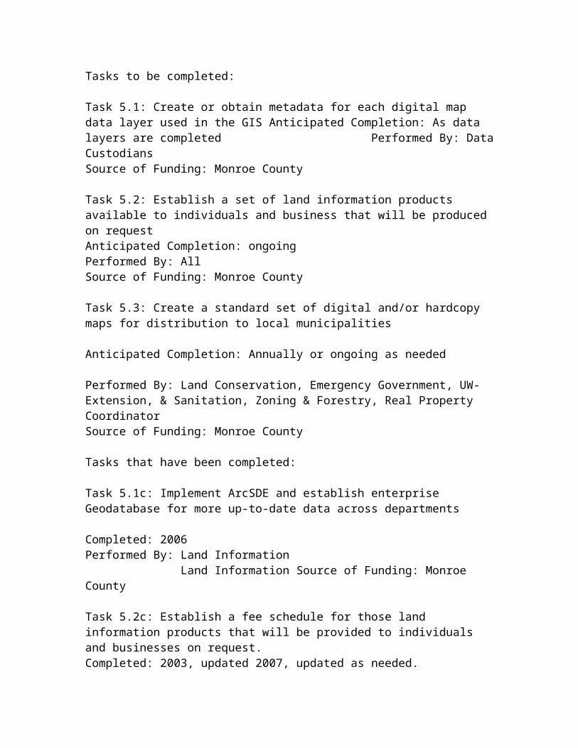
Task 5.1: Create or obtain metadata for each digital map data layer used in the GIS Anticipated Completion: As data layers are completed Performed By: Data Custodians Source of Funding: Monroe County
Task 5.2: Establish a set of land information products available to individuals and business that will be produced on request Anticipated Completion: ongoing Performed By: AllSource of Funding: Monroe County
Task 5.3: Create a standard set of digital and/or hardcopy maps for distribution to local municipalities Anticipated Completion: Annually or ongoing as needed Performed By: Land Conservation, Emergency Government, UW-Extension, & Sanitation, Zoning & Forestry, Real Property CoordinatorSource of Funding: Monroe County
Tasks that have been completed:
Task 5.1c: Implement ArcSDE and establish enterprise Geodatabase for more up-to-date data across departments Completed: 2006 Performed By: Land Information Land Information Source of Funding: Monroe County
Task 5.2c: Establish a fee schedule for those land information products that will be provided to individuals and businesses on request. Completed: 2003, updated 2007, updated as needed. Performed By: Land Information & Treasurer’s Source of Funding: Monroe County
Objective 6: Increase Knowledge and Use of Modernized Land Information Anticipated Year of Completion: Ongoing Background: When a major change is made in the way County business (e.g. exchange of land information) is carried out, employees, local municipalities and citizens need to be educated about the new tools and methods that can be used to make use of the information. In addition, when a County goes through the process of creating GIS data layers there is often completely new data that is

created, and therefore, potential users need to be made aware of what is available.
Tasks to be completed:
Task 6.1: Establish an in-house ArcView training program Anticipated Completion: With current staffing resources and new direction of software implementation plan this is no longer a task that will be undertaken Performed By: N/A Source of Funding: N/A
Task 6.2: Establish a County GIS users group for training & support Anticipated Completion: Ongoing after significant GIS data has been developed Performed By: All Source of Funding: Monroe County
Task 6.3: Hold semi-annual progress meetings for County Board Supervisors, staff, and local units of government Anticipated Completion: as needed Performed By: Land Information Officer
Source of Funding: Monroe County
Task 6.4: Attend Land Information Council, Land Conservation, Zoning & Sanitation, Ag & Extension, and Law Enforcement Committee meetings to educate on the land information programAnticipated Completion: as needed Performed By: Land Information OfficerSource of Funding: Monroe County
Tasks that have been completed:
Objective 7: Develop County Policies That Maximize Land Information Related Services and Minimize the Cost of Using, Maintaining, and Distributing Land Information Anticipated Year of Completion: UnknownPerformed By: Land Information Officer & Land Information Council Background: Implementation of appropriate policy is the only way to ensure that all tax payers receive the most efficient and effective government provided service in an equitable manner.
Tasks to be completed:
Task 7.1: Establish data sharing agreements with state & federal agencies, local business and industry to help defray the cost of data acquisition and maintenance Anticipated Completion: Unknown

Performed By: all Source of Funding: To be determined
Task 7.2: Develop policy that clarifies how WLIP program funds can be spent for the benefit of County departments Anticipated Completion: Unknown Performed By: Administrative Committee, County Board, Land Information CouncilSource of Funding: To be determined
a. Monroe County has made use of the NAIP photography that can be acquired free of charge this information is helpful for many different applications. There is a wealth of other information available or becoming available that will be of great use for people to analyze for decision making in the future. At this time Monroe County is reaching or has recently reached a maintenance stage in many of its data sets and our wants and needs will have to be identified and reprioritized.
b. Monroe County could definitely use accurate right of way widths for our local roads. This would have to be researched in the highway department and their records are not digital and are located at a separate site. At this time our Highway Department and Health Department do not have a lot of data in our system and those are two potential growth areas in the future, but time restraints and costs may limit the ability to acquire and maintain the data necessary to get those departments more involved.
c. Monroe County will ensure that our land information is available in a standard industry format by adhering to state and federal guidelines.
d. Monroe County will ensure the land information is geographically referenced by creating the data within our ArcGIS system and utilizing our horizontal control network.
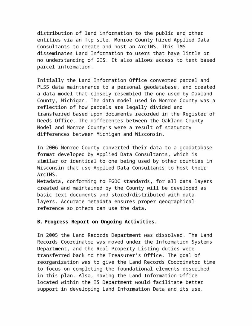
e. Monroe County will ensure that our data remains current and maintained by Identifying who the custodians of our datasets are, having timely land information council meetings, and following our land records modernization plan. 2. Monroe County’s Operating System Environment and Database Design Monroe County established a network in 2000, and has since upgraded from an NT to Windows 2003 Server environment. This network supports the goals and objectives described above because it allows land information to be “centrally located” and maintained, and to be distributed to the appropriate departments within the County. It also enables the distribution of land information to the public and other entities via an ftp site. Monroe County hired Applied Data Consultants to create and host an ArcIMS. This IMS disseminates Land Information to users that have little or no understanding of GIS. It also allows access to text based parcel information.

Initially the Land Information Office converted parcel and PLSS data maintenance to a personal geodatabase, and created a data model that closely resembled the one used by Oakland County, Michigan. The data model used in Monroe County was a reflection of how parcels are legally divided and transferred based upon documents recorded in the Register of Deeds Office. The differences between the Oakland County Model and Monroe County’s were a result of statutory differences between Michigan and Wisconsin.
In 2006 Monroe County converted their data to a geodatabase format developed by Applied Data Consultants, which is similar or identical to one being used by other counties in Wisconsin that use Applied Data Consultants to host their ArcIMS.Metadata, conforming to FGDC standards, for all data layers created and maintained by the County will be developed as basic text documents and stored/distributed with data layers. Accurate metadata ensures proper geographical reference so others can use the data.
B. Progress Report on Ongoing Activities.
In 2005 the Land Records Department was dissolved. The Land Records Coordinator was moved under the Information Systems Department, and the Real Property Listing duties were transferred back to the Treasurer’s Office. The goal of reorganization was to give the Land Records Coordinator time to focus on completing the foundational elements described in this plan. Also, having the Land Information Office located within the IS Department would facilitate better support in developing Land Information Data and its use. Unfortunately the Land Records Coordinator position has been empty since mid 2006 and will likely remain that way long term as the Land Records Department has been dissolved. After the Land Records Department was dissolved the IS Department acted as the Land Information Office until 1/1/2011. As of 1/1/2011 the Land Information Office has been assigned to the Real Property Coordinator.
In early 2006 ArcSDE was implemented. ArcSDE allowed implementation of an enterprise geodatabase that allows for a multiple user environment wherein each user can access current land information maintained in other departments and even edit the same data at the same time. The Real Property Coordinator, as part of the tax listing process, maintains the parcels in the geodatabase. Two floating licensees of ArcEditor and one floating license of ArcInfo are utilized for accessing the database from the Treasurer’s Office, Land Conservation Department, Planning & Zoning & Forestry and Emergency Management.
In 2000 Monroe County completed the densification of its geodetic control network for horizontal positioning. A total of 3 primary GPS control monuments and 12 secondary GPS control monuments were constructed in 1993. GPS observations were taken on these points from 1993 through 1998. Final network

adjustments were performed and final lat/long coordinate values were determined for the primary and secondary level monuments in 1999 by the Jackson County Surveyor. This was part of a cooperative project between Jackson, La Crosse, and Monroe Counties for densifying from the WHPGN. In 1996 and 1997, 65 tertiary GPS control monuments were constructed. GPS observations were performed on these points in 1999 and 2000. A final network adjustment was performed and final lat/long coordinate values were determined for the tertiary level monuments in 2000 by the Jackson County Surveyor. The WDOT completed the vertical control and the monuments that were lost to construction were replaced. Also new values were determined and blue booked with NGS.
Approximately 90-95% of the PLSS corners in the County have been remonumented, excluding the area within the Fort McCoy Military Installation. In 2000, GPS observations were made on 67 PLSS corners for the support of parcel mapping. Since 2000, GPS observations on section corners have continued by county staff and private surveyors.
Initial parcel mapping has been completed. Coordinate geometry digitizing has been performed for Certified Survey Maps, subdivision plats, and survey descriptions that will facilitate countywide parcel mapping as coordinates are obtained for PLSS section corners. Parcel mapping will be adjusted when survey and GPS information provides greater accuracy in the PLSS framework in which to map parcels.
C. New Initiatives
Since the creation of Monroe County’s last land records modernization plan, the State of Wisconsin and many local governments including Monroe County are experiencing a prolonged financial crunch. Staff reductions and smaller budgets have and will continue to influence how Monroe County provides service and what services we are able to provide. At the same time the expansion of wireless computing means Monroe County needs to prepare to provide digital data for the needs of its citizenry.
1. Proposed Projects 2010-2015. During the planning horizon, 2010-2015, Monroe County is intending to undertake the following major initiatives:
Project 1: Upgrade Parcel Mapping Based On the Acquisition of Missing Geodetic Control As GPS observations are made and County Coordinates are obtained on PLSS section corners, GIS data will be adjusted.
Project 2: Obtain New Digital Orthophotography in 2015Monroe County hopes to acquire 12” ground pixel, scale, color, digital
orthophotography as a cooperator in a future consortium. This new more detailed photo will assist and support all users of geographic data in Monroe County in countless ways. The photos will also support the achievement of many of the goals spelled out in this plan. Project 3: Implement Zoning & Sanitation Permit System integrated with a Geodatabase. The Sanitation, Zoning & Forestry department is very interested in establishing a modernized and computerized permit tracking system that is integrated with information created and maintained by the Real Property Coordinator, Register of Deeds, and Treasurer. During the planning horizon permit-tracking software will be evaluated and obtained. As part of the permit system a zoning feature class will be created for county zoning once parcel mapping is completed. Collection of GPS data of septics, wells, etc.
Project 4: Maintain geocoded street centerlines and Address Points for the Cities and Villages Since Monroe County implemented a consolidated dispatch, it is apparent there is a need to have geocoded street centerlines and address dots to improve the accuracy and response time of the police, fire departments, and ambulances. This data will be used as part of the E911 and Wireless 911 to assist the PSAP with their duties of dispatching to all citizens in the case of an emergency in Monroe County, and not just those in the rural areas where this data already exists.
Project 5: Register of Deeds Office ROD Direct Implementation Monroe County has been scanning the documents that get recorded and the ability to make those documents available via a website is now a possibility. This will allow people to avoid travelling long distances and give the option of acquiring data 24 hours a day, 7 days a week, all year long. This web portal can be a companion to our existing ArcIMS website which serves people geographic, tax, assessment and other information. People would gain the ability to purchase information with a credit card and Monroe County would be able to charge a fee to cover maintenance and other costs associated with serving the data up and may provide a revenue stream that currently does not exist all while freeing up people at the office to work on other tasks.
Project 6: ArcIMS Website Upgrades It may be advisable to upgrade our website to ADC’s newer WebGuide Xtreme this will allow us to take advantage of the latest technology and developments. It also would make us more efficient if we set up an automation of the GIS data upload so that GIS data served is more current. We also would gain efficiency by making our GIS data downloadable from the website.
Project 7: Scan the Surveyor Records Scan the remaining surveyor records and make them available to the general

public via one of our websites. This would ensure the preservation of the records, save the general public and other county employees who are located in a remote location the time of having to drive to the register of deeds office as well as allow surveyors the option of accessing data at all times not just the office hours of the register of deeds.
2. Assistance Requested
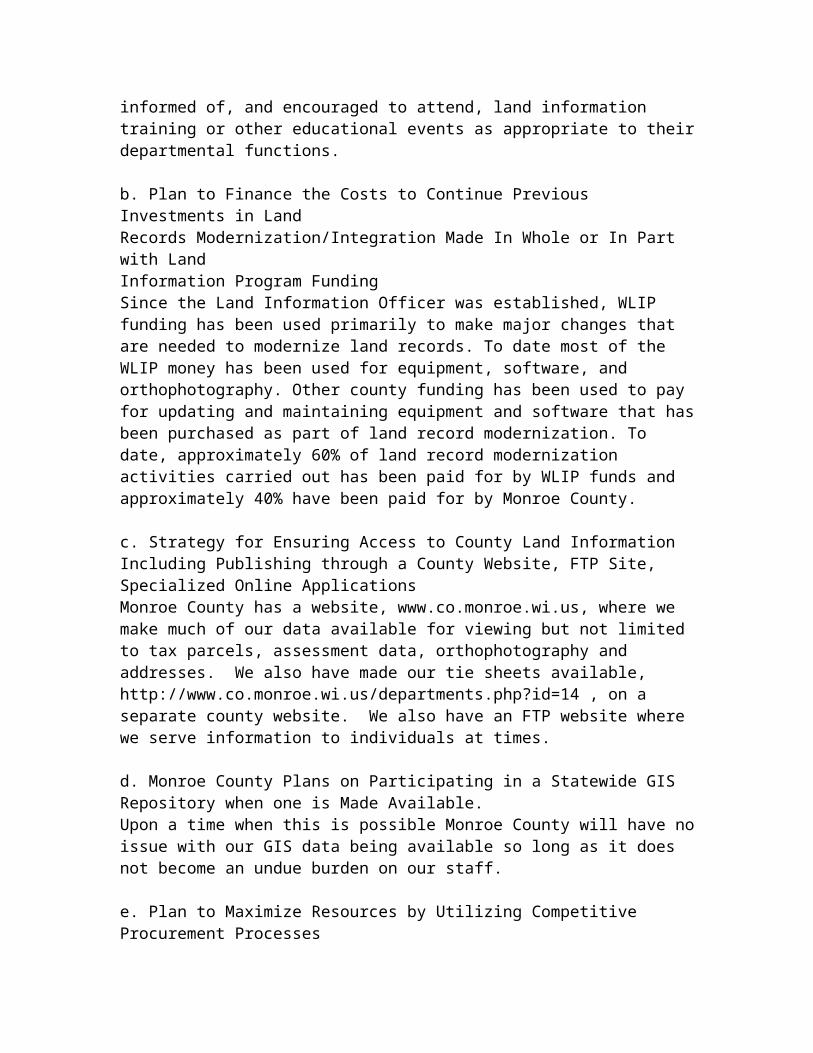
a. The County Will Need Financial Assistance, Technical Assistance and Continued Education of its GIS Stakeholders to Accomplish Our Goals The Land Information Officer has an internet connection and subscribes to the Land Info Technical Assistance List Server Service. The Land Information Officer will regularly attend WLIA meetings and the annual convention. The Land Information Officer and any GIS users will maintain professional competency by self-training, and by attending training that would be required to perform or facilitate land record modernization. Other departments will be informed of, and encouraged to attend, land information training or other educational events as appropriate to their departmental functions.
b. Plan to Finance the Costs to Continue Previous Investments in Land Records Modernization/Integration Made In Whole or In Part with Land Information Program Funding Since the Land Information Officer was established, WLIP funding has been used primarily to make major changes that are needed to modernize land records. To date most of the WLIP money has been used for equipment, software, and orthophotography. Other county funding has been used to pay for updating and maintaining equipment and software that has been purchased as part of land record modernization. To date, approximately 60% of land record modernization activities carried out has been paid for by WLIP funds and approximately 40% have been paid for by Monroe County.
c. Strategy for Ensuring Access to County Land Information Including Publishing through a County Website, FTP Site, Specialized Online ApplicationsMonroe County has a website, www.co.monroe.wi.us, where we make much of our data available for viewing but not limited to tax parcels, assessment data, orthophotography and addresses. We also have made our tie sheets available, http://www.co.monroe.wi.us/departments.php?id=14 , on a separate county website. We also have an FTP website where we serve information to individuals at times.
d. Monroe County Plans on Participating in a Statewide GIS Repository when one is Made Available.Upon a time when this is possible Monroe County will have no issue with our GIS data being available so long as it does not become an undue burden on our staff.
e. Plan to Maximize Resources by Utilizing Competitive Procurement Processes

(bid, RFP and justified sole-source) Consistent With State Of Wisconsin And Local Procurement Rules For land record modernization purposes Monroe County intends to utilize competitive procurement processes consistent with Monroe County and State of Wisconsin procurement policies.
3. Problems EncounteredAt times it has been difficult to make progress in a few of our projects. Software compatibility issues have brought our Register of Deeds online image project to a standstill. Our scanned documents are in a file format that will need to be converted before they can be used with Applied Data Consultant’s ROD Direct System.Furthermore our E911 project has been slowed by the loss of the E911 Coordinator position and the uncertainty of the job’s future.
D. Custodial Responsibilities
The following are Monroe County Departments that have custodial responsibilities for the indicated land records. Text within { } indicates whether we HAVE, would LIKE, or WILL accept custodianship of the data. The authority for custodianship is noted within ( ). An * indicates that the records are necessary for the operation of the office but are not specifically mandated by a governing body.
County Surveyor – • Maintains information on, and oversees the perpetuation of, PLSS corners including tie sheets and section summary sheets. {HAVE}(Wis. Statutes Ch. 59.45 & 59.74) • Maintains information on, and oversees the perpetuation of the County’s geodetic control network. {WILL}(Wis. Statutes Ch. 59.45 & 59.74) • Maintains files and an index of surveys performed within the County. {HAVE}(Wis. Statutes Ch. 59.45)
Dispatch – • Maintains Master Street Address Guide (MSAG). {HAVE}(Wis. Statutes Ch. 146.70)
Emergency Government – • Maintains rural address (i.e. 911 address) data and digital maps. {HAVE}(Wis. Statutes Ch. 59.54)
Land Conservation – • Files and maintains necessary natural resource maps and data. {HAVE}(*)
Land Information – • Creates, obtains, maintains, and/or coordinates the development of, digital GIS map layers for the County. {HAVE}(Wis. Statutes Ch. 59.72)

Highway – • Compiles and maintains a record of the laying out, alteration or discontinuance of all highways in the county outside the limits of incorporated cities and villages. {HAVE}(Wis. Statutes Ch. 83.01)
Real Property Lister – • Prepares and maintains accurate ownership and description information for all parcels of real property in the county. {HAVE}(Wis. Statutes Ch. 70.09)
Register of Deeds – • Record deeds, mortgages, plat maps, certified survey maps, and other real property related documents. {HAVE}(Wis. Statutes Ch. 59.43) • Maintains a grantor/grantee and tract index of real property. {HAVE}(Wis. Statutes Ch. 59.43)
Sanitation, Zoning, & Forestry –• Maintains zoning maps and zoning permits for towns that have adopted the Monroe County Zoning Code. {HAVE}(Monroe County Code Ch. 47; Wis. Statutes Ch. 59.69) • Maintains shoreland zoning maps. {HAVE}(Monroe County Code Ch. 53; Wis. Statutes Chs. 59.692) • Maintains and files private sanitary system site plans, permits, and soil test reports. {HAVE}(Monroe County Code Ch. 41; Wis. Admin. Code - Dept. of Comm. -Plumbing 83.05) • Maintains floodplain zoning maps. {HAVE}( Monroe County Code Ch. 50; Wis. Statutes Chs. 59.69 & 87.30) • Files WDNR wetlands and FEMA maps. {HAVE}(*) • Maintains County Forest maps. {HAVE}(Monroe County Code Ch. 44; Wis. Statutes Ch. 28.10 & 28.11)
Treasurer – • Maintains tax information for all tax parcels. {HAVE}(Wis. Statutes Ch. 59.25)
E. Framework Data, System Implementation and Statewide Standards
1. Geographic Positioning Reference Frameworks
A. Geodetic control network – Monroe County has completed densification from the WHPGN under the guidance of the Jackson County Surveyor. For the primary (1 ppm) and secondary (2 ppm) level of horizontal densification, Monroe County has adhered to the acquisition and analysis standards as specified in the WLIB document:
STANDARDS, SPECIFICATIONS, AND GUIDELINES to Support Densification
of the Wisconsin High Accuracy Reference Network (HARN) Using Global Positioning System (GPS) Technology (June 1995).
For the tertiary (4 ppm) level Monroe County is also adhering to these standards except for the following: • No pencil rubbings of monument caps were taken during data acquisition sessions • No photographs were taken during data acquisition sessions • No meteorological observation were taken during data acquisition
Horizontal Coordinates for each station are available in both the Monroe County Coordinate System and latitude/longitude values.
B. Public Land Survey System (PLSS) – Monroe County has completed between 90 and 95% of its PLSS corner remonumentation and is adhering to the requirements of the Wisconsin Administrative Code A-E 7.08 and Wisconsin Statutes (Sec. 59.74 and 59.45) as applicable. Monroe County has started the process of acquiring coordinates on PLSS corners using a combination of GPS and conventional surveying techniques. All coordinates will meet or exceed the new Federal Geographic Data Committee (FGDC) 1-Decimeter horizontal accuracy standard which is comparable to the old Federal Geodetic Control Committee (FGCC) Third-order, Class I horizontal accuracy standard. Monroe County intends to use Geoid99 (or the most current model available) for determining orthometric heights on PLSS corners. Coordinates will be maintained in the Monroe County Coordinate System which is mathematically relatable to North American Datum (NAD) 1983(91). The Monroe County Surveyors Office maintains custodial responsibility for the PLSS within the County. Land Conservation maintains the digital coordinate file.
2. Orthoimagery and Georeferenced Image base Data
a. Photogrammetric base maps – Monroe County currently does not have any base mapping from photogrammetric processes.
b. Digital Orthophoto (DOP) – In 2010 Monroe County participated in the WROC project, obtain 18 inch resolution imagery. In the future, Monroe County may be interested in acquiring 1 foot resolution imagery for DOP production.
c. Digital Raster Graphic – Monroe County has obtained the USGS Digital Raster Graphics (DRGs) and rubber-sheeted them using the 16 lat/long tic marks as reference points to the Monroe County Coordinate System.
d. Satellite imagery – Monroe County will be evaluating the new satellite imagery technology as a potential tool for map updates, land classification, land cover mapping, or as an alternative to DOPs. At this time, we have no definite plans for

acquiring any satellite imagery.
e. Oblique Satellite imagery – Monroe County will be evaluating the oblique satellite imagery technology as a potential tool. At this time, we have no definite plans for acquiring any oblique satellite imagery.
f. Historical imagery – Monroe County has some older hardcopy orthoimagery that can be converted to digital if necessary. In the short term Monroe County has no plans to acquire additional historical imagery.
3. Elevation Data Products and Topographic Base Data
a. Digital elevation models (DEM) – Monroe County will be able to create a DEM if the need arises, based on our 2010 LiDAR data.
b. Digital terrain models (DTM) – Monroe County will create a detailed DTM when and if the need arises, based on our 2010 LiDAR data.
c. Triangulated irregular networks (TIN) – Monroe County will acquire or utilize TINs when and if the need arises, based on our 2010 LiDAR data.
d. Contours – Monroe County will develop vector based contours as needed and appropriate to the specific application, based off of our 2010 LiDAR data.
e. LiDAR – Monroe County is in the process of acquiring 2010 LiDAR data.
f. IFSAR – Monroe County will obtain Interferometric Synthetic Aperture Radar if the need arises and we can afford it.
Digital Ortho Quad (DOQ) – Monroe County will be receiving DOQs from the NRCS and will be re-projecting them to the Monroe County Coordinate System.
4. Parcel Mapping
a. Monroe County intends to prepare parcel property maps that refer boundaries to the PLSS and will be suitable for use by local governmental units for planning purposes at a minimum, and in many cases will be suitable for assisting with accurate land title boundary line or land survey line determination. Monroe County parcel mapping is not intended to be a substitute for a public land survey or for guaranteeing title to property.
Monroe County will conform to the parcel mapping standards adopted by the FGDC and WLIA Digital Parcel Mapping Standard.
b. We currently have some older data in parcel mapping that does not match the PLSS and it will be converted in time to match.

c. All map data layers including parcels will be referenced to the Monroe County Coordinate System as defined in the 2009 Wisconsin Coordinate Reference Systems Handbook (http://www.sco.wisc.edu/pubs/2009/WisCoordRefSys_April2009.pdf). The coordinates determined for the PLSS corners, as described above, will be used as a framework for all parcel mapping.
d. Each parcel is currently labeled with the computer number of its associated record in the tax assessment and tax collection databases. Each parcel will also be labeled with a parcel identification number conforming to the WLIA’s parcel numbering standard.
5. Parcel Administration and Assessment Information
a. Monroe County is currently using software from GCS of Onalaska, Wisconsin for parcel administration. These programs allow for output of various reports required by the Real Property Lister, Treasurer, and Register of Deeds. Each tax parcel has a computer number and an alternate parcel number that is similar, but unfortunately not exactly the same as the WLIA standard.
b. Parcel Level Information
1. Parcel Id – Each parcel will be labeled with the computer number of its associated record in the tax assessment and tax collection databases. Each parcel will also be labeled with a parcel identification number conforming to the WLIA’s standard in the future
Because our parcel mapping will include the administrative computer number in the map database, we will be able to integrate the tabular tax assessment and tax collections databases with digital parcel mapping.
2. Tax Data – Monroe County maintains and manages tax assessment and tax collection information in computerized tabular databases. Both databases contain owner names; mailing addresses; property address (this data field needs to be populated); a brief legal description; a reference to the recorded documents that created the parcel; an administrative computer number; a parcel identification number; the school district; any special tax districts; assessment codes, valuations, and acreage; and the section, town and range the parcel is located in. The tax collection database also contains tax payment information. A parcel/tax record can be queried by identifying the computer number, the last and first name, the property address (after this data field is populated), and the parcel number. The tax record can also be queried by the tax bill number.
3. Site Address – As parcel mapping is completed, rural addresses (i.e. 911 addresses) will be incorporated into the parcel mapping and tax assessment and

tax collections databases.
4. Owner Name & Address – Property owner mailing addresses are maintained as an attribute in the tax assessment and tax collection databases.
5. Description/Current Document - Our records contain a short legal description conforming to Wisconsin Real Property Lister Association Standards and the most current document whenever applicable. The Register of Deeds Office has been using a computerized grantor/grantee and tract indexing system for real estate document recording since January 1, 1999. As time and budget permit, documents prior to that date will be entered into the computerized system.
6. Document Imaging – The County staff that utilizes land records the most use an optical imaging system which will need to be upgraded in order to get our documents ready for internet applications. During 2011 the departments that use the optical imaging system will be working to make necessary upgrades to our existing system.
7. Real estate transactions - Searches of real estate documents can be performed on the computerized system by document number, grantor, grantee, legal description, volume & page, document type, and recording date.
8. Easements and restrictions, including conservation easements – Easements may be mapped as a separate shapefile in the Arc geodatabase depending on time available. Mapping of easements significantly delayed the parcel mapping process. If mapped, a separate topologically correct polygon data layer will be created for them. They are being listed in the tax parcel history as recorded 8/16/2005.
9. Tax exempt status – An attribute code for tax exempt lands exists in the tax assessment and tax collections databases which will be relatable to digital parcel maps.
10. Zip codes – Zip codes, including +4 when known, are maintained for the physical address when known and the mailing address in our GCS Property Assessment and Taxation Program
11. Assessment class - All assessment class codes for each tax parcel are maintained in our GCS Property Assessment and Taxation Program
12. Public Lands – At this time some publicly held lands are not being assessed, but we strive to include them in our tax roll and they are being added as they are discovered The Publicly held lands are classified as X1 (Federal), X2 (state), X3 (County) and X4(other).
13. Liens – we currently do not list liens with our assessment information when

they are recorded, but this information is available directly from the Register of Deeds.
14. Evidence of Title - We cannot vouch for the title condition of a property
6. Street/Road Centerlines, Address Ranges and Address Points
a. Transportation Network (streets, roads, highways, railroads) – We have centerline data identified with embedded ranges and address points that are being maintained. The right of ways have yet to be verified where they have been created.
b. Rights of Way – Rights-of-way for public roads have been developed, but not verified, for about half of Monroe County as part of the parcel mapping process.
c. Centerlines – Monroe County developed centerline data originally based on 1:24 K DRG’s. In many cases this has been modified to match visual data from orthophotography. This data will continue to be maintained and updated as more accurate centerline information becomes available.
d. Address ranges – Monroe County has developed a centerline data layer with rural address ranges. They are maintained by the emergency management department.
e. Site address database - Monroe County will continue to reconcile conflicting addresses, road names, and locations as necessary to maintain this information.
f. Address point, structure and or driveway – Monroe County currently has most of the address points at the driveway, but some are located at or near the structure.
g. Road names – Monroe County implemented a system of road nomenclature that is administered via the emergency management department.
h. Functional Class – Monroe County has yet to establish a layer that indicates the functional class of roads.
i. Places/Landmarks – Monroe County has yet to establish a layer that has places of interest or landmarks.
j. Integration with the County’s/City Master Street Address Guide (MSAG) - Monroe County does not appear to be US Postal Addressing Standards Publication 28 compliant based on the way our mailing addresses are treated in our tax & assessment records, i.e., Co HWY B instead of County Highway B and St HWY 16 instead of State Highway 16.
k. Support of emergency planning, routing, response and mapping – Monroe County does provide support
l. Wireless 911 – Monroe County is able and currently supports wireless 911.
7. Hydrography, Hydrology and Wetlands Mapping
a. Hydrography - Monroe County has obtained 1:24 K hydrography
b. Watersheds - Monroe County has obtained 1:24K watersheds
c. Hydrogeology – Monroe County has obtained the 1:250K water table depth data layers. Other natural resource digital data layers will be created or obtained as time and budget permits
d. impacts on the environment (e.g. groundwater contamination, storm water) – Monroe County will create or obtain this information as time and budget permits.
e. Wetlands mapping activities - Monroe County has obtained the 1:24K digital wetlands from the WIDNR and plans to obtain updates of this digital wetland data by township as appropriate.
8. Soils Mapping, land cover and other Natural Resource Data
a. Soils Mapping activities - Monroe County has the NRCS SSURGO Certified Digital Soil Survey for Monroe County.
b. Land Cover – Monroe County has obtained 1:500K original (pre-settlement) vegetation cover.
c. Forests - Monroe County has completed County Forest Compartment mapping.
d. Geology - Monroe County has obtained 1:250K bedrock depth & 1:500K bedrock type
e. Hydrogeology – Monroe County has obtained the 1:250K water table depth data layers. Other natural resource digital data layers will be created or obtain as time and budget permits.
f. Non-metallic mining- Monroe County has created this layer of data.
g. Endangered Resources – Monroe County will create or obtain as time and budget permits.
h. impacts on the environment (e.g. air emissions; soil contaminants; coastal

stability) - Monroe County will create or obtain as time and budget permits.
9. Land Use Mapping
a. Monroe County has obtained 1:250K land use and land cover from the WDNR.
b. Monroe County adopted a Comprehensive Plan in 2010 that included existing and future land use maps. The plan will be updated every 5 years or sooner as needed. The local municipalities that adopted their own plans will have their own existing land future land use mapping incorporated in the county plan.
10. Zoning Mapping
a. Zoning districts – Monroe County Planning & Zoning has completed a countywide zoning layer in 2010.
b. Shorelands – Digital shoreland zoning mapping will be performed during the 2010-2015 planning horizon.
c. Floodplain and Floodway – Monroe County obtained the digital FIRMS that were updated and went into effect in 2010.
d. Environmental corridors – Monroe County has no environmental corridors at this time.
e. Burial sites - Monroe County has a Cemetery Point file, but does not have cemeteries mapped at this time and likely will not be doing so within the next five year land records modernization cycle.
f. Archeological sites - At this time Monroe County does not have any mapping of archeological sites but would consider doing so if the need were to arise.
g. Historic/cultural sites - At this time Monroe County does not have any mapping of archeological sites but would consider doing so if the need were to arise.
11. Election and Administrative Boundary System
a. Election (voting district) boundaries, precincts, wards, supervisory, voting places, etc.- Monroe County will update these boundaries when the redistricting is complete.
b. Legislative districts – Monroe County will update these boundaries when redistricting is complete
c. Utility Districts - The tax assessment database has codes for these districts. As time permits Monroe County will create layers for these districts.

d. School districts – This layer is complete and currently being maintained by the Real Property Coordinator.
e. Tax Incremental Finance Districts - The tax assessment database has codes for these districts. As time permits Monroe County will create layers for these districts.
f. Agency administrative districts and Zip Code - Monroe County currently has these layers and will continue to improve them as spatial accuracy is achieved in the maintenance process.
g. Census Geographies - This information will have to be re-compiled based on the latest census when redistricting occurs. Our existing data is out of date.
h. Civil Division Boundaries – The civil division boundaries are being maintained by the Monroe County Real Property Coordinator. It will be updated as improved spatial accuracy is achieved during parcel mapping maintenance.
i. Public Administered Lands - The tax assessment database has codes for some of these districts. As parcel mapping is completed, separate data layers for these districts will be created dynamically using the GIS software.
j. Native American Lands – We do not have a current shapefile of all lands owned by the Ho Chunk Nation but that could be easily created. However I am not aware of what lands are specifically considered to be part of their nation and fall under their governance.
k. County Boundaries - Monroe County has a boundary based on our parcel mapping and Section Corner coordinates.
l. State Outline - We do not have the state outline mapped as we are an interior county in the State of Wisconsin.
m. Lake Districts - The tax assessment database has codes for some of these districts. As parcel mapping is completed, separate data layers for these districts will be created dynamically using the GIS software
12. Critical Infrastructure and Facility Management
a. Emergency Service Districts – These districts have been mapped and are available.
b. 911 call center service areas & center locations – These locations need to be mapped.

c. Fire/Police Districts – These districts have been mapped and are available.
d. Fire/Police Stations – These locations need to be mapped.
e. Hospitals & Healthcare Facilities – The hospitals have been mapped but the other healthcare facilities need to be mapped.
f. Government Facilities – The town hall locations have been mapped but other governmental units and town shops etc. have not been mapped.
g. Utilities- Monroe County has some mapping of utilities at this time, but it may be dated.
h. Parks & Recreational Trails – Monroe County has this information
i. Transit Systems - This information has not been mapped as of yet.
j. Bridges, culverts, traffic road signs – This information has not been mapped as of yet.
k. Airports and airfields – This information has not been mapped as of yet.
l. Harbors – N/A… Monroe County has no harbors.
m. Boat Landings – This information has not been mapped as of yet.
n. Hazardous materials sites – This information has not been mapped as of yet.
o. Landfills – This information has not been mapped as of yet.
13. Data Base Design and System Implementation
a. Design evaluation - Our geodatabase was designed by Applied Data Consultants (ADC) and should conform to WLIA standards
b. Project Approach - When Monroe County contracted out the continuation of our parcel mapping project it was set up so that when we had the necessary control in place ADC was able to map areas out based on a fee per parcel approach. As a result Monroe County was able to monitor what areas of the county were being completed and areas were not mapped until we decided they were ready for production. We also were able to adjust which areas were mapped next based on needs.
c. Timeline - There was no set timeline for our project.
d. Metadata policies – Monroe County has developed metadata for some of our

data at this time. The custodian of the data should be creating metadata conforming to the FGDC Metadata Standards for all GIS data sets maintained.
e. Security/Privacy policies – Monroe County has security set up so that terminals can only be accessed by the proper employees with access logins. Furthermore our programs can only be edited by the proper individuals via password protected accounts. Some of our programs have separate view and edit permissions.
f. Implementation and Maintenance Strategy - Currently we have different departments maintaining their own custodial data. There may be overlap in a few instances, but this is dealt with by reconciling and posting data.
g. Data Quality Management – Currently each custodian manages the content of their own data as far as spatial quality that is dealt with by the interaction between the data custodian and the Land Information Officer.
h. Needs Assessment - Monroe County currently does not have a formal procedure in place for performing the above. The land information council should assist the Land Information Officer in determining land record modernization needs and planning for their development.
i. Data structure and format - Topology has been set up in our geodatabase and most data sets take part in the topology.
j. GIS Data Models - We have a hard copy of our Parcel Geodatabase Schema created by Applied Data Consultants during our Parcel Mapping Project available for view on the wall in the office of the Land Information Officer. There are some data sets that are outside of the schema that may be imported into it and adjustments to the existing schema may be necessary.
k. Data Dictionary – At this time Monroe County does not have a complete data dictionary.
l. Coding Schema – standard coding schemes will be used whenever possible to facilitate integrateability.
m. Transaction management – Date fields will be used where appropriate in databases to track changes.
n. Organizational information flows – We do not currently have an organizational information flow. After the Land Information Office was dissolved things changed and have been in a bit of flux but have basically stabilized with the implementation of our enterprise geodatabase. This is a task that should be handled by the Land Information Officer and other geographic information users at Monroe County.

o. Data Conversion – Monroe County currently uses ESRI software to manage all of our GIS data exclusively and our other data is managed exclusively by GCS products. Our data can be exchanged in any formats that those software programs will allow for.
p. Ability to integrate with other databases and information systems – Monroe County will exchange GIS data in formats useable by the above software. Tabular data can be exchanged in standard .dbf, Microsoft Access, and delimited ascii text files depending on the specific application.
F. Public Access
a. Use of technology to facilitate efficient access – There currently are three public access computers in the Register of Deeds Office. These computers can be used by the public to access the property assessment values, tax collection, and the computerized real estate document information.
Monroe County also has a website that contains most of our GIS information as well as tax and assessment data. We also have posted some of our surveyor’s office information.
Other information is available via our FTP site when necessary.
b. Use of 3rd party technology for access – At this time Monroe County does not host any of our data at 3rd party locations, however it is possible that information may be found elsewhere if it has been purchased from us.
c. Data sharing policies – Monroe County would be willing to share data with other entities should the opportunity arise. At this time we have not looked into copyrights or licensing of our data.
d. Open access to data in existing format – Monroe County adheres to the Wisconsin Open Records Law for access to any land record.
e. Subscription-based or public-facing web services – Monroe County has a free Geographic Information Web Service and in the near future will likely have a fee or subscription-based site for acquiring information from the Register of Deeds Office.
f. Optional production of customized data on cost-recovery or other basis – Monroe County currently offers tabular data for purchase in several industry accepted interchange formats. Cost is based on time and materials. Digital data requests are handled through the custodian of the data and this is covered by our fee schedule. Digital map data is generally provided in shapefiles. Monroe County currently is unable to process requests for customized data products, but

can reproduce and redistribute data that has been created and is being maintained. Frequently this information is shared via our ftp site or email, but can be distributed via compact disc as well.
g. Internet Accessibility – The public access terminals are in a location that would allow for anyone to access the data and the area is supervised by a staff member of the Register of Deeds Office.
h. System security – Network security, backup, and administration is being performed by the Information Systems Department using industry accepted software, hardware, and procedures.
i. Privacy Policies – Monroe County adheres to the Wisconsin Open Records Law and complies with State statutes for access to restricted records. Monroe County will be monitoring the issue and will be sensitive to public concerns related to privacy and distribution of data. At this time Monroe County does not have an official privacy policy.
j. Use of $2 fee designated for land information and housing data Sec. 59.72(5)(b)3- The fees are used for paying for our serving our land information on the internet via our geographic information web server and making more data available on a more frequent basis.
Monroe County adheres to the following standards where applicable:
State Agency GIS Data Interchange Standard which includes the possible future adoption of the Federal Geographic Data Committee (FGDC) Content Standards for Digital Geospatial Metadata.
WLIA Standards and Best Practices.
Monroe County will continue to follow County ordinances and Wisconsin State Statutes for procurement of services/products related to this plan which are consistent with the WLIP recommended procurement process.
Wisconsin Department of Administration Imaging Standards and Guidelines.
Wisconsin Department of Administration Information Technology Infrastructure Standards.
G. Integration and Cooperation
a. At this time Monroe County has no formal data sharing agreements (Memorandums of Understanding etc.)
b. At this time Monroe County does not have any formal or informal data

maintenance agreements between departments or agencies.
b. At this time Monroe County does not have cooperative arrangements (e.g. agencies; libraries; schools; RPCs; utilities; privates).
c. Monroe County took part in the Wisconsin Regional Orthophoto Consortium (WROC) when acquiring new orthophotography & LiDAR in 2010.
d. Monroe County does not currently have any collaborative arrangements (e.g. sharing of: local/state staff and budgets; technical assistance; peer review; collegial plan preparation; common help desk; bartering and mentoring etc.)
e. Monroe County shares data with the State Department of Revenue, but at this time that is not a statutory requirement. At this time I am not aware of any statutory relationships with other counties or between us and state agencies. At this time any of our relationships, if they exist, are unofficial.
1. Integrative/cooperative relationships – Monroe County has no formal integrative/cooperative relationships, but has exchanged data with Fort McCoy, local WDNR personnel, and between County Departments. Monroe County is interested in developing any integrative/cooperative relationships where such a relationship would be of mutual benefit.
2. Potential partners/projects – None at this time. Monroe County is open to suggestions.
3. Data shared/used – Our GIS data has been used for comprehensive planning at the local level. We also have rural addressing and parcel mapping maintained by the county.
4. Coordination and participation in regards to the allocation of WLIP funding was performed by the LIO in the past. In the future this will likely be determined by the Land Information Council.
5. Our county allows the City of Tomah and City of Sparta to use information from our website for their portal that is accessible via password from our Geographic Information Web Server. The county used land information monies for county-wide parcel mapping and purchasing new orthophotography which also benefits all local municipalities. H. Communication, Education, Training and Facilitated Technical Assistance
a. Documentation of County data – Where appropriate, as needed, and as time allows, brief summaries/info sheets about County data will be produced for use in documents such as handbooks,

plans, and internet pages.
b. Resources available – Currently the users of geographic data provide technical assistance to each other and other county departments and local municipalities who are developing, maintaining, and using computerized land information. Individuals should seek additional training and education meetings and training opportunities as appropriate.
c. Identification of customers needs – Monroe County has a new land information council that will meet to discuss land records needs and priorities. The land information officer will work with the land information council to identify and carry out the tasks identified earlier in this document. The land information council needs to identify our customer data needs and find out if we are meeting them.
d. Coordination of education/training with agencies, associations and educational institutions - As opportunities arise, Monroe County will participate in activities of this nature where time and budgets allow.
e. Use of technology to facilitate education and training - Through the County’s UW-Extension Office we have access to a satellite down link facility and Educational Teleconference Network (ETN) system. The County has projection monitors and laptop computers that can be used for education and training.
f. Use of Clearinghouse and Technical Assistance List Server -The Land Information Office has an internet connection and subscribes to the WLIP Technical Assistance List Server. All County departments have internet access and several subscribe to the technical assistance list server.
g. Use of Training Funds -The training funds provided through the WLIP are used to educate staff on new software, data models, and state programs.
I. Administrative Standards Not Associated With Foundational Elements
This Plan represents an agreement between Monroe County and the Wisconsin Department of Administration (DOA). This agreement is intended to effectuate the objectives of the program as embodied in the enabling legislation. In order for this Plan to be acceptable to the DOA, the DOA and Monroe County agree and consent as follows below:
1. Monroe County agrees to observe and follow the statutes relating to the Wisconsin Land Information Program and other relevant statutes.

2. Monroe County agrees to permit the DOA access to books, records and projects for inspection and audit.
3. Monroe County agrees to complete the GIS Inventory Survey annually.
4. Monroe County agrees to update the plan every 5 years and in the interim if the plan should change.
5. Development and implementation of an acceptable Plan confers certain benefits on local government within Monroe County, including continued eligibility for Program funding. A self-approving peer review process will be used to assess Plan acceptability by the land information community.