mining records curator arizona geological survey tucson,...
TRANSCRIPT

The following file is part of the
James Doyle Sell Mining Collection
ACCESS STATEMENT
These digitized collections are accessible for purposes of education and research. We have indicated what we know about copyright and rights of privacy, publicity, or trademark. Due to the nature of archival collections, we are not always able to identify this information. We are eager to hear from any rights owners, so that we may obtain accurate information. Upon request, we will remove material from public view while we address a rights issue.
CONSTRAINTS STATEMENT
The Arizona Geological Survey does not claim to control all rights for all materials in its collection. These rights include, but are not limited to: copyright, privacy rights, and cultural protection rights. The User hereby assumes all responsibility for obtaining any rights to use the material in excess of “fair use.”
The Survey makes no intellectual property claims to the products created by individual authors in the manuscript collections, except when the author deeded those rights to the Survey or when those authors were employed by the State of Arizona and created intellectual products as a function of their official duties. The Survey does maintain property rights to the physical and digital representations of the works.
QUALITY STATEMENT
The Arizona Geological Survey is not responsible for the accuracy of the records, information, or opinions that may be contained in the files. The Survey collects, catalogs, and archives data on mineral properties regardless of its views of the veracity or accuracy of those data.
CONTACT INFORMATION Mining Records Curator
Arizona Geological Survey 416 W. Congress St., Suite 100
Tucson, Arizona 85701 520-770-3500
http://www.azgs.az.gov [email protected]

r;
il . . . . 7 ~
,i
OLIVI~R B. KILROY INVESTMENTS
SUITE II0- 4625 EAST BROADWAY BROADWAY TERRACE
TUCSON, ARIZONA 85711
TELEPHONE 795-6114
December Ii, 1986
Mr. Jim Sell ASARCO ll50 N. 7th Avenue Tucson, Ariz~a 85705
Dear Mr. Sell:
Enclosed is some background information about the CWT property and my hydraulic system patents, related concepts and use s.
I am also enclosing my La Paz County prospect since it may be of interest as a straight exploration project. However, it also has some additional potential since it may be an area of interest for missile basing and since Arizona Public Service might be a partner if uranium is found to alternatively supply the Palo Verde nuclear station; also, it indicated the under- ground workings would be of interest for a future pumped stor- age project in its network since one of its high voltage power lines is adjacent to the claims.
Relative to the CWT property, it is my feeling that the pediment west of the claims contains some of the postulated "magma chamber" and, possibly, a low pressure tangential ore body whose location would be remote enough for a missile base. Also, I've just talked with Tucson Electric Power and found out that the Anamax mine site is in its power system area. Whether or not a pumped storage facility using the pit for the upper reservoir after the underground reserves were brought back via a tunnel to a mine and missile site on the CWT property is some- thing I believe to be a possibility worth investigating.
In any event, I believe I have developed good quality information about the C~ property and believe there may be an opportunity for reducing the net capital investment via my dual installation concept. Also, since the "D-M" article refers to locating the Midgetmanmissile base, the MXmissile base is yet to be located. I would hope that the deep oil shale reserve area would be used similarly to that proposed for the CWT property. Thus, the oil shale reserves are my ultimate target.
I will appreciate your firm reviewing the enclosed infor-

m
Letter To: Mr. Jim Sell, ASARCO, Tucson, Az. December ll, 1986
Page 2
mation and will contact you after the first of the year to see if you think the risk of deepening one or both of the use- able holes on the CWT property is justified relative to the potential I believe exists as indicated above.
Si•erely, f
Oliver B. Kilroy ~J
0BK/ed

~ /
'" .~;4~. ' : : : , : : ' : ,,,.:.',,y..-~i.¢" ' :" ' . ' .-: . U:;.. '-7,:L,."':{ . R . I - ' ~ w.c~"-:~.* ' : ~ : : ' : " ...... "]t;t"~ : ." '~ ~.~ .:-.:-!-[":':1
(
'% . .'
[:l' "L'I
m./'.: ~_~e ~ <!{[
!t v ;I • ,. ~-'4--- . .--. "" "' . : ~ ~,
q I $ ° , - - " i , - , - r l
• ~ ,
, ~ , , : . . .~ 4~., s ~ ). \ _ . . . - " ' Z/".~ ° " ? ,~" ~ " "'. .~l--~
. 7r.-,:,~ .~ " ~ ~ , ; ~ ' - :
.~,,,, '~ (: \ . ; ...\2~ ~/"~t ,;:<>_.7 ' " ' .~ ~ . 7', 7.
<t ,<'i~ or:,~
~ ~ ~ - _~_. I . . - - - - 1 ~ <, o., i "
• ~ J" - - i 1 ~, ' ~ t '~ t " " ,
C W T P R O P E R T Y -.~...: ,{j_ < ~ ' l
TWIN BUTTES D I S T R I C T , " ~ ' ~ " ~ ' ' ' ~ ~ ~ • . k
I I I <.__..i..~ ~-:

! . . . . . . T - - - - ~ - _ ~ ~ ~ : ~ . . . . . . . . . ~ . . . . . . . . . . . .l . . . . . ~ t _ = = . . . . . _ . " . ! ~ . : . . . . . . . . . L ~ _. i i ' / . ' . . . . .
t . . . . . l , .1.. /;J
i t , _ ,,-..
, P ,
"*i " "? 11, y
:. i "
" ~ r ~ " I l ! l o l l , , .~ , ,~ ,~ .
• . . " . - ' : " x 1 r B ' , " I s ."J I
. . . . . f :,., _ , . p .'I"'1 \ ....
/ - ; f T H l l
F . . . . - -
l l . ~ i ~ 7 ~ ~ . ~ " /
1
J,.
1
i
. % - - , . . • .
;- t s ~ z o s I ~ / ~ ~ o 7~
} 7"-/¢c " S G , .
e
j \
t~ ' t l
d
D O T
. . . . . . . . . . . . . : ~ l t 'O. S
t i . 1
.i l , i
,1
# I I
,1 f
i
'?~' l E'5
t .
~t
:f s
C 11
t
i .
f I
.. ,, • "

DRILL HOLE DATA LOCATION DRILLED DEPTH
NO SECTION BY DRILLED
2
3
4
6
7
__8_I 9 '
I0
I I
12'
14
1 5
16
17
18
A ,
NOTE:
14 PIMA 1500
24 ANAMAX I362
83 BE_AR _C_REEK 1143
2,3 . . . . . . . _BEAR CREEK 1140 . . . . . . . . . . . . . . . . . . . . . . . . . .
23 :@EAR .. OR E EK . . . . . I.5_ LI
23 BE_AR CREEK 1231
26 ANAMAX 148Q . . . . . . . . . . . . . . . . . . . . . . . . . .
25 ...... ANA.MAX . . . . . . . . . . . . . 7.~9__ .__
25 ANAMAX 1245
2 4 . . . . A _ N A M A X .... ~ _ . / 7 8 _ _ 4 . . . . .
2 4 ANAMAX ................. !.7.66
2 4 ANAMAX 1571 . . . . . . . . . . . . . . . . . . . . . . . . . . . . . . . . . . .
14 BEAR CREEK • 1109 . . . . . . . . . . . . . . . . . . . . . . .
2:5 BEAR CREEK 1255
26 BEAR CREEK 554
23 BEAR CREEK 1540
15 -,BEAR CREEK 197
21 RUSS TODD 4 5 0 T-41
23 BEAR CREEK 106.9
,THE ABOVE LISTEO DRILL HOLES REPRESENT A SMALL PORTION OF THE HO'LES DRII'LED ON THE PROPERTY.
/q 2.-O
.ZJ E
12-a8
T - 5 - 7
7"- / 2..
T - 3 ~ '
,4 12/,.3
A /o7#'
A- I Z / Z
A / z o z
A- IZlD
24751 T--/D
TJ~
7. 6.-.~
I
3 V o z
,F-/
CORNER
_E LOCATION
:FERENCE NUMBER
JD BOUNDARY
IDARY
IMIT KNOWN ORE
POLE-LINES
BODIES TWIN
GENERALIZED
\ "
G E O L O G I C A L E~ ~P AR'~'~AENT
. ~ E O P H Y S I C A L B R A N C H O F F I C E
T H E A.r4. ACONDA COMPANY 940 ~VEST PIqINCF~ P~O;~0, TUCSON, ABIZONA 35705
, i"~
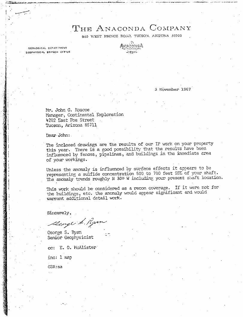
3 N6v~mber 1967
Mr_. John G. Roscoe Manager, Conti~neutal Exploration 4202 East Poe Street Tucson, Arizona 85711
Dear John:
The inclosed drawings are the results of our IP work on your p_~operty this year. Ti~ere is a good possibility that the resulzs have been influenced by fences, pi~lines, and bui! ~dings in the i~mediate area of your workings.
Unless the anomaly is influenced by surface effects it appears to be representing a sulfide concentration 500 to 700 feet SEE of your shaft. 1]%e anomaly trends roughly N 30o W including your present she~f% location,
This work should be considered as a recon co@erage. If it were not for the buildings, etc. the anomaly would appeam sig~nificant and would Warrant additional detail work.
S~icerely,
Ceorge S. Ryar Senior Geophysicist
co: E. O. ~-_Alister
inc: I mad
GSR: sa
4, "

~ ~ z . ~ ¢ ~ c ~ . . . . . . . " - -- -- ' - • . . . . . . . . . . . . . . . . . . . . . . . . . . . . ~
t
IZO0 FOOT .~3AF~CH DEPTH
I
TZ
1 T~'8
I T4.4
T I T S
s4~6"
I t
lOON:
/
t ' ! t . " I .
i
\
T4.~
7 " 4 4
• T 4 ~
R JZ E
NOTE" 5-POINT AVERAG.r.D PHASE 8H IF ' r
T~5 1
; "---~-;' ~-7ooo:t /
, _.o T ?
AO
ION
Z 6
) .','3~ 1
13
I
eTS~
2.4.
r'$1P e2~ ZG
24, z~
zro~,<.
l
• -ION I
~ ~r I $6
~V

g~
• - 7 - . 0 0 0 P - O O T S E A P , C,I'{ 9 E P T t . I I
eT D.~
TQ. 2,? T 3 8 t •
~ ~ . • X~ t 2"5 I
..r
T 2 3 J I 8ON.
R I Z E ~ o ' rE : N
~.P~t~T AvE~A~O p~ASE S~IFT I t
:I: ! ., j I
"°" l
I I
I
I )4"13G
T4"~
\ T'4I
• 7"49
80.,~
f
iON4
I . /
- - - - I T | T S
T3~ eQ3 2 4
J
I ON 1

4 . V
j ~
2 , ' - )0 : . . "
~:,o .. \ ~ .=,~!i"
, ..:, ; . _! =% ~ ,~>"-~ :~,"~-..: ../'~:':
"~"-' ..... :-:*.-:~./." " ' "I, "<.:" if,= '
,?' / , " t
4f: / ",
. / . ? ~;, : ,,
U
.. .4 >" , ' / / ; "
.. o "
f_ J"
{.. .
..-/.- ,~.ooO,. _
@....
P
\ ..,
) " , :
r j . . .~,~ \ I)..
~oo. "x. " ,>'" ) ! <~, -d,
~'t' ] ":'- >,_ -.,..
"< 40 .r"~' ~ ~
J
r-'---.,---.-~-,W i "~ d ~
%<,
"~.
!.
. . . . . . . . . . . . If . . . . . . . . . . . . . . . . . . II . . . .
• ,,, )t • • • I I I
I , ~ i I I
T 6 R h .~.. .s
TSI'( II "% If 'I ~ o
:, "~. , I I
. . . . . . . . . . . . r . . . . . . . . . ~! - \ - . . ~ . ~ : L _
• t'. ~ t""" -" 0, ; " ~ ~ ~ '
~'._..,~_"L":.~ s " ~ ,. . . . . . . . . . . . . . . . . . . . . . . . • :'~ . . . . . . . . . ~,_ : :~; , ~,\ ~'
,, ' :~ ,~ • " . ou
% . " II
• "z~...~--7 "%"" "
too~.~//,1"
'j
[ ~ . I T ~ - _ ] R I I Y O L I T E
[ i . . . . . . . i ] B I O ' [ I T E O T Z. M 0 N Z I
EL-I t l l hF~NBLE I ' !D - I , i O R I T E
E_-7 ] • - ( . .AYEI-~Ef) R O C P S {'~ D I A B A S E
. - f d::"~' (. ,', t. T f R E D A R
i f
PREI_IMINARY MAP
,:~#~,t_O,YL. PROSPECT YUMA CO., ARIZONA
l i n c h -: 1 (.dle A. G. Bluciler Feb. 1958

,.-.":4 + / . , ,
i~ " ,>'. ~
,i.?.: ~ , ; , i I:,:" ,. \ . ' 7 .. : , , . ; ' ~ 1 , . ,! ', "'7, ' : . ' : L+; '? ; ,"::: : .
" ; . ' i I . ' , ; , * , , ' , ~ i
+g'{; J + - " ' v . ' . , ' i . ::
,. "I + ' , ' :
...... ' { 1 7 ! ' . _. ' ' " -' ~'" . . . . . . . . .
" " i . + < a , : ' , ,x" + .- & ,t+-+ .~ ' -"-~;. ' s" ' " + ' L ' < " l :-++" , . t ' ~ " : : . - ' ; ~'7." '~,< +"~-': ' ;" '; . ,,:~';"'*-. ,-1,')'" '
• k + + ! .=+ s .
'" ' " " A :"7 "< ->:
• 2 " ~- . 7 , ~
- . . - ., . .
q -7. ' " 1,
. . . . . . . . . . . . ~ - - - - i . i t . . . . g : E i
, - . \ ? . " ~" i f - 1~ T,:L'. ~ 7: • [
" ~':~:""~I' .....,::~+ ~..- !.
+ 7: ' 6,:/.{, ,
'+ -. .... ".:? iL. ." . / " " : , : " ; 1 .
+ .i; ...... ~ b : ..... ': , ' "? ' -~. ' : ' :T": , u c
# : . . . . < . , . , ,. 4 . , .
. " ~ ~ , , " " """,':."o;'18 ' ~ " • " ' " <L '+" " . , :
+" <~..'.,...k~ : 4 " ' ( . . " "+ ' i • .,. / " . , , I ~ ,'.~
{
. . . . . ++'~+[+V'T- ~"~i
• = - - 2 , , , . . . . " 1,+~, • " ? . . . . Q " 7:""+. " " . . . . 3.': • % . I .',.+, '> : ' . ' , " , "
• <~,_~-" ~ • &'+,- +, H ' "" 5' ' ~ ~ / ~ / ' + ' / + ( ' ) . ' "
t ,n , r - ~ " " - '. -a.~?):~. <+:? ...
"9 ' ; ¢~ ' ~ " :'++ + ' ' " ," ~t" +*('.-," ' " "' 2 4 . • ~.~ " " +. 1 9 ~,~ , • . ' ~ 1 ~i> 5,,+ .,,,.,' .. ' , "' <:1~ ,"~. " . - " S! " - . : t : " ~ o "~ - . ',
. . . . . . ~ . ' , , ..." ~ , (/,' , ~.
. - . * T - - ~ - " - - - " - . + - - ~ . . . . . -At.:
'. ; - " ' "~-..w-,l",asa !. e: /3o e%:~i +~.7 "~ ' - . . . . . . . . . . . . . . m~, r - . . . . . . . . . . z~¢" ~4 - ~ "+ -e - - ~
\.,.. i~, -'., m.':~i ~-,i~ " + ~ ~: ,- ;'<~.,'. ~ ;, 3 0 2..} \ . - : . . . ~ : . t
. . . ' / i , t .J"". - . . . . T . . . . . 7" . . . . . " ~ . . . . . . . . ' ~,... :., :.,' X, . . ~ ... . : -
+1 -
iX ; , ,. ,~:<" 3 5 • , +
+, •
' , \ ,, • V/:.f ' ! \
,, ~' t I~.
,%
o 4 b " " . . . . . . ~ ~ ~+',.v : , " : . . . . . . . . . .
. : 6-':L. q'
+,~."
"~ d ) " . . <, ! ~ , ~ We,- : - . . . . . "~C<>.., ? ? ' - : :
-. . * , ~ [j
v~ f \ X =,
. c l + ,,\ .~2/.. !,.
• ... >t /_..~ / ' \ .L+, " '
• l .- - " ' "+ " + - • • " " - /
7 !
'fi:G fT,'t ' ', r!,(
" Q ~ • t " ' , . . ' ', . . ' ~.+' " " ' ' '" " " + ' "' :> .. ~ ,.> ' ~ x ' , ~ ( . , , < o " " - , ~ -: . . . . . . . . } ( ' i ~ " - ~ " " ' " , # ' f " + + " - "
" " L">" .... " ..... " + ~ + 4 - ? ' - . . . . . . ' . , - , ,. t , ' ' " + ~ " " l i . . . . . . . ",V'. ' , " S" . , " I : ' '
' ~ " ~ " ? + ~ ' ~ ' . i ' \ ,:X'~ . . . . . , ' , + ~ , ' ~ - . . . . . . 1 / ) <. ,',t . . l , - - - : - - '+ I , j : , . . d~ ~ . < I l l+ t . , , . I , , .,. , ,, ;Y . . i . 2 . /Y )~ ; , . , . . . . . ,t..J L , I .
, , . . . . : . . . ~ - ) ',",.r;), .7, 2U. ~ ::1 .... G;;. , . ' ~1 ,-.
• . , ' 1 ~ \ , " i
i i . - . ,
/'l~ " , , " :. 1 t . . . . h ~ " - - > +'e,:x.~ I
",~:'.,
, ' - .5 +') ._f~-
' ] ~ ,~>!i;:y / ",-::+ + : X
:,c i, I
~--77::i7-_;~-'+~,
I ~''++
k
' I L _ .'- %,.-:- . . . . . . . .
]t '. >,. I,<L -A
/ '+4 : . , ._ . . , 1 .
,,L~. . , ,
/ " ~ ' •
" , .~ "~ . . , . ' - - . " . " I ' , , . " ~ . , + v . L _- , , , r . . / ; ~ ' l k , t , , , . i t
. , - , c _ v , -,..~ ~o I d ~ " k 7 . x : " ~ - ~ ~ t.~ ~~s + '7 I 1-'
,,+ ,.
i' ~` :'-7,
; " :"-++.,'~'i ~' i < . •
*'+'<+ ~ 7"
l i:t~ " " 7 - 8 " Q : . ~
+ ' t
' ~ " "i " . " ) - , , . ' . .S . . ~ . .
. , , ;, : ; . ~
-+. ;,,<.,v .+ / m : . : , g x . . . . ~ - - ~ , , X
.~.~' ....... _.L..-::~:L.::;,.rT: ..... - . . . . ~"'+ " - . . ( . 2 - + 4 .
"7 ~,J*"4".Ai- id. l t " t - f ~ , i ~ - L '.-'1 , ' , ',
• ~ >~ , . . " ~ 4 1 ' - - - - - - ' ~ ,
(1" ~_.
• . , J "k . ' ~
41+ + '
.x., "~_~
' - - ' Z/r.{ ,.
-,2j, o , ~ < 0 ~ , 4 7 ~ /7~,,e D ~ ~. ~ , . ' ~ i ~ / . / / / ~ t I ! , .K_.Z.z_.~:! .~.~:.~:_v.<,, , 1,,,,: < " ' . ; , ' ! .... ~.,..
-$
K , , , , , : ' i'~ ,,7'. ~",'," < S . Y : r : :?:.::,-':'<" " " , " C .'r " , ' - ' - . ' ; - v . - ,
. . . . . . . . . . . . . . . . . . . . . . 1 , V , , , I , . , , I / . - " t l t ~ "v,,.,~.

SALOME AND NORT}{,~ST SALO]~E PROSPECTS SU],,~,~ AR IE S
],YEST FLANK GRANITE WASH MOIH~TAINS ELLSWORTH MINING DISTRICT YUMA COUNTY, ARIZONA
i. In the Salome and NW Salome prospects, there are approximately 130 and 40 claims respectively held by affi- davit of labor and owned by Kilroy Enterprises.
2. It seems to be an aerial photograph feature showin~ in plates 39 and ~0 that looks like an upper and lower half of a lense or tension fracture, separated at the center, which is over four and a half miles long. At the center is a curved bleached area which opens to the east, which includes the Calcite mine and which is covered by my Salome prospect.
3. There is some evidence that this is a valid feature or at least there is similar geologic movement and activity within its confines. Since a tension fracture - there is some evidence the feature has the configuration of a c~.~oid loop - is formed by kinetic forces, one should find the rock within the area similarly affected. The old geologic reports and Sid Willimms' petrographic findings indicate the quartz veins have followed the bedding as well as cutting it over a considerable distance in the area, both horizontally and vertically.
I believe the feature is also validated by the fact that they"hot spot" - represented, I believe, by one veln of tour- maline followed by pyrite, see petro, sample #43, indicating a greater degree of activity than at other areas where tourmaline is found - is located about 800 feet NE of drillhole ~K~6, the deepest hole recently continued to 2464 feet. This area is ap- proximately along an axis line drawn between the "North Invert- ed V" and the "South Normal V" shown in the photos and such axis line should receive the greatest forces in its development and, therefore, received the deepest sub-surface penetration.
To account for this feature, the description of the region by Harrison Schmitt in Titley and Hicks is interesting. He cites it as a zone of thrust faulting as well as being with- in the Texas orogenic zone, itself a left lateral thrust zone, he believes. He also states the crust is thin at a point in the northern part of the Gulf of California, not too:far away. Whether or not the crust was ripped to the magma in the area of the Granite Wash Mountains is conjectural.
~. As at C~'Yf, there is evidence of pegn~atitic activity followed by a later event that includes hypothermal chlorite - it is high iron, see petro, sample at 1970 feet, NK#6. Also, see Clark Arnold's report on drilling from 166~-2/~64. The early stage of quartz and microcline becomes raore clearly evident
// SAL0i~ AREA PROSPECTS SDU~H~i~_~YE.S Page 2
downhole, see petrographic samples at 2234 and 2298, ~#6. Some high ratio zinc/copper zones have been found in the hole along with zeolites which, again similar to the events at CWT, seems to grade into the lower quartz-microcline invasion.
~. Another significant finding is the epidote found in the last 160 plus feet of NiE~6 which I believe is the border zone over the deep prospec~ and similar to the epidote that borders the bleached zone at the surface. Art Blucher's al- ternative that the bleached zone is the barely exposed apex of deep-seated veinlet and disseminated mineralization seems to be right. I believe the solutions have come up through and along the axis line of the fracture, spread out and came to the present surface at the contact between the sedLments and the tonalite (hornblende schist) rock that is surrounded by the bleachea area. !~!~6 has followea along the edge of the apex and has entered the m~i~n alteration area by the penetration of the postulated epidote border zone.
6. The pegmatitic activity is widespread as is repre- sented by a more solid stage in the form of quartz veins, peg- matite dikes and aplite (felsite) indicated on HCKensie's map going at least from ~NK#~6U~east about to the KOANS group of claims and to the fei~g£t~e outcrop, an east-west distance of a mile.
7. The geochems and spectographs indicate a slight moly anoma!ism.at about 2300 feet, just above the contact with the epidote, %~hich I believe reflects the apex solutions, not the main zone itself; a build-up of titanium and boron in this zone is also significant. There seems to be a reversal of fluorine and phosphorus values in the epidote zone which indicates to me the epidote does border at depth the topaz and fluorite found at shallower depths and in the bleached area. The P was run because of the triplite mineral found in sample ,v43. Trip- lite, according to Ransom, is a f]uo-phosphate of iron and manganese, a rare mineral usually found with tungsten minerals in pegmatite dikes.
8. I would expect to eventually penetrate a limestone zone if the rocks thus far are Paleozoic. Perhaps the epidote zone indicates going into or being near limestone rather than into a calcic igneous rock. Thus, the pe~nuatitic actdvity could be expressed as a limestone replacement orebody. Also, this activity could grade into contact metamorphism or, con- ceivably, with the amount of fluorine present could result into something similar to Climax where the moly is found in quartz
• veins with topaz and fluorite.
9. The I.P. anomalism is widespread. The reason for deepening i~6ilwas a compromise hole to test the deep anom- alism as W@~ll as to stay close to the bleached area. If the axis line represents the source, then the possibility exists

SALOME AREA PROSPECTS SUMMARIES Page 3
that the volatiles are in and around the bleached zone and grades out into typical mesothermal hydrothermal alteration, lacking the volatiles, as found in NK#3. This would be sim- ilar to CNT where it, as the source, grades out to the per- ipheral orebodies. The more the volatiles, the greater the chance for moly and tungsten. Relative to the situation where tungsten was the main metal, both Utah International and Ken- nametal have expressed interest in finding reserves and would offer a bailout possibility.
lO. The lC~J Salome prospect has encountered trace amounts of tourmaline in the OBK#1 towards the bottor~ of the hole which nay be related to the photo feature.
ll. The Three Musketeers mine, located west of the Yuma mine produced tungsten and rumor has it that drilling has found an economic orebody with significant muounts of gold being involved.
12. At the Topaz claims, 30-~0 miles west of the pros- pects, radioactive material was found with moly and scheelite in quartz veins, see enclosure.
13. I am suggesting that the Salome prospect be deepen- ed to penetrate the epidote zone to see what lies underneath it. However, any option would include all cla~as in the Saltine and ~P~.~ Salome areas.

g
ADDITIONAL COF~MENTS TO THE SALOME AND NOETHI~ST r _ PROSPECT SUndAE IE S
WEST FLAI~K - GRANITE WASH MOUNTAINS ELLSWORTH MTNING DISTRICT YUMA COUNTY, ARIZONA
1. The Salome Prospect claim group has been expanded to include about 179 claims, all of which are believed to be valid. 0 y~ !~
2. In November, 1981, a 6~" hole was air hammered to 1365 feet. The following were encountered from visual exam- ination of the chips and from petrography.
a. The location of the hole, NKI!!~I5, approximately at a south contact with the large bleached zone east of the Calcite Mine did not intercept the intense alteration on a continuing basis but, instead, all samples had chips of, one, quartz with hem./mag., two, sericite/muscovite, hem./mag. (in- tense alteration) and three, less altered gneiss at the top of the hole and sediments - at least in one zone - at the bottc~ and this less altered rock had chlorite, epidote and hem./mag, with occasional pyrite. This suggests quartz veins with vein walls and nearby rock altered to sericite/muscovite, hem./nag, as semblage.
b. Sulphides in the quartz fragments become evident at depth along with the hem./mag, of up hole which may be significant. Also, pyrrhotite becomes distinctly more evident in patches and veins at depth and its appearance seems to start about 1200-1300 feet where the sedimentary-type rock (calc- shale) seems to be involved and more prominent than pyrite, I believe.
c. In addition to the pyrrhotite, brown biotite becomes much more evident down hole and stilbite (a zeolite) was noted in one petrographic specimen down hole.
d. Because pyrrhotite was encountered in NK #6 from about 1000-2100 feet in intermittent intercepts, a "tarnished pyite resembling bornite" - probably pyrrhotite - was described with copper in the Calcite Mine ~d pyrrhotite is present in the Ytuna Mine, the drilling of NKI!#I5 becom@s more interesting below 1365 feet for the next phase.
e. The confirming of pyrrhotite as a significant min- eral in the hydrothermal system gives stronger evidence that pegmatitic activity is indeed involved and makes tungsten a better possibility, in light of the Three Musketeers Mine west of the Yuma Mine, as being a part of the metal-mix in any ore

- r •
e °
Page 2
ADDITIONAL COMMENTS RELATIVE TO THE GRANITE WASH MTNS. PROSPECTS
~o;~y that would be found at depth under the prospect.
f. It now becomes more inberesting to drill the NE #1i~ deeper for another reason. The ~ijii#6111~from 2302 to total depth of 3416 had a csmmon chacterist~c different frmn up the hole. The assemblage found was mentioned previously but not the fact thatvisually the interval was "alive"-looking with colors mainly due to the hematite and piemontite - a mansanese miner- al related to epidote. This fa~t, along with an 18 degree drlft from vertical putting the bottom of the hole 670 feet SW of the collar and having the drill core give vertical and horizontal information as well, warrants the drilling of the NE #15 deep- er to see what the meanin~ is of the findings in the NK #6, as- suming the 2302-3416 interval in NKI~#6 is propylitic.
g. The generally uniform characteristic of the NK #15 samples indicate to me the hole is near or at the apex of the hydrothermal system as opposed to the E~#lO where the intense- ly altered rock abruptly changes at about 410 feet and the ~ole goes into a biotite-chlorite rock.
h. Coincidentally or not, two geologists from Anschutz - one with gold deposit experience and the other having a massive sulphide background were in the area at the time and visited the property. I believe there is an increasing possibility, especially with the deepening of the N K #15, they, along with Phillips, would be interested in the prospect for a combined metals-oil/gas exploration test or at least for one of Phillip's proposed "strat" test looking for deep '~0verthrust" and/or sedimentary information.

i
FURTHER ADDITIONAL CO~HKENTST0 THE SALOME AND
NORTHWEST PROSPECT SUMMARIES
WEST FLANK - GRANITE WASH MTNS. - ELLBWORTH MINING DISTRICT LA PAZ (FORMERLY YUMA) COUNTY, ARIZONA
Eii i#~i was NC wirelined cored from I. In 1982, the ~s,., ..... 1365 feet to 2214 feet.
2. The main points of interest are:
a. The intercept of a possible zinc build-up at the 2,000 foot level that roughly corresponds to the encount- ering of a small zinc geo-chem build-up at roughly the same depth in the NK ?~6; see Sid Williams petrography and geo-chem
~ ....
work.
b. ~zd~ite and chalcopyrlte seen sparsely down hole that may be related to hornblende in late metamorphic or con- tact metamorphic event. The rhyolites and diabasic dikes and sills - also considerable quartz - may represent a deep- seat- ed intrusive with a contact metamorphic event at depth.
c. Datolite was encountered at the bottom of the hole which, along with the zeolites, may confirm the remobill- zatlon of the hydrothermal solutions carrying the volatiles.
~3. In August, 1984, a NX hole, the deepening of I:NK #~O, was drilled to around i130 feet. It is located approximately 150~feet from the Calcite Mine shaft, being approximately in the center of the bleached zone. The following were noted:
a. gypsum veins were distinctly evident as late veins carrying sulphides and gives greater weight to the poss- ibility that limestone at depth has been acted upon.
b. A 44 foot interval from 984-1028 feet showed a very slight gold-silver anomalism which may be significant in the light of the possible zinc zoning found, a cobalt-nlckel anomalis~ at around 310G-feet in the ~#6 ~ and a finding of tellurium in the Desert Queen Mine, a~j~cent to the western
of zoning is correct (among edge of the claims. If Emmons theory others), an arsenopyrlte zone may be below the zinc zone. Ar- senopyrite, sometimes carrying cobalt, fottnd in the "Mother Lode" districts of California with the tellurides.
c. Relative to metallization, there is a slight indication that tungsten geo-chem values are slightly a~oma- lons at depth in the NE~6. There is tungsten in the area at

I
FURTHER ADDITI 0NAL COMMENTS .....................
PAGE 2
the Three Musketeers Mine west of the Yuma Mine to the north. Also, a slight copper anomaly is found in the NK #14~ east of the Calcite Mine in the pediment and associated with it is a slight niobium anomaly, niobium oftentimes being associ- ated with tungsten.
The potential for oil and gas accumulation at depth i~ highly speculative but certain facts, interpretations and questions exist and arise which are of interest, I think:
a. The precedent for finding oil and gas under metallization is found in Nevada.
b. Seismic work has been done in the area and a second survey was done south of Salome. A major unconformity is believed to exist below 10,000 feet, as per several mining geologists and confirmed to me by a Phillips' geologist, stemming from inter- pretation of old seismic work.
c. Wilson's map shows Eesozoic sediments in the area. Assum- ing this is true as is Sc~n~tt,s statement that during Cretaceous time the area of the TexasZone was the site of thick deposition of near shore sedimentary rock, where are the Cretaceous rocks in the prospect area? Has a sheet of Mesozoic and older ones been thrusted over younger ones rather than a simple erosional explanation?
d. The aerial photo tension fracture (cymoid loop?) appears to have been wrenched and this seems to be confirmed by the remobi- lization of hydrothermal minerals, It is believed these solutions are of Laramide age so that significant post-Cambrian structural deformation has taken place. This deformation may be involved in the considerable "arching" between Wickenburg, Az. and five miles west of the prospect area near Hope, Az., a distance of about six- ty miles. Sohio's Mukluk prospect on the North Slope was described as an "arch" and one canspeculate as to the significance of the one in the prospect area.
e. Schmitt reports a thin crust was meas~ured in a drill hole in the Gulf of California. I raise the questions, one, would a rela- tively thin crust be ~ more plastic than a thick one and, two, is the development of the above referred to and unusuallly large frac- ture in my prospect area further indication of such plasticity? Also, Schmitt makes the comment that the Texas Zone may be the contact between marine and continental crusts.
f. The drill hole, if successful, could be continued as a strat-
igraphic test for rock type data.