mitigation strategies for specific · pdf filemitigation strategies for specific hazards rafi...
TRANSCRIPT

MITIGATION STRATEGIES FOR SPECIFIC HAZARDS
RAFI AHMADUnit for Disaster Studies, Department of Geography &
Geology, University of the West Indies, Mona, Kingston 7, Jamaica
1. Natural hazards of principal concern to the 1. Natural hazards of principal concern to the Caribbean and Latin American region are: Caribbean and Latin American region are: HurricanesHurricanesDrought and desertificationDrought and desertificationGeologic hazards (earthquakes, volcanic Geologic hazards (earthquakes, volcanic eruptions, tsunamis)eruptions, tsunamis)FloodsFloodsLandslidesLandslides

2. Multiple hazards:While hazard events often materialize as discrete events, their occurrence may also overlap. For example:Hurricanes and tsunamis may produce floods; Earthquakes may trigger landslides; Erosion and sedimentation are frequently the result of flooding, desertification, or unsound land management practices rather than hazards in their own right.
• These hazardous processes are not only important because of their frequency and the most harm they cause to human life and property, but also because they may be exacerbated by development practices.
• The most important thing about these hazards is that means of reducing their impact are now available.

At the start of a development study, the planner should attempt to determine from the information available whether any particular hazard constitutes a problem in the study area. In the absence of sufficient information for these preliminary decisions, the planner usually decides by default: the hazard in question will not be considered.
•• However, it is no longer necessary to make these However, it is no longer necessary to make these default determinations since new techniques in default determinations since new techniques in hazard assessment easily facilitates obtaining hazard assessment easily facilitates obtaining hazard data in various platforms including GIS.hazard data in various platforms including GIS.
• The information required to evaluate a natural hazard can often be obtained as a part of the planning process and it is possible to make hazard assessments part of the study without incurring unreasonable costs or sacrificing other aspects.
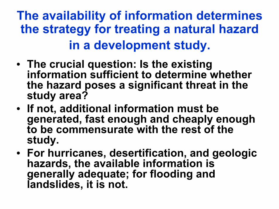
The availability of information determines the strategy for treating a natural hazard
in a development study.• The crucial question: Is the existing
information sufficient to determine whether the hazard poses a significant threat in the study area?
• If not, additional information must be generated, fast enough and cheaply enough to be commensurate with the rest of the study.
• For hurricanes, desertification, and geologic hazards, the available information is generally adequate; for flooding and landslides, it is not.

SUMMARY OF STRATEGIES FOR INCORPORATING NATURAL HAZARD CONSIDERATIONS INTO
DEVELOPMENT PLANNING STUDIES BASED ON INFORMATION AVAILABILITY
• 1. HURRICANES•• If hurricanes are found to be a threat, the study can go directlIf hurricanes are found to be a threat, the study can go directly to y to
locallocal--level vulnerability reduction strategieslevel vulnerability reduction strategies
•• Mitigation actions using established structural and nonMitigation actions using established structural and non--structural structural techniques can be undertaken as soon as it is established that ttechniques can be undertaken as soon as it is established that the he project falls within the hurricaneproject falls within the hurricane--prone belt because there is prone belt because there is currently no practical way to relate mitigation strategies to currently no practical way to relate mitigation strategies to different hurricane intensitiesdifferent hurricane intensities
•• Prepare for storms so as to reduce the damage they cause, with Prepare for storms so as to reduce the damage they cause, with emphasis on procedures for small towns and villages.emphasis on procedures for small towns and villages.
2. DESERTIFICATION2. DESERTIFICATION• The information available on desertification for the
region is very general, but it can be augmented for a study area easily and at low cost to the level needed for policy orientation and project identification and formulation.
• Desertification potential must be refined in the context of a development study precisely because the degree of that potential is directly related to the impact of development activities on natural conditions.
• Carry out a desertification analysis using universally available parameters.
• Prepare desertification potential maps for each political subdivision subject to the hazard.
3. GEOLOGIC HAZARDS• The information available on seismic,
volcanic and tsunami hazards is sufficient to determine in the preliminary mission whether they constitute a significant threat in the study area.
• Vulnerability reduction, however, is a site-specific matter, with emphasis on micro-level zonation and determination of severity and probability characteristics.
• These determinations require relatively elaborate and expensive techniques that are suitable only for feasibility and engineering design studies.

4. FLOODING AND LANDSLIDES4. FLOODING AND LANDSLIDES• The information available on flooding
and landslide hazards is generally spotty or nonexistent.
• However, with a combination of historical event studies and new mapping techniques, these hazards can be evaluated at costs and scales appropriate to the corresponding stage of a development study.

DETAILED DESCRIPTION OF MITIGATION STRATEGIESHURRICANESSmall countries are particularly vulnerable tohurricanes, since they can be affected over their entirearea, and major infrastructure and economic activitiesmay be crippled in a single event.• The reduced death rates are due almost entirely to
improved warning systems and preparation. • Some progress has been made toward reducing
damage, but that is a more difficult issue.• To assess risk as a step in the process of
preparing a hurricane hazard mitigation plan, a planner first determines whether the study area lies within the belt of commonly occurring hurricanes. If it is located in "Hurricane Alley", the planner studies records of past storms and land uses and correlates them with probable future land use and population changes.

HURRICANE TRACKS IN THE CARIBBEAN, From: Munich Re

1. a. UNDERSTANDING THE HAZARD, VULNERABILITY and RISK:In the Caribbean island countries hurricanes cause more damage and disturb the lives of more people than any other natural hazard. The hurricane season of the Greater Caribbean Basin is June through November, although 84 percent occur in August and September.
2005 Hurricane season defied the popular saying in the Caribbean
“JUNE TOO SOONJULY STANDBY
AUGUST IT MUSTSEPTEMBER REMEMBER
OCTOBER ALL OVER”

Hurricanes cause damage by their high winds, heavy rainfall, andstorm surge.
• Winds up to about 162 km/hr cause moderate damage such as blowing out windows. Above that velocity winds begin to cause structural damage.
• Heavy rainfall can cause river flooding, putting at risk all structures and transportation facilities in valleys, and can also trigger landslides.
• Storm surge is a rise in sea level due to on-shore winds and low barometric pressure. Storm surges of 7.5 meters above mean sea level have been recorded, and a surge of over 3 meters is not uncommon for a large hurricane.
• Storm surges present the greatest threat to coastal communities.Ninety percent of hurricane fatalities are due to drowning caused by storm surges.
• If heavy rain accompanies a storm surge, and the hurricane landfall occurs at a peak high tide, the consequences can be catastrophic.
• The excess water inland creates fluvial flooding, and the simultaneous increase in sea level blocks the seaward flow of rivers, leaving nowhere for the water to go.

Most cities in the West Indies are in low coastal zones threatened by storm surge, and population movement to these high-risk zones greatly increases vulnerability.
The economic sectors most affected by hurricanes are agriculture and tourism. Bananas, one of the most important Caribbean crops, are particularly vulnerable.
The tourism sector in the Caribbean is notorious for its apparent disregard of hurricane risk. Not only does a hotel built with insufficient setback risk damage by wave action and storm surge, the building also interferes with the normal processes of beach and dune formation and thus reduces the effectiveness of a natural protection system.
• Once the risks are defined and quantified, planners and engineers can design appropriate mitigation mechanisms. Obviously, these are most cost-effective when implemented as part of the original plan or construction.

b. EXAMPLES OF EFFECTIVE MITIGATION b. EXAMPLES OF EFFECTIVE MITIGATION MEASURESMEASURES
• AMONG THE IMPORTANT STRUCTURAL STRATEGIES are building codes that control the design and construction of buildings and, in public works, the construction of breakwaters, diversion canals,and storm surge gates and the planting of tree lines to serve aswindbreaks.
• AT THE NATIONAL LEVEL NON-STRUCTURAL MITIGATION STRATEGIES INCLUDE CAMPAIGNS TO CREATE A PUBLIC AWARENESS OF WARNING SERVICES AND PROTECTIVE MEASURES, since informed citizens are more likely to check the condition of their roofs and other structures at risk.
• Taxation of investment in high-risk land is a potentially important strategy that has not been tried widely.
• Insurance can also be structured to encourage sound land use and structural mitigation actions.

RURAL COMMUNITIESThe above approaches may be effective in the largest urban settings where communications are good and institutional arrangements are
firmly in place.
But national emergency preparedness offices usually do not have the resources to function effectively in areas of low population density
when faced with widespread catastrophes such as hurricanes.
An alternative is to prepare small towns and villages to respond to
emergencies by their own means.• THE PROCESS OF PREPARING COMMUNITY LEADERS TO COPE WITH
HURRICANES CONSISTS OF SIX STEPS: •• Preparing an inventory of lifeline networks and critical facilitPreparing an inventory of lifeline networks and critical facilities. ies. •• Learning the operation of these networks and facilities and theiLearning the operation of these networks and facilities and their potential r potential
for disruption by hurricanes. for disruption by hurricanes. •• Checking the vulnerability of the lifelines and facilities throuChecking the vulnerability of the lifelines and facilities through field gh field
inspection and investigation. inspection and investigation. •• Establishing an effective working relationship with the agenciesEstablishing an effective working relationship with the agencies and and
companies that manage the infrastructure and services of the companies that manage the infrastructure and services of the community. community.
•• Developing an understanding of the total risk to the community. Developing an understanding of the total risk to the community. •• Formulating a mitigation strategy.Formulating a mitigation strategy.
2. DROUGHT AND DESERTIFICATION; Droughts are prolonged dry periods in natural climate cycles.
In arid and semi-arid regions, dry periods that are much drier than average and wet periods that are much wetter are common. These variations cause serious problems.• Desertification is the spread of desert-like conditions
induced by human activities with consequent decrease in biomass production.
• It is manifested by loss of productive soils, water and wind erosion, creation and movement of dunes, water logging, reduced quantity and quality of surface and subsurface water, and rapid depletion of vegetative cover.
• Desertification is a result of many interrelated phenomena, with human-induced erosion and salinization often exacerbating natural drought.

Soil erosion by moving water occurs on any sloping land but can be accelerated by overgrazing, deforestation, certain agricultural practices, road construction, and urban development.
Erosion by wind can take place on flat land lacking vegetative cover.
Erosion results in loss of soil nutrients, downstream damage by the deposition of sediments generated by the erosion, and depletion of water storage capacity.
Salinization most often occurs on irrigated land as the result of poor water control. Salts accumulate because of flooding of low-lying lands, evaporation from depressions having no outlets, and the rising of groundwater close to the soil surface.
Many of the problems associated with desertification canbe circumvented by sound planning. This requires information about physical conditions and the sociThis requires information about physical conditions and the socialal--culturalculturalcontext of the planning area. If the area has the potential for context of the planning area. If the area has the potential for desertification, adesertification, adesertification hazard assessment should be undertaken at the vedesertification hazard assessment should be undertaken at the very outset of a ry outset of a
development planning study. development planning study.

THE FOLLOWING ARE SOME MITIGATION MEASURES FOR THE FOLLOWING ARE SOME MITIGATION MEASURES FOR OVERGRAZING, DRYOVERGRAZING, DRY--LAND FARMING, AND SALINIZATION.LAND FARMING, AND SALINIZATION.
Addressing the problem of overgrazing starts with recognizing the needs of the pastoralists. Reducing the number of stock and introducing improvements such as fencing and watering points can help.
The difficulties of dry-land agriculture include low and unreliable rainfall, hot and dry winds, dependence on extensive rather thanintensive farming, a restricted choice of crops, soils that are highly susceptible to wind erosion, and crop yields that are seldom sufficient to justify major investment in chemicals or erosion control measures. Thus the prospects for mitigating problems of dry-land farming are not as favorable as those for range lands.
Major dry-land farming problems are erosion by wind and water and loss of fertility owing to the removal of nutrients by crops.
Fertility can be restored with fertilizer-expensive over the short term, but the long-term alternative is severe loss of production. Coarse, sandy soils and soils on steeply sloping land are the most difficult to improve.

Mitigation of soil erosion problemsMitigation of soil erosion problems can draw on an array of wellcan draw on an array of well--known soil and water conservation practices, for example,known soil and water conservation practices, for example,
use of droughtuse of drought--resistant plants, resistant plants, fallow periods and mulches, fallow periods and mulches, the installation of waterthe installation of water--retaining terraces, retaining terraces, wide spacing of plants in and between rows, wide spacing of plants in and between rows, special practices such as minimum tillage and zero tillage, special practices such as minimum tillage and zero tillage, and leaving crop residues in place after harvesting. and leaving crop residues in place after harvesting.
With some experimentation it is usually possible to find a set oWith some experimentation it is usually possible to find a set of f management practices that the farmer will accept and that will management practices that the farmer will accept and that will result in greater profits for him within a few years. result in greater profits for him within a few years.
SalinizationSalinization can be mitigated with currently available can be mitigated with currently available technology. Leaching is a practical way to remove technology. Leaching is a practical way to remove excess salts from soils, but requires good drainage.excess salts from soils, but requires good drainage.

•• Essentially, what is needed is properly designed Essentially, what is needed is properly designed and managed irrigation systems. and managed irrigation systems.
•• This involves, at a minimum, consideration of the This involves, at a minimum, consideration of the peculiarities of the natural soil situation (e.g., peculiarities of the natural soil situation (e.g., chemical composition of ground water, chemical composition of ground water,
•• salinity of soils up to the water table, salinity of soils up to the water table, •• conditions of natural drainage), conditions of natural drainage), •• deep drainage installations to carry off excess deep drainage installations to carry off excess
water, water, •• and avoidance of overand avoidance of over--watering. watering.
•• OverOver--watering is a common consequence of the watering is a common consequence of the propensity to undercharge for water; it can result in propensity to undercharge for water; it can result in such heavy use of it as to result in such heavy use of it as to result in waterloggingwaterlogging and and salinizationsalinization. .

3. GEOLOGIC HAZARDS3. GEOLOGIC HAZARDSThe most damaging geologic hazards are The most damaging geologic hazards are earthquakes, earthquakes, volcanic eruptions, volcanic eruptions, tsunamis tsunamis LandslidesLandslidesGeologic hazards are characterized by • very rapid onset; • geographically limited impact (the phenomena
occur in limited and clearly defined zones in Latin America and the Caribbean);
• lack of predictability except in the most general sense; and
• extreme destructiveness

In spite of their relative rarity, earthquakes in urban areas, pyroclasticflows and mudflows caused by volcanic eruptions, and flooding due to tsunamis are some of the most damaging and feared natural hazards.
THIS COMBINATION OF CHARACTERISTICS MAKES THE NON-STRUCTURAL STRATEGY OF AVOIDANCE THE BEST WAY TO COPE WITH GEOLOGIC HAZARDS.
THE AVOIDANCE STRATEGY, HOWEVER, REQUIRES INFORMATION ABOUT THE THREAT OF THE HAZARDS AS EARLY AS POSSIBLE IN THE DEVELOPMENT PLANNING PROCESS.
•• The information requirements are very general early in the proceThe information requirements are very general early in the process, ss, becoming more explicit with each successive stage so as to provibecoming more explicit with each successive stage so as to provide de answers to the following questions in order: answers to the following questions in order:
•• Does the hazard pose a threat in the study area? Does the hazard pose a threat in the study area? •• Is the danger great enough to merit mitigation?Is the danger great enough to merit mitigation?•• What kinds of mitigation mechanisms are appropriate? What kinds of mitigation mechanisms are appropriate? •• What are the costs and benefits of a particular mitigation measuWhat are the costs and benefits of a particular mitigation measure, in re, in
terms of both economics and quality of life?terms of both economics and quality of life?
Scientific data to answer the first question exist for the princScientific data to answer the first question exist for the principal ipal geologic hazards in most of Latin America and the Caribbean.geologic hazards in most of Latin America and the Caribbean.

EARTHQUAKESEARTHQUAKESTHE PRINCIPAL EARTHQUAKE HAZARDS ARE THE PRINCIPAL EARTHQUAKE HAZARDS ARE
GROUND SHAKING, GROUND SHAKING, FAULT RUPTURE, FAULT RUPTURE, LANDSLIDES AND LANDSLIDES AND PROPENSITY TO LIQUEFACTION.PROPENSITY TO LIQUEFACTION.
•• Two kinds of information are needed to evaluate Two kinds of information are needed to evaluate earthquake threat: earthquake threat: –– the potential severity of an earthquake and the potential severity of an earthquake and –– the likelihood that a damaging earthquake will occur during the likelihood that a damaging earthquake will occur during
a specific time frame. a specific time frame.
•• When either type of information is not available, a When either type of information is not available, a partial evaluation can be made with the information partial evaluation can be made with the information that does exist.that does exist.
•• POTENTIAL SEVERITY IS USUALLY DEFINED POTENTIAL SEVERITY IS USUALLY DEFINED HISTORICALLY; that is, the largest earthquake HISTORICALLY; that is, the largest earthquake determined to have occurred in an area is taken as determined to have occurred in an area is taken as the maximum that is likely to occur there again. the maximum that is likely to occur there again.

A MAP OF EARTHQUAKE INTENSITIES OF THE CARIBBEAN HAS A MAP OF EARTHQUAKE INTENSITIES OF THE CARIBBEAN HAS BEEN PREPARED that delineates zones according to the Modified BEEN PREPARED that delineates zones according to the Modified MercalliMercalli Intensity (MMI) scale, a 12Intensity (MMI) scale, a 12--unit scale of increasing shaking unit scale of increasing shaking intensity (CDMP, 1999). intensity (CDMP, 1999).

In this scale, MMI VI, for example, is defined as follows: "FeltIn this scale, MMI VI, for example, is defined as follows: "Felt by all; many by all; many frightened and run outdoors; falling plaster and chimneys; damagfrightened and run outdoors; falling plaster and chimneys; damage e small."small."
At MMI X, roughly equivalent to magnitude 7 on the Richter scaleAt MMI X, roughly equivalent to magnitude 7 on the Richter scale, "Most , "Most masonry and frame structures destroyed; ground cracked; rails bemasonry and frame structures destroyed; ground cracked; rails bent; nt; landslides." landslides."
Taking MMI VI as a cutTaking MMI VI as a cut--off, on the assumption that mitigation measures off, on the assumption that mitigation measures would be difficult to justify economically at or below this levewould be difficult to justify economically at or below this level, mitigation l, mitigation measures should be considered for areas of MMI VII and above. measures should be considered for areas of MMI VII and above.
If, for example, a study area has an 80 percent probability of bIf, for example, a study area has an 80 percent probability of being struck eing struck by an MMI X earthquake in the next 20 years, the planner recogniby an MMI X earthquake in the next 20 years, the planner recognizes that zes that reality as something that cannot be ignored. reality as something that cannot be ignored.
•• Active fault zonesActive fault zones--the locus of potential the locus of potential earthquakes and unstable ground unsuitable for earthquakes and unstable ground unsuitable for locating infrastructure must be identified.locating infrastructure must be identified.

Once it is recognized that an area is prone to Once it is recognized that an area is prone to earthquakes, it is important to prepare maps of highearthquakes, it is important to prepare maps of high--risk risk areas delineating zones subject to the particular hazards.areas delineating zones subject to the particular hazards.• Some hazard and risk mapping has been completed in
Latin America and Caribbean countries, but in general it is not very useful to engineers, government officials, or planners for site-specific engineering design work.
• Some national and regional projects have begun to incorporate recent scientific and technological advances into seismic hazard and risk mapping, and are producing work of much higher quality.
• The availability of existing information, and more particularly the quality of that information, must be determined for areas under seismic threat and supplemented as necessary.

THE SCIENCE OF EARTHQUAKE ENGINEERING HAS DEVISED BUILDING TECHNIQUES AND MATERIALS THAT RESIST ALL BUT THE STRONGEST EARTH SHAKING.
•• Building codes stipulate the application of these structures. Building codes stipulate the application of these structures.
•• Retrofitting may provide important economic benefits for large Retrofitting may provide important economic benefits for large buildings and public infrastructure. buildings and public infrastructure.
•• It is also of great importance in saving lives of millions who lIt is also of great importance in saving lives of millions who live in ive in nonnon--engineered mud constructions. engineered mud constructions.
•• Basic doBasic do--itit--yourself techniques can prolong resistance to shaking of yourself techniques can prolong resistance to shaking of these structures long enough to allow people to escape before these structures long enough to allow people to escape before collapse. collapse.
•• With regard to fault rupture, the best way to cope with this hazWith regard to fault rupture, the best way to cope with this hazard is to ard is to avoid the narrow zones prone to movement along faults. avoid the narrow zones prone to movement along faults.

VOLCANIC ERUPTIONSVOLCANIC ERUPTIONSTHE PRINCIPAL VOLCANIC HAZARDS ARE:THE PRINCIPAL VOLCANIC HAZARDS ARE:PYROCLASTIC FLOWS,PYROCLASTIC FLOWS,MUDFLOWS (OR LAHARS),MUDFLOWS (OR LAHARS),ASH FALLS,ASH FALLS,PROJECTILES, ANDPROJECTILES, ANDLAVA FLOWS.LAVA FLOWS.These hazards usually do not constitute a serious problem These hazards usually do not constitute a serious problem more than 30 km from the source, more than 30 km from the source, although in exceptional cases; lahars or an ash fall can cause although in exceptional cases; lahars or an ash fall can cause serious damage as much as 60 km away.serious damage as much as 60 km away.•• Because some of the most terrible eruptions have Because some of the most terrible eruptions have
come from volcanoes that had been regarded as come from volcanoes that had been regarded as dormant, dormant, an active volcano is defined as one that has an active volcano is defined as one that has erupted in the past 10,000 yearserupted in the past 10,000 years (the Holocene Epoch (the Holocene Epoch of geologic time). of geologic time).
•• The degree of threat is gauged by periodicity, with The degree of threat is gauged by periodicity, with shortshort--term periodicity (interval between eruptions of term periodicity (interval between eruptions of less than 100 years) posing a greater threat than longless than 100 years) posing a greater threat than long--term periodicityterm periodicity-- return period.return period.

The degree of threat is gauged by return period, with The degree of threat is gauged by return period, with shortshort--term return period (interval between eruptions of term return period (interval between eruptions of less than 100 years) posing a greater threat than longless than 100 years) posing a greater threat than long--term periodicity. term periodicity. •• The information for each volcano should be The information for each volcano should be
catalogued and must include location, periodicity, catalogued and must include location, periodicity, date of last eruption, a measure of the size of the date of last eruption, a measure of the size of the largest historic eruption, and the hazards associated largest historic eruption, and the hazards associated with its eruptions. with its eruptions.
•• If a study area lies within 30 km of a volcano with If a study area lies within 30 km of a volcano with shortshort--term periodicity, a volcanic hazard zonation term periodicity, a volcanic hazard zonation map showing the likelihood of occurrence and map showing the likelihood of occurrence and severity of each hazard in the vicinity of the volcano severity of each hazard in the vicinity of the volcano should be prepared as part of the planning process. should be prepared as part of the planning process.
•• Few mitigation measures other than avoidance are Few mitigation measures other than avoidance are effective in resisting volcanic hazards such as lava effective in resisting volcanic hazards such as lava flows or flows or pyroclasticpyroclastic flows. flows.
•• Steeply sloping roofs help to reduce damage from Steeply sloping roofs help to reduce damage from heavy ash falls. heavy ash falls.

TSUNAMISTSUNAMISThese awesome seismic sea waves are caused by largeThese awesome seismic sea waves are caused by large--scale sudden scale sudden movement of the sea floor, usually due to earthquakesmovement of the sea floor, usually due to earthquakes , , by collapses by collapses of volcanic edificesof volcanic edifices and and submarine landslidessubmarine landslides..In Latin America they are a significant threat only on the west In Latin America they are a significant threat only on the west coast of coast of South America, where every offSouth America, where every off--shore earthquake over a magnitude shore earthquake over a magnitude 7.5 is potentially 7.5 is potentially tsunamigenictsunamigenic. . While they occur in the Caribbean, in the preWhile they occur in the Caribbean, in the pre--2000 era they were 2000 era they were regarded as so infrequent and were thought to have caused so litregarded as so infrequent and were thought to have caused so little tle damage, mitigation was difficult to justify economically. damage, mitigation was difficult to justify economically. However, since 2000 new research data have been published includHowever, since 2000 new research data have been published including ing signatures of signatures of paleotsunamispaleotsunamis( historic and pre( historic and pre--historic events) all over historic events) all over the Caribbean that has changed the older view.the Caribbean that has changed the older view.
•• The graphic scenes of 2004 Indian ocean tsunami seen all over thThe graphic scenes of 2004 Indian ocean tsunami seen all over the e world have changed the tsunami perspective in the political worlworld have changed the tsunami perspective in the political world.d.
•• Even where tsunamis pose a significant threat, mitigation is Even where tsunamis pose a significant threat, mitigation is feasible only for urban concentrations. feasible only for urban concentrations.
•• The construction of sea walls along lowThe construction of sea walls along low--lying stretches of coast, lying stretches of coast, planting tree belts between the shoreline and builtplanting tree belts between the shoreline and built--up areas, and up areas, and zoning restrictions provide some measure of help, but effective zoning restrictions provide some measure of help, but effective warning and evacuation systems are the most reliable defense warning and evacuation systems are the most reliable defense against this intractable hazard.against this intractable hazard.

North AmericaNorth America-- Caribbean plate boundary zone is marked by alongCaribbean plate boundary zone is marked by along--strike strike transition in structural styles from west to east comprising zontransition in structural styles from west to east comprising zones of es of transtensiontranstension (NW corner), strike(NW corner), strike--slip, slip, transpressiontranspression, and oblique collision , and oblique collision between the Caribbean plate and the Bahamas carbonate platform. between the Caribbean plate and the Bahamas carbonate platform. (Figure 1 (Figure 1 from N. R. from N. R. GrindlayGrindlay, , M.HearneM.Hearne, & P. Mann, , & P. Mann, EOS,VolEOS,Vol. 86, No. 12, 22 March 2005). 86, No. 12, 22 March 2005)Black arrowsBlack arrows: Caribbean: Caribbean--North America plate velocity (18North America plate velocity (18--20 20 ±±3 in mm/yr) 3 in mm/yr) predictions of predictions of DeMetsDeMets et al. [2000] based on GPS velocities.et al. [2000] based on GPS velocities.Black circlesBlack circles ((○○1692) are locations of 1692) are locations of six historical tsunamis in the northern six historical tsunamis in the northern Caribbean with documented loss of human life:1780 and 1692 (JamaCaribbean with documented loss of human life:1780 and 1692 (Jamaican area), ican area), 1842, 1946, 1918, 1867. 1842, 1946, 1918, 1867.
•• 4. FLOODS:4. FLOODS:Although a most recurrent hazard throughout the Although a most recurrent hazard throughout the Caribbean, floods are a misunderstood natural process. Caribbean, floods are a misunderstood natural process. For example, 2004 Flood Disaster in Haiti was a classic For example, 2004 Flood Disaster in Haiti was a classic case of debris floods. case of debris floods.
Flooding processes in the small and steep watersheds Flooding processes in the small and steep watersheds of the Caribbean represent a spectrum of channel of the Caribbean represent a spectrum of channel processes comprising water floods, processes comprising water floods, debris and mud floods, debris and mud floods, and debris flows. and debris flows.
Hydrologic properties of floods and channels should Hydrologic properties of floods and channels should
guide mitigation.guide mitigation.

Floods are usually described in terms of their statistical frequFloods are usually described in terms of their statistical frequency. ency.
For example, the flat land bordering a stream that is inundated For example, the flat land bordering a stream that is inundated at a at a time of high water is called a "100time of high water is called a "100--year floodplain" if it is subject to year floodplain" if it is subject to a 1 percent probability of being flooded in a given year. a 1 percent probability of being flooded in a given year.
Commonly, any risk this great or greater is considered significaCommonly, any risk this great or greater is considered significant.nt.
•• Development practices may unwittingly increase the risk of floodDevelopment practices may unwittingly increase the risk of flooding by increasing ing by increasing the amount of sediment and water that must be carried off, or dethe amount of sediment and water that must be carried off, or decreasing the area creasing the area available to absorb it. available to absorb it.
•• Drainage and irrigation ditches, as well as water diversions, caDrainage and irrigation ditches, as well as water diversions, can alter the discharge n alter the discharge into floodplains and a channel's capacity to carry the dischargeinto floodplains and a channel's capacity to carry the discharge. .
•• Deforestation or logging practices will reduce a forest's water Deforestation or logging practices will reduce a forest's water absorption capacity, absorption capacity, thus increasing runoff. thus increasing runoff.
•• Large dams will affect the river channel both upstream and downsLarge dams will affect the river channel both upstream and downstream: the tream: the reservoir acts as a sediment trap, and the sedimentreservoir acts as a sediment trap, and the sediment--free stream below the dam free stream below the dam scours the channel. scours the channel.
•• Urbanization of a floodplain or adjacent areas increases runoff Urbanization of a floodplain or adjacent areas increases runoff because it reduces because it reduces the amount of surface area available to absorb rainfall. the amount of surface area available to absorb rainfall.
•• In short, integrated development planning must examine the potenIn short, integrated development planning must examine the potential tial effect on flooding of any proposed change and must identify mitieffect on flooding of any proposed change and must identify mitigation gation measures that would avoid or minimize flooding for inclusion in measures that would avoid or minimize flooding for inclusion in investment projects.investment projects.

First, however, the planning study must establish river First, however, the planning study must establish river geomorphology, flow patterns, amount of sediments that rivers geomorphology, flow patterns, amount of sediments that rivers carry or likely to carry through landslides, and propensity to fcarry or likely to carry through landslides, and propensity to flood. lood.
This has commonly been accomplished by gauging rivers and streams, thus directly measuring flood levels and recurrence intervals over a period of many years to determine the statistical probability of given flood events.
• Without a record of at least twenty years such assessments are difficult, but in many countries stream-gauging records are insufficient or absent.
• In this situation hazard assessments based on remote sensing data, damage reports, and field observations can be used to map flood-prone areas that are likely to be inundated by a flood of a specified interval.
• Floods, the sediments entrained in the runoff, and engineering structures on a floodplain cause changes in the river channel, sedimentation patterns, and flood boundaries.

Floods, the sediments entrained in the runoff, and engineering Floods, the sediments entrained in the runoff, and engineering structures on a floodplain cause changes in the river channel, structures on a floodplain cause changes in the river channel,
sedimentation patterns, and flood boundaries.sedimentation patterns, and flood boundaries.
•• A flood often leaves its imprint, or "signature," on the surfaceA flood often leaves its imprint, or "signature," on the surface in in the form of sediment deposits, soil moisture anomalies, the form of sediment deposits, soil moisture anomalies, pondedpondedareas, soil scours, stressed vegetation, and debris lines for daareas, soil scours, stressed vegetation, and debris lines for days ys or even weeks after the flood waters have receded. or even weeks after the flood waters have receded.
•• Because satellite imagery can provide a record of these changes Because satellite imagery can provide a record of these changes and imprints, upand imprints, up--toto--date imagery can be compared with date imagery can be compared with previously collected data to determine alterations during specifpreviously collected data to determine alterations during specific ic time periods. Similarly, the inundated area can be compared withtime periods. Similarly, the inundated area can be compared witha map of the area under prea map of the area under pre--flood conditions. flood conditions.
•• It should be noted that the delineation of floodIt should be noted that the delineation of flood--plains through plains through remoteremote--sensing data cannot, by itself, be directly related to sensing data cannot, by itself, be directly related to probabilities of recurrence. However, when these data are used probabilities of recurrence. However, when these data are used in conjunction with other information such as precipitation in conjunction with other information such as precipitation records and history of flooding, the delineated floodplain can brecords and history of flooding, the delineated floodplain can be e related to an event's likelihood of occurrence. This method can related to an event's likelihood of occurrence. This method can reveal the degree to which an area is flood prone and yield reveal the degree to which an area is flood prone and yield information useful for a flood hazard assessment. information useful for a flood hazard assessment.

5. LANDSLIDES5. LANDSLIDESThe term "landslide" conjures up an image of a great mass of rocThe term "landslide" conjures up an image of a great mass of rock and k and dirt roaring down a mountainside, uprooting huge trees, burying dirt roaring down a mountainside, uprooting huge trees, burying whole whole villages, pushing before it a howling wind that flattens every svillages, pushing before it a howling wind that flattens every structure. tructure. This is a fair description of an avalanche, one type of the eartThis is a fair description of an avalanche, one type of the earth mass h mass movements grouped popularly as landslides, but there are severalmovements grouped popularly as landslides, but there are severalothers. others.
Many are less dramatic but nevertheless cause much damage.Many are less dramatic but nevertheless cause much damage.
•• For the purpose of hazard management, three general types of For the purpose of hazard management, three general types of earth mass movement merit consideration: earth mass movement merit consideration:
(1) Slides and avalanches, (1) Slides and avalanches, (2) Flows and lateral spreads (liquefaction phenomena), and (2) Flows and lateral spreads (liquefaction phenomena), and (3) (3) RockfallsRockfalls. .
•• Slides and avalanches are very rapid movement of Slides and avalanches are very rapid movement of colluvialcolluvialmaterial on overmaterial on over--steepened slopes under conditions of high steepened slopes under conditions of high moisture. moisture. RockfallsRockfalls are freeare free--falling or tumbling rocks from cliffs falling or tumbling rocks from cliffs and steep slopes.. and steep slopes..
•• They occur commonly to frequently, and each event can cause They occur commonly to frequently, and each event can cause moderate to great damage, so that collectively they cause very moderate to great damage, so that collectively they cause very great damage.great damage.

Liquefaction refers to rapid, fluid movement of Liquefaction refers to rapid, fluid movement of unconsolidated material on gently sloping to nearly flat unconsolidated material on gently sloping to nearly flat land. land. These earth movements occur commonly and can These earth movements occur commonly and can cause great tocause great tovery great damage.very great damage.
•• EACH EVENT MAY CAUSE LIMITED DAMAGE, BUT EACH EVENT MAY CAUSE LIMITED DAMAGE, BUT BECAUSE THEY ARE SO FREQUENT, CUMULATIVELY BECAUSE THEY ARE SO FREQUENT, CUMULATIVELY THEY CAUSE GREAT DAMAGE AND LOSS OF LIFE. THEY CAUSE GREAT DAMAGE AND LOSS OF LIFE.
•• LANDSLIDES ARE OFTEN TRIGGERED BY LANDSLIDES ARE OFTEN TRIGGERED BY EARTHQUAKES EARTHQUAKES
BUT CAN ALSO BE SET OFF BY VOLCANIC ERUPTIONS, BUT CAN ALSO BE SET OFF BY VOLCANIC ERUPTIONS, HEAVY RAINS, HEAVY RAINS,
GROUNDWATER RISE, GROUNDWATER RISE, UNDERCUTTING BY STREAMS, AND OTHER UNDERCUTTING BY STREAMS, AND OTHER
MECHANISMS; MECHANISMS; •• CONSEQUENTLY, THEYCONSEQUENTLY, THEY OCCUR MORE WIDELY THAN OCCUR MORE WIDELY THAN
EARTHQUAKES.EARTHQUAKES.

The best strategies for mitigating landslide hazards are The best strategies for mitigating landslide hazards are to avoid construction in hazardous areas and to avoid construction in hazardous areas and to avoid land uses that provoke mass movement.to avoid land uses that provoke mass movement.
•• TO BUILD THESE STRATEGIES INTO TO BUILD THESE STRATEGIES INTO DEVELOPMENT PLANNING REQUIRES DEVELOPMENT PLANNING REQUIRES INFORMATION ON THE LIKELY OCCURRENCE OF INFORMATION ON THE LIKELY OCCURRENCE OF LANDSLIDES. LANDSLIDES.
•• Such information should be compiled only for areas Such information should be compiled only for areas of intensive present or planned land use, since of intensive present or planned land use, since mitigation is not needed in areas of nonmitigation is not needed in areas of non--intensive intensive use such as extensive grazing or park land. use such as extensive grazing or park land.
•• A map showing landslide potential is suitable for A map showing landslide potential is suitable for making recommendations on land use intensity, but making recommendations on land use intensity, but the more explicit information afforded by a landslide the more explicit information afforded by a landslide zonation map is required for land use management. zonation map is required for land use management.

The best indicator of landslide potential is the evidence of pasThe best indicator of landslide potential is the evidence of past t landslides. landslides. The location, size, and structure of past landslides can be inteThe location, size, and structure of past landslides can be interpreted rpreted from remotelyfrom remotely--sensed imagery (aerial photography and satellite sensed imagery (aerial photography and satellite imagery) followed by ground checks. imagery) followed by ground checks. A map showing the aerial distribution of landslides can be compiA map showing the aerial distribution of landslides can be compiled, led, and zones of differing landslide potential can be interpreted. Sand zones of differing landslide potential can be interpreted. Since the ince the map is based simply on frequency of occurrence and not on causalmap is based simply on frequency of occurrence and not on causalfactors, it has limited predictive power.factors, it has limited predictive power.

•• Landslide zonation map:Landslide zonation map:
Slides and avalanches are associated with steep slopes, certain Slides and avalanches are associated with steep slopes, certain types and types and structures of bedrock, and particular hydrological conditions. Mstructures of bedrock, and particular hydrological conditions. Maps of aps of these characteristics can be prepared, and a landslide zonation these characteristics can be prepared, and a landslide zonation map can map can be compiled by overlaying these causal factors. be compiled by overlaying these causal factors. Much of the required data such as bedrock geology and topographyMuch of the required data such as bedrock geology and topography may may already be available. The rest can be compiledalready be available. The rest can be compiled--again using remoteagain using remote--sensing imagery. sensing imagery. The geology, slope, and hydrology data can be overlaid to compilThe geology, slope, and hydrology data can be overlaid to compile a map e a map on which each unit is a combination of the three natural characton which each unit is a combination of the three natural characteristics. eristics.
Development activities (e.g., the conversion of forest to grasslDevelopment activities (e.g., the conversion of forest to grasslands or ands or crops, which increases soil moisture) can increase susceptibilitcrops, which increases soil moisture) can increase susceptibility to y to landslides, and the map units of natural characteristics can be landslides, and the map units of natural characteristics can be adjusted to adjusted to show the effects of these human activities. show the effects of these human activities.
Each of the resulting units can then be characterized as to landEach of the resulting units can then be characterized as to landslide slide
potential, to provide the basis for preparing a hazard zonation potential, to provide the basis for preparing a hazard zonation map.map.

Kingston Landslide Susceptibility Map ( Ahmad and McCalpin, 1999Kingston Landslide Susceptibility Map ( Ahmad and McCalpin, 1999))

EXAMPLE LANDSLIDE HAZARD ASSESSMENT PREPARED BY EXAMPLE LANDSLIDE HAZARD ASSESSMENT PREPARED BY THE OAS FOR THE VOLCANIC ISLAND OF DOMINICA.THE OAS FOR THE VOLCANIC ISLAND OF DOMINICA.
•• The study found that the volcanic origin of the country, resultiThe study found that the volcanic origin of the country, resulting in ng in steep slopes and unstable bedrock, and the abundant rainfall steep slopes and unstable bedrock, and the abundant rainfall together create conditions which readily generate landslides. together create conditions which readily generate landslides.
•• A full 2 percent of the land area of the country is disturbed byA full 2 percent of the land area of the country is disturbed byexisting landslides, of which the most abundant type is debris fexisting landslides, of which the most abundant type is debris flows. lows.
•• The landslide analysis team first delineated and mapped all pastThe landslide analysis team first delineated and mapped all pastlandslides on blacklandslides on black--andand--white 1:20,000 aerial photographs and white 1:20,000 aerial photographs and prepared a landslide inventory map at a scale of 1:50,000. prepared a landslide inventory map at a scale of 1:50,000.
•• Next a map of surface geology was compiled from existing Next a map of surface geology was compiled from existing information and overlaid on the landslide map to determine whichinformation and overlaid on the landslide map to determine whichbedrock units were associated with existing landslides. bedrock units were associated with existing landslides.
•• Six of the eight bedrock units were found to be so associated. Six of the eight bedrock units were found to be so associated. •• Next a map of slope classes was compiled, again from existing Next a map of slope classes was compiled, again from existing
information. information. •• Four classes were defined that corresponded to present land usesFour classes were defined that corresponded to present land uses..•• Hydrologic factors were examined, but no correlation between Hydrologic factors were examined, but no correlation between
rainfall distribution or vegetation zones with landslides could rainfall distribution or vegetation zones with landslides could be be established. established.
•• Finally, the bedrock and slope units were combined, the compositFinally, the bedrock and slope units were combined, the composite e units were compared with the landslide map,units were compared with the landslide map, and and
•• the proportion of each bedrockthe proportion of each bedrock--slope unit subject to landslide slope unit subject to landslide disturbance was determined. disturbance was determined.

THE MAP OF THE 290 SQ MI COUNTRY WAS COMPILED IN SIX THE MAP OF THE 290 SQ MI COUNTRY WAS COMPILED IN SIX WEEKS AT A TOTAL COST OF US$13,000 IN 1997.WEEKS AT A TOTAL COST OF US$13,000 IN 1997.
•• The landslide hazard map was used to locate areas The landslide hazard map was used to locate areas unsuitable for development. unsuitable for development.
•• Surprisingly, it also showed that an active landslide area Surprisingly, it also showed that an active landslide area could dam a tributary of the could dam a tributary of the TroisTrois Pitons river, Pitons river, threatening the lives of the downstream population. threatening the lives of the downstream population.
•• The important message here is that by using modern The important message here is that by using modern remoteremote--sensing techniques a landslide hazard zoning sensing techniques a landslide hazard zoning mapmap--which greatly enhances the ability of planners to which greatly enhances the ability of planners to make intelligent choices about future land usemake intelligent choices about future land use--can be can be compiled in one or two months at only the costs of compiled in one or two months at only the costs of technician time and the acquisition of the imagery. technician time and the acquisition of the imagery.
•• As wise as the strategy of avoiding hazardous areas As wise as the strategy of avoiding hazardous areas may be, it is not always possible to follow it. may be, it is not always possible to follow it.

•• THE POOR COMMONLY ESTABLISH SQUATTER THE POOR COMMONLY ESTABLISH SQUATTER SETTLEMENTS ON THE SLIDESETTLEMENTS ON THE SLIDE--PRONE STEEPLY PRONE STEEPLY SLOPING AREAS SURROUNDING MANY SLOPING AREAS SURROUNDING MANY CARIBBEAN AND LATIN AMERICAN URBAN CARIBBEAN AND LATIN AMERICAN URBAN CENTERS. CENTERS.
Landslide mitigation mechanisms tend to be very Landslide mitigation mechanisms tend to be very expensive under these circumstances. expensive under these circumstances.
At a minimum, squatters should be helped to avoid At a minimum, squatters should be helped to avoid settling on previous slides, and care should be taken to settling on previous slides, and care should be taken to avoid cutting off the toe of a steep slope to increase the avoid cutting off the toe of a steep slope to increase the area of a settlement. area of a settlement.
These areas are most susceptible to sliding in heavy These areas are most susceptible to sliding in heavy rains, at which time preparatory measures should be rains, at which time preparatory measures should be taken to deal with large slides that may occur. taken to deal with large slides that may occur.

LIQUEFACTION CAN BE PREVENTEDLIQUEFACTION CAN BE PREVENTED
by ground stabilization techniques or by ground stabilization techniques or
accommodated through appropriate accommodated through appropriate engineering design, but both are engineering design, but both are expensive.expensive.•• As with all mitigation measures, these As with all mitigation measures, these
proposals hold only within the proposals hold only within the constraints of costconstraints of cost--benefit analysis. benefit analysis.
•• avoidance mechanisms will almost avoidance mechanisms will almost invariably yield high costinvariably yield high cost--benefit ratios. benefit ratios.
•• the results for other mechanisms are the results for other mechanisms are not as predictable. not as predictable.