moghra2
DESCRIPTION
Mograh aquifieresTRANSCRIPT

Improvements of Methods of Long Term Prediction of Variations in Groundwater Resources and Regimes Due to Human Activity (Proceedinas of the Exeter Symposium, July 1982). IAHS Publ. no. 136.
Impact of a future Qattara salt-water lake on the Nubian Sandstone aquifer system in the Western Desert, Egypt
M.A, EZZAT Organisation for Land Reclamation and Agricultural Development Projects, State Ministry for Land Reclamation, Cairo
ABSTRACT The Qattara Depression, in the Western Desert of Egypt, is the largest natural depression in the Libyan Desert of North Africa. It is, in part at least, the base level of the great Nubian Sandstone aquifer system, which underlies the Western Desert of Egypt. Due to the expected future shortage in power, the Egyptian Government is currently studying the feasibility of using the Qattara Depression as a hydrosolar power plant. The project depends on the conveyance of sea water from the Mediterranean to the eastern end of the Qattara Depression. The lowest point in the depression is at 133 m below sea level and any future permanent salt-water lake will be at 60 m below sea level. The present paper deals with the impact of a future Qattara salt-water lake on the present hydro-dyanamic equilibrium of the Nubian Sandstone aquifer system. The present paper deals also with the results of a digital groundwater model made to assist in the present study.
INTRODUCTION
Scope of investigation
Due to the expected shortage in power in the next century, the Egyptian Government at present is studying the feasibility of using the Qattara Depression as a hydrosolar power plant. The project depends on the conveyance of sea-water from the Mediterranean to the eastern end of the Qattara Depression. The lowest point in the depression is at 133 m b.m.s.l. but the future permanent lake would be at 60 m b.m.s.l. The depression at present functions as the base level for groundwater movement in the whole Western Desert of Egypt.
The present paper considers the effects on the present hydro-dynamic equilibrium of the aquifers in the Qattara Depression Area of filling the Qattara Depression to 60 m b.m.s.l. with sea-water.
297

298 M.A. Ezzat
Area of investigation
In order to study any future effects, it was found necessary to enlarge the area of investigation:
in a northern direction to the Mediterranean Sea, in a western direction to the Libyan border, and
including Siwa Oasis, in an eastern direction as far as the Nile, and in a southern direction as far as latitude 25 °N, to
include Bahariya, Farafra, Dakhla and Kharga Oases.
FIG.I Location of investigated area.
Method of investigation
In order to understand the hydrogeological conditions of the Qattara Depression, the following reports and data were collected and studied:
composite well logs of 120 deep oil wells, isopachs of freshwater bearing aquifers, general geological reports,, hydrogeological reports, piezometric levels and groundwater levels for the different aquifers in the northern part of the Western Desert, hydrodynamic parameters for the different aquifers in the Western Desert of Egypt.
Due to the very heterogenous compositions and varying dynamic parameters of the different aquifers, the effect on the adjoining aquifers of filling the Qattara Depression with sea water to 60 m b.m.s.l. cannot be predicted by conventional means

Impact of salt-water lake on Nubian aquifer 299
of calculation. Resort was made to a computerized digital regional groundwater model for that part of the Nubian Sandstone reservoir located south of the Qattara Depression. The work on the model was done using the Honeywell Time-Sharing Electronic Circuit Analysis Program (ECAP) in Rome.
REGIONAL GEOLOGY
Regional geomorphology and surface geology
The Qattara Depression is cut into horizontal layers of Miocene and Eocene sediments. Sandy and clayey layers of Lower Miocene age (Moghra Formation) form the bottom and the surroundings of the north-eastern part of the depression, where the ground level reaches 50 to 80 m b.m.s.l. (Fig.2). In the south-western part, where maximum depth of the depression amounts to 133 m b.m.s.l., calcareous and clayey sediments of Middle and Upper Eocene and Oligocène predominate. The northern border is formed by a steep escarpment with a maximum elevation of about 250 m a.m.s.l. This northern plateau is covered by the so called Marmarica Formation, a sequence of Middle Miocene mostly calcareous sediments ranging in thickness from a few metres at the depression rim to several hundred metres at the coast, where Pliocene carbonate rocks cover the older formations.
FIG.2 Morphology of the Qattara Depression.

300 M.A. Ezzat
Lower Miocene clastic formations are exhibited between the western rim of the Qattara Depression and the Wadi Natrun in the east as far south as the uplifted areas of Faiyum and Bahariya Oases. Topographical levels are slightly ascending from 200 to 300 m a.m.s.l. Marine Paleogene limestone formations bordering the depression in the extreme south cover large areas of the central Western Desert, overlying carbonate formations of Upper Cretaceous age and the continental Nubian Formation of Cretaceous to possibly Paleozoic age. The latter formations are exposed in the depressions of the oases of Bahariya and Farafra, and cover the main part of the south-western desert south and west of the oases of Dakhla and Kharga. The central limestone plateau with elevations from 200 to 500 m a.m.s.l. is dissected by the Nile Valley in its eastern part to levels of 80 to 20 m a.m.s.l. respectively between Aswan and Cairo. East of the Nile the sedimentary sequence ends with the metamorphic and igneous basement rocks of the Red Sea Uplift.
The arid landscape of the Western Desert is modified only by relatively small patches of green vegetation in the oases of Bahariya, Farafra, Dakhla and Kharga. Their existence is based on the fact that the ground level of these depressions (0 to 130 m a.m.s.l.) lies below the piezometric surface of the water table of the Nubian aquifer system. The genesis of these oases as well as those of the Qattara Depression and of Siwa Oasis
(17 m b.m.s.l.) has been the source of much controversy. The interaction of tectonics, wind erosion and groundwater fluctuations as agencies for the origin of desert depressions is favoured. Structural preconditions are sometimes obvious as in Kharga and Bahariya Oases.
Due to the fact that the depression zone between Jaghabub Oasis at the Libyan border in the west and the Moghra Lake in the east forms the topographically lowermost area of Egypt (5 to 133 m b.m.s.l.), it forms the base level for the groundwater of the whole Western Desert which is not consumed in the oases and lakes in the south or diverted to the River Nile or to the Mediterranean Sea.
Sedimentary sequence
Due to the structural setting a remarkable difference in the thickness of the sedimentary sequence in the mobile and stable shelf areas can be observed. A generalized sequence for the mobile area is given in Fig.3. In the northern area the thickness changes very rapidly laterally in each stratigraphical unit, especially in pre-Oligocene time. A consequence of this change can be seen in cross sections A and B (Figs 4 & 5).
The Paleozoic to Lower Creteceous sequence, summarized by Said (1962, 1971) as the Lower Clastic Division, is composed mainly of sandstones interbedded with shales. Some calcareous layers are known from Jurassic and Lower Cretaceous times. The mainly sandy Lower Cenomanan formations can be included in this division. The thickness of this sequence ranges from a few metres in southern Egypt to several thousand metres in the

Impact of salt-water lake on Nubian aquifer 301
Qattara area. To the south the uppermost part of the clastic unit becomes younger and is regarded in Upper Egypt as of Senonian age. A marine environment is generally accepted for the Paleozoic to Lower Cretaceous deposits of the mobile shelf, confirmed by intercalations of marine shales and limestone (Masjid Formation, Alamein Formation). During the Cenomanian transgression, marine influence extended to Upper Egypt. Here the undivided continental clastic formations are generally grouped into the Nubian Sandstone Complex.
AGE
Quaternary Plio-
Pleistocene
Miocene
M
L
Oligocène
Eocene
U
M
1, Paleocene
3 O
u
u
L.C
reta
ce
ou
s.
Seno
nian
Tu
Maastricht.
Campanian
Santonian
Coniacian
ronian
Cenomanian
Albian
Aptian
Barremian
Neocomian
Jurassic
U
M
L
Paleozoic
Basement
UNIT L
Hammam Form.
^iarabub Form (Marmarica)
Moghra Form <>
Dabaa Form
Apollonia Form
Khoman Form
a b c
d
a
b
Abu, Roash Form
Bahanya Form
Burg
el
Arab
Form
Kharita Mbr.
Mubarak Mbr.
Aiamein Mbr. Alam el ^ST""" Bueib ^^>
Betty Form
Masjid Form
Khataba Form -^C ,
Wadi Natrun •<_ Form - *
jnei Or.
igneous and
metamorphic rocks
ithology Thick.ml
ss., LS
LS
SS.,S. \
Sh. ~^
Sh,
LS sh
LS,Sh
Ls.Sh
LS
ss. , Shj^*
ss. 85% sh
ss. 60 6,/
LS 60 % SS. , c "'
sh <^sh
ss. , sh, Ls
Ls. , sh.
sh S
Z,ss-
ss., sh.
0-300
0-950
0-820
0-
1300
0-700
200 -
1400
90 -
2200
0 -
1050
1200 -
2400
( C o m p i l e d a l l e r A a l a m d a n d S c h u m a n 1 9 7 1 , H a j r c n o n d N o r t o n 1 9 7 3 , A b d i n 1 9 7 4 ) .
FIG.3 Stratigraphie and lithologie sequence, Qattara area, Egypt.

302 M.A. Ezzat
I -H O* -1 3 MI8IHS
NnHl VN-13 lôfM
I - NI3SSnn NI S
0
Xt
s
< Z o t -u UJ
m <A
C-R
O
•d to m :s
• H
IQ
v S o
' H +J 0 © C/3
W
o M D
M ni 0
• M
en 0
geoJ
O in
Si
'a 03 N
q Qj
H

Impact of salt-water lake on Nubian aquifer 303
M M t 5 i ! i ^ ills J Wit ' riiA^aK;
I-SI9VMVQ
T^yynnvM ;
I :
CD
!
3 S ,2 S3
. o •H
0 z 9 — bi H O U ^ Ui -W
T3
s.S a: tg o SM * 0)
eu
O H

304 M.A. Ezzat
FIG.6 Isopach map of the Upper Eocene/'Oligocène shale complex (Dabaa Formation).
The Upper Eocene-Oligocene sequence of the northern Western Desert is characterized by the thick layer of Dabaa Shales underlying the entire Qattara Depression and pinching out to the west and south. Shale layers of 150 to 250 m thickness were penetrated below the south-western depression (Fig.6) where Miocene calcareous deposits directly overlie Eocene rocks. In the south (Tibaghbagh-Baharein area) the top of the Middle Eocene limestone is exposed at the land surface at a level of 20 to 70 m a.m.s.l. It is likely that the younger shale facies was never deposited here since strata of upper Miocene age directly lie on the Eocene limestone.
In the central and eastern part of the Qattara Depression the Dabaa Shales are covered by the lower Miocene Formation composed mainly of sand and silt with some interbeddings of
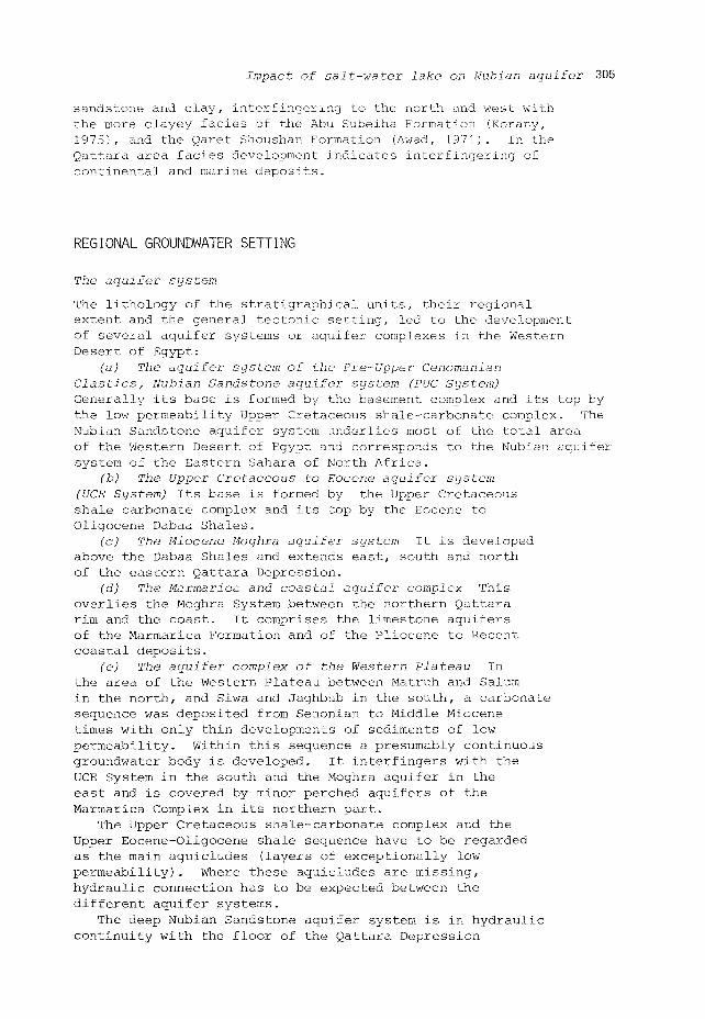
Impact of salt-water lake on Nubian aquifer 305
sandstone and clay, interfingering to the north and west with the more clayey facies of the Abu Subeiha Formation (Korany, 1975), and the Qaret Shoushan Formation (Awad, 1971). In the Qattara area facies development indicates interfingering of continental and marine deposits.
REGIONAL GROUNDWATER SETTING
The aquifer system
The lithology of the stratigraphical units, their regional extent and the general tectonic setting, led to the development of several aquifer systems or aquifer complexes in the Western Desert of Egypt:
(a) The aquifer system of the Pre-Upper Cenomanian elastics, Nubian Sandstone aquifer system (PUC System) Generally its base is formed by the basement complex and its top by the low permeability Upper Cretaceous shale-carbonate complex. The Nubian Sandstone aquifer system underlies most of the total area of the Western Desert of Egypt and corresponds to the Nubian aquifer system of the Eastern Sahara of North Africa.
(b) The Upper Cretaceous to Eocene aquifer system (UCE System) Its base is formed by the Upper Cretaceous shale carbonate complex and its top by the Eocene to Oligocène Dabaa Shales.
(c) The Miocene Moghra aquifer system It is developed above the Dabaa Shales and extends east, south and north of the eastern Qattara Depression.
(d) The Marmarica and coastal aquifer complex This overlies the Moghra System between the northern Qattara rim and the coast. It comprises the limestone aquifers of the Marmarica Formation and of the Pliocene to Recent coastal deposits.
(e) The aquifer complex of the Western Plateau In the area of the Western Plateau between Matruh and Salum in the north, and Siwa and Jaghbub in the south, a carbonate sequence was deposited from Senonian to Middle Miocene times with only thin developments of sediments of low permeability. Within this sequence a presumably continuous groundwater body is developed. It interfingers with the UCE System in the south and the Moghra aquifer in the east and is covered by minor perched aquifers of the Marmarica Complex in its northern part.
The Upper Cretaceous shale-carbonate complex and the Upper Eocene-Oligocene shale sequence have to be regarded as the main aquicludes (layers of exceptionally low permeability). Where these aquicludes are missing, hydraulic connection has to be expected between the different aquifer systems.
The deep Nubian Sandstone aquifer system is in hydraulic continuity with the floor of the Qattara Depression

306 M.A. Ezzat
through movement of the artesian groundwater along fault planes. A particularly important set in the Qattara Area is the one with an ENE-WSW trend. Important faults belonging to this set include those bordering the Qattara Depression northwards and some within the depression itself. Other faults are encountered to the south of the depression, one of which is superimposed on the small depressions extending from El-Baharein to Sitra, (Fig.7). Another set of special significance has an ESE-WNW trend. This is well illustrated by the very long fault extending from the Siwa Oasis depression westwards towards the southern part of the Qattara Depression.
FIG.7 Western Desert Structure Map (After Joint-Venture Qattara, 1979).
With the exception of part of the aquifer complexes of the Northern and of the Western Plateau, the depression area between the Jaghbub Oasis in the west and the Moghra Lake in the east (where ground levels are at 5 to 133 m b.m.s.l.), acts as base level sink for all the other aquifer systems in the northern Western Desert.
The regional groundwater flow
All aquifer systems identified previously are related to the depression oases and salt flats of the Western Desert. Seen in terms of groundwater movement the exceptional position of the Qattara Depression lies only in its vast extent because all other depressions (their surface elevation being lower than the piezometrlc surface of the groundwater) also serve as local sinks for the groundwater flow. This implies that they

Impact of salt-water lake on Nubian aquifer 307
act as discharge areas in much the same way as the Qattara Depression. However, being situated up-gradient of the Qattara Depression, they intercept at least part of the groundwater flow which is then lost by evapo-transpiration.
At first sight, grounwater flow seems directed to the Qattar Depression from practically all sides:
from NW through the Western Plateau aquifer system from the Mediterranean since sea water enters the
Moghra System via the Marmarica Complex and flows to the depression
from NE and E, Nile water passes via the deltaic sediments and flows within the Moghra System towards the Depression
from S, groundwater approaches the depression through the PUC and the UCE Systems.
Special problems are caused by the interconnection of different aquifer systems. The groundwater flow has to be considered in three dimensions. Downward leakage takes place from the Marmarica System to the Moghra System, as well as from perched groundwater bodies to underlying main aquifers. On the other hand, upward leakage transfers groundwater from the Nubian System to the UCE System south and west of the Qattara Depression. Horizontal underflow probably occurs from the Western Plateau System to the Moghra System and SE of the Qattara Depression from the UCE into the Moghra System.
Hypotheses explaining the source of groundwater
The source of Nubian Sandstone groundwater has been ascribed to several mechanisms:
(a) Recharge from southern regions where the rate of
precipitation is relatively high (Ball, 1927; Hellstrom, 1940).
Support for this hypothesis lies in the fact that when flow
lines are constructed on piezometric maps and traced back to
the areas of high head, their origin is located in areas
receiving measurable amounts of precipitation.
(b) The water may be due to recharge from past pluvial
periods of high precipitation. Support for this hypothesis
comes from paleoclimatography theories (Lloyd and Farag, 1978).
It is strongly believed that 10 000 to 6000 years ago the rate
of precipitation was several orders of magnitude greater than
at present. This rain infiltrated the sandstone at its outcrop
area, filled the aquifer, and created a piezometric gradient
which remains today.
(c) The water is recharged by present-day precipitation in
the outcrop region under conditions that induce high infiltration
rates (Ezzat, 1959; Chow and Wilson, 1981). Although the
precipitation measures less than 1 mm/year, it comes in a few
intense storms during which precipitation greatly exceeds
evaporation. Rain which collects in small depressions will
infiltrate relatively quickly (Dincer et al., 1974).
(d) Groundwater levels are maintained by mechanisms which
enhance flow without requiring new recharge: two of these are
thermal drive and pressure bursting (Burdon, 1977).

308 M.A. Ezzat
Discharge of groundwater
The natural discharge of the aquifer occurs through upward leakage in the oases and depressions, where the level of the land surface intersects the piezometric surface and where the low permeability cover of the water-bearing strata is missing or its effects are reduced due to special lithological or structural conditions. In other parts of the Qattara Depression, post-Nubian aquifer systems such as the Upper Cretaceous-Eocene System and the Moghra System are recharged from below, where the underlying aquiclude permits vertical flow, or along fault planes.
GROUNDWATER MODEL
In order to study the effect that the filling of the Qattara Depression to 60 m b.m.s.l. would have on the hydrodynamic water balance of the Nubian Sandstone aquifer system, it was found necessary to use a computerized digital groundwater model.
Data preparation
In order to design the model, the following maps were prepared to obtain a good knowledge of the geology and hydrogeological conditions of the Nubian Sandstone aquifer system.
(a) Isopachs of the Nubian Sandstone aquifers Underneath the southern part of the Qattara Depression and Siwa Oasis, the lower part of the Nubian Sandstone aquifers are salt-water bearing, but in the present study their water was considered to be stagnant. Therefore, only the fresh-water bearing aquifers (which are considered to be under dynamic movement) were modelled. An isopach map has been drawn to show the thickness of these parts
of the Nubian Sandstone aquifer system (Paleozoic-Mesozoic Section) (Fig.8). Thickness of fresh water aquifers in Siwa, Bahariya and Farafra Oases are 834, 1500 and 2000 m respectively. In a north and north-west direction towards the fresh-water/salt-water zone, the thickness of freshwater bearing aquifers decreases sharply. Underneath the southern area of the Qattara Depression, the thickness of the fresh-water zone increases from zero at the freshwater/salt-water boundary, to 1000 m towards the south.
(b) Piezometric levels From available data on piezometric levels, a general piezometric map for the fresh-water bearing Nubian Sandstone aquifers has been prepared (Fig.9). Recorded piezometric levels in Baharein, Desouky and Siwa water wells are 138, 135 and 110 m respectively. In Kifar exploratory well, which is situated in the Qattara Depression, the piezometric level of the Cenomanian aquifers was recorded at 57 m b.m.s.l. Two areas

Impact of salt-water lake on Nubian aquifer 309
FIG.8 Isopach map of fresh-water aquifers in Palaeozoic* Mesozoic formations.
of zero piezometric level and lower are shown: one is in the Sewa Oasis, and the other is around Ain Hussein and Kifar wells in the Qattara Depression. These two areas represent discharging areas in the Nubian Sandstone aquifer system.
Groundwater model
(a) Nodal network The area under study was covered by a Thiessen polygon nodal network (Fig.10) consisting of 39 nodes, 88 conducting branches and 39 input branches. The model covered an area of about 297 206 km^ . Each node covered an area of about 7821 km^ .
(b) Calibration of model: (Steady state condition) The Nubian Sandstone aquifer system is at present under steady state condition, i.e. the amount of recharge equals the amount of discharge. According to the shape of the piezometric surface (Fig.9) and direction of flow lines, recharge to the area under study is derived only from the south-west corner

310 M.A. Ezzat
FIG.9 Piezometric map of the Nubian Sandstone aquifer system.
of the study area. From a flow-net analysis of the piezometric map, the amount of annual recharge was found to be 308.98 x 10⁶ m3. The model was tested under the following conditions :
Run No.l: No discharge to the Qattar Depression Head at Bahariya Oasis was found to be 412 m instead of
130 m a.m.s.1.
Run No.2: Head in the Qattara Depression to be floating - Head at Bahariya Oasis dropped to 28.72 m b.m.s.l. - Discharge in Qattara Depression was about
0.272 x 10⁶ m3/year. - With the Qattara Depression behaving as a discharging
area, practically no flow reaches Wadi El-Rayan.
Run No.3: Head in the Qattara Depression floating: losses in Bahariya Oasis were reduced from 190 to 100 x 106 m3/year
- Head at Bahariya increased from 28.72 m b.m.s.l. to 33.08 m b.m.s.l.
- Discharge in the Qattara Depression increased from 50.26 to 90.25 x 10⁶ m3/year.

Impact of salt-water lake on Nubian aquifer 311
A value of 100 has been added to voltage values obtained at each node from the steady state last run. Obtained values were plotted. A piezometric map has been drawn (Fig.11).
The final simulated steady state condition for the Qattara Depression and its southern area, was as follows:
Recharge
Node ( 1) Node (2) Node (3) Node (4)
Total
(m x 10 /year)
= 107.455 = 179.851 = 69.777 = 23.003
= 380.086
Discharge
Farafra = Bahariya = Bahrain Siwa = Qattara =
Total
,3 ,.6 . (m x 10 /year
0.7 100.0 50.0 140.0 90.0
380.7
Recently, Amer, Nour and Mishriki (1980), by the use of a finite element model of the Nubian aquifer system in Egypt, proved that the Qattara Depression is one of the discharging areas for the Nubian Sandstone aquifer system. The water balance of the simulated steady state condition proved that about 114.920 x 10fc ,3 are lost annually from the Nubian Sandstone aquifer system in the Qattara Depression.
FIG.10 Qattara groundwater model, polygon diagram.

312 M.A. Ezzat
FIG.11 Qattara groundwater model, simulated steady state.
IMPACTS OF A FUTURE SALT WATER LAKE ON THE NUBIAN SANDSTONE AQUIFER SYSTEM
Only the effect of the Qattara Depression hydrosolar power plant on the hydrogeological condition of the Nubian Sandstone aquifer system will be discussed in this paper.
In the author's opinion, the Nubian Sandstone aquifer system is in a quasi-equilibrium state, i.e. amount of recharge equals amount of discharge. According to Ball (1927,1933), Hellstrom (1940), Bassler (1973), Ezzat (1975, 1977), the Qattara Depression is at least partially the base level of a great subterranean groundwater body, which originates in the highlands of Ennedi and Erdi in the south, and supplies the artesian wells of the oases of Kharga, Dakhla, Farafra, Bahariya and Siwa in the Western Desert of Egypt.
The groundwater below the "Sabkha" (salt marsh) in the southern part of the Qattara Depression is fed by a continuous groundwater seepage from the Nubian Sandstone aquifer system through faults and other fractures in the overlying limestone section of the Upper Cretaceous to the Eocene aquifer system. The groundwater is finally lost by evaporation from the salt marsh.

Impact of salt-water lake on Nubian aquifer 313
Groundwater losses from the Nubian Sandstone aquifer system in the southern part of the Qattara Depression, as determined by the different authors, are as follows:
Ball (1933) = 1008.86 nr x 10^/year Ezzat (1972) = 504.43 m x 10 /year Amer, Nour, Mishriki (1980) = 114.92 m x 10 /year Ezzat (present study) = 90.25 m x 10 /year
Ground levels of the southern part of the Qattara Depression range between 132 m b.m.s.l. to sea level, and the area to be covered by any future permanent lake (60 m b.m.s.l.) is shown in Fig.2. The first effect of filling the depression to 60 m b.m.s.l. will be the prevention of the Nubian groundwater losses beneath the area which will be covered by a future lake.
The Calcareous Upper Cretaceous to Eocene aquifer system, outcrops on the floor of the southern part of the Qattara Depression. This aquifer system is hydraulically connected with the underlying Nubian Sandstone aquifer system through fault planes. The piezometric level of the Nubian System in the southern part of the Qattara Depression is at least 50 m b.m.s.l., i.e. higher than ground levels in the floor of the depression. As a result of filling the depression to a level of 60 m b.m.s.l. there will be the positive effect of a 70 m head of salt water. As a result of this new head on the Nubian Sandstone system, heads in the nearby oases will increase. In order to study such an effect, a two-layer, three-dimensional model is needed to simulate the hydrogeologic conditions underlying the greater Qattara Area, to include Siwa, Baharein, Sitra, Bahariya Oases.
Salt water intrusion into the grounwater bodies underlying or adjacent to the depression is not possible because all hydraulic heads are considerably higher than the filling level of 60 m b.m.s.l.
REFERENCES
Amer, A.S., Nour & Meshriki, M. (1981) A Finite Element Model For The Nubian Aquifer System in Egypt, Water Resources Planning in Egypt: Proceeding of the International Conference, held in Cairo, Egypt, Jan. 1981. (Cairo: Ministry of Irrigation and CU/MIT Technology Planning Program), 1981.
Awad, I.N. (1971) Water Salinity in the Moghra Formation, 4 pp., 4 maps, Cairo, AMOCO, UAR Oil Company, Geol. Report 136.
Ball, J. (1927) Problems of the Libyan Desert: the artesian water supplies of the Libyan Desert. - Geogr. J. 70, London.
Ball, J. (1933) The Qattara Depression of the Libyan Desert and the Possibility of its Utilization for Power Production, Geogr. J. 82, 4, pp. 289-314, London.
Surdon, D.J. (1977) Flow of Fossil Groundwater, Quarterly J. of Eng. Geol., 10 (2) pp. 97-124.
Chow, J.S. & Wilson, J.L. (1981) A Qualitative Review

314 M.A. Ezzat
of Nubian Sandstone Regional Aquifer Behaviour, Water Resources Planning in Egypt: Proceeding of the International Conference held in Cairo, Egypt, Jan. 1981. (Cairo: Ministry of Irrigation and CU/MIT Technology Planning Program.)
Dincer, T. et al. (1974) Study of the infiltration and recharge through the sand dunes in and zones with special reference to the stable isotopes and thermonuclear tritium, J. Hydrology, 23, pp. 79-109.
Ezzat, M.A. (1959) Origin of the Underground water in the Libyan Desert and Preliminary Evaluation of its Amount, Report to General Desert Development Org., Cairo.
Ezzat, M.A. (1977) The Groundwater Model of South Qattara Area Western Desert of Egypt - 55 pp., 24 Fig., The General Petroleum Co., Cairo.
Hellstrom, B. (1940) The subterranean water in the Libyan Desert, Bull, of Inst, of Hydraulics, No. 26, Royal Inst, of Tech., Stockholm, 1940.
Joint - Venture Qattara (1979) Study Qattara Depression, Volume III, part ]. Topography, Regional Geology and Hydrogeology, Report Submitted to Ministry of Electricity and Energy, Qattara Project Authority, Egypt, by Lahmeyer International GMBH, 125 pp., 8 Tabl., 19 Fig., 26 Annexes, October, 1979.
Korany, E.A. (1975) Geological and Hydrogeological Studies of the Area Between Burg El-Arab and El Dabaa, North Western Desert of Egypt. 260 pp., Ph. D. Thesis unpibl., Ain Shams Univ., Cairo.
Loly, J.W. & M.H. Farag (1978) Fossil G-W gradients in arid regional sedimentary basins, Groundwater 16(6), pp. 388-392.
Said, R. (1962b) The Geology of Egypt: Elsevier Publ. Co. Amsterdam and New York, 377 pp.
Said, R. (1971) Explanatory Notes to Accompany the Geological Survey of Egypt, Paper No. 56, 123 pp., 3 tabl., 1 map, 1 map, Cairo.