monomoy massachusetts great swamp … massachusetts and great swamp new jersey geological survey...
TRANSCRIPT

STUDIES RELATED TO WILDERNESSWILDLIFE REFUGES
MONOMOYMASSACHUSETTSandGREAT SWAMPNEW JERSEY
GEOLOGICAL SURVEY BULLETIN 1260- Ij), F


Summary Report on the Geology and Mineral Resources of the Monomoy National Wildlife
Refuge, Barnstable County
MassachusettsBy CARL KOTEFF
Great Swamp National
Wildlife Refuge
New JerseyBy JAMES P. MINARD
STUDIES RELATED TO WILDERNESS WILDLIFE REFUGES
GEOLOGICAL SURVEY BULLETIN 1260- D, E
UNITED STATES GOVERNMENT PRINTING OFFICE, WASHINGTON : 1967

UNITED STATES DEPARTMENT OF THE INTERIOR
STEWART L. UDALL, Secretary
GEOLOGICAL SURVEY
William T. Pecora, Director
For sale by the Superintendent of Documents, U.S. Government Printing Office Washington, D.C. 20402 - Price 15 cents (paper cover)

STUDIES BELATED TO WILDEKNESS
WILDLIFE REFUGES
The Wilderness Act (Public Law 88-577, Sept. 3, 1964) directs the Secretary of the Interior to review roadless areas of 5,000 contiguous acres or more, and every roadless island, within the national wildlife refuges and game ranges under his jurisdiction, and to report on the suitability or nonsuitability of each such area or island for preservation as wilderness. As one aspect of the suitability studies, existing published and unpublished data on the geology and the occurrence of minerals subject to leasing under the mineral leasing laws are as sembled in brief reports on each area. This bulletin is one such report and is one of a series by the U.S. Geological Survey and the U.S. Bureau of Mines on lands under the jurisdiction of the U.S. Department of the Interior.


Summary Report on the Geology and Mineral Resources of the Monomoy National Wildlife Refuge, Barnstable County MassachusettsBy CARL KOTEFF
STUDIES RELATED TO WILDERNESS WILDLIFE REFUGES
GEOLOGICAL SURVEY BULLETIN 1260-D
A compilation of available geologic information


CONTENTS
Page Summary. ___ _____________________________________________________ DlIntroduction. _____________________________________________________ 1Geology._________________________________________________________ 2Mineral resources________________________________________________ 4References cited.__________________________________________________ 4
ILLUSTRATION
Page FIGURE 1. Map of the Monomoy National Wildlife Refuge.___________ D2


STUDIES RELATED TO WILDERNESS
SUMMARY REPORT ON THE GEOLOGY AND MINERAL RESOURCES OF THE MONOMOY NATIONAL WILDLIFE REFUGE, BARNSTABLE COUNTY, MASSACHUSETTS
By CARL KOTEFF
SUMMARY
Monomoy National Wildlife Refuge occupies Monomoy Island and a small part of Morris Island at the southeast corner of Cape Cod. Most of the refuge is underlain by beach and dune sand derived by wave action and transported southward by shore currents. Wind action on the beach deposits has piled a line of coastal dunes along the central part of Monomoy Island. The sands are under lain by glacial drift, which probably is several hundred feet thick. Far below sea level, the drift lies on a basement of crystalline rocks.
The Monomoy Refuge has no known mineral resources other than the sands from which the islands are made. Considering the abundance ol; pand in the Cape Cod area, the sand of the refuge is of low economic value.
INTRODUCTION
The Monomoy National Wildlife Refuge, in Barnstable County, Mass., occupies an area of about 4 square miles on Monomoy Island and a small part of Morris Island, at the southeast corner of Cape Cod (fig. 1). The refuge is shown on the Monomoy Point and Chatham, 7i^-minute topographic quadrangle maps. Access to the refuge head quarters on Morris Island is by causeway from Chatham; Monomoy Island can be reached by boat across Pleasant Bay. The area has low relief, and all points within the refuge are below 50 feet in altitude.
The present report is based on a study of the refuge made in June 1965 as part of a geologic mapping program covering the Cape Cod National Seashore and surrounding area, in cooperation with the Massachusetts Department of Public Works. Harold O'Connor of the U.S. Bureau of Sport Fisheries and Wildlife was most helpful in pro viding transportation to and on Monomoy Island.
In the absence of mineral production or deposits, the U.S. Bureau of Mines has not had occasion to examine the refuge, but the Bureau
Dl
274-524 O - 67 - 2

D2 STUDIES RELATED TO WILDERNESS WILDLIFE REFUGES
70°
FIGURE 1. Map of the Monomoy National Wildlife Refuge, Barnstable County,Mass.
is informed of the findings and conclusions of the Geological Survey and concurs in them.
GEOLOGY
Cape Cod was formed by deposition of large masses of sand, gravel, and clay laid down directly by ice as moraines and by melt waters as stratified drift from two major ice lobes during the retreat of the last
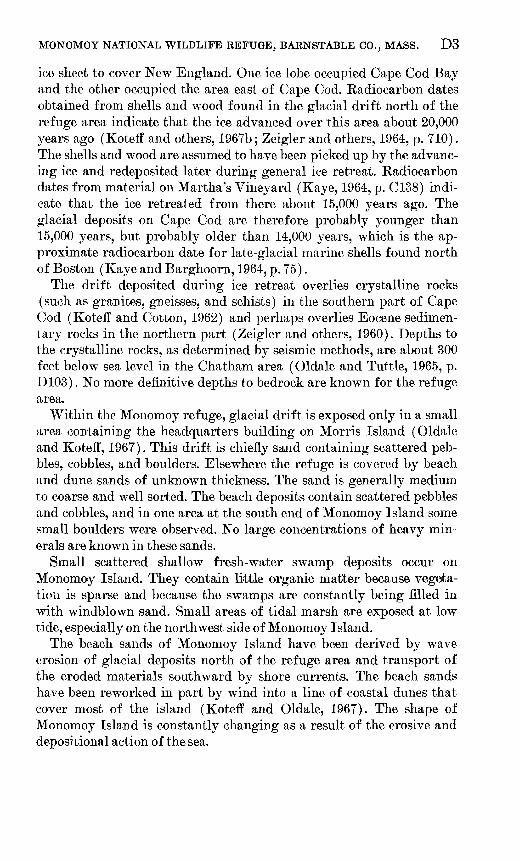
MONOMOY NATIONAL WILDLIFE REFUGE, BARNSTABLE CO., MASS. D3
ice sheet to cover New England. One ice lobe occupied Cape Cod Bay and the other occupied the area east of Cape Cod. Radiocarbon dates obtained from shells and wood found in the glacial drift north of the refuge area indicate that the ice advanced over this area about 20,000 years ago (Kotefl and others, 1967b; Zeigler and others, 1964, p. 710). The shells and wood are assumed to have been picked up by the advanc ing ice and redeposited later during general ice retreat. Radiocarbon dates from material on Martha's Vineyard (Kaye, 1964, p. C138) indi cate that the ice retreated from there about 15,000 years ago. The glacial deposits on Cape Cod are therefore probably younger than 15,000 years, but probably older than 14,000 years, which is the ap proximate radiocarbon date for late-glacial marine shells found north of Boston (Kaye and Barghoorn, 1964, p. 75).
The drift deposited during ice retreat overlies crystalline rocks (such as granites, gneisses, and schists) in the southern part of Cape Cod (Kotefl and Cotton, 1962) and perhaps overlies Eocene sedimen tary rocks in the northern part (Zeigler and others, 1960). Depths to the crystalline rocks, as determined by seismic methods, are about 300 feet below sea level in the Chatham area (Oldale and Tuttle, 1965, p. D103). No more definitive depths to bedrock are known for the refuge area.
Within the Monomoy refuge, glacial drift is exposed only in a small area containing the headquarters building on Morris Island (Oldale and Kotefl, 1967). This drift is chiefly sand containing scattered peb bles, cobbles, and boulders. Elsewhere the refuge is covered by beach and dune sands of unknown thickness. The sand is generally medium to coarse and well sorted. The beach deposits contain scattered pebbles and cobbles, and in one area at the south end of Monomoy Island some small boulders were observed. No large concentrations of heavy min erals are known in these sands.
Small scattered shallow fresh-water swamp deposits occur on Monomoy Island. They contain little organic matter because vegeta tion is sparse and because the swamps are constantly being filled in with windblown sand. Small areas of tidal marsh are exposed at low tide, especially on the northwest side of Monomoy Island.
The beach sands of Monomoy Island have been derived by wave erosion of glacial deposits north of the refuge area and transport of the eroded materials southward by shore currents. The beach sands have been reworked in part by wind into a line of coastal dunes that cover most of the island (Kotefl and Oldale, 1967). The shape of Monomoy Island is constantly changing as a result of the erosive and depositional action of the sea.
D4 STUDIES RELATED TO WILDERNESS WILDLIFE REFUGES
MINERAL RESOURCES
The Monomoy refuge is not known to contain significant mineral resources except sand. Sand of similar character is abundant and widely accessible in many parts of Cape Cod, and the sand in the refuge is therefore not considered to be of economic significance. Heavy-mineral concentrations are absent in the beach sands. The gla cial drift and crystalline rocks beneath the sands are not likely to contain leasable minerals such as coal, oil, gas, phosphate, potash, or sodium. The deep-lying crystalline rocks are unseen and are known only from regional geophysical studies; the presence of mineral de posits in them can only be speculative. The mineral potential of the Monomoy Kef uge is very low.
REFERENCES CITED
Kaye, C. A., 1964, Outline of Pleistocene geology of Martha's Vineyard, Massa chusetts: U.S. Geol. Survey Prof. Paper 501-C, p. C134-C139.
Kaye, C. A., and Barghoorn, E. S., 1964, Late Quaternary sea-level change andcrustal rise at Boston, Massachusetts, with notes on the autocompaction ofpeat: Geol. Soc. America Bull., v. 75, no. 2, p. 63-80.
Koteff, Carl, and Cotton, J. E., 1962, Preliminary results of recent deep drillingon Oape God, Massachusetts: Science, v. 137, no. 3523, p. 34.
Koteff, Oarl, Oldale, R. N., and Hartshorn, J. H., 1967a, Geologic map of theMonomoy Point quadrangle, Barnstable County, Mass.: U.S. Geol. Surveyopen-file map.
, 1967b, Geology of the North Truro quadrangle, Barnstable County,Massachusetts; U.S. Geol. Survey Geol. Quad. Map GQ-599.
Oldale, R. N., and Tattle, C. R., 1965, Seismic investigations in the Harwich andDennis quadrangles, Cape Cod, Massachusetts: U.S. Geol. Survey Prof.Paper 525-D, p. D101-D105.
Oldale, R. N., and Koteff, Carl, 1967, Geologic map of the Chatham quadrangle,Cape Cod, Mass.: U.S. Geol. Survey open-file map.
Zeigler, J. M., Hoffmeister, W. S., Giese, Graham, and Tasha, Herman, 1960, Adiscovery of Eocene sediments in the subsurface of Cape Cod, Massachusetts:Science, v. 132, p. 1397-1398.
Zeigler, J. M., Tuttle, S. D., Tasha, H. J., and Giese, G. S., 1964, Pleistocenegeology of outer Cape Cod, Massachusetts: Geol. Soc. America Bull., v. 75,no. 8, p. 705-714.

Summary Report on the Geology and Mineral Resources of the Great Swamp National Wildlife Refuge New JerseyBy JAMES P. MINARD
STUDIES RELATED TO WILDERNESS WILDLIFE REFUGES
GEOLOGICAL SURVEY BULLETIN 1260-E
A compilation of available geologic information


CONTENTS
Page Summary_______________________________________________________ E 1Introduction. _____________________________________________________ 1
Location and geography._______________________________________ 1Present studies._______________________________________________ 3Acknowledgments _____________________________________________ 3
Physiography and history_ _________________________________________ 3Surface features _______________________________________________ 5
Geology_ _________________________________________________________ 6Triassic rocks _________________________________________________ 6
Brunswick Shale_________-___________________--___-_--_--_- 6Watchung Basalt__________________________________________ 7
Deposits of Quaternary age._______________--_______----_--__-__ 7Glacial lake clay___________________________________________ 7Stratified drift_____________________________________________ 9Swamp deposits___________________________________________ 9
Resources- _______________________________________________________ 10Surrounding region_ ___________________________________________ 10
Copper. __________________________________________________ 11The refuge____________________________________________________ 11
Clay_____________________________________________________ 11Sand_____________________________________________________ 11Peat_____________________________________________________ 12Water. ___________________________________________________ 12
Conclusions. ______________________________________________________ 13References cited.__________________________________________________ 14
ILLUSTRATIONS
Page FIGURE 1. Index map of Great Swamp National Wildlife Refuge showing
proposed wilderness area_ ______________________________ E 22. Reconnaissance geologic map of Great Swamp National Wild
life Refuge__________._________________--_____--_---- 43. Cross section of Great Swamp National Wildlife Refuge. _____ 64. Logs of auger holes______________________________________ 85. Photograph showing typical swamp vegetation-_____________ 106. Photograph of Great Brook, Great Swamp National Wildlife
Refuge-._______________________________---______----- 13


STUDIES RELATED TO WILDERNESS
SUMMARY REPORT ON THE GEOLOGY AND MINERAL RESOURCES OF THE GREAT SWAMP NATIONAL WILD LIFE REFUGE, NEW JERSEY
BY JAMES P. MINARD
SUMMARY
Great Swamp National Wildlife Refuge, an area of about 6,000 acres, is in the southern part of Morris County, north-central New Jersey. In the eastern part of the refuge is a 2,400-aere roadless island The M. Hartley Dodge Unit which has been proposed for inclusion in the National Wilderness Preservation System. Most of the surface of the refuge lies between altitudes of 220 and 240 feet and consists largely of swampland and some poorly drained farmland. Small areas of glacial outwash sand form low islands in the swamp. Great Swamp occupies the southwestern part of former glacial Lake Passaic. It is bounded on three sides by hills and ridges of gneiss and basalt and on the fourth side by terminal moraine. Mineral resources are principally clay and peat but also include sand, some gravel, and trap rock (basalt). Only the clay and peat are known to be present in sufficient volume to be of possible economic signifi cance. Small deposits of copper have been mined from Triassic rocks in nearby areas, but whether copper deposits exist in these rocks beneath the refuge is unknown. Because Great Swamp is underlain by sediments filling a basin carved in the underlying bedrock, it has an important potential for ground water, although no significant use has thus far been made of this water.
INTRODUCTION
LOCATION AND GEOGRAPHY
The Great Swamp National Wildlife Refuge is in the southern part of Morris County, north-central New Jersey (fig. 1). The M. Hartley Dodge Unit a 2,400-acre roadless island which has been proposed for inclusion in the National Wilderness Preservation System is in the eastern part of the refuge, and consists of that part of the refuge lying east of Meyersville Road. The refuge has a very irregular boundary and encompasses most of the area of Great Swamp. The long axis of the refuge extends about 5y± miles in an east-west direc tion ; the short axis extends about 2*^ miles in a north-south direction.
El

E2 STUDIES RELATED TO WILDERNESS WILDLIFE REFUGES74° 30'
Proposed wilderness area
Refuge boundaryLOCATION MAP
FIGURE. 1 Small map is an index map of New Jersey showing the location of Great Swamp National Wildlife Refuge; dotted lines are physiographic prov ince boundaries. Large map shows the outline of the refuge; lined area is that part of the refuge to be known as the M. Hartley Dodge Wilderness Unit.
Most of the refuge has very little relief and lies between altitudes of 220 and 240 feet; locally it reaches 300 feet along the periphery. The refuge consists largely of swampland and contains many vegeta tion-choked water areas. Locally, small deposits of glacially derived

GREAT SWAMP NATIONAL WILDLIFE REFUGE, NEW JERSEY E3
sand form islands of firm ground within the swamp. Slope wash and residual soils from the surrounding bedrock also form areas of firm ground along the border of the swamp. Stands of large deciduous trees are on the firmer ground. Some of these better drained areas have been cleared and farmed for more than a century.
Black-top roads completely circle the swamp, and three cross it near the middle and western part (fig. 1). A railroad lies just a few miles to the south, and an airport is located near Morristown, a short distance to the north.
PRESENT STUDIES
The Great Swamp National Wildlife Refuge was examined by the author during December 1966, as part of a reconnaissance study of sedimentary rocks of the coastal plain. Geologic traverses were made along the roads through the refuge and along roads surrounding it (fig. 2). A reconnaissance geologic map was prepared (fig. 2), and samples were collected for study and analysis.
In the absence of mineral production, the U.S. Bureau of Mines did not have occasion to examine the refuge, but the Bureau is in formed of the findings and conclusions of the Geological Survey and concurs in them.
ACKNOWLEDGMENTS
Frank Markewicz of the New Jersey Department of Conservation and Economic Development, Bureau of Geology, made available well data on the area. Alien Sinnott, Harold Gill, and Solomon Lang of the U.S. Geological Survey supplied information on sources of pub lished and unpublished data. David Wones, J. P. Owens, and Mary Mrose of the U.S. Geological Survey aided in various ways in the studies of clays.
PHYSIOGRAPHY AND HISTORY
Great Swamp lies in the western part of the bed of former glacial Lake Passaic. This former lake was first recognized by Cook in 1880 (p. 61-64) and was later described in detail by Salisbury and Kum- mel (1894; 1895). The lake is also described in a report on the Passaic quadrangle (Darton and others, 1908, p. 14-20).
Glacial Lake Passaic occupied the drainage basin lying within the northeast-southwest-trending valley between the Watchung Mountains on the southeast and hills on the northwest. The shape and size of the valley can be seen on the maps in Darton and others (1908, p. 19). The Watchung Mountains are northwest-tilted basalt flows at the inner edge of the Triassic Lowland (fig. 1) and are separated by softer

E4 STUDIES RELATED TO WILDERNESS WILDLIFE REFUGES
Stratified drift Glacial lake clay^
Watchung Basalt Brunswick ShaleJ
Contact Approximately located
Sand or clay pit
Auger holeNumbers refer to logs shoivn on
figure 4
Approximate boundary of Great Swamp National Wildlife Refuge
FIGURE 2. Reconnaissance geologic map of the Great Swamp National Wild life Refuge, Morris County, N..T.

GREAT SWAMP NATIONAL WILDLIFE REFUGE, NEW JERSEY E5
shale, sandstone, and conglomerate of Triassic age which have been differentially eroded faster than the basalt and which underlie the present valleys. The hills on the northwest consist of Precambrian rocks and are in the New Jersey Highlands. A normal fault, locally of considerable displacement, separates the two provinces.
Lake Passaic formed from melt water from a continental glacier of Wisconsin age whose ice front reached the area near present Green Village. The glacier filled the basin and blocked drainage that existed towards the northeast to Paterson, and to the southeast through the Watchung Mountains via Millburn Gap, between Summit and Short Hills. As the ice front receded towards the northeast, melt water filled the basin, until, at its maximum size, the lake was about 10 miles wide and 30 miles long (Darton and others, 1908, p. 19). Jumikis (1959, p. 20) estimated the maximum depth of the lake at 240 feet, and the average depth at 160-200 feet. At that time the lake overflowed south- westward at Moggy Hollow (Salisbury, 1902, p. 155). Morainal de posits effectively dammed the outlet at Millburn Gap, and only when the ice front had receded northeast of the water gap at Paterson did the lake begin to drain through that gap. This probably was about 10,000-12,000 years ago or about 10,000 years after the ice front had advanced to the area near Green Village. Most of the water in the lake drained away leaving only remnants in the old lakebed. Great Swamp, the site of one of these remnants, occupies the southwest part of the glacial lakebed.
During advance, stagnation, and recession of the ice front, melt water carried large quantities of clay, silt, sand, and gravel into the lake and basin in front of the ice. Coarse material largely was deposited directly from the ice, both along its periphery and from beneath and within as it melted. Slower rates of deposition continued in the rem nant lakes. This deposition was largely in the form of fine sediment, which was deposited by runoff from rain and melting snow, and as peat from the vegetation that encroached on the lakeshores as they receded. Peat deposition continues to the present in the heavily vege tated swamps.
SURFACE FEATURES
As seen on vertical aerial photographs, the surface of the swamp presents a conspicuous irregular light- and dark-mottled pattern which is in marked contrast to the surrounding terrane. The pattern is caused by interspersed dark areas of wet soil, swamp deposits, and water areas in contrast with light areas of fairly dry soil and wooded patches of ground above the water table.
In the western part of the swamp, an interesting pattern of sym metrical circular or elliptical poorly drained basin several tens to sev-

E6 STUDIES RELATED TO WILDERNESS WILDLIFE REFUGES
oral hundreds of feet across can be seen. They closely resemble the periglacial frost-thaw basins of Wolfe (1953, pi. 1), who states (p. 135) that they are present on formations of Cretaceous, Tertiary, and Qua ternary age. In Great Swamp they are present only on the Quaternary deposits, as was noted by Minard and Owens (1962, p. 21) for similar basins in the central part of New Jersey.
GEOLOGY
The consolidated rocks underlying Great Swamp National Wildlife Kefuge are of Triassic age and are assigned to the Newark Group. They consist of basalt and interbedded shale, siltstone, and fine to very fine grained sandstone. These rocks crop out only along the northern edge of the refuge, but they border it on the west, south, and southeast and underlie it at depth (fig. 3). Thick deposits of the terminal moraine of Wisconsin age border the refuge on the northeast. Most of the surface of the refuge is underlain by glacial lakebed clay and silt, which is interbedded locally with and overlain by glacial outwash and gravel, particularly in the central part of the refuge (fig. 2) and by peat deposits in the eastern half.
TBIASSIC BOCKS
BRUNSWICK SHALE
The Brunswick Shale consists largely of soft shale which locally contains layers of siltstone and sandstone and is estimated to be 100- 200 feet thick. As exposed along the northwestern boundary of the refuge (fig. 2), the rock is mostly a grayish-red to grayish-brown, very fine grained sandstone that contains abundant fine-grained color less mica. Beds of Brunswick Shale underlie the lakebed of the swamp, as shown by auger holes. They are more readily eroded than the under-
~- 1000' 2000'
HORIZONTAL SCALE
FIGURE 3. Cross section across Great Swamp along line A-A' of figure 2. Ver tical exaggeration is X 10. The shallow peat deposits are not shown but they are present in the upper part of most of the swamp areas:. See figure 2 for explanation of symbols.

GREAT SWAMP NATIONAL WILDLIFE REFUGE, NEW JERSEY E7
lying basalt or nearby gneiss and conglomerate, and they generally underlie the valley bottoms or lower slopes in the area bordering the swamp.
WATCHUNG BASALT
The Watchung Basalt is a dark-olive-gray to greenish-black rock which weathers to shades of brown. The basalt is mostly a fine-tex- tured hard resistant igneous rock. The rock generally is vesicular at the top where the escaping gas bubbles left small openings as the rock cooled and solidified, and to a lesser extent at the base. Many vesicles are filled by calcite and zeolites, which are obtained from nearby quar ries by mineral-collecting enthusiasts. Conspicuous columnar joint pat terns are present in nearby exposures.
The basalt crops out along the northwest edge of Great Swamp but completely underlies it at depth and borders it along the entire length, just south of the southern boundary, as a prominent linear ridge known as Long Hill. This basalt flow, which is the upper of three flows in the area, probably is about 200-300 feet thick. The other two underlying flows closely parallel Long Hill to the south and southeast and are known as the first and second Watchung Mountains. The flows lie within the Brunswick Shale and are separated by several hundred feet of shale, siltstone, and sandstone beds of this formation. Soil formed from the basalt is fairly thick, clayey, and yellow brown.
Details on the surrounding area are given in Darton and others (1908) and Bayley and others (1914).
DEPOSITS OF QUATEBNABY AGE
GLACIAL LAKE OLAY
The glacial lake clay is mainly a medium-gray and light-olive-gray to grayish-red and pale-red plastic unctuous clay containing inter mixed silt. The clay-size sediment consists mostly of quartz, feldspar, mica, kaolinite, and chlorite.
Although the clay crops out at the surface only in the western part of the refuge, it forms a thick deposit which underlies nearly the entire area of Great Swamp; it was considered by Salisbury and Kuminel (1894, p. 327) to be a practically inexhaustible supply. The clay is largely covered at the surface by extensive thin deposits of peat, and by deposits of glacial outwash sand and gravel, which also underlie and are interbedded with the clay (fig. 3). Small areas of the clay that are bordered by swamp, peat, or drift deposits were not mapped separately.
Because of the low relief and high water table in the swamp, only a few feet of the upper part of the clay is exposed. Pits in the material are filled by water to within a few feet of the surface, and the exposed clay is weathered and slumped into the pits; consequently, its original

E8 STUDIES RELATED TO WILDERNESS WILDLIFE REFUGES
structure cannot be seen. The clay is conspicuously varved elsewhere in the glacial lake basin, as at Moonachie in Bergen County, N.J. (Jumi- kis, 1959, p. 26 and 39). The varves consist of pairs of thin layers or laminae of silt and clay, each pair representing 1 year's deposition of glacially derived rock-flour material which settled out of the glacial lake waters at different rates in summer and winter. The thicker light colored layer was deposited during the summer, and the thinner darker layer was deposited during the winter.
The clay is reported to be more than 100 feet thick 1% miles south of Green Village (Hies and others, 1904, p. 128-129), and possibly as much as 128 feet of it was penetrated in a well in the east end of Great Swamp (Frank Markewicz, written commun., Dec. 1966). The thick nesses and distribution of clay and stratified drift shown in the cross section in figure 3 are based on data from auger holes (fig. 4) airport test drilling, and water wells.
1HjKH 0-5 feet. Brown silty soil SS3 5-8 feet. Yellow-brown silty
sandy colluvium
0-8 feet. Grayish-orange to dark- yellowish-orange silt and clay
8-15 feet. Pale-brown to dark- yellowish-brown clay
15-68 feet. Medium-gray to light-olive- gray clay
68-71 feet. Grayish-red to grayish- brown very fine grained sandstone to siltstone
" *!?0-20 feet. Yellow-brown grading
down into medium-gray sandcontaining small pebbles
20-40 feet. Medium-gray very finegrained sand grading down intosilt and clay
40-102 feet. Medium-gray to olive- gray wet unctuous clay
102-116 feet. Medium-gray compact mostly fine to very fine sand containing granules and small pebbles
0-25 feet. Brownish- to pale-red moist unctuous clay
25-80 feet. Medium-gray wet clay
80-84 feet. Medium-gray compact clayey fine-grained sand
0-12 feet. Yellow-brown fine to medium heterogeneous sand
12-20 feet. Brownish-gray very fine sand grading down into silt
20-90 feet. Grayish- to pale-red wet firm clay
90-98 feet. Medium-dark-gray compact fine to medium sand; upper part oxidized
FIGUEE 4. Logs of auger holes. Numbers at tops of columns are keyed to numbers assigned to the auger holes plotted on the geologic map (fig. 2).

GREAT SWAMP NATIONAL WILDLIFE REFUGE, NEW JERSEY E9
STRATIFIED DRIFT
The stratified drift in the refuge is mostly sand and fine gravel. The deposits are a heterogeneous mixture of material derived largely from various rock types within the refuge or from nearby. Fragments of grayish-red to grayish-brown siltstone and sandstone from the Bruns wick Shale are abundant, as are rocks and minerals from the gneiss and basalt. All deposits examined contain abundant quartz and a consider able amount (several percent) of feldspar. Accessory minerals include hornblende, ilmenite, magnetite, augite, epidote, graphite, muscovite, biotite, and bronze mica. Clay-size material is largely quartz and feldspar.
Most deposits contain scattered boulders, some of which probably were carried by the glacier, and some of which may have been ice-rafted to their present locations. The boulders include gneiss, basalt, sand stone, and conglomerate. A particularly conspicuous type of boulder is known locally as pudding stone. This type is characteristically a pale- purple to grayish-red-purple resistant quartzite conglomerate contain ing abundant white or milky rounded quartz pebbles and some red and black chert pebbles. The boulders were derived originally from the Green Pond Conglomerate in northern New Jersey. These same boulders are found in fanglomerates of Triassic age along the High lands front, and some of those in the glacial deposits were probably derived secondarily from these Triassic sources.
The drift occurs as scattered deposits which form slightly elevated dry islands in the central part of the swamp. The two north-south roads across the center of the swamp follow the higher parts of these deposits. Other drift occurs beneath the clay and above the underlying bedrock. These deposits are as much as 60 to more than 100 feet beneath the surface of the swamp. The stratified drift deposits occur largely as horizontally stratified beds of sand, granules, and small gravel. Small exposures can be seen in shallow roadcuts within the refuge and in numerous nearby sand and gravel pits outside the refuge boundary.
Where above the water table and oxidized, the deposits are shades of yellow brown. Below the water table the deposits are mostly shades of gray. The soil formed from the stratified drift is sandy and well drained, considering the high surrounding water table.
SWAMP DEPOSITS
Most of the surface area of the swamp is underlain by shallow swamp deposits. These deposits consist of recent accumulations of peat and organic-rich fine sand, silt, and clay, which were laid down by streams carrying suspended matter eroded from the adjacent terrane. Some areas of drift and lakebed clay are included in the swamp map unit, where the water table is at or above the ground surface.

E10 STUDIES RELATED TO WILDERNESS WILDLIFE REFUGES
In the swamp areas there is a thick, luxuriant growth of aquatic veg etation (fig. 5) which continually adds to the store of organic matter.
RESOURCES
SURROUNDING REGION
Resources that have been utilized in the surrounding region in clude crushed stone, building stone, riprap, roofing granules, clay, sand, and gravel. Several quarries are operated in the basalt flows northeast, south, and west of Great Swamp. Fine-grained sandstone from beds in the Brunswick Shale has been used extensively as build ing stone. Many quarries were operated from the Delaware River to the west to Paterson to the north. Most of the quarries in the nearby area were in the beds just beneath the basalt flows. Numerous large sand and gravel pits are in terminal moraine from Woodbridge to the southeast, to Florham Park, Morristown, and Morris Plains to the north. Large, thick deposits of peat occur to the north in Warren and Sussex Counties. Clay is abundant and extensively mined from rocks of Cretaceous age to the south near Perth Amboy.
FIGURE 5. Photograph of the swamp along Loantaka Brook, in the north-central part of the refuge, showing typical area of thick aquatic vegetation where the water table is at or near the surface most of the year.

GREAT SWAMP NATIONAL WILDLIFE REFUGE, NEW JERSEY Ell
COPPER
Copper has been mined from Triassic rocks in New Jersey since the early 1700's (Woodward, 1944, p. 43). Probably the most profitable mine was the Schuyler, about 16 miles northeast of Great Swamp, which yielded substantial profits during most of the 18th century (Woodward, 1944, p. 47). Practically all known occurrences of copper minerals in Triassic rocks of the Eastern States are associated with trap rock (basalt, diabase) ; few occur in sedimentary rocks that are far removed from igneous rocks. The copper minerals may occur on one or both sides of the igneous body (intrusive as the Palisades Dia base or extrusive as the Watchung Basalt) but are most common along the upper contact or in sediments above the igneous bodies. Some of the ores occur in or near extrusive contacts, as in the belt of prospects along First Watchung Mountain near Somerville, west of Great Swamp. Here the copper minerals are below the flow rocks (Wood ward, 1944, p. 28), and the most important copper mineral probably is the sulfide chalcocite, which forms the richest ore pockets at all prospects (Woodward, 1944, p. 15). Chrysocolla and malachite are common copper minerals associated with the igneous rock. Native copper, although not important as an ore, is found in the Triassic sedimentary rocks. Although no copper deposits are known in Great Swamp refuge, the rocks in which they occur border and underlie the entire swamp.
Small amounts of silver are associated with some of the copper de posits (Woodward, 1944, p. 52, 55, and 65), and assays as high as 4.4 ounces per ton of ore were obtained (Woodward, 1944, p. 65). Small amounts of gold also are recorded from the copper ore (Woodward, 1944, p. 52 and 65).
THE REFUGE
CLAY
Clay is available in large amounts in the refuge, although most of it is below the water table. Several abandoned water-filled pits are present along the west end of the refuge, west of Great Brook and north of Pleasant Plains Road. Several pits are j list off the northwest corner of the refuge. These pits were excavated to a depth of as much as 40 feet. The clay from them fired to an attractive uniform moderate reddish-brown to dark-yellowish-orange color and was used locally at the Logansville (fig. 1) pottery plant, whose principal product was flowerpots. The plant has been inoperative for some years.
SAND
A fairly large amount of sand is available in the islandlike deposits in the central part of the refuge. The water table would be penetrated

E12 STUDIES RELATED TO WILDERNESS WILDLIFE REFUGES
at a shallow depth in any excavating operation. Large amounts of sand also are present at depth beneath the clay. The presence of abundant mica, shale particles, schistose material, and sparse flakes of graphite would detract from its quality as a good mortar sand. Large and more readily available deposits of sand exist in esker, moraine, and drift deposits a short distance northeast of the refuge.
PEAT
The refuge contains many peat deposits, mostly in its eastern part. The quality of the peat varies because of intermixed glacial and al luvial deposits. The thickness ranges from 1 to 12 feet, although a thickness of 25 feet is reported near Loanfcaka Brook (Waksman and others, 1943, p. 191). The peat is high in ash content in those parts of the bog subject to repeated flooding by clay-, silt-, and sand-laden waters. These areas are usually along the borders of the swamp where runoff from the soil-covered slopes washes material out onto the peat bogs, and in areas adjacent to through-flowing water channels and islands of glacial deposits.
Ash content of the peat is highest (about 40-90 percent) at depths of 0-1 foot and 7-12 feet from the surface, and lowest (6-16 percent) at depths of 1-7 feet (Waksman and others, 1943, p. 188 and 191). The peat ranges from fibrous matted reeds and woody material to de composed and sedimentary peat. The main body of peat in the candi date area averages about 5 feet in thickness, although a thickness of more than 18 feet is reported (Waksman and others, 1943, p. 191).
WATER
Great Swamp refuge is a reservoir for both ground and surface water. Much of the swamp is underlain by confining beds (aquicludes) of silt and clay which are not water bearing and which rest on lower water bearing sand and gravel beds (aquifers). Streams flowing into the swamp do not aid much in recharging the underlying aquifers, partly because of the hydrostatic pressure from below. This pressure is caused by the partly confined water in the aquifers, which are recharged largely by runoff from the surrounding slopes. The edges of the aquifers are exposed along the bases of the slopes, and the intake area is above the level of the surface of the swamp. Therefore a hydro static head is created in the aquifers which slope downward from the intake area toward the center of the swamp beneath the thick confining layers of the lakebed clay and silt. Water from these aquifers flows upward under pressure and is discharged into the swamp, to be dis sipated by evapotranspiration or carried off by streamflow. This dis charge of ground water is in contrast to many swamps which are considered to be ground-water recharge areas.

GREAT SWAMP NATIONAL WILDLIFE REFUGE, NEW JERSEY E,13
The swamp acts as a retention basin during periods of excessive run off from the surrounding region, both when the water level in the swamp is low and the excess water seeps into the upper swamp deposits and glacial sands, and when the water level is high and the through water-flow rate is slowed by the winding channels and low gradients (fig. 6 ; Vecchioli and others, 1962, p. TOO) .
At present there is no significant use being made of water in the Great Swamp (Miller, 1965, p. B179). The swamp probably could supply a large volume of water through wells drilled into the lower sand and gravel aquifers without appreciably detracting from the wilderness aspect of the swamp. Present investigations suggest that the potential is smaller than in the buried Pleistocene channels under Black Meadows, which are part of the lake basin just to the north (Gill and others, 1965) . Stratified drift deposits presently supply TV percent of the total ground-water withdrawals in Morris County, and the full potential is not yet reached (Gill and Vecchioli, 1965, p. 24, 25, and 33) .
lr>/r ;AvK ji ,', ' * f-
£ ti ^ /ft *^ ^^ ';f*'L i : ?l
W !/-<
FIGURE 6. Great B'rook, Great Swamp National Wildlife Refuge, looking upstream at the west end of the refuge. Photograph shows low stream gradient which is characteristic of the swamp.
CONCLUSIONS
The principal known mineral resource of the Great Swamp is clay, although peat, sand, gravel, and traprock also exist. Sand, gravel, traprock and also possibly clay can be obtained more readily and less expensively in numerous nearby locations. An appreciable ground-

E14 STUDIES RELATED TO WILDERNESS WILDLIFE KEFUGES
water resource exists beneath the swamp but thus far has not been significantly utilized.
REFERENCES CITED
Bayley, W. S., Kiumnel, H. B., and Salisbury, R. D., 1914, Description of the Raritan quadrangle, New Jersey: U.S. Geol. Survey Geol. Atlas, Folio 191.
Cook, G. H., 1880, Surface geology report of progress: New Jersey Geol. Survey Ann. Rept. State Geologist for 1880, p. 14-97.
Darton, N. H., Bayley, W. S., Salisbury, R. D., and Kiimmel, H. B., 1908, De scription of the Passaic quadrangle, New Jersey: U.S. Geol. Survey Geol. Atlas, Folio 157.
Gill, H. E., and Vecchioli, John, 1965, Availability of groundwater in Morris County, New Jersey: New Jersey Dept. Conserv. and Devel. Spec. Rept. 25, 56 p.
Gill, H. E., Vecchioli, John, and Monini, W. E. 1965, Tracing the continuity of Pleistocene aquifers in northern New Jersey by seismic methods: Ground Water, v. 3, no. 4 [3p].
Jumikis, A. R., 1959, Engineering aspects of glacial soils of the Newark metro politan area of New Jersey: Rutgers Univ. Eng. Research Bull. 42, 72 p.
Miller, E. G., 1965, Effect of Great Swamp, New Jersey, on streamflow during base-flow periods: U.S. Geol. Survey Prof. Paper 525-B, p. B177-B179.
Minard, J. P., and Owens, J. P., 1962, Application of color aerial photography to geologic and engineering soil mapping: Natl. Research Council, Highway Research Board Bull. 216, paper 2, p. 12-22.
Ries, Heinrich, Kummel, H. B., and Knapp, G. N., 1904, the clays and clay in dustry of New Jersey: New Jersey Geol. Survey Final Rept., v. 6, 548 p.
Salisbury, R. D., 1902, The glacial geology of New Jersey: New Jersey Geol. Survey Final Rept., v. 5, 802 p.
Salisbury, R. D., and Kummel, H. B., 1894, Lake Passaic, an extinct glacial lake: New Jersey Geol. Survey Ann. Rept. for 1893, p. 225-328.
1895, Lake Passaic an extinct glacial lake: Jour. Geology, v. 3, p. 533-560.Vecchioli, John , Gill, H. E., and Lang, S. M., 1962, Hydrologic role of the Great
Swamp and other marshland in upper Passaic River basin: Am. Water Works Assoc. Jour., v. 54, no. 6, p. 695-701.
Waksman, S. A., Schulhoff, C. A., Hickman, T. C. C., and Stevens, S. C., 1943, The peats of New Jersey and their utilization. Pt. B, the peat resources of New Jersey: New Jersey Dept. Conserv. and Devel., geol. ser. Bull. 55B, 278 p.
Wolfe, P. E., 1953, Periglacial frost-thaw basins in New Jersey: Jour. Geology, v. 61, no. 2, p. 133-141.
Woodward, H. P., 1944, Copper mines and mining in New Jersey: New Jersey Dept. Conserv. and Devel., Geol. ser. Bull. 57,156 p.
U. S. GOVERNMENT PRINTING OFFICE : 1967 O - 274-524