morton county land use code - north dakota
TRANSCRIPT

MORTON COUNTY LAND USE CODE
Amended as of: September 8, 2014
Adopted on: September 8, 2014

Morton County Land Use Code Amended as of: 9/08/2014
Document Revision History ii
Land Use Code of Morton County, North Dakota
Amended as of: September 8, 2014
Adopted on: September 8, 2014
Document Revision History
Date Amended
Resolution Description Sections affected (underline = new)
Morton County Land Use Code Amended as of: 9/08/2014
Table of Contents iii
Land Use Code of Morton County, North Dakota
Table of Contents
General Provisions ................................................................................................................ 1 Article 1 |
Title ................................................................................................................................................... 1 Section 1-010
Authority .......................................................................................................................................... 1 Section 1-020
Purpose ............................................................................................................................................ 1 Section 1-030
Exemptions ....................................................................................................................................... 1 Section 1-040
Severability ..................................................................................................................................... 1 Section 1-050
Relation to Previous Zoning Regulations .................................................................................... 1 Section 1-060
Administrative Liability ................................................................................................................. 2 Section 1-070
Effective Date ................................................................................................................................. 2 Section 1-080
Zoning Districts ..................................................................................................................... 3 Article 2 |
Districts and Boundaries ................................................................................................................ 3 Section 2-010
General Regulation of Districts ................................................................................................... 4 Section 2-020
Agricultural (A) District Regulations ............................................................................................ 4 Section 2-030
Residential (R) District Regulations .............................................................................................. 5 Section 2-040
Residential Multifamily (RM) District Regulations ..................................................................... 5 Section 2-050
Recreational (RC) District Regulations ........................................................................................ 5 Section 2-060
Commercial (C) District Regulations ............................................................................................ 6 Section 2-070
Limited Commercial (CL) District Regulations ............................................................................ 6 Section 2-080
Industrial (I) District Regulations .................................................................................................. 6 Section 2-090
Limited Industrial (IL) District Regulations .................................................................................. 7 Section 2-100
Use Table ......................................................................................................................................... 8 Section 2-110
Dimensional Table ....................................................................................................................... 12 Section 2-120
Overlay Districts .................................................................................................................. 15 Article 3 |
Floodplain Overlay District ....................................................................................................... 15 Section 3-010
Airport Overlay District ............................................................................................................. 23 Section 3-020
Missouri River Overlay District ................................................................................................. 27 Section 3-030
Animal Feeding Operation Setback Overlay District .......................................................... 28 Section 3-040
General Use Standards ........................................................................................................ 30 Article 4 |
Automobile Parking .................................................................................................................... 30 Section 4-010
Buffers between Zoning Districts .............................................................................................. 32 Section 4-020
Transportation Access Management ....................................................................................... 34 Section 4-030

Morton County Land Use Code Amended as of: 9/08/2014
Table of Contents iv
Specific Use Standards ........................................................................................................ 37 Article 5 |
Accessory Dwelling Unit ............................................................................................................. 37 Section 5-010
Adult Entertainment Center ....................................................................................................... 37 Section 5-020
Agricultural Recreation Use ....................................................................................................... 38 Section 5-030
Airport ........................................................................................................................................... 40 Section 5-040
Animal Husbandry....................................................................................................................... 41 Section 5-050
Animal Feeding Operation ....................................................................................................... 41 Section 5-060
Cemetery ...................................................................................................................................... 44 Section 5-070
Drive-in Theater ........................................................................................................................... 45 Section 5-080
Fueling Station ............................................................................................................................. 45 Section 5-090
Golf Driving Range, Miniature Golf Course .......................................................................... 46 Section 5-100
Gravel Pit or Mineral Processing ............................................................................................. 46 Section 5-110
Home Occupation........................................................................................................................ 46 Section 5-120
Salvage Yard .............................................................................................................................. 50 Section 5-130
Manufactured Home Park ......................................................................................................... 50 Section 5-140
Recreational Vehicle Camp ....................................................................................................... 52 Section 5-150
Solid Waste Facility ................................................................................................................... 53 Section 5-160
Temporary Crew Housing.......................................................................................................... 54 Section 5-170
Wind Energy Facility .................................................................................................................. 56 Section 5-180
Non-Conformity .................................................................................................................. 61 Article 6 |
Application ................................................................................................................................... 61 Section 6-010
Provisions for Non-Conforming Uses ....................................................................................... 61 Section 6-020
Continuance and Discontinuance .............................................................................................. 62 Section 6-030
Provisions for Non-Conforming Lots......................................................................................... 62 Section 6-040
Subdivision of Land ............................................................................................................ 64 Article 7 |
Purpose ......................................................................................................................................... 64 Section 7-010
General Provisions ...................................................................................................................... 64 Section 7-020
Determination of Process ........................................................................................................... 64 Section 7-030
Specifications for Subdivision Plats ......................................................................................... 66 Section 7-040
Streets ........................................................................................................................................... 70 Section 7-050
Layout ............................................................................................................................................ 72 Section 7-060
Easements ..................................................................................................................................... 72 Section 7-070
Public Sites and Open Spaces.................................................................................................. 73 Section 7-080
Street Names ............................................................................................................................... 73 Section 7-090
Morton County Land Use Code Amended as of: 9/08/2014
Table of Contents v
Improvements ............................................................................................................................... 74 Section 7-100
Covenants ..................................................................................................................................... 76 Section 7-110
Hazard Mitigation ...................................................................................................................... 76 Section 7-120
Large Scale Developments........................................................................................................ 76 Section 7-130
Stormwater Management .................................................................................................... 77 Article 8 |
Purpose ......................................................................................................................................... 77 Section 8-010
General Provisions ...................................................................................................................... 77 Section 8-020
Scope ............................................................................................................................................. 78 Section 8-030
Stormwater Management Review Process ............................................................................. 79 Section 8-040
Stormwater Management Standards...................................................................................... 80 Section 8-050
Construction Activities ................................................................................................................. 83 Section 8-060
Operation, Maintenance and Inspection ................................................................................ 83 Section 8-070
Stormwater Management Permits ........................................................................................... 84 Section 8-080
Monitoring and Enforcement ..................................................................................................... 86 Section 8-090
Building Code ...................................................................................................................... 90 Article 9 |
Adoption of Code ....................................................................................................................... 90 Section 9-010
Scope ............................................................................................................................................. 90 Section 9-020
Amendments ................................................................................................................................. 90 Section 9-030
Agricultural Exemption ............................................................................................................... 90 Section 9-040
Fees ................................................................................................................................................ 90 Section 9-050
Administration .................................................................................................................. 91 Article 10 |
Roles and Responsibilities ......................................................................................................... 91 Section 10-010
Long Form Subdivisions ............................................................................................................. 92 Section 10-020
Short Form Subdivisions............................................................................................................. 97 Section 10-030
Special Use Permits .................................................................................................................. 100 Section 10-040
Temporary Use Permits ........................................................................................................... 103 Section 10-050
Variances ................................................................................................................................... 105 Section 10-060
Land Use Code Amendments ................................................................................................. 109 Section 10-070
Zoning Map Amendments ....................................................................................................... 110 Section 10-080
Subdivision Plat Vacations ...................................................................................................... 112 Section 10-090
Fee Schedule ............................................................................................................................. 112 Section 10-100
Appeals and Enforcement ............................................................................................... 114 Article 11 |
Request for an Appeal Hearing ............................................................................................ 114 Section 11-010
Petition Process ......................................................................................................................... 114 Section 11-020
Morton County Land Use Code Amended as of: 9/08/2014
Table of Contents vi
Procedures for an Appeal Hearing ...................................................................................... 114 Section 11-030
Rights and Powers .................................................................................................................... 115 Section 11-040
Appeals to District Court ......................................................................................................... 115 Section 11-050
Enforcement ............................................................................................................................... 115 Section 11-060
Complaints Regarding Violations .......................................................................................... 116 Section 11-070
Definitions ....................................................................................................................... 117 Article 12 |
General Word Usage ............................................................................................................. 117 Section 12-010
Specific Definitions ................................................................................................................... 117 Section 12-020

Morton County Land Use Code Amended as of: 9/08/2014
Article 1 |General Provisions > Section 1-010 Title 1
GENERAL PROVISIONS Article 1 |
Title Section 1-010
The regulations, provisions and procedures contained herein shall be known and may be cited
and referred to as the “Morton County Land Use Code.”
Authority Section 1-020
The Morton County Land Use Code is adopted under the authority granted to the Morton
County Board of County Commissioners by NDCC Chapter 11-33 County Zoning and NDCC
Chapter 11-33.2 Subdivision Regulation.
Purpose Section 1-030
The purpose of the Morton County Land Use Code is to promote the public health, safety,
morals, comfort, and general welfare through implementation of the goals and objectives of
the Morton County Comprehensive Plan.
Exemptions Section 1-040
Farming and Ranching Exemption: With the exception of Section 3-010 Floodplain (a)
Overlay District, no part of this code shall be construed as restricting the use of land or
buildings for farming or ranching or any normal incidents of farming or ranching.
Public Utilities Exemption: With the exception of Section 3-010 Floodplain Overlay (b)
District, no part of this code shall have control over type or location of any poles,
towers, wires, cables, conduits, vaults, or any other similar distributing equipment of a
public utility, such utilities being regulated by existing law.
Severability Section 1-050
Invalid Regulation: If any part of this code is found to be invalid by a court of (a)
competent jurisdiction, the remainder of this code shall not be affected.
Invalid Application: If any application of any part of this code to a particular (b)
property, building, or structure, is found to be invalid by a court of competent
jurisdiction, such judgment shall not affect the application of the same provision to any
other property, building, or structure not specifically included in said judgment.
Relation to Previous Zoning Regulations Section 1-060
Repeal: The Morton County Zoning Regulations, adopted in 1967 and reenacted in (a)
1985, and all of its amendments are hereby repealed.

Morton County Land Use Code Amended as of: 9/08/2014
Article 1 |General Provisions > Section 1-070 Administrative Liability 2
Continuance of Provisions: This Morton County Land Use Code, in part, carries (b)
forward some of the provisions governing zoning and related matters, being previously
known collectively as the “Morton County Zoning Regulations,” in place prior to the
effective date of this code. It is the intention of this code to continue in force such
existing provisions so that all rights and liabilities that have accrued thereunder are
preserved and may be enforced, unless explicitly surrendered by specific provisions of
this code or altered by the Morton County Zoning Map.
Right to Enforce: The adoption of this code, and any amendment thereto, shall not (c)
adversely affect the County’s right to prosecute any violation of the predecessor
“Morton County Zoning Regulations,” provided that such violation first occurred while
that regulation was in effect.
Application Submittal Date: Development applications that were submitted in (d)
complete form and were pending approval on or before the effective date of this
code, or any amendment to this code, shall be reviewed wholly under the terms of any
regulation as it existed at the time the complete application was submitted.
Administrative Liability Section 1-070
No officer, agent, deputy, or employee of Morton County shall be rendered personally liable
for any damage that may accrue to any persons or property as a result of any act required or
permitted in the discharge of any duty under the Morton County Land Use Code. Any action
brought against any officer, agent, deputy, or employee of Morton County as a result of any
act required or permitted in the discharge of any duty under the Morton County Land Use
Code shall be defended by the Morton County States Attorney until a final determination of
the action is concluded.
Effective Date Section 1-080
The Morton County Land Use Code, and any amendment to this code, shall be effective after
its passage, publication and recordation as provided by NDCC Section 11-33-09 and NDCC
Section 11-33.2-06.

Morton County Land Use Code Amended as of: 9/08/2014
Article 2 |Zoning Districts > Section 2-010 Districts and Boundaries 3
ZONING DISTRICTS Article 2 |
Districts and Boundaries Section 2-010
Districts Established: The Board of County Commissioners exercises authority granted (a)
through NDCC Section 11-33-02 to divide the county into districts for the purposes of
uniformly applying the provisions of this code. The following zoning districts are hereby
established for certain unincorporated areas of Morton County:
A Agricultural District
R Residential District
RM Residential Multifamily
RC Recreational District
C Commercial District
CL Limited Commercial District
I Industrial District
IL Limited Industrial District
Zoning Map: The location and boundaries of the zoning districts hereby established (b)
under the authority of this Morton County Land Use Code are shown on the Morton
County Zoning Map, which is made a part of this section. The Morton County Zoning
Map is contained within the geographical information system (GIS) files on the Morton
County computer server, and is made publically available through the office of the
Department of Planning and Zoning. Said digital map file will be regulatory for the
purposes of administration and enforcement of this code.
Rules for Interpretation of Boundaries: Where uncertainties exist with respect to the (c)
boundaries of the various districts as shown on the zoning map, the following shall
apply:
The district boundaries shall be interpreted as following the centerlines of public (1)
roadways, waterways, or railroad rights-of-way, or property lines.
In the case that a boundary does not clearly follow any of the above features, it (2)
shall be interpreted as following the quarter-quarter section boundaries of the
United States Public Land Survey System.
Where the exact location of a zoning district boundary remains uncertain, the (3)
boundary location shall be determined by the Zoning Administrator.
Whenever any street, alley or public way is vacated by official action of the (4)
Board of County Commissioners, the zoning districts adjoining each side of such
street, alley, or public way will be automatically extended to the center of such
vacation and all area included in the vacation will be subject to all regulations of
the extended district.

Morton County Land Use Code Amended as of: 9/08/2014
Article 2 |Zoning Districts > Section 2-020 General Regulation of Districts 4
Extraterritorial Areas: Unincorporated areas of Morton County that are within a duly-(d)
enacted extraterritorial zoning area of any incorporated city, pursuant of NDCC
Section 40-47-01.1 or any agreement between Morton County and another
government, are not assigned a zoning district on the Morton County Zoning Map.
Areas that are designated for joint jurisdiction between Morton County and an
incorporated city are assigned a zoning district on the Morton County Zoning Map, and
all procedures of said section of NDCC shall be followed in the administration of this
code within areas of joint jurisdiction.
General Regulation of Districts Section 2-020
Except as hereinafter provided:
Uses Regulated: No person shall use any premises in any district or area zoned under (a)
authority of this code for a use other than those permitted in the district or area in
which such premises are located, excepting under the provisions of a non-conforming
use as provided for under Article 6 | Non-Conforming Uses of this code.
Building Construction Regulated: No building or structure shall be erected unless it (b)
shall be designed to make the premises conform to the regulation for the district in
which the premises is located.
Building Modification Regulated: No building or structure shall be enlarged, (c)
structurally altered or moved unless such enlargement, structural alteration or moving
shall be designed to make the premises conform to the regulation for the district in
which the premises is located, excepting under the provisions of a non-conforming use
as provided for under Article 6 | Non-Conforming Uses of this code.
Lots and Tracts Regulated: Every building or structure hereafter erected, enlarged or (d)
structurally altered shall be located on a lot or tract of land as herein defined, and
there shall not be more than one principal building on any one lot or tract of land,
except where permitted by Section 5-010.
Agricultural (A) District Regulations Section 2-030
In any Agricultural (A) zoning district the following regulations shall apply:
General Description: An Agricultural (A) District is established as a district in which the (a)
predominant use of the land is for general agricultural uses. The specific intent of this
section is:
To encourage economic diversification by permitting a wider variety of land uses (1)
in the Agriculture zoning district.
To discourage any use, which because of its character, size or location, would (2)
interfere with existing agricultural uses, create a nuisance for existing rural
residents, create a negative environmental impact, or increase public costs.

Morton County Land Use Code Amended as of: 9/08/2014
Article 2 |Zoning Districts > Section 2-040 Residential (R) District Regulations 5
Permitted Uses: Uses are permitted in the Agricultural (A) District in accordance with (b)
the Use Table in Section 2-110 of this code, together with any accessory uses,
buildings, and structures incidental and directly related to the uses allowed as
permitted and special in this article.
Dimensional Standards: Uses within the Agricultural (A) District are subject to the (c)
Dimensional Table in Section 2-120 of this code.
Residential (R) District Regulations Section 2-040
In any Residential (R) District the following regulations shall apply:
General Description: A Residential (R) District is established to provide areas of (a)
predominantly residential character and only such uses and forms compatible with this
purpose.
Permitted Uses: Uses are permitted in the Residential (R) District in accordance with (b)
the Use Table in Section 2-110 of this code, together with any accessory uses,
buildings, and structures incidental and directly related to the uses allowed as
permitted and special in this article.
Dimensional Standards: Uses within the Residential (R) District are subject to the (c)
Dimensional Table in Section 2-120 of this code.
Residential Multifamily (RM) District Regulations Section 2-050
In any Residential Multifamily (RM) District the following regulations shall apply:
General Description: A Residential (R) District is established to provide areas of (a)
predominantly residential character, including a greater variety of housing types and
densities, and only such uses and forms compatible with this purpose.
Permitted Uses: Uses are permitted in the Residential Multifamily (RM) District in (b)
accordance with the Use Table in Section 2-110 of this code, together with any
accessory uses, buildings, and structures incidental and directly related to the uses
allowed as permitted and special in this article.
Dimensional Standards: Uses within the Residential Multifamily (RM) District are (c)
subject to the Dimensional Table in Section 2-120 of this code.
Recreational (RC) District Regulations Section 2-060
In any Recreational (RC) District the following regulations shall apply:
General Description: A Recreational (RC) District is established to encourage areas of (a)
public recreation without curtailing uses and forms that are reasonably compatible with
this purpose.

Morton County Land Use Code Amended as of: 9/08/2014
Article 2 |Zoning Districts > Section 2-070 Commercial (C) District Regulations 6
Permitted Uses: Uses are permitted in the Recreational (RC) District in accordance with (b)
the Use Table in Section 2-110 of this code, together with any accessory uses,
buildings, and structures incidental and directly related to the uses allowed as
permitted and special in this article.
Dimensional Standards: Uses within the Recreational (RC) District are subject to the (c)
Dimensional Table in Section 2-120 of this code.
Commercial (C) District Regulations Section 2-070
In any Commercial (C) District the following regulations shall apply:
General Description: A Commercial (C) District is established to provide areas for (a)
local and regional commercial uses, to further economic development of Morton County
and facilitate commerce and services. Uses in this district may generate heavy traffic
volumes and create other impacts that may not be compatible with residential or
agricultural use.
Permitted Uses: Uses are permitted in the Commercial (C) District in accordance with (b)
the Use Table in Section 2-110 of this code, together with any accessory uses,
buildings, and structures incidental and directly related to the uses allowed as
permitted and special in this article.
Dimensional Standards: Uses within the Commercial (C) District are subject to the (c)
Dimensional Table Section 2-120 of this code.
Limited Commercial (CL) District Regulations Section 2-080
In any Limited Commercial (CL) District the following regulations shall apply:
General Description: A Limited Commercial (CL) District is an area in which the (a)
principal use of land is for the commercial and service businesses serving the
surrounding neighborhood, and in which traffic and parking congestion can be reduced
to a minimum in order to preserve residential values and promote the general welfare
of the surrounding neighborhood.
Permitted Uses: Uses are permitted in the Limited Commercial (CL) District in (b)
accordance with the Use Table in Section 2-110 of this code, together with any
accessory uses, buildings, and structures incidental and directly related to the uses
allowed as permitted and special in this article.
Dimensional Standards: Uses within the Limited Commercial (CL) District are subject to (c)
the Dimensional Table in Section 2-120 of this code.
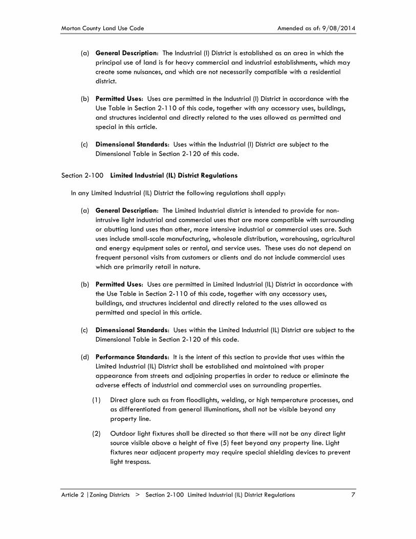
Industrial (I) District Regulations Section 2-090
In any Industrial (I) District the following regulations shall apply:
Morton County Land Use Code Amended as of: 9/08/2014
Article 2 |Zoning Districts > Section 2-100 Limited Industrial (IL) District Regulations 7
General Description: The Industrial (I) District is established as an area in which the (a)
principal use of land is for heavy commercial and industrial establishments, which may
create some nuisances, and which are not necessarily compatible with a residential
district.
Permitted Uses: Uses are permitted in the Industrial (I) District in accordance with the (b)
Use Table in Section 2-110 of this code, together with any accessory uses, buildings,
and structures incidental and directly related to the uses allowed as permitted and
special in this article.
Dimensional Standards: Uses within the Industrial (I) District are subject to the (c)
Dimensional Table in Section 2-120 of this code.
Limited Industrial (IL) District Regulations Section 2-100
In any Limited Industrial (IL) District the following regulations shall apply:
General Description: The Limited Industrial district is intended to provide for non-(a)
intrusive light industrial and commercial uses that are more compatible with surrounding
or abutting land uses than other, more intensive industrial or commercial uses are. Such
uses include small-scale manufacturing, wholesale distribution, warehousing, agricultural
and energy equipment sales or rental, and service uses. These uses do not depend on
frequent personal visits from customers or clients and do not include commercial uses
which are primarily retail in nature.
Permitted Uses: Uses are permitted in Limited Industrial (IL) District in accordance with (b)
the Use Table in Section 2-110 of this code, together with any accessory uses,
buildings, and structures incidental and directly related to the uses allowed as
permitted and special in this article.
Dimensional Standards: Uses within the Limited Industrial (IL) District are subject to the (c)
Dimensional Table in Section 2-120 of this code.
Performance Standards: It is the intent of this section to provide that uses within the (d)
Limited Industrial (IL) District shall be established and maintained with proper
appearance from streets and adjoining properties in order to reduce or eliminate the
adverse effects of industrial and commercial uses on surrounding properties.
Direct glare such as from floodlights, welding, or high temperature processes, and (1)
as differentiated from general illuminations, shall not be visible beyond any
property line.
Outdoor light fixtures shall be directed so that there will not be any direct light (2)
source visible above a height of five (5) feet beyond any property line. Light
fixtures near adjacent property may require special shielding devices to prevent
light trespass.

Morton County Land Use Code Amended as of: 9/08/2014
Article 2 |Zoning Districts > Section 2-110 Use Table 8
Vibration shall not be discernible at any property line to the human sense of (3)
feeling for more than a total of five (5) minutes per day.
The storage of trash and refuse shall be within principal buildings or otherwise (4)
shall be within an accessory enclosure complete with six (6) foot opaque walls or
screened from visibility with an adequate buffer.
Storage of materials in any front yard shall be prohibited. Any storage of (5)
materials in rear or side yards shall be located or screened so as not to be visible
from public streets or neighboring properties.
With the exception of temporary construction equipment, noises produced shall (6)
neither exceed 65 decibels between the hours of 7:00 am and 11:00 pm nor 60
decibels between the hours of 11:00 pm and 7:00 am, as measured at or beyond
any of the property lines from which the noise is emanating.
Buffer yards shall be installed where required as outlined in Section 4-020. (7)
Fuel, oil, or chemical tanks shall be in compliance with all applicable federal, (8)
state, and local laws.
Use Table Section 2-110
The following table lists all uses allowed within zoning districts of Morton County:
Use Categories (a)
P Uses Permitted By Right: A “P” indicates that a use category is allowed (1)
by right in the respective zoning district. These permitted uses are subject to all
other applicable provisions of this code.
S Uses Permitted with Special Use Permit: An “S” indicates that a use (2)
category is allowed only if reviewed and approved as a special use, in
accordance with the special use review procedures of Section 10-040. Special
uses are subject to all other applicable provisions of this code.
T Uses Permitted with Temporary Use Permit: A “T” indicates that a use (3)
category is allowed only if reviewed and approved as a temporary use, in
accordance with the temporary use review procedures of Section 10-050 for a
period not to exceed the number of days identified in the Use Table.
/C Uses Subject to Specific Conditions: A “P,” an “S,” or a “T” that is (4)
accompanied by the symbol “/C” indicates that the listed use type is subject to
use-specific conditions. The standards for specific uses are listed in Article 5 |
Specific Use Standards and a reference to the section is provided.
- Uses Not Allowed: A “-” indicates that a use type is not allowed in the (5)
respective zoning district, unless it is otherwise expressly allowed by other
provisions of this code. Additionally, all uses not included on this list are not
allowed within any zoning district within Morton County, unless they are
interpreted as a use type in this table according to Section 2-110(b).

Morton County Land Use Code Amended as of: 9/08/2014
Article 2 |Zoning Districts > Section 2-110 Use Table 9
Section 2-110 | Use Table
Zoning Districts
Use Type (with reference to applicable standards) A R RM RC C CL I IL
Agricultural Uses
Farming or Ranching P P P P P P P P
Animal Feeding Operation, major - Section 5-060 S/C - - - - - - -
Animal Feeding Operation, minor - Section 5-060 P/C - - - - - - -
Grain Elevator S - - - - - - -
Winery or Distillery or Brewery -Section 5-030 P/C - - S/C - - - -
Agricultural Recreational Use - Section 5-030 P/C - - S/C - - - -
Residential Uses
Dwelling, single family P P P P - - - -
Dwelling, multifamily - - P - - - - -
Manufactured Home Park - Section 5-140 S/C S/C S/C - - - - -
Group Home P P P P - - - -
Temporary Crew Housing - Section 5-170 S/C - - - S/C - S/C -
Commercial Uses
Animal Boarding Kennel S - - - P - - P
Bank - - - - P P - -
Fueling Station - Section 5-090 - - - - P P/C P -
Livestock Sales Pavilion S - - - - - P -
Hotel - - - - P - - S
Office - - - - P P - P
Parking Lot or Parking Garage1 - - - - P - - -
Retail, automotive - - - - P - P -
Retail, farm implements - - - - P - P P
Retail, general - - - - P P - -
Retail, grocery - - - - P P - -
Services, personal - - - - P P - -
Services, automotive repair - - - - P - P P
Services, general repair - - - - P P P P
Sign, outdoor advertising - - - - P P P -
Undertaking Establishment - Section 5-070 S/C - - - - - P P
Arts, Entertainment and Recreational Uses
Adult Entertainment Center - Section 5-020 - - - - - - S/C -
Arts and Crafts Gallery - - - - P P - -
Bar or Tavern - - - - S - - -
Drive-in Theater - Section 5-080 S/C - - - S/C - S/C -
Golf Driving Range - Section 5-100 S/C - - - S/C - - -
Hunting Cabin S - - - - - - -
Miniature Golf Course - Section 5-100 S/C - - - S/C - - -
Public Recreation Area2 P S S S P P - -
Race Track S - - - - - - -
1 Only applies to parking facilities that are a principal use. Parking is permitted as an accessory use according to Section 4-010 Automobile Parking. 2 Operated by government or non-profit agencies only.

Morton County Land Use Code Amended as of: 9/08/2014
Article 2 |Zoning Districts > Section 2-110 Use Table 10
Section 2-110 | Use Table
Zoning Districts
Use Type (with reference to applicable standards) A R RM RC C CL I IL
Restaurant - - - - P P - S
Riding Stable, commercial3 S - - - P - - -
Recreational Vehicle Camp - Section 5-150 S/C - - - S/C - S/C -
Rodeo Arena4 S - - - P - - -
Sports Arena, Ice Rink, Pool, or Bowling Alley5 - - - - P - - S
Shooting Range S - - - - - P -
Theater - - - - P P - -
Institutional Uses
Cemetery - Section 5-070 S/C - - - - - S/C S/C
Church S P P - P - - S
Community Center P - - P P P - S
Day Care Center - - - - P P - -
Health Care Facility - - - - P - - -
Nursing Home or Assisted Living Facility - - - - P P - -
School, college or university - - - - P - - -
School, elementary or secondary P P P - P - - -
School, technical or trade - - - - P - P P
Police, Fire, or EMS Station P - - - P - P P
Veterinary Clinic S - - - P - - P
Industrial Uses
Asphalt, Concrete Batch, or Aggregate Plant S - - - - - P -
Contractor Storage Yard S - - - - - P S
Fertilizer Facility S - - - - - P -
Gravel Pit or Mineral Processing - Section 5-110 S/C - - - - - P/C -
Salvage Yard - Section 5-130 - - - - - - S/C -
Laboratory, research - - - - - - P P
Manufacturing, major - - - - - - P -
Manufacturing, minor - - - - - - P P
Oil and Gas Well P P P P P P P P
Slaughterhouse - - - - - - S -
Warehouse, Storage, and Wholesale Distribution S - - - - - P P
Solid Waste Facility - Section 5-160 S/C - - - - - S/C -
Sewage Treatment Plant S - - - - - P -
Storage, fuel - - - - - - P -
Telecommunications Tower S - - - - - P P
Utility, public facility P - - - - - P P
Wind Energy Facility - Section 5-180 S/C - - - - - - -
Transportation-Related Uses
3 For commercial use. A stable for private use is an accessory “Animal Husbandry” use. A non-profit or government stable may be considered a “Public Recreation” use. 4 For commercial use. Rodeo arenas for private use only may be permitted by right in the Agricultural (A) District. 5 For commercial use. Non-profit or government athletic facilities may be considered a “public recreation use.”

Morton County Land Use Code Amended as of: 9/08/2014
Article 2 |Zoning Districts > Section 2-110 Use Table 11
Section 2-110 | Use Table
Zoning Districts
Use Type (with reference to applicable standards) A R RM RC C CL I IL
Airport - Section 5-040 S - - - - - - -
Railyard - - - - - - P -
Railroad Track P - - - P - P -
Transloading Facility S - - - - - P -
Additional Accessory Uses
Accessory Dwelling Unit - Section 5-010 S/C - - - - - - P/C
Animal Husbandry - Section 5-050 P P/C P/C - - - - -
At-Home Business - Section 5-120(c) S - - - - - - -
Home Occupation, Major - Section 5-120(b) P/C S/C S/C S/C - - - -
Home Occupation, Minor - Section 5-120(a) P/C P/C P/C P/C - - - -
Home Occupation, 2nd on lot or tract6 S/C S/C S/C S/C - - - -
Temporary Uses
Concert or fair (21 days) T - - - T - T -
Construction staging area (120 days) T T T T T T T T
Contractors office (120 days) T T T T T T T T
Housing for construction project (30 days) T - - - T T T T
Public or religious meeting (60 days) T - - - T - T -
Sales stand for produce, Christmas trees, or
fireworks (60 days)7 T - - - T - T -
Any other temporary use (60 days) S S S S S S S S
Interpretation of Use Types (b)
The Zoning Administrator is authorized to classify specific land uses, either proposed or
existing, into a use type in the Section 2-110 Use Table based on:
The definition of that use type in Article 12 | Definitions. (1)
Any standards for that use in Article 5 | Specific Use Standards. (2)
Any previous interpretations of a similar nature made in Morton County. (3)
Rules for Interpretation: When a specific land use cannot be readily classified into a (c)
use type or appears to fit into multiple use types, the Zoning Administrator is
authorized to determine the most similar, and thus most appropriate, use type. The
interpretation shall be made in writing, and forwarded to the party proposing the use.
The interpretation shall be based on the following rules:
The actual or projected characteristics of the specific use in relationship to the (1)
stated characteristics of the various use types.
The amount of site area, floor space and equipment required for the use. (2)
6 A second Home Occupation may be either Minor or Major, but may not be an At-Home Business. 7 Rummage sales, yard sales, and garages sales do not require any permit, subject to Section 5-120(a)(6).

Morton County Land Use Code Amended as of: 9/08/2014
Article 2 |Zoning Districts > Section 2-120 Dimensional Table 12
The frequency and type of sales activity generated by the use. (3)
The nature of the customer interaction generated by the use (e.g. on site, remote (4)
access, daily or infrequent.)
The number of employees required for the use. (5)
The hours of operation. (6)
The building, site arrangement and access requirements for the use. (7)
The types of vehicles or equipment used in association with the use. (8)
The number of vehicle trips generated by the use per day of the week over the (9)
course of a week, month or year.
The means by which the use advertises itself. (10)
Whether the use is likely to be located independent of other uses on the site or (11)
established in a shared use environment.
Dimensional Table Section 2-120
The following table lists all dimensional standards for lots or tracts and buildings as they apply
within each zoning district of Morton County. Dimensional standards shall be interpreted according
to the following rules:
Application of Standards: All dimensional standards for buildings or structures apply (a)
to the principal building or structure together with all accessory buildings or structures
on the lot or tract.
Calculation of Setbacks: Setbacks in Section 2-120 Dimensional Table are measured (b)
from the foundation of the building or structure to the property line of the lot or tract
within which the building or structure is located. The statutory right of way from a
section line of thirty-three (33) feet, as determined by NDCC Section 24-07-03, shall
be considered a property line for the purposes of administering this section.
Calculation of Building Height: Roof structures and mechanical appurtenances such as (c)
belfries, chimneys, cupolas, domes, flag poles, flues, radio towers, and spires shall not
be taken into account when calculating the height of buildings for the purposes of
determining compliance with height limitations. Furthermore, building height limitations
do not apply to bulkheads, monuments, radio towers, tanks, water towers or similar
structures. However, no such structure of this paragraph shall have a total area greater
than twenty-five (25) percent of the roof area of a building.
Airport Height Restrictions Prevail: Nothing in this section, nor in this code, shall be (d)
interpreted to permit the erection of any structure in violation of any applicable
Airport Overlay District provisions in Section 3-010(h)(5).

Morton County Land Use Code Amended as of: 9/08/2014
Article 2 |Zoning Districts > Section 2-120 Dimensional Table 13
Farming and Public Utilities Exemption: No dimensional standards shall be (e)
interpreted to apply to uses that are exclusively related to farming and ranching or
for certain public utilities, in accordance with Section 1-040.
Section 2-120 | Dimensional Table
Zoning Districts
Standard A R & RM RC C CL I IL
Minimum Dimensions for Lots/Tracts Served by Public Water and Sanitary Sewer
Minimum Lot/Tract Area (Sq Ft) 35 acre 7,200 7,200 7,2008 7,2008 65,000 65,000
Minimum Lot/Tract Width (Feet) 640 60 60 60 60 150 150
Minimum Lot/Tract Depth (Feet) 640 120 120 120 120 150 150
Minimum Dimensions for Lots/Tracts Not Served by Public Water and Sanitary Sewer
Minimum Lot/Tract Area (Sq Ft) 35 acre 65,000 65,000 80,0008 65,0008 80,000 65,000
Minimum Lot/Tract Width (Feet) 640 100 100 200 150 200 150
Minimum Lot/Tract Depth (Feet) 640 200 200 300 150 300 150
Minimum Building/Structure Setbacks
Front Yard (Feet) 60 40 40 40 15 50 25
Side Yard (Feet) 159 159 159 159 159 159 159
Rear Yard (Feet) 5010 5010 5010 20 20 25 25
Other Dimensional Standards
Maximum Building Height (feet)
35 or
2½
stories
35 or
2½
stories
35 or
2½
stories
35 or 2
stories
25 or 2
stories
50 or 4
stories11
35 or
2½
stories11
Maximum Floor Area Ratio NA 0.40 0.40 0.50 0.35 0.60 0.60
Maximum Building Coverage of Lot NA 30% 30% 30% 25% 30% NA
Maximum Impervious Surface of Lot NA NA NA NA NA NA 70%
8 However, a building having one or more party walls and a common roof with one or more similar buildings but individually owned, may be on any size lot or tract as long as the other provisions of this code, including Section 4-010 Automobile Parking, sanitation and other provisions are fully complied with. 9 Or ten (10) percent of the average width of the lot or tract, whichever is greater, except that the side yard need not exceed twenty five (25) feet. Side yards for accessory structures may be less than fifteen (15) feet, but may not be less than ten (10) feet. 10 However, an accessory building may be less than fifty (50) feet but no less than ten (10) feet from the rear property line. 11 No accessory building may exceed two (2) stories, or twenty five (25) feet in height.

Morton County Land Use Code Amended as of: 9/08/2014
Article 2 |Zoning Districts > Section 2-120 Dimensional Table 14
Additional Setbacks from Roadways: All buildings or structures must be at least set (f)
back from the centerline of a roadway according to the Section 2-120(f) Roadway
Setback Table. Where the setbacks required by the Section 2-120 Dimensional Table
and the Section 2-120(f) Roadway Setback Table differ, whichever setback is greater
applies.
Section 2-120(f) | Roadway Setback Table
Class of Roadway Minimum Setback from Centerline
Interstate 250 feet
Arterial 150 feet
Collector 120 feet
Local 80 feet

Morton County Land Use Code Amended as of: 9/08/2014
Article 3 |Overlay Districts > Section 3-010 Floodplain Overlay District 15
OVERLAY DISTRICTS Article 3 |
Overlay districts are specifically defined areas with unique characteristics, within which the
provisions of the zoning districts identified in Article 2 | Zoning Districts of this code are
supplemented with additional provisions. This article defines all overlay districts in Morton
County and applies additional standards and procedures to each of these areas.
Floodplain Overlay District Section 3-010
Findings of Fact (a)
The flood hazard areas of Morton County are subject to periodic inundation which (1)
can endanger life, result in loss of property, create health and safety hazards,
disrupt commerce and governmental services, cause extraordinary public
expenditures for flood protection and relief, and impair the tax base, all of which
adversely affect the public health, safety and general welfare.
Flood losses caused by the cumulative effect of obstructions in the special flood (2)
hazard areas cause increases in flood heights and velocities. Inadequately flood-
proofed elevated or otherwise unprotected structures also contribute to the flood
loss.
Statement of Purpose: It is the purpose of this section to promote the public health, (b)
safety, and general welfare, and to minimize public and private losses due to flood
conditions in specific areas by provisions designed:
To protect human life and health. (1)
To minimize expenditure of public money for costly flood control projects. (2)
To minimize the need for rescue and relief efforts associated with flooding and (3)
generally undertaken at the expense of the general public.
To minimize prolonged business interruptions. (4)
To minimize damage to public facilities and utilities such as water and gas mains, (5)
electric, telephone and sewer lines, streets and bridges.
To help maintain a stable tax base by providing for the second use and (6)
development of special flood hazard area so as to minimize future flood blight
areas.
To ensure that those who occupy special flood hazard areas assume responsibility (7)
for their actions.
Methods of Reducing Flood Losses: In order to accomplish its purposes, this section (c)
includes methods and provisions for:

Morton County Land Use Code Amended as of: 9/08/2014
Article 3 |Overlay Districts > Section 3-010 Floodplain Overlay District 16
Restricting or prohibiting uses which are dangerous to health, safety, and property (1)
due to water or erosion hazards, or which result in damaging increases in erosion
or in flood heights or velocities.
Requiring that uses vulnerable to floods, including facilities which serve such uses, (2)
be protected against flood damage at the time of initial construction.
Controlling the alteration of natural floodplains, stream channels, and natural (3)
protective barriers, which help accommodate or channel flood waters.
Controlling filling, grading, dredging and other development in the floodplain (4)
which may increase flood damage.
Preventing or regulating the construction of flood barriers which will unnaturally (5)
divert flood waters or which may increase flood hazards in other areas.
General Provisions (d)
Lands to which this Section Applies: This section shall apply to all areas of (1)
special flood hazard within the jurisdiction of Morton County, and outside of any
incorporated cities or their extraterritorial areas.
Basis for Establishing the Areas of Special Flood Hazard: The special flood (2)
hazard areas identified by the Federal Emergency Management Agency in a
scientific and engineering report entitled, "The Flood Insurance Study for the
Morton County, North Dakota," dated April 19, 2005, with an accompanying
Flood Insurance Rate Map, and as subsequently updated by any Letter of Map
Amendment, Letter of Map Revision and/or Letter of Map Revision Based on Fill
issued by the Federal Emergency Management Agency, is hereby adopted by
reference and declared to be a part of this section. The Flood Insurance Study
and the Flood Insurance Rate Map is on file at the office of the Zoning
Administrator.
Compliance: No structure or land shall hereafter be constructed, located, (3)
extended, converted, or altered without full compliance with the terms of this
section and other applicable regulations.
Greater Restrictions: This section is not intended to repeal, remedy, or impair any (4)
existing easements, covenants, or deed restrictions. However, where this section
and another section, easement, covenant, or deed restriction conflict or overlap,
whichever imposes the more stringent restrictions shall prevail.
Interpretation: In the interpretation and application of this section, all provisions (5)
shall be:
Considered as minimum requirements. A)
Liberally construed in favor of the governing body. B)
Deemed neither to limit nor repeal any other powers granted under state C)
statutes.
Morton County Land Use Code Amended as of: 9/08/2014
Article 3 |Overlay Districts > Section 3-010 Floodplain Overlay District 17
Warning and Disclaimer of Liability: The degree of flood protection required (6)
by this section is considered reasonable for regulatory purposes and is based on
scientific and engineering considerations. Larger floods can and will occur on rare
occasions. Flood heights may be increased by man-made or natural causes. This
section does not imply that land outside the special flood hazards or uses
permitted within such areas will be free from flooding or flood damages. This
section shall not create liability on the part of Morton County, any officer or
employee thereof or the Federal Emergency Management Agency, for any flood
damages that result from reliance on this section or any administrative decision
lawfully made thereunder.
Establishment of Floodplain Development Permit: A floodplain development permit (e)
shall be obtained before construction or development begins within any area of
special flood hazard area established in Section 3-010(d)(2). Application for a
floodplain development permit shall be made on forms furnished by the Zoning
Administrator and may include, but not be limited to:
Plans drawn to scale showing the nature, location, dimensions, and elevations of (1)
the area in question; existing or proposed structures, fill storage materials,
drainage facilities; and the location of the foregoing.
Certification by a registered professional engineer or architect that the flood- (2)
proofing methods for any non-residential structure meet the flood-proofing
criteria in Section 3-010(g)(2).
Elevation in relation to mean sea level to which any structure is flood-proofed. (3)
Estimated market value of structure after completion, and estimated project costs, (4)
of labor and materials, for proposed development.
Description of the extent to which any watercourse will be altered or relocated as (5)
a result of proposed development.
Any additional information requested by the Zoning Administrator that is (6)
necessary to ensure compliance with the provisions of this section.
Designation and Duties for Floodplain Management: The Zoning Administrator is (f)
hereby appointed to administer and implement this section by granting or
disapproving floodplain development permit applications in accordance with its
provisions. The Zoning Administrator shall consult with the Building Inspector and a
representative from the applicable Water Resource District, as needed, before
granting a floodplain development permit. Duties of the Zoning Administrator include,
but are not limited to:
Permit Review: The Zoning Administrator shall: (1)
Review all floodplain development permits to determine that the permit A)
requirements of this section have been satisfied.
Review all floodplain development permits to determine that all B)
necessary permits have been obtained from those federal, state, or local

Morton County Land Use Code Amended as of: 9/08/2014
Article 3 |Overlay Districts > Section 3-010 Floodplain Overlay District 18
governmental agencies from which prior approval is required.
Review all floodplain development permits to determine if the proposed C)
development is located in the floodway. If located in the floodway,
assure that the encroachment provisions of Section 3-010(g)(3) are met.
Use of Other Base Flood Data: When base flood elevation data has not been (2)
provided in accordance with Section 3-010(d)(2), “Basis For Establishing The
Areas Special Flood Hazard Areas,” the Zoning Administrator shall obtain, review,
and reasonably utilize any base flood elevation and floodway data available,
known as best available data, from a federal, state, or other source, as criteria
for requiring that new construction, substantial improvements or other development
in the floodplain are administered in accordance with Section 3-010(g)(2)
“Specific Standards.”
Information to be Obtained and Maintained: After a floodplain development (3)
permit has been granted and construction has been completed, the Zoning
Administrator shall:
Obtain and record the actual elevation (in relation to mean sea level) of A)
the lowest floor, including basement, of all new or substantially improved
structures, and whether or not the structure contains a basement. This shall
be provided in the form of an elevation certificate, completed by a
licensed engineer, architect, or surveyor.
For all new or substantially improved flood-proofed structures, obtain B)
and record the actual elevation (in relation to mean sea level) to which
the structure has been flood-proofed and maintain the flood-proofing
certifications required in Section 3-010(g)(2).
Maintain for public inspection all records pertaining to the provisions of C)
this section.
Alteration of Watercourses: After finding that a watercourse is proposed for (4)
alteration, the Zoning Administrator shall:
Notify nearby communities, the water resource district, and the North A)
Dakota State Engineer, as necessary prior to any alteration or relocation
of a watercourse, and submit evidence of such notification to the Federal
Emergency Management Agency.
Require that maintenance is provided within the altered or relocated B)
portion of said watercourse so that the flood carrying capacity is not
diminished.
Notify the appropriate water resource district prior to removal or C)
placement of fill within two hundred (200) feet of the bank of a body of
water during normal flow or stage.
Interpretation of Flood Insurance Rate Map (FIRM) Boundaries: The Zoning (5)
Administrator shall make interpretation where needed as to the exact location of

Morton County Land Use Code Amended as of: 9/08/2014
Article 3 |Overlay Districts > Section 3-010 Floodplain Overlay District 19
the boundaries of the special flood hazards areas (for example, where there
appears to be a conflict between a mapped boundary and actual field
conditions). The person contesting the location of the boundary shall be given a
reasonable opportunity to appeal the interpretation as provided in Section 3-
010(h).
Notification of State: The Zoning administrator shall notify the State Engineer of (6)
any application for a floodplain development permit within a floodway and
supply all technical documentation available and relevant to the application,
pursuant of NDCC Section 61-16.2-14.
Provisions for Flood Hazard Reduction (g)
General Standards: In all special flood hazard areas, the following standards (1)
are required:
Anchoring A)
a) All new construction and substantial improvements, including
additions, shall be anchored to prevent flotation, collapse or lateral
movement of the structure.
b) All manufactured homes shall be elevated and anchored to resist
flotation, collapse or lateral movement. Methods of anchoring may
include, but are not limited to, use of over-the-top or ties-to-ground
anchors. This requirement is in addition to applicable state and local
anchoring requirements for resisting wind forces.
Construction Materials and Methods B)
a) All new construction and substantial improvements shall be
constructed with materials and utility equipment resistant to flood
damage.
b) All new construction and substantial improvements shall be
constructed using methods and practices that minimize flood
damage.
c) All new construction and substantial improvements shall be
constructed with electrical, heating, ventilation, plumbing, and air
conditioning equipment and other service facilities that are designed
and/or located so as to prevent water from entering or accumulating
within the components during conditions of flooding.
Utilities C)
a) All new and replacement water supply systems shall be designed to
minimize or eliminate infiltration of flood waters into the system.
b) New and replacement sanitary sewage systems shall be designed to
minimize or eliminate infiltration of flood waters into the systems and
discharge from the systems into flood waters.

Morton County Land Use Code Amended as of: 9/08/2014
Article 3 |Overlay Districts > Section 3-010 Floodplain Overlay District 20
c) On-site waste disposal system shall be located to avoid impairment
to them or contamination from them during flooding.
Subdivision Proposals D)
a) All subdivision proposals shall be consistent with the need to minimize
flood damage.
b) All subdivision proposals shall have public utilities and facilities such
as sewer, gas, electrical, and water systems located and constructed
to minimize flood damage.
c) All subdivision proposals shall have adequate drainage provided to
reduce exposure to flood damage.
d) Base flood elevation data shall be provided for subdivision
proposals and other proposed development in the special flood
hazard areas which contain at least fifty (50) lots or five (5) acres.
Specific Standards: In all areas of special flood hazards where base flood (2)
elevation data have been provided as set forth in Section 3-010(d)(2) “Basis for
Establishing the Areas of Special Flood Hazard Areas” or Section 3-010(f)(2)
“Use of Other Base Flood Data”, the following provisions are required:
Residential Construction: New construction or substantial improvement of A)
any residential structure shall have the lowest floor, including basement,
elevated to at least one (1) foot above the base flood elevation.
Nonresidential Construction: Construction or substantial improvement of B)
any nonresidential structure shall either have the lowest floor, including
basement, elevated to at least one (1) foot above the base flood
elevation, or together with attendant utility and sanitary facilities shall:
a) Be flood-proofed to at least two (2) feet above the base flood
elevation, so that below this elevation the structure is watertight with
walls substantially impermeable to the passage water.
b) Have structural components capable of resisting hydrostatic and
hydrodynamic loads and the effects of buoyancy.
c) Be certified by a registered professional engineer or architect that
the standards of this subsection are satisfied. Such certifications shall
be provided to the zoning administrator as set forth in Section 3-
010(f)(3)B).
Manufactured Homes: Manufactured homes shall be anchored in C)
accordance with Section 3-010(g)(1)A). All manufactured homes or those
to be substantially improved shall be elevated on a permanent
foundation such that the lowest floor of the manufactured home is
elevated to at least one (1) foot above the base flood elevation, and is
securely anchored to an adequately anchored foundation system.
Morton County Land Use Code Amended as of: 9/08/2014
Article 3 |Overlay Districts > Section 3-010 Floodplain Overlay District 21
Floodways: Located within the special flood hazard areas established in (3)
Section 3-010(d)(2) are areas designated as floodways. Since the floodway is
an extremely hazardous area due to the velocity of flood waters which carry
debris, potential projectiles, and erosion potential, the following provisions
apply:
Encroachments, including fill, new construction, substantial improvements, A)
and other development are prohibited unless certification by a registered
professional engineer or architect is provided demonstrating that
encroachments shall not result in any increase in flood levels during the
occurrence of the base flood discharge.
If Section 3-010(g)(3)A) is satisfied, all new construction and substantial B)
improvements shall comply with all applicable flood hazard reduction
provisions of Section 3-010(g) “Provisions for Flood Hazards Reduction.”
Variances and Appeals (h)
Variance and Appeal Procedures (1)
The Planning and Zoning Commission and the Board of County A)
Commissioners shall hear and decide upon requests for variances from the
requirements of this section, according to procedures in Section 10-060
and additional criteria of Section 3-010(h)(2) and Section 3-010(h)(3) of
this code.
The Board of County Commissioners shall hear and decide appeals when B)
it is alleged there is an error in any requirement, decision, or
determination made by the Zoning Administrator in the enforcement or
administration of this section, according to the procedures in Article 11 |
Appeals and Enforcement.
Those aggrieved by the decision of the Board of County Commissioners C)
may appeal such decision to the South Central Judicial District, according
to procedures of NDCC Sections 28-34-01.
Additional Approval Criteria for Variances and Appeals: In addition to the (2)
approval criteria listed in Section 10-060, the Board of County Commissioners
shall consider all technical evaluations, all relevant factors, standards specified in
other sections of this code and:
The danger that materials may be swept into other lands to the injury of A)
others.
The danger to life and property due to flooding or erosion damage. B)
The susceptibility of the proposed facility and its contents to flood C)
damage and the effect of such damage on the individual owner.
The importance of the services provided by the proposed facility to the D)
community.

Morton County Land Use Code Amended as of: 9/08/2014
Article 3 |Overlay Districts > Section 3-010 Floodplain Overlay District 22
The necessity to the facility of a waterfront location, where applicable. E)
The availability of alternative locations, for the proposed use which are F)
not subject to flooding or erosion damage.
The compatibility of the proposed use with existing and anticipated G)
development in special flood hazard areas.
The relationship of the proposed use to the Comprehensive Plan and H)
floodplain management program for that area.
The safety of access to the property in time of flood for ordinary I)
emergency vehicles.
The expected heights, velocity, duration, rate of rise, and sediment J)
transport of the floodwaters and the effects of wave action, if
applicable, expected at the site.
The costs of providing governmental services during and after flood K)
conditions, including maintenance and repair of public utilities and
facilities such as sewer, gas, electrical, and water systems, and streets and
bridges.
Special Conditions for Variances (3)
Variances may be issued for the reconstruction, rehabilitation, or A)
restoration of structures listed on the National Register of Historic Places
or the State Inventory of Historic Places, without regard to the procedures
set forth in this section.
Variances shall not be issued within any identified floodway if any B)
increase in flood levels during the base flood discharge would result.
Variances shall only be issued upon a determination that the granting of C)
a variance will not result in increased flood heights, additional threats to
public safety, cause fraud on or victimization of the public as identified in
Section 3-010(h)(2)), or conflict with existing local laws or ordinances.
Lot size Considerations: Generally, variances may be issued for new construction (4)
and substantial improvements to be erected on a lot of one-half (½) acre to less
in size contiguous to and surrounded by lots with existing structures constructed
below the base flood level, providing items (a-k) in Section 3-010(h)(2) have
been fully considered. As the lot area increases beyond the one-half (½) acre, the
technical justification required for issuing the variance increases.
Applicant Notification: The Zoning Administrator shall notify the applicant in (5)
writing that:
The issuance of a variance to construct a structure below the base flood A)
level will result in increased premium rates for flood insurance
commensurate with the increased risk of flood damage

Morton County Land Use Code Amended as of: 9/08/2014
Article 3 |Overlay Districts > Section 3-020 Airport Overlay District 23
Such construction below the base flood level increases risks to life and B)
property.
Record of Variances and Appeals: The Zoning Administrator shall maintain the (6)
records of all variance and appeal actions, including notifications and
justifications for their issuance, and report said actions to the Federal Emergency
Management Agency upon request.
Airport Overlay District Section 3-020
Purpose: It is hereby found that an obstruction has the potential for endangering the (a)
lives and property of users of the Mandan Municipal Airport and the Glen Ullin
Regional Airport, and property or occupants of land in their vicinity; that an obstruction
may affect existing and future instrument approach minimum of the Mandan Municipal
Airport and the Glen Ullin Regional Airport; and that an obstruction may reduce the
size of areas available for the landing, takeoff, and maneuvering of aircraft; thus
tending to destroy or impair the utility of the airport and the public investment therein.
Accordingly, it is declared:
That the creation or establishment of an obstruction has the potential of being a (1)
public nuisance and may injure the region served by the Mandan Municipal
Airport or the Glen Ullin Regional Airport.
That it is necessary in the interest of the public health, public safety, and general (2)
welfare that the creation or establishment of obstructions that are a hazard to air
navigation be prevented.
That the prevention of these obstructions should be accomplished, to the extent (3)
legally possible, by the exercise of the police power without compensation.
That the prevention of hazards to air navigation, the elimination or mitigation of (4)
hazards to air navigation, or marking and lighting of obstructions are public
purposes for which a political subdivision may raise and expend public funds and
acquire land or interests in land.
Airport Zones: In order to carry out the provisions of this section, there are hereby (b)
created and established certain zones which include all of the land lying beneath the
approach surfaces, transitional surfaces, horizontal surfaces, and conical surfaces as
they apply to the Mandan Municipal Airport and the Glen Ullin Regional Airport.
Such zones are shown on the Mandan Municipal Airport Zoning Map, in its most recent
version, prepared by the Mandan Municipal Airport Authority and the Glen Ullin
Regional Airport Zoning Map, in its most recent version, prepared by the Airport
Engineer. Both maps are attached to the Morton County Land Use Code and made a
part hereof. An area located in more than one of the following zones is considered to
be only in the zone with the more restrictive height limitation. The various zones are
hereby established and defined as follows:

Morton County Land Use Code Amended as of: 9/08/2014
Article 3 |Overlay Districts > Section 3-020 Airport Overlay District 24
Utility Runway Visual Approach Zone: The inner edge of this approach zone (1)
coincides with the width of the primary surface and is 250 feet wide. The
approach zone expands outward uniformly to a width of 1,250 feet at a
horizontal distance of 5,000 feet from the primary surface. Its centerline is the
continuation of the centerline of the runway.
Utility Runway Non-precision Instrument Approach Zone: The inner edge of (2)
this approach zone coincides with the width of the primary surface and is 500
feet wide. The approach zone expands outward uniformly to a width of 2,000
feet at a horizontal distance 5,000 feet from the primary surface. Its centerline is
the continuation of the centerline of the runway.
Runway Larger than Utility Visual Approach Zone: The inner edge of this (3)
approach zone coincides with the width of the primary surface and is 500 feet
wide. The approach zone expands outward uniformly to a width of 1,500 feet at
a horizontal distance of 5,000 feet from the primary surface. Its centerline is the
continuation of the centerline of the runway.
Runway Larger than Utility with a Visibility Minimum Greater than ¾ Mile (4)
Non-precision Instrument Approach Zone: The inner edge of this approach
zone coincides with the width of the primary surface and is 500 feet wide. The
approach zone expands outward uniformly to a width of 3,500 feet at a
horizontal distance of 10,000 feet from the primary surface. Its centerline is the
continuation of the centerline of the runway.
Runway Larger than Utility with a Visibility Minimum as Low as ¾ Mile Non-(5)
precision Instrument Approach Zone: The inner edge of this approach zone
coincides with the width of the primary surface and is 1,000 feet wide. The
approach zone expands outward uniformly to a width of 4,000 feet at a
horizontal distance of 10,000 feet from the primary surface. Its centerline is the
continuation of the centerline of the runway.
Precision Instrument Runway Approach Zone: The inner edge of this approach (6)
zone coincides with the width of the primary surface and is 1,000 feet wide. The
approach zone expands outward uniformly to a width of 16,000 feet at a
horizontal distance of 50,000 feet from the primary surface. Its centerline is the
continuation of the centerline of the runway.
Transitional Zones: The transitional zones are the areas beneath the transitional (7)
surfaces.
Horizontal Zone: The horizontal zone is established by swinging arcs of 5,000 (8)
feet radii for all runways designated utility or visual and 10,000 feet for all
others from the center of each end of the primary surface of each runway and
connecting the adjacent arcs by drawing lines tangent to those arcs. The
horizontal zone does not include the approach and transitional zones.
Conical Zone: The conical zone is established as the area that commences at the (9)
periphery of the horizontal zone and extends outward there from a horizontal
distance of 4,000 feet.

Morton County Land Use Code Amended as of: 9/08/2014
Article 3 |Overlay Districts > Section 3-020 Airport Overlay District 25
Airport Zone Height Limitations: Except as otherwise provided in this section, no (c)
structure shall be erected, altered, or maintained, and no tree shall be allowed to
grow in any zone created by this section to a height in excess of the applicable height
herein established for such zone. Such applicable height limitations are hereby
established for each of the zones in question as follows:
Utility Runway Visual Approach Zone: Slopes twenty (20) feet outward for (1)
each foot upward beginning at the end of and at the same elevation as the
primary surface and extending to a horizontal distance of 5,000 feet along the
extended runway centerline.
Utility Runway Nonprecision Instrument Approach Zone: Slopes twenty (20) (2)
feet outward for each foot upward beginning at the end of and at the same
elevation as the primary surface and extending to a horizontal distance of 5,000
feet along the extended runway centerline.
Runway Larger Than Utility Visual Approach Zone: Slopes twenty (20) feet (3)
outward for each foot upward beginning at the end of and at the same elevation
as the primary surface and extending to a horizontal distance of 5,000 feet
along the extended runway centerline.
Runway Larger Than Utility With A Visibility Minimum Greater than ¾ Mile (4)
Non-precision Instrument Approach Zone: Slopes thirty-four (34) feet outward
for each foot upward beginning at the end of and at the same elevation as the
primary surface and extending to a horizontal distance of 10,000 feet along the
extended runway centerline.
Runway Larger Than Utility With A Visibility Minimum As Low As ¾ Mile (5)
Non-precision Instrument Approach Zone: Slopes thirty-four (34) feet outward
for each foot upward beginning at the end of and at the same elevation as the
primary surface and extending to a horizontal distance of 10,000 feet along the
extended runway centerline.
Precision Instrument Runway Approach Zone: Slopes fifty (50) feet outward (6)
for each foot upward beginning at the end of and at the same elevation as the
primary surface and extending to a horizontal distance of 10,000 feet along the
extended runway centerline; thence slopes upward forty (40) feet horizontally for
each foot vertically to an additional horizontal distance of 40,000 feet along the
extended runway centerline.
Transitional Zones: Slope seven (7) feet outward for each foot upward (7)
beginning at the sides of and at the same elevation as the primary surface and
the approach surface, and extending to a height of 150 feet above the airport
elevation or:
A height of 2,093 feet above mean sea level for the Mandan Municipal A)
Airport.
A height of 2,260 feet above mean sea level for the Glen Ullin Regional B)
Airport.

Morton County Land Use Code Amended as of: 9/08/2014
Article 3 |Overlay Districts > Section 3-020 Airport Overlay District 26
In addition to the foregoing, there are established height limits sloping C)
seven (7) feet outward for each foot upward beginning at the sides of
and the same elevation as the approach surface, and extending to where
they intersect the conical surface. Where the precision instrument runway
approach zone projects beyond the conical zone, there are established
height limits sloping seven (7) feet outward for each foot upward
beginning at the sides of and the same elevation as the approach
surface, and extending a horizontal distance of 5,000 feet measured at
90 degree angles to an extended runway centerline.
Horizontal Zone: Established at 150 feet above the airport elevation or: (8)
A height of 2,093 feet above mean sea level for the Mandan Municipal A)
Airport.
A height of 2,260 feet above mean sea level for the Glen Ullin Regional B)
Airport.
Conical Zone: Slopes twenty (20) feet outward for each foot upward beginning (9)
at the periphery of the horizontal zone and at 150 feet above the airport
elevation or
A height of 2,093 feet above mean sea level for the Mandan Municipal A)
Airport.
A height of 2,260 feet above mean sea level for the Glen Ullin Regional B)
Airport.
and extending to a height of 350 feet above the airport elevation, or
A height of 2,293 feet above mean sea level for the Mandan Municipal A)
Airport.
A height of 2,460 feet above mean sea level for the Glen Ullin Regional B)
Airport.
Excepted Height Limitations: Nothing is this section shall be construed as (10)
prohibiting the construction or maintenance of any structure, or growth of any tree
to a height up to fifty (50) feet above the surface of the land.
Use Restrictions: Notwithstanding any other provisions of this section, no use may be (d)
made of land or water within any zone established by this section in such a manner as
to create electrical interference with navigational signals or radio communication
between the airport and aircraft, make it difficult for pilots to distinguish between
airport lights and others, result in glare in the eyes of pilots using the airport, impair
visibility in the vicinity of the airport, create bird strike hazards, or otherwise in any
way endanger or interfere with the landing, takeoff, or maneuvering of aircraft
intending to use the airport
Marking and Lighting of Non-Conforming Uses: Notwithstanding Article 6 | Non-(e)
Conforming Uses, the owner of any non-conforming structure or tree in existence on or

Morton County Land Use Code Amended as of: 9/08/2014
Article 3 |Overlay Districts > Section 3-030 Missouri River Overlay District 27
after May of 2003 is hereby required to permit the installation, operation, and
maintenance thereon of such markers and lights as shall be deemed necessary by the
applicable airport manager to indicate to the operators of aircraft in the vicinity of the
airport the presence of such airport obstruction. Such markers and lights shall be
installed, operated, and maintained at the expense of the applicable airport authority.
Administration: Except as specifically provided in this section, no material change (f)
shall be made in the use of land, no structure shall be erected or otherwise established
unless a permit therefore shall have been applied for and granted from the Morton
County Building Inspector.
Missouri River Overlay District Section 3-030
Purpose: To preserve and enhance the environmental and recreational qualities of the (a)
Missouri River, conserve the scenic and historic values of the Missouri River shoreland,
protect shoreland development from river bank erosion, and provide for the wise use
of the river and related land resources, the following additional development
standards for non-agricultural uses are hereby established for land abutting the
Missouri River.
Application: This section applies to all lots or tracts zoned by Morton County that abut (b)
the Missouri River.
Setbacks from Missouri River: The following structure setback requirements apply to (c)
all zones of Morton County:
All structures on lots or tracts with stabilized banks, either stabilized by an existing (1)
Army Corps of Engineers’ structure or as permitted and approved by the Army
Corps of Engineers, shall be set back a minimum of seventy-five (75) feet from the
ordinary high water mark of the Missouri River.
All structures on lots or tracts without such approved stabilized banks shall be (2)
setback a minimum of one hundred (100) feet from the ordinary high water mark
of the Missouri River.
Additional Development Standards: The following additional development standards (d)
apply to all zones of Morton County, except for land in the Agricultural (A) District:
Impervious Surface Coverage: The percentage of the lot covered by impervious (1)
surfaces shall not exceed twenty-five (25) percent.
Steep Slopes: For structures and/or facilities to be placed on steep slopes. The (2)
County Building Inspector may attach conditions on the building permit to prevent
erosion and preserve existing vegetation.
Topographic Alterations above the Ordinary High Water Mark: Grading, filling (3)
and excavation necessary for the construction of structures, sewage treatment
systems or driveways under validly issued permits shall be allowed. Any other
topographic alterations shall meet the following standards:

Morton County Land Use Code Amended as of: 9/08/2014
Article 3 |Overlay Districts > Section 3-040 Animal Feeding Operation Setback Overlay District 28
Alterations shall not adversely affect adjacent or nearby properties, and A)
Alterations shall be designed and constructed in a manner that minimizes B)
soil erosion, including the installation of erosion control measures as
needed.
Topographic Alterations below the Ordinary High Water Mark: All topographic (4)
alterations below the ordinary high water mark shall be approved by the Army
Corps of Engineers.
Animal Feeding Operation Setback Overlay District Section 3-040
Purpose: Setbacks from existing animal feeding operations are established for the (a)
purpose of reducing the impacts of odor on certain uses in the vicinity of the operation,
and protecting operators of animal feeding operations from potential nuisance claims.
Establishment of Odor Setbacks: The setback distances vary by the size of the (b)
operation, and are established according to the following schedule:
Section 3-040 | Odor Setback Table
Number of Animal Units in Operation Setback Distance
Operations with only Animals other than Hogs
Fewer than 300 None
300-1,000 0.50 mile
1,001 or more 0.50 mile
2,001 or more 0.75 mile
5,001 or more 1.00 mile
Operations including Hogs
Fewer than 250 None
250-750 0.50 mile
751 or more 0.75 mile
1,000 or more 1.00 mile
2,000 or more 1.50 mile
The North Dakota Department of Health maintains a list of all permitted animal (1)
feeding operations, as defined by NDCC, and the size of each operation. The
location and size of operations, as recorded by this department, will be used to
determine the center-point and radius of the setback, respectively.
Requirements within Odor Setbacks: An owner of property shall locate and establish (c)
a residence, business, church, school, public park or zone for residential use so as to
provide a separation distance from any existing animal feeding operation a distance
not less than the setback applicable to that operation.

Morton County Land Use Code Amended as of: 9/08/2014
Article 3 |Overlay Districts > Section 3-040 Animal Feeding Operation Setback Overlay District 29
An owner of property who is an operator of the site from which the setback is (1)
established may locate the owner’s residence or business within the setback.
Setbacks for Future Expansion: If notified in writing by an operator of a planned (d)
future expansion of an animal feeding operation, the local unit of government may
implement the corresponding odor setback for a temporary time period not to exceed
two (2) years, after which time the setback will remain in effect only if the expansion
was completed.

Morton County Land Use Code Amended as of: 9/08/2014
Article 4 |General Use Standards > Section 4-010 Automobile Parking 30
GENERAL USE STANDARDS Article 4 |
Development and use standards contained within this article apply broadly to all zoning
districts of unincorporated Morton County.
Automobile Parking Section 4-010
Purpose: The purpose of this section is to provide adequate off-street automobile (a)
parking capacity on the premise of uses, thus reducing parking and travel impacts on
surrounding properties and the public rights-of-way.
Provision of Off-Street Parking (b)
Except as provided elsewhere in this section, no application for a building permit or
certificate of occupancy in any zone shall be approved unless there is included with the
plan for such building, improvement or use, a site plan showing the required open
space designated as being reserved for off-street parking purposes to be provided in
connection with such building, improvement or use in accordance with this section; and
no certificate of occupancy shall be issued unless the required facilities have been
provided in accordance with those shown on the approved plan.
Such off-street parking shall be provided on the basis of the following minimum (1)
requirements. The Section 2-110 Use Table may be consulted for more specific
types of uses contained under each use category:
Section 4-010 Table | Off-Street Parking
Use Type Minimum Parking Required
Agricultural Uses
Winery/Distillery/Brewery 1 space per 400 SF of public Gross Floor Area
Agricultural Recreational Use 1 space per 400 SF of public Gross Floor Area
All other Agricultural Uses None
Residential Uses
Dwelling, Single Family 1 space
Dwelling, Multifamily 1 space per dwelling unit
Manufactured Home Park 1 space per dwelling unit
Group Home 1 space per 2 beds + 1 space per regular staff
Temporary Crew Housing 1 space per bed
Commercial Uses
Hotel 1 space per 2 rooms
Parking Lot or Parking Garage None
Sign, Outdoor Advertising None
All other Commercial Uses 1 space per 200 SF of public Gross Floor Area + 1

Morton County Land Use Code Amended as of: 9/08/2014
Article 4 |General Use Standards > Section 4-010 Automobile Parking 31
Section 4-010 Table | Off-Street Parking
Use Type Minimum Parking Required
space per 400 SF of non-public Gross Floor Area
Arts, Entertainment, and Recreational Uses
Adult Entertainment Center Comply with requirements for theater and/or retail
Drive-in Theater In addition to theater spaces, 30% of theater spaces
Recreational Vehicle Camp 1 space per regular staff
Restaurant or Bar 1 space per 4 seats
Theater 1 space per 5 seats
All other Arts, Entertainment, and
Recreational Uses 1 space per 400 SF of public Gross Floor Area
Institutional Uses
Cemetery None
Church 1 space per 5 seats
Health Care Facility 1 space per practitioner + 1 space per 2 additional
regular staff
Nursing Home or Assisted Living Facility 1 space per 2 beds + 1 space per regular staff
All Schools 1 space per 2 regular staff + 1 space per classroom
Police, Fire, or EMS Station None
Veterinary Clinic 1 space per 200 SF of public Gross Floor Area + 1
space per 400 SF of non-public Gross Floor Area
All other Institutional Uses 1 space per 400 SF of public Gross Floor Area
Industrial Uses
Airport, Railroad Station, or Truck Terminal Determined by Board of County Commissioners
according to Section 4-010(b)(3)
All other Industrial Uses 1 space per 2 regular staff + sufficient space for all
company owned or leased vehicles.
Any one site that contains more than one type of use shall meet the minimum (2)
parking requirements for each use for the portion of the site dedicated to that
use, unless adequate shared parking between uses on site can be demonstrated.
For certain uses designated in the Section 4-010(b) Table as under the discretion (3)
of the Board of County Commissioners, the following matters shall be taken into
consideration during a special use permit process:
The site plan should provide the minimum amount of parking spaces A)
necessary to adequately serve the public as customers, patrons and
visitors.
The site plan should provide at least one (1) additional parking space per B)
two (2) regular staff.
The Planning and Zoning Commission may require the developer to C)
provide a parking study to justify the number of parking spaces shown on
the site plan, and such a study may be considered in determining the

Morton County Land Use Code Amended as of: 9/08/2014
Article 4 |General Use Standards > Section 4-020 Buffers between Zoning Districts 32
number of spaces required for the use.
Continuing Character of Obligation: The schedule of requirements for off-street (c)
parking shall be a continuing obligation of the owner of the real estate on which any
such structure is located as long as the facilities continue. It shall be unlawful for an
owner of any building affected by this regulation to discontinue, change or dispense
with, or to cause the discontinuance or change of the required vehicle parking or
loading apart from the discontinuance, sale or transfer of such structure, without
establishing alternative vehicle parking or loading space which meets with the
requirements of and is in compliance with this regulation. It shall be unlawful for any
firm or corporation to use such building without acquiring such land or other suitable
land for vehicle parking or loading space.
Buffers between Zoning Districts Section 4-020
Purpose: The buffer yard requirements are intended to provide separation between (a)
land uses of differing intensity and reduce potential land use conflicts.
Applicability: Buffer yards shall be required between abutting zoning districts as (b)
outlined in this section and shall only be applicable to properties rezoned by petition
from the land owner through procedures of Section 10-080 after the year 2012.
Location of Buffer Yards: Buffer yards shall be located along the entire length of any (c)
side or rear property line where two or more zoning districts abut as required in the
Section 4-020(c) Table. Buffer yards may overlap with other required yards or
building setbacks. No buildings, accessory buildings, parking, or impervious surfaces
shall be allowed in buffer yards.
Section 4-020(c) Table | Type of Buffer Yard Required
Proposed
Zoning
Existing Adjacent Zoning District
A R, RM or RC C CL or IL I
A -- Light -- -- --
R, RM, or RC -- -- Light Moderate Heavy
C -- Light -- -- Light
CL or IL -- Moderate -- -- Light
I -- Heavy Light Light --
-- = none required
Type of Buffer Yard: There are three different types of buffer yards that may be (d)
required between zoning districts: “Light”, “Moderate”, and “Heavy”. The Section 4-
020(c) Table stipulates the type of buffer required for each zoning district when it
abuts a different zoning district. Each type of buffer yard has different width and
vegetation requirements as specified in the Section 4-020(d) Table.

Morton County Land Use Code Amended as of: 9/08/2014
Article 4 |General Use Standards > Section 4-020 Buffers between Zoning Districts 33
Section 4-020(d) Table | Buffer Yard Requirements by Type
Buffer
Type
Buffer
Width
Vegetation required per one hundred (100) linear feet
Without a fence or
berm
With a six (6) foot
fence or with a five
(5) foot berm
With a fence on top
of a berm totaling
eleven (11) feet
Light 40’ 6 Evergreens
12 Shrubs
3 Evergreens
6 Shrubs -
Moderate 75’
2 Canopy trees
6 Evergreens
16 Shrubs
2 Canopy trees
3 Evergreens
8 Shrubs
-
Heavy 150’
3 Canopy trees
14 Evergreens
30 Shrubs
3 Canopy trees
7 Evergreens
15 Shrubs
-
- = none required
Responsibility for Buffer Yard Installation: Installation of all required buffer yards (e)
shall be the responsibility of the owner of the property that is being rezoned, and must
be completed within eighteen (18) months of the approval of the zoning map
amendment.
Vegetation: Within each buffer yard there shall be vegetation planted of a type and (f)
number specified in the Section 4-020(d) Table. No trees or shrubs, however, shall be
required to be planted in any area that is required to remain free of vegetation by
this or any other regulation or law, or in any area that may create a safety hazard as
determined by the Board of County Commissioners. The vegetation should be suited for
USDA Plant Hardiness Zone 4a or lower. The required vegetation shall be planted
within forty (40) feet of the property line and arranged in rows so as to create a
visual screen. Descriptions and examples of the three vegetation types are listed below
and minimum size requirements are shown in the Section 4-020(f) Table.
Canopy trees shall be tall trees with branches that spread to provide a visual (1)
screen. Examples of canopy trees include maple, oak, willow, elm, Siberian
crabapple, boxelder, linden, Russian olive, and the like.
Evergreen trees shall be coniferous trees that maintain their foliage year-round. (2)
Examples of evergreens include fir, spruce, pine, juniper, arborvitae, and the like.
Shrubs may be deciduous or coniferous. Examples of shrubs include lilac, sumac, (3)
caragana, and the like.
Section 4-020(f) Table | Vegetation
Type of
Vegetation
Minimum Size at Time of Planting Minimum Height at Maturity
Canopy Minimum height of 5 feet above grade. 20 feet
Evergreen Minimum height of 4 feet above grade. 15 feet
Shrub Minimum height of 2 feet above grade. 4 feet

Morton County Land Use Code Amended as of: 9/08/2014
Article 4 |General Use Standards > Section 4-030 Transportation Access Management 34
Provisions for a Fence and/or Berm: The following provisions apply as described: (g)
If an opaque fence of at least six (6) feet in height or an earthen berm of at least (1)
five feet (5’) in height is installed within the buffer yard, the number of shrubs
required may be reduced by fifty (50) percent and the number of evergreens
required may be reduced by fifty (50) percent as shown in the fourth column of
the Section 4-020(d) Table.
If an opaque fence and an earthen berm are installed within the buffer yard, then (2)
no vegetation shall be required as shown in the fifth column of the Section 4-
020(d) table. In this case, the fence would need to be placed on top of the
earthen berm and reach a total height of at least eleven (11) feet.
Any fence used in lieu of any required vegetation shall be made of solid wood, (3)
composite/vinyl material with the appearance of solid wood, masonry, or a
combination thereof.
Vegetation Substitutions: Two (2) evergreen trees may be planted in lieu of any (h)
required canopy tree. For example a moderate buffer, which requires two (2) canopy
trees, six (6) evergreens, and sixteen (16) shrubs per one hundred (100) linear feet
could instead contain ten (10) evergreens, sixteen (16) shrubs, and no canopy trees.
Buffer Yards for Agriculturally Zoned Dwellings: The Board of County (i)
Commissioners may require a buffer yard for developments which abut an Agricultural
(A) District in situations where there is an existing dwelling unit within 300 feet of any
of the proposed development’s property lines. For the purpose of defining the type of
buffer yard required in these cases, the “R, RM or RC” column of Section 4-020(c)
Table shall be used in place of the “A” column.
Maintenance and Replacement: The property owner shall be responsible for regular (j)
maintenance of all required vegetation in good condition in a way that presents a
healthy, neat and orderly appearance. Dead or diseased plants shall be promptly
removed and replaced within the next growing season. Required buffer yard
vegetation that is not installed, maintained, or replaced as needed to comply with this
section shall be in violation of this code and subject to the enforcement provisions of
Article 11 | Appeals and Enforcement.
Transportation Access Management Section 4-030
Purpose: the Morton County Highway Department manages vehicular approaches to (a)
county roads in order to improve roadway sight distances, limit the number of vehicle
conflict points, reduce roadway congestion, and mitigate safety hazards resulting from
water and ice on roadways.

Morton County Land Use Code Amended as of: 9/08/2014
Article 4 |General Use Standards > Section 4-030 Transportation Access Management 35
Approach Permits: Approaches to any road in the unincorporated parts of Morton (b)
County, including extraterritorial areas, shall require an approach permit which is
issued by the Morton County Highway Department.
An approach permit is required for all new approaches, and for all existing (1)
approaches that provide access to a new or changed use.
An approach permit must be signed by the owners of the property on which the (2)
approach is proposed.
The fee for the approach permit shall be established by the Board of Morton (3)
County Commissioners.
The County Engineer shall review all approach permits and approve permits that (4)
comply with all standards of this section.
No building permit or occupancy permit for new construction of a principle use (5)
may be issued for any property prior to approval of an approach permit to that
property.
An approach must be constructed within twenty-four (24) months of the approval (6)
of the approach permit or the approach permit shall lapse and the applicant must
re-apply. Extensions of two (2) months may be granted by the County Engineer
for good cause shown in writing.
Number of Approaches: Only one non-agricultural approach shall be permitted for a (c)
lot or tract, unless the applicant demonstrates that an additional approach or
additional approaches to and from the site are necessary to accommodate traffic and
can be achieved in a safe and efficient manner.
Service Roads: All land subdivided under the jurisdiction of this code, and all (d)
structures constructed, reconstructed or moved within the unincorporated parts of
Morton County where two (2) or more residential, commercial, or other buildings are
constructed shall provide for service roads connecting to an existing road. Access to the
adjoining properties shall be made onto the service road and not directly from the
properties onto the existing public roadway.
Design and Spacing Standards: All new approaches to county roads shall meet the (e)
following design and spacing standards
Approaches to state roadways shall be approved by the North Dakota (1)
Department of Transportation.
No approach may intersect with any non-access line, as shown on a recorded plat. (2)
The total number of approaches to any county road shall be no more than the (3)
following, based on the design speed of the county road:
Roads up to 35 MPH: Ten (10) approaches per mile per side A)
Roads between 35 to 45 MPH: Seven (7) approaches per mile per side B)

Morton County Land Use Code Amended as of: 9/08/2014
Article 4 |General Use Standards > Section 4-030 Transportation Access Management 36
Roads above 45 MPH: Five (5) per mile per side. C)
Service road approaches to county roads shall be a minimum of 1,000 feet from (4)
any existing or proposed approach or intersection with another road.
Approach spacing is measured from the end of one approach radius to the (5)
beginning of the next approach or intersection radius.
Approaches shall be constructed in such a manner that water runoff from the (6)
approach does not flow on the road, which causes icing problems in the winter.
Approaches to county roads shall meet all roadway design guidelines for (7)
approaches set by the Morton County Highway Department, which includes
roadway grades, drainage, widths, turning radii, and other engineering
standards.

Morton County Land Use Code Amended as of: 9/08/2014
Article 5 |Specific Use Standards > Section 5-010 Accessory Dwelling Unit 37
SPECIFIC USE STANDARDS Article 5 |
Development and use standards in this article apply only to individual, specific uses as
identified in the Section 2-110 Use Table. Because of the unique characteristics of each use in
this article, additional provisions are required to further the purposes of the Morton County
Land Use Code.
Accessory Dwelling Unit Section 5-010
Permitted Districts: An accessory dwelling unit may be permitted in an Agricultural (A) (a)
District with a special use permit and in a Limited Industrial (IL) District with a special
use permit, subject to the additional standards to be applied within each district.
Standards for Agricultural District: An accessory dwelling unit in an Agricultural (A) (b)
District shall meet the following standards:
No more than one (1) accessory dwelling unit is allowed per lot or tract. (1)
The lot or tract containing the primary home and an accessory dwelling unit is a (2)
minimum of eighty (80) acres.
Standards for Limited Industrial District: An accessory dwelling unit in a Limited (c)
Industrial (IL) District shall meet the following standards:
No more than one (1) accessory dwelling unit is allowed per lot or tract. (1)
The accessory dwelling unit shall be used exclusively by a watchman, custodian, (2)
caretaker, or proprietor and his/her nuclear family whose employment of business
is directly related to the principal use.
Such dwelling shall be no greater than 900 square feet. (3)
Such dwelling shall be within or attached to a principle building, and shall not be (4)
a detached single-family dwelling.
Adult Entertainment Center Section 5-020
Permitted Districts: An adult entertainment center may be permitted in an Industrial (I) (a)
District with a special use permit, subject to additional standards in this section.
Standards: An adult entertainment center shall meet the following standards: (b)
The center is located no closer than one-half mile (2,640 feet) from any existing (1)
church, school, or residentially zoned property and/or property used for
residential purposes.

Morton County Land Use Code Amended as of: 9/08/2014
Article 5 |Specific Use Standards > Section 5-030 Agricultural Recreation Use 38
The center excludes from its premises those persons less than eighteen (18) years (2)
of age.
The center displays no signs visible from the exterior of the center except signs (3)
identifying the center as an adult bookstore or adult cinema or both.
No materials depicting any of the following shall be visible from the exterior of (4)
the center.
Less than completely and opaquely covered human genitals, pubic region; A)
buttocks; or female breasts below point immediately above the top of the
areola.
Human male genitals in a discernibly turgid state, even if completely and B)
opaquely covered.
Acts of a sexual nature. C)
Fondling of human genitals, pubic region, buttock or female breasts. D)
The manager and the owners of the center are registered with the County Sheriff (5)
and have provided him with such information as he reasonably may require with
respect to their identities, including fingerprints, and prior criminal records, if any.
The business premises of the center which are generally open to its patrons are (6)
open equally at the same time without charge to members of the Sheriff's
Department who may wish to enter thereon, provided the entry is in the course of
the discharge of the official's duties.
The business premises of the center which are generally open to its patrons shall (7)
be closed to its patrons from 1:00 a.m. to 8:00 a.m. daily, except on Sundays
from 12:01 a.m. to 8:00 a.m. the following day.
Agricultural Recreation Use Section 5-030
An agricultural recreation use combines agricultural production with recreational and/or limited
commercial use, ancillary to the primary agricultural use. Permitting such uses promotes
agritourism in Morton County, and the standards in this section encourage compatibility with the
surrounding environment.
Application: The following uses are declared to be Agricultural Recreation Uses: (a)
Domestic Winery, as licensed through NDCC Section 5-01-17. (1)
Domestic Distillery, as licensed through NDCC Section 5-01-19. (2)
Brewer Taproom, as licensed through NDCC Section 5-01-21. (3)
U-Pick orchard or farm. (4)
Truck and flower garden with direct sale to customers. (5)

Morton County Land Use Code Amended as of: 9/08/2014
Article 5 |Specific Use Standards > Section 5-030 Agricultural Recreation Use 39
Any farm, ranch, orchard, or greenhouse with a seasonally-recurring ancillary (6)
recreational use and/or direct sale to customers.
Permitted Districts: An agricultural recreation use may be permitted in an Agricultural (b)
(A) District by right, or in a Recreation (RC) District with a special use permit, subject to
additional standards in this section.
Allowable Activities: The following activities are permitted within any Agricultural (c)
Recreation Use:
Farming and ranching. (1)
Production or manufacture of value-added products derived, in part, from (2)
produce grown on site, or on land within Morton County.
Direct sale of any produce grown on site, or on land within Morton County. (3)
Direct sale of value-added products created on site, or on land within Morton (4)
County.
Provision of samples of any product allowable for sale in this section through (5)
tasting rooms or other means.
Storage and warehousing of any product allowable for sale in this section. (6)
Weddings, wedding receptions, or any events relating to the principle agricultural (7)
use at which no more than two hundred (200) persons are in attendance at any
time.
Sale of merchandise related to principal use, as allowable by NDCC Sections 5-(8)
01-17 or 5-01-19.
Catering related to the principle agricultural use or an allowable event, and (9)
kitchen facilities to support this activity.
Hayrides. (10)
Farm animal viewing and petting. (11)
Tours of grounds and facilities. (12)
Seasonal outdoor maze of agricultural origin such as straw bales or corn. (13)
Exhibits and activities related to the principle agricultural use, as determined by (14)
the Zoning Administrator.
Allowable activities by temporary use permit (d)
Weddings, wedding receptions, or any event relating to the principle agricultural (1)
use at which two hundred (200) persons or more are in attendance at any time.

Morton County Land Use Code Amended as of: 9/08/2014
Article 5 |Specific Use Standards > Section 5-040 Airport 40
Application of Standards: All uses other than the primary agricultural use are defined (e)
as non-agricultural, and thus not exempt from the provisions of this code according to
Section 1-040(a).
Additional Standards: An agricultural recreation use shall meet the following (f)
additional standards:
Sound generated by outdoor amplified music shall neither exceed sixty-five (65) (1)
decibels between the hours of 7:00am and 11:00pm nor sixty (60) decibels
between the hours of 11:00pm and 7:00am, as measured at or beyond any of
the property lines from which the noise is emanating.
Outdoor light fixtures shall be directed so that there will not be any direct light (2)
visible above a height of five feet beyond any property line. Light fixtures near
adjacent property may require special shielding devices to prevent light trespass.
Airport Section 5-040
Permitted Districts: An airport or heliport may be permitted in an Agriculture (A) (a)
District with a special use permit, subject to additional standards in this section.
Standards: An airport or heliport shall meet the following standards: (b)
The area shall be sufficient to meet the Federal Aviation Administration (1)
requirements for the class of airport proposed.
There are no existing flight obstructions such as towers, chimneys, or other tall (2)
structures, or natural obstructions outside the proposed airport which would fall
within the approach zone to any of the proposed airport runways or landing
strips.
There is sufficient distance between the end of each usable landing strip and the (3)
airport boundary to satisfy the requirements of the Federal Aviation
Administration or any other appropriate authority. In cases where air rights or
easements have been acquired from the owners of abutting properties, in which
approach zones fall, satisfactory evidence thereof shall be submitted with the
application.
Any buildings, hangers, or other structures shall be at least one hundred (100) (4)
feet from any street or property line.
The application for authorization of an airport shall be accompanied by a plan, (5)
drawn to scale, showing the proposed location of the airport; boundary lines;
dimensions; names of the owners of abutting properties; proposed layout of
runways, landing strips or areas, taxi strips, aprons, roads, parking areas,
hangers, buildings, and other structures and facilities; the location and height of
all building structures, trees, and overhead wire falling within the airport
approach zone and less than 500 feet distant from the boundary lines of the
airport, other pertinent information such as topography and grading plan,
drainage, water, and sewage, etc.

Morton County Land Use Code Amended as of: 9/08/2014
Article 5 |Specific Use Standards > Section 5-050 Animal Husbandry 41
Animal Husbandry Section 5-050
Permitted Districts: Animal husbandry, including private riding stables, may be (a)
permitted by right in an Agricultural (A) District, without regard to the standards of this
section, and permitted by right as an accessory use in a Residential (R) District and
Residential Multifamily (RM) District, subject to additional standards in this section.
Standards: Animal husbandry, including private riding stables, in a Residential (R) (b)
District or Residential Multifamily (RM) District shall meet the following standards:
Such activities are not conducted for commercial purpose. (1)
No animal, animal stable, barn or shelter shall be located within one hundred (2)
(100) feet of any neighboring residence or structure.
The County reserves the right to enter, evaluate and correct any corral-stable (3)
area to alleviate odorous and unsanitary conditions at the owner’s expense, after
a ten (10)-day written notice to correct these conditions has been issued.
The number of animals permitted will be based on one (1) domestic farm animal (4)
unit on premises which contains at least two (2) acres and additional domestic
farm animal units shall be allowed at the rate of one half (½) unit for every
additional one and one half (1½) acres on the premises.
For the purpose of this section, domestic animal units are calculated as follows: (5)
Section 5-050 Table | Permitted Domestic Farm Animal Units
Animal Animal Units
Animal Animal Units
Horse 1 Cattle 1
Llama 1 Alpaca 1
Mule 1 Burro/Donkey 0.5
Sheep 0.5 Goat 0.5
Miniature Horse 0.5 Pony 0.5
Chicken 0.1 Duck 0.1
The Planning & Zoning Commission shall determine the domestic farm animal unit (6)
value of any additions to the list and its appropriateness.
Domestic Pet Exemption: Customary domestic pets, such as cats and dogs, are (c)
permitted in all zoning districts, and the standards of this section shall not apply to such
animals.
Animal Feeding Operation Section 5-060
Authority: Notwithstanding the exemption for farming and ranching in Section 1-(a)
040(a), animal feeding operations are subject to the provisions of this code, as
authorized by NDCC Section 11-33-02.1. No regulation contained herein should be

Morton County Land Use Code Amended as of: 9/08/2014
Article 5 |Specific Use Standards > Section 5-060 Animal Feeding Operation 42
interpreted to preclude the development of animal feeding operations from Morton
County.
Permitted Districts: The districts within which an animal feeding operation is permitted (a)
are determined by the number of Animal Units capable of being handled by the
operation, as designed.
A minor animal feeding operation, meaning an operation capable of handling (1)
less than 1,000 Animal Units, may be permitted in an Agriculture (A) District by
right, subject to additional standards in this section.
A major animal feeding operation, meaning an operation capable of handling (2)
1,000 Animal Units or greater, may be permitted in an Agriculture (A) District with
a special use permit, subject to additional standards in this section.
An existing animal feeding operation that expands to handle more than 1,000 (3)
animal units shall receive a special use permit to continue operation as a major
animal feeding operation. Whenever the capacity of an animal feeding
operation is expanded to handle more than 2,000 or 5,000 animal units, the
operator shall apply for a new special use permit to continue operation at the
expanded capacity.
Environmental Protection: The operator of an animal feeding operation shall locate, (b)
construct, operate and maintain the facility so as to minimize, reduce or abate effects
of pollution on environmental resources and on public safety and health. The operator
of an existing facility shall operate and maintain the facility so as to minimize, reduce
or abate effects of pollution on environmental resources and on public safety and
health. Each operator shall comply with applicable state laws and rules, including the
laws and rules administered by the North Dakota Department of Health and with any
permits granted by that department.
Water Resource Setbacks: The operator of a new major animal feeding operation (c)
that has more than 1,000 animal units shall not locate or establish that operation:
Within a delineated source water protection area for a public water system. The (1)
source water protection areas for water supply wells include the entire wellhead
protection area, as determined by the North Dakota Department of Health. For
the surface-water intakes of public water systems, the source water protection
area includes all or a portion of the surface water that supplies the water for the
public water system, including all or a portion of the surface-water’s shoreline
Within 1,200 feet of a private ground water well which is not owned by the (2)
operator or within 1,500 feet of a public ground water well which does not have
a delineated source water protection area.
Within 1,000 feet of surface water which is not included in a source water (3)
protection area.
Odor Setbacks (d)

Morton County Land Use Code Amended as of: 9/08/2014
Article 5 |Specific Use Standards > Section 5-060 Animal Feeding Operation 43
The operator of a new animal feeding operation, whether major or minor, shall (1)
locate the site of that operation from existing residence, businesses, churches,
schools, public parks and areas of property that are zoned residential so as to
exceed the corresponding setback listed in the Section 3-040 Odor Setback
Table from these places.
The Board of County Commissioners may increase or decrease a setback distance (2)
for a new animal feeding operation after consideration of the proposed
operation’s plans, if it determines that a greater of lesser setback distance is
necessary or acceptable, respectively, based upon site conditions or demonstrable
safety, health, environmental or public welfare concerns.
Additional Procedures: In addition to the general procedures for special use permit (e)
applications in Section 10-040, the following provisions shall be practiced:
The Zoning Administrator shall notify the North Dakota Department of Health that (1)
the County has received an application for an animal feeding operation.
After receiving approval of a special use permit for an animal feeding operation (2)
from the Morton County Board of County Commissioners, the applicant shall then
forward the application for a special use permit, together with the approval by
Morton County, to the North Dakota Department of Health.
Following a review by the North Dakota Department of Health of the operator’s (3)
application for a state permit, the North Dakota Department of Health will notify
Morton County of its decision.
The special use permit will become final following the granting of a permit by the (4)
North Dakota Department of Health.
Additional Application Requirements: In addition to the general materials required (f)
to be submitted with a special use permit application in Section 10-040, the following
materials are required:
Proposed maximum capacity of animal feeding operation, in terms of the number (1)
of animal units.
Total acreage of the site of the facility. (2)
Existing and proposed roads and access ways within and adjacent to the site of (3)
the facility.
Surrounding land uses and ownership. (4)
A copy of any permit application submitted by the applicant to the North Dakota (5)
Department of Health.
Ownership Change: An operator of a facility that includes an animal feeding (g)
operation having a special use permit granted according to this section shall notify the
Zoning Administrator of the sale, or the transfer of the ownership of that operation.

Morton County Land Use Code Amended as of: 9/08/2014
Article 5 |Specific Use Standards > Section 5-070 Cemetery 44
Operating Change: An operator of a facility that includes an animal feeding (h)
operation having a special use permit granted according to this section shall notify the
local unit of government of intent to include an alternate livestock type. The notice
shall be given at least 120 days prior to the anticipated date of the change.
Cemetery Section 5-070
Permitted Districts: A cemetery, mausoleum, columbarium or crematory may be (a)
permitted in an Agricultural (A) District with a special use permit, or an Industrial (I)
District with a special use permit, subject to additional standards in this section.
Standards: A cemetery, mausoleum, columbarium or crematory shall meet the (b)
following standards:
No graves shall be located less than one hundred (100) feet from any property (1)
line.
In any cemetery in which there will be permitted monuments and grave markers (2)
rising above the surface of the ground there shall be a strip at least seventy-five
(75) feet in width adjacent to all boundaries of the cemetery landscaped and
maintained as a green area; and that as a portion of the landscaped area there
shall be a dense evergreen hedge at least six (6) feet in height; and that such
dense evergreen hedge shall be at least seventy (70) feet distant from any
boundary of the cemetery with a public right-of-way.
In any cemetery in which markers or monuments rising above the surface of the (3)
ground, and private tombs or mausoleums are prohibited, there shall be planted
and maintained a landscaped strips at least seventy-five (75) feet in depth
adjacent to all boundaries of the cemetery, but there need not be a dense
evergreen hedge planted as part of the landscaping.
No public mausoleum, columbarium, crematory, cemetery chapel shall be erected (4)
within one hundred (100) feet of any boundary of the lot or tract on which it is
located.
The owners of any cemetery parcel which lies across any existing roadway or (5)
proposed roadway corridors shown on a the Fringe Area Road Master Plan shall
reserve and dedicate a right-of-way for such thoroughfare having a minimum
width of one hundred (100) feet, or such greater minimum width as the County
Engineer or the Board of County Commissioners shall determine necessary; and
those portions of said cemetery lying on either side of such dedicated
thoroughfare shall be considered a separate cemetery for the purpose of
determining grave setbacks, landscaped strips, and building setbacks.
Additional Procedures: The following additional procedures shall be met for all (c)
cemeteries pursuant of NDCC Section 23-06-21:
An application for a cemetery or place of burial shall be submitted to the North (1)
Dakota Department of Health.

Morton County Land Use Code Amended as of: 9/08/2014
Article 5 |Specific Use Standards > Section 5-080 Drive-in Theater 45
A plat shall be created of the cemetery grounds to be recorded with the Morton (2)
County Recorder.
Drive-in Theater Section 5-080
Permitted Districts: A drive-in theater may be permitted in an Agricultural (A) District (a)
with a special use permit, a Commercial (C) District with a special use permit, or an
Industrial (I) District with a special use permit, subject to additional standards in this
section.
Standards: A drive-in theater shall meet the following standards: (b)
No part of such theater shall be located closer to the boundary of any residential (1)
district than 1,000 feet, nor closer to any public right-of-way or adjoining
property line than one hundred (100) feet.
The area accessible to patrons' vehicles shall be treated with a suitable material (2)
to prevent dust.
Reservoir parking space off the street shall be provided for patrons awaiting (3)
admission in an amount not less than thirty (30) percent of the vehicular capacity
of the theater, per Section 4-010(b).
The vehicular circulation shall be so designed and constructed as to permit only (4)
one way traffic within the boundaries of the tract on which the theater is to be
located.
Ingress and egress from the roadway shall be so designed and constructed as to (5)
provide for safe traffic movement.
The screen shall be so located and shielded so that the picture shown thereon shall (6)
be invisible from any roadway.
A structure for the sale and service of food and nonalcoholic beverages may be (7)
permitted as an accessory use for a drive-in-theater when approved by the
governing health authority.
Fueling Station Section 5-090
Permitted Districts: A fueling station may be permitted in a Commercial (C) District by (a)
right, a Limited Commercial (CL) District subject to the additional standards of this
section, or an Industrial (I) District by right, subject to additional standards in this
section.
Standards: A fueling station in a Limited Commercial (CL) District shall meet the (b)
following standards:
Storage of all gasoline in connection with the service shall be below the surface of (1)
the ground, and that no major engine, body, or other major repair services are
provided.

Morton County Land Use Code Amended as of: 9/08/2014
Article 5 |Specific Use Standards > Section 5-100 Golf Driving Range, Miniature Golf Course 46
Golf Driving Range, Miniature Golf Course Section 5-100
Permitted Districts: A golf driving range or miniature golf course may be permitted in (a)
an Agricultural (A) District with a special use permit or Industrial (I) District with a
special use permit
Standards: A golf driving range or miniature golf course shall meet the following (b)
standards:
The area within 500 feet of all boundaries of the lot or tract is not developed in (1)
residence to a greater density than one (1) housing unit per acre
Any flood lights used illuminate the premises are so directed and shielded as not (2)
to be an annoyance to any developed residential property.
Gravel Pit or Mineral Processing Section 5-110
Permitted Districts: A gravel pit or mineral processing use may be permitted in an (a)
Agricultural (A) District with a special use permit or Industrial (I) District by right, subject
to additional standards in this section.
Standards: A gravel pit or mineral processing use shall meet the following standards: (b)
Remediation of excavated areas due to the crushing process shall be complete (1)
within six (6) months of termination or abandonment of gravel pit leases.
All access roads from sand and gravel operations to public roads shall be treated (2)
to minimize dust conditions on all parts of such access roads which are located
within one-fourth (¼) mile of a neighboring dwelling unit.
All sand and gravel hauling operations shall be conducted during the hours of (3)
daylight (meaning to 10 p.m. at the latest) except in the case of public or private
emergency. This condition does not apply to processing of material.
Any noxious weeds on site shall be controlled as required by the County Weed (4)
Control Officer.
Home Occupation Section 5-120
There are three classes of home occupations allowable as accessory uses, according to the Use
Table in Section 2-110.
Minor Home Occupation (a)
Purpose: To establish standards for home occupations that promote compatibility (1)
with the surrounding environment. Due to their incidental and residential nature,
minor home occupations are relatively common accessory uses which are not easily
detectable and are not reasonable or desirable to regulate through a special use
permit.

Morton County Land Use Code Amended as of: 9/08/2014
Article 5 |Specific Use Standards > Section 5-120 Home Occupation 47
Permitted Districts: A minor home occupation may be permitted as an accessory (2)
use in an Agricultural (A) District by right, in a Residential (R) District or Residential
Multifamily (RM) District by right, or in a Recreation (RC) District by right, subject
to additional standards in this section.
Standards: A minor home occupation shall meet the following standards: (3)
The occupation shall be conducted entirely within a dwelling and clearly A)
incidental to the use of the structure for residential purposes. Accessory
buildings or structures shall not be used for the occupation.
Only residents of the dwelling shall be employed by or participate in the B)
occupation.
The storage of equipment, products, vehicles, or supplies associated with C)
the occupation shall not occur outside the dwelling. Accessory buildings or
structures shall not be used for storage. There shall be no display of
products visible in any manner when viewed from outside the dwelling.
No advertising or display signs shall be permitted other than a D)
nameplate attached to the dwelling. The nameplate shall not be
illuminated and shall not be more than two (2) square feet in area.
There shall be only limited and incidental sale of products conducted on E)
the premise.
The occupation shall not generate more than ten (10) visits per day from F)
clients or customers averaged over a period of seven (7) consecutive
days.
The number of deliveries generated by the occupation shall not G)
significantly affect the character of the area. Delivery vehicles shall be
limited to automobile, pick-up, or typical delivery service truck.
No equipment or process shall be used in the occupation which creates H)
noise, vibration, glare, fumes, or odor detectable to the normal senses off
the property. No equipment or process shall be used in the occupation
which creates visual or audible electrical interference in any radio or
television receiver off the property.
Toxic, explosive, flammable, combustible, corrosive, radioactive or other I)
hazardous materials not commonly found at a residential dwelling are
prohibited.
The occupation shall not result in any additional off-street parking spaces J)
for clients or customers.
The occupation shall not require external alterations or involve K)
construction features not customary to a dwelling. There shall be no visible
evidence of the conduct of the occupation, except for a nameplate as
provided in this section.

Morton County Land Use Code Amended as of: 9/08/2014
Article 5 |Specific Use Standards > Section 5-120 Home Occupation 48
Examples of minor home occupations include: (4)
Dressmaker, seamstress, or tailor. A)
Music teacher or tutor. B)
Artist, painter, or sculptor. C)
Author. D)
Day care, Family (providing care for 1-7 children). E)
Home office. F)
On-line business. G)
The following uses shall not be considered as minor home occupations: (5)
Body or mechanical repair, including but not limited to any modification, A)
assembly or painting of motor vehicles and repair of internal combustion
engines.
Animal boarding kennels and veterinarian care. B)
Body art/tattoo and body piercing services. C)
On-site retail sales or rental. D)
Day care, group or Day Care Centers (child care services for eight (8) or E)
more children).
Bed & breakfast or restaurant. F)
Medical or dental care. G)
Rummage sales, yard sales, or garage sales will be permitted provided that no (6)
more than two (2) such sales in any calendar year are held in any one location.
Rummage, yard or garage sales may be of up to five (5) consecutive days in
duration.
Only one (1) minor home occupation is allowed as an accessory use. A special use (7)
permit is required for a second minor home occupation on any one lot or tract.
Major Home Occupation (b)
Purpose: To establish standards for home occupations that may be appropriate (1)
in an agricultural setting or that may require special consideration for use in a
residential setting in order to promote compatibility with the surrounding
environment.
Permitted Districts: A major home occupation may be permitted as an accessory (2)
use in an Agricultural (A) District by right, in a Residential (R) District or Residential
Multifamily (RM) District with a special use permit, or in a Recreation (RC) District
with a special use permit, subject to additional standards in this section.

Morton County Land Use Code Amended as of: 9/08/2014
Article 5 |Specific Use Standards > Section 5-120 Home Occupation 49
Standards: A home occupation which does not meet the standards for a minor (3)
home occupation but does meet the following standards is declared to be a major
home occupation:
The occupation shall be conducted entirely within a dwelling and/or A)
accessory building and be clearly incidental to the use of the structure for
residential purposes.
The occupation shall be operated by a member of the family residing in B)
the dwelling. Employees of the occupation shall be limited to residents of
the dwelling and up to two (2) non-resident employees.
The storage of equipment, products, or supplies associated with the C)
occupation shall not occur outside the dwelling and/or accessory building.
There shall be no display of products visible in any manner when viewed
from outside the dwelling. No more than two (2) commercial vehicles
associated with the occupation may be stored outside of a dwelling
and/or accessory building.
No advertising or display signs shall be permitted other than a D)
nameplate attached to the dwelling or accessory building. The nameplate
shall not be illuminated and shall not be more than two (2) square feet in
area.
There shall be only limited and incidental sale of products conducted on E)
the premise.
The occupation shall not generate more than eighteen (18) visits per day F)
from clients or customers averaged over a period of seven (7) consecutive
days.
The number of deliveries generated by the occupation shall not G)
significantly affect the character of the area. Delivery vehicles shall be
limited to automobile, pick up, or typical delivery service truck.
No equipment or process shall be used in the occupation which creates H)
noise, vibration, glare, fumes, or odor detectable to the normal senses off
the property. No equipment or process shall be used in the occupation
which creates visual or audible electrical interference in any radio or
television receiver off the property.
Toxic, explosive, flammable, combustible, corrosive, radioactive or other I)
hazardous materials not commonly found at a residential dwelling are
prohibited.
Examples of major home occupations include: (4)
Day care, group (providing care for 8-12 children). A)
Beauty salons, nail salons, barber shops, and animal grooming. B)
At-home service delivery providers which operate off-site but require the C)

Morton County Land Use Code Amended as of: 9/08/2014
Article 5 |Specific Use Standards > Section 5-130 Salvage Yard 50
storage of vehicles, trailers, or equipment on-site, such as: electrician,
plumbing, handyman, HVAC, lawn care, roofing, siding, etc.
The following uses shall not be considered as major home occupations: (5)
Body or mechanical repair, including but not limited to any modification, A)
assembly or painting of motor vehicles and repair of internal combustion
engines.
Animal boarding kennels and veterinarian care. B)
Body art/tattoo and body piercing services. C)
On-site retail sales or rental. D)
Day care centers (child care services for 13 or more children). E)
Bed & breakfast, restaurant. F)
Medical or dental care. G)
Only one (1) major home occupation is allowed as an accessory use. A special (6)
use permit is required for a second minor home occupation on any one lot or tract.
At-Home Business (c)
An at-home business that is operated by a member of the family residing in the
dwelling on the premises that does not meet the above standards for either minor home
occupations or major home occupation is allowed as an accessory use only by special
use permit in the Agricultural (A) Zone.
Salvage Yard Section 5-130
Permitted Districts: A salvage yard may be permitted in an Industrial (I) District with a (a)
special use permit, subject to additional standards in this section.
Standards: A salvage yard shall meet the following standards: (b)
All operations shall be conducted wholly within an enclosed building or within an (1)
area enclosed on all sides with a solid wall, compact evergreen or equivalent
hedge or uniformly painted fence not less than six (6) feet in height.
There shall be no burning of wrecked automobiles or other products except within (2)
a furnace or incinerator approved by the Board of County Commissioners.
Manufactured Home Park Section 5-140
Permitted Districts: A manufactured home park may be permitted in an Agricultural (a)
(A) District with a special use permit or in a Residential (R) District or Residential
Multifamily (RM) District with a special use permit, subject to additional standards in
this section.

Morton County Land Use Code Amended as of: 9/08/2014
Article 5 |Specific Use Standards > Section 5-140 Manufactured Home Park 51
Subdivision Process Required: Substantial compliance with the long form subdivision (b)
standards established by Article 7 | Subdivision of Land and the procedures
established by Section 10-040 of this code shall be required with respect to any
application for a special use permit for a manufactured home park.
A plat of all manufactured home parks shall contain the necessary dedication of (1)
public streets, alleys, easements, parks and open spaces and shall be approved
as in the case of other subdivisions and filed in the Office of the Morton County
Recorder.
If standards from this section conflict with standards in Article 2 | Zoning Districts (2)
or Article 7 | Subdivision of Land, the standards from this section prevail.
The fee established for long form subdivisions in this code shall be paid, based on (3)
the number of proposed lots in the park, but the fee established for special use
permits in this code is not required.
Standards: A manufactured home park shall meet the following standards: (c)
Ownership: The area proposed shall be in common ownership, or if owned by (1)
several parties the application for the special use permit shall be filed jointly by
all the owners of the properties included in the plan.
Minimum Area: The plan for a manufactured home park shall cover an area of (2)
not less than forty (40) acres.
Density: The overall density of residential development shall not exceed five (5) (3)
families per acre.
Public Space: No less than ten (10) percent of the gross area of the project shall (4)
be devoted to parks and playgrounds, and such parks and playgrounds shall be
dedicated to the public use.
Commercial Uses: Not more than five (5) percent of the gross area of the (5)
project shall be set aside for commercial development. Only commercial
enterprises determined by the Planning and Zoning Commission or Board of
County Commissioners to have a minimal impact on surrounding residential uses
are allowed.
Sanitary Sewer: All units within a manufactured home park must be connected to (6)
a shared sanitary sewer system that is permitted by the Custer Public Health
District. No individual septic systems shall be allowed.
Minimum Lot Area: The minimum lot area shall be 5,000 square feet, with a (7)
minimum width of fifty (50) feet and a minimum depth of ninety (90) feet.
However, because of the manner in which manufactured homes are constructed the
Board of County Commissioners may permit various shapes of the lots so long as
the minimum width and area requirements are met.
Number Limit: No more than one (1) single family manufactured home shall be (8)
placed on each lot. In addition, incidental and accessory uses authorized in a
Morton County Land Use Code Amended as of: 9/08/2014
Article 5 |Specific Use Standards > Section 5-150 Recreational Vehicle Camp 52
Residential (R) District or Residential Multifamily (RM) District area are permitted
on the same lot.
Parking: The minimum requirements for on-lot off-street parking set forth in (9)
Section 4-010 Automobile Parking shall be provided on each lot.
Setbacks: Each lot shall have a front yard not less than twenty (20) feet in depth (10)
and the set back line shall be uniform for all manufactured homes facing the same
street. There shall be a minimum clearance distance of at least twenty (20) feet
between adjacent manufactured homes, and between manufactured homes and
other structures. Provided, however, the minimum side yard shall in no event be
less than five (5) feet.
Conventional Construction Prohibited: No conventional construction for (11)
residential purposes shall be permitted on any lot in a manufactured home park
except buildings permitted as an accessory or incidental use of the manufactured
home.
Additions Prohibited: No additions shall be attached to the manufactured home (12)
unless it is manufactured as a component or auxiliary part of the home, nor shall
any manufactured home be attached to any existing structure.
Central Water and Sewer: No manufactured home shall be permitted to occupy (13)
any lot in any manufactured home park unless the same is equipped with a central
water and sewer system, providing both hot and cold water facilities for family
use, including but not limited to kitchen washing facilities, and a flush toilet and
bath or shower.
Utilities: No manufactured home shall be occupied until the same is connected to (14)
a central sewer and water system approved by the North Dakota Department of
Health, and served with central station electricity for artificial lighting and to
serve electrical equipment used in the manufactured home.
Street Access: A maximum of two (2) entrance streets which connect the internal (15)
streets of a manufactured home park to a public street should be provided in
order to control the flow of traffic from the park on to the public street.
Storage Facilities: If the manufactured home does not so provide, the owner of (16)
each manufactured home shall provide storage facilities on the lot with ample
space for the storage of equipment such as rakes, shovels, garden hoes, lawn
chairs and other similar items. Nothing whatsoever shall be stored under any
manufactured home in a manufactured home park.
Fuel Storage: No above ground storage or distribution of fuel for heating shall (17)
be permitted. No liquid petroleum gas (LPG) or fuel oil container shall be placed
inside or beneath any manufactured home, storage cabinet, carport or other
structure.
Recreational Vehicle Camp Section 5-150

Morton County Land Use Code Amended as of: 9/08/2014
Article 5 |Specific Use Standards > Section 5-160 Solid Waste Facility 53
Permitted Districts: A recreational vehicle camp may be permitted in an Agricultural (a)
(A) District with a special use permit, and in an Industrial (I) District with a special use
permit, subject to additional standards in this section.
Standards: A recreational vehicle camp shall meet the following standards: (b)
The minimum total area of the premises shall be 90,000 square feet. (1)
The minimum unit area of premises used or occupied by each trailer shall be (2)
2,000 square feet, clearly defined on the ground by stakes, posts or other
markers.
The minimum lane or driveway on which each individual trailer front shall be (3)
twenty (20) feet in width surfaced with an all-weather surface, and giving an
unobstructed access to public road.
No recreational vehicle shall be placed within twenty (20) feet of any other (4)
recreational vehicle, nor within thirty (30) feet of the right-of-way line of any
public street, nor within ten (10) feet of any other boundary of the recreational
vehicle camp.
All entrances, exits, lanes and driveways between rows of recreational vehicles (5)
used or occupied in any recreational vehicle camp shall be lighted by electricity;
at least 150 watt light shall be provided for each one hundred (100)-linear feet
of lane or driveway.
No business or major home occupation shall be conducted in any recreational (6)
vehicle in a recreational vehicle camp.
Every recreational vehicle camp shall have erected around its border suitable (7)
woven wire or open metal fence not less than five (5) feet, nor more than six (6)
feet in height, having only necessary openings for ingress and egress to public
road or alley. Barbed wire shall not be used in the construction of any fence.
All provisions for water supply, laundry, sewage, and fire protection to be (8)
provided in any recreational vehicle camp shall have been approved by the
appropriate county, or state officer or agency.
Solid Waste Facility Section 5-160
Permitted Districts: A solid waste facility may be permitted in an Agricultural (A) (a)
District with a special use permit, and in an Industrial (I) District with a special use
permit, subject to additional standards in this section.
Standards: A solid waste facility shall meet the following standards: (b)
All operations are conducted within an area enclosed on all sides by a solid wall, (1)
compact evergreen or equivalent hedge or uniformly painted fence, not less than
6 feet in height

Morton County Land Use Code Amended as of: 9/08/2014
Article 5 |Specific Use Standards > Section 5-170 Temporary Crew Housing 54
The operation shall conform to all regulations established by the North Dakota (2)
Department of Health.
Temporary Crew Housing Section 5-170
Permitted Districts: Temporary crew housing may be permitted in an Agricultural (A) (a)
District with a special use permit, in a Commercial (C) District with a special use permit,
and in an Industrial (I) District with a special use permit, subject to additional standards
in this section.
Standards: Temporary crew housing shall meet the following standards: (b)
Temporary crew housing should not be located closer than three-quarter (¾) mile (1)
from any existing residence, business, school, and church and should not be
located closer than one-half mile (½) from a public park or public campgrounds.
Off-street parking shall be provided on a one-to-one (1:1) ratio, one parking (2)
space per bed.
Housing units shall be spaced a minimum of fourteen (14) feet apart to ensure (3)
adequate space to accommodate emergency services.
Recreational vehicles, campers, and mobile homes are prohibited as housing units (4)
in a crew housing facility.
No animals are allowed on the premises of a crew housing facility, with the (5)
exception of service animals as defined by the American Disabilities Act.
No parking is allowed between units. (6)
The site is to be maintained free of garbage and refuse. (7)
Additional Application Requirements: In addition to the general materials required (c)
to be submitted with a special use permit application in Section 10-040, the following
materials are required:
A description of the units together with a numbering system. (1)
A description of how the proposed units are set/and or anchored. (2)
A statement that roads to be constructed within the facility will meet county (3)
specifications.
The name and address and contact information of the on-site manager. (4)
A copy of the lease for the land (if applicable). (5)
Plot plans drawn to scale showing housing units, additional structures, setbacks, (6)
utilities, drainage, ingress and egress, screens, buffers, and fencing.
A list of rules and regulations governing the occupants of the facility. (7)
An on-site security plan. (8)

Morton County Land Use Code Amended as of: 9/08/2014
Article 5 |Specific Use Standards > Section 5-170 Temporary Crew Housing 55
A fire and emergency evacuation plan. (9)
A copy of the permit issued by the North Dakota Department of Health, Custer (10)
Health Department, and other organizations to include fresh water, refuse
disposal plan, and septic or sewer discharge plan.
Any additional information deemed necessary by the Zoning Administrator, the (11)
Planning and Zoning Commission, or the Board of County Commissioners.
Special Fees: In order to compensate for additional expenses to Morton County (d)
incurred by administration and enforcement for Temporary Crew Housing, a separate
fee schedule is established, in lieu of fees required with applications for special use
permits generally.
A temporary housing fee of $400 per projected occupant within the crew housing (1)
camp.
A fee of $35,000 per year of operation is required for a camp with a capacity (2)
of up to one hundred (100) occupants. An additional fee of $5,000 per year of
operation is required for each one hundred (100) occupants of capacity
thereafter. For example, for a 200 person camp the fee would be $35,000 times
two (2) years plus $5,000 times two (2) years, equals $80,000. See Section 5-
170(e)(3) for the fee renewal prior to the expiration of the special use permit
after two years.
The applicable fee shall be paid by the applicant upon approval or renewal of (3)
the special use permit by the Morton County Board of County Commissioners.
Upon approval of the special use permit for a new temporary crew housing (4)
facility, the applicant shall also submit a surety bond for clean-up purposes using
the following schedule:
Section 5-160 Temporary Crew Housing Surety Bond Schedule
Occupant Capacity of Camp Amount of Bond Required
0 - 50 occupants $20,000
51 – 100 occupants $30,000
101 – 250 occupants $50,000
251 – 500 occupants $100,000
501 – 1200 occupants $250,000
Permit Time Period (e)
Any special use permit for temporary crew housing granted in accordance with (1)
this section shall expire two (2) years from the date it is approved by the Board
of County Commissioners.
Morton County Land Use Code Amended as of: 9/08/2014
Article 5 |Specific Use Standards > Section 5-180 Wind Energy Facility 56
The permit may be renewed for any number of additional two (2) year periods (2)
by the Planning and Zoning Commission upon written application for each
subsequent period of renewal from the owner of the property or authorized
representative, provided that the extension is for the same use as specified in the
original permit and that the applicant is in compliance with the terms and
conditions specified in this section and the original permit.
Upon renewal of a permit, the Board of County Commissioners may increase the (3)
fee for the next two (2) year period, if the additional county expenses attributed
to the facility exceed the annual fees collected from said facility.
Wind Energy Facility Section 5-180
Permitted Districts: A wind energy facility may be permitted in an Agricultural (A) (a)
District with a special use permit, subject to additional standards in this section.
Standards: A wind energy facility shall meet the following standards: (b)
Appearance Standards (1)
Turbines shall be installed on tubular, monopole-type towers. A)
Wind turbines and related towers shall be painted a non-reflective, non-B)
obtrusive color.
Wind turbines and related towers shall not be used for displaying any C)
advertising except for reasonable identification of the manufacturer or
operator of the wind energy facility.
The design of buildings and related structures at wind energy facility sites D)
shall, to the extent reasonably possible, use materials colors, textures and
location that will blend the wind energy facility to the natural setting and
existing environment.
Wind turbines shall not be artificially lighted, except to the extent E)
required by Federal Aviation Administration (FAA) or other applicable
authority.
Construction and Maintenance Standards (2)
At wind energy facility sites, the location and construction of access roads A)
and other infrastructure shall, to the extent reasonably possible, minimize
disruption to farmland, the landscape and agricultural operations within
Morton County.
The applicant shall promptly replace or repair all fences or gates B)
removed or damaged during all phases of the wind energy facility’s life,
unless otherwise negotiated with the affected landowner. When the
permittee installs a gate where electric fences are present, the permittee
shall provide for continuity in the electric fence circuit.

Morton County Land Use Code Amended as of: 9/08/2014
Article 5 |Specific Use Standards > Section 5-180 Wind Energy Facility 57
The applicant shall ensure that, following completion of construction of a C)
wind energy facility, all county roads will be repaired or restored to a
condition at least equal to the condition prior to construction of such
facility, as inspected and approved by the County Engineer.
The applicant is responsible for abiding by the state and local overweight D)
load permitting process in accordance with NDCC Chapter 39-12. A
special use permit issued under this ordinance to erect a wind turbine
facility does not negate a hauler’s obligation to obtain overweight load
permits for hauling.
The applicant shall take into account, avoid, promptly repair or replace E)
all drainage tiles broken or damaged during all phases of project life
unless otherwise negotiated with the affected landowner.
The applicant shall minimize the removal of trees and shall not remove F)
groves of trees or shelter belts without the written approval of the
affected landowner. Trimming or removal of trees within the public right-
of-way to allow for safe construction of power lines shall be allowed.
Public Safety Standards (3)
Prior to construction, the applicant shall prepare fire protection and A)
medical emergency plans in consultation with the rural fire district,
Sheriff’s Department, Emergency Management, and local emergency
medical service provider having jurisdiction over the area.
Each wind tower shall be marked with a visible identification number to B)
assist with provision of emergency services, and the permittee shall file
with the Morton County Emergency Manager a wind energy facility map
identifying wind turbine locations and numbers.
The applicant is encouraged to provide educational material to C)
landowners within the site boundaries and, upon request, to interested
persons about the project and any restrictions or dangers associated with
the project. The applicant is encouraged to also provide any necessary
safety measures, such as warning signs and gates for traffic control or to
restrict public access to turbine access roads, substations, and wind
turbines. The applicant shall comply with provisions outlined in their public
safety plan.
Within twenty-four (24) hours of an occurrence, the applicant shall notify D)
the Morton County Emergency Manager of any extraordinary event.
Extraordinary events include, but shall not be limited to, fires, tower
collapse, thrown blade, collector or feeder line failure, or injured wind
turbine facility worker or private person. The applicant shall, within thirty
(30) calendar days of the occurrence, submit a report to the County
Emergency Manager describing the cause of the occurrence and the steps
taken to avoid future occurrences.

Morton County Land Use Code Amended as of: 9/08/2014
Article 5 |Specific Use Standards > Section 5-180 Wind Energy Facility 58
Collector System Standards (4)
The permittee shall place electrical lines, known a collectors, and A)
communication cables underground to a depth of at least four (4) feet
when located on private property. Collectors and cables shall also be
placed within or adjacent to the land necessary for wind turbine access
roads unless otherwise negotiated with the affected landowner.
Overhead collection facilities may be permitted where necessary.
The permittee shall not place overhead feeder lines on public road or B)
drainage easement rights-of-way. When placing feeders on private
property, the permittee shall place the feeder in accordance with the
easement negotiated with the affected landowner. If the permittee cannot
place overhead feeder lines on private property a request may be made
to place feeder lines on public rights-of-way with approval from the
governmental unit responsible for the affected right-of-way.
The applicant shall be responsible for compliance with all federal, state, C)
and local laws applicable to the generation, storage, transportation,
clean-up, and disposal of hazardous wastes generated during any phase
of the project’s life.
Turbine Setback Standards: Setbacks shall be measured as the horizontal (5)
distance between the monopole of the turbine and any object.
Each wind turbine shall be set back from the nearest occupied dwelling, A)
commercial building, publicly used structure or facility, or state and county
park a distance not less than one and a quarter (1 ¼) times the height of
the turbine or 1,320 feet, whichever is greater.
Each wind turbine shall be set back from the nearest interstate, state, or B)
county road or above ground communication or electrical lines or railroad
right-of-way a distance not less than 1.1 times the height of the turbine
plus seventy-five (75) feet from the centerline of the existing right-of-way
or object.
Each wind turbine shall be set back from all section lines a distance not C)
less than one hundred (100) feet.
Each wind turbine shall be set back from the wind energy facility D)
perimeter a distance not less than one and a half (1 ½) times the height
of the wind turbine. A variance may be granted if an authorized
representative or agent of the applicant and those affected parties of
adjoining properties with associated wind rights sign a formal and
binding agreement expressing all parties’ support for a variance that
may reduce the setback requirements.
Morton County has many sensitive sites, and the Board of County E)
Commissioners may ask the permittee to avoid these sites in granting a
special use permit.

Morton County Land Use Code Amended as of: 9/08/2014
Article 5 |Specific Use Standards > Section 5-180 Wind Energy Facility 59
Minimum Ground Clearance: The blade tip of any wind turbine shall, at its lowest (c)
point, have ground clearance of no less than seventy five (75) feet.
Additional Application Requirements: In addition to the general materials required (d)
to be submitted with a special use permit application in Section 10-040, the following
materials are required:
Electromagnetic Interference Assessment: The applicant shall submit an (1)
assessment of microwave signal patterns in the project area prior to
commencement of construction of the project.
The assessment shall be designed to provide data that can be used in the A)
future to determine whether the turbines and associated facilities are the
cause of disruption or interference of microwave patterns in the event
residents complain about such disruption or interference after the turbines
are placed in operation. The assessment shall be completed prior to
operation of the turbines.
The applicant shall be responsible for alleviating any disruption or B)
interference caused by the turbines or any associated facilities of cell
phone, television, radio, computer, satellite or other electronic
transmissions, receptions, or services.
The applicant shall not operate the wind turbine facility so as to cause C)
microwave, television, radio, telecommunications or navigation
interference contrary to Federal Communications Commission (FCC)
regulations or federal, state or local laws.
In the event the wind turbine facility or its operations cause such D)
interference as described in this section, the applicant shall take measures
necessary to correct the problem within thirty (30) calendar days.
Archeological Resource Survey and Consultation: Unless the project is under the (2)
purview of the North Dakota Public Service Commission (PSC), and an
Archeological Resource Survey is being prepared as part of that process, the
applicant shall work with the State Historic Preservation Office (SHPO) at the
State Historical Society of North Dakota at the beginning of the planning process
for the wind energy facility to determine whether an archaeological survey is
recommended for any part of the proposed project.
If recommended, the applicant shall contract with a qualified A)
archaeologist to complete such surveys, and shall submit the results to the
Zoning Administrator and the SHPO. The SHPO will make
recommendations for the treatment of any significant archaeological sites
which are identified. Any issues in the implementation of these
recommendations will be resolved by Morton County Board of
Commissioners in consultation with the SHPO. All information submitted
under this provision is subject to NDCC Section 55-02-07.1.
If any archaeological sites or human remains are found during B)

Morton County Land Use Code Amended as of: 9/08/2014
Article 5 |Specific Use Standards > Section 5-180 Wind Energy Facility 60
construction, the applicant shall follow standard operating procedures as
established by the SHPO and in accordance with NDCC Section 23-06-
27 and associated North Dakota Administrative Code 40-02-03.
Biological Resources Survey: The applicant, in consultation with the US Fish & (3)
Wildlife Service - Ecological Services Office (USFWS) and the North Dakota
Department of Game and Fish (NDGF) shall, for the project site, conduct a
preconstruction inventory of existing wildlife management areas, scientific and
natural areas, recreation areas, native prairies and forests, wetlands, and any
other biologically sensitive areas and wildlife resources, particularly birds and
bats, within the site and assess the presence of state- or federally-listed or
threatened species, and other protected species, such as migratory birds. The
results of the survey shall be submitted to the Zoning Administrator, USFWS and
NDGF.
Road Use Arrangements: Prior to construction, the applicant shall make satisfactory (e)
arrangements (including obtaining permits) for road use, access roads, intersections,
maintenance and repair of damages with the governmental jurisdiction with authority
over each road. The applicant shall notify the County Engineer of such arrangements
upon request.
Restoration of Property: Within six (6) months of termination or abandonment of (f)
leases or easements for a wind energy facility in Morton County, the current permitee
shall cause, at its own expenses, removal of all structures to a depth of three (3) feet
below pre-construction grade. Underground collection cables do not have to be
removed, but any easements of record must be released.
Changes to Permit: After a special use permit has been granted, any minor changes (g)
in the location or character of wind turbine facilities and structures may be authorized
in writing by the Zoning Administrator. All other changes shall require approval of an
amended special use permit under these same ordinance requirements.
Change of Ownership: Prior to any change in ownership or controlling interest of any (h)
entity owning a wind energy facility permitted in Morton County, application shall be
made to the Morton County Board of County Commissioners, requesting transfer of the
wind energy facility special use permit. Approval of such transfer shall be conditioned
upon explicit agreement by the new permittee to comply with all provisions of this
section and the original permit. The application may be in letter form and shall be
signed by the authorized representatives or agents of both the current permittee and
the prospective permittee.

Morton County Land Use Code Amended as of: 9/08/2014
Article 6 |Non-Conformity > Section 6-010 Application 61
NON-CONFORMITY Article 6 |
This article defines the legal standing and procedures that apply to uses of land or buildings
and platted lots that do not conform to the provisions of the Morton County Land Use Code, as
amended.
Application Section 6-010
Continued Validity of Use: Any lawful use of the land or buildings existing at the (a)
date of passage of this code, or an amendment thereto, and located in a district in
which it would not be permitted as a new use under the provisions of this code, as
amended, is hereby declared to be a non-conforming use, and not in violation of this
code at the date of adoption of such regulation.
Continued Validity of Lot: Notwithstanding requirements of Section 2-120 (b)
Dimensional Table, any lawful use or structure may be constructed and used on a lot
having less than the prescribed minimum area, width, or depth requirements, provided
that said lot was platted according to the subdivision regulations in effect at the time
the lot was created or the lot was created prior to the adoption of the Morton County
Zoning Regulations of 1967. Any new use on a non-conforming lot must comply with all
other regulations of this code, including building setbacks.
Continued Validity of Permit or Variance: Any valid permit or variance lawfully (c)
granted prior to the effective date of this code, or an applicable amendment thereto,
and located in a district in which the use for which the permit is granted would not be
allowed under the provisions of this code, as amended, is hereby declared to continue
in validity, unless otherwise effected by the terms and conditions of the permit or
variance.
Provisions for Non-Conforming Uses Section 6-020
Section 6-010 notwithstanding, a non-conforming use shall be subject to, and the owner shall
comply with the following regulations:
Extension: The non-conforming use of a building may be extended throughout any (a)
part of a building clearly designed for such use but not so used at the date of the
adoption of the regulation. No non-conforming use may be extended to occupy land
outside the building nor any additional building not used for such non-conforming use
at the date of adoption of this regulation. The non-conforming use of land shall not be
extended to any additional land not so used at the date of the adoption of this
regulation.
Additions, Repair, Alteration: No building used for a non-conforming use shall be (b)
enlarged, extended, reconstructed or structurally altered unless the use is changed to

Morton County Land Use Code Amended as of: 9/08/2014
Article 6 |Non-Conformity > Section 6-030 Continuance and Discontinuance 62
one which complies with the provisions of this regulation. Provided, however, repairs
and maintenance work may be carried out each year in an amount not to exceed
twenty-five (25) percent of assessed value of the building for that year, but such
repairs and maintenance work shall not increase the cubical content of the building nor
the floor area devoted to the non-conforming use, nor shall it increase the number of
dwelling units provided in a building. Nothing in this regulation shall be deemed to
prevent the strengthening nor repair of a building which may be necessary to restore
the building to a safe condition or to improve the sanitary conditions of the building,
provided that such strengthening and repair may not be used to restore a building to
the provisions of Section 6-020(c).
Destruction: If any building in which there is a non-conforming use is damaged by fire, (c)
flood, explosion, wind, war or other catastrophe, in an amount equal to or greater
than fifty (50) percent of its assessed valuation, it shall not be again used or
reconstructed to be used for any use except one complying with the provisions of this
code for the district in which it is located.
Moving Building: Any building in which there is a non-conforming use shall not be (d)
moved unless it is moved to a district in which the use for which the building was
designed is permitted by this code, or it is moved outside of the jurisdiction of this
code. If any building in which there is a non-conforming use is moved any distance
whatsoever, the building shall thereafter be used only in compliance with the provisions
of this code for the district in which it is located.
Change: A non-conforming use may be continued in accordance with the provisions of (e)
this section, but it shall not be changed to any other use except one which would be
permitted as a new use in the district in which the building is located.
Continuance and Discontinuance Section 6-030
Continuance: Any legal non-conforming use may be continued. The Certificate of (a)
Occupancy issued by the Building Inspector for a non-conforming use shall state that
the use may be continued indefinitely.
Discontinuance from Attrition: If, for any reason, a non-conforming use of land or a (b)
building ceases for a continuous period of more than two (2) years, the land shall
thereafter not be used except in compliance with the provisions of this code for the
district in which the land or building is located.
Provisions for Non-Conforming Lots Section 6-040
Merger of Non-Conforming Lots: Any number of contiguous non-conforming lots under (a)
common ownership may be merged together to create a single conforming lot, for the
purpose of the administration of this code. In such a case, the lot line between the
merged lots and any required setbacks from that lot line shall be considered void. A
merged lot shall be considered one lot for all other applications of this code and the

Morton County Land Use Code Amended as of: 9/08/2014
Article 6 |Non-Conformity > Section 6-040 Provisions for Non-Conforming Lots 63
individual lots that comprise a merged lot may not be transferred independently to a
different owner, unless the principal building on the merged lot is removed.
No increase in Non-conformity: Such a non-conforming lot shall not be further (b)
reduced in area, and if it is subsequently merged with other land, it shall not again be
subdivided unless through the procedures of Article 7 | Subdivision of Land.

Morton County Land Use Code Amended as of: 9/08/2014
Article 7 |Subdivision of Land > Section 7-010 Purpose 64
SUBDIVISION OF LAND Article 7 |
Subdivision standards and procedures in this article and Article 10 | Administration govern the
division of all land in areas of Morton County subject to the Morton County Land Use Code.
Purpose Section 7-010
In addition to the purposes stated in Section 1-030, this article is intended:
To provide for the proper arrangement of streets in relation to other existing and (a)
planned streets.
To provide for adequate and convenient open spaces for recreation, light and air. (b)
To provide for traffic, utilities, and access of fire-fighting and emergency services (c)
apparatus.
General Provisions Section 7-020
Ownership: All subdivision of land within the jurisdiction of this code must be (a)
authorized by all legal landowners of the property to be subdivided.
Plat to be Authoritative: Pursuant of NDCC Section 11-33.2-12, no subdivision shall (b)
take effect or improvements be constructed except in accordance with a plat that is
approved and signed by the Board of County Commissioners and recorded with the
Morton County Recorder.
Validity for Recordation: No plat for subdivision of any land within the jurisdiction of (c)
this code may be recorded with the Morton County Recorder nor shall it have any
legal validity unless approved under the provisions of this code.
Building Permits and Sale of Land: A lot within a subdivision proposed for approval (d)
under the provisions of this code shall not be considered eligible for the issuance of a
building permit or transfer of title until the subdivision has been recorded with the
Morton County Recorder.
Determination of Process Section 7-030
All subdivision of land within unincorporated areas of Morton County subject to the County’s
zoning jurisdiction shall follow one of three processes, as determined by the criteria in this
section.
Exempt Division of Land (a)

Morton County Land Use Code Amended as of: 9/08/2014
Article 7 |Subdivision of Land > Section 7-030 Determination of Process 65
Criteria for Qualification: The following types of divisions all qualify as exempt (1)
divisions of land and are subject to the provisions of this section, and shall not be
considered subdivisions as defined by NDCC Section 11-33.2-01 and Article 12 |
Definitions of this Code. An exempt division of land shall meet all of the following
criteria:
The land is entirely within an Agricultural (A) District. A)
Each lot being created is thirty-five (35) acres in area or greater. B)
No new street, whether public or private, will be dedicated or constructed C)
to provide access to more than one lot or tract.
Each lot has access to a public right-of-way through one of the following: D)
by abutting a county roadway, by acquiring a private easement to a
county-maintained roadway, or by constructing a section line roadway on
a section line which meets county standards for section line roads.
A sixty (60) to seventy-five (75) foot wide right-of-way easement or E)
dedicated right-of-way exists or is obtained adjacent to each side of all
section lines.
A utility easement of up to forty (40) feet in width exists or is obtained F)
adjacent to all public right-of-way and existing road easements on each
lot being created.
The Board of County Commissioners does not require a different G)
subdivision approval process for any other reason.
Procedures: An exempt division of land is exempt from the remainder of this (2)
article and all subdivision procedures of Article 10 | Administration, but the
following procedures shall be followed:
The applicant may consult informally with the Zoning Administrator to A)
determine eligibility of a proposed division of land.
The applicant shall submit a completed Uniform Development Application, B)
and:
a) The legal description of the lot to be created, only if it can be
described as an aliquot part of a section; or
b) A Plat of Irregular Description signed by a certified land surveyor
for the lot to be created.
The County Engineer shall review the submitted materials for compliance C)
with the criteria of this section and technical specifications of the plat.
The County Engineer shall sign all approved Plats of Irregular Description D)
and return to the applicant for recording with the Morton County
Recorder.

Morton County Land Use Code Amended as of: 9/08/2014
Article 7 |Subdivision of Land > Section 7-040 Specifications for Subdivision Plats 66
Naming Exempt Divisions of Land: All subdivisions approved through these (3)
exempt division of land procedures shall be named “Outlot,” followed by a letter
of the alphabet. The first outlot in a quarter-section shall be known as “Outlot A,”
with each additional outlot in that quarter section appended with the subsequent
letter of the alphabet.
Long Form Subdivision (b)
Criteria for Qualification: Subdivision of land shall follow the long form (1)
subdivision procedures whenever it does not qualify as an exempt division of land
and one of the following criteria is met:
The subdivision would result in two (2) or more platted lots, in addition to A)
an existing lot or tract being subdivided.
A new road would be dedicated or created, other than a private drive B)
for a single individual.
A new approach not located on a section line or quarter line would be C)
required to a road, and the new approach would cause more than one
(1) approach within a half mile to be used for other than agricultural
purposes.
The land proposed to be subdivided, or a portion thereof, has been D)
previously subdivided within two (2) years of the date the application is
submitted, and the proposed subdivision would create an additional lot or
lot(s).
The Board of County Commissioners determines that the long form E)
subdivision process is necessary to promote orderly development.
Procedures: Subdivisions that qualify as long form subdivisions shall follow the (2)
application and review process in Section 10-020 of this code. All standards of
this article shall be met.
Short Form Subdivision (c)
Criteria for Qualification: Subdivision of land shall follow the short form (1)
subdivision process whenever it does not qualify as either an exempt division of
land or a long form subdivision. Generally, subdivisions with one or two platted
lot(s) of less than thirty-five (35) acres will qualify as a short form subdivision.
Procedures: Subdivisions that qualify as short form subdivisions shall follow the (2)
application and review process in Section 10-030 of this code.
Specifications for Subdivision Plats Section 7-040
Preliminary Plats: At a minimum, preliminary plats shall contain the following (a)
information:

Morton County Land Use Code Amended as of: 9/08/2014
Article 7 |Subdivision of Land > Section 7-040 Specifications for Subdivision Plats 67
Proposal name of subdivision, using addendum of “subdivision” rather than (1)
“addition.”
Location of subdivision by section, township and range to nearest quarter section, (2)
or by other legal description.
Label clearly marked as “preliminary plat.” (3)
Name and address of licensed land surveyor. (4)
Name(s) and address(es) of property owner(s). All property owners shall be (5)
included.
Scale of subdivision plat, which shall be one (1) inch equals one hundred (100) (6)
feet or less.
Date of field survey and date of plat preparation (if different). (7)
North point indication. (8)
Boundary lines of proposed subdivision indicated by a solid heavy line. (9)
Total acreage within the subdivision and each individual lot. (10)
A location map inset showing the boundary of the proposed subdivision and (11)
covering an area sufficient to identify the location within Morton County.
Existing access points along public right-of-way within or adjacent to the (12)
subdivision. All such adjacent access points within ¼ mile of the subdivision shall
be shown or noted.
Name, location, width and type of surfacing of all existing or previously platted (13)
roadways within or adjacent to the subdivision.
Name, dimensions and location of any railroad right-of-way within or adjacent to (14)
the subdivision.
Name, dimensions and location of any existing utility easements within or adjacent (15)
to the subdivision.
Name, dimensions and location of any existing permanent buildings or structures (16)
within or adjacent to the subdivision.
Location of any corporate boundaries within or adjacent to the subdivision. (17)
Location of section lines within or adjacent to the subdivision. (18)
Existing water mains, storm sewers, sanitary sewers, culverts, bridges, poles, (19)
pipelines and other utility structures within or adjacent to the tract, indicating pipe
sizes, grades, and exact locations.
Boundary lines of adjacent tracts of subdivided and un-subdivided land (including (20)
any lots being replatted), showing owners’ names.

Morton County Land Use Code Amended as of: 9/08/2014
Article 7 |Subdivision of Land > Section 7-040 Specifications for Subdivision Plats 68
Location of streams, water courses and marshy or swampy areas within or (21)
adjacent to the subdivision, including federally designated wetlands (must be
labeled).
Topographic contours with a maximum contour interval of two (2) feet. (22)
Special Flood Hazard Area and floodway, as determined by FEMA, shown on (23)
plat, if any portion of the subdivision is within the floodplain.
Indication of datum used (NAVD88 preferred for all areas, and Mean Sea Level (24)
Datum is required if floodplain is depicted).
Layout, numbers and dimensions of lots. (25)
Location and width of proposed streets, alleys, crosswalks and easements. (26)
Proposed access points to existing or future public rights-of-way. (27)
Location and dimensions of non-access lines. (28)
Proposed purpose of any easement shown on plat. (29)
Identification of parcels of land intended to be dedicated or reserved for public (30)
uses, or set aside for use of property owners within the subdivision.
Proposed names for new streets and public areas. (31)
Final Plats: At a minimum, final plats shall contain the following information. (b)
Sheet size of 24" x 36"or 30" x 36". If more than one sheet is required, an index (1)
sheet showing the entire subdivision on one sheet shall be submitted, all sheets
shall be numbered, be the same size, and include matchlines. A border of one half
(½) inch shall be provided on the top, bottom, and right sides of the plat and a
border of two (2) inches shall be provided on the left side.
Name of subdivision, using addendum of “subdivision” rather than “addition.” (2)
Location of subdivision by section, township and range to nearest quarter section, (3)
or by other legal description.
Name and address of registered land surveyor. (4)
Name and address of property owner or owners. (5)
Scale, which shall be one (1) inches equals one hundred (100) feet or less and (6)
shall be shown graphically.
Basis of bearings. Any accepted surveying methodology may be followed, but a (7)
digital copy of the features following Section 7-040(c) must be also provided.
Indication of both vertical and horizontal datum used. (8)
Date of field survey and date of plat preparation (if different). (9)
North point indication. (10)

Morton County Land Use Code Amended as of: 9/08/2014
Article 7 |Subdivision of Land > Section 7-040 Specifications for Subdivision Plats 69
Boundary line of proposed subdivision based on accurate traverse, with angular (11)
and linear dimensions.
Legal description of property being platted, including any section line right-of-(12)
way not previously deeded for roadway purposes.
Building setback lines shall not be shown on the final plat. (13)
Accurate locations of all monuments, indicating whether found or set. All set (14)
monuments shall comply with currently accepted surveying practice. One
monument shall be placed at each corner and at each change of direction in the
boundary line of the subdivision.
True angles and distances to the nearest established street lines or official (15)
monuments, not less than two (2) need to be accurately described on the plat.
Exact location, width and name of all streets within and adjoining the subdivision (16)
and exact location of all alleys and crosswalks within the subdivision.
Accurate outlines and legal descriptions of any areas (not including streets, alleys (17)
or public utility easements) to be dedicated or reserved for public use, with the
purposed indicated; and of any area to be reserved for common use of all
property owners within the subdivision plat.
All easements for rights-of-way provided for public services and public utilities, as (18)
well as easements for stormwater management facilities.
All lot numbers and lot lines, with accurate dimensions in feet and hundredths. (19)
Square footage or acreage of land within the subdivision, each individual lot and (20)
total area in streets. If the subdivision crosses a quarter-section line, the acreage
within each quarter section shall also be noted.
City, township, county or section lines accurately tied to the boundary lines of the (21)
subdivision by distance and angles.
Radii, internal angles, points of curvature, tangent bearings and lengths of all arc. (22)
Location and dimensions of non-access lines. (23)
Flood fringe and floodway elevations and topographic contours with a minimum (24)
contour interval of two (2) feet for any portion of the subdivision plat within a
Special Flood Hazard Area, with indication that Mean Sea Level datum is used
and source of the vertical datum.
Present shoreline locations and water elevations shown and dated for any (25)
waterways or bodies of water within the subdivision (meander line).
For subdivision plats adjacent to the Missouri River, the 33,000 cfs flow elevation (26)
shall be shown, which is considered the ordinary high water mark.
Certification by the registered surveyor that the subdivision plat represents a (27)
survey made by him/her, or under the surveyor's direct supervision, and that the

Morton County Land Use Code Amended as of: 9/08/2014
Article 7 |Subdivision of Land > Section 7-050 Streets 70
monuments shown thereon are accurate, all required monuments have been set,
and that all dimensional and geodetic details are correct.
Notarized certification by all owner(s) of the land of adoption of the subdivision (28)
plat and dedication of streets, public areas and any other improvements depicted
on the plat. If there are multiple owners, the specific lot(s) owned by each shall be
specified.
Proper form for approval by the Morton County Planning and Zoning Commission, (29)
with signature lines for the chair and secretary.
Proper form for approval by the Morton County Board of County Commissioners, (30)
with signature lines for the chair and auditor.
Proper form for county approval, with signature lines for the County Engineer and (31)
the Zoning Administrator.
Coordinate System Specifications: All digital survey work submitted to any Morton (c)
County department shall be completed according to the following technical standards:
Section 7-040(c) Coordinate System Standards
Projection: State Plane Coordinate System
Zone: North Dakota South Zone (FIPPS 3302)
Datum: North American Datum (NAD) 83
Units: International Feet
Metadata (for GIS): xml format
Notwithstanding any required standards of this section, Mean Sea Level (MSL) (1)
datum shall be used for plats within a Special Flood Hazard Area as required by
NDCC Section 40-50.1.
Streets Section 7-050
All subdivisions, except for exempt divisions of land, shall meet the following standards for any
streets included on the subdivision plat:
Dedication of Streets: All streets proposed for subdivisions shall be dedicated as (a)
public right-of-way, unless otherwise provided for under Section 7-070(3).
General Street Design: The arrangements, character, extent, width, grade, and (b)
location of all streets shall meet the following criteria:
Be considered in relation to existing and planned streets, to topographical (1)
conditions, and to the proposed uses of lands to be served thereby.
Provide for the continuance of the appropriate projection of existing streets in (2)
surrounding areas, where practical.

Morton County Land Use Code Amended as of: 9/08/2014
Article 7 |Subdivision of Land > Section 7-050 Streets 71
Conform to the Fringe Area Road Master Plan, where applicable. This includes the (3)
dedication of right-of-way that approximates alignments of any corridors shown
on the plan that are within or adjacent to land proposed to be subdivided. The
applicant may request an amendment to the Fringe Area Road Master Plan,
according to the amendment procedures of the plan.
Conform to any master plan for the neighborhood or area adopted by the Board (4)
of County Commissioners to meet a particular situation where topographical or
other conditions make continuance of or conformance to an existing street
impractical.
Relation to Arterial or Collector Roads: Where a subdivision abuts or contains an (c)
existing or proposed arterial or collector road, the Planning and Zoning Commission or
Board of County Commissioners may require frontage roads, reverse frontage lots,
with a screen planting contained in a no-access line along the rear property lines, or
with rear service alleys, or other provisions that it deems advisable to give adequate
protection to residential properties and afford separation of through and local traffic.
Non-Access Lines: The Board of County Commissioners may require a non-access line (d)
to be recorded on the plat in certain situations wherein providing access to a lot across
a certain portion of the lot line would create a traffic safety hazard or disrupt traffic
circulation on an arterial or collector roadway.
Reserve Strips Prohibited: Reserve strips controlling access to roads shall be (e)
prohibited except where their control is definitely placed with the County under
conditions approved by the Board of County Commissioners.
Roadway Engineering Standards: Subdivision streets shall be designed in accordance (f)
with Morton County Roadway Design Standards and Specifications, as determined by
the County Engineer, to encourage the smooth flow of traffic and safety for roadway
users and the general public. Engineering companies shall provide the Morton County
Highway Department with plan, profile, and cross-section sheets to demonstrate that
the roadway meets said standards.
Road Section Widths: In cases where subdivisions are being developed with road (g)
sections, the following shall be not less than:
Section 7-040(g) Table | Road Section Widths
Class of Street Right-of-Way Roadway
Surface
Arterial 150 feet Varies
Collector 120 feet 30 feet
Local Rural 80 feet 24 feet
Local Urban (with curb and gutter) 66 feet 24 feet
Alleys 20 feet 20 feet

Morton County Land Use Code Amended as of: 9/08/2014
Article 7 |Subdivision of Land > Section 7-060 Layout 72
Layout Section 7-060
All subdivisions, except for exempt divisions of land, shall meet the following layout design
standards:
Lots (a)
Lot dimensions and areas shall conform to the requirements of the applicable (1)
zoning district.
Platting of lots for commercial purposes should be avoided in favor of a (2)
comprehensive design of the entire site, providing for off-street parking, loading
space, and landscaping.
All lots shall abut a street or other public right-of-way. (3)
Double frontage lots should be avoided, in favor of reverse frontage lots. (4)
Corner lots shall be of extra width sufficient to maintain building lines on both (5)
streets.
Side lot lines shall be approximately at right angles or radial to front and rear lot (6)
lines.
Property lines at street intersections shall be rounded with a radius of twenty-five (7)
(25) feet, or of a greater radius where the Planning and Zoning Commission may
deem necessary. The Planning and Zoning Commission may permit chords or
cutoffs in place of rounded corners.
Blocks (b)
Length of blocks should usually not exceed 1,320 feet nor be less than 300 feet. (1)
Pedestrian crosswalks not less than fifteen (15) feet wide may be required in (2)
blocks longer than 900 feet where such crosswalks are deemed by the Planning
and Zoning Commission to be essential to provide circulation, or access to schools,
playgrounds, shopping centers, transportation, or other community facilities.
The width of blocks shall generally be sufficient to allow two (2) tiers of lots. (3)
Blocks intended for business and industrial use should specifically be designated (4)
for such purposes with adequate space set aside for off-street parking and
delivery facilities.
Where frontage is on an arterial or collector roadway, the long dimension of the (5)
block should front thereon.
Easements Section 7-070
All subdivisions, except for exempt divisions of land, shall meet the following easement
standards:

Morton County Land Use Code Amended as of: 9/08/2014
Article 7 |Subdivision of Land > Section 7-080 Public Sites and Open Spaces 73
Easements across lots or centered on the rear or side lot line shall provide for at (1)
least forty (40) feet of width for utilities, where necessary for overhead or
underground utilities. The County Engineer may approve a reduced width if
deemed sufficient.
Where a subdivision is traversed by a water course, coulee, drainage way, (2)
channel, or stream, there shall be provided a stormwater easement or drainage
right-of-way conforming substantially to the line of such watercourse. The width of
the easement shall be sufficient to accommodate the expected outflow generated
by a 10-year rain event, as determined in a stormwater management plan.
An easement may be granted for public right-of-way only in such cases when the (3)
roadway is an existing roadway or an extension of an existing roadway and an
easement is already recorded for the extent of that roadway through an
adjoining lot or tract of land.
Public Sites and Open Spaces Section 7-080
Where deemed essential by the Planning and Zoning Commission upon consideration of the
type of development proposed in the subdivision and especially in large scale neighborhood
unit developments, the Planning and Zoning Commission may request the dedication or
reservation of such other area or sites of a character, extent, or location suitable to the need
created by such development for schools, parks, and other neighborhood purposes.
Land Requirements: Amounts of usable land shall be dedicated to the public for (1)
parks, playgrounds, or open space area in accordance according to the following
schedule:
Section 7-0800(1) Public Land Dedication Table
Average Lot Area Dedication Required
Less than two (2) acres 5% of Platted area
Two (2) to five (5) acres 2.5% of Platted Area
Location of Land: The Planning and Zoning Commission shall determine suitable (2)
locations for dedicated land.
Exemption for Restrictive Covenant: These requirements may be waived by the (3)
Planning and Zoning Commission or Board of County Commissioners if the
developer designs the area to contain lands set aside for public use and
protected by restrictive covenants that run with the land.
Street Names Section 7-090
Application: A new roadway within a subdivision shall be named if it meets at least (a)
one of the following criteria:

Morton County Land Use Code Amended as of: 9/08/2014
Article 7 |Subdivision of Land > Section 7-100 Improvements 74
If three (3) or more lots are proposed that would be accessed by the roadway. (1)
If the roadway functions as a driveway to an existing or proposed dwelling and (2)
is longer than 500 feet.
If the roadway is proposed to be maintained by the Morton County Highway (3)
Department.
Naming Standards: All names of streets within subdivisions shall meet the standards of (b)
the Morton County and City of Mandan Addressing and Street Naming Guide, in its
most current version.
Review Authority: Morton County Department of Emergency Management will review (c)
all subdivisions for conformance with the street naming policy at the time of the
preliminary plat review.
Improvements Section 7-100
The Planning and Zoning Commission or the Board of County Commissioners may require
improvements to the property as set forth in this section as a condition of final plat approval of
the proposed subdivision.
Examples of Improvements: The improvements required as a condition for plat (a)
approval can include but shall not be limited to the following:
Street and alley grading and surfacing. (1)
Curbs and gutter. (2)
Sidewalks, crosswalks, and streetlights. (3)
Sanitary sewers and water mains. (4)
Buffers, pursuant of Section 4-020. (5)
Stormwater management facilities, pursuant of Article 8 | Stormwater (6)
Management.
Survey Monuments. (7)
Assurances of Construction: To ensure that the improvements have been met, no final (b)
plat may be signed by the Board of County Commissioners and recorded pursuant of
Section 10-020(e) unless the improvements which have been required are:
Constructed and approved by the County Engineer; or (1)
Assured of completion by the deposit with the County Auditor of a certified check (2)
in the amount sufficient to construct such improvements, the amount to be
determined by the Board of County Commissioners; or
Assured of completion by the posting of a performance bond or bonds with the (3)
County Auditor in an amount sufficient to construct such improvements, the amount

Morton County Land Use Code Amended as of: 9/08/2014
Article 7 |Subdivision of Land > Section 7-100 Improvements 75
to be determined by the Board of County Commissioners; such bond or bonds to
be executed by a corporate surety licensed to do business in the State of North
Dakota and naming Morton County as obligee, the bond or bonds shall be
approved as to form to insufficiency by the State's Attorney or;
Assured of completion by the deposit with the County Auditor of an instrument of (4)
credit from one or more financial institutions subject to state and federal
regulation pledging that the funds necessary to complete the improvements, as
determined by the Board of County Commissioners are on deposit and
guaranteed for payment for the required improvements.
Construction Timeframe: If the developer opts to provide an assurance for (c)
completion of improvements, the Board of County Commissioners shall set a timeframe
and a procedure for extension of the timeframe by which the improvements must be
completed by the developer. The County may utilize an amount of assured funds
necessary to complete the improvements if the timeline has not been met.
Design Standards: The improvements so required and constructed shall conform to all (d)
applicable state and county design standards.
No improvements shall be made until all necessary plans, profiles, and (1)
specifications thereon have been submitted to and approved by the County
Engineer as in compliance with all applicable design standards and conditions
required by the Board of County Commissioners.
Inspection and Approval: The County Engineer is responsible for inspection and final (e)
approval of all required improvements.
During construction of improvements, the County Engineer may inspect construction (1)
and issue guidance to the developer for meeting applicable standards and
conditions. The County Engineer may suspend all construction if he determines the
construction does not conform to the plans, profiles and specifications approved
by him.
The County Engineer shall immediately notify the County Auditor that he has (2)
suspended construction. The County Auditor shall convene a meeting of the Board
of County Commissioners within three (3) days of such action. The Board of County
Commissioners at such meeting shall review the action of the County Engineer. The
Board of County Commissioners may affirm or reverse the action of the County
Engineer. If construction is suspended it shall not commence again until the
objections of the County Engineer or the Board of County Commissioners have
been satisfied.
Upon completion of construction of any improvements, the County Engineer shall (3)
inspect all required improvements to determine compliance with county standards
and the conditions of any subdivision approval.
After approval, the County Engineer shall inform the financial institution to release (4)
any funds held to assure completion of the project.

Morton County Land Use Code Amended as of: 9/08/2014
Article 7 |Subdivision of Land > Section 7-110 Covenants 76
Enforcement of Assurance: In accordance with Section 11-060(a) and NDCC 11-(f)
33.2-13, the Board of County Commissioners may enforce any assurances of this
section with legal and equitable remedies, in order to complete required
improvements.
Covenants Section 7-110
Any proposed protective covenants that are to run with the land shall be submitted with the
final plat. These covenants may be shown upon the final plat, but if they are not so shown, they
shall be submitted with the final plat in a form proper for recording, and shall be recorded
with the Morton County Recorder at the same time the final plat is recorded.
Hazard Mitigation Section 7-120
Reduction of Flood Hazard: For any subdivision entirely or partially within a Special (a)
Flood Hazard Area, the requirements of Section 3-010(g)(1)D) apply.
Reduction of Safety Hazard: In accordance with NDCC Section 11-33.2-04, every (b)
reasonable effort shall be made in subdivision design to reduce or eliminate any
anticipated safety hazards due to the location.
Large Scale Developments Section 7-130
The provisions and restrictions of this regulation may be modified by the Planning and Zoning
Commission or Board of County Commissioners in the case of a plan for a new town or a
complete community or neighborhood unit, with a master plan and development program
which, in the judgment of the Board of County Commissioners, provides and dedicates
adequate public open spaces and improvements for the circulation, recreation, education, light,
air and service needs of the tract when fully developed and populated, and which provides
such covenants, financial guarantees, and other legal assurances that the plan will be followed
and will be achieved.

Morton County Land Use Code Amended as of: 9/08/2014
Article 8 |Stormwater Management > Section 8-010 Purpose 77
STORMWATER MANAGEMENT Article 8 |
This article sets forth uniform requirements for stormwater management systems within areas of
Morton County governed by the Morton County Land Use Code.
Purpose Section 8-010
To promote, preserve, and enhance the natural resources within Morton County. (a)
To protect and promote the health, safety, and welfare of the people and property (b)
through effective stormwater management practices.
To protect the County’s natural resources from adverse impacts occasioned by (c)
development or other activities.
To regulate land development, land disturbing, or other activities that may have an (d)
adverse and potentially irreversible impact on water quality and environmentally
sensitive lands.
To minimize conflicts and encourage compatibility between land disturbing and (e)
development activities and environmentally sensitive issues (e.g. land, water, habitat,
etc.).
To require detailed review standards and procedures for land development activities (f)
proposed throughout the County thereby achieving a balance between growth and
development, and the protection of water quality.
To provide for adequate stormwater system analysis and appropriate stormwater (g)
system design as necessary to protect public and private property, water quality, and
existing natural resources.
General Provisions Section 8-020
Conflicting Provisions: It is the intent of the Board of County Commissioners that the (a)
requirements and standards contained in this article comply with all applicable state
and federal laws. In the event of any conflict between the provisions of this article and
the provisions of Section 3-010 floodplain overlay district or any other regulations
adopted by a city, county, state or federal authorities, the more restrictive standard
prevails.
Stormwater Management Criteria: This article establishes and provides for the (b)
following stormwater management criteria:
The regulation of development through the issuance of stormwater permits and (1)
through the enforcement of general stormwater drainage requirements throughout

Morton County Land Use Code Amended as of: 9/08/2014
Article 8 |Stormwater Management > Section 8-030 Scope 78
the County. It also authorizes monitoring and enforcement activities, and provides
for the setting of applicable fees for the equitable distribution of costs associated
with the administration of the stormwater management program established
herein.
The regulation of, and the establishment of criteria for, public underground storm (2)
sewers, artificial and natural open channel drainage systems, stormwater
detention and retention ponds, and private stormwater drainage systems
discharging into the public system.
The regulation of development activities as they relate to managing stormwater (3)
volumes, rates of runoff, flow duration, and their subsequent impacts to
downstream property and stormwater management facilities.
Except as otherwise provided herein, the County Engineer shall administer, (4)
implement, and enforce the provisions of this section.
Scope Section 8-030
Application to Uses: Every applicant for a building permit, subdivision approval, (a)
special use permit, or a permit to allow land disturbing activities shall submit a
stormwater management plan to the County Engineer, unless deemed to be exempt by
the provisions of this section. No building permit, subdivision approval, special use
permit, or permit to allow land disturbing activities shall be issued until approval of the
stormwater management plan or a waiver of the approval requirement has been
obtained in strict conformance with the provisions of this article. Exemptions to the
requirements of this section include:
Any part of a subdivision if a plat of the subdivision has been approved by the (1)
Board of County Commissioners and recorded with the Morton County Recorder
on or before July 11, 2006. A stormwater permit for land disturbing activities on
such properties may still be required, however, in accordance with this article.
Land within an Agricultural (A) District. (2)
Subdivisions that qualify for the short form subdivision procedures per Section 7-(3)
030(c) or exempt division of land procedures per Section 7-030(a).
Land disturbing activity use involving farming or ranching. (4)
Land disturbing activity involving the construction of a single-family or a two-(5)
family dwelling.
A lot or tract for which a building permit has been approved on or before July (6)
11, 2006.
Installation of a fence, sign, telephone, and electric poles and other kinds of posts (7)
or poles.
Emergency work to protect life, limb, or property. (8)

Morton County Land Use Code Amended as of: 9/08/2014
Article 8 |Stormwater Management > Section 8-040 Stormwater Management Review Process 79
Waiver from County Engineer: The County Engineer may waive any requirement of (b)
this article upon making a finding that compliance with the requirement will involve an
unnecessary hardship, and the waiver of such requirement will not adversely affect the
standards and requirements put forth in this article. The County Engineer may require
as a condition of the waiver, such dedication or construction, or agreement to dedicate
or construct, as may be necessary to adequately meet said standards and
requirements. At the County Engineer’s discretion, a waiver request may, or at the
request of a County Commissioner a waiver request shall be brought before the Board
of County Commissioners for consideration, and approval or disapproval.
Stormwater Management Review Process Section 8-040
Application (a)
The applicant shall submit a stormwater management plan to the County Engineer (1)
for all activities that fall within the scope of Section 8-030:
No more than twenty-one (21) days prior to the meeting of the planning A)
and zoning commission at which the final plat for a long form subdivision
is to be considered.
With an application for a building permit. B)
Before the land-disturbing activity is commenced. C)
Review by County Engineer (b)
The County Engineer shall approve, approve with conditions, or disapprove the (1)
stormwater management plan according to the standards of this code and the
Stormwater Design Standards Manual.
If a particular stormwater management plan involves a complex application or (2)
has the potential for significant controversy, the County Engineer or the applicant
may bring the proposed stormwater management plan before the Morton County
Water Resource District and/or the Planning and Zoning Commission for
consideration and comment.
Duration of Validity (c)
Approval of any plan submitted under the provisions of this article shall expire (1)
one (1) year after the date of approval unless construction has commenced in
accordance with the plan.
However, if prior to the expiration of approval, the applicant makes a written (2)
request to the County Engineer for an extension of time to commence construction
setting forth the reasons for the requested extension, the County Engineer may
grant one extension of not greater than one (1) year. Receipt of any request for
an extension shall be acknowledged by the County Engineer within fifteen (15)
days. The County Engineer shall make a decision on the extension within thirty (30)
days of receipt.

Morton County Land Use Code Amended as of: 9/08/2014
Article 8 |Stormwater Management > Section 8-050 Stormwater Management Standards 80
Any plan may be revised in the same manner as originally approved. (3)
Any disapproved application may be resubmitted with additional information (4)
addressing the concerns contained within the disapproval. The resubmittal is
subject to all applicable fees and shall be considered as a new application.
Special Conditions (d)
A stormwater management plan may be approved subject to compliance with (1)
conditions reasonable and necessary to ensure that the requirements contained in
this section are met.
The following conditions may be required with approval of a stormwater (2)
management plan:
Limitations on the size, kind or character of the proposed development. A)
Required construction of structures, drainage facilities, storage basins and B)
other facilities.
Required replacement of vegetation, establish required monitoring C)
procedures.
Requirement to stage the work over time. D)
Required alteration of the site design to ensure buffering. E)
Required acquisition of certain lands or easements. F)
Required transfer to Morton County or other public entity of certain lands G)
or interests therein.
Required surety bond of sufficient size to ensure completion of all H)
required improvements and conditions of the plan.
Any other conditions reasonable and necessary to ensure that the I)
requirements contained in this article are met.
The County Engineer may specify special requirements for specific watersheds (3)
within the County. The nature of these requirements will be subject to the unique
environmental and natural resource environment of each sub-watershed. Approval
of a plan shall bind the applicant to perform all of the conditions and
requirements of the plan prior to commencing any land disturbing activities.
Fees: All applications for stormwater management plan approval shall be (e)
accompanied by a processing and approval fee established by the County Engineer.
In the case of complex applications or regional stormwater facilities, a secondary fee
schedule will be used as established by the County Engineer. All fees under this article
shall be reviewed and approved by the Board of County Commissioners.
Stormwater Management Standards Section 8-050

Morton County Land Use Code Amended as of: 9/08/2014
Article 8 |Stormwater Management > Section 8-050 Stormwater Management Standards 81
General Standards (a)
A stormwater management plan which fails to meet the standards contained in this (1)
section shall not be approved by the County Engineer or the Board of County
Commissioners.
Other standards, such as state and federal standards, shall also apply. If two (2)
standards of different agencies conflict, the more restrictive standards shall apply.
It shall be the responsibility of the applicant to obtain any required permits from
other governmental agencies having jurisdiction over the work to be performed.
Typically, such agencies would include cities and their extraterritorial areas within
Morton County, the Morton County Water Resource District, the State Water
Commission and State Engineer’s Office, the State Department of Transportation,
the State Department of Health, the State Historical Preservation Officer, the U.S.
Army Corps of Engineers, the U.S. Environmental Protection Agency, and possibly
others.
Stormwater Design Standards Manual (b)
The Morton County Stormwater Design Standards Manual, as adopted by the (1)
Morton County Board of County Commissioners, contains the principal standards
and design criteria for developing an effective and acceptable stormwater
management plan.
Said manual contains an overview of the County’s Stormwater Management Policy (2)
and design objectives as well as a detailed discussion of the contents of
stormwater management plans submitted to the County Engineer for approval.
Said manual contains detailed criteria for hydrologic evaluations, the design of (3)
stormwater management system facility components, water quality protection
standards, instructions for the development of an erosion and sedimentation
control plan, and requirements for easements and right-of-way.
Said manual also contains a discussion of operation and maintenance (4)
requirements, standard forms to be used, and standard construction details
adopted by the County.
Hydrological Response of Site: The stormwater management plan shall show how the (c)
applicant intends to install or construct, on or for the proposed land-disturbing or
development activity, all stormwater management facilities necessary to manage
increased runoff so that the two (2) year, ten (10) year and one hundred (100) year
storm peak discharge rates existing before the proposed development shall not be
increased and accelerated channel erosion will not occur as a result of the proposed
land disturbing or development activity.
In lieu of the installation or construction of required stormwater management (1)
facilities, an applicant may have the ability to make an in-kind or monetary
contribution for the development and maintenance of regional stormwater
management facilities designed to serve multiple land disturbing and

Morton County Land Use Code Amended as of: 9/08/2014
Article 8 |Stormwater Management > Section 8-050 Stormwater Management Standards 82
development activities undertaken by one or more persons, including the
applicant.
The County Engineer shall establish this fee based upon an approved Watershed (2)
Master Plan and an analysis of drainage and flood protection benefits provided
to property directly impacted by any regional stormwater management facilities.
Natural Features of the Site: The applicant shall give consideration to reducing the (d)
need for stormwater management facilities by incorporating the use of natural
topography and land cover such as wetlands, ponds, natural swales and depressions
as they exist before development to the degree that they can accommodate the
additional flow of water without compromising the integrity or quality of these natural
features.
Construction Plans and Specifications (e)
The construction plans and specifications prepared for the construction of the (1)
stormwater management facilities shall:
Be consistent with the stormwater management plan approved by the A)
County Engineer.
Conform to all standards of the Morton County Stormwater Design B)
Standards Manual.
Conform to any other requirements of Morton County and any other C)
necessary permits issued by other governmental agencies.
Be sealed and signed by a Professional Engineer registered in the State D)
of North Dakota.
Be submitted to the County Engineer for approval. E)
No construction may commence until approval of the construction plans and (2)
specifications has been received.
The set of construction plans, in a format acceptable to the County Engineer, shall (3)
contain a drawing or drawings delineating the erosion and sediment control plan,
including details of silt fences, storm drain inlet protection, and other construction
erosion control facilities.
Standards for Installation and Construction (f)
All stormwater management facilities shall be installed or constructed in (1)
accordance with the construction plans and specifications, as approved by the
County Engineer.
The adequacy of any outlet used as a discharge point for proposed stormwater (2)
management facilities shall be assessed and documented to the satisfaction of the
County Engineer, according to the standards of the Stormwater Design Standards
Manual.

Morton County Land Use Code Amended as of: 9/08/2014
Article 8 |Stormwater Management > Section 8-060 Construction Activities 83
Construction Activities Section 8-060
Construction operations within the areas under jurisdiction of this code shall at a minimum
comply with the following requirements:
Site Dewatering: Water pumped from the site shall be treated by temporary (1)
sedimentation basins, grit chambers, sand filters, upflow chambers, hydro-
cyclones, soil concentrators or other appropriate controls as deemed necessary.
Water may not be discharged in a manner that causes erosion, sedimentation, or
flooding on the site, the receiving channels, or any wetland.
Waste and Material Disposal: All waste and unused building materials (including (2)
garbage, debris, cleaning wastes, wastewater, toxic materials, or hazardous
materials) shall be properly disposed of off-site and not allowed to be carried by
runoff into a receiving channel, storm sewer system, or wetland.
Tracking Management: Each site shall have roads, access drives and parking (3)
areas of sufficient width, length and surfacing to prevent sediment from being
tracked onto public or private roadways. Any material reaching or placed on a
public or private road shall be removed (not by flushing) before the end of each
work day.
Water Quality Protection: The construction contractor shall be required to control (4)
oil and fuel spills, and the discharge of any chemicals to prevent such spills or
discharges from entering any water course, sump, sewer system, water body, or
wetland.
Site Erosion and Sedimentation Control: Construction operations shall include (5)
erosion and sedimentation control measures meeting accepted design criteria,
standards and specifications contained in the Stormwater Design Standards
Manual. Additionally, all requirements of the North Dakota Department of Health
shall be met.
Operation, Maintenance and Inspection Section 8-070
All stormwater management facilities shall be designed to minimize the need for (1)
maintenance, to provide access for maintenance purposes, and to be structurally
sound.
All stormwater management facilities shall have a plan of operation and (2)
maintenance that assures continued effective removal of pollutants carried in
stormwater runoff.
The County Engineer may inspect all stormwater management facilities at any (3)
time. Inspection records will be kept on file at the County Engineering Department.
It shall be the responsibility of the applicant to obtain any necessary easements or (4)
other property interests to allow access to the stormwater management facilities
for inspection and maintenance purposes.

Morton County Land Use Code Amended as of: 9/08/2014
Article 8 |Stormwater Management > Section 8-080 Stormwater Management Permits 84
The County Engineer shall retain enforcement powers for assuring adequate (5)
operation and maintenance activities through permit conditions and penalties for
noncompliance orders.
Management of Site Vegetation (b)
The applicant shall provide for the installation and maintenance of vegetation on
development property in accordance with the following criteria:
Use of Impervious Surfaces: No person shall apply fertilizer to or deposit grass (1)
clippings, leaves, or other vegetative materials on impervious surfaces, or within
stormwater drainage systems with impervious liners or conduits.
Unimproved Land Areas: Except for driveways, sidewalks, patios, areas (2)
occupied by structures or areas which have been improved, all areas shall be
covered by plants or vegetative growth.
Use of Pervious Surfaces: No person shall deposit grass clippings, leaves, or (3)
other vegetative materials, with the exception of normal mowing or weed control,
within natural or manmade drainageways, wetlands, or within wetland buffer
areas.
Plan Applicability (c)
A plan issued under this article runs with the land and is a condition of plat approval.
Any owner or subsequent owner of any lot within the plat shall comply with the plan or
any approval, revision or modification of the plan.
Stormwater Management Permits Section 8-080
Permit Requirement (a)
It is unlawful to initiate land development, land disturbing, or other activities which (1)
result in an increase in stormwater quantities, degradation of stormwater quality,
or restriction of flow in any storm sewer system, open ditch or natural channel,
stormwater easement, water body, or wetland outlet within Morton County,
without having first complied with the terms of this article.
Any person proposing a development or project which involves land development, (2)
land disturbing, or other activities as defined in this article, shall obtain a
stormwater management permit before initiating those activities.
Permit Procedures (b)
Permit Application: All persons subject to meeting the requirements for a (1)
mandatory stormwater permit shall complete and file with the County Engineer an
application in the form prescribed by the County Engineering and accompanied
by a fee established by the County Engineer and adopted by the Board of
County Commissioners.

Morton County Land Use Code Amended as of: 9/08/2014
Article 8 |Stormwater Management > Section 8-080 Stormwater Management Permits 85
Accompanied by Stormwater Management Plan: The permit application shall (2)
be accompanied by a stormwater management plan as prescribed under Section
8-040 of this article. The County Engineer will evaluate the data furnished as part
of the stormwater management plan and may require additional information.
After evaluation and acceptance of the stormwater management plan, the County
Engineer may issue a stormwater management permit subject to any terms and
conditions deemed necessary.
Permit Conditions: Stormwater management permits are issued subject to all (3)
provisions of this article and all other applicable regulations, user charges and
fees established by the County. Permits may contain any of the following
conditions:
The user fee for a stormwater outlet utilizing a regional stormwater A)
management facility;
Limits on the maximum rate of stormwater discharge; B)
Limits on water quality degradation of stormwater discharge; C)
Requirements for the installation, operation and maintenance of D)
stormwater detention/retention facilities;
Compliance schedule; E)
Requirements for notification to and acceptance by the County Engineer F)
of any land disturbing activities which have the potential for increasing
the rate of stormwater discharge resulting in degradation of stormwater
quality; and
Other conditions as deemed appropriate by the County Engineer to G)
ensure compliance with this article.
Permit Duration: Permits shall be issued for a time period specified by the (4)
County Engineer. The applicant shall apply for permit renewal a minimum of
ninety (90) days prior to the expiration of the applicant’s existing permit. The
terms and conditions of a permit are subject to modification by the County
Engineer during the term of the permit as set forth in Section 8-080(b)(5).
Permit Modification: Permits may be modified by the County Engineer for just (5)
cause upon thirty (30) days’ notice. Just cause shall include but not be limited to:
Promulgation of a new applicable nationwide permit standard; A)
Changes in the requirements of this section; B)
Changes in the process used by the permittee or changes in discharge C)
rate, volume, or character; and
Changes in the design or capability of receiving stormwater facilities. The D)
applicant shall be informed of any proposed changes in the permit at
least thirty (30) days prior to the effective date of change. Any changes

Morton County Land Use Code Amended as of: 9/08/2014
Article 8 |Stormwater Management > Section 8-090 Monitoring and Enforcement 86
or new conditions in the permit shall include a reasonable time schedule
for compliance.
Permit Amendments: Stormwater permits may be amended only by a written (6)
request submitted by the permittee to the County Engineer. This request shall
contain the reason for the change and documentation related to any additional
impacts which may result from amendment approval. Amendment requests
submitted prior to issuance of a stormwater permit shall be considered part of the
original submittal. Amendment requests filed after permit approval shall be
considered and reviewed under the same procedures and guidelines as used for
the stormwater permit applications under this article.
Permit Transfer: A permit runs with the property it covers and is transferable to (7)
new owners in its entirety or by parcel, with each parcel being subject to the
permit and any conditions which apply to that parcel.
Monitoring Facilities: The County Engineer may require the applicant to provide (8)
and operate at the applicant’s expense a monitoring facility to allow inspection,
sampling, and flow measurements of each stormwater facility component. Where
at all possible, the monitoring facility shall be located on the property of the
applicant as opposed to on public rights-of-way. Ample room shall be allowed
for accurate flow measuring and sampling and the facility shall be kept in a safe
and proper operating condition.
Inspection: The County Engineer may inspect the stormwater management (9)
facilities of any permittee to determine compliance with the requirements of this
article. A permittee shall allow the County Engineer to enter upon the premises at
all reasonable hours for the purposes of inspection, sampling or record
examination. The County Engineer shall be allowed to set up equipment on the
permittee’s premises as required for the purpose of collecting samples and flow
recording.
Final Stormwater Management Plan (c)
Upon completion of all required construction activities, the permit applicant shall (1)
submit to the County Engineer the final stormwater management plan to document
any change to the original Stormwater Management concept.
The final stormwater management plan shall contain record drawings showing the (2)
final configuration for all improvements as constructed.
The final stormwater management plan and record drawings shall be certified by (3)
a Professional Engineer registered in the State of North Dakota.
Monitoring and Enforcement Section 8-090
Emergency Suspension of Permits (a)
The County Engineer may for cause order the suspension of the stormwater (1)
management permit of a person or property owner when it appears to the

Morton County Land Use Code Amended as of: 9/08/2014
Article 8 |Stormwater Management > Section 8-090 Monitoring and Enforcement 87
County Engineer that an actual or threatened discharge presents or may present
an imminent or substantial danger to the health or welfare of persons
downstream, substantial danger to the environment, or a violation of any permit
conditions imposed by this article.
If any person is notified of the suspension of a stormwater management permit (2)
and/or a person fails to comply voluntarily with the suspension order, the County
Engineer shall commence whatever steps are necessary to obtain compliance,
including judicial proceedings. The County Engineer may reinstate the stormwater
management permit upon proof of compliance with all permit conditions.
Whenever the County Engineer orders the suspension of a stormwater (3)
management permit pursuant to the emergency provisions of this section, the
County Engineer shall serve notice on the permittee personally, by registered or
certified mail.
The permittee has the right to an informal hearing before the County Engineer (4)
upon request made in writing and filed with the County Engineer. The informal
hearing shall be held within five (5) days of the request. Following the hearing,
the County Engineer may affirm, modify or rescind the order.
Any applicant has a right to appeal this decision, according to Section 11-010. (5)
Revocation of a Permit (b)
A stormwater management permit may be revoked following notice and an (1)
opportunity for a hearing in accordance with Section 8-090(c) and Section 8-
090(d). The Board of County Commissioners may revoke a stormwater
management permit for cause, including but not limited to:
Violation of any terms or conditions of the stormwater management A)
permit;
False statements on any required reports; B)
Obtaining a permit by misrepresentation or failure to disclose fully all C)
relevant facts; or
Any other violation of this article or related section. D)
The Board of County Commissioners may suspend a stormwater management (2)
permit and order a temporary work stoppage to bring a project into compliance.
Notice of such an order shall be given and a hearing provided in accordance with
Section 8-090(c) and Section 8-090(d).
Notification (c)
Whenever the County Engineer finds that any person has violated or is violating (1)
this article, stormwater discharge permit and/or its conditions, or any prohibition,
limitation or requirement contained herein, the County Engineer shall serve upon
such person a written notice stating the nature of the violation.

Morton County Land Use Code Amended as of: 9/08/2014
Article 8 |Stormwater Management > Section 8-090 Monitoring and Enforcement 88
Within thirty (30) days of the date of the notice, unless a shorter time frame is set (2)
by the County Engineer due to the nature of the violation, a plan for the
satisfactory correction thereof shall be submitted to the County Engineer.
Hearing (d)
If the violation is not corrected by timely compliance, the County Engineer may (1)
order any permittee who causes or allows a violation to a stormwater permit to
show cause before the Board of County Commissioners why the order of the
County Engineer should not be upheld.
A notice of hearing shall be served on the permittee specifying the time and place (2)
of a hearing to be held by the Commission regarding the order of the County
Engineer, and directing the permittee to show cause before the Commission why
the order of the County Engineer should not be upheld.
The notice shall be served personally or by registered or certified mail at least (3)
ten (10) days before the hearing.
The evidence submitted at the hearing shall be considered by the Board of (4)
County Commissioners which shall then either uphold, modify or rescind the order
of the County Engineer. An appeal of the Board of County Commissioner’s
decision may be taken according to Article 11 | Appeals and Enforcement.
Legal Action (e)
The discharge of deposited or eroded materials onto public rights-of-way or (1)
public storm sewer systems within Morton County shall be considered an offense
and may result in an order to remove such materials.
Removal of such materials shall be at the owners expense based on the properties (2)
from which they originated. The owner shall have three (3) days after receiving
the notice to remove these materials. If such materials are not removed they may
be removed under the County Engineer’s direction and any associated costs shall
be the responsibility of the owner.
If any person commences any land disturbing activities which result in increased (3)
stormwater quantity or stormwater quality degradation into the County
stormwater management system contrary to the provisions of this article, federal
or state requirements or any order of the County, the Morton County States
Attorney may, following the authorization of such action by the Board of County
Commissioners, commence action for appropriate legal and/or equitable relief.
Penalty (f)
Any person who is found to have violated an order of the Board of County (1)
Commissioners made in accordance with this article, or who has failed to comply
with any provision of this article and the orders, rules, regulations and permits
issued hereunder, is guilty of an offense.

Morton County Land Use Code Amended as of: 9/08/2014
Article 8 |Stormwater Management > Section 8-090 Monitoring and Enforcement 89
Each day on which a violation shall occur or continue shall be deemed a separate (2)
and distinct offense.
Costs of Damage (g)
Any person violating any of the provisions of this article or who initiates an (1)
activity which causes a deposit, obstruction, or damage or other impairment to the
County’s stormwater management system is liable to the County for any expense,
loss, or damage caused by the violation or the discharge.
The County may bill the person violating this article the costs for any cleaning, (2)
repair or replacement work caused by the violation of stormwater discharge.
In addition to the civil penalties provided herein, the County may recover (3)
reasonable attorney’s fees, court costs, court reporter’s fees, and other expenses
of litigation by appropriate action against the person found to have violated this
article or the orders, rules, regulations and permits issued hereunder.
Falsifying Information (h)
Any person who knowingly makes any false statements, representations, or certification
in any applicable record, report, plan, or other document filed or required to be
maintained pursuant to this article, or stormwater management permit, or who
knowingly falsifies, tampers with, or knowingly renders inaccurate any monitoring
devices or method required under this chapter, shall be guilty of an offense.

Morton County Land Use Code Amended as of: 9/08/2014
Article 9 |Building Code > Section 9-010 Adoption of Code 90
BUILDING CODE Article 9 |
The North Dakota State Building Code, in its most current version, is adopted by the Board of
County Commissioners and enforced in Morton County. This article contains the adoption of and
any amendments to this statewide code.
Adoption of Code Section 9-010
The erection, construction, enlargement, alteration, repair, moving, removal, demolition,
conversion, occupancy, equipment, uses, height, area and maintenance of buildings or structures
in Morton County shall meet with the provisions of the rules and regulations of the North Dakota
State Building Code, which includes the International Building Code, and any future updates
and amendments to that code, one copy of which is on file with the County Building Inspector
and is hereby made part of this article by reference, and Morton County hereby adopts the
North Dakota State Building Code.
Scope Section 9-020
Morton County exercises building code jurisdiction over all unincorporated areas of Morton
County with the exception of extraterritorial areas of cities, as defined in Section 2-010(d).
Amendments Section 9-030
The North Dakota State Building Code is not amended for application within Morton County in
any way by this article.
Agricultural Exemption Section 9-040
Pursuant of NDCC Section 54-21.03-04, no building shall be required for any building or
structure located on a farm and used for farming or ranching purposes, as defined by this
code. For the purposes of this section, no farm shall be less than 150 acres of contiguous
agricultural land under common ownership or operation. However, a building permit and
occupancy permit shall be required for any building used for human habitation or by the
public, regardless of the acreage of the farm.
Fees Section 9-050
A fee for each building or occupancy permit shall be paid as required, in accordance with the
schedule established by the Board of County Commissioners.

Morton County Land Use Code Amended as of: 9/08/2014
Article 10 |Administration > Section 10-010 Roles and Responsibilities 91
ADMINISTRATION Article 10 |
Any person has the right to request an amendment to the Morton County Land Use Code or the
Morton County Zoning Map, or to apply for a permit or variance contained therein. This article
details the administrative process for review and decision-making regarding certain permits
and amendments to this code.
Roles and Responsibilities Section 10-010
Roles and responsibilities for reviewing certain applications and rendering a decision are
distributed as follows:
Section 10-010 Table | Application Review Roles and Responsibilities
Application Type
Section Zoning
Administrator
Planning and
Zoning
Commission
Board of
County
Commissioners
Long Form Subdivision
Preliminary Plat Section 10-020 Recommend
Tentatively
Decide -
Long Form Subdivision
Final Plat Section 10-030 Recommend Recommend Decide
Short Form Subdivision Section 10-030 Recommend Recommend Decide
Exempt Division of Land Section 7-030(a) County Engineer
Decides
Special Use Permit Section 10-040 Recommend Recommend Decide
Renewal of Special Use
Permit (with time condition) Section 10-040(e) Recommend Decide -
Temporary Use Permit Section 10-050 Decide Review -
Variance Section 10-060 - Recommend Decide
Administrative Variance Section 10-060(e) Decide Review
Land Use Code Amendment Section 10-070 Recommend Recommend Decide
Zoning Map Amendment Section 10-080 Recommend Recommend Decide
Subdivision Plat Vacation Section 10-090 Recommend Recommend Decide
Appeal of Decision Section 11-010 - - Decide

Morton County Land Use Code Amended as of: 9/08/2014
Article 10 |Administration > Section 10-020 Long Form Subdivisions 92
The Morton County Board of County Commissioners retains all decision-making (a)
authority pertaining to the administration of or amendment to this code, unless such
authority is explicitly delegated to another entity.
The Morton County Planning and Zoning Commission is established by the Board of (b)
County Commissioners, according to NDCC Section 11-33-04, to prepare and
recommend the comprehensive plan, land use code, zoning map, and the administration
of these provisions. The Planning and Zoning Commission shall be governed according
to the Morton County Planning Commission Bylaws and NDCC Chapter 11-33.
Any applicant or any representative of an applicant should attend all public hearings (c)
concerning the application. The burden of demonstrating that an application complies
with applicable review and approval criteria is on the applicant. The burden is not on
the Morton County or other parties to show that the criteria have not been met.
The Zoning Administrator shall review all applications prior to public hearings, with the (d)
exception of appeals of decision, in consultation with relevant departments and
agencies and prepare a report documenting findings of fact necessary to establish a
rational basis for review.
Long Form Subdivisions Section 10-020
Long form subdivisions require public hearings for both a preliminary plat and a final plat of
the proposed subdivision. The following procedures shall be followed before any long form
subdivision is approved:
Approval Criteria (a)
During the review of a long form subdivision, the Planning and Zoning Commission and
the Board of County Commissioners shall take the following matters into consideration:
All design standards contained within Article 7 | Subdivision of Land and Article 8 (1)
| Stormwater Management, or any other section of this code should be met by the
proposed subdivision.
It is the duty of the Planning and Zoning Commission to disapprove the subdivision (2)
of lands whose development would be contrary to the goals and objectives of the
Morton County Comprehensive Plan.
It is the duty of the Planning and Zoning Commission to encourage the re-platting (3)
of lands deemed to be unsatisfactorily subdivided and which because of this are
tax delinquent or are underdeveloped and which represent an obstacle to the
orderly and efficient growth of the County.
It is the duty of the Planning and Zoning Commission to encourage the coordinated (4)
platting of adjacent small lots or tracts lands.

Morton County Land Use Code Amended as of: 9/08/2014
Article 10 |Administration > Section 10-020 Long Form Subdivisions 93
Any improvements, as authorized under Section 7-100, may be applied as a (5)
condition to mitigate impacts of the proposed subdivision and further the purposes
of this code.
Any variances may be granted as a condition of the subdivision, following the (6)
conditions for the approval of variances in Section 10-060.
Consultation and Application (b)
Before preparing the preliminary plat of a long form subdivision, a prospective (1)
applicant should consult informally with the Zoning Administrator and such other
advisory personnel as the Zoning Administrator may direct concerning the relation
of the property to existing conditions, future plans, community facilities, utilities
and services.
A prospective applicant should also consult with potentially interested parties and (2)
with the ultimate users of the development, such as mortgage insurance and
lending institutions, with a view to reaching a clear understanding of the part of
market demand that should be served, suitability of the location of the proposed
subdivision, and the most advantageous general plan for arrangement of streets,
lots, and other features of the proposed development.
The applicant shall submit a completed Uniform Development Application to the (3)
Zoning Administrator at least twenty-one (21) days prior to the meeting of the
County Planning and Zoning Commission at which the plat is to be considered. The
application shall be submitted with:
The required fee, set in Section 10-100. A)
A digital copy of the preliminary plat in portable document format (pdf), B)
and the number of physical copies, if any, requested by the Zoning
Administrator. The preliminary plat shall meet all technical specifications
in Section 7-040(a).
Any other attachments required under the long form subdivision section of C)
the application.
An application is not considered complete until the application is signed by all (4)
property owners and representatives, fees are paid, and all required attachments
are included.
Preliminary Plat Review (c)
Where there is a proposed subdivision one (1) public hearing before the Planning (1)
and Zoning Commission on the proposed preliminary plat shall be required.
Public notice of the hearing for preliminary plat review with the Planning and (2)
Zoning Commission shall be given in accordance with NDCC Section 11-33.2-5.
The Zoning Administrator shall notify by mail all Morton County property owners (3)
within one half (½) mile of the property to be subdivided, stating the name of the

Morton County Land Use Code Amended as of: 9/08/2014
Article 10 |Administration > Section 10-020 Long Form Subdivisions 94
applicant, the proposed name of the subdivision, the number of lots being
proposed, the location of the proposed subdivision, and the date, time, and
location of the scheduled public hearing. Notification procedures shall still be
followed whenever such properties are within incorporated cities or the
extraterritorial areas of incorporated cities. This requirement shall be considered
to be met if reasonable effort is made to contact applicable property owners,
even if some are inadvertently omitted from notification.
At the public hearing, the Planning and Zoning Commission shall hear testimony (4)
and comments regarding the proposed subdivision. The applicant or a designated
representative is encouraged to attend the public hearing to provide additional
information on the proposed subdivision, as requested by the Planning and Zoning
Commission.
After the public hearing is closed, the Planning and Zoning Commission shall make (5)
one of the following four decisions:
Tentatively approve the preliminary plat. A)
Tentatively approve the preliminary plat conditionally, stating all B)
improvements, variances, or other conditions of the approval. The reasons
for any such conditions or modifications shall be stated.
Hold a second public hearing to review the preliminary plat during the C)
next regularly scheduled meeting of the Planning and Zoning Commission,
requesting from the applicant any revisions to the preliminary plat or
additional information on the subdivision proposal necessary to facilitate
the body’s decision. If a second public hearing on the preliminary plat has
been held, the Planning and Zoning Commission may not decide to hold a
third public hearing on the same request.
Tentatively disapprove the preliminary plat, stating the reason for the D)
disapproval.
The decision and all supporting statements shall be recorded in the official records (6)
of the Planning and Zoning Commission.
Tentative approval of a preliminary plat is not an acceptance of the subdivision (7)
plat for record, but is rather an expression of approval of a general plat as a
guide to preparation of a subdivision plat for final approval and recording, upon
fulfillment of all requirements of this code.
Upon disapproval of the preliminary plat by the Planning and Zoning Commission, (8)
the Board of County Commissioners shall consider the preliminary plat at the next
regularly scheduled meeting and either tentatively approve the preliminary plat
for subdivision or disapprove the preliminary plat for subdivision, stating any
reason for disapproval. The decision and all supporting statements shall be
recorded in the official records of the Board of County Commissioners.
Upon tentative approval by the Board of County Commissioners, the A)
applicant may proceed with final plat review procedures of Section 10-

Morton County Land Use Code Amended as of: 9/08/2014
Article 10 |Administration > Section 10-020 Long Form Subdivisions 95
030(c), including a public hearing with the Planning and Zoning
Commission.
Tentative approval of the preliminary plat by the Planning and Zoning (9)
Commission or the Board of County Commissioners shall be effective for a
maximum period of twelve (12) months unless the applicant submits a written
request within the twelve (12) month period for an extension, and the Zoning
Administrator grants the extension. If the final plat has not been submitted, or
granted an extension, within this time limit approval of the preliminary plat shall
be null and void to no effect.
Final Plat Review (d)
After the Planning and Zoning Commission or Board of County Commissioners (1)
makes a decision on the preliminary plat, an applicant may submit a final plat
and stormwater management plan, if required by Section 8-040(a), for the
proposed subdivision to be considered for approval.
The final plat shall be submitted to the Zoning Administrator in portable A)
document format (pdf), with the number of physical copies, if any,
requested by the Zoning Administrator.
The final plat must substantially conform to the approved preliminary plat B)
for the subdivision, including all conditions of the approval, if any.
The final plat shall meet all requirements in Section 7-040(b) and any C)
additional technical specifications required in NDCC Section 40-50.1-01.
The stormwater management plan shall meet all of the requirements of D)
Article 8 |Stormwater Management of this code.
These materials shall be submitted at least twenty-one (21) days prior to E)
the Planning and Zoning Commission meeting at which the final plat is to
be considered.
If any information on the Uniform Development Application submitted for F)
the subdivision has changed since it was first submitted for the preliminary
plat, including a change of ownership, the final plat shall be accompanied
by new signed and completed application before the final plat will be
considered by the Planning and Zoning Commission. An additional fee will
not be required.
Public notice of the hearing for final plat review with the Planning and Zoning (2)
Commission shall be given in accordance with NDCC Section 11-33.2-5.
At the public hearing, the Planning and Zoning Commission shall hear testimony (3)
and comments regarding the final plat for the proposed subdivision. The applicant
or a designated representative is encouraged to attend the public hearing to
provide additional information on the proposed subdivision, as requested by the
Planning and Zoning Commission.

Morton County Land Use Code Amended as of: 9/08/2014
Article 10 |Administration > Section 10-020 Long Form Subdivisions 96
At the public hearing, the Planning and Zoning Commission shall review the final (4)
subdivision plat.
The Planning and Zoning Commission shall determine whether the plat A)
contains all the required information and conforms substantially to the
approved preliminary subdivision plat.
The Planning and Zoning Commission shall also determine a schedule for B)
the completion of any improvements required as a condition of subdivision
approval.
The Planning and Zoning Commission shall make a decision to recommend (5)
approval of the final plat or recommend disapproval of the final plat. If the final
plat is not approved, the reason for the disapproval shall be stated. The decision
and all supporting statements shall be recorded in the official records of the
Planning and Zoning Commission.
After the Planning and Zoning Commission has made a recommendation, the (6)
Board of County Commissioners shall consider the final plat at the next regularly
scheduled meeting and either approve the final plat for subdivision or disapprove
the final plat for subdivision, stating any reason for disapproval. The decision and
all supporting statements shall be recorded in the official records of the Board of
County Commissioners.
If the final plat for subdivision is disapproved, the decision and any supporting (7)
statements of the Board of County Commissioners shall be communicated in writing
to the applicant.
Final approval of a plat for subdivision shall in no way constitute legal (8)
acceptance of any dedicated streets, alleys, or other public lands.
Plat Recordation (e)
Before an approved subdivision is recorded, any improvements for that (1)
subdivision must be completed by the applicant and approved by the County
Engineer. Otherwise, sufficient assurances must be provided to Morton County that
all conditions will be met by a prescribed deadline, per Section 7-100(c).
Following final approval by the Board of County Commissioners per Section 10-(2)
020(d)(4), a plat in recordable form shall be furnished to the County Auditor
within one (1) year. Extensions of thirty (30) days may be granted by the County
Auditor for good cause shown in writing.
The applicant shall also provide the digital files for all lot lines, easement (3)
boundaries, roadway rights-of-way, and other geographic features recorded on
the final plat to the Zoning Administrator in a requested format.
Upon review and obtaining required signatures, the final plat shall be returned to (4)
the developer, and the developer shall be informed of the number of copies of
the final plat requested by county departments, not to exceed ten (10) copies.

Morton County Land Use Code Amended as of: 9/08/2014
Article 10 |Administration > Section 10-030 Short Form Subdivisions 97
The developer shall file and record the original signed final plat, together with all (5)
appropriate certificates and documents, with the Morton County Recorder within
thirty (30) days of receiving the signed final plat.
Failure to file the signed original of the approved final plat within said A)
thirty (30) days shall constitute voidance of approval of the final plat,
with reinstatement only possible by final plat re-consideration by the
Board of County Commissioners.
Extensions of thirty (30) days may be granted by the County Auditor for B)
good cause shown in writing.
The developer shall provide the additional copies of the signed final plat to the (6)
County Auditor’s office.
Short Form Subdivisions Section 10-030
Short form subdivisions require one public hearing for a final plat of the proposed subdivision.
the following procedures shall be followed before any short form subdivision is approved:
Approval Criteria (a)
During the review of a short form subdivision, the Planning and Zoning Commission and
the Board of County Commissioners shall take the following matters into consideration:
All designs standards contained within Article 7 | Subdivision of Land, Article 8 | (1)
Stormwater Management, or any other section of this code shall be met by the
proposed subdivision.
It is the duty of the Planning and Zoning Commission to disapprove the subdivision (2)
of lands whose development would be contrary to the goals and objectives of the
Morton County Comprehensive Plan.
It is the duty of the Planning and Zoning Commission to encourage the re-platting (3)
of lands deemed to be unsatisfactorily subdivided and which because of this are
tax delinquent or are underdeveloped and which represent an obstacle to the
orderly and efficient growth of the County.
It is the duty of the Planning and Zoning Commission to encourage the coordinated (4)
platting of adjacent small lots or tracts of lands.
Any improvements, as authorized under Section 7-100, may be required as a (5)
condition to mitigate impacts of the proposed subdivision and further the purposes
of this code.
Any variances may be granted as a condition of the subdivision, following the (6)
terms and conditions for the approval of variances in Section 10-060.
Consultation and Application (b)

Morton County Land Use Code Amended as of: 9/08/2014
Article 10 |Administration > Section 10-030 Short Form Subdivisions 98
The applicant shall submit a completed Uniform Development Application to the (1)
Zoning Administrator at least twenty-one (21) days prior to the meeting of the
Planning and Zoning Commission at which the plat is to be considered. The
application shall be submitted with:
The required fee, set in Section 10-100. A)
Any checklist of final plat specifications deemed necessary by the Zoning B)
Administrator to facilitate the plat review process.
A digital copy of the final plat in the Portable Document Format (pdf), C)
and the number of physical copies, if any, requested by the Zoning
Administrator. The final plat shall meet all requirements in Section 7-
040(b) and any additional technical specifications required in NDCC
Section 40-50.1-01.
Any other attachments required under the short form subdivision section of D)
the application.
An application is not considered complete until the application is signed by all (2)
property owners and representatives, fees are paid, and all required attachments
are included.
Final Plat Review (c)
Where there is a proposed subdivision one (1) public hearing before the Planning (1)
and Zoning Commission on the proposed final plat shall be required.
Public notice of the hearing for final plat review with the Planning and Zoning (2)
Commission shall be given in accordance with NDCC Section 11-33.2-5.
The Zoning Administrator shall notify by mail all Morton County property owners (3)
within one half (½) mile of the property to be subdivided, stating the name of the
applicant, the proposed name of the subdivision, the number of lots being
proposed, the location of the proposed subdivision, and the date, time, and
location of the scheduled public hearing. Notification procedures shall still be
followed whenever such properties are within incorporated cities or the
extraterritorial areas of incorporated cities. This requirement shall be considered
to be met if reasonable effort is made to contact applicable property owners,
even if some are inadvertently omitted from notification.
At the public hearing, the Planning and Zoning Commission shall hear testimony (4)
and comments regarding the proposed subdivision. The applicant or a designated
representative is encouraged to attend the public hearing to provide additional
information on the proposed subdivision, as requested by the Planning and Zoning
Commission.
After the public hearing is closed, the Planning and Zoning Commission shall make (5)
one of the following four decisions:
Recommend approval of the final plat to the Board of County A)

Morton County Land Use Code Amended as of: 9/08/2014
Article 10 |Administration > Section 10-030 Short Form Subdivisions 99
Commissioners.
Recommend conditional approval of the final plat to the Board of County B)
Commissioners, stating all required improvements, variances, or other
conditions of the approval. The reasons for any such conditions or
modifications must be stated.
Hold a second public hearing to review the final plat during the next C)
regularly scheduled meeting of the Planning and Zoning Commission,
requesting from the applicant any revisions to the final plat or additional
information on the subdivision proposal necessary to facilitate the body’s
decision. If a second public hearing on the final plat has been held, the
Planning and Zoning Commission may not decide to hold a third public
hearing on the final plat.
Recommend disapproval of the final plat to the Board of County D)
Commissioners, stating the reason the final plat should be disapproved.
The decision and all supporting statements shall be recorded in the official records (6)
of the Planning and Zoning Commission.
If the Planning and Zoning Commission recommends approval with conditions or (7)
disapproval of the final plat, the applicant shall then be given the opportunity to
submit a revised final plat to address statements made by the Planning and
Zoning Commission at least ten (10) days prior to the Board of County
Commissioners meeting in which the final plat will be reviewed.
After the Planning and Zoning Commission has made a recommendation, the (8)
Board of County Commissioners shall consider the final plat at the next regularly
scheduled meeting, unless the applicant and zoning administrator agree to defer
to a later meeting, and make one of the following decisions:
Approve the final plat. A)
Refer the final plat back to the Planning and Zoning Commission for the B)
purpose of hearing additional testimony and gathering additional
information. The Board of County Commissioners shall only exercise this
option if there is found to be substantial additional information relating to
the subdivision, which was not presented to the Planning and Zoning
Commission.
Disapprove the final plat, stating the reason for the disapproval. C)
The decision and all supporting statements shall be recorded in the official records (9)
of the Board of County Commissioners. The decision of the Board of County
Commissioners shall also be communicated in writing to the applicant.
Plat Recordation (d)
Before an approved subdivision is recorded, any improvements for that (1)
subdivision must be completed by the applicant and approved by the County

Morton County Land Use Code Amended as of: 9/08/2014
Article 10 |Administration > Section 10-040 Special Use Permits 100
Engineer. Otherwise, sufficient assurances must be provided to Morton County that
all conditions will be met by a prescribed deadline.
Following approval by the Board of County Commissioners per Section 10-(2)
030(c)(8), a plat in recordable form shall be furnished to the County Auditor
within one (1) year. Extensions of thirty (30) days may be granted by the County
Auditor for good cause shown in writing.
The applicant shall also provide the digital files for all lot lines, easement (3)
boundaries, roadway rights-of-way, and other geographic features recorded on
the final plat to the Zoning Administrator in a requested format.
Upon review and obtaining required signatures, the final plat shall be returned to (4)
the developer, and the developer shall be informed of the number of copies of
the final plat requested by county departments, not to exceed ten (10) copies.
The developer shall file and record the original signed final plat with the Morton (5)
County Recorder within thirty (30) days of receiving the signed final plat.
Failure to file the signed original of the approved final plat within said A)
thirty (30) days shall constitute voidance of approval of the final plat,
with reinstatement only possible by final plat re-consideration by the
Board of County Commissioners.
Extensions of thirty (30) days may be granted by the County Auditor for B)
good cause shown in writing.
The developer shall provide the additional copies of the signed final plat to the (6)
County Auditor’s office.
Special Use Permits Section 10-040
In order to carry out the purposes of this code, the Board of County Commissioners finds it
necessary to require that certain uses, because of unusual size, potential safety hazard,
infrequent occurrence, effect on surrounding area, or other reasons be permitted only with
approval by the Board of County Commissioners.
General Provisions (a)
A special use permit shall be required for uses identified within each zoning (1)
district as a special use according to the Use Table in Section 2-110.
The Board of County Commissioners shall not authorize the location of a special (2)
use in any district from which it is prohibited.
No building permit or certificate of occupancy shall be issued by Morton County (3)
until the application for a required special use permit has been granted by the
Board of County Commissioners.
Approval Criteria (b)

Morton County Land Use Code Amended as of: 9/08/2014
Article 10 |Administration > Section 10-040 Special Use Permits 101
During the review of a request for a special use permit, the Planning and Zoning
Commission and the Board of County Commissioners shall take the following matters
into consideration:
The proposed use is in harmony with the Morton County Comprehensive Plan. (1)
The proposed use will not adversely affect the health and safety of the public (2)
and the workers and residents, or farming in the area, and will not be detrimental
to the use or development of adjacent properties or of the general neighborhood.
The proposed use will comply with all appropriate regulations for the district in (3)
which it will be located.
The proposed use will comply with any special regulations established by Article (4)
5 | Specific Use Standards.
Application and Review Process (c)
The applicant shall submit a completed Uniform Development Application to the (1)
Zoning Administrator at least twenty-one (21) days prior to the meeting of the
County Planning and Zoning Commission at which the permit is to be considered.
The application shall be submitted with:
The required fee, set in Section 10-100. A)
A copy of a site plan, if applicable, or operations plan, if applicable, in B)
a format and scale requested by the Zoning Administrator.
Any additional materials required for the proposed use in Article 5 | C)
Specific Use Standards.
Any other information relevant to the need for the proposed use or the D)
expected effect of the proposed use on surrounding areas and Morton
County in general, as requested by the Zoning Administrator or the
Planning and Zoning Commission.
Where there is a request for a special use permit one (1) public hearing before (2)
the Planning and Zoning Commission shall be required.
Public notice of the hearing for review of the special use permit with the Planning (3)
and Zoning Commission shall be given in accordance with NDCC Section 11-33.2-
5.
The Zoning Administrator shall notify by mail all Morton County property owners (4)
within one half (½) mile of the area for which the special use permit is being
requested, stating the name of the applicant, the type of special use being
request, the proposed location of the special use, and the date, time, and location
of the scheduled public hearing. Notification procedures shall still be followed
whenever such properties are within incorporated cities or the extraterritorial
areas of incorporated cities. This requirement shall be considered to be met if
reasonable effort is made to contact applicable property owners, even if some
are inadvertently omitted from notification.
Morton County Land Use Code Amended as of: 9/08/2014
Article 10 |Administration > Section 10-040 Special Use Permits 102
At the public hearing, the Planning and Zoning Commission shall hear testimony (5)
and comments regarding the request for special use permit. The applicant or a
designated representative is encouraged to attend the public hearing to provide
additional information on the proposal, as requested by the Planning and Zoning
Commission.
After the public hearing is closed, the Planning and Zoning Commission shall make (6)
one of the following four decisions:
Recommend approval of the special use permit to the Board of County A)
Commissioners.
Recommend conditional approval of the special use permit to the Board B)
of County Commissioners, stating the recommended terms and conditions
to be attached to the permit.
Hold a second public hearing to review the special use permit during the C)
next regularly scheduled meeting of the Planning and Zoning Commission,
requesting from the applicant any additional information about the
proposed use necessary to facilitate the body’s decision. If a second
public hearing on a special use has been held, the Planning and Zoning
Commission may not decide to hold a third public hearing on the same
special use.
Recommend disapproval of the special use permit to the Board of County D)
Commissioners, stating the reason the special use permit should be
disapproved.
The decision and all supporting statements shall be recorded in the official records (7)
of the Planning and Zoning Commission.
If the Planning and Zoning Commission recommends approval with conditions or (8)
disapproval of the special use permit, the applicant shall then be given the
opportunity to submit a revised proposal and supporting documents to address
statements made by the Planning and Zoning Commission at least ten (10) days
prior to the Board of County Commissioners meeting in which the special use
permit will be reviewed.
After the Planning and Zoning Commission has made a recommendation, the (9)
Board of County Commissioners shall consider the special use permit at the next
regularly scheduled meeting, unless the applicant and zoning administrator agree
to defer to a later meeting, and make one of the following decisions:
Approve the special use permit. A)
Approve the special use permit with any terms and conditions deemed B)
necessary to protect the surrounding areas or Morton County in general.
Refer the special use permit back to the Planning and Zoning Commission C)
for the purpose of hearing additional testimony and gathering additional
information. The Board of County Commissioners shall only exercise this

Morton County Land Use Code Amended as of: 9/08/2014
Article 10 |Administration > Section 10-050 Temporary Use Permits 103
option if there is found to be substantial additional information relating to
the special use permit, which was not presented to the Planning and
Zoning Commission.
Disapprove the special use permit, stating the reason for the disapproval. D)
The decision and all supporting statements shall be recorded in the official records (10)
of the Board of County Commissioners. If the request is not approved, the decision
of the Board of County Commissioners shall also be communicated in writing to the
applicant.
If the special use permit is approved, the special use permit shall be filed at the (11)
office of the Zoning Administrator, and a copy shall be sent by mail to the
applicant.
Duration of Validity (d)
A special use permit granted under this article must be put into use within twenty-(1)
four (24) months or it shall lapse and the applicant must re-apply. Extensions of
two (2) months may be granted by the Zoning Administrator for good cause
shown in writing.
When a special use has been established and is discontinued for any reason for a (2)
period of two (2) years or longer, the special use permitted shall be considered
abandoned and no longer in effect.
Once a special use permit has been put into use and remains in use, the permit (3)
shall not automatically expire, unless the Board of County Commissioners has
included a time period of validity as a condition of the permit.
Renewal of Special Use Permit (e)
In such cases when a special use permit is conditioned with a specific time period, (1)
and that time period has lapsed, the permittee must request a renewal of the
permit.
The Planning and Zoning Commission, during their next regularly scheduled (2)
meeting, shall determine whether the conditions of the special use permit and all
provisions of this code have been met by the applicant and whether the overall
conditions of the site or its surroundings have not significantly changed since the
permit was previously granted or renewed.
The Planning and Zoning Commission is hereby granted authority to approve the (3)
renewal of a special use permit according to the criteria of this section. The
Planning and Zoning Commission may recommend disapproval of the special use
permit, and the Board of County Commissioners shall decide whether to approve
or disapprove the special use permit renewal at their next regularly scheduled
meeting.
Temporary Use Permits Section 10-050

Morton County Land Use Code Amended as of: 9/08/2014
Article 10 |Administration > Section 10-050 Temporary Use Permits 104
The Zoning Administrator may authorize certain temporary uses of a property, as identified in
the Section 2-110 Use Table by means of a temporary use permit. These temporary uses may
be utilized in an interim period as approved by the Zoning Administrator.
Approval Criteria (a)
During the review of a request for a temporary use permit, the Zoning Administrator
shall take the following matters into consideration:
The use is allowed in the zoning district of the proposed location. (1)
The proposed timeline of the use complies with maximum allowable durations for (2)
the use in the Section 2-110 Use Table.
The use will not create a burden on public facilities and utilities which serve or are (3)
proposed to serve the area.
The use will be sufficiently compatible with surrounding land uses so that there will (4)
be no deterrence to the use of adjacent land and uses. Reasonable restrictions on
the hours of operation, lighting, and noise levels may be defined where
appropriate to maintain compatibility.
Adequate measures have been taken to provide ingress and egress so designed (5)
as to minimize traffic congestion, provide adequate access to public roads, and
provide on-site parking.
Adequate water supply, individual sewage treatment system facilities, erosion (6)
control and stormwater management are provided in accordance with applicable
standards.
All applicable permits, licenses, and/or certifications required for the operation of (7)
the temporary use have been acquired from the respective governing entities.
There is a plan in place to return the land to its original condition. Remediation (8)
shall be complete by the date specified on the temporary use permit. Extensions
to the remediation period may be granted by the Zoning Administrator when
completing remediation within the required time creates an extraordinary
hardship for the applicant, but extensions may not be granted beyond ninety (90)
days in total.
Application and Review Process (b)
The applicant shall submit a completed temporary use permit application to the (1)
Zoning Administrator at least ten (10) days prior to the initiation of the proposed
use, along with the following:
temporary use permit application. A)
The required fee, set in Section 10-100. B)
Information requested by the Zoning Administrator to ensure that the C)
proposed temporary use meets the terms and conditions of this code.

Morton County Land Use Code Amended as of: 9/08/2014
Article 10 |Administration > Section 10-060 Variances 105
The Zoning Administrator shall review the application, in consultation with relevant (2)
Morton County staff and area service providers, according to the approval
criteria in Section 10-050(a).
The Zoning Administrator shall issue permits for all applications that meet the (3)
criteria of this section, with the following conditions stated:
The specific date after which the temporary use may be initiated. A)
The specific date before which the temporary use must be terminated. B)
The specific date by which any remediation of the site must be completed. C)
Any reasonable conditions on the use necessary to meet the criteria of this D)
section.
The Zoning Administrator shall report the issuance of the permit at the next (4)
regularly scheduled meeting of the Planning and Zoning Commission, and any
comments shall be noted.
Does not Confer Property Rights: The issuance of a temporary use permit does not (c)
confer any land use entitlement or property right to the holder of the permit.
Permit Revocation: A temporary permit is revocable with or without cause upon thirty (d)
(30) days written notice to the permittee, unless imminent threat to public health, safety
or welfare is occurring, in which case the permit will be immediately revocable.
Permit Renewal: When the stated duration of the permit has expired, a permittee (e)
must apply for a Special Use Permit, following procedures of Section 10-040, to
continue operation for any period of time, even if the nature of the use has not
changed.
Variances Section 10-060
The Board of County Commissioners may adjust any regulation in this code for a particular
application of the regulation if unique circumstances meet the approval criteria of this section.
Any adjustments of enforcement, pursuant of NDCC Section 11-33-11, will be made through
this variance process.
Approval Criteria (a)
During the review of a request for a variance, the Planning and Zoning Commission and
the Board of County Commissioners shall take the following matters into consideration:
Strict compliance would result in extraordinary hardship to the landowner, or (1)
adversely affect the public welfare, or obstruct or retard the goals and objectives
of the Comprehensive Plan.

Morton County Land Use Code Amended as of: 9/08/2014
Article 10 |Administration > Section 10-060 Variances 106
The hardship, which motivates the request for variance, must be related to the (2)
size, shape, or topography of the lot or tract or some other physical feature that
deprives the landowner of a reasonable use of the property.
The hardship is unique to the property in question and not a common condition (3)
experienced by other landowners in the area.
Application of this code will deprive the applicant of rights commonly enjoyed by (4)
other landowners in the area.
Granting the variance will not give any special rights or privileges to the (5)
applicant that are not already enjoyed by other landowners in the area.
The hardship has not been created by the applicant for anyone acting on the (6)
applicant’s behalf.
Granting the variance will have no adverse effect on the applicant’s neighbors or (7)
Morton County in general.
Any variance granted shall be no more than a minimum easing of the regulation (8)
necessary to alleviate the hardship.
Application and Review Process (b)
The applicant shall submit a completed Uniform Development Application to the (1)
Zoning Administrator at least twenty-one (21) days prior to the meeting of the
County Planning and Zoning Commission at which the variance is to be considered.
The application shall be submitted with:
The required fee, set in Section 10-100. A)
A written letter of hardship stating the reason for the variance request. B)
A copy of a site plan, if applicable, or operations plan, if applicable, in C)
a format and scale requested by the Zoning Administrator.
Public notice of the hearing for the variance with the Planning and Zoning (2)
Commission shall be given in accordance with NDCC Section 11-33.2-5.
The Zoning Administrator shall notify by mail all property owners adjacent to the (3)
property in question and within Morton County, stating the name of the applicant,
the regulation from which the variance is sought, the location of the variance, and
the date, time, and location of the scheduled public hearing. Notification
procedures shall still be followed whenever such properties are within
incorporated cities or the extraterritorial areas of incorporated cities. This
requirement shall be considered to be met if reasonable effort is made to contact
applicable property owners, even if some are inadvertently omitted from
notification.
At the public hearing, the Planning and Zoning Commission shall hear testimony (4)
and comments regarding the variance request. The applicant or a designated
representative is encouraged to attend the public hearing to provide additional

Morton County Land Use Code Amended as of: 9/08/2014
Article 10 |Administration > Section 10-060 Variances 107
information on the variance request, as requested by the Planning and Zoning
Commission.
Immediately after the public hearing is closed, the Planning and Zoning (5)
Commission shall make one of the following four decisions:
Recommend approval of the variance to the Board of County A)
Commissioners.
Recommend conditional approval of the variance to the Board of County B)
Commissioners, stating the recommended conditions to be attached to the
variance.
Hold a second public hearing to review the variance during the next C)
regularly scheduled meeting of the Planning and Zoning Commission,
requesting from the applicant any additional information about the
variance necessary to facilitate the body’s decision. If a second public
hearing on a variance has been held, the Planning and Zoning Commission
may not decide to hold a third public hearing on the same variance
request.
Recommend disapproval of the variance to the Board of County D)
Commissioners, stating the reason the variance should be disapproved.
The decision and all supporting statements shall be recorded in the official records (6)
of the Planning and Zoning Commission.
If the Planning and Zoning Commission recommends approval with conditions or (7)
disapproval of the variance, the applicant shall then be given the opportunity to
submit a revised proposal and supporting documents to address statements made
by the Planning and Zoning Commission at least ten (10) days prior to the Board
of County Commissioners meeting in which the variance request will be reviewed.
After the Planning and Zoning Commission has made a recommendation, the (8)
Board of County Commissioners shall consider the variance at the next regularly
scheduled meeting, unless the applicant and zoning administrator agree to defer
to a later meeting, and make one of the following decisions:
Approve the variance. A)
Approve the variance with any terms and conditions deemed necessary to B)
protect the surrounding areas or Morton County in general.
Refer the request for variance back to the Planning and Zoning C)
Commission for the purpose of hearing additional testimony and
gathering additional information. The Board of County Commissioners
shall only exercise this option if there is found to be substantial additional
information relating to the request for variance, which was not presented
to the Planning and Zoning Commission.
Disapprove the variance, stating the reason for the dissapproval. D)

Morton County Land Use Code Amended as of: 9/08/2014
Article 10 |Administration > Section 10-060 Variances 108
The decision and all supporting statements shall be recorded in the official records (9)
of the Board of County Commissioners.
If the request is not approved, the decision of the Board of County Commissioners (10)
shall also be communicated in writing to the applicant.
If the variance is approved, the variance shall be filed at the office of the Zoning (11)
Administrator, and a copy shall be sent by mail to the applicant.
Conditions Attached to Variance: In granting a variance, whether by modification or (c)
waiver, the Board of County Commissioners may require such conditions that will, in
their judgment, achieve the purpose of this code and protect the public welfare.
Duration of Validity: Approval for a variance from the regulation shall be effective (d)
for a maximum period of twelve (12) months, unless upon application by the applicant
with the twelve (12) month period, the Board of County Commissioners grants an
extension. If construction has not begun within the time limit the approval for the
variance shall be null and void.
Administrative Variances (e)
If upon submission of an application for a building permit, the Zoning (1)
Administrator determines that a variance would be required for strict compliance
with this code, the Zoning Administrator is empowered to make a determination of
no public need for a hearing on the variance in accordance with the approval
criteria of Section 10-060(a) and the following guidelines:
Situations where documented county authority can be found for current A)
improvements on a lot or tract of land, and proposed improvements are
consistent with the existing improvements.
Residential development within the unincorporated town sites of Morton B)
County where the lot has a minimum of 20,000 square feet and is
already platted and it is proven that no objection exists.
Residential development on a property that cannot feasibly be C)
developed without infringing on an Animal Feeding Operation Overlay
District of Section 3-040, when no objection exists from the owner of the
operation.Section 3-040
If the Zoning Administrator determines that a hearing would not be in the public (2)
interest in accordance with the above guidelines, he is empowered to issue the
variance, and impose any reasonable requirements he may feel necessary before
granting a variance.
This shall be known as an administrative variance, and a fee set in Section 10-(3)
100 is required.
All administrative variances shall be reviewed by the Planning and Zoning (4)
Commission at their next regularly scheduled meetings and their comments noted.
If the Planning and Zoning Commission disagrees with the administrative variance
Morton County Land Use Code Amended as of: 9/08/2014
Article 10 |Administration > Section 10-070 Land Use Code Amendments 109
a solution shall be worked out which will not cause a hardship to the person who
had received an administrative variance.
Land Use Code Amendments Section 10-070
Authority (a)
The Board of County Commissioners may from time to time, amend this code by (1)
supplementing, changing, modifying, or repealing any of the regulations,
restrictions, or other provisions thereof.
A proposed amendment may be initiated by said Board upon its own motion, or (2)
upon receipt of a request therefore from the Planning and Zoning Commission or
upon receipt of a petition therefore from any interested person or persons or their
agents.
Report and Public Hearing (b)
The Board of County Commissioners shall require a report from the County (1)
Planning and Zoning Commission on a proposed amendment or new regulation
before taking final action thereon.
The Planning and Zoning Commission shall hold a public hearing thereon, at which (2)
the proposed amendment or new regulation shall be submitted for discussion, and
parties in interest and citizens shall have an opportunity to be heard.
Public notice of the hearing for the amendment to the Land Use Code with the (3)
Planning and Zoning Commission shall be given in accordance with NDCC Section
11-33.2-5.
The Planning and Zoning Commission shall determine whether the proposed (4)
amendment is consistent with the goals and objectives of the Comprehensive Plan.
The final report of the Planning and Zoning Commission to the Board of County (5)
Commissioners shall be submitted within ninety (90) days after referral of the
proposed amendment to the Planning and Zoning Commission unless the Board of
County Commissioners is agreeable to an extension of time.
Action (c)
After the receipt of the final report on any proposed amendment or new (1)
regulation from the Planning and Zoning Commission or in the event of the failure
of the County Planning and Zoning Commission to so report within ninety (90) days
following the time of referral of the proposed amendment or new regulation to
the County Planning and Zoning Commission; the Board of County Commissioners
may adopt the proposed amendment or new regulation, with such changes as it
may deem advisable.

Morton County Land Use Code Amended as of: 9/08/2014
Article 10 |Administration > Section 10-080 Zoning Map Amendments 110
The decision and all supporting statements shall be recorded in the official records (2)
of the Board of County Commissioners and published in accordance with NDCC
Section 11-33-09.
Any such amendment or new regulation may, from time to time, be amended or (3)
repealed by the Board of County Commissioners upon like proceedings as in the
case of the adoption of an amendment or new regulation.
Zoning Map Amendments Section 10-080
Amendments to the Morton County Zoning Map are legally equivalent to amendments of the
Morton County Land Use Code, because the zoning map is incorporated into this code in
Section 2-010. A zoning map amendment may be initiated by the Board of County
Commissioners or the Planning and Zoning Commission pursuant of Section 10-070, or a zoning
map amendment may be initiated by an applicant following the procedures of this section.
Approval Criteria (a)
Proposed zoning districts shall follow existing property boundaries, or property (1)
boundaries that will be created on or before the effective date of the zoning
map amendment.
The map amendment shall be consistent with the goals and objectives of the (2)
Morton County Comprehensive Plan.
The map amendment shall further the intent of the Future Land Use Plan, where (3)
applicable.
Map Amendments with Subdivision (b)
An applicant may seek approval for a subdivision and a zoning map change (1)
during the same public hearing or hearings. However, separate fees for both must
be paid.
If a zoning map amendment is approved with a subdivision, no zoning map (2)
amendment will be recorded or take effect until the subdivision accompanying the
amendment is recorded with the Morton County Recorder.
Application and Procedures (c)
The applicant shall submit a completed Uniform Development Application to the (1)
Zoning Administrator at least twenty-one (21) days prior to the meeting of the
Planning and Zoning Commission at which the zoning map change is to be
considered. The application shall be submitted with:
The required fee, set in Section 10-100. A)
A map or legal description of the area proposed for a zone change, B)
unless the application is accompanied by a plat that shows the area.

Morton County Land Use Code Amended as of: 9/08/2014
Article 10 |Administration > Section 10-080 Zoning Map Amendments 111
Where there is a request for a zoning map amendment, one (1) public hearing (2)
before the Planning and Zoning Commission shall be required.
Public notice of the hearing for review of the zoning map amendment with the (3)
Planning and Zoning Commission shall be given in accordance with NDCC Section
11-33.2-5.
The Zoning Administrator shall notify by mail all Morton County property owners (4)
within ½ mile of the area for which the zoning map amendment is being
requested, stating the name of the applicant, the type of special use being
request, the proposed location of the zone change, and the date, time, and
location of the scheduled public hearing. Notification procedures shall still be
followed whenever such properties are within incorporated cities or the
extraterritorial areas of incorporated cities. This requirement shall be considered
to be met if reasonable effort is made to contact applicable property owners,
even if some are inadvertently omitted from notification.
At the public hearing, the Planning and Zoning Commission shall hear testimony (5)
and comments regarding the request for a zoning map amendment. The applicant
or a designated representative is encouraged to attend the public hearing to
provide additional information on the proposal, as requested by the Planning and
Zoning Commission.
After the public hearing is closed, the Planning and Zoning Commission shall make (6)
one of the following three decisions:
Recommend approval of the zoning map amendment to the Board of A)
County Commissioners.
Hold a second public hearing to review the zoning map amendment B)
during the next regularly scheduled meeting of the Planning and Zoning
Commission, requesting from the applicant any additional information
about the proposed area necessary to facilitate the body’s decision. If a
second public hearing on a zoning map amendment has been held, the
Planning and Zoning Commission may not decide to hold a third public
hearing on the same zoning map amendment.
Recommend disapproval of the zoning map amendment to the Board of C)
County Commissioners, stating the reason the request should be
disapproved.
The decision and all supporting statements shall be recorded in the official records (7)
of the Planning and Zoning Commission.
If the Planning and Zoning Commission recommends disapproval of the zoning (8)
map amendment, the applicant shall then be given the opportunity to submit a
revised proposal and supporting documents to address statements made by the
Planning and Zoning Commission at least ten (10) days prior to the Board of
County Commissioners meeting in which the zoning map amendment will be
reviewed.

Morton County Land Use Code Amended as of: 9/08/2014
Article 10 |Administration > Section 10-090 Subdivision Plat Vacations 112
After the Planning and Zoning Commission has made a recommendation, the (9)
Board of County Commissioners shall consider the zoning map amendment at the
next regularly scheduled meeting, unless the applicant and zoning administrator
agree to defer to a later meeting, and make one of the following decisions:
Approve the zoning map amendment. A)
Refer the zoning map amendment back to the Planning and Zoning B)
Commission for the purpose of hearing additional testimony and
gathering additional information. The Board of County Commissioners
shall only exercise this option if there is found to be substantial additional
information relating to the request, which was not presented to the
Planning and Zoning Commission.
Disapprove the zoning map amendment, stating the reason for the C)
disapproval.
The decision and all supporting statements shall be recorded in the official records (10)
of the Board of County Commissioners and published in accordance with NDCC
Section 11-33-09. If the request is not approved, the decision of the Board of
County Commissioners shall also be communicated in writing to the applicant.
Subdivision Plat Vacations Section 10-090
Recorded subdivision plats may be vacated, either in whole or in part, according to the
procedures of this section.
Any property owner desiring to vacate a part or all of a previously approved and (a)
recorded plat shall follow the same procedures as required for approval of that
subdivision in either Section 10-020 Long Form Subdivisions or Section 10-030 Short
Form Subdivisions of this code. However, the vacation or alteration of building setback
lines from a recorded plat is exempt from these procedures, but must be approved by
the County Engineer.
Prior to the Board of County Commissioners’ or County Engineer’s approval of any plat (b)
vacation, the applicant must submit a petition signed by all property owners in the plat
proposed for vacation assenting to the vacation, in accordance with NDCC Section 40-
50.1-16.
Fee Schedule Section 10-100
No permit or approval as required by this code shall be issued until the fee prescribed in the
Section 10-100 Table shall have been paid in full, unless a particular action is explicitly
exempted from this fee schedule under a different section of this code.
Section 10-100 Table | Fee Schedule

Morton County Land Use Code Amended as of: 9/08/2014
Article 10 |Administration > Section 10-100 Fee Schedule 113
Permit or Approval Fee
Short Form Subdivision $200
Long Form Subdivision with 2 – 10 Lots $400
Long Form Subdivision with 11 – 20 Lots $600
Long Form Subdivision with 21 or More Lots $800
Special Use Permit 0.001 x Total Project Cost or $300
(whichever is greater)
Temporary Use Permit $50
Variance $200
Administrative Variance $50
Zoning Map Amendment $200
Fees not Exhaustive: All fees required under this section are in addition to any fee (a)
for licenses or any other fees or charges required under other regulations.
Application to County: Fees shall not be required for applications initiated by the (b)
Planning and Zoning Commission, the Board of County Commissioners, or Morton
County department heads for official county purposes.
Fees Non-Refundable: All fees are non-refundable, unless a refund is authorized by (c)
an action of the Board of County Commissioners.
Fees Cumulative: Applicants seeking multiple permits and approvals at the same time (d)
shall pay individual fees for each permit or approval being requested.
Special Use Permit Fees: All fees in this section are to be paid at time of application, (e)
with the exception of the .001 x Total Project Cost fee for special use permits, which is
to be paid before final occupancy permits are granted, with a $1,000 portion paid at
time of application. If the special use permit cost is calculated to be $1,000 or less, the
entire cost is to be paid at time of application.
Total project costs for a special use permit are based on capital costs only, and (1)
shall not include costs associated with planning, permitting, land acquisition or
leasing, and other costs not related to physical construction.
Total project costs shall be the same as any equivalent costs reported to any (2)
North Dakota state agency for the same project, or the portion of the project
proposed for Morton County. In such cases where this does not apply, the total
project costs shall be provided by the applicant.
General Fund: All fees will be credited to the Morton County general fund, in (f)
accordance with NDCC Section 11-33-18.
Morton County Land Use Code Amended as of: 9/08/2014
Article 11 |Appeals and Enforcement > Section 11-010 Request for an Appeal Hearing 114
APPEALS AND ENFORCEMENT Article 11 |
Request for an Appeal Hearing Section 11-010
Any person may file a petition for a separate hearing before the Board of County
Commissioners if aggrieved by any of the following:
A provision of the Morton County Land Use Code, or any amendment thereto, within (a)
thirty (30) days after the first publication of the enactment of such regulation or
amendment.
An approval or disapproval made by the Board of County Commissioners regarding a (b)
previous application or petition, within thirty (30) days after the public meeting in
which the decision was made.
An administrative decision made by any officer, board, or agent of Morton County, (c)
within thirty (30) days after the decision being appealed was made, either in writing
or verbally.
Petition Process Section 11-020
Before filing a formal appeal of a decision made by an officer or agent of Morton (a)
County, a prospective appellant should consult with any manager of this person or
individual members of the Board of County Commissioners with oversight over this
person before proceeding with an appeal.
The petition for an appeal shall be in writing and shall specify in detail the grounds for (b)
the objection. The petition may request that the Board of County Commissioners take
any legal action to rectify the stated objection.
The petition for an appeal shall be filed with the Morton County Auditor. (c)
Procedures for an Appeal Hearing Section 11-030
A hearing thereon shall be held by the Board of County Commissioners no sooner than (a)
seven (7) days, nor later than thirty (30) days after the filing of the petition with the
County Auditor, who shall notify the petitioner of the time and place of the hearing.
The Board of County Commissioners shall take into consideration any relevant (b)
provisions from this code, as well as the comprehensive plan, during the public hearing
for the appeal.

Morton County Land Use Code Amended as of: 9/08/2014
Article 11 |Appeals and Enforcement > Section 11-040 Rights and Powers 115
At this hearing the Board of County Commissioners shall consider the matter for which (c)
the appeal has been filed and shall notify the petitioner, by certified mail, what
actions if any, it proposes to take thereon.
Rights and Powers Section 11-040
The provisions of this section shall not operate to curtail or exclude the exercise of any other
rights or powers of the Board of County Commissioners or any citizen.
Appeals to District Court Section 11-050
Any person or person jointly or severally aggrieved by a decision of the Board of County
Commissioners under this act may appeal to the district court in the manner provided in NDCC
Section 11-33-12 and Section 28-34-01.
Enforcement Section 11-060
The Board of County Commissioners delegates enforcement duties in accordance with NDCC
Section 11-33-16. The Planning and Zoning Commissioners, Zoning Administrator, Building
Inspector, County Engineer, County Auditor, Sheriff, and their departmental employees, have
hereby been delegated the duty of enforcing the Morton County Land Use Code.
Violations: The violation of any portion of the Morton County Land Use Code (a)
thereunder shall constitute the maintenance of a public nuisance, and the subject
property owner is guilty of a Class B Misdemeanor as per NDCC Section 11-33-21.
Notice of violations shall be served upon the said property owner. (1)
It shall be the duty of the Morton County States Attorney to properly prosecute (2)
violations of the Morton County Land Use Code in the appropriate court.
Failure to comply with any condition set forth as part of a special use permit or (3)
variance shall be considered a violation of this code and is subject to the
enforcement process of this article. Continued non-compliance shall be grounds for
revocation of the special use permit or variance, as determined by the Board of
County Commissioners following a public hearing on the issue.
Application to County Personnel: The failure of any officer or employee of Morton (b)
County to perform any official duty imposed by this article shall not subject the officer
or employee to a penalty imposed for violation unless a penalty is specifically
provided for such failure.
Injunction: In the event of a violation or the threatened violation of any provision of (c)
the Morton County Land Use Code, or any provision or condition of a permit issued
pursuant to this code, Morton County may institute appropriate actions or proceedings
to prevent, restrain, correct, or abate such violation or threatened violation. It shall be
the duty of the Morton County States Attorney to institute such action.

Morton County Land Use Code Amended as of: 9/08/2014
Article 11 |Appeals and Enforcement > Section 11-070 Complaints Regarding Violations 116
Right to Enforce: Nothing in this article shall prevent Morton County from taking such (d)
other actions necessary to prevent or remedy a violation as are permitted under law.
Civil Penalties: Unless another penalty is specifically prescribed, a person violating (e)
this code, or any rule, order, or condition in a permit issued under this code, may be
subject to a civil penalty as per NDCC Section 23-29-12.
Complaints Regarding Violations Section 11-070
Whenever a violation of the Morton County Land Use Code occurs, or is alleged to have
occurred, any person may file a written complaint concerning same. Such complaint shall state
fully the causes and basis thereof. The complaint shall be filed with the County Auditor, who
shall record such complaint and inform appropriate county officials. The County Auditor,
Building Inspector, Zoning Administrator, County Engineer, Sheriff, and their department
employees shall investigate such complaint as may be appropriate and take action thereon as
provided by this article. Complaints regarding violations are to be submitted to the Morton
County States Attorney for prosecution when necessary.

Morton County Land Use Code Amended as of: 9/08/2014
Article 12 |Definitions > Section 12-010 General Word Usage 117
DEFINITIONS Article 12 |
General Word Usage Section 12-010
The following rules shall be used to interpret the language of this code:
Specific words and phrases should be interpreted in the context of the entire (1)
section or article within which they are placed.
Words used in the present tense include the future. (2)
The singular number includes the plural and plural includes the singular. (3)
The words “road” and “street” are used interchangeably. (4)
Masculine and feminine pronouns refer to persons of either gender. (5)
The words “shall” and “must” are always mandatory and the words “may” and (6)
“should” are always permissive.
Specific Definitions Section 12-020
For the purpose of this code certain terms and words are hereby defined:
Accessory Dwelling Unit: A separate, complete housekeeping unit with a separate entrance,
kitchen, sleeping area, and full bathroom facilities, which is attached to a principal
building or detached but on the same lot or tract as the principal building.
Appeal: A request for review of a decision made by the Board of County Commissioners,
Morton County Planning and Zoning Commission, or agent of Morton County, or any of
said parties’ interpretations of any provision of this code.
Approach: An entrance or exit used by vehicular traffic to or from properties abutting a road.
The term includes driveways, service roads, alleys, and access to parking lots.
Accessory: A use, activity, structure, or part of a structure that is subordinate and incidental to
the principal use or structure on the site. Examples of accessory uses for residential lots
are sheds, detached garages, greenhouses, hoophouses, playhouses, carports, stables,
and gazebos.
Adult Entertainment Center: Either of the following:
An enclosed building having as a substantial or significant portion of its stock in 1.
trade, books, magazines, or other periodicals which are distinguished or
characterized by the emphasis on matter depicting or describing specified
sexual activities or specified anatomical areas.

Morton County Land Use Code Amended as of: 9/08/2014
Article 12 |Definitions > Section 12-020 Specific Definitions 118
An enclosed building used on a regular basis for presenting pictorial materials 2.
or other visual images by way of direct or indirect projection, which materials
are distinguished or characterized by an emphasis on the depiction of
specified sexual activities or specified a patrons therein in return for payment
of a consideration, irrespective of the number of patrons who may be able to
view the presentation at one time.
Agricultural: The use of land for planting, growing, cultivating and harvesting crops for human
or livestock consumption and pasturing or yarding of livestock.
Airport: Any area of land or water designed and set aside for the landing and take-off of
aircraft, including all necessary facilities for the housing and maintenance of aircraft
and facilitation of travel.
Alley: A public way which affords only secondary access to abutting property.
Animal Boarding Kennel: Any premises, except where accessory to an agricultural use, where
domestic animals, such as dogs and cats, are boarded, trained, or bred.
Animal Feeding Operation: Any livestock feeding, handling, or holding operation, or feed
yard, where animals are concentrated in an area that is not normally used for pasture
or for growing crops and in which animal wastes may accumulate. An animal feeding
operation may be classified as either major or minor per Section 5-060. The term does
not include normal wintering operations for cattle. Adjoining animal feeding operations
under common ownership are considered to be one animal feeding operation, if they
use common areas or system for manure handling. An animal feeding operation is
equivalent to a “Concentrated Feeding Operation” defined in NDCC Section 11-33-
02.1(a).
Animal Husbandry: The use of land for raising of domesticated farm animals for educational,
recreational, or companionship purposes, including stables, barns, and other structures
necessary to the use. Animal husbandry does not include the keeping or animals for
farming or ranching purposes, and the exemption for farming and ranching uses in
Section 1-040(a) does not apply to animal husbandry.
Animal Unit: A unitless number developed from the nutrient and volume characteristics of
manure for a specific livestock type. The tern “animal units” is used to normalize the
number of animals (e.g., head) for each specific livestock type which produce
comparable bulk quantities of manure. This definition does not include “domestic farm
animal units,” which are calculated differently in Section 5-050. The animal unit
equivalents for types of livestock and the numbers of livestock for sample facility size
thresholds of 300 animal units (AU), and so forth, are listed in the following table:
Animal Units Table
Livestock Type
Animal Unit
Equivalent
For 300
AU
For 1,000
AU
For 2,000
AU
For 5,000
AU
1 horse 2 150 hd 500 hd 1,000 hd 2,500 hd

Morton County Land Use Code Amended as of: 9/08/2014
Article 12 |Definitions > Section 12-020 Specific Definitions 119
Animal Units Table
Livestock Type
Animal Unit
Equivalent
For 300
AU
For 1,000
AU
For 2,000
AU
For 5,000
AU
1 dairy cow 1.33 225 750 1,500 3,750
1 mature beef 1 300 1,000 2,000 5,000
1 beef feeder finishing 1 300 1,000 2,000 5,000
1 beef feeder back grounding 0.75 400 1,333 2,667 6,667
1 mature bison 1 300 1,000 2,000 5,000
1 bison feeder 1 300 1,000 2,000 5,000
1 swine, > 55lbs 0.4 750 2,500 5,000 12,500
1 swine, < 55 lbs 0.1 3,000 10,000 20,000 50,000
1 sheep 0.1 3,000 10,000 20,000 50,000
1 duck 0.033 9,090 30,303 60,606 151,515
1 turkey 0.0182 16,500 55,000 110,000 275,000
1 laying hen 0.012 25,000 83,333 166,666 416,666
1 other chicken 0.008 37,500 125,000 250,000 625,000
Animal Wintering Operation: The confinement of cattle or sheep used or kept for breeding
purposes in a feedlot or sheltered area at any time between October 15 and May 15
of each production cycle under circumstances in which these animals do not obtain a
majority of their feed and nutrients from grazing. The term includes the weaned
offspring of cattle and sheep, but it does not include 1) breeding operations of more
than 1,000 animal units or 2) weaned offspring which are kept longer than 120 days
and that are not retained for breeding purposes.
Applicant: Any person wishing to obtain a building permit, special use permit, subdivision
approval, stormwater management plan approval, approval of a request to amend
the zoning map, or any other permission contained within this code.
Approach Surface: A surface longitudinally centered on the extended airport runway
centerline, extending outward and upward for the end of the primary surface and at
the same slope as the approach zone height limitation slope set forth in Section 3-
010(h)(5) Airport Overlay District of this code. In plan the perimeter of the approach
surface coincides with the perimeter of the approach zone.
Arterial: See Road, arterial.
Arts and Crafts Gallery: An establishment engaged in the sale, loan, or display of art books,
paintings, sculpture, or other works of art or craft. This use may include libraries,
museums, or cultural exhibits of a similar nature.
Assisted-Living Facility: A special combination of housing, supportive services, personalized
assistance, and health care designed to respond to the individual needs of those who
need help with activities of daily living. A facility with a central or private kitchen,
dining, recreational, and other facilities, with separate bedrooms or living quarters,
where the emphasis of the facility remains residential.

Morton County Land Use Code Amended as of: 9/08/2014
Article 12 |Definitions > Section 12-020 Specific Definitions 120
Assurance: A financial deposit or guarantee to ensure that sufficient funds will be available to
complete any required improvements. Examples of assurances are certified checks and
performance bonds.
Bank: A financial institution that is open to the public and engaged in deposit banking, and
that performs closely related functions such as making loans, investments, and fiduciary
activities.
Bar: An establishment primarily devoted to sale or provision of alcoholic beverages for
consumption on site, and in which the service of food is only incidental to the
consumption of such beverages. A bar must have an on-sale liquor license through
Morton County. The term does not include breweries, wineries, or distilleries.
Base Flood Elevation (BFE): The height of the base flood, also known as a 100-year flood,
measured in feet above mean sea level.
Base Flood: The flood having a one percent (1%) chance of being equaled or exceeded in
any given year. It is also referred to as the 100-year flood or regional flood.
Basement: For purposes other than floodplain management, a story of a building all or partly
underground and having at least one-half (½) of its height, the distance between the
ceiling and floor, below grade. However, for the purpose of floodplain management,
a basement is any area of a building having its floor below ground level on all sides.
Best Available Data (BAD): Water elevation information from any source used to estimate or
determine a base flood elevation (i.e. high water mark).
Block: The property abutting one side of a street and lying between the two nearest
intersecting streets, or between the nearest such street and railroad right-of-way,
undivided acreage, river, or live stream; or between any of the foregoing and any
other barrier to the continuity of development.
Board of County Commissioners: The Board of County Commissioners for Morton County,
North Dakota. The Board of County commissioners functions as the board of
adjustment, as provided in NDCC Section Chapter 11-33, for the purposes of
administering this code.
Brewery: A brewer taproom, as licensed through NDCC Section 5-01-21.
Building: Any structure used or intended for supporting or sheltering any use or occupancy.
When a structure is divided into separate parts by unpierced walls extending from the
ground up, each part is deemed a separate building.
Building Inspector: The Morton County Building Inspector charged by the Board of County
Commissioners with the administration and enforcement of the Building Code, or a duly
authorized representative.

Morton County Land Use Code Amended as of: 9/08/2014
Article 12 |Definitions > Section 12-020 Specific Definitions 121
Building Lines: The extreme overall dimensions of a building as determined from its exterior
walls or any part of a primary structural support or component, which is nearest to the
property line. Horizontally projecting roof overhangs and chimneys into the setback up
to two feet (2') shall not be considered when determining the building line.
Building Height: The vertical distance from the grade to the highest point of the coping of a
flat roof or to the deck line of a mansard roof or to the mean height level between
eaves and ridge of gable, hip, and gambrel roofs.
By Right: A use that is permitted within a zoning district without the need for a special use
permit. Uses permitted by right are still subject to all requirements of this code.
Cemetery: Land used or intended to be used for the burial of the dead and dedicated for
cemetery purposes including columbariums, crematoriums, mausoleums, and funeral
establishments, when operated in conjunction with and within the boundary of such
cemetery.
Church: Any building or site whose primary use is public religious assembly or worship,
irrespective of the denomination or religion practiced.
Code: Morton County Land Use Code, unless specified otherwise.
Collector: See Road, collector.
Community Center: A building to be used as a place of meeting, recreation, or social activity
and not operated for profit and in which neither alcoholic beverages nor meals are
normally dispensed or consumed.
Comprehensive Plan: The Comprehensive Plan most recently prepared by the Morton County
Planning and Zoning Commission and adopted by the Board of County Commissioners.
The Morton County Comprehensive Plan guides public and private development within
the County’s jurisdiction and provides the purpose for and basis of this code, as
mandated by NDCC Section 11-33-03.
Contractor Storage Yard: Any land or buildings used primarily as a contractor’s office and for
the storage of equipment, vehicles, machinery (new or used), building materials, paints,
pipe, or electrical components used by the owner or occupant of the premises in the
conduct of any building trades or building craft.
Control Measure: A practice or combination of practices to control erosion and attendant
pollution.
Conveyance: A geometric characteristic of a river or watercourse at a given point that
determines the flow-carrying capacity at that point.
Corner Lot: A lot located at the intersection of two (2) or more streets, and having the street
right-of-way abut the front and one or more side lines of the lot.

Morton County Land Use Code Amended as of: 9/08/2014
Article 12 |Definitions > Section 12-020 Specific Definitions 122
County Engineer: The County Engineer of Morton County or a duly authorized agent.
Day Care Center: Any facility, other than a dwelling, offering care, maintenance and
supervision for hire or compensation, for less than twenty-four (24) hours per day, for
children under the age of twelve (12) years, having a fenced outdoor recreation area,
and licensed by the North Dakota Department of Human Services as required by law.
Child care facilities operated in connection with a church, shopping center, business, or
other establishment where children are cared for during periods of time not exceeding
four continuous hours while the child's parent, guardian, or custodian is attending church
services, shopping, or engaged in other activities, other than employment, on or near
the premises, shall not be considered a day care center.
Day Care, family: A detached single family dwelling, which also serves as the primary
residence of the operator of the day care, offering care, maintenance and supervision
for hire or compensation, for less than twenty-four (24) hours per day, for at least one
(1) but not more than seven (7) children under the age of twelve (12) years, having a
fenced outdoor recreation area, and licensed by the North Dakota Department of
Human Services as required by law.
Day Care, group: A detached single family dwelling, which also serves as the primary
residence of the operator of the day care, offering care, maintenance and supervision
for hire or compensation, for less than twenty-four (24) hours per day, for at least
eight (8) but not more than twelve (12) children under the age of twelve (12) years,
having a fenced outdoor recreation area, and licensed by the North Dakota
Department of Human Services as required by law.
Developer: A person, firm, corporation, sole proprietorship, partnership, federal or state
agency, or political subdivision thereof engaged in a land disturbing activity and/or
development.
Development: Any man-made change to improved or unimproved real estate, including but
not limited to buildings or other structures, mining, dredging, filling, grading, paving,
excavation or drilling operations.
Distillery: Domestic Distillery, as licensed through NDCC Section 5-01-19.
District: A portion or portions of the unincorporated area of Morton County, North Dakota,
within which the provisions in this code are uniform.
Double Frontage Lot: A lot with frontage on more than one street or public thoroughfare which
do not intersect one another.
Dwelling: Any building, or portion thereof, which is designed or used for residential purposes.
Dwelling, multifamily: A building, or portion thereof, designed exclusively for occupancy by
two (2) or more families living independently of each other in individual dwelling units.

Morton County Land Use Code Amended as of: 9/08/2014
Article 12 |Definitions > Section 12-020 Specific Definitions 123
Dwelling, single family: A building designed exclusively for and occupied by no more than
one (1) family.
Easement: A grant by the property owner of the use of a portion of land by the public, or by
one or more persons or corporations for a specific purpose or purposes.
Erosion: Any process that wears away at the surface of the land by the action of water, wind,
ice, or gravity. Erosion can be accelerated by the activities of man and nature.
Erosion and Sediment Control Plan: A written description of the number, locations, sizes, and
other pertinent information about best management practice methods designed to
meet the requirements of this ordinance.
Exempt Division of Land: A division of land that is exempt from the short form and long form
subdivision procedures of this code, meeting the criteria of Section 7-030(a).
Existing: Unless otherwise explicitly stated in the context, “existing” refers to anything in place
and operational on the date a complete application is submitted to which the
particular regulation would be applied.
Extraterritorial Area: An unincorporated area of Morton County under the extraterritorial
authority of an incorporated city within Morton County, as exercised through NDCC
Section 40-47-01.1 or by agreement with the Morton County Board of County
Commissioners.
Family: A group of one or more persons occupying a premise and living as a single
housekeeping unit as distinguished from a group occupying a boarding house, lodging
house or hotel, as herein defined.
Farm: A single tract, or contiguous tracts, of agricultural land in Morton County which is used
for the growing of the usual farm products such as vegetables, fruit trees, and grain,
and their storage on the site, or for raising thereon the usual farm poultry and farm
animals, such as horses, cattle, sheep and swine.
Farming or Ranching: Cultivating land for the production of agricultural crops or livestock, or
raising, feeding, or producing livestock, poultry, milk, or fruit. The term does not include
the production of timber or forest products; the provision of grain harvesting or other
farm services by a processor or distributor of farm products or supplies in accordance
with the terms of a contract; or animal feeding operations.
Fertilizer Facility: An establishment with the primary purpose of processing, storage, or retail
of bulk fertilizer for commercial agricultural purposes, other than storage on the site of
an agricultural operation. Anhydrous ammonia facilities licensed under NDCC Section
12-20.2 are included in this definition.
Flood Fringe: That portion of the flood plain outside of the floodway.

Morton County Land Use Code Amended as of: 9/08/2014
Article 12 |Definitions > Section 12-020 Specific Definitions 124
Flood Insurance Rate Map (FIRM): The official map issued by the Federal Emergency
Management Agency where special flood hazard areas are designated as Zone A,
AE, AO, AH, A1-A30 or A-99.
Flood Insurance Study: The official report provided by the Federal Emergency Management
Agency that includes flood profiles, the Flood Insurance Rate Map, the water surface
elevation of the base flood.
Flood: A general and temporary condition of partial or complete inundation of normally dry
land areas from the overflow of inland or tidal waters and/or; from the unusual and
rapid accumulation or runoff of surface waters from any source.
Floodplain: The areas adjoining a water course or water basin that have been or may be
covered by a regional or base flood.
Floodplain Development Permit: A permit that must be obtained before any construction or
development occurs within the Special Flood Hazard Area within the jurisdiction of
Morton County.
Floodplain Management: The regulation of the nature and location of construction on (or
other occupancy of) lands subject to inundation by flood waters, so that foreseeable
(probable) flooding damages will have an average annual risk smaller than some
preselected amount. Floodplain management consists of technical and nontechnical
studies, policies, management strategies, statutes and ordinances that collectively
manage floodplains along rivers, streams, major drainages, outfalls, or other
conveyances. The federal government normally plays a major role in floodplain
planning and management, whereas in urban stormwater management and design,
local governments dominate the decision-making process.
Flood-proofing: Protection provided a structure, together with attendant utilities and sanitary
facilities, which is watertight two feet above the base flood elevation with walls that
are substantially impermeable to the passage of water.
Floodway: The channel of a river or other watercourse and the adjacent land areas that must
be reserved in order to discharge the base flood without cumulatively increasing the
water surface elevation more than one (1) foot.
Floor Area Ratio (FAR): The total floor area of all buildings or structures on a lot, divided by
the area of that lot. A floor area of a building or buildings is the sum of the gross
horizontal areas of the several floors of all buildings on the lot, measured from the
exterior faces of exterior walls, or from the center line of walls separating two (2)
buildings. Floor area shall include the area of basements when used for commercial or
residential purposes. In calculating floor area, the following need not be included:
Attic space providing structural head room of less than seven (7) feet, six (6) 1.
inches;
Uncovered steps; 2.

Morton County Land Use Code Amended as of: 9/08/2014
Article 12 |Definitions > Section 12-020 Specific Definitions 125
Terraces, breezeways and open porches; 3.
Automobile parking space in basement or private garage, but not to exceed 4.
600 square feet for single-family dwelling, 800 square feet for a two-family
dwelling, and 200 square feet per car space required by the provisions of this
resolution for any other use.
Fringe Area Road Master Plan: The plan, most recently adopted by the Morton County Board
of County Commissioners, to preserve certain arterial and collector road corridors, and
to guide decisions relating to land development in the Mandan metropolitan fringe
area.
Front Lot Line: The line separating the front of the lot from the street. In the case of a corner
lot, either of the two lot lines separating the front of the lot and public street right-of-
way may be considered the front lot line, based on the orientation of any buildings
and access to public right-of-way.
Front Yard: A yard extending across the full width of the lot and measured between the front
lot line and the building or structure, or any projection thereof, other than the
projection of the usual steps. On corner lots each yard adjacent to a street is a front
yard and shall comply with the regulations for front yards.
Frontage: The distance of a front lot line as measured along the public thoroughfare
Frontage Road: A minor road, parallel to and adjacent to an arterial roadway, whose
primary purpose is providing access to abutting properties.
Future Land Use Plan: The Regional Future Land Use Plan, most recently adopted by the
Morton County Board of County Commissioners. The plan establishes general land use
patterns in the area around Mandan to provide a resource for guiding land
development in these areas.
Garage, private: A private garage is an accessory building housing motorized vehicles and/or
household goods and equipment for the use of the occupants of the lot on which the
private garage is located.
Garage, public: A public garage is any building or premises used for equipment, repairing,
hiring, selling or storing motorized vehicles.
Fueling Station: Any building or premises used for the dispensing, sale, or offering for sale at
retail of any automobile fuels or oils. When the dispensing, sale or offering for sale is
incidental to the conduct of a public garage, the premises are classified as a public
garage.
Golf Driving Range: A limited area on which golf players drive golf balls from a central
driving tee, such area to include the driving tee and other incidental activities
pertaining to this activity.

Morton County Land Use Code Amended as of: 9/08/2014
Article 12 |Definitions > Section 12-020 Specific Definitions 126
Gravel Pit: Land used for the purpose of extracting or processing gravel, stone, sand, or
another mineral resource for sale or use of that processed resource. Operations that
process said materials that are not extracted from the site are still considered gravel
pits.
Grain Elevator: Any plant or installation at which grain is unloaded, handled, cleaned, dried,
stored, or loaded.
Greenhouse: An establishment where flowers, shrubbery, vegetables, trees, and other
horticultural and floricultural products are grown both in open and enclosed buildings,
all or part of which may be available for retail or wholesale on the site, unless the
greenhouse is an accessory structure to a residential property.
Gross Floor Area, non-public: The total area of a building measured by taking the outside
dimensions of the building at each floor level, including only areas intended for
functions unrelated to the principal use of the property, such as storage, utilities, unused
space, and other areas generally off-limits to customers or patrons.
Gross Floor Area, public: The total area of a building measured by taking the outside
dimensions of the building at each floor level, including only areas intended for
functions related to the principal use of the property and for which customers and
patrons are generally given access to.
Group Home: A residence for up to eight (8) service-dependent or developmentally-disabled
people, along with additional support staff or caretakers, that is licensed by the North
Dakota Department of Human Services.
Health Care Facility: A facility or institution, whether public or private, principally engaged in
providing services for health maintenance, diagnosis or treatment of human diseases,
pain, injury, deformity, or physical condition, including but not limited to a general
hospital, diagnostic center, treatment center, rehabilitation center, extended care
center, nursing home, hospice, intermediate care facility, outpatient laboratory, or
central services facility serving one or more such institutions.
Home Occupation: Any occupation, profession, or business activity in a home which is carried
on by a resident of the premises; which is conducted in whole or part in the dwelling
unit or accessory building; and which is clearly an accessory or incidental use and
subordinate to the residential use of the dwelling unit.
Horizontal Surface: A horizontal plane 150 feet above an established airport elevation, the
perimeters of which in plan coincide with the perimeter of the horizontal zone.
Hotel: A building in which lodging with or without meals, is provided and offered to the public
for compensation and which is open to transient guests. Hotels include motels and
automobile courts, but do not include multifamily dwellings as defined herein.
Hunting Cabin: A building containing basic amenities providing sleeping accommodations and
reserved for hunters during the hunting season.

Morton County Land Use Code Amended as of: 9/08/2014
Article 12 |Definitions > Section 12-020 Specific Definitions 127
Hydric Soils: Soils that are saturated, flooded, or covered by water long enough during the
growing season to develop anaerobic conditions in the upper part of the soil profile.
Hydrophytic Vegetation: Macrophytic plant life growing in water, soil, or on a substrate that
is at least periodically deficient in oxygen as a result of excessive water content.
Impervious Surface: A surface composed of any material which impedes or prevents the
natural infiltration of water into the soil. Such surfaces include all concrete, asphalt and
gravel surfaces. These include, but are not be limited to, streets and parking areas,
sidewalks, patios, and rooftops which cover the land.
Improvement: Street pavements or resurfacing, curbs, gutters, sidewalks, water lines, sewer
lines, drains, street lights, flood control and drainage facilities, utility lines, landscaping,
and other related matters normally associated with the development of undeveloped
land into building sites. Also, see definition of “Substantial Improvement” specific to
Floodplain Management.
Salvage Yard: The use of more than 200 square feet of the area of any lot or tract, whether
inside or outside a building, for the storage, keeping, or abandonment of material or
equipment of minimal or no value, including scrap metals, rags, paper or other scrap
materials, used lumber, salvaged house wrecking and structural steel materials and
equipment, or for the dismantling, demolition or abandonment of automobiles, other
vehicles, appliances, or machinery or any parts thereof.
Laboratory, research: A building or group of buildings in which are located facilities for
scientific research, investigation, testing, or experimentation, but not facilities for the
manufacture or sale of products, except as incidental to the main purpose of the
laboratory.
Land Disturbing Activity: Any man-made change of the land surface including removing
vegetative cover, excavating, filling and grading, but not including agricultural land
uses such as planting, growing, cultivating and harvesting of crops, growing and
tending of gardens; and harvesting trees.
Landowner: Any person, agent, firm, corporation, or partnership that alone, jointly, or
severally with others has legal or equitable title to any premises or dwelling, with or
without accompanying actual possession thereof; or has charge, care, or control of any
premises or dwelling as agent of the owner or as executor, administrator, trustee, or
guardian of the estate of the beneficial owner. The person shown on the records of the
Morton County Recorder to be the owner of a particular property shall be presumed
to be the person in control of that property. A person in contract for deed for
ownership shall be considered the landowner for the purpose of administering this
code.
Livestock: Any animal raised for food, raw materials or pleasure, including, but not limited to,
beef and dairy cattle, bison, sheep, swine, poultry and horses. Livestock also includes
fur animals raised for pelts.

Morton County Land Use Code Amended as of: 9/08/2014
Article 12 |Definitions > Section 12-020 Specific Definitions 128
Livestock Sales Pavilion: An enclosure or structure designed or used for holding livestock for
purposes of sale or transfer by auction, consignment, or other means.
Lot: A parcel of land occupied or intended for occupancy by one (1) main building together
with its accessory buildings, including the open space required by this code and having
its principal frontage upon a street or upon an officially approved place. Any parcel
of land created pursuant of NDCC Section 57-02-39, commonly known as an
“Auditor’s lot” or “Outlot,” shall not be considered a lot for the purposes of the
administration and enforcement of this code, except when defined as an exempt
division of land by Section 7-030(a)(1) of this code.
Lot Area: The gross area, exclusive of streets or other public rights-of-way, within the
boundary lines of a lot.
Lot Depth: The horizontal distance between the midpoints of the front and rear lot lines.
Lot Lines: The horizontal lines bounding the perimeter of a lot.
Lot Width: The horizontal distance between side lot lines measured at the required front
setback.
Lowest Floor: For the purposes of floodplain management, the lowest floor of a structure
including the basement.
Manufactured Home: A structure that is transportable in one or more sections, which is built on
a permanent chassis, and designed to be used with or without a permanent foundation
when connected to the required utilities. The term “manufactured home” does not
include a “recreational vehicle”, but does include “mobile home.”
Manufactured Home Park: A lot or contiguous lots of land which has been developed for the
placement of manufactured homes and is owned in its entirety by an individual, firm,
trust, partnership, public or private association, or corporation.
Manufacturing, major: An establishment engaged in manufacturing, assembly, fabrication,
packaging or other industrial processing of products primarily from extracted or raw
materials or the bulk storage and handling of such products and materials, or an
industrial establishment having potential to produce noise, dust, glare, odors or
vibration beyond its property line. This term includes but is not limited to: (a) processing
and packaging of alcohol beverages (other than agricultural recreation uses); (b)
chemical manufacturing; (c) stonework or concrete product manufacturing; (d)
fabrication of metal products; (e) manufacturing of agricultural, construction, or mining
machinery; (f) oil and gas refinery; (g) lumber milling; (h) tannery or curing or storage
of raw hides (h) boat, vehicle, manufactured house construction.
Manufacturing, minor: An establishment engaged in the indoor manufacturing, assembly,
fabrication, packaging or other industrial processing of finished parts or products,
primarily from previously prepared materials, or the indoor provision of industrial
services, where there are few external effects across property lines. This term includes

Morton County Land Use Code Amended as of: 9/08/2014
Article 12 |Definitions > Section 12-020 Specific Definitions 129
but is not limited to a business engaged in the processing, fabrication, assembly,
treatment, or packaging of food, non-alcoholic beverages, textile, leather, wood,
paper, plastic, ceramic, or metal products, but does not include basic industrial
processing from raw materials.
Manure: Fecal material and urine from livestock, as well as animal-housing wash water,
bedding material, rainwater or snow melt that comes in contact with fecal material or
urine.
Miniature Golf Course: A novelty version of golf played with a putter and a golf ball on a
miniature course, typically with artificial playing surfaces, and including obstacles such
as bridges and tunnels.
Mobile Home: A structure, either single or multi-sectional, which is built on a permanent chassis,
ordinarily designed for human living quarters, either on a temporary or permanent
basis, and as further defined by NDCC Section 57-55-01.
NDCC: North Dakota Century Code.
New Construction: Pertaining to floodplain management, structures for which the "start of
construction" commenced on or after March 5, 1985, the effective date of the Morton
County “Model D Floodplain Ordinance,” currently known as the Floodplain Overlay
District.
Non-Access Line: A line on a subdivision plat that follows a segment of a lot line adjoining a
public right-of-way. The non-access line prohibits ingress and egress between that lot
and the public right-of-way across this segment of the lot line.
Non Precision Instrument Runway: An airport runway having an existing instrument
approach procedure utilizing air navigation facilities with only horizontal guidance, or
area type navigation equipment, for which a straight-in non-precision instrument
approach procedure has been approved or planned.
Non-Conforming Use: Any building or land lawfully occupied by a use at the time of passage
of this code or amendments thereto, which does not conform after the passage of this
code or an amendment thereto.
Nursery, plants: Any land used to raise trees, shrubs, flowers, and other plants for sale or for
transplanting, either through retail or wholesale.
Nursing Home: A use providing bed care and inpatient services for persons requiring regular
medical attention but excluding a facility providing surgical or emergency medical
services and excluding a facility providing care for alcoholism, drug addiction, mental
disease, or communicable disease.
Obstruction: Any structure, growth, or other objects, including a mobile object, which exceeds
a limiting height set forth in the Airport Overlay District or causes and increase in flood
volume or velocity.

Morton County Land Use Code Amended as of: 9/08/2014
Article 12 |Definitions > Section 12-020 Specific Definitions 130
Office: A room, suite of rooms, or building in which a person transacts the affairs of a business,
profession, service, industry, or government.
Official Monument: Any survey monument listed in the Morton County GIS database of survey
monuments, or any monument officially recognized by any public agency within North
Dakota. The County Engineer may, upon inspection, determine any monument to qualify
as an official monument.
Oil and Gas Well: A site used for drilling and production of oil and gas.
Operator: An individual or group of individuals, a partnership, a corporation, a joint venture,
or any other entity owning or controlling one or more operation or business.
Ordinary High Water Mark: The elevation of the Missouri River at a flow rate of 33,900 cubic
feet per second. In areas where there are multiple channels, the ordinary high water
mark is the landward extent of the floodway, as delineated on the Federal Emergency
Management Agency’s Flood Boundary and Floodway Map for Morton County.
Outdoor light fixture: Outdoor artificial illuminating devices, lamps, and other devices,
permanent or portable, used for illumination or advertisement. Such devices shall
include but are not limited to search, spot, or flood lights for buildings and structures,
recreational areas, parking lot lighting, landscape lighting, billboards and other
signage, and street lighting.
Outlet: Any outlet including storm sewers and combined sewer overflows, into a watercourse,
pond, ditch, lake or other body of surface or groundwater.
Outlot: A lot created through the exempt division of land procedures of Section 7-030(a).
Parking Lot: An off-street, ground level area improved for the temporary storage of motor
vehicles.
Parking Structure: A structure or portion thereof comprised of one or more levels or floors
used exclusively for the parking or storage of motor vehicles. A parking structure may
be totally below grade (as in an underground parking garage) or either partially or
totally above grade with those levels being either open or enclosed.
Permittee: Any person who applies for and receives a permit according to the provisions for
this code, holds title to land for which a permit has been grant, or has been transferred
a permit according to the provisions of this code.
Person: An individual, firm, partnership, corporation, company, association, joint stock
association or government entity; includes a trustee, a receiver, an assignee, or a
similar representative of any of them.
Planning and Zoning Commission: The Planning and Zoning Commission of the Morton
County, North Dakota as appointed by the Board of County Commissioners to maintain

Morton County Land Use Code Amended as of: 9/08/2014
Article 12 |Definitions > Section 12-020 Specific Definitions 131
and implement the Morton County Comprehensive Plan and advise the Board of
County Commissioners on matters of land use and development.
Plat of Irregular Description: A plat certified by a registered land surveyor that complies with
the standards of NDCC Section 25-02-39.
Precision Instrument Runway: An airport runway having an existing instrument approach
procedure utilizing an Instrument Landing System (ILS) or a Precision Approach Radar
(PAR). It also means a runway for which a precision approach system is planned and is
so indicated on an approved airport layout plan or any other planning document.
Primary Surface: In relation to airport runways, a surface longitudinally centered on a
runway. When the runway has a specially prepared hard surface, the primary surface
extends 200 feet beyond each end of that runway; for military runways or when the
runway has no specially prepared hard surface, or planned hard surface, the primary
surface ends at each end of that runway. The width of the primary surface is set forth
in Section 3-020(b) of this code. The elevation of any point on the primary surface is
the same as the elevation of the nearest point on the runway centerline.
Principal Use: The main use of land or structures as distinguished from an accessory use.
Public Recreation Area: A use in which the principal activity is public recreation involving
athletics, play, or other recreation activities, together with the customary buildings,
structures and other facilities used or useful in respect to such activities, and which is
operated by a governmental agency or private non-profit agency. Examples of public
recreation areas are: park, playground, public riding stable, campground, swimming
pool, boating facility, athletic field, and golf course.
Public Utility: Any association, person, firm, corporation, limited liability company, or agency
engaged or employed in any business enumerated in NDCC Title 49 Public Utilities,
with the exception of energy conversion facilities. The term includes electric utilities,
water providers, natural gas companies, telecommunications facilities other than
cellular towers or radio towers.
Public Storm Sewer: A storm sewer located entirely within publicly owned land or easements.
Race Track: A facility consisting of a paved roadway used primarily for the sport of
automobile racing. A racetrack may include seating, concession areas, suites, and
parking facilities, but does not include accessory offices, residences, or retail facilities.
Railyard: An area of land, a portion of which is covered by a system of tracks, that provides
for the making up of trains by one or more railroads or private industry concerns.
Necessary functions of a railyard include but are not limited to the classifying,
switching, storing, assembling, distributing, consolidating, moving, repairing, weighing,
or transferring of cars, trains, engines, locomotives, and rolling stock.

Morton County Land Use Code Amended as of: 9/08/2014
Article 12 |Definitions > Section 12-020 Specific Definitions 132
Rear Lot Line: The rear lot line is that boundary which is opposite and most distant from the
front lot line. In case of an interior triangular or gore-shaped lot, it shall mean a
straight line ten (10) feet in length which:
Is parallel to the front lot line or its chord. 1.
Intersects the two (2) other lot lines at points most distant from the front lot line. 2.
Rear Yard: A yard extending across the full width of the lot and measured between the rear
lot line and the building or any projections other than steps, unenclosed balconies or
unenclosed porches. On interior lots, it is the opposite end of the lot from the front
yard.
Reasonably Safe from Flooding: Base flood waters will not inundate the land or damage
structures to be removed from the special flood hazard area, and that any subsurface
waters related to the base flood will not damage existing or proposed buildings.
Recreational Vehicle: A vehicle which is built on a single chassis, is 400 square feet or less
when measured at the largest horizontal projection, and is designed to be self-
propelled or permanently towable by a light duty truck. A recreational vehicle is
designed primarily not for use as a permanent dwelling but as temporary living
quarters for recreational camping, travel, or seasonal use.
Recreational Vehicle Camp: A privately-run lot or tract of land, together with open spaces
required by this or any other regulation, used, designed, maintained, or held out to
accommodate three (3) or more recreational vehicles, including all buildings, vehicles,
and accessories used or intended as equipment for such recreational vehicle camp,
whether or not a charge is made for the use of the camp or its facilities. A recreational
vehicle camp does not include automobile or trailer sales lots on which unoccupied
trailers are parked for inspection and sale. A recreational vehicle camp may have sites
for tent use only.
Regular Staff: The maximum number of employees expected to be on-site during any given
shift or average day of business operations.
Reserve Strips: A narrow strip of land overlying a dedicated street reserved to the county for
control of access until such time as additional right-of-way is accepted by the city for
continuation or widening of the street.
Retail, automotive: Any establishment that sells or leases new or used automobiles, trucks,
vans, trailers, recreational vehicles, boats, or motorcycles or other similar motorized
transportation vehicles. An automotive retail establishment may maintain an inventory
of the vehicles for sale or lease either on-site or at a nearby location and may provide
on-site facilities for the repair and service of the vehicles sold or leased by the
dealership.
Retail, farm implements: Any establishment that sells or leases machinery and tools used in
the production, harvesting, and care of farm and ranching products.

Morton County Land Use Code Amended as of: 9/08/2014
Article 12 |Definitions > Section 12-020 Specific Definitions 133
Retail, General: Any establishment that sells or leases goods, other than automobiles, farm
supplies and implements, or food items directly to the ultimate consumer or persons.
Retail, Grocery: Any establishment selling food or beverages for consumption off-premises
either immediately or with further preparation. Such establishments may include, but
not be limited to, supermarket, grocery store, bakery, candy store, butcher,
delicatessen, convenience store, and similar establishments.
Reverse Frontage Lot: A corner lot, the side street line of which is substantially a continuation
of the front lot line of the first interior lot to its rear.
Riding Stable: A structure in which horses, mules or ponies used exclusively for pleasure riding
or driving are housed, boarded, or kept for hire, including riding tracks or academies.
A riding stable may be private, commercial, or part of a public recreation area.
Right of Way: A strip of land taken or dedicated for use as a public way. In addition to the
roadway surface, it may include drainage ditches, curbs, sidewalks, lighting, and
related public facilities.
Road, arterial: A road of regional or statewide significance, predominantly serving through-
traffic with minimal direct service to abutting land uses. Roads designated as either
major arterial or minor arterial by the North Dakota Department of Transportation are
included in this definition, as well as any roads within the Federal-Aid Highway System.
Road, collector: A road of area-wide significance that provides a balance between regional
mobility and access to adjoining land uses. Roads designated as either major collector
or minor collector by the North Dakota Department of Transportation are included in
this definition.
Road, county: A roadway within Morton County, along with any dedicated right-of-way or
easement, that is under county jurisdiction.
Road, local: A road of local and neighborhood significance, providing direct access to land
uses and connections to collector and arterial roads. Public roads that are not
designated as interstate, arterial, or collector roads are considered to be local roads.
Road, interstate: A road of national or statewide significance, predominantly serving through
traffic with controlled access points. Roads on the Interstate Highway System are
designated by the Federal Highway Administration.
Road, section line: A sixty-six (66) foot open access right-of-way on all section lines in the
unincorporated areas of Morton County, as granted by NDCC Section 24-07-03, that
are either unimproved or under minimum maintenance.
Road, state: A public road accepted and officially numbered as a State Highway by the
North Dakota Department of Transportation.

Morton County Land Use Code Amended as of: 9/08/2014
Article 12 |Definitions > Section 12-020 Specific Definitions 134
Runoff: The rainfall, snowmelt, dewatering or irrigation water flowing over the ground surface
and into open channels, underground storm sewers, and detention or retention ponds.
Runway: A defined area on an airport prepared for landing and take-off or aircraft along
its length.
Runway, larger than utility: A runway that is constructed for and intended to be used by
propeller driven aircraft of greater than 12,500 pounds maximum gross weight and
jet powered aircraft.
Safety Hazard: Any actual or projected hazard to public health and safety, or any condition
that increases the frequency or severity of an existing hazard. A safety hazard
includes, but not is limited to, hazards identified in the Morton County Hazard
Mitigation Plan.
Sales Stand: A temporary structure not permanently affixed to the ground and is readily
removable in its entirety, which is used solely for the display or sale of farm products,
Christmas trees, or other similar seasonal natural products. A sales stand is not greater
than 300 square feet in area.
Sediment: Solid material or organic material that is being transported or has been moved by
air, water, gravity, or ice, and deposited at another location.
Service Road: A private roadway that provides access to two (2) or more properties abutting
a public roadway.
Services, automotive repair: An establishment primarily engaged in the repair or
maintenance of motor vehicles, trailers, and similar mechanical equipment, including
brake, muffler, upholstery work, tire repair and change, lubrication, tune ups, and
transmission work, provided it is conducted within a completely enclosed building.
Services, general repair: An establishment primarily engaged in repair services to individuals
and households, rather than businesses, but excluding automotive and equipment repair
use types. Typical uses include appliance repair shops, shoe repair, watch or jewelry
repair shops, or repair of musical instruments.
Services, personal: Enterprises primarily serving individual necessities, such as barber shops,
beauty salons and spas, clothing rental, coin-operated laundromats, massage services
by masseurs/masseuses, personal laundry and dry cleaning establishments,
photographic studios, tattoo parlors, and travel agencies.
Setback: The distance by which a structure, parking area or other development feature must
be separated from a property line, roadway centerline, easement, other structure, or
development feature. For purposes of this code, the term "yard" may be used
interchangeably with the term "setback."
Sewage Treatment Plant: Any facility designed for the treatment of sewage that serves in
excess of two (2) structures or dwelling units.

Morton County Land Use Code Amended as of: 9/08/2014
Article 12 |Definitions > Section 12-020 Specific Definitions 135
Shooting Range: An area or structure specially designed for the safe discharge and use of
rifles, shotguns, pistols or any similar firearm for the purpose of sport shooting or
military/law enforcement training.
Side Lot Line: Any lot boundary line not a front lot line or a rear lot line.
Side Yard: A yard extending from the front yard to the rear yard and measured between a
side lot line and the building or any projection thereof. Each lot or tract has two (2)
side yards.
Sign: Any structure, including but not limited to a device or display, other than buildings or
landscaping, used primarily for visual communication for the purpose of or having the
result of bringing the subject thereto to the attention of a person, group of persons, or
the public generally. The term "sign" includes but is not limited to any and all reading
matter, letters, numerals, pictorial representations, emblems, trademarks, inscriptions,
and patterns, whether affixed to a building, painted or otherwise depicted on a
building, or separate from any building. Nothing in this code shall be construed so as
to prohibit ideological or noncommercial advertising on any sign on which commercial
advertising is permitted.
Sign, outdoor advertising: A sign, including billboard, which directs attention to a business,
commodity, service, entertainment or other activity conducted, sold or offered
elsewhere than on the premises upon which the sign is located.
Site: The entire area included in the legal description of the lot or tract on which land
development, land use, or land disturbing activity is proposed.
Slaughterhouse: A facility for the slaughtering and processing of animals and the refining of
their byproducts.
Solid Waste Facility: Any land used for the disposal or storage of solid waste material,
including garbage, sewage, trash, rubble, construction debris, and all other kinds of
organic or inorganic refuse by abandonment, discarding, dumping, reduction, burial,
incineration, or any other similar means. Facilities for “Special Waste” and “Industrial
Waste,” as defined by NDCC Section 23-29-03 are included.
Special Flood Hazard Area (SFHA): An area of land that would be inundated by a flood
having a one percent (1%) chance of being equaled or exceeded in any given year,
as designated by the Federal Emergency Management Agency.
Special Use: A use with special conditions that is not automatically permitted within a zoning
district, but is permitted with a special use permit granted by the Board of County
Commissioners according to the procedures and standards of this code.
Stabilize: To make the site steadfast or firm, minimizing soil movement by mulching and
seeding, sodding, landscaping, concrete, gravel, or other measures.
Morton County Land Use Code Amended as of: 9/08/2014
Article 12 |Definitions > Section 12-020 Specific Definitions 136
Stabilized Bank: A river bank that has been stabilized by the U.S. Army Corps of Engineers or
under a Corps of Engineers’ permit for bank stabilization. If the plans and
specifications for the permitted structure were not approved by the Corps of Engineers,
or if the structure was not built in accordance with the Corps-approved plans and
specifications, certification from a registered professional engineer will be required.
Start of Construction: Date the building permit was issued, provided the actual start of
construction, repair, reconstruction, placement, or other improvement was within 180
days of the permit date. The definition includes new construction and substantial
improvement. The actual start means the first placement of permanent construction of a
structure on a site, such as the pouring of slab or footings, the installation of piles, the
construction of columns, or any work beyond the stage of excavation or the placement
of a manufactured home on a foundation. Permanent construction does not include land
preparation, such as clearing, grading and filling; nor does it include the installation of
streets and/or walkways; nor does it include excavation for a basement, footings,
piers, or foundations or the erection of temporary forms; nor does it include the
installation on the property of accessory buildings, such as garages or sheds not
occupied as dwelling units or not part of the main structure.
State: The State of North Dakota.
Storage, fuel: The storage of petroleum products, natural gas, or hazardous materials in
above ground or below ground storage containers designed for wholesale distribution
or mass consumption. This term does not include storage of fertilizer.
Storm Sewer: A pipe or conduit for carrying storm waters, surface runoff, street and wash
waters, and drainage, excluding sewage and industrial wastes.
Stormwater Detention Facility: Temporary storage of stormwater runoff in ponds, parking
lots, depressed grassy areas, roof tops, buried underground tanks, etc., for future or
controlled release. Such a facility is used to delay and attenuate flow.
Stormwater Management: The planned set of public policies and activities undertaken to
regulate runoff under various specified conditions within various portions of the
drainage system. It may establish criteria for controlling peak flows or runoff volumes,
for runoff detention and retention, or for pollution control, and may specify criteria for
the relative elevations among various elements of the drainage system. Stormwater
management is primarily concerned with limiting future flood damages and
environmental impacts due to development, whereas flood control aims at reducing the
extent of flooding that occurs under current conditions.
Stormwater Retention Facility: Storage designed to eliminate subsequent surface discharge.
Wet ponds are the most common type of retention storage (though wet ponds may
also be used for detention storage).
Story, half: A space under a sloping roof which has the line of intersection of the roof decking
and wall face not more than three (3) feet above the top floor level and in which
space not more than two-thirds (2/3) of the floor area is finished off for use. A one

Morton County Land Use Code Amended as of: 9/08/2014
Article 12 |Definitions > Section 12-020 Specific Definitions 137
half (½) story containing an independent apartment or living quarters shall be counted
as a full story.
Story: That portion of a building included between the surface of any floor and the surface of
the floor next above it, or if there is no floor above it, then the space between the
floor and the ceiling next above it. A basement is counted as a story, when determining
building height, if it is subdivided and used for commercial or residential purposes.
Street Line: A dividing line between a lot or tract of land and a continuous street.
Structural Alteration: Any change in the supporting members of a building, such as bearing
walls or partitions, columns, beams or girders, or any substantial change in the roof or
in the exterior walls.
Structure: An object, including a mobile object, constructed or installed by man, including but
without limitation, building, towers, cranes, smokestacks, liquid storage tanks, earth
formation, and overhead transmission lines. For the purposes of floodplain
management, a structure must have at least two rigid walls and a roof.
Subdivision: The division of a lot, tract, or parcel of land, creating one or more lots, tracts, or
parcels for the purpose, whether immediate or future, of sale or building development,
and any plat or plan which includes the creation of any part of one or more streets,
public easements, or other rights of way, whether public or private, for access to or
from any such lot, tract, or parcel, and the creation of new or enlarged parks,
playgrounds, plazas, or open spaces. Subdivision includes the resubdivision of one or
more lots in a subdivision made and recorded prior to or after the date this code is
adopted. Subdivisions in Morton County are classified by type according to Section 7-
030.
Substantial Damage: Damage of any origin sustained by a structure whereby the cost of
restoring the building to its pre-damaged condition would equal or exceed fifty (50)
percent of the market value of the structure before the damage occurred.
Substantial Improvement: Any repair, reconstruction, or improvement of a structure, the cost
of which equals or exceeds fifty (50) percent of the market value of the structure
either:
Before the improvement or repair is started; or 1.
If the structure has been damaged and is being restored, before the damage 2.
occurred.
For the purpose of this definition "substantial improvement" is considered to occur when
the first alteration of any wall, ceiling, floor, or other structural part of the building
commences, whether or not that alteration affects the external dimensions of the
structure. The term does not however, include either:

Morton County Land Use Code Amended as of: 9/08/2014
Article 12 |Definitions > Section 12-020 Specific Definitions 138
Any project for improvement of a structure to comply with existing state or 1.
local health, sanitary, or safety specifications which are solely necessary to
assure safe living conditions; or
Any alteration of a structure listed on the National Register of Historic Places 2.
or a State Inventory of Historic Places.
Telecommunications Tower: A tower, pole, or similar structure that supports a
telecommunications antenna operated for commercial purpose above ground in a fixed
location, freestanding, guyed, or on a building or other structures.
Temporary Crew Housing: Modular residential structures used to house workers on a
temporary basis for a specified period of time. It may include one or more lodging
units which are not mobile homes as defined in NDCC Section 57-55-01.
Temporary Structure: A structure such as a tent or a building of sectional construction whose
design and construction is such that it will be used only for a short period of time or
that it can be readily moved to another location.
Theater: A building or part of a building devoted to showing motion pictures, or for dramatic,
dance, musical, or other live performances.
Tract: A unit or contiguous units of land under single ownership and not within a subdivision,
meaning that no part of the tract is platted pursuant of Article 7 | Subdivision of Land
of this code. The Zoning Administrator shall decide whether a roadway easement or
prescriptive right-of-way for a county roadway functions as a break in contiguity or
not, based on specific conditions of the land.
Transitional Surface: A surface extended outward at ninety (90) degree angles to an airport
runway centerline and a runway centerline extended at a slope of seven (7) feet
horizontally for each foot vertically from the sides of the primary and approach
surfaces to where it intersects the horizontal and conical surfaces. A transitional surface
for those portions of the precision approach surfaces, which project through and
beyond the limits of the conical surface, extends a distance of 5,000 feet measured
horizontally from the edge of the approach surface and at ninety (90) degree angles
to the extended runway centerline.
Transloading Facility: A site or facility at which shipments are transferred from one mode of
surface transportation to another, typically between truck and rail carriers.
Transloading facilities include accessory warehouse and rail yard uses necessary to
facilitate the transfer.
Undertaking Establishment: An establishment engaged in undertaking services such as
preparing the dead for burial, and arranging and managing funerals. Typical uses
include funeral homes or mortuaries.
Unincorporated Townsite: Those unincorporated townsites located within Morton County,
including surrounding areas, as identified on the Morton County Zoning Map.

Morton County Land Use Code Amended as of: 9/08/2014
Article 12 |Definitions > Section 12-020 Specific Definitions 139
Use: Any purpose for which buildings, other structures or land may be arranged, designed,
intended, maintained or occupied; or any occupation, business activity or operation
carried on (or intended to be carried on) in a building or other structure on land
Utility, public facility: A building or structure used or intended to be used by any public utility,
including but not limited to any pumping and booster station; water treatment plant,
well, reservoir, tank, or other storage facility; electric generating plant, distribution, or
transmission substation; telephone switching or other communications plant, earth
station, or other receiving or transmission facility; any storage yard for public utility
equipment or vehicles; and any parking lot for parking vehicles or automobiles to
serve a public utility. The term does not apply to wind energy facilities of 100kw
capacity or greater, or facilities for storage and treatment of petroleum or natural
gas. The term also does not include transmission structures and the like, as exempted
from this code in Section 1-040(b).
Utility Runway: A runway that is constructed for and intended to be used by propeller driven
aircraft of 12,500 pounds maximum gross weight and less.
Variance: Permission to deviate from the literal standards of this code.
Veterinary Clinic: An establishment for the care and treatment of the diseases and injuries of
animals and where animals may be boarded during their convalescence.
Visual Runway: An airport runway intended solely for the operation of aircraft using visual
approach procedures.
Warehouse: An establishment engaged in storage, wholesale, and distribution of
manufactured products, supplies, and equipment, excluding bulk storage of materials
that are inflammable or explosive or that present hazards or conditions commonly
recognized as offensive.
Watershed Master Plan: The plan that an engineer/designer formulates to manage urban
stormwater runoff for a particular project or drainage area. It typically addresses such
subjects as characterization of the site development and grading plan; peak rates of
runoff, flow duration, runoff volumes for various return frequencies; locations, criteria
and sizes of detention or retention ponds and conveyances; runoff control features;
land parcels, easement locations, opinions of probable costs, measures to enhance
runoff quality, salient regulations, and how the plan addresses them, and consistency
with secondary objectives such as public recreation, aesthetics, public safety, and
groundwater recharge. It is usually submitted to regulatory officials for their review for
adoption.
Wetlands: Lands transitional between terrestrial and aquatic systems where the water table is
usually at or near the surface or the land is covered by shallow water. For purposes of
this definition, wetlands must have the following three attributes.
A predominance of hydric soils; 1.

Morton County Land Use Code Amended as of: 9/08/2014
Article 12 |Definitions > Section 12-020 Specific Definitions 140
Are inundated or saturated by the surface or groundwater at a frequency and 2.
duration sufficient to support a prevalence of hydrophytic vegetation typically
adapted for life in saturated soil conditions; and
Under normal circumstances support the prevalence of such vegetation. 3.
Wind Energy Facility: One or more wind turbine(s) rated at one hundred (100) kilowatts
nameplate capacity or larger.
Winery: A domestic winery, as licensed through NDCC Section 5-01-17.
Yard: An open space on the same lot with a building, occupied and unobstructed by any
portion of a structure from the ground upward, except as otherwise provided herein
measuring a yard for a purpose of determining the width of a side yard, the depth of
a rear yard, the minimum horizontal distance between the lot line and the main
building shall be used.
Zoning Administrator: A person who shall be appointed by the Board of County
Commissioners to administer and enforce certain provisions of the Morton County Land
Use Code, or a duly authorized agent of the Zoning Administrator.