myanmar: environmental & social impact study for offshore
TRANSCRIPT

The world’s leading sustainability consultancy
Myanmar: Environmental & Social Impact Study for Offshore Bay of Bengal Block AD-02
Initial Environmental Examination Report – Executive Summary 25 November 2015 Environmental Resources Management www.erm.com

Myanmar: Environmental & Social Impact Study for Offshore Bay of Bengal Block AD-02
Initial Environmental Examination Report –Executive Summary Document Code: 0274927_IEE Report_20151008_Block AD-02_FINAL.docx
Environmental Resources Management ERM-Hong Kong, Limited 16/F, Berkshire House 25 Westlands Road Quarry Bay Hong Kong Telephone: (852) 2271 3000 Facsimile: (852) 2723 5660 http://www.erm.com
Client: BG Exploration & Production Myanmar Pte Ltd
Project No: 0274927
Summary: Date: 25/11/15
This document presents the Executive Summary of the Initial Environmental Examination Report as required under the study Myanmar: Environmental & Social Impact Study for Offshore Bay of Bengal Block AD-02 (Tender Ref 118899TND).
Approved by: Craig A Reid Partner
2 FINAL to MOGE Var BS CAR 13/11/15
1 Revised Final for MOGE Var BS CAR 14/10/15
0 Draft Final for MOGE Var JNG CAR 17/07/15
Revision Description By Checked Approved Date
Distribution
Internal
Public
Confidential
ENVIRONMENTAL RESOURCES MANAGEMENT BG GROUP 0274927_IEE_BG_AD2_FINAL_EN.DOCX NOVEMBER 2015
1-1
1 EXECUTIVE SUMMARY
1.1 THE PURPOSE AND EXTENT OF THE IEE REPORT
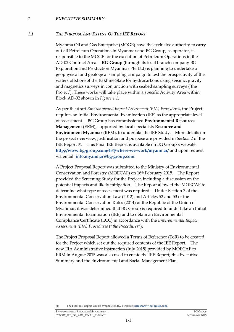
Myanma Oil and Gas Enterprise (MOGE) have the exclusive authority to carry out all Petroleum Operations in Myanmar and BG Group, as operator, is responsible to the MOGE for the execution of Petroleum Operations in the AD-02 Contract Area. BG Group (through its local branch company BG Exploration and Production Myanmar Pte Ltd) is planning to undertake a geophysical and geological sampling campaign to test the prospectivity of the waters offshore of the Rakhine State for hydrocarbons using seismic, gravity and magnetics surveys in conjunction with seabed sampling surveys (‘the Project’). These works will take place within a specific Activity Area within Block AD-02 shown in Figure 1.1.
As per the draft Environmental Impact Assessment (EIA) Procedures, the Project requires an Initial Environmental Examination (IEE) as the appropriate level of assessment. BG Group has commissioned Environmental Resources Management (ERM), supported by local specialists Resource and Environment Myanmar (REM), to undertake the IEE Study. More details on the project overview, justification and purpose are provided in Section 2 of the IEE Report (1). This Final IEE Report is available on BG Group’s website: http://www.bg-group.com/484/where-we-work/myanmar/ and upon request via email: [email protected].
A Project Proposal Report was submitted to the Ministry of Environmental Conservation and Forestry (MOECAF) on 16th February 2015. The Report provided the Screening Study for the Project, including a discussion on the potential impacts and likely mitigation. The Report allowed the MOECAF to determine what type of assessment was required. Under Section 7 of the Environmental Conservation Law (2012) and Articles 52 and 53 of the Environmental Conservation Rules (2014) of the Republic of the Union of Myanmar, it was determined that BG Group is required to undertake an Initial Environmental Examination (IEE) and to obtain an Environmental Compliance Certificate (ECC) in accordance with the Environmental Impact Assessment (EIA) Procedures (“the Procedures”).
The Project Proposal Report allowed a Terms of Reference (ToR) to be created for the Project which set out the required contents of the IEE Report. The new EIA Administrative Instruction (July 2015) provided by MOECAF to ERM in August 2015 was also used to create the IEE Report, this Executive Summary and the Environmental and Social Management Plan.
(1) The Final IEE Report will be available on BG’s website: http://www.bg-group.com.

!
!
!
!
!
!
!
!
!
!
!
!
!
!(
!(
!(
!(
!(
Kyaukpyu
Manaung
Ramree
Thandwe
Toungup
AD-02
ZinChaung
San TinMaw
KyaukOo Mou
KyaukNi Maw
Za KuKyun
MagyeeKyun
Ye Kyun
Ka Ei
Kamar
Zee Taw
Thabyugyaing
SinGaung
Gyeiktaw
94°30'0"E
94°0'0"E
94°0'0"E
93°30'0"E
93°30'0"E
93°0'0"E
93°0'0"E
92°30'0"E
92°30'0"E
92°0'0"E
92°0'0"E19
°30'
0"N
19°3
0'0"
N
19°0
'0"N
19°0
'0"N
18°3
0'0"
N
18°3
0'0"
N
18°0
'0"N
18°0
'0"N
350000
350000
400000
400000
450000
450000
500000
500000
550000
550000
600000
600000
650000
650000
2000
000
2000
000
2050
000
2050
000
2100
000
2100
000
2150
000
2150
000
Legend!( Town
!Key Villages /Settlements
Area of Interest
Blocks3D Survey Area
Activity Areashowingorientation ofSeismic Lines
BG OperatedBlock
Depth (m)< 0
0.1 - 10
10.1 - 20
20.1 - 30
30.1 - 40
40.1 - 50
50.1 - 60
60.1 - 70
70.1 - 80
80.1 - 90
90.1 - 100
100.1 - 200
200.1 - 300
300.1 - 400
400.1 - 500
500.1 - 1,000
1,000.1 - 1,500
1,500.1 - 2,000
2,000.1 - 2,500
> 2,500
® 0 2010Kilometres
Service Layer Credits: Sources: Esri, HERE,DeLorme, USGS, Intermap, increment P Corp.,NRCAN, Esri Japan, METI, Esri China (Hong Kong),Esri (Thailand), TomTom, MapmyIndia, ©OpenStreetMap contributors, and the GIS UserCommunity
Myanmar
Thailand
Bay of Bengal
EnvironmentalResourcesManagement
Block AD-02 and Area of Interest
Figure 1.1
File: T:\GIS\CONTRACT\0274927\Mxd\Report_AD02\0274927_Block_and_AoI_for_Summary_AD02.mxdDate: 17/7/2015

ENVIRONMENTAL RESOURCES MANAGEMENT BG GROUP 0274927_IEE_BG_AD2_FINAL_EN.DOCX NOVEMBER 2015
1-2
1.2 SUMMARY OF THE ACTIVITIES UNDERTAKEN DURING THE IEE STUDY
The Project commenced with a screening and scoping phase under which the Project identified potentially affected stakeholders, Project Area of Interest (1), potential impacts and gathered baseline data. The Project also conducted consultations with a number of government bodies, scientific organisations and NGOs in order to collect data. This information fed into the Project Proposal Report. In addition, a scoping assessment was prepared for internal use at BG Group in order to define the study limits and the key potential impacts from the Project.
After the initial screening and scoping phase, the environmental and social impact assessment (ESIA) phase commenced. The ESIA phase included stakeholder consultations in Sittwe, Kyaukphyu, Ramree, Manaung and Thandwe. These consultations were undertaken in order to present the Project information, present BG Group, discuss the currently known baseline conditions and potential impacts and gather comments, concerns or queries from stakeholders to be included in the impact assessment and development of mitigation measures for the IEE Report.
Collecting relevant baseline information also involved a literature review, using a range of published materials, including journals and online resources to help gain an understanding of the biological, physical and social environment. This baseline information was then verified to the extent possible through consultations within Rakhine with a variety of stakeholders during the public consultations.
1.3 PROJECT ALTERNATIVES AND SELECTED ALTERNATIVE
The Project is the initial data-gathering phase, which if the area appears prospective for hydrocarbons may lead to an exploration drilling program, which if successful in finding economic reserves of gas or oil may lead to development and production. Each of these three phases of activity will be preceded by an environmental and social assessment. Securing indigenous resources for the development of Myanmar is strategically important for the country and this first data gathering exercise is both key to an accurate assessment of prospectivity and has a very low environmental and social impact.
Nevertheless consideration of Project alternatives was undertaken as part of the IEE study in order to attempt to avoid or reduce any adverse environmental and social impacts and maximise or enhance any potential project benefits.
(1) The Project Area of Interest was defined as the area within Block AD-02 as well as its immediate surroundings
including the adjacent nearshore waters and coasts of Rakhine State mainland.

ENVIRONMENTAL RESOURCES MANAGEMENT BG GROUP 0274927_IEE_BG_AD2_FINAL_EN.DOCX NOVEMBER 2015
1-3
The different options included:
• The type of streamer to be used; it was suggested that solid or gel-filled streamers would be preferential as they do not leak when damaged, and are less sensitive to weather and wave noise.
• The project would be located as far as practicably possible from any key sensitive receivers. In this instance, the Activity Area is around 50 km from the coastline of Manaung Island where there are sensitive coastal habitats (e.g. corals); and
• The navigational safety zone during seismic operations was agreed to be mobile (i.e. around the seismic vessels and equipment), instead of covering the whole Block, in order to reduce impacts on other marine users.
The “No Project” alternative was also considered (i.e. no exploration campaign would be implemented). However, this would imply that no further exploration activity could be conducted in this Block; such as drilling exploration wells. This would in turn mean that no oil and gas development project could be undertaken. As a result, “No Project” would result in fewer opportunities for future gas supply to the domestic market as well as less direct and indirect employment opportunities.
The Selected Project Alternative
A fuller description of the project activities is provided in Section 4 of the IEE Report and is summarised below:
Programme and Seismic Survey Area
The exploration campaign in Block AD-02 is proposed to consist of seismic and gravity / magnetic surveys as well as a seabed sampling survey. The seismic and gravity / magnetic surveys are planned to commence in approximately February 2016, and last for a period of two to three months. The seabed sampling survey is due to take place between approximately March and May 2016. The timing of the survey coincides with the Northeast monsoon (December to April) so as to avoid the cyclone season.
The seismic survey will cover approximately 7,500 km2. The seismic vessel will sail either up or down pre-plotted survey/ sail lines that run north-west to south-east orientation (Figure 1.1). It is envisaged that the survey will start in the eastern waters of Block AD-02 and follow the survey/sail lines westwards over the survey period. The three-dimensional (3D) seismic survey will be approximately 110 km from the mainland coast and 50 km from Manaung Island at its closest point.
Seismic Overview
Marine geophysical seismic surveys are used to define sub-seabed deposits and geological structures. A specialized seismic survey vessel is used which tows an impulse emitting sound source. High energy low frequency sounds

ENVIRONMENTAL RESOURCES MANAGEMENT BG GROUP 0274927_IEE_BG_AD2_FINAL_EN.DOCX NOVEMBER 2015
1-4
are produced by the sound source and these sound waves bounce off the sub-surface rock formations and return to the surface where the seismic energy is collected by an array of receivers (hydrophones) fixed onto streamers behind the vessel. The acquired data is then recorded by on-board computers for subsequent processing to produce profiles of the sub-seabed geology for interpretation by geophysicists. The principles behind marine seismic survey operations are illustrated in Figure 1.2.
Vessels
A specialized seismic survey vessel and an appropriate number of chase vessels (typically one to three) will be utilised for the seismic, gravity and magnetic survey. Chase vessels will scout ahead for obstructions and safely warn-off any vessels in the path of the survey. The vessels will be re-supplied with provisions at a port via a support vessel; however, there is no significant onshore component of this Project.
Typical seismic vessels are shown in Figure 1.3 and the layout of the seismic vessel and equipment is shown in Figure 1.4. The different components of this figure are discussed below. A separate vessel will be used to conduct the seabed sampling survey.
Airguns
The seismic sound source is created when a bubble of compressed air is discharged into water from airguns and the bubble subsequently collapses. The sound travels through the water column beneath the vessel to penetrate the subsurface rocks. Each gun is proposed to be towed by the vessels at a water depth of 8 m, using a firing interval of 10 seconds.
Streamers
The receivers (hydrophones) will be encased in long cables or “streamers” towed behind the seismic vessel. There will be up to 12 streamers which are around 8 km in length, which are towed at a water depth of up to 25 m. The acquired data is recorded by on-board computers for processing.
Emissions
Vessels will be required to follow International Convention for the Prevention of Pollution from Ships (MARPOL) Annex I, IV, V, and VI requirements with regards to handling of waste, wastewater, air emissions and effluents.
Gravity and Magnetic Survey
Gravity and magnetic surveys are used to assess the physical properties of the seabed sediments to more accurately target oil and gas deposits. This survey will be carried out as part of the seismic survey and no additional vessel will be used. The equipment passively measures the naturally occurring variations in the earth’s gravity and magnetic fields and does not have any associated emissions.

SEISMIC SURVEY VESSEL
EnvironmentalResourcesManagement
Figure 1.2
FILE: 0274927u.cdrDATE: 13/07/2015
Schematic of Marine Seismic Survey
TAIL
BUOYHYDROPHONE STREAMER
SIGNAL GENERATING DEVICE
SOUND WAVES
REFLECTED
SOUND WAVES
SOLID ROCK STRATA
SEABED SEDIMENTS
WATER COLUMN

Survey Method
Parameter
No. of personnel onboard (POB) (crew + survey personnel)
Length
Width
Draft
Fuel consumption
Minimum operating depth
Maximum load speed
Specification *
30 – 100
50 – 90 m
15 – 20 m
5 – 6 m
9 – 15 tonnes/ day
~ 10 m
Up to 15 Knots
* Indicative only
The seismic survey vessel is purposely built for towing the airguns and streamers for conducting the
seismic surveys.
Indicative seismic survey vessel specifications
Typical Seismic Lines
EnvironmentalResourcesManagement
Figure 1.3
FILE: 0274927v.cdrDATE: 13/07/2015
Illustrative Example of Seismic Survey Vessels
Typical Seismic Vessels
Typical Seismic Vessel

Sail Line
Survey Vessel
Airgun Arrays
Pneumatic device that producesacoustic output by rapidly releasinga volume of compressed air
Hydrophone Streamer
Captures the reflected wavesfor a seismic line plot to mapstructural traps wherehydrocarbons may accumulate
Tail Buoy
Brightly coloured with a radarreflector and flashing lights forindication
Birds
Allow the streamer to be raised/s slowered in the water column tooptimise its position or to avoid hazardse.g. in the event of very shallow water depth,seabed obstructions or another vessel sailingacross the deployed streamer
EnvironmentalResourcesManagement
Figure 1.4
FILE: 0274927wDATE: 13/07/2015
Illustrative Arrangement of Seismic Survey Equipment

ENVIRONMENTAL RESOURCES MANAGEMENT BG GROUP 0274927_IEE_BG_AD2_FINAL_EN.DOCX NOVEMBER 2015
1-5
Seabed Sampling Survey
Seabed sampling surveys are used to characterise surface and subsurface sediments, which can be used to provide information on the hydrocarbon and reservoir potential of an area as well as environmental, floral and faunal data.
A single dedicated vessel will be used for the sampling survey fitted with specialist sampling equipment, to obtain soft sediment samples approximately 10 centimetres in diameter of the seabed for physicochemical and biological testing and analysis. Prior to seabed coring, the vessel may opt to secure sub bottom profiling to ensure the locations is suitable for a sample (i.e., not rocky). This would involve using echo-sounders to map the seabed.
Approximately 100 core samples (10 cm in diameter) will be collected across the Block. The seabed samples and slick samples will undergo detailed geochemical and geological analysis in onshore laboratories which will provide new data on the hydrocarbon potential of the blocks.
The AD-02 seabed sampling will commence around the beginning of April 2016 and will run for approximately 1 month.
1.4 DESCRIPTION OF THE ENVIRONMENT TO BE AFFECTED BY THE PROJECT
Information has been collected through stakeholder engagement and field visits have been undertaken from March to May 2015. Further information has been collected through desktop review of publicly available information. Findings of the baseline data review are summarised below. The Area of Interest for the baseline study encompasses Block AD-02 and the immediate surroundings, extending for assessment purposes to the adjacent nearshore waters of the Rakhine State mainland (Figure 1.1) and also covers locations where fishing activities may overlap with the Project Activities.
The IEE Report focuses on the physical, environmental and social characteristics in the Area of Interest. A summary of the baseline is provided below.
1.4.1 Physical Environment
The survey will be primarily conducted during the northeast monsoon period which runs from December to April, when winds blowing from north and east, bring less cloud, scant rainfall, mild temperatures and lower humidity. In the Bay of Bengal the surface circulation moves generally clockwise from January to July and counter-clockwise from August to December. Tides in the Area of Interest are semi-diurnal with a tidal range of 2.5 m at Manaung Island. The water depth within the Block is in excess of 1,500 m. The seafloor within the majority of Block AD-02 is characterised by homogeneous olive grey muds typical of low energy depositional environments (1).
(1) Dr Rangin (2005) unpublished data.

ENVIRONMENTAL RESOURCES MANAGEMENT BG GROUP 0274927_IEE_BG_AD2_FINAL_EN.DOCX NOVEMBER 2015
1-6
1.4.2 Biological Environment
Shallow nearshore waters within the Area of Interest host habitats with enhanced biological productivity and higher biodiversity (such as coral reefs, seagrass, mangroves). However, the Activity Area will be confined to open deeper waters where typically lower ecological value habitats occur, i.e. areas of lower productivity and biodiversity.
Coral habitats around Manaung Island are closest to the Activity Area (Figure 1.5) however these are located at least 50 km from Block AD-02. Photos of common coral species in Rakhine waters are shown in Figure 1.6; taken during a survey near Ngapali beach in Thandwe.
Fish in Rakhine waters have been categorised into three types: pelagic species, which inhabit the open ocean, neither near the seabed nor the coast; demersal species, which live on or near the seabed; and reef associated / coastal species, which live in coral reefs or coastal areas. Of the fish identified from data sources to have been possibly recorded within the Area of Interest, three are listed as species of conservation concern (vulnerable or above) on the IUCN Red List (1); whale shark (Rhincodon typus), bleeker’s grouper (Epinephelus bleekeri) and narrow barred Spanish mackerel (Scomberomorus commerson). Photos of commercial fish species observed during consultations in Rakhine are shown in Figure 1.7.
A total of 21 cetaceans (whale and dolphin) and 1 sirenian (dugong) species have been reported from Myanmar waters. The Irrawaddy dolphin (Orcaella brevirostris) and dugong (Dugong dugon) are protected under Myanmar Law (2) but these species are mostly coastal or riverine species and hence not likely to be present in the Activity Area. Numerous marine mammals have also been recorded from a recent seismic survey conducted in 2015 immediately south of AD-02, such as the humpback whale (Megaptera novaeangliae) and bryde’s whale (Balaenoptera edeni) . It is considered likely that cetaceans will also be present during the proposed exploration campaign. The marine mammal species that have been recorded in the Area of Interest are shown in Figure 1.8.
There are five species of marine turtle listed as present in the offshore waters of Rakhine State, all of which are listed as species of concern on IUCN Red List. Turtles nest along the Rakhine coast from September to March with peak nesting in December and January. As such, turtles could be migrating through Block AD-02 to their nesting beaches during the survey period. Turtle species that have been recorded in the Area of Interest are shown in Figure 1.9.
1.4.3 Social Environment
Rakhine State, located in Western Myanmar, is divided into four districts and 17 townships and is the eighth largest and the second most populous state in Myanmar. The main sources of livelihood are agriculture, fisheries and
(1) The International Union for the Conservation of Nature (IUCN) Red List is a provides information on the global
conservation status of biological species.
(2) Protected under the Myanmar Protection of Wildlife and Conservation of Natural Areas Law.

!
!
!
!
!
!
!
!
!
!
!
!
!
!(
!(
!(
!(
!(
Kyaukpyu
Manaung
Ramree
Thandwe
Toungup
AD-02
ZinChaung
San TinMaw
KyaukOo Mou
KyaukNi Maw
Za KuKyun
MagyeeKyun
Ye Kyun
Ka Ei
Kamar
Zee Taw
Thabyugyaing
SinGaung
Gyeiktaw
94°30'0"E
94°0'0"E
94°0'0"E
93°30'0"E
93°30'0"E
93°0'0"E
93°0'0"E
92°30'0"E
92°30'0"E
92°0'0"E
92°0'0"E19
°30'
0"N
19°3
0'0"
N
19°0
'0"N
19°0
'0"N
18°3
0'0"
N
18°3
0'0"
N
18°0
'0"N
18°0
'0"N
350000
350000
400000
400000
450000
450000
500000
500000
550000
550000
600000
600000
650000
650000
2000
000
2000
000
2050
000
2050
000
2100
000
2100
000
2150
000
2150
000
Legend!( Town
!Key Villages /Settlements
Coral Reefs
Mangrove
Seagrass
Area of Interest
Blocks3D Survey Area
Activity Area
BG OperatedBlock
Depth (m)< 0
0.1 - 10
10.1 - 20
20.1 - 30
30.1 - 40
40.1 - 50
50.1 - 60
60.1 - 70
70.1 - 80
80.1 - 90
90.1 - 100
100.1 - 200
200.1 - 300
300.1 - 400
400.1 - 500
500.1 - 1,000
1,000.1 - 1,500
1,500.1 - 2,000
2,000.1 - 2,500
> 2,500
® 0 2010Kilometres
Service Layer Credits: Sources: Esri, HERE,DeLorme, USGS, Intermap, increment P Corp.,NRCAN, Esri Japan, METI, Esri China (Hong Kong),Esri (Thailand), TomTom, MapmyIndia, ©OpenStreetMap contributors, and the GIS UserCommunity
Myanmar
Thailand
Bay of Bengal
EnvironmentalResourcesManagement
Locations of Coral, Seagrass and Mangroves in Rakhine
Figure 1.5
File: T:\GIS\CONTRACT\0274927\Mxd\Report_AD02\0274927_Location_of_Sensitive_Habitats_for _Summary_AD02.mxdDate: 17/7/2015

EnvironmentalResourcesManagement
Figure 1.6
FILE: 0274927f.cdrDATE: 05/06/2015
Coral Photos from Surveys in April 2015, Ngapali Beach
Platygyra sp. Turbinaria sp. Sponges with Porites sp.
Acropora sp. Goniopora sp. Favites sp.

EnvironmentalResourcesManagement
Figure 1.7
FILE: 0274927k.cdrDATE: 29/06/2015
Representative Photos of Some Commercial Fisheries Species observed during Site Visits in the Area of Interest
Barramundi (Latidae) Catfish (Arridae) Shad (Clupeidae)
Mackerel (Scombridae) Croaker (Sciaenidae) Spiny Lobster (Panulirus ornatus)

Figure 4.12 Marine Turtles in Rakhine waters
Dugong
Indo-pacific bottlenosedolphin
Irrawaddy dolphin
Brydes whale
(Source: www.whale-watching.co.za)
Dwarf sperm whale
(Source: uk.whales.org)
(Source: )www.greatocean.com.au/(Source: )www.itsnature.org
(Source: www.tonywublog.com)
EnvironmentalResourcesManagement
Figure 1.8
FILE: 0274927o.cdrDATE: 13/07/2015
Marine Mammal Species Recorded in Myanmar Waters ( )1
Rissos dolphin
Short finned pilot whale
Spinner dolphin
Blainville's beaked whale
(Source: www.animal-kid.com)
(Source: www.eoearth.org)
Pantropical spotteddolphin
Latin Name
Balaenoptera edeni
Balaenoptera musculus
Balaenoptera physalus
Megaptera novaeangliae
Mesoplodon densirostris
Kogia sima
Pseudorca crassidens
Orcinus orca
Peponocephala electra
Feresa attenuata
Kogia breviceps
Globicephala macrorhynchus
Physeter macrocephalus
Stenella longirostris roseiventris
Tursiops aduncus
Neophocaena phocaenoides
Sousa chinensis
Orcaella brevirostris
Stenella attenuata
Grampus griseus
Stenella longirostris
Stenella coeruleoalba
Dugon Dugong
IUCN Red List
Data Deficient
Endangered
Endangered
Least Concern
Data Deficient
Data Deficient
Data Deficient
Data Deficient
Least Concern
Data Deficient
Data Deficient
Data Deficient
Vulnerable
Data Deficient
Data Deficient
Vulnerable
Near Threatened
Vulnerable
Least Concern
Least Concern
Data Deficient
Least Concern
Vulnerable
Common Name
Baleen Whales
Bryde's whale
Blue whale
Fin whale
Humpback whale
Toothed Whales
Blainville's beaked whale
Dwarf sperm whale
False killer whale
Killer whale
Melon-headed Whale
Pygmy killer whale
Pygmy sperm whale
Short-finned pilot whale
Sperm Whale
Porpoise and Dolphins
Dwarf Spinner Dolphin
Indo-pacific bottlenose dolphin
Indo-pacific finless porpoise
Indo-pacific humpbacked dolphin
Irrawaddy dolphin
Pantropical spotted dolphin
Rissos dolphin
Spinner dolphin
Striped dolphin
Sirenian
Dugong
Fin whale
(Source: www.whalesanddolphinsoftenerife.org)
(Source: www.arkive.org)
Sperm whale

EnvironmentalResourcesManagement
Figure 1.9
FILE: 0274927p.cdrDATE: 29/06/2015
Marine Turtles in Rakhine waters
Olive Ridley Turtle Loggerhead urtleT Green Turtle
Hawksbill urtleT Leatherback urtleT
Latin Name
Lepoidochely olivacea
Caretta caretta
Chelonia mydas
Eretmochelys imbricata
Dermochelys coriacea
Common Name
Olive ridley turtle
Loggerhead turtle
Green turtle
Hawksbill turtle
Leatherback turtle
Myanmar Name
Leik Lyaung
Leik Khway
Pyin Tha Leik
Leik Kyet Tu Yway
Leik Zaung Lyar
IUCN Status
Endangered
Endangered
Vulnerable
Critically Endangered
Endangered
Potential Presence in Block AD-02
Reported to occur in Rakhine and have been observed bylocal fishermen. Known to be nesting in Rakhine State andlikely to be present in Block A - .D 02
Reported to occur in Rakhine and have been observed bylocal fishermen. Not known to nest on the Rakhine Coast.
Reported to be nesting in Rakhine State and likely to bepresent in Block A - .D 02
Reported to occur in Rakhine and have been observed bylocal fishermen. Known to be nesting in Rakhine State andlikely to be present in Block A - .D 02
Have historically been recorded in Rakhine waters but arenow considered rare.

ENVIRONMENTAL RESOURCES MANAGEMENT BG GROUP 0274927_IEE_BG_AD2_FINAL_EN.DOCX NOVEMBER 2015
1-7
livestock; over 50 percent of the population is dependent upon agriculture, while 13 percent engage in fishing, and 10 percent in livestock farming. Within the villages consulted, a large part of the local economy revolves around fishing, with only limited agricultural activities. In many villages around 80% to 90% of the households are engaged in fishing, with some of the households being fully dependent on fishing.
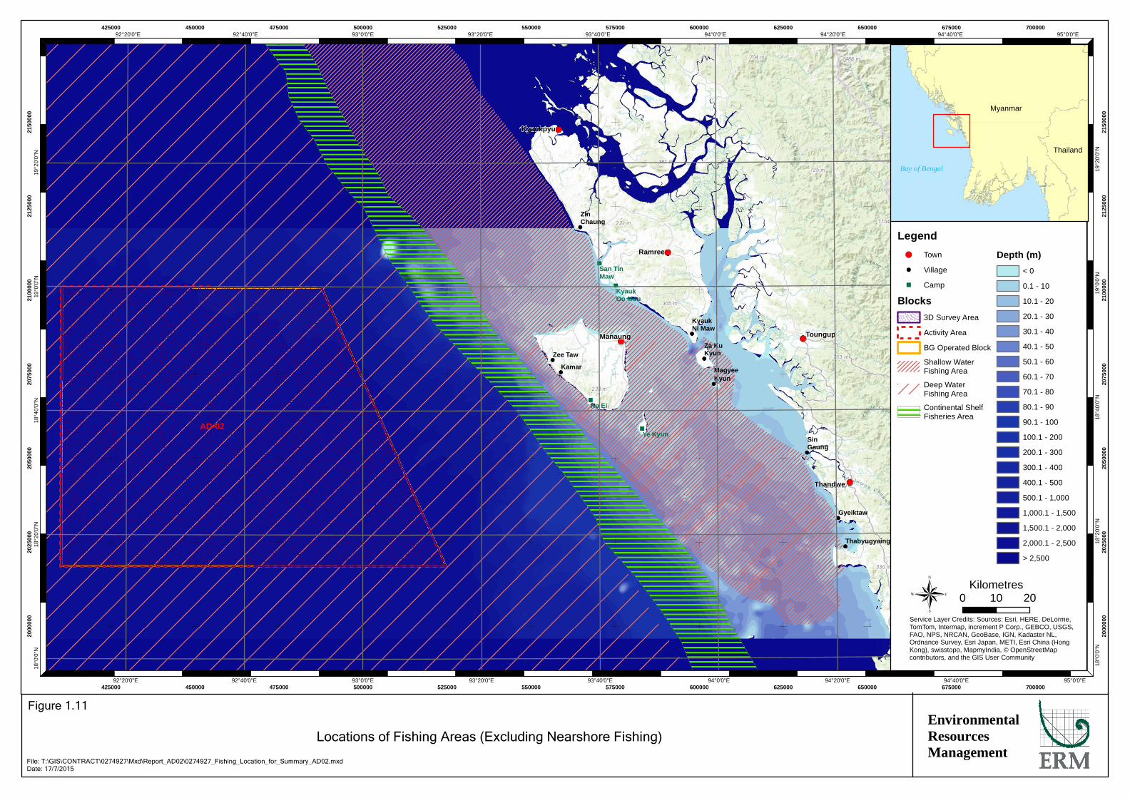
Fishing and fishing related livelihoods were considered the main social activity which could be impacted. The fishing baseline is presented below. It builds upon a number of field visits to selected fishing communities along the Rakhine coast as well as Sittwe and Yangon, who could potentially be active in Block AD-02. The majority of fishing communities in Rakhine State conduct their activities in nearshore (within 10 nautical miles) or offshore, shallow waters (0-50m of water depth), far from BG Group’s Activity Area. This is supported by information from the Department of Fisheries (DoF) which reported that 67% of the population in coastal regions fish in nearshore waters (within 10 nautical miles). Offshore fishing in the Area of Interest can be classified into the following:
• Shallow water: Fishing in waters of 0-50 m water depth to the north, east and south of Manaung Island. This area is considered a very rich fishing ground, where there is a high concentration of fishing activity from the surrounding villages. Diving for fish, lobster, shrimp and other species also takes place here. No project activities are planned to take place in this area, nor in other shallow water areas of less than 50m.
• Outer Continental Shelf: Fishing activities that focus efforts along the outer continental shelf in water depths of approximately 50 to 200m. This area is located over 50 km from the mainland coast. Fishing in this area was reported to be less common than in shallow waters. However, several villages consulted reported fishing in and nearby the outer continental shelf area, particularly from November to April. In addition, during this period fishing camps are established on Manaung and Ye Kyun, for fishing around the west coast of Manaung and in this area. No project activities are planned to take place in this area.
• Deep Water: Fishing in water depths of more than 200 m. There appears to be only limited fishing from local villages. Most of the limited fishing in these deeper waters is undertaken by vessels from outside Rakhine State. This is the only area which potentially overlaps with Block AD-02. Very limited deep-water fishing activity was reported from a neighbouring deep water block to AD-02 during a recent seismic survey.
Sizes of fishing boats typically fall into three categories: small (<20ft), medium (30-45ft) and large (50-90ft). Details on the type of boats encountered in the area of interest are provided in Figure 1.10. Indicative fishing locations as recorded by local fishing villages are shown in Figure 1.11. Fishermen across villages commonly agreed that November to April was the best season for fish catch (in terms of monetary value). Fishing during the rainy season (June to September) was reported to be difficult due to poor weather conditions,

Typical boats size and associated details in coastal villages of Rakhine Figure 1.10
DATE: June 2015
Medium Boats in Kyauk Ni Maw
Environmental Resources Management
Small boats in Gyeiktaw Big boats in Thabyugyiang
Boat size Dimensions Engine (hp) POB Distance offshore Depth Range (m) Trip Duration (days) Nets used
Small 5.5-6.5m 9 3-4 4.5-8km <25 1 Longline Drift Net
Medium 9-14m 13-30 3-8 Up to 16km 25-60 1-4 Longline Drift Net Trawl Purse seine
Big 15-25m 20-450 8-18 24km to 30km
30-140 2-25 Drift Longline Trawl Purse Seine
Kyaukpyu
Manaung
Ramree
Thandwe
Toungup
AD-02
San TinMaw
KyaukOo Mou
Ye Kyun
Ka Ei
ZinChaung
KyaukNi Maw
Za KuKyun
MagyeeKyun
Kamar
Zee Taw
Thabyugyaing
SinGaung
Gyeiktaw
95°0'0"E
95°0'0"E
94°40'0"E
94°40'0"E
94°20'0"E
94°20'0"E
94°0'0"E
94°0'0"E
93°40'0"E
93°40'0"E
93°20'0"E
93°20'0"E
93°0'0"E
93°0'0"E
92°40'0"E
92°40'0"E
92°20'0"E
92°20'0"E19
°20'
0"N
19°2
0'0"
N
19°0
'0"N
19°0
'0"N
18°4
0'0"
N
18°4
0'0"
N
18°2
0'0"
N
18°2
0'0"
N
18°0
'0"N
18°0
'0"N
425000
425000
450000
450000
475000
475000
500000
500000
525000
525000
550000
550000
575000
575000
600000
600000
625000
625000
650000
650000
675000
675000
700000
700000
2000
000
2000
000
2025
000
2025
000
2050
000
2050
000
2075
000
2075
000
2100
000
2100
000
2125
000
2125
000
2150
000
2150
000
Legend!( Town
! Village
" Camp
Blocks3D Survey Area
Activity Area
BG Operated Block
Shallow WaterFishing Area
Deep WaterFishing Area
Continental ShelfFisheries Area
Depth (m)< 0
0.1 - 10
10.1 - 20
20.1 - 30
30.1 - 40
40.1 - 50
50.1 - 60
60.1 - 70
70.1 - 80
80.1 - 90
90.1 - 100
100.1 - 200
200.1 - 300
300.1 - 400
400.1 - 500
500.1 - 1,000
1,000.1 - 1,500
1,500.1 - 2,000
2,000.1 - 2,500
> 2,500
0 2010Kilometres
Service Layer Credits: Sources: Esri, HERE, DeLorme,TomTom, Intermap, increment P Corp., GEBCO, USGS,FAO, NPS, NRCAN, GeoBase, IGN, Kadaster NL,Ordnance Survey, Esri Japan, METI, Esri China (HongKong), swisstopo, MapmyIndia, © OpenStreetMapcontributors, and the GIS User Community
®
EnvironmentalResourcesManagement
Locations of Fishing Areas (Excluding Nearshore Fishing)
Figure 1.11
File: T:\GIS\CONTRACT\0274927\Mxd\Report_AD02\0274927_Fishing_Location_for_Summary_AD02.mxdDate: 17/7/2015
Myanmar
Thailand
Bay of Bengal

ENVIRONMENTAL RESOURCES MANAGEMENT BG GROUP 0274927_IEE_BG_AD2_FINAL_EN.DOCX NOVEMBER 2015
1-8
especially in deeper water. As a result of this, fishing during the rainy season was generally undertaken closer to shore.
The main wholesale fish market is located at Yangon, with a number of local markets being located in the various States and Regions (Figure 1.12) (1). Consultations and site visits in the Rakhine coastal villages suggested that there are buying centres near most fishing villages, which are linked to either Thandwe, Toungup, or Yangon.
Communication systems used by fishermen vary across fishing villages. Consultation with fishermen suggests that most fishermen have limited communications and navigational equipment, using only GSM-CDMA mobile (locally known as coastal phone). In contrast, larger commercial boats also use radio and have Global Positioning System (GPS) and echo-sounding equipment for positioning. Information at the village level that may be of concern to the fishermen is either distributed through the fisheries association or the Village Tract Leader. Information from the Department of Fisheries (DoF) is usually provided to Village Tract Leaders and then passed on to the fishermen. In some villages, fishing associations were considered as nodal point of information by the fishermen. Fishermen also use locally accessible media such as Skynet TV, MRTV and radio.
Block AD-02 is located in a shipping route between ports in the north (Kolkata, Chittagong etc.) heading to the southern tip of India and the Straits of Malacca in the south. The Blocks neighbouring Block AD-02 are also currently being explored for oil and gas by other operators. Cumulative impacts with other oil and gas Blocks is assessed in the IEE Report and summarised below.
1.5 SIGNIFICANT ENVIRONMENTAL IMPACTS
1.5.1 Impact Assessment Methodology
The impact assessment methodology followed a receptor sensitivity vs. impact magnitude model. Each of the predicted impacts was described in terms of its potential magnitude, derived from an examination of the extent, duration, scale and frequency of the impact. Additionally, for unplanned events only, magnitude incorporates the ‘likelihood’ factor (i.e., a qualitative assessment of the potential for any impact to occur). The sensitivity (including vulnerability and importance) of the impacted resource/receptor was also identified taking into account legal protection, government policy, stakeholder views and economic value. Once impact magnitude and resource/receptor sensitivity have been characterised, the significance can be assigned for each impact. Impact significance is designated using the matrix shown in Table 1.1. If a species is protected by law it is considered to be of high sensitivity so even small impacts will result in a moderately significant outcome.
(1) FAO (2003) and (2006) Op. cit.

Typical buying centres and fish markets in coastal areas of Rakhine Figure 1.12
DATE: June 2015
Dried Tuna Fish in Sittwe market
Local market in Manaung
Environmental Resources Management
Fish Buying Centre in Gyeiktaw Dry Fish Storage in Gyeiktaw
Local Fish Market in Sittwe Sittwe Fish Market: Women selling fish

ENVIRONMENTAL RESOURCES MANAGEMENT BG GROUP 0274927_IEE_BG_AD2_FINAL_EN.DOCX NOVEMBER 2015
1-9
Table 1.1 Impact Significances
Resource/Receptor Sensitivity
Low Medium High
Mag
nitu
de o
f Im
pact
Negligible Negligible Negligible Negligible
Small Negligible Minor Moderate
Medium Minor Moderate Major
Large Moderate Major Major
Potential Impacts and Mitigation Measures
Potential impacts from proposed project activities (both planned and unplanned) were identified through a systematic scoping process. A full discussion on the potential impact, required mitigation and residual impact significance is provided in Section 6 of the IEE Report. Interactions which were considered to have the potential to result in significant environmental and social impacts from the survey include:
• Potential increases in ambient underwater sound and generation of sound pressure levels from the operation of airguns. These activities have the potential to impact ecologically sensitive receivers, e.g. marine mammals, marine turtles and fish.
• Potential water contamination and related secondary impacts to biodiversity and fishing from accidental spills of chemicals or fuel (e.g. during offshore re-fuelling).
• Potential risk of entanglement with marine turtles by the operating seismic survey hydrophone streamers.
• Potential short-term disturbance to fishing activities.
• Potential risk of collisions with fishing vessels and other marine users and entanglement of fishing gear by the operating seismic hydrophone streamers.
Appropriate mitigation and management measures were recommended for the potentially significant environmental and social impacts identified in the IEE Study. No Major impacts were identified and those that were deemed Moderate significance have been mitigated appropriately to ensure they are as low as reasonably practicable. A summary of the potential impacts, mitigation measures and residual impact significance is presented in Table 1.2.

ENVIRONMENTAL RESOURCES MANAGEMENT BG GROUP 0274927_IEE_BG_AD2_FINAL_EN.DOCX NOVEMBER 2015
1-10
Table 1.2 Summary of Key Impacts, Mitigation Measures and Residual Impact Significance
Potential Impact/Issue Control / Mitigation Measures
Significance of Residual Impact
Impacts from towed equipment by collision with or entrapment of marine turtles
• Install turtle guards on seismic survey tail buoys in order to reduce the risk of trapping turtles in the seismic equipment.
• Implement JNCC Guidelines (1) including the alignment of Contractor operations with JNCC Guidelines.
• In line with JNCC guidelines, implement a soft-start procedure to allow adequate time for marine fauna to leave the area).
• As an enhancement measure, all sightings of marine mammals / turtles should be recorded and reported to MOECAF following survey completion.
Moderate (Note: Small magnitude impact to high sensitivity resource)
Impacts from underwater sound on marine fauna
• Optimum airgun configurations to ensure that the lowest possible sound level of airguns is selected.
• Implement JNCC Guidelines (1) including alignment of Contractor operations with JNCC Guidelines.
• In line with JNCC guidelines: • Implement a soft-start procedure to allow adequate
time for marine fauna to leave the area, • Dedicated Marine Mammal Observers will be on-board
to undertake pre-shooting search • the vessel to postpone start-up if mammals observed
within 500 m and • Passive Acoustic Monitoring (PAM) will be used to
detect marine mammals in the vicinity of the seismic vessel during night time or low visibility operations.
• To ensure protection of certain marine mammal species, the soft-start procedure will be extended to between 20-30 minutes duration.
• As an enhancement measures, all sightings of marine mammals / turtles should be recorded and reported to MOECAF following survey completion.
Minor (for fishes) to Moderate (for marine mammals and turtle) (Note: Small magnitude impact to high sensitivity resource)
Impacts from unplanned spills on marine fauna
• Accepted industry good practice vessel standard operating procedures will be implemented, including an offshore re-fuelling plan.
• Contingency plans will be prepared and implemented, e.g. vessel Shipboard Oil Pollution Emergency Plans (SOPEPs).
Negligible
Impacts on fisheries and fishing communities from physical presence of seismic vessel and equipment
Impacts from unplanned collisions on
• A mobile navigational safety zone will be implemented around the seismic vessel and equipment.
• An appropriate number of chase vessels that will liaise with fishermen and other mariner users.
• The chase vessel(s) will have Myanmar speaking Fishing Liaison Officers on-board.
• Survey vessels will comply with international standards of navigational safety.
• A stakeholder engagement plan will be developed to ensure timely sharing of information on the movement of survey vessels.
Negligible (fisheries, fishing activities and livelihoods)
(1) The JNCC “Guidelines for minimising the risk of injury and disturbance to marine mammals from seismic
surveys, 2010”

ENVIRONMENTAL RESOURCES MANAGEMENT BG GROUP 0274927_IEE_BG_AD2_FINAL_EN.DOCX NOVEMBER 2015
1-11
Potential Impact/Issue Control / Mitigation Measures
Significance of Residual Impact
fishing vessel and other marine users
• A “fishing navigational safety protocol” will be followed, which sets out actions to be taken in the event that fishing activities are encountered within the mobile safety zone.
Although this measure does not impact the impact significance, a grievance mechanism for the Project will be disclosed and implemented and timely investigation of any grievances will be conducted.
1.5.2 Cumulative Impacts
Cumulative impacts refer to impacts that result from more than one project operating at the same time. Block AD-02 is surrounded by other offshore Blocks AD-01, AD-03, AD-08, AD-09 and AD-10 (shown in Figure 1.13). It is understood that of these neighbouring oil and gas Blocks which could potentially cause cumulative impacts; the only Block in which concurrent activities are being carried out is in Blocks AD-09 and AD-10. Activities in these Blocks are likely to be similar to Block AD-02. As the mitigation measures listed in the above sections are standard international best practise for seismic surveys it is likely that the block holders of Block AD-09 and AD-10 will adopt the same practises, therefore reducing the potential for a cumulative impact.
The main cumulative environmental impacts would be from underwater sound on marine fauna, physical presence of vessels impacting turtles and unplanned fuel spills. For cumulative impacts from underwater sound, the vessels operating on Block AD-02 and Blocks AD-09 and AD-10 are unlikely to be within close proximity of each other. Typically, to avoid any risk of operational interference, offshore seismic surveys maintain minimum separation distances of at least 20 to 30 km and often far greater. As such, there is unlikely to be a cumulative impact resulting in injury to these species. Therefore, the impact from underwater sound on all receptors will be the same magnitude as those experienced during the Block AD-02 survey, with only a limited risk of overlap and will therefore be of Moderate significance to marine mammals and turtles and of Minor significance for fish. As a result of this, and the significant distance of the blocks offshore possible cumulative impacts from underwater sound or the physical presence of the surveys acting as a barrier to turtle migratory pathways to nesting beaches are considered to be Negligible. The potential for cumulative spills of fuel from the vessels is extremely unlikely to occur and as both vessels use light fuels which are readily diluted and dispersed and implement standard mitigation measures, impacts would be expected to be Minor.
Potential cumulative social impacts, particularly those to fishermen, could occur as a result of a number of potential exploration campaigns taking place at the same time in offshore Rakhine waters. Impacts could include the cumulative impact from disturbance to fishing activities due to the presence of the seismic vessels, as well as the increased risk of collision.

MD-03
AD-12
AD-09
AD-10
AD-13
AD-14
AD-16
A-5
AD-04
A-7AD-05
MD-01
MD-02
M-8
AD-02
AD-03
AD-15M-4
M-7
YWB
AD-1A-3
A-1 A-2
AD-6
AD-8
AD-7
AD-11
YEB
M-1
M-1
M-3
M-6
M-9
M-11 M-12 M-13
M-5
M-2
M-10
A-6
A-4
100°0'0"E
100°0'0"E
98°0'0"E
98°0'0"E
96°0'0"E
96°0'0"E
94°0'0"E
94°0'0"E
92°0'0"E
92°0'0"E
90°0'0"E
90°0'0"E
88°0'0"E
88°0'0"E20
°0'0
"N
20°0
'0"N
18°0
'0"N
18°0
'0"N
16°0
'0"N
16°0
'0"N
14°0
'0"N
14°0
'0"N
0
0
200000
200000
400000
400000
600000
600000
800000
800000
1000000
1000000
1200000
1200000
1600
000
1600
000
1800
000
1800
000
2000
000
2000
000
2200
000
2200
000
®0 200100
Kilometres
Service Layer Credits: Sources: Esri, HERE, DeLorme, USGS,Intermap, increment P Corp., NRCAN, Esri Japan, METI, EsriChina (Hong Kong), Esri (Thailand), TomTom, MapmyIndia, ©OpenStreetMap contributors, and the GIS User Community
EnvironmentalResourcesManagement
Offshore Oil and Gas Blocks within Rakhine Waters
Figure 1.13
File: T:\GIS\CONTRACT\0274927\Mxd\Report_AD02\0274927_Offshore_Blocks_AD02.mxdDate: 17/7/2015
MYANMAR

ENVIRONMENTAL RESOURCES MANAGEMENT BG GROUP 0274927_IEE_BG_AD2_FINAL_EN.DOCX NOVEMBER 2015
1-12
Disturbance to fishing activities is expected to remain short term and localised limited to the application of a mobile navigational safety zone around each of the seismic vessels. In addition, there are only a limited number of fishermen operating in the deep water area. The vast majority of fishers are active around the shallow and outer continental shelf area, from 0 to 200 m water depth.
It is expected that, with the mitigation in place, social impacts will be localised to mobile navigational safety zone and temporary in nature. Therefore, the impact will be of Negligible significance to fishing activities.
1.6 THE PUBLIC CONSULTATION AND PARTICIPATION PROCESS UNDERTAKEN
The stakeholder engagement process is driven by BG Group’s own social performance standards which have been aligned with international best practices, such as IFC PSs, for undertaking stakeholder consultations and social impact assessments.
Following a scoping exercise which included engagement with representatives from government, civil society, and fishing communities and organisations, a range of public consultation meetings were held, focused on significant offshore fishing communities in Rakhine state. Stakeholder engagement was conducted at the four administrative levels, in line with MOECAF regulations and subject to permissions of responsible authorities: National, State, District/Township, and selected Village (tract) level, where significant fishing communities are located. A list of public meetings conducted as part of the engagement process is summarised in Table 1.3 and photos are provided in Figure 1.14.
Table 1.3 Summary of Public Meetings undertaken as part of the IEE process
Date Location 31st March 2015 Sittwe meeting 1st April 2015 Kyaukphyu Township meeting 2nd April 2015 Zin Chaung village meeting 3rd April 2015 Ramree Township meeting 4th April 2015 Kyauk-Ni-Maw (Rakhine community) 4th April 2015 Kyauk-Ni-Maw (Muslim community) 6th April 2015 Manaung Township meeting 7th April 2015 Ka Ei village meeting 8th May 2015 Thandwe Township Meeting 9th May 2015 Thabyugyaing Village Meeting 10th May 2015 Sin Gaung Village Meeting 11th May 2015 Gyeitkaw Village Meeting
The consultation process was guided by the following key principles:
• Inclusive: The consultations were organised to ensure representation of potentially affected and interested stakeholders. Separate focus groups were undertaken with women, fishermen and boat owners and, where relevant the consultation involved both Rakhine Buddhist and Muslim fishermen;

Environmental Resources Management
Photo Records of Stakeholder Consultation Sheet Figure 1.14
Photo 1: Consultations in Thabyugyiang Photo 2: Consultations in Gyeiktaw Photo 3: Q&A session at Gyeitaw
Photo 6: Consultations with Sittwe GAD and DoF Photo 4: Meeting with Sittwe Department of Fishery Photo 5: Meeting with Sittwe District GAD

ENVIRONMENTAL RESOURCES MANAGEMENT BG GROUP 0274927_IEE_BG_AD2_FINAL_EN.DOCX NOVEMBER 2015
1-13
• Sharing of information: At the village level consultations, special
emphasis was given to build understanding of the project. All the information was provided in Myanmar language;
• Participatory: Stakeholders were encouraged to actively participate in the consultations and were always given the opportunity to ask questions.
• Gender inclusive: The team consisted of female representatives for undertaking focus group discussions with women.
During stakeholder consultations the key issues raised included:
• Impact on fishing: Stakeholders were primarily concerned with whether the Project would result in exclusion from fishing grounds, thereby impacting their livelihoods. Some were concerned that underwater sound caused by the project would impact fish, and thereby affect fish catches. These issues are addressed in the impact assessment.
• Sharing of benefits and social investment: Stakeholders asked questions about how local people would benefit from BG Group’s presence, including on whether BG Group would invest in community projects.
• Information sharing and communication methods: Stakeholders wanted to know how information related to movement of the Project survey vessel would be communicated to them, and provided suggestions for routes BG Group should use.
• Grievance redressal: Stakeholders wanted to know what BG Group would do in case of a grievance, such as damage to nets or collisions with the seismic vessel and provided information on the current grievance redressal procedure at the village level.
1.7 SUMMARY OF THE ESMP
An ESMP for the Project is provided in Section 7 of the IEE Report and provides the procedures and processes which will be applied to the Project activities to check and monitor compliance and effectiveness of the mitigation measures to which BG Group has committed. The ESMP identifies the structure and responsibilities of the personnel responsible for environmental and social management and implementation of the ESMP. BG Group will work with and influence the contractor to ensure that all contractors are aware of and competent with respect to:
• Sensitive baseline conditions;
• Key environmental and social impacts;
• Necessity of conforming to the requirements of the IEE and ESMP;

ENVIRONMENTAL RESOURCES MANAGEMENT BG GROUP 0274927_IEE_BG_AD2_FINAL_EN.DOCX NOVEMBER 2015
1-14
• Roles, responsibilities and accountability to achieve that conformity; and
• Documentation and reporting requirements and other ESMP compliance requirements.
Emergency preparedness and response will be reviewed continually by the seismic contractor during operations, and after the occurrence of any accidents or emergency situations to ensure that lessons learnt inform continuous improvement.
1.8 CONCLUSIONS AND RECOMMENDATIONS OF THE IEE REPORT
1.8.1 Recommendations for Future Activities
The disclosure process will include disclosure of the executive summary of the IEE study in Myanmar language in the townships visited; Sittwe, Kyaukphyu, Ramree, Manaung and Thandwe. The IEE Report disclosure will also be advertised in two newspapers; one national and one local Rakhine. The project will also disclose information about the grievance mechanism for the project and information regarding movement of the seismic survey vessel to stakeholders. Detailed plans for disclosure will be developed prior to the commencement of the Project.
The engagement activities thus far, were undertaken as part of the IEE process. However, stakeholder engagement is understood to be a continuous process to be undertaken throughout the life of the Project, in this case during the duration of the seismic survey. BG Group will further develop the Stakeholder Engagement Plan to manage ongoing consultation and respond to stakeholder concerns that may be reported in relation to the implementation of the Project.
1.8.2 Conclusions of IEE Report
The IEE Study for the proposed exploration programme survey in Block AD-02 was conducted to comply with the requirements of the MOECAF draft EIA Procedures. The IEE demonstrates the proponent understands the environment and social setting in which they are operating and has properly assessed the key potential environmental and social impacts associated with the proposed Project. A project-specific, dedicated Environmental Social Management Plan (ESMP) has been developed and presented as a tool to manage impacts associated with the Project and ensure legislative compliance and standards of good practice during the execution of the survey programme in Block AD-02. Provided that the recommended mitigation measures are properly implemented, it is expected that the environmental and social impacts of the proposed exploration programme at Block AD-02 would be managed by BG Group in a professional and acceptable manner. As such, the IEE concludes that no Major impacts on the environment and people are anticipated from this Project and all impacts have been properly mitigated to be as low as reasonably practical.

ERM consulting services worldwide www.erm.com
ERM has over 150 officesAcross the followingcountries worldwide
ArgentinaAustraliaBelgiumBrazilCanadaChinaColombiaFranceGermanyHong KongHungaryIndiaIndonesiaIrelandItalyJapanKazakhstanKoreaMalaysiaMexico
New ZealandPanamaPeruPolandPortugalPuerto RicoRomaniaRussiaSingaporeSouth AfricaSpainSwedenTaiwanThailandThe NetherlandsUnited Arab EmiratesUnited KingdomUnited StatesVietnam
Environmental Resources Management
16/F Berkshire House25 Westlands RoadQuarry Bay, Hong Kong
Telephone 2271 3000Facsimile 2723 5660
www.erm.com