n a - gwinnett county
TRANSCRIPT
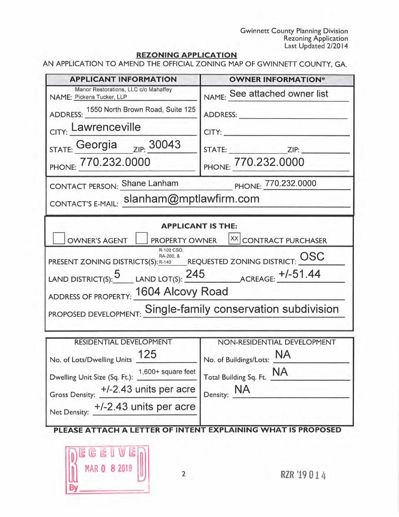
Gwinnett County Planning Division Rezoning Application Last Updated 2/2014
REZONING APPLICATION AN APPLICATION TO AMEND THE OFFICIAL ZONING MAP OF GWINNETT COUNTY, GA.
APPLICANT INFORMATION OWNER INFORMATION* Manor Restorations, LLC c/o Mahaffey
NAME: See attached owner list NAME: Pickens Tucker, LLP
ADDRESS: 1550 North Brown Road, Suite 125
ADDRESS:
ciTY: Lawrenceville CITY:
STATE: Georgia ZIP: 30043 STATE: ZIP:
PHONE: 770.232.0000 PHONE: 770.232.0000
CONTACT PERSON: Shane Lanham PHONE: 770.232.0000
CONTACT'S E-MAIL: [email protected]
APPLICANT IS THE:
D OWNER'S AGENT D PROPERTY OWNER I xx I CONTRACT PURCHASER R-100 CSO,
REQUESTED ZONING DISTRICT: QSC RA-200, &
PRESENT ZONING DISTRICTS(S): R-140
LAND DISTRICT(S): 5 LAND LOT(S): 245 ACREAGE: +/-51.44
ADDREss oF PROPERTY: 1604 Alcovy Road
PROPOSED DEVELOPMENT: Single-family conservation subdivision
RESIDENTIAL DEVELOPMENT NON-RESIDENTIAL DEVELOPMENT
125 No. of Lots/Dwelling Units _____ _ No. of Buildings/Lots: _N_A _____ _ 1,600+ square feet
Dwelling Unit Size (Sq. Ft.): _____ _ Total Building Sq. Ft. _N_A ______ _
G D . +/-2.43 units per acre
ross ens1ty: --------- D . NA ens1ty: -----------
N D . +/-2.43 units per acre
et ens1ty: ----------
PLEASE ATTACH A LETTER OF INTENT EXPLAINING WHAT IS PROPOSED
fD) [H~ ~LI W ~~ lli MAR 0 8 2019 ~ By
2 RZR '1901 l~
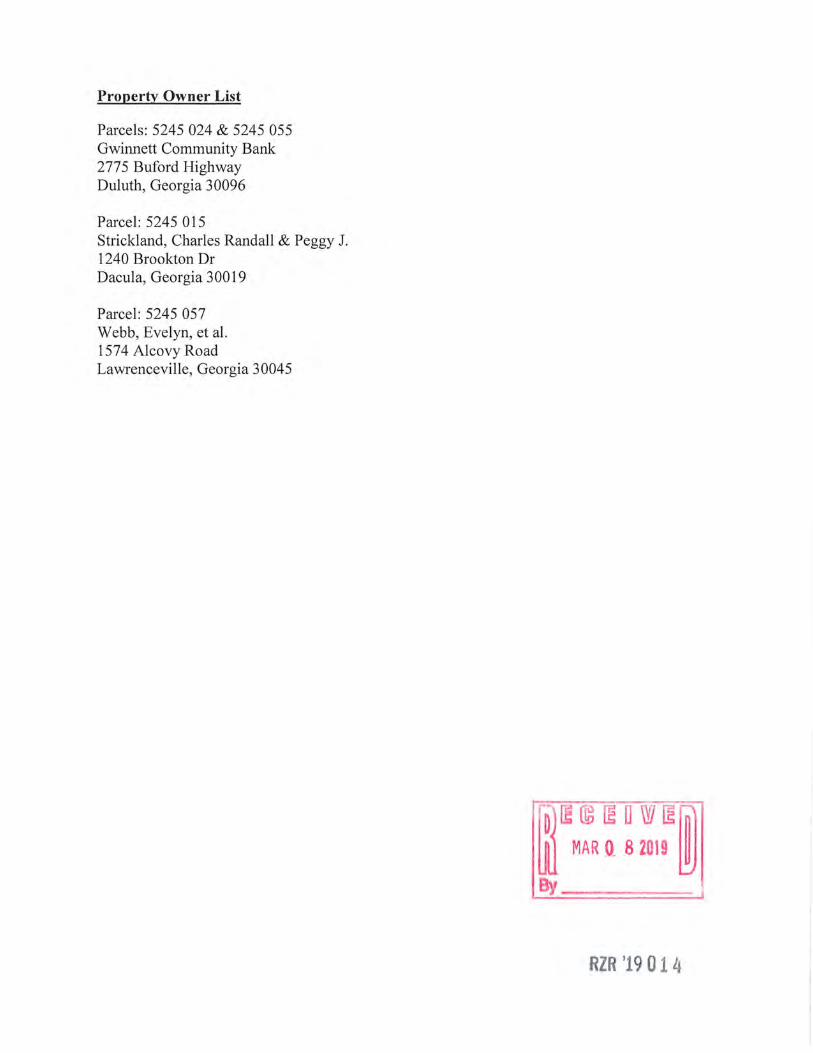
Property Owner List
Parcels: 5245 024 & 5245 055 Gwinnett Community Bank 2775 Buford Highway Duluth, Georgia 30096
Parcel: 5245 015 Strickland, Charles Randall & Peggy J. 1240 Brookton Dr Dacula, Georgia 30019
Parcel: 5245 057 Webb, Evelyn, et al. 1574 Alcovy Road Lawrenceville, Georgia 30045
ID) rn © ma w ~ ~ ill MAR Q 8 2019 ~
RZR '19014
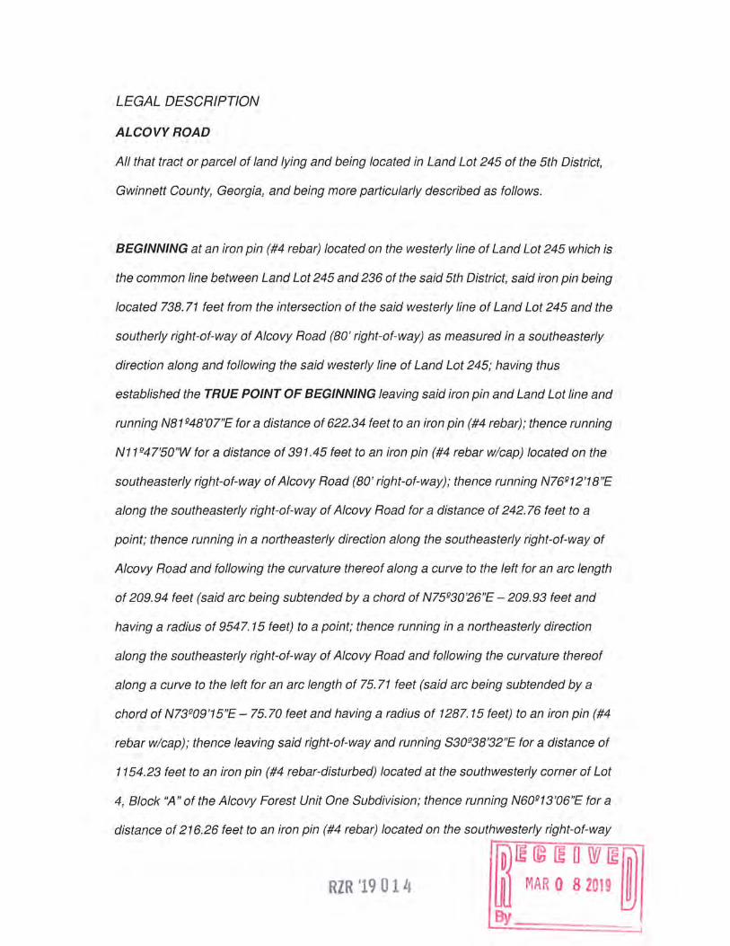
LEGAL DESCRIPTION
ALCOVYROAD
All that tract or parcel of land lying and being located in Land Lot 245 of the 5th District,
Gwinnett County, Georgia, and being more particularly described as follows.
BEGINNING at an iron pin (#4 rebar) located on the westerly line of Land Lot 245 which is
the common line between Land Lot 245 and 236 of the said 5th District, said iron pin being
located 738. 71 feet from the intersection of the said westerly line of Land Lot 245 and the
southerly right-of-way of Alcovy Road (80' right-of-way) as measured in a southeasterly
direction along and following the said westerly line of Land Lot 245; having thus
established the TRUE POINT OF BEGINNING leaving said iron pin and Land Lot line and
running N81 g48'07"E for a distance of 622.34 feet to an iron pin (#4 rebar); thence running
N 11g47'50 "W for a distance of 391. 45 feet to an iron pin ( #4 rebar w/cap) located on the
southeasterly right-of-way of Alcovy Road (80' right-of-way); thence running N76g12'18"E
along the southeasterly right-of-way of Alcovy Road for a distance of 242. 76 feet to a
point; thence running in a northeasterly direction along the southeasterly right-of-way of
Alcovy Road and following the curvature thereof along a curve to the left for an arc length
of 209.94 feet (said arc being subtended by a chord of N75g30'26"E -209.93 feet and
having a radius of 9547. 15 feet) to a point; thence running in a northeasterly direction
along the southeasterly right-of-way of Alcovy Road and following the curvature thereof
along a curve to the left for an arc length of 75. 71 feet (said arc being subtended by a
chord of N73g09'15"E - 75. 70 feet and having a radius of 1287. 15 feet) to an iron pin (#4
rebar w/cap); thence leaving said right-of-way and running S30g38'32"E for a distance of
1154.23 feet to an iron pin (#4 rebar-disturbed) located at the southwesterly corner of Lot
4, Block ':A" of the Alcovy Forest Unit One Subdivision; thence running N60g13'06"E for a
distance of 216.26 feet to an iron pin (#4 rebar) located on the southwesterly right-of-way
RZR '1901 4 fD) © rn a wrn1m w MAR 0 8 2019 ~

of Alcovy Forest Drive (60' right-of-way); thence running S29Q45'12"E along the
southwesterly right-of-way of Alcovy Forest Drive for a distance of 31. 19 feet to a point;
thence running in a southeasterly direction along the southwesterly right-of-way of Alcovy
Forest Drive and following the curvature thereof along a curve to the left for an arc length
of 28. 78 feet (said arc being subtended by a chord of S33Q02'44"E - 28. 76 feet and
having a radius of 250.37 feet) to an iron pin (#4 rebar); thence leaving said right-of-way
and running S60Q15'31"W for a distance of 216.86 feet to an iron pin (#4 rebar-disturbed)
which is the northwest corner of Lot 1, Block "B" of the Alcovy Forest Unit One
Subdivision; thence running S30Q35'28"E for a distance of 553.99 feet to an iron pin (#4
rebar w/cap) located on the northwesterly right-of-way of Sugarloaf Parkway (right-of-way
varies); thence running S51Qt2'36"W along the northwesterly right-of-way of Sugarloaf
Parkway for a distance of 932.38 feet to an iron pin (#4 rebar w/cap); thence running is a
southwesterly direction along the northwesterly right-of-way of Sugarloaf Parkway and
following the curvature thereof along a curve to the left for an arc length of 91.32 feet (said
arc being subtended by a chord of S51Q57'48"W- 91.32 feet) to an iron pin (#4 rebar
w/cap); thence leaving said right-of-way and running S63Q12'41 "W for a distance of
215.87 feet to an iron pin (#4 rebar w/cap) located on the westerly line of said Land Lot
245; thence running N30Q02'07"W for a distance of 1072.31 feet to an iron pin (#4 rebar);
thence running N30Q02'37"W along the westerly line of said Land Lot 245 for a distance of
839. 1 O feet to an iron pin (#4 rebar) which is the TRUE POINT OF BEGINNING. Said tract
contains 51.444 acres (±2,240,913 sq. ft.).
RZR '19014
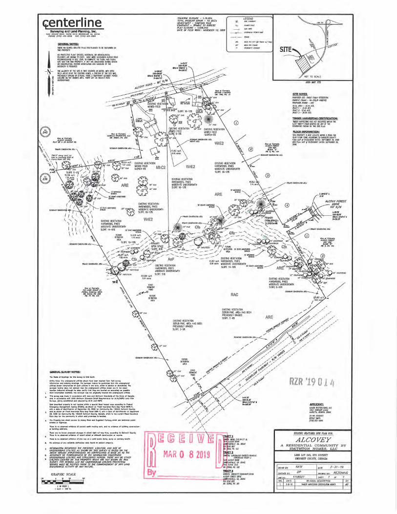
c;enterline
' -N-
' !
'
GENERAL NOTES: JlU[ N09.Cf£.S~[A1Ul THAN 25XPUJDl£D TOEl:CXSlUROCD<»I TllSPROPERTY.
NOPROITCTI\£ PUHT9'1:0£S. !ISTOO-.CAL M ARCtlCl.OCICAL F!ATURESAREKHOViNTOEXIST.NM'tlER(!XSCO'.{R(OOVR'l.'4Gf1El..O R£CCfll>JSSAHC£ ~DCC. 2018, TO CO.f'U:TE THE fl.MA AllO rAU!O. SITE IAST FM nlS PRCP£RTY. r ~y >RE ()SCQ\Ul[I) ~ [)(9~ OOCOOSJRUCOOf,PRCPCRNOT\flCATICtlAHOHANCX.tK:C'.f'M t:tscCM:RYtSR£QJRm.
n£ MJ..XlRl lY u lH£ sm: IS TR[[ CO'v£RfD AS NOlID, ~TH (ffN fJJ.D AR£AS t.'£AA 1l£ EXlSTllC tOLS.. A PCRTlOO r.T »£ 9TE WAS Pfil'Y.OOSl.Y c.RAOCD BY OMRS. THERE 2 TWPMARY sawn PC.1.-0S ~~~nc mAD£D AREA. nm AR£ NO Cfl""()JS ROCX
\\ Y.~\ 7J&n'o10119LcndLat
6 \ Uicta1outMtlyRO'ttaf ~\\Alco1yRaod(atJ"RW)
-;,., ;08\
©~
TRAltfRSC Cl.OSURf - 1:76,924 TOTAL ANGULAR ERROR - '12 SCC's AD.AJSTllE:NT - COMPASS RULE EOUIPM£N r - TR/Met.£ SS R080 nc PLAT CLOSURE - 1: 689, 445 DA TE OF REW MlRK- NO'r£1JBER IJ. 2018
EXISTillG VEG£TATIOll HARO~OOOS. PINES UOOERAT£ UNDERGROWTH SlOPE I0-12%
WrE2
EllSTillG VEG£TATIOH HARO~OOOS, PlllES UOIJ£RAT£ UllOERGROWTH SLOPE I0-12i
LEGEND
EXISTING VEGUATIOll HAROV.OOOS,P1NES UOOERATIUllOERGRDWTH SLOPE 10-12%
GENERAL SURVEY NO'TES:
Ul.llty Nat.: Ill.• uncl•t'll"OVncl ul li lOn li'\ow" ha..w t. ... localed frcim r•d eurwy Wlfonnoticinot\de-b\Wl9clto.i<l9a.ThearW")Ol'mdo.t1noguarontcelhotlhel.Wlder9'CU'1d ul lillHlll.o.nt.Gn"91'atnlHol•udlullllr11illh•oreo.-1lh«'"MNlc•otcbandaned. The IUr\Oe)Of furthe<dc>e1nol WOTOnl ltlat the undenJrt>undul.,t\H tNwnor•'" the ncct IDCot\ol'I Wld\eotld ollhm>9h ht!..._ cwurr tho\ Uwyor• locot..:I oa cccurotalyo• pout.It
1. lromhlotm0llot\CM11oble.lheaur\Oe)Ofhatl\Olpl'l)Sk:allylocoltdlh11.W\der!1'CU\dutn11ts..
Th1'.._y_mod1...,oCGOtdar•u•llhlatr1ondW\oll"''""StCllldan!1oflht!Stol•olc.otqlo; Ol'\d, '" occOf"donc• •Hll 2015 VWlh'lulTt S1Cllldord D1lal R1 ... \"11T1tnl• IOI' ALTAft&S Lond TIU• Surwr-. pr.uyntobr.,.ed G'\d odopled tlyALTA ond NSPS..
Sold dexfkd pt~erlr .. Ml IDColed •lt.l'IWI a lj:ltdd llood ho1otd orea occ.ord'r\9 lo fedlrd ~yl.lano9-t A9-y(f[VA). 01 IN!wn Of'\ Rood ftiUUll'IU Roll Polap POl'lll 00111 f, •llh o dot• ofldtnllflc.ol\ol'I ofS.,l1m~• 20. 2006 lor Com""u1JtyNll.. IJO.l:Z:Z C.lronell C-ly,
l. onc101llllownanAoodlnturonc•Rol•lil<lpPonel0091r,_.111odol•ofid1nUllcotlcnofSlplWl'lll• :ZD,2005 flWCcmmuNlyN6.1JCll220.Mell'°'-'"1Y,Ceotq\o, ... \cJlll lheeutT.,lf\ood~uranu Rol•\lop!Qf°lhlccmrnuNlrWl,,..\tll1oldpn-11T1~itlocoltd.
_. _ The Prgp&"&"lyha• dhct occn1 to AlcOY"t Rood end Sugorlool Portwar•ll\dl or-e dt*oted public 1lrffl1orlll9ll..o)'IL
n...•lll\Oobt~htd....:•ofcun-e"llO'Ulm~g•orli. Cllldno~1alb&Adngc0'\llrucl1""
Ofbu~godcltlana.
There ore "o uo.., propoud chOf'IQU In tltHI ngtil-af-1ay 1rin. occcrllng to C.Nltll Counl~ '""-'•lino ob11rwd r.old91'1C• ofrK.,I 1ltnl or llldh'ollcon.lrucl\ol'I ar-t.,:ialra.
1· ~:::l~GtffW:l i:~:g~sm~.ri;,'f;JrJE/,~0 B~fffo ~ THE ABO~ GROUND APPURTENANCES NO cmnRCAnON IS A/ADE AS TO THE
e. ~Zfi1:~'lfo frnrf:s~NJa~~cl1f5R:if~~:~~ it°&i°!J~'~~E OTHER D. ununrs LOCATCD ON THIS PROPERTY KHICH ARE NOT SHO>tN ON THIS
SURVfY. PER GEORGIA LAW THE UNDERGROUND ununf'S PROTECnON SERWCf: AIUST BE NOllF1fD PRIOR TO THE COUUENCEU£NT OF ANY LAND DISTURBANCE Acnwrr OF ANY NATURE.
GRAPHIC SCALE
·kw • .JJ-.€ i
WrE2
EXISTINGVEG£TATION SCRUBPlllE.AREAHASBEEN PRE\10USLYGRAOED SLOPE 3-5%
fD) lHG5 !B \YI
ill MAR 0 8 2019
RAC
EXISTillGVEG£TATIOll SCRUBPlllE.AREAHASBEEN PRrnOUSLY GRAllEO SlOPE2-4%
By o~CWJ..'\fnCDiJJJWTY/JA)J( L......!'....:====:;;::::::::::,:·~ ~~~- ~'J'{',:::tJ.:'~s
PiN5245055 08..5.J~PG.761
:i~~:
SITE NOTES PIK.l'OSEIJUSC: SIKUWJl..YRCSUJITW Ctllfl(NTllJD.'C-KA-2()()~-IOO{CSO} PflOP{)$E1)ltJ//NC-asc TOTA.1..ARCA-51.44AC:S. TRACTl-12.45.AC:S.
:~~~ ~--'~t~l?c:s.
TIMBER HARVESTING CBmFICATION: TllBERHAR\BmcttASNOTOCOJRR£DYtlnrn Ttt( LAST NlNTY-n:oR ucwrns CH >JiY CF THE PR!ffRTES9iO'MlOOJKSSITEPU.'l.
ROOD INFORMATION: TKSPRCffRTYlS NOT LOCATED \llHI A IUIA 100 'IU.R flOOO ZCK ACCMOtfe TO GW~~·rn CO.JtHY FtUAUAPf1Jll5C0076fOAT£0:SEPm.eER29,2006 ~~AUAP11Jl.15COO!lff0Al£D::S[pfEU8£R29,
SlaNl>R'faMDN..UOl«.A
ARE
ALCOVY FOREST DR/I-£
50' R/W
l•28.71'
~~.>.,--::s•.:m, ... [ .. ,.,,,.
RZR '1901 4
24~CCWTACT:
BllmCSUTH (770)651-()()4'
EXIS7!NG FEATURES SITE PW/ Fl!R:
ALCO VEY A RESIDENTIAL COMMUNITY BY
SMITHTON HOMES, LLC
LANO LOT 245, 5TH DISTRICT Gli!NNETT COUNTY, GEORGIA
NKW 2-21-19
DP °"'"""' ""' REZONING ff18021 SHECT 1 or 1

G=enterline 1301SS~~,!~.8~u~T6~~1~, ~!~~~~,!~~144
PHONE: (770) -124-002! FAX: (170) 424-Z.!U
' -N-
SITENOTCS PR<POSfD I/SI: SINCLffAJJILYRCSf)[}JTW. aA//lf)/1 lOW.O - HA-200;11-Tot(CSO) PNOPOSllJlCil'JC- OSC TOTA1.AR£A-51.44ACS. TRACTl-12.fSACS. TRACT2-1245ACS. TRACT J- 26.54 ACS. ODISITY..<RlA-51.UACS.GWJSSjJKT 51.UACS.-aOrJntNn~-51.44ACS LOTSOONOTOKROACJltlTORf(JIJR[IJSTATfBtlTfliS.
DSC ZONING REQUIREMENTS U.JUMILOTSllf- 7,51XJSF. U!NiU.NlOTNDTH-60' UA.tlllWBUX11£r.HT-.15rT IJINJllJJlfEATfDllOCflSPACE- 1,#XJSf A.L.LOWABL[ODISTY- 2.51.UTSffiiA(R[ (128 I.MTS) WNJAJJJOPOJSPAC£25X(12.66ACS)
PROPOSED SITE REQUIREMENTS TOTAL RLSIDENnAL UNITS PROPOSED - 125 PR!P05£DJCTDDISITY-24JWTSPfRACRf UJIJ/IAJlOTSlf-7,51XJSF. AIO'AC£LOT9lf-9.566SF.
PROPOSED SITE REQUIREMENTS TOTAJ..CffNSPACf-llBJACS.(26.BX)
~J,;;J~ tA~J!t:f fWICD >KJ.'f-QOACS
g~~~;;: tsCS.JJ~ PUJMD Allf»TYAffA - Q•fl ACS.
Norforf"ft'mtrlf TH£u.BRICRQJPLP
POll£1.LRANDALLmlH 08..5.J.J11.PC.5f6
PB..11,PG.115
ST1lfET TREE REQUIRMENTS
1. Under9"0U'ldut1itiescnre'1.frtd.
2. ()ietmj>tf50foto'fettofstmt(bolhddesofslrttl)shdl btproW:ied.
J. Street lrusshal ht l«oltdou\sidf: or the street riljlt-or-W"f, wilhii 5 feel or the rigil-of-woy.
-4. Slteel treesshal be sdtt!~ frc:rn the Tree Species WI ii the l.OOApptn<hCl'ldsho1 beatk:cslJ'1chcd'per atlii1eof pblti\4
5. Uin:ifuncl!<Nd:ilegenusofslteelltussha'lbelJ1/Jpetttnl oltnfresM.uionttonegenusperslteel
6. Priortopmnitis.sucnc,eCl'IO'.e'o'lslteelltt.eplonshdlbe subrr.ittedfo1 1~cnd ~oo.dll'lalild';eotesl~locotion;size; l}!NJS. species, Cl'ld "o<riety; l}M1Jspereentoqes. end p!cnli\g deloh. Thesltedlteep!Mrr.oybeopa1.olthe TreePrestNatiol"I Md/« ReplownenlPb\.
7. Thedt..e'qiersholbertSpcnU:llefttlheplCl'l\i1i9olslteetlte6 ~e~~eocndeaiser.olic:nspocelclspriorlothet:w'"O'.dOI
a. Theht:rntlxi!6ersho'lbemponsblelorthepla\lhgofstreel lteesiifronlollheaffect~ m,mai1otspr'.iotlollle~°' a Cetlficote of Clca.'l)(l'ley
9. Slteellteeplonlhgsho'lbede!o)'edfrcmJ.inelhtw<jlAu9Jsl
007£: All Df7DJTJC11ARCASJt..H£8£DJRlllOl!Df7NlJ 1Hf CPDJSPAC£CAJ.Cl.A..AT!Ci/S.11£DfTDITJCNAR£ASTOTAL5.'J9ACS
10. Slteellreesshalbema'nta'ntdot1deortdlttbylheptopttly ~ert'IUpl'1sUxt.Uions'1whlchlhep<qwtyo.nmouodalion p<ao.~moiiltnmu:cndeore.Uaiilmir.cest\Olildudercploc«M'll ond\1immii9osnece~Prut1i19Cl'\dlteema109erntnlshdlbeii =~:lhslcn<b'dsofthelnternotionalSocletyol
BUILDING SCTllACK REO!JIREMENTS: fmll-25' RCAR-JO' 90£ -7.5'
GRAPHIC SCALE
-·~·-.JJ-t i
TRACT1 o~.rR: llfBB.flfl'rNOAL 15UA1COVYRO.W
~.~:f/·CA.30045 08...1922,PC.l.11
TRACT2 O~US:STRJCXUJIDCJIJ.Nt.ES!WIDAU
16lU Alcovf':° Pff.6Y J
~~o«tf-CAJlXU5 DB.2~PG.118
TRACT3 O~.fflS: C'ffiM.fTTCOOMITYBJJIX AlCOW FCHST /JIM£
~Jl~!fffGA.JlXH5 DB.53766,PG..761
®
AREAJJAP:NTS
FLOOD INFORMATION: TltSPR<ffRTYISOOTLOCATEDv.l~AfDJAIOO 'l[AR FlOOO ZCJ£. ACC®:NG TO GWJCIETT COOtHY fUJAU.l.Pf1Jll5C007fJ"DATID:SEPITllOCR29,2006 >J:OfUJAllAP#1J135C0091fDAITD:SCPTDJllER29, 2006.
APl'UCAHT: UAJKRRCSra?AllWS, UC. 416J TO'MISHP CHJ.Sl UAkEffA.,ClCRa4JtfJ66
241R. WJTACT: BlRJICfJATH {170)6.52-IXJ#
CONCEP1VAL srrE PW/ roR:
ALCO VEY A RESIDENTIAL COMMUNITY BY
SMITHTON HOMES, LLC
LAND LOT 245, ST!! DISTRICT GWINNETT COUN1Y, GEORGIA
NKW 2-21-19
DP orw1wc NO., REZONING 1118021 SHaT 1 or 1
510CWAIX,11lA1 .tSTRffTTRfCSA.OOro
Gwinnett County Planning Division Rezoning Application Last Updated 2/2014
REZONING APPLICANT'S RESPONSE STANDARDS GOVERNING THE EXERCISE OF THE ZONING POWER
PURSUANT TO REQUIREMENTS OF THE UNIFIED DEVELOPMENT ORDINANCE, THE BOARD OF COMMISSIONERS FINDS THAT THE FOLLOWING STANDARDS ARE RELEVANT IN BALANCING THE INTEREST IN PROMOTING THE PUBLIC HEALTH, SAFETY, MORALITY OR GENERAL WELFARE AGAINST THE RIGHT TO THE UNRESTRICTED USE OF PROPERTY AND SHALL GOVERN THE EXERCISE OF THE ZONING POWER.
PLEASE RESPOND TO THE FOLLOWING STANDARDS IN THE SPACE PROVIDED OR USE AN ATTACHMENT AS NECESSARY:
(A) WHETHER A PROPOSED REZONING WILL PERMIT A USE THAT IS SUITABLE IN VIEW OF THE USE AND DEVELOPMENT OF ADJACENT AND NEARBY PROPERTY:
Please see attached
(B) WHETHER A PROPOSED REZONING WILL ADVERSELY AFFECT THE EXISTING USE OR USABILITY OF ADJACENT OR NEARBY PROPERTY: Please see attached
(C) WHETHER THE PROPERTY TO BE AFFECTED BY A PROPOSED REZONING HAS REASONABLE ECONOMIC USE AS CURRENTLY ZONED: Please see attached
(D) WHETHER THE PROPOSED REZONING WILL RESULT IN A USE WHICH WILL OR COULD CAUSE AN EXCESSIVE OR BURDENSOME USE OF EXISTING STREETS, TRANSPORTATION FACILITIES, UTILITIES, OR SCHOOLS: Please see attached
(E) WHETHER THE PROPOSED REZONING IS IN CONFORMITY WITH THE POLICY AND INTENT OF THE LAND USE PLAN: Please see attached
(F) WHETHER THERE ARE OTHER EXISTING OR CHANGING CONDITIONS AFFECTING THE USE AND DEVELOPMENT OF THE PROPERTY WHICH GIVE SUPPORTING GROUNDS FOR EITHER APPROVAL OR DISAPPROVAL OF THE PROPOSED REZONING:
Please see attached
3 ZR '19 0 1 L~ /D)~ ©~aw~~ lfil MAR 0 8 2019 ~ By -~ - =~

STANDARDS GOVERNING THE EXERCISE OF THE ZONING POWER
A. Approval of the proposed rezoning will permit a use that is suitable in view of the use and development of adjacent and nearby property. The subject Property is adjacent to additional land zoned for residential uses and is located in close proximity to land zoned for a mix of uses in Gwinnett County and the City of Dacula. The Property is adjacent to Sugarloaf Parkway and would provide an appropriate transition from activity centers to lower-density residential uses.
B. Approval of the proposed rezoning will not adversely affect the existing use or usability of adjacent or nearby property. Rather the proposed development would complement surrounding residential land uses by providing additional housing options for current and future residents of Gwinnett County. The proposed development would also complement future commercial and mixed-use development at designated activity centers.
C. The Applicant submits that due to its size, location, and layout, the subject property does not have a reasonable economic use as currently zoned.
D. Approval of the proposed rezoning will not result in a use which will or could cause an excessive or burdensome use of existing streets, transportation facilities, utilities, or schools. The property has convenient access to Sugarloaf Parkway and State Route 316 and has access to utilities.
E. The proposed rezoning is in conformity with the policy and intent of the 2040 Plan. The subject Property is designated as within the Emerging Suburban Character Area on the 2040 Plan Future Development Map. Encouraged land uses for this character area specifically include conservations subdivisions.
F. The planned Sugarloaf Parkway extension and the subject Property's prox1m1ty to Freemans's Mill Park provide additional supporting grounds for approval of the Application.
RZR '19014
fO) rn © rn a w rn fll) w MAR 0 8 2019 ~
y
Matthew P. Benson Gerald D avidson, Jr.* Brian T. Easley Kelly 0 . Faber Christopher D. Holbrook Nicholas N . Kemper Shane M. Lanham Austen T . Mabe
l•flii ' • • 4 ~
Mahaffey Pickens Tucker, LLP . .. ~~ ..
ATTORNEYS AT LAW . . - . ._ ~·' > I • ). •
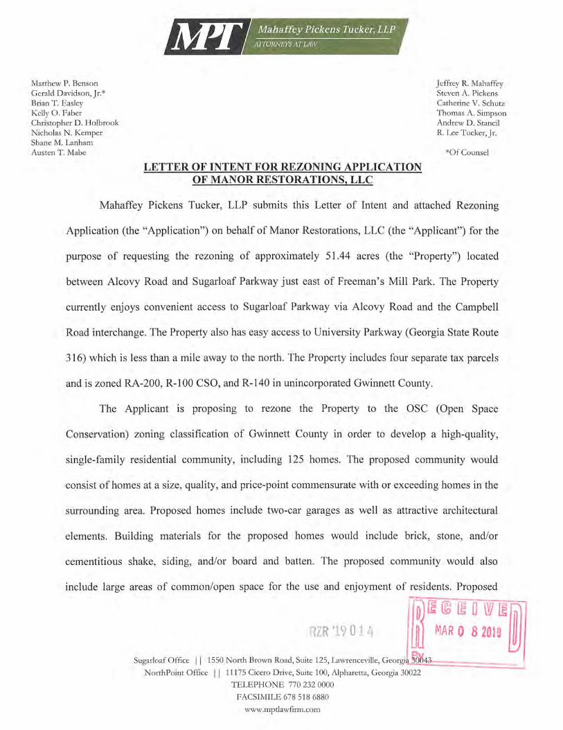
LETTER OF INTENT FOR REZONING APPLICATION OF MANOR RESTORATIONS, LLC.
Jeffrey R. Mahaffey Steven A. Pickens Catherine V. Schutz Thomas A. Simpson Andrew D. Stancil R. Lee Tucker, Jr.
*Of Counsel
Mahaffey Pickens Tucker, LLP submits this Letter of Intent and attached Rezoning
Application (the "Application") on behalf of Manor Restorations, LLC (the "Applicant") for the
purpose of requesting the rezoning of approximately 51.44 acres (the "Property") located
between Alcovy Road and Sugarloaf Parkway just east of Freeman's Mill Park. The Property
currently enjoys convenient access to Sugarloaf Parkway via Alcovy Road and the Campbell
Road interchange. The Property also has easy access to University Parkway (Georgia State Route
316) which is less than a mile away to the north. The Property includes four separate tax parcels
and is zoned RA-200, R-100 CSO, and R-140 in unincorporated Gwinnett County.
The Applicant is proposing to rezone the Property to the OSC (Open Space
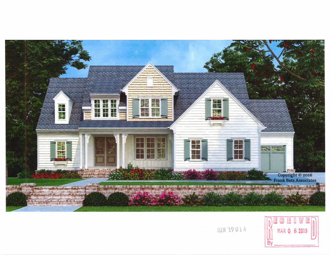
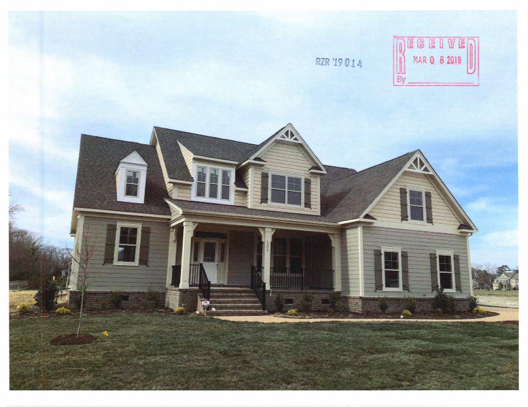
Conservation) zoning classification of Gwinnett County in order to develop a high-quality,
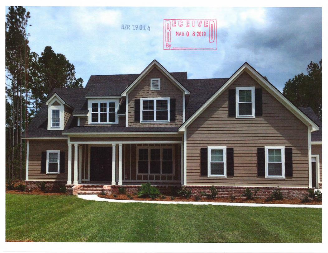
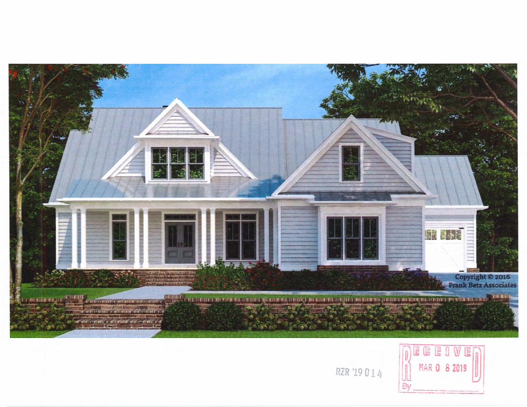
single-family residential community, including 125 homes. The proposed community would
consist of homes at a size, quality, and price-point commensurate with or exceeding homes in the
surrounding area. Proposed homes include two-car garages as well as attractive architectural
elements. Building materials for the proposed homes would include brick, stone, and/or
cementitious shake, siding, and/or board and batten. The proposed community would also
include large areas of common/open space for the use and enjoyment of residents. Proposed
fD) © ru w rn WI f@ '1901 li l.fil MAR 0 8 2019 ~
Sugarloaf O ffice 11 1550 North Brown Road, Suite 125, Lawrenceville, Georgi~~ ~~~4.J,.~=-=-======-i - - I
NorthPoint Office 11 11175 Cicero D rive, Suite 100, Alpharetta, Georgia 30022
TELEPHONE 770 232 0000
FACSIMILE 678 518 6880
"\Vww.mptlawfirm.com

amenities include a bocce ball court and fire pit as well as a community pavilion and patio which
would serve as a gathering place for residents to recreate and socialize.
In addition to being an attractive, high-quality residential community, the proposed
development is compatible with the use and development of adjacent and nearby property and
would provide an appropriate transition of land uses from Sugarloaf Parkway westward towards
additional single-family residential uses. The Gwinnett County 2040 Unified Plan (the "2040
Plan") Future Development Map identifies the Property as within the Emerging Suburban
Character Area. Encouraged land uses for this character area include single-family residential
and mixed residential developments. Further, the 2040 Plan specifically encourages "Open Space
Conservation subdivisions" as a potential development type. Accordingly, the proposed
development is in line with the policies of the 2040 Plan and is compatible with surrounding and
nearby development. Encouraging single-family residential uses, and specifically conservation
subdivisions, at appropriate densities within the Emerging Suburban Character Area furthers the
2040 Plan's objectives by promoting efficient land use and expanding housing options for
current and future residents. Specifically, Theme 4 of the 2040 Plan is to "Provide More Housing
Choices" and Policy 4.1 is to "Preserve and Expand Housing for All Income Levels and Phases
of Life."
Moreover, the Property is located in close proximity to a Neighborhood Activity Center
at Sugarloaf Parkway's intersections with Alcovy Road and a Regional Activity Center along
State Route 316 near Harbins Road as depicted on the City of Dacula' s comprehensive plan. The
proposed development would complement these activity centers by providing residential critical
mass needed to support the mixed and non-residential uses that are encouraged in those areas.

The Applicant and its representatives welcome the opportunity to meet with staff of the
Gwinnett County Planning & Development Department to answer any questions or to address
any concerns relating to the matters set forth in this letter or in the Rezoning Application filed
herewith. The Applicant respectfully requests your approval of the Application.
Respectfully submitted this 27th day of February, 2019.
MAHAFFEY PICKENS TUCKER, LLP
Attorneys for Applicant
fO) rn @ rn a w rn 1m ill MAR 0 8 201 ~
Gwinnett County Planning Division Rezoning Application Last Updated 2/2014
REZONING APPLICANT'S CERTIFICATION
THE UNDERSIGNED BELOW IS AUTHORIZED TO MAKE THIS APPLICATION. THE UNDERSIGNED IS AWARE THAT NO APPLICATION OR REAPPLICATION AFFECTING THE SAME LAND SHALL BE ACTED UPON WITHIN 12 MONTHS FROM THE DATE OF LAST ACTION BY THE BOARD OF COMMISSIONERS UNLESS WAIVED BY THE BOARD OF COMMISSIONERS. IN NO CASE SHALL AN APPLICATION OR REAPPLICATION BE ACTED UPON IN LESS THAN SIX (6) MONTHS FROM THE DATE OF LAST ACTION BY THE BOARD OF COMMISSIONERS.
Shane Lanham, Attorney for the Applicant Type or Print Name and Title
f D) ~ © rn a \YI rn fnl lfil MAR Q 8 2019 ~ 4
Gwinnett County Planning Division Rezoning Application
Last Updated 12120 15
REZONING APPLICANT'S CERTIFICATION
THE UNDERSIGNED BELOW IS AUTHORIZED TO MAKE THIS APPLICATION. THE UNDERSIGNED IS AWARE THAT NO APPLICATION OR REAPPLICATION AFFECTING THE SAME LAND SHALL BE ACTED UPON WITHIN 12 MONTHS FROM THE DATE OF LAST ACTION BY THE BOARD OF COMMISSIONERS UNLESS WAIVED BY THE BOARD OF COMMISSIONERS. IN NO CASE SHALL AN APPLICATION OR REAPPLICATION BE ACTED UPON IN LESS THAN SIX (6) MONTHS FROM THE DATE OF LAST ACTION BY THE BOARD OF COMMISSIONERS.
--·-2 ~ / ~-- ~ ... ----Signature of Applicant
Type or Print Name and Title
4
Date
Ri 'J9 0 .~ b.
Date
f~[H!3 Ul U W ~foj ill MAR 0. 8 2019 ~
y
Gwinnett County Planning Division Rezoning Application Last Updated 2/2014
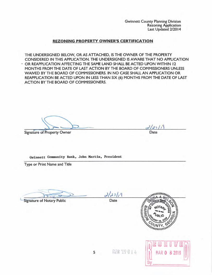
REZONING PROPERTY OWNER'S CERTIFICATION
THE UNDERSIGNED BELOW, ORAS ATTACHED, IS THE OWNER OF THE PROPERTY CONSIDERED IN THIS APPLICATION. THE UNDERSIGNED IS AWARE THAT NO APPLICATION
.. OR REAPPLICATION AFFECTING THE SAME LAND SHALL BE ACTED UPON WITHIN 12 MONTHS FROM THE DATE OF LAST ACTION BY THE BOARD OF COMMISSIONERS UNLESS WAIVED BY THE BOARD OF COMMISSIONERS. IN NO CASE SHALL AN APPLICATION OR REAPPLICATION BE ACTED UPON IN LESS THAN SIX (6) MONTHS FROM THE DATE OF LAST ACTION BY THE BOARD OF COMMISSIONERS.
e Signature of Property Owner
Gwinnett CoDDllUnit:y Bank. John Martin, President
Type or Print Name and Title
Date
5 RL. '· c 0 ·1 L ... -; _, i
Date
D Ii:© ~ O W ~j~ MAR 0 8 2019 l~

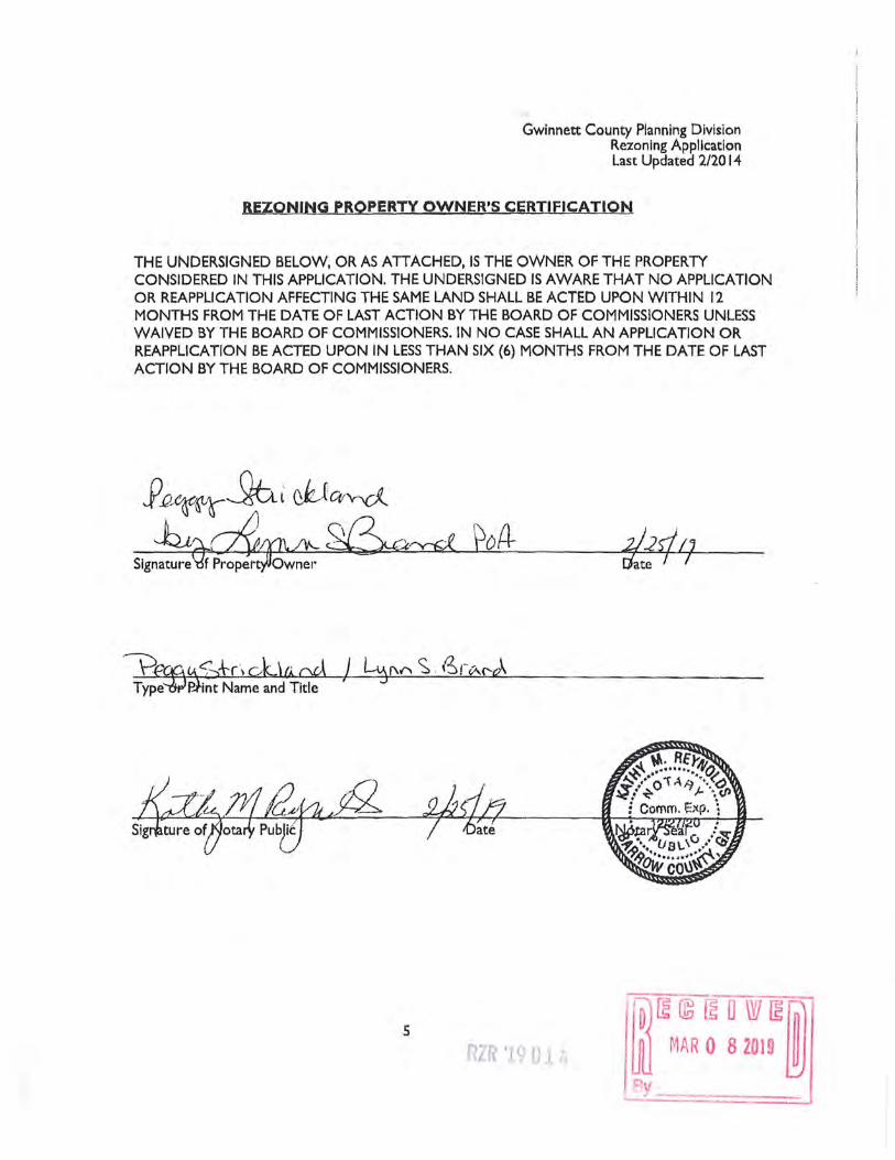
Gwinnett County Planning Division Rezoning Application Last Updated 2/20 14
REZONING PROPERTY OWNER•s CERTIFICATION
THE UNDERSIGNED BELOW, OR AS ATTACHED, IS THE OWNER OF THE PROPERTY CONSIDERED IN THIS APPLICATION. THE UNDERSIGNED IS AWARE THAT NO APPLICATION OR REAPPLICATION AFFECTING THE SAME LAND 'SHALL BE ACTED UPON WITHIN 12 MONTHS FROM THE DATE OF LAST ACTION BY THE BOARD OF COMMISSIONERS UNLESS WAIVED BY THE BOARD OF COMMISSIONERS. IN NO CASE SHALL AN APPLICATION OR· REAPPLICATION BE ACTED UPON IN LESS THAN SIX (6) MONTHS FROM THE DATE OF LAST ACTION BY THE BOARD OF COMMISSIONERS.
Signai;{Jre of Property Owner
Type or Print Name and Title
5 RL":'/f) ;., (1 0 . n _., '- lJ
/~ rn © rn a w rn ml lfil MAR 0 B 2019 ~
y
Gwinnett County Planning Division Rezoning Application Last Updated 2/20 14
REZONING PROPERTY OWNER'S CERTIFICATION
THE UNDERSIGNED BELOW, OR AS ATTACHED. IS THE OWNER OF THE PROPERTY CONSIDERED IN THIS APPLICATION. THE UNDERSIGNED IS AWARE THAT NO APPLICATION OR REAPPLICATION AFFECTING THE SAME LAND SHALL BE ACTED UPON WITHIN 12 MONTHS FROM THE DATE OF LAST ACTION BY THE BOARD OF COMMISSIONERS UNLESS WAIVED BY THE BOARD OF COMMISSIONERS. IN NO CASE SHALL AN APPLICATION OR REAPPLICATION BE ACTED UPON IN LESS THAN SIX {6} MONTHS FROM THE DATE OF LAST ACTION BY THE BOARD OF COMMISSIONERS.
Signature fPrope;: owner
5

Gwinnett County Planning Division Rezoning Application Last Updated 2/2014
CONFLICT OF INTEREST CERTIFICATION FOR REZONING
The undersigned below, making application for a Rezoning, has complied with the Official Code of Georgia Section 36-67 A- I, et. seq, Conflict of Interest in Zoning Actions, and has submitted or attached the required information on the forms provided.
OF APPLICANT DATE TYPE OR PRINT NAME AND TITLE
Shane M. Lanham, Attorney for Applicant
SI AT E OF APPLICANT'S DATE TYPE OR PRINT NAME AND TITLE ATTORNEY OR REPRE ENTATIVE
D YEs [l( No Mahaffey Pickens Tucker, LLP YOUR NAME
If the answer is yes, please complete the following section:
NAME AND OFFICAL CONTRIBUTIONS DATE CONTRIBUTION
1 POSITION OF GOVERNMENT
(List all which aggregate WAS MADE
OFFICIAL to $250 or More) (Within last two years)
~lil aHeel1e~
Attach additional sheets if necessary to disclose or describe all contributions.
6
r~ rn © rn LI W rn ~ lJll MAR 0 8 2019 ~

Gwinnett County Planning Division Rezoning Application
Last Updated I 2120 I 5
CONFLICT OF INTEREST CERTIFICATION FOR REZONING
The undersigned below, making application for a Rezoning, has complied with the Official Code of Georgia Section 36-67 A-1, et. seq, Conflict of Interest in Zoning Actions. and has submitted .or
- attached the required information on the forms provided.
~~ 2-. /2c /201t /3El1,v1e S'1t1 111-( r4-1 ~.N~ SIGNATURE OF APPLICANT DATE TYPE OR PRINT NAME AND TITLE
SIGNATURE OF APPLICANT'S DATE ATTORNEY OR REP ENTATIVE
Have you, within the two years immediately preceding the filing of this application, made campaign contributions aggregating $250.00 or more to a member of the Board of Commissioners or a member of the Gwinnett County Planning Commission?
D YEs ~No /J_av_~_16_~_,_7it __________ _ YOUR NAME
If the answer is yes, please complete the following section:
Attach additional sheets if necessary to disclose or describe all contributions.
6 m~M~R~ ~~!~~ 'f}y
Gwinnett County Planning Division Rezoning Application Last Updated 2/2014
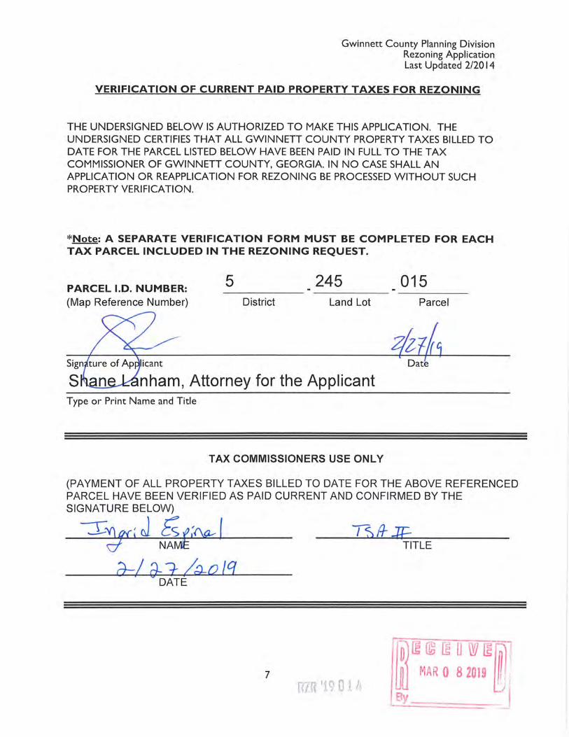
VERIFICATION OF CURRENT PAID PROPERTY TAXES FOR REZONING
THE UNDERSIGNED BELOW IS AUTHORIZED TO MAKE THIS APPLICATION. THE UNDERSIGNED CERTIFIES THAT ALL GWINNETT COUNTY PROPERTY TAXES BILLED TO DATE FOR THE PARCEL LISTED BELOW HAVE BEEN PAID IN FULL TO THE TAX COMMISSIONER OF GWINNETT COUNTY, GEORGIA IN NO CASE SHALL AN APPLICATION OR REAPPLICATION FOR REZONING BE PROCESSED WITHOUT SUCH PROPERTY VERIFICATION.
*Note: A SEPARATE VERIFICATION FORM MUST BE COMPLETED FOR EACH TAX PARCEL INCLUDED IN THE REZONING REQUEST.
PARCEL l.D. NUMBER: (Map Reference Number)
Type or Print Name and Title
5 245 District Land Lot
TAX COMMISSIONERS USE ONLY
015 Parcel
(PAYMENT OF ALL PROPERTY TAXES BILLED TO DATE FOR THE ABOVE REFERENCED PARCEL HAVE BEEN VERIFIED AS PAID CURRENT AND CONFIRMED BY THE SIGNATURE BELOW)
---s~, J f U/'<k I TITLE
a--/ if=]: /~o /q DATE
7

Gwinnett County Planning Division Rezoning Application Last Updated 2/2014
VERIFICATION OF CURRENT PAID PROPERTY TAXES FOR REZONING
THE UNDERSIGNED BELOW IS AUTHORIZED TO MAKE THIS APPLICATION. THE UNDERSIGNED CERTIFIES THAT ALL GWINNETT COUNTY PROPERTY TAXES BILLED TO DATE FOR THE PARCEL LISTED BELOW HAYE BEEN PAID IN FULL TO THE TAX COMMISSIONER OF GWINNETT COUNTY, GEORGIA. IN NO CASE SHALL AN APPLICATION OR REAPPLICATION FOR REZONING BE PROCESSED WITHOUT SUCH PROPERTY VERIFICATION.
*Note: A SEPARATE VERIFICATION FORM MUST BE COMPLETED FOR EACH TAX PARCEL INCLUDED IN THE REZONING REQUEST.
PARCEL l.D. NUMBER: 5 245 024 (Map Ref · District Land Lot Parcel
of Applicant
Shane Lanham, Attorney for the Applicant Type or Print Name and Title
TAX COMMISSIONERS USE ONLY
(PAYMENT OF ALL PROPERTY TAXES BILLED TO DATE FOR THE ABOVE REFERENCED PARCEL HAVE BEEN ERIFIED AS PAID CURRENT AND CONFIRMED BY THE SIGNATURE BELOW)
DATE
7
1ZR: 'J.9014
Gwinnett County Planning Division Rezoning Application Last Updated 2/2014
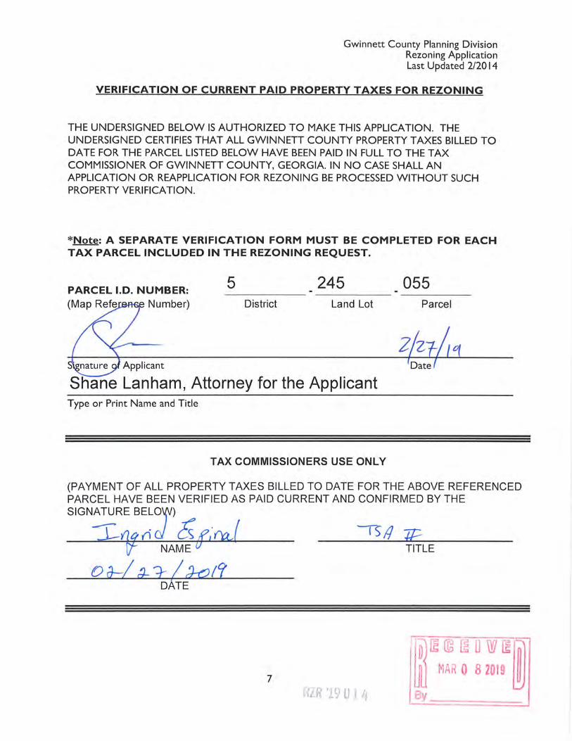
VERIFICATION OF CURRENT PAID PROPERTY TAXES FOR REZONING
THE UNDERSIGNED BELOW IS AUTHORIZED TO MAKE THIS APPLICATION. THE UNDERSIGNED CERTIFIES THAT ALL GWINNETT COUNTY PROPERTY TAXES BILLED TO DATE FOR THE PARCEL LISTED BELOW HAVE BEEN PAID IN FULL TO THE TAX COMMISSIONER OF GWINNETT COUNTY, GEORGIA. IN NO CASE SHALL AN APPLICATION OR REAPPLICATION FOR REZONING BE PROCESSED WITHOUT SUCH PROPERTY VERIFICATION.
*Note: A SEPARATE VERIFICATION FORM MUST BE COMPLETED FOR EACH TAX PARCEL INCLUDED IN THE REZONING REQUEST.
PARCEL l.D. NUMBER: 5 245 055 Number) District Land Lot Parcel
Applicant
Shane Lanham, Attorney for the Applicant Type or Print Name and Title
TAX COMMISSIONERS USE ONLY
(PAYMENT OF ALL PROPERTY TAXES BILLED TO DATE FOR THE ABOVE REFERENCED PARCEL HAVE BEEN VERIFIED AS PAID CURRENT AND CONFIRMED BY THE
SIGNA~RE BELOd W) . ~- f I 1)11 :r .J__o/ {i cs 17' f'tt,l /1 :H::::.
NAME TITLE
o a--:! :;_ 2 I :J-o 1? DATE
7
Gwinnett County Planning Division Rezoning Application Last Updated 2/2014
VERIFICATION OF CURRENT PAID PROPERTY TAXES FOR REZONING
THE UNDERSIGNED BELOW IS AUTHORIZED TO MAKE THIS APPLICATION. THE UNDERSIGNED CERTIFIES THAT ALL GWINNETT COUNTY PROPERTY TAXES BILLED TO DATE FOR THE PARCEL LISTED BELOW HAVE BEEN PAID IN FULL TO THE TAX COMMISSIONER OF GWINNETT COUNTY, GEORGIA. IN NO CASE SHALL AN APPLICATION OR REAPPLICATION FOR REZONING BE PROCESSED WITHOUT SUCH PROPERTY VERIFICATION.
*Note: A SEPARATE VERIFICATION FORM MUST BE COMPLETED FOR EACH TAX PARCEL INCLUDED IN THE REZONING REQUEST.
PARCEL l.D. NUMBER: (Map Reference Number)
5 District
245 Land Lot
Shane Lanham, Attorney for the Applicant Type or Print Name and Title
TAX COMMISSIONERS USE ONLY
057 Parcel
(PAYMENT OF ALL PROPERTY TAXES BILLED TO DATE FOR THE ABOVE REFERENCED PARCEL HAVE BEEN VERIFIED AS PAID CURRENT AND CONFIRMED BY THE SIGNATURE BELOW)
~flrJ n J Cs 6.1\tt) -rs/I :ff.-NAME I TITLE
0 a-:! ()._ r-/Jp!? DATE
7
JUSTIFICATION FOR REZONING
The portions of the Gwinnett County Unified Development Ordinance (the "UDO")
which classify or may classify the property which is the subject of this Application (the
"Property") into any less intensive zoning classification other than as requested by the Applicant,
are or would be unconstitutional in that they would destroy the Applicant's property rights
without first paying fair, adequate and just compensation for such rights, in violation of Article I,
Section I, Paragraph II of the Constitution of the State of Georgia of 1983, and the Due Process
Clause of the Fourteenth Amendment to the Constitution of the United States.
The application of the UDO as applied to the subject Property, which restricts its use to
the present zoning classification, is unconstitutional, illegal, null and void, constituting a taking
of the Applicant's and the Owner's property in violation of the Just Compensation Clause of the
Fifth Amendment and the Due Process Clause of the Fourteenth Amendment to the Constitution
of the United States, Article I, Section I, Paragraph I, and Article I, Section I, Paragraph II of the
Constitution of the State of Georgia of 1983, and the Equal Protection Clause of the Fourteenth
Amendment to the Constitution of the United States denying the Applicant an economically
viable use of its land while not substantially advancing legitimate state interests.
The Property is presently suitable for development under the OSC classification as
requested by the Applicant, and is not economically suitable for development under the present
RA-200, R-lOOCSO, and R-140 zoning classifications of Gwinnett County. A denial of this
Application would constitute an arbitrary and capricious act by the Gwinnett County Board of
Commissioners without any rational basis therefore, constituting an abuse of discretion in
violation of Article I, Section I, Paragraph I and Article I, Section I, Paragraph II of the
Constitution of the State of Georgia of 1983, and the Due Process Clause of the Fourteenth
Amendment to the Constitution of the United States.
A refusal by the Gwinnett County Board of Commissioners to rezone the Property to the
OSC classification with such conditions as agreed to by the Applicant, so as to permit the only
feasible economic use of the Property, would be unconstitutional and discriminate in an
arbitrary, capricious and ·unreasonable manner between the Applicant and owners of similarly
RZR '1901 Li
fo)~ © ~ 0 w ~~ !JU MAR 0 8 2019 ~

situated property in violation of Article I, Section I, Paragraph II of the Constitution of the State
of Georgia of 1983 and the Equal Protection Clause of the Fourteenth Amendment to the
Constitution of the United States. Any rezoning of the subject Property to the OSC classification,
subject to conditions which are different from the conditions by which the Applicant may amend
its application, to the extent such different conditions would have the effect of further restricting
the Applicant's and the Owner's utilization of the subject Property, would also constitute an
arbitrary, capricious and discriminatory act in zoning the Property to an unconstitutional
classification and would likewise violate each of the provisions of the State and Federal
Constitutions set forth hereinabove.
Accordingly, the Applicant respectfully requests that the rezoning application submitted
by the Applicant relative to the Property be granted and that the Property be rezoned to the
zoning classification as shown on the respective application.
1550 North Brown Road Suite 125 Lawrenceville, Georgia 30043 (770) 232-0000
Respectfully submitted,
Y PICKENS TUCKER, LLP
-~~R~ ~~1~™ By ~~-=--=-~
c )
~
en
~ -'""""
r:::::J 0
0
~
0
IL :J
~
en
~
c:»
C":J
0
0
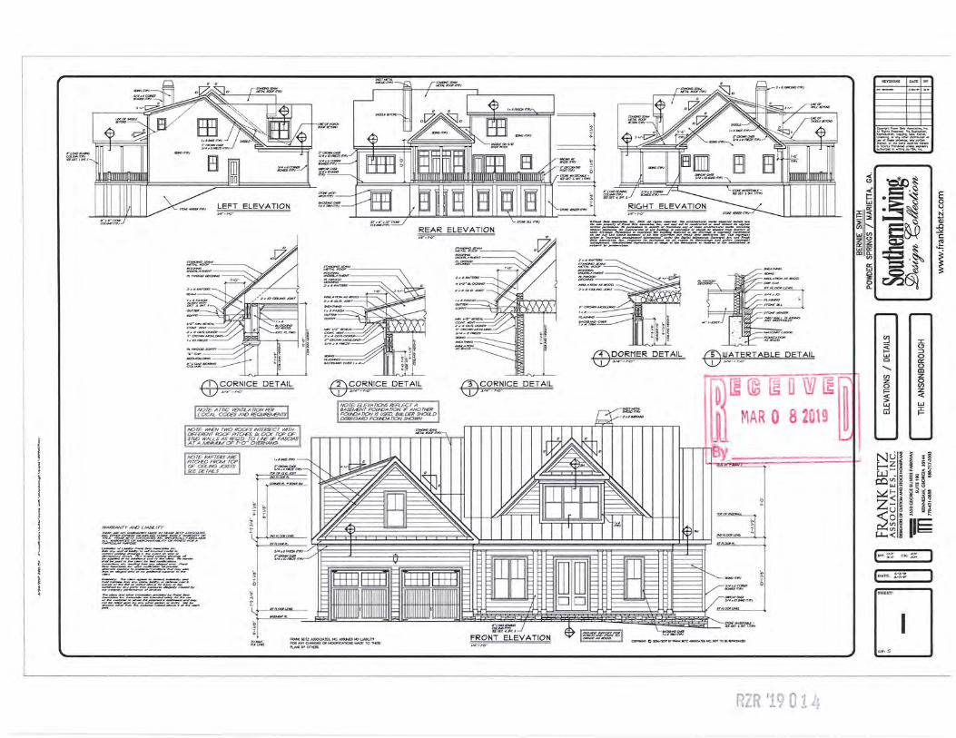
ELEVATION
;:=mt; ~ ;:m":fr.Nft;~
o,,.._._,.~-. ........ l:fll-. AJ1ni,~,,_,__ ;ra...-,,_,_..,..i_.,.,._,_~..,.
REAR ELEVATION f.f:~;:--~}~~~~~€~~~~~~
,';9=' I I ?II "~
CD C:;'.~_,,~ICE DETAIL
NOTE ATTIC VENT/LA nON PER LOCAL CODES Af>D REOll'RENENTS
liKJTE WT-EN TWO ROCJFS INTERSECT YATH DIFFERENT ROOF PITCJES. BLOCK TCP OF STlO WALLS AS REOD TO L/!£ LP FASCIAS AT A MNM..M OF r-o-- 01/ERHAMS
NOTE RAFTERS ARE PITD-ED FROU TCP OF CEILING .JOISTS SEE DETAILS
~All/JFNO W.~°"'f-aEllY F#:ANl::'/llE17A~ T'ES; #>C... Bf>.EJ/1~~'-'f..LD.01>6'fTH'INAW.~~~
fil~~~rY~~ t.-. ..,~r.-w 11wu...._._he.
;:~~~~~~~ ~:;:-~::~2::;
~
"""''~~.,J
CD S.~~~ICE DETAIL
NOTE· B..EVAnOIVS REA..ECT A 8ASE!vENT FOl/'OATION IF ANOTl-ER FOl/'OA nON IS USED. 8ULDER SHOILD DISREGARD FOl/'OA nON SHOWN
CD S.<::':~ICE DETAIL
~~~~~---.,~-::::.,,,::,.~-.J~r::---::::::"f-
ED~5'.~~ER DETAIL ED ~~-1!RT ABLE DETAIL
ctf rn a w ~ MAR 0 8 19
~.::;;..~&:~;-~~by
§i"~~i.-;fF"~-~7:. •'lllilllgl !D'lllilll~- $$· µwz- y.. 11tw J-w-XD?ff&i~
~~~ 4 ~ SEEt:£T:S!HT.lf1'11'J
AW« eETZ ASSCX:IATES. NC ASSU.e> NO UAal.fTY FOQNi'f OWolGE5 OR MOOFICATIONS MADE TO nESE f'L.N-t;&YOnERS.
FRONT
··ZR '1901 l~
i!= SE U)
I.LI z et:: I.LI ID
~r~~ ~~trn.~~~c.
~i!':z!U: ?£r~Dr lh....,f,or lh• pU.•dtplc1ood~•S StrictJJ P,..,,,t>hd ~"'-• ._...aiy autnorlud l-l ..,.lfilqtlyfllA.. tn<;.
-
~~ '~~· ~ ~~ ~~t =·
r55(§1
en ~ I
(.!) ~ ::::>
0 w c::: Cl 0 ......... Cl z en 0 :z en 0 z F= < < w > w ~ ~
w
u ~ ~ §
~~ ~ ~ ~ µJ -~ llii ~ ,...,...<Jl ~ -~w c ~§ ~E-~ ~~ ~
Z~ ~ § ;:; u a ~ ~
~~I i1~ (ev ~ CIC~ )
(om>~ J
~
E 0 u
~ ..0 ~ c:
1