national historic trails - national park service · national historic trails ... for gold seekers...
TRANSCRIPT

National Trails Intermountain RegionNational Park ServiceU.S. Department of the Interior
National Historic TrailsAuto Tour Route Interpretive Guide
Across Nevada
California National Historic TrailPony Express National Historic Trail

By the time they reached the Humboldt Sink, or Forty-mile Desert, many emigrant pioneers had little food, exhausted livestock, and broken wagons.
[Cover photo] Forty-mile Desert

NATIONAL HISTORIC TRAILS
AUTO TOUR ROUTE INTERPRETIVE GUIDE
Across Nevada on the Humboldt Route and The Central Route of the Pony Express
Prepared by
National Park Service National Trails Intermountain Region
www.nps.gov/caliwww.nps.gov/oregwww.nps.gov/poexwww.nps.gov/mopi
NATIONAL PARK SERVICEU. S. DEPARTMENT OF THE INTERIOR
April 2012

Table of Contents
‘MOST CORDIALLY I HATE YOU’:
THE HUMBOLDT RIVER • • • • • • • • • • • • • • • • • • • • 2
THE GREAT BASIN • • • • • • • • • • • • • • • • • • • • 4
SEEKING MARY’S RIVER • • • • • • • • • • • • • • • • • • • • 5
APPROACHING THE HUMBOLDT • • • • • • • • • • • • • • • • • • • • 11
PRELUDE TO MURDER • • • • • • • • • • • • • • • • • • • • 15
THE HUMBOLDT EXPERIENCE • • • • • • • • • • • • • • • • • • • • 18
WEST TO STONY POINT • • • • • • • • • • • • • • • • • • • • 21
THE POLITICS OF HUNGER • • • • • • • • • • • • • • • • • • • • 24
A FLASH OF THE BLADE • • • • • • • • • • • • • • • • • • • • 27
‘HEARTILY TIRED OF THE JOURNEY’ • • • • • • • • • • • • • • • • • • • • 29
THE HUMBOLDT SINK • • • • • • • • • • • • • • • • • • • • 33
THE FORTY-MILE DESERT; or,
HOW TO KILL AN OX • • • • • • • • • • • • • • • • • • • • 35
INTO THE SIERRA NEVADA • • • • • • • • • • • • • • • • • • • • 42
THE PONY BOYS • • • • • • • • • • • • • • • • • • • • 44
CHANGE IN THE GREAT BASIN • • • • • • • • • • • • • • • • • • • • 51
Sites & Points of Interest:
Setting Out • • • • • • • • • • • • • • • • • • • • 53
Navigating the California Trail Across Nevada • • • • • • • • • • • • • • • 54
Tips for Trailing Across Nevada • • • • • • • • • • • • • • • • • • • • 56
AUTO TOUR SEGMENT A:
WEST WENDOVER AND JACKPOT, NEVADA, TO CALIFORNIA
(California Trail) • • • • • • • • • • • • • • • • • • • • 58
AUTO TOUR SEGMENT B:
BLACK ROCK DESERT, RYE PATCH RESERVOIR TO GERLACH, NEVADA
(Applegate and Nobles Trails) • • • • • • • • • • • • • • • • • • • • 77
AUTO TOUR SEGMENT C:
WEST WENDOVER, NEVADA TO CALIFORNIA BORDER
(Pony Express Trail and Carson and Walker River-Sonora
Routes of the California Trail) • • • • • • • • • • • • • • • • • • • • 86
FOR MORE INFORMATION: • • • • • • • • • • • • • • • • • • • • 102

IntroductIon
Many of the pioneer trails and other historic routes that are important in our nation’s past have been
designated by Congress as national historic trails. While most of those old wagon roads and routes are not open to motorized traffic, visitors can drive along modern highways that either retrace the original route or closely
parallel it. Those modern roads are designated as Auto Tour Routes. They are marked with “National Historic Trails” highway signs to help today’s travelers follow the routes used by the pioneers who helped to open the American West.
This interpretive publication guides visitors along the Auto Tour Routes for the California and Pony Express national historic trails as they cross the state of Nevada from east to west. Site-by-site driving directions are included, and an overview map is located inside the back cover. To make the tour more meaningful, this guide also provides a historical overview of the two trails, shares the thoughts and experiences of emigrants who trekked to California, and discusses how the westward expansion impacted native peoples of what is now Nevada.
Individual Auto Tour Route interpretive guides such as this one are in preparation for each state that the Oregon, California, Mormon Pioneer, and Pony Express trails pass through. In addition, individual National Park Service brochures for the four national historic trails are available at many trail-related venues and can be requested from the National Trails Intermountain Region Salt Lake City Branch Office at [email protected]. Each brochure includes a color map of the entire trail and provides an overview of information about each of the trails. Additional information can also can be found on individual trail websites. For links see page 102.
Auto Tour Route Interpretive GuideNevada
2
‘MoSt cordIALLY I HAtE You’:tHE HuMBoLdt rIVEr
the four great rivers that led covered wagon pioneers into the far West each had a personality all its own.
There was the gritty prairie Platte, cantankerous but dependable; the brooding, basalt-shrouded Snake, menacing as a stranger with a hostile stare; and the broad-shouldered Columbia, the Big River of the West, confident and athletic, striding purposefully toward the Pacific Ocean.
But the Humboldt.
The Humboldt was sullen and spiteful, a mocking mean joker that lured emigrants deep into the desert, swindled them of all they possessed, and left them abandoned at last on a dead lake floor of silt and salt. Along its twisting course across today’s Nevada, the foul Humboldt River drove many California-bound travelers to despair and at least two to bitter poetry.
Meanest and muddiest, filthiestStream, most cordially I hate you
—Dr. Horace Belknap, 1850
Farewell to thee! Thou Stinking turbid streamAmid whose waters frogs and Serpents gleamThou putred mass of filth farewell foreverFor here again I’ll tempt my fortunes never
—Adison Crain, 1852
The Humboldt was, as Western historian Dale Morgan wrote, “the most necessary river of America, and the most hated.”
Hated for its deep, reedy sloughs, which trapped and drowned thirst-crazed livestock. Hated for the stinking broth of mud and decay that dawdled down its meandering channels. Hated for the buzzing, biting insects and raucous coyotes that mobbed its banks. Hated for its willow thickets that concealed expert archers with poison-tipped arrows.

Auto Tour Route Interpretive GuideNevada
Oxbows along the Humboldt River.
3
Yet necessary, because the Humboldt River ambled in a curving diagonal from northeastern Nevada toward the gold fields of northern California. Necessary because it was a long, reliable (if repulsive) drink of water across some 300 miles of desert. Necessary because it enabled thousands of Americans to go west and help build a nation stretching from coast to coast.
Necessary, too, for the survival and independence of the native peoples who lived, hunted, and harvested along its length. The Humboldt and its marshes, meadows, and lake were beautiful, not baleful, to the Shoshones and Paiutes. These waters provided them drink, a bounty of waterfowl, fish, and food plants to feed their families, and willows to make baskets and dwellings.
For gold seekers and emigrating settlers, the Humboldt River was a necessary evil. For the native people of the Great Basin, it was life-giver and home.

Auto Tour Route Interpretive GuideNevada
Humboldt River Valley, by Daniel Jenks, ca. 1859. Courtesy Library of
Congress.
4
tHE GrEAt BASIn
Mountain men who probed the country between the Rocky Mountains and the Sierra Nevada recognized the region to
be a vast, bowl-like depression—a basin. Within that Great Basin rise hundreds of north/south-trending mountain ranges separated by broad valleys of sagebrush, greasewood, and saltbush. “A barren country,” observed the mountain men, “a Country of Starvation.”
Explorers had more bad news for pioneers seeking a wagon route to California: the legendary Buenaventura River was just that—a legend. Early mapmakers had conjectured that the unknown interior would be drained by a great river, the “Buenaventura,” flowing west out of the Rocky Mountains and emptying into San Francisco Bay. But in fact the streams of the Great Basin are landlocked. Not one has an outlet to the sea. Instead, they all drain to the basin floor and pool into lakes and marshes or gradually dwindle and finally expire in mudflats known as sinks.
Then too, most of the Basin’s streams run north or south, parallel to the mountain ranges and not in the direction emigrants wished to go. The only river to thread its way west among the ramparts of Nevada is the maligned Humboldt, also known to 19th-century trappers and emigrants as the Unknown, the Swampy, the Barren, Paul’s, and Ogden’s River. It was best known as Mary’s River until 1845, when explorer John C. Frémont renamed it after the distinguished German geographer Alexander von Humboldt. Whatever its name,
this watercourse is not the lusty Buenaventura of mapmakers’ imaginations, for it is basin-bound and dies a desert death miles short of the Sierra Nevada.
But it is wet and it is westerly, and so in 1841 the first California-bound overland emigrants followed the Humboldt River across the Great Basin.
Auto Tour Route Interpretive GuideNevada
“Emigrant Party On The Road To California” Courtesy Library of Congress.
5
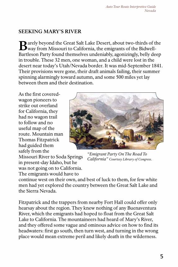
SEEKInG MArY’S rIVEr
Barely beyond the Great Salt Lake Desert, about two-thirds of the way from Missouri to California, the emigrants of the Bidwell-
Bartleson Party found themselves undeniably, agonizingly, belly deep in trouble. These 32 men, one woman, and a child were lost in the desert near today’s Utah/Nevada border. It was mid-September 1841. Their provisions were gone, their draft animals failing, their summer spinning alarmingly toward autumn, and some 500 miles yet lay between them and their destination.
As the first covered-wagon pioneers to strike out overland for California, they had no wagon trail to follow and no useful map of the route. Mountain man Thomas Fitzpatrick had guided them safely from the Missouri River to Soda Springs in present-day Idaho, but he was not going on to California. The emigrants would have to continue west on their own, and best of luck to them, for few white men had yet explored the country between the Great Salt Lake and the Sierra Nevada.
Fitzpatrick and the trappers from nearby Fort Hall could offer only hearsay about the region. They knew nothing of any Buenaventura River, which the emigrants had hoped to float from the Great Salt Lake to California. The mountaineers had heard of Mary’s River, and they offered some vague and ominous advice on how to find its headwaters: first go south, then turn west, and turning in the wrong place would mean extreme peril and likely death in the wilderness.

Auto Tour Route Interpretive GuideNevada
John Bidwell became one of California’s leading citizens. Courtesy Utah State Historical Society.
6
One month and 200 miles after bidding farewell to Fitzpatrick at Soda Springs, the Bidwell-Bartleson Party was in desperate straits. Ben and Nancy Kelsey, parents of a baby daughter, left their two wagons on the desert near present-day Lucin, Utah, on September 12 because their oxen were too weak to pull. They continued on with pack mules, driving their cattle along as beef-on-the-hoof. Four days later, near today’s I-80 at Oasis, Nevada, the other emigrants prepared to abandon their wagons, as well.
As the men crafted packsaddles for their mules, horses, and oxen, a joyful old Indian man, likely Goshute, walked into camp and told by gestures that he had dreamt of their coming. Charmed, the emigrants made him gifts of items they could not pack, and Nicholas Dawson later recounted that the men “helped” the laughing stranger to put on unfamiliar articles of clothing “hind-part fore [and] upside down until they could get no more on.” Taking no offense in the horseplay, the elderly man accepted each precious gift with a broad smile and a lengthy prayer of thanks. It was a happy meeting of mutual goodwill that, sadly, would not set the tone for intercultural relations in the years to come.
We signed to our aged host that the wagons and everything abandoned were his, all his, and left him circumscribing the heavens—the happiest, richest, most religious man I ever saw.
—Nicholas “Cheyenne” Dawson, 1841
Now the emigrants urgently needed to make their way to the mysterious Mary’s River and over the Sierra to California. The first task at hand was to load necessities onto the livestock. John Bidwell claimed that none of the men had so much as witnessed a horse being packed (experienced packers know that balancing and securing an awkward bundle onto the back of an animal is harder than it looks). Cinching a pack to an ox is especially difficult because, unlike horses and mules, oxen lack well-defined withers, the high, bony prominence between the shoulder blades that keeps a

Auto Tour Route Interpretive GuideNevada
Pioneer wagon road through the dry uplands between the Humboldt Range and the Ruby Mountains.
7
saddle from slipping to one side. Predictably, the men’s first efforts resulted in a bucking, bawling, braying brawl.
It was but a few minutes before the packs began to turn; horses became scared, mules kicked, oxen jumped and bellowed, and articles were scattered in all directions.
—John Bidwell, 1841
Dawson noted grimly: “There was one thing we had no trouble to pack—our provisions.” That is because they had none. The party had finished off the last of their supplies before reaching the Great Salt Lake several weeks earlier. Since game was scarce in this country, the emigrants had begun butchering their weakest oxen. Now about 20 cattle remained. When those were gone, they would have to eat the mules and horses.
As the group resumed their westward march, those emigrants who packed their belongings on the backs of plodding oxen fell to the rear of the caravan while those with horses and mules rode miles ahead, too fast for the cattle to keep up. This inequity soon would fuel resentments and eventually split the party, but for now they all focused on moving west, deeper into the Great Basin, toward the elusive Mary’s River.
Range after range of mountains forced the migrating band to stair-step anxiously south, west, and south again, until the emigrants found themselves in a dry camp at the foot of the Ruby Mountains in today’s eastern Nevada. They gazed worriedly into the wasteland. Trappers from Fort Hall had warned of a dangerous desert to the south. Could

Auto Tour Route Interpretive GuideNevada
The Humboldt River drains into the desert south of Lovelock, Nevada.
8
this be it? Had they gone too far? In desperation, the party turned abruptly west, pushed over the Rubys at Harrison Pass, and then followed a creek northward to regain their course. On September 24, eight days after abandoning their wagons in the desert, the emigrants struck a larger stream. Although they did not know it, this was the south fork of Mary’s River, of the soon-to-be Humboldt. A week later the party emerged from the mouth of a twisting canyon about eight miles west of present-day Elko, where their stream emptied into a west-flowing channel. It was, at last, their necessary river and the future route of the California Trail.
Day by day the river led the travelers deeper into the barrens. Grass and game were in short supply. The worn-out oxen, those walking commissaries, were growing too weak to carry their packs and too skinny to make a good meal. It was early October, the Sierra lay ahead, the emigrants were hungry, and Mary’s River itself appeared to be drying up.
Auto Tour Route Interpretive GuideNevada
9
The country on both sides appeared a desert. The river seemed to be dwindling instead of receiving big tributaries to swell its flood and guide us onto the plains of California and on to the Pacific, where our suffering and troubles would end, and where we could eat, eat, eat—and something that had some fat in it.
—Nicholas “Cheyenne” Dawson, 1841
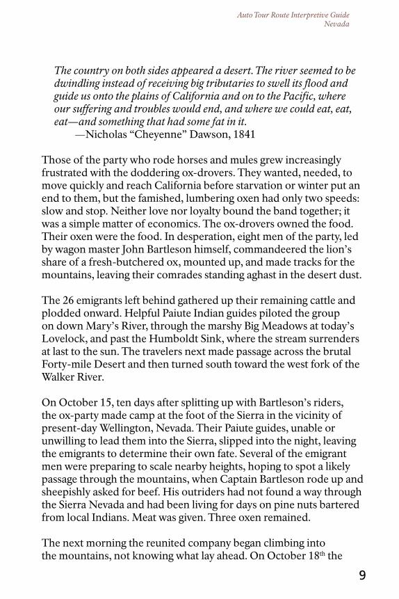
Those of the party who rode horses and mules grew increasingly frustrated with the doddering ox-drovers. They wanted, needed, to move quickly and reach California before starvation or winter put an end to them, but the famished, lumbering oxen had only two speeds: slow and stop. Neither love nor loyalty bound the band together; it was a simple matter of economics. The ox-drovers owned the food. Their oxen were the food. In desperation, eight men of the party, led by wagon master John Bartleson himself, commandeered the lion’s share of a fresh-butchered ox, mounted up, and made tracks for the mountains, leaving their comrades standing aghast in the desert dust.
The 26 emigrants left behind gathered up their remaining cattle and plodded onward. Helpful Paiute Indian guides piloted the group on down Mary’s River, through the marshy Big Meadows at today’s Lovelock, and past the Humboldt Sink, where the stream surrenders at last to the sun. The travelers next made passage across the brutal Forty-mile Desert and then turned south toward the west fork of the Walker River.
On October 15, ten days after splitting up with Bartleson’s riders, the ox-party made camp at the foot of the Sierra in the vicinity of present-day Wellington, Nevada. Their Paiute guides, unable or unwilling to lead them into the Sierra, slipped into the night, leaving the emigrants to determine their own fate. Several of the emigrant men were preparing to scale nearby heights, hoping to spot a likely passage through the mountains, when Captain Bartleson rode up and sheepishly asked for beef. His outriders had not found a way through the Sierra Nevada and had been living for days on pine nuts bartered from local Indians. Meat was given. Three oxen remained.
The next morning the reunited company began climbing into the mountains, not knowing what lay ahead. On October 18th the

Auto Tour Route Interpretive GuideNevada
“Summit of the Sierras,” by Thomas Moran. Courtesy Library of Congress
10
emigrants—down to their last two oxen and carrying most of their remaining belongings on their own backs—stood deep among the peaks of the Sierra Nevada. Despite the odds against them, the Bidwell-Bartleson Party had reached California. They had yet to reach safety.
A frightful prospect opened before us—naked mountains whose summits still retained the snows perhaps of a thousand years.
—John Bidwell, 1841
Ahead lay the steepest, most dangerous terrain of the trip. The Bidwell-Bartleson Party would spend two desperate weeks picking a way down the rugged west slope of the Sierra before staggering, half-starved, into bountiful San Joaquin Valley.
These emigrants had packed a third of the way to California, arriving on horseback and on foot. Over the next few years, other pioneers would muscle their desiccated, rattling wagons all the way down Mary’s River and over Truckee Pass into California’s Central Valley. A complete wagon trail stretched from Missouri to California by 1844, three years after the first wagon party set off for California.

Auto Tour Route Interpretive GuideNevada
City of Rocks National Reserve.
11
APProAcHInG tHE HuMBoLdt
the Bidwell-Bartleson Party’s meandering route from Soda Springs to the Humboldt River was not one that later emigrants
cared to follow. Two other approaches to the river soon developed.
Most California-bound traffic approached the Humboldt River using a wagon trail blazed in 1843 by mountain man Joseph Rutherford Walker. Walker’s route went directly southwest from Fort Hall, Idaho, to the City of Rocks, near today’s Idaho/Utah border. Later cutoffs across Idaho and up from Salt Lake City merged with Walker’s trail near City of Rocks. Wagon traffic passed among the fantastic granite monoliths of the “silent city” of stone, then crested Granite Pass at the rim of the Great Basin. There, travelers paused to take in an expansive view of the landscape ahead.
A prospect bounded only by the power of vision, now burst upon the sight … a vast amphitheater, of mountains, rising in successive chains behind each other, the most distant, overlooking the whole, and appearing like the faint glimpse of a cloud, with pointed summits stretching along the horizon.
—Franklin Langworthy at Granite Pass, 1850
Auto Tour Route Interpretive GuideNevada
12
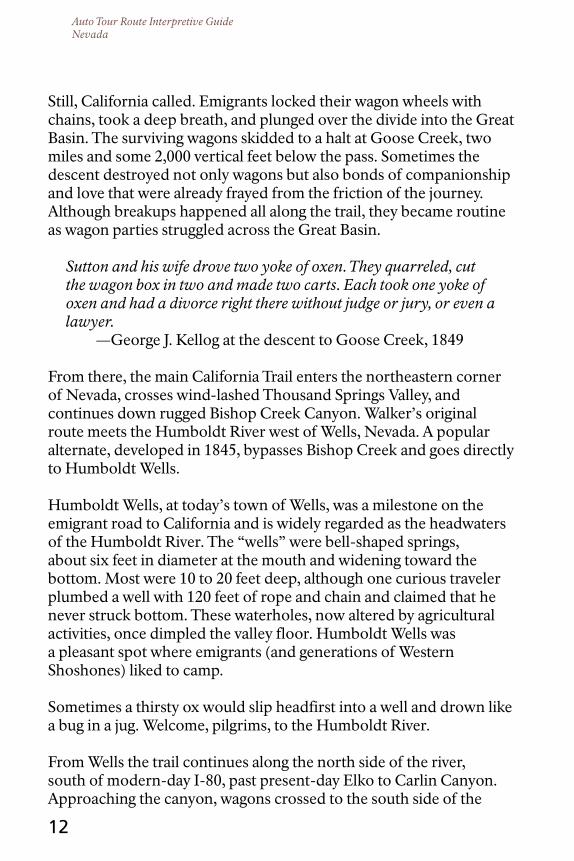
Still, California called. Emigrants locked their wagon wheels with chains, took a deep breath, and plunged over the divide into the Great Basin. The surviving wagons skidded to a halt at Goose Creek, two miles and some 2,000 vertical feet below the pass. Sometimes the descent destroyed not only wagons but also bonds of companionship and love that were already frayed from the friction of the journey. Although breakups happened all along the trail, they became routine as wagon parties struggled across the Great Basin.
Sutton and his wife drove two yoke of oxen. They quarreled, cut the wagon box in two and made two carts. Each took one yoke of oxen and had a divorce right there without judge or jury, or even a lawyer.
—George J. Kellog at the descent to Goose Creek, 1849
From there, the main California Trail enters the northeastern corner of Nevada, crosses wind-lashed Thousand Springs Valley, and continues down rugged Bishop Creek Canyon. Walker’s original route meets the Humboldt River west of Wells, Nevada. A popular alternate, developed in 1845, bypasses Bishop Creek and goes directly to Humboldt Wells.
Humboldt Wells, at today’s town of Wells, was a milestone on the emigrant road to California and is widely regarded as the headwaters of the Humboldt River. The “wells” were bell-shaped springs, about six feet in diameter at the mouth and widening toward the bottom. Most were 10 to 20 feet deep, although one curious traveler plumbed a well with 120 feet of rope and chain and claimed that he never struck bottom. These waterholes, now altered by agricultural activities, once dimpled the valley floor. Humboldt Wells was a pleasant spot where emigrants (and generations of Western Shoshones) liked to camp.
Sometimes a thirsty ox would slip headfirst into a well and drown like a bug in a jug. Welcome, pilgrims, to the Humboldt River.
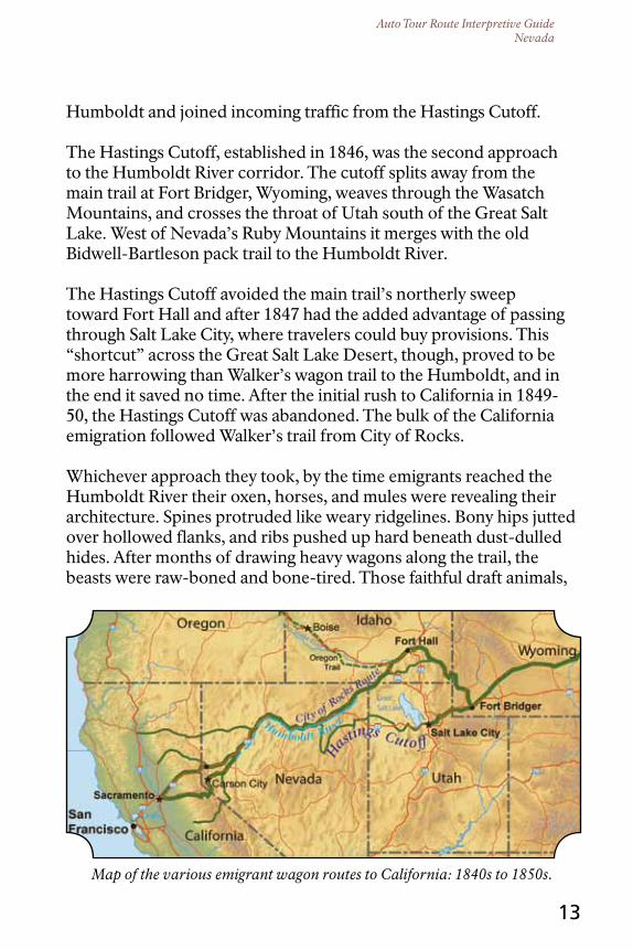
From Wells the trail continues along the north side of the river, south of modern-day I-80, past present-day Elko to Carlin Canyon. Approaching the canyon, wagons crossed to the south side of the
Auto Tour Route Interpretive GuideNevada
Map of the various emigrant wagon routes to California: 1840s to 1850s.
13
Humboldt and joined incoming traffic from the Hastings Cutoff.
The Hastings Cutoff, established in 1846, was the second approach to the Humboldt River corridor. The cutoff splits away from the main trail at Fort Bridger, Wyoming, weaves through the Wasatch Mountains, and crosses the throat of Utah south of the Great Salt Lake. West of Nevada’s Ruby Mountains it merges with the old Bidwell-Bartleson pack trail to the Humboldt River.
The Hastings Cutoff avoided the main trail’s northerly sweep toward Fort Hall and after 1847 had the added advantage of passing through Salt Lake City, where travelers could buy provisions. This “shortcut” across the Great Salt Lake Desert, though, proved to be more harrowing than Walker’s wagon trail to the Humboldt, and in the end it saved no time. After the initial rush to California in 1849-50, the Hastings Cutoff was abandoned. The bulk of the California emigration followed Walker’s trail from City of Rocks.
Whichever approach they took, by the time emigrants reached the Humboldt River their oxen, horses, and mules were revealing their architecture. Spines protruded like weary ridgelines. Bony hips jutted over hollowed flanks, and ribs pushed up hard beneath dust-dulled hides. After months of drawing heavy wagons along the trail, the beasts were raw-boned and bone-tired. Those faithful draft animals,
Auto Tour Route Interpretive GuideNevada
14
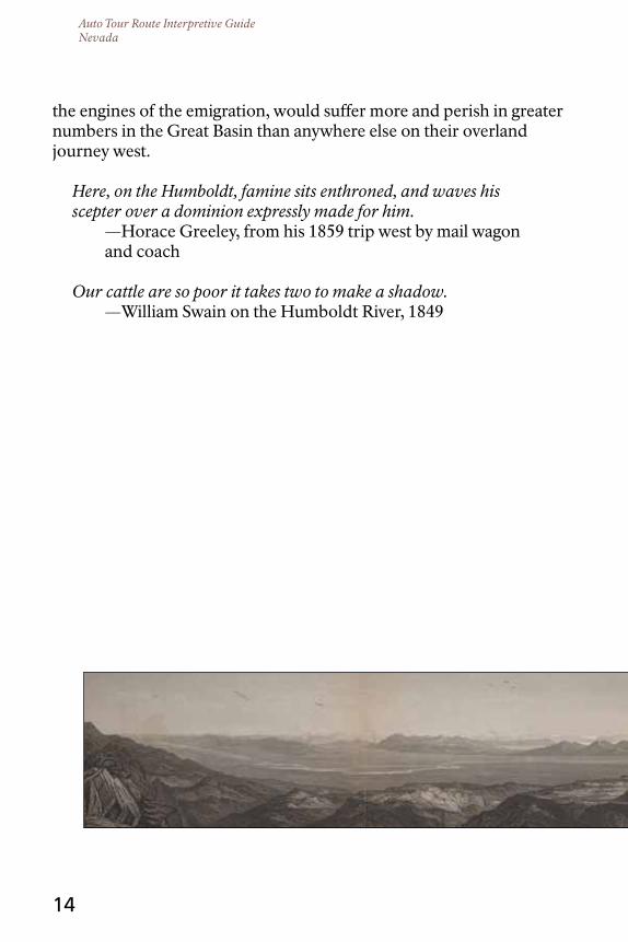
the engines of the emigration, would suffer more and perish in greater numbers in the Great Basin than anywhere else on their overland journey west.
Here, on the Humboldt, famine sits enthroned, and waves his scepter over a dominion expressly made for him.
—Horace Greeley, from his 1859 trip west by mail wagon and coach
Our cattle are so poor it takes two to make a shadow. —William Swain on the Humboldt River, 1849

Auto Tour Route Interpretive GuideNevada
Valley of the Humboldt River at Lassens Meadows. Courtesy Beinecke Rare Book and Manuscript Library, Yale University.
15
PrELudE to MurdEr
Life on the trail just wore a man down.
It was all too much for much too long: months of hardship, pain, labor, and loss; of worry, drudgery, fear, and exhaustion. And there was the forced intimacy with traveling companions who grew more contrary and contemptible with each miserable mile, no escaping them day or night, their opinions, their voices, at last even their mere presence, rubbing, abrading, grinding away like an Arkansas whetstone until a fellow’s temper was honed blade-sharp. The Bidwell-Bartleson Party felt it in 1841. So did the ill-fated Donner-Reed Party in 1846.
Some among that company of 87 souls blamed James Frazier Reed for their troubles. Back at South Pass in western Wyoming, Reed had argued for leaving the proven trail to California to follow instead a newly blazed shortcut around the Great Salt Lake. This, the Hastings Cutoff, was supposed to be much faster than the established trail through City of Rocks; but once on the route the party, guided by Reed, spent weeks grubbing passage through the Wasatch Mountains of present-day Utah. Next the travelers found themselves facing 80 miles of salt flats west of the Great Salt Lake. Reed lost all but two of his cattle during that dry crossing. He abandoned two wagons in the desert and then pressed the other emigrants to lend him a second yoke of oxen to help draw his family’s remaining large vehicle. All of that aside, Reed simply grated on people. He was a

Auto Tour Route Interpretive GuideNevada
James Frazier Reed, Donner-Reed Wagon Party. Courtesy Utah State
Historical Society.
16
well-off businessman who spent his money in conspicuous ways, riding a flashy mare, bringing a comfortable camper-style wagon along on the trail, and hiring others to tend his livestock, drive his wagons, and cook his family’s meals. Reed was smart and capable,
a devoted husband and father who volunteered for the party’s most difficult jobs. He also was opinionated, proud, and strong-willed to the point of arrogance. He had grit and he had a temper.
James Frazier Reed was a whetstone, but he was a blade, too.
Now here they all were, following Lansford W. Hastings’s cussed cutoff on a muddy, six-day detour around the Ruby Mountains. In fact, these emigrants were on the old track of the Bidwell-Bartleson
Party along the alignment of today’s Nevada Highway 788, but the Donner-Reed wagons could not follow the Bidwell pack train over the Ruby Mountains. Instead, they continued south and crossed the range at a lower spot, now called Overland Pass, south of the Ruby Lake wetlands.
Worry gnawed the emigrants. It was late September and several times already they had encountered snow. Their oxen were nearly played out and they had yet even to reach the Humboldt River. Worst of all, the emigrants realized they did not have food enough to last them to their destination. Two of the company’s men were riding ahead to California for provisions, but when would they return? Or would they return at all?
Once west of the Rubys, the party followed the combined Hastings Cutoff/Bidwell-Bartleson trail north along Huntington Creek (approximated by today’s Nevada Highway 228 and White Pine County Road 1) and on to the South Fork of the Humboldt River.
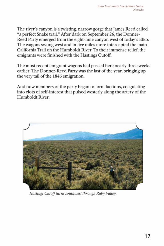
Auto Tour Route Interpretive GuideNevada
Hastings Cutoff turns southwest through Ruby Valley.
17
The river’s canyon is a twisting, narrow gorge that James Reed called “a perfect Snake trail.” After dark on September 26, the Donner-Reed Party emerged from the eight-mile canyon west of today’s Elko. The wagons swung west and in five miles more intercepted the main California Trail on the Humboldt River. To their immense relief, the emigrants were finished with the Hastings Cutoff.
The most recent emigrant wagons had passed here nearly three weeks earlier. The Donner-Reed Party was the last of the year, bringing up the very tail of the 1846 emigration.
And now members of the party began to form factions, coagulating into clots of self-interest that pulsed westerly along the artery of the Humboldt River.

Auto Tour Route Interpretive GuideNevada
18
tHE HuMBoLdt EXPErIEncE
Most emigrants reached the Humboldt River in late August or September, after several hot, dry months had reduced its flow.
Expecting a big river like those they knew in the East, travelers found instead a channel 30 to 40 feet wide and about three feet deep. Their surprise turned to contempt as they followed the stream west, for its quick, clear flow gradually turned lazy and foul. Along much of its length, the Humboldt ambled blood warm, turbid and soapy with alkali, down meandering channels. Instead of shady cottonwoods, its banks were plumed with willow thickets; and aside from a few large meadows that were overgrazed during the heaviest emigration seasons, there was little grass for the draft animals. Where grass did grow along the river, it often was too salted with alkali for livestock.
[The] Humboldt is not good for man nor beast…and there is not timber enough in three hundred miles of its desolate valley to make a snuff-box, or sufficient vegetation along its banks to shade a rabbit, while its waters contain the alkali to make soap for a nation.
—Reuben Cole Shaw, 1849
The Humboldt twists along countless looping turns or meanders called oxbows, so named for their resemblance to the wooden, U-shaped pieces that secure a heavy yoke onto the necks of oxen. Although the river spans about 300 land-miles, a twig drifting downstream along its myriad meanders between Humboldt Wells and the Humboldt Sink would easily travel twice that distance. The few emigrants who experimented with floating the tortuous stream soon gave up, finding that they quickly fell miles behind the wagons on the trail.
This is the crookedest stream that I ever saw. I believe it runs a thousand miles in the distance of three hundred. It sometimes runs 2 or 3 miles and gets not over 30 rods [about 500 feet] from where it started.
—Alonzo Delano, 1849
Auto Tour Route Interpretive GuideNevada
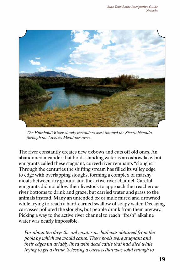
The Humboldt River slowly meanders west toward the Sierra Nevada through the Lassens Meadows area.
19
The river constantly creates new oxbows and cuts off old ones. An abandoned meander that holds standing water is an oxbow lake, but emigrants called these stagnant, curved river remnants “sloughs.” Through the centuries the shifting stream has filled its valley edge to edge with overlapping sloughs, forming a complex of marshy moats between dry ground and the active river channel. Careful emigrants did not allow their livestock to approach the treacherous river bottoms to drink and graze, but carried water and grass to the animals instead. Many an untended ox or mule mired and drowned while trying to reach a hard-earned swallow of soapy water. Decaying carcasses polluted the sloughs, but people drank from them anyway. Picking a way to the active river channel to reach “fresh” alkaline water was nearly impossible.
For about ten days the only water we had was obtained from the pools by which we would camp. These pools were stagnant and their edges invariably lined with dead cattle that had died while trying to get a drink. Selecting a carcass that was solid enough to
Auto Tour Route Interpretive GuideNevada
20
hold us up, we would walk into the pool on it, taking a blanket with us, which we would wash around and get as full of water as it would hold, then carry it ashore, [where] two men, one holding each end, would twist the filthy water out into a pan, which in turn would be emptied into our canteens.
—Gilbert L. Cole, 1852
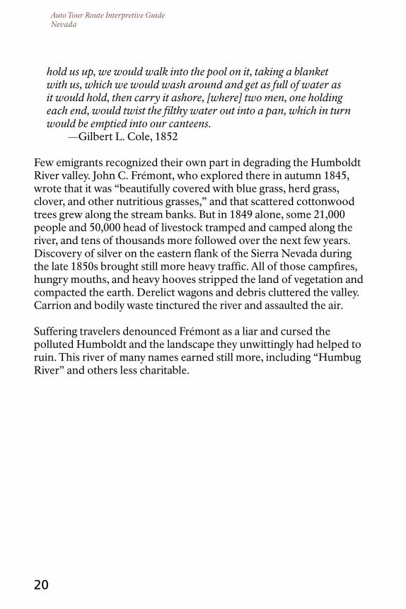
Few emigrants recognized their own part in degrading the Humboldt River valley. John C. Frémont, who explored there in autumn 1845, wrote that it was “beautifully covered with blue grass, herd grass, clover, and other nutritious grasses,” and that scattered cottonwood trees grew along the stream banks. But in 1849 alone, some 21,000 people and 50,000 head of livestock tramped and camped along the river, and tens of thousands more followed over the next few years. Discovery of silver on the eastern flank of the Sierra Nevada during the late 1850s brought still more heavy traffic. All of those campfires, hungry mouths, and heavy hooves stripped the land of vegetation and compacted the earth. Derelict wagons and debris cluttered the valley. Carrion and bodily waste tinctured the river and assaulted the air.
Suffering travelers denounced Frémont as a liar and cursed the polluted Humboldt and the landscape they unwittingly had helped to ruin. This river of many names earned still more, including “Humbug River” and others less charitable.

Auto Tour Route Interpretive GuideNevada
Hikers follow a long ascent through a historic emigrant pass.
21
WESt to StonY PoInt
West of Elko, the Humboldt River has cut deep gorges through some of the mountain ranges in its path. One of these is
Palisade Canyon, a narrow chokepoint that forces the trail and today’s interstate highway to leave the river for an 18-mile climb through the Tuscarora Mountains. The bypass includes a mule-killing, seven-mile ascent to Emigrant Pass. Today’s I-80 overlies the old trail corridor through the pass for two and a half miles. John Clark, crossing in 1852, called this trail segment “the steepest, roughest, and most desolate road that can be imagined.”
Beyond Emigrant Pass, the trail turns south away from the freeway and descends by various routes. It approaches the river in the vicinity of Gravelly Ford, about six miles south of the highway. Emigrants stopped there, despite a pestering plague of mosquitoes, to rest and graze their draft animals.
Could not sleep, although I had my sun-bonnet on, and a large silk handkerchief pinned closely down over my face, boots and gauntlets on, and closely wrapped in the blankets; yet on the morrow was looking as though I had the measles.
—Nellie Phelps, at Gravelly Ford, 1859
Auto Tour Route Interpretive GuideNevada
22
Although travelers griped to their journals about petty discomforts, the trail experience along the upper Humboldt River had not been unduly miserable for most. However, beyond Palisade Canyon the river further dwindled, its water grew increasingly salty, the ashy trail dust became ever deeper, and grass all but disappeared. To spare their draft animals, emigrants tossed belongings from their wagons: tools, stoves, heavy chains, mining equipment, even bedding and clothing. Travelers had discarded many items, including food, back on the plains, but here on the Humboldt nobody threw away bacon, flour, or beans. After months on the trail, many parties were running dangerously low on provisions.
From Gravelly Ford, wagon traffic rattled along both sides of the Humboldt. The trails follow the winding river northerly between mountain ranges, intercepting I-80 again near present-day Dunphy. There the Humboldt River turns sharply west. The trail corridor is on the right as the freeway approaches the town of Battle Mountain.
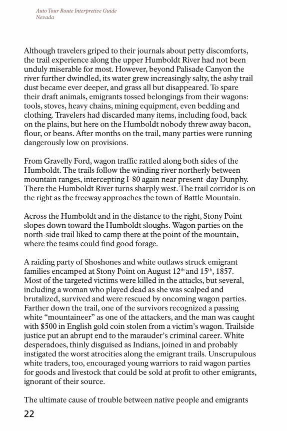
Across the Humboldt and in the distance to the right, Stony Point slopes down toward the Humboldt sloughs. Wagon parties on the north-side trail liked to camp there at the point of the mountain, where the teams could find good forage.
A raiding party of Shoshones and white outlaws struck emigrant families encamped at Stony Point on August 12th and 15th, 1857. Most of the targeted victims were killed in the attacks, but several, including a woman who played dead as she was scalped and brutalized, survived and were rescued by oncoming wagon parties. Farther down the trail, one of the survivors recognized a passing white “mountaineer” as one of the attackers, and the man was caught with $500 in English gold coin stolen from a victim’s wagon. Trailside justice put an abrupt end to the marauder’s criminal career. White desperadoes, thinly disguised as Indians, joined in and probably instigated the worst atrocities along the emigrant trails. Unscrupulous white traders, too, encouraged young warriors to raid wagon parties for goods and livestock that could be sold at profit to other emigrants, ignorant of their source.
The ultimate cause of trouble between native people and emigrants

Auto Tour Route Interpretive GuideNevada
Stony Point descends toward the west and a series of sloughs on the Humboldt River.
23
crossing the Great Basin, though, was hunger, not greed. Resources were limited along the sinuous green line of the Humboldt River. One full belly meant another might go empty.
The Indians claim that we have eaten up their grass and thereby deprived them of its rich crop of seed which is their principal subsistence during winter. They say too that the long guns of the white people have scared away the game and now there is nothing left for them to eat but ground squirrels and piss-ants.
—Utah Territorial Indian Agent Garland Hurt to Brigham Young, Governor of Utah and Superintendent of Indian Affairs, August 27, 1855
Auto Tour Route Interpretive GuideNevada
24
tHE PoLItIcS oF HunGEr
Emigrants routinely encountered Western Shoshone people along the Humboldt across central Nevada. Shoshones often
gave advice and answered questions about the country ahead, and sometimes they offered their own food to starving pioneers.
The Shoshones generally had little to share. Bighorn sheep, deer, and antelope were scarce in the region, so the native people hunted mostly ground squirrels, rabbits, reptiles, insects, and birds of all kinds. When the Humboldt ran high and clear from spring snowmelt, and before the hordes of late summer emigrants arrived each year, they took cutthroat trout from the river. They also dug roots and collected pine nuts, chokecherries, and grass seed. Most did not keep horses, which would eat up their seed grasses. Theirs was a smart, diverse strategy that had enabled native peoples to survive hard times in the Great Basin for thousands of years. But many emigrants scorned the Shoshones as pesky paupers, resented their dogging the wagons, and contemptuously called them (and the Paiutes) “Diggers.”
[The Western Shoshones] were absolutely naked, poor and hungry, and quite in keeping with the character of the country. . . . Their faces were pinched and careworn, while the most abject misery seemed stamped on every feature.
—Reuben Cole Shaw, 1849
Shoshones, or Newe, held the emigrants in similar regard. Lying concealed on the hillsides above the river, they had watched in alarm as the first wagons rolled into their country. A Shoshone account, passed down across generations, relates that the Newe tried traditional rituals for driving off intruders, but these did not work on the emigrants because white peoples’ souls were full of holes, like a sieve. The powers of the ritual had nothing to push against; so the emigrants, called by the pejorative name Taibo, came on in great numbers. The Taibo treated the Newe with disrespect, cut Newe pine nut groves, took their best campsites, and competed for scarce game. Their livestock ate Newe seed grasses, trampled their wild crops, and contaminated their water. Life had never been easy here, but once the gold seekers began their four-year rush to California in 1849, native

Auto Tour Route Interpretive GuideNevada
25
resources were quickly depleted and famine indeed “sat enthroned.”
On the other hand, the Taibo brought beef into the hungry Newe homeland.
Imagine the emigrants’ outrage when the humble people they scorned managed to outfox them, silently driving off or shooting poisoned arrows into five, 20, even 50 oxen and mules in a single night’s work. Imagine, too, their gut-wrenching horror, for emigrants were vulnerable in this harsh country. The loss of their draft animals meant travelers would be forced to cross the desert and mountains on foot with only those supplies they could carry. It could be a death sentence.
We begin to think these Diggers are somewhat dangerous neighbors. —Franklin Langworthy, 1850
Farther west along the Humboldt the Numa, or Paiutes, faced the same problems—and arrived at the same solutions. They, too, drove off livestock in the night or crippled the draft animals with poisoned arrows so that they would be left behind when the wagons rolled out the next morning.
And why not take what they needed? White men did the same. Emigrants took the rivers for their wagon roads, fouling the water with carrion and disease and destroying the native foods that grew nearby. Settlers took the valleys for their ranches and towns and the mountains for their mines, fencing off the meadows and springs, cutting down the pinyon trees, and digging up the earth like squirrels.
Besides, white men’s livestock were the biggest packages of protein on the landscape. Of course they would become targets for hungry native people.
A few outraged emigrants vowed to shoot every Indian on sight. Some searched out Shoshone and Paiute encampments and destroyed their shelters, food, and belongings. One angry doctor, finding his ox full of arrows, poisoned the animal’s offal with strychnine and left it for the Indians to eat. But each act of vengeance brought another

Auto Tour Route Interpretive GuideNevada
Paiute Woman and Traditional House. Courtesy University of Nevada, Reno
Library, Special Collections, Margaret M. Wheat Collection.
26
in retaliation, creating a cycle of violence that played out along the Humboldt trail. Innocent people of both races often paid the price for others’ misdeeds. The aim, after all, was not justice but revenge.
Sometimes hunger is simply a lack of food. Sometimes it is much more complicated.

Auto Tour Route Interpretive GuideNevada
27
A FLASH oF tHE BLAdE
river, trails, and the modern freeway all curve northwestward beyond Battle Mountain and cross a long plain between
mountain ranges. Many travelers here complained of the dreary landscape and the caustic alkali dust that burned skin and eyes. Each day served up the same menu of miseries.
The heat is fiery, intense, sultry, oppressive, suffocating, parching and scorching earth, and water and air and every green thing (Californians included).
—Israel Shipman Lord, 1849
The road is the dustyest that I ever saw. We eat it, drink it, (it don’t taste good) & we breath it.
—John Francis Freeman, 1852
Bah! This is a monotonous, barren country hereabouts. —Nellie Phelps, 1859
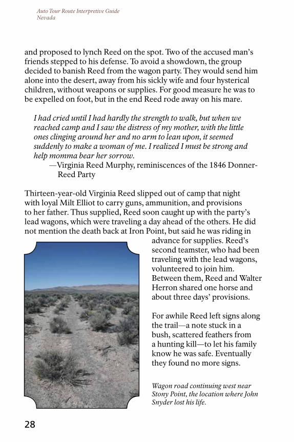
Discomfort, hunger, exasperation, and exhaustion honed travelers’ nerves to razor edge. Near the end of the long valley, where the south-side trail crosses a butte called Iron Point, tempers flashed one autumn day and a minor traffic snarl turned fatal for the Donner-Reed Party.
On October 5, 1846, ox teams belonging to the James Reed and Franklin Graves families became entangled as they started up the sandy slope of Iron Point, east of present-day Golconda. The Graves family’s driver, John Snyder, uncharacteristically exploded in rage and (eyewitness accounts vary) either began beating his oxen or fighting with Reed’s teamster, Milt Elliot. When Reed intervened, Snyder struck him several times with the butt of his whip, accidentally hitting Mrs. Reed in the fray. James Reed, bloodied, lashed out with his hunting knife. Snyder fell with a mortal wound to the heart.
The Graves family, who blamed Reed for their troubles on the Hastings Cutoff, furiously demanded justice on behalf of the well-liked Snyder; and Louis Keseberg propped up his wagon tongue
Auto Tour Route Interpretive GuideNevada
Wagon road continuing west near Stony Point, the location where John Snyder lost his life.
28
and proposed to lynch Reed on the spot. Two of the accused man’s friends stepped to his defense. To avoid a showdown, the group decided to banish Reed from the wagon party. They would send him alone into the desert, away from his sickly wife and four hysterical children, without weapons or supplies. For good measure he was to be expelled on foot, but in the end Reed rode away on his mare.
I had cried until I had hardly the strength to walk, but when we reached camp and I saw the distress of my mother, with the little ones clinging around her and no arm to lean upon, it seemed suddenly to make a woman of me. I realized I must be strong and help momma bear her sorrow.
—Virginia Reed Murphy, reminiscences of the 1846 Donner- Reed Party
Thirteen-year-old Virginia Reed slipped out of camp that night with loyal Milt Elliot to carry guns, ammunition, and provisions to her father. Thus supplied, Reed soon caught up with the party’s lead wagons, which were traveling a day ahead of the others. He did not mention the death back at Iron Point, but said he was riding in
advance for supplies. Reed’s second teamster, who had been traveling with the lead wagons, volunteered to join him. Between them, Reed and Walter Herron shared one horse and about three days’ provisions.
For awhile Reed left signs along the trail—a note stuck in a bush, scattered feathers from a hunting kill—to let his family know he was safe. Eventually they found no more signs.

Auto Tour Route Interpretive GuideNevada
29
‘HEArtILY tIrEd oF tHE JournEY’
From Iron Point the Humboldt River cuts south toward present-day Golconda, where emigrants enjoyed camping near a cluster
of hot springs. A short distance downstream was another popular camping area: a five-mile “island,” thick with native grasses, between the river and the sloughs. The island and other meadows like it were prime pasture for emigrant livestock. Northern Paiutes depended on those grasses, too, for their annual seed harvest.
The river begins to arc southwest from today’s Winnemucca, and the next 45 miles of trail were especially disagreeable: worse water, more dreary brown hills, deeper dust, and scant forage for the draft animals. Extreme hunger among the emigrants was a common problem along this stretch, especially in 1849 and 1850. Many were packing at this point, having lost too many cattle to continue with wagons. Starving travelers begged other emigrants for bits of moldy bread, rotten bacon, or a cup of weak coffee, and offered any price for a biscuit or a pound of flour. The lucky ones received a few crumbs, for few had provisions to spare.
We have been no little troubled today with starving emigrants begging for provisions. There is some that is tetotelly out; others say they have not tasted meat for fifteen days; some complaining of being very weak with hunger; some of them that is suffering or complains of suffering we divide with but if we was to listen to all we would not have a mouthful of provisions in two days. God only [k]nows what they are to do.
—Thomas Christy, 1850
Men who once, secure in their stores of bacon, had remarked in wondering disgust on the diets of native people now were grateful to eat lizards, coyotes, ground squirrels, and whatever else they could catch to eat.

Auto Tour Route Interpretive GuideNevada
30
I killed & skinned & gutted about fifty frogs an inch & a half long & fried them with our hawk this noon & eat them
Shot a Fisher (shitepoke) [a heron] & had him & his gravy for dinner with burned-biscuit coffee very good
—Charles Darwin, 1849
Many ate things that were much worse.
I have noticed several dead horses, mules and oxen by the roadside, that had their hams cut out to eat by the starving wretches along the road.
—Eleazer Stillman Ingalls, 1850
The burning thrill of the overland adventure was turned to cold ash. “Who says ‘hurra for California’?” wondered Israel Shipman Lord in 1849. “Not many here, for most are heartily tired of the journey.”
West of present-day Imlay, about 210 miles downstream from the Humboldt headwaters at Wells, the river swung south in a great bend and then fingered out across a wide plain. Today the area is drowned by Rye Patch Reservoir, but then it was the welcome grazing-ground, thick with wild rye, that became known as Lassen’s (now Lassens) or Lawson’s Meadows. John Bidwell saw Northern Paiute people encamped here when his party passed through in 1841.
Perhaps it was here that little Thocmetony, daughter of the Northern Paiute leader Winnemucca, first encountered emigrants. Just four or five years old, she had been warned by her mother that white people ate humans—a rumor that was circulating widely among Great Basin peoples. One morning as the women were grinding grass seed in the meadow, word flew through camp that wagons approached. Thocmetony, who would grow up to be the teacher, author, and popular lecturer known as Sarah Winnemucca, later recalled:
My poor mother was carrying my little sister on her back, and trying to make me run; but I was so frightened I could not move my feet, and while my poor mother was trying to get me along my aunt overtook us, and she said to my mother: ‘Let us bury our girls, or we

Auto Tour Route Interpretive GuideNevada
Studio portrait of Sarah Winnemucca, ca. 1880s.
31
shall all be killed and eaten up.’ So they went to work and buried us, and told us if we heard any noise not to cry out, for if we did they would surely kill us and eat us. So our mothers buried me and my cousin, planted sage bushes over our faces to keep the sun from burning them, and there we were left all day.
The little girls lay hidden there for hours, unmoving under the hot sun, terrified of the passing emigrants, until their mothers returned. Meanwhile, Sarah Winnemucca related in her 1883 book, the emigrants viciously burned up all the seed that the women had collected for the winter. She believed that the vandals were members of the Donner-Reed Party.
The Donner-Reed Party continued to disintegrate while approaching the meadows at the Big Bend of the Humboldt River. Its members abandoned an old man, unable to walk, to die alone in the desert. Paiutes shot at them. Along the trail through the meadows they found a final note from James Reed, warning of troubles ahead.
There at the Big Bend the Donner-Reed Party also found a brand new wagon trail branching off to the right toward Oregon. The faint track, the Applegate Trail, was a grueling route blazed earlier that summer by established Oregon pioneers for the benefit of oncoming emigrants. This “Southern Route” to Oregon was supposed to be more direct and safer than the old Oregon Trail to the north, but those who first tried it in 1846 did not find it so. J. Goldsborough Bruff and Jessy Quinn Thornton left excellent first-person accounts of their troubles on the Applegate Trail that year.
By 1849, the Nobles, Lassen, and other trails branched off the Applegate to carry traffic to the gold fields of northern California. Wagon companies paused at the Lassens Meadows junction to drop mail into a red barrel and to debate which way to go. Many

Auto Tour Route Interpretive GuideNevada
Lassens Meadows.
32
who chose the right branch soon enough regretted their decision, for it was a hard, hard road. Journals tell of parties who followed the Applegate deep into the bleak Black Rock Desert and then, despairing, backtracked to the relative safety of the Humboldt River. The Humboldt was horrid but it was liquid, mostly.
Today the trail junction, most of the ryegrass meadows, and several miles of the north-side trail along the Big Bend lie beneath Rye Patch Reservoir. Beyond Rye Patch the river continues its southwesterly arc. After rounding the bend, wagons rolled another 40 hot, dusty trail-miles to the last Humboldt pasture, Big Meadows.
I saw three or four lizards, one or two flies; one must pity them. —John Edwin Banks, 1849
The farther we traveled the worse [the river] became. During the last eight or ten days it seems to have been mixed up with everything nauseous.
—Margaret Frink, 1850
Our great want, now is: water! Water!! Water!!! Good spring water, good well water, good snow water, good river water. Our dreams are of water, clear and cold, spouting from the earth like a geyser.
—John Hawkins Clark, 1852

Auto Tour Route Interpretive GuideNevada
33
tHE HuMBoLdt SInK
Approaching its celebrated end, the Humboldt River spreads out in one last green flourish of sloughs and marshes that the
emigrants called Big Meadows. Today the community of Lovelock nestles near the north end of Big Meadows and farm fields occupy the rest.
Travelers laid over here for several days to rest and strengthen their cattle. Several hundred wagons might encamp at the meadows on a typical day. As the draft animals grazed, emigrants cut hay for the terrible desert crossing ahead and purged their wagons, once more, of belongings. At times the meadows were as busy, cluttered, and noisy as a city.
Paiutes used the area heavily, too, had done so for countless generations, and often camped among the emigrants while hunting and food collecting. In the early years of the emigration, some Paiutes, such as the leader that white men called Chief Truckee (Sarah Winnemucca’s grandfather), directed or guided emigrant parties from here across the Sierra Nevada to California. Some advised travelers where they would find water along the way. Some hired themselves out to cut hay or collect firewood.
Others found more profit in running off the emigrants’ livestock. During their first night at Big Meadows, the Donner-Reed Party lost 18 oxen and a milk cow to Paiute raiders. On their second night in the area, several more oxen were shot with arrows. Paiutes, though, were not to blame for the loss of a mare that bogged down in the marsh. So hostile were the party members toward one another that no one would help the horse’s owner pull her out. She suffocated in the mud.
In wet years the dregs of the Humboldt River drain another 12 miles south from Lovelock and bleed onto the desert floor at the foot of a natural dike called the Humboldt Bar. The resulting pool, Humboldt Lake, can be seen today from I-80. Here, and in the salt flats beyond, is the Humboldt Sink.
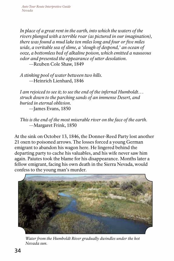
Auto Tour Route Interpretive GuideNevada
Water from the Humboldt River gradually dwindles under the hot Nevada sun.
34
In place of a great rent in the earth, into which the waters of the rivers plunged with a terrible roar (as pictured in our imagination), there was found a mud lake ten miles long and four or five miles wide, a veritable sea of slime, a ‘slough of despond,’ an ocean of ooze, a bottomless bed of alkaline poison, which emitted a nauseous odor and presented the appearance of utter desolation.
—Reuben Cole Shaw, 1849
A stinking pool of water between two hills. —Heinrich Lienhard, 1846
I am rejoiced to see it; to see the end of the infernal Humboldt… struck down to the parching sands of an immense Desert, and buried in eternal oblivion.
—James Evans, 1850
This is the end of the most miserable river on the face of the earth. —Margaret Frink, 1850
At the sink on October 13, 1846, the Donner-Reed Party lost another 21 oxen to poisoned arrows. The losses forced a young German emigrant to abandon his wagon here. He lingered behind the departing party to cache his valuables, and his wife never saw him again. Paiutes took the blame for his disappearance. Months later a fellow emigrant, facing his own death in the Sierra Nevada, would confess to the young man’s murder.

Auto Tour Route Interpretive GuideNevada
“A Desperate Situation” by Charles Nahl. From Across the Plains in the Donner Party, by Virginia Reed Murphy.
35
tHE FortY-MILE dESErt; or, HoW to KILL An oX
Expect to find the worst desert you ever saw and then find it worse than you expected.
—John Wood, 1850
As they skirted Humboldt Lake, travelers stopped to camp and top off kegs and jugs (nobody carried the heavy barrels portrayed in Western movies) from waterholes gouged in the lakeside mud.
The thermometer indicates 140 on this arid plain. . . . The whole atmosphere glows like an oven.
—Niles Searls, 1849
Dead horses and oxen, in great numbers, with steaks cut out of their flesh, lay scattered over the land; and men, without a morsel to eat, were begging from wagon to wagon, offering all they had for a little dry bread.
—John T. Clapp, 1850

Auto Tour Route Interpretive GuideNevada
36
the Forty-mile Desert ahead would devour the weak. Some emigrants started into it already half-chewed.
Toward the start of the drive, near the Humboldt Bar, the trail forks. The right branch is the Truckee Route, named for the kindly Northern Paiute chief who first directed emigrants along the north edge of the desert and through the Sierra Nevada in 1844. This trail shares the corridor of modern I-80 across the desert and meets the gushing Truckee River near present-day Wadsworth. The left branch is the Carson Route, which opened in 1848 and carried most of the emigrant traffic thereafter. It skirts the south edge of the desert, roughly paralleling US 95, and intercepts the Carson River west of Fallon. Either way, right or left, Truckee or Carson, emigrants faced 40 miles of desolation ending with a tough pull through eight to 10 miles of deep sand before reaching the salvation of a stream. The Forty-mile Desert is as welcoming as a hot griddle. There is no shade. A friable crust of salt and silt crunches underfoot. In places, shadscale and greasewood anchor mounds of windblown dirt, and wet-season playas glimmer with alkali water. Ironically, this terrible desert once lay at the bottom of a deep ice age lake that covered much of western Nevada. Lake Lahontan’s ancient shorelines are etched into nearby mountainsides 500 feet or more above the desert floor. But in the 19th century this was a dry lakebed, churned by hooves and wheels into drifting, caustic clouds of dust that choked man and beast alike.
Many emigrants started into the desert in the evening, hoping to be nearly across the exposed flats before the sun reared up and punished them for the cheat. On moonless nights, travelers set fire to abandoned wagons along the trail in order to light their way. The ghastly bonfires flickered over dead oxen, mules, and horses whose dry staring eyes glittered, lifelike, with salt. Death perfumed the air. The trail twitched with maggots. Brittle bone crackled beneath the wagon wheels.
Burning wagons render still more hideous the solemn march; dead horses line the road, and living ones may be constantly seen, lapping and rolling the empty water casks (which have been cast away) for

Auto Tour Route Interpretive GuideNevada
Pools of warm spring water, some as hot as 1750 F, are sparsely scattered across Nevada.
37
a drop of water to quench their burning thirst, or standing with drooping heads, waiting for death to relieve them of their tortures, or lying on the sand half buried, unable to rise, yet still trying.
—Eleazer Stillman Ingalls on the Carson Route, 1850
At intervals could be seen wagons … with two to four yoke of cattle lying dead, with the yokes on their necks, the chains still in the rings, just as they fell and died, most of them with their tongues hanging from their mouths.
—Gilbert L. Cole on the Carson Route, 1852
About 20 miles into the desert, emigrants on the Truckee Route reached the dubious relief of Boiling Springs. Here, more than a hundred boiling mineral springs simmered in the hillside. (Today a geothermal power plant occupies the site, which can be glimpsed from I-80 south of Exit 65.) Thirsty draft animals, literally dying to drink, charged to the water and scalded their tongues and muzzles. Dogs, including a spaniel beloved of frontiersman James Clyman, leaped eagerly into the welcoming pools and died astonished. Rarely,
Auto Tour Route Interpretive GuideNevada
38
an emigrant arriving in the dark might stumble into a bubbling ground-cauldron and hideously perish. Most travelers stopped here just long enough to cool some water for their livestock and then pressed on. Too soon the morning sun would scowl from the horizon, illuminating the full extent of the trailside devastation and the suffering of the animals.
Morning comes, and the light of day presents a scene more horrid than the route of a defeated army; dead stock line the roads, wagons, rifles, tents, clothes, everything but food may be found scattered along the road. … men scattered along the plain and stretched out among the dead stock like corpses, fills out the picture.
—Eleazer Stillman Ingalls on the Carson Route, 1850
Our feelings were touched as [our oxen] constantly looked at us, as if entreating for water and food. They were panting rapidly, and their long protruding tongues hung from their open mouths.
—Charles Frederick True, age 16, on the Carson Route, 1859
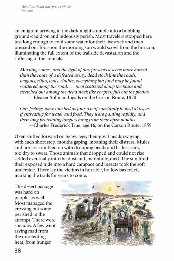
Oxen shifted forward on heavy legs, their great heads swaying with each short step, mouths gaping, moaning their distress. Mules and horses stumbled on with drooping heads and listless ears, too dry to sweat. Those animals that dropped and could not rise settled eventually into the dust and, mercifully, died. The sun fired their exposed hide into a hard carapace and insects took the soft underside. There lay the victims in horrible, hollow bas relief, marking the trails for years to come.
The desert passage was hard on people, as well. Most managed the crossing but some perished in the attempt. There were suicides. A few went raving mad from the unrelenting heat, from hunger

Auto Tour Route Interpretive GuideNevada
39
and thirst, or perhaps from the surrealism of the whole experience. Suffering and fear brought out the worst in their humanity. Among the Donner-Reed Party, an emigrant bearing water in his family wagon denied drink to William and Eleanor Eddy, who, having abandoned their wagon at the sink, were carrying their young children in their arms through the Forty-mile Desert.
The hot earth scorched our feet; the grayish dust hung about us like a cloud, making our eyes red, and tongues parched, and our thousand bruises and scratches smart like burns…Sometimes we found the bones of men bleaching beside their broken-down and abandoned wagons.
—Luzena Wilson on the Carson Route, 1849
But the sight of the dead is not so fearful as the living dying. God of heaven! Could human suffering appease [thy] wrath, the world would soon be forgiven.
—John Wood on the Carson Route, 1850
When my little one, from the wagon behind me, called out, ‘Mamma I want a drink’—I stopped, gave her some, noted that there were but a few swallows left, then mechanically pressed onward again, alone, repeating, over and over, the words, ‘Let me not see the death of the child [she survived].’
—Sarah Royce on the Carson Route, 1849
On a quilt by the side of the cart lay a man, woman, and two children. They had completely given out and were sick and starving.
—Henrietta Catherine McDaniel on the Truckee Route, 1853
But no one stopped to gaze or to help. The living procession marched steadily onward, giving little heed to the destruction going on, in their own anxiety to reach a place of safety.
—Margaret Frink on the Carson Route, 1850
The Carson and Truckee dune fields, miles of deep, loose sand that sucked at hooves and wheels, posed the final test. While yet five or six miles from water, livestock could scent the rivers and they picked up the pace; some teams, still yoked to their wagons, tried desperately to
Auto Tour Route Interpretive GuideNevada
40
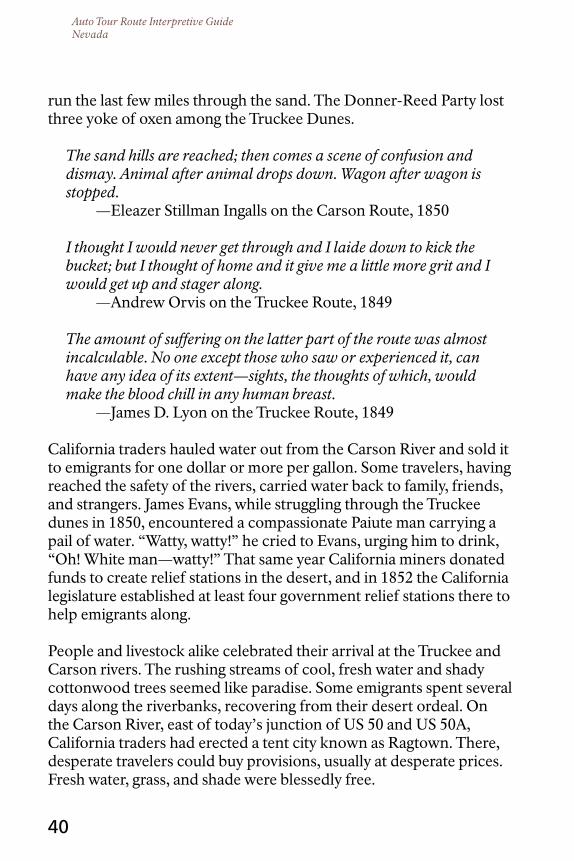
run the last few miles through the sand. The Donner-Reed Party lost three yoke of oxen among the Truckee Dunes.
The sand hills are reached; then comes a scene of confusion and dismay. Animal after animal drops down. Wagon after wagon is stopped.
—Eleazer Stillman Ingalls on the Carson Route, 1850
I thought I would never get through and I laide down to kick the bucket; but I thought of home and it give me a little more grit and I would get up and stager along.
—Andrew Orvis on the Truckee Route, 1849
The amount of suffering on the latter part of the route was almost incalculable. No one except those who saw or experienced it, can have any idea of its extent—sights, the thoughts of which, would make the blood chill in any human breast.
—James D. Lyon on the Truckee Route, 1849
California traders hauled water out from the Carson River and sold it to emigrants for one dollar or more per gallon. Some travelers, having reached the safety of the rivers, carried water back to family, friends, and strangers. James Evans, while struggling through the Truckee dunes in 1850, encountered a compassionate Paiute man carrying a pail of water. “Watty, watty!” he cried to Evans, urging him to drink, “Oh! White man—watty!” That same year California miners donated funds to create relief stations in the desert, and in 1852 the California legislature established at least four government relief stations there to help emigrants along.
People and livestock alike celebrated their arrival at the Truckee and Carson rivers. The rushing streams of cool, fresh water and shady cottonwood trees seemed like paradise. Some emigrants spent several days along the riverbanks, recovering from their desert ordeal. On the Carson River, east of today’s junction of US 50 and US 50A, California traders had erected a tent city known as Ragtown. There, desperate travelers could buy provisions, usually at desperate prices. Fresh water, grass, and shade were blessedly free.

Auto Tour Route Interpretive GuideNevada
41
It is wonderful to see cattle rush in the water. They drink, they stand, now taste it. O how delicious! I know it was to me.
—John Edwin Banks on the Truckee Route, 1849
The Forty-mile crossing was over, but the experience would haunt emigrants for a lifetime.
The desert! You must see it and feel it in an August day, when legions have crossed it before, to realize it in all its horrors. But heaven save you from the experience.
—Eleazer Stillman Ingalls, 1850
I wish California had sunk into the ocean before I had ever heard of it. —James F. Wilkins, 1849
“Thirsty Oxen at a Water Hole,” by Frederic Remington. From Across the Plains in the Donner Party, by
Virginia Reed Murphy.
Auto Tour Route Interpretive GuideNevada
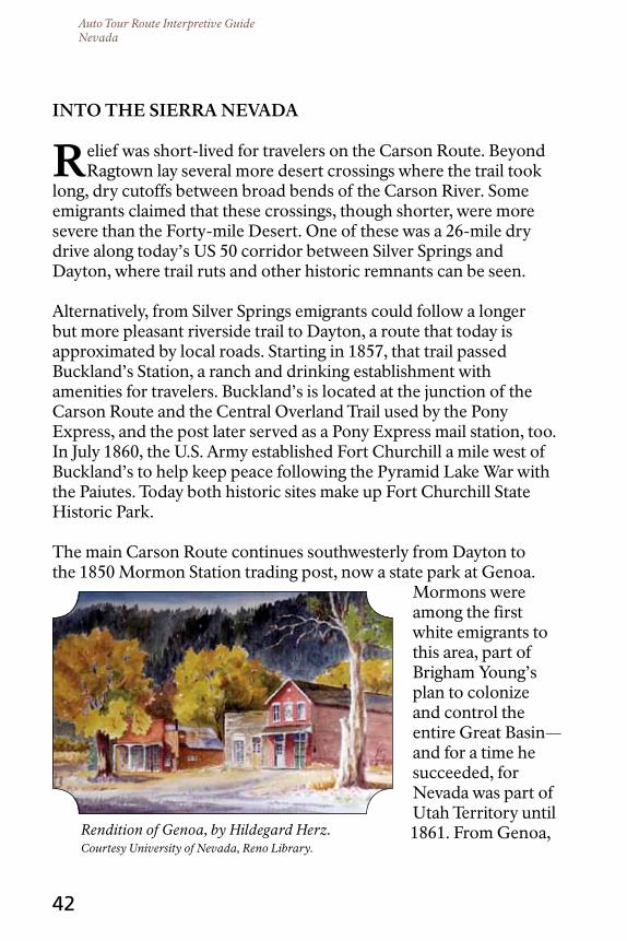
Rendition of Genoa, by Hildegard Herz. Courtesy University of Nevada, Reno Library.
42
Into tHE SIErrA nEVAdA
relief was short-lived for travelers on the Carson Route. Beyond Ragtown lay several more desert crossings where the trail took
long, dry cutoffs between broad bends of the Carson River. Some emigrants claimed that these crossings, though shorter, were more severe than the Forty-mile Desert. One of these was a 26-mile dry drive along today’s US 50 corridor between Silver Springs and Dayton, where trail ruts and other historic remnants can be seen.
Alternatively, from Silver Springs emigrants could follow a longer but more pleasant riverside trail to Dayton, a route that today is approximated by local roads. Starting in 1857, that trail passed Buckland’s Station, a ranch and drinking establishment with amenities for travelers. Buckland’s is located at the junction of the Carson Route and the Central Overland Trail used by the Pony Express, and the post later served as a Pony Express mail station, too. In July 1860, the U.S. Army established Fort Churchill a mile west of Buckland’s to help keep peace following the Pyramid Lake War with the Paiutes. Today both historic sites make up Fort Churchill State Historic Park.
The main Carson Route continues southwesterly from Dayton to the 1850 Mormon Station trading post, now a state park at Genoa.
Mormons were among the first white emigrants to this area, part of Brigham Young’s plan to colonize and control the entire Great Basin—and for a time he succeeded, for Nevada was part of Utah Territory until 1861. From Genoa,
Auto Tour Route Interpretive GuideNevada
43
the wagon trail continues up the Carson River into California. At the tiny settlement of Woodfords (which was a Pony Express station, too), the trail enters Carson Canyon. Here it begins climbing westerly toward Carson Pass and finally West Pass, the crest of the Sierra Nevada, to its destination in Placerville.
The Truckee Route was an entirely different experience. Instead of more dry crossings, this trail follows the Truckee River through a long, narrow canyon. After the perils of the Forty-mile Desert, it might at first have seemed like paradise, but the river did not make a good wagon road. The snow-fed stream is cold and deep, and its swift current and slick, submerged boulders make crossings hazardous. Wagons maneuvering up the narrow canyon had to ford the twisting channel 27 times.
After several days working their way up the canyon from Wadsworth, travelers emerged into Truckee Meadows, at present-day Reno and Sparks. The meadows belonged to the Wa She Shu, the Washoe Indian people, who called the place Welgonuh. To the Donner-Reed Party in late October 1846, it appeared vacant—but Wa She Shu were there, watching. The emigrants spent several precious days pasturing their cattle at the meadow and nervously eyeing the Sierra, unaware of being observed. On October 25, the Donner-Reed Party was continuing raggedly up the Truckee River into the mountains when the lead wagons met an eastbound rider. It was Charles Stanton, one of two men who had ridden ahead from the Ruby Mountains weeks earlier to fetch provisions. Stanton brought a string of seven loaded pack mules and two Miwok Indian vaqueros, generously sponsored by John Sutter of Sutter’s Fort, California. Stanton also brought good news: James Reed and Walt Herron, along with Reed’s cherished gray mare, all walking skeletons, had crossed the mountains to safety. The rest of the Donner-Reed Party hoped they soon would do the same. They continued, strung out in clusters along the Truckee, toward the clear lake and mountain pass that soon would become grisly landmarks, named for them.
Auto Tour Route Interpretive GuideNevada
The Central Overland Route across Nevada.
44
tHE PonY BoYS
the Williams brothers ran a trailside stage station and grog shop on the Carson River, about four miles east of today’s Silver
Springs, Nevada. In early May 1860, the three men kidnapped a pair of young Paiute girls, assaulted them, and kept them captive in a secret cellar under the barn. A visiting Paiute man heard the children’s muffled cries for help and galloped off with news of his discovery to Pyramid Lake, where Paiutes, Shoshones, and Bannocks had gathered for the annual fish run. On May 6, nine warriors returned to Williams Station. They killed the white men they found there, freed the girls, and burned the place down. Word of the killings, along with rumors of a widespread Indian rampage, reached the Comstock settlements the next morning.
Six days later a motley militia of 105 miners and townsmen, aiming to teach the Indians a lesson, followed Paiute decoys into a ravine a few miles south of Pyramid Lake. Some 300 warriors awaited them there. The stunned survivors, about 30 men who somehow escaped the well-laid trap, carried news of their bloody defeat back to the settlements. On June 2, over 750 regular and volunteer troops returned to engage the warriors in a second Battle of Pyramid Lake. Out-gunned, the Paiutes and their allies scattered into the desert. These events sparked a general, Basin-wide resistance that now licked
Auto Tour Route Interpretive GuideNevada
45
eastward from the Sierra toward the Great Salt Lake.
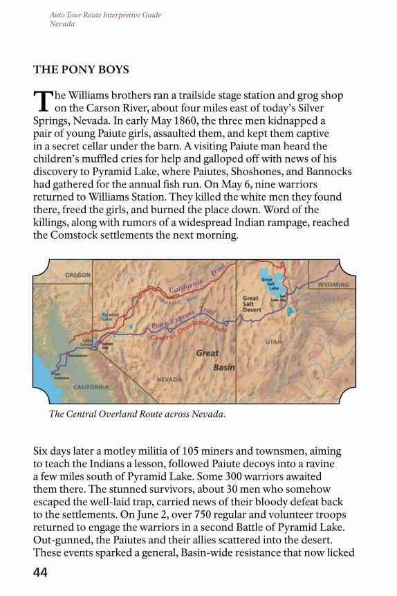
The Pony Express, a horse relay that carried mail between St. Joseph, Missouri, and San Francisco, California had been in operation barely five weeks when the Pyramid Lake War broke out. The Pony, as it was commonly known, had nothing to do with events at Williams Station, but it was an irritant to the people whose land, grass, and water had been snatched up for mail and stage stations. The Pony men took what they wanted without asking or paying, and their permanent structures and hurried comings and goings felt invasive to the people of the land. The people were fed up with takings and invasion.
The Pony Express largely followed the Central Overland Trail, opened across the western Great Basin by Army Captain James Simpson in 1859. The Central Overland runs many miles south of the Humboldt River, crossing the unpaved, remote territory between Ibapah, Utah, and Carson City, Nevada; its route is roughly approximated by today’s US 50, “The Loneliest Road in America.” Solitary riders, with their predictable schedules, were easy targets in that empty country. “Pony Bob” Haslam reported some close calls at the outbreak of the Pyramid Lake War while making a 380-mile, round-trip mail ride between Friday’s Station at Lake Tahoe and Smith Creek Station, southwest of Austin, Nevada. During his record-breaking ride, said to be the longest in Pony Express history, Haslam evaded war parties and seems to have missed at least two attacks on stations by a margin of hours.
I kept a bright lookout, and closely watched every motion of my poor pony’s ears, which is a signal for danger in an Indian country. I was prepared for a fight, but the stillness of the night and the howling of the wolves and coyotes made cold chills run through me at times.
—“Pony Bob” Haslam, on his ride from Cold Springs to Sand Springs in May 1860
Haslam has been hailed as a hero of the Pony Express but, curiously, neither his name nor his exploits are among those eagerly reported by newspapers of the day. The story of Pony Bob’s epic ride, which he related to an interviewer decades later, was first published in
Auto Tour Route Interpretive GuideNevada
46
1908, where he had some key Pony Express names and facts wrong. Friday’s Station, where Haslam claimed to have started his ride, was only a relay station where riders switched horses, not a Pony Express home station where a rider would begin his route; and his round-trip distance between Friday’s and Smith Creek is exaggerated by 50 miles. Based on these and other errors, some researchers dismiss his story as a hoax. Was Haslam a fraud, like some others who claimed in their later years to be original Pony riders? Or was he just an old man with faded memories of events nearly a half-century past?
Accounts mention numerous Pony riders who were killed during the outbreak that year, but multiple sources may be referring to the same unnamed rider, and some stories were clearly made up. So far, only three rider fatalities at the hands of warriors are securely documented. One was that of José Zowgaltz, a Hispanic rider who was ambushed as he crossed the thick aspen bottoms of Edwards Creek, north of Cold Springs Station. Suffering a mortal abdominal wound, Zowgaltz galloped into the station, which still stands about 55 miles west of Austin, Nevada. He slipped bleeding from his saddle and soon died. The rider’s death was recorded by Assistant Station Keeper J.G. Kelley, who had to ride Zowgaltz’s return relay two days later. Kelley raced his pony through the leafy green tunnel of aspens “like a streak of greased lightning” and once clear, paused to look back. The bushes along the trail trembled. Kelley suspected they concealed warriors who had been unable to get a clear shot at him.
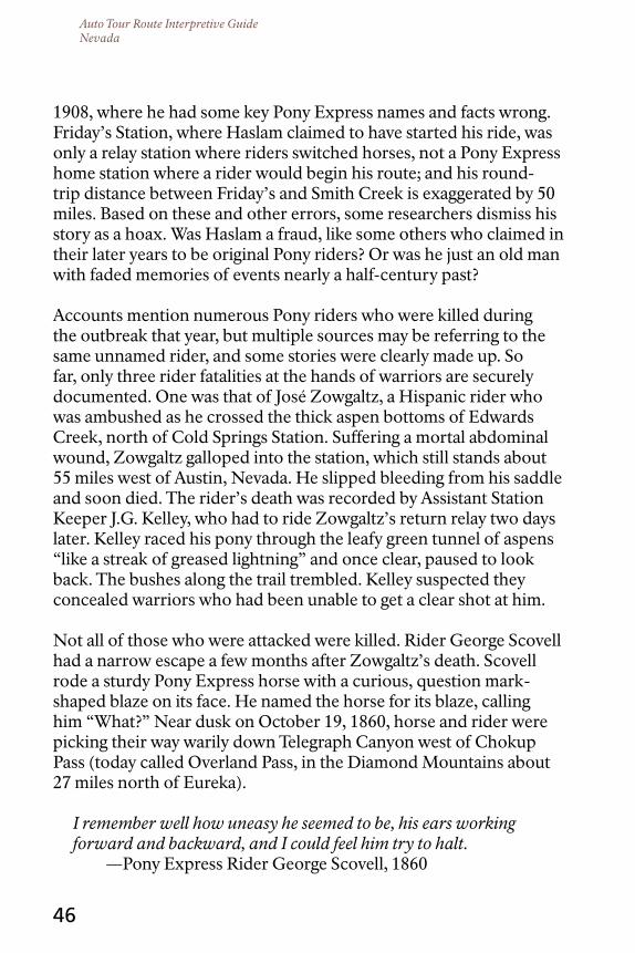
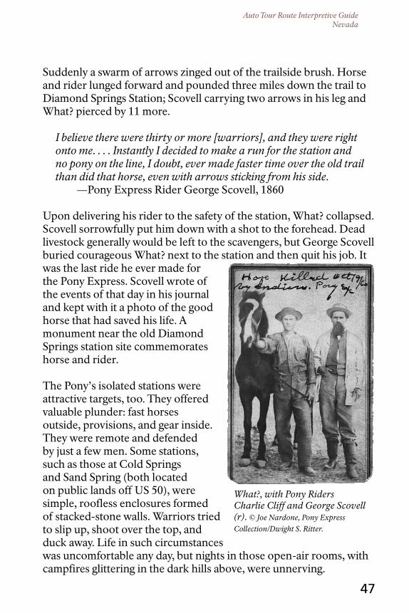
Not all of those who were attacked were killed. Rider George Scovell had a narrow escape a few months after Zowgaltz’s death. Scovell rode a sturdy Pony Express horse with a curious, question mark-shaped blaze on its face. He named the horse for its blaze, calling him “What?” Near dusk on October 19, 1860, horse and rider were picking their way warily down Telegraph Canyon west of Chokup Pass (today called Overland Pass, in the Diamond Mountains about 27 miles north of Eureka).
I remember well how uneasy he seemed to be, his ears working forward and backward, and I could feel him try to halt.
—Pony Express Rider George Scovell, 1860
Auto Tour Route Interpretive GuideNevada
What?, with Pony Riders Charlie Cliff and George Scovell (r). © Joe Nardone, Pony Express
Collection/Dwight S. Ritter.
47
Suddenly a swarm of arrows zinged out of the trailside brush. Horse and rider lunged forward and pounded three miles down the trail to Diamond Springs Station; Scovell carrying two arrows in his leg and What? pierced by 11 more.
I believe there were thirty or more [warriors], and they were right onto me. . . . Instantly I decided to make a run for the station and no pony on the line, I doubt, ever made faster time over the old trail than did that horse, even with arrows sticking from his side.
—Pony Express Rider George Scovell, 1860
Upon delivering his rider to the safety of the station, What? collapsed. Scovell sorrowfully put him down with a shot to the forehead. Dead livestock generally would be left to the scavengers, but George Scovell buried courageous What? next to the station and then quit his job. It was the last ride he ever made for the Pony Express. Scovell wrote of the events of that day in his journal and kept with it a photo of the good horse that had saved his life. A monument near the old Diamond Springs station site commemorates horse and rider.
The Pony’s isolated stations were attractive targets, too. They offered valuable plunder: fast horses outside, provisions, and gear inside. They were remote and defended by just a few men. Some stations, such as those at Cold Springs and Sand Spring (both located on public lands off US 50), were simple, roofless enclosures formed of stacked-stone walls. Warriors tried to slip up, shoot over the top, and duck away. Life in such circumstances was uncomfortable any day, but nights in those open-air rooms, with campfires glittering in the dark hills above, were unnerving.

Auto Tour Route Interpretive GuideNevada
Remnants of Cold Springs Station, Courtesy Bureau of Land Management.
48
It was a marvel that the ‘Pony boys’ were not all killed. There were only four men at each station and the Indians, who were then hostile, roamed over the country in bands of from thirty to a hundred. —J. G. Kelley, Assistant Station Keeper, Cold Springs Station
Parties of Paiutes, Shoshones, Goshutes, and Bannocks burned several Nevada stations between May and October 1860 and killed six station personnel. Stagecoaches, which also followed the Central Overland and sometimes shared stations with the Pony Express, came under attack as well. A handed-down Goshute account of an attack on a stage tells that their people were desperate for food—this was a summer of famine—but all they found in the coach was money that they could neither eat nor spend.
The troubles forced the Pony Express to shut down for 44 days, May 25 to July 7, 1860. Meanwhile, soldiers from Camp Floyd, located about 40 miles southeast of Salt Lake City, arrived in June to patrol the Central Overland between Deep Creek, at today’s Utah/Nevada border, and Robert’s Creek, west of Eureka. In mid-July, believing the hostilities were over, the troops started riding east back toward Camp Floyd.
On July 16 some 80 warriors rode up to Egan Station, at Egan Canyon north of present-day Ely, and commanded station keeper Mike Holten and an off-duty rider named Wilson to give them food. The white men (according to one account) feverishly baked bread most of the day as the warriors feasted, taunted Holten and Wilson, and planned how they would dispatch the two Pony men later that evening. Or (according to a second account) they handed over a few bags of flour and sugar and barricaded themselves in the station to await their fate.

Auto Tour Route Interpretive GuideNevada
US Army Corps of Topographical Engineers at Pyramid Lake, ca. 1845. Courtesy Yale Collection of Western Americana, Beinecke Rare Book and Manuscript
Library, Yale University .
49
Incoming eastbound Express rider Will Dennis was overdue that day. Holten and Wilson assumed he had been killed. But from a knoll behind the station, Dennis spotted the warriors milling around and knew there was trouble. On the way in, about five miles back down the trail, he had loped past the eastbound Camp Floyd detachment; by now the soldiers would be a mile or two closer to the station. Dennis rode back to summon help. As in a classic Western movie script, and both accounts agree on this, the U.S. cavalry charged to the rescue in the nick of time, just as Holten and Wilson were about to perish. Three US soldiers and 18 warriors died in the ensuing fight; Holten and Wilson survived.
The Pyramid Lake War formally ended that November, when Paiute leaders and an army special envoy met in the Black Rock Desert to negotiate peace. Some of the native people returned to their home at Pyramid Lake, but others retreated to northern Nevada and southeastern Oregon. A period of unrest and occasional skirmishing followed. Shoshone bands signed treaties with the US in the early 1860s, and by 1869 the Great Basin conflict had mostly ceased.

Auto Tour Route Interpretive GuideNevada
50
The number of Indian fighters who lost their lives defending their homelands during the 1860 hostilities is unrecorded. Costs to the Pony Express, on the other hand, are well documented: nine personnel killed, six stations burned, and some $75,000 worth of livestock, gear, and provisions lost. The operation continued, despite these and other financial setbacks, until the new transcontinental telegraph made the Pony obsolete. The telegraph was completed on October 24, 1861. The Pony Express announced that it was closing two days later.
The Pony had run its course.

Auto Tour Route Interpretive GuideNevada
Military exploratory expedition at the Carson Sink, 1859. Courtesy Utah
State Historical Society.
51
cHAnGE In tHE GrEAt BASIn
the emigrant experience through the Great Basin evolved between 1841, when the Bidwell-Bartleson Party blazed the way,
and 1869, when the transcontinental railroad brought the overland trail heyday to an end. In the early years of the emigration travelers had to be self-reliant, for they were entirely on their own. Most difficult were the years 1849 through 1852, when tens of thousands of people surged west along the Humboldt River to seek their fortunes in the California gold fields. By the late 1850s, trading posts, ranches, and mining settlements dotted the trail, and by the early 1860s the Pony Express, stage lines, and the telegraph were busily stitching West to East. The “country of starvation” was becoming a land of enterprise and industry.
However, changes that white settlers saw as progress came at great cost to the original people of the land. Great Basin lifeways that had developed over 12,000 years disappeared within a single generation. Indigenous peoples were forced to adapt almost overnight to new technologies, foods, languages, customs, and utterly alien notions of wealth and land ownership. The changes were traumatic, but the people are resilient and strong. The Northern Paiutes, Western Shoshones, Goshutes, and Washoes still reside in their Great Basin homeland. They want others to know they have not disappeared, and although they honor their cultural traditions, they are not quaint relics of the past. Rather, they are alive and well and living in the modern world, with sovereign governments that deal with today’s
Auto Tour Route Interpretive GuideNevada
52
complicated issues. They are here, and now, and then, and always.
US 50 roughly parallels the line of the Pony Express Trail across Central Nevada, while Interstate 80 carries travelers smoothly and comfortably along the Humboldt River corridor. These days the stream and its valley are so scenic that one can hardly imagine the devastation of the 1850s and 1860s. Away from the freeway, though, especially along the quiet back roads of Nevada, are places where the past penetrates the present.
Walk in the footsteps of John Bidwell and James Reed, Truckee and Sarah Winnemucca. Enter a lonely Central Overland canyon and feel the lingering unease. Stand among ruins where men fought for their lives and livelihoods, and where some of them lost. Tread the crisp desert where an emigrant mother numbly contemplated the death of her only child, or the meadow where other mothers desperately hid their small daughters in the dirt. Taste the alkali kicked up by a passing dust devil; catch a whiff of sage and playa; hear the crunch of footsteps on an ancient lakebed; and feel the weight of the summer sun. Much has changed. Much remains the same.
My God, McKinstry, why do you write about this trip so you can remember it? All I hope is to get home, alive, as soon as possible so I can forget it!
—Unnamed companion to Byron McKinstry, 1850
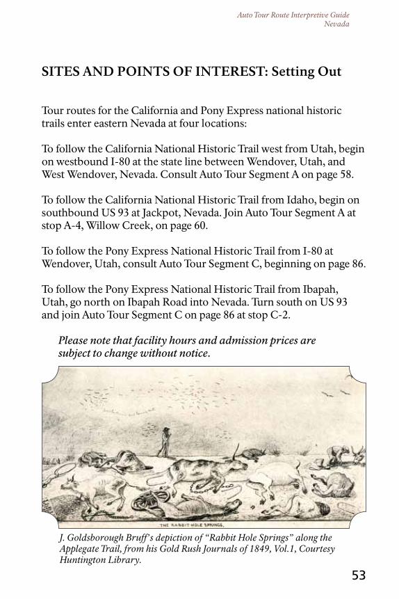
Auto Tour Route Interpretive GuideNevada
J. Goldsborough Bruff’s depiction of “Rabbit Hole Springs” along the Applegate Trail, from his Gold Rush Journals of 1849, Vol.1, Courtesy Huntington Library.
53
SItES And PoIntS oF IntErESt: Setting out
Tour routes for the California and Pony Express national historic trails enter eastern Nevada at four locations:
To follow the California National Historic Trail west from Utah, begin on westbound I-80 at the state line between Wendover, Utah, and West Wendover, Nevada. Consult Auto Tour Segment A on page 58.
To follow the California National Historic Trail from Idaho, begin on southbound US 93 at Jackpot, Nevada. Join Auto Tour Segment A at stop A-4, Willow Creek, on page 60.
To follow the Pony Express National Historic Trail from I-80 at Wendover, Utah, consult Auto Tour Segment C, beginning on page 86.
To follow the Pony Express National Historic Trail from Ibapah, Utah, go north on Ibapah Road into Nevada. Turn south on US 93 and join Auto Tour Segment C on page 86 at stop C-2.
Please note that facility hours and admission prices are subject to change without notice.

Auto Tour Route Interpretive GuideNevada
54
nAVIGAtInG tHE cALIFornIA trAIL AcroSS nEVAdA
the route of the Pony Express Trail was planned and used to carry mail efficiently between St. Joseph and San Francisco. Across
Nevada, it is largely a single trail with an occasional short alternate, generally a temporary detour around some obstacle. The California Trail, on the other hand, is a network pieced together over more than a decade by separate parties traveling to different destinations. The main corridor of the California Trail enters the northeastern corner of Nevada from Idaho and joins the Humboldt River west of Wells. It then follows that indispensable lifeline across the Great Basin to the river’s end at the Humboldt Sink, beyond Lovelock. Numerous trail variants feed into and branch from the main corridor along the Humboldt River, particularly on the west end where fortune seekers fanned out toward the California gold fields.
Read ahead to decide which variant to follow into California, and consult the separate National Park Service “Map and Guide” brochure to the California National Historic Trail for an overview map. The brochure is available from many trail venues along this auto tour and also can be requested free from the National Park Service at: [email protected] or by calling 801-741-1012.
Variants of the California National Historic Trail in Nevada, listed from east to west, are:
The Hastings Cutoff (est. 1846). The difficult “short cut” attempted by the Donner-Reed Party enters Nevada about 10 miles north of Wendover at the Utah border, meanders south around the Ruby Mountains, and turns north again to the Humboldt River. This winding cutoff twice crosses highways along the auto tour route before joining the main California Trail corridor near the California Trail Historic Interpretive Center west of Elko. Consult Auto Tour Segment A on page 58.
The Applegate Trail (est. 1846). This trail branches off the main California Trail corridor about seven and a half miles northwest of Imlay, Nevada. It crosses the Black Rock Desert and enters California a few miles northeast of Cedarville, eventually ending at Oregon’s
Auto Tour Route Interpretive GuideNevada
55
Willamette Valley. The auto tour of the Applegate Trail in Nevada begins at entry A-13 in this guide. For a backcountry taste of the Applegate where it approaches the Black Rock Desert, consult Auto Tour Segment B on page 77.
The Nobles Trail (est. 1852). The Nobles Trail splits off the Applegate Trail at the eastern edge of the Black Rock Desert and ends at Shasta, California. This trail in Nevada crosses paved highway at Gerlach, but segments of it are accessible via backcountry dirt roads. Consult Auto Tour Segment B on page 77.
The Truckee Route (est. 1844). The main corridor of the California Trail forks into two branches, the Truckee Route and the Carson Route, near the Humboldt Bar beyond Lovelock. The Truckee Route, taken by the Donner-Reed Party, continues along the north side of the Forty-mile Desert to Wadsworth. From there it follows the Truckee River through Reno, enters the Sierra Nevada, and ends at Johnson’s Ranch southeast of Yuba City, California. Directions for this route through Nevada begin at entry A22 on page 74.
The Carson Route (est. 1848). From the trail fork near the Humboldt Bar, the Carson Route turns south through the Forty-mile Desert toward the Carson River near Fallon. The trail follows the river into the Sierra Nevada south of Lake Tahoe and ends at Sacramento, California. Much of the Carson Route through Nevada coincides with the alignment of US 50. The auto tour of this route starts on page 75.
The Beckwourth Trail (est. 1851). This trail, established by African American mountain man Jim Beckwourth, branches from the Truckee Route in Sparks, Nevada. From there it crosses Beckwourth Pass and ends near Oroville, California. See Beckwourth Trail text on page 76.
The Walker River-Sonora Route (est. 1852). This route branches from the Carson Route at Fort Churchill, Nevada, and enters California at Topaz Lake. From there it follows the Walker River south and ends at Sonora, California. See Walker River-Sonora text C-19 on page 100.

Auto Tour Route Interpretive GuideNevada
Confluence of the South Fork of the Humboldt and the Humboldt River west of Elko where the Hastings Cutoff joins the main trail corridor.
56
tIPS For trAILInG AcroSS nEVAdA
Many unfortunate emigrants found themselves stranded without oxen, wagon, water, or food, and hundreds of miles from help
while following the California Trail through Nevada’s pitiless deserts and sagebrush barrens. Some of today’s Great Basin highways are still long and lonesome, and walking miles along the sun-baked roadside without food and water is an authentic trail experience most visitors do not relish. Before starting across Nevada, consult a road map to plan fuel and refreshment stops. Carry emergency supplies and refuel when your vehicle’s gas tank approaches half empty, especially when driving US 50. There is a reason why it is called “The Loneliest Road in America.”
However, Nevada is threaded with roads that are even lonelier. This guide notes opportunities for side trips on backcountry roads closer to and sometimes on the original California and Pony Express trails. Some of these dirt roads wind through empty expanses of rangeland, see little traffic, and are beyond cell phone service. Do not count on summoning help if your vehicle becomes disabled in the backcountry. Go prepared. Start with a full tank of gas, heavy-duty, off-pavement tires in good condition, and at least one full-size spare, properly

Auto Tour Route Interpretive GuideNevada
57
inflated and in good condition. Carry water, and travel with at least one other vehicle in case one breaks down. More specific advisories are provided among the individual tour entries.
While traveling the Nevada Auto Tour Routes, visitors will notice T-shaped markers made of steel railroad rail at many stops along the way. Mounted to the distinctive markers are metal plates inscribed with emigrant quotes about the trail. The markers are erected by Trails West, Inc., a nonprofit volunteer organization, to denote and interpret key sites and segments of the California Trail. Trails West, Inc. publishes a series of comprehensive driving guides, Emigrant Trails West, for its T-rail markers, with directions to many off-highway sites not described here. These and other useful guides are available from www.emigranttrailswest.org, www.shopblackrockdesert.org, and www.octa-trails.org. Numbers on the T-rail markers correspond to the Trails West guides, not to the numbered stops listed in this auto tour route guide.
Remember as you follow the pioneers that the ruts, swales, campsites, graves, and relics they left behind are touchstones to our nation’s past. Please avoid driving over abandoned wagon ruts and swales, but do explore them on foot. Unauthorized metal detecting, probing and digging for artifacts, and relic collecting are illegal on public lands, as well as on private lands without the owner’s permission. Leave the trail undisturbed for everyone to enjoy.
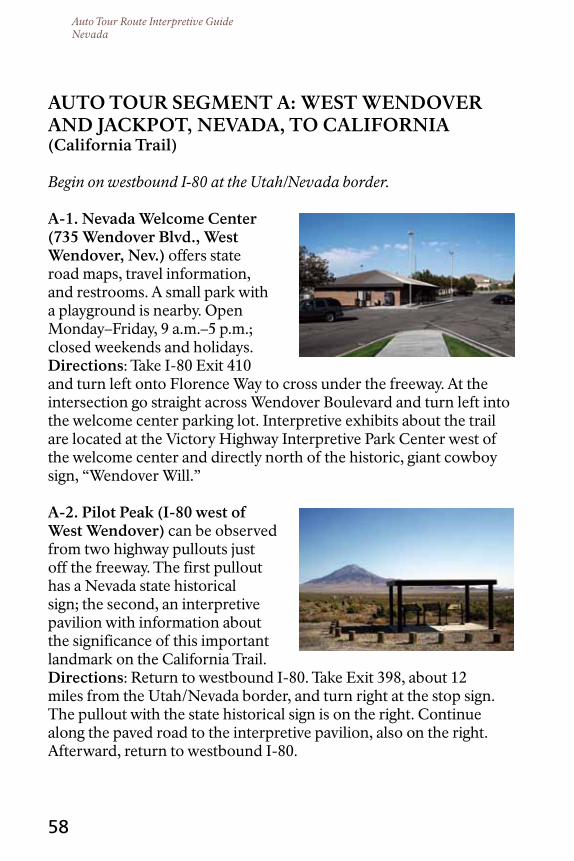
Auto Tour Route Interpretive GuideNevada
58
Auto tour SEGMEnt A: WESt WEndoVEr And JAcKPot, nEVAdA, to cALIFornIA (california trail)
Begin on westbound I-80 at the Utah/Nevada border.
A-1. nevada Welcome center (735 Wendover Blvd., West Wendover, nev.) offers state road maps, travel information, and restrooms. A small park with a playground is nearby. Open Monday–Friday, 9 a.m.–5 p.m.; closed weekends and holidays.directions: Take I-80 Exit 410 and turn left onto Florence Way to cross under the freeway. At the intersection go straight across Wendover Boulevard and turn left into the welcome center parking lot. Interpretive exhibits about the trail are located at the Victory Highway Interpretive Park Center west of the welcome center and directly north of the historic, giant cowboy sign, “Wendover Will.”
A-2. Pilot Peak (I-80 west of West Wendover) can be observed from two highway pullouts just off the freeway. The first pullout has a Nevada state historical sign; the second, an interpretive pavilion with information about the significance of this important landmark on the California Trail.directions: Return to westbound I-80. Take Exit 398, about 12 miles from the Utah/Nevada border, and turn right at the stop sign. The pullout with the state historical sign is on the right. Continue along the paved road to the interpretive pavilion, also on the right. Afterward, return to westbound I-80.

Auto Tour Route Interpretive GuideNevada
59
Stop A-3 is 15 miles north of the primary tour route on I-80. To bypass this site and continue along the freeway, skip to entry A-4.
A-3. Willow creek (uS 93 north of Wells, nev.) is a stretch of original wagon trail on a public easement. There are no interpretive exhibits or historical signs at this location.directions: From the Pilot Peak stop, continue westbound on I-80 toward Wells, about 60 miles
west of the Utah border. Take Exit 352B and turn right onto US 93 toward Twin Falls, Idaho. Reset your vehicle’s trip odometer at the turn. In 14.4 miles, turn right onto an unpaved road, marked with a wooden BLM directional sign for Willow Creek and Hunter Draw. For travelers southbound on US 93 from Idaho, this signed turnoff is 54 miles south of Jackpot and on the left (east). On the other side of the boundary fence, park at the informal turnout on the left. East and south of the road, original trail is marked with white fiberglass posts and is visible as a faint track through the sagebrush. Please do not drive on original trail remnants.
Also of Interest: About 12.2 miles farther north along US 93, visitors will see signs for the California Trail Back Country Byway. The unpaved byway route closely parallels the original California Trail to the northeast corner of Nevada, where it splits. One branch of the byway curves west again, away from the historic trail, and emerges onto US 93 at Jackpot, Nevada. From Jackpot, visitors can drive south on the highway and resume the tour at Wells (stop A-4). The unpaved portion of the loop is about 100 miles long and takes about three hours to complete. The other branch of the byway continues northeast along the historic trail route toward the Utah border, where the designated byway ends (although the historic trail corridor continues across the

Auto Tour Route Interpretive GuideNevada
60
northwestern corner of Utah and into southern Idaho). For more information about the byway, see www.byways.org/explore/byways/68964/, stop by the Bureau of Land Management’s California Trail Historic Interpretive Center west of Elko, or phone the center at 775-738-1849. High-clearance vehicles are recommended for this drive; some segments of the road into Utah may require four-wheel drive.
To continue west on the Auto Tour Route across Nevada, return to Wells; or to join the Oregon Trail across Idaho, go north on US 93 to Twin Falls, Idaho and consult the Auto Tour Route Interpretive Guide Across Idaho.
A-4. Humboldt Wells (radar road, Wells, nev.) was a cluster of springs or “wells,” the headwaters of the much-maligned Humboldt River that travelers followed across Nevada. The waterholes were scattered across an area of about two square miles that served as a major emigrant campground. This stop has no interpretive exhibits but offers an opportunity to hike a short segment of the original emigrant trail across public land.directions: If approaching on I-80, take the first exit (352B for 6th Street/Business I-80) into Wells, cross US 93, and continue northwest on 6th Street/Old Highway 40. If approaching from southbound US 93, turn right onto 6th Street. From 6th Street, turn right onto Lake Avenue and cross the railroad tracks. Turn left onto 8th Street. Pass Starr Avenue and at the next intersection turn right onto Wells Avenue and head northeast out of town. Where the road splits about 0.4 mile from town, turn left and set your trip odometer. Continue up the hill toward a radio facility, keeping on the main bladed road. The road crosses a wetland area (part of the “wells” locale) and passes a private development on the right. At the fork just beyond the development, continue straight ahead on the main road; watch on the left for a T-rail marker at odometer mile 1.7. Park near the marker and walk down the unimproved two-track, which is a remnant of the California Trail, for about a mile to view the valley. The waterholes or
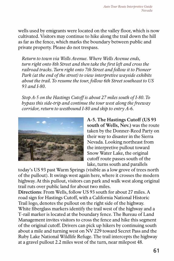
Auto Tour Route Interpretive GuideNevada
61
wells used by emigrants were located on the valley floor, which is now cultivated. Visitors may continue to hike along the trail down the hill as far as the fence, which marks the boundary between public and private property. Please do not trespass.
Return to town via Wells Avenue. Where Wells Avenue ends, turn right onto 8th Street and then take the first left and cross the railroad tracks. Turn right onto 7th Street and follow it to Pioneer Park (at the end of the street) to view interpretive wayside exhibits about the trail. To resume the tour, follow 6th Street southeast to US 93 and I-80.
Stop A-5 on the Hastings Cutoff is about 27 miles south of I-80. To bypass this side-trip and continue the tour west along the freeway corridor, return to westbound I-80 and skip to entry A-6.
A-5. the Hastings cutoff (uS 93 south of Wells, nev.) was the route taken by the Donner-Reed Party on their way to disaster in the Sierra Nevada. Looking northeast from the interpretive pullout toward Snow Water Lake, the original cutoff route passes south of the lake, turns south and parallels
today’s US 93 past Warm Springs (visible as a low grove of trees north of the pullout). It swings west again here, where it crosses the modern highway. At this pullout, visitors can park and walk west along original trail ruts over public land for about two miles.directions: From Wells, follow US 93 south for about 27 miles. A road sign for Hastings Cutoff, with a California National Historic Trail logo, denotes the pullout on the right side of the highway. White fiberglass markers identify the trail west of the highway and a T-rail marker is located at the boundary fence. The Bureau of Land Management invites visitors to cross the fence and hike this segment of the original cutoff. Drivers can pick up hikers by continuing south about a mile and turning west on NV 229 toward Secret Pass and the Ruby Lake National Wildlife Refuge. The trail intercepts the highway at a gravel pullout 2.2 miles west of the turn, near milepost 48.
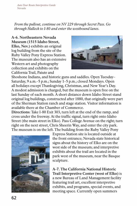
Auto Tour Route Interpretive GuideNevada
62
From the pullout, continue on NV 229 through Secret Pass. Go through Halleck to I-80 and enter the westbound lanes.
A-6. northeastern nevada Museum (1515 Idaho Street, Elko, nev.) exhibits an original log building from the site of the Ruby Valley Pony Express Station. The museum also has an extensive Western art and photography collection and exhibits on the California Trail, Paiute and Shoshone Indians, and historic guns and saddles. Open Tuesday–Saturday, 9 a.m.–5 p.m.; Sunday 1–5 p.m.; closed Mondays. Open all holidays except Thanksgiving, Christmas, and New Year’s Day. A modest admission is charged, but the museum is open free on the last Sunday of each month. A short distance down Idaho Street stand original log buildings, constructed after 1880, that originally were part of the Sherman Station ranch and stage station. Visitor information is available there at the Chamber of Commerce.directions: Take I-80 Exit 303, turn left at the end of the ramp, and cross under the freeway. At the traffic signal, turn right onto Idaho Street (the main street in Elko). Pass College Avenue on the right; turn right on the next street, Chris Sheerin Way, and enter the city park. The museum is on the left. The building from the Ruby Valley Pony
Express Station site is located outside at the front entrance; Nevada state historical signs about the history of Elko are on the west side of the museum; and interpretive exhibits about the trail are located in the park west of the museum, near the Basque sculpture.
A-7. the california national Historic trail Interpretive center (west of Elko) is a new Bureau of Land Management facility featuring trail art, excellent interpretive exhibits, and programs, special events, and meeting space. Currently open summers
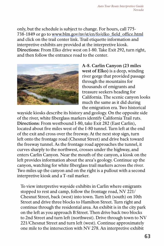
Auto Tour Route Interpretive GuideNevada
63
only, but the schedule is subject to change. For hours, call 775-738-1849 or go to www.blm.gov/nv/st/en/fo/elko_field_office.html and click on the trail center link. Trail etiquette information and interpretive exhibits are provided at the interpretive kiosk.directions: From Elko drive west on I-80. Take Exit 292, turn right, and then follow the entrance road to the center.
A-8. carlin canyon (23 miles west of Elko) is a deep, winding river gorge that provided passage through the mountains for thousands of emigrants and treasure seekers heading for California. The scenic canyon looks much the same as it did during the emigration era. Two historical
wayside kiosks describe its history and geology. On the opposite side of the river, white fiberglass markers identify California Trail ruts.directions: From westbound I-80, take Exit 282 (East Carlin), located about five miles west of the I-80 tunnel. Turn left at the end of the exit and cross over the freeway. At the next stop sign, turn left onto the frontage road (Chesnut Street) and drive back toward the freeway tunnel. As the frontage road approaches the tunnel, it curves sharply to the northwest, crosses under the highway, and enters Carlin Canyon. Near the mouth of the canyon, a kiosk on the left provides information about the area’s geology. Continue up the canyon, watching for white fiberglass trail markers across the river. Two miles up the canyon and on the right is a pullout with a second interpretive kiosk and a T-rail marker.
To view interpretive wayside exhibits in Carlin where emigrants stopped to rest and camp, follow the frontage road, NV 221/Chesnut Street, back (west) into town. Turn left (south) on 10th Street and drive three blocks to Hamilton Street. Turn right and continue through the residential area. An exhibit is in the city park on the left as you approach B Street. Then drive back two blocks to 2nd Street and turn left (northwest). Drive through town to NV 221/Chesnut Street and turn left (west). Continue approximately one mile to the intersection with NV 278. An interpretive exhibit
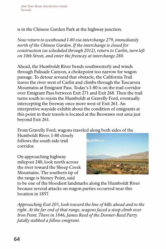
Auto Tour Route Interpretive GuideNevada
64
is in the Chinese Garden Park at the highway junction.
Now return to westbound I-80 via interchange 279, immediately north of the Chinese Garden. If the interchange is closed for construction (as scheduled through 2012), return to Carlin, turn left on 10th Street, and enter the freeway at interchange 280.
Ahead, the Humboldt River bends southwesterly and winds through Palisade Canyon, a chokepoint too narrow for wagon passage. To detour around that obstacle, the California Trail leaves the river west of Carlin and climbs through the Tuscarora Mountains at Emigrant Pass. Today’s I-80 is on the trail corridor over Emigrant Pass between Exit 271 and Exit 268. Then the trail turns south to rejoin the Humboldt at Gravelly Ford, eventually intercepting the freeway once more west of Exit 261. An interpretive wayside exhibit about the condition of emigrants at this point in their travels is located at the Beowawe rest area just beyond Exit 261.
From Gravelly Ford, wagons traveled along both sides of the Humboldt River. I-80 closely follows the south side trail corridor.
On approaching highway milepost 240, look north across the river toward the Sheep Creek Mountains. The southern tip of the range is Stoney Point, said to be one of the bloodiest landmarks along the Humboldt River because several attacks on wagon parties occurred near this location in 1857.
Approaching Exit 205, look toward the line of hills ahead and to the right. At the far end of that range, wagons faced a steep climb over Iron Point. There in 1846, James Reed of the Donner-Reed Party fatally stabbed a fellow emigrant.
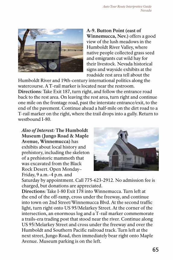
Auto Tour Route Interpretive GuideNevada
65
A-9. Button Point (east of Winnemucca, nev.) offers a good view of the lush meadows in the Humboldt River Valley, where native people collected grass seed and emigrants cut wild hay for their livestock. Nevada historical signs and wayside exhibits at the roadside rest area tell about the
Humboldt River and 19th-century international politics along the watercourse. A T-rail marker is located near the restroom.directions: Take Exit 187, turn right, and follow the entrance road back to the rest area. On leaving the rest area, turn right and continue one mile on the frontage road, past the interstate entrance/exit, to the end of the pavement. Continue ahead a half-mile on the dirt road to a T-rail marker on the right, where the trail drops into a gully. Return to westbound I-80.
Also of Interest: the Humboldt Museum (Jungo road & Maple Avenue, Winnemucca) has exhibits about local history and prehistory, including the skeleton of a prehistoric mammoth that was excavated from the Black Rock Desert. Open Monday–Friday, 9 a.m.–4 p.m. and Saturday by appointment. Call 775-623-2912. No admission fee is charged, but donations are appreciated.directions: Take I-80 Exit 178 into Winnemucca. Turn left at the end of the off-ramp, cross under the freeway, and continue into town on 2nd Street/Winnemucca Blvd. At the second traffic light, turn right onto US 95/Melarkey Street. At the corner of the intersection, an enormous log and a T-rail marker commemorate a trails-era trading post that stood near the river. Continue along US 95/Melarkey Street and cross under the freeway and over the Humboldt and Southern Pacific railroad track. Turn left at the next street, Jungo Road, then immediately bear right onto Maple Avenue. Museum parking is on the left.

Auto Tour Route Interpretive GuideNevada
66
Advisory! West of Winnemucca, visitors will have the option of following part of the Applegate and Nobles trail variants of the California Trail into the Black Rock Desert-High Rock Canyon Emigrant Trails National Conservation Area (NCA). The area is remote and threaded with unsigned roads. Before leaving Winnemucca, travelers planning to explore the trail through the NCA should top off their gas tanks and stop by the Bureau of Land Management (BLM) office at 5100 E. Winnemucca Boulevard or phone 775- 623-1500 to purchase 1:100,000 BLM Surface Management Status maps of the area or to request a free Black Rock NCA eBook on CD. The CD can be requested by email at [email protected] and can be downloaded (without maps) from www.blackrockdesert.org/ebook/. Many other detailed maps and guidebooks for the area are available for purchase at www.shopblackrockdesert.org/mapsandbooks.html, www.emigranttrailswest.org, and www.octa-trails.org. While at the BLM office, pick up a free guide to the Lovelock Cave Back Country Byway, which begins at Lovelock.
Wayside exhibits at the Cosgrave rest area, about 20 miles west of Winnemucca at I-80 Exit 158, interpret the California Trail.
A-10. the dry cutoff (northwest of Mill city, nev.) is a segment of wagon trail in a largely natural setting.directions: Continue west on I-80 to Exit 149 and turn right at the end of the ramp. Continue northwest at the intersection, across the frontage road and railroad tracks, keeping to the paved road. The road next crosses an irrigation canal and then the Humboldt River. Set your trip odometer at the river bridge. Just beyond the bridge, the road crosses the old Idaho Stage Road. About 4.4 miles past the bridge, a bladed road that is part of the Dry Cutoff enters from the left. Turn onto the road and look for a T-rail marker on the right. Vehicles with high clearance can continue down the bladed road when it is dry, but the road may be closed about four miles beyond the turnoff.

Auto Tour Route Interpretive GuideNevada
67
A-11. the Applegate trail (west of Imlay, nev.) provided one last chance for emigrants to turn toward Oregon. This variant, blazed in 1846, leaves the main California Trail across the Humboldt River about 7.5 miles northeast of today’s community of Imlay and heads westerly to the Black Rock Desert. The Nobles and Lassen trails, established later, eventually branch off the Applegate Trail toward California destinations. A Nevada state historical sign tells the story. No trail remnants are visible at this stop.directions: From the Dry Cutoff, return to westbound I-80. Take Exit 145 at Imlay and turn right at the end of the ramp. At the stop sign, turn left onto the frontage road, Old Highway 40, along the north side of the freeway. The state historical sign is on the right at an intersection about a mile from the turn.
From here the route continues along an unpaved county road past Rye Patch Reservoir—once the “Big Bend” of the Humboldt and on the Applegate Trail. When dry, the road to sites A-12 through A-15 typically is negotiable by two-wheel-drive passenger vehicles. From stop A-15, vehicles unsuited for backcountry travel are advised to return to the highway. This out-and-back drive entails a round trip of about 22 miles over bladed dirt roads.
To bypass these sites and stay on the pavement, skip ahead to entry A-16.
High-clearance vehicles with all-terrain tires and at least one spare in good condition will be able to continue on backcountry roads beyond A-15 toward Gerlach. Further driving directions are provided in Auto Tour Segment B.
A-12. Lassens Meadows (west of Imlay, nev.), where the Humboldt River begins bending south toward its “sink,” is near the head of the Applegate Trail. The spot offered emigrants a welcome, wet place to camp at the end of the Dry Cutoff and provided an opportunity to cut meadow hay for livestock. Today
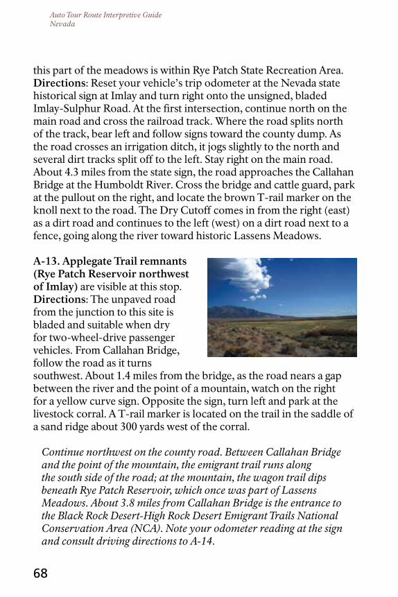
Auto Tour Route Interpretive GuideNevada
68
this part of the meadows is within Rye Patch State Recreation Area.directions: Reset your vehicle’s trip odometer at the Nevada state historical sign at Imlay and turn right onto the unsigned, bladed Imlay-Sulphur Road. At the first intersection, continue north on the main road and cross the railroad track. Where the road splits north of the track, bear left and follow signs toward the county dump. As the road crosses an irrigation ditch, it jogs slightly to the north and several dirt tracks split off to the left. Stay right on the main road. About 4.3 miles from the state sign, the road approaches the Callahan Bridge at the Humboldt River. Cross the bridge and cattle guard, park at the pullout on the right, and locate the brown T-rail marker on the knoll next to the road. The Dry Cutoff comes in from the right (east) as a dirt road and continues to the left (west) on a dirt road next to a fence, going along the river toward historic Lassens Meadows.
A-13. Applegate trail remnants (rye Patch reservoir northwest of Imlay) are visible at this stop.directions: The unpaved road from the junction to this site is bladed and suitable when dry for two-wheel-drive passenger vehicles. From Callahan Bridge, follow the road as it turns southwest. About 1.4 miles from the bridge, as the road nears a gap between the river and the point of a mountain, watch on the right for a yellow curve sign. Opposite the sign, turn left and park at the livestock corral. A T-rail marker is located on the trail in the saddle of a sand ridge about 300 yards west of the corral.
Continue northwest on the county road. Between Callahan Bridge and the point of the mountain, the emigrant trail runs along the south side of the road; at the mountain, the wagon trail dips beneath Rye Patch Reservoir, which once was part of Lassens Meadows. About 3.8 miles from Callahan Bridge is the entrance to the Black Rock Desert-High Rock Desert Emigrant Trails National Conservation Area (NCA). Note your odometer reading at the sign and consult driving directions to A-14.
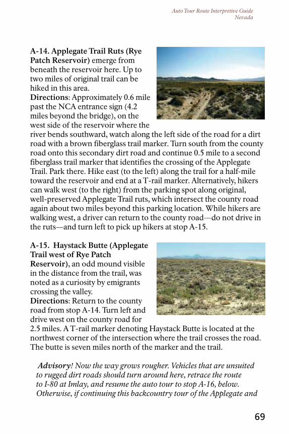
Auto Tour Route Interpretive GuideNevada
69
A-14. Applegate trail ruts (rye Patch reservoir) emerge from beneath the reservoir here. Up to two miles of original trail can be hiked in this area.directions: Approximately 0.6 mile past the NCA entrance sign (4.2 miles beyond the bridge), on the west side of the reservoir where the river bends southward, watch along the left side of the road for a dirt road with a brown fiberglass trail marker. Turn south from the county road onto this secondary dirt road and continue 0.5 mile to a second fiberglass trail marker that identifies the crossing of the Applegate Trail. Park there. Hike east (to the left) along the trail for a half-mile toward the reservoir and end at a T-rail marker. Alternatively, hikers can walk west (to the right) from the parking spot along original, well-preserved Applegate Trail ruts, which intersect the county road again about two miles beyond this parking location. While hikers are walking west, a driver can return to the county road—do not drive in the ruts—and turn left to pick up hikers at stop A-15.
A-15. Haystack Butte (Applegate trail west of rye Patch reservoir), an odd mound visible in the distance from the trail, was noted as a curiosity by emigrants crossing the valley.directions: Return to the county road from stop A-14. Turn left and drive west on the county road for 2.5 miles. A T-rail marker denoting Haystack Butte is located at the northwest corner of the intersection where the trail crosses the road. The butte is seven miles north of the marker and the trail.
Advisory! Now the way grows rougher. Vehicles that are unsuited to rugged dirt roads should turn around here, retrace the route to I-80 at Imlay, and resume the auto tour to stop A-16, below. Otherwise, if continuing this backcountry tour of the Applegate and
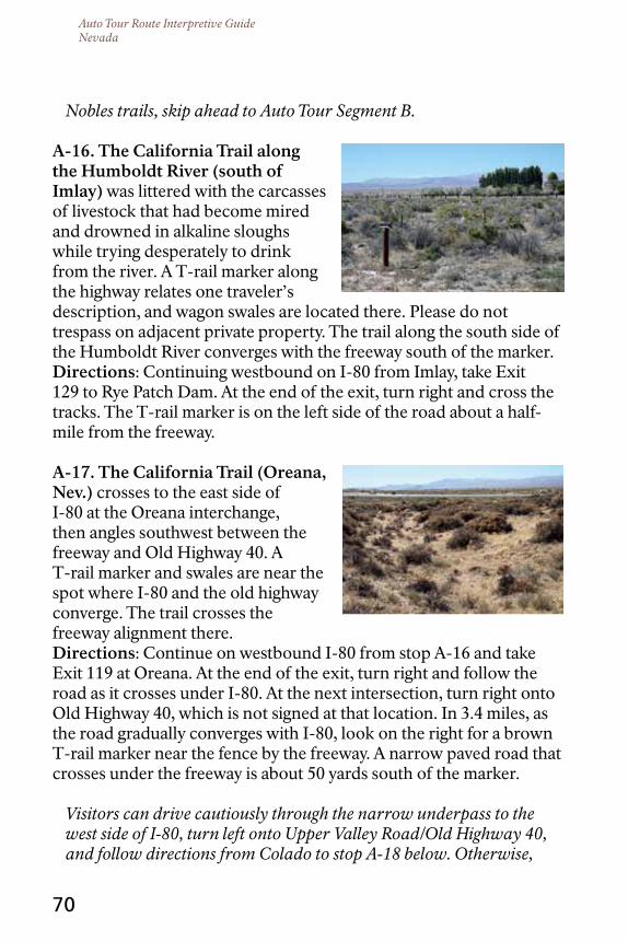
Auto Tour Route Interpretive GuideNevada
70
Nobles trails, skip ahead to Auto Tour Segment B.
A-16. the california trail along the Humboldt river (south of Imlay) was littered with the carcasses of livestock that had become mired and drowned in alkaline sloughs while trying desperately to drink from the river. A T-rail marker along the highway relates one traveler’s description, and wagon swales are located there. Please do not trespass on adjacent private property. The trail along the south side of the Humboldt River converges with the freeway south of the marker.directions: Continuing westbound on I-80 from Imlay, take Exit 129 to Rye Patch Dam. At the end of the exit, turn right and cross the tracks. The T-rail marker is on the left side of the road about a half-mile from the freeway.
A-17. the california trail (oreana, nev.) crosses to the east side of I-80 at the Oreana interchange, then angles southwest between the freeway and Old Highway 40. A T-rail marker and swales are near the spot where I-80 and the old highway converge. The trail crosses the freeway alignment there.directions: Continue on westbound I-80 from stop A-16 and take Exit 119 at Oreana. At the end of the exit, turn right and follow the road as it crosses under I-80. At the next intersection, turn right onto Old Highway 40, which is not signed at that location. In 3.4 miles, as the road gradually converges with I-80, look on the right for a brown T-rail marker near the fence by the freeway. A narrow paved road that crosses under the freeway is about 50 yards south of the marker.
Visitors can drive cautiously through the narrow underpass to the west side of I-80, turn left onto Upper Valley Road/Old Highway 40, and follow directions from Colado to stop A-18 below. Otherwise,
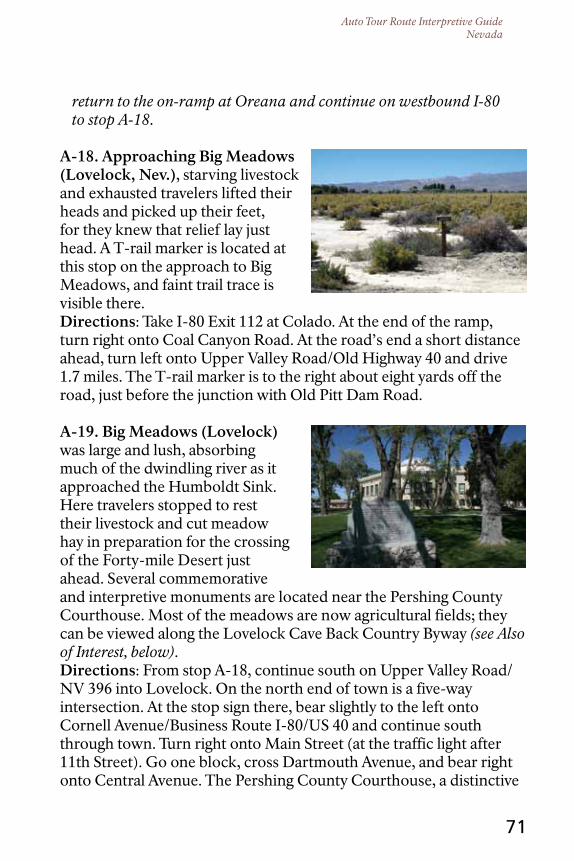
Auto Tour Route Interpretive GuideNevada
71
return to the on-ramp at Oreana and continue on westbound I-80 to stop A-18.
A-18. Approaching Big Meadows (Lovelock, nev.), starving livestock and exhausted travelers lifted their heads and picked up their feet, for they knew that relief lay just head. A T-rail marker is located at this stop on the approach to Big Meadows, and faint trail trace is visible there.directions: Take I-80 Exit 112 at Colado. At the end of the ramp, turn right onto Coal Canyon Road. At the road’s end a short distance ahead, turn left onto Upper Valley Road/Old Highway 40 and drive 1.7 miles. The T-rail marker is to the right about eight yards off the road, just before the junction with Old Pitt Dam Road.
A-19. Big Meadows (Lovelock) was large and lush, absorbing much of the dwindling river as it approached the Humboldt Sink. Here travelers stopped to rest their livestock and cut meadow hay in preparation for the crossing of the Forty-mile Desert just ahead. Several commemorative and interpretive monuments are located near the Pershing County Courthouse. Most of the meadows are now agricultural fields; they can be viewed along the Lovelock Cave Back Country Byway (see Also of Interest, below).directions: From stop A-18, continue south on Upper Valley Road/NV 396 into Lovelock. On the north end of town is a five-way intersection. At the stop sign there, bear slightly to the left onto Cornell Avenue/Business Route I-80/US 40 and continue south through town. Turn right onto Main Street (at the traffic light after 11th Street). Go one block, cross Dartmouth Avenue, and bear right onto Central Avenue. The Pershing County Courthouse, a distinctive

Auto Tour Route Interpretive GuideNevada
72
round building, is to the left. Park at the lot between the courthouse and the library. A T-rail marker commemorating Big Meadows is located at the flagpole in front of the library, north of the courthouse parking lot. Other historical signs and trail monuments are located on the grounds, as well.
Also of Interest: Lovelock cave Back country Byway. This Bureau of Land Management (BLM) driving tour passes through the long-ago meadows and ends at Lovelock Cave, at the edge of the Humboldt Sink. Entries in the backcountry byway driving guide correspond to numbered signs at points of interest along the route. Traces of an alternate wagon route that skirts the east rim of the Humboldt Sink are visible along this drive. The BLM guide to the byway and a children’s activity book are available free at a kiosk at the Marzen House Museum, the first stop on the byway tour. To get there, drive southwest through town on Cornell Avenue/ Business Route I-80. As the street approaches an I-80 overpass, look on the right for Marzen Lane and a sign to the museum. Turn onto Marzen Lane and continue to the museum to pick up your guides at the kiosk.
A-20. the Humboldt Sink, which begins about 20 miles south of Lovelock, is a shallow basin that collects the last of the Humboldt River. A T-rail marker on the playa summarizes one traveler’s opinion of the place.directions: From the Pershing County Courthouse in Lovelock,
take Main Street southeast toward I-80, cross the railroad tracks, and continue one full block to Amherst Avenue. Turn right onto Amherst, which becomes NV 397/399. As the road heads south of town, it passes among agricultural fields where emigrants once camped and

Auto Tour Route Interpretive GuideNevada
73
cut hay. Turn right at Westergard Road and continue west to the junction with Derby Airport Road. Turn right at Derby Airport Road and drive one mile. Look on the right, south of the tracks, for a T-rail marker denoting Granite Point.
Now drive north toward I-80 and cross the railroad tracks. Turn left onto the frontage road (NV 401) and drive 4.2 miles. Beyond Toulon, turn right and enter the westbound lanes of I-80. At highway milepost 90, look east for a view of the Humboldt Sink. Lovelock Cave appears as a white, crescent-shaped ridge on the hillside across the playa.
Farther south, look east to see Humboldt Lake, the last of the Humboldt River flow. At the south end of the sink the freeway crosses the Humboldt Bar, a natural dike that separates the Humboldt and Carson-Truckee River drainages. The dike was created by the currents of prehistoric Lake Lahontan, which covered much of western Nevada during the last Ice Age. Emigrants, unaware of the bar’s origins, regarded it as just another hill to climb. Near the Humboldt Bar, the main California Trail corridor splits. One branch, the Truckee Route, goes along the northern edge of the Forty-mile Desert toward the Truckee River at today’s town of Wadsworth. The other, the Carson Route, skirts the southern edge of the Forty-mile Desert, then angles toward the Carson River at present-day Fallon. By either route, it is roughly 40 miles—about a day and a half of hard, continuous travel by ox and wagon—across the desert to the nearest river.
A-21. the Forty-mile desert (between Lovelock and Fernley, nev.) was a 200,000 square-mile cauldron of heat and thirst. Here the trails were literally paved with dead livestock. Researchers have
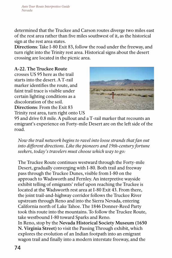
Auto Tour Route Interpretive GuideNevada
74
determined that the Truckee and Carson routes diverge two miles east of the rest area rather than five miles southwest of it, as the historical sign at the rest area states.directions: Take I-80 Exit 83, follow the road under the freeway, and turn right into the Trinity rest area. Historical signs about the desert crossing are located in the picnic area.
A-22. the truckee route crosses US 95 here as the trail starts into the desert. A T-rail marker identifies the route, and faint trail trace is visible under certain lighting conditions as a discoloration of the soil.directions: From the Exit 83 Trinity rest area, turn right onto US 95 and drive 0.8 mile. A pullout and a T-rail marker that recounts an emigrant’s experience on Forty-mile Desert are on the left side of the road.
Now the trail network begins to ravel into loose strands that fan out into different directions. Like the pioneers and 19th-century fortune seekers, today’s travelers must choose which way to go:
The Truckee Route continues westward through the Forty-mile Desert, gradually converging with I-80. Both trail and freeway pass through the Truckee Dunes, visible from I-80 on the approach to Wadsworth and Fernley. An interpretive wayside exhibit telling of emigrants’ relief upon reaching the Truckee is located at the Wadsworth rest area at I-80 Exit 43. From there, the joint trail-and-highway corridor follows the Truckee River upstream through Reno and into the Sierra Nevada, entering California north of Lake Tahoe. The 1846 Donner-Reed Party took this route into the mountains. To follow the Truckee Route, take westbound I-80 toward Sparks and Reno. In Reno, stop by the nevada Historical Society Museum (1650 n. Virginia Street) to visit the Passing Through exhibit, which explores the evolution of an Indian footpath into an emigrant wagon trail and finally into a modern interstate freeway, and the

Auto Tour Route Interpretive GuideNevada
75
Living on the Land exhibit, about native peoples of the Great Basin. The museum is open Wednesday–Saturday, 10 a.m.–5 p.m. A modest admission charged, 17 and younger admitted free. To find the museum, take I-80 Exit 13 and turn right on Virginia Street. Drive north for 0.8 mile, following University of Nevada signs. Just past the planetarium, turn right onto 16th Street and the University of Nevada-Reno Campus. The museum is on the left.
Return to the westbound lanes of I-80 and continue toward Truckee, California. Further directions will be provided in the future Auto Tour Route Interpretive Guide, California: Across the Sierra Nevada.
the carson route intercepts US 95 south of the I-80 Exit 83 rest area and then swings southwest toward US 50. The combined trail and highway corridor goes through Carson City and enters California south of Lake Tahoe. To follow this route, turn south onto US 95. About four miles south of the Exit 83 rest area, past the railroad crossing and on the left side of the highway, is a pullout with a T-rail marker indicating where the Carson Route crosses the highway. A few miles farther south, the emigrant trail veers southwest. To intercept the trail again, continue 28 miles on US 95 to Fallon and skip ahead to entry C-9.
the Applegate trail crosses the Black Rock Desert and enters California near Cedarville, more than 150 miles northwest of the I-80/US 95 junction. The Lassen and Nobles trails branch off the Applegate and end in California. To join the Applegate
Trail from here via paved roads, take westbound I-80 toward

Auto Tour Route Interpretive GuideNevada
76
Fernley. Leave the freeway at Exit 46 and turn right onto NV 427. At Wadsworth, turn right onto NV 447. Approaching Nixon, see entries B-11 and B-12 concerning the Pyramid Lake War. Continue north along the highway through Gerlach (where the Nobles Trail crosses the highway) to California. Further directions will be provided in the future Auto Tour Route Interpretive Guide, California: Across the Sierra Nevada.
the Beckwourth trail branches off the Truckee Route in the Truckee Meadows, a few miles west of Steamboat Creek. After crossing the Truckee River, the Beckwourth Trail heads northwest through present-day Reno, generally following today’s alignment of US 395 into California. A detailed driving guide to the Beckwourth Trail can be purchased at www.plumasmuseum.org/.
Beyond US 395 Exit 73 for Golden Valley and about 0.2 mile past a shopping center on the right side of the highway, look on the right to see Beckwourth Trail swales. Approaching Exit 80 for White Lake Parkway, look ahead and to the right to see the White Lake playa. Emigrants crossed the playa when it was dry but passed south of it along today’s highway alignment when it was wet.
Continue on northbound US 95 to Bordertown, where the trail leaves Nevada. Further directions will be provided in the future Auto Tour Route Interpretive Guide, California: Across the Sierra Nevada.

Auto Tour Route Interpretive GuideNevada
The Black Rock Desert is named for the prominent volcanic feature found at the southern end of the Black Rock Range.
77
Auto tour SEGMEnt B: BLAcK rocK dESErt, rYE PAtcH rESErVoIr to GErLAcH, nEVAdA (Applegate and nobles trails)
The Black Rock Desert/High Rock Canyon Emigrant Trail National Conservation Area (NCA), managed by the Bureau of Land Management, boasts some of the best wagon trail in the West. Here the emigrant road winds through empty, sun-blasted country that has changed little over the past 150 years. This tour, which takes visitors across the south end of the Black Rock Desert between Imlay and Gerlach, offers just a tantalizing taste of what the NCA has to offer. The tour route described here follows unpaved roads suitable in dry weather for two-wheel-drive vehicles with sturdy all-terrain (not all-weather) tires. High clearance is recommended. Gas, food, and drinking water are not available along the way. Cell phone coverage may be unavailable.
Segments of the road beyond Rabbithole Springs are considered “tire-shredders” because of sharp volcanic rocks that can puncture
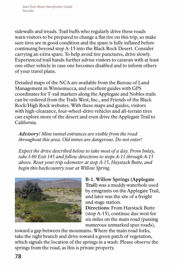
Auto Tour Route Interpretive GuideNevada
78
sidewalls and treads. Trail buffs who regularly drive these roads warn visitors to be prepared to change a flat tire on this trip, so make sure tires are in good condition and the spare is fully inflated before continuing beyond stop A-15 into the Black Rock Desert. Consider carrying an extra spare. To help avoid tire punctures, drive slowly. Experienced trail hands further advise visitors to caravan with at least one other vehicle in case one becomes disabled and to inform others of your travel plans.
Detailed maps of the NCA are available from the Bureau of Land Management in Winnemucca, and excellent guides with GPS coordinates for T-rail markers along the Applegate and Nobles trails can be ordered from the Trails West, Inc., and Friends of the Black Rock/High Rock websites. With these maps and guides, visitors with high-clearance, four-wheel-drive vehicles and all-terrain tires can explore more of the desert and even drive the Applegate Trail to California.
Advisory! Mine tunnel entrances are visible from the road throughout this area. Old mines are dangerous. Do not enter!
Expect the drive described below to take most of a day. From Imlay, take I-80 Exit 145 and follow directions to stops A-11 through A-15 above. Reset your trip odometer at stop A-15, Haystack Butte, and begin this backcountry tour at Willow Spring.
B-1. Willow Springs (Applegate trail) was a muddy waterhole used by emigrants on the Applegate Trail, and later was the site of a freight and stage station.directions: From Haystack Butte (stop A-15), continue due west for six miles on the main road (passing numerous unmarked spur roads),
toward a gap between the mountains. Where the main road forks, take the right branch and drive toward a green patch of vegetation, which signals the location of the springs in a wash. Please observe the springs from the road, as this is private property.

Auto Tour Route Interpretive GuideNevada
79
Advisory! The auto tour continues along this graded county road, which diverges from the Applegate Trail at Willow Springs. The graded road passes over Imlay Summit and rejoins the emigrant trail in about 15 miles, a short distance east of Rabbithole Springs. However, travelers with high-clearance four-wheel-drive vehicles can drive the actual Applegate Trail to that junction. To do so, return to the fork in the road east of Willow Springs. This time take the other (left) branch. This more primitive south road is the original Applegate Trail. Emigrant Trails West guides, published by Trails West, Inc., or Black Rock Desert guidebooks are recommended for that drive along the trail, as the route is shown inaccurately on the government surface management status map.
B-2. Imlay Summit offers a grand view to the east, all the way back to Lassens Meadows. Look west, too, and imagine 19th-century travelers’ thoughts about the landscape before them.directions: From Willow Springs, continue northwest for three miles on the main graded road. The road makes a series of curves as it approaches Imlay Summit.
B-3. Painted canyon (Applegate trail) takes its name from the colorful sedimentary layers that are exposed in the bluffs. Emigrants remarked on the canyon in their journals. The graded roads over Imlay Summit and the Applegate Trail from Willow Springs merge again here.directions: The drive from Imlay Summit to the Painted Canyon T-rail marker is 13 miles. From the summit, continue northwest toward the Kamma Mountains. Stay on the main road, disregarding unsigned secondary roads that branch off from it. About four miles past Imlay Summit, the road makes a series of curves and jogs due west; in another 1.7 miles, the road ends at an intersection. Turn

Auto Tour Route Interpretive GuideNevada
80
right. About 0.5 miles beyond the turn, the road curves broadly to the northwest and drops into a valley. Several prominent volcanic features come into view ahead. Continue on the main road up the valley, disregarding secondary branch roads; pass the volcanic features and enter scenic Rosebud Canyon. Past the west end of the canyon, another graded road turns off to the right toward Rosebud Peak: make note of your odometer reading there, but keep left and continue west down the valley. The road sweeps broadly to the southwest. About three miles from Rosebud Peak, an airstrip may be seen north of the road. Directly across from the airstrip, look on the left for the T-rail marker that indicates where the original Applegate Trail emerges from Painted Canyon. Traces of wagon swale are visible along the north side of the bladed county road.
B-4. rabbithole Springs (Applegate trail) was so named when Jesse Applegate’s 1846 party noticed dozens of rabbit trails converging on a green mound, which proved to be a series of small spring seeps. The water here did not taste good and there was not much of it—emigrants had to dig holes and wait for them slowly to fill—but it was better than nothing. The closest water lay 22 miles across the desert. The open pool at Rabbithole today is the result of modern development. The origin of the nearby stone ruins remains unresolved.directions: From the Painted Canyon T-rail marker, continue southwest on the main road for about 2.5 miles. The road leaves the valley and climbs a bench. The Rabbithole Springs are on the right as the road starts down off the bench, and more seeps are below on the left. Park and explore. A T-rail marker with emigrant quotes is located down a spur road to the left, overlooking the valley.
Advisory! Drive slowly to avoid tire punctures.
B-5. the fork of the Applegate and nobles trails is where a variant of the Nobles Trail branches off the road to Oregon and turns west toward California.

Auto Tour Route Interpretive GuideNevada
81
directions: Continue down the bluff, staying on the main road as it curves to the right. In 0.8 mile from the curve to the northwest, the road forks. A T-rail marker interpreting the Nobles Trail stands in the fork.
The left fork of the road at stop B-5 is the Nobles Trail. It is a primitive
dirt track that crosses a playa—impassable when moist—on the way to Trego Hot Springs. The road is scored with many deep, jolting gullies. Do not attempt to drive this segment; bear right and stay on the Applegate Trail.
B-6. rabbithole creek (Applegate trail) is more of a dry wash than a creek, and was crossed several times by emigrants on the Applegate Trail. The graded road is on the trail alignment as it approaches Rabbithole Creek. There the trail leaves the road and curves around a crescent-shaped sand ridge. A T-rail marker denoting the ridge is on the left, between the road and the sand ridge. Please do not drive this section of wagon ruts, but do explore them on foot.directions: At the fork of the trails (entry B-5 above), bear right and drive 2.1 miles to the wash. Careful—watch for gullies.
The modern bladed road continues away from the wagon trail, which heads northwest. The wagon trail and modern road intersect again at stop B-7.
B-7. rabbithole creek to Black rock Segment (Applegate trail). The draft animals were suffering terribly from thirst and heat at this point; dead and dying livestock choked the trail.directions: Continue northward for 2.7 miles on the county road until it ends at the junction with BLM Road 2048/Jungo Road. Turn left and drive 1.9 miles to where the road approaches a sand ridge,
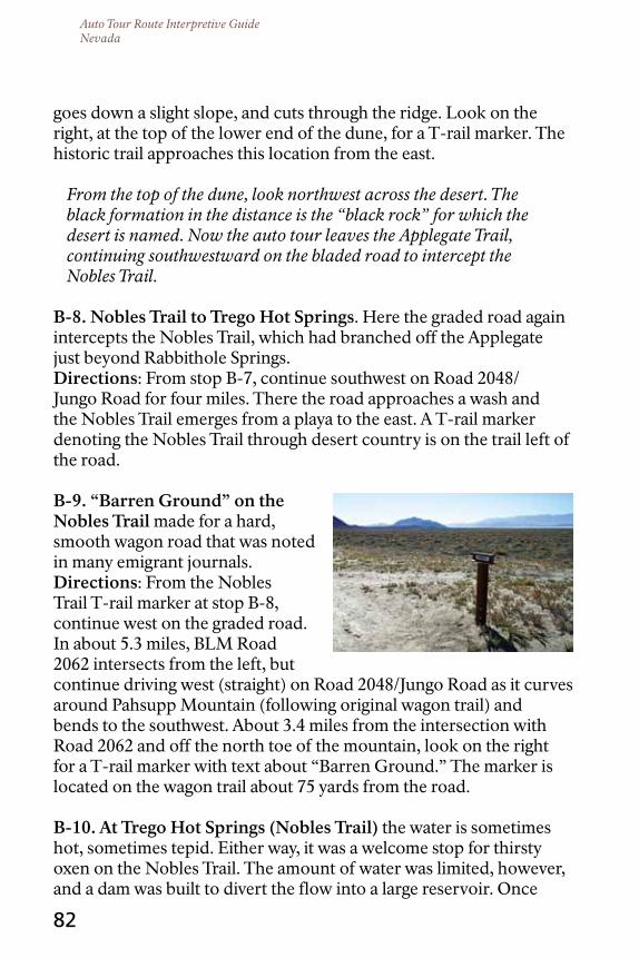
Auto Tour Route Interpretive GuideNevada
82
goes down a slight slope, and cuts through the ridge. Look on the right, at the top of the lower end of the dune, for a T-rail marker. The historic trail approaches this location from the east.
From the top of the dune, look northwest across the desert. The black formation in the distance is the “black rock” for which the desert is named. Now the auto tour leaves the Applegate Trail, continuing southwestward on the bladed road to intercept the Nobles Trail.
B-8. nobles trail to trego Hot Springs. Here the graded road again intercepts the Nobles Trail, which had branched off the Applegate just beyond Rabbithole Springs.directions: From stop B-7, continue southwest on Road 2048/Jungo Road for four miles. There the road approaches a wash and the Nobles Trail emerges from a playa to the east. A T-rail marker denoting the Nobles Trail through desert country is on the trail left of the road.
B-9. “Barren Ground” on the nobles trail made for a hard, smooth wagon road that was noted in many emigrant journals.directions: From the Nobles Trail T-rail marker at stop B-8, continue west on the graded road. In about 5.3 miles, BLM Road 2062 intersects from the left, but continue driving west (straight) on Road 2048/Jungo Road as it curves around Pahsupp Mountain (following original wagon trail) and bends to the southwest. About 3.4 miles from the intersection with Road 2062 and off the north toe of the mountain, look on the right for a T-rail marker with text about “Barren Ground.” The marker is located on the wagon trail about 75 yards from the road.
B-10. At trego Hot Springs (nobles trail) the water is sometimes hot, sometimes tepid. Either way, it was a welcome stop for thirsty oxen on the Nobles Trail. The amount of water was limited, however, and a dam was built to divert the flow into a large reservoir. Once

Auto Tour Route Interpretive GuideNevada
83
the water reached the reservoir, it was cool enough to use in cooking and bathing and for watering livestock. Today, Trego Hot Springs is a popular camping spot. Unfortunately, heavy use is taking a toll on the cultural and natural resources at the site. Please stay out of the sensitive dune areas, pack your trash, and confine campfires to existing fire rings.directions: From the “Barren Ground” site, continue southwest on Road 2048/Jungo Road, past Pahsupp Mountain and across a drainage at its flank. The road continues directly southwest. Ahead is the toe of Trego Mountain (labeled Old Razorback on some maps). The road turns gently to the west, curves sharply southwest again, and jogs west once more. As Jungo Road approaches the tip of Trego Mountain, a well defined dirt road enters from the right approximately four miles from stop B-9. Turn onto it and drive north toward the railroad track and the playa. South of the railroad track, the road intercepts another east/west road; turn right. The springs are ahead and to the left.
Advisory! Do not enter the playa here via the uncontrolled railroad grade crossing near the springs, where the line of sight along the tracks is limited and trains travel in excess of 70 mph. Accidents occur here. To access the playa safely, follow directions below to Gerlach, turn north on NV 34, and enter at the 3-Mile Access road. Do not enter the playa if it is moist. Get out and test the ground to make sure it is solid, or your vehicle could break through the dry crust and sink into the wet clay. Once on the playa, avoid dark areas that indicate moisture. More information on playa driving is available at the Bureau of Land Management visitor contact station in Gerlach.
From Trego Hot Springs, continue west on Road 2086, past the flank of Trego/Old Razorback Mountain, for about 16 miles to the intersection of NV 447, a paved highway. From the intersection, it is three miles north to Gerlach and three miles south to Empire. For fuel, food, lodging, automotive services, playa access, and

Auto Tour Route Interpretive GuideNevada
84
information about the Black Rock Desert, turn right to Gerlach.
B-11. Black rock Station (nV 447 west of Gerlach) is a Bureau of Land Management visitor contact station that offers National Parks and Federal Recreation Lands Passes for purchase, and restrooms, maps, brochures, interpretive panels, and a small exhibit. Open May–November, Wednesday-Sunday, 9 a.m.–5 p.m. For more information, call the station at 775-557-2503.
To intercept the Applegate Trail ahead in California, continue north from Gerlach on NV 447. Gerlach is 50 miles from the state border and nearly 85 miles from the next services at Cedarville. Further directions will be provided in the future Auto Tour Route Interpretive Guide, California: Over the Sierra Nevada.
OR, to return to the main California Trail along I-80 and the Humboldt River, turn south on NV 447 toward Empire. Fuel and groceries are available there, but the community offers no other services. It is 53 miles from Empire to the next services at Nixon, at the south end of Pyramid Lake.
In recognition of the beauty of that area, part of NV 447 is designated as the Pyramid Lake Scenic Byway.
B-12. Pyramid Lake Scenic Byway cultural center (709 State Street, nixon, nev.) is operated by the Pyramid Lake Paiute Tribe, whose ancestors resided in this region and battled militiamen and soldiers during the Pyramid Lake War. The center offers exhibits on Paiute culture and language. Summers, open Wednesday–Sunday, 10 a.m.–4:30 p.m.; closed Monday–Tuesday. Free.directions: Enter Nixon on NV 447 and cross the river. Continue through the community and turn right onto NV 446/Sutcliffe Way. The museum is a teepee-shaped building visible from the highway. Take the second right, toward the high school, then turn left

Auto Tour Route Interpretive GuideNevada
Pyramid Lake is named after the small pyramid-shaped rock feature seen on the distant shoreline to the right of center from this vantage point.
85
and proceed to the cultural center on the bench overlooking the community.
For a close-up view of Pyramid Lake, take an up-and-back drive along the NV 446 segment of the byway toward Sutcliffe. Return to Nixon and continue south on NV 447.
B-13. two Battles of Pyramid Lake (south of nixon, nV) were fought after white traders kidnapped and abused a pair of Paiute children. A Nevada historical sign tells the story.directions: Drive south from Empire for 59.5 miles, passing through Nixon. The sign is at a pullout on the left, overlooking the Truckee River.
From stop B-12, drive south 9.5 miles to Wadsworth. Turn right onto NV 427 and then enter the westbound lanes of I-80. To review your route options ahead, refer back to the Truckee Route and Beckwourth Trail descriptions on pages 74-76.
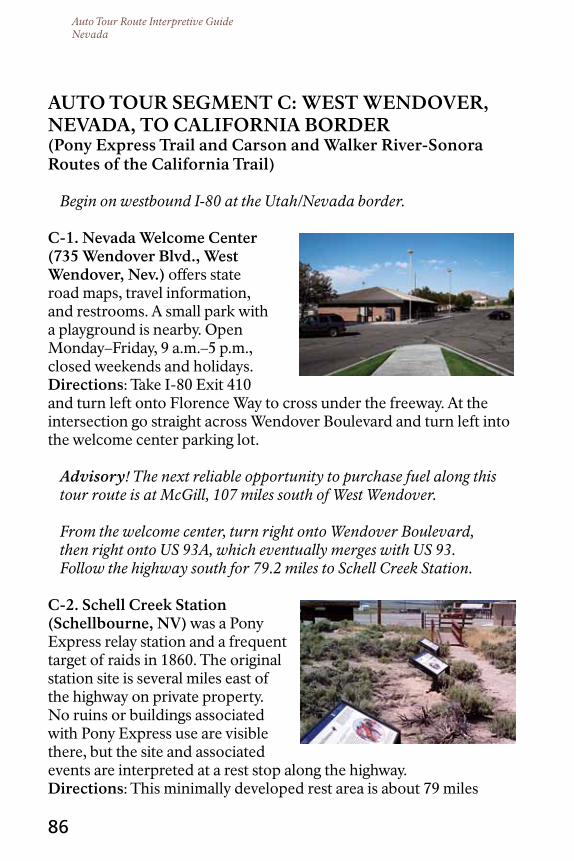
Auto Tour Route Interpretive GuideNevada
86
Auto tour SEGMEnt c: WESt WEndoVEr, nEVAdA, to cALIFornIA BordEr(Pony Express trail and carson and Walker river-Sonora routes of the california trail)
Begin on westbound I-80 at the Utah/Nevada border.
c-1. nevada Welcome center (735 Wendover Blvd., West Wendover, nev.) offers state road maps, travel information, and restrooms. A small park with a playground is nearby. Open Monday–Friday, 9 a.m.–5 p.m., closed weekends and holidays.directions: Take I-80 Exit 410 and turn left onto Florence Way to cross under the freeway. At the intersection go straight across Wendover Boulevard and turn left into the welcome center parking lot.
Advisory! The next reliable opportunity to purchase fuel along this tour route is at McGill, 107 miles south of West Wendover.
From the welcome center, turn right onto Wendover Boulevard, then right onto US 93A, which eventually merges with US 93. Follow the highway south for 79.2 miles to Schell Creek Station.
c-2. Schell creek Station (Schellbourne, nV) was a Pony Express relay station and a frequent target of raids in 1860. The original station site is several miles east of the highway on private property. No ruins or buildings associated with Pony Express use are visible there, but the site and associated events are interpreted at a rest stop along the highway.directions: This minimally developed rest area is about 79 miles

Auto Tour Route Interpretive GuideNevada
87
south of West Wendover, on the east side of the highway at the junction of US 93 and White Pine County Road 18. Two large wooden buildings—the only ones visible for miles along the highway—are directly across from the rest area. A Pony Express monument and interpretive exhibits are on the east side of the rest area.
The visit to stop C-3 entails a 23-mile round-trip drive on unpaved roads. When dry, the roads are negotiable by two-wheel drive passenger vehicles. To skip this stop and stay on the pavement, continue south on US 93 to Ely, turn west onto US 50, and consult entry C-4 for further directions.
Also of Interest. For eastbound travelers on the Pony Express Auto Tour Route, there is a Local Tour Route (LTR) that begins at Ibapah Road approximately 50 miles north of the Schell Creek Station, or about 25-30 miles south of Wendover, on US 93A. This route continues east to Ibapah, Utah, where travelers can follow the original Pony Express Trail east to Lehi and Salt Lake City. LTR highway signs are expected to be installed by summer of 2012 on US 93A for this turnoff.
Advisory! There are no fuel stops or convenience services along this route until Vernon, Utah, a distance of approximately 160 miles. Most of this road is sand and gravel. It is not maintained during the winter and can be unstable when wet. Come prepared for desert travel—bring extra water, food, and fuel.
c-3. Egan canyon (about 40 miles north of Ely), a twisting, narrow defile on the Pony Express route west of Schell Creek Station, was a worrisome ride for mail couriers, and for good reason: this is where US troops and Shoshone warriors clashed over two captive Pony Express station employees. Speculation abounds as to who lies buried in the small 19th-century graveyard beyond the head of Egan Canyon, but researchers agree that no Pony Express rider rests there. Please do not enter private
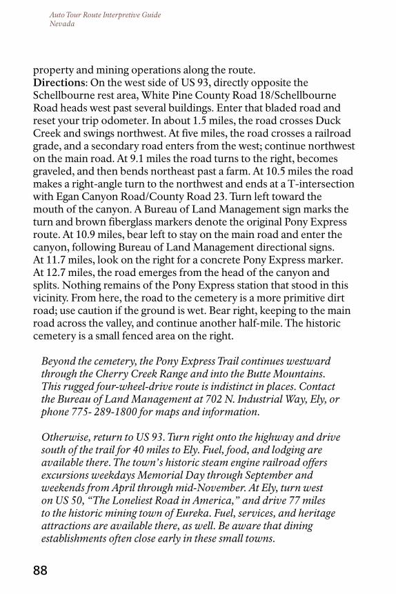
Auto Tour Route Interpretive GuideNevada
88
property and mining operations along the route.directions: On the west side of US 93, directly opposite the Schellbourne rest area, White Pine County Road 18/Schellbourne Road heads west past several buildings. Enter that bladed road and reset your trip odometer. In about 1.5 miles, the road crosses Duck Creek and swings northwest. At five miles, the road crosses a railroad grade, and a secondary road enters from the west; continue northwest on the main road. At 9.1 miles the road turns to the right, becomes graveled, and then bends northeast past a farm. At 10.5 miles the road makes a right-angle turn to the northwest and ends at a T-intersection with Egan Canyon Road/County Road 23. Turn left toward the mouth of the canyon. A Bureau of Land Management sign marks the turn and brown fiberglass markers denote the original Pony Express route. At 10.9 miles, bear left to stay on the main road and enter the canyon, following Bureau of Land Management directional signs. At 11.7 miles, look on the right for a concrete Pony Express marker. At 12.7 miles, the road emerges from the head of the canyon and splits. Nothing remains of the Pony Express station that stood in this vicinity. From here, the road to the cemetery is a more primitive dirt road; use caution if the ground is wet. Bear right, keeping to the main road across the valley, and continue another half-mile. The historic cemetery is a small fenced area on the right.
Beyond the cemetery, the Pony Express Trail continues westward through the Cherry Creek Range and into the Butte Mountains. This rugged four-wheel-drive route is indistinct in places. Contact the Bureau of Land Management at 702 N. Industrial Way, Ely, or phone 775- 289-1800 for maps and information.
Otherwise, return to US 93. Turn right onto the highway and drive south of the trail for 40 miles to Ely. Fuel, food, and lodging are available there. The town’s historic steam engine railroad offers excursions weekdays Memorial Day through September and weekends from April through mid-November. At Ely, turn west on US 50, “The Loneliest Road in America,” and drive 77 miles to the historic mining town of Eureka. Fuel, services, and heritage attractions are available there, as well. Be aware that dining establishments often close early in these small towns.

Auto Tour Route Interpretive GuideNevada
89
US 50 from Eureka to Austin, Nevada, parallels the route of the Pony Express National Historic Trail but lies many miles south of the original trail corridor. To intercept the trail in Diamond Valley north of Eureka, follow the directions to stops C-4 (about 33 miles one way, including 17 miles on bladed roads, no services) and/or C-5 (about 18 miles one way, all paved). Otherwise, continue west on US 50 through Austin and skip ahead to C-6.
c-4. diamond Springs monument (northwest of Eureka) commemorates the Pony Express horse “What?” and rider George Scovell. This visit entails a 66-mile round-trip drive, about half of that on bladed dirt roads that, when dry, are typically suitable for two-wheel-drive passenger vehicles. Nothing remains of the original Diamond Springs Pony Express station; however, Telegraph Canyon, where the attack on horse and rider occurred, is near the monument and can be explored.directions: Continue from Eureka on westbound US 50. If the ground is wet, skip to C-5; otherwise, to continue to the monument site, turn right on NV 278 and drive 16 miles on a long, northwesterly straightaway. Where the highway begins—a broad curve to the west—look for an unpaved, bladed road (Pony Express Trail Road) on the right. If the road is dry, turn there and drive north four miles. The road forks; bear right, to the northeast. Follow this road 11 miles to its end. Turn left (north), and drive two miles to the Diamond Springs monument, on the right side of the road, across from a ranch headquarters. Please do not trespass on private property. From the monument, the Pony Express National Historic Trail branches off to the right and turns east into Telegraph Canyon, where the horse and rider were shot. This road into the canyon requires four-wheel-drive, but it can be explored on foot. After your visit, return to NV 278. There, turn right and drive two miles to visit the Garden Pass interpretive site, stop C-5, or turn left to resume your tour along westbound US 50.
c-5. Garden Pass Interpretive Site (northwest of Eureka) was crossed by the Pony Express; interpretive exhibits at a roadside
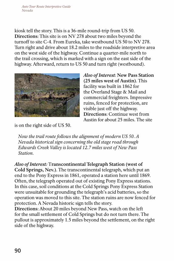
Auto Tour Route Interpretive GuideNevada
90
kiosk tell the story. This is a 36-mile round-trip from US 50.directions: This site is on NV 278 about two miles beyond the turnoff to site C-4. From Eureka, take westbound US 50 to NV 278. Turn right and drive about 18.2 miles to the roadside interpretive area on the west side of the highway. Continue a quarter-mile north to the trail crossing, which is marked with a sign on the east side of the highway. Afterward, return to US 50 and turn right (westbound).
Also of Interest: new Pass Station (25 miles west of Austin). This facility was built in 1862 for the Overland Stage & Mail and commercial freighters. Impressive ruins, fenced for protection, are visible just off the highway.directions: Continue west from Austin for about 25 miles. The site
is on the right side of US 50.
Now the trail route follows the alignment of modern US 50. A Nevada historical sign concerning the old stage road through Edwards Creek Valley is located 12.7 miles west of New Pass Station.
Also of Interest: Transcontinental telegraph Station (west of cold Springs, nev.). The transcontinental telegraph, which put an end to the Pony Express in 1861, operated a station here until 1869. Often, the telegraph operated out of existing Pony Express stations. In this case, soil conditions at the Cold Springs Pony Express Station were unsuitable for grounding the telegraph’s acid batteries, so the operation was moved to this site. The station ruins are now fenced for protection. A Nevada historic sign tells the story.directions: About 20 miles beyond New Pass, watch on the left for the small settlement of Cold Springs but do not turn there. The pullout is approximately 1.5 miles beyond the settlement, on the right side of the highway.

Auto Tour Route Interpretive GuideNevada
91
c-6. cold Springs Pony Express Station (west of cold Springs, nev.) was roofless but had thick stone walls with gun ports for defense against attack. The station keeper was slain during one skirmish and rider José Zowgaltz also died here. A two-mile hiking trail leads from the roadside interpretive kiosk to the station’s ruins. Please do not climb on or try to repair the ruins.directions: Continue west on US 50 to milepost 80, about two miles beyond the settlement of Cold Springs and roughly a half-mile past the telegraph station. The kiosk pullout is on the left side of the highway. The trailhead is between the kiosk and the restroom. Carry water, and allow two hours for the walk and visit to the station ruins.
c-7. Second cold Springs Pony Express Station (west of cold Springs Station) served the Pony Express for five months in 1861. The first station (see entry C-6), which was also a stop for the overland stage, was built on a hill. The operation was moved to this lower location to accommodate the daily arrivals and departures of the stage. Station ruins are fenced for protection.directions: From Cold Springs Station, continue west for 0.2 mile on US 50. The pullout is on the right side of the highway.
About 10 miles west of Second Cold Springs Station, US 50 passes directly over the former site of the Middlegate Pony Express Station.
c-8. Sand Spring Station (Sand Mountain recreation Area west of Middlegate), built in 1860, is a remarkable stone ruin near the foot of scenic Sand Mountain, an enormous white sand dune popular with all-terrain vehicle enthusiasts. Like the structure at Cold
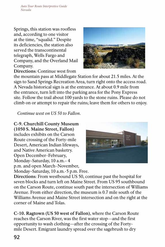
Auto Tour Route Interpretive GuideNevada
92
Springs, this station was roofless and, according to one visitor at the time, “squalid.” Despite its deficiencies, the station also served the transcontinental telegraph, Wells Fargo and Company, and the Overland Mail Company.directions: Continue west from the mountain pass at Middlegate Station for about 21.5 miles. At the sign to Sand Springs Recreation Area, turn right onto the access road. A Nevada historical sign is at the entrance. At about 0.9 mile from the entrance, turn left into the parking area for the Pony Express site. Follow the trail about 100 yards to the stone ruins. Please do not climb on or attempt to repair the ruins; leave them for others to enjoy.
Continue west on US 50 to Fallon.
c-9. churchill county Museum (1050 S. Maine Street, Fallon) includes exhibits on the Carson Route crossing of the Forty-mile Desert, American Indian lifeways, and Native American basketry. Open December–February, Monday–Saturday, 10 a.m.– 4 p.m. and open March–November, Monday–Saturday, 10 a.m.-5 p.m. Free.directions: From westbound US 50, continue past the hospital for seven blocks and turn left on Maine Street. From US 95 southbound on the Carson Route, continue south past the intersection of Williams Avenue. From either direction, the museum is 0.7 mile south of the Williams Avenue and Maine Street intersection and on the right at the corner of Maine and Tolas.
c-10. ragtown (uS 50 west of Fallon), where the Carson Route reaches the Carson River, was the first water stop—and the first opportunity to wash clothing—after the crossing of the Forty-mile Desert. Emigrant laundry spread over the sagebrush to dry
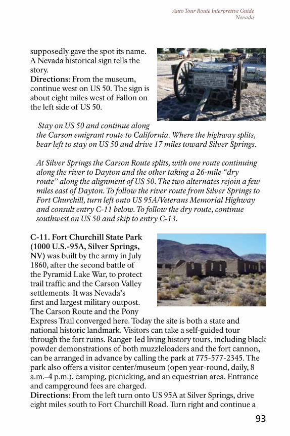
Auto Tour Route Interpretive GuideNevada
93
supposedly gave the spot its name. A Nevada historical sign tells the story.directions: From the museum, continue west on US 50. The sign is about eight miles west of Fallon on the left side of US 50.
Stay on US 50 and continue along the Carson emigrant route to California. Where the highway splits, bear left to stay on US 50 and drive 17 miles toward Silver Springs.
At Silver Springs the Carson Route splits, with one route continuing along the river to Dayton and the other taking a 26-mile “dry route” along the alignment of US 50. The two alternates rejoin a few miles east of Dayton. To follow the river route from Silver Springs to Fort Churchill, turn left onto US 95A/Veterans Memorial Highway and consult entry C-11 below. To follow the dry route, continue southwest on US 50 and skip to entry C-13.
c-11. Fort churchill State Park (1000 u.S.-95A, Silver Springs, nV) was built by the army in July 1860, after the second battle of the Pyramid Lake War, to protect trail traffic and the Carson Valley settlements. It was Nevada’s first and largest military outpost. The Carson Route and the Pony Express Trail converged here. Today the site is both a state and national historic landmark. Visitors can take a self-guided tour through the fort ruins. Ranger-led living history tours, including black powder demonstrations of both muzzleloaders and the fort cannon, can be arranged in advance by calling the park at 775-577-2345. The park also offers a visitor center/museum (open year-round, daily, 8 a.m.–4 p.m.), camping, picnicking, and an equestrian area. Entrance and campground fees are charged.directions: From the left turn onto US 95A at Silver Springs, drive eight miles south to Fort Churchill Road. Turn right and continue a

Auto Tour Route Interpretive GuideNevada
94
mile. The park entrance is on the left.
c-12. Buckland Station (near Fort churchill State Park) served the Pony Express before Fort Churchill was built, but no buildings from the Pony Express era remain. The two-story historic building standing at the site was constructed with material salvaged from the fort after its closure in
1869. On the left side of the parking lot is a stainless steel post; the original Pony Express station was 231 feet northeast of the post. Across the street from Buckland Station is the former orchards and stables area, which today is a day-use picnic and exhibit area with a display of 19th-century farm equipment.directions: From Fort Churchill State Park, return to US 95A, turn right and drive 0.6 mile. The site is on the left side of the road before the bridge.
From Buckland Station you can:
Return to the US 95 intersection and turn left onto Road 2B/Churchill Road toward Fort Churchill State Park. At the park entrance, stay right instead of entering the park, and drive 16 miles on the unpaved road along the Carson River to US 50. This road follows the Carson River wagon route. At US 50, turn left and continue into Dayton. Consult entry C-13 for further directions.
OR, to stay on pavement, turn right and go north on US 95A to Silver Springs. Turn left on US 50 and drive southwest toward Dayton. Proceed to stop C-13.
Dayton, the site of Nevada’s first gold strike, is full of historic properties. This auto tour route guide lists only those sites related to the Pony Express and emigrant trails, but a walking-tour guide to all the town’s historic properties, including buildings that existed when the emigrants and the Pony Express passed through, is available at the Dayton Cemetery.

Auto Tour Route Interpretive GuideNevada
95
c-13. dayton’s historical past is commemorated by a monument and plaque honoring this “stopping place on the river for California-bound pioneers,” and by a Nevada historical sign with information about 19th-century Chinese inhabitants of the town.directions: Drive south on US 50 to the traffic light at Main Street. The monuments are in front of a service station at the northeast corner (on the left) of the intersection. Main Street was once part of the wagon trail to California.
c-14. All that remains of the dayton Pony Express Station (Main Street, dayton) is a freestanding rock wall. A Nevada historical sign is nearby and a granite Pony Express monument are across the street at the corner of Main and Pike.directions: Turn right (west, away
from the river) onto Main Street at the traffic light; drive one block and park. Cross to the south side of Main and walk past the historic Union Hotel, then look in the narrow space between 85 W. Main and the adjacent building. The lone wall stands in the gap, perpendicular to the street. It is on private property; please do not trespass or disturb residents of adjacent buildings. The sign and monument are located at the parking lot on the north side of the street. c-15. the california and Pony Express trails (cemetery road, dayton) climb a bluff at the west edge of town. A gray T-rail marker is located at the top of the bluff, and trail swales are visible. This is a short but steep, rough climb on an unpaved road. Hike or use four-wheel drive.directions: Continue west on Main Street. Where Main curves to the left and becomes Cemetery Road, a Nevada historical sign commemorates an emigrant-era trading post called Hall’s Station.

Auto Tour Route Interpretive GuideNevada
View Down Six-Mile Canyon, Virginia City. Courtesy University of
Nevada, Reno Library.
96
Continue up Cemetery Road to its hairpin turn at the town water tower. There at the turn, an unpaved road—the Pony Express and emigrant trail—leaves the pavement and climbs the bluff. Follow the right branch of the gravel road to the top of the bench, where multiple wagon swales and ruts are visible. The trail corridor parallels the power line. Return to the pavement and turn right.
c-16. dayton cemetery (cemetery road, dayton) was established in 1851 near the emigrant road. A Nevada state historical sign can be found at the entrance.directions: At the hairpin turn, stay on the pavement and continue to the end of the road. Explore the historic cemetery and pick up a free
walking tour guide to the town.
Return to Main Street and turn right on US 50 toward Carson City.
Also of Interest: Virginia city, Gold Hill, and Silver city. Discovery of Nevada’s rich deposits of silver and gold enticed thousands of fortune hunters, including Mark Twain, to travel the
California Trail during the 1850s and 1860s. Virginia City—a Wild West mining town that grew up around the fabulous Comstock Lode, today—is a popular tourist destination. The scenic ghost towns of Gold Hill and Silver City are of interest, too.directions: From Dayton, drive westerly 3.5 miles on US 50. Turn right onto NV 341; where the highway splits, bear left, keeping to the main road, onto NV 342. Drive seven miles through Silver City and Gold Hill to Virginia City. Allow two to three hours to explore Virginia City. Afterward, return to US 50 and turn west to Carson City.
To view Pony Express markers and monuments at Carson City, turn left from US 50 onto Carson Street/US 395 and drive five blocks. The Nevada State Museum, a one-time U.S. Mint where $49 million of Nevada silver and gold was struck into coin, is on

Auto Tour Route Interpretive GuideNevada
97
the right at the southwest corner of Carson and Robinson. The markers and monuments are in front of the museum.
Continue south on Carson Street/US 395. Just a few miles ahead is another decision point:
To leave the trails, drive along the shore of Lake Tahoe, and rejoin the Pony Express Trail at Stateline, Nevada. Go south from the state museum on Carson Street/US 395 for about 2.5 miles. After passing the junction with Snyder Avenue/NV 518, move to the right lane and bear right onto US 50, the Lake Tahoe-Eastshore Drive National Scenic Byway. Drive 20 miles to the junction of Kingsbury Grade and US 50, where the tour route rejoins the Pony Express National Historic Trail. About a half-mile beyond the junction, look to the left (opposite the golf course) to see a white two-story building that was part of Friday’s Pony Express Station. (The property is privately owned; please do not trespass.) On entering Stateline a half-mile ahead, watch on the left for
the bronze Pony Express statue located in front of a casino. The Pony Express Trail crosses the state line into California just beyond the casino. Further directions will be provided in the future Auto Tour Route Interpretive Guide ,California: Across the Sierra Nevada.
OR, to follow the Pony Express Trail and the Carson Route along the Carson River, continue south on Carson Street/ US 395 and follow directions for entry C-17 below.
c-17. Mormon Station State Historic Park (2295 Main Street, Genoa, nV) is the site of a post established by Mormons in 1850 for trade with emigrants on the Carson Route. Nevada’s first permanent settlement, Genoa, soon grew up around “Mormon Station.” The

Auto Tour Route Interpretive GuideNevada
98
visitor center and reconstructed stockade are open mid-May to mid–October, Wednesday–Sunday, 10 a.m.-4 p.m. Entrance to the stockade is free. Admission to the museum/visitor center, with exhibits on the California and Pony Express trails, is $1; children under age 13 are admitted free. A kiosk near the park entrance provides information about the Pony Express, the emigrant experience, and pioneer life, and a T-rail marker is nearby. An interpretive wayside exhibit describes emigrants’ relief at having crossed the Great Basin.directions: From the Nevada State Museum, drive south on US 395 for about 11.5 miles. Turn right onto Genoa Lane and continue about four miles to Genoa. Turn right onto Main Street. The entrance to Mormon Station State Park is a half-block ahead on the right side of the street.
c-18. Genoa courthouse Museum (2304 Main Street, Genoa) exhibits cover the emigration experience, Pony Express, pioneer life, Washo Indian basketry, and more. Open daily, May–October, 10 a.m.–4:30 p.m. A modest admission is charged; children under age seven are admitted free.directions: From Mormon Station, cross to the west side of Main Street. At the corner, in front of the volunteer fire department, note the granite Pony Express monument that commemorates the Genoa Home Station. Walk north to the museum; an older Pony Express monument is located there.
Also of Interest: Snowshoe thompson Monuments and Grave. John “Snowshoe” Thompson, who emigrated from Norway as a child, drove a herd of cattle to California in 1851 when he was 24 years old. Instead of finding his fortune in the gold fields, he made his name as good as

Auto Tour Route Interpretive GuideNevada
99
gold by steadfastly carrying mail through the Sierra Nevada between Genoa and Placerville in the dead of winter for 20 years. Thompson made his 180-mile round-trip deliveries, alone and unarmed, two to four times a month on 10-foot-long homemade skis, thereby earning his nickname “Snowshoe.” A statue of Snowshoe stands at Mormon Station State Park at the corner of Main Street and Genoa Lane, and a plaque in his tribute is in front of the museum. His grave, with a marble headstone depicting crossed skis, is at the Genoa Cemetery north of town on Jacks Valley Road. Read the remarkable story of Snowshoe Thompson, “Viking of the Sierra,” at www.snowshoethompson.org. c-19. Walley’s Hot Springs (nV 206, one mile south of Genoa) was an expensive resort built in 1862 to cater to miners, who needed a hot soak after a hard day in the silver and gold mines around Virginia City. The Carson Route of the California Trail went through the springs area. Today the property remains a privately owned spa and timeshare. A Nevada historical sign near the entrance tells the story of the spa; trails-era buildings now serve as guest rooms and administrative offices. A Pony Express marker and a T-rail stand in front of the 1864 dinner house.directions: From Mormon Station, go south on NV 206/Foothill Road for about a mile. The resort is on the left side of the road. Go into the southernmost entrance and turn left into parking. During your visit, remember that this private resort is open to trail visitors by permission of the owner. Please be considerate of resort guests.
The Pony Express Trail splits beyond Walley’s Hot Springs. The south alternate continues south and enters California near Fredericksburg, then swings west and crosses the Sierra Nevada at Luther Pass. This route was used only during the first six weeks of the Pony Express operations. The north alternate, the main Pony Route, goes west up the Kingsbury Grade and over Daggett Pass to Stateline, on the Nevada/California border. The two branches rejoin south of Lake Tahoe near Meyers, California. Tour choices

Auto Tour Route Interpretive GuideNevada
100
here are:To take a scenic 11-mile drive over Daggett Pass following the main (north) Pony Express route into Stateline, turn left from Walley’s Hot Springs and continue south toward Mottsville; then turn right onto NV 207. The route is paved but steep and twisting. At the junction with NV 207 with US 50, turn left and continue into Stateline. Note the Pony Express statue near the Nevada/California border at Stateline. Further directions will be provided in the future Auto Tour Route Interpretive Guide, California: Across the Sierra Nevada.
OR, to follow the initial (south) Pony Express alternate and the Carson Route into California, continue south from Walley’s Hot Springs on NV 206 through Mottsville. Approximately seven miles south of Mottsville, beyond Sheridan, turn right onto Fredericksburg/Foothill Road and enter California. Drive three miles to NV 88 and turn right onto Emigrant Trail Road/Carson Pass National Scenic Byway. Further directions will be provided in the future Auto Tour Route Interpretive Guide, California: Across the Sierra Nevada.
OR, to join the Walker River-Sonora Route into California, continue south from Walley’s Hot Springs on NV 206 for about a mile. Turn left onto NV 757, then right onto US 395. Just ahead, the highway splits. Bear left to stay on US 395 and conclude your trip with entry C-21.
c-20. carson Valley Museum and cultural center (1477 uS 395 n, Gardenerville, nV) features American Indian murals depicting the lifeways of the Washoe people, and exhibits on the history of the Carson Valley. Open year-round, Monday–Saturday, 10 a.m.–4 p.m. A modest admission is charged;
children under age seven are admitted free.

Auto Tour Route Interpretive GuideNevada
J. Goldsborough Bruff’s 1849 drawing, “Descent from Mud Lake Basin to reach High Rock Cañon.” Courtesy Huntington Library.
101
directions: Take US 395 southeast to Gardnerville. The highway becomes Main Street. Turn left on High School Street and enter the parking lot on the north side of the street. From Gardnerville, continue southwest on US 395 into California at Topaz Lake. Further directions will be provided in the future Auto Tour Route Interpretive Guide, California: Across the Sierra Nevada.
This ends the Auto Tour Route of the California and Pony Express National Historic Trails across Nevada.
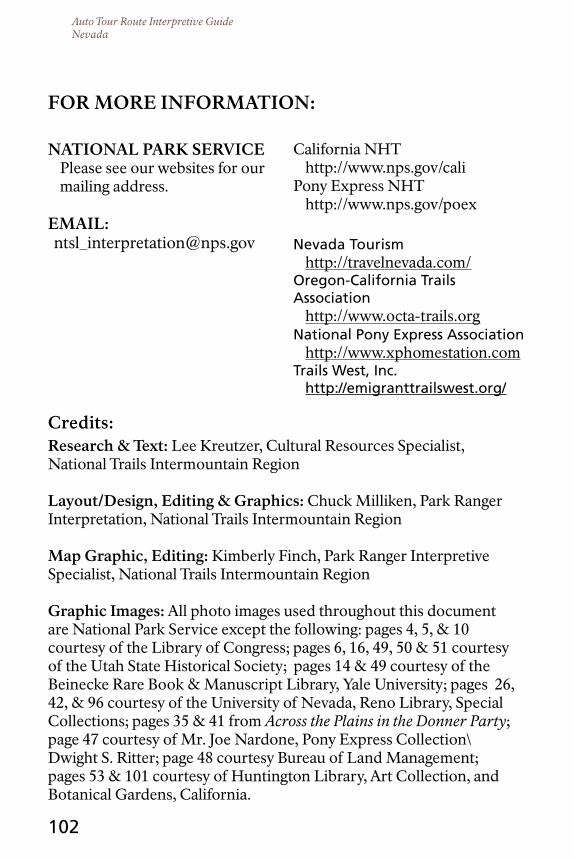
Auto Tour Route Interpretive GuideNevada
102
credits:research & text: Lee Kreutzer, Cultural Resources Specialist, National Trails Intermountain Region
Layout/design, Editing & Graphics: Chuck Milliken, Park Ranger Interpretation, National Trails Intermountain Region
Map Graphic, Editing: Kimberly Finch, Park Ranger Interpretive Specialist, National Trails Intermountain Region
Graphic Images: All photo images used throughout this document are National Park Service except the following: pages 4, 5, & 10 courtesy of the Library of Congress; pages 6, 16, 49, 50 & 51 courtesy of the Utah State Historical Society; pages 14 & 49 courtesy of the Beinecke Rare Book & Manuscript Library, Yale University; pages 26, 42, & 96 courtesy of the University of Nevada, Reno Library, Special Collections; pages 35 & 41 from Across the Plains in the Donner Party; page 47 courtesy of Mr. Joe Nardone, Pony Express Collection\Dwight S. Ritter; page 48 courtesy Bureau of Land Management; pages 53 & 101 courtesy of Huntington Library, Art Collection, and Botanical Gardens, California.
For MorE InForMAtIon:
nAtIonAL PArK SErVIcEPlease see our websites for our mailing address.
EMAIL:[email protected]
California NHThttp://www.nps.gov/cali
Pony Express NHThttp://www.nps.gov/poex
Nevada Tourismhttp://travelnevada.com/
Oregon-California Trails Association
http://www.octa-trails.orgNational Pony Express Association
http://www.xphomestation.comTrails West, Inc.
http://emigranttrailswest.org/
Glue the pocket for the folded map insert here. Pocket should be one-half inch shorter than the folded map so that the map sticks out of the pocket.
Did you find this interpretive guide useful? Is it engaging, are directions accurate?
To help us improve these guides, please send your thoughts and suggestions to: Please see our websites for mailing address or email your thoughts to [email protected].
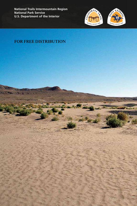
National Trails Intermountain RegionNational Park ServiceU.S. Department of the Interior
For FrEE dIStrIButIon