national wetlands inventory - united … palm...the national wetlands inventory. the following is a...
TRANSCRIPT
Introduction
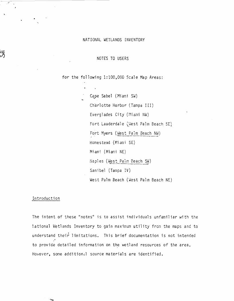
NATIONAL WETLANDS INVENTORY
NOTES TO USERS
for the following 1 :100,000 Scale Map Areas :
Cape Sabel (Miami SW)
Charlotte Harbor (Tampa III)
Everglades City (Miami NW)
Fort Lauderdale 0,aest Palm Beach. SE
Fort Myers (West Palm Beach NW)
Homestead (Miami SE)
Mi am
(Miami
NE)
Naples (West Palm Beach SW )
Sanibel (Tampa IV)
West Palm Beach ('nest Palm Beach NE)
However, some additional source materials are identified .
The intent of these "notes" is to assist individuals unfamiliar with the
Piational Wetlands Inventory to gain maximum utility from the maps and to
understand their limitations . This brief documentation is not intended
to provide detailed information on the wetland resources of the area .

Map Production
The maps were prepared by stereoscopic photo-interpretation of 1 :80,000
scale quad centered color infrared photography taken in 1972 and 1973 .
Photo-interpretation and cartography was accomplished by Martel Labs, Inc .,
St . Petersburg, Florida . Partial funding for the project was supplied by
the Jacksonville District, U.S . Army Corps of Engineers.
Location
Ecoregions
l ima to
tr
The area covered by this report extends fro(
Florida Bay i n the south to
the approximate center of Lake Okeechobee in the north and from the Atlantic
to the Gulf coasts .
The southeastern portion of the study area is located in the Humid Tropical
Domain ; Savanna Division ; Everglades Province . The northwestern portion is
in the Humid Temperate Domain ; Subtropical Division, Outer Coastal Plain
Province ; Beech- Sweetgum-Magnolia-Pine-Oak Forest .
For additional
information
consult Bailey, Robert G .
191' 8 .
Description of the ecoregions of the
United States .
USDA Forest Service .
Inte rntn .
Reg .
Ogden,
Utah .
77p .
i climate of the area i s characterized by long, warn and humid summers and
i winters. Precipitation occurs during all seasons but based on mean

Area Description
southward. .from Lake Okeechobee .
monthly totals, a rainy season occurs from June to October and relatively
dry season occurs from November to April . Annual rainful averages around
60 inches although there is some local variation . The growing season is
long with a frost free period of eleven months throughout much of the area .
Extensive wetlands constitute the predominant hydrological , geological , and
biological features of. the region .
The land surface is nearly flat seldom
exceeding 20 feet above sea level . Except for the excessively drained to
somewhat poorly drained soils of the coastal ridge, the soils generally are
poorly to very poorly drained . Many of the soils are organic . In fact, the
Everglades is the iargest,single body of organic soils in the world . The
soil characteristics and abundant rainfall, pramote a diversity of wetland
types .
Human population densities ar,e sparse except along the coastal ridge where
rapid and continuous urbanization is causing wholesale conversion of natural
habitats to an urban environment . Large acreages of wetlands have been
drained, filled, or excavated for housing and commercial expansion . Displace-
ment of agricultural by urbanization may also be influential in causing increased
utilization of orga : .ic (wetland) soils for the production of sugar cane, winter
vegetables, and beef cattle .
The major area of agricultural
devel oprient extends
In his now classic study, J . H . Davis (1943) described the vegetative
features of south Florida . For descriptive purposes, the area was divided

into seven physiographic regions : (1) Big Cypress ; (2) Southeastern Coast
and 10,000 Islands ; (3) Everglades ; (4) Miami Rock Ridge ; (5) Southern
Coast and Islands ; (6) Eastern Flatlands ; and (7) Western Flatlands .
Alexander and Crook (1973) made an in-depth evaluation of vegetative changes
in each region since Davis' report . It is suggested that those interested
in the phytogeography and successional trends of the area consult these
studies .
Wetland Cl assi fi -_ation
Wetland designations were made in accordance with Cowardin et al . 1977 .
Classification of Wetlands and Deeowater Habitats of the United States
(An Operational Draft) and for situations when strict adherence to the
classification was not possible, according to conventions developed by
the National Wetlands Inventory . The following is a listing of the
alphanumeric codes regularly appearing on the maps along with the wetland
types to which they correspond as well as representative plant species
constituents . No attempt has been made to list all possible combinations .
M1 ow
Marine,
subtidai, open ocean
Pen,ianently submerged area of open water .
Map Symbols
M2BB
Marine, intertidal, beaches or bars
Unvegetated beaches and bars exposed to the open ocean or gulf .

M2fi1
Marine,
i ntertidal , flats
Jnvegetated offshore flats .
E10W
Estuarine, subtidal , open water
inshore open water containing at least 0 .5 parts per thousand salinity .
E2EL
Estuarine, tntertidal , flat
Inshore flats periodically flooded by tides . Ofter, called salt flats
or pans .
El,AB6
Estuarine, subtidal , aquatic bed, unknown submergent
or
E2AB6
or Estuarine, intertida7, aquatic bed, unknown submercent
Estuarine grass beds . Vegetation includes manatee grass
(Syringodium filiformis ), shoal grass (Diplanthera vrrichtii ;3,
widgeon grass (Ru wia r,-,aritima ), seagrass Halo hila sip .)
and a variety of macrophytic algae .
E2EM5?
Estuarine, intertidal, er,iergent, narrow-Itleaved persistent,
. , irregularly flooded
Irregularly flooded salt marsh . Host often black needlerush
Juncus roemerianus -11 . Nay also include salt meadow ccrdgrass

S artina patens), Baker's cordgrass (Spart ina bakerii), smooth
11cordgrass S artina alterniflora ), salt grass - (Distichlis
spicata), glasswort (Sal icornia spp .) , sea bl i to
Sueda spp .) ,
and sal twort
Bati s mari ti,ma) .
E2SS3
Estuarine, intertidal, scrub/shrub, broad-leaved evergreen
Most often mangrove swamps vegetated by red mangrove (Rhizophora
mangle) , black mangrove (Avicennia germinans ) white mangrove
(Laguncuiari a racemosa ), and buttonvrood (Conocarpus erecta) .
Various water regimes may occur . To a lesser extent this designation
may also identify areas vegetated by saitbush (Baccharis
hal imi fol i a ) ,
waxmyrtl e
h1 ri ca
ceri fera ) ,
Brazilian
pepper
tree ~Sch i nus
terebi n thi fol ius ) ,
gumbo-limbo
(cursera
s imaruba) ,
and strangler fig -(Ficus aurea) .
ELF03
Estuarine, intertidal, forest, broad-leaved evergreen
Generally mangroves exceeding 6 meters in height . Water
regime often unknown ; u)
E2F04
Estuarine, intertidal, forest, needle-leaved evergreen
.1Former mangrove areas which have been invaded by Australian
pine Gasuarina equ setifolia) .

L1OW
Lacustrine, limnetic, open water
Freshwater bodies exceeding 2 meters in depth .
L20W
Lacustrine, littoral, open water
Freshwater bodies less than 2 meters in depth but exceeding
8 hectares iri size .
LIAB5
Lacustrine, 1 imnetic, aquatic bed, floating
Beds or mats of freshwater aquatic vegetation which float
freely on the surface . Plant species include water hyacinth
Eichornia crassipes ), water lettuce ~is tia strati otes), water
fern Salvinia rotundifolia ), and duckweeds Lemna spp .) .
L2AB5
Lacustrine, littoral , aquatic bed, float
Same as LlAB5 except for shallow water depth .
L2AB4
Lacustrine,
littoral, aquatic bed,
fl oat ; ng-l eaved
Rooted freshwater aquatic vegetation the leaves of which fon m~ ts
. A on
t"e water surface .
Species
include
lotus _( Nel ur1bo
l utea) ,
spatterdock ! ~uphar luteum ), and water lily P; , haea spp .) .

L2AB6
Lacustrine, littoral, aquatic bed, unknown submergent
Submerged mats of freshwater aquatic vegetation . May include
elodea Elodea densa ), hydrilla H drilla verticillata ), tape
grass (Val l i sneri a neotropical i s ) , pondweeds (Potamogeton spp .),
coontail (Ceratophyl lum demersum ) and water mil foil (Myriophyl ium
spP.) .
Rl0W Riverine, tidal , open water
That segment of coastal rivers which are tidally influenced but
have ocean derived sal ini ties of less than 0 .5 parts per thousand .
R20W Riverine, lower perennial , open water
Open unvegetated freshwater located within a natural or man-made
channel . Streams, rivers, drainages ditches, and canals are
placed i n this category .
R1AB5 Riverine, tidal , aquatic bed, floating
Mats of freshwater aquatic vegetation located within tidal channel .
Species cc iposi tion as for L1AB5 .
R2AB5 Riverine, lower perennial,-aquatic bed, floating
Same as RIAB5 except not under tidal influence .

}Si~iall shallow water bodies vegetated by water hyacinth, water
lettuce, duckweeds and other non-rooted aquatic vegetation .
Water regimes vary .
R1AB4 Riverine, tidal, aquatic bed, floating-leaved
As for L2AB4 except located within a tidal river channel .
R2AB4 Riverine, lower perennial , aquatic bed, fl oating-leaved
Same as above although without tidal influence .
RIAB6 Riverine, tidal, aquatic bed, unknown submergent
Same as L2AB6, however located within a tidal river channel .
R2AB6 Riverine, lower-perennial, aquatic bed, unknown submergent
Same as above except without tidal influence .
POW Pal us trine, open water
Freshwater areas less than 8 hectares in area or less than 2 meters
depth . Usually ponds, borrow pits, etc .
PAB5 Palustrine, aquatic bed, floating

PAB4
Pal ustrine, aquatic bed, floating-leaved
Small shallow water bodies vegetated by rooted vascular plants
having leaves which float at the surface such as water lily,
lotus,-- spatterdock or water shield Brasenia schreberi) .
PAB6
Pal ustrine, aquatic be!, unknown submergent
Submerged mats of aquatic vegetation found in small shallow
water bodies . Vegetation may or may not be rooted . Species
same as L2AB6 .
PEM5A
Palustrine, emergent, narrow-leaved, persistent, temporarily flooded
Tne veaeta ti en i s usually grass-like and these areas are often
referred to as "fresh meadows" . Much of this habitat type has
been modifier by ditching and flooding occurs briefly during
the growing season . Typical species inc,ude Carex spp , , beard
grass
(Andropegon v i rgin icus ) ,
beak
rushes
(Rhvnchospora micro-carpa),
cordgrass !Soartina ba kerii), torpedo grass (P an icum repens ), pennyworts
(Hydrocotyle spp .) and wire grass A,ristida sp .) . In the
Everglades area dominant vegetation within this classification
includes beard grass, muhly grass ;!1uhlenbercia filipes ),
(oxtail grass Setar a sp .), and sawgrass Cladi um jamaicense ) .
Note : This habitat type ~,,ay also be identified as "PEMIA" .
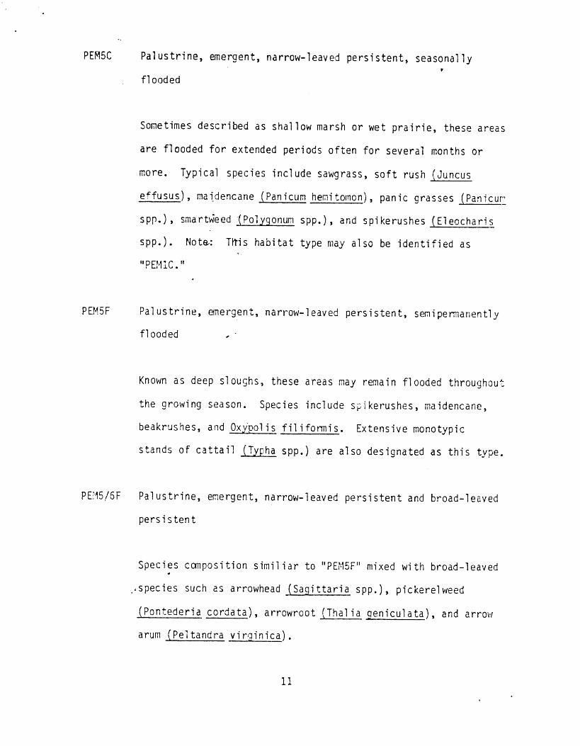
PEM5C
Palustrine, emergent, narrow-leaved persistent, seasonally
flooded
Sometimes described as shallow marsh or wet prairie, these areas
are flooded for extended periods often for several months or
more .
Typical species include sawgrass, soft rush tJuncus
effusus), maidencane Panicum hemitomon), panic grasses Panicur~
spp.),
smartHieed - Polygonum spp.),
and spi kerushes (El eocha ri s
spp .) . Note.: T1tis habitat type may also be identified as
~~ PE,11 I C . +~
PEM5F
Pal ustrine, emergent, narrow-1 eaved persistent, semi permanently
flooded
Known as deep sloughs, these areas may remain flooded throughout
the growing season . Species include s,ikerushes, maidencane,
beakrushes, and Oxypol is fil iformis .
Extensive monotypic
stands of cattail ? 1ha spp .) are also designated as this type .
PE`15/5F
Palustrine, emergent, narrow-leaved persistent and broad-leaved
persistent
Species composition s imi l i ar to "PEI-15F" mixed with broad-leaved
, .species such as arrowhead (Sagittaria spp.), pickerelweed
(Pontederia cordata ), arrowroot Thalia ceniculata ), and arrow
arum (Peltandra virginica) .

PS51C
Palustrine, scrub-shrub, broad-leaved deciduous, seasonally
flooded
Sometimes called shrub swamps, these areas are vegetated by
woody vegetation of less than 6 meters in height . Water regimes
vary from seasonal ly fl ooded
(C)
to semi permanentl y fl ooded
( F) .
Representative species are black willow Salix nigra), common
willow
Sal ix carol iniana ), Florida wil low
Sal ix floridana )
and bottonbush (Cephalanthus occiden t al is) .
PSS2C
Palustrine, scrub-shrub, needle-leaved deciduous, seasonally
flooded
Designation used to describe areas dominated by stressed or
imr<<ature cypress trees Taxodi um distichum) . Flooding usually
occurs for extended periods . In areas where flooding takes
place throughout the entire growing season, the semipermanently
fl,- oded
(F)
water regime
i s applied .
PSS3A
Palustrine, scrub-shrub, broad-leaved evergreen, temporarily
flooded
Areas dominated by a variety of evergreen shrubs and trees less
, , than 6 meters
tall .
Dorri nant species
include wax myrtle,
groundsel tree, Brazilian pepper tree . Everglades hammocks
with this designation are often dominated by red bay (Persea
12
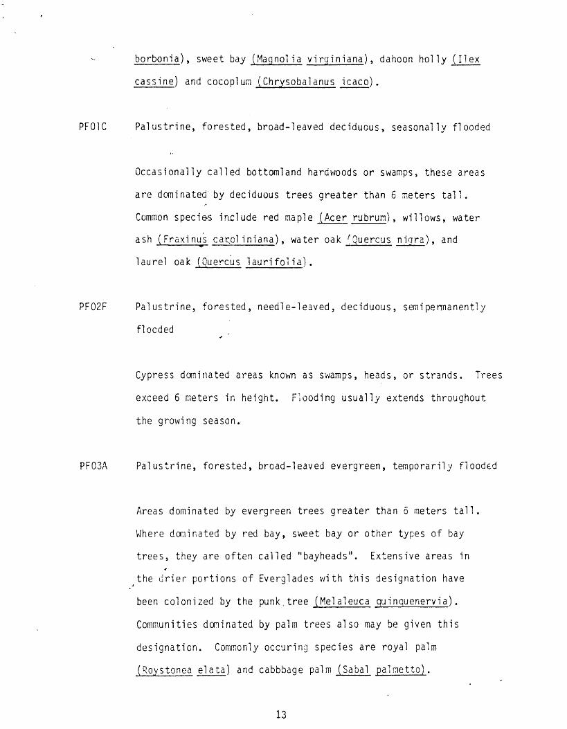
borbonia ), sweet bay (Magnolia vi rainiana ), dahoon holly (ilex
cassine ) and cocopium (Chrysobalanus ic aco) .
PFOIC
Pal ustrine, forested, broad-leaved deciduous, seasonally flooded
Occasionally called bottomland hardwoods or swamps, these areas
are dorm nated by deciduous trees greater than 6 meters tall .
Common species i n.cl ude red maple ( Acer rubrum), willows, water
ash
Fraxinus carol iniana ), water oak 'Quercus niara ), and
laurel
oak _ uuercus
1auri fol ia) .
PF02F
Palustrine, forested, needle-leaved, deciduous, s ,� ipermanently
fl ocded
Cypress dominated areas known as swamps, heads, or strands . Trees
exceed 6 meters in height . Flooding usually extends throughout
the growing season .
PFO3A
Palustrine, forested, broad-leaved evergreen, temporarily flooded
Areas dominated by evergreen trees greater than 6 meters tall .
Where domirated by red bay, sweet bay or other types of bay
trees, they are often called "bayheads" . Extensive areas in
the drier portions of Everglades with this designation have
been colonized by the punk,tree Melaleuca guinquenervia ) .
Communities dominated by palm trees also may be given this
designation . Commonly occuring species are royal palm
(R.oystonea elata )
and cabbbage palm
Sabal
ap lmett o~.
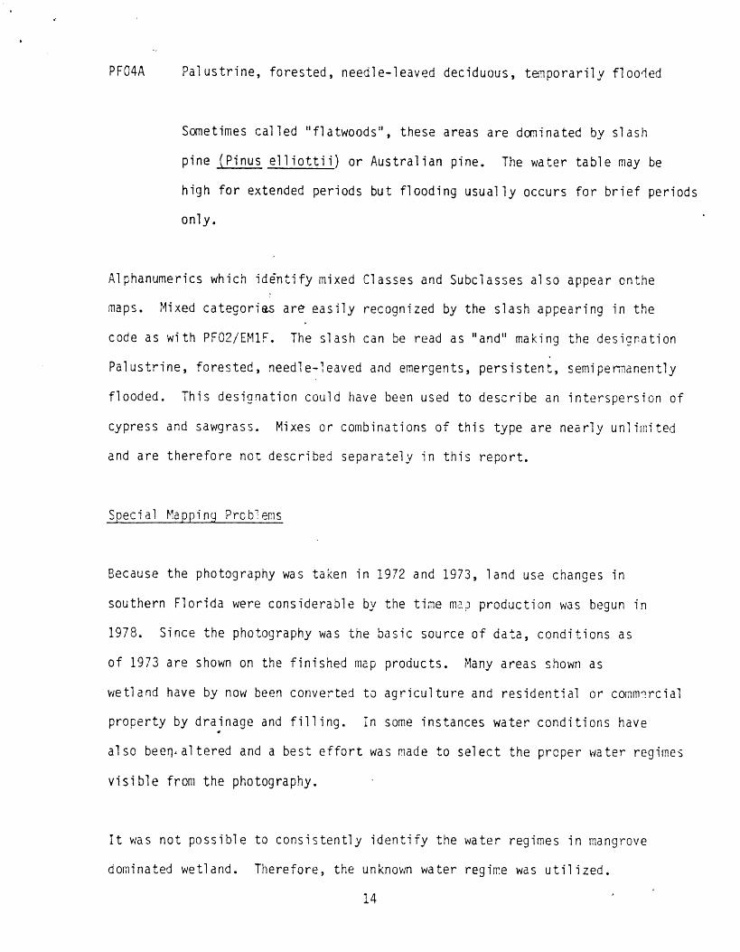
PF04A Palustrine, forested, needle-leaved deciduous, tenpo rarily flooded
Sometimes called "flatwoods",
pine
Pinus el l iotti i ) or Australian pine .
The water table may be
high for extended periods but flooding usually occurs for brief periods
only .
Specia l
Mapping Prcbl errs
these areas are dominated by slash
Al phanumerics which identify mixed Classes and Subclasses also appear onthe
maps . Mixed categories are easily recognized by the -slash appearing in the
code as with PFC2/EMIF . The slash can be read as "and" making
Palustrine, forested, needle-leaved and emergents, persistent,
flooded . This designation could have been used to describe an
cypress and sawgrass . Mixes or combinations of this type are
and are therefore not described separately in this report .
the designation
semi permanently
interspersion of
nearly unlimited
Because the photography was taken in 1972 and 1973, land use changes in
southern Florida were considerable by the time maP production was begun in
1978 . Since the photography was the basic source of data, conditions as
of 1973 are shown on the finished map products . Many areas shown as
wetland have by now been converted to agriculture and residential or comet-rcial
property by drainage and filling . In some instances water conditions have
al so been , al tered and a best effort was made to select the proper water regimes
visible from the photography .
It was not possible to consistently identify the water regimes in mangrove
dominated wetland . Therefore, the unknown water regime was utilized .
1 4

Additional Information
For additional information regarding any aspect of the wetland mapping, the user
is encouraged to-contact :
Regional Wetland Inventory Coordinator
U .S . Fish and Wildlife- Service
75 Spring Street,, SW
Atlanta, Georgia 3011,03