native native south dakota a travel guide to tribal lands 3 welcome to the land of the dakota,...
TRANSCRIPT

- SOUTH DAKOTA -NativeA TRAVEL GUIDE TO TRIBAL LANDS

RESERVATIONS
1 Cheyenne RiveR indian ReseRvation
2 CRow CReek indian ReseRvation
3 FlandReau santee indian ReseRvation
4 loweR BRule indian ReseRvation
5 Pine Ridge indian ReseRvation
6 RoseBud indian ReseRvation
7 sisseton-wahPeton oyate tRiBal lands
8 standing RoCk indian ReseRvation
9 yankton tRiBal lands
TRAILS
10 native ameRiCan sCeniC Byway
11 oyate tRail
Reservations & Tribal LandsCONTENTS
1 ReseRvations & tRiBal lands maP
2 intRoduCtion
4 RiCh CultuRe and heRitage
6 oCeti sakowin/the seven CounCil FiRes
8 milestones
10 visitoR guidelines
12 Cheyenne RiveR sioux tRiBe
16 CRow CReek sioux tRiBe
20 FlandReau santee sioux tRiBe
24 loweR BRule sioux tRiBe
28 oglala sioux tRiBe
32 RoseBud sioux tRiBe
36 sisseton wahPeton oyate
40 standing RoCk sioux tRiBe
44 yankton sioux tRiBe
48 landsCaPes & landmaRks
50 native ameRiCan aRt
60 Powwows & CeleBRations
64 tRiBal Casinos
66 tRiBal ContaCt listings
Pine Ridge Indian Reservation

NATIVE SOUTH DAKOTA A TRAVEL GUIDE TO TRIBAL LANDS2 3
WELCOME to the land of the Dakota, Lakota and Nakota. There are nine Native American tribes that call South Dakota home, and each of them has a unique story to tell. Working together, they welcome visitors into their communities in order to educate and to share. When visiting Native communities, you will experience genuine hospitality, discover authentic art, and hear about the fascinating history and unique culture of the people known by many as Sioux.
This guide is organized alphabetically, by tribe, and includes brief historical information, listings of attractions and events, and contact information. It also provides information about museums, art galleries and businesses where visitors can find authentic Dakota, Lakota and Nakota artworks to view and/or purchase.
The U.S. government officially recognized the Lakota as “Sioux” in 1825 and has applied this name to the Dakota, Lakota and Nakota in official documents ever since. The term Sioux is a fragment of the French and Ojibwa
word “nadouessioux,” which is believed to be a derogatory term meaning “little snakes.” The name may have resulted from a history of territorial conflicts between the Sioux and the Ojibwas. People of the Great Sioux Nation prefer the terms Dakota, Nakota and Lakota when referring to themselves as a people and a nation. These are the names of the group’s different dialects, regions and economies. The word “Sioux” appears in this publication when necessary, but efforts were made to use the more accepted terms of Dakota, Lakota and Nakota.
Information contained in this guide was taken from many sources. Because of that, there are inconsistencies in the spelling of Dakota, Lakota and Nakota words.
Please note that inclusion in this publication does not constitute an endorsement by the South Dakota Department of Tourism, nor do omissions indicate a statement or allusion to the merit of the organization so omitted.
= PROPERTY IS OFF TRIBAL LAND
Introduction

NATIVE SOUTH DAKOTA A TRAVEL GUIDE TO TRIBAL LANDS4 5
From rolling plains to majestic mountains, a diverse landscape decorates South Dakota. These lands also hold a diverse population. More than 71,000 Native Americans live in South Dakota.
Traditional creation stories place the nation’s birth in the Black Hills of South Dakota. Others say the people of the Seven Council Fires migrated to the area from the woodlands of Minnesota. Dakota, Lakota and Nakota customs hold the forces of nature as holy and emphasize the importance of balance among all things in the universe. This balance remains an instrumental piece of life, as do the cardinal virtues of “woksape” (wisdom), “woohitika” (bravery), “wowacintanka” (fortitude) and “wacantognaka” (generosity).
THE BUFFALO NATION
The Great Spirit Skan made us with bones from Stone, bodies from Earth, and souls from himself, Wind and Thunders. The gifts of Sun, Wisdom, Moon and Revealer gave us life. A council of the spirits named us Pte Oyate – Buffalo Nation – and told us to care for the spirits.
One day Spider sent Wolf to the Underworld to tell Tokahe that life would be easier on the surface of the earth. Tokahe ignored the warnings of the holy man, Tatanka, and led the people up through Wind Cave. Life there was hard, so Tatanka came to help – as a great, shaggy beast. Since then, the people have lived here with the buffalo.
Creation story courtesy of the South Dakota State Historical Society.
Rich Culture & Heritage
Bear Butte
Bison

NATIVE SOUTH DAKOTA A TRAVEL GUIDE TO TRIBAL LANDS6 7
1
2
4
Sisitonwan(camping among swamps)
Titonwan(camping on the plains)
Ihanktonwanna(camping at the little end)
Wahpetonwan(camping among leaves)
Mdewakantonwan(camping at spirit lake)
Ihanktonwan(camping at the end)
Wahpekute(leaf shooters)
5
6
7
3
W
S
N
E
LAKOTA-NAKOTA-DAKOTA OCETI SAKOWIN (SEVEN COUNCIL FIRES)
Used with permission from Native Discovery. Copyright Native Discovery 2007.
The people of the Oceti Sakowin call themselves Dakota, Lakota and Nakota which are dialectic distinctions between three major divisions of the Great Sioux Nation. The nine tribes named themselves, or each other, for the region they inhabited or after a particular characteristic or event. The tribes joined in an alliance for mutual protection and the Seven Council Fires, or Oceti Sakowin, emerged from the three divisions of the Great Sioux Nation.
SANTEE-DAKOTA: EASTERN
1 MDEWAKANTONWAN “SPIRIT LAKE PEOPLE”
2 WAHPEKUTES “SHOOTERS AMONG THE LEAVES”
3 WAHPETONWAN “DWELLERS AMONG THE LEAVES” WAHPETON
4 SISSETONWAN “PEOPLE OF THE FISH VILLAGE” SISSETON
YANKTON-NAKOTA: CENTRAL
5 IHANKTONWAN “DWELLERS AT THE END” YANKTONS
6 IHANKTONWANA “LITTLE DWELLERS AT THE END” YANKTONAIS
Oceti Sakowin – Seven Council
TETON-LAKOTA: WESTERN
7 TETONWAN “PEOPLE OF THE PRAIRIE” TETON
TETON-LAKOTA SUBDIVISIONS
A OGLALA “SCATTER THEIR OWN” PINE RIDGE RESERVATION
B KUL WACASA OYATE OR SICANGU “BURNT THIGH” ROSEBUD AND
LOWER BRULE RESERVATIONS
C HUNKPAPA “DWELLERS AT THE ENTRANCE” STANDING ROCK RESERVATION
D MNICOUJOU “PLANTS BY THE WATER” CHEYENNE RIVER RESERVATION
E SIHASAPA “BLACK FOOT” CHEYENNE RIVER RESERVATION
F OOHENUMPA “TWO KETTLES/TWO BOILINGS” CHEYENNE RIVER RESERVATION
G ITAZIPCO “SANS ARC OR NO BOWS” CHEYENNE RIVER RESERVATION
Fires
NATIVE SOUTH DAKOTA A TRAVEL GUIDE TO TRIBAL LANDS8 9
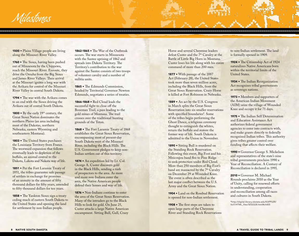
Horse and several Cheyenne leaders defeat Custer and the 7th Cavalry at the Battle of Little Big Horn in Montana. Custer loses his life along with his entire command of more than 200 men.
1877 • With passage of the 1887 Act (February 28), the United States took more than seven million acres, including the Black Hills, from the Great Sioux Reservation. Crazy Horse is killed at Fort Robinson in Nebraska.
1889 • An act by the U.S. Congress in March splits the Great Sioux Reservation into six smaller reservations with specified boundaries*. Some of the tribes begin performing the Ghost Dance, a religious ceremony thought to extinguish the whites, return the buffalo and restore the former way of life. South Dakota is admitted to the Union in November.
1890 • Sitting Bull is murdered on the Standing Rock Reservation. Following this event, Big Foot and his Mnicoujou band flee to Pine Ridge to seek protection under Red Cloud. More than 250 members of Big Foot’s band are massacred by the 7th Cavalry on December 29 at Wounded Knee. The event is often described as the last major conflict between the U.S. Army and the Great Sioux Nation.
1904 • Land on the Rosebud Reservation is opened for non-Indian settlement.
1908 • The first steps are taken to open large parts of the Cheyenne River and Standing Rock Reservations
to non-Indian settlement. The land is formally opened in 1909.
1924 • The Citizenship Act of 1924 naturalizes Native Americans born within the territorial limits of the United States.
1934 • The Indian Reorganization Act recognizes tribal governments as sovereign nations.
1973 • Members and supporters of the American Indian Movement (AIM) seize the village of Wounded Knee and occupy it for 71 days.
1975 • The Indian Self Determination and Education Assistance Act authorizes federal government agencies to enter into contracts with, and make grants directly to federally recognized Indian tribes. This authority gives tribes greater control over funding that affects their welfare.
1990 • Governor George S. Mickelson and representatives of the state’s nine tribal governments proclaim 1990 a Year of Reconciliation. A Century of Reconciliation is declared in 1991.
2010 • Governor M. Michael Rounds proclaims 2010 as the Year of Unity, calling for renewed efforts in understanding, cooperation and reconciliation among all races and cultures in South Dakota.
*http://digital.library.okstate.edu/KAPPLER/Vol1/HTML_files/SES0328.html#ch405
1500 • Plains Village people are living along the Missouri River Valley.
1760 • The Sioux, having been pushed out of Minnesota by the Chippewa, reach the Missouri River. Enroute, they drive the Omaha from the Big Sioux and James River Valleys. Their arrival at the Missouri ignites a long war with the Arikara for control of the Missouri River Valley in central South Dakota.
1794 • The war with the Arikara comes to an end with the Sioux driving the Arikara out of central South Dakota.
1800 • By the early 19th century, the Great Sioux Nation dominates the northern Plains (an area including most of the Dakotas, northern Nebraska, eastern Wyoming and southeastern Montana).
1803 • The United States purchases the Louisiana Territory from France. The westward expansion that follows eventually leads to depletion of the buffalo, an animal central to the Dakota, Lakota and Nakota way of life.
1851 • Per the Fort Laramie Treaty of 1851, the tribes guarantee safe passage of settlers in exchange for promises of an annuity in the amount of fifty thousand dollars for fifty years, amended to fifty thousand dollars for ten years.
1858 • The Yankton Sioux sign a treaty ceding much of eastern South Dakota to the United States and opening the land for settlement by non-Indian people.
1862-1865 • The War of the Outbreak occurs. The war starts in Minnesota with the Santee uprising of 1862 and spreads into Dakota Territory. The Territory’s contribution to the war against the Santee consists of two troops of volunteer cavalry and a number of militia units.
1865 • The Edmunds Commission, headed by Territorial Governor Newton Edmunds, negotiates a series of treaties.
1866-1868 • Red Cloud leads the successful fight to close off the Bozeman Trail, a pass leading to the gold mines of Montana. The trail crosses over the traditional hunting grounds of the Teton.
1868 • The Fort Laramie Treaty of 1868 establishes the Great Sioux Reservation, encompassing most of present-day South Dakota west of the Missouri River, including the Black Hills. The U.S. Government pledges to keep non-Indian settlers out of this territory.
1874 • An expedition led by Lt. Col. George A. Custer discovers gold in the Black Hills, sending a rush of prospectors to the area. As more and more non-Indians enter the area, the Native American people defend their homes and way of life.
1876 • Non-Indians continue to enter the area of the Great Sioux Reservation. Many of the intruders go to the Black Hills to look for gold. On June 25, Custer attacks a large Native American encampment. Sitting Bull, Gall, Crazy
Milestones

NATIVE SOUTH DAKOTA A TRAVEL GUIDE TO TRIBAL LANDS10 11
South Dakota’s tribal communities welcome visitors. The following guidelines will help travelers enjoy their visit while honoring the people, lands and culture. A visit to tribal administration offices for additional information is recommended. For tribal listings, see page 66.
Native American communities comprise a diversity of tribal members who practice varying degrees of tradition. Traditionalists expect tribal members and visitors to conduct themselves in a manner that is respectful of tribal religion and ceremonies. With this in mind, it must be recognized that a code of conduct practiced at one community or event may not be appropriate at another.
Some communities may have policies about picture taking, sketching and audio/video recording. Visitors should always ask for permission.
Moral precepts in appropriate dress, speech and behavior, and adherence to them, are highly regarded at ceremonial events. An unkempt appearance can be offensive where many people wear their finest.
Do not disturb sites that contain devotions or offerings. These include pipes, bundles, ties, flags of colored material, food offerings and other items. These sites are considered sacred.
The ancestors of today’s tribes left many artifacts and ruins behind. Resist the impulse to pick up souvenirs. Native American remains and artifacts are protected federally by the Native American Graves Protection and Repatriation Act, which carries stiff penalties for violations.
Visitor Guidelines
Wounded Knee Memorial

NATIVE SOUTH DAKOTA A TRAVEL GUIDE TO TRIBAL LANDS12 13
Ridge Reservation. Originally, the Reservation encompassed approximately 60 million acres in present-day South Dakota, Nebraska and Wyoming.
1890 – Following the Wounded Knee Massacre on the Pine Ridge Reservation, survivors returned to the Cheyenne River Reservation to the community of Bridger, located in the southwestern corner of the reservation. Today, many of the town’s residents are descendants of survivors and victims of the Massacre. The Massacre is memorialized with an annual horseback ride in December as well as a motorcycle ride in August.
1948 – Construction of the dams on the Missouri River begins. Communities and their residents are displaced. Visitors can view two repatriation monuments, located next to the Missouri River bridge on the eastern edge of the reservation and north of Eagle Butte along Highway 63, north of the Green Grass turn-off.
The Cheyenne River Indian Reservation was home to many great chiefs, including Big Foot and Touch the Clouds.
BIG FOOT or Si Tanka (c. 1820–1890), a Mnicoujou chief, remained true to the old ways throughout his life. He was regarded as a wise leader who respected the individual rights of his people. Big Foot, who settled on the Cheyenne River Reservation, led his Mniconjou band on a journey to flee from the U.S. Army in 1890. Their escape route can be traced through the site of Big Foot Pass
in the Badlands. Their journey ended on December 29, 1890, at Wounded Knee on the Pine Ridge Reservation, where more than 250 Lakota people, including Chief Big Foot, were killed by the 7th Cavalry. Chief Big Foot died under the white flag of truce. Today, a single stone monument marks the mass grave of those who died.
TOUCH THE CLOUDS or Mahpiya Icahtagya (c. 1838–1905) was a chief of the Mnicoujou Teton Lakota and was known for his bravery and skill in battle, physical strength and diplomacy in counsel. The youngest son of Lone Horn, he was brother to Big Foot, Frog and Roman Nose; and there is evidence suggesting that he was a cousin to Crazy Horse. When Touch the Clouds’ Wakpokinyan (flies-along-the-creek) band split in the mid 1870s, they traveled to the Cheyenne River Agency. He assumed the leadership of his band in 1875 after the death of his father and retained leadership during the initial period of the Great Sioux War of 1876-77.
Hunting opportunities on the reservation include elk, whitetail deer, mule deer, antelope, sharptail grouse, duck, goose, turkey, rabbit and prairie dog. Anglers can catch trout, walleye, salmon, sauger, large- and small-mouth bass, white bass, northern pike, catfish and various panfish.
The tribe raises herds of bison and elk. For information call the Cheyenne River Sioux Tribe’s Game, Fish & Parks office at 605-964-7812.
Creeks with names like Red Earth and Thunder Butte flow through the “Wakpa Wasté Oyanke” or “Good River Reservation.” The mighty Missouri River borders its eastern edge, the rugged Cheyenne River forms its southern border, and the Moreau River flows through the heart of the reservation. This land of sprawling prairies and abundant waters is home to the Cheyenne River Sioux Tribe.
Other boundaries include the Standing Rock Indian Reservation to the north and Meade and Perkins counties to the west. The Cheyenne River Indian Reservation was created as a result of the U.S. Congress Act of 1889, which broke up the Great Sioux Reservation into smaller reservations. Today, the reservation covers almost all of Dewey and Ziebach counties in South Dakota; however, much of the land inside the boundaries is privately owned. In addition, there are many small parcels of off-reservation trust land in surrounding counties. The total reservation land area is 1.4 million acres, making it the fourth largest Indian reservation in land area in the United States. The Cheyenne River Sioux Tribe’s (CRST) headquarters is located at Eagle Butte, the largest community on the reservation. U.S. Highway 212 and S.D. Highways 65, 63 and 20 pass through the reservation.
The name Cheyenne River Sioux Tribe was given by the U.S. Government when the Cheyenne Agency was moved from Fort Bennett, which was located at the mouth of the Cheyenne River. The name was created by the
Dawes Act of 1887 and is not to be confused with the Cheyenne Nation of Montana and other areas.
The reservation is the home of the Cheyenne River Sioux Tribe, or Cheyenne River Lakota Nation (Oyate), which is made up of parts of four of the traditional seven bands of the Lakota Nation: Plants by the Water or Mnicoujou, Sans Arc or Itazipco, Black Foot or Sihasapa, and Two Kettles or Oohenumpa. These bands speak Lakota.
Lakota people believe they emerged from Wind Cave in the Black Hills, or “Paha Sapa.” These Lakota ancestors roamed the vast areas east of the Rocky Mountains to the Eastern Seaboard.
1868 – The Treaty of Fort Laramie granted the Lakota a single, large reservation, called the Great Sioux Reservation, that covered parts of North Dakota, South Dakota and four other states. However, about half of this reservation was confiscated by the United States government.
1889 – On March 2, Congress passed an act that divided the Great Sioux Reservation into six separate reservations: Pine Ridge Agency, Rosebud Agency, Standing Rock Agency, Cheyenne River Agency, Lower Brule Agency, and Crow Creek Agency. Historically, the Great Sioux Reservation was made up of the Cheyenne River Reservation, Standing Rock Reservation, Lower Brule Reservation, Upper Brule (or Rosebud) Reservation, and the Pine
CHEYENNE RIVER SIOUX TRIBE
Cheyenne River Indian ReservationCHEYENNE RIVER SIOUX TRIBE

NATIVE SOUTH DAKOTA A TRAVEL GUIDE TO TRIBAL LANDS14 15
ISABEL CELEBRATION AND RODEO is held annually the first weekend in August. Rodeos, motocross races and community activities are part of the event.
DUPREE PIONEER DAYS is held annually the second weekend of July. Enjoy powwows and rodeo action. www.DupreeSD.com
EAGLE BUTTE HOME TOWN DAYS is held annually the third weekend in July and includes a Native art market and community events.
NATIVE DISCOVERY offers travel information, suggested itineraries and details about Native artists. 605-985-5249, www.NativeDiscovery.org
FOUR BANDS COMMUNITY FUND maintains a complete list of businesses on the Cheyenne River Reservation. 605-964-3687, www.FourBands.org/
For more detailed information, contact the following:
Cheyenne River Sioux Tribe Game, Fish & Parks Eagle Butte, South Dakota 605-964-7812, www.crstgfp.com
Tribal Office, Eagle Butte, South Dakota 605-964-4155, www.sioux.org
Four Bands Community Fund 605-964-3687, www.fourbands.org/
SERVICES
AUTO MECHANIC
BANK
BED & BREAKFAST
C-STORE/GAS
CAMPING/RV
FAST FOOD
GIFT SHOP
GROCERY STORE
HOTEL/MOTEL
LOUNGE/BAR
MEDICAL FACILITY
RESTAURANT/CAFÉ
POINTS OF INTEREST AND ATTRACTIONS
Contact the CRST GAME, FISH & PARKS DEPARTMENT for hunting and fishing opportunities, licenses and permits. Open weekdays only. Licenses and fishing bait can be obtained at local retailers. 605-964-7812, www.crstgfp.com
CHEYENNE RIVER SIOUX TRIBE BINGO, 605-964-8910
Visit the H.V. JOHNSTON LAKOTA CULTURAL CENTER located in Eagle Butte to learn more about culturally significant items. The museum contains a collection of artifacts from the Cheyenne River Sioux Tribe, including murals, photographs, beadwork and paintings. Visitors can purchase authentic, locally-made artwork as well as art supplies at the center’s gift shop. 605-964-2542
The TIMBER LAKE AND AREA MUSEUM in Timber Lake offers a taste of the area’s culture and history. Items from the Cheyenne River Sioux Tribe and Standing Rock Sioux Tribe (located to the north) are showcased at the museum. An extensive collection of marine fossils, native to South Dakota, is also on display. Locally-made artwork, books by area authors, and other gift items are found in the museum’s gift shop. 605-865-3553, www.TimberLakeHistory.org
The NATIVE AMERICAN SCENIC BYWAY provides a unique opportunity for visitors traveling through the reservation lands. The Byway is approximately 450 miles in length and takes travelers on a journey from the Nebraska border to the North Dakota border. The route winds through five reservations and tribal lands, including Standing Rock, Cheyenne River, Lower Brule, Crow Creek and Yankton.
INTERNATIONAL SOCIETY FOR THE PROTECTION OF MUSTANGS AND BURROS (ISPMB) ISPMB is a non-profit organization dedicated to saving America’s wild horses and burros. Take a tour through the majestic herds of wild horses. 605-964-6866, www.ispmb.org
LEWIS & CLARK TRAIL, 605-964-7812
CHEYENNE RIVER SIOUX TRIBE FAIR, RODEO AND POWWOW is held in Eagle Butte Labor Day weekend. The event features powwows, Native art markets, a carnival, horse races, softball games and rodeos. 605-538-4477
DAYS OF 1910 CELEBRATION is held in Timber Lake annually in July. The Days of 1910 are known for German suppers and talent shows, rodeos, parades and street dances. 605-865-3546, www.TimberLakeSouthDakota.com
Cheyenne River Indian ReservationCHEYENNE RIVER SIOUX TRIBE
Rodeo

NATIVE SOUTH DAKOTA A TRAVEL GUIDE TO TRIBAL LANDS16 17
Imagine the serene beauty as the sun slips quietly behind the Missouri River bluffs that flank the western and southern edges of the Crow Creek Indian Reservation in central South Dakota. The reservation boundaries to the west and south include Lake Sharpe and Lake Francis Case, two large reservoirs formed by the Big Bend and Fort Randall Dams on the Missouri River.
The land area of Crow Creek Reservation, which lies in Hughes, Hyde and Buffalo counties, is approximately 400 square miles (125,591 acres), making it the third smallest of South Dakota’s nine reservations. About 35 square miles of the reservation are covered by water.
The reservation originally included bottom lands along the Missouri River which had been farmed by the Arikara and other tribes prior to these tribes being wiped out by smallpox and other epidemics in the 1700s. Today, several Arikara or Mandan villages are archeological sites on the reservation.
In 1862, the U.S. Government established Fort Thompson, eight miles upstream from the small tributary called Crow Creek. Fort Thompson, one of several military forts built in this region at that time, was named for Clark W. Thompson, the Fort’s first superintendent. Fort Thompson also served as the headquarters for the Crow Creek Agency, which was created as a “repository” for Native
Americans in the aftermath of the Dakota-United States Conflict of 1862 in the neighboring state of Minnesota.
The Crow Creek Sioux Tribe is comprised of descendants of the Dakota and Nakota people: the Ihanktowan (Yankton and Yanktonias/Dwellers at the End) are Nakota, and the Isanti (Mdewakanton/Spirit Lake People) are Dakota. Both were river-plains people who did some farming and buffalo hunting.
OSCAR HOWE (1915–1983), a Yanktonai, pioneered a new era in Native American art. Born on the Crow Creek Reservation, he received many honors, including the title Artist Laureate of South Dakota. When he died, Howe left behind a legacy of cultural heritage and pride. More than 20 Oscar Howe originals are on display at the ◆ Oscar Howe Art Gallery at the Dakota Prairie Museum in Mitchell. He also painted the dome of the Mitchell Carnegie Library and several large murals in the auditorium in Mobridge.
ELIZABETH COOK-LYNN (1930– ) taught native studies for 20 years before becoming a full-time writer. She is the author of two novels and a collection of short stories. She edits the “Wicazo Sa (Red Pencil) Review,” an international Native American studies journal. She is also a traditional dancer. Cook-Lynn grew up on the Crow Creek Reservation.
CROW CREEK SIOUX TRIBE
Crow Creek Indian Reservation
Oscar Howe Art Gallery at the Dakota Prairie Museum, Mitchell

NATIVE SOUTH DAKOTA A TRAVEL GUIDE TO TRIBAL LANDS18 19
POINTS OF INTEREST AND ATTRACTIONS
The LODE STAR CASINO AND HOTEL, operated by the tribe and located in Fort Thompson, features slots, Blackjack, poker, a restaurant and lounge, and live entertainment. 605-245-6000 or 888-268-1360www.lodestarcasino.com
The NATIVE AMERICAN SCENIC BYWAY crosses the Crow Creek Reservation. This driving route offers incredible views of the mighty Missouri River and the surrounding prairie.
Dedicated in 2002, the SPIRIT OF THE CIRCLE MONUMENT at Big Bend Dam, honors the more than 1,300 people who died of malnutrition and exposure over a three-year period in the 1860s.
The Crow Creek Reservation has some of the finest hunting and fishing in the area. Guided hunts are provided by the WILDLIFE MANAGEMENT DEPARTMENT. Water recreation abounds on the 80-mile Lake Sharpe reservoir. Visitors enjoy boating, fishing, swimming, picnicking and camping along the water’s edge. The tribe maintains a buffalo herd that can often be seen grazing north of Fort Thompson. 605-245-2221
For more detailed information, contact the following:
Crow Creek Sioux Tribe Fort Thompson, South Dakota 605-245-2221
SERVICES
C-STORE/GAS
CAMPING/RV
CASINO
GROCERY STORE
HOTEL/MOTEL
LOUNGE/BAR
MEDICAL FACILITY
RESTAURANT/CAFÉ
Crow Creek Indian ReservationCROW CREEK SIOUX TRIBE
Native American Scenic Byway

NATIVE SOUTH DAKOTA A TRAVEL GUIDE TO TRIBAL LANDS20 21
In 1934, the Flandreau Santee Sioux Tribe was formally organized and recognized under the authority of the Indian Reorganization Act of 1934.
CHIEF LITTLE CROW or Taoya Te Duta (1818–1863) spent much of his life in Minnesota, where he was the head of a Santee band. Little Crow, a bold and passionate orator, established
himself as a spokesman for his people. After becoming chief, around 1834, he sought justice for his people, but also tried to maintain relations with non-Indians. In 1862, he led the fight, now known as the Minnesota Santee Conflict, protesting starvation and the loss of promised land payments from the federal government. Little Crow was killed the following year.
The Flandreau Santee Sioux Reservation is located in the southeastern region of the state and borders Minnesota on the east. The reservation covers nearly 5,000 acres of land along and near the Big Sioux River in Moody County. The region is known as the Prairie Coteau and consists primarily of undulating or gently rolling land.
The Flandreau Santee Sioux Tribe is comprised primarily of descendents of the Mdewakantonwan and Wakpekute bands of the Isanti division of the Great Sioux Nation. They refer to themselves as Dakota, meaning “friend” or “ally.” The Isanti are comprised of four bands that lived on the eastern side of the Great Sioux Nation: Mdewakanton (People of Spirit Lake), Wakpekute (Leaf Shooters), Wahpetons (People of the Leaves), and Sisseton (People of the Swamp). They were a river-plains people who did some farming and buffalo hunting.
At the time of European contact, the Santee lived in Minnesota and Wisconsin. After many years of semi-nomadic existence and due to pressure from non-Indian settlers, they ceded their land and entered a reservation in 1851.
The town of Flandreau (Flandrau) was originally settled in 1857 and was named for U.S. Indian Agent Charles E. Flandrau. The settlement, like others in the region, was abandoned within a year because of threatening activities of the Yankton Sioux.
In 1862, the Santee revolted against reservation life when the government did not meet its treaty obligations and non-Indian traders refused to allow food and provisions to be distributed. This uprising, led by Little Crow, was quickly crushed. Twelve hundred Santee surrendered; 38 were hung by the federal government. The rest were shipped to camps (prisons) in Davenport, Iowa, and Fort Thompson, South Dakota.
Eventually, the Fort Thompson and Davenport groups were re-united at Santee Agency at the mouth of the Niobrara River in Nebraska where about one-third of them were converted to Christianity. In 1869, 25 of the Christianized families gave up tribal rights and annuities to become citizens and acquire homesteads along the Big Sioux River. They built the Presbyterian Church, in what was to later become the resettled town of Flandreau, and were joined by 15 additional families. The church, built in 1873, is one of the oldest continually-used churches in South Dakota. The church’s cemetery memorializes many of those early Christian names who shared in the journey from Mankato, Minnesota, to Flandreau.
Non-Indian settlement of the area resumed in 1872. When Moody County was organized in 1873, Flandreau was made the county seat. Sioux Falls politician Richard F. Pettigrew established an Indian school at Flandreau and named it Riggs Institute. It opened in 1892 and is known today as the Flandreau Indian School.
Flandreau Santee Indian ReservationFLANDREAU SANTEE SIOUX TRIBE
Chief Little Crow’s grave site

NATIVE SOUTH DAKOTA A TRAVEL GUIDE TO TRIBAL LANDS22 23
POINTS OF INTEREST AND ATTRACTIONS
ROYAL RIVER ENTERTAINMENT COMPLEX had humble beginnings as a bingo hall. The multi-million dollar facility features a casino gambling area, an entertainment and conference center, a motel, an RV park, a full-service restaurant, buffet, snack bar and lounge. 800-833-8666, www.royalrivercasino.com
ROOSTER RIVER HUNTING LODGE, located next to Royal River Casino, features world-class guided pheasant hunting on more than 6,000 acres of land. 605-864-8106, www.roosterriver.com
The tribe reconstructed the traditional powwow grounds and now hosts its ANNUAL WACIPI each summer. It serves as a cultural and spiritual gathering place for Native Americans and has grown into a major regional tourist activity. 605-997-3891, www.santeesioux.com
For a taste of local history, visitors can stop at the MOODY COUNTY MUSEUM in Flandreau. It contains a collection of Native American and early pioneer artifacts. 605-997-3191
The FOUR WINDS CULTURAL CENTER, located on the Flandreau Indian School campus, displays artifacts, memorabilia and contemporary materials. 605-997-3773
South of town, the tribe maintains a herd of about 300 buffalo. For tours of the herd, contact the BUFFALO LAND MANAGEMENT DEPARTMENT. 605-997-3891
The BIG SIOUX RIVER, which winds its way through the area, provides opportunities for fishing, swimming and canoeing. ◆ SPLIT ROCK CREEK, to the east, is known for its towering quartzite cliffs. Visitors can get a great look at these ancient formations from the hiking trails in ◆ PALISADES STATE PARK south of Flandreau.
For more detailed information, contact the following:
Flandreau Santee Sioux Tribe Flandreau, South Dakota 605-997-3891, www.santeesioux.com
SERVICES
AUTO MECHANIC
◆ BANK
C-STORE/GAS
CAMPING/RV
CASINO
FAST FOOD
GIFT SHOP
GROCERY STORE
HOTEL/MOTEL
LOUNGE/BAR
MEDICAL FACILITY
RESTAURANT/CAFÉ
Flandreau Santee Indian ReservationFLANDREAU SANTEE SIOUX TRIBE
Split Rock Creek, Palisades State Park

NATIVE SOUTH DAKOTA A TRAVEL GUIDE TO TRIBAL LANDS24 25
Immerse yourself in the Great Plains of South Dakota where vast, sweeping prairies play host to antelope, mule deer and prairie dogs. This is the land of the Kul Wicasa Oyate (Lower Brule Sioux Tribe).
The Kul Wicasa Oyate is a band of related families of the Lakota Nation called the Sicangu (Burnt Thighs). Brule comes from the French word brulé (burnt), the name French fur traders used for the Sicangu in the late 1600s. The Sicangu divided into the Lower Brule and the Heyata Wicasa, or Upper Brule, in the late 1700s. The Lower Brule favored lands where the White River empties into the Missouri River, while the Upper Brule lived further south and west.
The Lower Brule Indian Reservation occupies an area of more than 400 square miles on the west side of the Missouri River Valley and in the uplands that roll westward from the Missouri River to the Black Hills. The construction of the mainstem dams
along the Missouri in the 1950s and 1960s flooded about 35 square miles of the tribe’s prime forests; hunting, fishing and gathering grounds; agricultural lands; and settlements, creating the Lake Sharpe and Lake Francis Case reservoirs. The Crow Creek Indian Reservation is on the eastern side of these reservoirs.
The Kul Wicasa Oyate lived freely for thousands of years in the vast expanses of plains and prairies between the Rocky Mountains and the Great Lakes. In October of 1865, the U.S. Government and several Lakota bands signed the Fort Sully Treaty, which established the Lower Brule Indian Reservation.
CHIEF IRON NATION or Mazu Oyate (1815-1894) led the Lower Brule Sioux Tribe through some of its most challenging years. He worked diligently, both as a warrior and statesman, to ensure the survival of his people. Iron Nation signed the treaty to establish the Great Sioux Reservation in 1868. He has been described as a just and noble leader.
Lower Brule Indian ReservationLOWER BRULE SIOUX TRIBE
Lower Brule Buffalo Interpretive Center
Bison

NATIVE SOUTH DAKOTA A TRAVEL GUIDE TO TRIBAL LANDS26 27
convention center and an RV park, open year-round. 605-473-5577, www.lbst.org
The LOWER BRULE TRIBAL ADMINISTRATION BUILDING is a state-of-the-art facility, that houses a spectacular TRIBAL COUNCIL MEETING CHAMBER. It symbolizes revitalized growth and economic development, while preserving the traditions and culture of the past. 605-473-5561
Visitor information about attractions, activities and summer programs is available at the Hospitality Office, located in the Tribal Administration Building or at WHITE EARTH HORSE (Sung Maka Ska) gift shop. The gift shop, offering products created by the tribe’s artisans, is located across from the Golden Buffalo Casino parking lot. 605-473-5076
A highly-recommended stop in Lower Brule is the colorful and exciting LOWER BRULE FAIR, POWWOW AND RODEO. It takes place every year on the second weekend in August. 605-473-5561
LAKOTA FOODS, the production and marketing outlet for the tribal farm, distributes the popcorn of Lower Brule across the United States. It is located in the town of Lower Brule across from the White Earth Horse gift shop. Tours are available. 605-473-5042, www.lakotafoods.com
A variety of SPECIALIZED TOURS are offered throughout the year. Some are site-specific and others are seasonal.
Timing of seasonal tours can be affected by weather. Seasonal tours include sweetgrass tour, sage tour, berry gathering tour and corn tour. Site-specific tours include interpretive areas tour, wildlife viewing and photo hunting, eco tours, reservation-wide adventure, agriculture and ranching tour, and economic development tour. For more information about tours, call the Lower Brule Tribe Hospitality Office. 605-473-8000
SERVICES
AUTO MECHANIC
BANK
C-STORE/GAS
CAMPING/RV
CASINO
FAST FOOD
GIFT SHOP
GROCERY STORE
HOTEL/MOTEL
MEDICAL FACILITY
RESTAURANT/CAFÉ
For more detailed information, contact the following:
Lower Brule Sioux Tribe Lower Brule, South Dakota 605-473-5561 www.lbst.org
POINTS OF INTEREST AND ATTRACTIONS
The NATIVE AMERICAN SCENIC BYWAY crosses the Lower Brule Reservation. Following the Missouri River, the route provides stunning vistas from the crests of lofty river bluffs and views of rolling hills as it descends into the fertile river bottom.
Along the route and north of the town of Lower Brule is the Big Bend of the Missouri River and the location of the tribe’s NARROWS HISTORICAL INTERPRETIVE AREA, a Scenic Byway facility.
The BIG BEND is the largest natural meandering loop in any river system in the United States. It features a narrow “neck” of land, formed around a chain of hills approximately one and one-half miles wide. These hills forced the Missouri to meander 30 miles in order to continue its flow southward. This natural landmark was widely known by the indigenous people of North America who lived and traded for thousands of years in the Missouri River Basin. In more recent history, this area became a landmark for fur trappers, frontiersmen and military personnel.
The NARROWS HISTORICAL INTERPRETIVE AREA is located near the area where travelers traditionally crossed the neck by land to avoid the long trip around the Bend. The interpretive area contains a Lakota tipi encampment and an Arikara earthlodge, representing the tribes that settled here over the past
thousand years. Visitors who walk the NARROWS RECREATIONAL TRAIL to the top of the hills will be rewarded with a stunning view of the entire Bend. Guided tours are available. 605-473-8000 ext. 48181)
The tribe maintains a herd of bison in three ranges covering approximately 6,200 acres. One of these preserves, the BIG GAME UNIT, is located near the town of Lower Brule and is also home to almost 200 elk.
The Lower Brule DEPARTMENT OF WILDLIFE, FISH AND RECREATION is located three miles north of the town of Lower Brule. Surrounded by the tribe’s bison and elk range, the wildlife facility offers unique interpretive exhibits and displays of area wildlife and native trees, plants and grasses. The tribe offers guided hunting packages for buffalo, elk and deer; hunting and fishing licenses; and guide services. 605-473-5666
The LOWER BRULE BUFFALO INTERPRETIVE CENTER is located on original tribal homelands next to the Missouri River. Hands-on exhibits, interpretive videos, special programs, and tours of the buffalo pasture offer visitors a unique educational experience. It is located seven miles southeast of Fort Pierre on the Native American Scenic Byway (Highway 1806). 605-232-2260
The Tribe’s GOLDEN BUFFALO CASINO AND RESORT, located in Lower Brule, offers gaming, a restaurant, a 40-room motel, a
Lower Brule Indian ReservationLOWER BRULE SIOUX TRIBE

NATIVE SOUTH DAKOTA A TRAVEL GUIDE TO TRIBAL LANDS28 29
Majestic Badlands, rolling grassland hills, dryland prairie and areas dotted with pine trees welcome visitors to the Pine Ridge Indian Reservation. It’s where they’ll learn of ancient legends, colorful history and heritage as old and wondrous as the Badlands that surround it.
Home of the Oglala Lakota Nation (Oglala Sioux Tribe), the reservation covers 11,000 square miles (approxi-mately 2.2 million acres) and includes land in the counties of Bennett, Jackson and Shannon in southwestern South Dakota. The reservation borders the Nebraska state line to the south, Rosebud Indian Reservation to the east and Badlands National Park to the north. Tribal headquarters is in the town of Pine Ridge. The Oglala (Scatter Their Own) are one of the seven bands of the Titowan (Lakota) division of the Great Sioux Nation.
There are three diverse geographic regions within the reservation. The southern and eastern sections consist of picturesque grassy plains. The west-central section merges with the small eastern spurs of the Black Hills. The result is an area of rolling pine-covered hills and ridges, providing the inspiration for the name Pine Ridge. To the north of the wooded area are approximately 160,000 acres of Badlands National Park.
Pine Ridge Indian Reservation was originally part of the Great Sioux Reservation established by the Fort
Pine Ridge Indian ReservationOGLALA SIOUX TRIBE
Laramie Treaty of 1868, which encom-passed approximately 60 million acres. In 1874, the U.S. Government violated the treaty of 1868 by opening millions of acres of the Black Hills to home-steaders and private interests. In 1889, the remaining area of the Great Sioux Reservation was divided into six separate reservations: Cheyenne River Agency, Lower Brule Agency, Rosebud Agency, Pine Ridge Agency, Standing Rock Agency and Crow Creek Agency.
RED CLOUD or Mahpiya Luta (1822–1909), an Oglala chief, was a respected warrior and statesman. From 1866-1868, he successfully led the fight to close off the Bozeman Trail, which passed through prime buffalo hunting grounds. Once settled at Pine Ridge, Red Cloud worked to establish a Jesuit-run school for Indian children. He is buried on a hill overlooking the Red Cloud Indian School, which was named in his honor.
CRAZY HORSE or Thashunka Witco (1849–1877), a respected war leader of the Oglala Lakota, fought against the U.S. Government in an effort to preserve the traditions and values of the Lakota way of life. He is most known for his participation in the Battle of Little Bighorn in June 1876 in Montana.
In 1964, BILLY MILLS (1938– ) won the 10,000-meter event at the 1964 Olympic Games in Tokyo. He was the first and only American ever to win that race, and he did it in record time. Mills, an Oglala Lakota, was born on the Pine Ridge Indian Reservation.
Badlands

NATIVE SOUTH DAKOTA A TRAVEL GUIDE TO TRIBAL LANDS30 31
For fishing, hiking, camping, sight-seeing and horseback riding, contact the Oglala Sioux Parks and Recreation Authority. 605-455-2584, oglalasiouxparksandrec.net/
For guided tours and travel information, contact the Pine Ridge Area Chamber of Commerce for current listings. 605-455-2685, www.pineridgechamber.com
SERVICES
AUTO MECHANIC
CREDIT UNION
BED & BREAKFAST
C-STORE/GAS
CAMPING/RV
CASINO
FAST FOOD
GIFT SHOP
GROCERY STORE
HOTEL/MOTEL
MEDICAL FACILITY
RESTAURANT/CAFÉ
For more detailed information, contact the following:
Pine Ridge Chamber of Commerce Kyle, South Dakota, 605-455-2685www.pineridgechamber.com
Oglala Sioux Tribe Pine Ridge, South Dakota 605-867-5821 www.oglalalakotanation.org
POINTS OF INTEREST AND ATTRACTIONS
The RED CLOUD HERITAGE CENTER, located on the campus of Red Cloud Indian School, houses an extensive collection of prize-winning paintings, graphics and sculptures created by contemporary Native American artists from across North America. Also on display is historical and contemporary Lakota art, including beadwork and porcupine quillwork. The gift shop offers a large selection of unique Lakota fine art. Each summer, the center hosts the RED CLOUD INDIAN ART SHOW, which showcases the works of modern Native American artists. 605-867-8257 www.redcloudschool.org
OGLALA LAKOTA COLLEGE, near Kyle, provides a site for higher education on the reservation. The accredited college stocks a variety of Native American literature in the bookstore. Visitors can see historical photographs and artwork displays. At the OGLALA LAKOTA COLLEGE HISTORICAL CENTER the displays chronicle the history of the Oglala Lakota from the early 1800s through the Wounded Knee Massacre in 1890. An audiotape provides greater meaning to the displays. The Center honors the struggles of those who came before and lost their lives to protect the Lakota way of life. 605-455-6000, www.olc.edu
The WOUNDED KNEE MASSACRE SITE is located south of Porcupine on BIA 27. Visitors are reminded to be respectful, as the burial ground is considered sacred.
The PINE RIDGE VISITOR CENTER, located in the Chamber of Commerce building at 7900 Lakota Prairie Drive near Kyle, provides visitor and travel information. Opened in 2009, the center features Lakota art and wildlife displays. Open year-round. 605-455-2685
The WHITE RIVER VISITOR CENTER is located about 20 miles south of the town of Scenic in the south unit of Badlands National Park where BIA 2 intersects with BIA 27. The center features Lakota exhibits and a video program. Open summer months. 605-455-2787
At the PRAIRIE WIND CASINO, near Oglala, visitors can take a chance at the gaming tables and slot machines. The casino offers live entertainment, a restaurant, bingo and a gift shop featuring works by local artists. 605-867-2683, or 800-705-WIND www.prairiewindcasino.com
The EAST WIND CASINO, near Martin, offers more than 100 Vegas-style machines and a snack bar. 605-867-2683, www.eastwindcasino.com
Pine Ridge Indian ReservationOGLALA SIOUX TRIBE
Chief Red Cloud’s grave site

NATIVE SOUTH DAKOTA A TRAVEL GUIDE TO TRIBAL LANDS32 33
Tail took part in a raid on a Pawnee camp that resulted in the deaths of more than 100 men. Spotted Tail kept his followers out of the hostilities that led to the Battle of Little Bighorn in 1876. However, later that year, he was forced to sign a treaty that gave away the Black Hills to the U.S. Government. Spotted Tail was murdered by Crow Dog on August 5, 1881.
BEN REIFEL (1906–1990), a five-term U.S. Congressman, was born near Parmelee on the Rosebud Reservation. During his lifetime, he worked for the Bureau of Indian Affairs, served in the U.S. Army and received a doctoral degree from Harvard University. Reifel ran for office in 1960 and served until his retirement in 1971.
WHITE EAGLE (1956-1995) was the first Native American to sing lead roles in American musical theater and opera. He graduated from the prestigious Merola Opera Program at the San Francisco Opera and per-formed with the Pennsylvania Opera Theater, Florentine Opera, Cleveland Opera and others. White Eagle was a member of the Rosebud Sioux Tribe.
The Rosebud Sioux Tribe, Sinte Gleska University, Bureau of Indian Affairs, the Todd County School District, St. Francis Indian School, and the Indian Health Service provide the majority of employment on the reservation. The major economic occupation is cattle ranching and farming. The tribe operates a ranch and a hunting
program for small game, big game and waterfowl. For hunting and fishing information, including guide service, contact the Rosebud Sioux Tribe Department of Game, Fish and Parks. 605-747-2289, rstgfp.net/
Breathtaking canyons, rolling hills, timberland and colorful community celebrations greet visitors to this area. Located in south-central South Dakota, the Rosebud Indian Reservation borders the Pine Ridge Indian Reservation on its northwestern corner and the state of Nebraska to its south. The reservation has large areas of Ponderosa Pine forest scattered in its grasslands; and deep valleys are defined by steep hills and ravines, often with lakes dotting the deeper valleys.
The reservation’s 922,759 acres encompass Todd County as well as tribal lands located in Mellette, Tripp, Gregory and Lyman counties. The tribal headquarters is located in Rosebud. There are 20 communities within the reservation.
The Rosebud Sioux Tribe (more properly known as Sicangu Lakota Oyate, or Burnt Thigh People) are descendants of the Sicangu Oyate of the Tetonwan Division of the Oceti Sakowin (Seven Council Fires). Historically, they were warriors and hunters and expert horsemen. Native plants and wildlife were very important to the Sicangu people and continue to be today.
The words “Rosebud” and “Sioux” are not part of the Lakota vocabulary. Rosebud is the site name for the federal agency designated for the Sicangu People in 1877, so named because of the abundance of wild rosebuds that grew in the area.
Rosebud Indian ReservationROSEBUD SIOUX TRIBE
The name Sicangu, according to oral history, originated when a sudden prairie fire destroyed a Lakota village. Many men, women and children, on foot some distance from the village, were burned to death. People who could get to a nearby lake saved themselves by jumping in, but many were badly burned on their upper legs from running through the tall, burning grass. This led to the name Sicangu, which the French later translated as Brule or Burnt.
The Rosebud Sioux tribal lands were originally reduced to a reservation by the U.S. Congress Act of 1889. The boundaries were further reduced by subsequent Homestead Acts. The Sicangu people were moved five times before the Rosebud Agency was finally established.
CHIEF SPOTTED TAIL or Sinte Gleska (1823–1881) was born in the White River area. A Brule Lakota, Spotted Tail distinguished himself as a warrior and a leader. He negotiated with the U.S. Government at Fort Laramie and eventually signed a peace treaty in June 1866. As a result, Spotted Tail and his followers were given permission to hunt buffalo along the Republican River. In 1868, Spotted Tail was tricked into signing another treaty which gave away Lakota lands along the Republican and Platte Rivers, forcing the tribe to move 30 miles to the west. In 1870, Spotted Tail and Red Cloud visited Washington, D.C., where peace negotiations led to the Lakota being allowed to move to the upper White River. In 1873, Spotted Antelope

NATIVE SOUTH DAKOTA A TRAVEL GUIDE TO TRIBAL LANDS34 35
MISSION
Hills Square Gold Course 605-856-2200S.H. Kimmel City Park Sinte Gleska University Art Institute and Gallery, 605-856-8100Sinte Gleska University Bookstore 605-856-8100Soldier Woman Art & Gift Gallery 605-856-4774, www.soldierwoman.comWhite Horse Trading Post 605-856-4125
PARMELEE
Eagle Feather Lake He Dog Dam
ROSEBUD
Ghost Hawk Park 605-747-2289Spotted Tail Golf Course 605-856-4986
ST. FRANCIS
St. Charles Borromeo Catholic Church
For more detailed information, contact the following:
Rosebud Sioux Tribe Mission, South Dakota 605-747-2381 www.rosebudsiouxtribe-nsn.gov
SERVICES
AUTO MECHANIC
BANK
BED & BREAKFAST
C-STORE/GAS
CAMPING/RV
CASINO
FAST FOOD
GIFT SHOP
GROCERY STORE
HOTEL/MOTEL
LOUNGE/BAR
MEDICAL FACILITY
RESTAURANT/CAFÉ
POINTS OF INTEREST AND ATTRACTIONS
City parks in Mission and White River and GHOST HAWK PARK in CRAZY HORSE CANYON offer rest and relaxation with camping and picnic facilities. Miles of rugged trails through the pine-covered hills and canyons of the reservation provide exceptional hiking. Enjoy an exciting rodeo or a colorful wacipi (powwow) or take in a weekend softball tournament or community celebration. For more information, contact the Rosebud Sioux Tribe Tourism Office. 605-856-5644
The SICANGU HERITAGE CENTER at Sinte Gleska University houses the official archives of the Rosebud Sioux Tribe, as well as artifacts collected by the University. It is located in the community of Antelope, just east of Mission. The University was established in 1971 to create an environment of learning centered on Lakota language and culture. Everything, down to the University’s logo design, represents aspects of Sicangu Lakota beliefs, legends and history. 605-856-8100
SINTE GLESKA UNIVERSITY is among the few tribal universities in the nation with its own bison ranch and herd. The University is leading the nation in research centering on
bison, traditional Lakota buffalo ceremonies, curriculum development, and sustainable, culturally-appropriate and environmentally-safe economic development. The University welcomes visitors to tour the ranch and the campus by appointment. 605-856-8100
The BUECHEL MEMORIAL LAKOTA MUSEUM in St. Francis is named for Father Eugene Buechel. It features Lakota artifacts collected by the priest during his years of teaching at the St. Francis Mission. The impressive collection includes a child’s fully-beaded vest, a cradleboard and a buffalo hide robe. A gift shop, located in the museum, provides beadwork, leather crafts, quilts and other fine items. 605-747-2745, www.sfmission.org/museum
Tribally owned and operated, the ROSEBUD CASINO, QUALITY INN AND CONVENTION CENTER is located 22 miles south of Mission. For additional information, see the Casino section of this publication. 800-786-7673
ADDITIONAL ATTRACTIONS: Contact the Tribal Tourism Office at 605-856-5644 for more information. Some of these listings appear in other parts of this publication. See Museums, Art Galleries and Shops, p. 50.
Rosebud Indian ReservationROSEBUD SIOUX TRIBE
American Bald Eagle

NATIVE SOUTH DAKOTA A TRAVEL GUIDE TO TRIBAL LANDS36 37
GABRIEL RENVILLE (1824-1892) was Chief of the Sisseton Wahpeton Sioux Tribe from 1866 until his death in 1892. As part of a large fur-trader family of French and Sioux origins, he was an unlikely candidate as Chief of the Sisseton Wahpeton. However, with the coming of the Dakota War of 1862, his fortunes changed. In 1863, he was appointed to the post of Chief of Scouts in the service of Minnesota state militia by Colonel Henry Hastings Sibley, who later became the first governor of the state of Minnesota. Renville’s service to the U.S. Army ended in 1865. For his loyalty, he was appointed by Sibley as Chief of the Sisseton Wahpeton. His people seconded Sibley’s appointment a year later by declaring Renville chief-for-life. His tenure as chief saw the creation and dissolution of the Lake Traverse Reservation and the transition of his people into the modern world. He is buried atop a bluff near Old Agency, South Dakota.
PAUL WAR CLOUD (1930–1973), a Sisseton Wahpeton, was born in 1930 near Sica Hollow. A self-taught artist, War Cloud realistically depicted Dakota culture and tradition in his paintings. A War Cloud mural, “Unity Through the Great Spirit,” hangs at the Cultural Heritage Center in Pierre.
MASTER SERGEANT WOODROW WILSON KEEBLE (1917-1982) was a U.S. Army National Guard veteran of both World War II and the Korean War. He was a full-blooded member of the Sisseton Wahpeton Oyate.
Keeble was awarded the Congressional Medal of Honor posthumously in 2009.
FLOYD WESTERMAN (1936–2007) was a Dakota musician, activist and actor. Late in his life, he became a leading Hollywood actor often depicting Native Americans in American films and television. He is sometimes credited as Floyd Red Crow Westerman. Westerman was born Floyd Kangi Duta Westerman on the Lake Traverse Reservation.
POINTS OF INTEREST AND ATTRACTIONS
Agency Village is home to SISSETON WAHPETON COLLEGE. The distinctive SONG TO THE GREAT SPIRIT building honors the traditions and past of the Dakota people, while also functioning as an academic building.
Mystery lurks within the area’s hills and valleys. When the Dakota settled in northeastern South Dakota, they encountered a wooded area, or hollow, filled with unusual occurrences. Phenomena such as glowing tree stumps, moaning sounds and a stream that ran red, led the Dakota to call this enchanted hollow “sica,” which means “bad.” Today, ◆ SICA HOLLOW is a state park known for its hiking and horseback riding trails. Each fall, the hollow draws visitors who come to see an incredible display of autumn colors. The park is located northwest of Sisseton.
The Sisseton Wahpeton Oyate owns three casinos. They are the
Nestled amidst the rolling hills of northeastern South Dakota and southeastern North Dakota lies the home of the Sisseton Wahpeton Oyate, consisting of the Sisseton (People of the Marsh or People of the Fish Village/Peninsula) and the Wahpeton (People on Lake Traverse or People Among the Leaves/Leaf Shooters). Lush, gently sloping prairies circle the tribal headquarters at Agency Village. Every hill and valley is a testament to the glaciers that once covered this land.
The Sisseton and Wahpeton bands are subdivisions of the eastern or Dakota/Dakotah Indians and two bands of the eastern Isanti or Santee division who speak the Dakota language. The word “Dakotah” can be translated into English as “friend” and is the preferred identification of the Sisseton and Wahpeton bands. The real significance of the word, “Dakotah” derives from the word ‘WoDakotah,’ which means “harmony.”
At the time of initial contact in the mid-1700s with European traders and missionaries, the Sisseton and Wahpeton bands resided in villages extending from Manitoba, Canada, to the present homelands on the Lake Traverse Reservation and further south in Minnesota and northern Iowa. In the mid-1850s, other missionaries identified and described the villages of the Sisseton and Wahpeton bands, noting that a typical village ordinarily consisted of 25 to 150 lodges, and each village was comprised of tiospaye, meaning one’s extended family.
Missionary Rev. Stephan Riggs reported that in the 1850s, many Sisseton Wahpeton villages had a population ranging from 5,000 to 9,000 residents.
The Lake Traverse and the Devil’s Lake Reservations and their boundaries were established by the Lake Traverse Treaty of 1867. From 1884 until 1913, the tribe’s government was based upon the concept of the Soldier’s Lodge. However, due to external pressures from federal Indian agents and missionaries, as well as internal turmoil, the system was changed in 1913 to an advisory committee, which was the basis of government until 1946. In 1934, the tribe was urged to adopt the provisions of the Indian Reorganization Act; but the tribal delegates rejected being an IRA form of government, citing they were a Treaty Tribe. By 1946, the current system of by-laws and tribal government was established by the tribe, returning governance to the Sisseton Wahpeton Sioux Tribe, citing the authority to do so in the Treaty of 1867. Tribal lands cover more than 106,000 acres, without boundaries.
The Sisseton Wahpeton Oyate were known as the Sisseton Wahpeton Sioux Tribe from 1946 (and briefly in 1994, as the Sisseton Wahpeton Dakota Nation) until the 2002 tribal general elections in which a measure was passed altering Sioux Tribe to the traditional Dakota word “Oyate,” meaning people or nation.
(This section was taken from text prepared by Ed Red Owl – Hin-Han Duta, Sisseton, South Dakota.)
Sisseton Wahpeton Oyate TribalSISSETON WAHPETON OYATE
Lands

NATIVE SOUTH DAKOTA A TRAVEL GUIDE TO TRIBAL LANDS38 39
The TIOSPA ZINA TRIBAL SCHOOL building at Agency Village is constructed in the shape of an eagle. 605-698-3953, www.tzts.us/
SISSETON WAHPETON OYATE ADMINISTRATION BUILDING 12554 BIA HW 711, Agency Village 605-698-3911, www.swo-nsn.gov
For more information about attractions, contact the Sisseton Wahpeton Oyate Tourism Office. 605-693-8217, www.oyatetourism.com
For more detailed information, contact the following:
Sisseton Wahpeton Oyate Agency Village, South Dakota 605-698-3911
SERVICES
◆ AUTO MECHANIC
BANK
C-STORE/GAS
CAMPING/RV
CASINO
FAST FOOD
◆ GIFT SHOP
◆ HOTEL/MOTEL
◆ MEDICAL FACILITY
RESTAURANT/CAFÉ
DAKOTA SIOUX CASINO AND HOTEL in Watertown, the DAKOTA CONNECTION CASINO AND C-STORE in Sisseton, and the DAKOTA MAGIC CASINO AND GOLF RESORT near Hankinson, North Dakota. In consideration and respect for the alliance between the Seven Council Fires, the Sisseton and Wahpeton Bands have erected seven torches in front of the Dakota Magic Casino’s entry, and each torch is representative of each of the seven bands among the Dakota, Lakota and Nakota people. These seven
Sisseton Wahpeton Oyate TribalSISSETON WAHPETON OYATE
Song to the Great Spirit Building
Sica Hollow
torches also are representative of the seven district council communities on the Lake Traverse Reservation.
DAKOTA CONNECTION CASINO AND C-STORE in Sisseton: restaurant, gas, bingo and slots. 800-542-2876 or 605-698-4273, www.dakotanationgaming.com
DAKOTA CONNECTION MOTOR POOL 605-698-3339
DAKOTA MAGIC CASINO AND GOLF RESORT near Hankinson, N.D.: hotel, restaurant, buffet, lounge, golf course, slots, digital roulette, craps, poker, Blackjack and entertainment. 800-325-6825 or 701-634-3000, www.dakotamagic.com
DAKOTA WINDS GOLF 800-325-6825 Ext. 1543
DAKOTA SIOUX CASINO AND HOTEL near Watertown: hotel, restaurant, slots, poker, Blackjack, lounge and entertainment. 800-658-4717 or 605-882-2051, www.dakotasioux.com
THE SISSETON WAHPETON OYATE BUFFALO FARM at Enemy Swim by tour. 605-698-3911
SONG TO THE GREAT SPIRIT building at Sisseton Wahpeton College: built in the shape of four drummers sitting around a drum. Located in Agency Village, 605-698-3966, www.swc.tc
Lands

NATIVE SOUTH DAKOTA A TRAVEL GUIDE TO TRIBAL LANDS40 41
Kenel, South Dakota. The FORT MANUEL REPLICA, a replica of where Sakakawea spent her last days, stands on the river bluffs near Kenel where visitors can admire the natural beauty and peace of her final resting place.
In addition to its rich culture and history, Standing Rock offers great scenic drives and recreational opportunities.
The STANDING ROCK NATIONAL NATIVE AMERICAN SCENIC BYWAY runs along historic Highway 1806 and Highway 24 for 86 miles. It crosses the lands of the Lakota and Dakota people, who preserve the history of several explorers, trappers and chiefs who were essential in the shaping of the American west. Memorial markers, interpretive signs and monuments commemorate the heritage of the Lakota and Dakota nations and allow visitors to learn history from the Native American and early settlers’ points of view. www.standingrockbyway.org
Standing Rock offers historical step-on guided tours along the Scenic Byway, covering the lives of Sitting Bull, Gall, Two Gun Hart, Moustache Maude, Hugh Glass, Jim Bridger and Jedediah Smith, and how they made history on the Standing Rock Reservation.
The LEWIS AND CLARK LEGACY NATURE TRAIL, located at Prairie Knight Marina near Fort Yates, North Dakota, is a three-mile walking/biking/hiking trail. Markers identify the wildlife of the area, and native plants,
including explanations about how the Lakota and Dakota used them. www.standingrocktourism.com/legacytrail
Standing Rock offers an abundance of water recreation on Lake Oahe. THE BAY, located near Grand River Casino and Resort west of Mobridge and PRAIRIE KNIGHTS MARINA, near Fort Yates, North Dakota, provide RV hookups, camping areas, and ample space for boating and fishing. www.grandrivercasino.com www.prairieknights.com
Throughout the year, there are many events such as rodeos, horse trail rides, horse racing, wagon train rides, bull riding and wacipis (powwows). www.standingrock.org or www.standingrocktourism.com
Covering 2.3 million acres, the Standing Rock Indian Reservation is the fifth largest reservation in the United States. It stretches across the expansive tall grass plains, rolling hills, and buttes that border the Missouri River. Lake Oahe, a Missouri River reservoir, is on the east side of Standing Rock. The Grand River is to the south and the Cannon Ball River is to the north. The reservation includes lands in South Dakota and North Dakota.
Standing Rock Reservation takes its name from a natural formation that resembles a woman with a child on her back. Today, this sacred stone stands on a monument outside the Standing Rock Agency’s office in Fort Yates, North Dakota.
The reservation is home to two bands of the Lakota Nation: the Sihasapa (or Blackfoot) and the Hunkpapa (or Campers at the Horn). It is also home to two bands of Dakota, including the Upper Yanktonai (called the Ihanktonwana or Little End Village) and the Lower Yanktonai (called the Hunkatina or Cut Heads). The reservation was established in July 1873 by the Fort Laramie Treaty of 1868, which broke up the Great Sioux Nation into smaller reservations.
The Hunkpapa and Sihasapa people were known as the horsemen of the plains and primarily hunted buffalo for their needs. The Yanktonai were a river-plains people who did some farming and buffalo hunting.
Standing Rock Indian ReservationSTANDING ROCK SIOUX TRIBE
Standing Rock is the birthplace of SITTING BULL (1831–1890), one of the most widely-recognized Native American historical figures. Known in his language as Tatanka Iyotake, Sitting Bull was a medicine man and an Itancan, or Leader of the People. He was born along the Grand River and lived the traditional lifestyle of his people. In his lifetime, he fought to preserve and protect the ways of the people and stood firm against all attempts by the U.S. Government to buy land sacred to the Lakota and Dakota people and to being relocated to the reservation set aside for the Nation.
Sitting Bull was killed on December 15, 1890, during an attempt to arrest him. Two burial sites memorialize Sitting Bull: the original burial site, located at FORT YATES, North Dakota, and the site to where the grave was reportedly relocated across the Missouri River from MOBRIDGE, South Dakota. At the Fort Yates site, a rock and bronze sign honors Sitting Bull. A bust, carved by Korzcak Ziolkowski, honors him at the site near Mobridge. This site overlooks the western bank of the Missouri River on the eastern boundary of the reservation. www.sittingbull.org
Near the memorial bust of Sitting Bull stands a marker erected as a tribute to SAKAKAWEA (1788–1812), the Shoshone woman who traveled with explorers Meriwether Lewis and William Clark on their journey to the Pacific Ocean. Six years after that historic journey, Sakakawea entered the spirit world at Fort Manuel near

NATIVE SOUTH DAKOTA A TRAVEL GUIDE TO TRIBAL LANDS42 43
POINTS OF INTEREST AND ATTRACTIONS
Bear Soldier Jackpot Bingo, McLaughlin, SDFort Manuel, Kenel, SDFort Yates Stockade Building, Fort Yates, NDGrand River Resort/The Bay, Grand River Casino near Mobridge, SDHarre Monument, Wakpala, SDHoly Spirit Church, Rock Creek, SDIndian Creek Recreation Area, Grand River, SDLake Oahe, SD & NDLeavenworth Monument, Wakpala, SDMajor McLaughlin Heritage Center, McLaughlin, SDMonument to Fathers Kenel and Marty, Kenel, SDMonument to Indian Police who killed Sitting Bull, Fort Yates, NDStanding Rock National Native American Scenic Byway, SD & NDOriginal Gravesite of Sitting Bull, Fort Yates, NDPrairie Knights & Lodge, Fort Yates, NDPrairie Knights Marina, Fort Yates, NDSitting Bull College Cultural Center, Fort Yates, NDSitting Bull Grave Site and Sakakawea Monumen near Mobridge, SD
Standing Rock Monument/Stone Woman Monument, Fort Yates, NDStanding Rock Tribal Service Center, Fort Yates, NDWorld War I Monument, Fort Yates, ND
For more detailed information, contact the following:
Standing Rock Tribal Tourism Office Fort Yates, North Dakota 701-854-3898 www.standingrocktourism.com
Standing Rock Sioux Tribe Fort Yates, North Dakota 701-854-8500, www.standingrock.org
SERVICES
AUTO MECHANIC
BANK
BED & BREAKFAST
C-STORE/GAS
CAMPING/RV
CASINO
FAST FOOD
GIFT SHOP
GROCERY STORE
HOTEL/MOTEL
LOUNGE/BAR
MEDICAL FACILITY
RESTAURANT/CAFÉ
Standing Rock Indian ReservationSTANDING ROCK SIOUX TRIBE
Sitting Bull Memorial

NATIVE SOUTH DAKOTA A TRAVEL GUIDE TO TRIBAL LANDS44 45
On the banks of the Missouri River, immediately downstream from Fort Randall Dam in southeastern South Dakota, hours can be spent peacefully watching the water flow, observing the animals and birds that frequent the area, and enjoying the breathtaking beauty of the surrounding shoreline.
Known as the Ihanktonwan Dakota Oyate (Dwellers of the End Village), the Yankton Sioux Tribe’s land is located in Charles Mix County along the Missouri River bottom bordering the state of Nebraska. The area of the reservation is approximately 262,300 acres. It is the second largest Indian reservation in the United States that is located entirely within one county.
The reservation is the homeland of the Ihanktonwan (Yankton) and the Ihanktowanna (Yanktonai) who refer to themselves as Nakota.
In the 16th and early 17th centuries, the Yankton and Yanktonai were one tribe. The 18th century saw the Yankton range north and west into Minnesota and into South Dakota. During this time, the Yanktonai followed the Teton tribes west. By the early 19th century, the Yanktonai hunted buffalo between the Red and Missouri Rivers.
In 1804, the friendly Yankton engaged Lewis and Clark in two ceremonies of smoking from the “pipe of peace” and in a party with music and dance. Clark described the Yanktons as “stout, bold looking people.”
Yankton Tribal LandsYANKTON SIOUX TRIBE
The Yanktons ceded 2.2 million acres of land to Iowa between 1830 and 1837. In 1858, the tribe ceded another 11 million acres. By 1860, the tribe had turned over almost all of its remaining land to the U.S. Government, and most Yanktons moved to the Yankton Reservation in South Dakota. When established, the reservation had 435,000 acres; but, starting in 1887, homesteading by non-Indian settlers withdrew much of the reservation from tribal control. In 1932, the Yankton created their first Tribal Constitution. They became a recognized tribe shortly after the implementation of the Indian Reorganization Act of 1934.
Folklore has it that while Lewis and Clark convened with the Yanktons in 1804 on Calumet Bluff, a male child was born. Learning of this fact, Captain Lewis sent for the child and wrapped him in an American flag. Lewis proceeded with a speech in which he prophesied that the boy would live to become eminent among his people and would be a great friend of the white men. STRUCK BY THE REE (1804–1888) grew up to become Chief of the Yankton Tribe. As a leader, he befriended the whites, yet remained dedicated and loyal to his people. He died in Greenwood, South Dakota.
Missouri River

NATIVE SOUTH DAKOTA A TRAVEL GUIDE TO TRIBAL LANDS46 47
For more detailed information, contact the following:
Yankton Sioux Tribe Marty, South Dakota 605-384-3641
SERVICES
◆ AUTO MECHANIC
BANK
BED & BREAKFAST
C-STORE/GAS
◆ CAMPING/RV
CASINO
FAST FOOD
GIFT SHOP
GROCERY STORE
HOTEL/MOTEL
LOUNGE/BAR
MEDICAL FACILITY
RESTAURANT/CAFÉ
POINTS OF INTEREST AND ATTRACTIONS
The Yankton Tribe maintains a BUFFALO HERD that roams near the TREATY OF 1858 MONUMENT which stands on a hill north of Greenwood overlooking the Missouri River. The monument pinpoints the spot where a treaty designating land for the Dakota Sioux was signed. 605-384-3641
Just north of the Treaty Monument is STRUCK BY THE REE’S GRAVE. A stone image commemorating this great leader marks his gravesite.
LAKE FRANCIS CASE, a Missouri River reservoir, draws visitors who enjoy swimming, fishing, camping and other outdoor activities. FORT RANDALL DAM, the large earthen dam that creates Lake Francis Case, is located at Pickstown.
Wildlife and waterfowl can be observed in their natural habitat at LAKE ANDES NATIONAL WILDLIFE REFUGE north of Pickstown. Grebes, pelicans, herons and gulls are commonly-spotted waterfowl species. White-tailed deer and ring-necked pheasants inhabit the grasslands surrounding the lake.
THE FORT RANDALL CASINO, HOTEL & RESTAURANT, owned by the tribe, is located near Wagner. The casino offers slots, Blackjack, poker, a full-service restaurant and lounge, and live entertainment. Local musicians and big name entertainers appear regularly at the casino. 605-487-7871
The IHANKTONWAN COMMUNITY COLLEGE was established by the tribe in 1997 to preserve the Nakota/Dakota language, history and culture for the purpose of vocational and technical education, leading to degrees and certificates in higher education. It is located in Marty. 605-384-3997
Beginning near Running Water and following the Missouri River, the southern section of the NATIVE AMERICAN SCENIC BYWAY winds through the Yankton Tribal Lands and is intersected by the Oyate Trail (Highway 46) near Wagner.
◆ The LEWIS AND CLARK VISITOR CENTER is located atop historic CALUMET BLUFF where Lewis and Clark convened with the Yankton Sioux Tribe. The Visitor Center overlooks the Missouri River, Lewis and Clark Lake and the city of Yankton. 402-667-7873, Ext. 3246
Yankton Tribal LandsYANKTON SIOUX TRIBE
Fort Randall Casino, Hotel & Restaurant

NATIVE SOUTH DAKOTA A TRAVEL GUIDE TO TRIBAL LANDS48 49
www.gfp.sd.gov/state-parks/directory/bear-butte
Buffalo remain an important focus of the Dakota, Lakota and Nakota people. Legend tells of the Great Spirit taking on the form of a wooly beast to feed his starving people. White buffalo have special, sacred significance. A white buffalo signifies good fortune and forecasts a time of plenty and peace. Today, many of the nine tribes in South Dakota maintain BUFFALO HERDS. Watch for them as you travel across the open prairies. Herds can also be viewed at Bear Butte State Park, Custer State Park, Wind Cave National Park and Badlands National Park.
The Badlands, a maze of buttes and spires, were originally named “mako sica” meaning “land bad” by the Lakota. Created by a million years of erosion, ◆ BADLANDS NATIONAL PARK stretches 244,000 acres with approximately 120,000 acres located on the Pine Ridge Reservation. www.nps.gov/badl
Landmarks tied to the Sioux Nation also take on the form of great leaders. ◆ CRAZY HORSE MEMORIAL in the Black Hills is a sculptural depiction of the legendary Lakota leader, Crazy Horse. Crazy Horse’s nine-story-high face has been completed, and work continues on the rest of the colossal mountain carving. Visitors can see the carving-in-progress and visit the INDIAN MUSEUM OF NORTH AMERICA at Crazy Horse Memorial near Custer. www.crazyhorsememorial.org
Several different varieties of wildflowers bloom along the walking paths at ◆ MOUNT RUSHMORE NATIONAL MEMORIAL. Native Americans found many uses for plants and flowers from food to medicines. Audio tour wands are available in several languages, including Lakota, which gives the Native American perspective on the Black Hills and Mount Rushmore. www.nps.gov/moru
Thirty to sixty million bison once roamed the great plains of North America. By the close of the 19th century, it is estimated that fewer than 1,000 bison survived. Located one mile north of Deadwood on US Highway 85, ◆ TATANKA: STORY OF THE BISON affords visitors a view of spectacular, larger-than-life bronze sculptures featuring 14 bison pursued by three Native American horseback riders. The hands-on Interpretive Center depicts the history of bison in North America. www.storyofthebison.com
South Dakota’s captivating landscapes continue to play an important role in the lives of the Dakota, Lakota and Nakota. The land holds legends and history from creation and promises hope and strength for the future.
The NATIVE AMERICAN SCENIC BYWAY extends through the center of the Great Sioux Nation in central South Dakota. It offers breathtaking views of the Missouri River, diverse landscapes, abundant wildlife, and tribal history and culture. The route takes travelers through the lands of the Yankton, Crow Creek, Lower Brule, Cheyenne River and Standing Rock Sioux Tribes, north through South Dakota from Nebraska to North Dakota.
Oyate (oh-YAH-tay) in the Dakota/Lakota language means a people or nation. Ochanku (oh-CHANG-koo) means well-traveled road. Thus, the Oyate Ochanku or OYATE TRAIL means “a well traveled road of nations.” The 388-mile highway, stretching from Vermillion to Edgemont, offers off-the-interstate travelers unique cultural and historical opportunities on South Dakota highways 18 and 50 (courtesy of Oyate Trail, Winner, South Dakota, www.oyatetrail.com).
◆ NICOLLET TOWER AND INTREPRETIVE CENTER (not affiliated with the Sisseton Wahpeton Oyate). To view the area’s characteristic prairie hills, visit the Nicollet Tower and Interpretive Center west of Sisseton in northeastern South Dakota. The 75-foot tower, named for mapmaker Joseph N. Nicollet, offers a tri-state view. In 1839, Nicollet, a Frenchman,
Landscapes & Landmarks
was befriended by Sisseton Wahpeton people who helped him navigate the area for his map-making. A video entitled “Dakota Encounter” relates the story of the interaction between Nicollet and the Native Americans in the area; it is shown at the tower’s Interpretive Center. The tower also houses an enlarged replica of the map created by Nicollet with the help of his native friends. Also view wildlife artwork by John S. Wilson. Located 3½ miles west of Sisseton on SD Hwy. 10. Open daily, May-October, 10 a.m. – 5 p.m.; other times by appointment. Confirm hours before traveling. 605-698-7672, sissetonmuseums.org/nicollet_tower.asp
Tradition centers on the pine-covered “paha sapa” or ◆ BLACK HILLS. Many of the Great Plains tribes believe the story of their creation begins in these beautiful mountains. At the highest point, the Black Hills reaches 7,242 feet. This apex, Harney Peak, is located within the ◆ BLACK ELK WILDERNESS, named for the Lakota leader who had a great vision in the area. www.blackhillsbadlands.com
At the northeastern end of the Black Hills, near Sturgis, stands “mato paha” or ◆ BEAR BUTTE. This site holds great spiritual significance for several Plains Indian tribes. Today, Bear Butte is a state park and a site for religious ceremonies and vision quests. Visitors may hike the sacred mountain, but a stop at the Visitors Center first for an orientation is recommended. While hiking, visitors may see bits of colorful cloth in the trees. These prayer cloths represent the prayers offered by worshipers and should not be disturbed.
Harney Peak

NATIVE SOUTH DAKOTA A TRAVEL GUIDE TO TRIBAL LANDS50 51
For generations, Native Americans have passed on their rich artistic traditions, knowledge and skills. Native American culture is woven into the fabric of South Dakota’s heritage. Dakota, Lakota and Nakota art colors our homes, schools, businesses and museums.
Treasured artifacts blend with modern Native American art in museums and galleries across South Dakota. From brightly-colored beadwork to finely-crafted horse dance sticks, each piece contributes to the ongoing story of the Dakota, Lakota and Nakota people.
With help from these listings, visitors can find Native American displays in museums, galleries, visitor centers and retail shops across the state, and locations that offer Native American art for sale.
PURCHASING AUTHENTIC ART
Under the Indian Arts and Crafts Act, all Native American/Alaska Native art and crafts products must be marketed truthfully regarding the Native American heritage and tribal affiliation of the artist or craftsperson.
Taken from the U.S. Department of Interior, Indian Arts and Crafts Board. www.iacb.doi.gov
SHOP WISELY – TIPS FOR BUYING
1 WHEN PURCHASING FROM A DEALER, SHOP WISELY AND CHOOSE ONE WITH A GOOD REPUTATION.
2 REQUEST A WRITTEN GUARANTEE OR WRITTEN VERIFICATION OF AUTHENTICITY.
3 GET A RECEIPT THAT INCLUDES ALL THE VITAL INFORMATION ABOUT YOUR PURCHASE, INCLUDING PRICE, MAKER AND MAKER’S TRIBAL AFFILIATION.
4 FAMILIARIZE YOURSELF WITH DIFFERENT MATERIALS AND TYPES OF NATIVE AMERICAN ARTS AND CRAFTS, AS WELL AS THE INDICATORS OF A WELL-MADE, HANDCRAFTED PIECE.
5 REALIZE THAT AUTHENTIC, HANDMADE PIECES MAY BE EXPENSIVE. IF A PRICE SEEMS TOO GOOD TO BE TRUE, BE SURE TO ASK MORE QUESTIONS ABOUT THE ITEM AND ITS MAKER.
Native American ArtMUSEUMS, GALLERIES & GIFT SHOPS
Akta Lakota Museum, Chamberlain

NATIVE SOUTH DAKOTA A TRAVEL GUIDE TO TRIBAL LANDS52 53
◆ PREHISTORIC INDIAN VILLAGE & ARCHEODOME3200 Indian Village RoadPO Box 621Mitchell, SD 57301605-996-5473www.mitchellindianvillage.com
◆ WORLD’S ONLY CORN PALACE604 N. Main, PO Box 1026Mitchell, SD 57301605-996-6223 or 866-273-2676www.cornpalace.org
MOBRIDGE
◆ KLEIN MUSEUM1820 W. Grand CrossingMobridge, SD 57601605-845-7243 www.mobridgekleinmuseum.com
◆ SCHERR-HOWE ARENA212 N. Main St.Mobridge, SD 57601605-845-3700 or 605-845-2387
PIERRE
◆ CULTURAL HERITAGE CENTER & SOUTH DAKOTA HERITAGE STORE900 Governor’s DrivePierre, SD 57501605-773-3458www.history.sd.gov
SIOUX FALLS
◆ CENTER FOR WESTERN STUDIESAugustana College2121 S. Summit Ave., Fantle Bldg.Sioux Falls, SD 57197605-274-4007www.augie.edu/CWS/
◆ WASHINGTON PAVILION OF ARTS AND SCIENCES301 S. Main Ave.Sioux Falls, SD 57104605-367-6000 www.washingtonpavilion.org
◆ OLD COURTHOUSE MUSEUM200 W. Sixth St.Sioux Falls, SD 57104605-367-4210 www.siouxlandmuseums.com ◆ PETTIGREW HOME AND MUSEUM131 N. Duluth Ave.Sioux Falls, SD 57104605-367-7097www.siouxlandmuseums.com
◆ PRAIRIE STAR GALLERY207 S. Phillips Ave. Sioux Falls, SD 57104605-338-9300 www.prairiestar.com
VERMILLION
◆ W.H. OVER MUSEUMUniversity of South Dakota 1110 Ratingen St.Vermillion, SD 57069605-677-5228www.whovermuseum.org
YANKTON
◆ DAKOTA TERRITORIAL MUSEUM610 SummitYankton, SD 57078605-665-3898www.dakotaterritorialmuseum.org
Native American ArtMUSEUMS, GALLERIES & GIFT SHOPS
FREEMAN
◆ HERITAGE HALL MUSEUM AND ARCHIVESFreeman Academy748 S. MainFreeman, SD 57029605-925-4237 or 605-925-7577www.heritagehallmuseum.com
HURON
◆ DAKOTALAND MUSEUMSouth Dakota State FairgroundsThird Street S.W.Huron, SD 57350 605-352-4626
IPSWICH
◆ J.W. PARMLEY HISTORICAL HOME Museum & Land Office319 Fourth St.Ipswich, SD 57451605-426-6580www.ipswich-sd.com
LAKE CITY
◆ FORT SISSETON STATE HISTORICAL PARK Visitor Center &Art Gallery11907 434th Ave Lake City, SD 57247605-448-5474gfp.sd.gov/state-parks
MITCHELL
◆ CARNEGIE RESOURCE CENTER119 W. 3rd Ave.Mitchell, SD 57301605-996-3209 or 605-996-2723www.mitchellcarnegie.com
◆ DAKOTA DISCOVERY MUSEUMDakota Wesleyan University Campus 1300 McGovern Ave.Mitchell, SD 57301605-996-2122www.dakotadiscovery.com
Eastern South DakotaABERDEEN
◆ DACOTAH PRAIRIE MUSEUM21 S. Main St.Aberdeen, SD 57401605-626-7117www.dacotahprairiemuseum.com
BRITTON
◆ MARSHALL COUNTY PRAYER ROCK MUSEUM723 Main StreetBritton, SD 57430605-448-2620
BROOKINGS
◆ SOUTH DAKOTA ART MUSEUMSouth Dakota State University Campus936 Medary Ave. Brookings, SD 57007605-688-5423 www.southdakotaartmuseum.com
CHAMBERLAIN
◆ AKTA LAKOTA MUSEUMSt. Joseph’s Indian School1301 N. Main St.Chamberlain, SD 57325605-234-3354 or 800-798-3452www.aktalakota.org
◆ AL’S OASISI-90 Exit 260Oacoma, SD 57362605-234-6051www.alsoasis.com
FLANDREAU
FOUR WINDS CULTURAL CENTERFlandreau Indian School1000 N. CrescentFlandreau, SD 57028605-997-3773
Cultural Heritage Center, Pierre

NATIVE SOUTH DAKOTA A TRAVEL GUIDE TO TRIBAL LANDS54 55
Western South DakotaBADLANDS
◆ BEN REIFEL VISITOR CENTERBadlands National ParkExit 131 on I-90Interior, SD 57750605-433-5361www.nps.gov/badl
◆ CEDAR PASS LODGEBadlands National Park20681 Highway 240Interior, SD 57750605-433-5460 www.cedarpasslodge.com
OGLALA ARTS CENTER605-441-9790Located on Pine Ridge Reservation in the Cuny Table area. By appointment only.
WHITE RIVER VISITOR CENTERBadlands National ParkSouthwest of Interior/Intersection of BIA Roads 27 and 2 605-455-2878 www.nps.gov/badl
BATESLAND
WAKPAMNI GALLERY AND GIFTS AND B&BUS Hwy 18Batesland, SD 57716605-288-1800 www.wakpamni.com
BELLE FOURCHE
◆ TRI-STATE MUSEUM415 Fifth Ave.Belle Fourche, SD 57717605-723-1200www.thetristatemuseum.com
CRAZY HORSE
◆ INDIAN MUSEUM OF NORTH AMERICA AT CRAZY HORSE MEMORIAL12151 Avenue of the ChiefsCrazy Horse, SD 57730-8900605-673-4681www.crazyhorsememorial.org
CUSTER
◆ THE ARTCRAFTERS436 Mount Rushmore RoadCuster, SD 57730605-673-4121
◆ RAINBOW HILLS GIFT SHOP AT THE CATTLEMAN’S RESTAURANT140 Mount Rushmore RoadCuster, SD 57730605-673-4402 ◆ NATIONAL MUSEUM OF WOODCARVING12111 Highway 16 WestCuster, SD 57730605-673-4404www.blackhills.com/woodcarving
CUSTER STATE PARK
◆ COOLIDGE GENERAL STORE13389 US Hwy 16ACuster, SD 57730605-255-4541www.custerresorts.com ◆ BLUE BELL LODGE STORE25453 SD Hwy 87Custer 57730605-255-4531 www.custerresorts.com
◆ STATE GAME LODGE GIFT SHOP13389 US Hwy 16A Custer, SD 57730605-255-4541www.custerresorts.com
Native American ArtMUSEUMS, GALLERIES & GIFT SHOPS
The Journey Museum, Rapid City

NATIVE SOUTH DAKOTA A TRAVEL GUIDE TO TRIBAL LANDS56 57
◆ THE INDIANS141 Winter St.Keystone, SD 57751605-666-4864 www.theindianskeystone.com
◆ MOUNT RUSHMORE GIFT SHOP CONCESSION AT MOUNT RUSHMORE MEMORIAL13000 Hwy 244Keystone, SD 57751605-574-2515 www.mtrushmorememorial.com
◆ THE RUBY HOUSEPO Box 134, 124 Winter St.Keystone, SD 57751605-666-4404 www.rubyhousekeystone.com
KYLE
PINE RIDGE CHAMBER VISITOR CENTERWest of Kyle on BIA Road 2Kyle, SD 57752605-455-2685www.pineridgechamber.com
RED OWL GALLERY3 miles east of Kyle, six miles north on Bombing Range RoadKyle, SD 57752605-455-2814 or 605-407-0773 www.lakotamall.com
LEMMON
◆ GRAND RIVER MUSEUM114 10th St. W.Lemmon, SD 57638 605-374-7574 www.grandrivermuseum.org/index.htm
MANDERSON
SINGING HORSE TRADING POST7 miles north of Manderson Porcupine, SD 57772605-455-2143 www.singinghorse.net
MARTIN
◆ SECURITY FIRST BANK401 3rd Ave.Martin, SD 57551605-685-6776
MISSION
SOLDIER WOMAN ART AND GIFT GALLERY100 Hwy 83 S.Mission, SD 57555605-856-4774 www.soldierwomangallery.com
SINTE GLESKA UNIVERSITY ART INSTITUTE AND GALLERYMission, SD 57555605-856-8123Located one block south of the junction of Hwys 18 and 83.
SINTE GLESKA UNIVERSITY BOOKSTORE EAST HWY 18386 W. Second St.Mission, SD 57555605-856-8110, ext. 4 or 605-856-8272 www.sintegleska.edu
WHITE HORSE HERBS AND TRADING COMPANY386 W. 2nd St. Mission, SD 57555 605-856-4125
PINE RIDGE
THE HERITAGE CENTERRed Cloud Indian School100 Mission Dr.Pine Ridge, SD 57770605-867-5491 or 605-867-1105www.redcloudschool.org
Native American ArtMUSEUMS, GALLERIES & GIFT SHOPS
DEADWOOD
◆ ADAMS MUSEUM54 Sherman St.Deadwood, SD 57732605-578-1714www.deadwoodhistory.com DUPREE
SIOUX YMCA1 B St.Dupree, SD 57623605-365-5232www.siouxymca.org
EAGLE BUTTE
HVJ LAKOTA CULTURAL CENTERCheyenne River Sioux TribeHwy 212Eagle Butte, SD 57625605-964-2542 www.nativediscovery.org
NORTHERN PLAINS ART16329 2045th Ave.Eagle Butte, SD 57625605-964-4728
PLAINS DEPARTMENT STOREHwy 212Eagle Butte, SD 57625605-964-4610
FORT MEADE
◆ FORT MEADE MUSEUM Bldg. 55Fort Meade, SD 57741605-347-9822 www.fortmeademuseum.org
FORT PIERRE/LOWER BRULE
THE LOWER BRULE SIOUX TRIBE BUFFALO INTERPRETATIVE CENTER29349 Hwy 1806 Fort Pierre, SD 57532605-323-2260
◆ VERENDRYE MUSEUM115 Deadwood, PO Box 643Fort Pierre, SD 57532605-223-7603
HILL CITY
◆ MOUNT RUSHMORE MEMORIES263 Main St. Hill City, SD 57745605-385-0251 www.facebook.com/mountrushmorememories
◆ SWALLOW GALLERY280 Main St. Hill City, SD 57745605-574-9505 or 605-642-7847www.sandyswallowgallery.com
HOT SPRINGS
◆ BLACK HILLS BOOKS & TREASURES112 S. Chicago St.Hot Springs, SD 57747 605-745-5545 www.blackhills-books.com
◆ SHAMAN GALLERY405 N. River St.Hot Springs, SD 57747605-745-6602 www.shamangallery.com
KEYSTONE
◆ BLACK HILLS SOUVENIRS & GIFTS207 Winter St.Keystone, SD 57751605-666-4816www.bhgifts.com
◆ EMPORIUM 160 Winter St.Keystone, SD 57751605-666-4836

NATIVE SOUTH DAKOTA A TRAVEL GUIDE TO TRIBAL LANDS58 59
TIMBER LAKE
TIMBER LAKE & AREA MUSEUM1910 Historic Main St. Timber Lake, SD 57656605-865-3553 or 605-865-3546 www.timberlakehistory.org
WALL
◆ LAKOTA WAYS600 Main St. Wall, SD 57790605-279-1056www.lakotaways.com
◆ WALL DRUG STORE510 Main St. Wall, SD 57790605-279-2175www.walldrug.com
◆ WALL TRADING POST513 Main St.Wall, SD 57790605-279-2297
◆ WOUNDED KNEE MUSEUM600 Main St.Wall, SD 57790605-279-2573www.woundedkneemuseum.org
Native American ArtMUSEUMS, GALLERIES & GIFT SHOPS
RAPID CITY
◆ HOTEL ALEX JOHNSON & MERCANTILE523 6th St.Rapid City, SD 57701605-342-1210 www.alexjohnson.com
◆ DAHL ARTS CENTER713 7th St.Rapid City, SD 57701605-394-4101 www.thedahl.org
◆ DAKOTA DRUM COMPANY603 Main St.Rapid City, SD 57701605-348-2421 or 866-578-5534www.dakotadrum.com ◆ THE JOURNEY MUSEUM222 New York St.Rapid City, SD 57701605-394-6923www.journeymuseum.org
◆ MUSEUM OF THE AMERICAN BISON607 St. Joseph Ave.Rapid City, SD 57701 605-716-3266www.bisonmuseum.org
◆ PRAIRIE EDGE TRADING COMPANY AND GALLERIES606 Main St. Rapid City, SD 57701605-342-3086 or 800-541-2388www.prairieedge.com
◆ SIOUX POTTERY AND CRAFTS1441 E. St. Francis St.Rapid City, SD 57701605-341-3657 or 800-657-4366www.siouxpottery.com
◆ SIOUX TRADING POST415 6th St. Rapid City, SD 57701605-348-4822www.siouxtrading.com SAINT FRANCIS
BUECHEL MEMORIAL LAKOTA MUSEUM350 S. Oak St., PO Box 499Saint Francis, SD 57572605-747-2745www.sfmission.org/museum/
SPEARFISH
◆ HIGH PLAINS GALLERY621 N. Main St.Spearfish, SD 57783605-642-3051
◆ HIGH PLAINS WESTERN HERITAGE CENTER825 Heritage Drive, PO Box 524I-90 Exit 14 SouthSpearfish, SD 57783605-642-9378 www.westernheritagecenter.com/
◆ THE SWALLOWS NEST415 N. Tinton Rd.Spearfish, SD [email protected] STURGIS
◆ BEAR BUTTE STATE PARK VISITOR CENTER20250 Hwy 79Sturgis, SD 57785605-347-5240 gfp.sd.gov/state-parks
Prairie Edge Trading Company and Galleries, Rapid City

NATIVE SOUTH DAKOTA A TRAVEL GUIDE TO TRIBAL LANDS60 61
Colorful finery, elaborate feather work and intricate beadwork describe the visual atmosphere of a powwow or “wacipi” (Dakota, Lakota and Nakota for “dance,” pronounced WA CHEE PEE). Spirited drumming and singing fill the air as dancers complete their fancy footwork. Many of today’s powwows feature competitions in categories such as traditional, fancy and jingle-dress dancing. During the intertribal dance, spectators have a chance to enter the dance ring. Vendors at powwows provide an opportunity for visitors to sample foods like Indian tacos, fry bread and “wojapi,” a fruit sauce or jam.
The wacipi, as practiced in the Plains region, is a social event which can last from one to several days and is a time when Dakota, Lakota and Nakota tribal people conduct honorings, give-a-ways and family gatherings. Friends meet, camp, visit and reconnect as tribal nations. During the summer months, the celebration is usually held outdoors with a shade or covered area where the audience
and dancers sit. The center area, or arena, is reserved for the dancing.
Dances are either for men or women, and competitions are divided into age categories. The dancers move in a clockwise direction which represents the circle of unity and the never-ending cycle of life. Singers are usually under or adjacent to the shade or covered area between the audience and the dance arena. Powwow singers and drummers play a very important part of the celebration, providing rhythm for the dancers. They sing many types of songs, including honor and family, war and conquest, joy, encouragement, humor and mourning. Attire worn by a dancer is called regalia and should not be referred to as a costume. Development of a dancer’s regalia often takes years to create and may include gifts which have deep meaning.
Catch the spirit at one of these or many other wacipi celebrations across the state. When attending, please remember to be respectful.
Powwows & Celebrations
Powwow

NATIVE SOUTH DAKOTA A TRAVEL GUIDE TO TRIBAL LANDS62 63
KENEL MEMORIAL DAY POWWOWLate May, Kenel 701-854-8500 or 701-854-8718
SISSETON WAHPETON OYATE WACIPIEarly July, Sisseton605-698-4972
FLANDREAU SANTEE ANNUAL TRADITIONAL POWWOW Third weekend in July, Flandreau605-997-3891 or 605-997-2870
FORT RANDALL POWWOWFirst weekend in August, Lake Andes605-491-0489 or 800-365-6333
OGLALA NATION POWWOW AND RODEOFirst weekend in August, Pine Ridge605-454-1348
KUL-WICASA OYATE FAIR AND CONTEST POWWOWSecond weekend in August, Lower Brule Fair Grounds605-473-0561
CROW CREEK SIOUX TRIBE ANNUAL POWWOW AND RODEOThird weekend in August, Fort Thompson605-245-2221
ROSEBUD FAIR RODEO AND CONTEST POWWOWFourth weekend in August, Rosebud605-747-2381
CHEYENNE RIVER SIOUX TRIBE FAIR, RODEO & POWWOWEarly September, Eagle Butte605-538-4477
◆ NORTHERN PLAINS TRIBAL ARTS POWWOW & ART SHOWMid-September, Sioux Falls605-856-8193
◆ GATHERING OF THE WAKANYEJAMid-September, St. Joseph Indian School in Chamberlain605-734-3475 or 605-734-3300
◆ BLACK HILLS POWWOW: HE SAPA WACIPI NA OSKATEEarly October, Rapid City605-341-0925
Many powwows are held at the same time each year; however, it’s best to call ahead to verify dates and times. This is only a partial listing. For additional information about the events listed above and for other powwows, www.sdtribalrelations.com
Powwows & Celebrations

NATIVE SOUTH DAKOTA A TRAVEL GUIDE TO TRIBAL LANDS64 65
FORT RANDALL CASINO, HOTEL & RESTAURANTLocated on Hwy 46, 10 miles west of Wagner or three miles east of Pickstown605-487-7871 www.fortrandallcasino.comGaming: slots, Blackjack, poker, bingoDining: restaurant and loungeLodging: 57 rooms, 800-362-6333 for reservationsCasino owned by the Yankton Sioux Tribe GOLDEN BUFFALO CASINO & MOTEL321 Sitting Bull St., Lower Brule605-473-5577www.lbst.orgGaming: slots, video Blackjack, poker, video poker and “let it ride”Dining: restaurant and barLodging: Golden Buffalo Motel, 38 roomsCasino owned by the Lower Brule Sioux Tribe
GRAND RIVER CASINO & RESORTLocated two miles west of Mobridge on Hwy 12605-845-7104 or 800-475-3321www.grandrivercasino.comGaming: Las Vegas style gambling, slots, Blackjack, pokerDining: River’s Edge Restaurant, loungeLodging: 40 rooms, 6 cabinsCasino owned by Standing Rock Sioux Tribe
LODE STAR CASINO & HOTEL1003 SD Hwy 47, Fort Thompson 605-245-6000 or 888-268-1360www.lodecasino.comGaming: slots, Blackjack, pokerDining: restaurant and loungeLodging: 50 rooms Gift shop, live entertainmentCasino owned by the Crow Creek Sioux Tribe
PRAIRIE WIND CASINO, HOTEL & RESTAURANTLocated 12 miles east of Oelrichs and 30 miles west of Pine Ridge on US Hwy 18800-705-9463 or 605-867-6300www.prairiewindcasino.comGaming: slots, Blackjack, poker, bingoDining: Winds of Change Restaurant Lodging: 78 rooms, swimming pool, fitness center Live entertainmentCasino owned by the Oglala Sioux Tribe
EAST WIND CASINOEast of Martin on US Hwy 18Owned by the Oglala Sioux Tribe605-685-1140Gaming: 100 Vegas-style machinesDining: Deli/snack bar, soft drinks www.eastwindcasino.com
ROSEBUD CASINO & QUALITY INN HOTELLocated 21 miles south of Mission on Hwy 83800-786-ROSE or 605-378-3800Gaming: slots, Blackjack, poker, bingoDining: Rosebud Room, loungeLodging: Quality Inn Hotel, 60 rooms, 605-378-3360 for reservationsFuel plaza, convention center, live entertainmentCasino owned by the Rosebud Sioux Tribe
ROYAL RIVER CASINO & HOTEL607 S. Veterans St., Flandreau800-833-8666www.royalrivercasino.comGaming: slots, Blackjack, poker, off-track bettingDining: River’s Bend Restaurant, loungeLodging: 120 roomsRV park and entertainment centerCasino owned by the Flandreau Santee Sioux Tribe
Tribal Casinos
Many of South Dakota’s tribes operate casinos. In addition to gaming, the casinos offer entertainment, motels and RV parks, and good food at great prices. If you like to gamble a bit, one of these tribal casinos is a sure bet.
DAKOTA CONNECTION CASINO 46102 Cty Hwy 10, Sisseton 605-698-4273www.dakotaconnection.comGaming: slots, bingo, BlackjackDining: Crossroads RestaurantConvenience store, gift shop, RV parking, fuel Casino owned by the Sisseton Wahpeton Oyate
DAKOTA SIOUX CASINO & HOTEL16415 Sioux Conifer Road, Watertown605-882-2051 or 877-250-2121www.dakotasioux.comGaming: slots, Blackjack, poker tournaments Dining: buffet, deli, lounge and service barLodging: 92 roomsConvenience store, gift shop, RV parkingCasino owned by the Sisseton Wahpeton Oyate
DAKOTA MAGIC CASINO16849 102nd St., SE, Hankinson, ND701-634-3201 or 800-325-6825www.dakotamagic.comGaming: slots, Blackjack, poker, craps, rouletteDining: buffet, grille, barLodging: 157 rooms18-hole golf course, RV Parking, gift shop
Royal River Casino & Hotel, Flandreau

NATIVE SOUTH DAKOTA A TRAVEL GUIDE TO TRIBAL LANDS66 67
Regional Tourism Associations
The four South Dakota Regional Tourism Associations are also a source of information concerning travel on reservations and tribal lands.
◆ BLACK HILLS & BADLANDS1851 Discovery CircleRapid City, SD 57701605-355-3600info@blackhillsbadlands.comwww.blackhillsbadlands.com
◆ SOUTHEAST SOUTH DAKOTA1101 Broadway, Suite 113Yankton, SD [email protected]
◆ GLACIAL LAKES & PRAIRIESBox 244Watertown, SD [email protected]
◆ SOUTH DAKOTA MISSOURI RIVER Box 786Pierre, SD [email protected]
CHEYENNE RIVER SIOUX TRIBEPO Box 590, Eagle Butte, SD 57625605-964-4155 fax: 605-964-4151 www.sioux.org
CROW CREEK SIOUX TRIBEPO Box 50, Fort Thompson, SD 57339605-245-2221 fax: 605-245-2470 crowcreekconnections.org
FLANDREAU SANTEE SIOUX TRIBEPO Box 283, Flandreau, SD 57028-0283605-997-3512 fax: 605-997-3891 fsst.org
LOWER BRULE SIOUX TRIBEPO Box 187, Lower Brule, SD 57548605-473-5561 fax: 605-473-5606 lbst.org
OGLALA SIOUX TRIBEPO Box 2070, Pine Ridge, SD 57770605-867-5821 fax: 605-867-6076 www.oglalalakotanation.org
ROSEBUD SIOUX TRIBEPO Box 430, Rosebud, SD 57570605-747-2381 fax: 605-747-2243 www.rosebudsiouxtribe-nsn.gov
SISSETON WAHPETON OYATEPO Box 509, Agency Village, SD 57262605-698-3911 fax: 605-698-3708 www.swo-nsn.gov Tribal Tourism website: www.oyatetourism.com
STANDING ROCK SIOUX TRIBEBox D, Fort Yates, ND 58538701-854-8500 fax: 701-854-7299 www.standingrock.org
YANKTON SIOUX TRIBEPO Box 1153, Wagner, SD 57380605-384-3641 fax: 605-384-5687 www.yanktonsiouxtribe.com
Tribal Listings
Lower Brule Sioux Tribe Headquarters
Native American star quilt

Black Hills National Forest
This brochure was produced by the South Dakota Department of Tourism with contributions from:
Cheyenne River Sioux Tribe
Crow Creek Sioux Tribe
Flandreau Santee Sioux Tribe
Lower Brule Sioux Tribe
Oglala Sioux Tribe
Rosebud Sioux Tribe
Sisseton Wahpeton Oyate
Standing Rock Sioux Tribe
Yankton Sioux Tribe
Additional information was provided by:
South Dakota Department of Tribal Relations
South Dakota State Historical Society
South Dakota Attorney General’s Office
Native Discovery
The Wakpa Sica Reconciliation Place
R. James Walker: Diagram of the Seven Council Fires, The Structure of Society p. 15
www.TravelSD.com605-773-3301 1-800-S-DAKOTA (1-800-732-5682)
SOuTh DAKOTA DepArTmenT Of TOuriSm 711 e. WellS Ave., pierre, SD [email protected]
April 2014 – 34,551 copies were printed at a cost of 46¢ per copy.

- SOUTH DAKOTA -Native
A TRAVEL GUIDE TO TRIBAL LANDS