nawdex - u.s. geological survey publications warehouse national water data exchange definitions of...
TRANSCRIPT

nawdexNATIONAL WATER DATA EXCHANGE
DEFINITIONS OF DATABASE FILES AND FIELDS OF THE PERSONAL COMPUTER-BASED WATER DATA SOURCES DIRECTORY
U.S. Geological Survey Open-File Report 91-184
Definitions of Database Files and Fields of the Personal Computer-Based Water Data Sources Directory____
By J. Wayne Green
U.S. Geological Survey Open-File Report 91-184 (Supersedes Open-File Report 82-923)
1991

U.S. DEPARTMENT OF THE INTERIOR MANUEL LUJAN, JR., SECRETARY
U.S. GEOLOGICAL SURVEY DALLAS L PECK, DIRECTOR
For additional information write to:
Chief Hydrologist U.S. Geological Survey 421 National Center Reston, Virginia 22092
Copies of this report can be purchased from:
U.S. Geological Survey Books and Open-File Reports
SectionBox 25425, Federal Center Denver, Colorado 80225

CONTENTS
Page
Preface ....................................................... 1Abstract ...................................................... 2Introduction ................................................... 3
Background .............................................. 3Purpose and scope ......................................... 5
Overview of the Water Data Sources Directory .......................... 6Data base description ....................................... 6Data base structure ......................................... 7
How to use this document ......................................... 7Water Data Sources Directory (Personal Computer-Based System)
Database file and field definitions .................................. 14WDORG ................................................ 15
NWDX_AGCY ....................................... 16ORG_NAME ........................................ 17NWDX_MBR ........................................ 18TYP .............................................. 19OTHRJTYP ........................................ 21ORTN1 ............................................ 22ORTN2 ............................................ 23OTHR_ORTN ....................................... 24LSTJJPDT ......................................... 25DIRJTYP .......................................... 26
WDOFCO ............................................... 27NWDX_AGCY ....................................... 28ORG_NAME ........................................ 29OFC_CODE ........................................ 30OFC_NAME ........................................ 31OFC_CONTAC ...................................... 32OFC_ST ........................................... 33OFC_CITY ......................................... 34OFC STATEA ...................................... 35OFCTZIP .......................................... 36OFC_CNTRY ....................................... 37OFC_PHONE ....................................... 38OFC_DIR .......................................... 39OFC_AREA ........................................ 40OFC_REQST ....................................... 41OFCJ/IEDIA ........................................ 42OFCJ.FLAG ........................................ 43OFC LHRS ........................................ 44
in
Page
OFCJPHONE ...................................... 45WDOFCSD .............................................. 46
NWDX AGCY ....................................... 47OFCjfODE ........................................ 48OJMUSCNTRY ...................................... 49OFC_STATE ........................................ 50OJDATJDIR ......................................... 51
WDOCNTY .............................................. 52NWDX_AGCY ....................................... 53OFC_CODE ........................................ 54OFC_STATE ........................................ 55OFCJ3NTY ........................................ 56
WDOCOM .............................................. 57NWDX AGCY ....................................... 58OFCjSbDE ........................................ 59OCOM ............................................ 60
WDOSD ................................................ 61NWDX__AGCY ....................................... 62NUS_CNTRY ....................................... 63STATE ............................................ 64SW_QLTY ......................................... 65SW_QNTY ......................................... 66GW_QLTY ......................................... 67GW_LVL........................................... 68GW_PUMP ......................................... 69GLGC ............................................. 70WTRJJSE ......................................... 71MET_DAT.......................................... 72DAT_DIR .......................................... 73
WDCNTY ............................................... 74NWDX_AGCY ....................................... 75STATE ............................................ 76COUNTY .......................................... 77
WDOS ................................................. 78NWDX_AGCY ....................................... 79OS^ALT ........................................... 80OS_AGCY ......................................... 81OS_NAME ......................................... 82OS_CONTAC ....................................... 83OS_ST ............................................ 84OS_CITY .......................................... 85OS STATE ......................................... 86
IV

Page
OS_ZIP ........................................... 87OSJDNTRY ........................................ 88OS_PHONE ........................................ 89OS_DIR ........................................... 90OS_DAT ........................................... 91OS_MEDIA ......................................... 92
WDOSCOM ............................................. 93NWDX_AGCY ....................................... 94OS_AGCY ...'...................................... 95OSCOM ........................................... 96
WDMLO ................................................ 97NWDX AGCY ....................................... 98LCODE. ........................................... 99LTITLE ............................................ 100LNAME ............................................ 101LCONTAC ......................................... 102LSTREET .......................................... 103LCITY ............................................. 104LSTATEA .......................................... 105LZIP .............................................. 106LCONAME ......................................... 107LPHONE .......................................... 108LDIR ............................................. 109
WDLSTAT .............................................. 110NWDX_AGCY ....................................... 111LCODE ............................................ 112LSTATE ........................................... 113
WDLNUS ............................................... 114NWDX AGCY ....................................... 115LCODE . ........................................... 116LNUSJDNTRY ...................................... 117
WDLCOM ............................................... 118NWDX_AGCY ....................................... 119LCODE ............................................ 120LCOM ............................................ 121
WDMWDI ............................................... 122NWDX_AGCY ....................................... 123MNUSJDNTRY ...................................... 124MSTATE ........................................... 125MSW_QLTY ........................................ 126MSW QNTY ........................................ 127
Page
MGW QLTY ........................................ 128MGW_LVL ......................................... 129MGW PUMP ....................................... 130MGLGC ........................................... 131MWTFUJSE ........................................ 132MMET DAT ........................................ 133MDIR 7............................................ 134
WDMCNTY .............................................. 135NWDX_AGCY ....................................... 136MSTATE .....................:..................... 137MCNTY ........................................... 138
WDWRD ............................................... 139NWDX_AGCY ....................................... 140PARAM_CD ........................................ 141BEGIN_YR ......................................... 142END_YR ........................................... 143NO_SITES ......................................... 144NOJDBS .......................................... 145GEO_AREA ........................................ 146OBS_FREQ ........................................ 147STOR_MEDIA ....................................... 148OTHR_SRC ........................................ 149WRD_DIR .......................................... 150
WDPARAM .............................................. 151PARAM_CD ........................................ 152PNAME ........................................... 153
WDSTATE .............................................. 156STATE ............................................ 157STATEA ........................................... 158STATES ........................................... 159
WDCNTRY .............................................. 160NUS_CNTRY ....................................... 161NUS CNTRYA ...................................... 162
WDDAT . ~ ............................................. 163NWDX_AGCY ....................................... 164STATE ............................................ 165DAT .............................................. 166
References ................................................... 167
VI

ILLUSTRATIONS
Page
Figure 1. Hierarchical structure and contents of theMaster Water Data Index ......................... 4
2. Relational database structure and contents of the WaterData Sources Directory .......................... 8
3. Format for a database file description ................. 114. Format for a field description ....................... 13
TABLES
Table 1. Water Data Sources Directory Database File Descriptions .. 9 2. Water Data Sources Directory Support Database File
Descriptions .................................. 10
VII


PREFACE
The National Water Data Exchange (NAWDEX) is an interagency program to facilitate the exchange of water data and promote the standardization of water-data-handling procedures. Participants in the NAWDEX program consist of federal, state, and local governmental organizations, and private organizations that collect and use water data.
NAWDEX maintains a Water Data Sources Directory (WDSD) which is a computerized index of water resources organizations. The original WDSD was a hierarchical database on the U.S. Geological Survey (USGS) mainframe computer. The WDSD was converted from a hierarchical design to a relational database design for the personal computer. The report describes the personal computer version. It describes the database files and fields of the new relational database design in dBASE IV1 for the personal computer.
This document is a revision of U.S Geological Survey Open File Report 82-923, "Definitions of the Components of the Water Data Sources Directory Maintained by the National Water Data Exchange," by Melvin D. Edwards. Open-File Report 82-923 describes the WDSD on the USGS mainframe computer.
The Directory provides answers to the following questions: What kinds of water data are available? Who has the data? Where can the data be obtained?
This document defines the database files and fields contained in the (WDSD); it is referred to as the "dictionary." Its purpose is to describe, in detail, the information in the WDSD.
inquiries related to the dictionary may be directed to:
ChiefNational Water Data Exchange U.S. Geological Survey 421 National Center Reston, Virginia 22092
Telephone: 703-648-5684 FTS 959-5684
1 Use of brand names in this paper is for identification purposes only and does not constitute endorsement by the U.S. Geological Survey.
1

DEFINITIONS OF DATABASE FILES AND FIELDS OF THE PERSONAL COMPUTER-BASED WATER DATA SOURCES DIRECTORY
By J. Wayne Green
ABSTRACT
This report describes the database files and fields of the personal computer-based Water Data Sources Directory (WDSD). The personal computer-based WDSD was derived from the U.S. Geological Survery (USGS) mainframe computer version. The mainframe version of the WDSD is a hierarchical database design. The personal computer-based WDSD is a relational database design. This report describes the database files and fields of the relational database design in dBASE IV for the personal computer.
The WDSD contains information on (1) the type of organization, (2) the major orientation of water-data activities conducted by each organization, (3) the names, addresses, and telephone numbers of offices within each organization from which water data may be obtained, (4) the types of data held by each organization and the geographic locations within which these data have been collected, (5) alternative sources of an organization's data, (6) the designation of liaison personnel in matters related to water-data acquisition and indexing, (7) the volume of water data indexed for the organization, and (8) information about other types of data and services available from the organization that are pertinent to water-resource activities.
This document contains a definition and description of each database file and field of the WDSD database system. It will help users to update and retrieve data from the database.

INTRODUCTION
Background
The personal computer-based Water Data Sources Directory (WDSD) is a relational database developed and maintained by the National Water Data Exchange (NAWDEX) Program Office. It contains information about organizations that collect, store, and disseminate water data and water-related data.
The personal computer-based WDSD was derived from the U.S. Geological Survery (USGS) mainframe computer version. The mainframe version of the WDSD is a heirarchicai database design. The personal computer-based WDSD is relational database design. This report describes the database files and fields of the new relational database design in dBASE IV for the personal computer. Data from the mainframe computer were appended to dBASE IV for a personal computer.
The WDSD was redesigned to make the data more accessible to the user and to decrease the costs of using the mainframe computer.
The WDSD contains information on (1) the type of each organization, (2) the major orientation of water-data activities conducted by each organization, (3) the names, addresses, and telephone numbers of offices within each organization from which water data may be obtained, (4) the types of data held by each organization and the geographic locations within which these data have been collected, (5) alternative sources of an organization's data, (6) the designation of liaison personnel in matters related to water- data acquisition and indexing, (7) the volume of water data indexed for the organization, and (8) information about other types of data and services available from the organization that are pertinent to water-resource activities.
The WDSD is designed to be used independently or in conjunction with the Master Water Data Index (MWDI). A few components in the MWDI are common to fields in the WDSD thereby cross-referencing retrieved information between the two databases. For example, a retrieval may be made from the MWDI to identify all sites within a geographic area of interest. A retrieval can then be made from the WDSD to determine the addresses from which data may be obtained from organizations operating the identified sites. The hierarchical structure and content of the MWDI appear in figure 1.


MASTER WATEH DATA INDEX
0'WATER_DATA_SITE 1*NAWDEX_ID« 2'LATITUDE 3'LONGITUDE 4'NAWDEX_AGCY« 5'AGCY_STA_NO 7'STATION_NAME
71 * NON-US-COUNT R Y B'STATE 9'COUNTY
10'HYDROL_UNIT« 11'CONG-DIST 12'SITE_TYPE» 13'8ASIN_OESCRP 17'WDSD_DFC_CODE« 19'DRAIN_AREA 20'NC_AHEA 21'LAST-UPDATE 22'STATE_COUNTY« 34'PRIMARY_USE 35'WRD_ACCT36'DOWNSTREAM_ORDER_NO40'OTHER_DATA
150'SW_ACTIVE«250'GW_ACTIVE«350'OW_ ACTIVE*450'8IO_ACTIVE«550'PHY_ACTIVE«650'SED_ACTIVE«750'CHM_ACTIVE«
13SO'MET_ACTIVE«
100'SUHFACE_WTR 10rSW_BEGIN_YH 102*SW_END_YH 103*SW_INTEflHUPTED 104*SW_OWDC_NO 107'SW_OWDC_SEQ 110*COMPLETE_STAGE 111*PEAK_STAGE 112'LOW_STAGE 113*STAGE_MED 116*COMPLETE_FLOW 11B'PEAK_FLOW 117*LOW_FLOW 119'MISC_FLOW_MEAS 121*FLOW_MEO 124'VOLUME 125'VOLUME_CHANGE 126'VOLUME_MED 127*SW_UNIT_FLOW 128*SW_UNIT_STAGE 129*SW_UNIT_VO LUME 130*SW_RECMO_MTHOS 140*SW_OTHER 143*SW_TELEMETHY 144*SW_LST,UPDATE I48*SW_PURPOSE 147'SW_RECORDER_TYPE 148*SW_RECOROER_FREQ 149»SW_PN_CODE
170*SW_MODIFIERS
171"SW_POINTER 172'SW_MOD_FILE
200'GROUND_WTR 201*GW_8EGIN_YH 202'GW_END_YR 203*GW_INTERRUPTED 204*GW_OWDC_NO 20e*PRIN_AQUIFER 209* AQUIFER-TYPE 210*LEVEL_FHEO 211*LEVEL_MED 212'DISCHRG_FREQ 213*DISCHflG-MED 214*SUBSIDE_FREO 215*SUBSIDE_MED 221*WELL_DEPTH 230*GW_ RECMD-MTHDS 240*GW_OTHEH 242*MAJOfl_VAR 243*GW_TELEMETHY 244*GW_LST_UPDATE 245*GW_PUflPOSE 247'GW_HECOHDEH_TYPE 246*GW_RECORDER_FREQ 249"GW_PN_CODE
270*GW_IWODIFIEHS271*GW_POINTER 272'GW_IVIOD_FILE
454'BIOLOGIC_QW2 455*PHIMARY_PHDCTVTY 456*SECONDARY_PHDCTVTY 458'CHEMOSYNTHETIC_ACTIVITY459-BIOSTIMULATOHY-TEST460-TOXICITY_TEST461-OTHER_BIOASSAY_TEST 462»CHM_TISSUE^ANALYSIS 463'HISTOPATH_XNALYSIS 464'OTHER_TISSUE_ANALYSIS
300'OUALITY_WTH 30I'QW_BEGIN_YH 302'OW_END_YR 303*OW_INTEHRUPTED 304'QW_OWDC_NO 307'QW_OWDC_SEO 330*OW_RECMD_MTHDS 343'QW_TELEMETRY 344'QW_LST_UPDATE 345'QW_PURPOSE 347*QW_HECOHDEH_TYPE 348*aW_flECORDER_FREQ 349'QW_PN_CODE 355'STORET_POINTER
L
BOO'PROJECTS 801'WRD_PROJ_NO
900'NETWORKS 901'NETWORK_CODE«
990'SITE_FUNDING 991'TOTAL_DOLLARS 992*SITE_FISCAL_YR
370*OW_MODIFIERS 371'OW_POINTEH 372'QW_MOD_FILE
400'BIOLOGIC_QW 401*ENTEHIC_8ACT 402'NATIVE_BACT 403*PHYTOPLANKTON 404'ZOOPLANKTON 406'PEfllPHYTON 406*MACROPHYTON 407'MICROINVERTS 406'MACRQINVERTS 409*VERTEBRATES 410'FUNGI 41KVIRUSES 430*BIO_RECMO_MTHDS 440"BIO_BEGIN_YR 441*BIO_END_YR 444*BIO_LST_UPDATE 446'BIDLQGIC_MED
600*PHYSICAL_QW 601'TEMPERATURE 602'SPEC_CONDUCT 603'TURBIDITY 504'COLOR 606'ODOR 506*PH507*SUSPD-SOLIDS S30*PHY_RECMD_MTHDS 540*PHY_BEGIN_YR 541*PHY_END_YR 644*PHY,LST_UPDATE 546*PHY§ICAL_MED
600*SEDIMENT_QW 601*BED_LOAD 602*CNCNTHTN_SUS 603*CNCNTHTN_TOT 604*PART_SI2_SUS 605'PART_SI2_BED 606*SEO_DIS_SUS 807*SED_DIS_TOT B30*SED_RECMD_MTHDS 640»SED_BEGIN_YR 641*SED_END YR 644'SED^LST= UPDATE 646'SEDrMENf_MED
870*PHY_MODIFltHS 571'PHY POINTER 572*PHYll«OD_FILE
670'SED_MQDIFIERS 671*SED_POINTER 872*SED_I«OD_FILE
470*BIO_MODIFIERS 471»BIO_POINTER 472'BIO_MOD_FILE
1000'FUNDING 1001 'CUSTOMER NUM 1002'PERCENTA(jE 1003' DISCIPLINE 1004'DOLLARS 1005'FISCAL_YR 1044'FUND_LST_UPDATE
1100*OTHH_SRC 1101'OT_SHC_AGCY
1200'SOURCE_INFORMATION 1201-SOUHCE_FILE_ID 1202*SOUHCE_FILE_AGENCY
1300'METEOROLOGICAL 130rMET_BEGIN_YR 1302'MET_END-YR 1303*MET_INTEHRUPTED 1310*MET_HAINFALL 1311'MET_UNIT_RAINFALL 1312*MET_AIR_TEMPERATUHE 1313'MET_HSVD1 1314'MET_WIND_VELOCITY 1315*MET_RSVD2 1316*MET_RSV03 1330'MET_RECMD_MTHDS 1340*MET_OTHER 1343*MET_TELEMETRY 1344'MET_LST_UPDATE 1346'MET_MEDIA 1347'MET_RECORDER_TYPE 1348'MET_RECORDER_FREO 1349*MET_PN_CODE
1370> MET_MODIFIERS 1371'MET_POINTEH 1372'MET_MOD_FILE
700'CHEMICAL_QW 701'SOLIDS_DIS 702*MAJOR_IONS 703* HARDNESS 705'SILICA 706'PHOSPHOflUS 707'PHOS_SPECIES 708'NITROGEN 709*N_SPECIES 710'DETERGENTS 711*OMI_CONSTITS 712'RADIOACTIVITY 713'HCHM_SPECIES 714'CARBON 715*ORG_GROUPS 718»PEST_SPECIES 717"OTH_ORG_SPECIES 71B'BIOCHM_QX_DMND 719'CHM_OX_DMND 720*DISSSLVfD_OX 721'OTHER DIS_GAS 730 > CHM_fllCMD_MTHDS 740*CHM_BEGIN_YR 741'CHM_END_YR 744'CHM_LST_UPDATE 746*CHEMICAL_MEO
770*CHM_MODIFIERS 771*CHM_POINTER 772*CHM_MOD_FILE
KEYED ITEM
Figure 1.-Hierarchical structure and contents of the Master Water Data Index

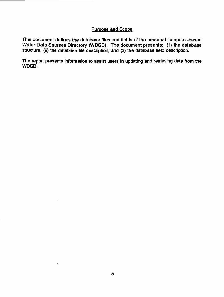
Purpose and Scope
This document defines the database files and fields of the personal computer-based Water Data Sources Directory (WDSD). The document presents: (1) the database structure, (2) the database file description, and (3) the database field description.
The report presents information to assist users in updating and retrieving data from the WDSD.
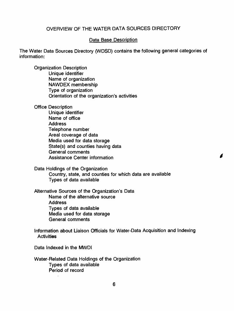
OVERVIEW OF THE WATER DATA SOURCES DIRECTORY
Data Base Description
The Water Data Sources Directory (WDSD) contains the following general categories of information:
Organization Description Unique identifier Name of organization NAWDEX membership Type of organization Orientation of the organization's activities
Office DescriptionUnique identifier Name of office AddressTelephone number Areal coverage of data Media used for data storage State(s) and counties having data General comments Assistance Center information
Data Holdings of the OrganizationCountry, state, and counties for which data are available Types of data available
Alternative Sources of the Organization's Data Name of the alternative source AddressTypes of data available Media used for data storage General comments
Information about Liaison Officials for Water-Data Acquisition and Indexing Activities
Data Indexed in the MWDI
Water-Related Data Holdings of the Organization Types of data available Period of record
Number of sites or observationsGeographic area coveredFrequency of measurementMedia used for data storageOther organizations that are sources of the data
As the NAWDEX program progresses, additional groups of data, or additional data items, will be added to the WDSD. Future editions of this dictionary will reflect any additions or changes to the WDSD.
Data Base Structure
The WDSD relational database contains sixteen database files and four support database files as shown in figure 2. Each block in figure 2 represents a database file. The sixteen database files are described in table 1, and the four support database files are described in table 2.
Ashton-Tate's dBASE IV relational database management system manages and maintains the WDSD database. Fields are individual pieces of information, such as the name of an organization or the address of an office; database files contain logically related fields.
HOW TO USE THIS DOCUMENT
This document contains a detailed explanation of each database file and field of the WDSD. It is organized as is the WDSD database, with descriptions of fields belonging to the same database file located together. Each description of a database file or field in this document begins on a new page. The description of the fields associated with each database file follows the description of the database file. At the top of each page, certain attributes of the field defined are listed to provide information usually needed only by data processing personnel for software development. These attributes include IN DATABASE FILE, DATA TYPE, and LARGEST OR LONGEST VALUE. A full definition of each of these attributes is found below. For most users it will only be necessary to consider these attributes when producing a report or formulating a complex retrieval using dBASE IV. The attribute with which all users should be concerned is FIELD NAME. Figure 3 illustrates the format used to describe each database file. The following is an explanation of each attribute:
DATABASE FILE NAME - The name of the database file.
DATABASE FILE DEFINITION - A description of information available.
FIELDS - A list of fields included in the database file.

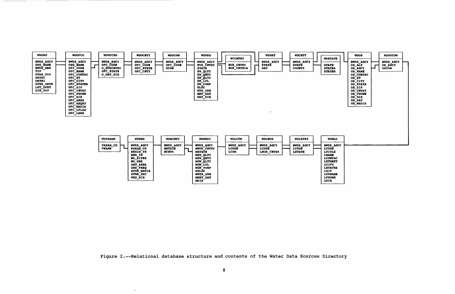
WDORG
NWDX AGCY OR6 NAME NWDX MBR TYPrintuD 1*VD
ORTMl ORTM2 OTHR ORTM LST UPDT DIR TYP
WDOPCO
NWDX AGCYORG NAME OPC CODE OPC~NAMB OPC CONTAC OPC ST OPC CITY OPC STATBA OPC ZIP OPC~~CNTRY OPC PHONE OPC DIR OPC~AREA OPC REQST OPC MEDIA OPC LPLAG OPC_LHRS
J~
WDOPCSD
NWDX AGCYOPC CODE 0 NUSCNTRY OPC STATE 0 DAT DIR
WDOCNTY
NWDX AGCYOPC CODE OPC_STATE OPC_CNTY
WDOCOM
NWDX AGCYOPC CODE OCOM
WDOSD
NWDX AGCYNUS CNTRY STATE SW QLTY SW QNTY GW QLTY GW LVL GW PUMP GLGC WTR USB MET DAT DAT~DIR
J~
WCCN
i NUS C 1 NUS_C
1
TRY
NTRY NTRYA
WDDAT
NWDX AGCY STATE DAT
WDCNTY
NWDX_AGCYCTAfPIP
COUNTY
1 WDSTATB
STATE STATEA STATBB
1 WDOS
HWDX AfU*?YnnwA m^i* &OS ALTOS_AGCYflG UKUVOS NAME OS CONTACOS STOS CITYOS STATEOS ZIPOS CNTRYOS PHONEOS DIROS DATOS_MEDIA
J"
WDOSCOM
uwriT &R/*VMlflJA AU\* Z
OS AGCYOSCOM
WDWRD
HWDT &RT*Y
rnfUUt **!/
BEGIN YR
NO SITES NO~OBS GEO AREA OBS~FREQ STOR MEDIA OTHR SRC WRD DIR
WDMCNTY
HaAAltt
MCNTY"L
WDMWDI
NWDX AGCYfUMUd v> M*. l^i
MSTATEUCU AT TV
MSW QNTY MGW QLTY NOW LVL NOW PUMP MGLGC MWTR USE MMET DATMDIR
WDLCOM
MUTIT &n/*v
LCOM
WDLNUS
HWnT AfST*Y
&4%« \frnf ft
LNUS_CNTRY
WDLSTAT
HUTIT &fv*vLCODE LSTATB
WDMLO
NWDX_AGCYLCODELTITLKLNAMELCONTACLSTRBETLCITYLSTATEALZIPLCONAKBLPHONELDIR
Figure 2. Relational database structure and contents of the Water Data Sources Directory


Table 1. - Water Data Sources Directory Database File Descriptions
Database File
WDORG.dbf
WDOFCO.dbf
WDOFCSD.dbf
WDOCNTY.dbf
WDOCOM.dbf
WDOSD.dbf
WDCNTY.dbf
WDOS.dbf
WDOSCOM.dbf
WDMLO.dbf
WDLSTAT.dbf
WDLNUS.dbf
WDLCOM.dbf
WDMWDI.dbf
WDMCNTY.dbf
WDWRD.dbf
Description
Water-related activities of an organization
Office information about an organization
Geographic area covered by the data available from an office
Counties for which an office has data
General information about an office
Number and types of sites operated by an organization
Counties where the organization operates data collection sites
Other sources of an organization's data
General information about an other source organization
Persons to consult about water-data acquisition, coordination, and indexing activities
State location of the liaison contact
Country location of the liaison contact
General information about liaison activities
Number and type of sites indexed in the MWDI for an organization
Counties where the organization operates sites indexed in the MWDI
Water-related data that are collected and made available by an organization

Table 2. - Water Data Sources Directory Support Database File Descriptions
Database File
WDCNTRY.dbf
WDDAT.dbf
WDSTATEdbf
WDPARAM.dbf
Description
Cross references a non-United States country code with its name
Cross references NAWDEX agency code, state numeric code, and type of site
Cross references a numeric state code with its name
Cross references a parameter code with its name
10

NAWDEXWATER DATA SOURCES DIRECTORY
PERSONAL COMPUTER-BASED SYSTEMDATA DICTIONARY
DATABASE FILE NAME:
DATABASE FILE DEFINITION:
FIELDS:
Figure 3. Format for a database file description.
11

Figure 4 illustrates the format for the field description. The following is an explanation of each attribute:
FIELD NAME - The unique name of the field as used in the database.
MANDATORY - Marked either Yes or No. If Yes, a value for the data field must be present in every occurrence in the database file. For example, the field NWDX_AGCY, is mandatory because it is the unique identification code of the organization and, therefore, must always be present. On the other hand, the field SW_QLTY, is not mandatory because not every organization operates surface water quality sites and, therefore, the data field may be non-valued.
DATA TYPE - Contains either CHARACTER, NUMERIC, or LOGICAL, depending on what type of data are stored for the field.
LARGEST OR LONGEST VALUE - This is the largest value that is allowed for the data field.
DATA VALUES - This is a narrative definition of the values that can be stored for a field.
GENERAL DESCRIPTION - This is a narrative description of the type of data stored for a field, its purpose, and the source or usefulness of the data. If a coding scheme is used, the meaning of each code is explained.
12

NAWDEXWATER DATA SOURCES DIRECTORY
PERSONAL COMPUTER-BASED SYSTEMDATA DICTIONARY
FIELD NAME:
IN DATABASE FILE:
MANDATORY:
DATA TYPE:
LARGEST OR LONGEST VALUE:
DATA VALUES:
GENERAL DESCRIPTION:
Figure 4. Format for a field description.
13
WATER DATA SOURCES DIRECTORY
(PERSONAL COMPUTER-BASED SYSTEM)
DATABASE FILE AND FIELD DEFINITIONS
14

DATABASE FILE NAME:
DATABASE FILE DEFINITION:
FIELDS:
WDORG
Information that identifies and describes the water-related activities of the organization
NWDX_AGCYORGJMAMENWDX_MBRTYPOTHR TYPORTN?ORTN2OTHR ORTNLSTjJPDTDIR TYP
15

FIELD NAME: NWDX_AGCY
IN DATABASE FILE: WDORG
MANDATORY: Yes
DATA TYPE: Character
LARGEST OR LONGEST VALUE: 5 characters
DATA VALUES:
The NAWDEX agency code varies in length from three to five characters. For federal organizations, it is US followed by a two- or three-character abbreviation of the organization's name. Values for non-federal organizations whose activities are within a given state boundary have a two-character state code followed by a NAWDEX-assigned sequence number. Values for non-federal organizations having activities at the multistate or national level have a three-to five-character abbreviation of the organization name (the characters US will not appear in the first two character positions). Alphabetic state codes are contained in the Federal Information Processing Standards (FIPS) Publication 5-1, dated June 15, 1970, "States and Outlying Areas of the United States." NAWDEX agency codes are presented in the publication, "Identification Codes for Organizations Listed in Computerized Data Systems of the U.S. Geological Survey" which may be obtained from the National Water Data Exchange, U.S. Geological Survey, 421 National Center, Reston, Virginia 22092. Telephone: (703) 648-6848; FTS 959-6848.
GENERAL DESCRIPTION:
The NAWDEX agency code is assigned by the NAWDEX Program Office and is the unique identifier for participating federal and non-federal organizations that actively collect and store water data. Non-federal organizations include state, county, and municipal agencies, as well as intergovernmental compacts, private organizations, universities, and any local organizations at other than county or municipal level.
16
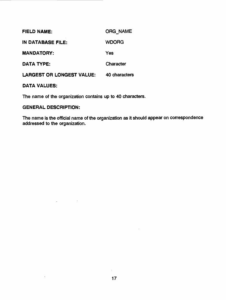
FIELD NAME: ORG_NAME
IN DATABASE FILE: WDORG
MANDATORY: Yes
DATA TYPE: Character
LARGEST OR LONGEST VALUE: 40 characters
DATA VALUES:
The name of the organization contains up to 40 characters.
GENERAL DESCRIPTION:
The name is the official name of the organization as it should appear on correspondence addressed to the organization.
17
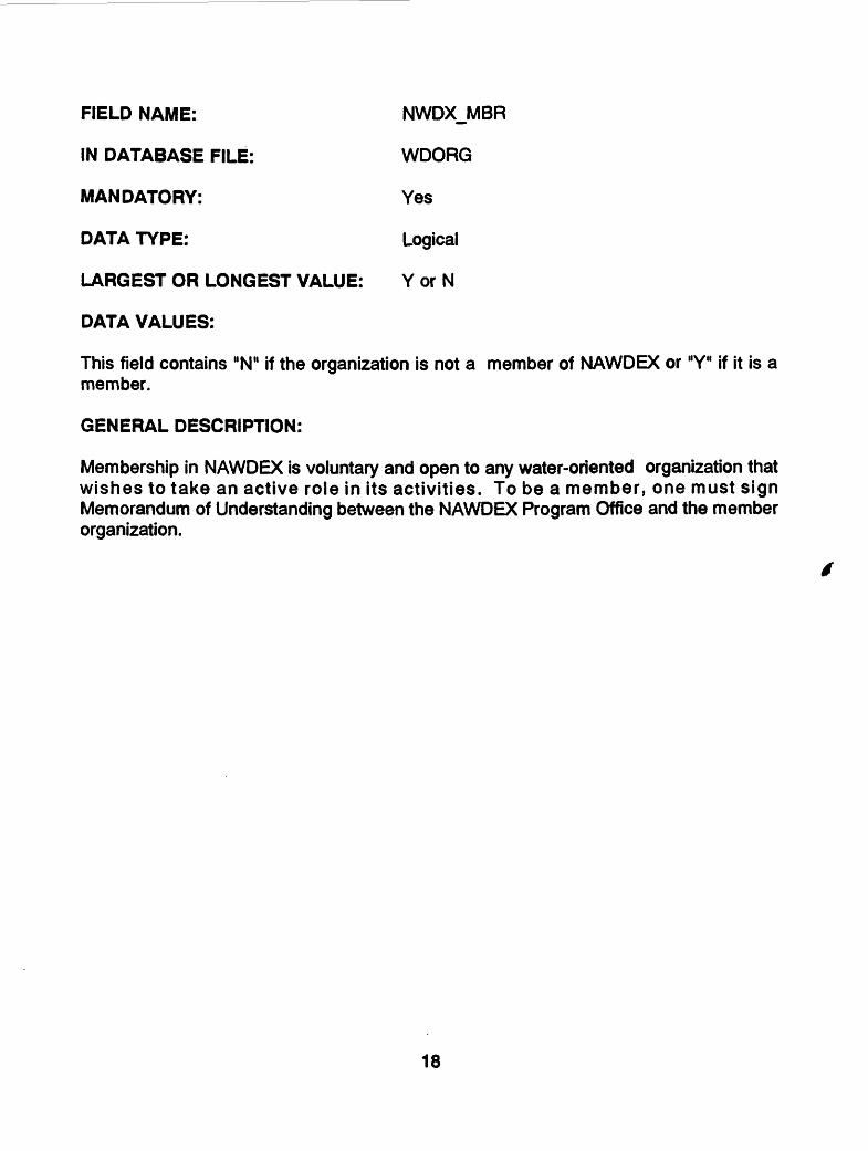
FIELD NAME: NWDXJ/IBR
IN DATABASE FILE: WDORG
MANDATORY: Yes
DATA TYPE: Logical
LARGEST OR LONGEST VALUE: Y or N
DATA VALUES:
This field contains "N" if the organization is not a member of NAWDEX or "Y" if it is a member.
GENERAL DESCRIPTION:
Membership in NAWDEX is voluntary and open to any water-oriented organization that wishes to take an active role in its activities. To be a member, one must sign Memorandum of Understanding between the NAWDEX Program Office and the member organization.
18

FIELD NAME: TYP
IN DATABASE FILE: WDORG
MANDATORY: Yes
DATA TYPE: Character
LARGEST OR LONGEST VALUE: One-letter NAWDEX TYP code
DATA VALUES:
The TYP field contains a code used to classify an organization into one of the groups explained below.
GENERAL DESCRIPTION:
Code Meaning
C County - A single organization, typically governmental, whose scope of activity is encompassed by the boundaries of one or more counties but does not cover an entire state.
F Federal - An agency or agencies of the federal government or a multi- country organization operating at the federal level.
G Intergovernmental - An organization made up of different government agencies, such as federal-state compacts, state-state compacts, multicounty compacts, and river basin commissions. The scope of all the agencies involved is only within the United States.
I International - An organization made up of representatives from different countries, such as UNESCO and WHO.
L Local - A local governmental organization other than county or municipal.
M Municipal - A single municipal governmental organization.
P Private - An organization that cannot be classified as a governmental organization.
S State - A single governmental organization whose scope of activity is encompassed by the boundaries of a single state.
19

Code Meaning
U University or Research Institute - An educational institution (public or private)at the university or college level, or a non-profit organization engagedin research.
0 Other - An organization that cannot be classified into one of the othergroups. If this field is valued as "0" then field OTHRJTYP containsa description of the type of organization.
20
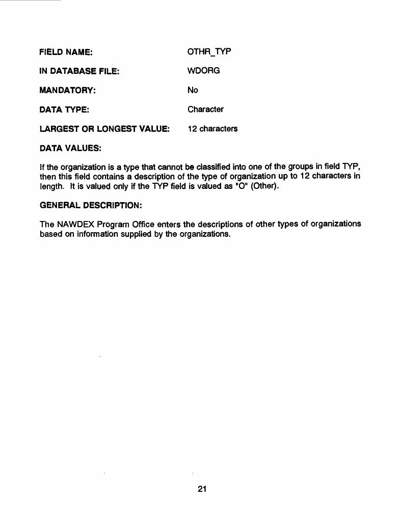
FIELD NAME: OTHR_TYP
IN DATABASE FILE: WDORG
MANDATORY: No
DATA TYPE: Character
LARGEST OR LONGEST VALUE: 12 characters
DATA VALUES:
If the organization is a type that cannot be classified into one of the groups in field TYP, then this field contains a description of the type of organization up to 12 characters in length. It is valued only if the TYP field is valued as "O" (Other).
GENERAL DESCRIPTION:
The NAWDEX Program Office enters the descriptions of other types of organizations based on information supplied by the organizations.
21

FIELD NAME: ORTN1
IN DATABASE FILE: WDORG
MANDATORY: Yes
DATA TYPE: Character
LARGEST OR LONGEST VALUE: One-character NAWDEX orientation code
DATA VALUES:
This field contains a code that describes the primary orientation of the organization's water-related activities.
GENERAL DESCRIPTION:
Code Meaning
A Agriculture and IrrigationB Basic Hydrologlc ResearchD Domestic, RuralE Evaluation of ResourcesF Flood ControlH HydroelectricI IndustryM Multiple Source Public SupplyN NavigationP Pollution StudiesR RecreationS Single Source Public SupplyT ThermoelectricW Fish and WildlifeO Other
If this field is valued as "O" then field OTHRJDRTN (other types of orientation described on page 24) contains a description of the orientation of the organization's water-related activities.
22

FIELD NAME: ORTN2
IN DATABASE FILE: WDORG
MANDATORY: No
LARGEST OR LONGEST VALUE: One-character NAWDEX orientation code
DATA VALUES:
This field contains a code that describes the secondary orientation of the organization's water-related activities if a single designation in field ORTN1 is inadequate to describe those activities.
GENERAL DESCRIPTION:
The fields ORTN1 and ORTN2 use the same codes.
23

FIELD NAME: OTHR_ORTN
IN DATABASE FILE: WDORG
MANDATORY: No
DATATYPE: Character
LARGEST OR LONGEST VALUE: 12 characters
DATA VALUES:
This field contains up to a 12-character description of the orientation of the organization's water-related activities. It is valued only if ORTN1 is valued as "0" (Other).
GENERAL DESCRIPTION:
The NAWDEX Program Office enters descriptions of other types of orientations based on information supplied by the reporting organization.
24

FIELD NAME: LSTJJPDT
IN DATABASE FILE: WDORQ
MANDATORY: Yes
DATA TYPE: Character
LARGEST OR LONGEST VALUE: 1 0 characters
DATA VALUES:
This field contains the month, day, and year of the last date (MM/DD/YYYY) that an update of any type was processed against the organization's entry in the database.
GENERAL DESCRIPTION:
An update is any transaction that adds, deletes, or changes data values in the WDSD database. If no updates have been made to the data about an organization, the LSI UPDT is the date on which the data was first inserted into the database.
25
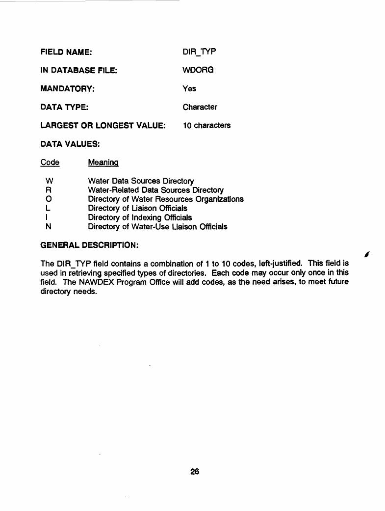
FIELD NAME: DIRJTYP
IN DATABASE FILE: WDORG
MANDATORY: Yes
DATA TYPE: Character
LARGEST OR LONGEST VALUE: 10 characters
DATA VALUES:
Code Meaning
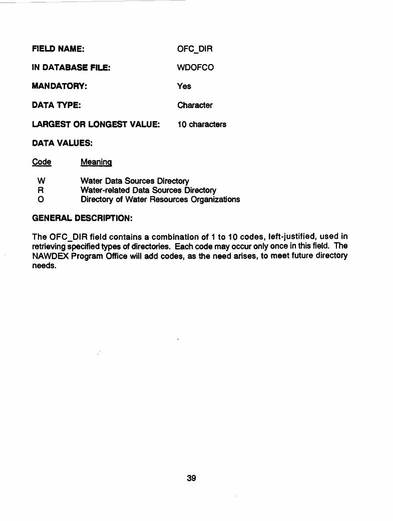
W Water Data Sources DirectoryR Water-Related Data Sources DirectoryO Directory of Water Resources OrganizationsL Directory of Liaison OfficialsI Directory of Indexing OfficialsN Directory of Water-Use Liaison Officials
GENERAL DESCRIPTION:
The DIRJTYP field contains a combination of 1 to 10 codes, left-justified. This field is used in retrieving specified types of directories. Each code may occur only once in this field. The NAWDEX Program Office will add codes, as the need arises, to meet future directory needs.
26

DATABASE FILE NAME:
DATABASE FILE DEFINITION:
FIELDS:
WDOFCO
Information about one or more offices of the organization, including the office's address and telephone number, and the areal coverage of the data owned by the office. Contains the telephone number and operating hours of assistance centers.
The primary purpose of this database file is to provide information to NAWDEX users about offices that can and will supply their data upon request.
NWDX.AGCYORG_NAMEOFC CODEOFC" NAMEOFC_CONTACOFC_STOFC_C1TYOFC STATEAOFC^ZIPOFC_CNTRYOFC_PHONEOFC_DIROFC_AREAOFC_REQSTOFC MEDIAOFCJ.FLAGOFCJ.HRSOFC LPHONE
27

FIELD NAME: NWDX_AGCY
IN DATABASE FILE: WDOFCO (Also in WDORG)
MANDATORY: Yes
DATA TYPE: Character
LARGEST OR LONGEST VALUE: 5 characters
DATA VALUES:
The NAWDEX agency code varies in length from three to five characters. For federal organizations, it is US followed by a two- or three-character abbreviation of the organization's name. Values for non-federal organizations whose activities are within a given state boundary have a two-character state code followed by a NAWDEX-assigned sequence number. Values for non-federal organizations having activities at the multistate or national level have a three-to five-character abbreviation of the organization name (the characters US will not appear in the first two character positions). Alphabetic state codes are contained in the Federal Information Processing Standards (FIPS) Publication 5-1, dated June 15, 1970, "States and Outlying Areas of the United States." NAWDEX agency codes are presented in the publication, "Identification Codes for Organizations Listed in Computerized Data Systems of the U.S. Geological Survey" which may be obtained from the National Water Data Exchange, U.S. Geological Survey, 421 National Center, Reston, Virginia 22092. Telephone: (703) 648-6848; FTS 959-6848.
GENERAL DESCRIPTION:
The NAWDEX agency code is assigned by the NAWDEX Program Office and is the unique identifier for participating federal and non-federal organizations that actively collect and store water data. Non-federal organizations include state, county, and municipal agencies, as well as intergovernmental compacts, private organizations, universities, and any local organizations at other than county or municipal level.
28
FIELD NAME: ORG_NAME
IN DATABASE FILE: WDOFCO (Also in WDORG)
MANDATORY: Yes
DATA TYPE: Character
LARGEST OR LONGEST VALUE: 40 characters
DATA VALUES:
The name of the organization contains up to 40 characters.
GENERAL DESCRIPTION:
The name is the official name of the organization as it should appear on correspondence addressed to the organization.
29

FIELD NAME: OFC_CODE
IN DATABASE FILE: WDOFCO
MANDATORY: Yes
DATA TYPE: Character
LARGEST OR LONGEST VALUE: 9 characters
DATA VALUES:
The NAWDEX Program Office assigns the OFC_CODE field. The first two characters of the code consists of two digits representing the state or two letters representing the country in which the office is located; the next five characters consist of five digits representing the city or place in which the office is located; and the last two characters consist of an arbitrary two-digit sequence number to uniquely identify multiple offices within the same city or place. A complete list of country codes is contained in the Federal Information Processing Standards (FIPS) Publication 10-2, "Countries, Dependencies, and Areas of Special Sovereignty," dated 1976; a complete list of state codes is contained in the Federal Information Processing Standards (FIPS) Publication 5-1, "States and Outlying Areas of the United States," dated 1970; and a complete list of city and place codes is contained in the Federal Information Processing Standards (FIPS) Publication 55, "Codes for Named Populated Places and Related Entities of the State of the United States," dated 1978.
GENERAL DESCRIPTION:
This field is used to retrieve addresses of operating offices from the WDSD database. The code for an office is unique within an organization but is not necessarily unique across the database. Its counterpart in the MWDI database is component number 17, WDSD OFC CODE.
30

FIELD NAME: OFC_NAME
IN DATABASE FILE: WDOFCO
MANDATORY: No
DATA TYPE: Character
LARGEST OR LONGEST VALUE: 40 characters
DATA VALUES:
This field contains the name of the office.
GENERAL DESCRIPTION:
This field contains the official name of the office. If the organization has only a single office, this field may be the same as the ORG_NAME field.
31

FIELD NAME: OFC_CONTAC
IN DATABASE FILE: WDOFCO
MANDATORY: No
DATA TYPE: Character
LARGEST OR LONGEST VALUE: 40 characters
DATA VALUES:
This field contains the name of the contact person.
GENERAL DESCRIPTION:
The office contact is the name or title of the person or office a requester contacts for obtaining the office's data that are indexed in NAWDEX.
32

FIELD NAME: OFC.ST
IN DATABASE FILE: WDOFCO
MANDATORY: No
DATA TYPE: Character
LARGEST OR LONGEST VALUE: 40 characters
DATA VALUES:
This field contains up to 40 characters.
GENERAL DESCRIPTION:
This field contains the street address or post office box number of the office contact named in the field, OFC_CONTAC. A requester should send a letter to this address requesting the office's data indexed in NAWDEX.
33

FIELD NAME: OFC_CITY
IN DATABASE FILE: WDOFCO
MANDATORY: No
DATA TYPE: Character
LARGEST OR LONGEST VALUE: 30 characters
DATA VALUES:
This field contains the name of the city up to 30 characters.
GENERAL DESCRIPTION:
The office is located in this city. The city name accompanies the address and, therefore, should be the name of the city used for mailing.
34
FIELD NAME: OFC_STATEA
IN DATABASE FILE: WDOFCO
MANDATORY: No
DATA TYPE: Character
LARGEST OR LONGEST VALUE: WY
DATA VALUES:
This field contains a two-character postal code identifying the state in which the office is located.
GENERAL DESCRIPTION:
Postal codes are alphabetic state abbreviations recognized by the U.S. Postal Service as part of a mailing address. The OFC_STATEA field should be valued only if the office is located within the United States or one of its territories. If the office is outside the United States, this field is not valued.
35

FIELD NAME: OFC_ZIP
IN DATABASE FILE: WDOFCO
MANDATORY: No
DATA TYPE: Character
LARGEST OR LONGEST VALUE: 9999999999
DATA VALUES:
This field contains up to ten digits and/or characters which is the U.S. Postal ZIP code or foreign postal code of the organization.
GENERAL DESCRIPTION:
The ZIP code is a geographic code that identifies areas within the United States and its possessions for simplifying the distribution of mail by the U.S. Postal Service. The ZIP code aiinements do not adhere to boundaries of cities, counties, states, or other jurisdictions. For organizations outside the United States and its territories, the foreign postal code, if applicable, will be defined in the format of its local usage.
36
FIELD NAME: OFC_CNTRY
IN DATABASE FILE: WDOFCO
MANDATORY: No
DATA TYPE: Character
LARGEST OR LONGEST VALUE: 30 Characters
DATA VALUES:
This field contains the name of the country in which the office is located. If the office is in the United States, the abbreviation "USA" is used. For countries other than the United States, the full name of the country is stored.
GENERAL DESCRIPTION:
The name of the country applies to the country in which the office is physically located. It is the name that is part of the mailing address on correspondence addressed to the office. It bears no relationship to the data holdings of the office.
37
FIELD NAME: OFC_PHONE
IN DATABASE FILE: WDOFCO
MANDATORY: No
DATA TYPE: Character
LARGEST OR LONGEST VALUE: 999-999-9999
DATA VALUES:
This is the telephone number of the office. If the office is within the United States or one of its territories, the number consists of a three-digit area code, followed by a dash, and followed by the seven digits of the local telephone number. A dash appears between the third and fourth digits of the local number. If the office is outside the United States, whatever format is required is the one used to store the correct telephone number.
GENERAL DESCRIPTION:
This is the telephone number at which the office and its contact can be reached.
38
FIELD NAME: OFC.DIR
IN DATABASE FILE: WDOFCO
MANDATORY: Yes
DATA TYPE: Character
LARGEST OR LONGEST VALUE: 10 characters
DATA VALUES:
Code Meaning
W Water Data Sources DirectoryR Water-related Data Sources DirectoryO Directory of Water Resources Organizations
GENERAL DESCRIPTION:
The OFC_DIR field contains a combination of 1 to 10 codes, left-justified, used in retrieving specified types of directories. Each code may occur only once in this field. The NAWDEX Program Office will add codes, as the need arises, to meet future directory needs.
39
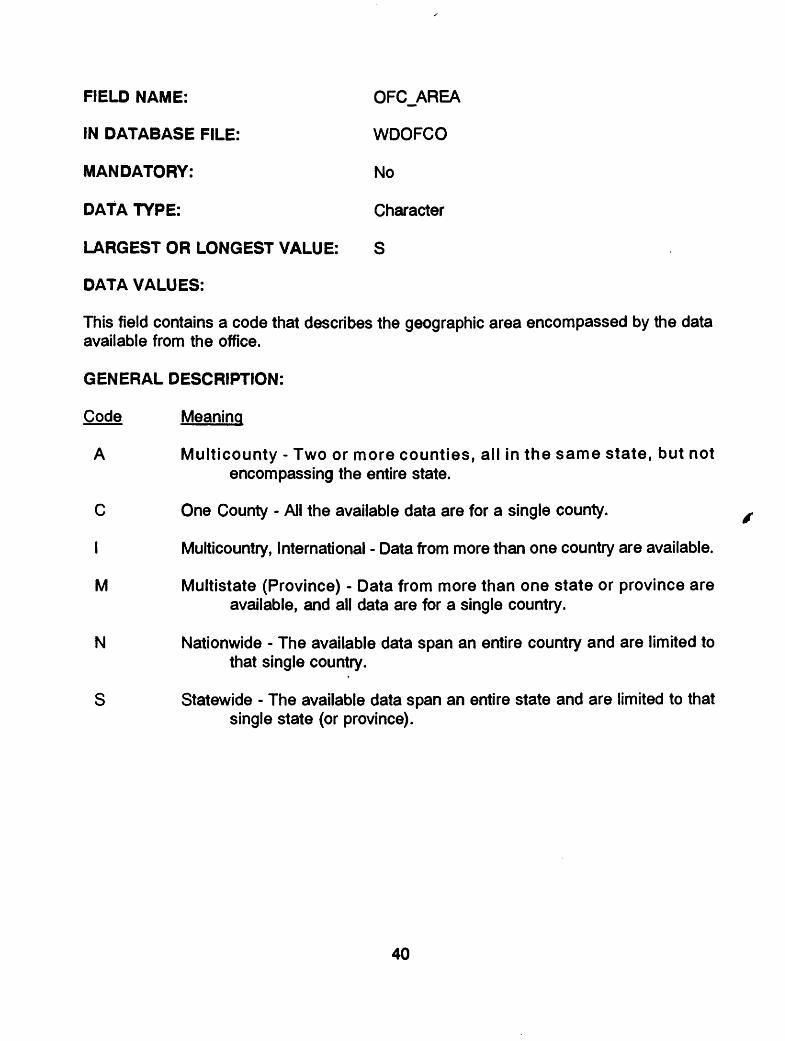
FIELD NAME: OFC_AREA
IN DATABASE FILE: WDOFCO
MANDATORY: No
DATA TYPE: Character
LARGEST OR LONGEST VALUE: S
DATA VALUES:
This field contains a code that describes the geographic area encompassed by the data available from the office.
GENERAL DESCRIPTION:
Code Meaning
A Multicounty - Two or more counties, all in the same state, but not encompassing the entire state.
C One County - All the available data are for a single county.
I Multicountry, International - Data from more than one country are available.
M Multistate (Province) - Data from more than one state or province are available, and all data are for a single country.
N Nationwide - The available data span an entire country and are limited to that single country.
S Statewide - The available data span an entire state and are limited to that single state (or province).
40

FIELD NAME: OFC_REQST
IN DATABASE FILE: WDOFCO
MANDATORY: Yes
DATA TYPE: Character
LARGEST OR LONGEST VALUE: Y or N
DATA VALUES:
This field contains "Y" if the office responds to requests for data and "N" if it does not.
GENERAL DESCRIPTION:
Offices that collect and/or store water data may or may not choose to furnish that data to those who request it. If the office does respond to requests for its data, then this field contains "Y". This information is furnished to users of NAWDEX so that they can ascertain if the office can be contacted to obtain data.
If the office does not respond to requests for its data, it is still included in the WDSD for administrative purposes, and this field contains "N". Frequently offices that do not respond to requests for data furnish their data to one or more organizations that do respond to requests. When this is the case, information about the alternative source of data is contained in WDOS.
41
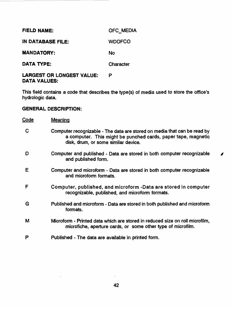
FIELD NAME: OFCJ/IEDIA
IN DATABASE FILE: WDOFCO
MANDATORY: No
DATA TYPE: Character
LARGEST OR LONGEST VALUE: P DATA VALUES:
This field contains a code that describes the type(s) of media used to store the office's hydrologic data.
GENERAL DESCRIPTION:
Code Meaning
C Computer recognizable - The data are stored on media that can be read by a computer. This might be punched cards, paper tape, magnetic disk, drum, or some similar device.
D Computer and published - Data are stored in both computer recognizable and published form.
E Computer and microform - Data are stored in both computer recognizable and microform formats.
F Computer, published, and microform -Data are stored in computer recognizable, published, and microform formats.
G Published and microform - Data are stored in both published and microform formats.
M Microform - Printed data which are stored in reduced size on roll microfilm, microfiche, aperture cards, or some other type of microfilm.
P Published - The data are available in printed form.
42

FIELD NAME: OFCJ-FLAG
IN DATABASE FILE: WDOFCO
MANDATORY: No
DATA TYPE: Character
LARGEST OR LONGEST VALUE: 1
DATA VALUES:
This field contains "1" if the office is a NAWDEX Assistance Center. Otherwise, it has no value.
GENERAL DESCRIPTION:
The purpose of this field is to identify offices that are assistance centers for the NAWDEX program. A nationwide network of assistance centers support the service capabilities of NAWDEX. These centers were set up in offices of NAWDEX members to provide local and convenient access to NAWDEX and its services. Most are equipped with computer terminals, thereby providing an extensive telecommunications network for access to the computerized directory and indexes being developed for the NAWDEX program. As the NAWDEX membership increases, additional centers will be added in large population areas and areas of high user interest to provide more optimal access to NAWDEX and its services. A complete directory of assistance centers may be obtained from the National Water Data Exchange, U.S. Geological Survey, 421 National Center, Reston, Virginia 22092.
43

FIELD NAME: OFCJ.HRS
IN DATABASE FILE: WDOFCO
MANDATORY: Yes
DATA TYPE: Character
LARGEST OR LONGEST VALUE: 20 characters
DATA VALUES:
The hours of operation of an Assistance Center are given in this way:
As shown in the following, the first three characters show the time zone, standardized to Greenwich Mean Time; the fourth character is a blank.
Greenwich Standardization United States Time Zone (First Three Characters)
Atlantic +04Eastern +05Central +06Mountain +07Pacific +08Yukon +09 Alaska-Hawaii +10Bering +11
The following abbreviations are also incorporated: SU for Sunday; M for Monday; T for Tuesday; W for Wednesday; TH for Thursday; F for Friday; S for Saturday. Thus, the following would be for an office in the Central Time Zone in the U.S.A. which is open from 9 a.m. to 3 p.m. on Monday through Thursday, and 9 am. to 2 p.m. on Friday:
+ 06 M-TH9-3 F9-2
GENERAL DESCRIPTION:
This field contains information about the hours during which someone is available at an Assistance Center to respond to requests for data.
44
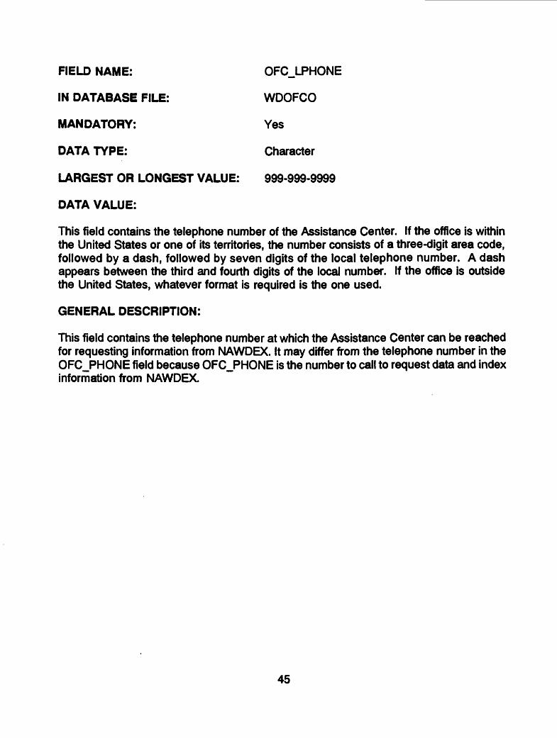
FIELD NAME: OFCJ-PHONE
IN DATABASE FILE: WDOFCO
MANDATORY: Yes
DATA TYPE: Character
LARGEST OR LONGEST VALUE: 999-999-9999
DATA VALUE:
This field contains the telephone number of the Assistance Center. If the office is within the United States or one of its territories, the number consists of a three-digit area code, followed by a dash, followed by seven digits of the local telephone number. A dash appears between the third and fourth digits of the local number. If the office is outside the United States, whatever format is required is the one used.
GENERAL DESCRIPTION:
This field contains the telephone number at which the Assistance Center can be reached for requesting information from NAWDEX. It may differ from the telephone number in the OFC_PHONE field because OFC_PHONE is the number to call to request data and index information from NAWDEX.
45
DATABASE FILE NAME:
DATABASE FILE DEFINITION:
FIELDS:
WDOFCSD
Information about the geographic area covered by the data available from the office
NWDX AGCY OFCjfODE O NUSCNTRY OFC_STATE O DAT DIP
46

FIELD NAME: NWDX_AGCY
IN DATABASE FILE: WDOFCSD
MANDATORY: Yes
DATA TYPE: Character
LARGEST OR LONGEST VALUE: 5 characters
DATA VALUES:
The NAWDEX agency code varies in length from three to five characters. For federal organizations, it is US followed by a two- or three-character abbreviation of the organization's name. Values for non-federal organizations whose activities are within a given state boundary have a two-character state code followed by a NAWDEX-assigned sequence number. Values for non-federal organizations having activities at the multistate or national level have a three-to five-character abbreviation of the organization name (the characters US will not appear in the first two character positions). Alphabetic state codes are contained in the Federal Information Processing Standards (FIPS) Publication 5-1, dated June 15, 1970, "States and Outlying Areas of the United States." NAWDEX agency codes are presented in the publication, "Identification Codes for Organizations Listed in Computerized Data Systems of the U.S. Geological Survey" which may be obtained from the National Water Data Exchange, U.S. Geological Survey, 421 National Center, Reston, Virginia 22092. Telephone: (703) 648-6848; FTS 959-6848.
GENERAL DESCRIPTION:
The NAWDEX agency code is assigned by the NAWDEX Program Office and is the unique identifier for participating federal and non-federal organizations that actively collect and store water data. Non-federal organizations include state, county, and municipal agencies, as well as intergovernmental compacts, private organizations, universities, and any local organizations at other than county or municipal level.
47

FIELD NAME: OFC_CODE
IN DATABASE FILE: WDOFCSD
MANDATORY: Yes
DATA TYPE: Character
LARGEST OR LONGEST VALUE: 9 characters
DATA VALUES:
The NAWDEX Program Office assigns the OFC_CODE field. The first two characters of the code consists of two digits representing the state or two letters representing the country in which the office is located; the next five characters consist of five digits representing the city or place in which the office is located; and the last two characters consist of an arbitrary two-digit sequence number to uniquely identify multiple offices within the same city or place. A complete list of country codes is contained in the Federal Information Processing Standards (FIPS) Publication 10-2, "Countries, Dependencies, and Areas of Special Sovereignty," dated 1976; a complete list of state codes is contained in the Federal Information Processing Standards (FIPS) Publication 5-1, "States and Outlying Areas of the United States," dated 1970; and a complete list of city and place codes is contained in the Federal Information Processing Standards (FIPS) Publication 55, "Codes for Named Populated Places and Related Entities of the State of the United States," dated 1978.
GENERAL DESCRIPTION:
This field is used to retrieve addresses of operating offices from the WDSD database. The code for an office is unique within an organization but is not necessarily unique across the database. Its counterpart in the MWDI database is component number 17, WDSDJDFC^CODE.
48
FIELD NAME: O_NUSCNTRY
IN DATABASE FILE: WDOFCSD
MANDATORY: No
DATA TYPE: Character
LARGEST OR LONGEST VALUE: 2 characters
DATA VALUES:
This field contains a FIPS country code only if the office has data for sites physically located outside the United States; if the office's data is for sites within the United States, the field has no value.
A complete list of country codes is contained in the Federal Information Processing Standards (FIPS) Publication 10-2, "Countries, Dependencies, and Areas of Special Sovereignty," dated 1976.
GENERAL DESCRIPTION:
The non-United States country code is valued for only those offices that have data from sites that lie outside of the borders of the United States and its outlying areas. It bears no relationship to the location of the office.
49

FIELD NAME: OFC_STATE
IN DATABASE FILE: WDOFCSD
MANDATORY: No
DATA TYPE: Numeric
LARGEST OR LONGEST VALUE: 99
DATA VALUES:
This field contains a code representing the state or outlying area for which the office has data.
GENERAL DESCRIPTION:
State codes are contained in the Federal Information Processing Standards (FIPS) Publication 5-1, "States and Outlying Areas of the United States," dated June 15, 1970. The NAWDEX Program Office assigns temporary codes to identify foreign installations. The state code represents the location of a data collection site for which the office has data, and not the location of the office.
50

FIELD NAME: OJDATJDIR
IN DATABASE FILE: WDOFCSD
MANDATORY: Yes
DATA TYPE: Character
LARGEST OR LONGEST VALUE: 10 characters
DATA VALUES:
Code Meaning
W Water Data Sources DirectoryR Water-related Data Sources Directory0 Directory of Water Resources Organizations
GENERAL DESCRIPTION:
The 0_DAT_DIR field contains a combination of 1 to 10 codes, left-justified, used in retrieving specified types of directories. Each code may occur only once in this field. The NAWDEX Program Office will add codes, as the need arises, to meet future directory needs.
51

DATABASE FILE NAME:
DATABASE FILE DEFINITION:
FIELDS:
WDOCNTY
Information about the counties for which the office has data
NWDX AGCY OFC_CODE OFC STATE OFC~"CNTY
52
FIELD NAME: NWDX_AGCY
IN DATABASE FILE: WDOCNTY (Also in WDORG)
MANDATORY: Yes
DATA TYPE: Character
LARGEST OR LONGEST VALUE: 5 characters
DATA VALUES:
The NAWDEX agency code varies in length from three to five characters. For federal organizations, it is US followed by a two- or three-character abbreviation of the organization's name. Values for non-federal organizations whose activities are within a given state boundary have a two-character state code followed by a NAWDEX-assigned sequence number. Values for non-federal organizations having activities at the muitistate or national level have a three-to five-character abbreviation of the organization name (the characters US will not appear in the first two character positions). Alphabetic state codes are contained in the Federal Information Processing Standards (FIPS) Publication 5-1, dated June 15, 1970, "States and Outlying Areas of the United States." NAWDEX agency codes are presented in the publication, "Identification Codes for Organizations Listed in Computerized Data Systems of the U.S. Geological Survey" which may be obtained from the National Water Data Exchange, U.S. Geological Survey, 421 National Center, Reston, Virginia 22092. Telephone: (703) 648-6848; FTS 959-6848.
GENERAL DESCRIPTION:
The NAWDEX agency code is assigned by the NAWDEX Program Office and is the unique identifier for participating federal and non-federal organizations that actively collect and store water data. Non-federal organizations include state, county, and municipal agencies, as well as Intergovernmental compacts, private organizations, universities, and any local organizations at other than county or municipal level.
53

FIELD NAME: OFC_CODE
IN DATABASE FILE: WDOCNTY (Also in WDOFCO)
MANDATORY: Yes
DATA TYPE: Character
LARGEST OR LONGEST VALUE: 9 characters
DATA VALUES:
The NAWDEX Program Office assigns the OFC_CODE field. The first two characters of the code consists of two digits representing the state or two letters representing the country in which the office is located; the next five characters consist of five digits representing the city or place in which the office is located; and the last two characters consist of an arbitrary two-digit sequence number to uniquely identify multiple offices within the same city or place. A complete list of country codes is contained in the Federal Information Processing Standards (FIPS) Publication 10-2, "Countries, Dependencies, and Areas of Special Sovereignty," dated 1976; a complete list of state codes is contained in the Federal Information Processing Standards (FIPS) Publication 5-1, "States and Outlying Areas of the United States," dated 1970; and a complete list of city and place codes is contained in the Federal Information Processing Standards (FIPS) Publication 55, "Codes for Named Populated Places and Related Entities of the State of the United States," date 1978.
GENERAL DESCRIPTION:
This field is used to retrieve addresses of operating offices from the WDSD database. The code for an office is unique within an organization but is not necessarily unique across the database. Its counterpart in the MWDI database is component number 17, WDSD OFC CODE.
54
FIELD NAME: OFC_STATE
IN DATABASE FILE: WDOCNTY (Also in WDOFCSD)
MANDATORY: No
DATA TYPE: Numeric
LARGEST OR LONGEST VALUE: 99
DATA VALUES:
This field contains a code representing the state or outlying area for which the office has data.
GENERAL DESCRIPTION:
State codes are contained in the Federal Information Processing Standards (FIPS) Publication 5-1, "States and Outlying Areas of the United States," dated June 15, 1970. The NAWDEX Program Office assigns temporary codes to identify foreign installations. The state code represents the location of a data collection site for which the office has data, and not the location of the office.
55

FIELD NAME: OFC_CNTY
IN DATABASE FILE: WDOCNTY
MANDATORY: Yes
DATA TYPE: Numeric
LARGEST OR LONGEST VALUE: 840
DATA VALUES:
This field contains a three-digit code for a county for which the office has data. For data from sites outside the United States, this field has no value.
GENERAL DESCRIPTION:
This field contains a code representing a county in which a data collection site exists and for which the office holds data. The county must be in the state whose code is in the OFC_STATE field. County codes are contained in the Federal Information Processing Standards (FIPS) Publication 6-3, "Counties and County Equivalents of the States of the United States and the District of Columbia," dated December 15, 1979.
Note: Codes used to value this field include independent city codes for the States of Maryland, Missouri, Nevada, and Virginia; division codes for the State of Alaska; and county equivalents of Puerto Rico and the Virgin islands.
56

DATABASE FILE NAME:
DATABASE FILE DEFINITION:
FIELDS:
WDOCOM
General information about an office and its data holdings
NWDX_AGCY OFC CODE OCO"M
57

FIELD NAME: NWDX_AGCY
IN DATABASE FILE: WDOCOM (Also in WDORG)
MANDATORY: Yes
DATA TYPE: Character
LARGEST OR LONGEST VALUE: 5 characters
DATA VALUES:
The NAWDEX agency code varies in length from three to five characters. For federal organizations, it is US followed by a two- or three-character abbreviation of the organization's name. Values for non-federal organizations whose activities are within a given state boundary have a two-character state code followed by a NAWDEX-assigned sequence number. Values for non-federal organizations having activities at the multistate or national level have a three-to five-character abbreviation of the organization name (the characters US will not appear in the first two character positions). Alphabetic state codes are contained in the Federal Information Processing Standards (FIPS) Publication 5-1, dated June 15, 1970, "States and Outlying Areas of the United States." NAWDEX agency codes are presented in the publication, "Identification Codes for Organizations Listed in Computerized Data Systems of the U.S. Geological Survey" which may be obtained from the National Water Data Exchange, U.S. Geological Survey, 421 National Center, Reston, Virginia 22092. Telephone: (703) 648-6848; FTS 959-6848.
GENERAL DESCRIPTION:
The NAWDEX agency code is assigned by the NAWDEX Program Office and is the unique identifier for participating federal and non-federal organizations that actively collect and store water data. Non-federal organizations include state, county, and municipal agencies, as well as intergovernmental compacts, private organizations, universities, and any local organizations at other than county or municipal level.
58

FIELD NAME: OFC_CODE
IN DATABASE FILE: WDOCOM (Also in WDOFCO)
MANDATORY: Yes
DATA TYPE: Character
LARGEST OR LONGEST VALUE: 9 characters
DATA VALUES:
The NAWDEX Program Office assigns the OFC_CODE field. The first two characters of the code consists of two digits representing the state or two letters representing the country in which the office is located; the next five characters consist of five digits representing the city or place in which the office is located; and the last two characters consist of an arbitrary two-digit sequence number to uniquely identify multiple offices within the same city or place. A complete list of country codes is contained in the Federal Information Processing Standards (FIPS) Publication 10-2, "Countries, Dependencies, and Areas of Special Sovereignty," dated 1976; a complete list of state codes is contained in the Federal Information Processing Standards (FIPS) Publication 5-1, "States and Outlying Areas of the United States," dated 1970; and a complete list of city and place codes is contained in the Federal Information Processing Standards (FIPS) Publication 55, "Codes for Named Populated Places and Related Entities of the State of the United States," dated 1978.
GENERAL DESCRIPTION:
This field is used to retrieve addresses of operating offices from the WDSD database. The code for an office is unique within an organization but is not necessarily unique across the database. Its counterpart in the MWDI database is component number 17, WDSD OFC CODE.
59

FIELD NAME: OCOM
IN DATABASE FILE: WDOCOM
MANDATORY: No
DATA TYPE: Character
LARGEST OR LONGEST VALUE: 65 characters
DATA VALUES:
This field contains comments about the office and its data holdings. Up to fifteen comment lines are allowed.
GENERAL DESCRIPTION:
The purpose of this field is to provide a means of storing general information about an office and its data holdings. The information may include anything that would interest a user of NAWDEX.
60

DATABASE FILE NAME: WDOSD
DATABASE FILE DEFINITION: Information about the number and types of sitesoperated by the organization
FIELDS: NWDX_AGCYNUS_CNTRY STATE SW_QLTY SW_QNTY GW_QLTY GW_LVL GW_PUMP GLGC WTR_USE MET_DAT DAT DIR
61

FIELD NAME: NWDX_AGCY
IN DATABASE FILE: WDOSD (Also in WDORG)
MANDATORY: Yes
DATA TYPE: Character
LARGEST OR LONGEST VALUE: 5 characters
DATA VALUES:
The NAWDEX agency code varies in length from three to five characters. For federal organizations, it is US followed by a two- or three-character abbreviation of the organization's name. Values for non-federal organizations whose activities are within a given state boundary have a two-character state code followed by a NAWDEX-assigned sequence number. Values for non-federal organizations having activities at the multistate or national level have a three-to five-character abbreviation of the organization name (the characters US will not appear in the first two character positions). Alphabetic state codes are contained in the Federal Information Processing Standards (FIPS) Publication 5-1, dated June 15, 1970, "States and Outlying Areas of the United States." NAWDEX agency codes are presented in the publication, "Identification Codes for Organizations Listed in Computerized Data Systems of the U.S. Geological Survey" which may be obtained from the National Water Data Exchange, U.S. Geological Survey, 421 National Center, Reston, Virginia 22092, Telephone: (703) 648-6848; FTS 959-6848.
GENERAL DESCRIPTION:
The NAWDEX agency code is assigned by the NAWDEX Program Office and is the unique identifier for participating federal and non-federal organizations that actively collect and store water data. Non-federal organizations include state, county, and municipal agencies, as well as intergovernmental compacts, private organizations, universities, and any local organizations at other than county or municipal level.
62
FIELD NAME: NUS_CNTRY
IN DATABASE FILE: WDOSD
MANDATORY: No
DATA TYPE: Character
LARGEST OR LONGEST VALUE: 2 characters
DATA VALUES:
This field contains a country code only if the organization operates data collection sites physically located outside the United States. If the organization's data collection sites are within the United States, the field has no value.
A complete list of country codes is contained in the Federal Information Processing Standards (FIPS) Publication 10-2, "Countries, Dependencies, and Areas of Special Sovereignty," dated 1976.
GENERAL DESCRIPTION:
The non-United States country code has a value for only those organizations that operate data collection sites that lie outside of the borders of the United States and its outlying areas. It bears no relationship to the location of the organization.
63

FIELD NAME: STATE
IN DATABASE FILE: WDOSD
MANDATORY: No
DATA TYPE: Numeric
LARGEST OR LONGEST VALUE: 99
DATA VALUES:
This field contains a code representing the state or outlying area in which the organization operates data collection sites. A complete list of state or outlying area codes is contained in the Federal Information Processing Standards (FIPS) Publication 5-1, "States and Outlying Areas of the United States," dated June 15, 1970.
GENERAL DESCRIPTION:
The STATE field has a value for those states or outlying areas in which there are sites for which the organization has data. It bears no relationship to the location of the organization.
64
FIELD NAME: SW_QLTY
IN DATABASE FILE: WDOSD
MANDATORY: No
DATA TYPE: Numeric
LARGEST OR LONGEST VALUE: 9999999
DATA VALUES:
This field contains the total number of surface-water-quality sites, located in the state identified by the STATE field or the country identified by the NUS_CNTRY field which the organization operates.
GENERAL DESCRIPTION:
The total includes surface-water sites at which one or more water-quality parameters are, or have been, collected. It includes both active and inactive sites and it makes no difference whether or not the organization supplies the data upon request. Sites included in the total are only those that are operated by the organization in the state identified by STATE or the country identified by NUS_CNTRY. Water-quality parameters include physical, chemical, sediment, or biological characteristics of water.
65

FIELD NAME: SW_QNTY
IN DATABASE FILE: WDOSD
MANDATORY: No
DATA TYPE: Numeric
LARGEST OR LONGEST VALUE: 9999999
DATA VALUES:
This field contains the total number of surface-water-quantity sites, located in the state identified by the STATE field or the country identified by the NUS_CNTRY field, which the organization operates.
GENERAL DESCRIPTION:
The total includes surface-water sites at which one or more water-quantity parameters are, or have been, collected. It includes both active and inactive sites and it makes no difference whether or not the organization supplies the data upon request. Sites included in the total are only those that are operated by the organization in the state identified by STATE or the country identified by NUS_CNTRY. Surface-water-quantity parameters include such items as stream flow, peak flow, low flow, peak stage, low stage, reservoir content, and change in reservoir content.
66

FIELD NAME: GWJ3LTY
IN DATABASE FILE: WDOSD
MANDATORY: No
DATA TYPE: Numeric
LARGEST OR LONGEST VALUE: 9999999
DATA VALUES:
This field the total number of ground-water-quality sites, located in the state identified by the STATE field or the country identified by the NUS_CNTRY field, which the organization operates.
GENERAL DESCRIPTION:
The total includes ground-water sites at which one or more water quality parameters are, or have been, collected. It includes both active and inactive sites and it makes no difference whether or not the organization supplies the data upon request. Sites included in the total are only those that are operated by the organization in the state identified by the STATE field or the country identified by the NUS_CNTRY field. Water quality parameters include physical, chemical, or biological characteristics of water.
67
FIELD NAME: GWJ.VL
IN DATABASE FILE: WDOSD
MANDATORY: No
DATA TYPE: Numeric
LARGEST OR LONGEST VALUE: 9999999
DATA VALUES:
This field contains the total number of data-monitoring sites the organization operates, at which water-level measurements are made in the state identified by the STATE field or the country identified by NUS_CNTRY field.
GENERAL DESCRIPTION:
The total includes ground-water sites at which water level measurements are, or have been, collected. It includes both active and inactive sites and it makes no difference whether or not the organization supplies the data upon request. Sites included in the total are only those that are operated by the organization in the state identified by the STATE field or the country identified by the NUS_CNTRY field.
68
FIELD NAME: GW_PUMP
IN DATABASE FILE: WDOSD
MANDATORY: No
DATA TYPE: Numeric
LARGEST OR LONGEST VALUE: 9999999
DATA VALUES:
This field contains the total number of data-monitoring sites, at which there is ground-water pumpage, located in the state identified by the STATE field or the country identified by the NUS_CNTRY field, which the organization operates.
GENERAL DESCRIPTION:
The total includes ground-water sites at which pumpage measurements are, or have been, collected. It includes both active and inactive sites and it makes no difference whether or not the organization supplies the data upon request. Sites included in the total are only those that are operated by the organization in the state identified by the STATE field or the country identified by the NUS_CNTRY field.
69

FIELD NAME: GLGC
IN DATABASE FILE: WDOSD
MANDATORY: No
DATA TYPE: Numeric
LARGEST OR LONGEST VALUE: 9999999
DATA VALUES:
This field contains the total number of ground-water sites with geologic descriptions available, located in the state identified by the STATE field or the country identified by the NUS_CNTRY field which the organization operates.
GENERAL DESCRIPTION:
The total includes ground-water sites for which there is information describing the geology in which the site is located. This includes descriptions of the surficial geology and other information such as stratigraphic or lithologic logs. It includes both active and inactive sites and it makes no difference whether or not the organization supplies the information upon request. Sites included in the total are only those that are operated by the organization in the state identified by the STATE field or the country identified by the NUS CNTRY field.
70

FIELD NAME: WTRJJSE
IN DATABASE FILE: WDOSD
MANDATORY: No
DATA TYPE: Numeric
LARGEST OR LONGEST VALUE: 9999999
DATA VALUES:
This field contains the total number of sites or locations at which water-use data are being collected or monitored by the organization in the state identified by the STATE field or the country identified by the NUS_CNTRY field.
GENERAL DESCRIPTION:
The total includes all sites or locations at which water-use data are, or have been, collected or monitored. It includes both active and inactive sites or locations and it makes no difference whether or not the organization supplies the data upon request. Sites or locations included in the total are only those that are operated by the organization in the state identified by the STATE field or the country identified by the NUS_CNTRY field. Water-use data includes all data and information collected about the use of water, both withdrawals and returns, for agriculture, industry, municipal water supplies, domestic use, energy production and development, mining, and a variety of other purposes.
71

FIELD NAME: METJDAT
IN DATABASE FILE: WDOSD
MANDATORY: No
DATA TYPE: Numeric
LARGEST OR LONGEST VALUE: 9999999
DATA VALUES:
This field contains the total number of sites at which meteorological data are measured or monitored by the organization in the state identified by the STATE field or the country Identified by the NUS_CNTRY field.
GENERAL DESCRIPTION:
The total includes all sites at which meteorological data are, or have been, collected or monitored. It includes both active and inactive sites and it makes no difference whether or not the organization supplies the data upon request. Sites included in the total are only those that are operated by the organization in the state identified by the STATE field or the country identified by the NUS_CNTRY field. Meteorological data include measurements of precipitation, snow accumulations, wind direction and velocity, temperature, and relative humidity.
72

FIELD NAME: DAT_DIR
IN DATABASE FILE: WDOSD
MANDATORY: Yes
DATA TYPE: Character
LARGEST OR LONGEST VALUE: 1 0 characters
DATA VALUES:
Code Meaning
W Water Data Sources DirectoryR Water-related Data Sources DirectoryO Directory of Water Resources Organizations
GENERAL DESCRIPTION:
This field contains a combination of 1 to 10 codes, left-justified, used in retrieving specified types of directories. Each code may occur only once in this field. The NAWDEX Program Office will add codes, as the need arises, to meet future directory needs.
73

DATABASE FILE NAME: WDCNTY
DATABASE FILE DEFINITION: Identifies the counties in which the organizationoperates data collection sites
FIELDS: NWDX_AGCYSTATE COUNTY
74

FIELD NAME: NWDX_AGCY
IN DATABASE FILE: WDCNTY (Also in WDORG)
MANDATORY: Yes
DATA TYPE: Character
LARGEST OR LONGEST VALUE: 5 characters
DATA VALUES:
The NAWDEX agency code varies in length from three to five characters. For federal organizations, it is US followed by a two- or three-character abbreviation of the organization's name. Values for non-federal organizations whose activities are within a given state boundary have a two-character state code followed by a NAWDEX-assigned sequence number. Values for non-federal organizations having activities at the multistate or national level have a three-to five-character abbreviation of the organization name (the characters US will not appear in the first two character positions). Alphabetic state codes are contained in the Federal Information Processing Standards (FIPS) Publication 5-1, dated June 15, 1970, "States and Outlying Areas of the United States." NAWDEX agency codes are presented in the publication, "Identification Codes for Organizations Listed in Computerized Data Systems of the U.S. Geological Survey" which may be obtained from the National Water Data Exchange, U.S. Geological Survey, 421 National Center, Reston, Virginia 22092. Telephone: (703) 648-6848; FTS 959-6848.
GENERAL DESCRIPTION:
The NAWDEX agency code is assigned by the NAWDEX Program Office and is the unique identifier for participating federal and non-federal organizations that actively collect and store water data. Non-federal organizations include state, county, and municipal agencies, as well as intergovernmental compacts, private organizations, universities, and any local organizations at other than county or municipal level.
75

FIELD NAME: STATE
IN DATABASE FILE: WDCNTY (Also in WDOSD)
MANDATORY: No
DATA TYPE: Numeric
LARGEST OR LONGEST VALUE: 99
DATA VALUES:
This field contains a code representing the state or outlying area in which the organization operates data collection sites. A complete list of state or outlying area codes is contained in the Federal Information Processing Standards (FIPS) Publication 5-1, "States and Outlying Areas of the United States," dated June 15, 1970.
GENERAL DESCRIPTION:
The STATE field has a value for those states or outlying areas in which there are sites for which the organization has data. It bears no relationship to the location of the organization.
76
FIELD NAME: COUNTY
IN DATABASE FILE: WDCNTY
MANDATORY: Yes
DATA TYPE: Numeric
LARGEST OR LONGEST VALUE: 840
DATA VALUES:
This field contains a code for a county in which the organization operates one or more data collection sites. For sites operated outside the United States, there will be no occurrences in WDCNTY.
GENERAL DESCRIPTION:
This field has a value for those counties in which there are one or more data collection sites operated by the organization. The counties must be in the state identified in the STATE field. A complete list of county codes is contained in the Federal Information Processing Standards (FIPS) Publication 6-3, "Counties and County Equivalents of the States of the United States and the District of Columbia, 11 dated December 15, 1979.
Note: Codes used to value this field include independent city codes for the States of Maryland, Missouri, Nevada, and Virginia; division codes for the State of Alaska; and county equivalent codes for American Samoa, Guam, Puerto Rico, and the Virgin Islands.
77

DATABASE FILE NAME:
DATABASE FILE DEFINITION:
FIELDS:
WDOS
Information about other sources of the organization's data. If another organization stores in part or in whole, data available from the organization named in the ORQ_NAME field, and will respond to requests for the data, that organization is an "other source."
NWDX_AGCY OS ALT OS AGCY OS~NAME OS~CONTAC
OS_CITY OS STATEoslzipOS_CNTRY OS PHONE OS DIROS"DAT OS"MEDIA
78
FIELD NAME: NWDX_AGCY
IN DATABASE FILE: WDOS (Also in WDORG)
MANDATORY: Yes
DATA TYPE: Character
LARGEST OR LONGEST VALUE: 5 characters
DATA VALUES:
The NAWDEX agency code varies in length from three to five characters. For federal organizations, it is US followed by a two- or three-character abbreviation of the organization's name. Values for non-federal organizations whose activities are within a given state boundary have a two-character state code followed by a NAWDEX-assigned sequence number. Values for non-federal organizations having activities at the multistate or national level have a three-to five-character abbreviation of the organization name (the characters US will not appear in the first two character positions). Alphabetic state codes are contained in the Federal Information Processing Standards (FIPS) Publication 5-1, dated June 15, 1970, "States and Outlying Areas of the United States." NAWDEX agency codes are presented in the publication, "Identification Codes for Organizations Listed in Computerized Data Systems of the U.S. Geological Survey" which may be obtained from the National Water Data Exchange, U.S. Geological Survey, 421 National Center, Reston, Virginia 22092. Telephone: (703) 648-6848; FTS 959-6848.
GENERAL DESCRIPTION:
The NAWDEX agency code is assigned by the NAWDEX Program Office and is the unique identifier for participating federal and non-federal organizations that actively collect and store water data. Non-federal organizations include state, county, and municipal agencies, as well as intergovernmental compacts, private organizations, universities, and any local organizations at other than county or municipal level.
79
FIELD NAME: OS_ALT
IN DATABASE FILE: WDOS
MANDATORY: Yes
DATA TYPE: Character
LARGEST OR LONGEST VALUE: A or P
DATA VALUES:
This field contains either an "A" or a "P" depending whether the organization is an alternative source or a preferred source, respectively.
GENERAL DESCRIPTION:
An alternative data source is an "other source" which can be contacted instead of the organization that collected the data. A preferred data source is an "other source" which should be contacted instead of the collector organization. A collector organization that does not have the capability to respond to requests for data may appoint another organization as a preferred source. If the collector organization will respond to requests for its data, and its data is also available from another organization, that other organization may be appointed as an alternative source.
All data stored by the collector organization may not be available from the "other source" organization. The OS_DAT field shows what kinds of data are available from the "other source" organization, and any further qualifications can be explained in comment form in WDOSCOM.
80

FIELD NAME: OS_AGCY
IN DATABASE FILE: WDOS
MANDATORY: Yes
DATA TYPE: Character
LARGEST OR LONGEST VALUE: 5 characters
DATA VALUES:
This field contains the NAWDEX agency code for the other source organization. The NAWDEX agency code varies in length from three to five characters. For federal organizations it is US followed by a meaningful two- or three-character abbreviation of the organization name. Values for non-federal organizations whose activities are contained within a given state boundary will have a two-character state code followed by a NAWDEX assigned sequence number. Values for non-federal organizations having activities at the multistate or national level have a meaningful three- to five-character abbreviation of the organization name (the letters US will not appear in the first two positions). Alphabetic state codes are contained in the Federal Information Processing Standards (FIPS) Publication 5-1, "States and Outlying Areas of the United States," dated June 15, 1970. NAWDEX agency codes are presented in the publication "Identification Codes for Organizations Listed in Computerized Data Systems of the U.S. Geological Survey," which may be obtained from the National Water Data Exchange, U.S. Geological Survey, 421 National Center, Reston, Virginia 22092.
GENERAL DESCRIPTION:
The NAWDEX Program Office assigns the NAWDEX agency code. This code is the unique identifier for the participating federal and non-federal organizations that actively collect and store water data. Non-federal organizations include state, county, and municipal agencies, as well as intergovernmental compacts, private organizations, universities, and any local organizations at other than county or municipal level.
81
FIELD NAME: OS_NAME
IN DATABASE FILE: WDOS
MANDATORY: Yes
DATA TYPE: Character
LARGEST OR LONGEST VALUE: 40 characters
DATA VALUES:
This field contains up to 40 characters.
GENERAL DESCRIPTION:
This field contains the official name of the organization.
82
FIELD NAME: OS_CONTAC
IN DATABASE FILE: WDOS
MANDATORY: No
DATA TYPE: Character
LARGEST OR LONGEST VALUE: 40 characters
DATA VALUES:
This field contains up to 40 characters.
GENERAL DESCRIPTION:
The contact is the name, or title, of the person or organization, that should be contacted by a requester for obtaining the organization's data that are indexed in NAWDEX.
83
FIELD NAME: OS_ST
IN DATABASE FILE: WDOS
MANDATORY: No
DATA TYPE: Character
LARGEST OR LONGEST VALUE: 40 characters
DATA VALUES:
This field contains up to 40 characters.
GENERAL DESCRIPTION:
This field contains the street address or post office box number of the contact named in the OS_CONTAC field. It is the address to which a requester should send a letter asking for the organization's data indexed in NAWDEX.
84
FIELD NAME: OS_CITY
IN DATABASE FILE: WDOS
MANDATORY: No
DATA TYPE: Character
LARGEST OR LONGEST VALUE: 30 characters
DATA VALUES:
This field contains up to 30 characters.
GENERAL DESCRIPTION:
This field contains the city in which the organization is located. The city name accompanies the address and, therefore, should be the name of the city used for mailing.
85
FIELD NAME: OS.STATE
IN DATABASE FILE: WDOS
MANDATORY: No
DATA TYPE: Character
LARGEST OR LONGEST VALUE: WY
DATA VALUES:
This field contains a postal code identifying the state in which the organization is located.
GENERAL DESCRIPTION:
Postal codes are alphabetic state abbreviations recognized by the U.S. Postal Service as part of a mailing address. The OS_STATE field has a value only if the organization is located within the United States or one of its territories. If the organization is outside the United States, this field has no value.
86

FIELD NAME: OS_ZIP
IN DATABASE FILE: WDOS
MANDATORY: No
DATA TYPE: Character
LARGEST OR LONGEST VALUE: 9999999999
DATA VALUES:
This field contains up to ten digits and/or characters which is the U.S. Postal ZIP code or foreign postal code of the organization.
GENERAL DESCRIPTION:
The ZIP code is a geographic code that identifies areas within the United States and its possessions for simplifying the distribution of mail by the U.S. Postal Service. The ZIP code alinements do not adhere to boundaries of cities, counties, states, or other jurisdictions. For organizations outside the United States and its territories, the foreign postal code, if applicable, has a value in the format of its local usage.
87
FIELD NAME: OS_CNTRY
IN DATABASE FILE: WDOS
MANDATORY: No
DATA TYPE: Character
LARGEST OR LONGEST VALUE: 30 characters
DATA VALUES:
This field contains the name of the country in which the organization is located, if the organization is in the United States, use "USA" for an abbreviation. For non-United States countries, store the full name of the country in this field.
GENERAL DESCRIPTION:
The name of the country applies to the country in which the organization is physically located. It is the name that would be part of a mailing address on correspondence addressed to the organization. It bears no relationship to the data holdings of the organization.
FIELD NAME: OS.PHONE
IN DATABASE FILE: WDOS
MANDATORY: No
DATA TYPE: Character
LARGEST OR LONGEST VALUE: 999-999-9999
DATA VALUES:
This field contains the telephone number of the contact named in the OS_CONTAC field. If the office is within the United States or one of its territories, the number consists of a three-digit area code, followed by a dash, and followed by the seven digits of the local telephone number. A dash appears between the third and fourth digits of the local number. If the office is outside the United States, store the correct telephone number in whatever format required.
GENERAL DESCRIPTION:
This field contains the telephone number to call the office and its contact.
89

FIELD NAME: OSJ)IR
IN DATABASE FILE: WDOS
MANDATORY: Yes
DATA TYPE: Character
LARGEST OR LONGEST VALUE: 10 characters
DATA VALUES:
Code Meaning
W Water Data Sources DirectoryR Water-related Data Sources DirectoryO Directory of Water Resources Organizations
GENERAL DESCRIPTION:
The OS_DIR field contains a combination of 1 to 10 codes, left-justified, used in retrieving specified types of directories. Each code may occur only once in this field. The NAWDEX Program Office will add codes, as the need arises, to meet future directory needs.
90

FIELD NAME: OSJDAT
IN DATABASE FILE: WDOS
MANDATORY: Yes
DATA TYPE: Character
LARGEST OR LONGEST VALUE: 6 characters
DATA VALUES:
This field contains one or more alphabetic codes showing what kinds of data from the collector organization are available from the "other source" organization. Use one to six codes.
GENERAL DESCRIPTION:
Code Meaning
D Geologic Descriptions - Information describing the geology of the area around data collection sites is available.
G Ground Water Quality - Water quality data from ground-water sites are available.
L Ground Water Level - Water-level measurements from ground-water sites are available.
P Ground Water Pumpage - Pumpage measurements (drawdown volume) from ground-water sites are available.
Q Surface Water Quantity - Water-quantity data from surface-water sites are available.
S Surface Water Quality Stations - Water-quality data from surface-water sites are available.
91
FIELD NAME: OS_MEDIA
IN DATABASE FILE: WDOS
MANDATORY: No
DATA TYPE: Character
LARGEST OR LONGEST VALUE: P
DATA VALUES:
This field contains a code that describes the type(s) of media used to store the organization's hydrologic data.
GENERAL DESCRIPTION:
Code Meaning
C Computer recognizable - The data are stored on media that can be read by a computer. This might be punched cards, paper tape, magnetic tape, magnetic disk, drum, or some similar device.
D Computer and published - Data are stored in both computer recognizable and published form.
E Computer and microform - Data are stored in both computer recognizable and microform formats.
F Computer, published, and microform - Data are stored in computer recognizable, published, and microform formats.
Q Published and microform - Data are stored in both published and microform formats.
M Microform - Printed data which are stored in reduced size on roll microfilm, microfiche, aperture cards, or some other type of microfilm.
P Published - The data are available in printed form.
92

DATABASE FILE NAME: WDOSCOM
DATABASE FILE DEFINITION: General information about an "other source 1organization and its data holdings
FIELDS: NWDX_AGCYOS_AGCY OSCOM
93

FIELD NAME: NWDX.AGCY
IN DATABASE FILE: WDOSCOM (Also in WDORG)
MANDATORY: Yes
DATA TYPE: Character
LARGEST OR LONGEST VALUE: 5 characters
DATA VALUES:
The NAWDEX agency code varies in length from three to five characters. For federal organizations, it is US followed by a two- or three-character abbreviation of the organization's name. Values for non-federal organizations whose activities are within a given state boundary have a two-character state code followed by a NAWDEX-assigned sequence number. Values for non-federal organizations having activities at the multistate or national level have a three-to five-character abbreviation of the organization name (the characters US will not appear in the first two character positions). Alphabetic state codes are contained in the Federal Information Processing Standards (FIPS) Publication 5-1, dated June 15, 1970, "States and Outlying Areas of the United States." NAWDEX agency codes are presented in the publication, "Identification Codes for Organizations Listed in Computerized Data Systems of the U.S. Geological Survey" which may be obtained from the National Water Data Exchange, U.S. Geological Survey, 421 National Center, Reston, Virginia 22092. Telephone: (703) 648-6848; FTS 959-6848.
GENERAL DESCRIPTION:
The NAWDEX agency code is assigned by the NAWDEX Program Office and is the unique identifier for participating federal and non-federal organizations that actively collect and store water data. Non-federal organizations include state, county, and municipal agencies, as well as intergovernmental compacts, private organizations, universities, and any local organizations at other than county or municipal level.
94

FIELD NAME: OS_AGCY
IN DATABASE FILE: WDOSCOM (Also in WDOS)
MANDATORY: Yes
DATA TYPE: Character
LARGEST OR LONGEST VALUE: 5 characters
DATA VALUES:
This is the NAWDEX agency code for the other source organization. The NAWDEX agency code varies in length from three to five characters. For federal organizations it is US followed by a meaningful two- or three-character abbreviation of the organization name. Values for non-federal organizations whose activities are contained within a given state boundary will have a two-character state code followed by a NAWDEX assigned sequence number. Values for non-federal organizations having activities at the multistate or national level have a meaningful three- to five-character abbreviation of the organization name (the letters US will not appear in the first two positions). Alphabetic state codes are contained in the Federal information Processing Standards (FIPS) Publication 5-1, "States and Outlying Areas of the United States," dated June 15, 1970. NAWDEX agency codes are presented in the publication "Identification Codes for Organizations Listed in Computerized Data Systems of the U.S. Geological Survey," which may be obtained from the National Water Data Exchange, U.S. Geological Survey, 421 National Center, Reston, Virginia 22092.
GENERAL DESCRIPTION:
The NAWDEX Program Office assigns the NAWDEX agency code. The agency code is the unique identifier for the participating federal and non-federal organizations that actively collect and store water data. Non-federal organizations include state, county, and municipal agencies, as well as intergovernmental compacts, private organizations, universities, and any local organizations at other than county or municipal level.
95

FIELD NAME: OSCOM
IN DATABASE FILE: WDOSCOM
MANDATORY: Yes
DATA TYPE: Character
LARGEST OR LONGEST VALUE: 40 characters
DATA VALUES:
This field consists of up to 10 comment lines about the other source organization and its data holdings.
GENERAL DESCRIPTION:
The purpose of this field is to provide a means of storing general information about an "other source" organization and its data holdings. The information may include anything that would potentially be of interest to a user of NAWDEX
96

DATABASE FILE NAME:
DATABASE FILE DEFINITION:
FIELDS:
WDMLO
Information about individuals within the organization that should be consulted on water- data acquisition, coordination, and indexing activities. Information may also be provided about individuals that serve as liaison officials in other water-related matters as the need arises.
NWDX_AGCYLCODELTITLELNAMELCONTACLSTREETLCITYLSTATEALZIPLCONAMELPHONELDIR
97

FIELD NAME: NWDX_AGCY
IN DATABASE FILE: WDMLO (Also in WDORG)
MANDATORY: Yes
DATA TYPE: Character
LARGEST OR LONGEST VALUE: 5 characters
DATA VALUES:
The NAWDEX agency code varies in length from three to five characters. For federal organizations, it is US followed by a two- or three-character abbreviation of the organization's name. Values for non-federal organizations whose activities are within a given state boundary have a two-character state code followed by a NAWDEX-assigned sequence number. Values for non-federal organizations having activities at the multistate or national level have a three-to five-character abbreviation of the organization name (the characters US will not appear in the first two character positions). Alphabetic state codes are contained in the Federal Information Processing Standards (FIPS) Publication 5-1, dated June 15, 1970, "States and Outlying Areas of the United States." NAWDEX agency codes are presented in the publication, "Identification Codes for Organizations Listed in Computerized Data Systems of the U.S. Geological Survey 11 which may be obtained from the National Water Data Exchange, U.S. Geological Survey, 421 National Center, Reston, Virginia 22092. Telephone: (703) 648-6848; FTS 959-6848.
GENERAL DESCRIPTION:
The NAWDEX agency code is assigned by the NAWDEX Program Office and is the unique identifier for participating federal and non-federal organizations that actively collect and store water data. Non-federal- organizations include state, county, and municipal agencies, as well as intergovernmental compacts, private organizations, universities, and any local organizations at other than county or municipal level.
98
FIELD NAME: LCODE
IN DATABASE FILE: WDMLO
MANDATORY: Yes
DATA TYPE: Character
LARGEST OR LONGEST VALUE: 9 characters
DATA VALUES:
The NAWDEX Program Office assigns the liaison office code which consists of a 9- character code. The first two characters of the code consists of two digits representing the state or two letters representing the country in which the office is located; the next five characters consist of five digits representing the city or place in which the office is located; and the next two characters consist of an arbitrary two-digit sequence number to uniquely identify multiple offices within the same city or place. A complete list of country codes is contained in the Federal Information Processing Standards (FIPS) Publication 10-2, "Countries, Dependencies, and Areas of Special Sovereignty", dated 1976; a complete list of state codes is contained in the Federal Information Processing Standards (FIPS) Publication 5-1, "States and Outlying areas of the United States," dated 1970; and a complete list of city and place codes is contained in the Federal Information Processing Standards (FIPS) Publication 55, "Codes for Named Populated Places and Related Entities of the States of the United States," dated 1978.
GENERAL DESCRIPTION:
The NAWDEX Program Office assigns the liaison office code which is used to retrieve addresses of liaison offices from the WDSD database. The code for an office is unique within an organization but is not necessarily unique across the database.
99

FIELD NAME: LTITLE
IN DATABASE FILE: WDMLO
MANDATORY: No
DATA TYPE: Character
LARGEST OR LONGEST VALUE: 40 characters
DATA VALUES:
This field contains up to 40 characters.
GENERAL DESCRIPTION:
This field contains the official name of the office in which the liaison official occupies, the title of the liaison official, or a combination of these, as appropriate.
100

FIELD NAME: LNAME
IN DATABASE FILE: WDMLO
MANDATORY: No
DATA TYPE: Character
LARGEST OR LONGEST VALUE: 40 characters
DATA VALUES:
The name of the office contains up to 40 characters.
GENERAL DESCRIPTION:
This field contains the official name of the office within the organization in which the liaison official occupies.
101

FIELD NAME:
IN DATABASE FILE:
MANDATORY:
DATA TYPE:
LCONTAC
WDMLO
No
Character
LARGEST OR LONGEST VALUES: 40 characters
DATA VALUES:
This field contains up to 40 characters.
GENERAL DESCRIPTION:
The contact is the name of the person within the organization to contact on matters related to water-data acquisition, coordination, and indexing, or other matters as defined by the LDIR field.
102
FIELD NAME: LSTREET
IN DATABASE FILE: WDMLO
MANDATORY: No
DATA TYPE: Character
LARGEST OR LONGEST VALUE: 40 characters
DATA VALUES:
This field contains up to 40 characters.
GENERAL DESCRIPTION:
This field contains the street address or post office box number of the office of the liaison official.
103

FIELD NAME: LCITY
IN DATABASE FILE: WDMLO
MANDATORY: No
DATA TYPE: Character
LARGEST OR LONGEST VALUE: 30 characters
DATA VALUES:
This field contains up to 30 characters.
GENERAL DESCRIPTION:
This field contains the city in which the liaison office is located. The city name accompanies the address (the LSTREET field) and, therefore, should be the name of the city used for mailing.
104

FIELD NAME: LSTATEA
IN DATABASE FILE: WDMLO
MANDATORY: No
DATA TYPE: Character
LARGEST OR LONGEST VALUE: WY
DATA VALUES:
This field contains a postal code abbreviation that identifies the state in which the liaison office is located.
GENERAL DESCRIPTION:
Postal codes are alphabetic state abbreviations recognized by the U.S. Postal Service as part of a mailing address. The LSTATEA field has a value only if the office is located within the United States or one of its territories. If the office is outside the United States, this field has no value.
105

FIELD NAME: LZIP
IN DATABASE FILE: WDMLO
MANDATORY: No
DATA TYPE: Character
LARGEST OR LONGEST VALUE: 9999999999
DATA VALUES:
This field contains up to ten digits and/or characters which is the U.S. Postal ZIP code or foreign postal code of the organization.
GENERAL DESCRIPTION:
The ZIP code is a geographic code that identifies areas within the United States and its possessions for simplifying the distribution of mail by the U.S. Postal Service. The ZIP code alinements do not adhere to boundaries of cities, counties, states, or other jurisdictions. For organizations outside the United States and its territories, the foreign postal code, if applicable, is formatted according to its local usage.
106

FIELD NAME: LCONAME
IN DATABASE FILE: WDMLO
MANDATORY: No
DATA TYPE: Character
LARGEST OR LONGEST VALUE: 30 characters
DATA VALUES:
This field contains the name of the country in which the liaison office is located. If the office is in the United States, use "USA" as an abbreviation. For non-United States countries, store the full name of the country in this field.
GENERAL DESCRIPTION:
The name of the country applies to the country in which the office is physically located. It is the name that is part of the mailing address on correspondence addressed to the office.
107

FIELD NAME: LPHONE
IN DATABASE FILE: WDMLO
MANDATORY: No
DATA TYPE: Character
LARGEST OR LONGEST VALUE: 999-999-9999
DATA VALUES:
This field contains the telephone number of the liaison office. If the office is within the United States or one of its territories, the number consists of a three-digit area code, followed by a dash, followed by the seven digits of the local telephone number. A dash appears between the third and fourth digits of the local number. If the office is outside the United States, format as required.
GENERAL DESCRIPTION:
This is the telephone number to call the liaison official.
108
FIELD NAME: LDIR
IN DATABASE FILE: WDMLO
MANDATORY: Yes
DATA TYPE: Character
LARGEST OR LONGEST VALUE: 1 0 characters
DATA VALUES:
Code Meaning
L Directory of Liaison OfficialsI Directory of Indexing OfficialsN Directory of Water-Use Liaison Officials
GENERAL DESCRIPTION:
The LDIR field contains a combination of 1 to 10 codes, left-justified, used in retrieving specified types of directories. Each code may occur only once in this field. The NAWDEX Program Office will add codes, as the need arises, to meet future directory needs.
109

DATABASE FILE NAME: WDLSTAT
DATABASE FILE DEFINITION: Information about the geographic areas in whichthe liaison officials identified in the LCONTAC field has jurisdiction
FIELDS: NWDX_AGCYLCODE LSTATE
110

FIELD NAME: NWDX_AGCY
IN DATABASE FILE: WDLSTAT (Also in WDORG)
MANDATORY: Yes
DATA TYPE: Character
LARGEST OR LONGEST VALUE: 5 characters
DATA VALUES:
The NAWDEX agency code varies in length from three to five characters. For federal organizations, it is US followed by a two- or three-character abbreviation of the organization's name. Values for non-federal organizations whose activities are within a given state boundary have a two-character state code followed by a NAWDEX-assigned sequence number. Values for non-federal organizations having activities at the multistate or national level have a three-to five-character abbreviation of the organization name (the characters US will not appear in the first two character positions). Alphabetic state codes are contained in the Federal Information Processing Standards (FIPS) Publication 5-1, dated June 15, 1970, "States and Outlying Areas of the United States." NAWDEX agency codes are presented in the publication, "Identification Codes for Organizations Listed in Computerized Data Systems of the U.S. Geological Survey" which may be obtained from the National Water Data Exchange, U.S. Geological Survey, 421 National Center, Reston, Virginia 22092. Telephone: (703) 648-6848; FTS 959-6848.
GENERAL DESCRIPTION:
The NAWDEX agency code is assigned by the NAWDEX Program Office and is the unique identifier for participating federal and non-federal organizations that actively collect and store water data. Non-federal organizations include state, county, and municipal agencies, as well as intergovernmental compacts, private organizations, universities, and any local organizations at other than county or municipal level.
111
FIELD NAME: LCODE
IN DATABASE FILE: WDLSTAT (Also in WDMLO)
MANDATORY: Yes
DATA TYPE: Character
LARGEST OR LONGEST VALUE: 9 characters
DATA VALUES:
The NAWDEX Program Office assigns the liaison office code which consists of a 9- character code. The first two characters of the code consists of two digits representing the state or two letters representing the country in which the office is located; the next five characters consist of five digits representing the city or place in which the office is located; and the next two characters consist of an arbitrary two-digit sequence number to uniquely identify multiple offices within the same city or place. A complete list of country codes is contained in the Federal Information Processing Standards (FIPS) Publication 10-2, "Countries, Dependencies, and Areas of Special Sovereignty", dated 1976; a complete list of state codes is contained in the Federal Information Processing Standards (FIPS) Publication 5-1, "States and Outlying areas of the United States," dated 1970; and a complete list of city and place codes is contained in the Federal Information Processing Standards (FIPS) Publication 55, "Codes for Named Populated Places and Related Entities of the States of the United States," dated 1978.
GENERAL DESCRIPTION:
The NAWDEX Program Office assigns the liaison office code used to retrieve addresses of liaison offices from the WDSD database. The code for an office is unique within an organization but is not necessarily unique across the database.
112

FIELD NAME: LSTATE
IN DATABASE FILE: WDLSTAT
MANDATORY: Yes
DATA TYPE: Numeric
LARGEST OR LONGEST VALUE: 99
DATA VALUES:
This field contains a code representing a state within which the liaison official identified in the LCONTAC field has jurisdiction.
GENERAL DESCRIPTION:
State codes are contained in the Federal Information Processing Standards (FIPS) Publication 5-1, "States and Outlying Areas of the United States," dated June 15, 1970.
113

DATABASE FILE NAME: WDLNUS
DATABASE FILE DEFINITION: Information about the geographic areas in whichthe liaison official identified in the LCONTAC field has jurisdiction
FIELDS: NWDX_AGCYLCODE LNUS CNTRY
114
FIELD NAME: NWDX_AGCY
IN DATABASE FILE: WDLNUS (Also in WDORG)
MANDATORY: Yes
DATA TYPE: Character
LARGEST OR LONGEST VALUE: 5 characters
DATA VALUES:
The NAWDEX agency code varies in length from three to five characters. For federal organizations, it is US followed by a two- or three-character abbreviation of the organization's name. Values for non-federal organizations whose activities are within a given state boundary have a two-character state code followed by a NAWDEX-assigned sequence number. Values for non-federal organizations having activities at the multistate or national level have a three-to five-character abbreviation of the organization name (the characters US will not appear in the first two character positions). Alphabetic state codes are contained in the Federal Information Processing Standards (FIPS) Publication 5-1, dated June 15, 1970, "States and Outlying Areas of the United States." NAWDEX agency codes are presented in the publication, "Identification Codes for Organizations Listed in Computerized Data Systems of the U.S. Geological Survey" which may be obtained from the National Water Data Exchange, U.S. Geological Survey, 421 National Center, Reston, Virginia 22092. Telephone: (703) 648-6848; FTS 959-6848.
GENERAL DESCRIPTION:
The NAWDEX agency code is assigned by the NAWDEX Program Office and is the unique identifier for participating federal and non-federal organizations that actively collect and store water data. Non-federal organizations include state, county, and municipal agencies, as well as intergovernmental compacts, private organizations, universities, and any local organizations at other than county or municipal level.
115

FIELD NAME: LCODE
IN DATABASE FILE: WDLNUS (Also in WDMLO)
MANDATORY: Yes
DATA TYPE: Character
LARGEST OR LONGEST VALUE: 9 characters
DATA VALUES:
The NAWDEX Program Office assigns the liaison office code which consists of a 9- character code. The first two characters of the code consists of two digits representing the state or two letters representing the country in which the office is located; the next five characters consist of five digits representing the city or place in which the office is located; and the next two characters consist of an arbitrary two-digit sequence number to uniquely identify multiple offices within the same city or place. A complete list of country codes is contained in the Federal Information Processing Standards (FIPS) Publication 10-2, "Countries, Dependencies, and Areas of Special Sovereignty dated 1976; a complete list of state codes is contained in the Federal Information Processing Standards (FIPS) Publication 5-1, "States and Outlying areas of the United States," dated 1970; and a complete list of city and place codes is contained in the Federal Information Processing Standards (FIPS) Publication 55, "Codes for Named Populated Places and Related Entities of the States of the United States," dated 1978.
GENERAL DESCRIPTION:
The NAWDEX Program Office assigns the liaison office code used to retrieve addresses of liaison offices from the WDSD database. The code for an office is unique within an organization but is not necessarily unique across the database.
116

FIELD NAME: LNUS_CNTRY
IN DATABASE FILE: WDLNUS
MANDATORY: No
DATA TYPE: Character
LARGEST OR LONGEST VALUE: 2 characters
DATA VALUES:
This field contains a code representing a country other than the United States within which the liaison official identified in the LCONTAC field, has jurisdiction.
GENERAL DESCRIPTION:
The liaison non-United States country code has a value only if the liaison official has jurisdiction outside the United States. Country codes are contained in the Federal Information Processing Standards (FIPS) Publication 10-2, "Countries, Dependencies, and Areas of Special Sovereignty," dated 1976.
117

DATABASE FILE NAME: WDLCOM
DATABASE FILE DEFINITION: General information about the liaison activities
FIELDS: NWDX_AGCYLCODE LOOM
118

FIELD NAME: NWDX_AGCY
IN DATABASE FILE: WDLCOM (Also in WDORG)
MANDATORY: Yes
DATA TYPE: Character
LARGEST OR LONGEST VALUE: 5 characters
DATA VALUES:
The NAWDEX agency code varies in length from three to five characters. For federal organizations, it is US followed by a two- or three-character abbreviation of the organization's name. Values for non-federal organizations whose activities are within a given state boundary have a two-character state code followed by a NAWDEX-assigned sequence number. Values for non-federal organizations having activities at the multistate or national level have a three-to five-character abbreviation of the organization name (the characters US will not appear in the first two character positions). Alphabetic state codes are contained in the Federal Information Processing Standards (FIPS) Publication 5-1, dated June 15, 1970, "States and Outlying Areas of the United States." NAWDEX agency codes are presented in the publication, "Identification Codes for Organizations Listed in Computerized Data Systems of the U.S. Geological Survey" which may be obtained from the National Water Data Exchange, U.S. Geological Survey, 421 National Center, Reston, Virginia 22092. Telephone: (703) 648-6848; FTS 959-6848.
GENERAL DESCRIPTION:
The NAWDEX agency code is assigned by the NAWDEX Program Office and is the unique identifier for participating federal and non-federal organizations that actively collect and store water data. Non-federal organizations include state, county, and municipal agencies, as well as intergovernmental compacts, private organizations, universities, and any local organizations at other than county or municipal level.
119

FIELD NAME: LCODE
IN DATABASE FILE: WDLNUS (Also in WDMLO)
MANDATORY: Yes
DATA TYPE: Character
LARGEST OR LONGEST VALUE: 9 characters
DATA VALUES:
The NAWDEX Program Office assigns the liaison office code which consists of a 9- character code. The first two characters of the code consists of two digits representing the state or two letters representing the country in which the office is located; the next five characters consist of five digits representing the city or place in which the office is located; and the next two characters consist of an arbitrary two-digit sequence number to uniquely identify multiple offices within the same city or place. A complete list of country codes is contained in the Federal Information Processing Standards (FIPS) Publication 10-2, "Countries, Dependencies, and Areas of Special Sovereignty", dated 1976; a complete list of state codes is contained in the Federal Information Processing Standards (FIPS) Publication 5-1, "States and Outlying areas of the United States," dated 1970; and a complete list of city and place codes is contained in the Federal Information Processing Standards (FIPS) Publication 55, "Codes for Named Populated Places and Related Entities of the States of the United States," dated 1978.
GENERAL DESCRIPTION:
The NAWDEX Program Office assigns the liaison office code used to retrieve addresses of liaison offices from the WDSD database. The code for an office is unique within an organization but is not necessarily unique across the database.
120

FIELD NAME: LOOM
IN DATABASE FILE: WDLCOM
MANDATORY: Yes
DATA TYPE: Character
LARGEST OR LONGEST VALUE: 40 characters
DATA VALUES:
This field contains comments about the liaison office and its data.
GENERAL DESCRIPTION:
The purpose of this field is to provide a means of storing information about a liaison office and its data holdings. The information may include anything that would potentially be of interest to a user of NAWDEX.
121

DATABASE FILE NAME:
DATABASE FILE DEFINITION:
FIELDS:
WDMWDI
Information on the total number of an organization's data collection sites about which data are stored in the Master Water Data Index (MWDI) data base of the National Water Data Exchange (NAWDEX)
NWDX AGCY MNUS CNTRY MSTATE MSW QLTY MSW_QNTY MGW_QLTY MGW_LVL MGW PUMP MGLGC MWTR_USE MMET DAT MDIR"
122

FIELD NAME: NWDX_AGCY
IN DATABASE FILE: WDMWDI (Also in WDORG)
MANDATORY: Yes
DATA TYPE: Character
LARGEST OR LONGEST VALUE: 5 characters
DATA VALUES:
The NAWDEX agency code varies in length from three to five characters, For federal organizations, it is US followed by a two- or three-character abbreviation of the organization's name. Values for non-federal organizations whose activities are within a given state boundary have a two-character state code followed by a NAWDEX-assigned sequence number. Values for non-federal organizations having activities at the multistate or national level have a three-to five-character abbreviation of the organization name (the characters US will not appear in the first two character positions). Alphabetic state codes are contained in the Federal Information Processing Standards (FIPS) Publication 5-1, dated June 15, 1970, "States and Outlying Areas of the United States." NAWDEX agency codes are presented in the publication, "Identification Codes for Organizations Listed in Computerized Data Systems of the U.S. Geological Survey" which may be obtained from the National Water Data Exchange, U.S. Geological Survey, 421 National Center, Reston, Virginia 22092. Telephone: (703) 648-6848; FTS 959-6848.
GENERAL DESCRIPTION:
The NAWDEX agency code is assigned by the NAWDEX Program Office and is the unique identifier for participating federal and non-federal organizations that actively collect and store water data. Non-federal organizations include state, county, and municipal agencies, as well as intergovernmental compacts, private organizations, universities, and any local organizations at other than county or municipal level.
123
FIELD NAME: MNUS_CNTRY
IN DATABASE FILE: WDMWDI
MANDATORY: No
DATA TYPE: Character
LARGEST OR LONGEST VALUES: 2 characters
DATA VALUES:
This field contains a country code if the organization has sites in the Master Water Data Index (MWDI) database that are physically located outside the United States. If the organization's sites are within the United States, this field is not valued. A complete list of country codes contained in the Federal Information Processing Standards (FIPS) Publication 10-2, "Countries, Dependencies, and Areas of Special Sovereignty," dated 1976.
GENERAL DESCRIPTION:
This field is valued only if the organization operates sites outside the boundaries of the United States and its territories and if one or more of those sites are indexed in the MWDI database. It bears no relationship to the location of the organization or to the organization's sites outside the United States that are not indexed in the MWDI.
124
FIELD NAME:
IN DATABASE FILE:
MANDATORY:
DATA TYPE:
MSTATE
WDMWDI
Yes
Numeric
LARGEST OR LONGEST VALUES: 99
DATA VALUES:
This field contains a code representing a state or outlying area in which the organization operates sites, as long as one or more of those sites are indexed in the Master Water Data Index. A complete list of state and outlying area codes is contained in the Federal Information Processing Standards (FIPS) Publication, "States and Outlying Areas of the United States, 11 dated June 15,1970.
GENERAL DESCRIPTION:
The MSTATE field is valued for those states or outlying areas in which the organization operates sites that are indexed in the Master Water Data Index (MWDI). It bears no relationship to the location of the organization or to the organization's sites that are not indexed in the MWDI.
125
FIELD NAME: MSW_QLTY
IN DATABASE FILE: WDMWDI
MANDATORY: No
DATA TYPE: Character
LARGEST OR LONGEST VALUE: 9999999
DATA VALUES:
This field contains the total number of surface-water-quality sites operated by the organization that are located in the state identified in the MSTATE field (or country identified in the MNUSJ3NTRY field) and are indexed in the Master Water Data Index (MWDI). For the same organization and state/country, the value in the MSW_QLTY field must be less than or equal to the value in the SW_QLTY field.
GENERAL DESCRIPTION:
The purpose of this field is to provide information on the number of the organization's surface-water-quality sites that are indexed in the MWDI. It should not be confused with the SW_QLTY field, which is the total number of surface-water-quality sites operated by the organization, regardless of how many of them are indexed in the MWDI. If a site is indexed in the MWDI, detailed information about the site is available, including its name, location, period of record, and frequency of collection of the major surface-water-quality variables at the site.
126

FIELD NAME: MSWJ3NTY
IN DATABASE FILE: WDMWDI
MANDATORY: No
DATA TYPE: Numeric
LARGEST OR LONGEST VALUE: 9999999
DATA VALUES:
This field contains the total number of surface-water-quantity sites operated by the organization that are located in the state identified in the MSTATE field (or country identified in the MNUS_CNTRY field) and are indexed in the Master Water Data Index (MWDI). For the same organization and state/country, the value in the MSWJ3NTY field must be less than or equal to the value in the SW_QNTY field.
GENERAL DESCRIPTION:
The purpose of this field is to provide information on the number of the organization's surface-water-quantity sites that are indexed in the MWDI. It should not be confused with the SW_QNTY field, which is the total number of surface-water-quantity sites operated by the organization, regardless of how many of them are indexed in the MWDI. If a site is indexed in the MWDI, detailed information about the site is available, including its name, location, period of record, and frequency of collection of the major surface-water- quantity variables at the site.
127
FIELD NAME: MGW_QLTY
IN DATABASE FILE: WDMWDI
MANDATORY: No
DATA TYPE: Numeric
LARGEST OR LONGEST KEY: 9999999
DATA VALUES:
This field contains the total number of ground-water-quality sites operated by the organization that are located in the state identified in the MSTATE field (or country identified in the MNUS_CNTRY field and are indexed in the Master Water Data Index. For the same organization and state/country, the value in the MGW_QLTY field must be less than or equal to the value in the GW_QLTY field.
GENERAL DESCRIPTION:
The purpose of this field is to provide information on the number of the organization's ground-water-quality sites that are indexed in the MWDI. It should not be confused with the GWJ3LTY field, which is the total number of ground-water-quality sites operated by the organization, regardless of how many of them are indexed in the MWDI. If a site is indexed in the MWDI, detailed information about the site is available, including its name, location, period of record, and frequency of collection of the major ground-water-quality variables at the site.
128

FIELD NAME: MGWJ.VL
IN DATABASE FILE: WDMWDI
MANDATORY: No
DATA TYPE: Numeric
LARGEST OR LONGEST VALUE: 9999999
DATA VALUES:
This field contains the total number of ground-water-level sites operated by the organization that are located in the state identified in the MSTATE field (or country identified in the MNUS_CNTRY field) and are indexed in the Master Water Data Index (MWDI). For the same organization and state/country, the value in the MGW_LVL field must be less than or equal to the value in the GW_LVL field.
GENERAL DESCRIPTION:
The purpose of this field is to provide information on the organization's ground-water-level sites that are indexed in the MWDI. It should not be confused with the GW_LVL field, which is the total number of ground-water-level sites operated by the organization, regardless of how many of them are indexed in the MWDI. If a site is indexed in the MWDI, detailed information about the site is available, including its name, location, period of record, and frequency of collection of the ground-water levels at the site.
129

FIELD NAME: MGW_PUMP
IN DATABASE FILE: WDMWDI
MANDATORY: No
DATA TYPE: Numeric
LARGEST OR LONGEST VALUE: 9999999
DATA VALUES:
This field contains the total number of ground-water-pumpage sites operated by the organization that are located in the state identified in the MSTATE field (or country identified in the MNUS_CNTRY field) and indexed in the Master Water Data Index (MWDI). For the same organization and state/country, the value in the MGW_PUMP the must be less than or equal to the value in the GW_PUMP field.
GENERAL DESCRIPTION:
The purpose of this field is to provide information on the number of the organization's ground-water-pumpage sites that are indexed in the MWDI. It should not be confused with the GW_PUMP field, which is the total number of ground-water-pumpage sites operated by the organization, regardless of how many of them are indexed in the MWDI. If a site is indexed in the MWDI, detailed information about the site is available, including
its name, location, period of record, and frequency of collection of the ground-water- pumpage data at the site.
130

FIELD NAME: MGLGC
IN DATABASE FILE: WDMWDI
MANDATORY: No
DATA TYPE: Numeric
LARGEST OR LONGEST VALUE: 9999999
DATA VALUES:
This field contains the total number of ground-water sites with geologic descriptions available, that are operated by the organization located in the state identified in the MSTATE field (or country identified in the MNUS_CNTRY field), and that are indexed in the Master Water Data Index (MWDI). For the same organization and state/country, the value in the MGLGC field must be less than or equal to the value in the GLGC field.
GENERAL DESCRIPTION:
The purpose of this field is to provide information on the number of the organization's ground-water sites that are indexed in the MWDI for which there is information describing the geology in which the sites are located. It should not be confused with GLGC, which is the total number of sites with geologic information operated by the organization, regardless of how many of them are indexed in the MWDI. If a site is indexed in the MWDI, detailed information about the site is available, including its name, location, period of record, and the geologic descriptors for the site.
131

FIELD NAME: MWTFUJSE
IN DATABASE FILE: WDMWDI
MANDATORY: No
DATA TYPE: Numeric
LARGEST OR LONGEST VALUE: 9999999
DATA VALUES:
Water-use data are not currently indexed in the Master Water Data Index. This field is, therefore, reserved for future use.
132
FIELD NAME: MMETJDAT
IN DATABASE FILE: WDMWDI
MANDATORY: No
DATA TYPE: Numeric
LARGEST OR LONGEST VALUE: 9999999
DATA VALUES:
This field contains the total number of meteorological sites operated by the organization that are located in the state identified in the MSTATE field (or country identified in the MNUS_CNTRY field) and are indexed in the Master Water Data Index (MWDI). For the same organization and state/country, the value in the MMET_DAT field must be less than or equal to the value in the METJDAT field.
GENERAL DESCRIPTION:
The purpose of this field is to provide information on the number of the organization's meteorological sites that are indexed in the MWDI. It should not be confused with the MET_DAT field, which is the total number of meteorological sites operated by the organization regardless of how many of them are indexed in the MWDI. If a site is indexed in the MWDI, detailed information about the site is available, including its name, location, period of record, and the frequency of collection of the major meteorological variables at the site.
133
FIELD NAME: MDIR
IN DATABASE FILE: WDMWDI
MANDATORY: Yes
DATA TYPE: Character
LARGEST OR LONGEST VALUE: 10 characters
DATA VALUES:
Code Meaning
W Water Data Sources DirectoryR Water-related Data Sources DirectoryO Directory of Water Resources Organizations
GENERAL DESCRIPTION:
The MDIR field contains a combination of 1 to 10 codes, left-justified, used in retrieving specified types of directories. Each code may occur only once in this field. Additional codes will be added by the NAWDEX Program Office, as the need arises, to meet future directory needs.
134

DATABASE FILE NAME:
DATABASE FILE DEFINITION:
FIELDS:
WDMCNTY
Identifies the counties in which the organization operates sites that are indexed in the Master Water Data Index
NWDX_AGCYMSTATEMCNTY
135

FIELD NAME: NWDX_AGCY
IN DATABASE FILE: WDMCNTY (Also in WDORG)
MANDATORY: Yes
DATA TYPE: Character
LARGEST OR LONGEST VALUE: 5 characters
DATA VALUES:
The NAWDEX agency code varies in length from three to five characters. For federal organizations, it is US followed by a two- or three-character abbreviation of the organization's name. Values for non-federal organizations whose activities are within a given state boundary have a two-character state code followed by a NAWDEX-assigned sequence number. Values for non-federal organizations having activities at the multistate or national level have a three-to five-character abbreviation of the organization name (the characters US will not appear in the first two character positions). Alphabetic state codes are contained in the Federal Information Processing Standards (FIPS) Publication 5-1, dated June 15, 1970, "States and Outlying Areas of the United States." NAWDEX agency codes are presented in the publication, "Identification Codes for Organizations Listed in Computerized Data Systems of the U.S. Geological Survey" which may be obtained from the National Water Data Exchange, U.S. Geological Survey, 421 National Center, Reston, Virginia 22092. Telephone: (703) 648-6848; FTS 959-6848.
GENERAL DESCRIPTION:
The NAWDEX agency code is assigned by the NAWDEX Program Office and is the unique identifier for participating federal and non-federal organizations that actively collect and store water data. Non-federal organizations include state, county, and municipal agencies, as well as intergovernmental compacts, private organizations, universities, and any local organizations at other than county or municipal level.
136
FIELD NAME: MSTATE
IN DATABASE FILE: WDMCNTY (Also in WDMWDI)
MANDATORY: Yes
DATA TYPE: Numeric
LARGEST OR LONGEST VALUES: 99
DATA VALUES:
This field contains a code representing a state or outlying area in which the organization operates sites, as long as one or more of those sites are indexed in the Master Water Data Index. A complete list of state and outlying area codes is contained in the Federal Information Processing Standards (FIPS) Publication, "States and Outlying Areas of the United States," dated June 15, 1970.
GENERAL DESCRIPTION:
The MSTATE field is valued for those states or outlying areas in which the organization operates sites that are indexed in the Master Water Data Index (MWDI). It bears no relationship to the location of the organization or to the organization's sites that are not indexed in the MWDI.
137

FIELD NAME: MONTY
IN DATABASE FILE: WDMCNTY (Also in WDMWDI)
MANDATORY: Yes
DATA TYPE: Numeric
LARGEST OR LONGEST VALUE: 840
DATA VALUES:
This field contains a code for a county in which the organization operates one or more sites that are indexed in the Master Water Data Index. For sites operated outside the United States, there will be no occurrences in the WDMCNTY database file.
GENERAL DESCRIPTION:
This field is valued for those counties in which there are one or more data collection sites operated by the organization, if those sites are indexed in the MWDI. The counties must be in the state identified in the MSTATE field. A complete list of county codes is contained in the Federal Information Processing Standards (FIPS) publication 6-3, "Counties and County Equivalents of the States of the United States and the District of Columbia," dated December 15, 1979.
Note: Codes used to value this field include independent city codes for the States of Maryland, Missouri, Nevada, and Virginia; division codes for the State of Alaska; and county equivalents of Puerto Rico and the Virgin Islands.
138
DATABASE FILE NAME:
DATABASE FILE DEFINITION:
FIELDS:
WDWRD
Information about water-related data that are collected and made available by the organization. Examples of water-related data include meteorological, water use, land use, oceanographic, and agricultural, demographic, and other types of data. Water related data are defined as any data having significance to users of water data or to those conducting water- resource projects or investigations.
NWDX AGCY PARAM CD BEGIN ~YR END YR NO SITES NO~OBS GE5 AREA OBS~FREQ STOR MEDIA OTHR~SRC WRD DIR
139
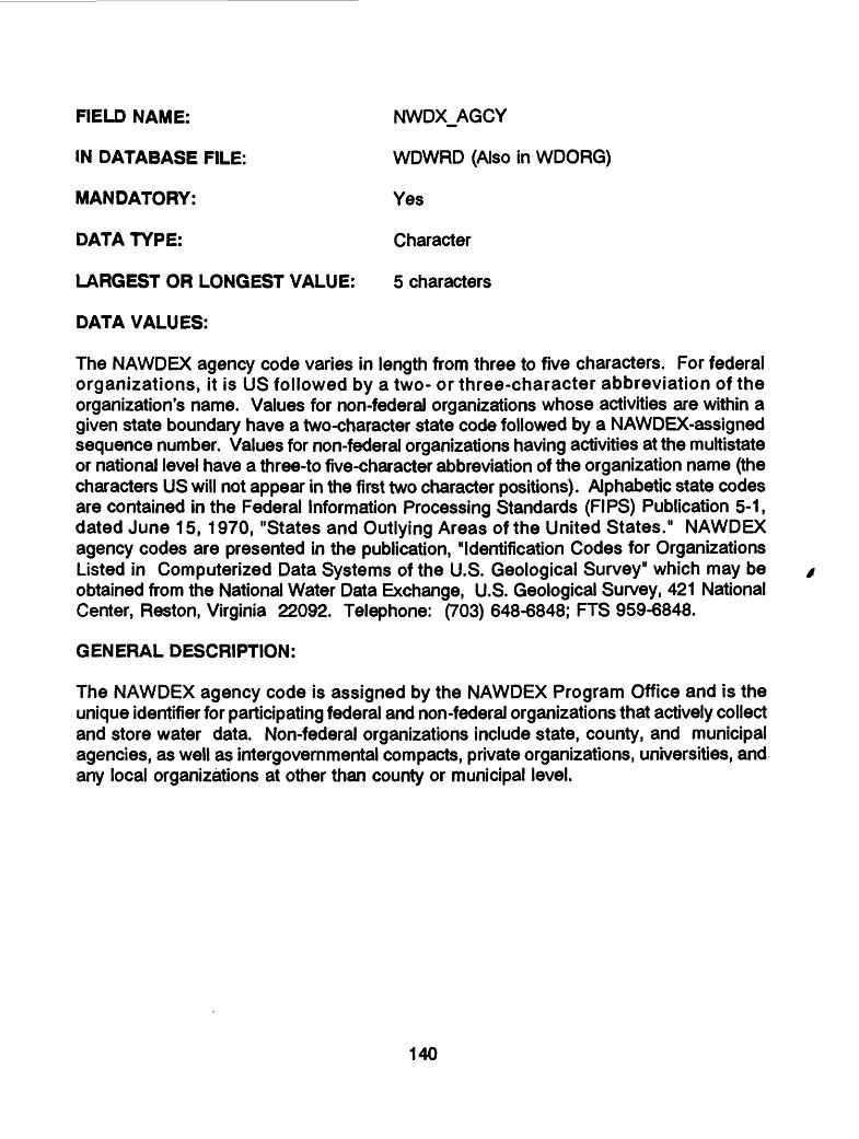
FIELD NAME: NWDX_AGCY
IN DATABASE FILE: WDWRD (Also in WDORG)
MANDATORY: Yes
DATA TYPE: Character
LARGEST OR LONGEST VALUE: 5 characters
DATA VALUES:
The NAWDEX agency code varies in length from three to five characters. For federal organizations, it is US followed by a two- or three-character abbreviation of the organization's name. Values for non-federal organizations whose activities are within a given state boundary have a two-character state code followed by a NAWDEX-assigned sequence number. Values for non-federal organizations having activities at the multistate or national level have a three-to five-character abbreviation of the organization name (the characters US will not appear in the first two character positions). Alphabetic state codes are contained in the Federal Information Processing Standards (FIPS) Publication 5-1, dated June 15, 1970, "States and Outlying Areas of the United States." NAWDEX agency codes are presented in the publication, "Identification Codes for Organizations Listed in Computerized Data Systems of the U.S. Geological Survey" which may be obtained from the National Water Data Exchange, U.S. Geological Survey, 421 National Center, Reston, Virginia 22092. Telephone: (703) 648-6848; FTS 959-6848.
GENERAL DESCRIPTION:
The NAWDEX agency code is assigned by the NAWDEX Program Office and is the unique identifier for participating federal and non-federal organizations that actively collect and store water data. Non-federal organizations include state, county, and municipal agencies, as well as intergovernmental compacts, private organizations, universities, and any local organizations at other than county or municipal level.
140

FIELD NAME: PARAM_CD
IN DATABASE FILE: WDWRD
MANDATORY: No
DATA TYPE: Character
LARGEST OR LONGEST VALUE: 99999999
DATA VALUES:
This field contains a code which identifies the type of water-related data available.
GENERAL DESCRIPTION:
The purpose of this field is to identify the individual types of water-related data that may be available from the organization. A different parameter code is assigned to each major category or subcategory of water-related data identified. A complete list of all codes assigned may be obtained from: National Water Data Exchange, U.S. Geological Survey, 421 National Center, Reston, Virginia 22092.
141
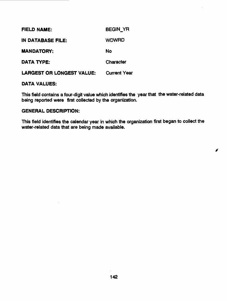
FIELD NAME: BEGIN_YR
IN DATABASE FILE: WDWRD
MANDATORY: No
DATA TYPE: Character
LARGEST OR LONGEST VALUE: Current Year
DATA VALUES:
This field contains a four-digit value which identifies the year that the water-related data being reported were first collected by the organization.
GENERAL DESCRIPTION:
This field identifies the calendar year in which the organization first began to collect the water-related data that are being made available.
142

FIELD NAME: END_YR
IN DATABASE FILE: WDWRD
MANDATORY: No
DATA TYPE: Character
LARGEST OR LONGEST VALUE: Current Year
DATA VALUES:
This field contains a four-digit value which identifies the year that data-collection activities for the water-related data being reported were ceased. If the organization is currently collecting the water-related data reported, this field is not valued.
GENERAL DESCRIPTION:
This field identifies the calendar year in which the organization discontinued collection of the water-related data being reported. If, at a future date, the collection of the water- related data is resumed, the former end date is deleted.
143
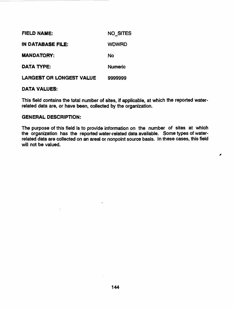
FIELD NAME: NO_SITES
IN DATABASE FILE: WDWRD
MANDATORY: No
DATA TYPE: Numeric
LARGEST OR LONGEST VALUE 9999999
DATA VALUES:
This field contains the total number of sites, if applicable, at which the reported water- related data are, or have been, collected by the organization.
GENERAL DESCRIPTION:
The purpose of this field is to provide information on the number of sites at which the organization has the reported water-related data available. Some types of water- related data are collected on an area! or nonpoint source basis. In these cases, this field will not be valued.
144

FIELD NAME: NOJDBS
IN DATABASE FILE: WDWRD
MANDATORY: No
DATA TYPE: Numeric
LARGEST OR LONGEST VALUE: 99999999
DATA VALUES:
This is the total number of occurrences or observations, if applicable, for which the reported water-related data are, or have been, collected and are available.
GENERAL DESCRIPTION:
Many types of water-related data are collected on an areal basis and the number-of- sites field is not applicable. The number of occurrences or observations of these data may, then, be reported to indicate the volume of data available to the user.
145
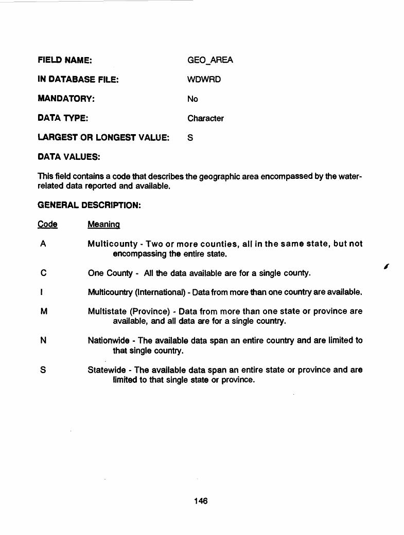
FIELD NAME: GEO_AREA
IN DATABASE FILE: WDWRD
MANDATORY: No
DATA TYPE: Character
LARGEST OR LONGEST VALUE: S
DATA VALUES:
This field contains a code that describes the geographic area encompassed by the water- related data reported and available.
GENERAL DESCRIPTION:
Code Meaning
A Multicounty - Two or more counties, all in the same state, but not encompassing the entire state.
C One County - All the data available are for a single county.
I Multicountry (International) - Data from more than one country are available.
M Multlstate (Province) - Data from more than one state or province are available, and all data are for a single country.
N Nationwide - The available data span an entire country and are limited to that single country.
S Statewide - The available data span an entire state or province and are limited to that single state or province.
146

FIELD NAME: OBS.FREQ
IN DATABASE FILE: WDWRD
MANDATORY: No
DATA TYPE: Character
LARGEST OR LONGEST VALUE: Z
DATA VALUES:
This field contains a code that best describes the frequency at which the water-related data reported are collected or measured.
GENERAL DESCRIPTION:
Code Frequency
A Annual (Once per year)B Other periodic (Less than once per year)C Continuous, Year-round - NonrecorderD Continuous, Seasonal - NonrecorderE Eliminated Activity - Data are no longer being collectedI Continuous, Year-round, Recorder usedJ Continuous, Seasonal, Recorder usedM Monthly, Year-roundN Monthly, Seasonal0 Daily, Year-roundP Daily, SeasonalQ Quarterly, Year-roundR Quarterly, SeasonalS Semiannual (Twice per year)U Unique (One-time only) measurementW Weekly, Year-roundX Weekly, SeasonalY Seasonal (No time period specified)Z Data collected at an irregular or unspecified frequency
147
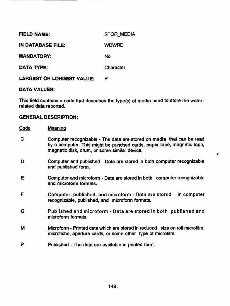
FIELD NAME: STORJ/IEDIA
IN DATABASE FILE: WDWRD
MANDATORY: No
DATA TYPE: Character
LARGEST OR LONGEST VALUE: P
DATA VALUES:
This field contains a code that describes the type(s) of media used to store the water- related data reported.
GENERAL DESCRIPTION:
Code Meaning
C Computer recognizable - The data are stored on media that can be read by a computer. This might be punched cards, paper tape, magnetic tape, magnetic disk, drum, or some similar device.
D Computer and published - Data are stored in both computer recognizable and published form.
E Computer and microform - Data are stored in both computer recognizable and microform formats.
F Computer, published, and microform - Data are stored in computer recognizable, published, 'and microform formats.
G Published and microform - Data are stored in both published and microform formats.
M Microform Printed data which are stored in reduced size on roil microfilm, microfiche, aperture cards, or some other type of microfilm.
P Published - The data are available in printed form.
148

FIELD NAME: OTHR_SRC
IN DATABASE FILE: WDWRD
MANDATORY: No
DATA TYPE: Character
LARGEST OR LONGEST VALUE: 5 characters
DATA VALUES:
This is the NAWDEX Agency Code that identifies another organization that is a source of the organization's water-related data.
GENERAL DESCRIPTION:
A complete description of the NAWDEX Agency Code may be found in this dictionary under field NWDX_AGCY. This is the same code that is also stored in field OS_AGCY. If this field is valued, the WDOS database file must also be valued.
149
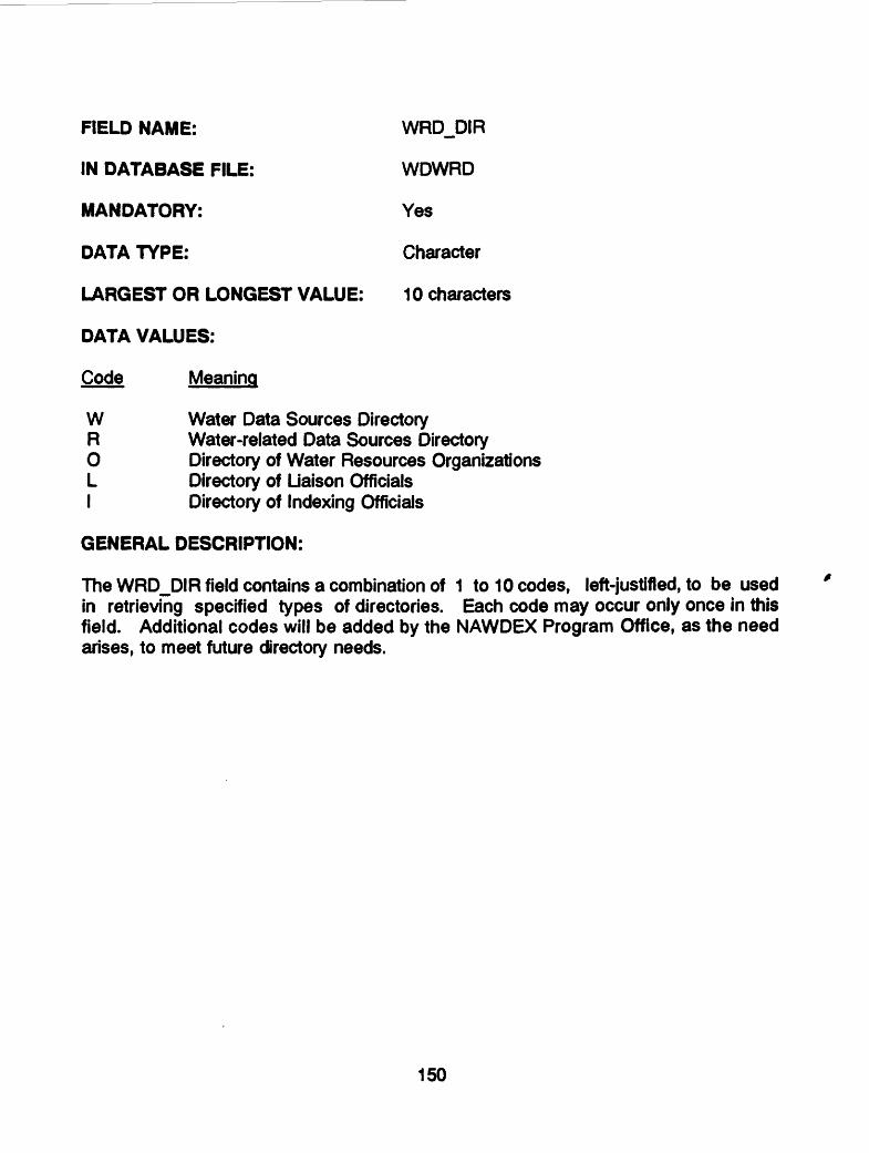
FIELD NAME: WRDJDIR
IN DATABASE FILE: WDWRD
MANDATORY: Yes
DATA TYPE: Character
LARGEST OR LONGEST VALUE: 1 0 characters
DATA VALUES:
Code Meaning
W Water Data Sources DirectoryR Water-related Data Sources DirectoryO Directory of Water Resources OrganizationsL Directory of Liaison OfficialsI Directory of Indexing Officials
GENERAL DESCRIPTION:
The WRDJDIR field contains a combination of 1 to 10 codes, left-justified, to be used in retrieving specified types of directories. Each code may occur only once in this field. Additional codes will be added by the NAWDEX Program Office, as the need arises, to meet future directory needs.
150
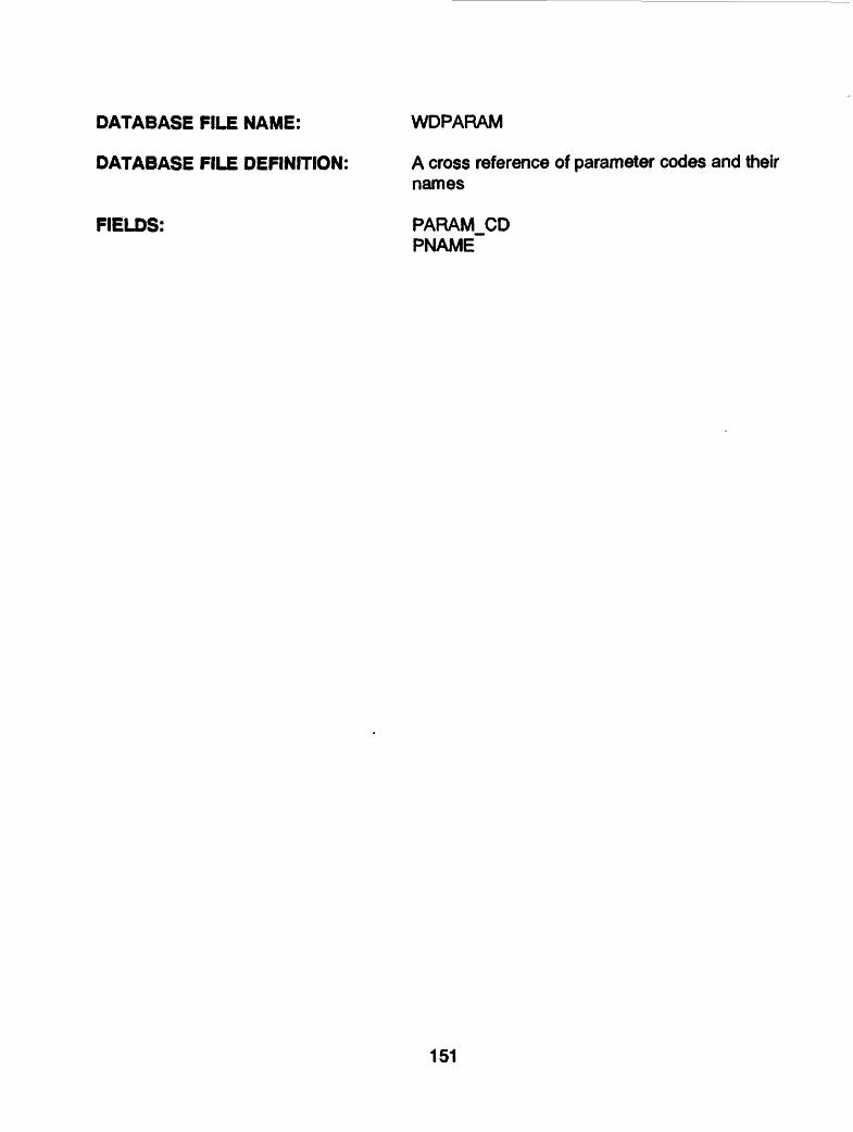
DATABASE FILE NAME: WDPARAM
DATABASE FILE DEFINITION: A cross reference of parameter codes and theirnames
FIELDS: PARAM_CDPNAME
151
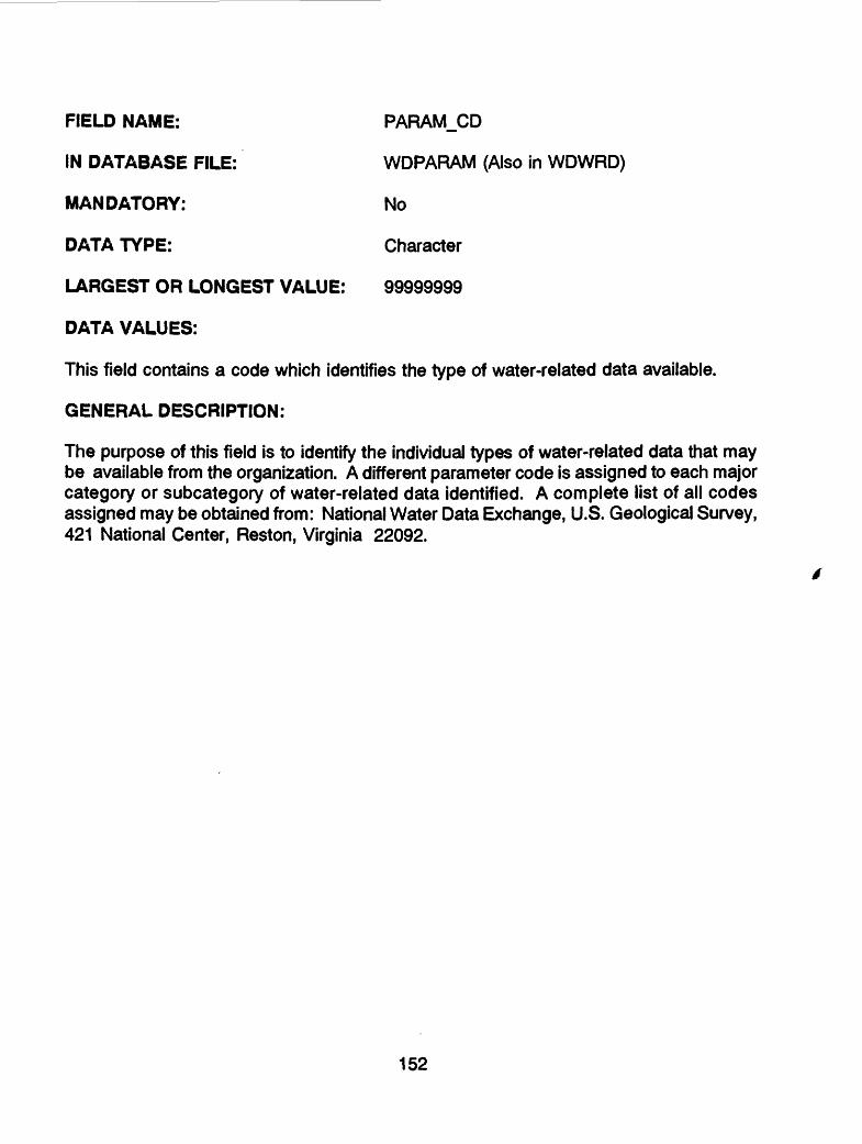
FIELD NAME: PARAM_CD
IN DATABASE FILE: WDPARAM (Also in WDWRD)
MANDATORY: No
DATA TYPE: Character
LARGEST OR LONGEST VALUE: 99999999
DATA VALUES:
This field contains a code which identifies the type of water-related data available.
GENERAL DESCRIPTION:
The purpose of this field is to identify the individual types of water-related data that may be available from the organization. A different parameter code is assigned to each major category or subcategory of water-related data identified. A complete list of all codes assigned may be obtained from: National Water Data Exchange, U.S. Geological Survey, 421 National Center, Reston, Virginia 22092.
152

FIELD NAME:
IN DATABASE FILE:
MANDATORY:
DATA TYPE:
PNAME
WDPARAM
No
Character
LARGEST OR LONGEST VALUE: 26 characters
DATA VALUES:
This field contains up to a 26-character description of a parameter code.
GENERAL DESCRIPTION:
Code Meaning
00010000 METEOROLOGICAL00010001 PRECIPITATION00010002 WIND MOVEMENT00010003 AIR TEMPERATURE00010004 PAN EVAPORATION00010005 LAKE SURFACE EVAP00010006 AIR QUALITY00010007 AIR POLLUTANTS00010008 EMISSIONS DATA00010010 PRECIP EQUIVALENTS00010011 SNOWFALL00010020 RELATIVE HUMIDITY00010030 CLIMATOLOGICAL DATA00020000 WATER USE00020001 WATER USE PUB SUP00020002 WATER USE RURAL00020003 WATER USED IRRIGATION00020004 WATER USE INDUSTRIAL00020005 WATER USED HYDRO PWR00020006 STM ELEC PWR PLANT00020007 WATER USE CEN PIVOT00020011 RETURN FLOW MUNICIPAL00020013 RETURN FLOW INDUSTRIAL00021000 STATE STREAM USE CLASS00100000 WATER RIGHTS00100001 WATER RIGHTS PERMITS
153

00100010 SELF REPORTING DATA00100012 WATER QUAL PERMIT00100100 PUBLIC WATER SUP (QUALITY)00109000 TOPOGRAPHIC DATA00109001 CARTOGRAPHIC DATA00109002 DIGITAL CARTO DATA00109003 SATELLITE IMAGERY00109010 FLOOD-PRONE AREA MAPS00109015 GEOLOGIC MAPS00109020 GEOPHYSICAL MAPS00109025 HYDROLOGIC MAPS00109030 LAND-USE MAPS00109031 LAND COVER MAPS00109035 MIN & ENGY RES MAPS00109040 NATIONAL ATLAS00109045 RIVER SURVEY MAPS00109050 SATELLITE IMAGE MAPS00109055 TOPOGRAPHIC MAPS00109060 WATER RESO DEV MAPS00109300 AERIAL PHOTOGRAPHS00109305 SPACE PHOTOGRAPHS00200000 LAND USE00201000 ABANDONED MINE INV00202000 DAM INVENTORY00300000 WELL REGISTRATION00300001 WELL PERMITS00300010 WELL LOGS00300020 GEOLOGIC MAPPING00300030 SPRINGS LOGS & MEAS00300040 GEOPHYSICAL DATA00300050 EARTHQUAKE DATA .00301000 COAL DATA SYSTEM00302000 GEOLOGIC DATA00303000 HYDROGEOLOGIC DATA00400000 OCEANOGRAPHIC DATA00500000 HAZARD DATA00500005 INDUST SOLID WASTE00500010 HAZARDS WASTE DISP00500020 HAZARDOUS SPILLS00600000 CARTOGRAPHIC PRODUCTS01000000 AGRICULTURAL DATA01000005 SOIL MOISTURE01000010 SOIL TYPES01000020 SOIL SUM FILE
154

01000021 SOIL SURVEYS01000022 SOIL MAPPING UNITS01000023 SOIL INTERP MAPS02000010 DEMOGRAPHIC DATA02000011 SOCIODEMOGRAPHIC02000020 HEALTH STATISTICS02000021 EPIDEMIOLOGIC02000030 ECONOMIC DATA02000040 NAVIGATION DATA02000050 MARINE DATA10000001 WATER DISTRICT FILE
155

DATABASE FILE NAME: WDSTATE
DATABASE FILE DEFINITION: A cross reference of state codes and theirnames
FIELDS: STATESTATEA STATES
156
FIELD NAME: STATE
IN DATABASE FILE: WDSTATE (Also in WDOSD and WDCNTY)
MANDATORY: No
DATA TYPE: Numeric
LARGEST OR LONGEST VALUE: 99
DATA VALUES:
This field contains a code representing the state or outlying area in which the organization operates data collection sites. A complete list of state or outlying area codes is contained in the Federal Information Processing Standards (FIPS) Publication 5-1, "States and Outlying Areas of the United States," dated June 15, 1970.
GENERAL DESCRIPTION:
The STATE field is valued for those states or outlying area in which there are sites for which the organization has data. It bears no relationship to the location of the organization.
157

FIELD NAME: STATEA
IN DATABASE FILE: WDSTATE
MANDATORY: No
DATA TYPE: Character
LARGEST OR LONGEST VALUE: 1 6 characters
DATA VALUES:
This field contains up to the first 16 characters of the name of the state or outlying area in which the organization operates data collection sites. A complete list of state or outlying area names is contained in the Federal Information Processing Standards (FIPS) Publication 5-1, "States and Outlying Areas of the United States, dated June 15,1970.
GENERAL DESCRIPTION:
This field is valued for those states or outlying areas that have a value for the STATE field.
158

FIELD NAME: STATES
IN DATABASE FILE: WDSTATE
MANDATORY: No
DATA TYPE: Character
LARGEST OR LONGEST VALUE: 1 4 characters
DATA VALUES:
This field contains up to the last 14 characters of the name of the state or outlying area in which the organization operates data collection sites. A complete list of state or outlying area names is contained in the Federal Information Processing Standards (FIPS) Publication 5-1, "States and Outlying Areas of the United States," dated June 15, 1970.
GENERAL DESCRIPTION:
This field is valued for those states or outlying areas that have a value for the STATE field and the name is longer than 16 characters.
159

DATABASE FILE NAME: WDCNTRY
DATABASE FILE DEFINITION: A cross reference of country codes and theirnames
FIELDS: NUS_CNTRYNUS CNTRYA
160
FIELD NAME: NUS_CNTRY
IN DATABASE FILE: WDCNTRY (Also in WDOSD)
MANDATORY: No
DATA TYPE: Character
LARGEST OR LONGEST VALUE: 2 characters
DATA VALUES:
This field contains a country code only if the organization operates data collection sites physically located outside the United States. If the organization's data collection sites are within the United States, the field is not valued. A complete list of country codes is contained in the Federal Information Processing Standards (FIPS) Publication 10-2, "Countries, Dependencies, and Areas of Special Sovereignty," dated 1976.
GENERAL DESCRIPTION:
The non-United States country code is valued for only those organizations that operate data collection sites that lie outside of the borders of the United States and its outlying areas. It bears no relationship to the location of the organization.
161

FIELD NAME: NUS__CNTRYA
IN DATABASE FILE: WDCNTRY
MANDATORY: No
DATA TYPE: Character
LARGEST OR LONGEST VALUE: 1 6 characters
DATA VALUES:
This field contains up to 16 characters of the name of the country in which the organization operates data collection sites. A complete list of country names is contained in the Federal Information Processing Standards (FIPS) Publication 10-2, "Countries, Dependencies, and Areas of Special Sovereignty," dated 1976.
GENERAL DESCRIPTION:
This field is valued for those countries that have a value for the NUS_CNTRY field.
162

DATABASE FILE NAME: WDDAT
DATABASE FILE DEFINITION: A cross reference relating the NAWDEXagency, state numeric code, and the type of site
FIELDS: NWDX_AGCYSTATE DAT
163

FIELD NAME: NWDX_AGCY
IN DATABASE FILE: WDDAT (Also in WDORG)
MANDATORY: Yes
DATA TYPE: Character
LARGEST OR LONGEST VALUE: 5 characters
DATA VALUES:
The NAWDEX agency code varies in length from three to five characters. For federal organizations, it is US followed by a two- or three-character abbreviation of the organization's name. Values for non-federal organizations whose activities are within a given state boundary have a two-character state code followed by a NAWDEX-assigned sequence number. Values for non-federal organizations having activities at the multistate or national level have a three-to five-character abbreviation of the organization name (the characters US will not appear in the first two character positions). Alphabetic state codes are contained in the Federal Information Processing Standards (FIPS) Publication 5-1, dated June 15, 1970, "States and Outlying Areas of the United States." NAWDEX agency codes are presented in the publication, "Identification Codes for Organizations Listed in Computerized Data Systems of the U.S. Geological Survey" which may be obtained from the National Water Data Exchange, U.S. Geological Survey, 421 National Center, Reston, Virginia 22092. Telephone: (703) 648-6848; FTS 959-6848.
GENERAL DESCRIPTION:
The NAWDEX agency code is assigned by the NAWDEX Program Office and is the unique identifier for participating federal and non-federal organizations that actively collect and store water data. Non-federal organizations include state, county, and municipal agencies, as well as intergovernmental compacts, private organizations, universities, and any local organizations at other than county or municipal level.
164

FIELD NAME: STATE
IN DATABASE FILE: WDDAT (Also in WDOSD and WDCNTY)
MANDATORY: No
DATA TYPE: Numeric
LARGEST OR LONGEST VALUE: 99
DATA VALUES:
This field contains a code representing the state or outlying area in which the organization operates data collection sites. A complete list of state or outlying area codes is contained in the Federal Information Processing Standards (FIPS) Publication 5-1, "States and Outlying Areas of the United States," dated June 15, 1970.
GENERAL DESCRIPTION:
The STATE field is valued for those states or outlying area in which there are sites for which the organization has data. It bears no relationship to the location of the organization.
165
FIELD NAME: DAT
IN DATABASE FILE: WDDAT
MANDATORY: No
DATA TYPE: Character
LARGEST OR LONGEST VALUE: 11111
DATA VALUES:
This field contains 5 digits with each digit valued as "0" or "1".
GENERAL DESCRIPTION:
WDDAT is created as necessary by the program, WDMAJN. A "1" indicates information about the number and type of site operated by the organization exist. A "0" indicates no information exist. Position 1 of this field pertains to the SW QNTY field or the MSW QNTY field. Position 2 pertains to the SW QLTY field or the MSW_QLTY field. Position 3 pertains to the GW QLTY field or the MGW QLTY field. Position 4 pertains to the GW LVL field or the MGW LVL field. Position Spertains to the GW PUMP field or the MGW PUMP field.
166
REFERENCES
Burton, J. S., Morris, J. E., Green, J. W., and Dolnack, D. J., 1991, Improved service of the U.S. Geological Survey's National Water Data Exchange (NAWDEX) Program, in Second International Symposium on Advanced Technology in Natural Resources Management, Washington, D.C., November 12-15,1990, Proceedings: Resource Technology 90, p. 186-205.
Edwards, M. D., and Josef son, B. M., 1982, Identification codes for organizations listed in computerized data systems of the U.S. Geological Survey: U.S. Geological Survey Open-File Report 82-921, 114 p.
Edwards, M. D., 1982, Definitions of the components of the Water Data Sources Directory maintained by the National Water Data Exchange: U.S. Geological Survey Open- File Report 82-923, 121 p.
U.S. Department of Commerce, National Bureau of Standards, 1970, States and outlying areas of the United States: Federal Information Processing Standards (FIPS) Publication 5-1, 4 p.
___ 1976, Countries, dependencies, and areas of special sovereignty: Federal Information Processing Standards (FIPS) Publication 10-2, 25 p.
____ 1978, Codes for named populated places and related entities of the States of the United States, Volumes 1 and 2: Federal Information Processing Standards (FIPS) Publication 55, 1,946 p.
___ 1979, Counties and county equivalents of the States of the United States and the District of Columbia: Federal Information Processing Standards (FIPS) Publication 6-3, 35 p.
167