nettleham neighbourhood plan review 2021
TRANSCRIPT

Nettleham Neighbourhood Plan Review 2021
June 2021 consultation

What is a Neighbourhood Plan? • A Neighbourhood Plan is a community-led planning policy document that is
created by local people. Its aims, objectives and policies help to steer the right developments in the right locations.
• Nettleham has an existing Neighbourhood Plan which was approved at a Public Referendum in 2016 and made by West Lindsey District Council in March 2016.
• Since 2016, the Neighbourhood Plan has been successful in helping to guide appropriate development within the Parish. It helped to reject large proposals that would have significantly increased the size of the village, whilst allocating smaller development sites in locations agreed by the community.
• Due to change in Government and local planning legislation, the Neighbourhood Plan needs to be reviewed so that it conforms to relevant updated legislation.

How does a Neighbourhood Plan work with other Planning Documents?
National Policy Planning
Framework
Local Plan (Central
Lincolnshire Plan (CLP))
Neighbourhood Plan
The National Planning Policy Framework sets out the Government’s planning policies for England and how these should be applied. It provides a framework within which locally-prepared plans for housing and other development can be produced
Local Plans set out the strategic priorities for development of an area and cover housing, commercial, public and private development, including transport infrastructure. They set out guidance on what development will and won’t be permitted in your area
A Neighbourhood Plan enables a community to develop a shared vision for their community and shape the development and growth specifically within their local area. Policies developed within the NP are statutory
Planning applications
must be compliant
with all three plans

The Neighbourhood Plan Process
Designating the Neighbourhood
Area
Preparing a Draft
Neighbourhood Plan
Pre-submission and consultation
Submission of Neighbourhood
Plan to Local Authority
Independent Examination
We are here
Plan is ‘MADE’ REFERENDUM

Nettleham Neighbourhood Plan Review - FAQs
• How can I have input to the plans?
Complete the questionnaire today
Talk to the representatives from the Parish Council
Use the stickers provided to leave your comments on any of the displays.
Your views will be recorded and collated and where appropriate, feed into the next draft of the plan
The process is ongoing – there will be other stages along the way when we will want your input and
feedback
• Next Steps?
There will be a presentation of the feedback in July, and a questionnaire survey delivered to all
households in Nettleham parish
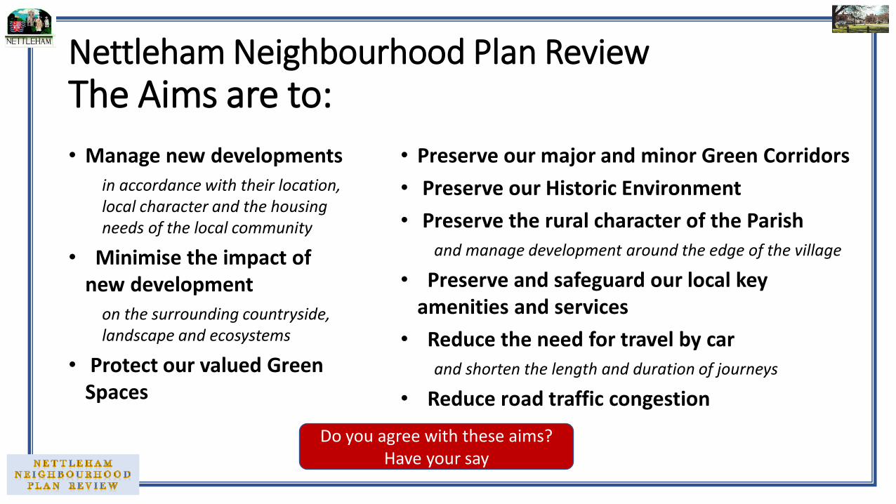
Nettleham Neighbourhood Plan Review The Aims are to:
• Manage new developments
in accordance with their location, local character and the housing needs of the local community
• Minimise the impact of new development
on the surrounding countryside, landscape and ecosystems
• Protect our valued Green Spaces
• Preserve our major and minor Green Corridors
• Preserve our Historic Environment
• Preserve the rural character of the Parish
and manage development around the edge of the village
• Preserve and safeguard our local key amenities and services
• Reduce the need for travel by car
and shorten the length and duration of journeys
• Reduce road traffic congestion
Do you agree with these aims? Have your say

Environment (1) • Policy E1 – Protecting the Green Wedge
Proposals for built development within the identified Green Wedge will be carefully controlled.
• Policy E2 – Local Green Spaces Identified Green Spaces to be protected
• Policy E3 – The Historic Environment Developments that conserve or enhance the significance of heritage assets and their setting will be supported
Development proposals which would directly affect a heritage asset or its setting should be accompanied with a Heritage Impact Assessment.

• Policy E4 – Major and Minor Green
Corridors Major and minor Green Corridors (see map)
…have been identified for their strong contribution to the character of Nettleham and importance to the movement of local wildlife and people. Proposals that impact a major or minor Green Corridor should demonstrate how the impacts have been considered
Environment (2)
Proposals that provide an enhancement to a major or minor Green Corridor will be strongly supported.
Green Space (Public)
Green Space (not public)
Beck Field paths/bridleways
Accessibility, Parking Standards and Highways Safety • Policy D1 – Road safety, parking provision, active transport
Where appropriate, all new development proposals will need to demonstrate that they can provide suitable access, clear visibility, and pedestrian safety to and from the site.
All development proposals should provide an appropriate level of off-street parking and, for a residential use, an appropriate level of off-street parking is defined as:
1 – 2 bedrooms = 2 spaces (per property); or 3 – 4 bedrooms = 3 spaces (per property); or 5 or more bedrooms = 4 spaces (per property).
Where appropriate, all new development will be expected to incorporate pedestrian and cycle infrastructure into the design of the scheme.
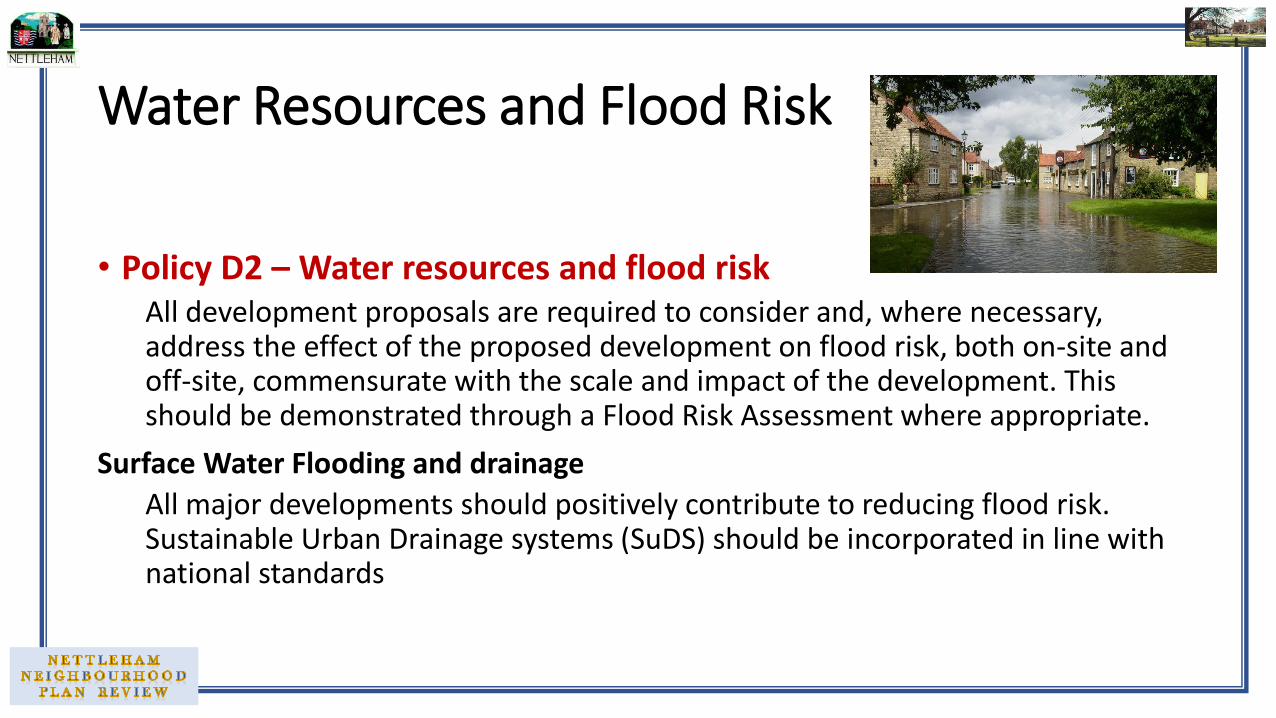
Water Resources and Flood Risk
• Policy D2 – Water resources and flood risk All development proposals are required to consider and, where necessary, address the effect of the proposed development on flood risk, both on-site and off-site, commensurate with the scale and impact of the development. This should be demonstrated through a Flood Risk Assessment where appropriate.
Surface Water Flooding and drainage
All major developments should positively contribute to reducing flood risk. Sustainable Urban Drainage systems (SuDS) should be incorporated in line with national standards

Design of New Development and Parish-wide Design Code Principles
• Policy D3 – Development in keeping with local character To ensure that growth across the Plan Area is delivered in a coherent and coordinated way, development should positively address the relevant principles in the Nettleham Character Assessment and Design Code principles.
Developers will be expected to demonstrate that design options, proportionate to the nature and scale of development, informed by an understanding of local context have been used to determine the most appropriate form of development.

Housing Development within the Development Boundary of Nettleham • Policy D4 – Village footprint
Unless demonstrated otherwise, proposals for new residential development will only be supported if filling a gap within existing developed footprint of Nettleham, and it meets all the following criteria:
a) It is only proposing 1 or 2 dwellings per site, unless a greater number would not lead to the site becoming overdeveloped and therefore out of scale with the immediate character of the locality;
b) has regard to the overall character of the area and the current layout, density and size of the surrounding plots and dwellings to which the scheme relates;
c) safeguards the integrity of existing garden spaces and the relationship between property sizes and their wider curtilages

Settlement Development Boundary suggestions
curtilages;
Do you agree with these locations?
Have your say
Site Ref Status
CL4660 Completed
CL4726 Completed
CL4661 Under development
CL4662 Outline Planning
1, 2, 3 Potential sites should additional housing in Nettleham be required by the CLP
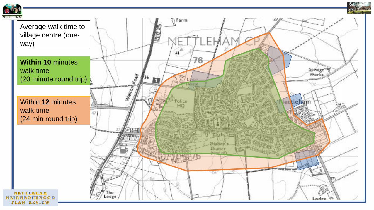
Within 10 minutes
walk time
(20 minute round trip)
Within 12 minutes
walk time
(24 min round trip)
Average walk time to
village centre (one-
way)
Housing development on the edge of the developed footprint or within the open countryside • Policy D5 – Development outside of village footprint
Proposals for residential development outside of but immediately adjacent to the developed footprint of Nettleham will only be supported if they are compliant with the Central Lincolnshire Local Plan.
Proposals for residential development elsewhere in the neighbourhood area will only be supported where they meet the criteria included in the Central Lincolnshire Local Plan. In addition, development proposals should demonstrate that they have undertaken an assessment of other alternative potential development options within the developed footprint of Nettleham.

Housing Mix and Affordable or Specialist Housing • Policy D6 – Housing stock
1. All proposals over 10 units in size, should provide a good mix of dwelling types and provide 25% affordable housing.
2. The mix of types of dwellings should:
• provide an appropriate balance of house size, type and tenure to meet the housing needs of the local community;
• specifically incorporate units for the needs of the younger and older populations
• consider the need for supported living units for those with disabilities or mobility issues.
3. The affordable housing should:
• be delivered on the application site concerned unless it can be demonstrated that exceptional circumstances exist to necessitate equivalent provision on another site and/or the making of a payment for other off-site provision;
• be integrated into the wider layout of the housing sites concerned.

Community Services and Amenities
Policy S1 – Community The existing facilities (see list), will be safeguarded for community purposes throughout the plan period.
• Proposals to redevelop, or change the use of, an existing community facility to a non-community use shall only be supported where conditions are met:
• Proposals for a new community facility will only be supported if it located within the developed footprint of Nettleham, unless there is a demonstrated need for such a proposal and a more central site is not available elsewhere in the village.
What else would you like to see in Nettleham?
Community Facilities
Library (The Hub)
Medical Centre
All Saints Church, Methodist Church
Medical Centre
Mulsanne Park Pavilion and playing field, tennis courts, Bowls Club
Junior School Infants School
The Old School Building Village Hall
Bill Bailey’s Memorial Field Children’s play areas, skate park
The Black Horse, The White Hart, The Plough Public Houses
All the small shops /takeaways /cafes in the Conservation Area
The Co-operative convenience store Nettleham Convenience Store

Linelands site – the future?
• Do we need another sheltered care accommodation for over 55s?
• Should it be a small courtyard development like Ambrose Court?
• Should it be a bungalow development like Jubilee Court?
• Should it be sold off for market housing?
• Any other thoughts?
Have your say