next-generation probabilistic wsr-88d rainfall algorithms...
TRANSCRIPT

Next-generation ProbabilisticWSR-88D Rainfall Algorithms
in theNational Weather Service
Richard Fulton
PQPE Contract ManagerHydrology Laboratory
National Weather Service
Probabilistic Quantitative Precipitation WorkshopApril 14, 2003
Iowa City, Iowa

Outline
P Where are we now?
P Where do we want to go?
P Why do we want to do this?
P How do we get there from here?
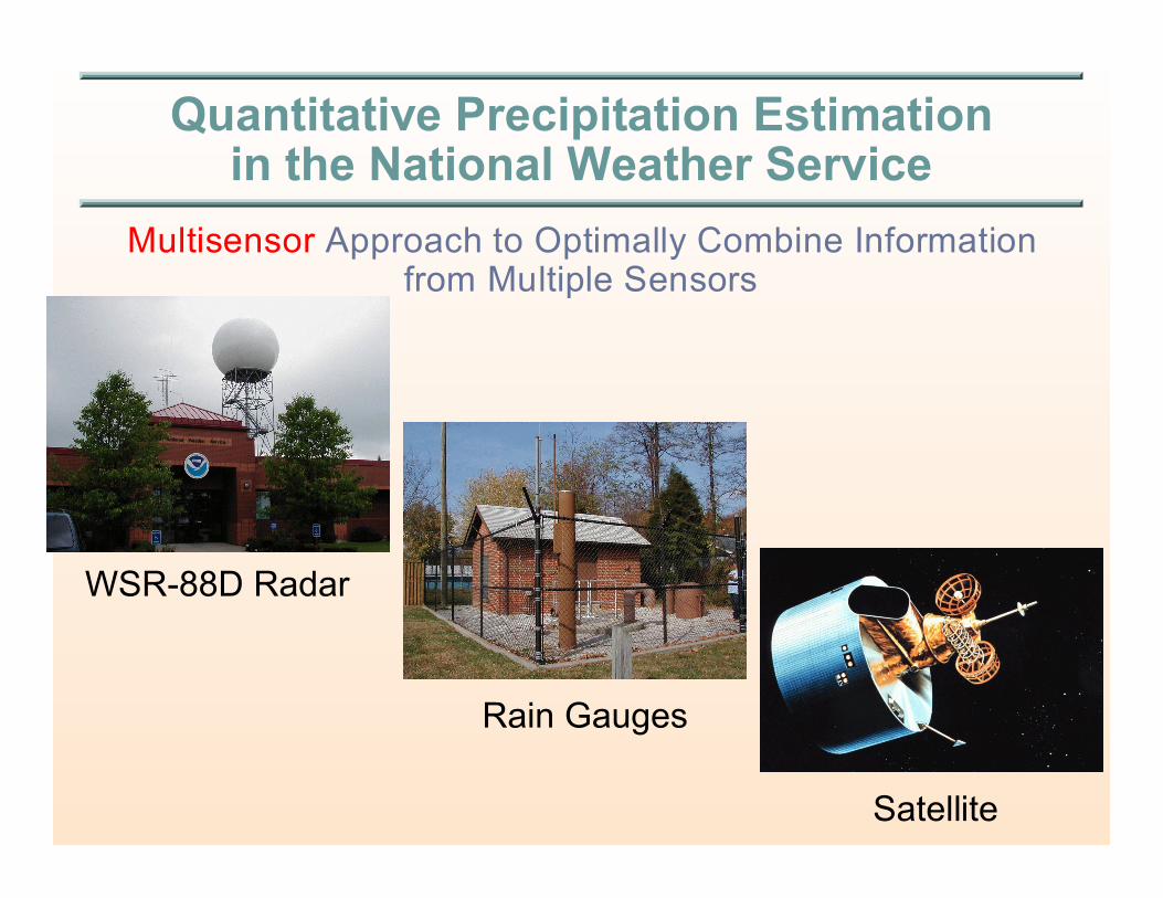
Quantitative Precipitation Estimationin the National Weather Service
Multisensor Approach to Optimally Combine Informationfrom Multiple Sensors
WSR-88D Radar
Rain Gauges
Satellite
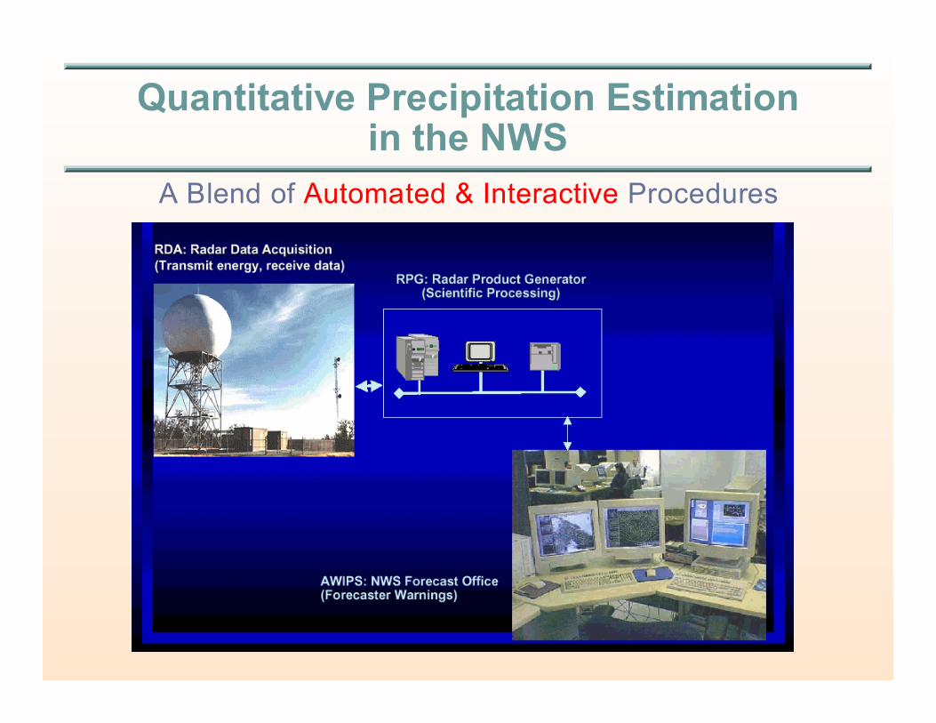
Quantitative Precipitation Estimationin the NWS
A Blend of Automated & Interactive Procedures
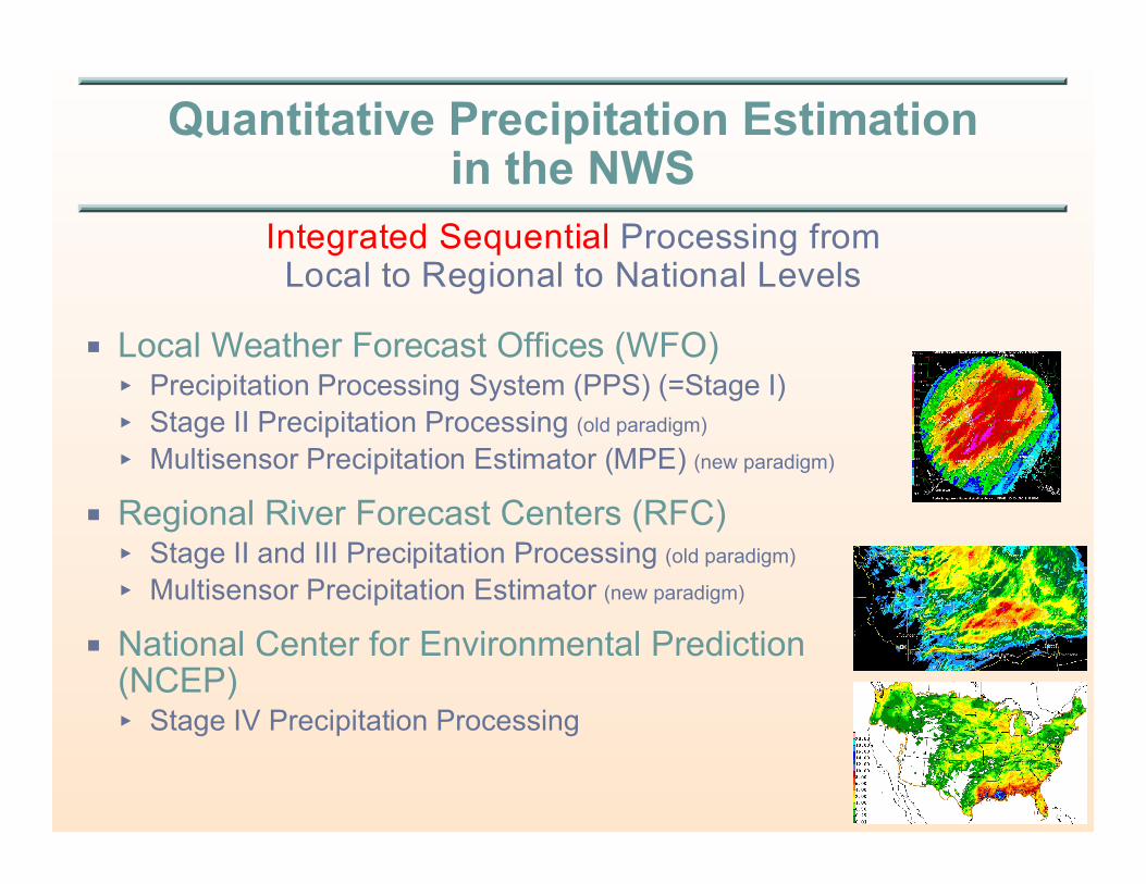
Quantitative Precipitation Estimationin the NWS
Integrated Sequential Processing fromLocal to Regional to National Levels
P Local Weather Forecast Offices (WFO)< Precipitation Processing System (PPS) (=Stage I)
< Stage II Precipitation Processing (old paradigm)
< Multisensor Precipitation Estimator (MPE) (new paradigm)
P Regional River Forecast Centers (RFC)< Stage II and III Precipitation Processing (old paradigm)
< Multisensor Precipitation Estimator (new paradigm)
P National Center for Environmental Prediction (NCEP)< Stage IV Precipitation Processing
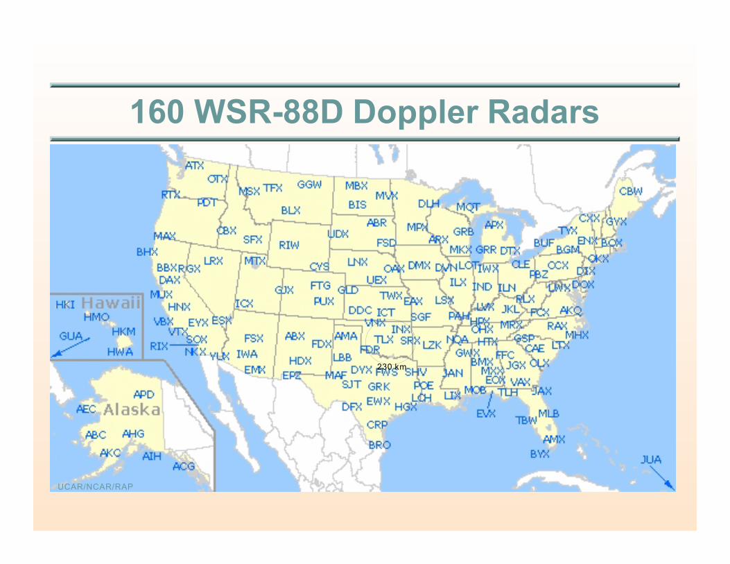
160 WSR-88D Doppler Radars
UCAR/NCAR/RAP
230 km
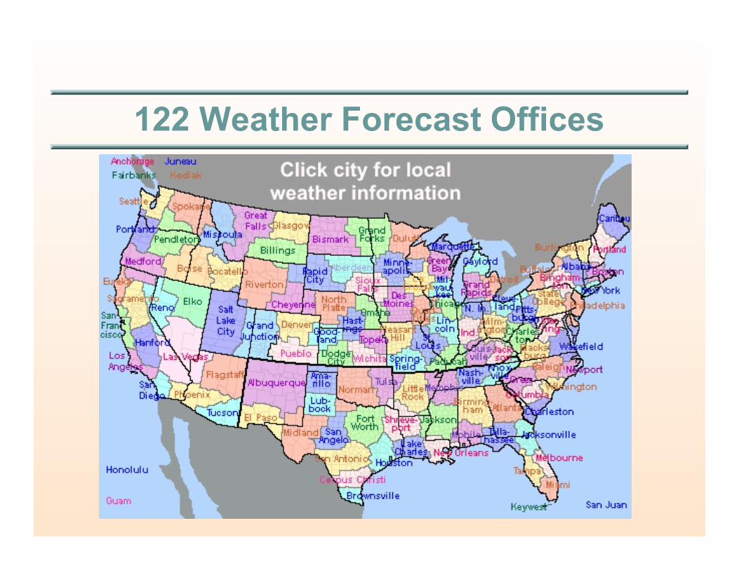
122 Weather Forecast Offices
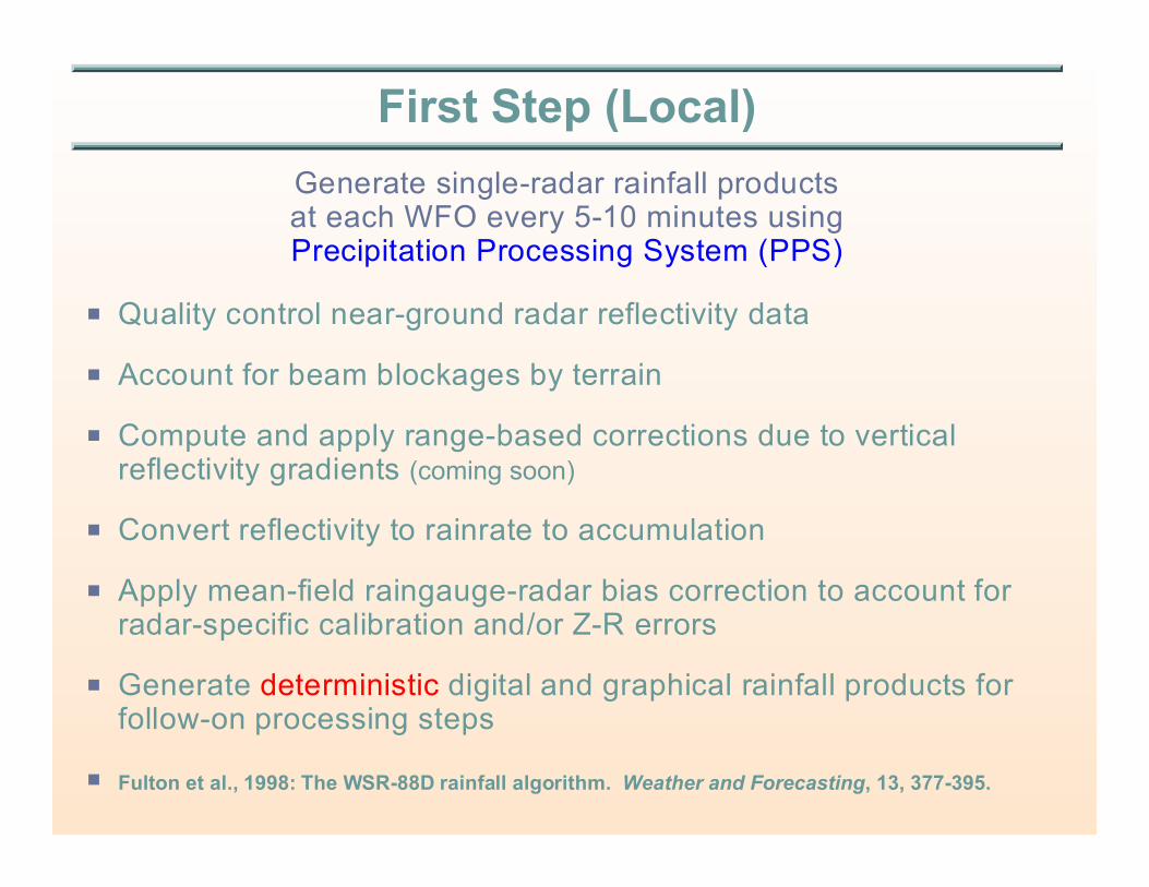
First Step (Local)
Generate single-radar rainfall productsat each WFO every 5-10 minutes usingPrecipitation Processing System (PPS)
P Quality control near-ground radar reflectivity data
P Account for beam blockages by terrain
P Compute and apply range-based corrections due to verticalreflectivity gradients (coming soon)
P Convert reflectivity to rainrate to accumulation
P Apply mean-field raingauge-radar bias correction to account forradar-specific calibration and/or Z-R errors
P Generate deterministic digital and graphical rainfall products forfollow-on processing steps
P Fulton et al., 1998: The WSR-88D rainfall algorithm. Weather and Forecasting, 13, 377-395.

Graphical16-levelimage
products
1-hr, 3-hr,storm-total, &user-definedaccumulation
periods
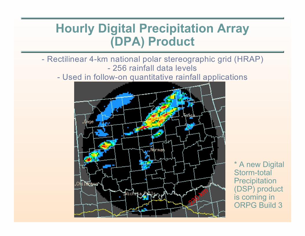
Hourly Digital Precipitation Array(DPA) Product
- Rectilinear 4-km national polar stereographic grid (HRAP)- 256 rainfall data levels
- Used in follow-on quantitative rainfall applications
* A new DigitalStorm-totalPrecipitation(DSP) productis coming inORPG Build 3
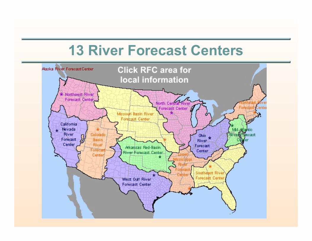
13 River Forecast Centers

Second Step (Regional)
Generate 4-km regionally-mosaicked hourly multisensor rainfall products at each RFC and WFO
using Multisensor Precipitation Estimator (MPE)
P Compute & apply hourly mean-field raingauge-radar correctionsfor each WSR-88D radar
P Regionally mosaic these hourly rainfall products
P Merge radar, gauge, and satellite rainfall estimates to generatemultisensor rainfall grids
P Interactively quality control real-time rain gauge, radar & satelliterainfall estimates. Iterate the above if needed
P Generate deterministic, hourly, regional, multisensor rainfallmosaic products on the 4-km HRAP grid
P http://www.nws.noaa.gov/oh/hrl/presentations/mpe_training_wkshp_0601/course_outline.htm
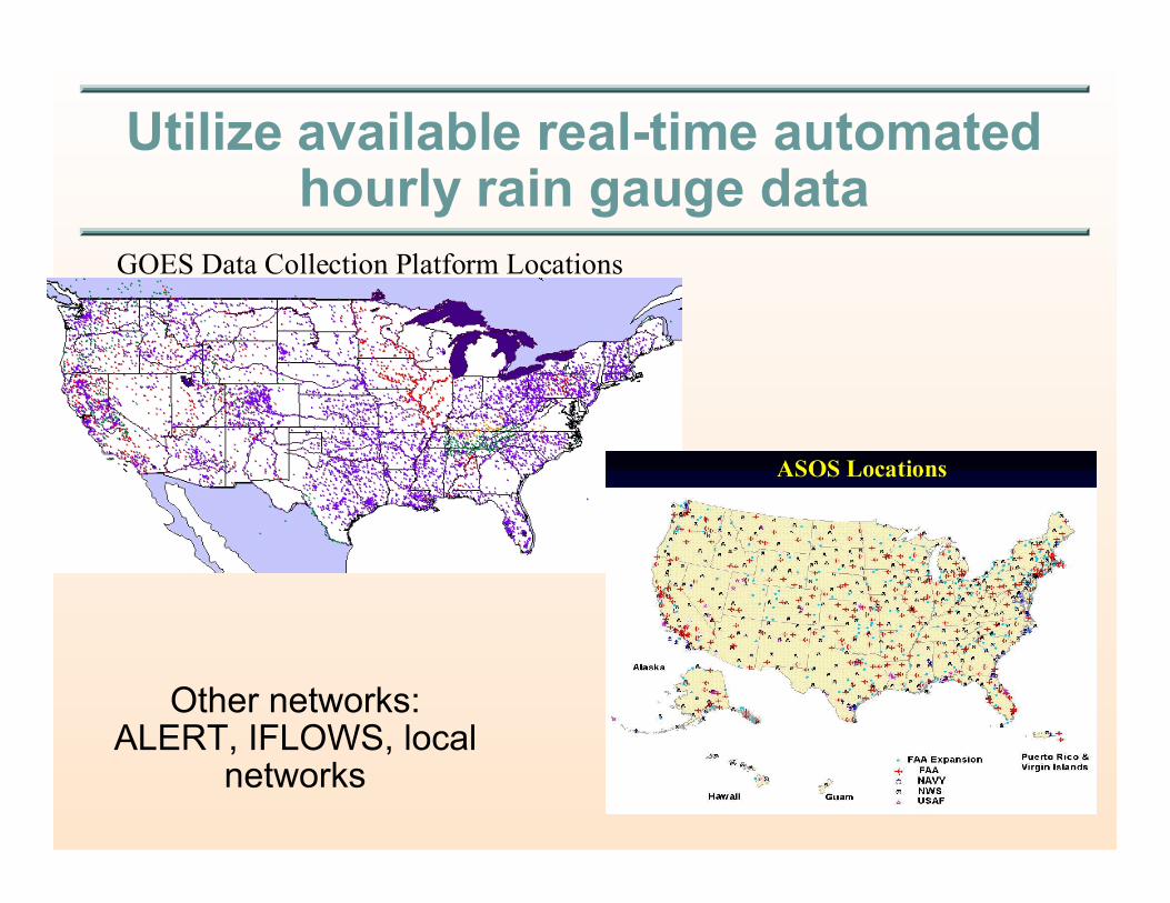
Utilize available real-time automatedhourly rain gauge data
GOES Data Collection Platform Locations
Other networks:ALERT, IFLOWS, local
networks
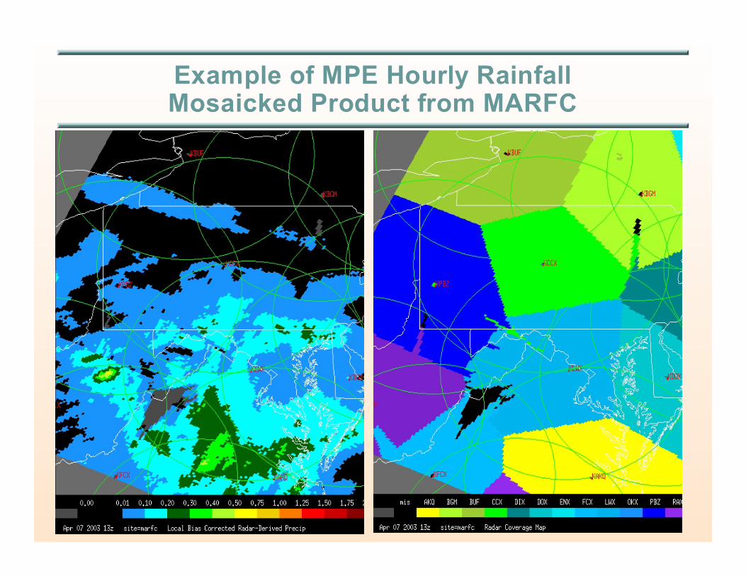
Example of MPE Hourly RainfallMosaicked Product from MARFC

Regional hourly multisensor rainfall products may thenbe used as input to RFC hydrologic forecast models of
the River Forecast System
Third Step (National)
Generate National Mosaic of Hourly Rainfall Products usingStage IV Precipitation Processing algorithm
P NWS/NCEP/EMC performs national radar-gauge rainfallmosaicking< http://wwwt.emc.ncep.noaa.gov/mmb/ylin/pcpanl/
< See Baldwin and Mitchell, 1997: The NCEP hourly multisensor U.S. precipitation analysis foroperations and GCIP research. Preprints, 13th AMS Conference on Hydrology, 54-55
P Used as input to NWS numerical weather prediction modelsto improve quality of:< 4-d data assimilation of precipitation (Eta Data Assimilation System) and short-
term Eta model precipitation forecasts< Other water cycle components, e.g., soil moisture
< See Lin et al., 2001: Spring 2001 changes to NCEP Eta analysis and forecast system:Assimilation of observed precipitation data. Preprints, 9th Conf. Meso. Proc., J92-J95
P Used for verification of QPFs from NCEP NWP models, HPCand RFC forecasters< http://www.hpc.ncep.noaa.gov/npvu/
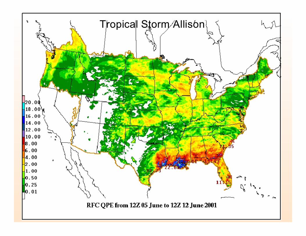
Tropical Storm Allison
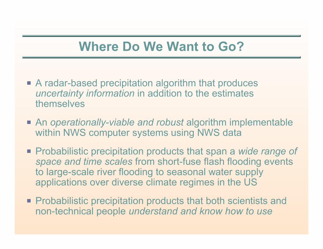
Where Do We Want to Go?
P A radar-based precipitation algorithm that producesuncertainty information in addition to the estimatesthemselves
P An operationally-viable and robust algorithm implementablewithin NWS computer systems using NWS data
P Probabilistic precipitation products that span a wide range ofspace and time scales from short-fuse flash flooding eventsto large-scale river flooding to seasonal water supplyapplications over diverse climate regimes in the US
P Probabilistic precipitation products that both scientists andnon-technical people understand and know how to use
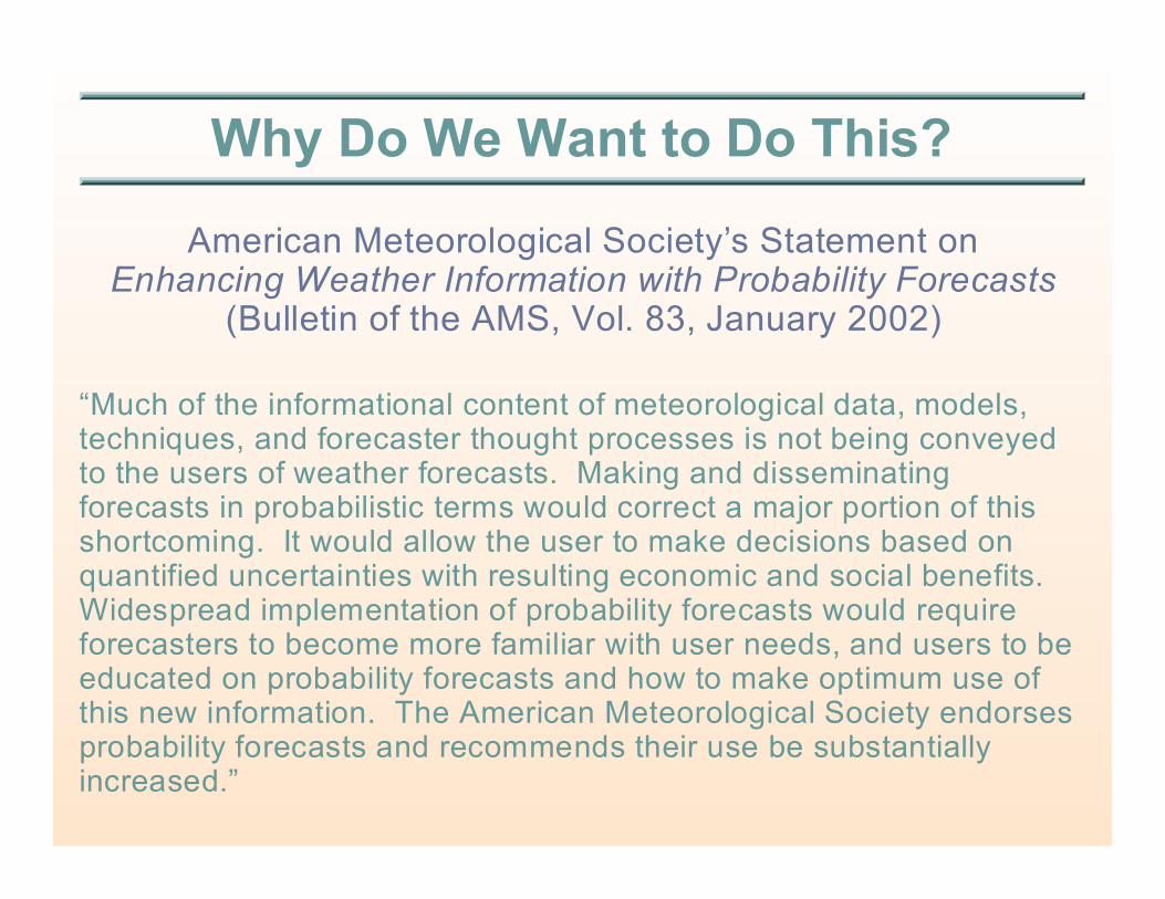
Why Do We Want to Do This?
American Meteorological Society’s Statement onEnhancing Weather Information with Probability Forecasts
(Bulletin of the AMS, Vol. 83, January 2002)
“Much of the informational content of meteorological data, models,techniques, and forecaster thought processes is not being conveyedto the users of weather forecasts. Making and disseminatingforecasts in probabilistic terms would correct a major portion of thisshortcoming. It would allow the user to make decisions based onquantified uncertainties with resulting economic and social benefits. Widespread implementation of probability forecasts would requireforecasters to become more familiar with user needs, and users to beeducated on probability forecasts and how to make optimum use ofthis new information. The American Meteorological Society endorsesprobability forecasts and recommends their use be substantiallyincreased.”
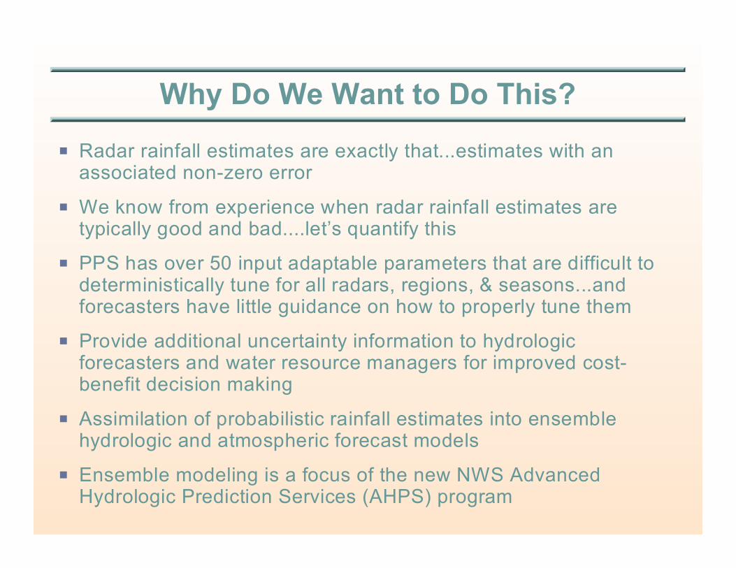
Why Do We Want to Do This?
P Radar rainfall estimates are exactly that...estimates with anassociated non-zero error
P We know from experience when radar rainfall estimates aretypically good and bad....let’s quantify this
P PPS has over 50 input adaptable parameters that are difficult todeterministically tune for all radars, regions, & seasons...andforecasters have little guidance on how to properly tune them
P Provide additional uncertainty information to hydrologicforecasters and water resource managers for improved cost-benefit decision making
P Assimilation of probabilistic rainfall estimates into ensemblehydrologic and atmospheric forecast models
P Ensemble modeling is a focus of the new NWS AdvancedHydrologic Prediction Services (AHPS) program

How Do We Get There from Here?
P Identify funding and establish a 3-year external competitivecontract< Advanced Hydrologic Prediction Services (AHPS) and Radar Operations
Center (ROC) provide funding
< University of Iowa IIHR won the competition in Sept. 2002
P Establish a PQPE project with practical, implementableresults for the NWS Hydrology Program
P Build on recent fundamental research in radar rainfalluncertainty estimation
P Partner with Univ. of Iowa IIHR and others for collaborativestrategic planning and path finding
P NWS desires an initial version of an operationally-viable androbust PQPE software algorithm at end of Year 3
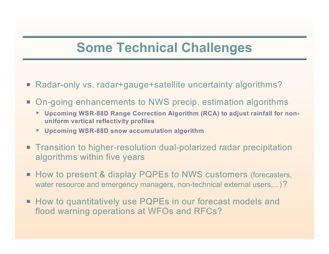
Some Technical Challenges
P Radar-only vs. radar+gauge+satellite uncertainty algorithms?
P On-going enhancements to NWS precip. estimation algorithms< Upcoming WSR-88D Range Correction Algorithm (RCA) to adjust rainfall for non-
uniform vertical reflectivity profiles
< Upcoming WSR-88D snow accumulation algorithm
P Transition to higher-resolution dual-polarized radar precipitationalgorithms within five years
P How to present & display PQPEs to NWS customers (forecasters,
water resource and emergency managers, non-technical external users,...)?
P How to quantitatively use PQPEs in our forecast models andflood warning operations at WFOs and RFCs?
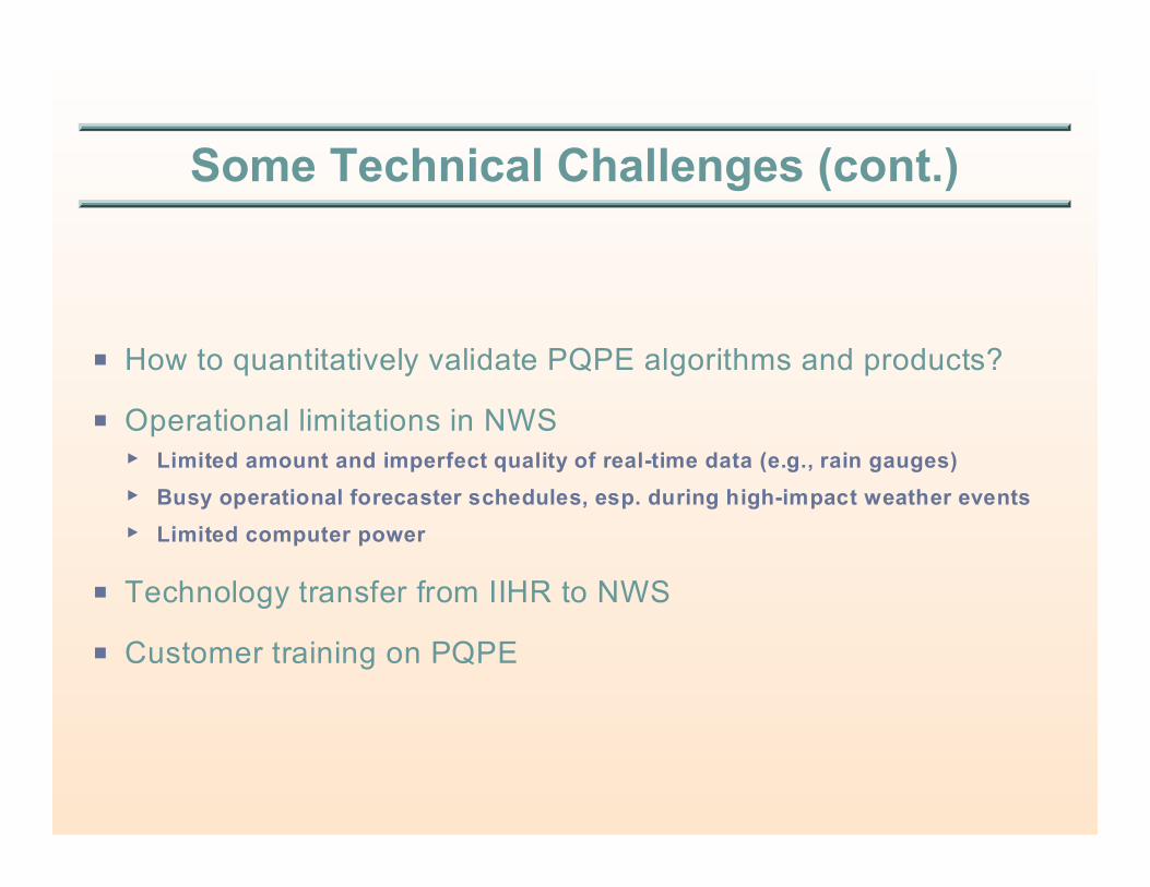
Some Technical Challenges (cont.)
P How to quantitatively validate PQPE algorithms and products?
P Operational limitations in NWS< Limited amount and imperfect quality of real-time data (e.g., rain gauges)
< Busy operational forecaster schedules, esp. during high-impact weather events
< Limited computer power
P Technology transfer from IIHR to NWS
P Customer training on PQPE

Conclusion
P There is no better time than the present tobegin developing next-generation NWSradar-based precipitation algorithms andproducts