nms state of sanctuary cover - microsoft · 10 gerry e. studds stellwagen bank national marine...
TRANSCRIPT


The National Marine Sanctuary System National Oceanicand AtmosphericAdministrationUS Secretary of CommerceDonald L. Evans
Under Secretary of Commercefor Oceans and Atmosphereand Administrator, NationalOceanic and AtmosphericAdministrationVice AdmiralConrad C. Lautenbacher,USN (Ret.)
Assistant Administrator forOcean Services and CoastalZone Management, NationalOcean ServiceMargaret A. Davidson, acting
National MarineSanctuary Program
DirectorDaniel J. Basta
Deputy DirectorMichael Weiss
Branch Chiefs—Charles AlexanderNational Programs
Helen GoldeConservation Policyand Planning
Matt StoutCommunicationsand Development
Our national marine sanctuaries embrace part of our collective riches as a nation. Within their
protected waters, giant humpback whales breed and calve their young, coral colonies flourish, and
shipwrecks tell stories of our maritime history. Sanctuary habitats include beautiful rocky reefs,
lush kelp forests, whale migration corridors, spectacular deep-sea canyons, and underwater
archaeological sites. Our nation’s sanctuaries can provide a safe habitat for species close to extinction
or protect historically significant shipwrecks. Ranging in size from less than one square mile to over
5,300 square miles, each sanctuary is a unique place needing special protections. Natural classrooms,
cherished recreational spots, and valuable commercial industries—marine sanctuaries represent
many things to many people.
The National Marine Sanctuary Program serves as the trustee for a system of thirteen underwater
parks, encompassing 18,000 square miles of marine and Great Lakes waters from Washington State to
the Florida Keys, and from Lake Huron to American Samoa. The National Oceanic and Atmospheric
Administration’s (NOAA) Ocean Service has managed National Marine Sanctuaries since passage of the
Marine Protection, Research, and Sanctuaries Act in 1972. Protecting sanctuary resources requires
a great deal of planning, management, and cooperation between federal, state, and local officials. The
National Marine Sanctuary Program works cooperatively with its partners and the public to balance
enjoyment and use with long-term conservation. Increasing public awareness of our marine
heritage, scientific research, monitoring, exploration, educational programs, and outreach are just a few
of the ways the National Marine Sanctuary Program fulfills its mission to the American people. The
Program’s staff is ever mindful of their responsibility to protect America’s ocean treasures for this and
future generations.
The National Marine Sanctuary Program’s (NMSP) guiding vision is to inspire people through
education, research, public outreach, ocean exploration, and marine management to value
marine sanctuaries as treasured places today and for generations ahead. Its mission is to serve
as trustee of our nation’s underwater parks in conserving, protecting and enhancing their
biodiversity, ecological integrity, and cultural legacy. Three branches—National Programs,
Communications and Development, and Conservation Policy and Planning—support the system’s
13 sites. Currently, NMSP has begun the process for designating our country’s fourteenth
national marine sanctuary in the Northwestern Hawaiian Islands. This area contains over 24
species of coral, more than 7,000 marine species and includes nearly the entire world population of
endangered Hawaiian monk seals.
Director’s Office
Operations Staff
National ProgramsBranch
Sanctuary FieldOperations Division
Conservation Policy &Planning Division
Communications &Development Branch
Pacific Islands West Coast Gulf of Mexico &Southeast
Northeast &Great Lakes
Hawaiian IslandsHumpback Whale
NMSOlympic Coast NMS
Flower GardenBanks NMS
Gerry E. StuddsStellwagen Bank
NMS
Fagatele Bay NMS
NorthwesternHawaiian Islands
Coral-ReefEcosystem Reserve
NMS
Cordell Bank NMS
Gulf of theFarallones NMS
Monterey Bay NMS
Channel IslandsNMS
Florida Keys NMS
Gray’s Reef NMS
Monitor NMS
Thunder Bay NMS &Underwater Preserve
The Northwestern Hawaiian Islands were named a Coral-Reef Ecosystem Reserve under Executive Orders 13178 and13196. It is currently beginning a process to determine if it will be designated a national marine santuary.

6
In his address to the nation after September 11, President George W. Bush described our countryas “the brightest beacon for freedom and opportunity in the world…no one will keep that lightfrom shining." The events of last year have taught many lessons to our nation and the worldabout the American spirit and the importance of preserving and enhancing the values thatembody that spirit: freedom to explore, to discover, to pursue education, to honor communities,and most importantly to prevail in our commitment to protect, preserve, and pass on to futuregenerations the national resources we ourselves inherited. This year, we in the National MarineSanctuary Program renew again our commitment to preserve our nation’s system of underwaterparks from Washington State to the Florida Keys, from Massachusetts to California and faroffshore to American Samoa.
Americans have held a deep appreciation for our nation’s great natural resources, our nationalparks, and more recently, our coasts and oceans. Over the last century advances in science andtechnology have confirmed the oceans’ importance to our very existence.
For many years, our marine sanctuaries were as unfamiliar and mysterious to the public as theocean habitats the Program protects today. Ten years ago funding for the system of sanctuariesthat Congress had created in 1972 to protect our country’s special ocean places was a mere $5million. As knowledge of the oceans’ importance increased, so did support for this importantmarine program. In 2002, the year of its 30th anniversary, the National Marine SanctuaryProgram will operate with a total budget of $48.9 million. Currently, the Program protects 18,618square miles of ocean and freshwater natural resources on both coasts and in American Samoa.
The National Marine Sanctuary Program today is developing new marine conservationpartnerships and utilizing innovative management structures that bring direct public participationto a new level. We’re working together with others throughout the NOAA family—the NationalWeather Service, the Office of Ocean Exploration, the National Marine Fisheries Service, and theNational Undersea Research Program, as well as with a wide mix of state and other Federalagencies. In addition, new partners in our marine outreach and education efforts include theNational Geographic Society and the Association of Zoos and Aquariums.
In 2001 the non-profit National Marine Sanctuary Foundation was created to expand the reachof our program’s education and outreach nationwide. Within a short time, the Foundation andBoard members, which include marine explorer Jean-Michel Cousteau, Director of the Institute forExploration Dr. Robert Ballard, and ocean explorer Dr. Sylvia Earle, began promoting the vision
Message from the Director...
77
National MarineSanctuary Program FAQsHeadquarters address:
1305 East-West Highway
Silver Spring, Maryland 20910
Telephone: 301-713-3125
Fax: 301-713-0404
E-mail: [email protected]
Website: http://sanctuaries.nos.noaa.gov/
Total area protected: 18,618 square miles
Date created: On October 23, 1972 with
the passage of the Marine Protection,
Research, and Sanctuaries Act
and mission of our national marine sanctuaries. In its first year, the Foundation was the organizingsponsor of the first Ocean Day on Capital Hill, engaging members and staff from both the House andthe Senate to learn more about the work of our national marine sanctuaries.
Also in 2001, we broke new ground through the Management Plan Review process which continuestoday. This review process ensures each sanctuary can reevaluate its mission and goals with helpfrom its constituents. In 2001, the Program for the first time is using an integrated ecosystemframework in jointly reviewing the management plans of three California sanctuaries: Cordell Bank,Gulf of the Farallones, and Monterey Bay.
This year, for the first time in its history, the National Marine Sanctuary Program will have SanctuaryAdvisory Councils (SAC) at all of its 13 sites. Currently more than 200 citizens along our coastsparticipate on these councils as members or act as alternates. SACs bring together leaders frombusiness, recreation, diving, conservation, boating and fishing communities who share in a commongoal—to protect our oceans and Great Lakes.
With the increased funds, we are making major investments in the Sanctuary Program infrastructureand building a physical presence never before seen at our sites, in visitor centers, in sea-goingvessels, and in the equipment necessary for scientific research. These investments will pay ten-folddividends in bringing the vision of marine conservation and national stewardship to all Americans.
For example, the Dr. Nancy Foster Center, to be constructed in Key West, will house Florida KeysSanctuary operations and laboratory space, provide waterfront for research vessels andscientific collaborators, and state and federal agency activities. The Center will also offer a place toeducate visitors about the marine environment and conservation. The recent transfer of a USCoast Guard three-story building and boathouse in Scituate, Massachusetts to NOAA also furthersProgram conservation efforts. This space now provides office space for the Stellwagen Bank MarineSanctuary operations.
We’re especially excited about the Program’s increased use of pioneering innovative technology thatwill bring a vast array of ocean treasures directly to the American public and change the way weexperience marine environments. Most Americans have never seen a marine sanctuary and most ofthose who have, only see the surface. We plan to bring real-time virtual experiences of theunderwater world to classrooms and venues across the country.
The National Marine Sanctuary Program is partnering with Bob Ballard’s Institute for Exploration and
8
•
Sea Research Foundation to build and test a model in ocean education with telepresencetechnologies. Now after exploring the floor of the Monterey Bay with remote camera systems, studentsbecome part of a computer-generated experience of the Monterey environment and learn about thedifferent marine species and plants of the region. This project is the first step in linking all 13 nationalmarine sanctuaries together into a networked web of live interactive cameras and introducingadvanced education programs that bring visitors under the waves and into the sanctuaries to explore,examine, and experience.
Our submerged cultural marine resources will also be highlighted. With increased funding, theProgram’s early focus on marine inhabitants and ecosystems can now include a stronger emphasis oncreating a nationally recognized submerged cultural resources program. The Monitor NMS office andThe Mariners’ Museum are joining together to create the USS Monitor Center and NOAA SubmergedCultural Resources Center. The creation of this center will demonstrate the beginning of our Program’snew emphasis on submerged cultural resources.
In 2002, the Monitor National Marine Sanctuary concludes the Program’s most significant culturalresource project as NOAA and the US Navy attempt to raise the turret of the famed Civil War shipwreckoff Cape Hatteras, North Carolina. In the future, underwater cameras will let students and teachers tagalong when marine archeologists visit the sunken remains of historic shipwrecks in the Thunder BayNational Marine Sanctuary and Underwater Preserve in Lake Huron.
Exciting sea adventures have challenged the American public to learn more about our mysteriousocean worlds. As a maturing program we’ve taken up the challenge and have begun periodicexpeditions of exploration that promote marine conservation, research, and education. In recent years,we’ve joined the National Geographic Society, NOAA’s Office of Ocean Exploration, and the Woods HoleOceanographic Institution in ocean explorations such as the Sustainable Seas Expeditions, Islands inthe Stream and participated in the underwater lab, Aquarius. This year, the National Marine SanctuaryProgram embarks on the “Investigations of Marine Sanctuaries 2002” (IMS2002), a project to identifylinked ecosystems along the Pacific coastline, mapping wrecks in Thunder Bay, Michigan, and joiningwith the National Geographic Society’s Sustainable Seas Expeditions in the Gulf of Mexico.
As we move forward with our new programs we are looking over a changed national landscape. All ofthe staff, including state and local partners of the National Marine Sanctuary Program, its supporters,and volunteers are even more dedicated to preserving our nation’s marine sanctuaries. The changednational landscape has made us think we will never be the same again. And we won’t; we will be better.
Daniel J. BastaNational Marine Sanctuary Program

99
Table of Contents
10
Gerry E. StuddsStellwagen Bank National Marine Sanctuary
The Sanctuary...The slow retreat of massive Ice Age glaciers formed what is today Stellwagen Bank, a sand and
gravel plateau at the mouth of Massachusetts Bay. There, ocean currents sweep water in and out
of the bay, with the bank partially blocking the opening and funneling the flow into relatively
narrow passageways. Nutrient-rich waters make this an area of high marine productivity and a
multilayered food web with species ranging from single-celled phytoplankton to great whales.
The presence of feeding whales in the sanctuary draws an estimated one million
whalewatchers a year, intent on witnessing the acrobatics of the gregarious but endangered
humpback whale.
Sanctuary FAQsDate Designated: November 4, 1992
Protected area: 842-square miles; 25 miles east of Boston, 3 miles southeast of Cape Ann,
and 3 miles north of Provincetown
Key species: Humpback whale, northern right whale, white-sided dolphin, storm petrel,
northern gannet, bluefin tuna, Atlantic cod, winter flounder, sea scallop, northern lobster
Key habitats: Sand and gravel bank, muddy basins, boulder fields, rocky ledges, open water
Sanctuary Superintendent: Dr. Craig MacDonald
Headquarters address: 175 Edward Foster Road, Scituate, Massachusetts 02066
Telephone: 781-545-8026
Fax: 781-545-8036
E-mail: [email protected]
Website: http://stellwagen.nos.noaa.gov/
Accomplishments 2000 -2001Whalewatch Guidelines—The sanctuary and the National Marine Fisheries Service (NMFS)
Office of Protected Resources jointly issued revised guidelines for whalewatching in the
northeast region. The guidelines provide approach and departure speeds and minimal distance
recommendations for commercial and recreational humpback whalewatching boats. Regulations
Massachusetts
Stel
lwag
en B
ank
Ger
ry E
. Stu
dds
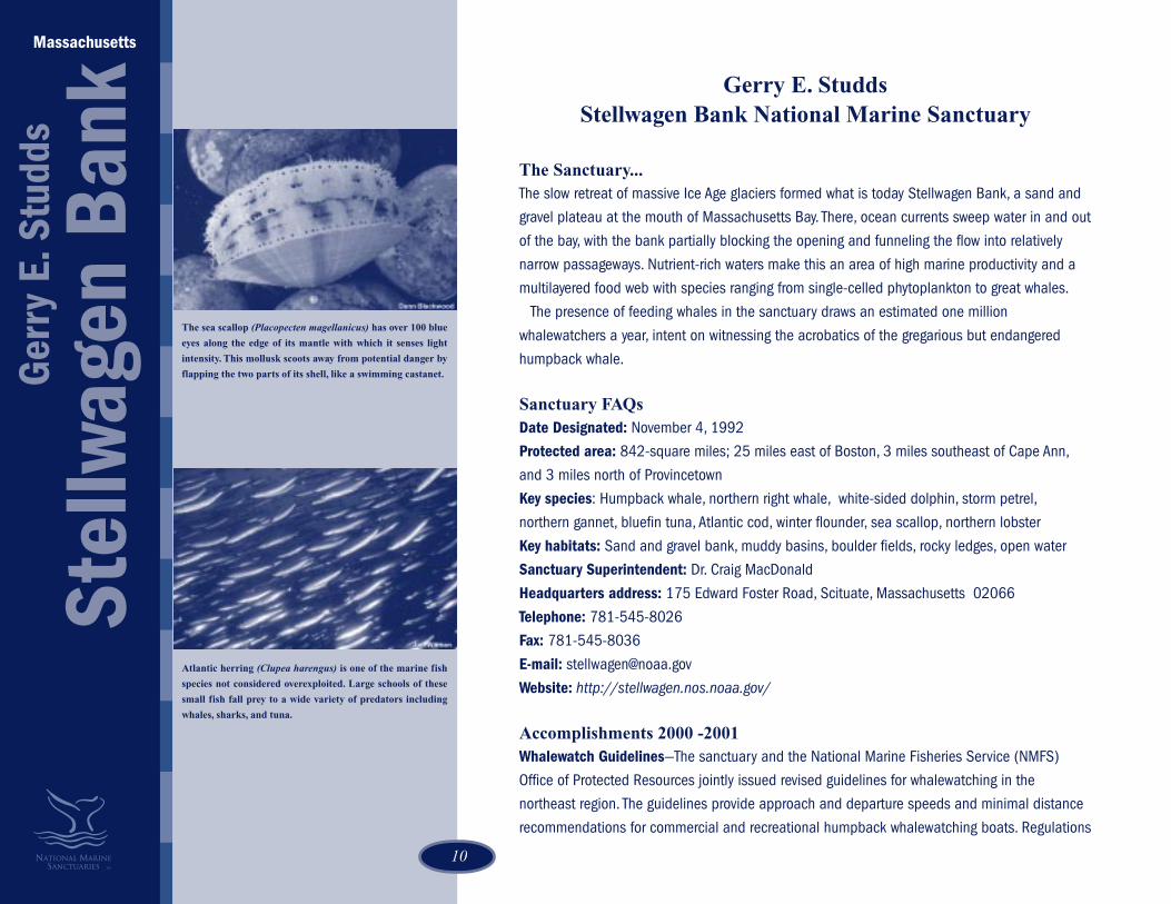
The sea scallop (Placopecten magellanicus) has over 100 blue
eyes along the edge of its mantle with which it senses light
intensity. This mollusk scoots away from potential danger by
flapping the two parts of its shell, like a swimming castanet.
Atlantic herring (Clupea harengus) is one of the marine fish
species not considered overexploited. Large schools of these
small fish fall prey to a wide variety of predators including
whales, sharks, and tuna.

1111
for approach distances when sighting northern right whales are also incorporated into all
materials. The National Marine Fisheries Service, in consultation with the sanctuary, issued an
Advance Notice of Proposed Rulemaking (ANPR) for whalewatching in the Northeast.
Humpback Whale Research Funded—Stellwagen Bank’s importance as a major feeding ground
for marine mammals was one of the primary reasons for the sanctuary’s designation. The
information archive on the whales of Stellwagen Bank is extensive. Many peer-reviewed research
publications have been generated based on that archive. The sanctuary has committed funding
to several whale research institutions to continue the maintenance and update of this database.
In addition, the sanctuary has supported monthly cruises to document and identify cetaceans
and to study whale feeding behaviors and sand lance populations.
Partnership with New England Aquarium—The New England Aquarium agreed to serve as the
Boston area Sanctuary Visitor Center. Outdoor exhibit panels focusing on sanctuary resources
and conservation issues were created for the Aquarium’s outdoor mall and whalewatch boats.
The Aquarium’s Immersive Theater currently offers a 15-minute interactive, multi-screen video
called “Storm Over Stellwagen.” The national sanctuary system contracted for an addition of a
brief film trailer to more fully describe the entire system of sanctuaries.
Seafloor Habitat Recovery Monitoring—This program is a collaborative effort between scientists
at the Stellwagen Bank Sanctuary, the National Undersea Research Center at the University of
Connecticut (NURC-UCONN), the University of Maine and Brown University. The program began in
2001 and is planned to continue for 10 years. The specific objectives are to compare the relative
impacts of human-caused and natural changes to the seafloor with respect to fish and benthic
animal communities and seafloor structure. The project uses remotely-operated vehicles and the
Sanctuary's Integrated Seafloor Imaging System (ISIS) along with box cores, side scan sonar,
and current profilers.
Water Monitoring Linked to MWRA Program—Although modeling by the Massachusetts Water
Resources Authority (MWRA) suggests there should be no impact on Sanctuary water quality
through normal operation of the outfall pipe, there has been a significant expression of public
concern over potential impacts from anomalous events. To assess this possibility, the sanctuary
established a multi-year water quality monitoring program in 2001. The sanctuary program works
with the Harbor Outfall Monitoring Program, supported by MWRA, to increase sampling coverage
to multiple sites within the sanctuary.
Submerged Cultural Resources—The sanctuary began its first systematic investigation of cultural
A sheet of water streams off the rounded tail of a humpback
whale (Megaptera novaeangliae). Humpbacks usually lift their
flukes out of the water when they dive; the underside, not seen
here, is different for every whale, giving researchers a way to
identify individual whales by their fluke prints.

12
resources within its boundaries. Sanctuary scientists collaborated with scientists from the
US Geological Survey in Woods Hole, Massachusetts, and NOS Coast Survey to visit three
shipwreck sites in the southern sanctuary. The ISIS camera system was used to collect
video and still photographs of each wreck. Those data are being analyzed to further
identification of the wrecks.
Provincetown Visitor Exhibit— In 2001, the Stellwagen Bank National Marine Sanctuary
created hi-tech portals that now provide the public with virtual visitation to this site three
miles off the coast of Massachusetts. The new exhibit received enthusiastic reviews from
visitors who expressed amazement in discovering the resources protected in the sanctuary.
“See A Spout – Watch Out”—An important part of the sanctuary’s mandate is protecting
vulnerable marine life from human threats. In 2001, the sanctuary joined with the
International Wildlife Coalition to help prevent whale strikes by recreational boaters in the
Stellwagen Bank Sanctuary through a variety of educational efforts. Almost 5,000 boaters
were trained, some 30,000 rack cards, and 25,000 decals were distributed, and 125
metal dockside signs were installed as a result of this new collaboration.
Stellwagen Bank Sanctuary Enforcement Program—Another noteworthy accomplishment
achieved in 2001 was the development of a Joint Enforcement Plan with the National
Marine Fisheries Service’s Office for Law Enforcement and the Massachusetts
Environmental Police. During the months of
May-October, enforcement officers conducted
two patrols a week and reported that boaters
responded well to on-water interception. Their
report also highlighted the high demand for
greater enforcement efforts.
Massachusetts
Stel
lwag
en B
ank
Ger
ry E
. Stu
dds
Former Congressman Gary E. Studds and Congressman Bill
Delahunt cut the ribbon at the grand opening for the
sanctuary’s high tech exhibit in Provincetown, Massachusetts.
Large numbers of boats travel into the sanctuary to watch
whales. Scientists are interested in knowing whether sound
levels are loud enough to hurt whales’ hearing or if noises are
causing whales to change their behaviors.
Caption (right):
A field of live sand dollars (Echinarachnius parma)
sits on a sandy plain along with one test (the white
inner structural form from a dead sand dollar)
Photo: Dann Blackwood and Page Valentine, USGS

1313
Monitor National Marine Sanctuary
The Sanctuary...The Monitor National Marine Sanctuary, designated in 1975, enjoys the distinction of being the
nation’s first national marine sanctuary.
The Monitor is recognized worldwide for its significance as the vessel that revolutionized nineteenth-
century naval technology and warfare. In 1862, the turreted ironclad engaged the Confederate warship
CSS Virginia in battle. Less than a year later the Monitor sank off Cape Hatteras, North Carolina, during
a storm.
Since 1995, the National Marine Sanctuary Program and its partners have worked to stabilize the
Monitor’s hull and recover major components of the ship, including the propeller, propeller shaft, and
skeg. The Monitor’s steam engine was recovered in July 2001 and recovery of her famous gun turret
and guns is planned for 2002. All recovered artifacts are transported to The Mariners’ Museum,
Newport News, Virginia, for conservation and eventual public exhibition.
Resting at a depth of 235 feet, the wreck provides habitat for corals, sponges, anemones, and other
plants and attracts a variety of deepwater fish.
Sanctuary FAQsDate Designated: January 30, 1975
Protected area: 1-square mile
Key species: Amberjack, black sea bass, red barbier, scad, dolphin, sand tiger shark, corals, sea
anemone, sea urchin
Key habitats: Pelagic, open ocean; artificial reef
Sanctuary Manager: Dr. John Broadwater
Headquarters address: c/o The Mariners’ Museum, 100 Museum Drive, Newport News, VA 23606
Telephone: 757-599-3122
Fax: 757-591-7353
E-mail: [email protected]
Website: http://monitor.nos.noaa.gov
James River, VA. Close-up view of officers on the Deck of the
USS Monitor near the turret. Taken July 9, 1862
The battle between the USS Monitor and the Confederate
Ironclad Virginia was the subject for a United States postage
stamp in 1995. The Monitor is the vessel near the lower portion
of the stamp.
North Carolina
Mon
itor

14
Accomplishments 2000 -2001Silver Anniversary—On January 30, 2000, the Monitor National Marine Sanctuary celebrated its
25th year of preservation, research, education, and outreach. The Mariners’ Museum, Newport News,
Virginia, hosted a ceremony honoring the sanctuary’s anniversary and NOAA’s 30th anniversary.
Monitor Expeditions—The 2000 field season ran April through mid-August with only a three-week
break between the two major expedition phases. Both NOAA and the US Navy fielded dive teams in
an effort to survey the site, install cement bags to stabilize the Monitor’s hull and deploy a 90-ton
engine recovery structure to be used for rigging and raising the vessel’s engine. An important
milestone was reached in July 2001 when The Monitor’s 35-ton steam engine, that had rested for
139 years under the Atlantic Ocean, was recovered. The Monitor 2001 Expedition was the longest,
most complex yet, consisting of six separate expeditions to the sanctuary, including a large-scale U.S.
Navy dive expedition with coordination and advice from the Monitor staff. The Navy again expanded
its capabilities, utilizing for the first time ever a commercial saturation diving system that greatly
increased the amount of time the Navy divers could work on the engine. NOAA supported the Navy
by conducting a spring expedition that mapped and photographed the engine, providing details on
configuration and access needed for the final recovery plan.
Increasing Sanctuary Awareness and Support—As the result of its recovery missions, the Monitor
Sanctuary received major media coverage during 2000 including nearly four and one-half hours of
prime time national television coverage. Many of the documentaries were repeated several times in
the months that followed. The Discovery Channel on May 14 aired a one-hour documentary titled,
Wreck Finder, which featured four significant salvage projects conducted by the USS Grasp. The
Grasp’s 1999 diving expedition to the Monitor was one of the four projects. On October 24, the
award-winning PBS science series NOVA aired a one-hour special on the Monitor titled, Lincoln’s
Secret Weapon. This program documented the recovery of the Monitor’s two-ton propeller by NOAA,
the U.S. Navy and other participants. The NOVA documentary was previewed at a special ceremony at
the National Press Club, Washington, D.C., on September 26. The event featured several key speakers
including Senator John Warner (R-VA), senior Department of Commerce representatives, and other
dignitaries. The History Channel aired Raise the Monitor, a full two-hour documentary on the USS
Monitor and Monitor National Marine Sanctuary on December 11. This program, which has
broadcast numerous times, tells the Monitor’s story from its construction up to the deployment of the
engine lifting structure by NOAA and the U.S. Navy during July 2000. On October 22, CBS Sunday
An illustration of the Monitor as seen from above its current
position. The Civil War ironclad rests on its turret in the deep
waters off Cape Hatteras, North Carolina.
Caption (right): Image compiled from a series of video stills
by Jeff Johnston of the Monitor National Marine Sanctuary.
Although there is a distinct amount of distortion from the
camera, this image shows some of the significant collapse that
has occurred over the years.
1515
Morning ran a feature story on the Monitor with host Charles Osgood reporting on NOAA’s current
efforts to work with the U.S. Navy and others to preserve the Monitor for future generations. In
addition to these new programs, the Arts and Entertainment Channel broadcast a program on the
Monitor on its Civil War Chronicles series. During the 2001 engine recovery expedition, a production
team was aboard to film the event for a documentary to be developed for the Discovery Channel.
International and National Outreach—Sanctuary Manager John Broadwater presented conference
papers and public lectures in numerous U.S. cities and in Canada, Turkey, and Australia. He also
served as NOAA Observer on a deep-sea expedition in the Black Sea sponsored by the Institute for
Exploration, with support from NOAA. A National Geographic Society article on the Black Sea
expedition noted NOAA’s participation.
Expanded Navy Partnerships—During 2001, the sanctuary expanded its partnership with the U.S.
Navy and developed a cooperative program of research and training with the Naval Sea Systems
Command. The training program has proved to be so successful that plans are already underway to
continue the program even after the Monitor’s turret recovery mission scheduled for 2002.
Expanded Dive Partnerships—Also in 2001, the sanctuary expanded its dive program partnerships
with the National Undersea Research Center at the University of North Carolina at Wilmington and
East Carolina University. The multi-agency dive team has the capability to conduct scientific diving
expeditions to water depths down to 300 feet.
Walter B. Jones Awards—On October 3, 2001 at the Walter B. Jones Awards and NOAA Excellence
Awards Ceremony, Monitor Sanctuary Manager John Broadwater received a NOAA Award for
Excellence in Sanctuary Management. The NOAA award recognized Dr. Broadwater’s efforts to
coordinate the recovery, preservation and exhibition of significant portions of the USS Monitor.
.
North Carolina
Mon
itor
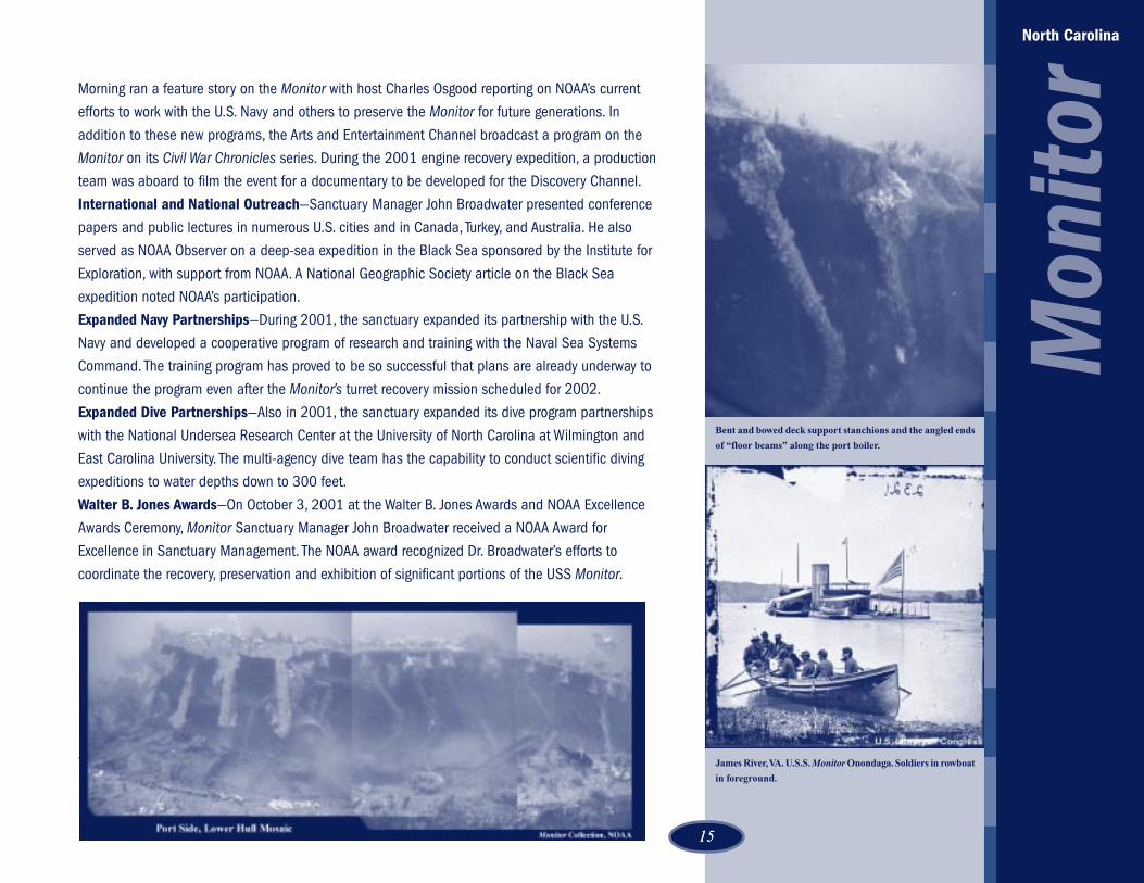
Bent and bowed deck support stanchions and the angled ends
of “floor beams” along the port boiler.
James River, VA. U.S.S. Monitor Onondaga. Soldiers in rowboat
in foreground.

16
Gray’s Reef National Marine Sanctuary
The Sanctuary...Gray’s Reef is 17 miles off the coast of Georgia, in waters 50-70 feet deep. One of the largest
nearshore sandstone reefs in the southeastern United States, its sandy, flat-bottom troughs and
sandstone outcroppings and ledges are optimal for the colonization of marine invertebrates,
including sponges and corals that in turn attract a rich diversity of reef and pelagic fish, sea turtles
and marine mammals. The sanctuary lies near the only known calving grounds for the northern right
whale, the most endangered large whale in the world.
In 1986, the United Nations listed Gray’s Reef as an International Biosphere Reserve. In recent
years, the South Atlantic Fishery Management Council designated Gray’s Reef as a “Habitat Area of
Particular Concern” citing its important biological and ecological values. The Council also noted its
scientific importance as a marine habitat, and its great interest to sport fishers and divers.
Sanctuary FAQsDate Designated: January 16, 1981
Protected area: 23-square miles, 17 miles east of Sapelo Island, Georgia
Key species: Loggerhead sea turtle, spotted and bottlenose dolphins, gag grouper, black sea bass,
angelfish, barrel sponge, ivory bush coral, and sea whips
Key habitats: Calcareous sandstone reefs, sand bottom communities, moderate relief ledges, patch
reefs, tropical/temperate reef
Sanctuary Manager: Reed Bohne
Headquarters address: 10 Ocean Science Circle, Savannah, Georgia 31411
Telephone: 912-598-2345
Fax: 912-598-2367
E-mail: [email protected]
Website: http://www.graysreef.nos.noaa.gov/
Accomplishments 2000 - 2001Habitat Assessment - Gray’s Reef initiated a comprehensive study of the sanctuary habitat through
NOAA’s National Centers for Coastal Ocean Science (NCCOS). The habitat assessment study
analyzed reef fish monitoring data, the importance of the non-reef habitats for juvenile fish, possible
The orange ridged sea star (Echinaster spinulosus) has orange
yellow spines. It has five legs with small tube feet in the under
side which are used in locomotion. If sea stars are cut in half,
they are able to regenerate and become two individual sea stars.
Sea slugs are uncoiled snails (mollusks) that have no shell and
have external gills (cerata). The regal sea goddess (Hyselodoris
edenticulata) specializes in feeding upon sponges, thus are quite
common in Gray’s Reef.
Georgia
Gra
y’s
Reef

1717
contaminant levels in sediments and shellfish, the species of fish that spawn at Gray’s Reef and the
movements of larval fish to and from Gray’s Reef.
Sanctuary Cruises—The sanctuary also accomplished several research projects during cruises
aboard the NOAA Ship Ferrel. The projects resulted in hundreds of biological and sediment
samples, bongo tows and beam trawls, 90 SCUBA dives, more than a dozen ROV dives of up to four
hours each and the release of drifter buoys, and sidescan sonar operations useful in the
management plan review process. Gray’s Reef also sponsored a detailed mapping of the sanctuary
on the NOAA ship Whiting. The results of this hi-tech bottom mapping will be used to characterize
the habitat of the sanctuary.
Student Ocean Council—The sanctuary created the Student Ocean Council program to enable
upper level high school students from local public and private schools to explore ocean science
related careers and subjects. The Student Ocean Council is comprised of 50 students from several
coastal Georgia counties. In 2000, the programs included field trips to Gray’s Reef and to several of
Georgia’s barrier islands. Students have worked with sanctuary staff, coastal area scientists
(oceanographers, marine biologists and archaeologists), marine educators, marine operations
professionals, search and rescue personnel, fisheries technicians, and NOAA personnel.
Distance Learning Programs—Through Georgia’s distance learning network Gray’s Reef staff are
able to teach “live” with as many as seven classes across the State or across the country. The
sanctuary can bring the reef to life through slides and video footage. Students in downtown Atlanta
and in the mountain community of Helen or on the plains of Texas go beneath the ocean via
sanctuary cameras and explore Gray’s Reef without ever getting wet.
Exploration—In summer 2001, the sanctuary sponsored a research exploration cruise to an area
known as the Savannah Scarp during the NOAA sponsored Islands in the Stream expedition. Using
a three person submersible from the Harbor Branch Oceanographic Institutions research vessel
Seward Johnson II, Gray’s Reef scientists joined researchers and educators from South Carolina
and Georgia to explore this productive reef fish habitat and document its value for conservation.
Management Plan Review—Gray’s Reef Marine Sanctuary significantly broadened its scope of
public involvement and awareness in 2001 through management plan revision that drew responses
from 100 individuals, organizations and academic institutions. The sanctuary held workshops and
produced proceedings for research, education and conservation.
Increased Partnerships—Gray’s Reef Marine Sanctuary joined forces with National Marine
Over the years, researchers have learned much about the
loggerhead’s nesting behavior (i.e. seasonality, number of eggs,
sites), but little is known about its behavior when underwater,
away from the beach--especially for the relatively small
Georgia/South Carolina nesting population. With use of
satellite tracking, researchers hope to learn more about the
swimming and resting behaviors, habitat utilization, and
genetics of the post-nesting loggerhead sea turtle.
The R/V Jane Yarn is a 65 foot converted Navy vessel renovated
for marine science and education at Gray’s Reef National
Marine Sanctuary. The vessel is named after the late Mrs. Jane
Yarn, a prominent advocate for protection of Georgia’s barrier
islands, who worked tirelessly to advance the designation of
Gray’s Reef National Marine Sanctuary. Jane Yarn served on
President Carter’s Council on Environmental Quality.
Georgia
Gra
y’s
Reef
18
Colonial Tunicate (Symplegma rubra): These orange, yellow,
and red colonies make bright colored patches on the sandstone
outcroppings of Gray's Reef.
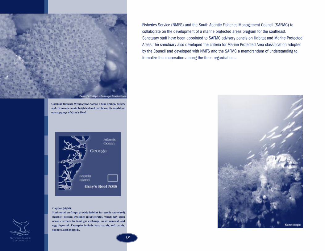
Fisheries Service (NMFS) and the South Atlantic Fisheries Management Council (SAFMC) to
collaborate on the development of a marine protected areas program for the southeast.
Sanctuary staff have been appointed to SAFMC advisory panels on Habitat and Marine Protected
Areas. The sanctuary also developed the criteria for Marine Protected Area classification adopted
by the Council and developed with NMFS and the SAFMC a memorandum of understanding to
formalize the cooperation among the three organizations.
Caption (right):
Horizontal reef tops provide habitat for sessile (attached)
benthic (bottom dwelling) invertebrates, which rely upon
ocean currents for food, gas exchange, waste removal, and
egg dispersal. Examples include hard corals, soft corals,
sponges, and hydroids.

1919
Florida Keys National Marine Sanctuary
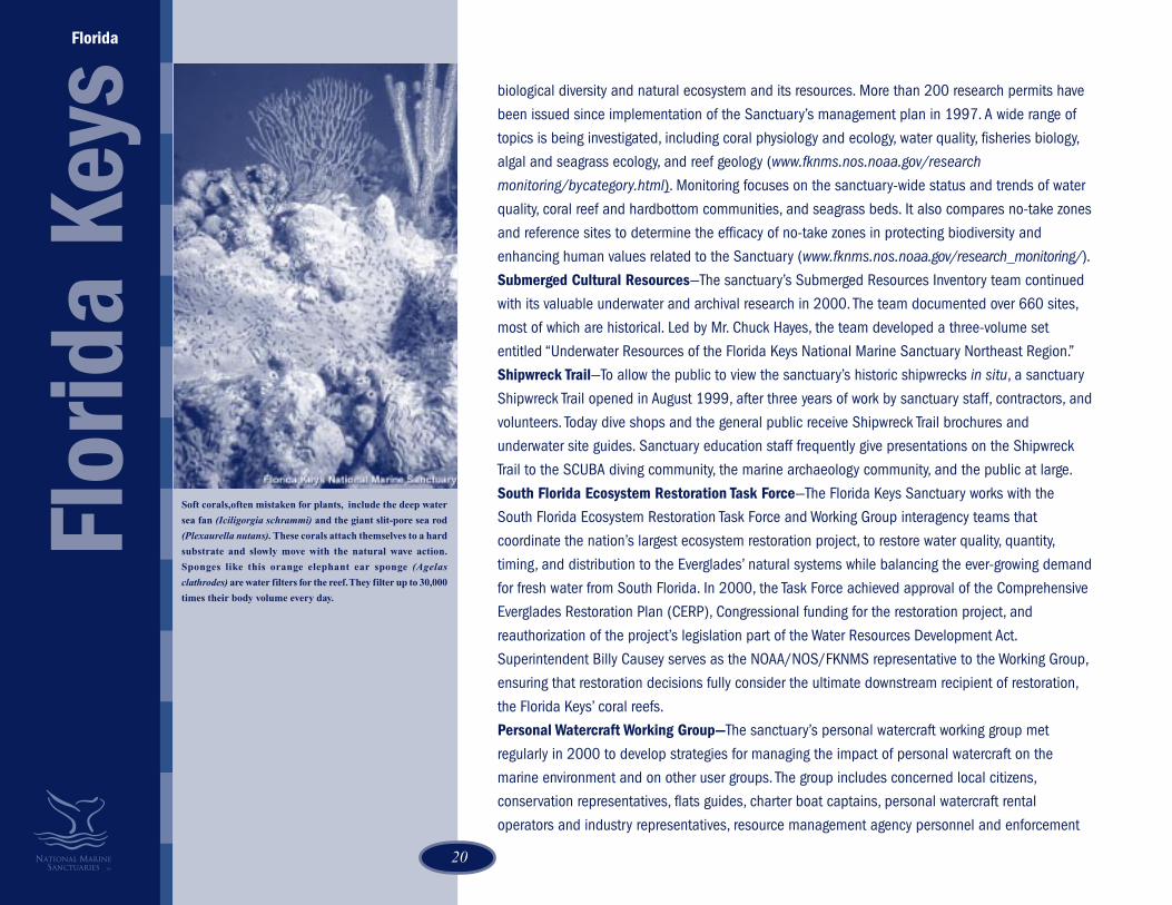
The Sanctuary…The Florida Keys National Marine Sanctuary contains one of the most diverse underwater communities
of plants and animals in North America. Its dazzling coral reefs support rich marine populations that
depend on the reefs for shelter, food, and habitat. The reefs also hold the final resting places of
shipwrecks that span pre-colonial and modern maritime history.
This complex marine ecosystem, which also includes fringing mangroves, seagrass meadows,
hardbottom communities, and bank reefs offers many opportunities to commercial fishing and
tourism-based businesses that are crucial to Florida’s economy. Today, the Florida Keys Sanctuary
serves as a model for international marine conservation efforts to save vulnerable oceans.
Sanctuary FAQsDate Designated (by Congress): November 16, 1990
Protected area: 3,674-square miles of water surrounding the archipelago formed by the Florida Keys
Key species: Hard corals: elkhorn, staghorn, pillar, brain and star corals; soft corals: sea fans, sea
rods, and sea whips; sponges; turtle grass; angelfish; spiny lobster; stone crab; grouper; tarpon
Key habitats: Coral reefs, patch and bank reefs, mangrove-fringed shorelines and islands, sand flats,
seagrass meadows, hardbottom communities
Sanctuary Superintendent: Billy Causey
Headquarters address: P.O. Box 500368, Marathon, Florida 33050. Regional operations offices
located in Key West and Key Largo.
Telephone: 305-743-2437
Fax: 305-743-2357
E-mail: [email protected]
Website: http://www.fknms.nos.noaa.gov/
Accomplishments 2000 - 2001Research and Monitoring—The Sanctuary Research and Monitoring Program’s primary goal is to
provide the knowledge necessary to make informed decisions about protecting the sanctuary’s
Flor
ida
Keys
Florida
Elkhorn coral (Acropora palmata) is a branching coral.
Branching corals grow in the shallow areas of the reef crest
and serve to break up the wave action as it comes onto the
reef. The branches of elkhorn coral resemble an elk's rack of
antlers, thus its name.
Mangrove islands serve as rookeries for many threatened and
endangered species such as the great white heron (Ardea
herodias occidentalis). Many of the islands in the Florida Keys
are zoned for protection of the nesting birds by both the
National Park Service and the National Wildlife Refuges.
20
biological diversity and natural ecosystem and its resources. More than 200 research permits have
been issued since implementation of the Sanctuary’s management plan in 1997. A wide range of
topics is being investigated, including coral physiology and ecology, water quality, fisheries biology,
algal and seagrass ecology, and reef geology (www.fknms.nos.noaa.gov/research
monitoring/bycategory.html). Monitoring focuses on the sanctuary-wide status and trends of water
quality, coral reef and hardbottom communities, and seagrass beds. It also compares no-take zones
and reference sites to determine the efficacy of no-take zones in protecting biodiversity and
enhancing human values related to the Sanctuary (www.fknms.nos.noaa.gov/research_monitoring/).
Submerged Cultural Resources—The sanctuary’s Submerged Resources Inventory team continued
with its valuable underwater and archival research in 2000. The team documented over 660 sites,
most of which are historical. Led by Mr. Chuck Hayes, the team developed a three-volume set
entitled “Underwater Resources of the Florida Keys National Marine Sanctuary Northeast Region.”
Shipwreck Trail—To allow the public to view the sanctuary’s historic shipwrecks in situ, a sanctuary
Shipwreck Trail opened in August 1999, after three years of work by sanctuary staff, contractors, and
volunteers. Today dive shops and the general public receive Shipwreck Trail brochures and
underwater site guides. Sanctuary education staff frequently give presentations on the Shipwreck
Trail to the SCUBA diving community, the marine archaeology community, and the public at large.
South Florida Ecosystem Restoration Task Force—The Florida Keys Sanctuary works with the
South Florida Ecosystem Restoration Task Force and Working Group interagency teams that
coordinate the nation’s largest ecosystem restoration project, to restore water quality, quantity,
timing, and distribution to the Everglades’ natural systems while balancing the ever-growing demand
for fresh water from South Florida. In 2000, the Task Force achieved approval of the Comprehensive
Everglades Restoration Plan (CERP), Congressional funding for the restoration project, and
reauthorization of the project’s legislation part of the Water Resources Development Act.
Superintendent Billy Causey serves as the NOAA/NOS/FKNMS representative to the Working Group,
ensuring that restoration decisions fully consider the ultimate downstream recipient of restoration,
the Florida Keys’ coral reefs.
Personal Watercraft Working Group—The sanctuary’s personal watercraft working group met
regularly in 2000 to develop strategies for managing the impact of personal watercraft on the
marine environment and on other user groups. The group includes concerned local citizens,
conservation representatives, flats guides, charter boat captains, personal watercraft rental
operators and industry representatives, resource management agency personnel and enforcement
Flor
ida
Keys
Florida
Soft corals,often mistaken for plants, include the deep water
sea fan (Iciligorgia schrammi) and the giant slit-pore sea rod
(Plexaurella nutans). These corals attach themselves to a hard
substrate and slowly move with the natural wave action.
Sponges like this orange elephant ear sponge (Agelas
clathrodes) are water filters for the reef. They filter up to 30,000
times their body volume every day.

2121
officials. The group developed strategies to address concerns associated with personal watercraft and
presented these at community meetings.
Sustainable Seas Expeditions/Outreach and Education—In 2000, the Florida Keys Sanctuary
Education and Outreach program taught visitors, residents, teachers and students about the sanctuary,
its resources, and stewardship skills to care for these resources. The 2000 Sustainable Seas
Expeditions provided unique educational opportunities for students from the Midwest and northeast
United States, and South Florida through fish counts, Coral Reef Classroom, tours of the NOAA Ship
Gunter and DeepWorker submersibles, student-at-sea days, and Internet uplinks. By leading the multi-
agency Florida Keys Seagrass Outreach Partnership, the sanctuary raises statewide awareness of the
importance of seagrass, the seriousness of boating impacts on seagrass, and ways boaters can
participate in a solution. The sanctuary education and outreach staff continued to reach residents and
visitors through Team OCEAN program brochures and on-the-water interpretation by volunteers.
Partnerships—The year 2000 saw many positive results from the sanctuary’s partnerships with the
State of Florida and Florida Keys local governments. Federal, state and local agencies have worked
together on water quality issues, restoration of the South Florida ecosystem, and management of
fisheries, wildlife and other natural resources of the Florida Keys. Foremost among the successes have
been the development of new sanitary wastewater treatment systems, creation of vessel no-discharge
zones around Key West and progress toward a no-discharge zone for state waters, and the cleanup of
spiny lobster and stone crab gear destroyed by hurricanes. Other partnerships include the National Park
Service, the US Environmental Protection Agency, and Sanctuary Friends of the Florida Keys.
Florida Keys Sanctuary, the National Park Service and the US Environmental Protection Agency
continued their six-year partnership to produce Waterways, a half-hour television show that profiles the
South Florida environment and sanctuary research and management efforts.
Establishment of the Tortugas Ecological Reserve—In the 1996 final Management Plan for the Florida
Keys National Marine Sanctuary, working closely with the State of Florida, NOAA made a commitment to
establish an ecological reserve in the Tortugas. During fiscal year 2001, the sanctuary established the
Tortugas Ecological Reserve based on a proposal developed by the Tortugas 2000 working group and
adopted by the Sanctuary Advisory Council. The 25-member working group included commercial and
recreational fishermen, divers, scientists, conservationists, citizens-at-large and resource managers. The
process to develop the reserve has drawn accolades from around the country and is touted as a model
for collaborative reserve design. (The Tortugas Ecological Reserve consists of two sections: Tortugas
The Florida Keys National Marine Sanctuary is visited by
several marine mammal species, including the endangered
West Indian manatee (Trichechus manatus). Manatees are
winter visitors while species like the spotted dolphins and
bottlenose dolphins can be seen throughout the year.
22
Flor
ida
Keys
Florida
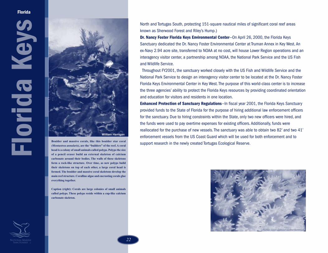
Boulder and massive corals, like this boulder star coral
(Montastrea annularis), are the “builders” of the reef. A coral
head is a colony of small animals called polyps. Polyps the size
of a pencil eraser build an external skeleton of calcium
carbonate around their bodies. The walls of these skeletons
form a rock-like structure. Over time, as new polyps build
their skeletons on top of each other, a large coral head is
formed. The boulder and massive coral skeletons develop the
main reef structure. Coralline algae and encrusting corals glue
everything together.
Caption (right): Corals are large colonies of small animals
called polyps. These polyps reside within a cup-like calcium
carbonate skeleton.
North and Tortugas South, protecting 151-square nautical miles of significant coral reef areas
known as Sherwood Forest and Riley’s Hump.)
Dr. Nancy Foster Florida Keys Environmental Center—On April 26, 2000, the Florida Keys
Sanctuary dedicated the Dr. Nancy Foster Environmental Center at Truman Annex in Key West. An
ex-Navy 2.94 acre site, transferred to NOAA at no cost, will house Lower Region operations and an
interagency visitor center, a partnership among NOAA, the National Park Service and the US Fish
and Wildlife Service.
Throughout FY2001, the sanctuary worked closely with the US Fish and Wildlife Service and the
National Park Service to design an interagency visitor center to be located at the Dr. Nancy Foster
Florida Keys Environmental Center in Key West. The purpose of this world-class center is to increase
the three agencies’ ability to protect the Florida Keys resources by providing coordinated orientation
and education for visitors and residents in one location.
Enhanced Protection of Sanctuary Regulations—In fiscal year 2001, the Florida Keys Sanctuary
provided funds to the State of Florida for the purpose of hiring additional law enforcement officers
for the sanctuary. Due to hiring constraints within the State, only two new officers were hired, and
the funds were used to pay overtime expenses for existing officers. Additionally, funds were
reallocated for the purchase of new vessels. The sanctuary was able to obtain two 82’ and two 41’
enforcement vessels from the US Coast Guard which will be used for both enforcement and to
support research in the newly created Tortugas Ecological Reserve.

2323
Flower Garden Banks National Marine Sanctuary
The Sanctuary...One hundred miles off the coasts of Texas and Louisiana, a trio of underwater gardens emerge
from the depths of the Gulf of Mexico. These fertile coral reefs serve as a regional reservoir of
shallow water Caribbean reef fishes and invertebrates. Like oases in the desert, these salt
domes provide homes for coral reefs, sponges, and fish of such beauty that the Flower Garden
Banks have become a premier diving destination in the United States. Each winter schools of
hammerhead sharks visit the sanctuary, and in summer, an annual coral spawning attracts
scientists and recreational divers from around the world.
Sanctuary FAQsDate Designated: January 17, 1992
Protected area: 56-square miles
Key species: Star coral, brain coral, manta ray, hammerhead shark, and loggerhead turtle
Key habitats: Coral reefs, algal-sponge communities, brine seep, sand flats, artificial reef and
pelagic, open ocean
Sanctuary Manager: G.P. Schmahl
Headquarters address: 216 West 26th Street, Suite 104, Bryan, Texas 77803
Telephone: 979-779-2705
Fax: 979-779-2334
E-mail: [email protected]
Website: http://www.flowergarden.nos.noaa.gov
Accomplishments 2000 - 2001Investigating Fish Habitat—The sanctuary worked with government and university researchers
to learn more about fish habitat within the sanctuary. The sanctuary received information from
acoustic studies carried out by Louisiana State University that indicated that deep water areas
of the sanctuary are being utilized by grouper and snapper as aggregation and possible
spawning areas. Further studies are planned to investigate and document this data.
Radar Buoys—Anchor points were made for the installation of radar reflecting buoys at the East
Texas/Louisiana
Flow
er G
arde
n Ba
nks
An example of the reefscape at the Flower Gardens - brain
coral (Diploria strigosa), exposed reef rock, branching tube
sponge (Pseudoceratina crassa), algae, parrotfish, bluehead
wrasse juveniles, and brown chromis. As seen in the
background, there is great competition for space. Monitoring
efforts over the past 20 years have shown over 50% coral
coverage - an indication of a very healthy reef.
The spotted drum (Equetus punctatus) is an elusive fish but it
can be found at all three banks of the sanctuary. Juveniles are
seen swimming in circular motions.
24
and West Flower Garden and Stetson Banks. These buoys will assist in warning large ships of
the sensitive coral reef communities located here, preventing potential damage caused by
anchors and slack towing cables.
GIS/Atlas & mapping—The sanctuary, in 2000, began the development of a sanctuary
Geographic Information System. The computer-based mapping and data management system
will compile information and enhance analysis and presentation. Sanctuary staff initiated this
effort by compiling sanctuary-related data into one system.
“Naturalist on Board” — The Flower Garden Banks Sanctuary initiated a new education and
outreach program that will place sanctuary-trained volunteers on commercial dive charter
vessels to provide information about the sanctuary and its resources. This is part of the overall
National Marine Sanctuary Program “Team OCEAN” program.
Speakers Bureau—To increase education and outreach capacity, the sanctuary successfully
piloted a Speakers Bureau in San Antonio, Texas. Volunteers are trained and provided with
audiovisual tools to use in Flower Garden Banks Sanctuary presentations given to students,
civic organizations, dive clubs and other groups.
“Down Under, Out Yonder”—This project is a continuation of the very successful teacher
workshops that bring diving educators to the Flower Garden Banks Sanctuary to learn about
the sanctuary system and to incorporate that knowledge in their individual educational
curricula.
Sanctuary Partnerships—In 2000, the Flower Garden Banks continued ongoing partnerships
and initiated new ones to fulfill its mission to conserve the vulnerable coral reefs in the Gulf of
Mexico. Working with the Minerals Management Service (MMS), an ongoing partnership, the
sanctuary continued a long-term monitoring project of coral reef areas. The sanctuary also
worked with MMS to expand the scope of the monitoring program to include additional
parameters and areas within the sanctuary. Other important sanctuary partnerships included
the U.S. Geological Survey, U.S. Coast Guard, National Marine Fisheries Service, and the Gulf of
Mexico Foundation.
Flower Garden Banks Receives IMO No-Anchor Area Designation— A NOAA proposal to the
International Maritime Organization (IMO) to create a no-anchor zone at the Flower Garden
Banks National Marine Sanctuary culminated in December 2000 with the establishment of the
first internationally-designated no-anchor zone for the purpose of coral reef protection. The
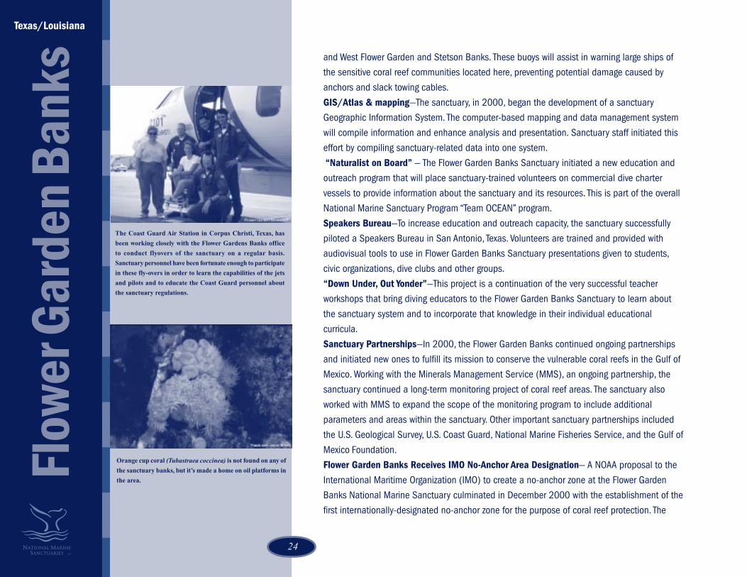
The Coast Guard Air Station in Corpus Christi, Texas, has
been working closely with the Flower Gardens Banks office
to conduct flyovers of the sanctuary on a regular basis.
Sanctuary personnel have been fortunate enough to participate
in these fly-overs in order to learn the capabilities of the jets
and pilots and to educate the Coast Guard personnel about
the sanctuary regulations.
Orange cup coral (Tubastraea coccinea) is not found on any of
the sanctuary banks, but it’s made a home on oil platforms in
the area.
Texas/Louisiana
Flow
er G
arde
n Ba
nks

2525
An annual, predictable event of coral spawning occurs at the
Flower Gardens Banks eight to ten nights after the full moon
in August or September. Here, a male star coral, (Montastraea
cavernosa) releases sperm into the water column.
designation took effect in June 2001. The IMO designation named the Flower Garden Banks
Sanctuary as the world’s first No-Anchor Zone for the purpose of protection of sensitive coral
reef resources.
Underwater Research—In 2001, the sanctuary continued a number of research studies that
used underwater remotely operated vehicles (ROVs) to explore sites within the sanctuary that
may be important aggregation and possible spawning areas for several species of grouper
and snapper. Sanctuary scientists also documented a rare double coral spawning event,
which occurred this year after both the full moons of August and September.
Sanctuary Vessel Acquisition—Acquiring a new sanctuary vessel, a decommissioned U.S.
Coast Guard 82' patrol boat named the Point Glass, was an important achievement for the
sanctuary in 2001. The new vessel will be used to support research and monitoring programs,
conduct environmental education projects, provide surveillance for enforcement of sanctuary
regulations, and maintain a physical presence in sanctuary waters.
Water Quality Monitoring—The ability to monitor water quality conditions within the
sanctuary was enhanced by the installation of a “real-time” oceanographic data buoy, which
provided, via satellite, information on currents, temperature, and salinity that can be accessed
over the Internet. Also multiparameter water quality data instruments were installed on each
of the three banks within the sanctuary which will continuously monitor temperature, salinity,
pH, dissolved oxygen, light intensity, and turbidity at the sea floor.
Partnership with the Audubon Aquarium of the Americas—The sanctuary initiated a
partnership with the Audubon Aquarium of the Americas in New Orleans, Louisiana, to develop
a Flower Garden Banks National Marine Sanctuary exhibit within the aquarium. The exhibit’s
opening is anticipated in 2002. In addition, a program to utilize aquarium volunteer divers to
conduct reef fish population surveys in the sanctuary is under development.
Ocean Discovery Day—A day of fun and marine exploration was held in Galveston, Texas, on
June 1, 2001, to celebrate the visit of the Sustainable Seas Expedition, a NOAA/National
Geographic Society undersea project, to the Flower Garden Banks Sanctuary. An open house
aboard the NOAA Ship McArthur, booths, exhibits, and a variety of activities for all ages were
held throughout the day.

26
Channel Islands National Marine Sanctuary
The Sanctuary…A fertile combination of warm and cool currents swirling around five islands makes up the Channel
Islands National Marine Sanctuary attracting a great variety of plants and animals—large nearshore
forests of giant kelp, flourishing populations of fish, invertebrates, and cetaceans, and diverse
colonies of pinnipeds and marine birds. Historic shipwrecks and Chumash Indian artifacts are
lodged in this marine protected area.
Sanctuary FAQsDate Designated: September 22, 1980
Protected area: 1,658-square miles
Key species: California sea lion, elephant seal, harbor seal, blue and gray whale, dolphin, blue
shark, brown pelican, western gull, abalone, garibaldi, and rockfish
Key habitats: Kelp forests, rocky shores, sandy beaches, seagrass meadows, deep rocky reefs, and
pelagic, open ocean
Sanctuary Superintendent: LCDR Matt Pickett
Headquarters address: 113 Harbor Way, Santa Barbara, California 93109
Telephone: 805-966-7107
Fax: 805-568-1582
E-mail: [email protected]
Website: http://www.cinms.nos.noaa.gov/
Accomplishments 2000 - 2001Submerged Cultural Resources—The Channel Islands Sanctuary’s submerged cultural resourceseducational programs targeted both local community and national audiences. Sanctuary staffcarried the sanctuary message to the public through schools, adult education programs, onlinechats hosted by RAIN Network (Regional Alliance for Information Networking), a local communityInternet and education provider, and a lecture program at the Santa Barbara Maritime Museum.Staff also presented papers on the sanctuary’s submerged cultural resources programs to theacademic community at the Society for Historical Archaeology in Quebec City, Canada. In addition,
Chan
nel I
slan
dsCalifornia
The Garibaldi (Hypsypops rubicundus) is lucky enough to be
protected not only within the boundaries of the marine
sanctuaries, but by California state law as well. They are
intensely curious about divers and are known for being very
aggressive when defending either territory or eggs. During
the spring these feisty fish will vigorously defend their nests
from unwelcome guests- no matter how large they may be.
As well as providing a wonderful setting for research and
recreation, the Channel Islands National Marine Sanctuary
is a wonderful classroom. Los Marineros is a marine education
program for children founded by the CINMS in 1987 and
administered by the Santa Barbara Natural History Museum.
Activities provided by the Los Marineros program include
lectures, presentations, and student field trips to the local
marine sites.

2727
the sanctuary partnered with BRIDGE, an Ocean Science Teacher Resources Center, to create anonline curriculum featuring shipwrecks of the five West Coast sanctuaries. Annual monitoring and recording of the cultural resources was completed through a componentof the Shipwreck Reconnaissance Program, a collaborative effort with partners including theCoastal Maritime Archaeology Resources Group and Channel Islands National Park. Shipwreckexhibits to be featured at the Santa Barbara Maritime Museum Visitors Center were also planned.The Collaborative Marine Research Program—The Channel Islands Sanctuary initiated aprogram to involve commercial fishers in assessing sanctuary resources. The program joinedtogether local marine researchers, commercial fishers, and the regional resource managementagencies (National Marine Fisheries Service and California Department of Fish and Game) towork on sanctuary issues. In the future, commercial fishers will aid the sanctuary in project selection and act as paidresearch assistants. The program will also collect significant information, build upon currentrelations between marine stakeholders, and contribute to resource protection.Sanctuary Partnerships—The sanctuary opened a southern regional office in Channel IslandsHarbor, Oxnard, California, to develop partnerships and programming opportunities within theVentura County and greater Los Angeles County communities. Over 53% of the population in the tri-county region of the sanctuary is located within theVentura region. Two harbors with over 5,000 boat slips are located within Ventura County. Thesanctuary works in partnership with Ventura County Harbor Department officials to develop thenew Youth and Group Boater Education facility in Channel Islands Harbor.Sanctuary Naturalist Corp Volunteer Program (SNC)—Whalewatching operators within SantaBarbara, Ventura, and Channel Islands Harbor signaled support for the new Sanctuary NaturalistCorps volunteer program, which numbers 100 volunteers, and their efforts to enhance whalewatching interpretation aboard their boats.Sanctuary Advisory Council—The Sanctuary Advisory Council (SAC) provided key advice andassistance in 2000 on the management plan revision. The SAC was instrumental in helping thesanctuary attract interested members of the local community, helped raise community awarenessabout the plan process and the concept of boundary expansion, and hosted two PublicInformation Forums on the project. In August, the SAC provided the sanctuary with arecommendation that two boundary configurations be considered as possible preferredalternatives in the Draft Environmental Impact Statement.
Chan
nel I
slan
ds
California
This urchin, the red urchin (Strogylocentrotus franciscanus)
is the largest species of urchin, growing up to 7 inches in
diameter and can survive for up to 20 years. Red urchins are
grazers whose appetite for kelp play a significant role in the
overall ecology of kelp forest and reef communities.
San Miguel, the westernmost island surrounded by Channel
Islands National Marine Sanctuary, is strongly influenced by
wind and weather. The colder waters here support a distinct
group of fish and invertebrates that are not found on the
southern islands.

28
In addition to being a food source for abalone, fish and
invertebrates, kelp forests (Macrocystis pyrifera) provide
shelter for many marine organisms. Factors such as these make
kelp an extremely important part of the Channel Islands
ecosystem.
Channel Islands Marine Reserves Process—The Marine Reserves Working Group (MRWG), asubgroup of the Sanctuary Advisory Council (SAC), provided the SAC and resourcemanagement agencies with a series of consensus agreements that provide the State andNOAA guidance on the establishment of sanctuary no-take marine reserves. The 17-memberMRWG group, reflecting fishing interests, conservation community representatives, governmentagencies, and the public reached consensus agreements on a problem statement, goals, andobjectives in a suite of reserve implementation recommendations. The MRWG received advicefrom the SAC-appointed Marine Reserve Science Panel who recommended that a minimum of30-50% of the representative habitats should be set aside in the sanctuary in order to meetMRWG’s goals for protecting biodiversity and sustaining fisheries. Similarly, the Socio-Economic Panel provided the MRWG with economic data on the commercial and recreationalindustries operating within the sanctuary. This information, along with ecological data, wasplaced in a GIS support tool that MRWG members used in mapping exercises to study the
potential benefits and impacts of various reserve placement scenarios. In 2001, the SAC
directed the sanctuary and Department of Fish and Game (DFG) to develop a reserve network
recommendation that incorporates the MRWG process and consensus agreements. After
nearly three years of unprecedented agency partnership, community involvement, science and
economic analysis, CINMS and DFG delivered a recommendation to protect 25% of CINMS
waters by prohibiting all extractive uses in a network of marine reserves. If adopted, this
network of marine reserves would be the largest in North America. The regulatory process is
expected to take 6 to 12 months
Management Plan Review—As one of the oldest of the 13 National Marine Sanctuaries,Channel Islands was one of three sanctuaries chosen to begin the five-year management planreview process. Five other sanctuaries have also begun management plan review. This processprovides the sanctuary with the opportunity to take a closer look at how the marineenvironment has changed over the last 20 years, understand the cause and effectrelationship of human activity and natural perturbations on the marine resources, and engagethe public in the management plan decision-making process.
New Research Vessel—The Channel Islands Sanctuary began construction design of a 62'
Teknicraft catamaran. This research vessel will cruise at 20 knots, sleep 10, and carry up to
24 passengers during research. The new vessel is designed to support a wide variety of
projects, includes wet and dry labs, a-frame, winch, crane, dive compressor and a variety of
electronic equipment.
2929
Monterey Bay National Marine Sanctuary
The Sanctuary...The Monterey Bay National Marine Sanctuary, the largest of the nation’s 13 marine sanctuaries,
encompasses more than 5,300 square miles of water. The sanctuary contains many diverse
biological communities: rocky shores, lush kelp forests, one of the deepest underwater canyons
in North America, and the largest habitat on earth—the open ocean. An abundance of life, from
tiny plankton to huge blue whales, thrives in these waters. This diversity of habitats and marine
life has made the sanctuary a national focus for marine research and educational programs.
Sanctuary FAQsDate Designated: September 18, 1992
Protected area: 5,328-square miles along nearly 300 miles of the central California coast from
the Marin County headlands south to Cambria.
Key species: Sea otter, blue whale, market squid, brown pelican, rockfishes, giant kelp, krill, and
leatherback sea turtle
Key habitats: Sandy beaches, rocky shores, kelp forests, subtidal rocky reefs, soft-bottom
benthic submarine canyons, cold seeps, wetlands and pelagic, open ocean
Cultural resources: Submerged shipwrecks and Indian midden sites
Sanctuary Superintendent: William J. Douros
Headquarters address: 299 Foam Street, Monterey, California 93940
Telephone: 831-647-4201
Fax: 831-647-4250
E-mail: [email protected]
Website: http://www.mbnms.nos.noaa.gov/
Accomplishments 2000 - 2001Sanctuary Vessel Traffic Strategies—The International Maritime Organization gave final approval
in May 2000 for a Sanctuary vessel traffic scheme that moves recommended tracks for ships of
300 gross tons and above, as well as ships carrying hazardous materials and barges, farther
offshore. The sanctuary began educating mariners about the new vessel tracks, which became
effective
California
Mon
tere
y Ba
y
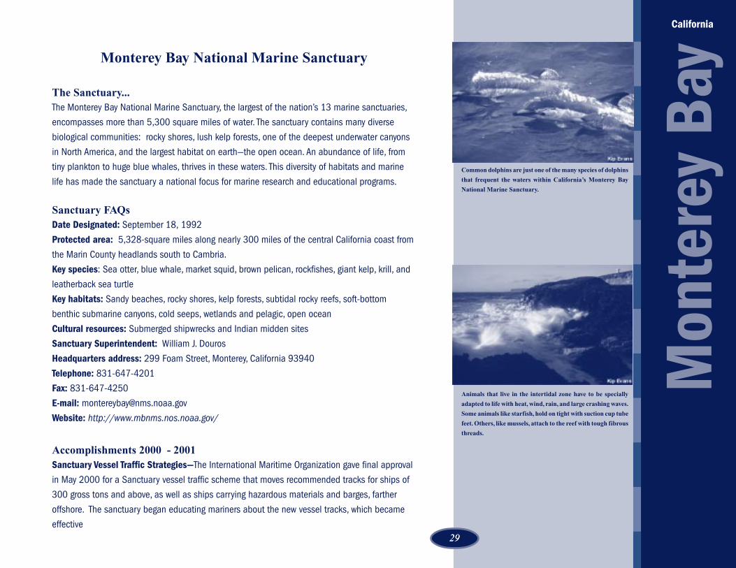
Common dolphins are just one of the many species of dolphins
that frequent the waters within California’s Monterey Bay
National Marine Sanctuary.
Animals that live in the intertidal zone have to be specially
adapted to life with heat, wind, rain, and large crashing waves.
Some animals like starfish, hold on tight with suction cup tube
feet. Others, like mussels, attach to the reef with tough fibrous
threads.
30
December 1, 2000, by distributing flyers to shipping agents and captains, placing the new trackson nautical charts, and including the strategy in NOAA’s U.S. Coast Pilot, a series of nautical booksthat cover a variety of information important to navigators of coastal and intracoastal waters.Sustainable Seas Student Summit—Ecosystem monitoring was the theme for the sanctuary’sannual SSE Student Summit event. To inspire high school student teams to undertake fieldprojects, a workshop on rocky intertidal monitoring techniques was organized with support fromregional scientific experts. At the summit, 40 students from six high schools presented their resultsto an audience of peers and local scientists. Other education activities related to the SSE includedtwo on-the-water excursions for students and a live satellite uplink that allowed the public tointeract with divers in the sanctuary.Environmental Emergencies—In 2000, Monterey Bay Sanctuary responded to 20 environmentalemergencies. These included sewage spills, a plane crash, boat groundings, and sinkings. Inaddition, the sanctuary sent a team to help the Channel Islands National Marine Sanctuaryrespond to the Alaska Airlines crash.Citizen Watershed Monitoring Network—The sanctuary’s Citizen Watershed Monitoring Networkorganized more than 100 volunteers for a one-day, sanctuary-wide monitoring event. The event,“Snapshot Day 2000,” held on Earth Day, was the largest simultaneous water quality monitoringevent in California. Data from the first event indicated relatively good water quality in most coastalstreams, but high nitrogen levels in and near the Salinas River and high coliform in some SanMateo County creeks.Furthering Education In Southern Boundaries—The sanctuary sponsored three Cambria teachersto participate in the sanctuary’s annual teacher workshop, worked with San Luis Obispo County toinstall a new “Sanctuary southern monument” exhibit, began planning a new outdoor exhibit at theHearst Castle Visitor Center, and partnered with California State Parks and National GeographicTheatre in San Simeon to host a special event launching the 2000 Sustainable Seas Expeditions.A new sanctuary education specialist was hired to work in a satellite office provided by CaliforniaState Parks, San Simeon District at Hearst Castle.Interpretive Enforcement to Further Resource Protection—In 2000 Monterey Bay became oneof two national marine sanctuaries selected to pilot an enforcement program. A special agent fromNOAA’s Office for Law Enforcement was assigned to concentrate on sanctuary enforcement issues.As a result, both response and investigative capabilities were improved and a strategicenforcement (monitoring and surveillance) plan is underway. The sanctuary piloted a newinterpretive enforcement program for the growing community of sea kayakers off Monterey and inElkhorn Slough. The new Team OCEAN program sent a team of sanctuary staff on the water to
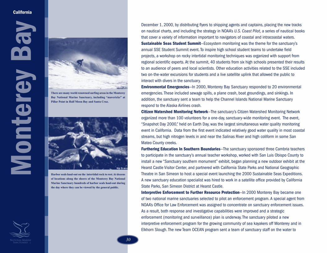
There are many world renowned surfing areas in the Monterey
Bay National Marine Sanctuary, including “mavericks” at
Pillar Point in Half Moon Bay and Santa Cruz.
Harbor seals haul-out on the intertidal rock to rest. At dozens
of locations along the shores of the Monterey Bay National
Marine Sanctuary hundreds of harbor seals haul-out during
the day where they can be viewed by the general public.
California
Mon
tere
y Ba
y

3131
Exposed rocky areas are often used as resting sites for many
fish eating birds such as these cormorants seen here at sunset.
educate fellow kayakers about the sanctuary, its wildlife, and how to protect marine mammalsfrom disturbance.Model Urban Runoff Program—Educational activities to reduce urban runoff continued inseveral California communities. Partnerships with the cities of Watsonville and Monterey and theCalifornia Coastal Commission led to a number of multimedia projects: bilingual brochures(Spanish-English); a bilingual training video, “Make The Connection,” which provides storm drainpollution prevention tips for restaurant employees; the award-winning “Dirty Words” radiocampaign; and a bilingual TV Public Service Announcement on urban runoff pollution. Inaddition, the sanctuary’s Urban Watch monitoring program expanded to Capitola, California.Research Cruises—The sanctuary research team participated in research cruises aboardMBARI’s Western Flyer, Moss Landing Marine Labs’ John Martin, and the NOAA Ship McArthur.The sanctuary also took advantage of a NOAA Shrike Commander aircraft. These effortsincluded exploring the Davidson Seamount, tagging leatherback turtles, and assessing krill,bird, and mammal populations. Using the Deep Worker submersible, divers took photographs ofthe seafloor associated with no-fishing reserves and proposed communication cable routes.Kelp Management Report—The sanctuary research team produced a kelp management reportthat summarized existing information on kelp systems and commercial harvesting and madepolicy recommendations for improving kelp harvesting throughout the sanctuary. The CaliforniaDepartment of Fish and Game is using it in developing its updated five-year kelp management plan.SIMoN: Ecosystem Monitoring Program—SIMoN, Sanctuary Integrated Monitoring Network,was developed after extensive input from resource managers and scientists to includecoordinated historical data, State of the Sanctuary publications, web access for education andresource management purposes, and new funds for monitoring. In 2001, the sanctuary staff
completed the design of SIMoN and received funding from NOAA to hire necessary staff. In
September 2001, the sanctuary received funding ($2 million) from the David and Lucile
Packard Foundation to initiate critical monitoring activities.
Joint Management Plan Review —The Monterey Bay joined with Cordell Bank and Gulf of the
Farallones Sanctuaries in a five-year management plan review process. Monterey Bay staff hired
two contractors to help in the process and completed six months of initial evaluation of existing
management plan review in advance of the public process that began in November 2001.
Initiated Collaborations with Fishing Industry - The sanctuary hosted several public forums
which focused on commercial fishing and research related to fishing issues. It also
commenced, at the initiation of leaders in the fishing industry, a collaborative process to
discuss fishing issues related the Monterey Bay National Marine Sanctuary.
32
Gulf of the Farallones National Marine Sanctuary
The Sanctuary...The Gulf of the Farallones Sanctuary is rich in marine resources: spawning grounds and nurseries
for commercially valuable species, at least 36 species of marine mammals, and 13 species of
breeding seabirds. One-fifth of California’s harbor seals breed within the sanctuary while the
Farallon Islands are home to the largest concentration of breeding seabirds in the contiguous
United States. In addition to the Farallon Islands, the sanctuary boundaries include the coastline
up to mean high tide, and protect a number of accessible lagoons, estuaries, bays, and beaches
for the public.
Sanctuary FAQsDate Designated: January 16, 1981
Protected area: 1,255-square miles, along the coast of California north and west of
San Francisco
Key species: Steller sea lion, gray, blue and humpback whales, Dungeness crab, Common Murre
and Ashy Storm-Petrel
Key habitats: Coastal beaches; rocky shores; salt marsh; estuaries; mud and tidal flats; pelagic,
open ocean; deep benthos; continental slope and shelf
Cultural resources: Shipwrecks and fossil beds
Sanctuary Manager: Ed Ueber
Headquarters address: Fort Mason, Building #201, San Francisco, California 94123
Telephone: 415-561-6622
Fax: 415-561-6616
E-mail: [email protected]
Website: http://www.gfnms.nos.noaa.gov/
Accomplishments 2000 - 2001Restoring Bolinas Lagoon—Bolinas Lagoon, a haven for wildlife with its rich wetlands and quiet
waters, has also attracted development and recreation seekers to this scenic area of the Gulf of
the Farallones National Marine Sanctuary. Filled in along its edges, the tidal prism of this
California
Gul
f of t
he F
aral
lone
s
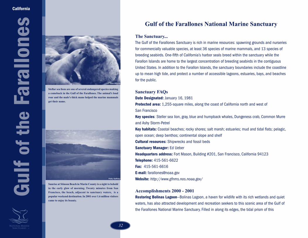
Stellar sea lions are one of several endangered species making
a comeback in the Gulf of the Farallones. The animal’s loud
roar and the male’s thick mane helped the marine mammals
get their name.
Sunrise at Stinson Beach in Marin County is a sight to behold
in the early glow of morning. Twenty minutes from San
Francisco, the beach, adjacent to sanctuary waters, is a
popular weekend destination. In 2001 over 1.6 million visitors
came to enjoy its beauty.

3333
dynamic lagoon has also changed due to an accumulation of silt from logging, housing
development, and other land use. Used extensively by wintering waterfowl and shorebirds, Bolinas
Lagoon is also home to breeding harbor seals, herons and egrets and is the only Ramsar site (the
Convention on Wetlands of International Importance) in California, Oregon, and Washington. The
Convention on Wetlands, signed in Ramsar, Iran, in 1971, is an intergovernmental treaty which
provides the framework for national action and international cooperation for the conservation and
wise use of wetlands and their resources.
To restore Bolinas Lagoon, sanctuary staff is working with the State of California, Marin County, the
Army Corp of Engineers, and other organizations on a long-term management plan. The Gulf of the
Farallones Sanctuary, in collaboration with the Farallones Marine Sanctuary Association, continued
its SEALS program to protect the harbor seals in Bolinas Lagoon. SEALS volunteers educate visitors
about harbor seals and monitor human and seal interactions that may cause resting seals to flee
from their haul-out areas.
Tracking Gray Whale Mortalities—Working in cooperation with The Marine Mammal Stranding
Network, which includes The Marine Mammal Center, California Academy of Sciences, University of
California-Berkeley, National Marine Fisheries Service, the sanctuary developed a system to keep
track of gray whale mortalities. To accurately assess the number of dead whales, the members of the
Marine Mammal Stranding Network developed a method to mark and track dead whales to ensure
accurate counts.
Farallones Marine Sanctuary Association—In 2000, the Farallones Marine Sanctuary Association,
a local group of sanctuary supporters, developed several new education programs in cooperation
with the sanctuary that reached out to the San Francisco Bay Area public about the marine
environment. School programs for kindergarten through 12th grade students were offered at the
Sanctuary Visitor Center in San Francisco. This program reached 432 students with the assistance
of AmeriCorps’ Watershed Stewards.
At Duxbury Reef, students are monitoring the reef and developing stewardship projects for this
heavily visited area. The pilot high school intertidal monitoring program teaches students how to
identify marine invertebrates and algae. They later use these skills to monitor key species and
human patterns to study the effects of trampling.
Sanctuary Visitor Center—The Sanctuary Visitor Center in San Francisco saw a dramatic increase in
Colorful sea stars decorate the algae-covered rocks of a
tidepool along the central California Coast.
California
Gul
f of t
he F
aral
lone
s
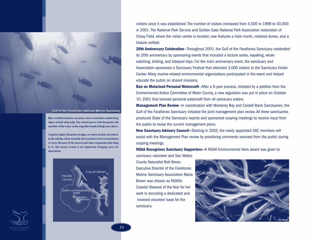
34
Blue rockfish (Sebastes mystinus) hover nearshore amidst long
stipes of bull whip kelp. The school moves with the gentle ebb
and flow of the water as the mop-like fronds of kelp wave above.
Caption (right): Branches of algae, or seaweed, that cast ashore
in the tideline often resemble the branches of terrestrial plants
or trees. Because of the insects and other organisms that cling
to it, this beach wrack is an important foraging area for
shorebirds.
visitors since it was established. The number of visitors increased from 4,500 in 1998 to 40,000
in 2001. The National Park Service and Golden Gate National Park Association restoration of
Crissy Field, where the visitor center is located, now features a tidal marsh, restored dunes, and a
historic airfield.
20th Anniversary Celebration—Throughout 2001, the Gulf of the Farallones Sanctuary celebrated
its 20th anniversary by sponsoring events that included a lecture series, kayaking, whale
watching, birding, and tidepool trips. For the main anniversary event, the sanctuary and
Association sponsored a Sanctuary Festival that attracted 3,000 visitors to the Sanctuary Visitor
Center. Many marine-related environmental organizations participated in the event and helped
educate the public on shared missions.
Ban on Motorized Personal Watercraft—After a 6-year process, initiated by a petition from the
Environmental Action Committee of Marin County, a new regulation was put in place on October
10, 2001 that banned personal watercraft from all sanctuary waters.
Management Plan Review—In coordination with Monterey Bay and Cordell Bank Sanctuaries, the
Gulf of the Farallones Sanctuary initiated the joint management plan review. All three sanctuaries
produced State of the Sanctuary reports and sponsored scoping meetings to receive input from
the public to revise the current management plans.
New Sanctuary Advisory Council—Starting in 2002, the newly appointed SAC members will
assist with the Management Plan review by prioritizing comments received from the public during
scoping meetings.
NOAA Recognizes Sanctuary Supporters—A NOAA Environmental Hero award was given to
sanctuary volunteer and San Mateo
County Naturalist Bob Breen.
Executive Director of the Farallones
Marine Sanctuary Association Maria
Brown was chosen as NOAA’s
Coastal Steward of the Year for her
work in recruiting a dedicated and
involved volunteer base for the
sanctuary.
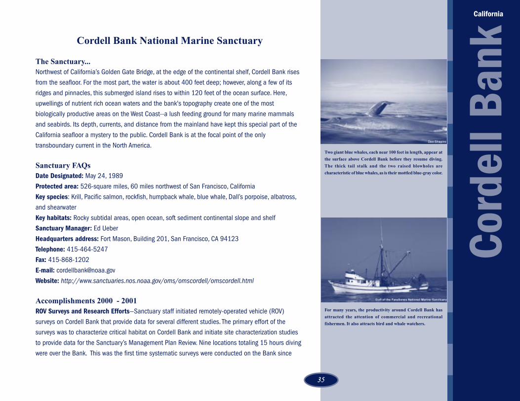
3535
Cordell Bank National Marine Sanctuary
The Sanctuary...Northwest of California’s Golden Gate Bridge, at the edge of the continental shelf, Cordell Bank rises
from the seafloor. For the most part, the water is about 400 feet deep; however, along a few of its
ridges and pinnacles, this submerged island rises to within 120 feet of the ocean surface. Here,
upwellings of nutrient rich ocean waters and the bank's topography create one of the most
biologically productive areas on the West Coast--a lush feeding ground for many marine mammals
and seabirds. Its depth, currents, and distance from the mainland have kept this special part of the
California seafloor a mystery to the public. Cordell Bank is at the focal point of the only
transboundary current in the North America.
Sanctuary FAQsDate Designated: May 24, 1989
Protected area: 526-square miles, 60 miles northwest of San Francisco, California
Key species: Krill, Pacific salmon, rockfish, humpback whale, blue whale, Dall’s porpoise, albatross,
and shearwater
Key habitats: Rocky subtidal areas, open ocean, soft sediment continental slope and shelf
Sanctuary Manager: Ed Ueber
Headquarters address: Fort Mason, Building 201, San Francisco, CA 94123
Telephone: 415-464-5247
Fax: 415-868-1202
E-mail: [email protected]
Website: http://www.sanctuaries.nos.noaa.gov/oms/omscordell/omscordell.html
Accomplishments 2000 - 2001ROV Surveys and Research Efforts—Sanctuary staff initiated remotely-operated vehicle (ROV)
surveys on Cordell Bank that provide data for several different studies. The primary effort of the
surveys was to characterize critical habitat on Cordell Bank and initiate site characterization studies
to provide data for the Sanctuary’s Management Plan Review. Nine locations totaling 15 hours diving
were over the Bank. This was the first time systematic surveys were conducted on the Bank since
Two giant blue whales, each near 100 feet in length, appear at
the surface above Cordell Bank before they resume diving.
The thick tail stalk and the two raised blowholes are
characteristic of blue whales, as is their mottled blue-gray color.
For many years, the productivity around Cordell Bank has
attracted the attention of commercial and recreational
fishermen. It also attracts bird and whale watchers.
Cord
ell B
ank
California

36
Cordell Expeditions completed SCUBA surveys in the mid 1980’s. Using the ROV provided by the
Sustainable Seas Expedition, the collaborative deep ocean explorations conducted by NOAA and
the National Geographic Society, allowed the sanctuary to collect data far below the diver depths of
the earlier study.
The divers discovered that most of the dive locations supported large aggregations of juvenile
rockfishes (Sebastes spp.). This bodes well for the Bank’s rockfish resources, as recruitment
throughout the 1990’s was generally poor. Data from this cruise may also provide information
which can be used to describe essential fish habitat for juvenile and adult rockfishes. Images
provided data that can be used to assess gear impacts and the distribution and abundance of
benthic invertebrates and algae on Cordell Bank.
Management Plan Review—In coordination with Monterey Bay and the Gulf of the Farallones
Sanctuaries, Cordell Bank initiated the joint management plan review. All three sanctuaries
produced State of the Sanctuary reports and sponsored scoping meetings to receive input from the
public to revise the current management plans.
Boundaries Clarified—Staff from the Cordell Bank Sanctuary, National Marine Sanctuary Program
headquarters and NOAA’s Coastal Services Center reviewed the boundary description for Cordell
Bank and identified inconsistencies in boundary definitions for the mutual boundary between
Cordell Bank and the Gulf of the Farallones. These inconsistences were clarified and the
boundaries digitized. Digitizing the boundary coordinates will be used in an analysis that may be
necessary during the Management Plan Review.
New Personnel & Office Space—In 2000, with increased funding for the program, the Cordell
Bank National Marine Sanctuary hired two permanent employees, an education specialist and
biological technician. With this increase in staff and resources, the sanctuary was better able to
address on-site and national program priorities. The new office space, a result of a cooperative
agreement with the National Park Service and the Cordell Bank Sanctuary, is located adjacent to
the Point Reyes National Seashore headquarters.
Research Vessel Purchased—The Cordell Bank and Gulf of the Farallones Sanctuaries added a
new research vessel, the C. Magister. The new vessel will greatly enhance the research capabilities
of the two sites.
Research Cruises—Using ROV and Delta submersible, the sanctuary conducted two research
cruises to classify Cordell Bank habitats.
Tiny strawberry anemones stretch their starry crowns of
tentacles to catch prey from the food-rich currents.

3737
Fagatele Bay National Marine Sanctuary
The Sanctuary…NOAA’s most remote sanctuary nestles in an eroded volcanic crater on the island of Tutuila, American
Samoa. An ancient Polynesian culture has served as steward of this fringing coral reef ecosystem that
contains crown-of-thorn starfish, giant clams, and blacktip reef sharks. In the late 1970s, nearly 200
species of coral were devastated by a crown-of-thorn starfish attack. Over 90% of the corals were
destroyed. This attack was followed by two hurricanes, tropical storms and coral bleaching. Despite
these damaging natural events, the coral has proved resilient, and today is protected by Fagatele Bay
National Marine Sanctuary.
Sanctuary FAQsDate Designated: April 29, 1986
Protected area: 0.25-square miles, 14 degrees south of the equator, on the southwest shore of Tutuila
Island, American Samoa
Key species: Crown-of-thorn starfish, blacktip reef sharks, surgeon fish, hawksbill turtle, parrotfish,
giant clam
Key habitats: Tropical coral reef
Sanctuary Manager: Nancy Daschbach
Headquarters address: P.O. Box 4318, Pago Pago, American Samoa 96799
Telephone: 684-633-7354
Fax: 684-633-7355
E-mail: [email protected]
Website: http://www.fbnms.nos.noaa.gov/
Accomplishments 2000 - 2001
Longliner Removal from Pago Pago Harbor--Nine abandoned longliners, grounded on the coral reef in
Pago Pago Harbor in 1991, were removed under a joint NOAA, American Samoa Government,
Department of the Interior, and US Coast Guard effort. Sanctuary Manager Nancy Daschbach
organized the removal and participated in many of the necessary activities during the removal and in
the aftermath. Daschbach and eight other NOAA employees were awarded the NOAA Silver Medal for
their efforts to restore and protect American Samoan corals.
Faga
tele
Bay
American Samoa
The genus Pocillipora is one of the most common types of coral
found in American Samoa, and has some of the most widely
distributed species throughout the Pacific. The species pictured
here, consists of compact clumps composed of uniform, thick,
primarily upright branches with flattened ends.
The coral formations in Fagatele Bay are found very close to
shore. The beach (upper left) is only about 20 feet wide and
200 long at high tide, and is composed mainly of calcareous
sand.

38
EnviroDiscoveries Camp—Entertaining-while-educating future coral reef stewards was an important
facet of Fagatele Bay Sanctuary’s EnviroDiscoveries Camps. Twice in 2000, three-day camps provided
children of the island with environmental activities. EnviroDiscoveries Camps were held on land within
the National Park of American Samoa on Tutuila and Ofu Islands. The sanctuary co-sponsored the
camp. Sixty-five schoolchildren attended the camps.
World Environment Day—On the first World Environment Day celebration in American Samoa on June
5, 2000, the sanctuary coordinated activities, exhibits, and interactive educational computer games to
teach children about hazards that impact the ocean such as oil spills. The sanctuary also presented
Environmental Hero Awards. The celebration was spearheaded by Le Tausagi, the interagency
environmental educators group.
Project Wet— The Sanctuary education coordinator co-facilitated two teachers’ Project Wet
workshops. Twenty-eight teachers and administrators attended workshops on the islands of Manu‘a
and Tutuila. Drawing upon instructions and activities from the Project Wet Curriculum and Activity
guide, the workshops informed the participants about water resources and water conservation. In
addition, three schools were visited by Le Tausagi members. Le Tausagi, using the Project Wet activity
guide, reached 67 students.
Fagatele Bay National Marine Sanctuary Signs—Educational signs are an important way of getting
the sanctuary’s message out. In 2000, turtle information signs and general information about the
sanctuary were produced in cooperation with the National Marine Fisheries Service. The informative
signs are part of a cooperative project with the National Marine Fisheries Service, Department of
Marine and Wildlife Resources, and the AmeriCorps volunteers.
AmeriCorps Volunteers—The Sanctuary education coordinator trained and supervised two AmeriCorps
volunteers. In all respects, the volunteers have been successful in promoting the sanctuary program
and assisting in 2000 projects and activities.
Coral Reef Resource Survey—The Fagatale Bay Sanctuary has sponsored periodic coral reef resource
surveys at the site since 1985. In 2001, the sanctuary conducted its fifth survey. The sanctuary and
the principal investigator, Dr. Charles Birkeland, announced that the coral reef had recovered from the
insults of the past twenty year, these include a crown-of-thorns starfish invasion in the late 1970s that
destroyed 90% of the corals in Fagatele Bay, two hurricanes, and a major coral bleaching in the mid-
1990s.
Mapping and GIS—A multi-beam mapping mission of Fagatele Bay was completed, and a GIS
Faga
tele
Bay
American Samoa
Fagatele Bay’s extensive coral reef ecosystem includes over 600
species of corals, macroinvertebrates, fish, and microalgae have
been recorded in the bay's waters.
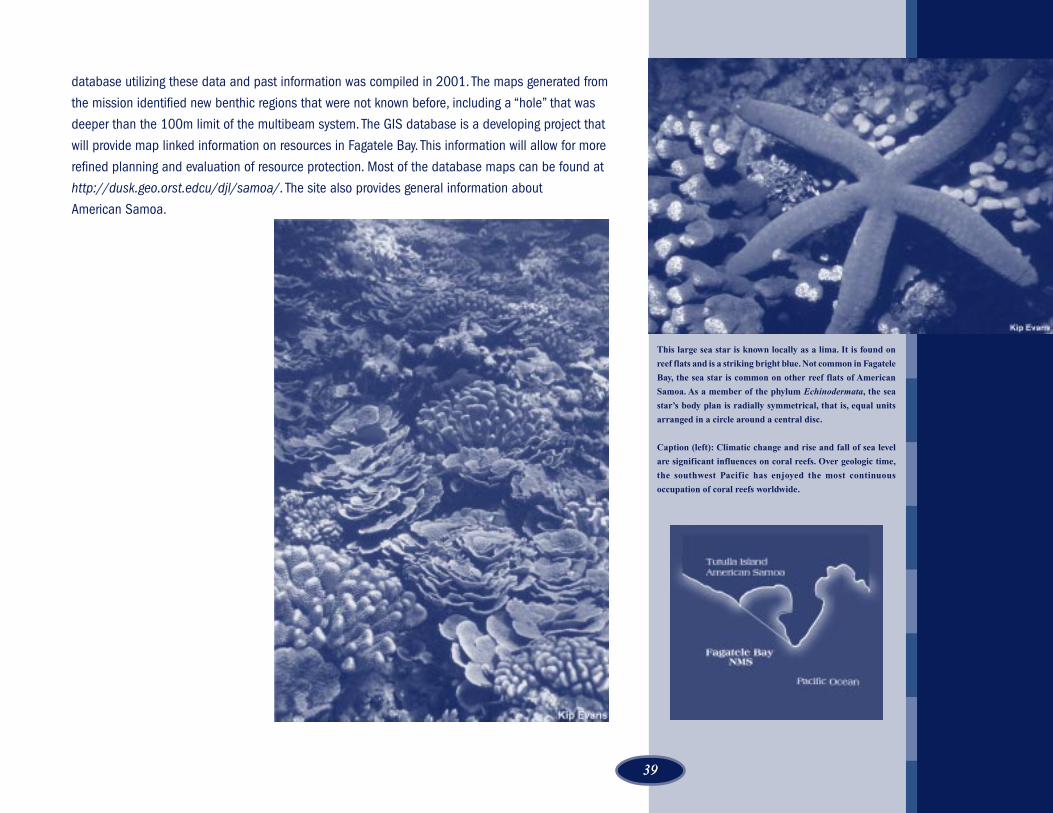
3939
database utilizing these data and past information was compiled in 2001. The maps generated from
the mission identified new benthic regions that were not known before, including a “hole” that was
deeper than the 100m limit of the multibeam system. The GIS database is a developing project that
will provide map linked information on resources in Fagatele Bay. This information will allow for more
refined planning and evaluation of resource protection. Most of the database maps can be found at
http://dusk.geo.orst.edcu/djl/samoa/. The site also provides general information about
American Samoa.
This large sea star is known locally as a lima. It is found on
reef flats and is a striking bright blue. Not common in Fagatele
Bay, the sea star is common on other reef flats of American
Samoa. As a member of the phylum Echinodermata, the sea
star’s body plan is radially symmetrical, that is, equal units
arranged in a circle around a central disc.
Caption (left): Climatic change and rise and fall of sea level
are significant influences on coral reefs. Over geologic time,
the southwest Pacific has enjoyed the most continuous
occupation of coral reefs worldwide.

40
Hawaiian Islands Humpback WhaleNational Marine Sanctuary
The Sanctuary...One of the world’s most important humpback whale habitats is within the warm and shallow
protected waters of the Hawaiian Islands Humpback Whale National Marine Sanctuary. Scientists
estimate that two-thirds of the entire North Pacific humpback whale (Megaptera novaeangliae)
population migrate to Hawaiian waters to breed, calve, and nurse their newborns. The sanctuary
is also home to a fascinating array of marine animals, corals, and plants, some of which are
found nowhere else on Earth. Its cultural heritage includes native Hawaiian traditions of living in
harmony with the sea.
Sanctuary FAQsDate Designated: November 4, 1992
Protected area: 1,370-square miles
Key species: Humpback whale, pilot whale, Hawaiian monk seal, spinner dolphin, green sea
turtle, coral reefs, limu (seaweed)
Key habitats: Humpback whale breeding, calving, nursing grounds; coral reefs; sandy beaches
Acting Sanctuary Manager: Naomi McIntosh
Headquarters address: Maui Office: 726 South Kihei Road, Kihei, Hawaii 96753. Sanctuary
offices are also based in Oahu and Kauai islands.
Telephone: 808-879-2818
Fax: 808-874-3815
E-mail: [email protected]
Website: http://www.hihwnms.nos.noaa.gov/
Accomplishments 2000 - 2001Humpback Whale Research—The sanctuary increased funding support in 2000 for scientific
research, awarding over $60,000 in grants to six projects. The projects yielded important findings
useful to sanctuary management and other agencies that share the responsibility for protecting
endangered humpback whales by increasing baseline information on habitat requirements,
Female humpback whales and their calves are sometimes
accompanied by a single adult male humpback whale,
otherwise known as an “escort” whale. This escort protects
the female and her calf from other whales and may sometimes
attempt to mate with her.
A young calf performing a back flip in Maalaea Bay, Maui.
Spectacular behaviors such as these (known as breaching) can
easily be seen from the shores of all the main Hawaiian Islands.
Whale watching regulations make it unlawful to approach a
whale closer than 100 yards.
Hawai’i
Haw
aiia
n Is
land
s H
umpb
ack
Wha
le

4141
population dynamics, social behavior, and vital rates of North Pacific humpbacks. The new
technologies and methods include tracking, aerial survey, and videogrammetry. To ensure study
results would be useful to other agencies and the general public, the sanctuary took several
steps to integrate research with sanctuary outreach and education. The sanctuary website
offers an annotated list of all sanctuary-supported research projects and studies dating back to
1993. Sanctuary research grant recipients also participate as presenters in the Sanctuary
Lecture Series on the islands of Maui, Kauai, and the Big Island.
Sanctuary Education Center— A mini marine science museum and library, where some
displays and artifacts are the hand-built creations of volunteers, remains a main attraction at
the site in Kihei, Maui. The sanctuary improved training and education for volunteers, enabling a
corps of interested individuals to assist the center and to provide visitors with information on
the sanctuary program and humpback whales. The center also proved an extremely popular
venue for the Sanctuary Lecture Series. Monthly lectures by cultural and marine science
experts--including researchers with projects supported by sanctuary funding--have attracted
capacity crowds and provided the sanctuary with opportunities for positive publicity.
During the 2001 humpback whale season over 1000 people visited the site during the month
of March. In addition, the Sanctuary Education Center hosted close to 25 school group
visitations that included students from Hawaii, other states and countries. In June, the
Sanctuary hosted a teacher workshop.
Media and Outreach—A sanctuary press kit successfully solicited positive media coverage of
the education center and, as a related development, the sanctuary experienced a significant
increase in the number of visitors stopping-in at the headquarters site on Maui. In response to
the increased visits by school and community groups, the sanctuary developed a program of
on-site interpretation of sanctuary resources, including the archeologically significant Native
Hawaiian aquaculture pond fringing the shorefront.
Solar Electric System Partnership— The sanctuary headquarters site was chosen in 2000 to
be the recipient of an innovative solar electric system, developed jointly by the US Department
of Energy and the Maui Electric Company. Collaborating with these agencies allowed the
sanctuary to publicize the environmental value of the system and promote a public festival that
included educational activities and entertainment.
Interagency coordination—The sanctuary continued to work with NOAA Fisheries Office for
Education and research are the main goals of the Hawaiian
Islands Humpback Whale National Marine Sanctuary. A
majority of the Sanctuary's publications are printed in English
and Hawaiian. Recently, the State of Hawaii's Department of
Education reprinted several of the Sanctuary's bilingual
coloring books for their native Hawaiian language program.
Hawai’i
Haw
aiia
n Is
land
s H
umpb
ack
Wha
le

42
The scientif ic name for the humpbacks, (Megaptera
novaengliae), means “Great Wings of New England.” The
Hawaiian name for the whale is Kohola.
Enforcement. This agency holds the authority to enforce humpback whale protection laws arising
from the Marine Mammal Protection Act and the Endangered Species Act. The sanctuary
continued to funding support enabling the NOAA Fisheries Office for Enforcement to have a
stronger presence on Maui to investigate and prosecute violations of humpback whale protection
regulations. Over 70 cases of potential whale harassment or approach law violation were
investigated in 2000.
The sanctuary also sponsored Ocean Users Workshops throughout the islands and assisted
NMFS with a publication on guidelines to ensure safe wildlife-viewing of marine mammals and
sea turtles in Hawaii.
2000 International Marine Debris Conference—The Hawaiian Islands Humpback Whale
Sanctuary, in cooperation with its multi-agency partners, tackled the important issue of ocean
pollution in the 2000 International Marine Debris Conference in Honolulu. Over a period of one
week, 300 resource managers, scientists, environmentalists and policy-makers convened to
examine the environmental impacts associated with discarded fishing gear. Working groups
focused on special interest areas of education, industry, legal issues, impacts, mitigation,
removal, and source identification. At the end of the session, each group issued
recommendations aimed at reducing harmful impacts of marine debris on the ocean
environment. Throughout the conference, website coverage of the latest development was made
accessible. The sanctuary also committed to monitoring the implementation of the
recommendations and pledged its support for further marine debris conferences.
Management Plan Review— The Hawaiian Islands Humpback Whale National Marine
Sanctuary completed initial efforts to revise its management plan. A draft of the revised
management plan was produced and reviewed during December 2001 and January 2002 and
will be released for public review in March 2002. The draft revised management plan made a
number of improvements including updating the vision, goals, and objectives of the sanctuary,
restructuring the document into a series of action plans, adding a new set of outcomes and
performance indicators; and removing tasks already completed and planning new tasks for the
next five years.
Annual Sanctuary Ocean Count—The annual Sanctuary Ocean Count has been expanded and
is being conducted year on the islands of Oahu, Kauai, and the Big Island. The event has
continued to be a popular attraction to both residents and visitors alike. The number of
participants increased from 400 in 2000 to over a 1000 in 2001 and will be available for public
comment in early 2002.

4343
The corals of the Hawaiian Islands, such as the Finger coral
(Porites compressa) pictured here, are rich in diversity and
support an abundance of life. Coral habitats are found
extensively throughout the sanctuary.
Caption (left): The green sea turtle (Chelonia mydas), also
known in the Hawaiian language as honu, is the most common
sea turtle in Hawaiian waters. It feeds on marine plants in
shallow coastal waters throughout the islands and can grow
to 200 pounds or more. Sea turtles hold an important role in
Hawaiian culture and were prominently represented in ancient
Hawaiian mythology and petroglyphs.
The sanctuary boundary extends from the high-water mark
on the shoreline to a 600-foot depth offshore. The area shown
here, off the north shore of Kauai, is also frequented by monk
seals and spinner dolphins.
Hawai’i
Haw
aiia
n Is
land
s H
umpb
ack
Wha
leKauai Ocean Fair and Teacher Workshops—The 4th annual Kauai Family Ocean Fair was held at
Kilauea Point National Wildlife Refuge in March. The Ocean Fair has been a signature event of the
Hawaiian Islands Humpback Whale Sanctuary and the US Fish and Wildlife Service Kilauea Point
National Wild Reserve since 1998. In 2001, approximately 3,000 people attended. A teacher
workshop and research lectures were also held in conjunction with the Ocean Fair.
Sanctuary Volunteers—A major social benefit of the Sanctuary involves the continuing success of
the Sanctuary Volunteer Program at the Maui office. A sanctuary volunteer coordinator recruits and
trains volunteers, apprising them of NOAA policies and sanctuary goals. A core group of
approximately 75 volunteers maintains regular weekly hours at the sanctuary, assisting with
everything from office chores to the design of educational displays. Last year, approximately 700
volunteers contributed a total of 4,500 hours of pro bono services to the Sanctuary.
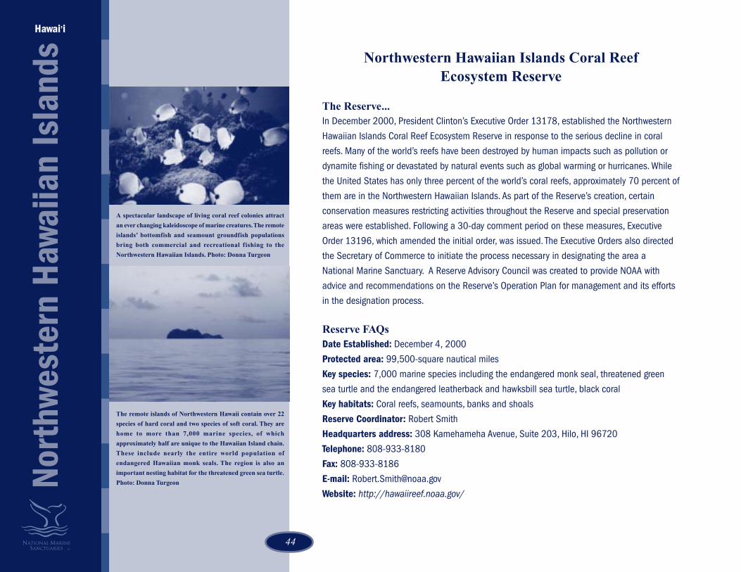
44
Northwestern Hawaiian Islands Coral ReefEcosystem Reserve
The Reserve...In December 2000, President Clinton’s Executive Order 13178, established the Northwestern
Hawaiian Islands Coral Reef Ecosystem Reserve in response to the serious decline in coral
reefs. Many of the world’s reefs have been destroyed by human impacts such as pollution or
dynamite fishing or devastated by natural events such as global warming or hurricanes. While
the United States has only three percent of the world’s coral reefs, approximately 70 percent of
them are in the Northwestern Hawaiian Islands. As part of the Reserve’s creation, certain
conservation measures restricting activities throughout the Reserve and special preservation
areas were established. Following a 30-day comment period on these measures, Executive
Order 13196, which amended the initial order, was issued. The Executive Orders also directed
the Secretary of Commerce to initiate the process necessary in designating the area a
National Marine Sanctuary. A Reserve Advisory Council was created to provide NOAA with
advice and recommendations on the Reserve’s Operation Plan for management and its efforts
in the designation process.
Reserve FAQsDate Established: December 4, 2000
Protected area: 99,500-square nautical miles
Key species: 7,000 marine species including the endangered monk seal, threatened green
sea turtle and the endangered leatherback and hawksbill sea turtle, black coral
Key habitats: Coral reefs, seamounts, banks and shoals
Reserve Coordinator: Robert Smith
Headquarters address: 308 Kamehameha Avenue, Suite 203, Hilo, HI 96720
Telephone: 808-933-8180
Fax: 808-933-8186
E-mail: [email protected]
Website: http://hawaiireef.noaa.gov/
Hawai’i
Nort
hwes
tern
Haw
aiia
n Is
land
s
A spectacular landscape of living coral reef colonies attract
an ever changing kaleidoscope of marine creatures. The remote
islands’ bottomfish and seamount groundfish populations
bring both commercial and recreational fishing to the
Northwestern Hawaiian Islands. Photo: Donna Turgeon
The remote islands of Northwestern Hawaii contain over 22
species of hard coral and two species of soft coral. They are
home to more than 7,000 marine species, of which
approximately half are unique to the Hawaiian Island chain.
These include nearly the entire world population of
endangered Hawaiian monk seals. The region is also an
important nesting habitat for the threatened green sea turtle.
Photo: Donna Turgeon

4545
Accomplishments 2000 - 2001A New Reserve Headquarters—In 2001, the Northwestern Hawaiian Islands Coral Reef Ecosystem
Reserve established two new offices on two islands within the Hawaiian islands, created a staff to
support its projects, and established relationships with headquarters and other sites necessary to
guide this new project over time.
Increasing Community Support—One important achievement for the NWHI Reserve in 2001, was the
creation of a Reserve Advisory Council. During the year the Council chose its own leadership and
responded to the various charges and requests given the Advisory Council by NOS leadership. In
particular, the enthusiasm for the NWHI project by the native Hawaiian community, educators,
researchers, and the recreational interests was noteworthy.
Reserve Operations Plan—Having a Reserve in place provides immediate added protection and
coordinated management for the NWHI coral reef ecosystem and marine environment. As directed by
Executive Order, a Reserve Operations Plan was drafted as a guide to govern the management of the
Reserve throughout the sanctuary designation process. The plan addresses priority issues like marine
debris, research and monitoring, education, and enforcement. The intended life span of this plan is
approximately three years, or until such a time as the designation process for the proposed sanctuary
is completed.
Sanctuary Designation Process—Sanctuary designation is an extensive public process that involves
identifying issues facing the NWHI and determining what a marine sanctuary can and should do to
address those issues. The process begins with a public scoping, including statewide public meetings,
in Spring 2002. Scoping is designed to solicit comments from user and interest groups, the public,
and agencies on management priorities for a proposed Sanctuary. Next, the NMSP reviews all
comments and works with the NWHI Reserve Advisory Council and the public to prioritize issues and
ultimately develop the draft management plan. If designated, the management plan serves as the
site-specific planning and management document describing objectives, policies, and activities.
These Masked Boobies feed by plunge diving for fish in
nearshore waters. They can be found among the wide diversity
of seabirds in the Northwestern Hawaiian Islands.
Photo: Donna Turgeon
Butterflyfish in Hawaii show a wide variety of feeding patterns.
These schooling Milletseed Butterflyfish focus on plankton
while other monogamous pairs of butterflyfish feed only on
certain Hawaiian species of coral.
Photo: Donna Turgeon

46
Olympic Coast National Marine Sanctuary
The Sanctuary...Spanning 3,310-square miles of marine waters and rugged undeveloped beaches, Olympic Coast
National Marine Sanctuary provides habitat for 29 species of marine mammals and is a critical link
along the Pacific flyway for migratory birds. The sanctuary boasts a rich mix of cultures, preserved in
the contemporary lives of the Quinault, Hoh, Quileute, and Makah Tribes.
Along this same stretch of coastline, vessel and air traffic, and recreational uses must all be
balanced to protect the region’s natural resources.
Sanctuary FAQsDate Designated: July 16, 1994
Protected area: 3,310-square miles, from Neah Bay to the mouth of the Copalis River, on
Washington’s outer coast
Key species: Tufted puffin, bald eagle, northern sea otter, gray and humpback whales, dolphin,
Pacific salmon, rockfish
Key habitats: Rocky and sandy shores, kelp forests, seastacks and islands, continental shelf, open
ocean, deepwater canyons
Sanctuary Superintendent: Carol Bernthal
Headquarters address: 138 W. First Street, Port Angeles, WA 98362
Telephone: 360-457-6622
Fax: 360-457-8496
E-mail: [email protected]
Website: http://www.ocnms.nos.noaa.gov/
Accomplishments 2000 - 2001Marine zoning—A Marine Conservation Work Group (MCWG) was appointed by the Olympic Coast
National Marine Sanctuary Advisory Committee to evaluate existing zoning strategies within the
sanctuary. The group was also asked to develop a specific proposal for the conservation and
protection of intertidal habitats. In 2000, the group developed ground rules, hired a contractor to
coordinate the evaluation process, met to develop goals and objectives, reviewed available intertidal
habitat data, and began evaluating zoning options.
Washington
Olym
pic
Coas
t
Most killer whales (Orcinus orca) in the sanctuary belong to
groups that migrate into the inner waters of Puget Sound and
Georgia Strait. Occasionally, oceanic pods visit the region.
Echinoderms - “spiny skin” - represent an important group
of invertebrates in sanctuary waters. The purple and red sea
urchins (Stongylocentrotus purpuratus, S. franciscanus,
respectively) and the blood and six-rayed sea stars (Henricia
leviuscula and Leptaserias hexactis) all have tube feet. Urchins
feed on algae. Sea stars are predators of smaller invertebrates.
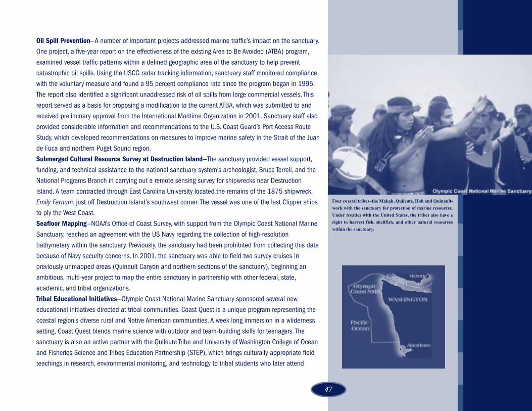
4747
Oil Spill Prevention—A number of important projects addressed marine traffic’s impact on the sanctuary.
One project, a five-year report on the effectiveness of the existing Area to Be Avoided (ATBA) program,
examined vessel traffic patterns within a defined geographic area of the sanctuary to help prevent
catastrophic oil spills. Using the USCG radar tracking information, sanctuary staff monitored compliance
with the voluntary measure and found a 95 percent compliance rate since the program began in 1995.
The report also identified a significant unaddressed risk of oil spills from large commercial vessels. This
report served as a basis for proposing a modification to the current ATBA, which was submitted to and
received preliminary approval from the International Maritime Organization in 2001. Sanctuary staff also
provided considerable information and recommendations to the U.S. Coast Guard’s Port Access Route
Study, which developed recommendations on measures to improve marine safety in the Strait of the Juan
de Fuca and northern Puget Sound region.
Submerged Cultural Resource Survey at Destruction Island—The sanctuary provided vessel support,
funding, and technical assistance to the national sanctuary system’s archeologist, Bruce Terrell, and the
National Programs Branch in carrying out a remote sensing survey for shipwrecks near Destruction
Island. A team contracted through East Carolina University located the remains of the 1875 shipwreck,
Emily Farnum, just off Destruction Island’s southwest corner. The vessel was one of the last Clipper ships
to ply the West Coast.
Seafloor Mapping—NOAA’s Office of Coast Survey, with support from the Olympic Coast National Marine
Sanctuary, reached an agreement with the US Navy regarding the collection of high-resolution
bathymetery within the sanctuary. Previously, the sanctuary had been prohibited from collecting this data
because of Navy security concerns. In 2001, the sanctuary was able to field two survey cruises in
previously unmapped areas (Quinault Canyon and northern sections of the sanctuary), beginning an
ambitious, multi-year project to map the entire sanctuary in partnership with other federal, state,
academic, and tribal organizations.
Tribal Educational Initiatives—Olympic Coast National Marine Sanctuary sponsored several new
educational initiatives directed at tribal communities. Coast Quest is a unique program representing the
coastal region’s diverse rural and Native American communities. A week long immersion in a wilderness
setting, Coast Quest blends marine science with outdoor and team-building skills for teenagers. The
sanctuary is also an active partner with the Quileute Tribe and University of Washington College of Ocean
and Fisheries Science and Tribes Education Partnership (STEP), which brings culturally appropriate field
teachings in research, environmental monitoring, and technology to tribal students who later attend
Four coastal tribes -the Makah, Quileute, Hoh and Quinault-
work with the sanctuary for protection of marine resources.
Under treaties with the United States, the tribes also have a
right to harvest fish, shellfish, and other natural resources
within the sanctuary.

48
intensive residence summer programs at the university.
Overflight Education Campaign—Sanctuary staff initiated a new peer-education program to inform
and seek voluntary compliance from pilots. The sanctuary currently has a 2,000-foot restriction for
flights over its most sensitive areas, but pilots have been generally unaware of this provision. A
brochure was mailed directly to 18,000 pilots, with a message from the federal co-managers (Olympic
National Park, USFWS) identifying the restricted area and asking for their cooperation. Targeted
presentations from an experienced pilot were also made to aviation groups, and a colorful booth at
aviation shows promoted the message of a “be a pro, don’t fly low.”
Seattle Aquarium Partnership—The sanctuary was a catalyst in the designation of the Seattle
Aquarium as a Coastal America Ecosystem Learning Center. As a designated center, the Seattle
Aquarium hosted a student conference for 60 high school students from around the region. The
sanctuary also contributed toward the production of a new sea otter exhibit at the Seattle Aquarium.
Ecosystem Monitoring—Multiple research and monitoring projects were accomplished by sanctuary
staff. These included a first-time rapid assessment of exotic plant and animal species, aerial surveys of
kelp to determine trends in abundance and distribution, population and prey studies for the northern
sea otter, and baseline surveys of intertidal plants and fishes. In 2000 the sanctuary launched a 10-
year program to monitor the impacts of the placement of submarine fiber optic cables within the
sanctuary. Sanctuary scientific staff completed a 14-day cruise using the R/V Velero and Delta
submersible along the cable route to identify benthic habitat impacts and begin monitoring bottom
habit recovery rates.
Sanctuary staff also collaborated with the NMFS Northwest Fisheries Science Center and the Olympic
Regional Harmful Algal Bloom (ORHAB) partners on a study of conditions that lead to harmful algal
blooms. Nearshore circulation studies were completed by installing remote sensors at key locations
along the coast to understand how offshore algal blooms reach shoreline areas. These HAB events
have led to the closures of significant razor clams fisheries along the coast because of human health
concerns. Blooms have also been linked to marine mammal deaths in California and may present a
hazard to recovering sea otter populations along the Washington Coast. Results of the monitoring
program were publicized through a website, annual newsletter, and public presentations.
Teacher Workshops—Teachers from the Olympic Peninsula were trained in intertidal monitoring
protocols like those used by sanctuary researchers in this field-based marine science program.
Teachers were trained in monitoring techniques and the use of Geographic Information Systems (GIS)
Washington
Olym
pic
Coas
t
Rich intertidal areas along the Olympic Coast host a wide
diversity of specialized plants and animals. Although pristine
by most standards, these habitats are vulnerable to oil spills
and other human impacts. The sanctuary, along with other
resource stewards, is considering ways that this fragile
boundary between terrestrial and ocean ecosystems can be
protected.
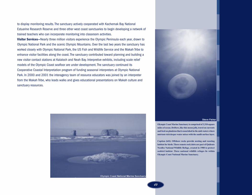
4949
Olympic Coast Marine Sanctuary is comprised of 3,310-square
miles of ocean. Drifters, like this moon jelly, travel on currents
and feed on plankton that is nourished in the mid-waters where
nutrient-rich deeper water mixes with the sunlit surface layer.
Caption (left): Offshore rocks provide nesting and roosting
habitat for birds. These remote rock islets are part of Quileute
Needles National Wildlife Refuge, created in 1908 to protect
seabird habitat. Three national wildlife refuges lie within
Olympic Coast National Marine Sanctuary.
to display monitoring results. The sanctuary actively cooperated with Kachemak Bay National
Estuarine Research Reserve and three other west coast sanctuaries to begin developing a network of
trained teachers who can incorporate monitoring into classroom activities.
Visitor Services—Nearly three million visitors experience the Olympic Peninsula each year, drawn to
Olympic National Park and the scenic Olympic Mountains. Over the last two years the sanctuary has
worked closely with Olympic National Park, the US Fish and Wildlife Service and the Makah Tribe to
enhance visitor facilities along the coast. The sanctuary contributed toward planning and building a
new visitor contact stations at Kalaloch and Neah Bay. Interpretive exhibits, including scale relief
models of the Olympic Coast seafloor are under development. The sanctuary continued its
Cooperative Coastal Interpretation program of funding seasonal interpreters at Olympic National
Park. In 2000 and 2001 the interagency team of resource educators was joined by an interpreter
from the Makah Tribe, who leads walks and gives educational presentations on Makah culture and
sanctuary resources.

50
Thunder Bay National Marine Sanctuaryand Underwater Preserve
The Sanctuary...Historic shipwrecks received special protection in the designation of the Thunder Bay National Marine
Sanctuary and Underwater Preserve. In 2000, Thunder Bay became the site of the nation’s 13th
sanctuary in the National Marine Sanctuary System and the first in the Great Lakes.
The known shipwrecks in Thunder Bay rest as close to the surface as 12 feet and as deep as 180
feet. Maritime archeologists believe the region’s shipwreck collection includes wooden schooners,
barks, brigs, steamers, barges, tugboats, steel-hulled steamers, and freighters—a vast collection of
nineteenth and twentieth century maritime history.
Sanctuary FAQsDate Designated: October 7, 2000
Protected area: 448-square miles in Lake Huron, off the coast of Alpena, Michigan
Cultural resources: Historic shipwrecks include the sidewheeler New Orleans (1844-1849) and the
steel-hulled propeller Isaac M. Scott (1909-1913)
Acting Sanctuary Manager: Ellen Brody
Address: 145 Water Street, Alpena, Michigan 49707
Telephone: 989-356-8805
Fax: 989-354-0144
E-mail: [email protected]
Website: http://www.glerl.noaa.gov/glsr/thunderbay/
Accomplishments 2000 - 2001Sanctuary Designation—After a decade of discussions and negotiations, on June 19, 2000, NOAA
and the State of Michigan announced agreement had been reached on the designation of a national
marine sanctuary in Thunder Bay. On October 7, 2000 the Thunder Bay National Marine Sanctuary
and Underwater Preserve was designated to protect and manage a nationally significant collection of
an estimated 116 shipwrecks. NOAA and Michigan are equal partners in protecting and managing
this important site.
The nation’s newest marine sanctuary, Thunder Bay National
Marine Sanctuary and Underwater Preserve, protects the
shipwrecks of the nineteenth and twentieth century. Large
steel-hulled vessels, such as the Isaac M. Scott, and earlier
wooden schooners are preserved in the cold freshwater of Lake
Huron.
Michigan
Thun
der B
ay
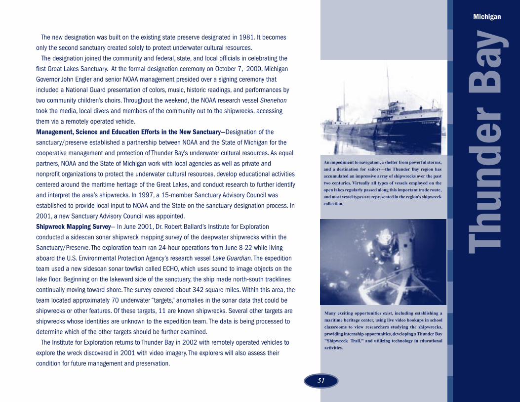
5151
The new designation was built on the existing state preserve designated in 1981. It becomes
only the second sanctuary created solely to protect underwater cultural resources.
The designation joined the community and federal, state, and local officials in celebrating the
first Great Lakes Sanctuary. At the formal designation ceremony on October 7, 2000, Michigan
Governor John Engler and senior NOAA management presided over a signing ceremony that
included a National Guard presentation of colors, music, historic readings, and performances by
two community children’s choirs. Throughout the weekend, the NOAA research vessel Shenehon
took the media, local divers and members of the community out to the shipwrecks, accessing
them via a remotely operated vehicle.
Management, Science and Education Efforts in the New Sanctuary—Designation of the
sanctuary/preserve established a partnership between NOAA and the State of Michigan for the
cooperative management and protection of Thunder Bay’s underwater cultural resources. As equal
partners, NOAA and the State of Michigan work with local agencies as well as private and
nonprofit organizations to protect the underwater cultural resources, develop educational activities
centered around the maritime heritage of the Great Lakes, and conduct research to further identify
and interpret the area’s shipwrecks. In 1997, a 15-member Sanctuary Advisory Council was
established to provide local input to NOAA and the State on the sanctuary designation process. In
2001, a new Sanctuary Advisory Council was appointed.
Shipwreck Mapping Survey— In June 2001, Dr. Robert Ballard’s Institute for Exploration
conducted a sidescan sonar shipwreck mapping survey of the deepwater shipwrecks within the
Sanctuary/Preserve. The exploration team ran 24-hour operations from June 8-22 while living
aboard the U.S. Environmental Protection Agency’s research vessel Lake Guardian. The expedition
team used a new sidescan sonar towfish called ECHO, which uses sound to image objects on the
lake floor. Beginning on the lakeward side of the sanctuary, the ship made north-south tracklines
continually moving toward shore. The survey covered about 342 square miles. Within this area, the
team located approximately 70 underwater “targets,” anomalies in the sonar data that could be
shipwrecks or other features. Of these targets, 11 are known shipwrecks. Several other targets are
shipwrecks whose identities are unknown to the expedition team. The data is being processed to
determine which of the other targets should be further examined.
The Institute for Exploration returns to Thunder Bay in 2002 with remotely operated vehicles to
explore the wreck discovered in 2001 with video imagery. The explorers will also assess their
condition for future management and preservation.
Michigan
Thun
der B
ay
Many exciting opportunities exist, including establishing a
maritime heritage center, using live video hookups in school
classrooms to view researchers studying the shipwrecks,
providing internship opportunities, developing a Thunder Bay
"Shipwreck Trail," and utilizing technology in educational
activities.
An impediment to navigation, a shelter from powerful storms,
and a destination for sailors—the Thunder Bay region has
accumulated an impressive array of shipwrecks over the past
two centuries. Virtually all types of vessels employed on the
open lakes regularly passed along this important trade route,
and most vessel types are represented in the region's shipwreck
collection.
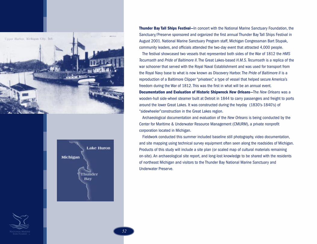
52
Thunder Bay Tall Ships Festival—In concert with the National Marine Sanctuary Foundation, the
Sanctuary/Preserve sponsored and organized the first annual Thunder Bay Tall Ships Festival in
August 2001. National Marine Sanctuary Program staff, Michigan Congressman Bart Stupak,
community leaders, and officials attended the two-day event that attracted 4,000 people.
The festival showcased two vessels that represented both sides of the War of 1812 the HMS
Tecumseth and Pride of Baltimore II. The Great Lakes-based H.M.S. Tecumseth is a replica of the
war schooner that served with the Royal Naval Establishment and was used for transport from
the Royal Navy base to what is now known as Discovery Harbor. The Pride of Baltimore II is a
reproduction of a Baltimore Clipper “privateer,” a type of vessel that helped secure America’s
freedom during the War of 1812. This was the first in what will be an annual event.
Documentation and Evaluation of Historic Shipwreck New Orleans—The New Orleans was a
wooden-hull side-wheel steamer built at Detroit in 1844 to carry passengers and freight to ports
around the lower Great Lakes. It was constructed during the heyday (1830’s-1840’s) of
“sidewheeler”construction in the Great Lakes region.
Archaeological documentation and evaluation of the New Orleans is being conducted by the
Center for Maritime & Underwater Resource Management (CMURM), a private nonprofit
corporation located in Michigan.
Fieldwork conducted this summer included baseline still photography, video documentation,
and site mapping using technical survey equipment often seen along the roadsides of Michigan.
Products of this study will include a site plan (or scaled map of cultural materials remaining
on-site). An archaeological site report, and long-lost knowledge to be shared with the residents
of northeast Michigan and visitors to the Thunder Bay National Marine Sanctuary and
Underwater Preserve.

5353
Cordell Bank NMS• Cordell Bank National Marine Sanctuary State of the
Sanctuary Report, November 2001, author DanHoward
• Cordell Bank brochure, author Cordell Bank NationalMarine Sanctuary staff, April 2002
• The Amazing Seabirds of Cordell Bank National MarineSanctuary, author Rich Stallcup, April 2002
Florida Keys NMS• Strategy for Stewardship - Florida Keys National Marine
Sanctuary Final Management Plan: An Overview - July1, 1997
• Florida Keys National Marine Sanctuary FinalManagement Plan/Environmental Impact Statement,July 1, 1997
• Draft Revised Florida Keys National Marine SanctuaryManagement Plan, March 2002.
• Florida Keys National Marine Sanctuary Site brochure,1998
• Florida Keys National Marine Sanctuary, Lower FloridaKeys Region brochure, December 1998
• Florida Keys National Marine Sanctuary, Upper FloridaKeys Region brochure, December 1999
• Keeping Your Bottom Off The Bottom brochure, January2001
• Florida Keys Safe Boating Tips decal, 1996• Florida's Coral Reef Ecosystem poster, 1993• The Fishes of the Florida Keys National Marine
Sanctuary poster, Fall 2001• Boat Groundings - Much More Than An Inconvenience
video, 1994• Protecting Paradise - Florida Keys Safe Boating Tips
video, 1996• Florida Keys Environmental Education Resource
Directory, 1997• Shipwreck Trail- An Adventure To Dive For… brochure,
July 1999• Shipwreck Trail- Site Guides, July 1999
Flower Garden Banks NMS• Gulf of Mexico Science: Flower Garden
Banks National Marine Sanctuary SpecialEdition, authors William W. Schroeder,FGNMS staff and partners, including Dr.Sylvia Earle, Dec. 1998
• FGBNMS 2001 Research Summary, authorsEmma Hickerson, Kevin L. Buch, andJennifer DeBose, Dec 2001
• 2001 Student Ocean Conference SummaryReport, Jan 2002, authors Sarah Bernhardt,Shelley Du Puy, and George Schmahl
• Quarterly Newsletter (Jan, April, July) Editor,Sarah Bernhardt
• 2001 “Down Under, Out Yonder” WorkshopsSummary Report, authors Sarah Bernhardtand Shelley Du Puy, March 2002
Gray’s Reef NMS• Monsters in the Mud - poster of creatures
that live in the sediments of the sanctuary,August 2002
• Gray’s Reef in Depth brochure (detailing theorganisms that occupy different layers of thewater column at the sanctuary), May 2002
• GRNMS draft management plan, June 2002• Rivers to Reefs educational module,
educational curricula and multimediadepiction of the major ecological zonesalong the watersheds and to the deepocean that influence life in the sanctuary,July 2002
• Gray’s Reef poster, (signature posteridentifies Gray’s Reef and its ties to thestate of Georgia), March 2002
Selected publications

54
Hawaiian Islands Humpback Whale NMS• Hawaiian Islands Humpback Whale NMS State of the
Sanctuary Report, Feb. 2002• Hawaiian Islands Humpback Whale NMS, Honolulu
Advertiser insert, Feb. 2002• Newspaper in Education, 12 page color insert, Feb.
2002• Draft Revised Hawaiian Islands Humpback Whale NMS
Management Plan, March 2002• International Marine Debris 2000 Conference
Proceedings, March 2002• Hawaiian Islands Humpback Whale NMS site brochure,
May 2002• Final Hawaiian Islands Humpback Whale NMS
Management, July 2002
Monterey Bay NMS• The Monterey Bay National Marine Sanctuary Summary
of Regulations• Monterey Bay Urban Watch Program brochure• Clean Bilge Pump-out Stations--A New Service for
Central Coast Boaters brochure• Water Quality Protection Program Action Plans:• Action Plan I - Urban Runoff brochure• Action Plan II - Regional Monitoring, Data Access, and
Interagency Coordination brochure• Action Plan III - Marinas and Boating brochure• Action Plan IV - Agriculture and Rural Lands brochure• MBNMS General brochure• Dredging brochure• Overflight brochure• Threatened and Thriving poster series (6 species pairs)
released quarterly starting May 02• Ecosystem Observations 2001• Compendium of Salmonid Activities (to complement
the poster)• 10th Anniversary Poster, artist Robert Lynn Nelson• 10th Anniversary celebrations announcement poster,
Monterey Bay Aquarium Sponsored• Quarterly Newsletter• Kayaking in the MBNMS brochure
• Diving in the MBNMS brochure (New Version!)• Boating in the MBNMS brochure• Motorized Personal Watercraft in the MBNMS
brochure• Water Quality Protection Program brochure• Monterey Bay is Closer Than You Think brochure• Interactive Monterey Bay is Closer Than You Think
brochure• A Natural History of the MBNMS: a 256 page book
produced cooperatively by the Monterey BayAquarium
• Sanctuary Explorations: An access guide to theMonterey Bay National Marine Sanctuary
• Monterey Bay National Marine Sanctuary (12 min.)• MBNMS: A National Treasure video (20 min.)• Watersheds to Seashores (20 min.)• Dive into Fish Watching (10 min.)• MBNMS Salmonid Poster• MBNMS Bathymetric & Topographic Map• MBNMS Nautical Chart• Water Quality poster• Storm Drains poster• Good Cleaning Practices poster for Auto Repair
Industry• Good Cleaning Practices poster for Food and
Restaurant Industry• Storm Drain Pollution Fact sheet• Monterey Submarine Canyon poster• Ten Ways You Can Help Make Earth Day Every Day
(4/22/00)• Birthday Celebration poster• Together We Can flyer & coloring page (available in English & Spanish)• Sanctuary Newsletter Winter 2002 (due in March)• Sanctuary Newsletter, Fall and Winter 2001• Sanctuary Newsletter, Fall and Winter 2000• Sanctuary Newsletter Summer, 1999• Sanctuary Newsletter Winter, Spring, Fall, 1998• Sanctuary Newsletter Winter, Spring, Fall, 1997• Sanctuary Newsletter Winter, Spring and Fall, 1996• Sanctuary Newsletter Fall, 1995
Selected publications
5555
• Sanctuary Newsletter Summer 1994• Ecosystem Observations: MBNMS Annual Report 2000• Ecosystem Observations: MBNMS Annual Report 1999• Ecosystem Observations: MBNMS Annual Report 1998• Coastal Links Newsletter, Winter, 1998• Coastal Links Newsletter, Spring, 1997• MBNMS Teacher Curriculum: The Land-Sea Connection.
Available in Spanish and English. Publications inprocess
• MBNMS general brochure• Dredging brochure• Overflight brochure• Threatened and Thriving poster series (6 species pairs)
released quarterly starting May ‘02• Ecosystem Observations 2001• Compendium of Salmonid Acclivities (complement to
the poster)• 10th Annivesary Poster, artist Robert Lynn Nelson• 10th Anniversary celebrations announcement poster,
Monterey Bay Aquarium Sponsored• Quarterly Newsletter
Olympic Coast National Marine Sanctuary•• OCNMS Overflight Program Review (internal progress
report), March 2002• OCNMS Seafloor Poster, April 2002• OCNMS Science Plan, June 2002
Thunder Bay National Marine Sanctuary• Historic Shipwreck Collection, authors Thunder Bay
National Marine Sanctuary and Underwater Preservestaff, October 2000, 8 pgs.
• Beneath the Waves (newsletter published twice a year)• Thunder Bay glossy brochure (expected publication
June 1, 2002)• Thunder Bay National Marine Sanctuary and
Underwater Preserve• Advisory Council 2002 National Marine Sanctuary,
(“bio” brochure, expected publication March 2002)