noaa/nesdis contributions to the international … contributions to the international polar year...
TRANSCRIPT
NOAA/NESDIS Contributions to NOAA/NESDIS Contributions to the International Polar Year (IPY)the International Polar Year (IPY)
WMO Space Task Group for IPYWMO Space Task Group for IPY55--6 May 20086 May 2008Frascati, ItalyFrascati, Italy
Jeff KeyJeff Keyandand
Pablo ClementePablo Clemente--ColColóónn
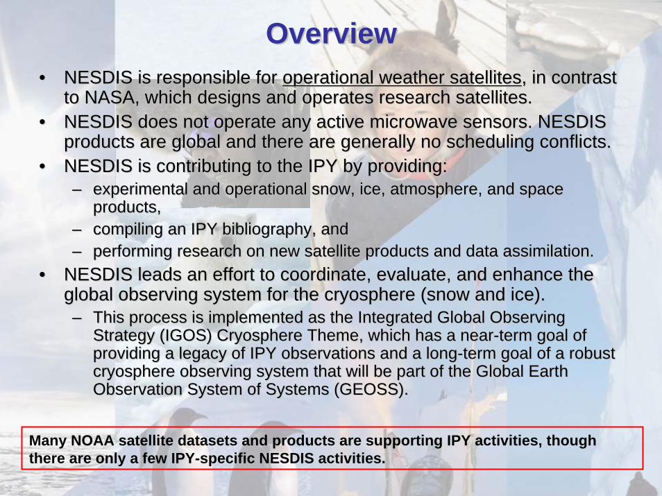
OverviewOverview•• NESDIS is responsible for NESDIS is responsible for operational weather satellitesoperational weather satellites, in contrast , in contrast
to NASA, which designs and operates research satellites.to NASA, which designs and operates research satellites.•• NESDIS does not operate any active microwave sensors. NESDIS NESDIS does not operate any active microwave sensors. NESDIS
products are global and there are generally no scheduling confliproducts are global and there are generally no scheduling conflicts.cts.•• NESDIS is contributing to the IPY by providing:NESDIS is contributing to the IPY by providing:
–– experimental and operational snow, ice, atmosphere, and space experimental and operational snow, ice, atmosphere, and space products, products,
–– compiling an IPY bibliography, andcompiling an IPY bibliography, and–– performing research on new satellite products and data assimilatperforming research on new satellite products and data assimilation. ion.
•• NESDIS leads an effort to coordinate, evaluate, and enhance the NESDIS leads an effort to coordinate, evaluate, and enhance the global observing system for the cryosphere (snow and ice). global observing system for the cryosphere (snow and ice). –– This process is implemented as the Integrated Global Observing This process is implemented as the Integrated Global Observing
Strategy (IGOS) Cryosphere Theme, which has a nearStrategy (IGOS) Cryosphere Theme, which has a near--term goal of term goal of providing a legacy of IPY observations and a longproviding a legacy of IPY observations and a long--term goal of a robust term goal of a robust cryosphere observing system that will be part of the Global Eartcryosphere observing system that will be part of the Global Earth h Observation System of Systems (GEOSS). Observation System of Systems (GEOSS).
Many NOAA satellite datasets and products are supporting IPY activities, though there are only a few IPY-specific NESDIS activities.
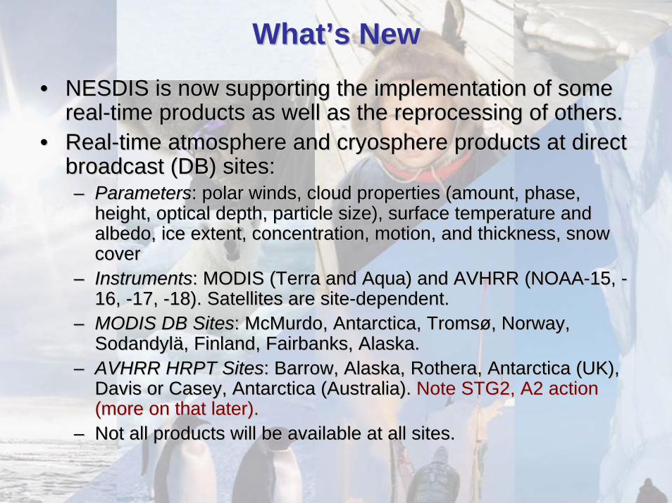
WhatWhat’’s News New
•• NESDIS is now supporting the implementation of some NESDIS is now supporting the implementation of some realreal--time products as well as the reprocessing of others.time products as well as the reprocessing of others.
•• RealReal--time atmosphere and cryosphere products at direct time atmosphere and cryosphere products at direct broadcast (DB) sites:broadcast (DB) sites:–– ParametersParameters: polar winds, cloud properties (amount, phase, : polar winds, cloud properties (amount, phase,
height, optical depth, particle size), surface temperature and height, optical depth, particle size), surface temperature and albedo, ice extent, concentration, motion, and thickness, snow albedo, ice extent, concentration, motion, and thickness, snow cover cover
–– InstrumentsInstruments: MODIS (Terra and Aqua) and AVHRR (NOAA: MODIS (Terra and Aqua) and AVHRR (NOAA--15, 15, --16, 16, --17, 17, --18). Satellites are site18). Satellites are site--dependent.dependent.
–– MODIS DB SitesMODIS DB Sites: McMurdo, Antarctica, : McMurdo, Antarctica, TromsTromsøø, Norway, , Norway, SodandylSodandylää, Finland, Fairbanks, Alaska., Finland, Fairbanks, Alaska.
–– AVHRR HRPT SitesAVHRR HRPT Sites: Barrow, Alaska, : Barrow, Alaska, RotheraRothera, Antarctica (UK), , Antarctica (UK), Davis or Casey, Antarctica (Australia). Davis or Casey, Antarctica (Australia). Note STG2, A2 action Note STG2, A2 action (more on that later). (more on that later).
–– Not all products will be available at all sites.Not all products will be available at all sites.
WhatWhat’’s New, cont.s New, cont.•• Reprocessing:Reprocessing:
–– AVHRR Polar Pathfinder extended (APPAVHRR Polar Pathfinder extended (APP--xx), 1982), 1982--present present –– AVHRR polar winds, 1982AVHRR polar winds, 1982--presentpresent–– Historical products will be tied into realHistorical products will be tied into real--time products, but will be time products, but will be
periodically reprocessed for consistency.periodically reprocessed for consistency.•• National Ice Center (NIC): TNational Ice Center (NIC): The NIC is improving its sea
ice analysis in the Antarctic region with the availability of ESA Envisat ASAR background data and products. The NIC expects to be increasingly dependent on such data over both polar regions as we lose access to the Canadian R-1 data. (Issue from PC-C: We are losing access to the vast amount of Canadian RADARSAT-1 SAR data acquisitions we have enjoyed over Alaska during more than a decade. We are now trying to establish in a long-term collaboration with Canada leading to a government-to-government agreement for the U.S. to participate in the operational RADARSAT-Constellation mission to begin in 2013.)
NESDIS Satellite Products Relevant to IPYPolar-specific Products• Polar winds
– Real-time: from MODIS, “bent-pipe” and direct broadcast.– AVHRR winds from NOAA and MetOp satellites; HRPT sites expanding.– Historical: from AVHRR, 1982-2002, both poles. Will be reprocessed and extended.
• Cloud properties, surface temperature and albedo, radiative fluxes from AVHRR– Real-time: Once daily, both poles– Extended AVHRR Polar Pathfinder (APP-x), both poles, twice daily, 1982-2004. Will be
extended.• MODIS direct broadcast products: Winds, cloud properties, temperature inversion characteristics,
surface temperature and albedo. Snow and ice products are being added.– Generated in real-time at direct broadcast sites in Norway, Finland, Antarctica– Development of a similar system at Fairbanks, Alaska (Gilmore Creek) is underway.
• The National Ice Center (NIC) produces operational hemispheric sea ice analyses for both polar regions using national and international satellite assets. In addition, the NIC is
– participating in research and validation of radar altimetry observations over Arctic sea ice for the measurement of ice thickness,
– also developing experimental sea ice coverage charts for the Polar Regions from QuikSCAT scatterometer backscatter data, in collaboration with NASA/JPL,
– developing/Updating Arctic and Antarctic ice chart climatologies,– transferring of the Operational Snow and Ice Analysis and Mapping System to the NIC,– a participant in the GMES Polar View IPY Activities (http://ipy-ice-portal.org).
• Synthetic aperture radar (SAR) research activities. NIC provides the Alaska Region with imagery and experimental derived products for safety of fisheries, marine transportation, and low-flying aircraft.
– Ice imagery for Arctic, coastal, and river ice analyses– Storm imagery for mesoscale storm prediction – High-resolution winds for coastal wind analyses and climate studies.

Global Products• Hydrological Products (Snow cover/SWE; precipitation, water vapor, sea-ice, etc.):
– Daily snow and ice cover at http://www.ssd.noaa.gov/PS/SNOW/– Real-time from POES/AMSU (see
http://www.orbit.nesdis.noaa.gov/corp/scsb/mspps/ and http://www.osdpd.noaa.gov/PSB/IMAGES/MSPPS_day2.html), including snow cover, snow water equivalent, cloud water, land surface temperature, rain rate, total precipitable water. Archived at CLASS (2000 to present); pentad and monthly products (see http://www.orbit.nesdis.noaa.gov/corp/scsb/mspps/climate.html)
– Real-time from DMSP/SSMI (see http://www.osdpd.noaa.gov/PSB/SHARED_PROCESSING/SHARED_PROCESSING.html). Archived at CLASS (1997 - present); Monthly products (1987 - present) archived at NCDC (see http://lwf.ncdc.noaa.gov/oa/satellite/ssmi/ssmiproducts.html)
– Real-time from Aqua/AMSR-E (see http://www.orbit.nesdis.noaa.gov/corp/scsb/wchen/AMSR-E/)
• Atmospheric temperature and humidity from AIRS and IASI.• Ocean products (SST, winds, etc.) at:
– http://www.orbit.nesdis.noaa.gov/sod/sst/index.php– http://www.orbit.nesdis.noaa.gov/star/meb_index.php– http://www.orbit.nesdis.noaa.gov/star/opb_index.php
• Measurements of auroral particle precipitation from the polar-orbiting POES satellites. NGDC is helping provide NOAA space weather data and analysis in collaborative research efforts with IPY scientists.
NESDIS Satellite Products Relevant to IPY
NESDIS Non-Satellite Products Relevant to IPYNational Oceanographic Data Center participating in::
• Preparation of oceanographic atlas and database of the Sub-Arctic Seas by the Ocean Climate Laboratory Division (OC5):
– Atlas and accompanying CD-ROM will contain oceanographic data collected for the Sub-Arctic seas with anticipated monthly data distribution plots for each year; monthly climatic maps of temperature and salinit.
– The Atlas will also include, in electronic format, selected copies of rare books and articles about the history of the sub-arctic exploration and climate studies as well as photos, which provide information about the people and environment of this region.
• NOAA Central Library (OC4) - Preparation of a printed and online bibliography of NOAA library polar resources (http://docs.lib.noaa.gov/rescue/Bibliographies/IPY2007.pdf ):
– "International Polar Year 2007-2008 Resources on Polar Research in the NOAA Central Library Network: A Selected Bibliography" - links to over hundred and fifty historically unique documents and other resources on exploration and research in the Polar Regions from the 18th century to the present.
– A four sections Bibliography: 1. What is the International Polar Year? 2. Historical resources on Polar research in the NOAA Central Library Special Collections. 3. Current resources on Polar research in the NOAA Central Library Network. 4. Internet resources on Polar research.
– A Polar Resources webpage in the NOAA Library Network home page has been prepared to support the Agency and NOAA Central Library (NCL) activities during International Polar Year 2007-2008. (http://www.lib.noaa.gov/collections/ipy.html)
– A Polar Poster has been developed in the NOAA Central Library to provide a visual display of the unique historical and contemporary Polar Resources in the NOAA Library Network. The poster has been also requested and sent to the National Archive and Records Administration (NARA) to be kept for posterity.
http://docs.lib.noaa.gov/rescue/Bibliographies/IPY2007_poster.pdf (PDF with abstract)http://docs.lib.noaa.gov/rescue/Bibliographies/IPY2007_poster.jpg (JPEG for easy access)http://docs.lib.noaa.gov/rescue/Bibliographies/IPY2007_poster.tif (TIFF for archiving)
AON Non-Satellite (and non-NESDIS) Data Relevant to IPY
Arctic Observing Network (AON): www.arctic.noaa.gov• 100% International Arctic Observing Network (AON) goal:
– 21 ice-tethered buoys– 60 ice buoys– 21 ice mass balance buoys– 68 oceanographic moorings (serviced once per year)– 19 annual ship line– 6 coastal climate observatories (Barrow, Eureka, Tiksi, Summit, Ny Alesund, Alert).
• 100% NOAA component of the AON goal:• 54 Ice Buoys = 30 International Arctic Buoy Program + 12 IMB + 12 Tethered Platforms• 40 Moorings = 10 pairs Pathway + 8 pairs Gateway + 8 Bering/Chukchi Seas + 4 Deep
Western Boundary Current• 12 Annual Ship Lines = 5 Pathway + 2 Gateway + 4 Bering/Chukchi Seas + 1 Deep
Western Boundary Current to service the buoys & moorings and provide physical, chemical and biological data to describe changes in Arctic Ocean climate and impacts to ecosystems.
• 4 Coastal Observatories: Eureka, Tiksi, Greenland Summit, and Ny Alesund
Note: Coastal Observatories: A system of strategically located, long-term Atmospheric Observatories will be developed around the Arctic to carry out both routine measurements made at meteorological stations and intensive measurements at the surface and through the depth of the atmosphere. Among the quantities to be measured are solar radiation, aerosols, air chemistry, trace gases, cloud properties, water vapor, ozone, temperatures, winds, precipitation, surface albedo, and stratospheric properties. These measurements are essential to calibrate and validate satellite sensors and to improve the reliability of climate models.
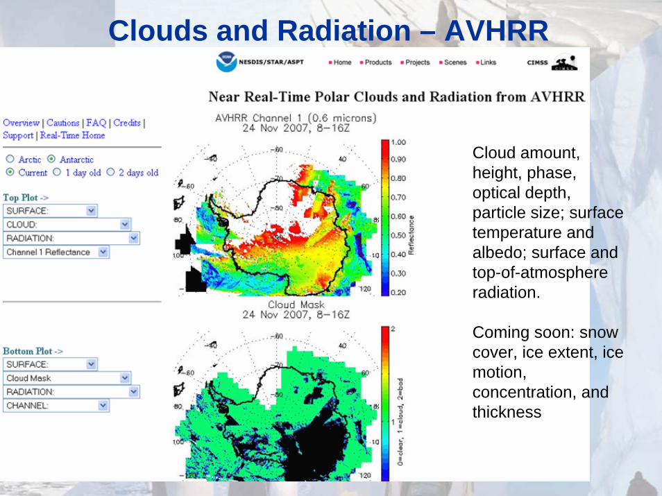
Clouds and Radiation – AVHRR
Cloud amount, height, phase, optical depth, particle size; surface temperature and albedo; surface and top-of-atmosphere radiation.
Coming soon: snow cover, ice extent, ice motion, concentration, and thickness
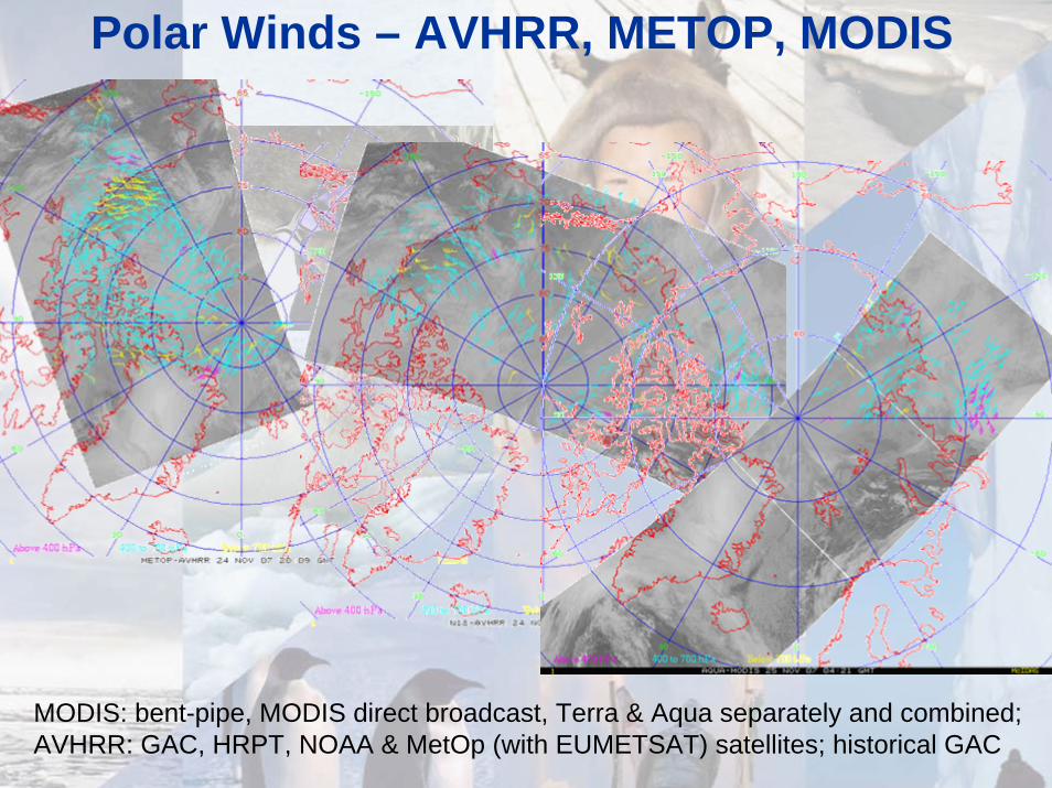
Polar Winds – AVHRR, METOP, MODIS
MODIS: bent-pipe, MODIS direct broadcast, Terra & Aqua separately and combined; AVHRR: GAC, HRPT, NOAA & MetOp (with EUMETSAT) satellites; historical GAC
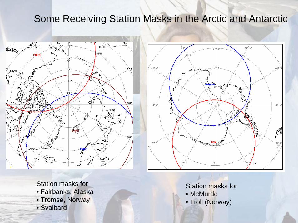
Some Receiving Station Masks in the Arctic and Antarctic
Station masks for • Fairbanks, Alaska• Tromsø, Norway• Svalbard
Station masks for • McMurdo• Troll (Norway)

Examples of Direct
Broadcast Products
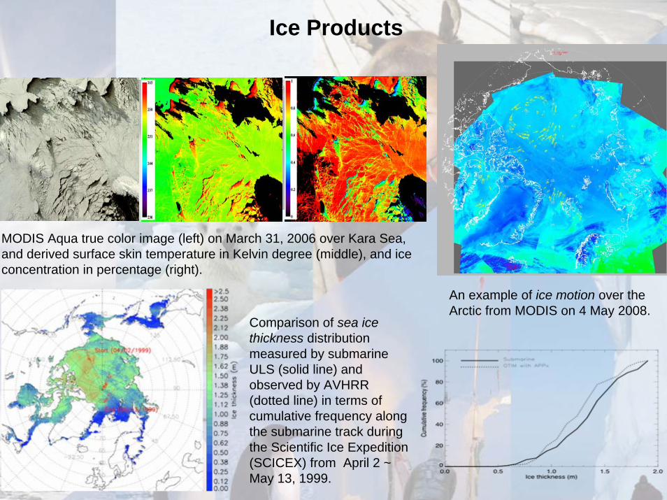
An example of ice motion over the Arctic from MODIS on 4 May 2008.
Ice Products
Comparison of sea ice thickness distribution measured by submarine ULS (solid line) and observed by AVHRR (dotted line) in terms of cumulative frequency along the submarine track during the Scientific Ice Expedition (SCICEX) from April 2 ~ May 13, 1999.
MODIS Aqua true color image (left) on March 31, 2006 over Kara Sea, and derived surface skin temperature in Kelvin degree (middle), and ice concentration in percentage (right).
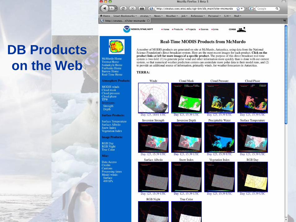
DB Products on the Web

Historical AVHRR Polar Winds• January 1, 1982 to August 31, 2002.
• One satellite at any given time, NOAA-7, -9, -11, -14, -16.
• Global Area Coverage (GAC) data gridded at 5 km.
• Cloud-track winds using IR channel only (no water vapor channel).
• ERA-40 used as background. ERA-40 is ECMWF’s 1957-2002 reanalysis product.
• Pros: An essential product for reanalysis projects.
• Cons: Low resolution. Currently only one satellite at any given time. Height assignment uncertainty for thin clouds.
NIC
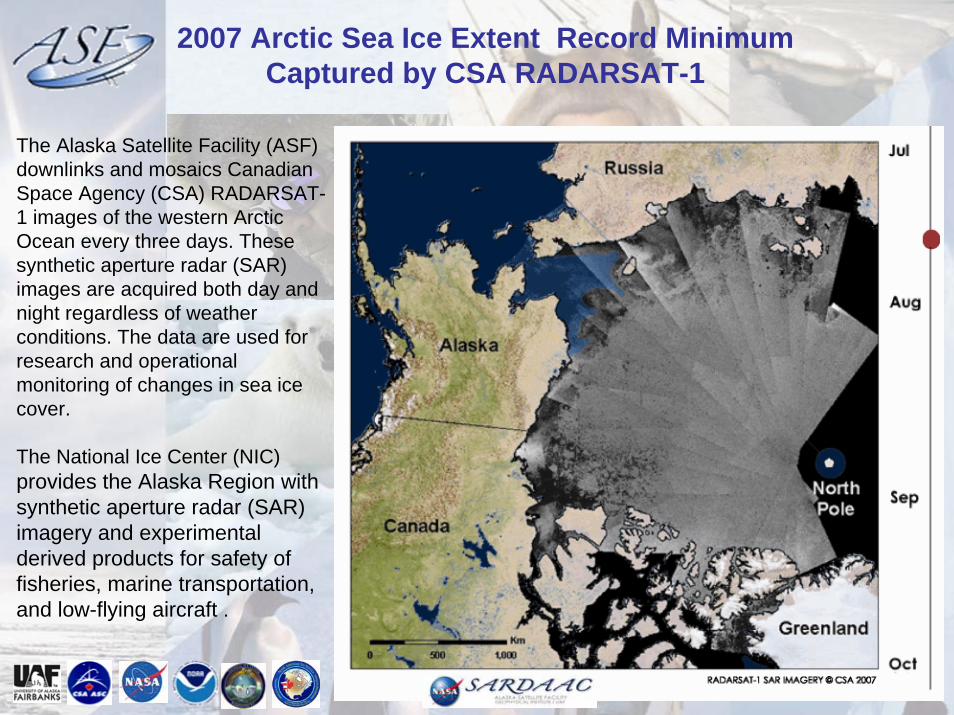
2007 Arctic Sea Ice Extent Record MinimumCaptured by CSA RADARSAT-1
The Alaska Satellite Facility (ASF) downlinks and mosaics Canadian Space Agency (CSA) RADARSAT-1 images of the western Arctic Ocean every three days. These synthetic aperture radar (SAR) images are acquired both day and night regardless of weather conditions. The data are used for research and operational monitoring of changes in sea ice cover.
The National Ice Center (NIC) provides the Alaska Region with synthetic aperture radar (SAR) imagery and experimental derived products for safety of fisheries, marine transportation, and low-flying aircraft .
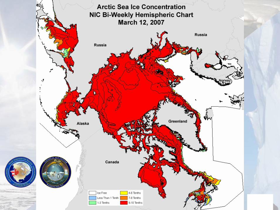
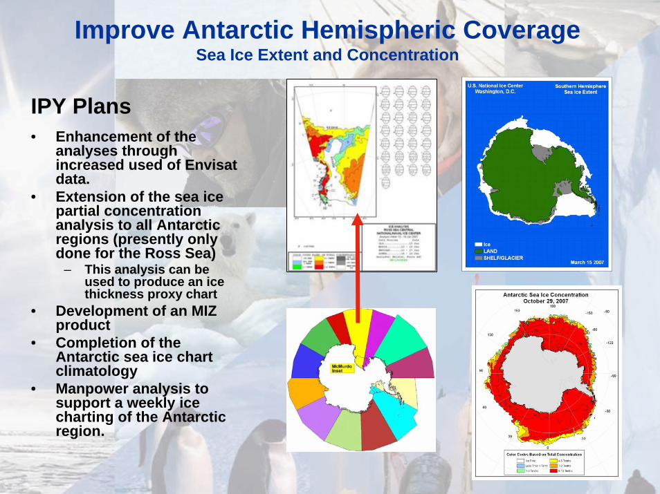
Improve Antarctic Hemispheric CoverageSea Ice Extent and Concentration
IPY Plans• Enhancement of the
analyses through increased used of Envisatdata.
• Extension of the sea ice partial concentration analysis to all Antarctic regions (presently only done for the Ross Sea)
– This analysis can be used to produce an ice thickness proxy chart
• Development of an MIZ product
• Completion of the Antarctic sea ice chart climatology
• Manpower analysis to support a weekly ice charting of the Antarctic region.
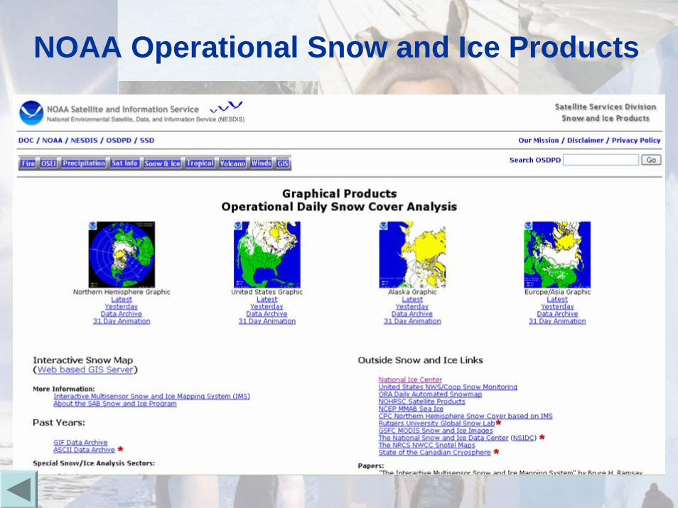
NOAA Operational Snow and Ice Products
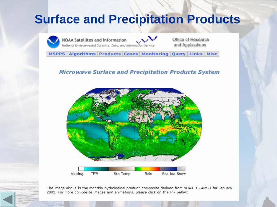
Surface and Precipitation Products
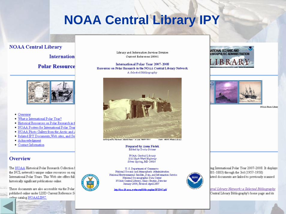
NOAA Central Library IPY
Other Items
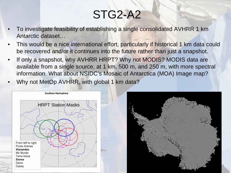
STG2-A2• To investigate feasibility of establishing a single consolidated AVHRR 1 km
Antarctic dataset…• This would be a nice international effort, particularly if historical 1 km data could
be recovered and/or it continues into the future rather than just a snapshot.• If only a snapshot, why AVHRR HRPT? Why not MODIS? MODIS data are
available from a single source, at 1 km, 500 m, and 250 m, with more spectral information. What about NSIDC’s Mosaic of Antarctica (MOA) Image map?
• Why not MetOp AVHRR, with global 1 km data?
HRPT Station Masks