notice of meeting - adelaide plains council · notice of meeting. notice is hereby ......
TRANSCRIPT

NOTICE OF MEETING
NOTICE IS HEREBY GIVEN THAT THE NEXT MEETING OF THE STRATEGIC INFRASTRUCTURE AND PLANNING COMMITTEE WILL BE HELD IN THE MALLALA COUNCIL CHAMBERS, REDBANKS ROAD, MALLALA ON MONDAY, 13 SEPTEMBER 2010 , COMMENCING AT 6:00PM
Charles Mansueto Chief Executive Officer * Open Forum at 7:00pm
AGENDA 10.1 ATTENDANCE 10.1.1 Councillors Present 10.1.2 Councillors Apologies 10.1.3 Councillors Absent 10.2 CONFIRMATION OF MINUTES 10.2.1 Strategic Infrastructure and Planning Committee Meeting held on 9 August 2010. 10.3. BUSINESS ARISING 10.4 BRIEFINGS 10.4.1 Flood Update 10.5 PUBLIC WORKS Nil
10.6 TRAFFIC MANAGEMENT 10.6.1 Road Naming – Gullaci Sub Division (14.58.1.1) 10.6.2 Frost Road Opening/Closure (14.16.1)
10.7 RECREATION AND OPEN SPACE 10.7.1 Two Wells War Memorial – Tank (17.36.1)
10.8 STRATEGIC ASSET MANAGEMENT Nil 10.9 ECONOMIC DEVELOPMENT Nil 10.10 URBAN DEVELOPMENT 10.10.1 Consent for the Extinguishment, Variation and Creation of Easements – Lot 29 and
Block 45 Port Gawler Road, Port Gawler (14.3.2.3) 10.11 ENVIRONMENTAL SUSTAINABILITY 10.11.1 Light River Floodplain Mapping Project (3.65.1.2) 10.11.2 Natural Disaster Resilience Program – Thompson Beach Levee Banks (5.71.2.5) 10.11.3 Natural Disaster Resilience Program – Sea Level Rise - Coastal Township
Adaptation Options for DC Mallala (5.73.1.1) 10.12 DEVELOPMENT CONTROL Nil 10.13 CLOSURE

10.6 TRAFFIC MANAGEMENT
13 September 2010
District Council of Mallala
Items: 10.6.1 Road Naming – Gullaci Sub Division 10.6.2 Frost Road Opening / Closure

10.6.1 Road Naming – Gullaci Sub Division
File No: 14.3.2.2 Previous Ref:
Report Date:
13 September 2010
Prepared by:
John Tillack
Corporate Objective: Strategy 3.7.1 Ensure a safe and efficient network of local roads and associated infrastructure
Purpose To seek concurrence for the naming of roads in the Gullaci sub division.
District Council of Mallala
Recommendation 1 “that the Committee, having considered Report 10.6.1 dated 13 September 2010 recommend that Council adopt Walter Avenue and Kay Avenue as the names for the roads within the Gullaci sub division as per the plan shown at Attachment 1.”
Recommendation 2 “that the Committee, having considered Report 10.6.1 dated 13 September 2010 recommend that Council delegates to the Chief Executive Officer the duty pursuant to Section 219(1a) of the Act to assign a name to a public road created after the commencement of Section 219(1a) of the Act by land division providing they comply with the provisions of Policy 3.24, Road Naming.”
Background As a consequence of the recent amendments to s219 of the Local Government Act 1999 Council must name roads within sub divisions prior to the issue of titles for the allotments created. Construction of Stage 1 of the Gullaci sub division adjacent to the Tangari estate is nearing completion and requires naming of the roads to be finalised. Current The new roads are effectively extensions of existing roads within the Tangari estate. After discussions with the Developer it is proposed to utilise the names of the roads within the Tangari Estate rather than create new road names. Issues Community consultation is not required as the only other party affected by this decision is the current land owner, ie the developer and they have concurred with this recommendation.

As Council is now specifically required to authorise road names within new sub divisions Council may wish to consider delegating the authority to name roads within new sub divisions to the Chief Executive Officer. Any such delegation should require road names to comply with the provisions of Council’s Road Naming policy. Conclusion It is recommended that: • Walter Avenue and Kay Avenue are adopted as the names for the roads within the Gullaci
sub division as per the plan shown at Attachment 1. • Council delegates to the Chief Executive Officer the duty pursuant to Section 219(1a) of
the Act to assign a name to a public road created after the commencement of Section 219(1a) of the Act by land division providing they comply with the provisions of Policy 3.24, Road Naming.

10.6.2 Frost Road Opening/Closure File No: 14.16.1 Previous Ref:
Resolution 2010/108, 263, 264 & 265
Report Date:
13 September 2010
Prepared by:
John Tillack
Corporate Objective: Strategy 3.7.1 Ensure a safe and efficient network of local roads and associated infrastructure
Purpose To update Council on the closure/opening of Frost Road, Two Wells between Hayman and Dawkins Roads.
District Council of Mallala
Recommendation 1 “that the Committee, having considered Report 10.6.2 dated 13 September 2010, recommend that Council authorise community consultation on the continued closure (in accordance with s32 of the Road Traffic Act 1961) or opening of Frost Road between Hancock Drive and Cavallaro Place with a report to be bought back to Council for consideration in December 2010.”
“that the Committee, having considered Report 10.6.2 dated 13 September 2010, recommend that Council authorise the closure of Frost Road between Cavallaro Place and Hancock Drive to all vehicles in accordance with s359 of the Local Government Act 1934 from the date of an advertisement to this effect being published in a local newspaper and the Government Gazette until 30 May 2011.”
Recommendation 2
Background At its meeting held in April 2010 Council resolved to remove the blockage between Hayman and Dawkins Roads on Frost Road, Lewiston ie
“that the current blockage on Frost Road between Cavallaro Place and Hancock Drive be removed to allow orderly traffic management and to enable Frost Road to keep its original name.” (2010/ 108)
and on 23 August 2010 resolved “that staff report on the possibility of opening Frost Road in a manner which ensures safety issues are adequately addressed and includes predicted costings.” (2010/263)
and
Strategic Infrastructure and Planning Committee

Strategic Infrastructure and Planning Committee
“that Council, having considered Report 10.6.3 dated 9 August 2010, recommends the authorisation of community consultation on the continued closure of Frost Road, between Hancock Drive and Cavallaro Place, in accordance with s32 of the Road Traffic Act 1961 and that a report be brought back to Council for consideration at an appropriate time.” (2010/264); and ““that Council, having considered Report 10.6.3 dated 9 August 2010, recommends the authorisation of community consultation on the road opening implications of Frost Road, between Hancock Drive and Cavallaro Place, in accordance with s32 of the Road Traffic Act 1961 and that a report be brought back to Council for consideration at an appropriate time.” (2010/265)
Current A ward councillor has indicated that many residents who reside near this location are concerned that opening this section of road will be detrimental for road safety. Frost Road is severed by an earth mound blockage located at the southern end of a 340 metre unconstructed section between Hancock Drive and Cavallaro Place. No record of Council approval for this blockage has been found in any Council Meeting Minutes. Frost Road between Hayman Road and Cavallaro Place is sealed as is the section between Hancock Drive and Dawkins Road. A plan of the area is shown at Attachment 1. Issues A provision of $10,500 has been made for the removal of the blockage in the current budget. It is estimated that the cost of removing the blockage and constructing a Category 3 road, ie 75mm compacted layer of road rubble, six metres wide, is $10,500. Opening a short section of unsealed road in between two sealed sections in a rural environment (default speed limit of 100 kph) will in all probability result in a significant road safety blackspot as traffic conditions will change without warning (a characteristic of unsealed roads). It should be noted that signage does not necessarily change human behaviour. If the road is to be opened then Council should provide sufficient funds to permit the construction and sealing of the road prior to removing the blockage. The cost of sealing the section of road is estimated at $70,000. However, even with sealing and the agreement of the Department for Transport, Energy and Infrastructure to impose an 80 kph speed limit as for all other sealed connector roads in the area I would anticipate a significant proportion of drivers would exceed the speed limit with an unpredictable impact on road safety in the area. An additional area of concern is the probable increase in traffic volume particularly at the Hayman/Frost Road intersection. Current traffic volumes at this crossroad are low, however, a through road on Frost Road will result in higher volumes using Frost Road as a north/south connector. Council cannot allocate additional funds to this project during the caretaker period ie until after 19 November 2010.

Strategic Infrastructure and Planning Committee
Options Three options have been developed for Council’s consideration. These are: 1. Conduct community consultation on the continued closure (in accordance with s32 of
the Road Traffic Act 196)1or opening of Frost Road between Hancock Drive and Cavallaro Place. Community consultation is required in accordance with the Road Traffic Act, however, a decision on the consultation results would not be presented to Council until December 2010 due to the provisions of Council’s Caretaker Policy.
2. At the conclusion of the caretaker period authorise the construction and sealing of Frost Road between Hancock Drive and Cavallaro Place at an estimated cost of $70,000 and request the Department for Transport, Energy and Infrastructure to impose an 80 kph speed limit on Frost Road between Hayman and Dawkins Roads. The estimate may rise to $80,000 if the road cannot be constructed and sealed before the onset of cool weather as sealing must be done when road temperatures are 18 degrees or above to ensure a quality outcome. This increase is to maintain the surface in a safe condition between the time of construction and sealing in the 2011-12 financial year.
3. Authorise the construction of a category 3 road with appropriate warning signs on Frost Road between Hancock Drive and Cavallaro Place at an estimated cost of $10,500, noting this option increases safety risks due to an unsealed road between two sealed sections.
If Options 1 or 2 are adopted then Council should consider formally closing Frost Road between Cavallaro Place and Hancock Drive to all vehicles in accordance with s359 of the Local Government Act 1934 from the date of an advertisement to this effect being published in a local newspaper and the Government Gazette until 30 May 2011. This will formalise the current closure until alternative action is approved. If construction is approved and completed earlier than this date Council can resolve to open the road at an earlier time. Conclusion It is recommended that Council conduct community consultation on the continued closure (in accordance with s32 of the Road Traffic Act 1961) or opening of Frost Road between Hancock Drive and Cavallaro Place with a report to be bought back to Council for consideration in December 2010 and that Council close Frost Road between Cavallaro Place and Hancock Drive to all vehicles in accordance with s359 of the Local Government Act 1934 from the date of an advertisement to this effect being published in a local newspaper and the Government Gazette until 30 May 2011.

10.7 RECREATION AND OPEN SPACE
13 September 2010
District Council of Mallala
Item: 10.7.1 Two Wells War Memorial - Tank
Strategic Infrastructure and Planning Committee

10.7.1 Two Wells War Memorial - Tank
File No: 17.36.1 Previous Ref:
Report Date: 13 September 2010 Prepared by: John Tillack
Corporate Objective: Strategy 1.2.2: Support and strengthen volunteers, community groups and organisations and Strategy 3.8.2: Maintain and improve where appropriate the quality, amenity and accessibility of open spaces.
Purpose To advise Council on a request from the Two Wells RSL to place a Leopard Tank as a permanent display at the Two Wells War Memorial.
District Council of Mallala
Recommendation 1 “that the Committee, having considered Report 10.7.1, Two Wells War Memorial – Tank, dated 13 September 2010, recommends that the Council support the application by the Two Wells RSL to acquire and display an ex-service Leopard Main Battle Tank at the Two Wells War Memorial, subject to the conducting of an appropriate risk assessment and the RSL seeking feedback from the community.” Recommendation 2 “that the Committee seek assurances that the RSL will maintain the tank on an ongoing basis.”
Background The Australian Army was equipped with Leopard 1A3 Main Battle Tanks in the 1980s and 1990s. These tanks have now been retired from service and some have been offered to RSL Clubs throughout Australia for display at War Memorials. The Two Wells RSL has requested Council’s approval to place a Leopard Tank at the Two Wells War Memorial as a permanent display/memorial if they are successful in being allocated a vehicle. Current A copy of the correspondence from the RSL is shown at Attachment 1. Issues The bulk of the Tank will dominate the available space. This may be viewed as a positive or negative impact depending on an individual’s perspective.
Strategic Infrastructure and Planning Committee

Strategic Infrastructure and Planning Committee
The Local Government Association Mutual Liability Scheme has been contacted and has raised no objections to the acquisition of the Tank as long as a risk assessment is completed prior to placement. If a Tank is acquired and displayed at the Memorial it is likely to attract visitors or to prolong visitor stays within Two Wells. In the interests of disclosure please note that the author of this report is an ex-serviceman and a member of the Two Wells RSL. Conclusion It is recommended that Council support the application by the Two Wells RSL to acquire and display an ex-service Leopard Main Battle Tank at the Two Wells War Memorial.

10.10 URBAN DEVELOPMENT
13 September 2010
District Council of Mallala
Items:
10.10.1 Consent for the Extinguishment, Variation and Creation of Easements – Lot 29 and Block 45 Port Gawler Road, Port Gawler
Strategic Infrastructure and Planning Committee

10.10.1 Consent for the Extinguishment, Variation and Creation of Easements – Lot 29 and Block 45 Port Gawler Road, Port Gawler
File No: 3.71.8.1 Previous Ref:
Report Date: 13 September
Prepared by: Team Leader - Development Assessment, Brendon Schulz
Corporate Objective: 3.6.3 Provide consistent and responsive development assessment and compliance processes Purpose The purpose of this report is to seek the Committee’s recommendation to Council, that Council authorises the Mayor and Chief Executive Officer to affix the Common Seal of the Council to Consents for the Extinguishment, Variation and Creation of Easements relating to water supply on land at Port Gawler.
District Council of Mallala
Recommendation “that the Committee, having considered Rep[ort 10.10.1, ‘Consent for the Extinguishment, Variation and Creation of Easements – Lot 29 and Block 45 Port Gawler Road, Port Gawler recommends that the Council authorises the Mayor and Chief Executive Officer of the Council, on the Council’s behalf, to affix the Common Seal of the Council to Consents for the Extinguishment, Variation and Creation of Easements associated with the land described and comprised in Certificate of Title Register Book Volume 5865 Folio 312 and Volume 5865 Folio 310.”
Background In 1996 Council granted approval to divide one allotment into five allotments adjacent to Port Gawler Road at Port Gawler (312/D005/95). The land is situated in the Horticulture Zone identified in Council’s Development Plan. A Land Management Agreement (8123387) pursuant to Section 57 of the Development Act, 1993, between the Council and landowners was prepared as part of the above land division, and operates to control the future management, preservation and conservation of portion of the land. Specifically, the agreement incorporates provisions relating to building preservation, dwelling restriction, fencing, water supply and access. Easements for water supply purposes were created as part of the land division process.
Strategic Infrastructure and Planning Committee

Strategic Infrastructure and Planning Committee
Current Due to ownership changes there is now a need to change the existing easements registered over the relevant land titles. Cosoff Cudmore Knox, lawyers, seek Council’s consent for the changes of these easements on behalf of Zerella Holdings Pty Ltd. The changes are for the extinguishment of easement, variation of easement and creation of easement. All changes relate to arrangements for water supply and Council has been advised by Cosoff Cudmore Knox lawyers that they do not disadvantage the subject land titles, or any other properties. It is noted that the relevant landowners (of allotment 29 and block 45) have consented to the changes, and as party to the documents now request Council’s consent. As the Council has an interest in the subject land by way of Land Management Agreement, the consent of the Council is required to enable lodgement of the required documents with the Lands Titles Office. Issues The changes proposed seek to formalise arrangements relating to water supply. From a planning perspective no issues have been identified.
10.11 ENVIRONMENTAL SUSTAINABILITY
13 September 2010
District Council of Mallala
Items: 10.11.1 Light River Floodplain Mapping Project 10.11.2 Natural Disaster Resilience Program – Thompson Beach Levee Banks 10.11.3 Natural Disaster Resilience program – Seal Level Rise Coastal Township
Adaption options for DC Mallala
Strategic Infrastructure and Planning Committee

10.11.1 Light River Floodplain Mapping Project
File No: 3.65.1.2 Previous Ref:
Report Date: 13 September 2010
Prepared by: Manager, Environment & Development Services
Corporate Objective: 3.3.1 Investigate and implement appropriate flood mitigation measures
Purpose To update members on progress with the Light River floodplain mapping project.
District Council of Mallala
Recommendation “the Committee, having considered Report 10.11.1, Light River Floodplain Mapping Project, dated 13 September 2010, recommends to Council that ‘in principle’ endorsement be given to the floodplain mapping of the Light River, Salt Creek and Templars Creek carried out to date.”
Background As members are aware, the Light River Floodplain Mapping Project combining flood mapping of the Light River, Templars Creek and Salt Creek has been funded from contributions by the State Stormwater Management Authority (SMA), the then Federal Natural Disaster Mitigation Program (NDMP), the Hickinbotham Group and the Mallala Council. As a condition of funding, a steering group was established with representatives from all the funding contributors. Considerable progress has been made on the project so far, including: • A LYDAR survey of the catchment was undertaken by aeroplane and a Digital Elevation
Model (DEM) was prepared for the area to be mapped; • The total catchment area and its sub-catchments were identified; • Hydraulic information was collected on river capacity, bridges and culverts including
available data, additional survey work where needed, and ground truthing; • Available rainfall and run-off data was collected on significant flood events, including the
observations of key local people, particularly to compensate for a lack of recorded data in the Templars Creek Catchment;
• Hydrographs were prepared to match the flooding for significant key events and a hydrological study report has been prepared. This was peer reviewed, tested and adjusted in light of local knowledge;
• The first flood modelling run has been undertaken for the 1:100 year ARI event (see flood map attached).
Strategic Infrastructure and Planning Committee

Strategic Infrastructure and Planning Committee
Current With the completion of the hydrologic model and the first run of the 1:100 year ARI event the flood model can now be run for the remaining events including the:
20 year ARI flood; 50 year ARI flood; 200 year ARI flood; 500 year ARI flood
A composite map is also yet to be prepared combining the Light River / Templars Creek and Salt Creek modelling with the flood plain mapping of the Gawler River to establish a worst case of inundation scenario in the area of overlap between the flood plains. Flood hazards are yet to be determined for the 50 year and 100 year ARI floods. The steering task group, in consultation with the Hickinbotham Group, is in the process of determining the first flood mitigation scenario to be run. The aim is to learn from the first run and apply this to the second run. That is, the second run will be determined with the benefit of the insights gleaned from an analysis of the first run. Preliminary Observations The following are some preliminary observations of the results of the 1:100 year flood mapping of the Light River, Templars Creek and Salt Creek: 1. Light River flood patterns are influenced by the gradual fall of the land from east to west and
the existence of manmade structures such as the railway line and Port Wakefield Road acting as barriers to the natural flow paths thereby redirecting the flows or causing flood water to backup.
2. A substantial flow path traverses the flood plain on the north side of the Light River from Korunye heading toward Lower Light in an east west direction.
3. A substantial flow path heads southward along the eastern side of the railway line, eventually draining into Salt Creek to the east and south of Two Wells, where it passes under the railway line and Port Wakefield Road.
4. Some of the culverts under Port Wakefield Road are under capacity whilst others are over capacity during a 1:100 year flood event.
5. The capacity of the culverts under Port Wakefield Road at Salt Creek and just north of Two Wells are exceeded causing significant backing up of floodwater. The capacity of the culverts under the railway line at Salt Creek is also exceeded causing water to backup to the east of the railway line.
6. A substantial flow path is redirected northward from Salt Creek through Two Wells and north of the town along the eastern side of Port Wakefield Road with the highway acting as a levee.

Strategic Infrastructure and Planning Committee
7. On the southern side of the Light River west of the railway line several relatively shallow but broad swathes of flood water traverse the landscape from the northeast to the south west. Although some of this water reaches the area immediately to the north of Two Wells most of the flood water in this area is from flows redirected into this area from Salt Creek adjacent to Port Wakefield Road.
8. Floodwater from Templars Creek drains into the Goss Lagoon. The overflow contributes relatively little to the flooding of Salt Creek. A large area at Reeves Plains upstream of Goss Lagoon is susceptible to inundation extending to Boundary Road.
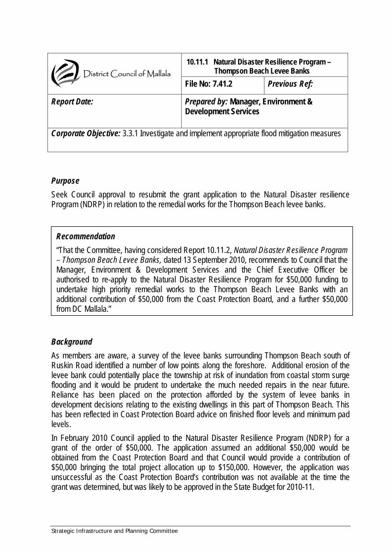
10.11.1 Natural Disaster Resilience Program – Thompson Beach Levee Banks
File No: 7.41.2 Previous Ref:
Report Date:
Prepared by: Manager, Environment & Development Services
Corporate Objective: 3.3.1 Investigate and implement appropriate flood mitigation measures Purpose Seek Council approval to resubmit the grant application to the Natural Disaster resilience Program (NDRP) in relation to the remedial works for the Thompson Beach levee banks.
District Council of Mallala
Recommendation “That the Committee, having considered Report 10.11.2, Natural Disaster Resilience Program – Thompson Beach Levee Banks, dated 13 September 2010, recommends to Council that the Manager, Environment & Development Services and the Chief Executive Officer be authorised to re-apply to the Natural Disaster Resilience Program for $50,000 funding to undertake high priority remedial works to the Thompson Beach Levee Banks with an additional contribution of $50,000 from the Coast Protection Board, and a further $50,000 from DC Mallala.”
Background As members are aware, a survey of the levee banks surrounding Thompson Beach south of Ruskin Road identified a number of low points along the foreshore. Additional erosion of the levee bank could potentially place the township at risk of inundation from coastal storm surge flooding and it would be prudent to undertake the much needed repairs in the near future. Reliance has been placed on the protection afforded by the system of levee banks in development decisions relating to the existing dwellings in this part of Thompson Beach. This has been reflected in Coast Protection Board advice on finished floor levels and minimum pad levels. In February 2010 Council applied to the Natural Disaster Resilience Program (NDRP) for a grant of the order of $50,000. The application assumed an additional $50,000 would be obtained from the Coast Protection Board and that Council would provide a contribution of $50,000 bringing the total project allocation up to $150,000. However, the application was unsuccessful as the Coast Protection Board’s contribution was not available at the time the grant was determined, but was likely to be approved in the State Budget for 2010-11.
Strategic Infrastructure and Planning Committee

Strategic Infrastructure and Planning Committee
Advice has been received that the application would be reconsidered in the next round of NDRP funding. However, in the meantime Council has not allocated the funds for its contribution during the 2010-11 budget deliberations. Council would need to allocate the Council contribution toward the project for the application to be reconsidered by the NDRP. Current The next funding round for NDRP has been delayed due to caretaker conventions associated with the Federal election. It is anticipated that applications will be called shortly and due to the delays a shorter deadline for applications is likely to apply. In the meantime, Councils are encouraged to consider their applications and prepare to submit at relatively short notice. At a recent meeting, the Coast Protection Board approved the draft work program for 2010-11 including a $50,000 contribution toward the Thompson Beach levee banks, subject to the State budget being approved in October (see attached email from James Guy Coastal Research Engineer). Although Council is currently in caretaker mode pending the upcoming Local Government elections, recent amendments to the relevant legislation excluded grants from the ambit of a ‘designated decision’ as it involves:
...an expenditure or other decision required to be taken under an agreement by which funding is provided to the council by the Commonwealth or State Government or otherwise for the council to be eligible for funding from the Commonwealth or State Government.
A preliminary design of the remediated levee banks has been prepared by Council’s consulting engineer (Trevor Mace) in consultation with the Coast Protection Board. As the project involves the use of more than 9 cubic metres of material a Development Approval will be required and the approval of the Native Vegetation Council for the clearance of native vegetation will also be necessary. Prior to seeking the necessary approvals it would be desirable to carry out community consultation in relation to the levee bank alignment and its design. It is suggested that the plans be put on display for a period of four weeks and a community consultation event be held during this time. However due to Council currently being involved in its own caretaker period it may be desirable to wait until November 2010 before commencing the consultation. Summary of Issues Council has the opportunity to resubmit the application for funding to the NDRP to carry out urgently required remedial works to the Thompson Beach levee banks. Under recent amendments to the relevant legislation decisions relating to grants are excluded from the definition of designated decision and hence the caretaker provisions do not prevent Council from making a decision on this matter during the current caretaker period. Due to the Federal Caretaker conventions, the announcement of the next round of funding for the NDRP has been delayed, with a shorter timeframe for lodgement of applications likely to apply. Hence it would be desirable for Council to consider its intentions for an application so that, if necessary, an application can be prepared in advance.

Strategic Infrastructure and Planning Committee
Earlier survey work identified a number of low spots in the levee bank system requiring attention in the short term. The draft design of the reinstatement of the levee bank system has been prepared. Public / community consultation is recommended, after which the plans can be finalised and submitted for both development approval and Native Vegetation Council approval. However, due to caretaker conditions it may be desirable to leave community consultation until November 2010. A viable source of suitable material to use in the remediation is yet to be identified and this will also influence the cost and hence, determine the extent of remediation able to be undertaken. There may be unforseen costs associated with the application to the Native Vegetation Council for clearance associated with the remedial works. Clarification is currently being sought on the amount of any contribution to the native vegetation Trust Fund to be paid as an offset for any incidental clearing of native vegetation. Alternatively, Council may be able to undertake revegetation to replace the vegetation cleared, thereby potentially obviating the requirement for a financial contribution.
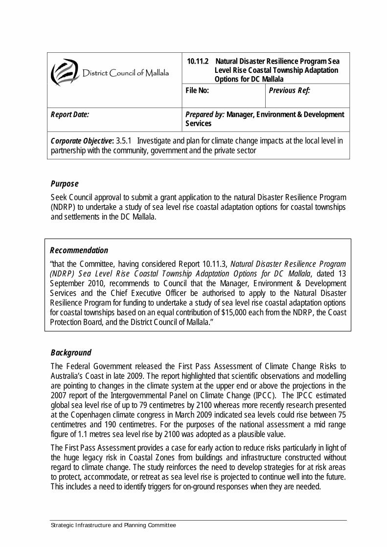
10.11.2 Natural Disaster Resilience Program Sea Level Rise Coastal Township Adaptation Options for DC Mallala
File No:
Previous Ref:
Report Date:
Prepared by: Manager, Environment & Development Services
Corporate Objective: 3.5.1 Investigate and plan for climate change impacts at the local level in partnership with the community, government and the private sector Purpose Seek Council approval to submit a grant application to the natural Disaster Resilience Program (NDRP) to undertake a study of sea level rise coastal adaptation options for coastal townships and settlements in the DC Mallala.
District Council of Mallala
Recommendation “that the Committee, having considered Report 10.11.3, Natural Disaster Resilience Program (NDRP) Sea Level Rise Coastal Township Adaptation Options for DC Mallala, dated 13 September 2010, recommends to Council that the Manager, Environment & Development Services and the Chief Executive Officer be authorised to apply to the Natural Disaster Resilience Program for funding to undertake a study of sea level rise coastal adaptation options for coastal townships based on an equal contribution of $15,000 each from the NDRP, the Coast Protection Board, and the District Council of Mallala.”
Background The Federal Government released the First Pass Assessment of Climate Change Risks to Australia’s Coast in late 2009. The report highlighted that scientific observations and modelling are pointing to changes in the climate system at the upper end or above the projections in the 2007 report of the Intergovernmental Panel on Climate Change (IPCC). The IPCC estimated global sea level rise of up to 79 centimetres by 2100 whereas more recently research presented at the Copenhagen climate congress in March 2009 indicated sea levels could rise between 75 centimetres and 190 centimetres. For the purposes of the national assessment a mid range figure of 1.1 metres sea level rise by 2100 was adopted as a plausible value. The First Pass Assessment provides a case for early action to reduce risks particularly in light of the huge legacy risk in Coastal Zones from buildings and infrastructure constructed without regard to climate change. The study reinforces the need to develop strategies for at risk areas to protect, accommodate, or retreat as sea level rise is projected to continue well into the future. This includes a need to identify triggers for on-ground responses when they are needed.
Strategic Infrastructure and Planning Committee

Strategic Infrastructure and Planning Committee
The report highlights the need to carry out detailed regional and local assessments to inform decision makers of future risks and enable climate change adaptation to be incorporated into planning approaches. The study suggests that there are benefits of aligning disaster risk reduction strategies with adaptation assessments. Some work is currently being done through the auspices of the Adelaide and Mount Lofty Ranges Natural Resource Management Board looking at hazards associated with the sensitive coastal ecosystems characterising much of the DC Mallala coastline. In collaboration with the States Coastal Management Branch and the Federal Natural Disaster Resilience Program (NDRP), digital elevation models have been prepared for all of the Coastal townships and settlements along the District Council of Mallala coastline. This combines the Digital Elevation Model (DEM) for the Light River Catchment providing coverage for Middle Beach with DEMS prepared for the remaining townships commissioned by the Coast Protection Board (CPB) using left over monies from an NDRP funded project on the York Peninsula. Council and the Coast Protection Board now have a complete coverage of levels to a high degree of accuracy for its coastal communities. This enables the preparation of inundation scenarios for the coastal settlements soon to be undertaken in collaboration with the CPB and the Department of Planning and Local Government (DPLG). In line with the First Pass Assessment, discussions have been held with the CPB in relation to a possible joint application to the NDRP for a three way funding split to carry out a detailed coastal adaptation study of coastal settlements in the Mallala DC. Current A Draft project definition statement has been prepared by James Guy Coastal Research Engineer for the Coastal Management Branch (see attached). The statement can be used in the preparation of an application to the NDRP and will form the basis for further discussions and preparation of a consultant’s brief in the event that Council approves its contribution and succeeds in an application to the NDMP. The Coast Protection Board has already approved their draft work program for 2010-11 which includes a $15,000 contribution toward the Coastal Townships sea level rise adaptation options study, subject to the State budget being approved in October (see attached email from James Guy attached). As pointed out in an earlier report the next funding round for NDRP has been delayed due to caretaker conventions associated with the Federal election. It is anticipated that applications will be called shortly and due to the delays a shorter deadline for applications is likely to apply. In the meantime Councils are encouraged to consider their applications and prepare to submit at relatively short notice. As pointed out above decisions relating to potential grant applications are exempt from the definition of designated decision and subsequently consideration of a possible contribution towards a joint study can occur during the current caretaker period. Summary of Issues The coastal settlements of Thompson Beach, Webb Beach, Parham, and Middle Beach are low lying and subject to coastal hazards such as storm surge flooding and erosion. Future sea level rise will exacerbate these hazards.
Strategic Infrastructure and Planning Committee
There is a need to undertake an assessment of risks from sea level rise and develop suitable adaptation strategies to protect, accommodate, or retreat based on close consideration of the environmental, social and economic consequences of such strategies.