nre wildfire threat analysis nre
TRANSCRIPT
Research report no. 55
Analysis of wildfire threat- issues and options
Analysis of wildfire threat
- issues and options
Research Report No. 55
Andrew A.G. Wilson
October 2004
This report was commissioned by
Fire Management Department of Sustainability and Environment
Victoria

ii
For further information contact:
DSE Customer Service Centre 136 186
© State of Victoria
Department of Sustainability and Environment 2004
This publication is copyright. Apart from any fair dealing for private study, research, criticism or review as
permitted under the Copyright Act 1968, no part of this publication may be reproduced, stored in a retrieval
system, or transmitted in any form or by any means, electronic, photocopying or otherwise, without the prior
permission of the copyright owner.
ISBN 1 74152 072 X
Department of Sustainability and Environment,
PO Box 500, East Melbourne, Victoria, 3002.
www.dse.vic.gov.au/fires
This publication may be of assistance to you, but the State of Victoria and its employees do not guarantee that the
publication is without flaw of any kind, or is wholly appropriate for your particular purposes, and therefore
disclaims all liability for any error, loss or other consequence which may arise from you relying on any information
in this publication.
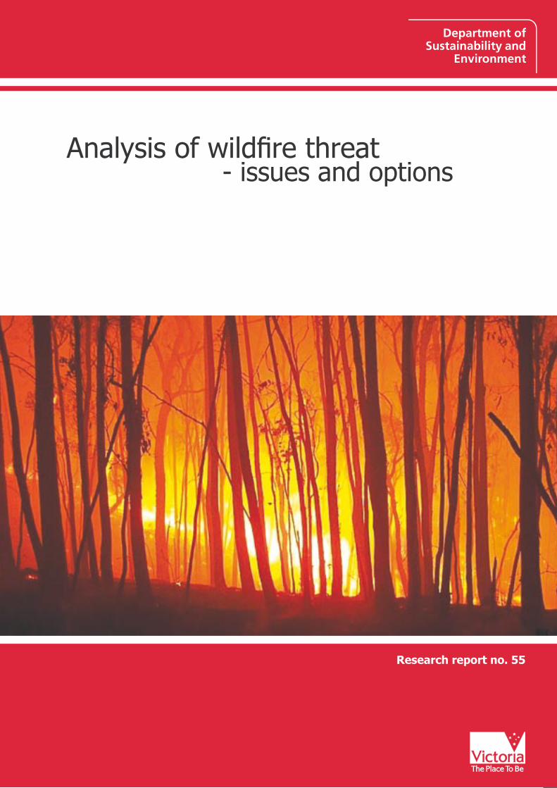
Cover photograph: Night flames, DSE
The full series of Fire Research Reports can be found on:
www.dse.vic.gov.au/fires (fire management; fire research)
iii
Foreword
For many years the Department of Sustainability and Environment (DSE) and its predecessors have managed fire on the basis of risk. More recently, as part of continuous improvement initiatives, DSE once again examined the balance between ‘prevention’ and ‘suppression’.
The Department in 1998 reviewed threat analyses around the world and noted that the general basis for analysing wildfire threat was to determine and combine measures of fire risk (chance of ignition), fire hazard (potential fire behaviour) and values at risk. The outputs from this approach were maps (usually produced on a Geographic Information System) showing variation in these measures across the landscape. Generally the approach ended with the production of these maps.
The work presented in this report was undertaken in late 1998 as the first stage of a brief project to explore how the-then Department of Natural Resources and Environment (now DSE) could implement an existing methodology for analysing wildfire threat. However, as much as anything else, the results highlighted the need for the Department to exercise care when considering how it proceeds in analysing fire threat.
With the recent establishment of a bushfire ‘Cooperative Research Centre’, further significant advances will undoubtedly occur in the evaluation and management of bushfires. This will see improved benefits being realised not only by rural fire agencies, but also obviously by the wider community. Fire threat will be one of the key issues to be explored.
Gary Morgan AFSM
CHIEF FIRE OFFICER Department of Sustainability and Environment
February 2004

iv

v
Contents Foreword .................................................................................................................................iii
Executive summary ..............................................................................................................vi
Introduction............................................................................................................................. 1 Issues ........................................................................................................................................ 2
1. Why analyse fire threat? ...................................................................................................................3 2. Separation of the place and time of fire ignition and loss........................................................4 3. Rating and combining factors .........................................................................................................5 4. Probabilities.........................................................................................................................................6 5. Scales, in space and time ..................................................................................................................7 6. Whether fire management actions should be part of threat analyses....................................9 7. Boundary issues................................................................................................................................10 8. Quantifying fire severity .................................................................................................................12 9. Constraints ........................................................................................................................................16
Options ...................................................................................................................................17 Option 1: Map and add together measures of risk, hazard and assets ....................................17 Option 2: Full spatial analysis of probabilities ..............................................................................18 Option 3: Primary indicators of fire threat .....................................................................................19
Discussion..............................................................................................................................22 Conclusion .............................................................................................................................23 Acknowledgements .............................................................................................................24
Glossary..................................................................................................................................25
References .............................................................................................................................26
vi
Executive summary
Fire managers seek a balance between costs (such as of fire suppression or prevention) and losses (such as timber resources, conservation values and property). They achieve this by implementing management actions (such as fire suppression, prevention, preparation and protection) in accordance with the perceived importance and urgency of suppressing fires within a particular time and extent and of protecting values. This paper describes issues and options concerning the quantification of such perceptions in a process that the fire community terms ‘wildfire threat analysis’.
An analysis of fire threat should:
• be based on a clearly-defined purpose and utilise a method that matches that purpose
• analyse separately the threat of a fire from elsewhere causing damage at a particular place, and the threat of a fire starting at that place and causing damage there or elsewhere
• avoid rating factors into arbitrary categories and avoid combining factors on an arbitrary basis. Particular care is needed when rating fire severity, fuels and weather.
• analyse information at scales of space and time that provide a balance in perspective and at levels of detail that match the purpose of the analysis
• include fire suppression (and other management actions) in the analysis
• address explicitly the boundary issues of the threat of losses from fires that cross administrative or land tenure boundaries, and of resource movements across those boundaries
• recognise that fire threat is about probabilities which characterise what may happen over a range of years and fire events. Actual outcomes may be quite different to probable outcomes.
• identify and work within constraints such as the available data.
The above criteria themselves should be subject to ongoing scrutiny and development.
Methods of analysing wildfire threat that simply add together measures of risk, hazard and asset produce invalid results. An alternative method, that of fully analysing for every location the probabilities of fires starting and causing damage at other places, is considered to be too complex and likely to lead to results that are too imprecise to use.
A third, recommended, option is to analyse and map the primary factors that contribute to fire threat and to calculate a numerical index of the extent of each factor for a particular area of interest, but not to combine the factors into a single index of fire threat. The relationships between these primary factors may be analysed subsequently.

Analysis of wildfire threat: issues and options – AAG Wilson 2004 1
Introduction
Each year the possibility of wildfires in Victoria puts life, property and natural values at risk, and cause costs to be incurred. Losses occur most years despite—and indeed no matter how much—effort and resources fire agencies expend to prevent them. A perennial challenge in managing fires is to strike a balance between the levels of the costs and the losses.
Cost levels can be chosen directly, and losses indirectly. Choice of costs tends to depend on the resources available, perceptions of expected losses and their significance, and on the nature of any fires that eventuate. Losses depend on the nature of the fires, and on the effort—hence costs—incurred in preventing and suppressing them.
Important aids to choosing appropriate levels of effort and cost are measures of fire risk, hazard, danger and threat. Measures of threat1, in particular, have been used to integrate both the ‘physics’ issues of whether a fire could start and be damaging, and the economic and social issues concerning the losses of values or assets such a fire could cause. The process of assessing threat has come to be known as Wildfire Threat Analysis.
The purpose of this report is to review issues of defining a measure of fire threat, and then propose options for developing and implementing a suitable measure to help fire agencies (in particular the Department of Sustainability and Environment—DSE) make decisions about fire management effort and cost; that is, about when, where and how much should be spent on fire prevention and suppression.
1 An area of low fire threat, for example, may be one where there are few assets or values to be lost (hence there may be little concern about what fires occur and how freely they burn) or an area where asset levels are high but where fires can’t burn. A high fire threat may be one where asset values are high and the chances of a fire causing loss of those assets is also high. It should be noted, however, that differentiating between low and high also depends on perspective: for example, a location may have relatively low threat from a statewide viewpoint, but high threat as seen by a particular individual who owns property there.
2 Analysis of wildfire threat: issues and options – AAG Wilson 2004
Issues
Several key issues affect the choice of approach to analysing fire threat. This report discusses the following:
1. Why analyse fire threat?
2. Separation of the place and time of ignition and loss
3. Rating and combining factors
4. Probabilities
5. Scales, in space and time
6. Whether fire management actions should be part of threat analyses
7. Boundary issues
8. Quantifying fire severity
9. Constraints
Analysis of wildfire threat: issues and options – AAG Wilson 2004 3
1. Why analyse fire threat?
A suitable method of analysing fire threat should not only be valid, but should also match the purpose for which it is required. The effort of developing or using a particular method may be wasted if the purpose is not clarified at the outset.
Ideally, the purpose of analysing fire threat would be to show what, where and when effort in fire prevention, suppression and protection should occur in order to achieve a desired level of balance between costs and losses – both overall and between one place and another.
Addressing that purpose requires the identification of priorities about the type of use and the resolution of the use that will be made of the result.
In relation to the type of use, priorities may include enabling people to:
• choose valid (appropriate) levels, types, locations and timings of fire management activities to minimise total fire costs and losses. The aim is to avoid costs or losses, or both, being higher than they need to be, both overall and in relation to specific places or situations.
• be objective about comparisons of fire threat and the response to them. This would help protect against any perception that resource allocation may not be in proportion to threat, and would reduce dependence on the knowledge and experience of particular individuals.
• justify resource needs and usage to help ensure that the needed resources are made available
• communicate about fire threat and appropriate responses to it. Support for both acquiring resources and undertaking actions would then be easier to gain.
In relation to the resolution of the uses to be made of the results, priorities may include enabling:
• determination of Statewide resource levels and distribution, year-to-year
• determination of resource levels and distribution across a local Fire District, year to year
• planning of strategic fire activities across a Fire District over a five-year period
• planning of strategic fire activities across a Fire District for the next year
• identification of Statewide needs for resources and resource distribution in the short-term (hours, days and/or weeks)
• identification of needs for resources and resource distribution across a Fire District in the short-term (hours, days and/or weeks)
• determination of the suitability of locating, for instance, a housing development or access road in a particular location, as viewed over a period of decades.
The issues of resolution, which strongly affect the suitability of a threat analysis method, are discussed further in Section 5 (Scales, in space and time).
In summary, an organisation needs to identify why it wants to analyse fire threat. Only then can it evaluate what to analyse. Any methodology proposed for analysing fire threat should first be tested for the fitness-for-purpose of the expected results.
4 Analysis of wildfire threat: issues and options – AAG Wilson 2004
2. Separation of the place and time of fire ignition and loss
A vital issue in analysing wildfire threat is to recognise that wildfires are intrinsically mobile. A fire at a given point threatens not just the point where it is, but also all points to which it may travel. There are therefore two components of fire threat:
• The threat of causing loss.
• The threat of incurring loss.
Fire managers respond to each component of threat in different ways. They prevent and suppress fires that could threaten, and they protect against and avoid the threat to values and assets that could be threatened.
At any given place the level of one of these components of threat can be very different to the level of the other component. Fire managers need to know the levels and locations of both forms of threat separately.
The level of need to prevent or suppress a fire at a given point depends on what assets or values the fire could affect, no matter where the assets or values are located. The level of need to protect a given asset or value depends on all the threats to it, no matter how far away those threats originate.
An example is the Ash Wednesday fire of 16 February 1983 that burned hundreds of houses in the Otway region of Victoria. That fire started at a settlement called Deans Marsh and within a few hours travelled south-east for 17 km, then north-east for 23 km before reaching the township of Anglesea. Preventing and suppressing a fire at Deans Marsh was important in this situation, even though the value of assets and risk of ignition at that particular location may have been relatively low. Recognising that Anglesea needed to be protected was the important factor, even if the risk of ignition in the immediate vicinity of Anglesea had happened to be low.
Each component of fire threat lends itself to being mapped. At least at first, however, each component should be mapped separately, so that the fire manager can respond to each component appropriately. Representing both components on the same map may then be possible, provided that care is taken to ensure the result is not confusing, misleading or meaningless, and that some benefit to fire management actions is evident.2
Determining which places a fire from a given origin could affect, and the chances of that occurring, is difficult. Likewise, determining for a particular location, the places from which a fire could originate and cause a threat, is also difficult. Nevertheless, accounting what may happen in the time and space between fire ignition and extinction is vital.
In summary, both components of fire threat are important. They must be treated separately in any analysis or mapping that seeks to resolve distances that are less than the distance a severe fire can reasonably be able to spread. Any methodology proposed for analysing fire threat should be tested in relation to its treatment of this issue.
2 Note that the smaller the map scale, the more the two components of fire threat would appear to coincide. This would be a function of whether the distance a fire could reasonably be expected to travel would be distinguishable on the map. A scale of 1:5 million would be needed, for example, to reduce a travel distance of 50 km on the ground to 10 mm on a map. Maps at such scales (where the whole State of Victoria fits on a 210 x 297mm A4 page) are unsuitable for distinguishing issues within a local area.

Analysis of wildfire threat: issues and options – AAG Wilson 2004 5
3. Rating and combining factors
A primary determinant of the validity (hence usefulness of the results) of an analysis of fire threat is the method used to rate and combine the various factors. Some general comments are offered below, and Section 8 addresses some specific issues about the difficulties of rating fire severity.
Appropriate rating of any factor that varies on a continuous scale (e.g. dollars or t/ha) is particularly important3. Recording such factors in discrete classes (like Low, Medium and High) causes a loss of information, makes trends much more difficult to detect, and makes results much more difficult to justify (especially statistically).
A particular issue in rating factors is to recognise that extreme events have a significance to fire threat that is far greater than the level suggested by the frequency of those events. Understanding where such factors fit on a continuous scale is vital, as is viewing fire threat over a suitable timeframe (see Section 5 below).
Where practicable, grouping factors into discrete classes should be avoided. Where this is not practicable, then grouping should be done in such a way as to minimise negative impacts on the analysis results. The impacts of any such grouping should be recognised.
Combining factors is meaningful only if the relationships between the factors are understood and utilised. Combining factors on an arbitrary or nominal basis (as for example is often the case when factors are simply added together) creates an arbitrary (or nominal) result4. Such results, when compared with a study of each of the factors in isolation, may have less value, not more. The problems are particularly significant when the scales of the factors are not linear, the factors are correlated with each other, or the values on the scales are of unequal importance when combined.
For example, the fact that each place has an ignition risk and a fuel hazard does not mean that the two factors at each place can be simply added together.
Any methodology of fire analysis that rates and combines factors should identify and justify the rationale of each rating scale and the means of combining them.
3 A familiar example of a factor that varies on a continuous scale is speed, measured in units of km/h. Factors that vary on a continuous scale can be recorded either on that continuous scale (e.g. 32 km/h, 67 km/h) or in discrete classes (e.g. Slow, Moderate, Fast).
Recording continuous data into discrete classes entails a loss of information and causes reduced flexibility and power in analyses. For example, if Moderate speed was to mean 10-90 km/h then speeds of 11 km/h would be separated from speeds of 9 km/h but grouped with speeds of 88 km/h. An analysis and its results could not then utilise speed data in anything other than the three categories; and would require a lot more data for a given confidence in the result than if the same data were to be recorded and analysed on a continuous scale. The analysis would have great difficulty detecting a relationship such as the risk to a driver’s life varying with the square of the speed of impact. In that case, for example, 20 km/h and 80 km/h would both be grouped in an amorphous category called Moderate, even though the risks at the two speeds would differ by a factor of 16.
4 For example, speed and elapsed time both contribute to a measure of distance travelled. Simply adding together speed and elapsed time does not, however, create a valid measure of distance travelled. For example, a jet travelling at 300 m/s for one second does not travel the same distance (300 m) that a dog travels in 300 seconds at 1 m/s. While such a ‘distance’ measure uses the correct factors, any notion that the results are “better than nothing” is incorrect.
6 Analysis of wildfire threat: issues and options – AAG Wilson 2004
4. Probabilities
Fire threat is much about expected fire loss, in particular about fire loss probability. The following thoughts are fairly basic but are intended as a reminder of the role of probability and the need for it to be considered carefully.
What is expected to happen differs from, though is related to, what will happen. For example, at a place with a high probability (say 50% per year) of fire occurring in a given year, in 50% of years there would be fire, and in 50%, no fire; but in any given year, there would typically be either fire or no fire. At, say, 1000 such places in the same circumstances, or in the same place in 1000 such circumstances, fire would occur in a predictable number of cases (500 is the most likely5 number). So the outcomes for each particular instance (a place or a year) is unknown even though the overall pattern is known.
Probabilities (e.g. of fire ignition) for a particular place may be derived from historical records of that place. The validity of the probabilities will depend on the length of time period studied (that is, a sufficient number of events is required) and the stability of the causal factors (for instance, whether the ignition risk or suppression capability is the same as it was 10 year ago). The validity of any given analysis needs to be demonstrated.
Another way of deriving probabilities is to combine records from a range of places. This increases the number of events that can be used in an analysis. The validity of this approach will depend on how similar the places are or how well the analysis accounts for the differences. The basis of any assumption that places have similar characteristics needs to be justified. Places with different characteristics may be used in the same analysis if the differences are quantified as variables. An example is the study of the probability of suppression success by McCarthy and Tolhurst (1998), which analyses fires under a range of conditions (one variable, for instance, is fuel level) to produce a predictive model of suppression success given particular conditions.
One danger is in trying to develop a cause-effect model with too many steps. The difficulty is that the uncertainties and errors can multiply with each step such that the result has such a low degree of confidence as to have no value.
In summary, probabilities are an important concept in analysing fire threat. Results should be applied over a series of events (such as seasons), not from individual events. The validity of any calculation of probability should be demonstrated. The analysis should not be over-extended to try to predict in short timeframes and small areas (an extreme example would be to try to predict if a one-hectare patch will burn in 300 day’s time, rather than to indicate the sorts of results expected for particular types of inputs).
5 The number of years when losses occur is most likely to be 500, but could be 499 or 501, 498 or 502 etc. The probability of a given number of years decreases the further the number from 500, in accordance with a probability distribution (in this case, a Normal Distribution).

Analysis of wildfire threat: issues and options – AAG Wilson 2004 7
5. Scales, in space and time
The scale at which an analysis of wildfire threat is undertaken, both in relation to space and time, affects the result. Scale particularly affects perspective, resolution and cost.
Scales that are too large (i.e. detailed) decrease the ability to gain perspective and to comprehend and present the major trends and patterns. They also demand much higher levels of data inputs and analysis resources. Maps at a street-directory scale, for example, are useless for showing the relative positions of the capital cities, and the effort needed to prepare the maps is intensive. Similarly, it is difficult to use hourly records of weather to portray climate.
On the other hand, scales that are too small decrease the ability to discern detail. A map of the world, for example, is good for showing the relative sizes of countries, but is useless for navigating through a city. Seasonal summaries of weather data are insufficient for determining an appropriate day and times for igniting a particular prescribed burn.
In relation to spatial scale, a reasonable perspective on fire threat across a Fire District would often be gained at a scale of 1:100 000 or smaller. The mapping accuracy at this scale (say ± 100 m or 4 ha) would generally be sufficiently detailed for strategic decisions at District level (e.g. for resource levels and placement, hazard and ignition reduction, or asset protection).
The benefit of mapping fire threat at a larger scale (e.g. 1:25 000) is doubtful. At such scales the management issues and the responses to them are concerned not so much with fire threat as with the factors that contribute to it. Data at 1:25 000 is likely to cloud perspective, and to require many more resources to collect, maintain, analyse and present.
Maintaining at 1:25 000 scale some of the data that contributes to the calculation of fire threat may, however, be warranted for other reasons. If so, the data could still be used in a fire threat analysis at a smaller scale.
Smaller scales (like from 1:1 million to 1:5 million, which could fit Victoria on A2 and A4 sized paper6, respectively) are needed to analyse and present broad-scale7 issues such as Statewide fuel dryness, ignition risk or the need to hire firefighters or aircraft.
‘Scale’ also raises other technical issues in relation to how data sets captured at different scales are to be combined. A data set never has any better resolution than it does at the scale at which it is captured. Further, data often does not translate well between scales, particularly if it is supposed to relate to map features (such as roads) that are derived from a different source and scale. Informed consideration should be given to the scales at which existing data sets are captured and the scale of capture of any additional data in any proposed analysis of wildfire threat.
6 The dimensions of A2 paper are 420 x 594 mm, and of A4 paper 210 x 297mm.
7 DSE’s Emergency Co-ordination Centre, which coordinates Statewide fire suppression, has a map of Victoria at a scale of 1:250 000 that takes up a whole wall. Staff use the map for detailed purposes while close to it, and Statewide purposes while several meters from it. Perspective in reading a map has to do with the distance from which it is viewed in order to take in the necessary scope and detail of information.

8 Analysis of wildfire threat: issues and options – AAG Wilson 2004
In relation to time, an analysis of fire threat could consider issues in terms of time scales ranging between decades and hours. For example, the following issues have quite different timescales: housing development, road construction, infrastructure (such as airstrips, dams or control centres), prescribed burning, equipment maintenance, hire of resources such as aircraft or summer firefighters, hire of resources like gas cylinders, standby, inter-regional deployment of resources by air and surface, and local deployment of resources. The usefulness of a time scale depends on how changeable the factors are that affect the outcome within the timeframe being considered.
For example, if the purpose of analysing fire threat is to determine resource needs on a seasonal and part-seasonal basis and to determine other activities that have timeframes of 1-10 years, then the analysis inputs and results need to pitched at that level of detail or resolution of time.
In summary, any proposed analysis of fire threat should give careful consideration to the issues of scale, with particular reference to the usage of the results and to data collection, analysis and presentation.

Analysis of wildfire threat: issues and options – AAG Wilson 2004 9
6. Whether fire management actions should be part of threat analyses
Fire management actions, such as fire suppression, fuel reduction burning, house maintenance and road maintenance, affect fire threat. They are, however, not so much part of the threat so much as part of the response to the threat. Whether or not to include threat response in an analysis of fire threat is a strategic issue.
A reason for excluding the actions from analyses is that they cannot be relied upon. The specific action that will occur at any given time is unknown. Further, in general, a commitment to an action may be changed or withdrawn at any time.
For example, considerations of the desirability of proposed housing developments may be kept independent of assumptions about management actions (e.g. whether the residents provide protection by maintaining low fuel levels) over a 50-year period. Or, considerations of the desirability of suppressing fires in a particular area may be kept independent of whether or not such suppression is assumed to occur.
A reason for including the actions in an analysis is, however, that if the very purpose of a threat analysis is to optimise the response to the threat, then evaluating the balance between the various actions is a central need. The purpose is not to model the theoretical behaviour of particular fires. Measures of expected cost and expected loss for alternative management regimes can be estimated only when the analysis includes the actions.
The issue of whether to include or exclude the actions is really one of purpose and scale. For example, an analysis designed to create a profile of expected outcome from records of a year of events is unsuited to predicting what will happen for any specific event, or over the course of a much longer period. The issue is addressed if the purpose is clearly identified and the scale chosen to match.
If fire suppression was to be excluded, for instance, then the analysis of fires for a season would typically end up assuming that the fires spread until they run out of fuel that is dry enough to allow the fires to stay alight. Under this scenario in Victoria, many fires would be assumed to burn for weeks or months. The fires would tend to reach assets (whether nearby or far away), and assets would tend to be reached. The more severe the fire weather on a particular day, the more extensive the fire spread. Fires would tend to encounter more assets on the days they travelled the most distance and were the most severe. The drier the season and the longer the timeframe being considered, the less useful the analysis. The analysis would lose much of its ability to distinguish differences in locations for determining suppression and protection needs.
In any case, excluding the actions is, in effect, equivalent to including them under a fire management regime of ‘no action’. Even placing a constraint on the fire spread analysis (e.g. that fires will burn for only three days) involves introducing an expedient, arbitrary assumption that distorts the validity of the analysis. Assumptions have to be made, and those assumptions would be best if they resemble whatever is expected to occur.

10 Analysis of wildfire threat: issues and options – AAG Wilson 2004
7. Boundary issues
Boundaries between administrative units and land tenures create issues that affect analyses of fire threat. A given place, for example, may pose a high threat to, or be highly threatened by, a neighbouring place, but the owners or managers of the two places may be different and have quite different motivations, resources and responsibilities. The significance of the ‘boundary’ effect increases as the size of land unit (all land included) being analysed decreases or the quantity of boundary (especially internal boundaries) increases.
In Australia, accountability for wildfires generally seems to have been along the following lines:
• A party (particularly if a corporation) that starts a fire can be held accountable8 for the losses that that fire causes.
• A party bears its own fire losses—unless it can sue the party that started the fire.
• No party is held accountable for the fuel through which a fire travels from place of ignition to place of damage.
• A party that owns an asset that a fire affects is not generally held responsible for the condition or level of protection of that asset. Even if the asset is more susceptible to loss than it could be, the liability of the party that started the fire does not diminish.
• A party bears its own costs of protection and suppression, although agreements to the contrary do occur, and suppression costs are sometimes recovered from the party that starts the fire.
• A party (especially a large one) provides mutual fire suppression assistance across boundaries, especially if a particular fire is likely to cross that boundary9.
A notable aspect of this accountability profile is the emphasis on holding the party that starts a fire to account, and the lack of emphasis on what a party does in relation to managing fuels and protecting assets.
An analysis of fire threat that ignores boundary issues (where those issues are significant) will lead to a result that is impractical. Such a result may give rise to gross anomalies and send inappropriate signals to other parties. Boundary issues are therefore of foundational significance, not something to be added to an analysis later.
At a minimum, some measure is needed of the ‘incoming’ fire threat and incoming suppression resources.
In addition, some measure of ‘outgoing’ fire threat and resources would appear appropriate. This would apply especially for public agencies, where there may be a greater sense of responsibility to neighbours. It would also provide some added justification for resource establishment.
8 For example, the Forests Act 1958, Crimes Act 1958 and Summary Offences Act 1966 provide for liability for damage to third-party property where a bushfire is intentionally, recklessly or negligently lit or permitted to spread.
9 For example, Victoria’s public land manager, DSE, is required under the Forests Act 1958 [Section 62(2)] to “…carry out proper and sufficient work for the prevention and suppression of fire…” on public land. That legislation, however, sets no such requirement in relation to protecting human life and private property. Nevertheless, in practice, DSE does provide some protection and suppression for adjacent private property, and receives Country Fire Authority support on public land.

Analysis of wildfire threat: issues and options – AAG Wilson 2004 11
On the other hand, there is a need to apportion responsibility and accountability appropriately. People tend to feel and act more responsibly and effectively when they are accountable for the result. The more that a party’s responsibilities are delegated to or assumed by another party, the greater the risk that fire protection arrangements will be distorted.
A basic principle of managing fire threat may be that each party should act in accordance with a reasonable level of duty of care. One duty of care would apply to implementing an effective and consistent response to the possibility of fire spread on the party’s own land, another to managing the possibility of endangering lives, assets or values on that land, and a third to sharing (not abdicating) some responsibility for protecting assets near (and, particularly, very close to) boundaries.
In summary, assumptions about boundary issues need to be explicit and appropriate to the purpose and context of the analysis. Some sound principles are needed. Where boundary issues are significant, the need to address the issue is inescapable. At least, expected costs, the threat of causing loss and of loss being caused need to be apportioned (even if not acted upon in practice) relative to each main party.
12 Analysis of wildfire threat: issues and options – AAG Wilson 2004
8. Quantifying fire severity
The costs and losses of a particular fire depend much on the severity (including extent) of that fire. The average, typical or total costs and losses of multiple fires over one or many fire seasons depend on the severity of each of those fires, which will differ from fire to fire. Quantifying the expected fire severity of many fires is fundamental to quantifying fire costs and losses, hence quantifying fire threat.
The scale on which severity is to be measured needs to be meaningful to the purpose and desired result of the analysis. The scale may differ depending on whether severity is being considered in relation to the ability of fires to spread, to cause damage or to resist control, since each of these factors contributes to costs and losses but not necessarily in the same way.
The relationships between these fire severity factors and fire costs and losses need10 to be understood. For example, relationships could be developed to describe how fires with higher resistance to control tend to result in larger fire sizes; and further, how larger fire sizes (whether because of the fire’s propensity to spread or limitations to the effectiveness of suppression action) may be associated with greater losses and suppression costs.
The severity of a given fire depends mostly on the weather, fuels, topography and fire suppression actions that prevail or are assumed to prevail for that fire. If fire severity is somehow to be predicted then relationships are needed between these factors and fire spread, damage and control resistance.
The severity of many fires over time also depends on weather, fuels, topography and fire suppression actions. Of these factors, fuels, topography and suppression are either effectively fixed or a matter of choice by the fire manager. Weather, however, is highly dynamic over time. Understanding multiple fires over time depends on understanding the profile of weather conditions over time—i.e. climate. Climate needs to be understood from a fire threat point of view, giving consideration to important individual factors affecting fire such as the duration of dry or windy periods, and the coincidence of multiple factors that together may be contribute to fire threat, such as low relative humidity, high temperature and high wind speeds occurring at the same time.
Issues relating to the quantification of weather and fuels are discussed below.
10 A way to avoid the difficulties of predicting fire severity and extent would be to assume that the costs and losses of fires over past decades will simply be repeated in future. Such an assumption would, however, typically be invalid because of changes in the key factors such as values at risk and fire suppression capability, and the lack of an adequate historical record. The fire events that cause the most losses and costs are typically infrequent in any particular time period or place, which makes it difficult for historical records to be adequate for use in predicting future costs and losses.

Analysis of wildfire threat: issues and options – AAG Wilson 2004 13
Weather profiles
Calculations of expected costs and losses are highly sensitive to assumptions about weather conditions, but the relationships between weather and costs and losses are neither linear nor well defined. The relationships are probably exponential, with few losses and costs at the low end of the range but exceptionally high losses at the high end. Understanding the relationships between weather and costs and losses within the top 15% (or especially 5% or 1%) of the range of weather conditions may be more important than understanding what happens within any of the lower 85%.
The result of an analysis of fire threat for a particular set of weather conditions would be an estimate of the costs and losses that would arise under those weather conditions. Analysing for 100 sets of conditions would give rise to 100 results, and may take a lot of effort. If a “typical” set of weather conditions could be identified then perhaps only that set need be analysed. On what basis might that set be chosen?
If only one set was to be used then it would presumably be the one that gives the same answer as would be obtained from averaging the costs and losses expected as a result of actual weather conditions that occur or are expected to occur over an extended period (at least a few decades). This assumes that the purpose of analysing fire threat is to compare (and hence minimise) costs and losses for a range of management scenarios, not to create a static map then try to infer from the map the response that should occur.
The set that gives that answer may be identified by analysing the extended period and generating a profile of the effects (costs and losses) across the range of weather conditions. Ironically, generating that profile would require much of the very effort that is hoped to be avoided.
If, instead, only a nominal set of weather conditions was to be chosen, not based on analysis of the profile, the outputs from using that set would reflect the input assumption and provide no information about how right or wrong that assumption may be, or about what the output would have been for other input assumptions. Such a choice would cause the analysis to make assumptions about (rather than justify by analysis) the importance of the various input factors relative to each other (see discussion in Section 3 above). The output will be a measure of fire threat but not a valid tool for evaluating cause and effect of a variety of management options. An effect of using such an output is that the management response to it may optimise the balance between expected costs and losses for that nominal set of conditions—but quite possibly not optimise it across the various weather conditions that are expected or that do occur.
Unfortunately, even when the profile of weather conditions over time is understood, determining relationships between any particular conditions and fire costs and losses is difficult. The cost and loss effects are caused only indirectly by the weather (unlike, for example, losses by cyclones or hailstorms). Even in extreme weather fires may not even occur; and the value of the historical record has limited predictive value because extreme fires are infrequent and typically many factors have changed since they occurred.
Since understanding the profile provides the highest level of utility of result, and choosing a single set leads either to questionable benefits (if the choice is nominal or arbitrary) or requires a comparable effort to create (if the choice is based on analysis), then generating and using the profile is the preferred basis on which to consider the relationships between weather and fire threat.

14 Analysis of wildfire threat: issues and options – AAG Wilson 2004
Rating weather and fuels
Numerous weather and fuel variables are important to fire threat. Weather variables include wind speed, temperature, relative humidity and rainfall, while fuel variables are fuel quantity, its vertical and horizontal distribution and its characteristics of flammability such as moisture content, particle size and shape. This complexity needs to be simplified, and simplified in ways that are valid and useful in considering the ability of fire to spread, to cause damage or to resist control.
‘Fire danger’ indices are numerical measures that are already in widespread use. Fire danger has been defined as the “resultant of all factors which determine whether fires will start, spread and do damage and whether and to what extent they can be controlled” (Luke & McArthur 1978). A fire danger index such as that of McArthur (1973) integrates relationships between recent rainfall, drought, wind speed, air temperature and relative humidity. It is used in determining daily preparations for the possibility of fire and in directly predicting aspects of fire behaviour such as rate of spread.
A difficulty with using a fire danger index to consider fire suppression, spread and loss across a landscape, however, is that typically a fire danger index is not independent of fuel type (e.g. is formulated specifically for grassland or forest). The effect of this is that the index often produces spurious results when used for other fuel types, making the index difficult to use validly in landscapes with mixed fuels or in making comparisons between different geographical areas.
Even within a particular fuel type of interest, evaluation is needed to confirm or determine how well the index correlates with the ability of fire to spread, to resist control and to cause damage.
Fuel levels have commonly been assessed in terms of fuel load, being the quantity per unit area of fuel that is less than 6 mm in diameter. The correlations between this simple measure and the ability of fire to spread, to resist control and to cause damage are, however, limited. A simple example would be to compare fires in grassland and forest with the same fuel load.
Fireline intensity (Byram 1959) is a measure of fire severity derived by multiplying fuel load by fire rate of spread. It describes the rate of heat output of a fire per unit length of fireline perimeter. While it can be calculated without reference to fuel type, comparing intensity levels between different fuel types has difficulties. Fast fires with low fuel loads may have the same intensity as slow fires in high fuel loads, but the fires—except in relation to rate of heat output—may have quite differing characteristics, especially in relation to fire spread, suppression difficulty and loss potential.
Wilson (1992a) attempted to avoid some of these difficulties by proposing a framework for rating fuels directly in terms of difficulty of fire control. The framework was applied11 in practice for bark fuels (Wilson 1992b), elevated and bark fuels together (Wilson 1993) and bark, elevated and surface fuels together (McCarthy et al. 1999).
This approach is useful to fire threat analysis in that the fuel measures are designed to relate directly to a key determinant of fire costs and losses; that is, the resistance to fire control. The relationships with fire spread and damage potential are, however, not addressed and would need to be separately quantified.
The approach also again illustrates the difficulty of considering any of weather, fuel or suppression action in isolation. These classifications of fuels have some dependence on a
11 The framework has been implemented in the form of a visual guide. However, it is not based on assumptions about what the images mean but directly on evaluation (in this case though consideration of the particular images by expert fire practitioners) specifically in relation to the difficulty of fire suppression in the early stages of fire development.

Analysis of wildfire threat: issues and options – AAG Wilson 2004 15
particular level and type of fire suppression effort, a particular stage of fire development and a particular way of looking at weather (using McArthur’s 1973 index and prescribing a particular minimum condition for wind speed).
The issues surrounding the assessment of fire spread and resistance to control also apply to the assessment of the susceptibility of assets and values to loss, with the added difficulty that this subject is largely unquantified. Depending on the severity of a fire the propensity of the fire to cause negative effects may be partial rather than complete; may depend on the extent of the fire (e.g. whether all or only some habitats of rare fauna be affected); may even be partly or fully positive (e.g. when the fire burns vegetation that was in need of fire-caused regeneration); and may depend on assumptions about active and passive asset protection—e.g. see the equation by Wilson and Ferguson (1986) relating fire severity and asset protection by residents to the probability of house survival.
When quantifying fuels, any assumptions made about weather or fire suppression action should be expressly considered and described. Likewise, when quantifying weather, any assumptions made about fuels or fire suppression should be expressly considered and described; and correspondingly the same discipline should be applied when quantifying fire suppression action. Trade-offs seem inevitable, so at least the trade-offs should be well acknowledged. Further, an analysis should not lightly add to the complexities and difficulties by simultaneously considering fire spread, suppression resistance and propensity to cause loss.
16 Analysis of wildfire threat: issues and options – AAG Wilson 2004
9. Constraints
A method of analysing fire threat needs to be feasible and sustainable to use. Constraints should be prescribed that exclude any activities that are not feasible or not sustainable (unless sustainability is clearly not a requirement).
Data needs to exist already or be readily collectable. Any data collected needs to have a clear use by those collecting it, otherwise the data collection (and hence currency of data) will not be sustained.
Constraints may include requirements for data, processing, skills, technology and cost and effort.
Many key decisions (e.g. about fixed costs, such as standing resources, suppression infrastructure and siting and protection of values) are hard to change between or within seasons. These decisions tend to become constraints rather than variables in an analysis of fire threat.

Analysis of wildfire threat: issues and options – AAG Wilson 2004 17
Options
Three options for analysing fire threat are outlined below.
1. Map and add together measures of risk, hazard and assets (and, perhaps, fire suppression).
2. Undertake full spatial analysis of probabilities.
3. Identify and map primary indicators of fire threat and spatially analyse the relationships between them.
Option 1: Map and add together measures of risk, hazard and assets
One option is to create separate maps of hazard, ignition risk and asset values (classifying each area of the map as High, Medium or Low) then ‘add’ these maps together to create a map of threat (also classified as High, Medium or Low). Some consideration of fire suppression may be added. Examples of this approach include those of the following organisations:
• Department of Conservation and Land Management – Western Australia (Muller 1994)
• Southern Regional Fire Association – New South Wales (Dovey 1994)
• Department of Housing and Urban Development – South Australia (Malcolm et al. 1995)
• Country Fire Authority – Victoria (Garvey 1995)
• Canadian Forest Service and Natural Resources (Hawkes & Beck 1997)
• New Zealand Rural Fire Association (1998)
• State Forests – New South Wales (Shields 1998)
This approach, however, has both strategic and tactical limitations or deficiencies that limit its usefulness.
The main strategic limitations are that it:
• does not distinguish the threat of a fire causing damage from the threat of damage being caused
• rates and combines factors in a nominal way that is quantified and could be grossly misleading
• is unable to rate adequately some key fire input factors, especially ignition risk and suppression action.
A tactical limitation of most of those models is that the input variables do not match Victorian conditions or practices—such as the fire spread models used, suppression difficulty (usually not modelled), and assessment of values and ignition risk.
The strategic limitations alone warrant that DSE should not adopt this approach and should not try to adapt any of the existing models. The tactical limitations make it difficult even to utilise the component methods and formulae.
This approach cannot validly be used by DSE. The existing examples of it cannot be adapted to meet DSE’s needs, although some of the input data and equations (e.g. mapping of private property asset values across Victoria) may be useful.
18 Analysis of wildfire threat: issues and options – AAG Wilson 2004
Option 2: Full spatial analysis of probabilities
A method for calculating (and mapping) fire threat and deriving expected fire costs and losses would be to model the probabilities of fire cause and effect for each ‘place’ in Victoria (a place would be defined as a spatial analysis unit such as a 1x1 km2 area of land).
The method would involve determining, for every place:
• the probability of a fire occurring in any given year or part-year, and of the various dimensions it might reach despite suppression action. Fire dimensions show the places that the fire could affect.
• the probability that the values (if any) at that place may become threatened by a fire (wherever that fire comes from) and sustain loss
• the probability of fixed and variable costs of fire management actions being incurred.
Each of these probabilities would vary according to the intrinsic characteristics of each place (including fuels and climate) and the assumptions made about fire prevention, fire suppression and value protection.
The method highlights the difference at a particular place between the probability of a fire that reaches that place (from elsewhere) causing a loss, and the probability of a fire that starts at that place causing a loss elsewhere. If these two probabilities are calculated and aggregated over only a small geographic area or single land tenure, the results may differ from each other greatly because of the boundary effect (see earlier discussion) of that area being a net threat to, or at risk from, adjacent areas. This method can still compile valid Fire District results if the ‘threat from’ adjacent areas is calculated and included. (The method also needs to analyse data from a wider area than one Fire District to ensure that the analysis does not constrain suppression resources across the boundaries.)
This method, being based on probabilities, promises a direct (rather than relative) measure of expected fire costs and losses for whatever scenarios are proposed. It also offers ‘error bounds’ or calculations of confidence in the result.
The calculations of expected loss and cost for each Fire District would lend themselves to an accompanying Statewide analysis, to address inter-District issues such as the cost-benefit of aircraft and the movement of resources between Districts when fires become large or multiple fires occur. Conversely, the method could test the expected results of applying actual or proposed Statewide standards.
The outputs of the interim steps could be evaluated in relation to existing knowledge, as a basis for helping to improve the formulae.
The data-processing requirements of this method would increase directly with the area that large fires could influence from a given origin, and inversely with the size (area) of analysis unit (e.g. a 1x1 km cell). For a potential area of influence of 20 km in any direction and a cell of size 0.25 ha (50x50 m), for example, the number of cell-to-cell relationships to be calculated for each cell would be 0.5 million. Simplifications, such as increasing cell size and limiting the potential area of influence of fires, would be possible but could occur only to a limited extent before the analysis would lose meaning.
Unfortunately, this method is impractical. As well as the effort of data processing, the model is attempting to model, in detail, cause and effect in relation to a number of complex factors and interactions. Few of the factors are fully understood, even in isolation, and the available data is limited. Approximations—even small ones—in each of the input factors multiply into large errors and uncertainties in the final results.

Analysis of wildfire threat: issues and options – AAG Wilson 2004 19
Option 3: Primary indicators of fire threat
Stage 1 – mapping individual components
An approach that would help satisfy some Statewide and Fire District needs in the short term, even if it did not deliver integrated calculations of cost and loss, would be to calculate and map components of fire threat across a District and to derive area statements of each of the components. This approach is the basis of Option 3.
Districts could use the component maps for strategic planning, and the State could use the area statements in comparing Districts and calculating the overall (Statewide) fire threat. The result, which has immediate application, does not need to solve the intractable issues of predicting the final boundaries that fires originating at each point may have. The approach could later be extended (see Stage 2) to analyse spatial relationships between the factors.
The approach would aim to quantify the primary aspects of fire threat such as:
• how much underlying fire potential there is
• how much suppression infrastructure (e.g. fire towers, access tracks, fuel reduced areas) there is to support first attack and subsequent attack
• how much value there is, and how susceptible and protected that value is.
DSE’s Models of Fire Cover describe these issues, but not spatially. The analysis of these primary indicators of fire threat would directly support future reviews of both the Models of Fire Cover and the strategic Fire Management Plans.
Candidate indicators that could be mapped and summed numerically across particular areas include:
• The number of hectares and hectare-days for which first attack can be expected to be successful, for a given set of weather conditions or range of season types (e.g. four levels of season severity). A Geographic Information System could calculate and map these measures, based on existing relationships between suppression effectiveness, fuel hazard and fire danger.
• The number of hectare-hours of surface travel by relevant first-attack resources from the points of dispatch to wherever fires may occur, weighted in some way so that longer times count disproportionately more. Ideally this would also be related to fuels and topography.
• The probability of multiple ignitions occurring within a short timeframe (a day or days) and within the area of influence of first attack resources. This would benefit from a review of the ‘Critical Incidents’ used in the Models of Fire Cover.
• The value (number of dollars or other measure) of interface of relevant private and public values/assets with which the study area interfaces. This would be a measure of the level of assets or values (hence potential loss) that is located amongst or near the fuel hazard.
• The susceptibility of the values/asset, taking into account adjacent fuels and loss probability (management actions can affect both of these).
20 Analysis of wildfire threat: issues and options – AAG Wilson 2004
Some of the rationale is that:
• A satisfactory fire suppression capability (which includes the infrastructure of roads and facilities) is one that provides for appropriate levels of expectation of success in first attack and sustained attack. Some overall quantification is needed as to what those levels would be. Analysis of historical fire data might provide some equations for estimating suppression cost in relation to fire size, and such equations might be used in analysing fire threat.
• The fuel hazard in an area is a key underlying determinant of the need for fire suppression capability. More area of fuel means more chance that a fire could start somewhere in the area, and more chance of multiple ignitions. Higher levels of fuel per unit area, especially if those fuels are also extensive, increase the effectiveness needed of first attack and subsequent attack. The relationships are not linear but the nature of them could be identified.
• First attack probability of success decreases markedly with increasing levels of fuel hazard. Fuels at the top end of the range (Very High and Extreme) are disproportionately more important to the risk and the response to the risk. The greater the extent of fuels and the higher the hazard, the more occasions there are per season when first attack may be unsuccessful, the further that fires will spread on those occasions, and the more damaging they will be. The scale is not linear.
• On a seasonal basis, the setting of resource levels is fairly insensitive to ignition risk. This is because once a threshold level of risk has been exceeded, the resources tend to be needed anyway—it becomes a matter of how busy and alert or ready they are. This is consistent with the rationale of the Model of Fire Cover. Further, there is only a coarse spatial resolution of the placement of resource levels because small numbers of resources are expected to cover very large areas. Management responses in areas of frequent ignition tend not to involve increasing suppression resources but to involve fuel reduction, community education and investigation of origin and cause. Ignition risk needs to be analysed in relation to the responses that management makes to it.
• Over short timeframes (hours and days), the setting of resource levels is highly sensitive to ignition risk, especially the chances of lightning ignitions. This bears on the variable cost of the resources, not the fixed costs.
• The public land manager’s interest in private property assets has a lot to do with protecting ‘communities’ (as distinct from individual farms etc.); the degree of control that individuals have over their situations (e.g. protecting a 0.1-hectare house-block against a fire from adjacent public land may be difficult); and history (e.g. townships which have a long history as forest settlements may receive more attention than do new subdivisions). Measures of asset value should be tailored to reflect these perspectives, with a particular focus on the extent of boundaries and what is close to them—paragraph 148 in the Code of Practice for Fire Management (CNR 1995) addresses this matter.

Analysis of wildfire threat: issues and options – AAG Wilson 2004 21
Stage 2 – Spatial analysis of the relationships between the primary factors that contribute to fire threat
The approach in Stage1 goes as far as to calculate and map some primary components of fire threat. Stage 2 would follow on from Stage 1 to develop integrated measures of fire threat factors. The activity required and the level of expectation of success are somewhat uncertain, however examples of the spatial relationships that could be explored include:
• the degree of intermingling or proximity to each other of the values and the fire potential and the related susceptibility of the values
• how the fuels, topography and roads/tracks are situated in relation to each other
• how well positioned the suppression capability is in relation to the fire potential.

22 Analysis of wildfire threat: issues and options – AAG Wilson 2004
Discussion
Over the past few decades there has been much progress in developing a quantified understanding of fire and its interactions with management actions and community assets. There has also been extraordinary growth in the sophistication, power and availability of data processing and presentation technologies such as Geographic Information Systems. These trends, together with ever-increasing expectations from communities and the custodians of government finances, converge in the form of an increased ability and need to analyse fire threat.
The issues outlined in this report effectively provide criteria that the community, government and fire practitioners can review, improve and use to determine the requirements that fire threat methodologies should or must meet. Any particular study or methodology should openly demonstrate how it addresses each of the criteria and the impacts of any that are not addressed.
The options outlined regarding possible approaches illustrate that methodologies will be unsuitable if they are simplistic (Option 1) or idealistic (Option 2). Fortunately, however, much work of lasting benefit can be done. There is considerable scope to explore the ideas identified in relation to Option 3.
Specifically in relation to DSE, Victoria’s manager of fire on public land, the use of existing models (Option 1) would produce very poor technical results that are very difficult to defend or improve. DSE will need to create its own model.
The full analysis of probabilities (Option 2) is not feasible, at least at present. It has some data-processing issues that would be problematic. The results would be unreliable because the errors would multiply across the large number of necessary steps. The framework would, however, provide a guide to some of the questions that research could be called upon to answer; and may be used as a reference when considering other methods. Pursuing Option 2 would incur a lot of cost, produce a result that DSE would not use, and probably take so long that other priorities would prevail and the project would be stopped well before completion.
Option 3 is pitched at contemporary resources and timeframes. It offers a way of exploring the issues while still producing some results that can be used in the short term in the preparation of both Models of Fire Cover and Fire Management Plans. It produces maps of the factors that contribute to fire threat but stays away from the greater difficulty of combining everything into a single index. It creates a basis for exploring many of the inherent spatial relationships that may exist between the factors (e.g. whether the suppression resources are all located near the low-hazard fuels).
In short, DSE should pursue Option 3.
Analysis of wildfire threat: issues and options – AAG Wilson 2004 23
Conclusion
Any method or exercise to analyse fire threat needs to address many issues relating to purpose, the inherent mobility of wildfire, rating and combining factors, probabilities, scale, management actions, boundaries, quantifying fire severity and constraints. The method needs to be neither simplistic nor too theoretical. Otherwise the results will lack validity, usefulness, or both; probably to a serious extent.
Activities that are particularly useful and likely to be sustained are those that bring tangible benefit in their own right—such as, for example, the development and usage of datasets and strategies on fuel levels and access times. More complex analyses of fire threat can build on such work as resources and insights permit.
Whatever method is used, its assumptions and justifications must be evaluated and documented. Some evaluation criteria are proposed in this report, and those criteria should themselves be subject to further scrutiny and development.
As the extent and expectations of fire management continue to rise, so too will the need and demand for clarity and transparency in balancing fire costs and losses, and in optimising the minimisation of both. Analysis of fire threat is a vital future need and, despite the difficulties, progress is essential.

24 Analysis of wildfire threat: issues and options – AAG Wilson 2004
Acknowledgements
I would like to thank Malcolm McKinty for assisting with the editing and publication process, and Richard Gijsbers for years ago highlighting to me the role of scale in presenting and interpreting spatial data.

Analysis of wildfire threat: issues and options – AAG Wilson 2004 25
Glossary
fire danger the resultant of all factors that determine whether fires start, spread and do damage, and whether and to what extent they can be controlled
fire hazard any fuel which may be difficult to extinguish if ignited
fire preparedness activities undertaken in advance of wildfire occurrence to ensure effective fire suppression
fire prevention all activities associated with minimising the incidence and severity of
wildfire, particularly those of human origin
fire protection all activities designed to protect an area (including human life, property, assets and values) from damage by fire
fire risk the probability of a fire starting
fire suppression the activities connected with restricting the spread of wildfire, following its detection and making it safe
*
* Source: Glossary of Fire Terminology – Fire Management Branch, Department of Natural Resources and Environment, Melbourne 2001. http://www.dse.vic.gov.au/fires

26 Analysis of wildfire threat: issues and options – AAG Wilson 2004
References
Byram, GM 1959, Combustion of forest fuels, in KP Davis (ed), Forest Fire: Control and Use, McGraw-Hill, New York, pp. 113–26.
CNR 1995, Code of Practice for Fire Management on Public Land, Department of Conservation and Natural Resources, Victoria.
Dovey, S 1994, Improving bushfire management for southern New South Wales, Southern Regional Fire Association, New South Wales.
Garvey, M 1995, ‘The use of geographic information systems to analyse wildfire threat’, Fire Management Quarterly No. 11, Country Fire Authority, Victoria.
Hawkes, B & Beck, J 1997, ‘A wildfire threat analysis system’, Technology Transfer Notes No. 1, Pacific Forestry Centre, Canadian Forest Service and Natural Resources, Canada.
Luke, RH & McArthur, AG 1978, Bushfires in Australia, Department of Primary Industry Forestry and Timber Bureau and CSIRO Division of Forest Research, Canberra.
Malcolm, I, Smith, K, Oh, T & Collins, N 1995, ‘Wildfire threat analysis’, Department of Housing and Urban Development, South Australia. Presented Papers Bushfire ’95. Australian Bushfire Conference, 27–30 September 1995, Hobart, Tasmania.
McArthur, AG 1973, Forest Fire Danger Meter, Mk 5, Forest Research Institute, Forestry and Timber Bureau, Canberra.
McCarthy, GJ & Tolhurst, KG 1998, ‘Effectiveness of firefighting first attack operations by the Department of Natural Resources and Environment from 1991/92-1994/95’, Research Report No. 45, Fire Management, Department of Natural Resources and Environment, Victoria.
McCarthy, GJ, Tolhurst, KG & Chatto, K 1999, ‘Overall fuel hazard guide - 3rd Edition’, Research Report No. 47, Fire Management, Department of Natural Resources and Environment, Victoria.
Muller, C (unpubl. 1994), ‘Wildfire threat analysis – a decision support system for improved fire management’, Department of Conservation and Land Management, Western Australia.
New Zealand Rural Fire Association. Web site viewed 1998 <http://nrfa.fire.org.nz>.
Shields, B 1998, Wildfire threat analysis, Discussion paper, Fire Management Branch, State Forests, New South Wales, Australia.
Wilson, AAG 1992a, ‘Assessing fire hazard on public land in Victoria: fire management needs, and practical research objectives’ Research Report No. 31, Fire Management Branch, Department of Conservation and Environment, Victoria.
Wilson, AAG 1992b, ‘Eucalypt bark hazard guide’, Research Report No. 32, Fire Management Branch, Department of Conservation and Environment, Victoria.
Wilson, AAG 1993, ‘Elevated fuel guide’, Research Report No. 35, Fire Management Branch, Department of Conservation and Natural Resources, Victoria.
Wilson, AAG & Ferguson, IS 1986, ‘Predicting the probability of house survival during bushfires’ Journal of Environmental Management, 23, pp. 259–70.