nsdi strategic plan update fgdc coordination group meeting june 18, 2013
TRANSCRIPT
NSDI Strategic Plan Update
FGDC Coordination Group MeetingJune 18, 2013
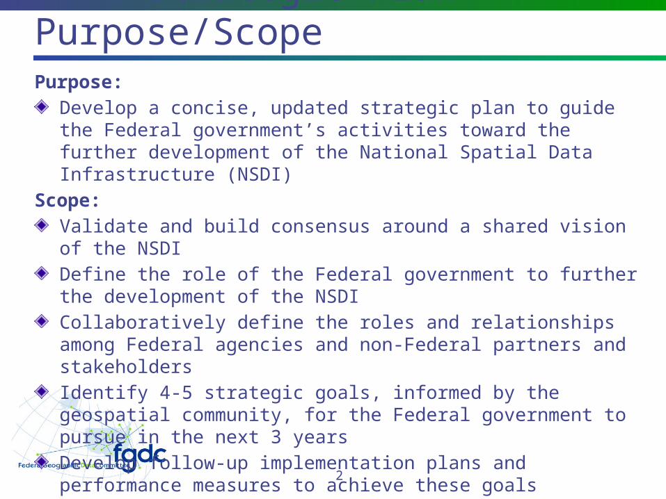
NSDI Strategic Plan – Purpose/ScopePurpose:
Develop a concise, updated strategic plan to guide the Federal government’s activities toward the further development of the National Spatial Data Infrastructure (NSDI)
Scope:Validate and build consensus around a shared vision of the NSDIDefine the role of the Federal government to further the development of the NSDICollaboratively define the roles and relationships among Federal agencies and non-Federal partners and stakeholdersIdentify 4-5 strategic goals, informed by the geospatial community, for the Federal government to pursue in the next 3 yearsDevelop follow-up implementation plans and performance measures to achieve these goals
2
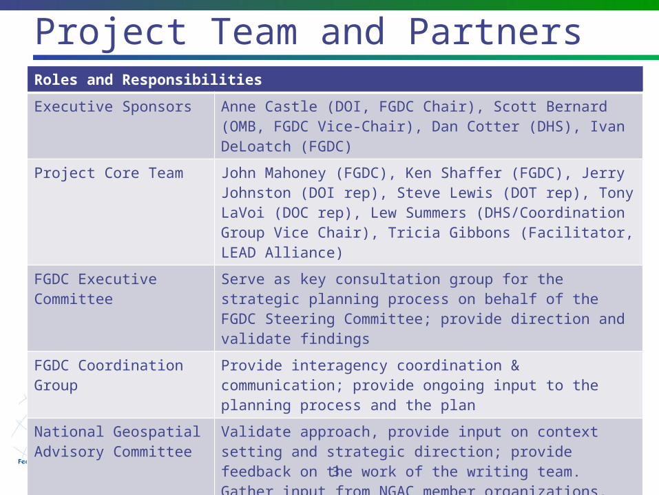
Project Team and PartnersRoles and Responsibilities
Executive Sponsors Anne Castle (DOI, FGDC Chair), Scott Bernard (OMB, FGDC Vice-Chair), Dan Cotter (DHS), Ivan DeLoatch (FGDC)
Project Core Team John Mahoney (FGDC), Ken Shaffer (FGDC), Jerry Johnston (DOI rep), Steve Lewis (DOT rep), Tony LaVoi (DOC rep), Lew Summers (DHS/Coordination Group Vice Chair), Tricia Gibbons (Facilitator, LEAD Alliance)
FGDC Executive Committee
Serve as key consultation group for the strategic planning process on behalf of the FGDC Steering Committee; provide direction and validate findings
FGDC Coordination Group
Provide interagency coordination & communication; provide ongoing input to the planning process and the plan
National Geospatial Advisory Committee
Validate approach, provide input on context setting and strategic direction; provide feedback on the work of the writing team. Gather input from NGAC member organizations.
Non-Federal Partners Provide input and feedback, validate approach
3
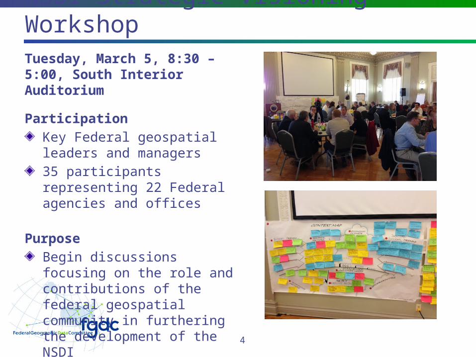
NSDI Strategic Visioning WorkshopTuesday, March 5, 8:30 – 5:00, South Interior Auditorium
ParticipationKey Federal geospatial leaders and managers35 participants representing 22 Federal agencies and offices
PurposeBegin discussions focusing on the role and contributions of the federal geospatial community in furthering the development of the NSDI 4
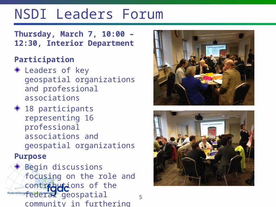
NSDI Leaders ForumThursday, March 7, 10:00 – 12:30, Interior Department
ParticipationLeaders of key geospatial organizations and professional associations18 participants representing 16 professional associations and geospatial organizations
PurposeBegin discussions focusing on the role and contributions of the federal geospatial community in furthering the development of the NSDI 5
NGAC Strategic Plan Subcommittee
Subcommittee has provided highly useful input into Version 1 of the PlanMeetings and dialogue with subcommittee members have been productiveDraft NSDI Plan incorporates inputs from three NGAC work groups: Vision Roles and Responsibilities External Factors
6
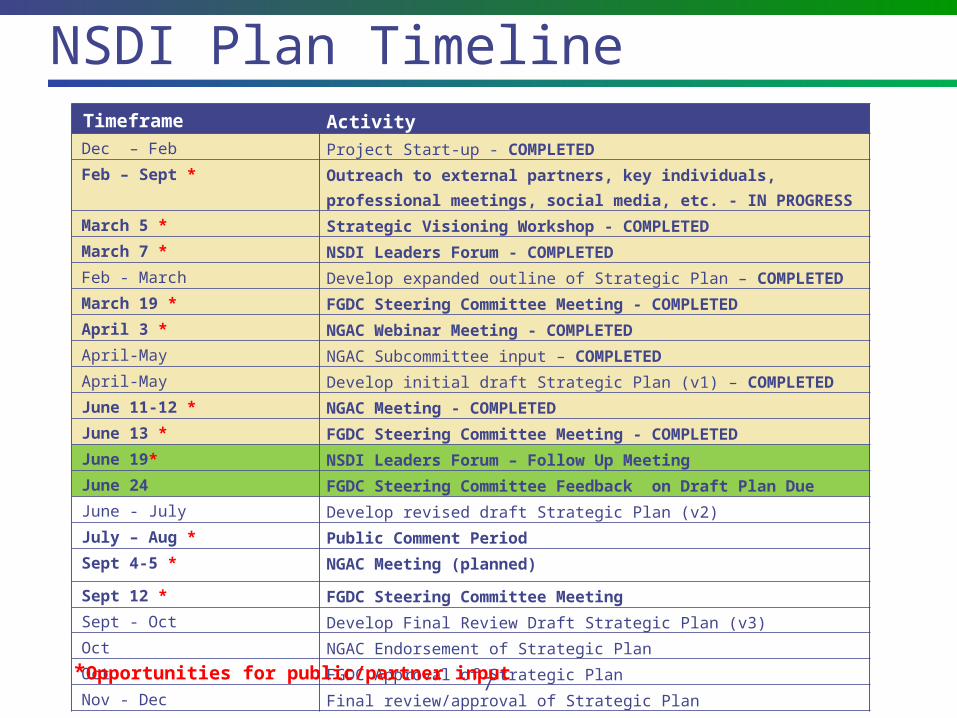
NSDI Plan Timeline
7
Timeframe Activity Dec – Feb Project Start-up - COMPLETED Feb – Sept * Outreach to external partners, key individuals,
professional meetings, social media, etc. - IN PROGRESS March 5 * Strategic Visioning Workshop - COMPLETED March 7 * NSDI Leaders Forum - COMPLETED Feb - March Develop expanded outline of Strategic Plan – COMPLETED March 19 * FGDC Steering Committee Meeting - COMPLETED April 3 * NGAC Webinar Meeting - COMPLETED April-May NGAC Subcommittee input – COMPLETED April-May Develop initial draft Strategic Plan (v1) – COMPLETED June 11-12 * NGAC Meeting - COMPLETED June 13 * FGDC Steering Committee Meeting - COMPLETED June 19* NSDI Leaders Forum – Follow Up Meeting
June 24 FGDC Steering Committee Feedback on Draft Plan Due June - July Develop revised draft Strategic Plan (v2) July – Aug * Public Comment Period Sept 4-5 * NGAC Meeting (planned)
Sept 12 * FGDC Steering Committee Meeting Sept - Oct Develop Final Review Draft Strategic Plan (v3) Oct NGAC Endorsement of Strategic Plan Oct FGDC Approval of Strategic Plan Nov - Dec Final review/approval of Strategic Plan
*Opportunities for public/partner input
NSDI Strategic Plan Draft–Key Points
High-level plan focused on a small set of critical goals and objectivesDescribes a broad National vision for the NSDI, and includes goals and objectives for the Federal government's role in continued sustainable development of the NSDIDeveloped with inputs from a variety of sources, including the FGDC community, the NGAC, and geospatial partner organizationsDesigned to address drivers including Administration priorities, FGDC strategic initiatives, NGAC recommendations, and GAO report on Federal geospatial programsSubsequent version (v2) will be broadly distributed for public review and comment in July/AugustFollowing completion of the strategic plan, FGDC will develop more detailed action plans for the goals and objectives in the plan
8
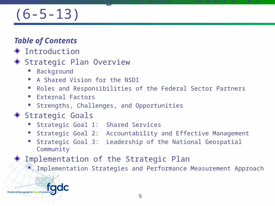
NSDI Strategic Plan – Draft v1 (6-5-13)
Table of ContentsIntroductionStrategic Plan Overview
Background A Shared Vision for the NSDI Roles and Responsibilities of the Federal Sector Partners External Factors Strengths, Challenges, and Opportunities
Strategic Goals Strategic Goal 1: Shared Services Strategic Goal 2: Accountability and Effective Management Strategic Goal 3: Leadership of the National Geospatial Community
Implementation of the Strategic Plan Implementation Strategies and Performance Measurement Approach
9
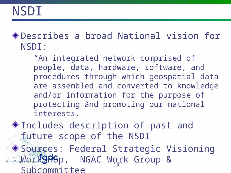
A Shared Vision for the NSDI
Describes a broad National vision for NSDI:“An integrated network comprised of people, data, hardware, software, and procedures through which geospatial data are assembled and converted to knowledge and/or information for the purpose of protecting and promoting our national interests.”
Includes description of past and future scope of the NSDISources: Federal Strategic Visioning Workshop, NGAC Work Group & Subcommittee
10
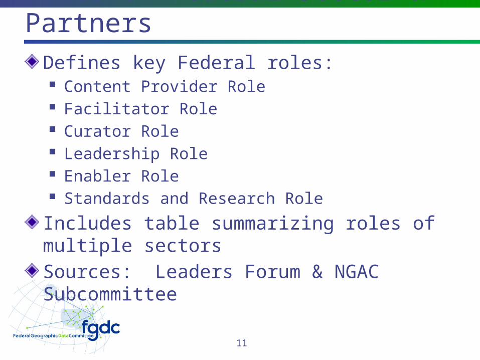
Roles of Federal Sector & Partners
Defines key Federal roles: Content Provider Role Facilitator Role Curator Role Leadership Role Enabler Role Standards and Research Role
Includes table summarizing roles of multiple sectorsSources: Leaders Forum & NGAC Subcommittee
11
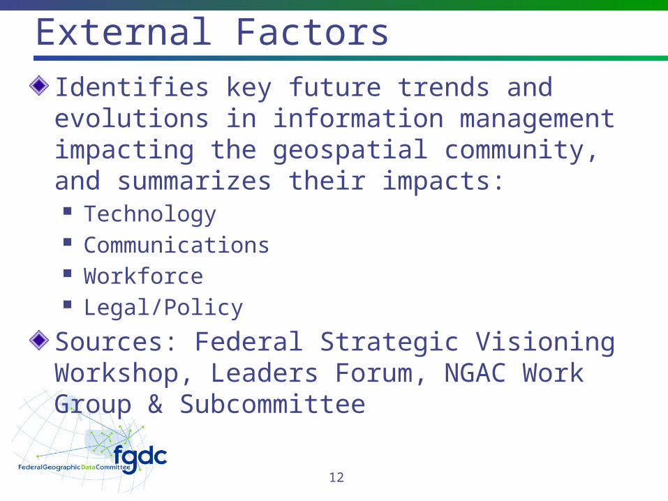
External FactorsIdentifies key future trends and evolutions in information management impacting the geospatial community, and summarizes their impacts: Technology Communications Workforce Legal/Policy
Sources: Federal Strategic Visioning Workshop, Leaders Forum, NGAC Work Group & Subcommittee
12
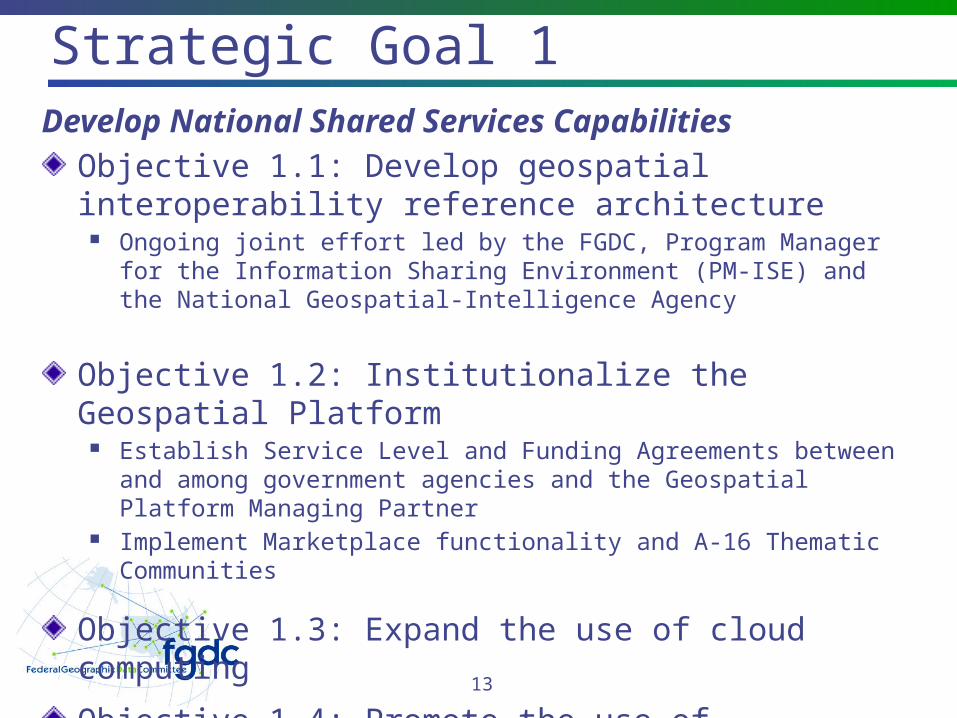
Strategic Goal 1Develop National Shared Services Capabilities
Objective 1.1: Develop geospatial interoperability reference architecture
Ongoing joint effort led by the FGDC, Program Manager for the Information Sharing Environment (PM-ISE) and the National Geospatial-Intelligence Agency
Objective 1.2: Institutionalize the Geospatial Platform
Establish Service Level and Funding Agreements between and among government agencies and the Geospatial Platform Managing Partner
Implement Marketplace functionality and A-16 Thematic Communities
Objective 1.3: Expand the use of cloud computing
Objective 1.4: Promote the use of consolidated acquisition vehicles for interagency and governmental purposes
13
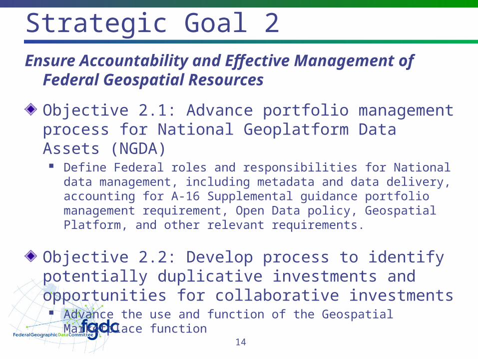
Strategic Goal 2Ensure Accountability and Effective
Management of Federal Geospatial Resources
Objective 2.1: Advance portfolio management process for National Geoplatform Data Assets (NGDA)
Define Federal roles and responsibilities for National data management, including metadata and data delivery, accounting for A-16 Supplemental guidance portfolio management requirement, Open Data policy, Geospatial Platform, and other relevant requirements.
Objective 2.2: Develop process to identify potentially duplicative investments and opportunities for collaborative investments
Advance the use and function of the Geospatial Marketplace function
14
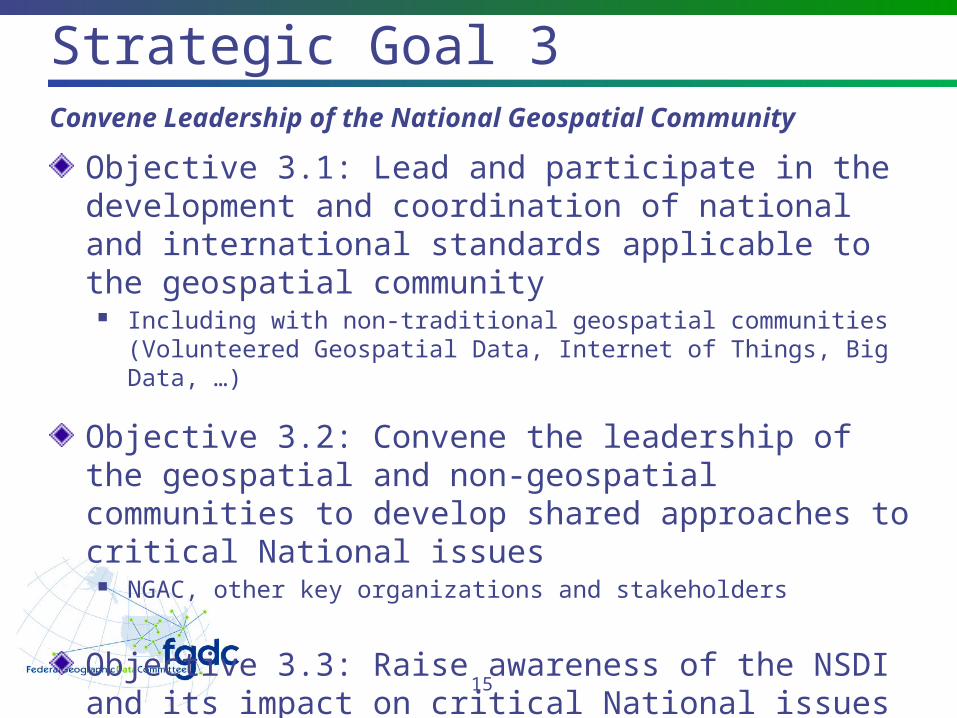
Strategic Goal 3Convene Leadership of the National Geospatial
Community
Objective 3.1: Lead and participate in the development and coordination of national and international standards applicable to the geospatial community
Including with non-traditional geospatial communities (Volunteered Geospatial Data, Internet of Things, Big Data, …)
Objective 3.2: Convene the leadership of the geospatial and non-geospatial communities to develop shared approaches to critical National issues
NGAC, other key organizations and stakeholders
Objective 3.3: Raise awareness of the NSDI and its impact on critical National issues
Promote benefits of NSDI
15
How you can help…
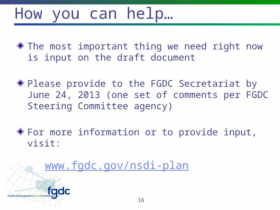
The most important thing we need right now is input on the draft document
Please provide to the FGDC Secretariat by June 24, 2013 (one set of comments per FGDC Steering Committee agency)
For more information or to provide input, visit:
www.fgdc.gov/nsdi-plan
16
Comments &
Questions
17