o sco american explorers - the story of oklahoma · chapter 6 american explorers the in oklahoma d...
TRANSCRIPT

chapter 6American explorers
in OklahomaTh
e D
iSC
Ov
eR
Y
Of
Ok
la
hO
ma
Key ThemesDemocracy and Civil RightsUnited States authorities apply territorial government to Oklahoma.
Free Enterprise and Economic DevelopmentU.S. Army expeditions and indepen-dent fur traders explore Oklahoma to determine its strategic and commer-cial potential.
ObjecTives• Trace the paths of scientific and
commercial explorations
• Explain the long-term effects of these expeditions on Oklahoma’s development
• Identify the major explorers and scientists who provided information about the region, and describe their influence on commerce
Key Terms• topography
• journal
• subagent
• zoology
• botanist
• Great American Desert
• squatters
• saltworks
74
• keelboat
• Adams-Onís Treaty
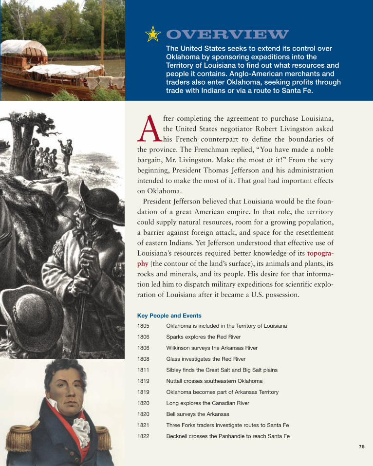
OverviewThe United States seeks to extend its control over Oklahoma by sponsoring expeditions into the Territory of Louisiana to find out what resources and people it contains. Anglo-American merchants and traders also enter Oklahoma, seeking profits through trade with Indians or via a route to Santa Fe.
After completing the agreement to purchase Louisiana, the United States negotiator Robert Livingston asked his French counterpart to define the boundaries of
the province. The Frenchman replied, “You have made a noble bargain, Mr. Livingston. Make the most of it!” From the very beginning, President Thomas Jefferson and his administration intended to make the most of it. That goal had important effects on Oklahoma.
President Jefferson believed that Louisiana would be the foun-dation of a great American empire. In that role, the territory could supply natural resources, room for a growing population, a barrier against foreign attack, and space for the resettlement of eastern Indians. Yet Jefferson understood that effective use of Louisiana’s resources required better knowledge of its topogra-phy (the contour of the land’s surface), its animals and plants, its rocks and minerals, and its people. His desire for that informa-tion led him to dispatch military expeditions for scientific explo-ration of Louisiana after it became a U.S. possession.
Key People and Events
1805 Oklahoma is included in the Territory of Louisiana
1806 Sparks explores the Red River
1806 Wilkinson surveys the Arkansas River
1808 Glass investigates the Red River
1811 Sibley finds the Great Salt and Big Salt plains
1819 Nuttall crosses southeastern Oklahoma
1819 Oklahoma becomes part of Arkansas Territory
1820 Long explores the Canadian River
1820 Bell surveys the Arkansas
1821 Three Forks traders investigate routes to Santa Fe
1822 Becknell crosses the Panhandle to reach Santa Fe
75

76 the story of oklahoma
un
iT 2
Territorial governmentAfter some experimenting, in 1805 the U.S. Congress divided Louisiana into two territories: Orleans in the south and Louisiana in the north. The Territory of Louisiana, with jurisdiction over what is now Oklahoma, had its administrative center at St. Louis. General James B. Wilkinson served briefly as the governor of Louisiana and was succeeded by William Clark of the famous Lewis and Clark expedition. Clark remained governor when northern Louisiana became the Territory of Missouri in 1812. Seven years later, Oklahoma was attached to the Territory of Arkansas, which eventually had its capital at Little Rock.
Scientific explorersThe earliest scientific explorers, Meriwether Lewis and William Clark, commanded the best-known expedition of western North America. Between 1804 and 1806, they went up the Missouri River, crossed the Rocky Mountains, and followed the Columbia River to the Pacific Ocean. Along the way, they gathered incredible amounts of information about northern Louisiana. They also impressed the Native peoples with the power and might of the “Great Father” in Washington. What the two commanders had done in the north, Jefferson hoped other army officers could do in the south. These were sent out almost immediately after Lewis and Clark finished their expedition.
The Sparks ExpeditionEarly in 1806, President Jefferson ordered Captain Richard Sparks to go up the Red River by boat to the Twin Villages of the Wichitas. From there, Sparks was to go by horseback to the Rocky Mountains. He was to take careful notes on the country he saw and the people he met. He put together a company of 24 soldiers and moved upriver in a small fleet of canoes. But his party barely made it into present-day Oklahoma—if it got there at all. A Spanish cavalry unit of several hundred men from Texas overran the camp and ordered Sparks to return to the American settlements or face arrest. He went back. The Spanish were very sensitive about any U.S. exploration of southern Louisiana while boundaries with Texas were still not definite.
The Pike-Wilkinson ExpeditionSince southern Louisiana remained a mystery, military authorities next dispatched Captain Zebulon M. Pike to search out the origins and course of the Red River. In July 1806, Pike departed from St. Louis with 23 men on a route that took him up the Missouri River to the Osage villages. There he bought horses and, dodging Spanish patrols, made his way to the Great Bend of the Arkansas River in west-central Kansas. At that point, he ordered Lieutenant James B. Wilkinson and 5 men to go east down the Arkansas while he and the rest of the troop went west up the river. Pike’s group pushed on to the Rocky Mountains, where he passed the peak now named after him. Later, a Spanish patrol arrested Pike and his
0 50 100 miles
0 80 160 kilometers
Beaver Creek
North Fork of Canadian River
Cimarron River Arkansas River
Canadian River
Washita River
Red River
North Fork of Red River
Gra
nd R
iver
Kiamichi River
1
6
1
8
8
4
4
5
5
2
7
7
339
Ver
digr
is R
iver
1.2.3.4.5.6.7.8.9.
James B. Wilkinson (1806)Anthony Glass (1806)George C. Sibley (1811)Thomas Nuttall (1819)Stephen H. Long (1820)John R. Bell (1820)Thomas James (1821)Glenn-Fowler (1821)William Becknell (1822)
N
American explorers, 1806–1822
ch
ap
te
r 6

un
iT 2
men. They spent a long time in prison before returning to the United States. Meanwhile, Wilkinson’s party worked its way down the Arkansas River in two elm-bark canoes. Shallow water soon forced them to march along the riverbank. By the time they reached Oklahoma in northeastern Kay County, they were able to navigate the river in two dugout canoes, but just barely. Winter came early and hard in 1806. The river filled with ice, and snowstorms limited visibility. Wilkinson and his men suffered greatly. They lost their food and ammunition and endured severe frost-bite. The only relief they found from their hunger and lack of supplies came from Osage hunters camped along the river’s edge. Wilkinson celebrated New Year’s Day, 1807, by leav-ing Oklahoma. His travel in the region had been brutal, without much time for observing. Yet his journal (daily record of his experiences) shows that he had learned a lot. The Osages were many and in “a constant state of warfare” with any Cherokees, Creeks, and Choctaws who entered the area. Wilkinson had heard about a salt-crusted prairie and about lead mines “northwest” of the Osages (the mines were actually to the northeast). He had passed over a seven-foot waterfall (Webbers Falls) on the Arkansas River. He noted that American hunters and
trappers were already working the Poteau River. President Jefferson, no doubt, found this official report very inter-esting, especially the part about an entire prairie of salt. When Jefferson had made earlier comments about a “salt mountain” in Louisiana, the eastern press had made fun of him.
The Sibley ExpeditionThe prospect of salt brought the third official expedition to Oklahoma in 1811. Salt, needed for preserving meat and seasoning food, was important on the frontier. George C. Sibley led the expedition, which included interpreters, Osage guides, and Sibley’s Irish valet. Sibley was not a military officer. He was a factor (government trader) and a subagent (civilian official who represented the U.S. gov-ernment) at Fort Osage. He was given the mission of nego-tiating peace agreements between the Osages and western Kansas tribes. But he also led his party into Oklahoma to see the fabled deposits of salt. Sibley first visited the Great Salt Plains on the Salt Fork of the Arkansas in present-day Cherokee County north of Jet. The wafer-thin sheets of salt on the vast flatland glistened “like a brilliant field of snow.” The sight so excited Sibley that he went on to the salt depos-its that Wilkinson had mentioned five years earlier. Near Freedom in present-day Woods County, the Big Salt Plain was just as impressive, even though recent rains had washed away most of the surface deposits. Near the brine springs that are the source of the salt, the deposits were 16 inches deep. The “beautifully white” rock salt, Sibley wrote, was “unquestionably superior to any that I ever saw.” An “inexhaustible store of ready made salt” in northern Oklahoma was just waiting to enter the “chan-nels of commerce.”
The Long-Bell ExpeditionNo military expedition yielded more information about Oklahoma than the one that Major Stephen H. Long com-manded. Yet the expedition was an accident. A major in the Corps of Topographical Engineers, Long was assigned to find the sources of the Red and Arkansas rivers and to descend each to the Mississippi River. In July 1820, he led his group west from Omaha along the Platte River to the Rocky Mountains. After hiking up the peak now named for him, Long turned south to the source of the Arkansas River. As Pike had done, he divided his troop there. While Long continued south to the source of the Red River, Captain John R. Bell and 12 other men headed down the Arkansas.
Chronology of American Exploration
Date Explorer Region
1806 Richard Sparks Red River
1806 James B. Wilkinson Arkansas River
1808 Anthony Glass Red River
1811 George C. Sibley Great Salt and Big Salt plains
1819 Thomas Nuttall Poteau and Kiamichi rivers; Three Forks; Cimarron
1820 Stephen H. Long Canadian River
1820 John R. Bell Arkansas River
1821 Hugh Glenn Arkansas and Canadian
1821 Thomas James North Canadian and Canadian rivers
1822 Thomas James North Canadian
1822 William Becknell Panhandle
ch
ap
te
r 6
american explorers oklahoma 77

78 the story of oklahoma
un
iT 2
Like Wilkinson 14 years earlier, Captain Bell found the Arkansas route tough going. This time the problem was not the cold weather but the heat. When Bell and his party got to Oklahoma in mid-August, 90-degree temperatures had worn them and their animals out. The heat also made game difficult to find. For food, the men were reduced to eating skunks, hawks, turkeys, turtles, mussels, and boiled corn. They even grabbed a fawn from the jaws of a wolf. An occasional deer, along with grain and melons from abandoned Osage campsites, kept them going. On September 9, Bell and his men arrived at Fort Smith. One member of Bell’s command was Thomas Say, known as the father of American zoology (the scientific study of animals). His task was to record his observations of the plants, animals, minerals, and Native peoples the Bell party encountered. Unfortunately, when three sol-diers deserted, they took Say’s five large journals with them. A reward of $200 was offered for the return of these
valuable papers, but to no avail. From his few remaining notebooks, Say later published the only account of the expedition. In the meantime, Major Long continued south-ward from the Arkansas, looking for the source of the Red River. His party also included a noted scientist—Edwin James, a botanist (a person who studies plants). Eventually Long came across a broad stream that he assumed was the Red River. He held that idea for nearly seven weeks. But it really was the Canadian River, that fabled waterway the French had followed to Santa Fe. Riding their horses in the riverbed, Long and his party reached the Antelope Hills and Oklahoma in August. Edwin James was impressed with the wildlife he saw: “Herds of bison, wild horses, elk, and deer are seen qui-etly grazing in these extensive and fertile pastures.” A prairie-dog colony that covered a square mile, filled him with awe. So did flocks of white pelicans, egrets, snowy herons, and the occasional bald eagle—not to mention
Stephen H. Long (1784–1864), in full military dress, points dra-matically to the West in this painting. Long commanded the U.S. Army expedition that explored the Canadian River in 1820. He also chose the site for Fort Smith.
Edwin James (1797–1861) was a noted scientist who accompa-nied Major Stephen Long’s expedition along the Canadian River in 1820. James described the plants and animals he saw along the way, as well as the summer’s scorching heat and lack of water that the explorers endured.
ch
ap
te
r 6

un
iT 2
tarantulas. Less inspiring were seed ticks. Neither wind nor smoke nor tight leather clothing could keep the men free of the pests. These natural wonders aside, James was even more impressed by the scorching heat and the dry bed of the Canadian River. Digging deep holes in the river sand produced no more than a mere cup of water. As he saw it, only a “wide sandy desert” lay between what is now Indianola in Pittsburg County and the Rocky Mountains: “The traveler who shall, at any time, have traversed its desolate sands will, we think, join us in the wish that this region may forever remain the unmo-lested haunt of the native hunter, the bison, the prairie wolf, and the marmot [a rodent].” But the parched land did have a purpose, he noted. It would prevent unruly expansion over the entire continent or, as James put it, “ruinous diffu-sion” of the American people. When Major Long and his party arrived at the Arkansas River on September 10, 1820, they realized that they were not on the Red River but on the Canadian. Both Long and James were embarrassed and disappointed, even more so because they knew that they did not have the energy, the time, or the means to go back and do the job right. Instead they moved on to Fort Smith. Three days later they were reunited there with Captain Bell and other members of the original party. The Long expedition did not meet its intended purpose, yet it had important results. Despite the loss of Say’s journals, it provided much scientific data on Oklahoma’s plants, animals, geology, and geography, as well as knowledge of its Native peoples. More important, the expe-dition confirmed the idea that the Southern Plains were a sandy wasteland that could not be used for farming. After the Long expedition, maps of the American West usually labeled the area as “the Great American Desert.” If no one had ever challenged the reports from Major Long and his party, Oklahoma and the sur-rounding area would have remained in their natural state.
The Nuttall ExpeditionThe most useful and complete information about the resources and people of Oklahoma did not come from government-sponsored
expeditions. Rather, it was gathered by the internation-ally famous English botanist Thomas Nuttall. In 1819, he spent several months in the region, collecting plant samples. He arrived at Fort Smith in the spring and joined Major William Bradford and a company of riflemen on an expedition to the Red River. The army unit had orders to eject white squatters (people who settle on property with-out the right to do so) and outlaws from lands claimed by the Osages.
Oklahoma explorers were expected to confront rugged terrain, wild ani-mals, and angry Native tribes. Yet those activities were out of the ordi-nary. Most days were given over to everyday chores, like setting up camp and fighting off insects. Edwin James of Major Stephen Long’s expedition across Oklahoma in 1820 wrote a marvelous description of his daily battle with seed ticks:
We found, however, the annoyance of innumerable multitudes of minute, almost invisible seed ticks, a sufficient counterpart to the advantages of our situation. These insects, unlike the mosquitoes, gnats, and sandflies, are not to be turned aside by a gust of wind, or an atmosphere surcharged with smoke, nor does the closest dress of leather afford any protection from their persecutions. A person no sooner sets foot among them than they commence in countless thousands, their silent and unseen march; ascending along the feet and legs, they insinuate themselves into every article of dress, and fasten, unperceived, their fangs upon every part of the body. The bite is not felt until the insect has had time to bury the whole of his beak, and in the case of the most minute and most troublesome species, nearly his whole body seems hid under the skin. Where he fastens himself with such tenacity, . . . he will sooner suffer his head and body to be dragged apart than relinquish his hold. It would perhaps be well . . . to suffer them to remain unmolested, but they excite such intolerable itching that the sufferer cannot avoid aggravating the evil by his efforts to relieve himself from the offending cause.
Source: Edwin James, comp., Account of an Expedition from Pittsburgh to the Rocky Mountains, performed in the years 1819 and ’20, by order of the Hon. J. C. Calhoun, Sec’y of War: under the Command of Major Stephen H. Long, Mr. T. Say, other Gentlemen of the Exploring Party, vol. 2 (1822–23; reprint, Ann Arbor: University Microfilms, 1966), 143–44.
Trial by Seed Ticks
ch
ap
te
r 6
american explorers oklahoma 79
80 the story of oklahoma
un
iT 2
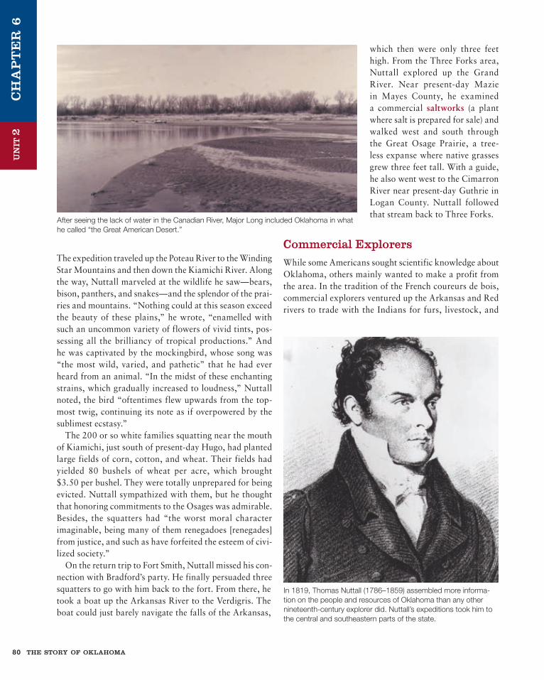
The expedition traveled up the Poteau River to the Winding Star Mountains and then down the Kiamichi River. Along the way, Nuttall marveled at the wildlife he saw—bears, bison, panthers, and snakes—and the splendor of the prai-ries and mountains. “Nothing could at this season exceed the beauty of these plains,” he wrote, “enamelled with such an uncommon variety of flowers of vivid tints, pos-sessing all the brilliancy of tropical productions.” And he was captivated by the mockingbird, whose song was “the most wild, varied, and pathetic” that he had ever heard from an animal. “In the midst of these enchanting strains, which gradually increased to loudness,” Nuttall noted, the bird “oftentimes flew upwards from the top-most twig, continuing its note as if overpowered by the sublimest ecstasy.” The 200 or so white families squatting near the mouth of Kiamichi, just south of present-day Hugo, had planted large fields of corn, cotton, and wheat. Their fields had yielded 80 bushels of wheat per acre, which brought $3.50 per bushel. They were totally unprepared for being evicted. Nuttall sympathized with them, but he thought that honoring commitments to the Osages was admirable. Besides, the squatters had “the worst moral character imaginable, being many of them renegadoes [renegades] from justice, and such as have forfeited the esteem of civi-lized society.” On the return trip to Fort Smith, Nuttall missed his con-nection with Bradford’s party. He finally persuaded three squatters to go with him back to the fort. From there, he took a boat up the Arkansas River to the Verdigris. The boat could just barely navigate the falls of the Arkansas,
which then were only three feet high. From the Three Forks area, Nuttall explored up the Grand River. Near present-day Mazie in Mayes County, he examined a commercial saltworks (a plant where salt is prepared for sale) and walked west and south through the Great Osage Prairie, a tree-less expanse where native grasses grew three feet tall. With a guide, he also went west to the Cimarron River near present-day Guthrie in Logan County. Nuttall followed that stream back to Three Forks.
Commercial explorersWhile some Americans sought scientific knowledge about Oklahoma, others mainly wanted to make a profit from the area. In the tradition of the French coureurs de bois, commercial explorers ventured up the Arkansas and Red rivers to trade with the Indians for furs, livestock, and
After seeing the lack of water in the Canadian River, Major Long included Oklahoma in what he called “the Great American Desert.”
In 1819, Thomas Nuttall (1786–1859) assembled more informa-tion on the people and resources of Oklahoma than any other nineteenth-century explorer did. Nuttall’s expeditions took him to the central and southeastern parts of the state.
ch
ap
te
r 6

un
iT 2
captives or to trap and hunt animals themselves. Some hoped to realize the old French dream of opening a trade with the Spanish settlements along the Rio Grande. Many of these “expectant capitalists,” as one historian called them, became trailblazers and explorers in their own right.
Red River TradersThe quest of Anthony Glass, a merchant from Natchez, Mississippi, took him up the Red River only two years after Spaniards had forced Captain Sparks to turn back. With the approval of the U.S. Indian agent at Natchitoches, Glass and 10 other men set off in July 1808 to participate in a trade fair hosted by the Wichitas and involving all of the Southern Plains tribes. Because of Spanish worries about American intentions, Glass was supposed to follow the north bank of the Red River to the Twin Villages. But he actually traveled parallel to the river on the Texas side, crossing into Oklahoma when he reached Love County. Then he turned west to the Twin Villages. Glass first presented the greetings of the president of the United States to Chief
Awahakei of the Wichitas. Then Glass expressed his own desire to trade with the Wichitas and their Comanche allies. He remained in the area for six months, swapping for horses and tracking down a meteorite that the Indians revered. His final report to John Sibley tells much about
Every American explorer who visited Oklahoma commented on its large herds of wild horses, and traders out of Three Forks and along the Red River wanted to catch and sell them. George Catlin captured the beauty and spirit of the animals in this 1834 drawing.
AR
KA
NSA
S
OK
LAH
OM
A
0 5 10 403020 50 Miles
Osages des Chênes
Bogie’sTrading Post
Fort Smith
Salt Fork
Arkansas River
Can
ey River
Verdigris River
Gra
nd
Riv
er
THREE FORKS
Little North Fork
Cimarron (Salt) River
North Fork Canadian River
N
Canadian R
iver
Nuttall’s expedition west of Three Forks, 1819
ch
ap
te
r 6
american explorers oklahoma 81

82 the story of oklahoma
un
iT 2
Wichita culture. Particularly impor-tant were Glass’s observations that the Wichitas were a people under siege and were virtually held as cap-tives in their villages by the Osages. (Three years later the Osages caused the Wichitas to abandon the Twin Villages permanently.) Also sig-nificant was Glass’s report that an American trading party had already passed through the villages on its way to Santa Fe. Glass was able to ascend the Red River even though two U.S. mili-tary expeditions (led by Sparks and Pike) had failed. Other commercial explorers later followed him to the Twin Villages and beyond, but most focused their activities in what is now southeastern Oklahoma. These hunters and trappers are nameless today, but they were known to be an independent lot who had little respect for the needs and rights of American Indians. The army tried to expel the commercial adventurers from the area in 1819 but had little success.
Three Forks TradersAmerican traders and trappers along the Arkansas tended to concentrate in the Three Forks area, where the Arkansas, the Verdigris, and the Grand River merge just north of Muskogee. North of there, the Arkansas band of the Osages lived. After driving the Wichitas from the area, the Osages had occupied it first for hunting camps in the 1760s and then in permanent villages in the 1780s. The talented warrior Cashesegra, or Big Track, led the Arkansas group, but Clermont, a noted hereditary chief, joined it before 1800. French trad-ers from Arkansas Post visited the Osages’ Verdigris River villages from the time they were established. With the onset of the American period, even more com-mercial activity took place at Three Forks. The Chouteau brothers accounted for much of this. Pierre and Auguste Chouteau had made fortunes trading with the Osages
along the Missouri River. The brothers had lost their monopoly of that trade, which the Spanish had granted, and in 1802 they relocated their large operation to the 3,000-member Arkansas Osage band. Historians used to think that the Chouteaus, in retaliation for losing their monopoly, had caused Clermont’s people to leave their homeland and follow the brothers to Oklahoma. But the opposite was true. The Chouteaus came to Oklahoma because the Osages were already there and had been for 30 years.
Fort Smith as it appears today, with the U.S. flag flying over the fort’s vista of the Arkansas River. The U.S. Army built Fort Smith in 1817 to preserve peace between the Osages and the Cherokees and to assure the safety of other eastern Indians who might emigrate to Oklahoma.
ch
ap
te
r 6

un
iT 2
Joseph Bogy was another early Three Forks trader. Of French extraction, he had operated trading businesses at Kaskaskia in Illinois and at Arkansas Post. On the Verdigris, he built a post of picket logs (driven vertically into the ground) and traded extensively with the Osages. That commerce partly accounted for his loss of a boat-load of trade goods to a Choctaw war party in 1807. The great Pushmataha, who led the raid, justified it because the goods were destined for his Osage enemies. As the American people moved westward after the War of 1812 (between England and the United States), both the population and the range of activities in the Three Forks area increased. The Chouteaus were temporarily absent, but merchants, hunters, salt manufacturers, and even farmers joined Joseph Bogy at Three Forks. Among the newcomers was Nathaniel Pryor, a mem- ber of the Lewis and Clark expedition and a captain in the war. Pryor, a Virginia native, came to the Three Forks area after going bankrupt while operating a trad-ing house at Arkansas Post. He opened a small busi-ness near the mouth of the Verdigris, married an Osage woman, learned the Osage language, and won the tribe’s confidence. He was never a very successful merchant, but late in life he received an appointment as subagent for the Arkansas band of Osages. In that position, he
In 1806, French artist C. B. J. F. Saint-Mémin completed this portrait of Cashesegra, principal leader of the Arkansas band of Osages who visited Washington, D.C., to meet with President Thomas Jefferson.
Arkansas River
Arkansas River
Verdigris River
Grand
Riv
er
Ca
ttle F
or
d
0 1 2 miles
0 1 2 3 kilometers
NTullahasseeMission
PresbyterianSchool
EbenezerMission Marshall
Town
McIntosh Town
Creek Agency1833–51
OsageAgency
Glenn and Pryor’sWigwamNeosho
Three Forks
Love’s TradingPost
Fort Davis
Fort Gibson
Creek Agency1878
Creek Agency1851–75
Muskogee
Agency Road
Texas Road
Military Road
Texas Road
Three Forks area
ch
ap
te
r 6
american explorers oklahoma 83

84 the story of oklahoma
un
iT 2
helped mediate many of the Osages’ disputes with their Indian neighbors. Another notable resident at Three Forks was Hugh Glenn of Cincinnati. Glenn had made and lost a fortune as a banker and steamboat owner before opening a trad-ing house on the Verdigris. George W. Brand of Tennessee and Captain Henry Barbour of New Orleans did business there as partners too. They brought much money with them and built an elaborate property known as Verdigris Landing. It consisted of 10 to 12 houses, several ware-houses, a ferry, and 30 acres of cleared land. Profits from the fur trade were never as grand as Brand and Barbour had hoped, though. The Chouteau interests returned to the Three Forks area in 1817. Colonel A. P. Chouteau, the son of Pierre and a graduate of West Point, opened a post on Grand River at Salina in present-day Mayes County. He had just completed a prison term in Mexico, his reward for taking trade goods across the plains to Santa Fe with-out Spanish approval. Joseph Revoir did a good job of managing the post for Chouteau, but Revoir’s attempt to
open a branch near Bogy’s and Pryor’s operations on the Verdigris failed. When Revoir was killed in 1821 by a Cherokee raiding party, Colonel Chouteau returned from St. Louis to man-age the Grand River post. He immediately purchased the businesses of Brand and Barbour near the mouth of the Verdigris, expanded them, and added a keelboat construc-tion operation. (Large, shallow vessels, keelboats were ideal for shipping freight on western rivers.) Fluent in the Osage language and the husband of at least two Osage women, Chouteau reigned as the merchant prince of Three Forks for the next decade. In 1824, Chouteau shipped 38,000 pounds of furs to New Orleans markets. Seven years later, he sent only 14,684 pounds. The difference showed the changes that were occurring in eastern Oklahoma. The Osages and other Indian hunters were finding game to be scarce in the Three Forks region. Also, products other than furs were being shipped downriver—namely, grain, salt, lead,
Pushmataha (1764–1824) became a prominent war chief by leading Choctaw raids against Osages and Caddos west of the Mississippi River. Such tribal fighting made commerce in the Three Forks area particularly dangerous. Pushmataha also rep-resented the Choctaws in negotiations with the United States in Washington, D.C.
Colonel A. P. Chouteau (1786–1838), the son of Pierre Chouteau, dominated the Indian fur trade in early Oklahoma. He operated posts at Three Forks on the Verdigris River and at present-day Salina on the Grand River.
ch
ap
te
r 6

un
iT 2
beeswax, and pecans. The basis of the Three Forks econ-omy was changing from hunting to agriculture. Tom Slover’s story provides an example of the transfor-mation. At first, Slover made his living as a commercial hunter. Then he brought his family to eastern Oklahoma and built a log cabin, cleared a field, planted a crop, and bought a horse and a cow. When Thomas Nuttall visited him in 1819 near Mazie, Slover had a “finely elevated and productive farm . . . well suited to the production of small grain.” Slover did not take furs to market anymore; instead he took his harvest of grain. What happened to Slover was happening to others in the Three Forks area and in the Red River valley.
Santa Fe TradersIn 1819, the United States negotiated the Adams-Onís Treaty with Spain. This agreement finally defined the southern boundary of the Louisiana Purchase, from
the Gulf of Mexico to the Pacific Ocean. The treaty was important to Oklahoma because it drew what would become its boundary with Texas—the south bank of the Red River and the 100th meridian (see the map on page 71). Acceptance of the border by Texas, however, would require a lengthy case before the U.S. Supreme Court in the 1920s and a dramatic confrontation between the Oklahoma National Guard and the Texas Rangers in the so-called Bridge War of 1931.
Spain ratified the Adams-Onís Treaty partly to help ensure continued control of its Mexican provinces. Spain assumed that a well-defined boundary would deter aggression from North America. But Spain soon realized that it had a problem within Mexico itself. Two years after the treaty was signed, Mexico declared its independence from Spain and made it stick. This turn of events was important for the traders and merchants at Three Forks and St. Louis. It offered hope that the new government might let Americans trade with Santa Fe and other Rio Grande settlements.
Peter Baum, a St. Louis trader, con-firmed that something was afoot. Like Colonel A. P. Chouteau, he had been impris-oned in Mexico for importing trade goods to Santa Fe. Baum had escaped from prison
In addition to his trading operations on the Grand and Verdigris rivers, Colonel A. P. Chouteau started a business that built and used keelboats. The one shown here is a replica of the 55-foot keelboat used by explorers Meriwether Lewis and William Clark on the Missouri River in 1804.
The Osages were the main Indian partners of the Three Forks traders. They were noted for their grace and beauty, especially the women. Charles Bird King cap-tured these characteristics in a painting of an Osage mother and child.
ch
ap
te
r 6
american explorers oklahoma 85

86 the story of oklahoma
un
iT 2
and worked his way eastward along the Canadian River. Early in 1821, he arrived at Three Forks, told his story at Glenn’s post, and then went on to St. Louis, where he told his story again. His account encouraged the traders in both places to test whether Santa Fe would now admit Americans. Thomas James, an Indian trader with experience on the upper Missouri River, led the 11-man St. Louis party. They took cloth, biscuits, flour, powder, lead, and whiskey as trade goods. Going in a keelboat, the group reached Three Forks late in the summer of 1821. There the men bought horses and mules to take them to Santa Fe. The James company arrived at Three Forks just as Hugh Glenn and his partner, Nathaniel Pryor, were finishing their
preparations to send a trapping and trading party to New Mexico. They had recruited 20 men from the Three Forks area (including Tom Slover), and they had gathered horses, mules, and supplies. One member of their group was Jacob Fowler, a surveyor from Kentucky who had brought his brother and a black slave with him. Fowler kept the only journal of the expedition, so historians usually refer to it as the Glenn-Fowler party. Both the James group and the Glenn-Fowler party left the Three Forks area for New Mexico in September. Each followed a different route. The Glenn-Fowler party went northwest from Three Forks through the Great Osage Prairie into what is now Kansas. From there, they fol-lowed the Arkansas River into present-day southeastern Colorado, stopping in the Pueblo area to trade with the
THE REST OF THE STORY
When Oklahomans and Texans cross back and forth over their common border today, they only vaguely realize that they have passed from one state to another, even when that border is the Red River. Not so long ago, however, residents of the two states cared deeply about the precise location of the border. In fact, they cared so deeply that they took a case to the U.S. Supreme Court, called out the National Guard, and mustered the Texas Rangers. Words written 110 years earlier helped resolve the crisis. The issue was money. In the 1920s, oil was dis-covered in the bed of the Red River. Texas officials claimed rights to own or tax the oil at least to the center of the river. Oklahoma officials insisted on rights to the entire riverbed. Oklahomans based their claim on language in the Adams-Onís Treaty of 1819. That treaty had set the southern bound-ary of the Louisiana Purchase as the south bank of Red River. After careful historical research and a long court case, the Supreme Court ruled in 1927 that the century-old language of the treaty prevailed and denied Texas any interest in the bed of the Red
River. But Oklahoma did not win a complete victory. Its interests were limited to the northern half of the river. The federal government reserved the rights to the southern half. Emotions between the two states had barely calmed down when the border question flared up again. Oklahoma governor William H. Murray wanted to open a free bridge across the Red River in 1931 that would compete with a private toll bridge licensed by Texas. Texas courts directed the Texas Rangers to block exits from Oklahoma’s free bridge, and Governor Murray called out the Oklahoma National Guard in response. The governor gained national headlines from the Bridge War, as it was called, but there was little danger of actual conflict. The Adams-Onís Treaty had, after all, set the Texas border as the south bank of Red River, in language that the U.S. Supreme Court affirmed as the law of the land. How old the words were did not matter. The guard and the rangers soon withdrew, the barri-ers at the free bridge were pulled down, and vehicles crossed the Red River without paying a toll.
When Old Words Mattered
ch
ap
te
r 6

un
iT 2
Indians and to trap for beaver. Business was so brisk, and hunting was so good, that the Oklahomans soon had more pelts and furs than they could transport. Instead of going to Santa Fe, they crossed the plains again in the following spring to sell their hides in St. Louis. Then they returned to Three Forks. The James party followed the Cimarron River to some point in Major County and turned due west, crossing the North Canadian River near present-day Woodward. Along the way, the group suffered much from a lack of cooking fuel and drinking water. Fortunately, the buffalo provided both: dried chips (manure) for fuel and blood to drink. In western Oklahoma, James and his party met a large band of Comanches, who invited them to return the next year to trade. As the Missourians continued west, they met a Mexican army patrol, who told them that Santa Fe was open for trade. In December, the James group set up shop in the market square. The next spring, they too returned to St. Louis, traveling for a time with the Glenn-Fowler party. The Three Forks expedition reached Santa Fe only days after William Becknell, a livestock dealer from Franklin, Missouri. Becknell thus won the honor of being “the father of the Santa Fe trade”—but for more reasons than just being the first American to trade successfully in the Rio Grande settlements. In the next year, 1822, he returned with large wagons filled with merchandise. The overland trail he pioneered cut across the Oklahoma Panhandle. Over the next 30 years, tens of thousands of American merchants and settlers followed his trail to northern Mexico, leaving wagon ruts that are still visible in Cimarron County today. Meanwhile, life at Three Forks had nearly returned to normal. Neither of the Santa Fe expeditions had been very profitable. Hugh Glenn and Nathaniel Pryor focused on their Verdigris trading posts. Thomas James and his partners organized a trading expedition to the Comanches in the fall of 1822. They took $5,500 worth of merchandise by keelboat to the North Canadian River. Where the water was too shallow to navigate, the 20-man party loaded its goods onto horses and into dugout canoes. James was impressed with central Oklahoma. Near Spring Valley (probably northeast of Banner) in Canadian County, he and his party built a fort, but heavy rains caused them to move upriver into Blaine County. From the stockade they built there, James and his part-ners had a very successful trading season, taking in 400 horses and mules and more buffalo hides and beaver pelts than they could carry to market.
Why is This Part of the Story important?
Few stories are as interesting as the Anglo-American exploration of Oklahoma, but what is their importance to the history of the state? Primarily this: in 1803, when the flag of the United States rose over Oklahoma, very little was known about its resources. Official and unof-ficial scientific expeditions along the Arkansas, Cimarron, Canadian, and Poteau rivers yielded much information. Hunters and traders operating in Three Forks and along the Red River discovered even more. By 1825, the “nature and extent” of the land that is now Oklahoma—what President Jefferson had sent expeditions to learn—were fairly well known, at least unofficially. Including part of the Great American Desert and bounded on two sides by the Republic of Mexico, the area was not likely to attract even the most energetic American farmers. Thus, Oklahoma was considered ideal as a resettlement zone for eastern Indians who, federal officials assumed, wanted to escape the pressures of civilization.
make it How toFire on the Trail
Finding fuel for fire on the treeless plains was an unexpected challenge for American explorers and trappers. Like the Thomas James party, they often used dried buffalo chips, or manure, as fuel. Josiah Gregg, a trader along the Santa Fe trail, recorded that using buffalo chips for fuel had both up- and downsides:
On the night after the first buffalo scamper, we encamped upon a woodless ravine, and were obliged to resort to “buffalo chips” . . . for fuel. It is amusing to witness the bustle which generally takes place in collecting this offal. In dry weather it is an excellent substitute for wood, than [which] it even makes a hotter fire; but when moistened by rain, the smoldering pile will smoke for hours before it condescends to burn, if it does at all. The buffalo meat which the hunter roasts or broils upon this fire, he accounts more savory than the steaks dressed by the most delicate cooks in civilized life.
Source: Josiah Gregg, Commerce of the Prairies, edited by Max Moorehead (Norman: University of Oklahoma Press, 1954), 237.
ch
ap
te
r 6
american explorers oklahoma 87