observations along the sabarmati - leafindia
TRANSCRIPT

Observations along the
Landscape Environment Advancement Foundation, LEAFLandscape Environment Advancement Foundation
L E A F
INDIA
Sabarmati

Introduction 01
Rivers 03
Rivers of India 03
The Sabarmati 04
Methodology 04
Along the Sabarmati
Places observed 05
Tributaries and Dams 07
Edges of the river
01. Kheroj; Ambaji 09
02. Gadhada; Khedbrahma 11
03. Valasana; Idar 13
04. Derol; Himmatnagar 15
05. Sadra; Gandhinagar 17
06. Palaj; Gandhinagar 19
07. Paldikankrej; Ahmedabad 21
08. Saroda; Bavla 23
09. Sahij; Dholka 25
10. Vadgam; Khambhat 27
Soil types and description
01. Kheroj; Ambaji 2902. Gadhada; Khedbrahma 3003. Valasana; Idar 3104. Derol; Himmatnagar 3205. Sadra; Gandhinagar 3306. Palaj; Gandhinagar 3407. Paldikankrej; Ahmedabad 3508. Saroda; Bavla 3609. Sahij; Dholka 3710. Vadgam; Khambhat 38
Landscape Vignettes
01. Kheroj; Ambaji 3902. Gadhada; Khedbrahma 4103. Valasana; Idar 43
Observations along the SabarmatiRitesh J. Kamdar
July 2009
Landscape Environment Advancement Foundation (LEAF), 2009, Doc.2
LEAF is engaged in research and publication in the area of landscape design and environmental planning. It supports research programs of varying durations every year.
Material produced by LEAF may be freely reproduced. LEAF and the author should be acknowledged while doing so.
LEAF invites applications for research positions.
For details please write to,
M/S. Prabhakar B. Bhagwat, 901-Panchtirth, Opp. Aristoville, S.M.Road, Ahmedabad-380 015. INDIA
T # 91 79 2692 3054
Contents04. Derol; Himmatnagar 4505. Sadra; Gandhinagar 4706. Palaj; Gandhinagar 4907. Paldikankrej; Ahmedabad 5108. Saroda; Bavla 5309. Sahij; Dholka 5510. Vadgam; Khambhat 57
Appendix
01. Rainfall data 5902. Soil key chart 6103. List of crops 6304. Native Flora 65
Bibliography 69

Forgotten legacy
Many aspects of our environment we take for granted. Oft traveled and traversed, they soon become a blur that cease to register except as a component of a larger composition.
Seminal landscape occurrences that shaped civilization are no different. In the past, features such as mountains, valleys, forests, lakes or rivers formed the anchor that determined how development of human settlements would occur. Settlements found their locations because the landscape provided protection, or succor.
Both these ideas, of protection and sustenance, have undergone a change, to an extent where the very reason why a settlement chose to exist , has ceased to be even registered. Gradually settlements turn their backs to these landscape events. Rivers become drains, mountains are flattened or leavened, and lakes are filled up. The gradual distancing of this dependence and obliteration from the consciousness, is not an urban phenomenon, but is simply a function of the fact that other support systems replace the original ones.
It is a tragedy that the new systems are concealed, and well cloaked, never revealing their character. Water neatly fed through pipes to irrigate the fields is soon taken for granted. Little does it even express the fury of a river in spate, or rarely does it satiate the soul like a gentle river filled from edge to edge. This is unfortunately the truth, and the only way to counter it is to consciously force ourselves to observe such actors in nature.
Ritesh Kamdar, a student of landscape Architecture, chose to travel to selected locations along the river Sabarmati. That it was summer, and hence the seasonal river was dry, did not in any way reduce the value of the exercise.
He selected ten locations along the 371 kms of the river and made simple recordings of the river bed, the soil , crops and birds.
So strong is our pre-occupation to find a conclusive meaning for every effort we undertake, that one is likely to go through the text and question the reason for doing such an effort.
The earlier paragraphs of this text should help ally such doubts. There are lessons learnt in the text; many of them, about the course of the river, the quality of its bed, its edges, the variety of soils and crops.
But more importantly it a reminder to re- look at such landscape features that shaped our civilizations; perhaps a mature contemplation of their nature and fate may allow us to reinterpret their values in our lives again.
Aniket Bhagwat
July 2009
1 2

Rivers
By definition, a river is a “natural watercourse which flows towards an ocean, a sea, a lake or towards another river or in some cases it flows into the ground or dries up completely before merging with any other water body”. It is however, part of a larger cycle that includes precipitation, topography, surface run off and catchment areas. Surface run off and topography together, determine a river's catchment area. Topography and geology play an important part in determining the rate of flow of the river. While the shape of a river is determined by the regions it flows through, the river in turn also leaves an imprint on these areas. Amount of water in the river, rate of flow, seasonal variations and flooding all affect the banks of the river and the adjacent areas. For example, a river flowing in a steep, mountaineous region cuts a sharp channel. The same river downstream in the plains will form a meandering course due to the shallow gradient. The river thus, at times becomes the most visible and identifiable element of the natural drainage and hydrological cycle of a region. The river system nurtures special flora and fauna and together they form another ecological entity.
Rivers of India
Major rivers of India Includes Brahmaputra, Narmada, Tapti, Godavari, Krishna, Kaveri, Mahanadi, Ganga, Indus, Yamuna and Sutlej, these rivers along with their numerous tributaries make the river system of India. Most of the rivers empty into the Bay of Bengal. Some of the rivers whose courses take them through the western part of the country empty into the Arabian Sea. Some parts of Ladakh, northern parts of the Aravalli range and the arid parts of the Thar Desert have inland drainage.
All major rivers of India originate from one of the three main watersheds.
1. The Himalaya and the Karakoram ranges 2. Vindhya and Satpura ranges and Chotanagpur plateau in central India 3. Sahyadri or Western Ghats in western India
The rivers of India can be divided into Himalayan Rivers and Peninsular Rivers.
Himalayan Rivers
The main Himalayan river systems are the Ganges river, the Indus and the Brahmaputra river systems.
Many rivers pass through the Himalayas. The Himalayan rivers form large basins. They perform intense erosional activity up the streams and carry huge loads of sand and silt. In the plains, they form large meanders, and a variety of depositional features like flood plains, river cliffs and levees.
Himalayan rivers are perennial as they get water from the rainfall as well as the melting of ice. These rivers create huge plains and are navigable over long distances of their course. As these rivers are perennial, they benefit the cities which are located on their banks. They provide rich fertile plains for agriculture and endow water for irrigation.
Peninsular Rivers
The peninsular river systems include the Narmada, the Tapti, the Godavari, the Krishna, the Kaveri, the Mahanadi river systems and their tributaries.
The Peninsular rivers mainly flow through shallow valleys. Majority of them are seasonal as their flow is dependent on rainfall. These rivers mainly have straight and linear courses. The intensity of erosion is comparatively low because of the hard rock bed. Lack of silt and sand does not allow any significant meandering.
3 4
The Sabarmati River
Sabarmati River originates from the Aravalli mountain range in the Udaipur District of Rajasthan of Western India. It is the west flowing river of Gujarat and is approximately 371km. in length. Sabarmati is a seasonal river and gets most of its water during monsoon and remains dry in summer for almost six months. In its initial course Sabarmati is also known as 'Wakal' river.
A major part of the Sabarmati's course flows through the state of Gujarat. The river travels from the Aravalli range towards the westward sloping Mehasana and Sabarkantha districts, and then flows through the south ward sloping Kheda & Ahmedabad districts of Gujarat before emptying in to the Gulf of Khambhat.
Sabarmati River Basin
Sabarmati river basin falls in the hot arid region in the mid-southern part of Rajasthan and Gujarat, between latitudes 23 degree 25' and 24 degree 55' and longitudes 73 degree 00' and 73 degree 48'. The total catchment area of the basin is 21,674 sq.km. out of which 4,124 sq.km. lies in Rajasthan and remaining18,550 sq.km. lies in Gujarat state. The Sabarmati basin in Gujarat state covers parts of the districts of Banaskantha, Sabarkantha, Mehsana, Gandhinagar, Ahmedabad and Kheda. The Banas and Mahi basins lie to the east of the Sabarmati basin, Luni Basin lies to the north and west and Banas basin lies to the west of the Sabarmati basin. The Sabarmati river basin extends in the regions of Udaipur, Sirohi, Pali and Dungarpur districts of Rajasthan. The western part of the basin is surrounded by hilly topography belonging to the Aravali range. The rainfall pattern within the basin is uneven and erratic with nearly 95% of the average rainfall occurring during monsoon months from July to October.
History
The earliest settlement along the banks of Sabarmati river is said to have taken place around 1 to 1.5 lakh years B.C. The settlements along the Sabarmati river in ancient times have been discussed in the sanskrit literature named 'Padmapuran' and 'Sabhramati Mahatmay'. We can find the reference of the river in Hemchandracharya's Dayashray and Rajshekhar's Kavyamimansa, written during 12th century. Voluminous books called Hammirmadmardan and Prabandhchintamani also give the reference of Sabarmati river.
Sultan Ahmed Shah founded Ahmedabad city on the serene banks of Sabarmati river in 1411 AD. Mahatma Gandhi established Sabarmati Ashram as his home on the banks of the river during India's independence struggle. Many famous folk songs on Sabarmati river were written during Mahatma Gandhi's era.
Methodology for Study
Sabarmati river acts as a lifeline for number of villages located on her banks. The aim of the exercise was to understand the natural system of the Sabarmati river through various parameters. The study also aimed at documenting the nature and behavior of the river course and to observe the various activities taking place along the banks of Sabarmati river.
The study identified ten villages located at the banks of the Sabarmati river dispersed at nearly regular intervals. The idea was to record the river bank, agriculture pattern, existing vegetation, settlements and character of river banks at each of these locations. The documentation is through photographs, collection of soil samples and interviews of local people.
The study material collected from ten villages is represented in this book in a manner in which one can understand the overall nature of the Sabarmati river. District rainfall data, soil key map and crop chart is included in the appendix for the better understanding of natural system along the Sabarmati river.
Ritesh J. Kamdar
July 2009

Along the Sabarmati 01. Places observed02. Tributaries and dams

5 6

N0 5 15 25 35km
Dams and Tributaries along the Sabarmati River
SabarmatiRiver
DharoiDam
HathmatiRiver
MeshwoDam
ShedhiRiver
VatrakRiver
MahiRiver
NarmadaRiver
KimRiver
VasnaBarrageHarnav
7 8
VatrakDam
MeshwoRiver
* Mahi, Narmada and Kim are not tributaries. Like Sabarmati, they also drain into the Gulf of Khambhat

Edges of the River
01. Kheroj; Ambaji02. Gadhada; Khedbrahma03. Valasana; Idar04. Derol; Himmatnagar05. Sadra; Gandhinagar06. Palaj; Gandhinagar07. Paldikankrej; Ahmedabad08. Saroda; Bavla09. Sahij; Dholka10. Vadgam; Khambhat

20 - 23°C42 - 44°C
Min. Max.
750
“Ambaji is a hilly area and as the Sabarmati carries less water, the fields are not much used for farming. I stay at the base of the mountain and I am dependent on wells and rainwater for agriculture. I do farming on the hilly region; it is a lot of hard work and I rarely get desired results. I make small bunds and grow crops in small patches. In rainy season everything gets washed off and I have to do all the hard work again. There is no such problem for farmers who are practicing agriculture near the banks of the Sabarmati River, but because of scarcity of water there, farming is reducing. Are you going to take my photo and publish it in newspaper ?”
Kheroj; Ambaji
River Cross Section
Vasantbhai
l Altitude - 480mt (1600.0ft.)l Average annual rainfall - 625mm
400 450 500 550 600 650 700
lTemp In Summer In Winter 8 - 10°C
34 - 36°C
9 10
Agricultural field in the river bank
Agricultural field in the river bed
Complete dry river bed
0 10 30 50mt
d r s The river course mean e s toward the left side while t ah usflowing downstream owards Khedbr ma. Beca e
t es y n of this, he left river bank fac heav erosio in the monsoon.
e ege baThere is abundant stunt d v tation on the left nk e s tof the river cours ; but it eems to give very lit le
es t o on r is ance t erosi during the monsoon.
r h e om In summe , all t e wat r fr the surface of the river sevaporate because of the excessive heat, leaving
omthe river bed c pletely dry. This enables the people i he t ng liv ng in t area o do farmi in the river bed, which v is ery fertile.
p i Cash crops are redom nantly grown in the river bed. dr e lDuring the y season, one can s e the agricu tural
fields marked in the river bed.
tThere are fields adjacent to he river bed as well. , t lHowever hese get f ooded in the rainy season and
u a i r ythe s rf ce s getting e oded graduall every year.
oi y n s oa lThe s l t pe i the region i l my-skeletal, we l ai r el prdr ned, loose in st ucture and sever y one to oer sion.
Agricultural FieldAgricultural FieldRiver BedAgricultural Field Dry River PlainAgricultural FieldNative Vegetation
on River BankNative
Vegetation
View taken from the over bridge looking downstream towards Khedbrahma
View taken from the river bank looking at agricultural fields marked on the river bed
View taken from the over bridge looking upstream towards Ambaji

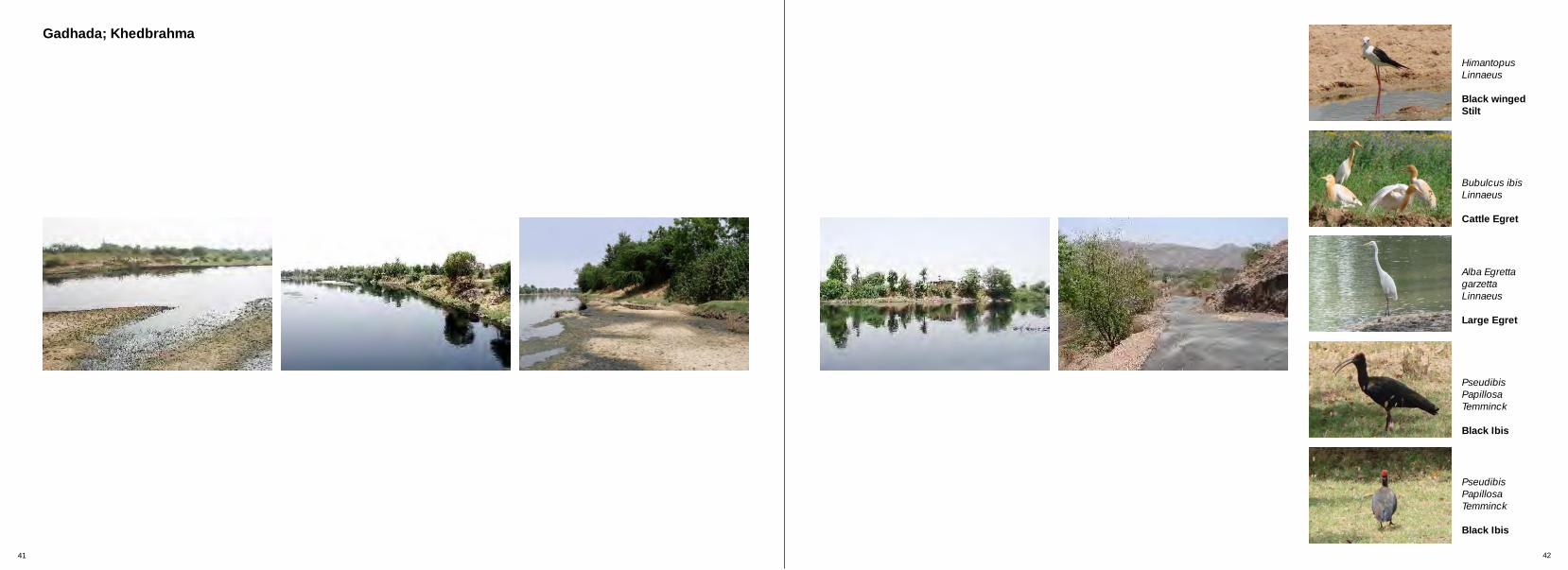
“We have spent two generations on the banks of Sabarmati River; she is our only life line. We do farming here and are completely dependent on the river. There is illegal mining going on in the river bed and the contractors are selling the river sand illegally; are you a reporter? Then please write about it! We grow different crops in different seasons; in summer we do agriculture in the river bed which helps us financially. Government has built a bridge across the river because of which water comes out of it with tremendous pressure in monsoon and erodes the surrounding area and forms large pits. Due to this, slowly the flow of river is changing, please write all this !”
Gadhada; Khedbrahma
22 - 26°C40 - 43°C
Min. Max.
750
l Altitude - 201mt (670.0ft.)l Average annual rainfall - 625mm
400 450 500 550 600 650 700
lTemp In Summer In Winter 10 - 12°C24 - 29°C
11 12
River bank
Vegetation cover at river bank
Water logged area landKishanbhai
0 10 30 50mt
River Cross Section
“y{khe çku ÃkuZeyu Mkkçkh{íke Ãkhs SðLk rðíkkÔÞw Au, Mkkçkh{íke LkËes íkku y{khe SðLksLkLke Au. y{u ¾uíke fheÞu Aeyu yLku y{khku çkÄku ykÄkh LkËe Ãkh Au. ynª Mkkçkh{íkeLkk Ãkx Ãkh økuhfkÞËuMkh ¾kuËfk{ [k÷u Au yLku yneLkª {kxe fkuLxÙkfxh ðu[e ykðu Au, ík{u Ãkºkfkh Aku? íkku y{khe VheÞkË AkÃkòu! y{u yne Éíkw Lkk rnMkkçku Ãkkf WøkkzeÞu Aeyu, økh{e {kt y÷øk, ðhMkkË{kt y÷øk. WLkk¤k{kt íkku LkËeLkk Ãkx Ãkh ¾uíke fheÞu Aeyu suÚke ykŠÚkf heíku Úkkuze MknkÞ ÚkE hnu Au. Mkhfkhu çkLkkðu÷k Mkkçkh{íke LkËe ÃkhLkk Ãkw÷ Lkk r÷Äu ðhMkkË{kt ÃkkýeLkku «ðkn yðhkuÄkÞ Au suÚke Ãkkýe íÞkÚke VwðkhkLke su{ çknkh ykðu Au yLku yuLke ykMkÃkkMk Lkk rðMíkkh{kt {kuxk ¾kzk Ãkkze Ëu Auu suLkk r÷Äu LkËeLkk «ðkn Lke rËþk Äehu Äehu çkË÷kE hne Au, ÷¾òu Lku!”
v gi eRi er banks in this re on ar very sharp and e r y y hebecaus of the unde l ing hard, rock stratum t y
one e duare less pr to rosion ring monsoon.
a r s otDense natural veget tion at the rive bank pr ect of gthe boundary the river course from gettin heavily
o eer d d during monsoon.
r v our p The ha d banks make the ri er c se dee and en l hence, water is pres t in amp e amount in this
egi a ar on. Portions of the river bed re w ter logged and i a coccas onally f rming is practi ed there. It is mainly
w ow and.cash crops hich are gr n on this marshy l
er i i fThe river bed is very f t le. People pract cing arming t gr aon he river bank manage to ow good mount of
bacrops. Even though the fields on the river nk get ng s d sflooded duri the rain ; the har rocky tratum
rbelow p events them from getting eroded isubstant ally.
oi e y oa lThe s l her is ver shallow, l my-skeletal, we l ai ydr ned and at places, it is cla ey.
Agricultural FieldAgricultural FieldRiver BedDry
River PlainDry River PlainAgricultural FieldNative Vegetation at the River Bank
Native Vegetation at the River Edge
View taken from the over bridge looking downstream towards Idar
View taken from one river bank looking towards the other one
View taken from the over bridge looking upstream towards Ambaji

“I am staying here for last forty years. Sabarmati River and this temple on the bank of the river is everything for me. I have spent my entire life on the banks of Sabarmati and have seen her changing. Are you a reporter? You look like a student. Twenty-two years before, the bank of the river was far away but in the last two decades, the river bed has increased in width and the bank has come closer to the temple. The soil at the bank of the river is loose, it gets eroded during monsoon. Earlier people used to practice agriculture till about five hundred meters from this temple towards the river, but now the course of the river has changed and it has come very close to the temple leaving very little land for agriculture.”
Valasana; Idar
24 - 26°C40 - 45°C
Min. Max.
750
l Altitude - 195mt (650.0ft.)l Average annual rainfall - 700mm
400 450 500 550 600 650 700
lTemp In Summer In Winter 10 - 12°C27 - 30°C
13 14
Agricultural field on river bed
River bed
Fields in linear pattern on river bed
River Cross Section
0 10 30 50mt
Manekbhai
h B a t iThe river bed ere is wide. ec use of he very m ld v islope in this region, the ri er deposits ts silt on the
banks.
l a t ow eThere is very litt e w ter present in he river. H ev r, ex e of otthe bed is tremely fertil and almost half the t al
of i l aswidth t is used as agriculture fie ds to grow c h l ds ecrops. The agricultura fiel are mark d on the river
a rbed in line r pattern just next to the rive bank.
Many types of seasonal crops are grown in the river os hs lbed for alm t six mont during summer. The sma l
h i samount of water present in t e river s u ed for i dsirr gating these fiel .
hi t In t s region, a major por ion of agricultural fields e ban e snext to the riv r ks hav been wa hed away by
osurface er sion during monsoon due to heavy rains. r doi on er bed Hence, people a e ng farming the riv in
o summer. Some farming is als done on the river banks.
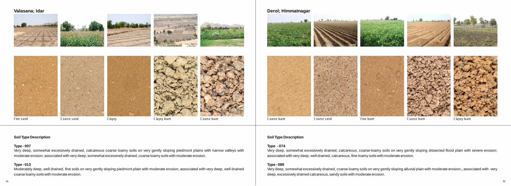
i y arThe soil here s excessivel drained, calc eous, at ocoarse, loamy type and moder ely prone to er sion.
Agricultural FieldFertile River PlainNative Vegetation at the River EdgeRiver BedFertile River PlainAgricultural Field
Native VegetationAgricultural Field
View taken from the over bridge looking downstream towards Himmatnagar
View taken from the river bank looking towards agriculture fields on the bed
View taken from the over bridge looking upstream towards Khedbrahma

“I have been staying here for the last thirty seven years. Village is surrounded by hilly region on one side and a flat terrain on the other side. The river is deep here and we do agriculture next to the river bed, some farmers do farming on the hilly areas. People here have two main occupations agriculture and fishing. On the left bank of the river there is a high rocky stratum so the pressure of water remains on the flatter side. In rainy season due to excessive pressure of water, soil erosion takes place on the flatter side because of which the width of the river bed is increasing. Both my sons have gone to the city in search of better employment. Many farmers are facing this problem and hence, in coming years the practice of agriculture will get reduced.”
Derol; Himmatnagar
23 - 25°C40 - 44°C
Min. Max.
750
l Altitude - 127mt (423.30ft.)l Average annual rainfall - 630mm
400 450 500 550 600 650 700
lTemp In Summer In Winter 7 - 10°C
32 - 36°C
15 16
Meandering of the river
River course
High rocky stratum at the bankSuryakantbhai
0 10 30 50mt
River Cross Section
i r e s In th s egion, the riv r meander slightly towards i r h Br ght bank as the ig t bank has flat terrain. ut the left
r u habank has a very hard rocky st at m. The left bank s v on athick native egetati adj cent to it and the right
ebank supports scrub v getation.
iThe r ver is deep in the central portion which r usupports fishing activity. Due to hard st at m towards
ba a s i tleft nk, water ccumulation is een n tha part.
m l a o During onsoon water gets fil ed up ne rly up t the of oc s on lupper level the r ky tratum the eft bank of the
i cr ver ourse.
s rDuring monsoon, many times piece of rock f om the a banks f ll off and the bank gets heavily eroded. This
dt hhas increased the wi h of t e river bed.
h i es v sSoil ere s somewhat exc si ely drained, coar e pe e pr osloamy-ty and sev rely one to er ion.
Thick Native Vegetation at The River Edge River Bed Fertile River Plain Agricultural FieldRiver BedNatural
Vegetation
View taken from Derol village looking at the turn of the river course downstream towards Sadra
View taken from Derol village looking closely at the sharp turn of the river
View taken from one bank of the river looking towards the other bank

“In Sadra village the Sabarmati River flows through a rocky area due to which farming is not possible along the river bed. Most of the fields are far from the river. We grow vegetables here but the production is very low. In summer, many farmers grow flowers and sell them to the nearby city. They make good money out of it. We also do agriculture in the river bed but in last few years because of illegal mining on the river bed, the fertility of the soil has decreased and we are forced to use more fertilizer. Secondly, because of mining the soil loosens up and thus, erosion increases during the monsoon which adversely affects the agricultural practice.”
Sadra; Gandhinagar
20 - 24°C35 - 43°C
Min. Max.
750
l Altitude - 90mt (300.0ft.)l Average annual rainfall - 675mm
400 450 500 550 600 650 700
lTemp In Summer In Winter 8 - 11°C
26 - 30°C
17 18
River course
Left river bank
Right river bankNitinbhai
River Cross Section
0 10 30 50mt
River BedWalkwayNative
VegetationAgricultural FieldAgricultural Field Thick Native Vegetation Cover at the River Bank Agricultural Field
t r v banks e y gh n hi r on,As he i er ar not ver hi i t s egi m i pl el i m .Sabar at river dries up com et y dur ng sum er
r v ong a i mThe right bank of the i er al Sadr v llage is uch han bank he t de.higher t the on t lef si
i f t ocat t ,Agr cultural ields are hus, l ed on he higher i he i ve a ar v eep r ght bank of t r ver. Ri r b nks e ery st on
nd l t a o tthis side a gent er on the opposite, lef b nk f he ir ver.
i occ i t r v bed.Illegal m ning of river sand urs n he i er of hi ni l verBecause t s mi ng the soi of the ri bed
and el r on.loosens up becomes sever y prone to e osi
i on r ve rThe nat ve vegetation the i r banks has educed ot t i hea l due o excessive eros on in t monsoon.
t i e lIn he ra ny season becaus of the loose soi he r v get erstructure, t i er bank s highly oded and
he dt of i ehence, t wi h the river course ncr ases which y af ec he ul ur f el .adversel f ts t agric t al i ds along the river
l t of som siThe soi ype the region is ewhat exces vely ai - oam pe.dr ned and coarse l y ty
View taken from one of the old forts at the river bank looking towards the river course
View taken from the river bed looking upstream towards Sadra village
View taken from the river bed looking downstream towards Palaj village.

“I have been staying in Palaj for last twenty seven years and agriculture is our main occupation. Earlier there used to be water in Sabarmati river for six to eight months because of which we were able to grow good amount of crop, but in the last twenty seven years water level of Sabarmati river has decreased substantially. Earlier because of the production of good amount of crop we faced no financial problems but as now Sabarmati dries up in three months and remains dry for the rest of the year, production of crop has become very less and therefore the money we get from that is not sufficient to run our family. Youngsters are heading towards the city in search of the better employment, which is adversely affecting livelihood from agriculture”.
Palaj; Gandhinagar
19 - 25°C36 - 42°C
Min. Max.
750
l Altitude - 81mt (270.0ft.)l Average annual rainfall - 700mm
400 450 500 550 600 650 700
Temp In Summer In Winter 7 - 10°C
29 - 31°C
19 20
Water bodies at the river bank
River bed
Eroded part on the river bedRanchhodbhai
River Cross Section
0 10 30 50mt
i e r ver gh. The r ver bed The r ver banks her a e y hi i thus,s e m l er i s appear deep and ther are s al wat bod e
es n r verpr ent i the i bed.
par h f l up i o er A t of t e river bed is ul ed w th s me wat ;her se r ve s o et y iot wi the i r i c mpl el dr ed up.
i t al i ds e es bot t si he Agr cul ur f el ar pr ent on h he de of ti er banks.r v
us s s hei l e qui n he i er Ind trie di charge t r pol ut d li ds i t r v .r t w t e nks gh ev The st eam of he a er her sti and has hi l el
l i ent eopl use t o i ed of f uor de cont . P e he c ntam nater f r i i w e f hi at wat or i r gat on, una ar of the act that t s w er
adv el f i er i i ofis ers y af ect ng the f t l ty the soil.
s par t r ver banks s ghl pr o he Mo t t of he i i hi y one t tos o he ver oose er i n because of t y l soil structure.
r ver i ever y od d uat on s The i bed s s el er e . The sit i it g of i eg m ni and get in worse because ll al i ng
t i i and B ause s, t transpor at on of r ver s . ec of thi he riverhas ur oosen i one o s e bed f ther l up and s pr t ever
os o i mer i n dur ng onsoon.
l s of cal r se l y and The soi here i ca eous, coar oam type one er on.pr to osi
River Bed Agricultural FieldAgricultural FieldFertile River PlainFertile River PlainAgricultural FieldPathwayAgricultural
FieldNative
VegetationNative
Vegetation
View taken from the river bed looking upstream towards Palaj
View taken from the river bed looking downstream towards Dholka
View taken from the river bed looking at the left bank of the river

“Our family is staying on the bank of Sabarmati River for last thirty five years. Sabarmati has given us many things but in return
has taken major part of our land. Where you are standing right now is only one-third of our total land, the other two-third has
been washed out due to soil erosion in rainy season. Because of less availability of land we do agriculture in the river bed. As it
is more fertile we grow good quantity of crops on it. This is possible only for four to six months during summer season because
the river remains filled up with water for rest of the year. Because of the lack of sufficient land and less crop we are facing
financial problems. Government needs to make some plans for the betterment of the village.”
Paldikankrej; Ahmedabad
23 - 25°C43 - 45°C
Min. Max.
750
l Altitude - 48mt (160.0ft.)l Average annual rainfall - 625mm
400 450 500 550 600 650 700
Temp In Summer In Winter 12 - 15°C32 - 35°C
21 22
Small stream of Sabarmati river
Agricultural field on the river bank
Fertile river bedSavjibhai
River Cross Section
0 10 30 50mt
nu eThere is a small conti ous str am of Sabarmati river er s i ein the region. Wat from the tream s us d for
i r virr gating fields in the i er bed.
s t ea The river bed on both ide of the s r m is extremely d he rfertile an hence, people use t river bed to g ow
crops.
alFarming is so done on the banks of the river. The s i y d t ifield een s onl one-thir of the otal f eld. The other
two-thirds has been washed away during monsoon.
e er eThe wat r in the riv is how ver not good for i e r di lirr gation becaus indust ies scharge their pol uted
liquid in it.
v t mFarmers ha e cu a strea from the river course and r o h u lhave di ected it t t e agricult ral fie ds. Because of
f p m mthis, armers don't have to u p water from the ain a c y a on rstream nd hen e, the s ve ene gy.
he ned, c rThe soil re is well drai alca eous fine loamy l i m atype, has s ight sal nity and is oder tely prone to
oer sion.
River Bed Dry River Plain Agricultural FieldAgricultural Field Agricultural Field Fertile River Plain Agricultural Field
View taken from the over bridge looking upstream towards Ahmedabad
View taken from a bank of the river covering agriculture fields on both banks
View taken from the over bridge looking downstream towards Dholka

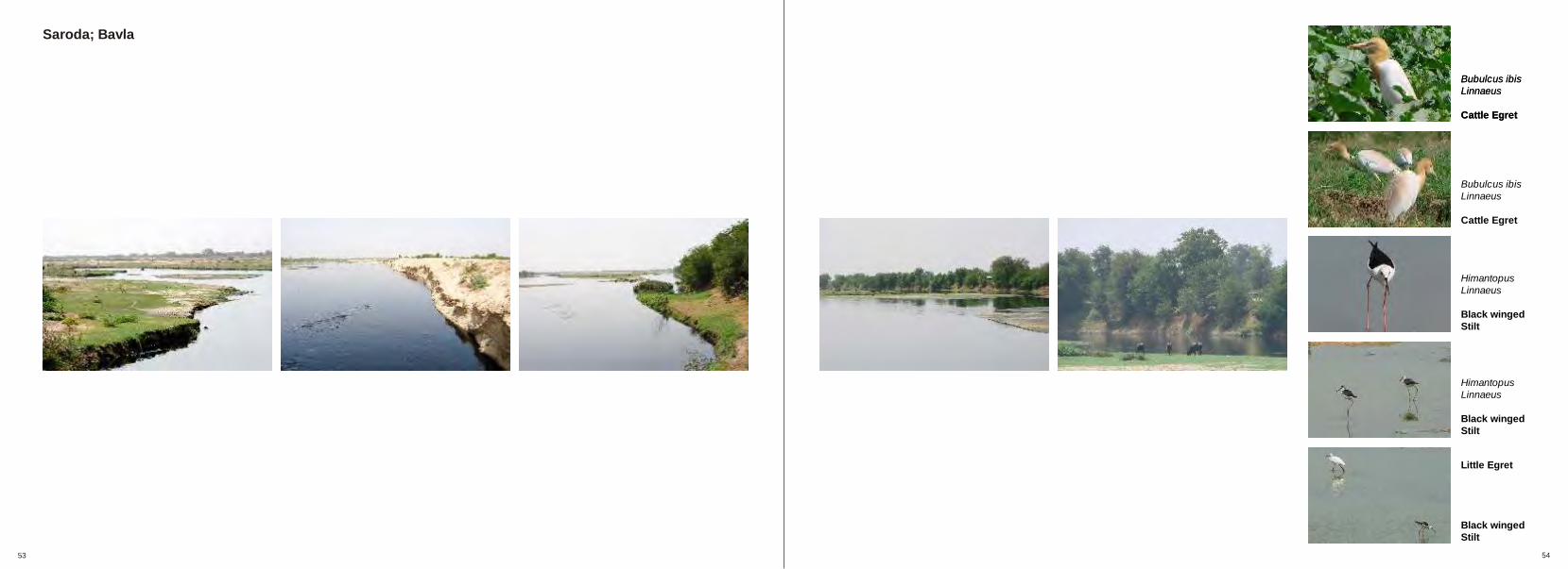
“I stay at the banks of Sabarmati River and do farming. I have seen three generations here. This part of Sabarmati is very deep and marshy, water remains in the river round the year. As the agricultural fields are just adjacent to the river they get filled up in monsoon. Because of the good fertility of the soil we grow vegetables along with many other crops. There is no scarcity of water but in rainy season due to soil erosion we are losing a part of our fertile land every year. Government needs to build dam here so that the flow of the river can be regulated and the water can be used for agriculture.”
Saroda; Bavla
25 - 27°C43 - 45°C
Min. Max.
750
l Altitude - 15mt (50.0ft.)l Average annual rainfall - 600mm
400 450 500 550 600 650 700
Temp In Summer In Winter 11 - 13°C20 - 22°C
23 24
River bank prone to high erosion
Thick native vegetation at the bank
Agricultural field on the river bankJethabhai
River Cross Section
0 10 30 50mt
River Bed Marshy Land Thick Natural Vegetation Agricultural FieldAgricultural FieldFertile River PlainAgricultural Field Agricultural Field
s ai her w er a The irregular haped terr n seen e as earli ast agr c f el hi al w shed v i ultural i d w ch has most been a
because he er n. Ri s away of t heavy osio ver bed hai wi ecaus ch at increased n dth b e of whi w er
col eads and ap a asper ates, spr ev or tes f ter.
v at on r on r ve Thick eget i is p esent the i r bank.a cover p n ng he s on Veget tion hel s i decreasi t ero i but
not abl t s t com et y o he is e o top i pl el . Just adjacent t teg t i er her ar i e i s ch v e at on cov t e e agr cultur f eld whi
f l w at i on oon o get i led ith w er dur ng m s and are prone tos oer i n.
t l e has d st at bel Par of the and her a har r um ow.of , he and get subm ged dur ng Because this t l s er i
ons but does n get washed m oon ot away.
t l t i f t l and deep As he upper ayer of he soil s er i e o f m ng, f m s ow op t f enough f r ar i ar er gr cash cr s on i or
t s x ont n um eralmos i m hs i s m .
s i e s l dr ned, cal eous wi h The o l type her i wel ai car , toder e al ni and at pr tm at s i ty is moder ely one o erosion.
View taken from the over bridge looking downstream towards Khambhat
View taken from the over bridge looking upstream towards Paldikankrej
View showing the river bank

“When I came to Sahij, there were hardly fifteen houses and most of the people used to practice farming. At that time the land
was very fertile and we use to grow many types of crop on it. Village has progressed very much over the years because of the
farming practice. Today people are still doing agriculture on both the sides of the river but the fertility of the soil and water level
of the river has decreased substantially which has severely affected the crop yield. Water level remains very low for six months
and in summer the river dries up completely. Now we cannot depend only on the river for livelihood hence, to earn money we
are forced to do other labor.”
Sahij; Dholka
23 - 25°C43 - 45°C
Min. Max.
750
l Altitude - 17mt (56.60ft.)l Average annual rainfall - 562mm
400 450 500 550 600 650 700
Temp In Summer In Winter 10 - 11°C20 - 22°C
25 26
River Cross Section
0 10 30 50mt
River bank
Eroded part of the river bank
Eroded agricultural fieldRamnikbhai
v dThe river banks here are ery steep an less eroded. v on r at Thick egetati cove the river banks protect the r bank f om getting heavily eroded.
par v he t amThis t of the ri er is deep and nce, i has ple i ramount of water for r igation.
e vAgricultural fields are pr sent on both the ri er banks. s ur ac oThese field faces s f e er sion and get heavily
o eer d d during the monsoon.
ng r Because of the continuous draini of water f om the ur ds adjacent agricult e fiel , the part from where water
he r ou i vjoins t rive c rse, has got heav ly eroded o er a i t a er a per od of ime. The veget tion cov of that are is
adua ght tgr lly reducing and this mi affec the river banks.
a a i As the soil here is s ndy, f rm ng is not practiced on i uc hthe r ver bed. The soil str ture of t e surrounding
l s t iarea is also oose and i prone o eros on.
s r w fThe oil type he e is ell drained, calcareous, ine s e o onand i s verely prone t erosi .
River Bed Marshy LandNative
Vegetation Agricultural Field Agricultural FieldNative
VegetationAgricultural FieldAgricultural FieldNative
Vegetation
View taken from the over bridge looking downstream towards Khambhat
View taken from the one river bank looking towards the other one
View taken from the over bridge looking upstream towards Ahmedabad

“Sabarmati River empties into Arabian Sea through Gulf of Khambhat. In my last sixteen years of staying here I have not observed any kind of major change in the river. As the soil here is very fertile, most of the people do farming practice here. The soil is also taken away to be used as manure in fields further away. Illegal transportation of river silt also happens here. Climate of Khambhat is ideal for many types of crop production. People have readily participated in the government initiated project of rain water harvesting. Water which is accumulated is mostly used in agriculture and also for other purposes. Any kind of serious problem never arises in any season. Village has developed a lot because of Sabarmati River.”
Vadgam; Khambhat
20 - 22°C36 - 38°C
Min. Max.
750
l Altitude - 8mt (26.60t.)l Average annual rainfall - 700mm
400 450 500 550 600 650 700
Temp In Summer In Winter 10 - 12°C25 - 30°C
27 28
Shrenikbhai
Severely eroded river bank
Bank as seen from Arabian sea
Water logged land
0 10 30 50mt
River Cross Section
Arabian Sea Marshy Land Marshy LandNative
Vegetation Agricultural Field Agricultural Field Agricultural FieldNative
Vegetation
h e hThe stretc along the riv r ere is very fertile & very ar iuseful for f m ng.
e oi Because of th loose s l structure & heavy rainfall, i b nk ar err ver a s e getting heavily oded during
s ea rmonsoon. The river bank here ha alr dy e oded by v hundr ue eaabout fi e ed meters. D to h vy erosion, the
of s size the river bed ha increased and it has eaten he f ng linto t adjacent ields maki them smal er.
s u er nk oosThe soil tr cture of the riv ba here is so l e f e hethat i w stand on it and give a slight push t whole
t dipor ion will fall down imme ately.
t et t nd baThere is a s r ch of a wa er logged la at the nk t i A t m of he r ver. s he Sabar ati empties into the bi depos of l rAra an Sea it its large amount si t he e.
lThis soil is also taken away to be used as a ferti izer in ethe fi lds farther away.
t arThe soil here is imperfec ly drained, calc eous, m acoarse-loamy type with oder tely prone to erosion.
View taken from the river bank looking towards Arabian Sea
View taken from the middle of the sea looking towards the heavily eroded river bank of vadgam
View taken from the terrace of the temple located at the bank, looking towards the sea and the agriculture fields

Soil types
01. Kheroj; Ambaji02. Gadhada; Khedbrahma03. Valasana; Idar04. Derol; Himmatnagar05. Sadra; Gandhinagar06. Palaj; Gandhinagar07. Paldikankrej; Ahmedabad08. Saroda; Bavla09. Sahij; Dholka10. Vadgam; Khambhat

Soil Type Description
Type - 004Shallow, well drained, loamy-skeletal soils on undulating piedmont with severe erosion and moderate stoniness; associated with very deep, well
drained, coarse-loamy soils on very gently sloping lands with moderate erosion.
Type - 008Very deep, well drained, fine loamy soils on very gently sloping piedmont plain with moderate erosion; associated with very deep, well drained,
coarse-loamy soils with moderate erosion.
Kheroj; Ambaji Gadhada; Khedbrahma
Soil Type Description
Type - 012Shallow, well drained , loamy soils on very gently sloping piedmont plain with narrow valleys with severe erosion; associated with shallow, well
drained, clayey soils with moderate erosion.
Type - 004Shallow, well drained, loamy-skeletal soils on undulating piedmont with severe erosion and moderate stoniness; associated with very deep, well
drained, coarse-loamy soils on very gently sloping lands with moderate erosion.
29 30
Clayey loam Silty Fine sand Fine loam Coarse loam Silty Clayey loam Coarse sand Coarse sand Coarse sand
Soil Type Description
Type - 007Very deep, somewhat excessively drained, calcareous coarse loamy soils on very gently sloping piedmont plains with narrow valleys with
moderate erosion; associated with very deep, somewhat excessively drained, coarse loamy soils with moderate erosion.
Type - 013Moderately deep, well drained, fine soils on very gently sloping piedmont plain with moderate erosion; associated with very deep, well drained
coarse loamy soils with moderate erosion.
Valasana; Idar Derol; Himmatnagar
Soil Type Description
Type - 074Very deep, somewhat excessively drained, calcareous, coarse-loamy soils on very gently sloping dissected flood plain with severe erosion;
associated with very deep, well drained, calcareous, fine-loamy soils with moderate erosion.
Type - 089Very deep, somewhat excessively drained, coarse-loamy soils on very gently sloping alluvial plain with moderate erosion,; associated with very
deep, excessively drained calcareous, sandy soils with moderate erosion.
31 32
Fine sand Coarse sand Clayey Clayey loam Coarse loam Coarse loam Coarse sand Fine loam Coarse loam Clayey loam

Soil Type Description
Type - 074Very deep, somewhat excessively drained, calcareous, coarse-loamy soils on very gently sloping dissected flood plain with severe erosion;
associated with very deep, well drained, calcareous, fine-loamy soils with moderate erosion.
Type - 097Very deep, well drained, fine-loamy soils on very gently sloping alluvial plain with moderate erosion, associated with very deep, moderately well
drained calcareous, fine-loamy soils with moderate erosion.
Sadra; Gandhinagar Palaj; Gandhinagar
Soil Type Description
Type - 088Very deep, somewhat excessively drained, coarse-loamy soils on nearly level alluvial plain with slight erosion; associated with very deep,
excessively drained, calcareous sandy soils with moderate erosion.
Type - 074Very deep, somewhat excessively drained, calcareous, coarse-loamy soils on very gently sloping dissected flood plain with severe erosion;
associated with very deep, well drained, calcareous, fine-loamy soils with moderate erosion.
33 34
Fine sand Clayey loam Coarse sand Coarse loam Fine loam Fine loam Sandy loam Fine sand Coarse sand Clayey loam

Soil Type Description
Type - 079Very deep, moderately well drained, calcareous fine loamy soils on very gently sloping flood plain with slight erosion and slight salinity;
associated with deep, moderately well drained, calcareous fine soils with slighter erosion and slighter salinity.
Type - 100Deep well drained, fine loamy soils on very gently sloping alluvial plain with slight erosion and slight salinity; associated with deep moderately
well drained, calcareous, fine soils on gently sloping lands with moderate erosion.
Paldikankrej; Ahmedabad Saroda; Bavla
Soil Type Description
Type - 115Moderately deep, moderately well drained, calcareous, fine soils on very gently sloping alluvial plain with slight erosion and slight salinity;
associated with deep, moderately well, drained, calcareous, fine soils with moderate erosion.
Type - 079Very deep, moderately well drained, calcareous fine loamy soils on very gently sloping flood plain with slight erosion and slight salinity;
associated with deep, moderately well drained, calcareous fine soils with slighter erosion and slighter salinity.
35 36
Silty Fine loam Clayey Clayey loam Coarse sand Silty Fine sand Coarse loam Clayey loam Coarse loam

Soil Type Description
Type - 079Very deep, moderately well drained, calcareous fine loamy soils on very gently sloping flood plain with slight erosion and slight salinity;
associated with deep, moderately well drained, calcareous fine soils with slighter erosion and slighter salinity.
Type - 098Very deep, well drained, fine loamy soils on very gently sloping alluvial plain with moderate erosion; associated with very deep, well drained,
coarse-loamy soils with moderate erosion.
Sahij; Dholka Vadgam; Khambhat
Soil Type Description
Type - 078Very deep, imperfectly drained, calcareous, coarse-loamy soils on very gently sloping dissected flood plain with moderate erosion and strong
salinity; associated with moderately deep, imperfectly drained, calcareous fine soils with slight erosion and moderate salinity.
Type - 116Moderately deep, well drained, calcareous, fine soils, on very gently sloping alluvial plain with slight erosion and moderate salinity; associated
with deep, moderately well drained, calcareous, fine soils with moderate erosion.
37 38
Coarse sand Coarse loam Fine loam Clayey loam Coarse loam Silty loam Silty Fine sand Clayey loam Coarse loam

Landscape Vignettes
01. Kheroj; Ambaji02. Gadhada; Khedbrahma03. Valasana; Idar04. Derol; Himmatnagar05. Sadra; Gandhinagar06. Palaj; Gandhinagar07. Paldikankrej; Ahmedabad08. Saroda; Bavla09. Sahij; Dholka10. Vadgam; Khambhat

39
Kheroj; Ambaji
40
Alba Egretta garzetta Linnaeus
Large Egret
Dicrurus adsimilis Bechstein
Black Drongo or King Crow
Himantopus Linnaeus
Black winged stilt
Saxicola torquata Linnaeus
Collard Bushchat
Bubulcus ibisLinnaeus
Cattle Egret
41
Gadhada; Khedbrahma
42
Bubulcus ibis Linnaeus
Cattle Egret
Alba Egretta garzetta Linnaeus
Large Egret
Pseudibis Papillosa Temminck
Black Ibis
Himantopus Linnaeus
Black winged Stilt
Pseudibis Papillosa Temminck
Black Ibis

43
Valasana; Idar
44
Pavo cristatus Linnaeus
Common Peafowl
Bubulcus ibis Linnaeus
Cattle Egret
Alba Egretta garzetta Linnaeus
Large Egret
Alba Egretta garzetta Linnaeus
Large Egret
Corvus splendens Vieillot
House Crow

45
Derol; Himmatnagar
46
Acridotheres ginginianus Latham
Bank Myna
Vanellus indicus Boddaert
Red wattled Lapwing
Nectarinia asiatica Latham
Purple Sunbird
Halcyon smyrnensis
Whitebrested Kingfisher
Acridotheres ginginianus Latham
Bank Myna

47
Sadra; Gandhinagar
48
Pavo cristatus Linnaeus
Common Peafowl
Himantopus Linnaeus
Black winged Stilt
Vanellus indicus Boddaert
Red wattled Lapwing
Alba Egretta garzetta Linnaeus
Large Egret
Columba livia Gmelin
Blue Rock Pigeon

49
Palaj; Gandhinagar
50
Bubulcus ibis Linnaeus
Cattle Egret
Egretta garzetta Linnaeus
Little Egret
Himantopus Linnaeus
Black winged Stilt
Little Egret
Black winged Stilt
Himantopus Linnaeus
Black winged Stilt
Himantopus Linnaeus
Black winged Stilt

51
Paldikankrej; Ahmedabad
52
Bubulcus ibis Linnaeus
Cattle Egret
Bubulcus ibis Linnaeus
Cattle Egret
Sarus Cranes
Spoonbill
White Ibis
Grus antigone Linnaeus
Sarus Cranes
Phoenicopterus roseus Pallas
Flamingo
53
Saroda; Bavla
54
Bubulcus ibis Linnaeus
Cattle Egret
Bubulcus ibis Linnaeus
Cattle Egret
Himantopus Linnaeus
Black winged Stilt
Himantopus Linnaeus
Black winged Stilt
Little Egret
Black winged Stilt
Bubulcus ibis Linnaeus
Cattle Egret

55
Sahij; Dholka
56
Bubulcus ibis Linnaeus
Cattle Egret
Cattle Egret
Large Egret
Alba Egretta garzetta Linnaeus
Large Egret
Pseudibis Papillosa Temminck
Black Ibis
Vanellus indicus Boddaert
Red wattled Lapwing

57
Vadgam; Khambhat
58
Alba Egretta garzetta Linnaeus
Large Egret
Anastomus oscitans Boddaert
Open billed stork
Pseudibis Papillosa Temminck
Black Ibis
Alba Egretta garzetta Linnaeus
Large Egret
Alba Egretta garzetta Linnaeus
Large Egret

Appendix
01. Rainfall data02. Soil key chart03. Crop chart04. Native Flora

Rainfall Data
l Sabarmati River flows through six districts of Gujarat state before emptying into the Gulf of Khambhatl Standard week number is the total number of week of the year in continuation, counting first week of the year from first of Januaryl Rainfall data of four districts is as followsl Reference is taken from the Agroclimatic Atlas of India
Ahmedabad and Gandhinagar
The normal rainfall of Ahmedabad is 617.4 mm and number of rainy days are 28. Within the district the annual rainfall vary between 500 to 750 mm. The time series of annual rainfall data of the district does not indicate any increasing or decreasing trend in 90 years period. The highest rainfall (1444.5 mm) in the district was recorded in 1927, while the lowest (201 mm) was recorded in 1918. Ahmedabad district experienced drought every 20 years, while district experienced excessive rainfall every 17 years.
About 95% of annual rainfall is received in four months period (June to September) of which July contributes maximum (38.3% of annual rainfall) followed by August (26.8%). June and September contribute about 13% and 16% respectively. January though may altogether contribute only 2% to annual rainfall, while October and November contribute more than 3% of annual rainfall.
During June, the weekly rainfall ranges between 12 to 36 mm, however the sufficient rainfall for sowing is received only in the last week i.e. standard week 26 (June 25 - 1July). The weekly rainfall increases during June and July and reaches to its maximum value (72 mm) in standard week 30 (July23-29) thereafter, weekly normal rainfall is less than 10mm.
Kheda
The normal annual rainfall of Kheda district is 808.5 mm in 35 rainy days. The spatial variation of rainfall in the district is observed between 700 to 900mm. The highest rainfall (1946 mm) was observed in 1927, while the lowest was (128mm) in 1973. During last 88 years, the district experienced droughts every 22 years, while excessive rainfall in every 23 years. More than 95 % of annual rainfall is received during June to September months. In Kheda district the maximum monthly rainfall is received in July (319mm) followed by August (225 mm), September (131.5 mm) and June (98.3 mm). October and November contribute 2.8% to annual rainfall.
The weekly rainfall during standard week 25 (June 18-24) is insufficient for sowing purpose. Adequate amount is received only in standard week 26 (June 25-July 1). The highest weekly rainfall (89 mm) is received in standard week 30 (July 23-29). The monsoon rain ceases in the third week of September.
Mehsana
In Mehsana district, the rainfall records are available only after 1927. The normal rainfall of the district is 603.4 mm which is received in 28 rainy days. The lowest rainfall (258 mm) was recorded in 1929, while the highest (1253 mm) was recorded in 1927. The spatial rainfall variation in the district is between 450-700 mm. Out of 60 years of rainfall data, about 23% of years experienced drought and equal percentage of years experienced excessive rainfall.
About 96 % of annual of the district is received during June- September months. July receives the maximum monthly rainfall (235.7 mm) followed by August (181.7 mm). June and September contribute about 10 % and 16 % respectively to the annual rainfall. October and November
altogether contribute about 2.2% to annual rainfall.
The sowing rains are received in standard week 26 (June 25 to July 1). The weekly rainfall increases with the advancement of monsoon and reaches to the maximum (62.4 mm) in standard week 30 (July 23-29), then decreases continuously during rest of the monsoon. After second week of September the weekly rainfall is less than 25mm which further decreases continuously during rest of the months.
Sabarkantha
The normal rainfall of Sabarkantha district is 807.4mm in 35 rainy days. The annual rainfall varies between 675 mm to 950 mm in the different parts of the district. Modasa and Idar records highest rainfall. The past rainfall records do not indicate any trend in annual rainfall in the district. The highest rainfall (1543 mm) was received in 1937 while the lowest (273 mm) was received in 1911. Out of 86 years, drought occurred in 25 years, while excessive rainfall (25% above normal) occurred in 26 years.
About 96% of annual rainfall of Sabarkantha district is received due to South-West monsoon rains. July receives (309 mm) rainfall followed by August (251.6 mm) rainfall and September contributes 15.8 % respectively. Only 12.3mm of rainfall is received during October. The highest weekly rainfall (82 mm) is received in standard week 30 (July 23-29). The monsoon rain ceases after standard week 38 (September 17-23).
59 60

Type - 079Very deep, moderately well drained, calcareous fine loamy soils on very gently sloping flood plain with slight
erosion and slight salinity; associated with deep, moderately well drained, calcareous fine soils with slighter
erosion and slighter salinity.
Type - 088Very deep, somewhat excessively drained, coarse-loamy soils on nearly level alluvial plain with slight erosion;
associated with very deep, excessively drained, calcareous sandy soils with moderate erosion.
Type - 089Very deep, somewhat excessively drained, coarse-loamy soils on very gently sloping alluvial plain with moderate
erosion,; associated with very deep, excessively drained calcareous, sandy soils with moderate erosion.
Type - 097Very deep, well drained, fine-loamy soils on very gently sloping alluvial plain with moderate erosion, associated
with very deep, moderately well drained calcareous, fine-loamy soils with moderate erosion.
Type - 098Very deep, well drained, fine loamy soils on very gently sloping alluvial plain with moderate erosion; associated
with very deep, well drained, coarse-loamy soils with moderate erosion.
Type - 100Deep well drained, fine loamy soils on very gently sloping alluvial plain with slight erosion and salinity; associated
with deep moderately well drained, calcareous, fine soils on gently sloping lands and moderate erosion.
Type - 115Moderately deep, well drained, calcareous, fine soils on very gently sloping alluvial plain with slight erosion and
slight salinity; associated with deep, moderately well, drained, calcareous, fine soils with moderate erosion.
Type - 116Moderately deep, well drained, calcareous, fine soils, on very gently sloping alluvial plain with slight erosion and
moderate salinity; associated with deep, moderately well drained, calcareous, fine soils with moderate erosion.
Type - 004Shallow, well drained, loamy-skeletal soils on undulating piedmont with severe erosion and moderate stoniness;
associated with very deep, well drained, coarse-loamy soils on very gently sloping lands with moderate erosion.
Type - 007Very deep, somewhat excessively drained, calcareous coarse loamy soils on very gently sloping piedmont plains
with narrow valleys with moderate erosion; associated with very deep, somewhat excessively drained, coarse
loamy soils with moderate erosion.
Type - 008Very deep, well drained, fine loamy soils on very gently sloping piedmont plain with moderate erosion; associated
with very deep, well drained, coarse-loamy soils with moderate erosion.
Type - 012Shallow, well drained , loamy soils on very gently sloping piedmont plain with narrow valleys with severe erosion;
associated with shallow, well drained, clayey soils with moderate erosion.
Type - 013Moderately deep, well drained, fine soils on very gently sloping piedmont plain with moderate erosion; associated
with very deep, well drained coarse loamy soils with moderate erosion.
Type - 074Very deep, somewhat excessively drained, calcareous, coarse-loamy soils on very gently sloping dissected flood
plain with severe erosion; associated with very deep, well drained, calcareous, fine-loamy soils with moderate
erosion.
Type - 078Very deep, imperfectly drained, calcareous, coarse-loamy soils on very gently sloping dissected flood plain with
moderate erosion and strong salinity; associated with moderately deep, imperfectly drained, calcareous fine soils
Types of soil along the Sabarmati River
l Codes and descriptions of the soil types are identified from the Soil map of Gujarat.l Soil samples collected from the river side has more silt content and samples collected from the agriculture fields has more clay content.l Variation in colour of similar soil types is because of the amount of humus content present in it.l In total 15 soil types are identified along the stretch, whose description is as given below.
61 62

Vegetables
Fruits
List of crops
(L) Solanum melongena
(L) Solanum lycopersicum
(L) Solanum tuberosum
(L) Trigonella foenum-graecum
(L) Spinacia oleracea
(L) Brassica oleracea var. Totrytis
(L) Brassica oleracea var. Capitata
(L) Lagenaria Siceraria
(L) Cucumis sativus
(L) Allium cepa
(L) Raphanus sativus
(L) Zingiber officinale
(L) Citrullus lanatus
(L) Syzigium cumini
(L) Musa spp.
(L) Manilkarna zapota
(L) Psidium guajava
(L) Punica granatum
(L) Mangifera indica
(R) Ringna, Baigan
(R) Tamatar, Tameta
(R) Alu, Bateta
(R) Methi
(R) Palak
(R) Phoolgobi
(R) Pattagobi, Gobi
(R) Doodhi, Karu, Indrajau
(R) Kakdi
(R) Kanda, Dungdi, Pyaz
(R) Mudo, Muli
(R) Adoo, Adrak, Alay
(R) Tarbuj, Kaling, Kalingad
(R) Jamun, Jaman, Jamoa, Jambolan
(R) Keda, Kela, Ked
(R) Chikoo
(R) Jam, Amrood
(R) Dadam, Anar, Anardana
(R) Aam, Amri, Ambi, Aamba, Ambo
(E) Eggplant, Aubergine
(E) Tomato
(E) Potato
(E) Fenugreek, Greekhay
(E) Spinach
(E) Cauliflower
(E) Cabbage, Colewart
(E) Dyer’s Oleander, Pala indiago
(E) Cucumber
(E) Onion
(E) Radish
(E) Ginger
(E) Watermelon
(E) Jara/Malbar/Blackplum/Indian black berry
(E) Banana
(E) Sapodilla, Chicle, Sapote, Naseburry
(E) Guava, Yellow Guava. Apple Guava
(E) Pomegranate, Chinese apple, Granada
(E) Mango
(L) Citrus sinensis
(L) Carica papaya
(L) Ziziphus mauritiana
(L) Tritium vulgare
(L) Sorghum vulgare
(L) Pennisetum glacecum
(L) Oryza sativa
(L) Zea mays
(L) Phaseolus aureus
(L) Phaseolus mungo
(L) Cicer arietinum
(L) Nicotiana tabacum
(L) Emblica officinalis
(L) Arachis hypogaea
(L) - Latin names(R) - Regional names(E) - English names
(R) Santra, Narangi
(R) Pappaiyu, Papitu, Papita
(R) Ber, Bera, Beri, Bor, Bordi
(R) Gahu, Gehu
(R) Jawar, Jawari
(R) Bajro, Bajri
(R) Chaval, Bhat
(R) Makai, Bhutta
(R) Mag, Mug
(R) Adad, Udad, Urd
(R) Chana
(R) Tambakhu
(R) Amda, Amla, Aonla, Amalki, Aunra
(R) Falli, Fallidana, Mungfalli, Sing
(E) Orange
(E) Papaya
(E) Desert apple, Indian jujube/Plum/Cherry
(E) Wheat
(E) Jowar
(E) Bajra
(E) Rice, Paddy
(E) Maize
(E) Green-gram
(E) Black-gram
(E) Bengal-gram
(E) Tobacco
(E) Emblic myrobalan, Indian gooseberry
(E) Groundnut
Grains
Cash Crops
6463

t l r d a ou s o a rNa ive F o a in an r nd region f the S barmati Rive
Trees Adina cordifolia
Acacia chundra
Bambusa arundinacea
Dalbergia latifolia
Tectona grandis
Albizia lebbeck
Anogeissus latifolia
Lagestroemia lanceolata
Terminalia bellerica
Tamarix ericoides
Vitex negundo
Salvadora oleoides
Acacia nilotica
Annona squamosa
Azadirachta indica
Emblica officinalis
Delonix regia
Kigelia pinnata
Millingtonia hortensis
Mimusops elengi
Peltophorum pterocarpum
Pongamia pinnata
Tamarindus indica
Ficus religiosa
Prosopis cineraria
Balanites aegyptia
Moringa oleifera
Pithecelobium dulce
Clerodendrum inerme
Euphorbia nerifolia
Jatropha curcas
Anisomeles indica
Barleria priontis
Caesalpinia crista
Capparis sepiaria
Kirganelia reticulate
Maytenus emarginata
Sesbania bispinosa
Cassia occidentalis
Cassia angustifoilia
Cassia auriculata
Cassia tora
Saccharum spontaneum
Plumbago capensis
Plumbago zeylanica
Ocimum canum
Ocimum basilicum
Ocimum gratissimum
Acalypha indica
Phyllanthus fraternus
Alhagi pseudalhagi
Tamarix ericoides
Argemone mixicana
Peristrophe bicalyculata
Cardamine trichocarpa
Polygala chinensis
Cleome viscose
Portulaca oleracea
Portulaca pilosa
Portulala quadrifida
Bergia suffruticosa
Bergia ammannioides
Sida acuta
Vernonia anthelmintica
Herbs
Sida cordifolia
Sida rhombifolia
Sida alba
Oxalis acetosella
Oxalis corniculata
Fagonia cretica
Aeschynomone indica
Psoralea corylifolia
Neptunia oleracea
Ammannia baccifera
Vahilia digyna
Ludwigia adscendens
Mollugo cerviana
Ageratum conyzodes
Blumea oblique
Blumea fistulosa
Caesulia axillaris
Cyathocline purpurea
Eclipta prostrata
Sphaeranthus senegalensis
Tridax procumbeans
Tragus biflorus
65 66
Shrubs
Amaranthus lividus
Amaranthus oleraceous
Amaranthus spinosus
Amaranthus viridis
Digera muricata
Polygonum glabrum
Aristolochia bracteolate
Chrozophora rottleri
Ceratophyllum demersum
Asphodelus tenuifolius
Commelina benghalensis
Wolffia arrhiza
Wolffia microscopia
Najas graminea
Limnophyton obtusifolium
Sagittaria sagittifolia
Potamogeton crispus
Juncus maritimus
Juncus bufonius
Cyperus aernarius
Cyperus bulbosus
Cyperus conglomeratus
Fimbristylis cymosa
Remirea maritime
Scirpus tuberosus
Aeluropus lagopoides
Bothriochola pertusa
Andropogon pumilus
Chloris barbata
Cynodon dactylon
Echivnocloa crus-galli
Melanocenchris jacquemontii
Pennisetum purpureum
Setaria glauca
Setaria verticellata
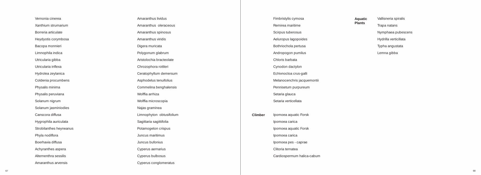
Ipomoea aquatic Forsk
Ipomoea carica
Ipomoea aquatic Forsk
Ipomoea carica
Ipomoea pes - caprae
Clitoria ternatea
Cardiospermum halica-cabum
Vallisneria spiralis
Trapa natans
Nymphaea pubescens
Hydrilla verticillata
Typha angustata
Lemna gibba
67 68
Vernonia cinerea
Xanthium strumarium
Borreria articulate
Heydyotis corymbosa
Bacopa monnieri
Limnophila indica
Utricularia gibba
Utricularia inflexa
Hydrolea zeylanica
Coldenia procumbens
Physalis minima
Physalis peruviana
Solanum nigrum
Solanum jasminiodies
Canscora diffusa
Hygrophila auriculata
Strobilanthes heyneanus
Phyla nodiflora
Boerhavia diffusa
Achyranthes aspera
Alternenthra sessilis
Amaranthus arvensis
Climber
Aquatic Plants

Bibliography
Books and Periodicals
01. Roy Mann, Rivers in the City Published by David and Charles Ltd., London, 197302. A Gillian Standring, Peter Credland, The living Waters, Published by Doubleday Anchor Books, Doubleday and Co. Inc, New York, 197703. Ian L. McHarg, Design with Nature, The American Museum of Natural History, Natural History Press, New York, 1969.04. Simon Bell, Landscape-Pattern, Perception and Process, E and FN Spon Publication, 1999.05. Sylvia Crowe, The Landscape of Roads, The Architectural Press:London, 1960.06. Iain Robertson, Penny Richards, Studying Cultural Landscapes, Hodder Arnold Publication, London, 2003.07. Richard Lannoy, Benaras; A world within a world, Published by Indica books, Varanasi, 2002.08. Agroclimatic Atlas of Gujarat, Published by Department of Agricultural Meteorology, B.A. College of Arcitecture, Anand (Gujarat), 1984.09. Illustrated Guide to India, Published by Reader’s Digest Association, Hongkong and Penguin Books, India, 2005.10. World Atlas, Published by Readers Digest.11. A. B. Vora, EIA Studies on Flora and Fauna of Command Area North of River Sabarmati upto Rajasthan.
Unpublished Thesis
12. Snehal Shah, A River in a City; Identifying its contemporary role, a case study of Surat, Urban Design Thesis (2001), School of Architecture, CEPT University, Ahmedabad.
13. Kalpana Shah, River as a generator of Environment, Architecture Thesis (1970), School of Architecture, CEPT University, Ahmedabad.
Websites
14. www.wikipedia.com15. www.wikimapia.com16. .www.mapsofindia.com17. www.indianetzone.com18. Http://birdsofgujarat.net
Ritesh Kamdar is a student of M a s t e r s i n L a n d s c a p e Architecture at CEPT University, Ahmedabad. This study is a part of his summer training for 10 weeks. He pursued his under graduation in architecture from Marathwada Mi t ramandal college of Architecture at Pune University, Maharashtra.
69 70