oceanography. suppose that all of the water were drained from the oceans. what would we see? plains?...
TRANSCRIPT
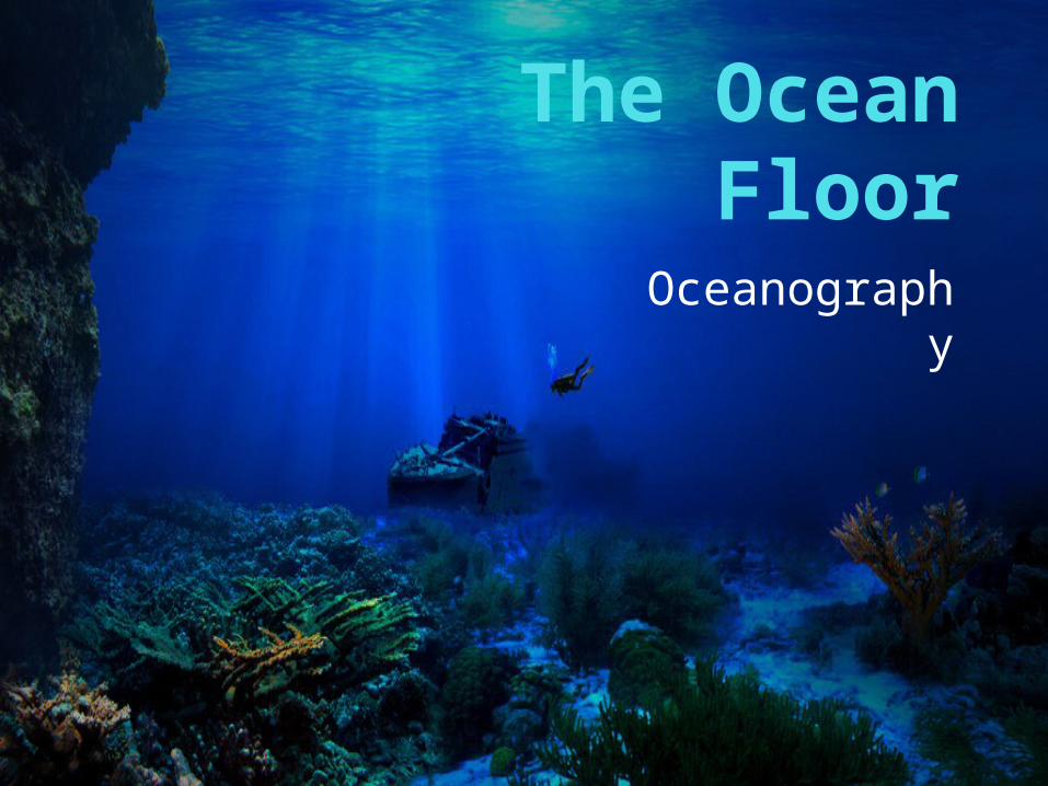
The Ocean FloorOceanograp
hy

The Vast World OceanSuppose that all of the water were drained from the oceans. What would we see? Plains?Mountains?Canyons?Plateaus?

The Blue PlanetNearly 71 percent of the
Earth’s surface is covered by global ocean.

The Blue PlanetIt has only been since the
late 1800s that the ocean became an important focus of study.

The Blue PlanetOceanography is a science
that draws on the methods and knowledge of geology, chemistry, physics, and biology to study the world ocean.
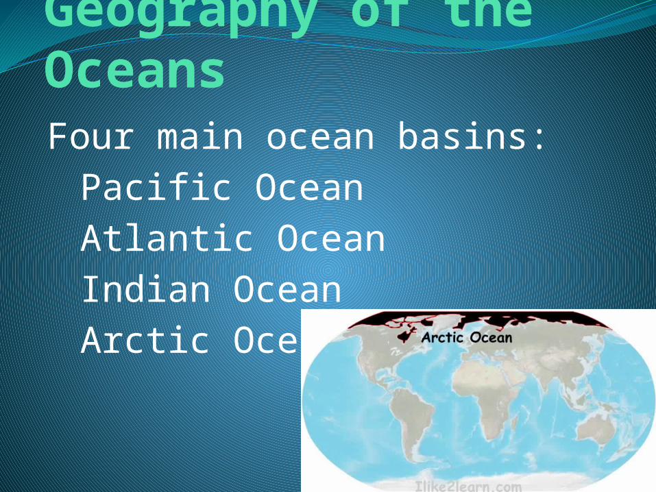
Geography of the OceansFour main ocean basins:
Pacific OceanAtlantic OceanIndian OceanArctic Ocean
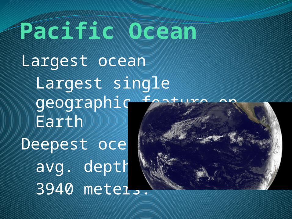
Pacific OceanLargest ocean
Largest single geographic feature on Earth
Deepest oceanavg. depth:3940 meters.

Atlantic OceanHalf the size of the PacificRelatively narrow compared
to the Pacific

Indian OceanSlightly smaller than the
Atlantic Ocean, but about the same average depth.
Located almost entirely in the southernhemisphere.

Arctic OceanAbout 7% the size of the
Pacific.Only a little more than one-
quarter as deep as the rest of the oceans.

Mapping the Ocean FloorIf all the water were drained
from the ocean basins, a variety of features would be seen.

Mapping the Ocean FloorThe topography of the ocean
floor is as diverse as that of the continents.

Mapping the Ocean FloorBathymetry is the
measurement of ocean depths and the charting of the shape or topography of the ocean floor.
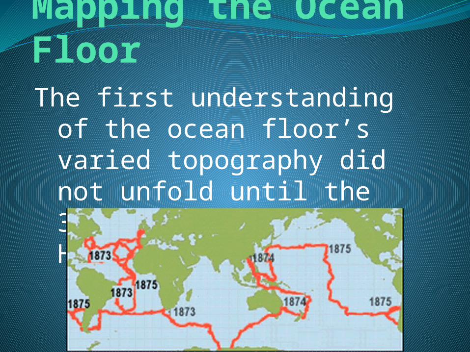
Mapping the Ocean FloorThe first understanding of
the ocean floor’s varied topography did not unfold until the 3.5 year voyage of the HMS Challenger.

HMS Challenger—1872-1876127,500 km tripWent to every ocean
except the Arctic.Sampled various ocean
properties.Measured depth by lowering a
long, weighted line overboard.

Mapping the Ocean FloorToday’s technology—
particularly sonar, satellites, and submersibles—allow scientists to study the ocean floor in a more efficient and precise manner than ever before.
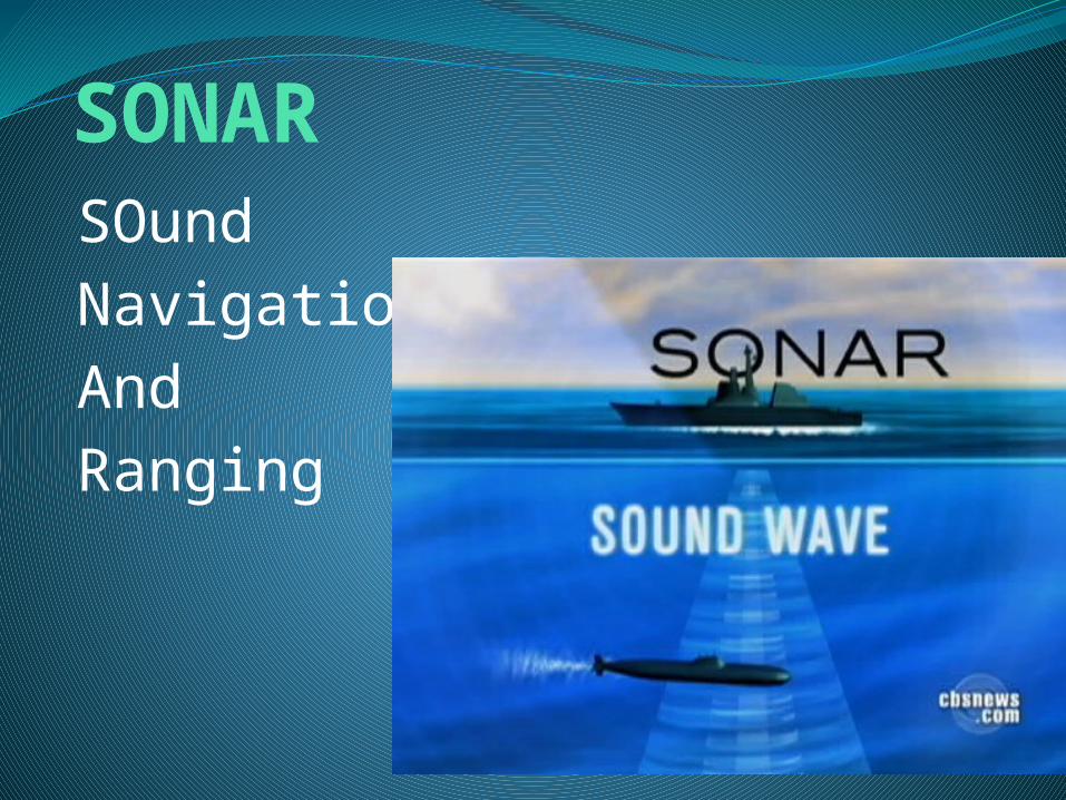
SONARSOundNavigationAndRanging
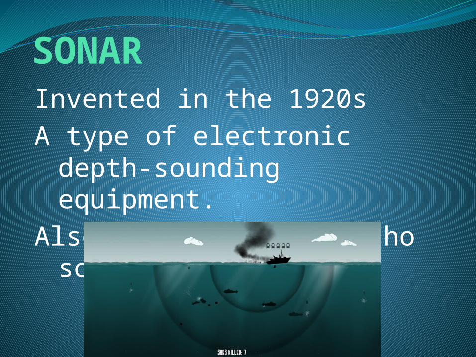
SONARInvented in the 1920sA type of electronic depth-
sounding equipment.Also referred to as echo
sounding.

SONARTransmits sound
waves toward the ocean bottom.
A sensitive receiver intercepts the echo reflected from the bottom.
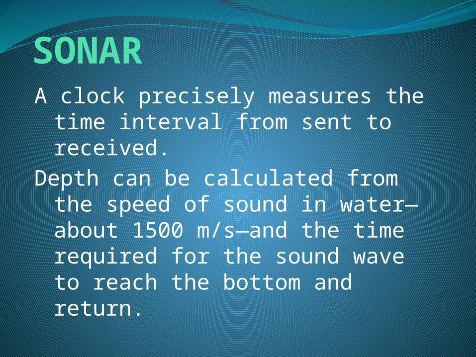
SONARA clock precisely measures the
time interval from sent to received.
Depth can be calculated from the speed of sound in water—about 1500 m/s—and the time required for the sound wave to reach the bottom and return.

SONARThe depths determined from
continuous monitoring of these echoes are plotted, and a map of the ocean floor is obtained.
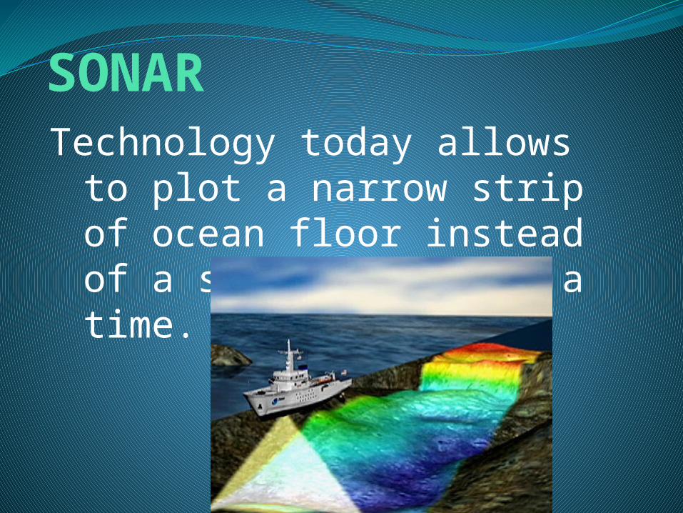
SONARTechnology today allows to
plot a narrow strip of ocean floor instead of a single point at a time.

SONARWhen a ship uses multibeam
sonar to make a map, the ship travels through the areain a regularlyspaced back-and-forth pattern.

SatellitesAfter compensating for
waves, tides, currents, and atmospheric effects, scientists discovered that the ocean surface is not perfectly flat.

SatellitesThe differences in ocean-
surface height cannot be seen with the naked eye, satellites, however, can detect the small differences.

SatellitesUsing a system similar to
SONAR, instead using RADAR, radio waves, they can map the surface height differences as small as 3 to 6 cm difference.

SubmersiblesA submersible is a small
underwater craft used for deep-sea research.
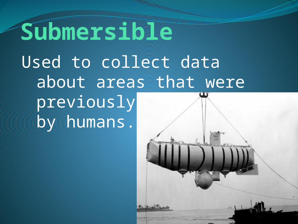
SubmersibleUsed to collect data about
areas that were previously unreachable by humans.

SubmersibleThey collect data, record
video, use SONAR, and collect sample organisms with remotely operated arms.
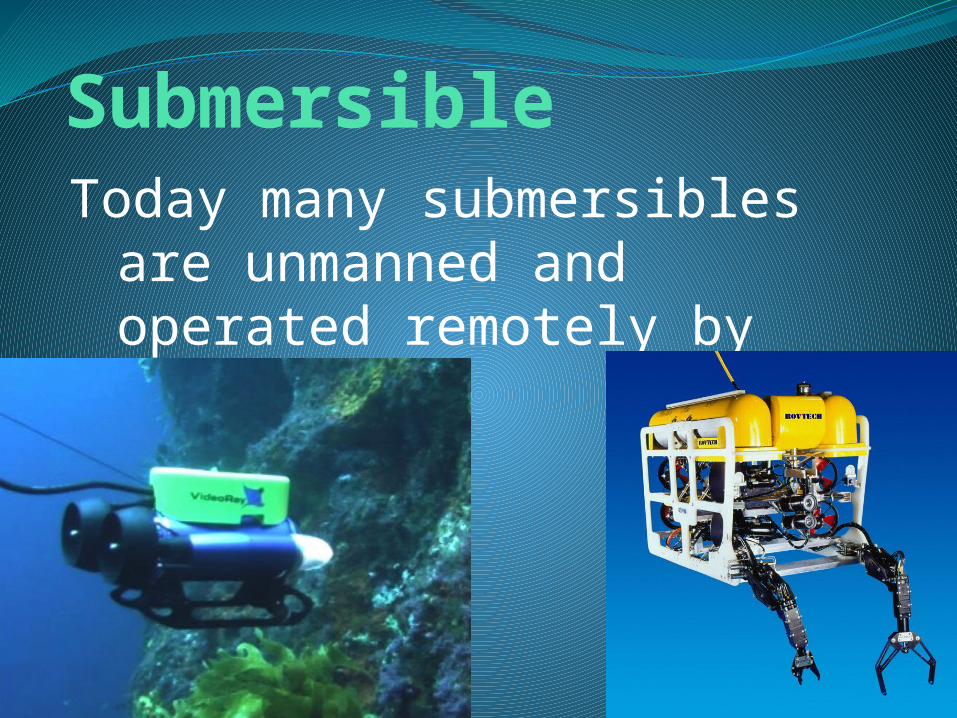
SubmersibleToday many submersibles are
unmanned and operated remotely by computers.

SubmersibleAnother unmanned
submersible is being built with a goal to collect long-term data without interruption.
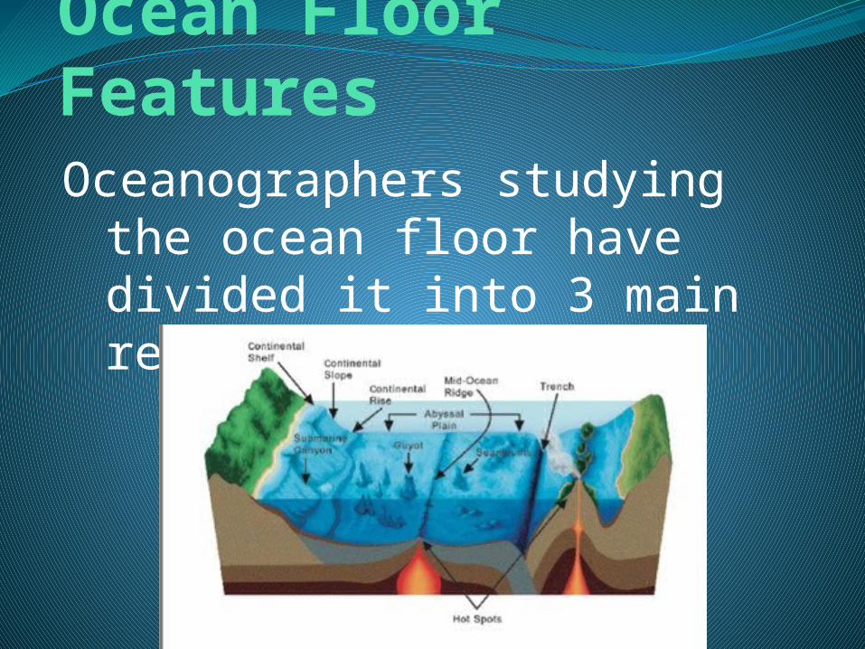
Ocean Floor FeaturesOceanographers studying the
ocean floor have divided it into 3 main regions.

Ocean Floor FeaturesThe ocean floor features are
the continental margins, the ocean basin floor, and the mid-ocean ridge.

Continental MarginsThe zone of transition
between a continent and the adjacent ocean basin floor.
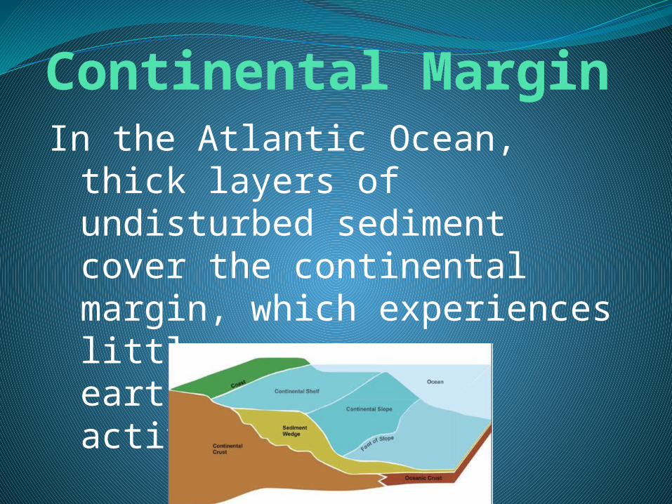
Continental MarginIn the Atlantic Ocean, thick
layers of undisturbed sediment cover the continental margin, which experiences little earthquake/volcanic activity

Continental MarginIn the Pacific, oceanic crust is
plunging beneath continental crust, which results in a narrow continental margin which results in earthquake/volcanic activity.

Continental MarginSome features common to
the continental margin include: the continental shelf, the continental slope, and the continental rise.

Continental ShelfThe gently sloping
submerged surface extending from the shoreline.
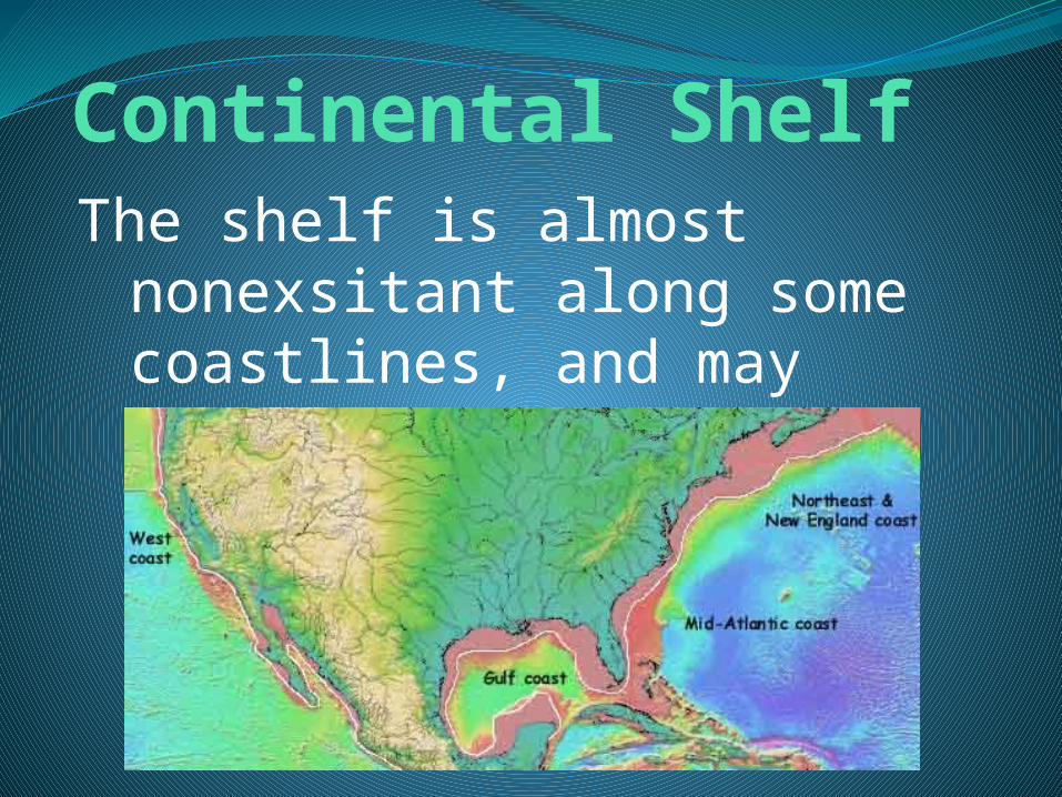
Continental ShelfThe shelf is almost
nonexsitant along some coastlines, and may extend 1500 km along others.

Continental ShelfContinental shelves contain
important mineral deposits, large reservoirs of oil and natural gas, and huge sand and gravel deposits.

Continental ShelfThe waters here also contain
important fishing grounds, which are significant sources of food.

Continental SlopeSteeper than the shelf, it
marks the boundary between continental crust and oceanic crust.

Continental SlopeDeep, steep-sided valleys
known as submarine canyons are cut into the continental slope.

Continental SlopeMost information suggests
that the submarine canyons have been eroded by turbidity currents.
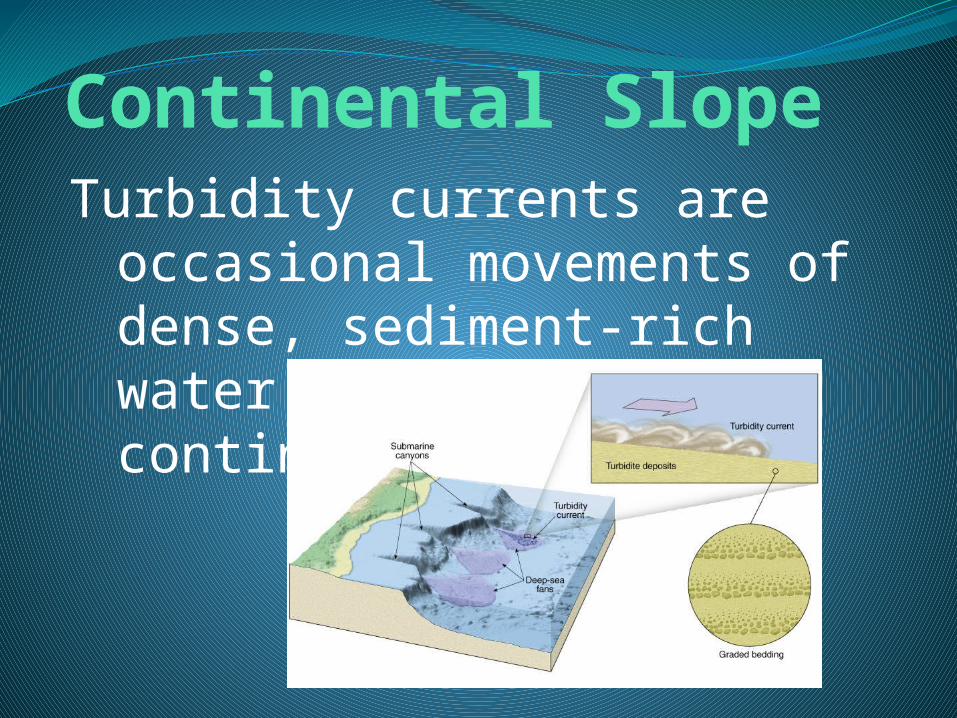
Continental SlopeTurbidity currents are
occasional movements of dense, sediment-rich water down the continental slope.
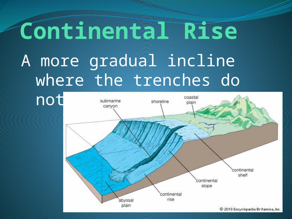
Continental RiseA more gradual incline where
the trenches do not exist.
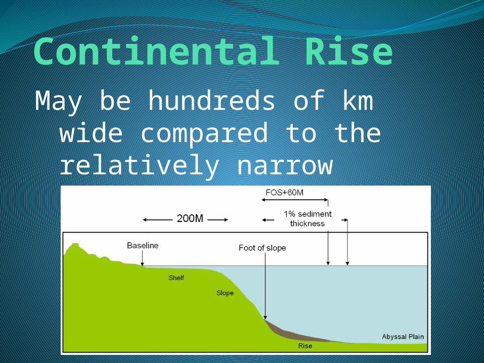
Continental RiseMay be hundreds of km wide
compared to the relatively narrow continental slope.

Ocean Basin FloorBetween the continental
margin and mid-ocean ridge lies the ocean basin floor.

Ocean Basin FloorThis region includes deep-
ocean trenches, very flat areas known as abyssal plains, and tall volcanic peaks called seamounts and guyots.

Deep-Ocean TrenchesLong, narrow creases in the
ocean floor that form the deepest parts of the ocean.

Deep-Ocean TrenchesTrenches form at sites of
plate convergence where one moving plate descends beneath another and plunges back into the mantle.

Deep-Ocean TrenchesMost trenches are located
along the margins of the Pacific Ocean

Deep-Ocean TrenchesA portion of one
trench—the Challenger Deep in the Mariana Trench—has been measured at a record 11,022 meters below sea level.

Abyssal PlainsDeep, extremely flat features
where thick accumulations of fine sediment have covered an otherwise rugged ocean floor.

Abyssal PlainsThe sediments that make up
the abyssal plains are carried there by turbidity currents or deposited as a result of suspended sediments settling.

Seamounts and GuyotsSubmerged volcanic peaks
that dot the ocean floor, which have not reached the ocean surface.

Seamounts and GuyotsSteep-sided cone-shaped
peaks found on the floors of all the oceans.

Seamounts and GuyotsWhen a volcano reaches the
surface it starts being eroded and may sink back into the ocean.

Seamounts and GuyotsThe once-active, now-
submerged, flat-topped structures are called guyots.

Mid-Ocean RidgesFound near the center of
most oceans, interconnected system of underwater mountains that have developed on new ocean crust.

Mid-Ocean RidgesSeafloor spreading occurs at
divergent plate boundaries where two lithospheric plates are moving apart.

Mid-Ocean RidgesNew ocean floor is formed at
mid-ocean ridges as magma rises between the diverging plates and cool.

Mid-Ocean RidgesHydrothermal vents form
along mid-ocean ridges.

Mid-Ocean RidgesHydrothermal vents are
zones of mineral-rich water, heated by the hot, newly-formed oceanic crust.

Mid-Ocean RidgesAs the super-heated, mineral-
rich water comes in contact with the surrounding cold water, minerals and metals precipitate out and are deposited.

Seafloor SedimentsExcept for steep areas of the
continental slope and the crest of the mid-ocean ridge, most of the seafloor is covered with sediments
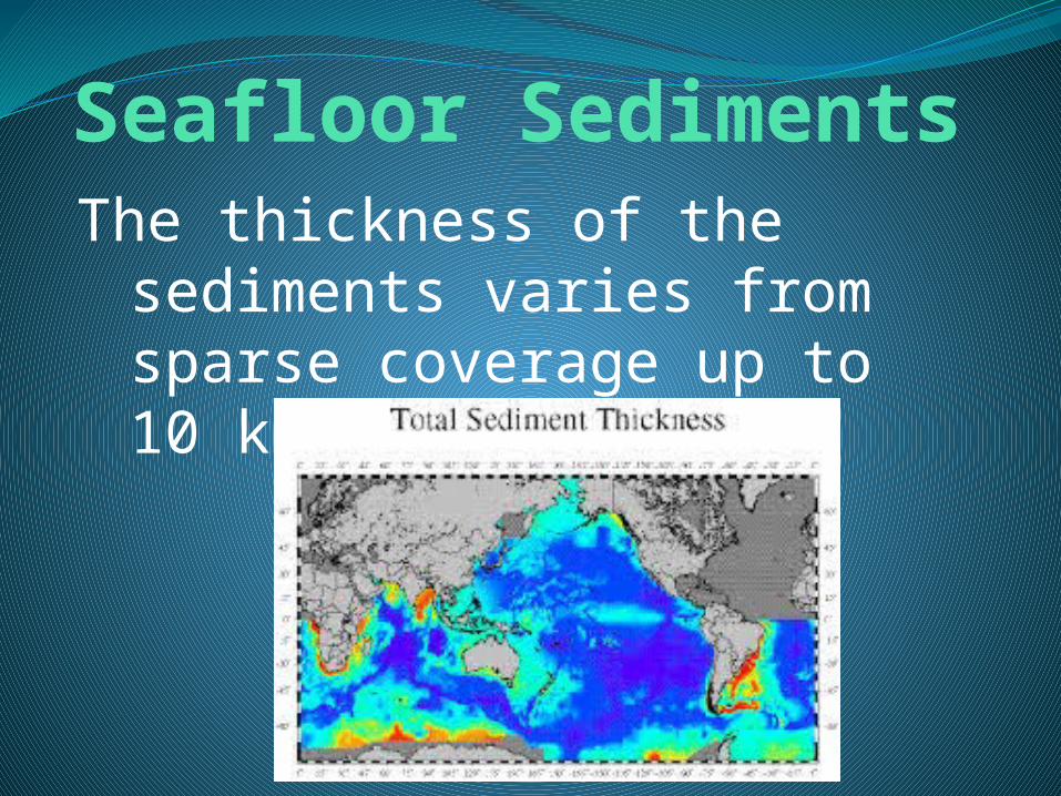
Seafloor SedimentsThe thickness of the
sediments varies from sparse coverage up to 10 km in some areas.

Seafloor SedimentsOcean-floor sediments can be
classified according to their origin into three broad categories.

Seafloor SedimentsThe three categories are:
TerrigenousBiogenousHydrogenous
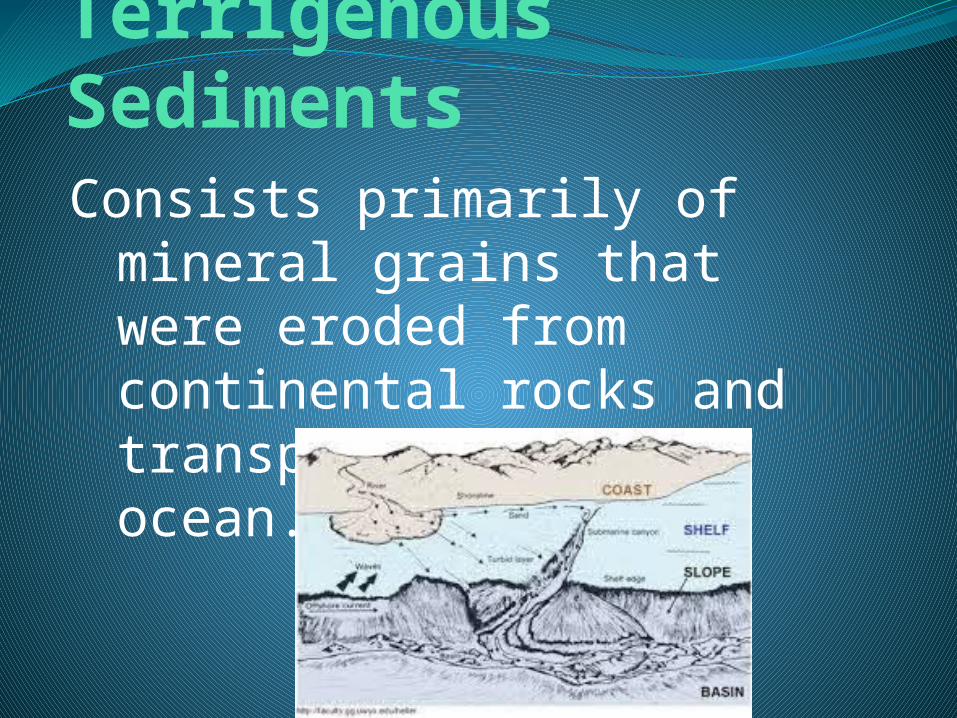
Terrigenous SedimentsConsists primarily of mineral
grains that were eroded from continental rocks and transported to the ocean.

Biogenous SedimentsConsist of shells and
skeletons of marine animals and algae.

Biogenous SedimentsCalcareous ooze, produced
from the calcium carbonate shells of organisms, is the most common biogenous sediment.
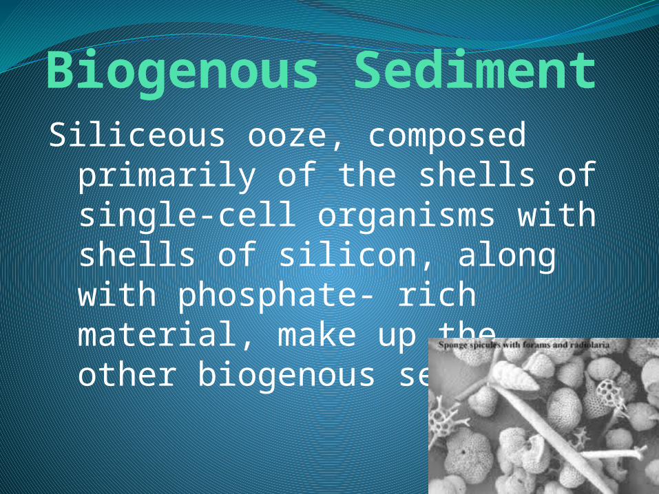
Biogenous SedimentSiliceous ooze, composed
primarily of the shells of single-cell organisms with shells of silicon, along with phosphate- rich material, make up the other biogenous sediments.

Hydrogenous SedimentHydrogenous sediment
consists of minerals that crystallize from ocean water through various chemical reactions.

Hydrogenous SedimentsMake up only a small portion
of the over all seafloor sediments.

Hydrogenous SedimentsMany different compositions
Distributed in many different environments.
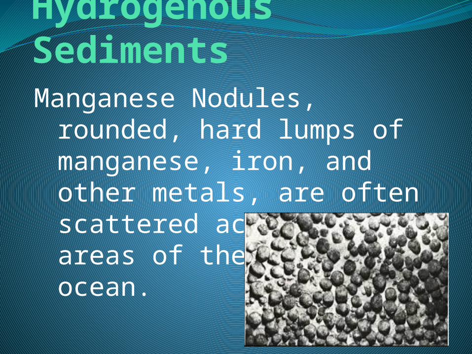
Hydrogenous SedimentsManganese Nodules,
rounded, hard lumps of manganese, iron, and other metals, are often scattered across large areas of the deep ocean.

Hydrogenous SedimentsCalcium Carbonates form by
precipitation directly by ocean water in warm climates.

Hydrogenous SedimentsEvaporites, formed in high
evaporation rates and areas of restricted open-ocean circulation.

Seafloor ResourcesThe ocean floor is rich in
mineral and organic resources.

Seafloor ResourcesRecovering the resources
involves technological challenges and high cost.

Energy ResourcesOil and natural gas are the
main energy products currently being obtained from the ocean floor.
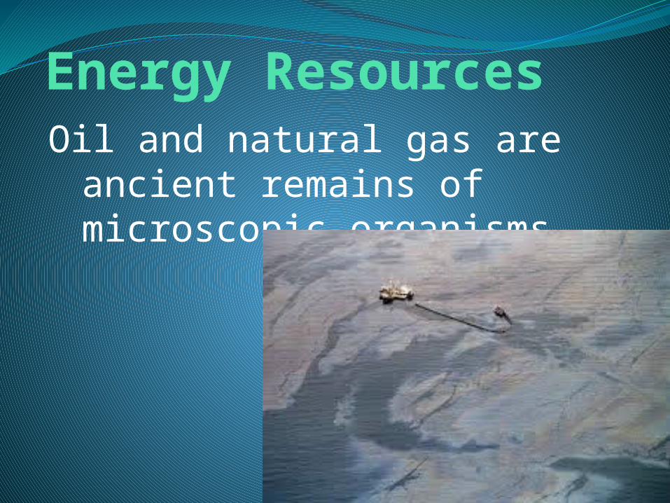
Energy ResourcesOil and natural gas are
ancient remains of microscopic organisms.
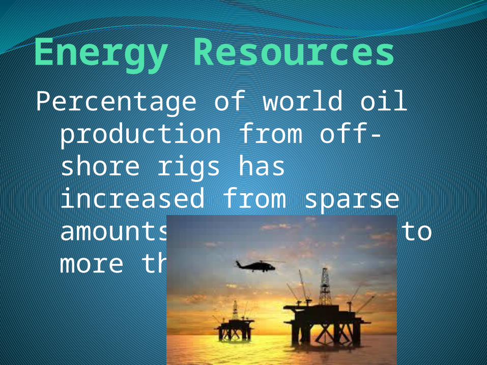
Energy ResourcesPercentage of world oil
production from off-shore rigs has increased from sparse amounts in the 1930s to more than 30% today.

Energy ResourcesThere are rigs in Persian
Gulf, Gulf of Mexico, off southern California, in the North Sea, and East Indies.

Energy ResourcesOne environmental concern
about offshore petroleum exploration is the possibility of oil spills.
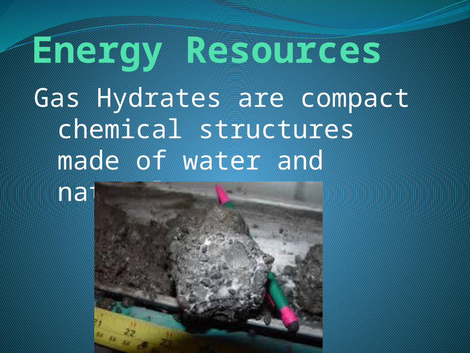
Energy ResourcesGas Hydrates are compact
chemical structures made of water and natural gas.

Energy ResourcesMost oceanic gas hydrates
are created when bacteria break down organic matter trapped in ocean-floor sediments.

Energy ResourcesThe bacteria produce
methane gas along with small amounts of ethane.

Energy ResourcesAn estimated 20 quadrillion
cubic meters of methane are locked up in sediments containing gas hydrates.
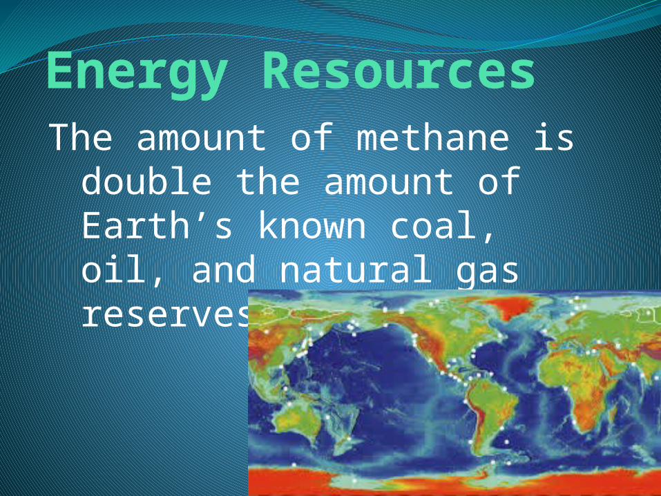
Energy ResourcesThe amount of methane is
double the amount of Earth’s known coal, oil, and natural gas reserves combined.

Other ResourcesOther major resources from
the ocean floor include sand and gravel, evaporative salts, and manganese nodules.

Sand and GravelThe offshore sand-and-gravel
industry is second in economic value only to the petroleum industry.
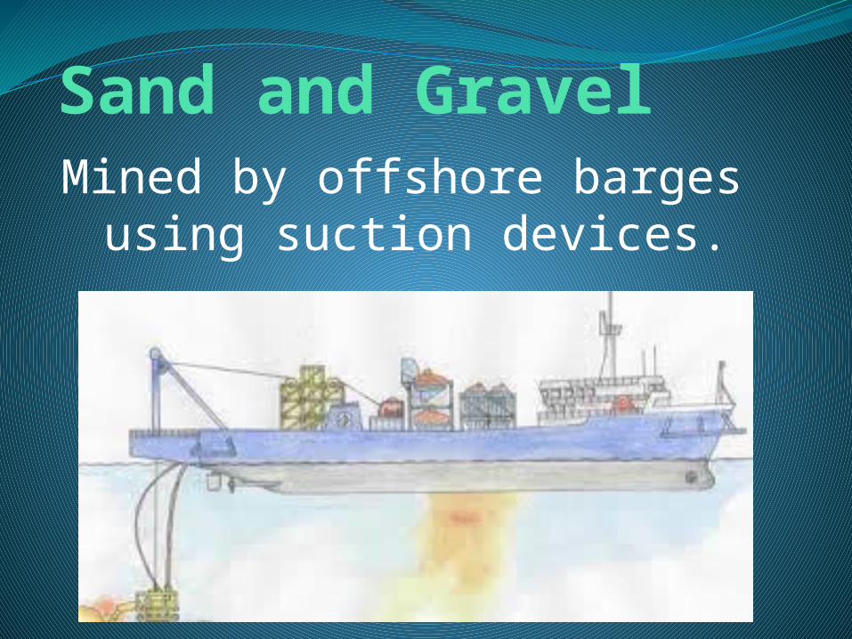
Sand and GravelMined by offshore barges
using suction devices.

Sand and GravelUsed for landfill, to fill in
recreational beaches, and to make concrete.
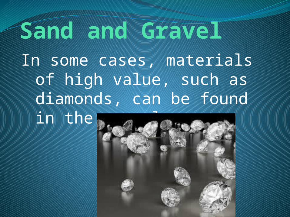
Sand and GravelIn some cases, materials of
high value, such as diamonds, can be found in the gravel.

Sand and GravelOther materials found
include: tin, platinum, gold, and titanium.

Manganese NodulesHard lumps of manganese
and other metals that precipitate around a smaller object, such as sand.

Manganese NodulesContain high concentration
of manganese, iron, and smaller concentrations of copper, nickel, and cobalt.

Manganese NodulesWith current technology,
mining the deep-ocean floor for manganese nodules is possible but not economically profitable.

Evaporative SaltsWhen seawater evaporates,
the salts increase in concentration until they can no longer be dissolved.
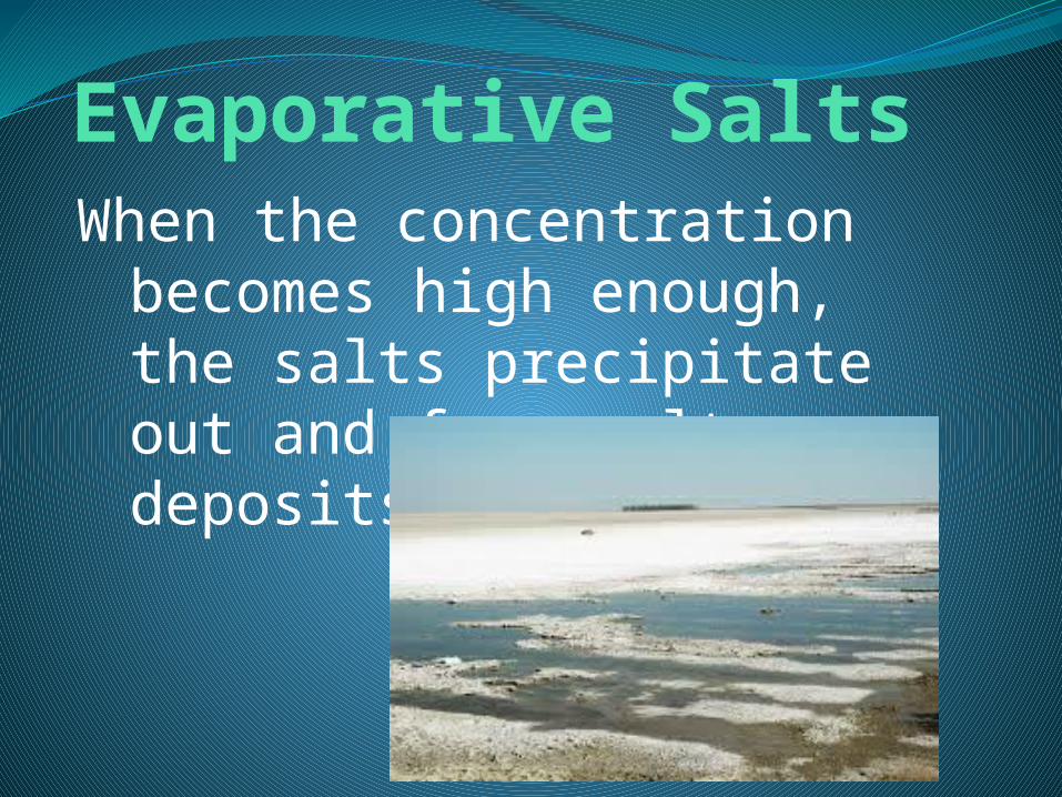
Evaporative SaltsWhen the concentration
becomes high enough, the salts precipitate out and form salt deposits.

Evaporative SaltsThese deposits can then be
harvested for the halide—table salt.
