onemap nasa lcluclcluc.umd.edu/sites/default/files/lcluc_documents/onemap_bastide.pdf · joan...
TRANSCRIPT
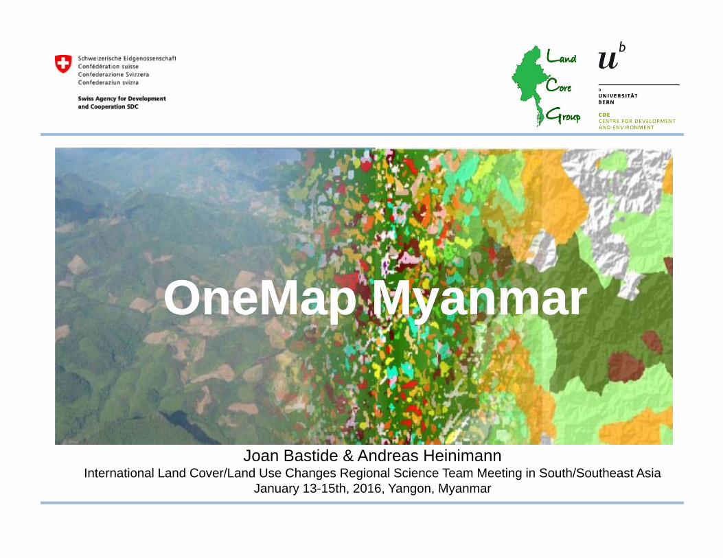
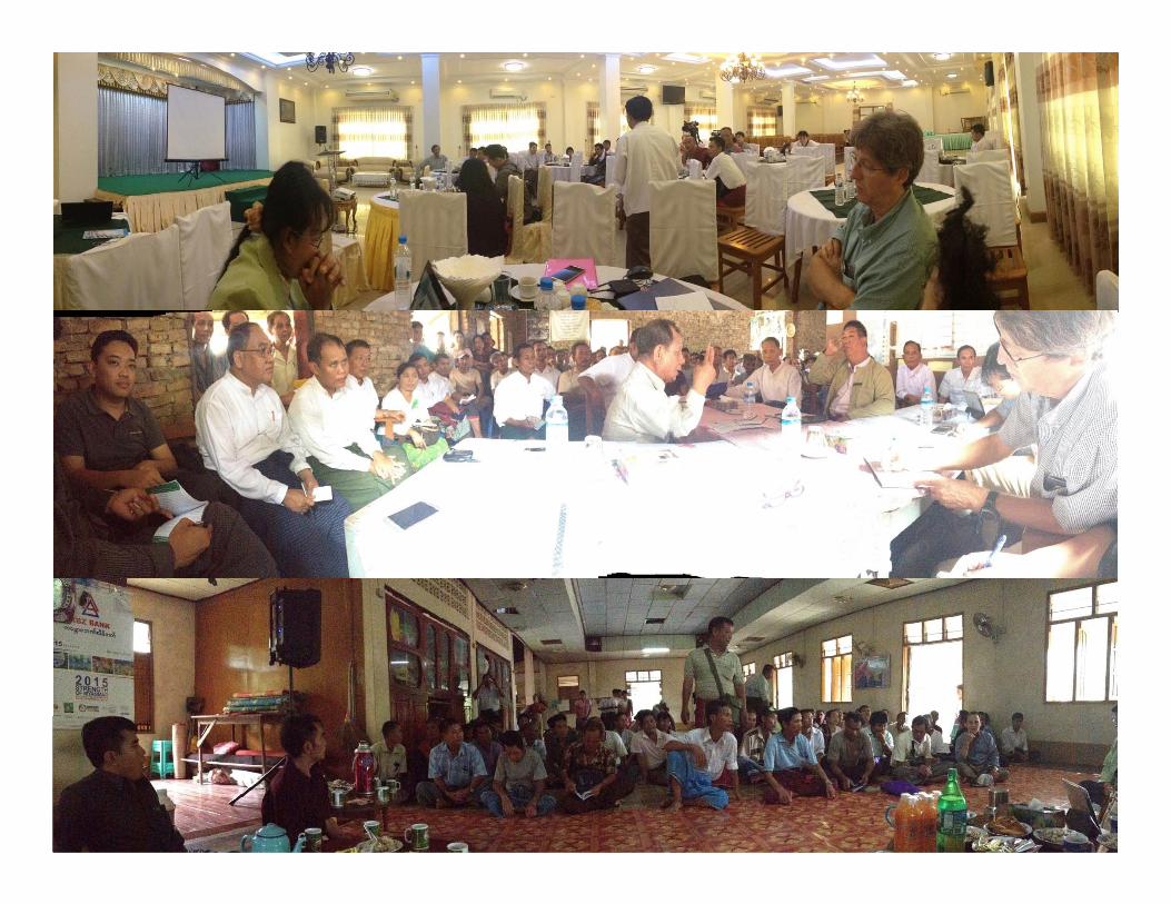
Joan Bastide & Andreas HeinimannInternational Land Cover/Land Use Changes Regional Science Team Meeting in South/Southeast Asia
January 13-15th, 2016, Yangon, Myanmar
OneMap MyanmarOneMap Myanmar
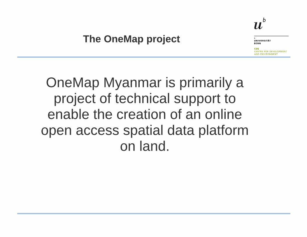
The OneMap project
OneMap Myanmar is primarily a project of technical support to
enable the creation of an online open access spatial data platform
on land.
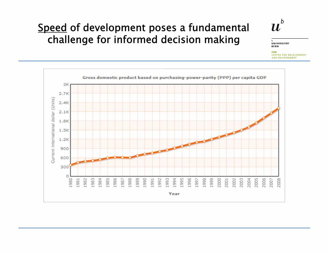
Speed of development poses a fundamental challenge for informed decision making
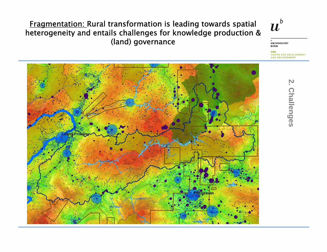
Fragmentation: Rural transformation is leading towards spatial heterogeneity and entails challenges for knowledge production &
(land) governance2. C
hallenges
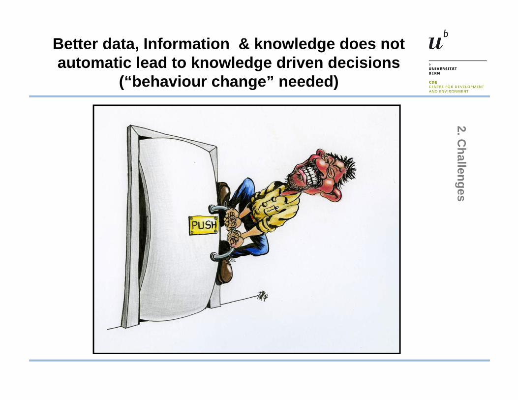
Better data, Information & knowledge does not automatic lead to knowledge driven decisions
(“behaviour change” needed)2. C
hallenges
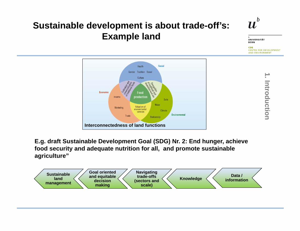
Sustainable development is about trade-off’s: Example land
Knowledge Navigating trade-offs
(sectors and scale)
Goal oriented and equitable
decision making
Sustainableland
management
Interconnectedness of land functions
E.g. draft Sustainable Development Goal (SDG) Nr. 2: End hunger, achieve food security and adequate nutrition for all, and promote sustainable agriculture”
Data / information
1. Introduction
8
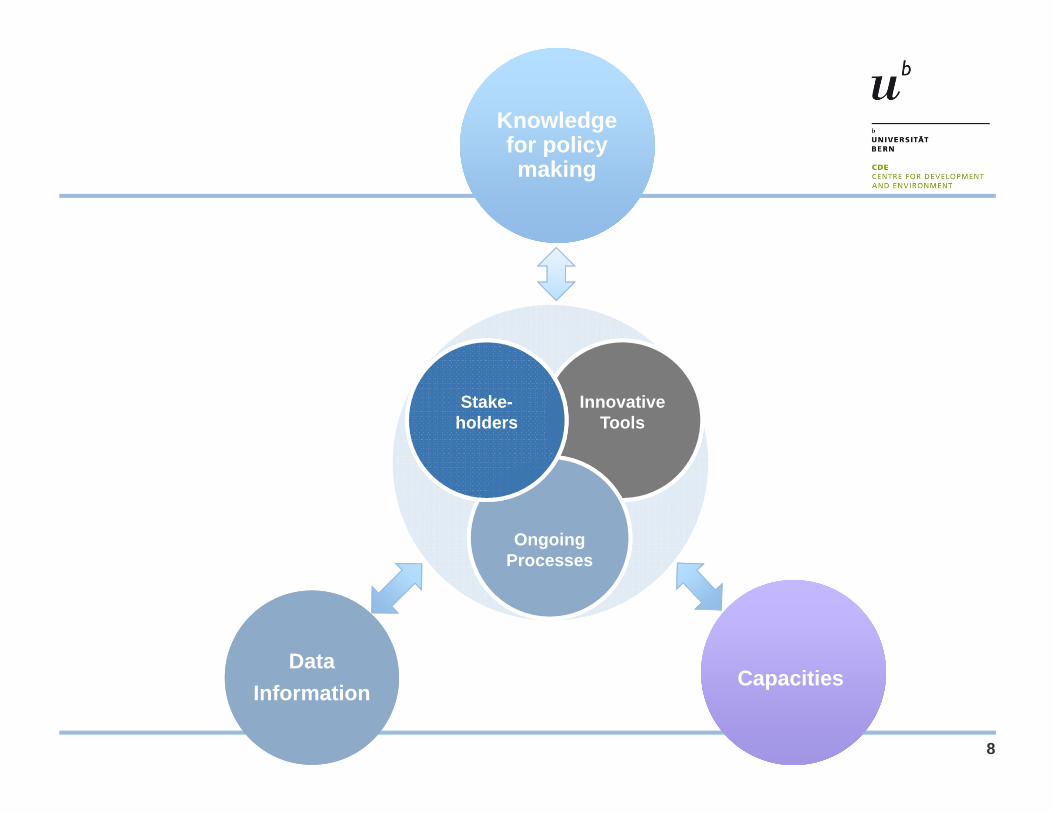
Knowledge for policy making
Data Information CapacitiesCapacities
InnovativeTools
Ongoing Processes
Stake-holdersStake-
holders
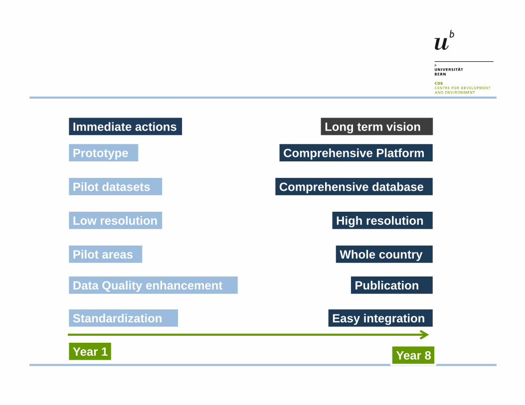
Year 1 Year 8
Standardization
Low resolution
Pilot areas Whole country
High resolution
Data Quality enhancement
Pilot datasets Comprehensive database
Prototype Comprehensive Platform
Immediate actions Long term vision
Easy integration
Publication
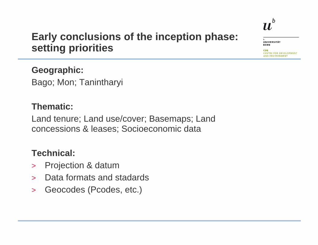
Early conclusions of the inception phase: setting priorities
Geographic:Bago; Mon; Tanintharyi
Thematic:Land tenure; Land use/cover; Basemaps; Land concessions & leases; Socioeconomic data
Technical:> Projection & datum> Data formats and stadards> Geocodes (Pcodes, etc.)
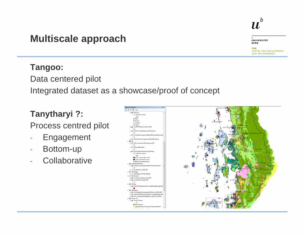
Multiscale approach
Tangoo:Data centered pilotIntegrated dataset as a showcase/proof of concept
Tanytharyi ?:Process centred pilot- Engagement- Bottom-up- Collaborative
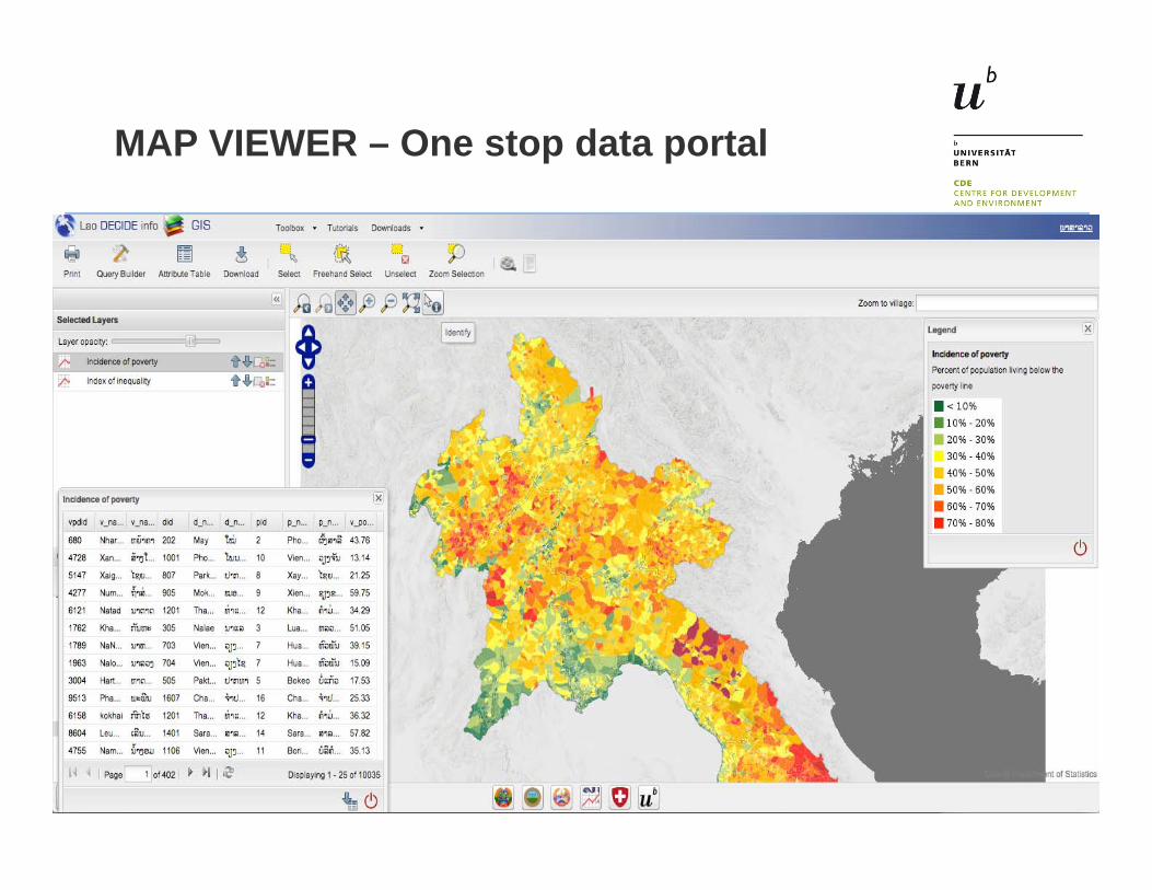
MAP VIEWER – One stop data portal
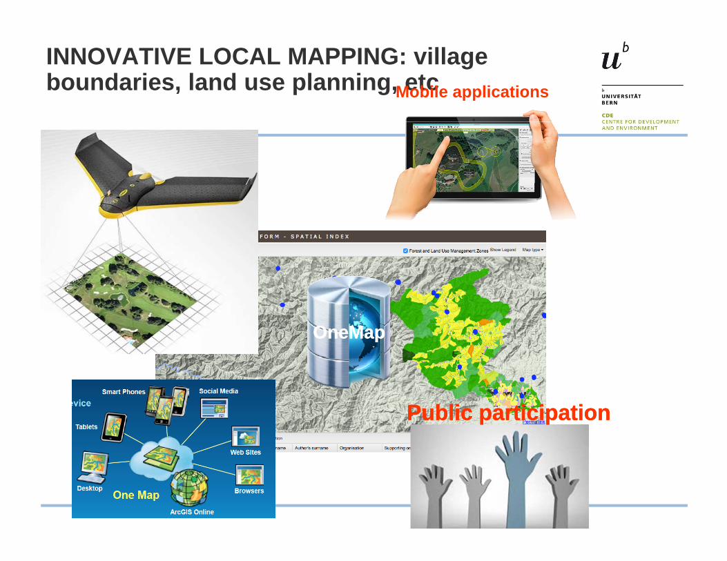
INNOVATIVE LOCAL MAPPING: village boundaries, land use planning, etcMobile applications
Public participationPublic participation
OneMapOneMap
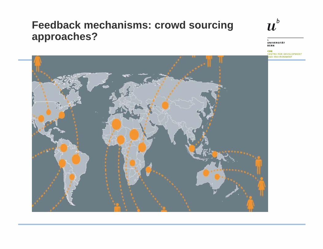
Feedback mechanisms: crowd sourcing approaches?
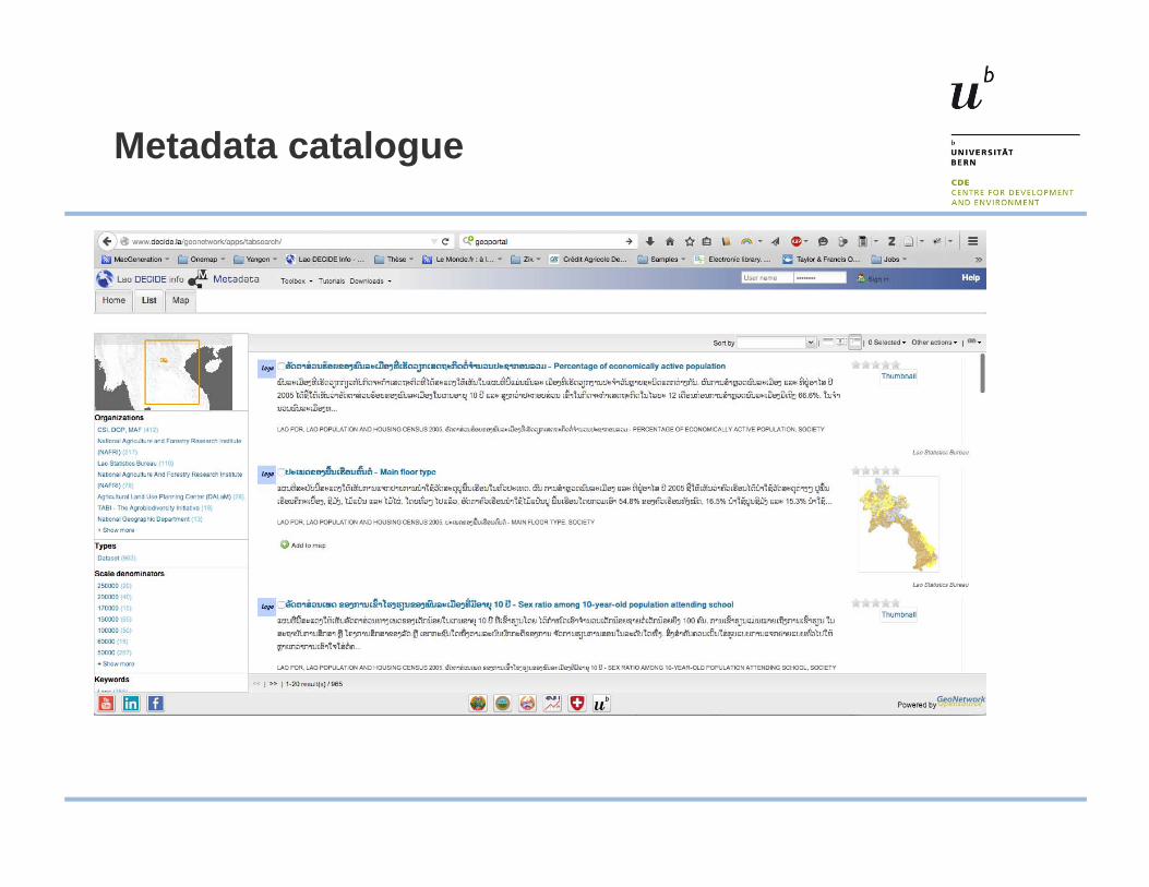
Metadata catalogue
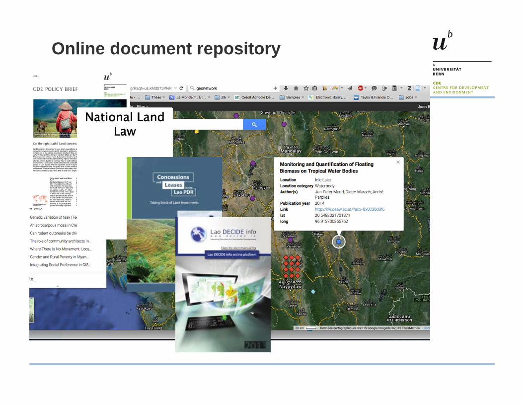
Online document repository
National Land Law
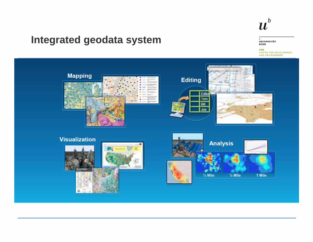
Integrated geodata system
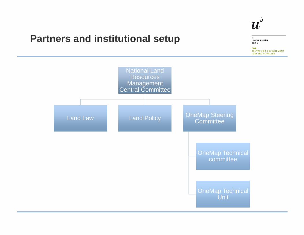
Partners and institutional setup
National Land Resources
Management Central Committee
National Land Resources
Management Central Committee
Land LawLand Law Land PolicyLand Policy OneMap Steering Committee
OneMap Steering Committee
OneMap Technical committee
OneMap Technical committee
OneMap Technical Unit
OneMap Technical Unit
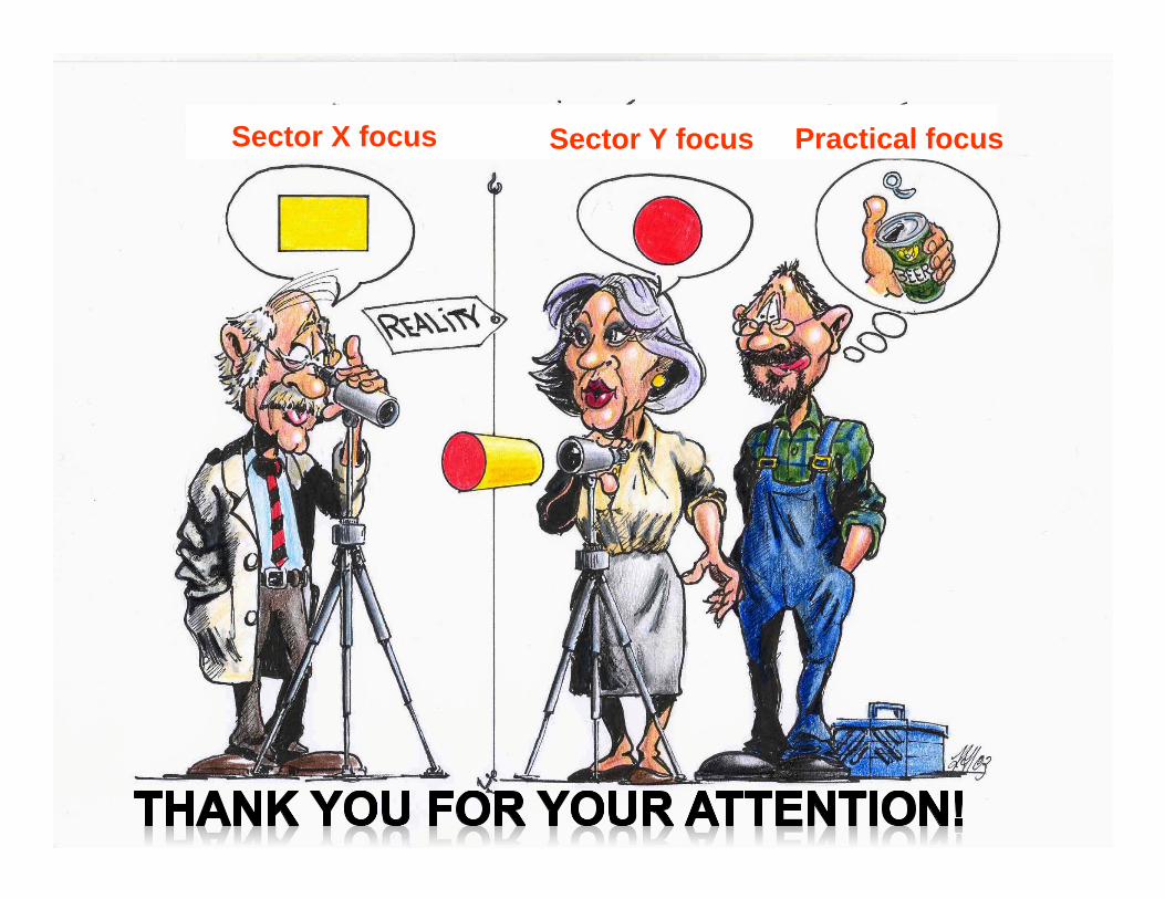
Sector X focus Sector Y focus Practical focus